integrated coastal zone management plan for gulf of ... ecology commission, government of gujarat...
TRANSCRIPT

Gujarat Ecology Commission, Government of Gujarat
Integrated Coastal Zone Management Plan for Gulf of Kachchh, Gujarat
Village consultations for the Gulf of Kachchh 2016
Revision B
August 2016

Gujarat Ecology Commission,
Government of Gujarat
ii
This proposal has been prepared under the DHI Business Management System certified by Bureau Veritas to comply with ISO 9001 (Quality Management)
Approved by:
Dr. Flemming Jakobsen
Managing Director

Coastal Profile iii
Integrated Coastal Zone Management Plan for Gulf of Kachchh, Gujarat
Village consultations for the Gulf of Kachchh, 2016
Revision B
August 2016
Prepared for Gujarat Ecology Commission,
Government of Gujarat
Represented by Member Secretary
Report authors U R Pandya, Harshad Dhande
Quality assurance Dr Flemming Jakobsen, Managing Director
Review Gorm Jeppesen, Flemming Jakobsen
Project number 63800657
Approval date
Revision B
Classification Confidential
© DHI. All rights reserved. No parts of this document may be reproduced, transmitted or otherwise disseminated in any form or by any means outside the recipient’s organisation without the prior written permission of DHI.

Coastal Profile iv
Table of Content Table of Content ................................................................................................................ iv
Table of Tables ................................................................................................................ vii
Table of Figures .............................................................................................................. viii
Acronyms and Abbreviations ............................................................................................. x
1 Background ............................................................................................................ 11
2 Introduction ............................................................................................................ 11
3 Village selection ..................................................................................................... 11
4 Methodology .......................................................................................................... 13
5 Village consultation summary ................................................................................. 14
6 Village reports ........................................................................................................ 17
6.1 Village: Khara Beraja .................................................................................... 17
6.1.1 Brief introduction ............................................................................. 17
6.1.2 Village infrastructure ........................................................................ 17
6.1.3 Source of livelihood ......................................................................... 18
6.1.4 Issues and community need ............................................................ 18
6.1.5 Contact persons .............................................................................. 19
6.2 Village Hadiyana ........................................................................................... 20
6.2.1 Brief introduction ............................................................................. 20
6.2.2 Village infrastructure ........................................................................ 20
6.2.3 Source of livelihood ......................................................................... 21
6.2.4 Issues and community need ............................................................ 21
6.2.5 Contact person ................................................................................ 22
6.3 Village Rasulnagar ........................................................................................ 23
6.3.1 Brief introduction ............................................................................. 23
6.3.2 Village infrastructure ........................................................................ 23
6.3.3 Sources of livelihood ....................................................................... 23
6.3.4 Issues and community need ............................................................ 23
6.3.5 Contact person ................................................................................ 24
6.4 Village Kalavad Simani ................................................................................. 25
6.4.1 Brief introduction ............................................................................. 25
6.4.2 Village infrastructure ........................................................................ 25
6.4.3 Sources of livelihood ....................................................................... 25
6.4.4 Issues and community need ............................................................ 26
6.4.5 Contact person ................................................................................ 27
6.5 Village Khatumba .......................................................................................... 28
6.5.1 Brief introduction ............................................................................. 28

Coastal Profile v
6.5.2 Village infrastructure ........................................................................ 28
6.5.3 Sources of livelihood ....................................................................... 28
6.5.4 Issues and community need ............................................................ 28
6.5.5 Contact person ................................................................................ 29
6.6 Village Bodki ................................................................................................. 30
6.6.1 Brief introduction ............................................................................. 30
6.6.2 Village infrastructure ........................................................................ 30
6.6.3 Source of livelihood ......................................................................... 31
6.6.4 Issues and community need ............................................................ 31
6.6.5 Contact person ................................................................................ 32
6.7 Village Kathada ............................................................................................. 33
6.7.1 Brief introduction ............................................................................. 33
6.7.2 Village infrastructure ........................................................................ 33
6.7.3 Source of livelihood ......................................................................... 33
6.7.4 Issues and community need ............................................................ 34
6.7.5 Contact persons .............................................................................. 35
6.8 Village Jangi .................................................................................................. 36
6.8.1 Brief introduction ............................................................................. 36
6.8.2 Village infrastructure ........................................................................ 36
6.8.3 Source of livelihood: ........................................................................ 37
6.8.4 Issues and community need ............................................................ 37
6.8.5 Contact persons .............................................................................. 38
6.9 Village Navinal .............................................................................................. 39
6.9.1 Brief introduction ............................................................................. 39
6.9.2 Village infrastructure ........................................................................ 39
6.9.3 Source of livelihood ......................................................................... 39
6.9.4 Issues and community needs .......................................................... 40
6.9.5 Contact persons .............................................................................. 40
6.10 Village Bhadreshwar ..................................................................................... 41
6.10.1 Brief introduction ............................................................................. 41
6.10.2 Source of livelihood ......................................................................... 41
6.10.3 Village infrastructure ........................................................................ 41
6.10.4 Issues and community needs .......................................................... 42
6.10.5 Contact persons .............................................................................. 43
6.11 Village Tuna .................................................................................................. 44
6.11.1 Brief introduction ............................................................................. 44
6.11.2 Sources of livelihood ....................................................................... 44
6.11.3 Village infrastructure ........................................................................ 44
6.11.4 Issues and community needs .......................................................... 45
6.11.5 Contact person ................................................................................ 45
7 Findings of the village stakeholder consultations .................................................... 46
Coastal Profile vi
Annex 1: Brief of the ICZM Project ......................................................................... 50
Annex 2: Sample letter sent to villagers for consultation ......................................... 54
Annex 3: List of participants by village .................................................................... 56

Coastal Profile vii
Table of Tables Table 1: Details of the village covered under consultation as per the PRA conducted in 2010-11 by GEC. ............................................................................................................ 11
Table 2: Summary sheet of village consultations ............................................................. 14
Table 3: Compilation of the village level stakeholder findings as per issues identified in Coastal profile Vol I ......................................................................................................... 47
Table 4: Participants in the consultations on 1 July 2016 at Khara Beraja village (Jodiya taluka in Jamnagar district) .............................................................................................. 56
Table 5: Participants in the consultations on 2 July 2016 at Hadiyana village (Jodiya taluka in Jamnagar district) ........................................................................................................ 57
Table 6: Participants in the consultations on 2 July 2016 at Rasulnagar village (Jamnagar taluka in Jamnagar district) .............................................................................................. 58
Table 7: Participants in the consultations on 3 July 2016 at Khatumba village (Dwarka taluka in Devbhumi Dwarka district) ................................................................................ 60
Table 8: Participants in the consultations on 3 July 2016 at Kalavad Simani village (Khambhaliya taluka in Devbhumi Dwarka district) .......................................................... 60
Table 9: Participants in the consultations on 5 July 2016 at Bodki village (Maliya taluka in Devbhumi Dwarka district) ............................................................................................... 61
Table 10: Participants in the consultations on 11 July 2016 at Kathada village (Mandvi taluka in Kachchh district)................................................................................................ 62
Table 11: Participants in the consultations on 11 July 2016 at Jangi village (Bhachau taluka in Kachchh district)................................................................................................ 63
Table 12: Participants in the consultations on 27 July 2016 at Navinal village (Mundra taluka in Kachchh district)................................................................................................ 65
Table 13: Participants in the consultations on 28 July 2016 at Bhadreshwar village (Mundra taluka in Kachchh district) ................................................................................. 65
Table 14: Participants in the consultations on 28 July 2016 at Tuna village (Mundra taluka in Kachchh district) .......................................................................................................... 66

Coastal Profile viii
Table of Figures Figure 3-1: Location of the villages’ selected for consultations ........................................ 12
Figure 6-1: Location map of the village Khara Bejara ...................................................... 17
Figure 6-2: Introduction by the team members ................................................................ 19
Figure 6-3: Interaction with the village community ........................................................... 19
Figure 6-4: Field visit to check the needs of the villagers ................................................. 19
Figure 6-5: Discussion at the field visit to understand the problem .................................. 19
Figure 6-6: Location map of the village Hadiyana ............................................................ 20
Figure 6-7: Team member explaning the objective of the meeting. .................................. 22
Figure 6-8: Focus group discussion with women ............................................................. 22
Figure 6-9: Location map of the village Rasulnagar ......................................................... 23
Figure 6-10: Introduction of team and objective of the meeting ....................................... 24
Figure 6-11: Focus group discussion with men ................................................................ 24
Figure 6-12: Explaining the situation in Gulf of Kachchh to the villagers .......................... 24
Figure 6-13: Discussion at the field visit to understand the problem ................................ 24
Figure 6-14: Location map of the village Kalavad Simani ................................................ 25
Figure 6-15: Introduction by the team members .............................................................. 26
Figure 6-16: Briefing about the project............................................................................. 26
Figure 6-17: Focus group discussion with men ................................................................ 27
Figure 6-18: Focus group discussion with women ........................................................... 27
Figure 6-19: Location map of the village Khatumba ......................................................... 28
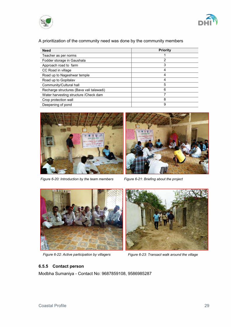
Figure 6-20: Introduction by the team members .............................................................. 29
Figure 6-21: Briefing about the project............................................................................. 29
Figure 6-22: Active participation by villagers.................................................................... 29
Figure 6-23: Transact walk around the village ................................................................. 29
Figure 6-24: Location map of the village Bodki ................................................................ 30
Figure 6-25: Discussion on issues ................................................................................... 32

Coastal Profile ix
Figure 6-26: Briefing about the project............................................................................. 32
Figure 6-27: Focus group discussion with men ................................................................ 32
Figure 6-28: Focus group discussion with women ........................................................... 32
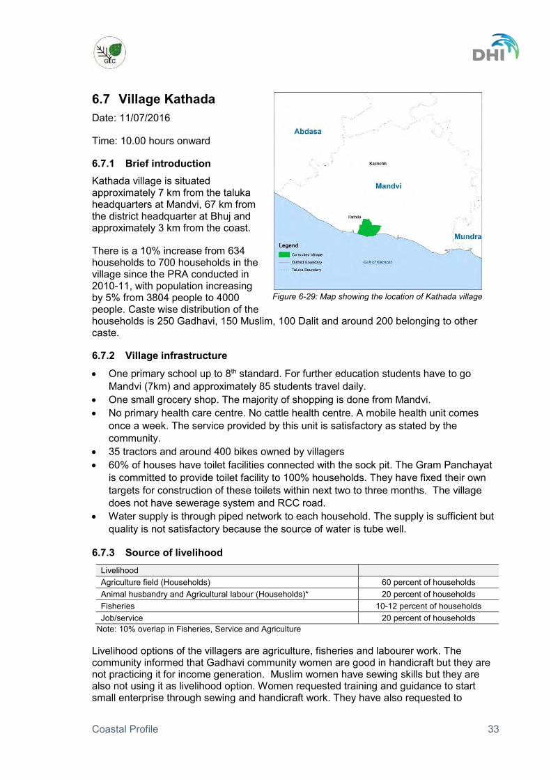
Figure 6-29: Map showing the location of Kathada village ............................................... 33
Figure 6-30: Discussion on issues ................................................................................... 35
Figure 6-31: Brainstorming on various options ................................................................ 35
Figure 6-32: Need prioritization ....................................................................................... 35
Figure 6-33: Site visit to understand the problem ............................................................ 35
Figure 6-34: Map showing the location of village Jangi .................................................... 36
Figure 6-35: Introduction by the team members about the program ................................ 38
Figure 6-36: Interaction with the village community ......................................................... 38
Figure 6-37: Active community participation .................................................................... 38
Figure 6-38: Clarification raised by the community members .......................................... 38
Figure 6-39: Location map of the village Navinal ............................................................. 39
Figure 6-40: Introduction of the project by the experts ..................................................... 40
Figure 6-41: Interaction with the villagers about problem identification ............................ 40
Figure 6-42: Locational map of village Bhadreshwar ....................................................... 41
Figure 6-43: Explaining the objective of the meeting to villagers ..................................... 43
Figure 6-44: Informal discussion after the meeting .......................................................... 43
Figure 6-45: Map showing the location of village Tuna .................................................... 44
Figure 6-46: Explaining the objective of the meeting ....................................................... 45
Figure 6-47: Interacting with the villagers ........................................................................ 45
Coastal Profile x
Acronyms and Abbreviations BPL: Below Poverty Line ESA: Ecological Sensitive Area GEC: Gujarat Ecology Commission GIS: Geographic Information System HH: House Holds ICZM: Integrated Coastal Zone Management KM: Kilo Meter MoEFCC: Ministry of Environment, Forest and Climate Change NCZMA: National Coastal Zone Management Authority PHC: Public Health Centre PRA: Participatory Rural Appraisal PRC: Participatory Rural Consultation WASMO: Water and Sanitation Management Organisation WBM: Water Bound Macadam

Coastal Profile 11
1 Background The World Bank funded ICZM project was initiated in 2010 by the Ministry of Environment Forest and Climate Change (MoEFCC). The overall objective of the project is to support the Government of India and selected states in developing and implementing an improved strategic management approach for India’s coastal zones to ensure sustainable development and economic growth.
In order to achieve the overall objective, the project supports capacity building for implementation of ICZM at national level and provides assistance to three states in the form of pilot projects.
Further details on the ICZM Project in India and in Gujarat are provided in Annex 1.
2 Introduction As a part of the ICZM plan preparation process dialogues/consultations have been carried out at village and district level. Village level stakeholder dialogues or Participatory Rural Consultations (PRC) have been carried out in 11 villages selected from the 160 villages covered under the “Socio-Economic Upliftment of Coastal Communities along the Gulf of Kachchh” support under the ICZMP which were initiated in September 2010.
These consultations sought feedback from local coastal communities around the Gulf of Kachchh on issues influencing their livelihood. In the consultation process, issues identified during the preparation of the Coastal Profile for the Gulf of Kachchh have been discussed, while at the same time giving opportunity to bring forward additional issues.
3 Village selection The eleven villages were selected from the 160 villages that are already supported
under the ICZM Project. This ensures that a basic understanding of these villages is already available against which the PRC can be developed and assessed. The knowledge base for these villages include PRAs carried out by GEC in 2010-2011.
The selected villages are spread over the entire coastal areas of the Gulf of Kachchh. This is to ensure that the variable conditions (climatic, ecological, economic) influencing local communities along the coast are represented in the selection.
Villages with more or less average population were selected. Very small or very large (semi urban) villages were avoided. Villages were selected from all four costal districts situated on Gulf of Kachchh, with maximum taluka coverage.
The villages were selected to represent different types of livelihood dependency including fisheries, agriculture, animal husbandry and labourers.
The selected villages along with basic information like population, households, occupation is given in Table 1.
Table 1: Details of the village covered under consultation as per the PRA conducted in 2010-11 by GEC.
Name of the village
Taluka District House holds (2010-11)
Population (2010-11)
Occupation Date
Khara Beraja Jamnagar Jamnagar 97 537 Agriculture, Animal Husbandry, Both (Agri&Animal Husb)
01/7/2016

Coastal Profile 12
Name of the village
Taluka District House holds (2010-11)
Population (2010-11)
Occupation Date
Hadiyana Jodhiya Jamnagar 1096 5198 Agriculture, Animal Husbandry, Both (Agri&Animal Husb)
02/7/2016
Rasulnagar Jamnagar Jamnagar 225 1364 Fishermen 02/7/2016
Khatumba Dwarka Devboomi Dwarka
142 439 Agriculture 03/7/2016
Kalavad Simani
Khambhaliya Devboomi Dwarka
103 593 Agriculture, Animal Husbandry, Both (Agri&Animal Husb)
03/7/2016
Bodki Maliya Morbi 327 1705 Farmers, livestock rearing
05/7/2016
Kathada Mandvi Kachchh 634 3804 Agriculture, Animal Husbandry, Both (Agri&Animal Husb)
11/7/2016
Jangi Bhachau Kachchh 913 4713 Agriculture, Animal Husbandry, Both (Agri&Animal Husb)
11/7/2016
Navinal Mundra Kachchh 602 3100 Agriculture 27/7/2016
Bhadreshwar Mundra Kachchh 750 3750 Fishermen 28/7/2016
Tuna Anjar Kachchh 1007 5114 Agriculture, Animal Husbandry, Both (Agri&Animal Husb)
28/7/2016
Source: PRA 2010-11
The location of the eleven villages consulted is mapped in Figure 3-1.
Figure 3-1: Location of the villages’ selected for consultations

Coastal Profile 13
4 Methodology A list of villages was finalized based on the above defined criteria, where the
consultations were to be organized. A prior message was conveyed to the village community through a letter from GEC
(sample letter attached as Annex 2) requesting to provide a suitable time for organizing village level consultation. The letter stated the clear objective of the meeting.
The social mobilizers (people appointed by GEC for carrying out various activities under ICZMP) built a pre consultation environment in the villages along with information dissemination on specific objectives of the meeting.
The project team has adopted a participatory approach and used participatory tools during the meetings. A gender sensitive approach was adopted, where the project team interacted with both male and female of the village community. The suggestions from both the genders have equally been taken.
The consultations were organized at the common and easily approachable location to encourage good participation by all sections of the society. The time schedule was also managed to maintain the trust of the community.
All consultations were half day long, including small focus group discussions and site visits. It was ensured that all information was gathered at the end of the consultation as per the objectives.
A simple and short introduction was facilitated by the ICZM planning team and community and the leaders. It was also ensured that the community understood the purpose of the consultations.
Local language (Gujarati) was used in the communication. Comfortable environment was created to encourage active participation of all segments
of the society and allowed them to speak on the issues during the discussions. Focus group 1 discussions were held in village, and discussions were carried out
separately with men and women to prioritize their problems issues to be addressed in a gender sensitive manner.
The photography and videography was done using simple camera and mobile telephones.
1 Focus Group Discussions is defined as “a Group Situation in which the participants talk with each other under the guidance of a facilitator”. Each participant is stimulated by the comments of others and in turn stimulates them. When participants direct their question to the facilitator rather than each other, it is not a Focus Group Interview. It is not an individual interview in a group meeting.

Coastal Profile 14
5 Village consultation summary A summary sheet has been prepared for all the village level consultations (Table 2).
Table 2: Summary sheet of village consultations
Place Date and time
Consulted persons/contact details
Issues discussed Outcome of discussions
Khara beraja Village
01.07.2016 At 16:00 hours onward
Village community The contact persons are Karshan bhai Makwana (Sarpanch)- Contact No: 9904949721 Vashrambhai (Ex sarpanch) - Contact No: 9904718621
Infrastructure available within the village Sources of livelihood Problem of increasing salinity in water
Various options of livelihood were suggested to the community. The village is located close to the district headquarter and the urban areas. Villagers have easy access to market. Efforts are required to strengthen value chains with forward and backward linkages. Vocational training could be proposed for this village
Hadiyana Village
02.07.2016 At 10:00 hours onward
Village Community (interacted with men and women groups separately) The contact person – Chetanbhai (Ex. Sarpanch)- Contact No: 9429385503
The village has sufficient existing infrastructure and some infrastructure is under construction. The health problem has emerged as a prominent issue due to a coal unit established close to the village. Sewerage, solid waste management and drainage are few areas need emphasis.
Tree plantation at the surroundings of the village at the side of coal unit Primary Health Care Centre need to be equipped with more equipment’s and medical facilities. Wire fencing for crop protection from wild animals.
Rasul Nagar Village
02.07.2016 At 16:00 hours onward
Village community. The contact person is Abbashbhai (Sarpanch)- Contact No: 9909376761
The village is very close to the seashoreFishing is the major source of livelihood, carried out for 10 months in a year. Poor accessibility to market. Poor/lack of basic amenities. Limited livelihood options.
Intensive efforts are required for development of such villages. Priorities are: Basic infrastructure like road, water, sewerage, health and education. Various livelihood options needs to be provided to the community with proper skill enhancement along with market connectivity after detailed study on demand/market driven specific value chains. Micro finance mechanisms should be investigated for the village.
Kalavad Simani Village
03.07.2016 At 10:00 hours onward
Village Community (interacted with men and women groups separately) The contact person is Bhavsang B Jadeja (EDC leader)- Contact No: 9099547537
The need for basic amenities was raised by the village community. Increase in salinity in water and soil.. Road and bridge connectivity are priority issues. Lack of women friendly livelihood options.
Government interventions required to provide clean water supply to the village households along with toilet facility. Capacity building and skill development support to village women. Facilitation for microfinance to initiate non-farm livelihood activities like handicraft and handloom. Women empowerment and gender sensitizationto ensure

Coastal Profile 15
Place Date and time
Consulted persons/contact details
Issues discussed Outcome of discussions
women’s economic empowerment in the region.
Khatumba Village
03.07.2016 at 10:00 hours onward
Village Community The contact person is Modbha Sumaniya- Contact No: 9687859108, 9586985287
Close to seashore Environment and health are of serious concerns to the community. Agriculture is rain fed Villagers sometimes involved in labour work in TATA and Reliance industries. Lack of awareness and women’s lower level of education considered as one of the obstructions in development process.
Environmental mitigation measures need to be taken Awareness to take appropriate steps for family health care. Government interventions to provide clean water supply and sanitation facilities to each household. Awareness generation campaigns are required in these villages to make the community aware on environment and health issues Capacity building activities are needed to provide multiple options of income generation among the coastal community.
Bodki Village 05.07.2016 at 10:30 hours onward
Village Community (interacted with men and women groups separately) The contact persons are - Ikbalbhai (Sarpanch)- Contact No: 9737960390 Dhirubhai (Ex Sarpanch) - Contact No: 9016314131
Enough infrastructure and basic amenities. Lack of livelihood options for women. Damage to agriculture crops by wild animals.
With good access to market potential for strengthening value chains (cotton, Ground Nuts etc.) Livelihood enhancement especially for women. The community aware due to easy and regular connectivity with cities. Potential as one of the model villages of the region.
Kathaba Village
11.07.2016 at 10:00 hours onward
Village Community The contact persons are - Marsinhbhai (Sarpanch) Contact no: 9825356734 Devangbhai (Member Taluka Panchayat Mandavi ) Contact No: 9909121093 Velajibhai (Activist) 9879526539
Ecosystem is disturbed due to industrial waste. The industrial effluents are affecting the human being and the aquatic lives. Water quality is deteriorating due to industrial pollution in the area. Skilled women are not able to utilize their skills to generate income. The awareness level is low in the village.
Need to manage pollution to protect the environment. The water quality need to be improved and the sewerage system to be provided to the village community. Specialized vocational trainings are needed and small microenterprise to be developed by facilitating micro financing, cash credit limits through banks and linking with various government schemes for the rural poor. Women empowerment and gender sensitization to ensure women’s economic empowerment in the region.
Jangi Village 11.07.216 at 16:00 hours onward
Village Community. The contact persons are - Vashrambhai (Sarpanch)- Contact no: 9979749651
Agriculture, which is the primary source of income is totally rain fed. The secondary activity is labour work in salt pans and fishing. Animal Husbandry could be a good option
Need to provideoptions of livelihood improvement. Environmental sensitization programs are needed for the local community. Vocational training and micro enterprise promotional activities to be started.

Coastal Profile 16
Place Date and time
Consulted persons/contact details
Issues discussed Outcome of discussions
Ranchhodbhai Patel- Leader- Contact no: 9879982209
of livelihood promotion but the community is not encouraged to opt it as primary source of income. Lack of awareness on environment protection.
Water conservation techniques to be promoted to create perennial source of irrigation. Water supply and sewerage needs to be provided to the village community.
Navinal 27.07.2016 at 17:00 hours onward
Village community. The contact person are
The major issues discussed were: Salinity intrusion and its effect on agriculture. Depletion of ground water table due to over extraction. Pollution due to industries and its environmental consequences
Villages have asked for: Construction of check dam Support in horticulture for increased income Options of additional income generating activities Vocational training.
Bhadreshwar 28.07.2016 at 17:00 hours onward
Village community. The contact person are Mr. Kailash (Sarpanch) - 9879627995 Mr. J Joshi (Talathi) – 9825610921
The major issues discussed were: Salinity intrusion and its effect on agriculture, Depletion of ground water table due to over extraction Pollution due to industries and its environmental consequences, Decrease in fish catch
Need for construction of check dam and options of additional income generating activities.
Tuna 28.07.2016 at 17:00 hours onward
Village community. The contact person is Ahir Falgun Nathubhai (Ex Sarpanch) - 9979016704
Reduction in Agricultural land due to increasing salinity Pollution due to industries Decrease in ground water table
Need for construction of check dam near Rampara village, increasing the depth of Usha check dam, and vocational training for women as an additional income generating activity.

Coastal Profile 17
6 Village reports List of participants in the village consultation are provided in Annex 3.
6.1 Village: Khara Beraja Date: 01/07/2016 Time - 16.00 hours onward
6.1.1 Brief introduction Khara Beraja village is located at the distance of 12 km from taluka and district headquarter in Jamnagar and 3-4 km from the seashore.
The village has dominant Dalit, Bharwad, Muslim and Mahajan communities.
There are 180 households in the village as informed by Sarpanch, out of which 20 households stay in wadi (extended) area. When compared to the PRA data (97 households), there is an increase in number of household by 96%. However the total population of Khara beraja has increased only 12% to 600 as compared to population in 2010-11f at 537 people.
The caste wise distribution of the households shows 80 households are Harijan, whereas 10 are Mahajan, 60 Bharwad and 40 Muslim families resides in the village.
6.1.2 Village infrastructure
One primay school upto 7th standard. For further education student’s travel to Jamnagar, which is 12 km from the village.
Two grocery shops to meet the daily needs of the villagers. Villagers have to travel to Jamnagar for major shopping purpose.
No primary health centre in the village. No milk collection centre and no flour mill available in the village. 15 trucks, 7 tractors, 8 cars and around 200 bikes, owned by the villagers. 158 houses out of 180 total households have toilet facility. 80 toilets have been
constructed with support from the GEC project. There is no sewerage collection and treatment system in the village.
Households have been provided with piped water supply facility through WASMO project. Due to poor management the water is being supplied more often through tankers compare to pipelines. One bore well was constructed under a scheme but it has dried up due to continuous water scarcity for last three years.
No street lights.
Figure 6-1: Location map of the village Khara Bejara
Coastal Profile 18
6.1.3 Source of livelihood Livelihood Agriculture Households 70 households Agricultural labour 30 persons Quarry labour 100 persons Drivers 30 persons Government Servants & any such permanent service 7 persons
Agriculture, animal husbandry, labourers (at stone crushing units & agricultural), government service, and driving are the primary sources of income in the village. Seven stone crushing units are operational in and around the village area, out of which some may be illegal. It is mainly the youth of the village that are involved in stone crushing units either as labours or as drivers. Women expressed concern about health issues related to employment in quarries. However, in absence of appropriate livelihood options the community is bound to work in the quarries. Women have shown interest in livestock development through cattle rearing linked with dairy development. Specialized work on brass assembly was another area of interest shown by the female community of the village. Agricultural practices: The Agriculture is largely monsoon based. Check dams help in irrigation of about 100 acre agriculture land during the summer. The main agriculture crops are cotton, wheat and maize as informed by the villagers.
Ground water table: Ground water table has gone down from 50-60 feet to 80-100 feet in the last couple of years. Bore wells have to be dug up by 170 feet beyond which the quality of water is brackish.
Irrigation facility: Total land available for the agriculture use is approximately 1200 acres, which is irrigated from open wells and bore wells. Average 40% land is being irrigated during the winter season and only 15% land is being irrigated during the summer.
6.1.4 Issues and community need
Villagers told that there is no sewerage system in the village. Therefore providing proper sewerage system (collection and treatment) has been identified as the need for the community.
Salinity intrusion has been identified as one of the main issues by the villagers. Major cause of salinity intrusion is the damage to the earthern dam at 3-4 places. The dam was constructed to prevent the sea water entering the landward area and to retain rain water. A site visit was made to check the condition of the earthern dam. Villagers have requested the construction of a pakka check dam to stop the salinity intrusion.
Considering higher education is an important pillar of development, the need of opening a Higher Secondary School in the village has come up from the community.
Linking employment generating opportunities with skill development, the demand of conducting vocational training has been identified as one of the future intervention areas in the village.

Coastal Profile 19
6.1.5 Contact persons (1) Karshanbhai Makwana (Sarpanch)- Contact No: 9904949721
(2) Vashrambhai (Ex sarpanch) - Contact No: 9904718621
Figure 6-2: Introduction by the team members Figure 6-3: Interaction with the village community
Figure 6-4: Field visit to check the needs of the villagers
Figure 6-5: Discussion at the field visit to understand the problem

Coastal Profile 20
6.2 Village Hadiyana Date: 02/07/2016 Time - 10.00 hours onward
6.2.1 Brief introduction Hadiyana village is situated approximately 12 km from the district headquarter in Jamnagar and 7-8 km from the seashore.
The communities that stay in the village are Brahmin, Patel, Sathwara, Bharvad, Dalit, and Mahajan families. Few Muslim families are also residing in the village.
There are total 1350 households in village, which has increased by 23% compared to households (1097) counted during PRA conducted in 2010-11. Number of households as per caste are Patel 400, Sathwara- 200, Dalit 60, Bharwad 58, Muslim-70, and Others 35.
6.2.2 Village infrastructure
One primary school upto 10th standard available. For further education almost 200 students travel to Jamnagar for higher education daily. Awareness towards education is quite high among the villagers.
Market facilities are sufficient to take care of the daily needs and all other needs of the villagers.
Road transport facility and connectivity is good. One primary health care centre in a good condition with satisfactory services to fulfil
health related primary requirements of the villagers. A private milk collection centre is operational collecting approximately 1000 litres of
milk on a daily basis. Nearly 20-25 trucks, 120-125 tractors, 100 cars and around 500 two wheelers owned
by the villagers. Nearly 90% houses have toilet facilities but these are not connected to the sewerage
system. A village sewerage system is under construction. Water is supplied through pipe network to all the villagers and people are satisfied with
water supply. Due to scarcity of water, the frequency of water supply is once in three days with sufficient water supply.
Proper street lights for movement in the night hours are requested. Two vocational training centres available in the village as informed by the community
leaders.
Figure 6-6: Location map of the village Hadiyana

Coastal Profile 21
6.2.3 Source of livelihood Livelihood Agriculture Households 70 percent Agricultural labour 15-20 percent Animal Husbandry 50 households Ceramic business @ Morbi 40-50 households Brass Pat work 40-50 households Government Servants & any such permanent service 500 persons Diamond policing work 30 persons
Agricultural practices: The main crops are cotton, wheat and maize. Cotton and groundnut crops are quite popular in the monsoon season, whereas wheat is the popular crop of winter season. In summers approximately 100 acres of agriculture land is irrigated.
Irrigation facility: Total land available for agricultural use is approximately 12,000 hectars, out of which 20% is irrigated. The major source of irrigation is open wells and tube wells. Various water conservation techniques like drip irrigation etc. have been adopted by most of the farmers (approximately 200). In addition to this three check dams partially support irrigation in the village. Other sites for check dam are available, which can be utilised for irrigation purpose.
Ground water table: The ground water table has gone down from 30 feet to 60 feet over the last 50 years. Bore wells must be be dug up to 150 feet to make water available for irrigation. Due to decreasing water table the quality of water has changed in last few years.
Health: The community complained about the increasing respiratory problems among people living in the village due to a coal unit located very close (around 5 km) to the village. Joint pains is another health problem identified among the local people; this is because of changes in the environment at the seashore. Women highlighted health problems usually seen during monsoon mainly in children such as diarrhoea, cough & cold and nausea. Child malnutrition among approximately 10% of children in the village.
Sanitation and cleanliness: Sanitation facilities in the village are satisfactory but there are problems with solid waste management. As per villagers daily one truck load of solid waste is dumped at the bank of the river in the nearby village. During monsoon all waste is washed directly into the sea. At religious occasions large quantities of solid waste are dumped into the sea.
6.2.4 Issues and community need
Sewerage system is present in the village but some localities are not covered. Villagers have requested to cover entire village with sewerage system.
Due to lack of drainage system, villagers are facing water logging problem especially during monsoon. This was under the priority list of village women.
Villagers requested to provide better water recharge system. Villagers demanded check dams for irrigation with good water retention capacity to
cope with the water scarcity problem during summers. Increase in height of three existing check dams Villagers requested to provide higher education at least up to 12th standard. Wire fencing to protect crops from wild animals.

Coastal Profile 22
Tree plantation at coal unit to protect villagers from coal dust. Quality and quantity of equipment’s to be enhanced in public health centre.
6.2.5 Contact person (1) Chetanbhai (Ex. Sarpanch)- Contact No: 9429385503
Figure 6-7: Team member explaning the objective of the meeting.
Figure 6-8: Focus group discussion with women

Coastal Profile 23
6.3 Village Rasulnagar Date: 02/07/2016 Time - 16.00 hours onward
6.3.1 Brief introduction Rasulnagar village is situated approximately 30 km from the district headquarter in Jamnagar and 1-2 km from the coast.
Total number of households in the village is 250, which is marginal increase compared to number of households (225) during the PRA conduted in 2010-11.
The village is Muslim dominated and livelihood of people depends on fishing activities.
Out of 250 households, 137 families are below the poverty line.
6.3.2 Village infrastructure
One primary school with an education upto 8th standard. The children of the village go to Bed village for higher education, which is approximately 8-10km away. Due to lack of transport facility parents are not interested in sending girls outside the village for higher education.
No primary health care facility. People have to go to other village (5km) to reach health facilities.
30-35 two wheelers, 1 car and four small transport vehicles owned by villagers 50 houses with toilet facility and 25 houses are constructing toilets. No sewerage
system in the village. Water supply situation is very poor with no piped water supply. Water supply from
government tankers. Three small grocery shops to fulfil daily needs of the villagers.
6.3.3 Sources of livelihood All household depend on fishing activities. No other livelihood option available. Villagers are insecure with respect to the sustainability of their livelihood.
6.3.4 Issues and community need
Fish catches have reduced 50% (earlier fish catch was 25-50kg). The reason cited by the villagers is restrictions of industries for the areas of fishing and heavy ship traffic.
Fishing practices are old and villagers do not have access to modern equipment. The community is not informed about various government schemes. Lack of
information and knowledge is considered major obstacles in development of the village.
Poor market linkage due to weak accessibility. Fish products are sold at low price.
Figure 6-9: Location map of the village Rasulnagar

Coastal Profile 24
80% families are in debt impeding financing of other livelihoods Oil spill problem has not been considered as an issue by the community, as they have
not faced any such problem in last few years. Increase in the level of sea height has not observed by community.
Needs:
Modern fishing catch equipment’s are highly demanded by the community. Drinking water facility/ connectivity. Road connectivity with cement concrete roads. Awareness raising and sensitization programmes on environment protection, pollution
control and climate change. Extra rooms for the school, construction of community halls and support for individual
house construction under government schemes like Indira aavas, construction of sanitation units by Government.
Micro finance for livelihood promotional activities like purchasing modern fishing equipment’s and livestock development.
6.3.5 Contact person Abbashbhai (Sarpanch) - Contact No: 9909376761
Figure 6-12: Explaining the situation in Gulf of Kachchh to the villagers
Figure 6-13: Discussion at the field visit to understand the problem
Figure 6-10: Introduction of team and objective of the meeting
Figure 6-11: Focus group discussion with men

Coastal Profile 25
6.4 Village Kalavad Simani Date: 03/07/2016 Time - 10.00 hours onward
6.4.1 Brief introduction Kalavad Simani village is situated 23 km from taluka headquarters Khambhaliya and 90 km from district headquarter Jamnagar and 2 km from the seashore.
There are 150 households, which has increased by 46% from the PRA conducted in 2010-11, however the population has increased from 593 to 900, which is around 52%.
Castewise distribution of the households are 110 darbar, 20 Brahmin, 10 koli, and 1 dalit.
6.4.2 Village infrastructure
One primary school up to 5th standard. Children go to Goinj village for further education. 10 to 12 students study in 10th to 12th standard and 3 students have migrated from the village for completing their graduation. Girls are not getting education beyond 8th standard due to poor road connectivity and lack of transportation facility in the village.
No primary health care centre. People have to travel to other village 5km away to get the health facilities.
7-8 tractors and 125 two wheelers owned by villagers. Sanitation facilities are not satisfactory and only 8-10 households have toilet facility.
There is no sewerage system inside the village. Every house is connected with piped water supply. However, the village is not yet
connected with bulk water supply scheme due to lack of storage facility. Present water supply is through 60 feet open well, which is not sufficient for the supply of water for the entire village. There is a demand for further deepening of the open well by 20 feet to augment water quantity.
3-4 small grocery shops in the village to provide daily need products to the community.
6.4.3 Sources of livelihood The majority of households depend on agriculture as the livelihood option and few families work as industrial labourers. In good rainfall years the community does not face any difficulty to secure food. In years with scarcity of rainfall they have to supplement income through labour to support their livelihood. The labour work is offered by ESSAR industries. 80% households have domestic cattle to fulfil their personal milk requirements but animal husbandry and dairy has yet to develop into a primary source of income in the village. Only approximately 150-160 litres of milk are delivered to the dairy.
Figure 6-14: Location map of the village Kalavad Simani

Coastal Profile 26
6.4.4 Issues and community need
Non availability of drinking water Drinking water supply and distribution door to door is of high priority. Limited toilet facility and no connectivity with sewage system. Toilet facility covering
100% households was requested by the women community. Salinity has increased in land as well as in water over the last 40-45 years. Bund and
desilting of 4 km long drainage channel to prevent salinity from 40 year old salt pan. 3-4 check dams need urgent repair as those were helping in recharge of considerable
agricultural land. Between Kalavad and Goinj villages there is a kachaa road crossed by five rainwater
drainage rivulets. Villagers requested for the construction of 5 - 6 causeways over these rivulets on this WBM road. They accorded high priority to this work and consider it likely to retain huge quantity of rainwater and benefit several acres of agriculture land and also sure to retain rain water to the extent of approximately 3 Square Km on the upper side of the road. Besides this will prevent high tide water going towards landward side. The causeway constructions will also make this road all season road and help them save extra travelling of 12 km to village Goinj in monsoon.
Repair of internal village roads at two to three places. As per people’s perception, an existing 40 year old salt pan of a private company
(Approximately 600-700 acres) has increased salinity in the adjoining area to a great extent.
Villagers apply old agricultural practices and request advanced tools and technologies from the government. Lack of awareness and education on various government schemes is a reason of less income from the agriculture. Value addition and market linkage are areas where the community needs support.
The women community is not educated to explore opportunities for employment generating activities. There is need for proper training and capacity building programmes along with exposure visits to more developed areas. Vocational and skill development training in specialized field is requested with handicraft and handloom (embroidery) as popular options for the local women. Facilitation/assistance for bank financing and loan procedures was requested by the community.
Figure 6-15: Introduction by the team members Figure 6-16: Briefing about the project

Coastal Profile 27
6.4.5 Contact person Bhavsang B Jadeja (EDC leader) - Contact No: 9099547537
Figure 6-17: Focus group discussion with men Figure 6-18: Focus group discussion with women

Coastal Profile 28
6.5 Village Khatumba Date: 03/07/2016 Time: 10.00 hours onward
6.5.1 Brief introduction Khatumba village is situated at 20 km from the taluka headquarter at Dwarka and 140 km from the district headquarter in Jamnagar and 1 km from the coast.
There are total 160 households (13% more than counted during PRA in 2009-2010) of which 100 Brahmin, 50-60 Vagher, 10 Dalit and 1 Valland.
The main occupation is agriculture. Some agriculture and industrial labourers also earn livelihood through informal sector.
6.5.2 Village infrastructure
One primary school up to 7th standard with only 1 teacher. Total students in the school are 70 out of which 40 are girls. For further education students have to go to Dwarka. There are approximately 20 students studying in 10th and 12th standard and 10-12 students are doing their graduation studies.
No primary health cantre in the village and villagers have to travel to Dwarka to reach medical facilities. .
60 % houses have toilet facility with no sewerage system. There is no solid waste management at the village level.
Villagers have piped water supply but there is not sufficient water. Recently very limited water is supplied to the villagers by the water supply board.
6.5.3 Sources of livelihood Agriculture is the major source of lihelihodd for the villagers but some families are dependent on other source of livelihood. If the rainfall is good then villagers do not face any problem for food, but in case of bad monsoon, villagers have to work as labourers. 20-25 people work for Tata Company and 30-35 people work for Reliance industries as labourers, and 8-10 people are dependent on skilled self employment during the lean season. In the lean season some people have to collect wood from surrounding Prosopis growth and sell it to earn money.
6.5.4 Issues and community need
Water supply is a major issue Lack of toliets and sewerage collection system is considered a major issue particularly
by the women Increase in salinity of land and water
Figure 6-19: Location map of the village Khatumba
Coastal Profile 29
A prioritization of the community need was done by the community members
Need Priority Teacher as per norms 1 Fodder storage in Gaushala 2 Approach road to farm 3 CC Road in village 4 Road up to Nageshwar temple 4 Road up to Gopitalav 4 Community/Cultural hall 5 Recharge structures (Bava vali talawadi) 6 Water harvesting structure /Check dam 7 Crop protection wall 8 Deepening of pond 9
6.5.5 Contact person Modbha Sumaniya - Contact No: 9687859108, 9586985287
Figure 6-20: Introduction by the team members Figure 6-21: Briefing about the project
Figure 6-22: Active participation by villagers Figure 6-23: Transact walk around the village

Coastal Profile 30
6.6 Village Bodki Date: 05/07/2016 Time: 10.30 hours onward
6.6.1 Brief introduction Bodki village is situated approximately 40 km from the taluka (Maliya) headquarters and 35 km from Morbi; Navlakhi port is 8-10 km away from the village.
The village has a mixed caste structure with few Muslim families. Households are mainly Koli, Patel, Bharwad, Bavaji and Vanad. Only one Brahmin family is residing in the village.
There are total 180 households with 875 total population of the village. This is 55% of the households and 51% of the population found during the PRA in 2009-2011.
Caste wise household distribution is Koli 90, Patel 40, Muslim 35, Bharwad 4, Bramin 1, Bavaji 1 and Vanand 1. 68 families are below poverty line.
6.6.2 Village infrastructure
One primary school in the village, which is up to 7th standard. Children go to Kuntasi (3 km) for high school and higher secondary education. The students also go to Pipaliya and Morbi. 15 students are studying in collage. 12 girls are staying in Morbi hostel. One girl has now become a teacher.
Two small grocery shops available in the village. The majority of shopping is done in Pipaliya and Morbi.
No primary heath care centre. No cattle health centre. No government grain public distribution shop (Ration shop).
No milk collection centre. 200 litres milk is collected daily and sent to Varsamedi village where there is an operational milk collection centre.
20 tractors and 150 two wheelers owned by villagers 35 houses have toilet facility connected with sock pit. Sewerage system is available in
the village for domestic waste. Villagers get piped water supply through WASMO project, however there is an internal
management issue of the water supply.
Figure 6-24: Location map of the village Bodki

Coastal Profile 31
6.6.3 Source of livelihood Livelihood Agriculture field (Households) 1400 acre 70 percent of household Agricultural labour (Households) 20 percent of households Labour work in Pipalya and Morbi ceramic (No.) 70-80 persons Animal husbandry as support income (Household) 20 percent of households
Agriculture is the major livelihood option of the villagers with 75% of families having agricultural land. The remaining 25% families are dependent on labourer work either in agriculture, the ceramic industry or at Navlakhi port. 70-80 people travel to nearby places like Pipaliya village and Morbi district for ceramic work and 5-6 people go to the port, where they work in coal related activities. People working in the ceramic industry get around Rs 200/day and get a job for 15 days in a month.
Villagers have 200 cattles and they sell surplus milk (approximately 200 litres) to a nearby government milk collection centre at Varsamedi village. Selling milk is not the primary source of income for the villagers. Women feel that they could have another source of income by attending vocational training programs and start micro enterprises.
Agricultural practices: The main monsoon crops are cotton, groundnut, Bajra and Guwar, if the monsoon is good. The community irrigates 200 bigha (80 acres) of land through check dams in the winter season to grow wheat, cumin and onion.
Ground water table: The ground water table is very shallow at the depth of 12-13 feet but the quality of water is brackish. The water cannot be used for irrigation purposes and the only source of water for irrigation is check dams. Due to brakish water there are only 2-3 open wells in the field.
Wild animals (200 - 250 Bhund and 100 - 150 blue bulls) impose problems for agriculture as they damage the standing crops. People are trying to protect their crops with wire fencing but this is not a long term solution.
There is one salt pan unit working for 40 years making the agriculture land salty.
6.6.4 Issues and community need
The community has requested to construct more check dams and farm ponds for water conservation in the area to have a perennial source of irrigation. This will also decrease salinity in the land and water.
It was informed that deepening of village pond has already been sanctioned. To protect it from siltation, repair of the earthern bund should be started.
Women have no other source of income other than as agriculture labourand vocational training on embroidery and silver work is requested. There is interest in home based income generating activities.
Minor canal for Irrigation: Fulka River is 30km from the village, where there is a canal at 500 meters from the river. If the water is released in the canal then 15,000 ha of land can be irrigated benefiting 15 villages. This will also improve the ground water table.
Community has requested a cyclone centre inside or around the village.

Coastal Profile 32
To improve the connectivity of Bodki and Khirsara village 6 km of surfaced road is required.
Wire fencing to protect crops from wild animals. Provide 10 to 12 houses under Indira Aawas scheme in Varsamedi village. There is no
electricity available to Jatt families.
6.6.5 Contact person (1) Ikbalbhai (Sarpanch)- Contact No: 9737960390
Figure 6-25: Discussion on issues Figure 6-26: Briefing about the project
Figure 6-27: Focus group discussion with men Figure 6-28: Focus group discussion with women
Coastal Profile 33
6.7 Village Kathada Date: 11/07/2016
Time: 10.00 hours onward
6.7.1 Brief introduction Kathada village is situated approximately 7 km from the taluka headquarters at Mandvi, 67 km from the district headquarter at Bhuj and approximately 3 km from the coast.
There is a 10% increase from 634 households to 700 households in the village since the PRA conducted in 2010-11, with population increasing by 5% from 3804 people to 4000 people. Caste wise distribution of the households is 250 Gadhavi, 150 Muslim, 100 Dalit and around 200 belonging to other caste.
6.7.2 Village infrastructure
One primary school up to 8th standard. For further education students have to go Mandvi (7km) and approximately 85 students travel daily.
One small grocery shop. The majority of shopping is done from Mandvi. No primary health care centre. No cattle health centre. A mobile health unit comes
once a week. The service provided by this unit is satisfactory as stated by the community.
35 tractors and around 400 bikes owned by villagers 60% of houses have toilet facilities connected with the sock pit. The Gram Panchayat
is committed to provide toilet facility to 100% households. They have fixed their own targets for construction of these toilets within next two to three months. The village does not have sewerage system and RCC road.
Water supply is through piped network to each household. The supply is sufficient but quality is not satisfactory because the source of water is tube well.
6.7.3 Source of livelihood Livelihood Agriculture field (Households) 60 percent of households Animal husbandry and Agricultural labour (Households)* 20 percent of households Fisheries 10-12 percent of households Job/service 20 percent of households
Note: 10% overlap in Fisheries, Service and Agriculture
Livelihood options of the villagers are agriculture, fisheries and labourer work. The community informed that Gadhavi community women are good in handicraft but they are not practicing it for income generation. Muslim women have sewing skills but they are also not using it as livelihood option. Women requested training and guidance to start small enterprise through sewing and handicraft work. They have also requested to
Figure 6-29: Map showing the location of Kathada village

Coastal Profile 34
facilitate backward and forward /marketing support in the handicraft and handloom value chain. It was told that 62 Muslims households are dependent on fishing activity. All are “Pagadia” fisherman, i.e. they do not have large boats to go deep in the sea for fishing activity. Remaining households are partially dependent on labour during season of no fishing. All Dalit families are dependent on agriculture and other casual/ miscellaneous labour.
Agricultural practices: Agriculture is the primary source of income, where major monsoon crops are cotton, groundnut, Millet and Pulses. Wheat is the major crop of winter season with irrigation from tube wells.
Ground water table: The ground water table has gone down and tube wells are as deep as 300 feet, where the quality of water is brackish and cannot be used for irrigation.
6.7.4 Issues and community need Ecological issue: There is an adverse effect of industrial growth near the village. Skin diseases have increased considerably in the last few years. The impact of industrial pollution can also be noticed on aquatic life, as a few fish species have completely vanished, and the number of fish has also decreased significantly. The quality of sea water has deteriorated, and polluted water can visibly be seen when water flows from Mandvi during the intermediate period of high tide and low tide.
Construction of industrial structures, roads, jetties, and dredging facilities are more near Nana Layja, Navinal, Modhava, Tragadi and Gundiyari village coasts as compare to Kathada village. Thus people are somehow less affected with pollution. Approximately 2-3 km of costal area near Kathada is suitable for mangroves plantation to protect the coast line, improve biodiversity of the coastal region and support fishing activity.
Improve water quality is a top priority. Water available in tube well is not potable and of no use for irrigation.
The community has requested to build check dams and provide other water conservation techniques and tools. This will help in recharge of ground water, store surface water for the purpose of irrigation during dry season. It will also help in reducing salinity in the soil and water.
A sewerage system in the village is the second most important priority and equally pushed by men and women.
Women request training and guidance to start enterprise through sewing & handicraft work. They also requested to facilitate bank financing, availability of raw material, designing and market support including all backward and forward linkages in the supply chain. Trainings is required on skills to run the business to compete with the prevailing market.
A primary health centre has come up as an important need. Enhance school up to 10th standard. Mangrove plantations. Awareness generation and information dissemination on various government schemes
to be implemented in the village development.
Coastal Profile 35
6.7.5 Contact persons (1) Marsinhbhai (Sarpanch) Contact no: 9825356734
(2) Devangbhai (Member Taluka Panchayat Mandavi ) Contact No: 9909121093
(3) Velajibhai (Activist) 9879526539
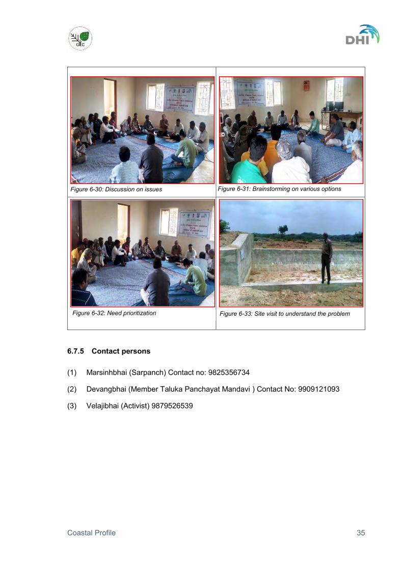
Figure 6-30: Discussion on issues Figure 6-31: Brainstorming on various options
Figure 6-32: Need prioritization Figure 6-33: Site visit to understand the problem

Coastal Profile 36
6.8 Village Jangi Date: 11/07/2016 Time: 16.00 hours onward
6.8.1 Brief introduction Jangi village is situated approximately 11 km from Samakhiyali (nearest market place), 30 km from the taluka headquarters in Bhachau, 100 km from district headquarters in Bhuj and 6-7 km from the coast.
The population of the village has almost doubled from 4713 to 9000 people since the PRA conducted in year 2010-11.
People belong to varied castes like Aair, Brahmin, Muslim, Koli and Dalit.
Agriculture is the main source of income for the villagers. People are also engaged in salt pans as labourers and a few people do fishing.
6.8.2 Village infrastructure
One primary school upto 8th standard with 900 students running two shifts and one high school upto 10th standard with 150 students. After 10th standard students have to travel to Vandhiya and Samkhiyali for higher education, which is approximately 12-14km away.
There are a few grocery shops in the village to cater to the needs of the villagers. Another option for the people is to travel to Samakhiyali for shopping which is 11 km from the village.
One primary health care centre in the village with satisfactory services. People from nearby villages also come to Jangi for consultation.
Animal husbandry is a supplementary source of livelihood, which is affected due to neglegance of cattle and other domestic animals. This is beause a post of veterinary doctor has been vacant for a long time.
140 tractors and 1600-1800 bikes are owned by villagers. Only 50% of household have toilet facility which are connected with soak pits. There is
no sewerage system Villagers are happy with the water supply system in the village. There is a piped water
supply network in the village and water is supplied in sufficient quantity through Narmada canal.
Figure 6-34: Map showing the location of village Jangi

Coastal Profile 37
6.8.3 Source of livelihood: Livelihood Agriculture field (Households) 500-600 households Fishing Households 35-40 households Salt pan labour Households 250 households Miscellaneous labour Households 200 households Job/service No. 40-50 persons
The primary source of livelihood is rain fed agriculture. After monsoon season a large part of the population works as salt pan labour.
Agricultural practices: Agriculture is the major source of income for the villagers, which is monsoon based agriculture. During the lean season, there are no agriculral activies due to brackish ground water and due to lack of enough water retaining structures.
Animal Husbandry practices: There are approximately 2,000 cows and 2,000 buffalos in the village but thesenumbers are gradually decreasing due to increased demand for space and grazing ground. There is a milk collection centre but the community is yet to be motivated towards dairy development business.
Ecological issue: Villagers face pollution problem from the industries near the village. During the winter there is a more pronounced problem of bad odour.
Villagers also highlighted that excessive salt pan activity, bunds construction for salt production and rejects/ waste disposal near shore, are affecting the seashore to a great extent. The seashore area is filled with these pollutants and siltation is taking place resulting in shore line changes.
6.8.4 Issues and community need
Water supply storage is one of the issues identified by the villagers. Construction of check dams and other water conservation structures to recharge of
ground water and conservation of surface water. Provision of underground sewerage system requested by women community. . Women raised issue of additional income sources requesting specialized training and
financing and marketing support. An animal health care centre at village level with sufficient staff. More mangrove plantations to improve bio-diversity of the region. Forest department to provide options to protect their crops from the wild animals like
blue bull and wild boar. Crematoria demanded by the community. There are vacant posts in high school, which is affecting the education of the children.
Request for early recruitment of teaching staff in the school. Drinking water and electricity/ solar light facility required for 30 – 35 houses settled at
the seashore.

Coastal Profile 38
6.8.5 Contact persons (1) Vashrambhai (Sarpanch)- Contact no: 9979749651 (2) Ranchhodbhai Patel- Leader- Contact no: 9879982209
Figure 6-35: Introduction by the team members about the program
Figure 6-36: Interaction with the village community
Figure 6-37: Active community participation Figure 6-38: Clarification raised by the community members

Coastal Profile 39
6.9 Village Navinal Date: 27/07/2016 Time: 17.00 hours onward
6.9.1 Brief introduction Navinal village is situated approximately 21 km from the taluka headquarters at Mundra, 70 km from district headquarters at Bhuj (Kachchh) Jamnagar and 3-4 km from the coast.
Jain, Darbar, Muslim and Dalit are main communities in the village.
There are total 300 households in the village, which has reduced to half compared to 602 households counted in PRA activity conducted in 2010-11.
200 households belonging to Jain community have settled in Mumbai but they are in touch with native village.
Cast wise househhold distribution are Darbar 100, Muslim 65, Dalit 70, Devipujak (Dataniya) 40, Gadhvi 30 and Miscellaneous 25.
6.9.2 Village infrastructure
One primary school up to 10th standard. For higher studies students have to travel to Bhujpur and Mundra, which is 10-15km.
Five small grocery shops, which fulfils the daily needs of the villagers. For major shopping people travel to Mundra and Mandvi.
No public health care centre. People have to travel to Zarapara village, which is 6km away for health facilities. For veterinary doctor and services people have to take their animals to Bhujpur village, which is 10km.
There is a SARHAD Dairy Milk collection centre in the village, where approximately 1000 litre milk is collected per day.
3 trucks, 15 tractors, 85 cars and around 100 bikes owned by villagers. Almost all houses have toilet facility and are connected to sewerage system. Water facility is available through WASMO project with regular and sufficient supply.
Water source is a tube well, with potable quality. Community RO Plant was established but is presently not working.
6.9.3 Source of livelihood Livelihood Agriculture 50 percent of households Agricultural labour 40 persons other labour 60-70 persons Drivers Nos. 10 persons
Figure 6-39: Location map of the village Navinal
Coastal Profile 40
Livelihood options for the villagers are agriculture, animal husbandry, labourers in industries, agriculture, driving and fishing. Some women are engaged in craft activity in an unorganized way. They showed interest in cattle rearing and other additional income sources.
Irrigation facility: 5,000 acres of land are under agricultural use of which 2,500 acres are irrigated from bore wells. Farmers have grown horticulture crops like Dates, Chiku and Coconut trees.
Ground water table: The ground water table has gone down in the last couple of years. Earlier the tubewells were 100-120 feet but now theu have gone down to 300 feet or more. After 300 feets the water become brackish and cannot be used for any purpose.
6.9.4 Issues and community needs
Sanlinity has increased in the water and in the soil. A canal of 2-3 km has been dug for the water use in power plant, which casuses the problem to farmers.
Degradation of mangroves have negative impact on fish catch. Huge power plant on seashore has environment side effects in the form of pollution.
Due to restrictions imposed by the power plant the distance has increased for fishing and its effect are shown on quantity of fish catch.
Wild animals like wild bore and neelgai damage the crops. Ill health effect such as breathing problem and cancer can be seen due to fly ash from
the power plant. Crops are also damaged due to fly ash. Government has not compensated pasture land after allotment to Adani Company.
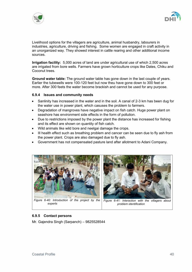
Figure 6-40: Introduction of the project by the
experts
Figure 6-41: Interaction with the villagers about
problem identification
6.9.5 Contact persons Mr. Gajendra Singh (Sarpanch) – 9825528544

Coastal Profile 41
6.10 Village Bhadreshwar Date: 28/07/2016 Time: 10.30 hours onward
6.10.1 Brief introduction Bhadreshwar village is situated approximately 22 km from the taluka headquarters in Mundra and 50 km from the district headquarters at Bhuj and 4 km from coast
The population of the village is about 5,000 people, which has increased by 33% from 3,750 people and number of households have increased by 60% from 750 to 1,200 after the PRA conducted in 2010-11.
The number households by caste is Muslim (350), Darbar (275), Rajput (80), Maheswari (75), Kumbhar (40) and remaining 80 households from casts like sutar and vanand.
6.10.2 Source of livelihood Livelihood Fishing 90% HH Muslim is doing fishing. They are going to Rang bandar sea shore. Muslim
women are doing fish screening, celling and drying. Agriculture 95% HH Darbar and 5% HH Muslim are doing agriculture Animal Husbandry 5% HH Muslim is doing animal husbandry. Mason work 75% HH Maheshwari is doing labour work in masonry. Service/Job Overall 30% HH doing in different Job from different cast. Rajput community Agriculture/service and labour work Kumbhar community Service and labour work.
Every day 40 person go to Bhadresh Company in Gandhidham for job related activities.
Agricultural practices: The majority of the population is dependent on monsoon based agriculture, as 50% (5,000 hectar) land is under agricultural use. Out of this 20% agriculture land is under irrigation through check dam. Main crops are Castor and cotton during the monsoon season.
Animal husbandry practices: There are nearly 4,000 cows and buffalos in the village but this number is decreasing due to increasing demand of space and grazing land. Apart from cows and buffalos there are 1,000 goats and sheep in the village. There are 2-3 Milk collection centres in the village collecting approximately 2,000 litres of milk every day.
6.10.3 Village infrastructure
Four primary schools and one high school up to 10th standard in the village. After 10th standard children either go to Adipur (27 km) or Gandhidham (33 km) for higher
Figure 6-42: Locational map of village Bhadreshwar

Coastal Profile 42
education. Apart from government schools there is one private high school in the village.
There are grocery shops in the village catering for the daily needs of the villagers. One primary health care centre A veterinary hospital is functional in th evillage 35 tractors, 20-25 cars and around 500 bikes owned by villagers 80-90% households have toilet facility. Toilets are connected with soak pits as there is
no sewerage system. There is no waste water disposal system. Water facility is available through bore wells. Gram Panchayat has a RO filter plant
and Panchayat charge Rs 5 per 20 litres of treated water by RO to the villagers.
6.10.4 Issues and community needs
Increase in salinity over a period of time due to over extraction of the ground water. Over extraction of ground water has resulted in decrease in ground water table from
20 feet’s to 50 feet’s over the last decade with TDS going as high as 1700. Reason for over extraction cited by the villagers is presence of industries like Nilkanth, OPG power near the village extracting more water than the permissible limit.
Due to high TDS and lack of water for irrigation, there is decrease in land under agricultural. People are leaving their agricultural land.
Pollution is increasing due to industries located near the village. OPG power plant is coal based and emits fly ash which is affecting the agriculture and health of the people. Villagers told that diseases like heart attack and cancer have increased over the last few years. There is another Philips Carbon industry near the village which emits very bad odour and it is suffocating during winter season because of that.
The salt industry in the area is encroaching on the good agricultural land by constructing high bunds (5-6 ft high). This is also contributing to the salinity problem in and around the village.
Due to pollution from the industries and decrease in mangrove cover over a period of time the survival ratio of juvenile fish has reduced. Villagers claim that the taste of the fish has changed over a period of time.
Fishermen has to travel deep into the sea to get the fish catch and which was not the case ealier. Pagdiya fishermen were getting 40-50 kg of fish earlier, which has reduced to 5-10 kg. Fishermen with boats earlier got 2 to 2.5 ton of fish, which is now reduced to 300-400 kg.
Another reason for the less fish catch is due to restrictions by industries in certain areas and disposal of hot water by industries into the sea. Apart from that the pollution caused by vessel traffic is also a contributing factor.
Kukadsar Village:
Kukadsar village is 4km away from Bhadreshwar and panchayat leader Palabhai Pababaiwas was present in the consultation. A major problem of the Kukadsar village is that of salinity ingress. They were also of the opinion that construction of check dams along the rivers would help reduce the salinity. Other demands of the villagers were, drinking water through tankers, drainage system, cattle rearing centre and milk collection centres for the village.

Coastal Profile 43
Figure 6-43: Explaining the objective of the meeting
to villagers
Figure 6-44: Informal discussion after the meeting
6.10.5 Contact persons Mr. Kailash (Sarpanch) - 9879627995
Mr. J Joshi (Talathi) – 9825610921
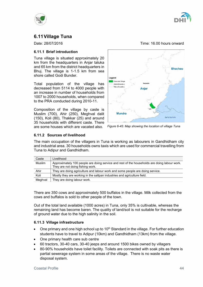
Coastal Profile 44
6.11 Village Tuna Date: 28/07/2016 Time: 16.00 hours onward
6.11.1 Brief introduction Tuna village is situated approximately 20 km from the headquarters in Anjar taluka and 65 km from the district headquarters in Bhuj. The village is 1-1.5 km from sea shore called Godi Bunder.
Total population of the village has decreased from 5114 to 4000 people with an increase in number of households from 1007 to 2000 households, when compared to the PRA conducted during 2010-11.
Composition of the village by caste is Muslim (700), Ahir (250), Meghval dalit (150), Koli (80), Thakkar (25) and around 35 households with different caste. There are some houses which are vacated also.
6.11.2 Sources of livelihood The main occupation of the villagers in Tuna is working as labourers in Gandhidham city and industrial area. 30 households owns taxis which are used for commercial travelling from Tuna to Adipur and Gandhidham.
There are 350 cows and approximately 500 buffalos in the village. Milk collected from the cows and buffalos is sold to other people of the town.
Out of the total land available (1000 acres) in Tuna, only 35% is cultivable, whereas the remaining land has become baren. The quality of land/soil is not suitable for the recharge of ground water due to the high salinity in the soil.
6.11.3 Village infrastructure
One primary and one high school up to 10th Standard in the village. For further education students have to travel to Adipur (10km) and Gandhidham (13km) from the village.
One primary health care sub centre 60 tractors, 30-40 cars, 30-40 jeeps and around 1500 bikes owned by villagers 80-90% households have toilet facility. Toilets are connected with soak pits as there is
partial sewerage system in some areas of the village. There is no waste water disposal system.
Caste Livelihood Muslim Approximately 100 people are doing service and rest of the households are doing labour work.
They are not doing fishing work. Ahir They are doing agriculture and labour work and some people are doing service. Koli Mostly they are working in the saltpan industries and agriculture field. Meghval They are doing labour work.
Figure 6-45: Map showing the location of village Tuna

Coastal Profile 45
Drinking water is supplied every alternate day to the villagers, which is the major issue as per the villagers.
6.11.4 Issues and community needs
There is a reduction in the agricultural land in the village due to high salinity. Salt farmers have encroached on the agricultural land, which forced some farmers to sell their land.
Due to extraction of ground water by industries and for agricultural use, the ground water table has gone down. Ground water table which was at 60 feet have gown down to 1000 feet over the last two decades. The quality of water has deteriorated with TDS increasing from 500 to 1800.
Pollution is increasing due to proximity of the Kandla Adani Port (3km) and the Renuka sugar factory (2km). People expressed that pollution norms are not adhered to by the industries and there is no strict monitoring by the competent authorities.
Figure 6-46: Explaining the objective of the meeting
Figure 6-47: Interacting with the villagers
6.11.5 Contact person Ahir Falgun Nathubhai (Ex Sarpanch) - 9979016704

Coastal Profile 46
7 Findings of the village stakeholder consultations The major findings of the village consultations are:
Ground water is extracted for agriculture and industrial purpose. Due to over extraction of the ground water, the water table has gone down.
Effect of the excess ground water extraction has resulted in sea water intrusion into the ground water table causing salinization. Due to increase in the salinity water is unsuitable for irrigation and for drinking purpose.
Land salinization makes it difficult to do agricultural activities along the Gulf of Kachchh, which is a major livelihood for the villagers.
Crop damage by wild animals (Nilgai and Wild Boar) is a major issue identified during the village level consultation.
Due to reduction in agricultural activities, people are looking for additional livelihood options for their economic growth.
Lack of veterinary hospital facilities. Lack of secondary school and college educational facilities is adding to the problem of
livelihood options, as people are not educated enough to opt for different livelihood option.
Lack of basic infrastructure like sewerage facilities i.e. toilets/latrines, sewage collection and treatment is a major issue in all the villages along the Gulf of Kachchh.
Amount of drinking water supplied is not sufficient to meet the daily needs of the people.
Pollution from the industries is a major problem along the Gulf of Kachchh. Due to pollution from untreated sewage and industries, the quality of mangroves has
deteriorated at some places over a period of time. This has resulted in reduced survival ratio of juvenile fishes. There is also reduction in the fish catch. Villagers also claim that the taste of the fish has changed over a period of time.
Due to industrial development and loss of agricultural land along the Gulf of Kachchh, there is change in the land use pattern.
Lack of awareness about various government beneficiary schemes, makes it difficult for the villages to avail the benefits.
Need for capacity building and training for coastal women population for livelihood improvement.
Public health facilities are in poor condition due to lack of doctors, para medical staff and proper equipments.
The issues identified during the village stakeholder consultations were compared to the issues identified in the Coastal Profile Vol I and it shows that the main issues identified in the ICZM plan process are in alignment with the perception among stakeholders at village levels. The issues identified during consultations are compiled and tabulated in Table 3.

Coastal Profile 47
Table 3: Compilation of the village level stakeholder findings as per issues identified in Coastal profile Vol I
Taluka Jamnagar Jodhiya Jamnagar Dwarka Khambhaliya Maliya Mandvi Bhachau Mundra Mundra Anjar
Main Issues/Villages Khara Beraja Hadiyana Rasulnagar Khatumb
a Kalavad Simani Bodki Kathada Jangi Navinal Bhadreshw
ar Tuna
Urbanisation · Pressure on physical infrastructure due to high population density
· Changing land use/conflicts X X X
· Land reclamation · Pollution Sanitation and Sewerage Issues
· Lack of sewerage collection X X X X X X X
· Lack of sewerage treatment X X X X X X X
· Solid waste collection · Solid waste disposal
· Lack of Water supply X X X
Probable impact on coastal ecosystem and marine biodiversity due to pollution from industrial development and urbanisation
· Mangroves X X X X X
· Corals · Turtles · Islands Pollution in the Sea
· Industry X X X X
· Agriculture

Coastal Profile 48
Taluka Jamnagar Jodhiya Jamnagar Dwarka Khambhaliya Maliya Mandvi Bhachau Mundra Mundra Anjar
Main Issues/Villages Khara Beraja Hadiyana Rasulnagar Khatumb
a Kalavad Simani Bodki Kathada Jangi Navinal Bhadreshw
ar Tuna
· Sewerage X X X X X X X
· Solid waste management · Ports (oil spill, others) Risk of oil spills due to transport and handling of oil by ships and oil depots along the Gulf of Kachchh;
· Handling · Transport · Storage
Ground water depletion
· Ground water extraction X X X X X X X X
· Saline intrusion X X X X X X X X
Livelihood (shore based) at risk
· Un sustainable fishing X
· Pollution X X X
· Land use conflicts
· Land salinization X X X X X X X X · Protection of Agricuture land from wild Animals X X X X
· Additional livelihood options X X X X X X X X
Shoreline changes · Erosion · Accretion · Development interference with shoreline Disasters risk
· Cyclones X

Coastal Profile 49
Taluka Jamnagar Jodhiya Jamnagar Dwarka Khambhaliya Maliya Mandvi Bhachau Mundra Mundra Anjar
Main Issues/Villages Khara Beraja Hadiyana Rasulnagar Khatumb
a Kalavad Simani Bodki Kathada Jangi Navinal Bhadreshw
ar Tuna
· Tsunamis · Earth quakes · Drought · Industrial hazards Effect of Climate Change on the natural resources
· Sea level rise · Water Temperature · Air Temperature · Rainfall
· Extreme weather (cyclones)

Coastal Profile 50
Annex 1: Brief of the ICZM Project The ICZM Project
The World Bank funded ICZM project was initiated in 2010 by the Ministry of Environment Forest and Climate Change. The overall objective of the project is to support the Government of India and selected states in developing and implementing an improved strategic management approach for India’s coastal zones to ensure sustainable development and economic growth.
In order to achieve the overall objective, the project supports capacity building for implementation of ICZM at national level and support to three states in the form of pilot projects.
The National Component
The national level ICZM capacity enhancement component of the project is engaged in;
Mapping, delineation and demarcation of the hazard lines, and delineation of coastal sediment cells along the entire mainland coast of India;
Mapping, delineation and demarcation, of the ecologically sensitive areas (ESAs), along the entire mainland coast of India;
Capacity building of the MoEFCC as the secretariat for the National Coastal Zone Management Authority (NCZMA), and nation-wide training program for integrated coastal zone management; and
Setting up and operationalization of the new National Centre for Sustainable Coastal Zone Management.
The other three components of the project focus on state wise piloting of ICZMP. The MoEFCC has identified Gujarat on the west coast and Odisha and West Bengal on the east coast for pilot implementation of project activities including the preparation of ICZM plans.
The Gujarat State Component
The Gujarat pilot project supports capacity enhancement of the state level agencies and institutions, priority investments in the coastal areas and the formulation and adoption of an ICZM Plan for the Gulf of Kachchh to address major management issues.
Capacity enhancement
Special attention is paid on building capacity related to ICZM at the following key institutions at state level:
Department of Environment and Forest (Secretariat for the State Coastal Zone Management Authority)
Gujarat State Pollution Control Board (for monitoring and enforcing pollution control in the coastal areas)
Gujarat Environment and Ecology Research Foundation (for developing relevant research capacity in coastal ecology, and for developing suitable techniques for transplantation and regeneration of coral reefs)

Coastal Profile 51
Bhaskaracharya Institute of Space Applications and Geo-Informatics (BISAG) for preparing GIS-enabled mapping and decision support tools for the coastal areas.
Priority investments
With the view of ensuring long term environmental sustainability investment under this project is made in the following priority areas:
Conservation and protection of coastal resources; mangrove plantation, coral reef regeneration, establishment of shelter belt and establishment of marine aquarium with public-private partnership
Environment and pollution management; commencement of environmental sanitation project in Jamnagar
Livelihood security of coastal communities; livelihood improvement in non-forest villages and eco-tourism development
Gulf of Kachchh ICZM Plan
The Gulf of Kachchh ICZM Plan is being developed in the following main phases:
Information acquisition
Information has been compiled from secondary sources to support the ICZM planning. Liaison has been made with institutions and organizations engaged in collection and management of information relevant to the situation in the Gulf of Kachchh.
The project makes extensive use of Geographic Information System and many themes are included in maps developed to support the ICZM planning. Key socio-economic, land use and environment indicators have been collected.
Updating baseline information while examining information management
Efforts have been given on acquiring the most recent available information and on updating the baseline on the situation in and around the Gulf of Kachchh. Information sources are many, sometimes overlapping and sometimes not available or not up-to-date. The information overviews maintained under the project offer a good baseline for further examining how well and efficient information is management to satisfy decision making requirements.
Preparing structured coastal profiles identifying management issues
The baseline situation in and around the Gulf of Kachchh is described in the form of a Coastal Profile on one side covering sector and cross-sector themes and on the other exposing local issues through a detailed geographic overview by districts and talukas bordering the Gulf of Kachchh. The baseline description and analyses has served to identify issues to consider in ICZM planning.
An important part of the profile is the compilation of baseline maps and tables with demographic, socio-economic, land-use and environmental indicator values.
Develop an ICZM Plan as a portfolio of actions addressing identified issues
A vision for Gulf of Kachchh will be pursued in an ICZM plan pursuing development objectives through actions addressing prioritized issues identified in the coastal profile.

Coastal Profile 52
The ICZM Plan for the Gulf of Kachchh is being developed in a participatory process and is based on a thorough appreciation of the roles, mandates and responsibilities vested in existing institutions and organizations:
Participatory approach
A fundamental requirement for developing and successfully implementing an ICZM Plan is participation from key stakeholders in the planning process. Such participation is important to mobilize knowledge and expertise in the planning while at the same time building ownership and commitment to the outcome of the planning.
The participation in the ICZM planning for the Gulf of Kachchh is pursued in particular though:
Field visits including discussions with local stakeholders. Two such field efforts are included, one at the start of the project to get an initial appreciation of local challenges and one during the building of coastal profiles to ensure integration of local perceptions in the issue identification.
Structured stakeholder meetings to consider and validate milestones. Three such meetings are included: - One during data and information acquisition to solicit coordination among and seek
guidance from key data and information providers at state and national level. The high level meeting also involved participation from other ICZM demonstration projects and from national institutions.
- One to consider and validate the baseline description of the situation in and around the Gulf of Kachchh and to discuss and initiate prioritization of identified issues. The stakeholders during this meeting will also establish a vision for the Gulf and development objectives and principles required to pursue the vision. Importantly a schedule for the ICZM plan development will be considered and contributions in issues prioritization will be agreed upon.
- One to consider and validate the ICZM Plan for the Gulf of Kachchh. The last two stakeholder meetings will include local level representatives.
Alignment to existing institutional framework
Emphasis has been given to presenting an overview of the existing arrangements to manage development in the Gulf of Kachchh. A separate chapter in the Coastal Profile provides a description of the institutional, legal, policy and planning arrangements in place today. Additional detail is given in sub-sections to other chapters in the coastal profile specifically discussing arrangements related to sector and cross-sector management.
The ICZM plan for the Gulf of Kachchh shall be aligned to the existing institutional framework and action plans will be designed for implementation coordinated through these institutions.
Coastal Profile for the Gulf of Kachchh
The coastal profile is being prepared in three volumes:
Volume I: Coastal Themes, presenting the situation in the coastal zone thematically, i.e. from the perspective of various sectors and other gulf wide themes.

Coastal Profile 53
Volume II: Coastal Districts and Talukas, offering an overview of the situation in the coastal districts and talukas bordering the Gulf of Kachchh localizing and adding detail to the information in Volume I.
Volume III: Maps and Tables, presenting maps in A3 format and offering tabulated information, collected from documents consulted or generated from the GIS.

Coastal Profile 54
Annex 2: Sample letter sent to villagers for consultation

Coastal Profile 55

Coastal Profile 56
Annex 3: List of participants by village Table 4: Participants in the consultations on 1 July 2016 at Khara Beraja village (Jodiya taluka in Jamnagar
district)
Name of village:Kharaberaja Taluka:Jamnagar District:Jamnagar
Date of consultation:- 01/07/2016
SL Name of Participant Designation
1 Vaghela Prabhaben D Villager
2 Ashiyana Ibrahim Villager
3 Jubedaben Ibrahim Villager
4 Dayaben Valabhai Villager
5 Kalpanaben Chaganbhai Vaghela Villager
6 Ushaben Sureshbhai Villager
7 Chndrikaben Chaganbhai Vaghela Villager
8 Puja Amarshibhai Vaghela Villager
9 Jashuben Nathabhai vaghela Villager
10 Ramuben Pithabhai Makwana Villager
11 Gaurai Karabhai Makwana Villager
12 Kantaben Jivabhai Vaghela Villager
13 Baluben Magabhai Dangar Villager
14 Jayaben Bineshbhai Makwana Villager
15 Shantaben Devabhai Makwana Villager
16 Pamiben Mohanbhai Veghala Villager
17 Kamlaben Devjibhai Vaghela Villager
18 Nandubhai Karshanbhai Vaghela Villager
19 Vijayaben Bhikhabhai Vaghela Villager
20 Manjulaben Somabhai vaghela Villager
21 Amrutaben nanjibhai Makwana Villager
22 Shantaben Chhaganbhai Vaghela Villager
23 Lilaben Govindbhai Vaghela Villager
24 Shantaben Khimabhai Makwana Villager
25 Dayaben Dayaljibhai Vaghela Villager
26 Savitaben Amarshibhai Vaghela Villager
27 Laxmiben Valabhai Vaghela Villager
28 Kanchanben Mahendrabhai makwana Villager
29 Savitaben Amarshibhai Makwana Villager
30 Raniben Devjibhai Makwana Villager
31 Komalben Jethabhai Vaghela Villager
32 Amiben Prahaladbhai Dangar Villager
33 Maniben Chaganbhai Vaghela Villager
34 Daxaben Premjibhai Vaghela Villager
35 Bhanuben Dayabhai Vaghela Villager
36 Sureshbhai Dayabhai Vaghela Villager
37 Bhikhabhai Mohanbhai Vaghela Villager

Coastal Profile 57
Name of village:Kharaberaja Taluka:Jamnagar District:Jamnagar
Date of consultation:- 01/07/2016
SL Name of Participant Designation
38 Dineshbhai Dayabhai Vaghela Villager
39 Amarshibhai Harjibhai Vaghela Villager
40 Rohit Dineshbhai Vaghela Villager
41 Hematbhai Dineshbhai Vaghela Villager
42 Vasharambhai Babubhai Dhranpa Sarpanch
43 Karshanbhai Zinabhai Makwana Chairman-EDC
44 Hariben Lakhaman Topra Villager
45 Sejuben Ramabhai Topra Villager
46 Farzanaben Ikbalbhai Sodha Villager
47 Gohil Parvatiben S.S. MNP Jamnagar
48 Ketan J ramani S.S. MNP Jamnagar
49 NP Bela Forester MNP Jamnagar
50 Mahavirsinh Sodha Villager
Table 5: Participants in the consultations on 2 July 2016 at Hadiyana village (Jodiya taluka in Jamnagar district)
Name of village: Hadiyana Taluka: Jodiya District:-Jamnagar
Date of consultation:- 02/07/2016
Name of Participant DesignatiHadyon
1 Nakum Komalben J Villager
2 Nakum Bhavnnaben J Villager
3 Kanani Nikita R Villager
4 Kanani Hemangi R Villager
5 Kanani Komal N Villager
6 Nakum Komal J Villager
7 Vaishnadi Bhaveshri A Villager
8 Bhavna T D Villager
9 Kusum D Makwana Villager
10 Kanani Aartiben Villager
11 Na+335:361kum Bhavnnaben J Villager
12 Sonagara Gitaben P Villager
13 Goswami Neha M Villager
14 Nakum Bina Karshanbhai Villager
15 Kadia Kulsumben H Villager
16 Pasani Bhavana R Villager
17 Agavat Rekhaben N Villager
18 Babita Vallabhbhai Kadani Villager
19 Kagathra Gaurav B Villager
20 Kagathra Saurav B Villager
21 Kagathra Dhandip P Villager

Coastal Profile 58
Name of village: Hadiyana Taluka: Jodiya District:-Jamnagar
Date of consultation:- 02/07/2016
Name of Participant DesignatiHadyon
22 Kagathra Mukesh M Villager
23 Delvadiya Kaushik J Villager
24 Husain Villager
25 Dharmshi Ghelabhai Villager
26 Chetan J Patel Villager
27 Prakash J Kalavadiya Villager
28 Kanani Minakshi P Villager
29 Bhavnaben Kanani Villager
30 Shridan Biharidan B Gadhvi Villager
31 Dave Hemal Jayeshbhai Villager
32 Pipavadiya Sahil Inusbhai Villager
33 Tilavat Aman Gunvatbhai Villager
34 Padliya Dhruvin Hasmukhbhai Villager
35 Bheghni Sarfraj Salimbhai Villager
36 Israni Ajay J Villager
37 Dhansukh Narsi Villager
38 Kanani Jayesh M Villager
39 Kamleshbhai Bhvanbhai Nandasana villager
40 Javiya Ramesh Amrishbhai Villager
41 R M Barad Vanpal Barad Table 6: Participants in the consultations on 2 July 2016 at Rasulnagar village (Jamnagar taluka in Jamnagar
district)
Name of village: Rasulnagar Taluka:Jamnagar District:Jamnagar
Date of consultation:- 02/07/2016
Name of Participant Designation
1 Nasimaben Ibrahim Subar Basar Villager
2 Jubedaben Abdulbhai Bhaya Villager
3 Husain Sarifaben Husainbhai Bariya Villager
4 Khtija Gani Bhaya Villager
5 Malu Kasam Shubhniya Villager
6 Halima Mamad Shanghar Villager
7 Sarifa Abdul Villager
8 Habeda Abdul Subhniya Villager
9 Mariyamben Salimbhai Jasraya Villager
10 Janamben Musabhai Bhgad Villager
11 Roshan Jasub Subhniya Villager
12 Haran Islam Villager
13 Osman Karim Villager
14 Salim Saik Villager

Coastal Profile 59
Name of village: Rasulnagar Taluka:Jamnagar District:Jamnagar
Date of consultation:- 02/07/2016
Name of Participant Designation
15 Gani Husain Villager
16 Kasam Saik Villager
17 Jasub Villager
18 Abdul Villager
19 Karim Sidiq Kerecha Villager
20 Javed Aamad Gaad Villager
21 Ismail Jushuf Kubadiya Villager
22 Akbar Harun Villager
23 Sabir Harun Gard Villager
24 Osman Siddiq Villager
25 Yunus Mamad Villager
26 Ajaj Jeram Villager
27 Salim Harun Villager
28 Iqbal Aagham Villager
29 Osman Saik Villager
30 Ibhram Kasam Villager
31 Ramik Aagham Villager
32 Ismal Jhaku Villager
33 Musi Ismal Villager
34 Kasam Valimamad Villager
35 Husain Hamida Villager
36 Inus Husain Villager
37 Ismal Mamagh Villager
38 Aagham Jaku Villager
39 Jumas Jaku Villager
40 Isbhai Saghik Villager
41 Aagham Ghavugh Villager
42 Ibrahim Musa Villager
43 Ghavugh Jusu Villager
44 Jusub Husain Villager
45 Osaman Saleman Villager
46 Ghavgh Musa Villager
47 Haji Saik Villager
48 Ghavagh Aamgh Villager
49 Kasam Isha Villager
50 Abas Jaku Villager
51 Aagham Jusu Villager
52 Gami Abas Villager
53 Husain Osaman Villager
54 Asgar Kasam Villager

Coastal Profile 60
Table 7: Participants in the consultations on 3 July 2016 at Khatumba village (Dwarka taluka in Devbhumi Dwarka district)
Name of village: Khatumba. Taluka: Dwarka. District: Devbhumi Dwarka
Date of Consultation: 03/07/2016
Name of Participant Designation
1 Modbha Ghaghabha Sumaniya Chairman EDC
2 G L Damor Member Secretary -EDC
3 J M Chavda Vanpal- Okha
4 K R Chudasama Van raxak Okha
5 Ibrahim Haji Sama Watchmen-Positra
6 Bhikhabhai Pragji Villager
7 Bhanshali Labh Lalji Villager
8 Velji Naran Villager
9 Shantilal M Operator
10 Deva Soma Chanpa Villager
11 Bhagvan Devji Villager
12 Lalji Devji Villager
13 Gaga Bhura Villager
14 Mada Budha Villager
15 Manga Madha Villager
16 Harishang Muru Villager
17 Tharya Budha Villager
18 Raju Karu Manek Villager
19 Ashabha kayabha Villager
20 Kanji Mohan Bhatt Villager
21 Mavji Lalji Villager
22 Ramji Lalji Villager
23 Kanji Mohan Villager
24 Govind Ram Villager
25 Dayaram Laxmidas Villager
26 Satish Manga Villager
27 Bhagwan devji Villager Table 8: Participants in the consultations on 3 July 2016 at Kalavad Simani village (Khambhaliya taluka in
Devbhumi Dwarka district)
Name of village: Kalavad Simani. Taluka: Khambhaliya District: Devbhumi Dwarka
Date of Consultation: 03/07/2016
Sl Name of Participant Designation
1 Natubha Jijibha Jadeja Sarpanch
2 Anopsinh Dilubha Jadeja Vice Sarpanch
3 Bhikhubha Chandrasang Jadeja Villager
4 Bhavsang Bhikhubha Jadeja Chairman-EDC
5 Mukeshbhai K Karmur Forest Guard

Coastal Profile 61
Name of village: Kalavad Simani. Taluka: Khambhaliya District: Devbhumi Dwarka
Date of Consultation: 03/07/2016
Sl Name of Participant Designation
6 Navalsang Surubha jadeja Villager
7 Prabhatsang Gagubha jadeja Villager
8 Babbha Motibha Jadeja Villager
9 Sajubha Pratapsang Jadeja Villager
10 Hamirji Lakhubha Jadeja Villager
11 Devubha Thanubha Jadeja Villager
12 Bharatsinh Bachubha Jadeja Villager
13 Arvindsinh Keshubha Jadeja Villager
14 Jayvantsinh Ramsangji Jadeja Villager
15 Sahdevsinh Devubha Jadeja Villager
16 Hitendrasinh Viraji jadeja Villager
17 Hansaba Sajubha Jadeja Villager
18 Vasanba Prabhatsinh Jadeja Villager
19 Ghanuba Chandrasang Jadeja Villager
20 Sajanba Ladhubha Sodha Villager
21 Manishaba Hardevsinh Villager Table 9: Participants in the consultations on 5 July 2016 at Bodki village (Maliya taluka in Devbhumi Dwarka
district)
Name of village: Bodki. Taluka: Morbi District:Morbi
Date of consultation:- 05/07/2016
Sr No:- Name of Participant Designation
1 Shri Lomesh Bhrahmbhatt Manager-Field- GEC
2 Rajesh H Barasara CM-GEC
3 Pravinbhai Bagda Coordinator-GEC
4 Sanjay F Basi Coordinator-GEC
5 Jasmatbhai Maganbhai Villager
6 Karshan Dhanjibhai Villager
7 Dhanjibhai Shankarbhai Villager
8 Amad Ahhuram Villager (varshamedi)
9 Jivaraj Chaganbhai Villager
10 Habib Virambhai Haida Villager
11 Moti Tarshibhai Villager
12 Naresh Rameshbhai Villager
13 Kantilal Vashrambhai Villager
14 Bharat Ambabhai Villager
15 Vasharam Devrajbhai Villager
16 Rajesh Dharamshibhai Villager
17 Bhavesh Mahadevbhai Villager
18 Ikbal Alibhai Sarpanch

Coastal Profile 62
Name of village: Bodki. Taluka: Morbi District:Morbi
Date of consultation:- 05/07/2016
Sr No:- Name of Participant Designation
19 Laljibhai Tarshibhai Villager
20 Haru Khimshabhai Panchayat Member(Varshamedi)
21 Devkaran Ghelabhai Villager
22 Dabhi Hiraben Haribhai Villager
23 Hiralben K Villager
24 Suvariya Nitaben Bharatbhai Villager
25 Hansoyaben Amrulbhai Villager
26 Jabuben Devjibhai Villager
27 Dhumiben Nanjibhai Villager
28 Hanshaben Jagdishbhai Villager
29 Gauriben Jagjivanbhai Villager
30 Ushaben Gagjibhai Villager
31 Joshnaben Gordhanbhai Villager
32 Jashuben Jivarajbhai Villager
33 Shantaben Keshavjibhai Villager
34 Ramaben Jivrajbhai Villager
35 Joshnaben Rajeshbhai Villager
36 Samjuben Amarshibhai Member-CBO
37 Kasturben Harkhabhai Villager
38 Ranjanben Rajeshbhai Villager
39 Rupaben Mavjibhai villager
40 Reshmaben Umarbhai Villager
41 Jashuben Jashmatbhai Villager
42 Ansoyaben Ravjibhai Villager
43 Lataben Oghadbhai Member-CBO
44 Rupaben Mavjibhai Villager
45 Ashwinsinh Meghubha Sarpanch-Vavaniya
46 Mashrubhai Jivabhai ex-Sarpanch
47 Vora Khengarbhai Social Mobilizer.BCRLIP
48 Dinesh V Sarvaiya Social Mobilizer.BCRLIP
Table 10: Participants in the consultations on 11 July 2016 at Kathada village (Mandvi taluka in Kachchh district)
Name of village: Kathada Taluka: Mandvi District:-Kachchh
Date of consultation:- 11/07/2016
Name of Participant Designation
1 Gadhvi Devangh Meghrajbhai Chairman
2 Gadhvi Arjanbhai Pabubhai Member

Coastal Profile 63
Name of village: Kathada Taluka: Mandvi District:-Kachchh
Date of consultation:- 11/07/2016
Name of Participant Designation
3 Gadhvi Mansibhai Devangh Sarpanch
4 Chauhan Umarbhai Adreman Villager
5 Sevak Bharatbhai Mohanbhai Villager
6 Vagher Suleman Alimamad Villager
7 Gadhvi Khimji Mansi Villager
8 Vagher Kasam Osmana Villager
9 Vagher Karim Ali Villager
10 Vagher Karim Ali Villager
11 Chauhan Mamad Kasam Villager
12 Vagher Aamad Kasam Villager
13 Gadhvi Viram L Villager
14 Ajur Anvar Aamad Villager
15 Gadhvi Jivan Kaku Villager
16 Valji J Chauhan Villager
17 Gadhvi Devaji Kaku Villager
18 Gadhvi Shivraj G Villager
19 Gadhvi Madhu Lakhman Villager
20 Gadhvi Lakhu Kabhn Villager
21 Gadhvi Ram Meghraj Villager
22 Gadhvi Haresh Suman Villager
23 Gadhvi Dilip Punja Villager
24 Gadhvi Viram Ladhu Villager
25 Gadhvi Bhimshi Muru Villager
26 Gadhvi Himmat Villager
27 Bashor Hari Jivan Villager
28 Gadhvi Mahesh Villager
29 Harijan Mansi Manga Villager
30 Gadhvi Nagji narayan Villager
31 Kamleesh V Parmar Villager Table 11: Participants in the consultations on 11 July 2016 at Jangi village (Bhachau taluka in Kachchh
district)
Name of village: Jangi Taluka: Bahchau District:-Kutch
Date of consultation:- 11/07/2016
SL Name of Participant Designation
1 U R Pandya Consulatant
2 Hargovan Patel Consulatant
3 B S Bhuriya Principal of Jangi School
4 Solanki Vashram Ala Sarpanch of Jangi
5 Ranchod Kana Ahir C.B.O Chairman

Coastal Profile 64
Name of village: Jangi Taluka: Bahchau District:-Kutch
Date of consultation:- 11/07/2016
SL Name of Participant Designation
6 Solanki Hirabhai Meghji Villager
7 Rajput Vibhabhai Khimji Villager
8 Gautamkumar P Ilodia Social Mobilizer
9 Vavecha Dipakkumar M BCRLIP WAS
10 Jadeja Rugrajsinh Businessman
11 Rauma Salimamad Villager
12 Sajan Villager
13 Ramagovind Villager
14 Manjihara Villager
15 Suresh Samrakoli Villager
16 Jumal Villager
17 Bhima Villager
18 Govabhada Chavda Villager
19 Aduhaji Villager
20 Sharmamad Salimamad Villager
21 Masudia Premji Bhura Villager
22 Naranbhai Ranchodbhai Villager
23 Suthar Rasilaben Kanjibhai Villager
24 Nitavatiya Dawaliben V Villager
25 Suthar Divaraben Kanji Villager
26 Suthar Gomtiben Kanjibhai Villager
27 Mansuri Javed Villager
28 Dangar Hari Ranchodbhai Villager
29 Mansuri Salim Ibrahim Villager
30 Jatavadiya Premjirana Villager
31 Maraj Tirath Vitthal Villager
32 Sohana Vibha Khima Villager
33 Maraj Mehul Devkaran Villager
34 Suthar Dasrath Kanji Villager
35 Loriya Sandip Gordhanbhai Teacher
36 Shersiya Alifhusain A Teacher
37 Bariya Sanjay F Project Coodinator GEC
38 Pravin F Project Coodinator GEC
39 Abdul Alarma Villager
40 Kanabhai Nathbahi Villager

Coastal Profile 65
Table 12: Participants in the consultations on 27 July 2016 at Navinal village (Mundra taluka in Kachchh district)
Name of village: Navinal. Taluka: Mundra. District: Kutch(Bhuj)
Date of Consultation: 27/07/2016
Sl Name of Participant Designation
1 Sodha Janakbha Lalsinh Villager
2 shahu shantaben M Villager
3 Sameja sherbanu Alimamad Villager
4 Jadeja Gajendrasinh B Sarpanch
5 Palu Gopal Gadhvi Member
6 Vagher Asagar Ibrahim Villager
7 Vora Chetan A Villager
8 Jadeja Sanjaysinh Dolubha Villager
9 Jadeja Bharatsinh Bhimaji Member
10 Jadeja Pravinsinh Velubha Villager
11 Jadeja Canghubha Khengarji Member
12 Ranjitsinh Gehji Jadeja Villager
13 Jadeja Ajitsinh Manubha Villager
14 Jadeja Kanubha Aamarji Villager
15 Gadhavi Nagajan Meghraj Villager
16 Gadhvi Valji R Villager
17 Jadeja Shaktisinh Navubha Villager
18 Jadeja Khimji Nanji Villager
19 Khalifa Aaisabai Isak Villager
20 Khalifa sakinabai Aasab Villager
21 Chavda Lilaben Khanji Villager
22 Jadeja Ajaysinh M Talati/Mantri Table 13: Participants in the consultations on 28 July 2016 at Bhadreshwar village (Mundra taluka in Kachchh
district)
Name of village: Bhadreshwar: Mundra. District: Kutch(Bhuj)
Date of Consultation: 28/07/2016
Sl Name of Participant Designation
1 Kailashbha J Jadeja Sarpanch
2 Kiritsinh N Jadeja Social Worker
3 Dasharthsinh J Jadeja Chairman VDC-Hatdi
4 Rabari Pala Paba Chairman VDC-Kukadsar
5 Majaliya Ibrahim Sale Villager
6 Shivji Thavar Villager
7 Husan Osman Villager
8 Abdulla Villager
9 Ismail Villager
10 A GH M Villager

Coastal Profile 66
Name of village: Bhadreshwar: Mundra. District: Kutch(Bhuj)
Date of Consultation: 28/07/2016
Sl Name of Participant Designation
11 Husen Abala Villager
12 Chatrasinh Narubha Villager
13 Gohil Dhirubha Gagubha Villager
14 Nur Amad Villager
15 Saleman Ali Chaiman-Machhimar
16 Husen Mamad Villager
17 Jadeja Dasharatsinh Lalji Chairman-Pavathiyara GD
18 Fakirmamad Juma Villager
19 Hanif Amla Villager
20 Fakirmamad Ibrahim Villager
21 Ramaju Villager
22 Mamahamad Ayub Villager
23 Patel Sunilkumar A Field Worker
24 Pravin K PC- GEC-Anjara
25 Bariya Sanjay F PC- GEC-Maliya
26 Barat Patel Machh
27 Prahaladsinh J Villager
28 Bharatbhai Merabhai Kabira Villager
29 Jadeja Dharmendrasinh B Villager
30 KT Joshi Talati
31 Jadeja Shailendrasinh chhotubha Villager
32 Jadeja Mahipatsinh Jatubha Villager
33 Pardi Mahipatsinh Jadeja Villager
34 LK Parmar Villager Table 14: Participants in the consultations on 28 July 2016 at Tuna village (Mundra taluka in Kachchh district)
Name of village: Tuna: Mundra. District: Kutch(Bhuj)
Date of Consultation: 28/07/2016
Sl Name of Participant Designation
1 Ahir Falgun Nathubhai Chairman-CBO
2 Gani Harun Villager
3 Lakhu Bhima Bakutra Vice Sarpanch-Rampar
4 Naran Mema Dangar Sarpanch-Rampar
5 Babhaniya Pratap ramjibhai Villager
6 Ramji Daya Dangar Villager
7 Rajesh Manjibhai Villager
8 Daud Jusab Villager
9 Jesaf Ismail Villager
10 Akbar Haji Villager
11 Abdul Saik Villager

Coastal Profile 67
Name of village: Tuna: Mundra. District: Kutch(Bhuj)
Date of Consultation: 28/07/2016
Sl Name of Participant Designation
12 Sahilesh Ahir Villager
13 Vela Bhacha Villager
14 Bambhaniya Valji Villager
15 Mansukhbhai Samabhai Parmar Villager
16 Babubhai Popatbhai Koli Villager
17 Bhurabhai Bijalbhai Koli Villager
18 Karsan Mohan Koli Villager
19 samji Bhura Mer Villager
20 Vinod Bechar Villager
21 Raghu Lakhu Villager
22 Kanabhai Villager
23 Dipa Sama Villager
24 Ratiben samatbhai Villager
25 Dhanuben Naranbhai Villager
26 Lakhiben Gagabhai Villager
27 Mangabhai Govindbhai Villager
28 Amadbhai Villager