integrated enterprise gis solution for gas utility distribution · pdf fileintegrated...
TRANSCRIPT
Integrated Enterprise GIS Solution for Gas Utility Distribution
Erik Naczynski, Enbridge Gas Distribution | Srikanth Yadiki, RMSI Private Ltd.,
Presentation Outline
Introduction
Asset Data Management & Compliance – The Need
Concept of Integrated Enterprise GIS – Functional
Solution
Benefits & Challenges
Summary

Introduction
Delivering a world of solutions
Canada's largest natural gas distribution company with 160-year history
Owned by Enbridge Inc., a Canadian-based leader in energy transportation and distribution
Canada's Greenest Employers for 2010
Distributes ~420 bcf natural gas to about 2 million customers
Owns and operates more than 34,000 km of distribution mains
Professional services organization providing enterprise wide geospatial solutions and application software services to utilities worldwide
Manages landbase, network database and GIS applications to provide real-time unified network information for the utility industry
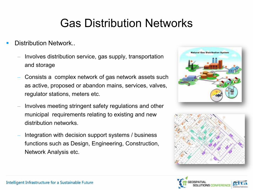
Distribution Network..
– Involves distribution service, gas supply, transportation and storage
– Consists a complex network of gas network assets such as active, proposed or abandon mains, services, valves, regulator stations, meters etc.
– Involves meeting stringent safety regulations and other municipal requirements relating to existing and new distribution networks.
– Integration with decision support systems / business functions such as Design, Engineering, Construction, Network Analysis etc.
Gas Distribution Networks

For efficient Gas Distribution, current utility environment requires:
– Monitoring real-time usage to manage distribution loads
– Leverage technological advantages to efficiently manage, automate and optimize operations
– Compliance with regulations for construction of new distribution assets and maintenance of existing networks
– Effective outage management and emergency preparedness
Enterprise GIS
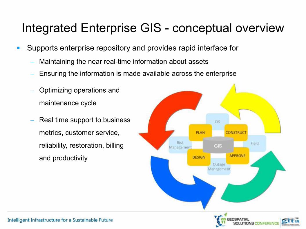
Supports enterprise repository and provides rapid interface for
– Maintaining the near real-time information about assets
– Ensuring the information is made available across the enterprise
Integrated Enterprise GIS - conceptual overview
– Optimizing operations and
maintenance cycle
– Real time support to business
metrics, customer service,
reliability, restoration, billing
and productivity
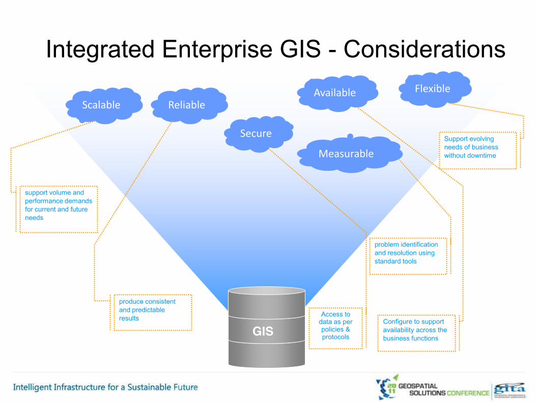
Integrated Enterprise GIS - Considerations
Scalable Reliable
FlexibleAvailable
Secure
Measurable
support volume and performance demands for current and future needs
produce consistent and predictable results
problem identification and resolution using standard tools
Configure to support availability across the business functions
Support evolving needs of business without downtime
Access to data as per policies & protocolsGIS

Integrated Enterprise GIS – Data Flow Enables streamlined inventory and seamless data flow across the enterprise

Sales
Planning Design
• Gas availability
• Regulation Requirements
• Feasibility Analysis
• Joint Trench
Drafting
• Planners Design
• Municipal requirements
• Permit Approvals
Integrated GIS
• Draft Gas network (mains,
services, Fittings, etc)
• “On from To” and BOM
Generation, Key plans etc.
• Planner Approval
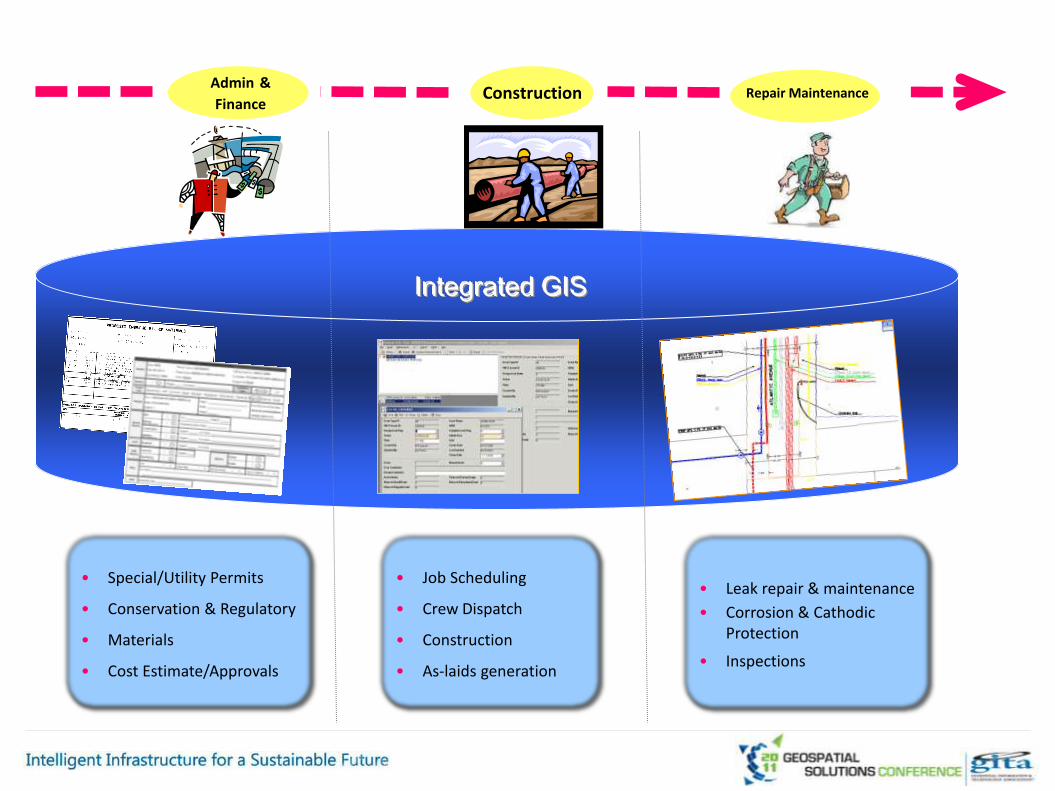
Admin &
FinanceConstruction
• Special/Utility Permits
• Conservation & Regulatory
• Materials
• Cost Estimate/Approvals
Repair Maintenance
• Leak repair & maintenance
• Corrosion & Cathodic Protection
• Inspections
• Job Scheduling
• Crew Dispatch
• Construction
• As-laids generation
Integrated GIS

Records
Integrated GIS
CIS
• Records completion
• As-laid management
• Field Notes & Misc Notes
• Billing & invoice
• Payment Receipts
• Customer Service
Analysis
• Network Analysis
• Load balancing
• Modeling
• Field MarkupsIntegration
• Updates
Field Updates

Integrated GIS @ Work Outage Management
– Identifying and real-time tracking of leaks & repairs
– Efficient response and dispatch of crew– Update and post job completion to reflect changes
– Create & communicate leak history report

Corrosion prevention survey & update
– Enable visualization of pipeline segments for cathodic protection
– Supports survey & plotting rectifiers
– Update in GIS
Integrated GIS@ Work

Network Analysis
– Support simulation, forecasting & long-range planning
– Analyzing the accuracy of existing gas load
– Forecast to ensure the availability of gas for future customers
Integrated GIS@ Work
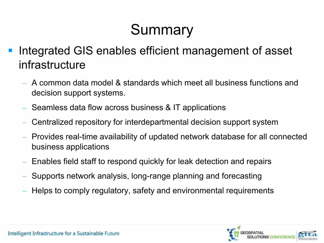
Summary Integrated GIS enables efficient management of asset
infrastructure – A common data model & standards which meet all business functions and
decision support systems.
– Seamless data flow across business & IT applications
– Centralized repository for interdepartmental decision support system
– Provides real-time availability of updated network database for all connected business applications
– Enables field staff to respond quickly for leak detection and repairs
– Supports network analysis, long-range planning and forecasting
– Helps to comply regulatory, safety and environmental requirements

Srikanth [email protected]
RMSI Private Limited, A-7, Sector 16NOIDA 201301, IndiaTel: +91 120 2511102, 2512101
Questions?
www.rmsi.comErik [email protected]
500 Consumers Road North York, ONM2J 1P8416-753-6215