integration of google-map in rails application
DESCRIPTION
simple walk-through to integrate Google-map in Rails Application.TRANSCRIPT

Integration of Google Maps in Rails Application
1
Swati Jadhav

Gmap4rails Gem provides:Multiple MapsMarkers with easy customizationClustersCirclesPolygonsPolylines

What all you need at Model level?
Latitude, Longitude and gmaps4rails_addressIn model: acts_as_gmappable :process_geocoding =>
false
def gmaps4rails_addressend
If your model do not have the latitude or longitude as fields, then you can delegate it or add instance methods.

Controller:
users = User.all@json = users.to_gmaps4rails do |user, marker| marker.infowindow render_to_string( :partial => <partial_name>, :locals => { <locals> }) marker.picture({ :picture => “<image-file-
path>” } ) marker.json({ :id => user.id })end
View:
= gmaps( "markers" => { data: @json })

Map Configuration:detect_location: falsecenter_on_user: false
(centers map on the location detected through the browser )
auto_zoom: true zoom : 1 (initial zoom. Set, 'auto_zoom' to false before
setting 'zoom' value. This enables the 'zoom' value to overide the default.)
maxZoom: nullminZoom: nullauto_adjust: true (adjust the map to the markers if set to
true)

MarkersLoad map without markers
= gmaps("map_options" => { :center_latitude => latitude, :center_longitude => longitude, "auto_zoom" => true })
With Markers:= gmaps("map_options" => { :center_latitude
=> latitude, :center_longitude => longitude, "auto_zoom" => true }, "markers" => { data: json, options: marker_options })

Add markers with js using addMarkers()
Example:var home_pin = [{picture:
"/assets/referral_engine/pins/home.png", width: 32, lat: "#{@practice.latitude}", lng: "#{@practice.longitude}"}];
Gmaps.map.addMarkers(home_pin)


ClusterCluster attributes:• do_clustering : to cluster markers, default to false• clusterer_gridSize: the more the quicker but the less
precise, default to 50• clusterer_maxZoom: define at which zoom level
clusterer is disabled, default to 10
Example:
= gmaps("markers" => { data: json, options: {clusterer_gridSize: 25, do_clustering: true, clusterer_maxZoom: 20} })


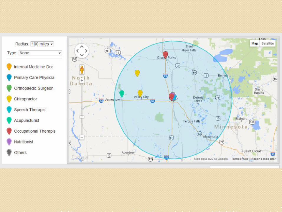
Circles Create circle:
attributes to pass: latitude, longitude, radius, stroke-color, fill-opacity
Example:
circle = [{lng: longitude, lat: latitude, radius: radius, strokeColor: "#00bdce", fillOpacity: 0.15}].to_json
Gmaps.map.circles = JSON.parse(data.circle) Gmaps.map.create_circles()
Clear existing circles:
Gmaps.map.clear_circles()

callback Gmaps.map.callback = function(){ google.maps.event.addListenerOnce(Gmaps.
map.serviceObject, 'idle', function(){ / set zoom-level var zoomLevel =
Gmaps.map.serviceObject.getZoom(); if (zoomLevel > 12) { Gmaps.map.serviceObject.setZoom(12); }})};

Issues:Full zoom-out for single pin• Solution: on map-load check the zoom-level
and adjust accordingly using setZoom()
Display only latest for multiple locations at same place
• Solution: create group of such locations and add while creating info-window for that location include the info of all those grouped locations
