international symposium on : the effects of global change ... · fluvial geomorphology and related...
TRANSCRIPT

INTERNATIONAL SYMPOSIUM ON:
THE EFFECTS OF GLOBAL CHANGE ON FLOODS,
FLUVIAL GEOMORPHOLOGY AND RELATED HAZARDS IN
MOUNTAINOUS RIVERS
6-8 March 2017
Potsdam, Germany
BOOK OF ABSTRACTS

INTERNATIONAL SYMPOSIUM ON:
THE EFFECTS OF GLOBAL CHANGE ON FLOODS, FLUVIAL
GEOMORPHOLOGY AND RELATED HAZARDS IN MOUNTAINOUS
RIVERS
6-8 March 2017
Potsdam, Germany
Scientific Committee
Dr. José Andrés López-Tarazón, Institute of Earth and Environmental Science
University of Potsdam, Potsdam, Germany
Prof. Dr. Axel Bronstert, Chair of Hydrology and Climatology, Institute of Earth and
Environmental Science, University of Potsdam, Potsdam, Germany
Prof. Dr. Annegret Thieken, Institute of Earth and Environmental Science
University of Potsdam, Potsdam, Germany
Dr. Theresia Petrow, Institute of Earth and Environmental Science
University of Potsdam, Potsdam, Germany
Dr. Donal Mullan, School of Natural and Built Environment, Queen’s University
Belfast, Northern Ireland, UK
Prof. Dr. Peter Rutschmann, Chair of Hydraulic and Water Resources Engineering,
Department of Civil, Geo and Environmental Engineering, Technical University of
Munich, Munich, Germany
Dr. Michael Bründl, Research Unit Snow Avalanches and Prevention, WSL Institute
for Snow and Avalanche Research SLF, Davos Dorf, Switzerland
Prof. Dr. Marco Borga, Departments of Land and Agroforest Environments,
University of Padova, Padova, Italy
Prof. Dr. Gerd Bürger, Institute of Earth and Environmental Science, University of
Potsdam, Potsdam, Germany

This work is licensed under a Creative Commons License: Attribution – Noncommercial – Share Alike 4.0 International To view a copy of this license visit http://creativecommons.org/licenses/by-nc-sa/4.0/ Book of abstracts of the International Symposium on the Effects of Global Change on Floods, Fluvial Geomorphology and Related Hazards in Mountainous Rivers Edition 2017 Editors: José Andrés López-Tarazón, Axel Bronstert, Annegret Thieken and Theresia Petrow With contributions of all conference participants Cover images: impacts of a flash flood in the town of Braunsbach. Photos: Ana Lucía Vela (June 2016) This work has been supported by the Marie Curie Intra-European Fellowship Program (Project ‘‘Floodhazards’’, PIEF-GA-2013-622468) (Seventh EU Framework Programme) and by the Deutschen Forschungsgemeinschaft (DFG) through the Research Training Group “Natural Hazards and Risks in a Changing World” (NatRiskChange; GRK 2043/1). Published online at the Institutional Repository of the University of Potsdam: URN urn:nbn:de:kobv:517-opus4-396922 http://nbn-resolving.de/urn:nbn:de:kobv:517-opus4-396922
Preface 3
International Symposium on: The Effects of Global Change on Floods,
Fluvial Geomorphology and Related Hazards in Mountainous Rivers
6-8 March, Potsdam, Germany
Preface
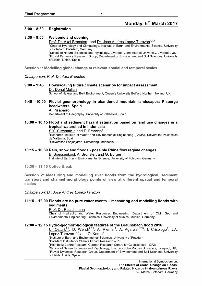
Both Alpine and Mediterranean areas are considered sensitive to so-called global change,
considered as the combination of climate and land use changes. All panels on climate
evolution predict future scenarios of increasing frequency and magnitude of floods which are
likely to lead to huge geomorphic adjustments of river channels so major metamorphosis of
fluvial systems is expected as a result of global change. Such pressures are likely to give
rise to major ecological and economic changes and challenges that governments need to
address as a matter of priority. Changes in river flow regimes associated with global change
are therefore ushering in a new era, where there is a critical need to evaluate hydro-
geomorphological hazards from headwaters to lowland areas (flooding can be not just a
problem related to being under the water). A key question is how our understanding of these
hazards associated with global change can be improved; improvement has to come from
integrated research which includes the climatological and physical conditions that could
influence the hydrology and sediment generation and hence the conveyance of water and
sediments (including the river’s capacity, i.e. amount of sediment, and competence, i.e.
channel deformation) and the vulnerabilities and economic repercussions of changing
hydrological hazards (including the evaluation of the hydro-geomorphological risks too).
Within this framework, the purpose of this international symposium is to bring together
researchers from several disciplines as hydrology, fluvial geomorphology, hydraulic
engineering, environmental science, geography, economy (and any other related discipline)
to discuss the effects of global change over the river system in relation with floods. The
symposium is organized by means of invited talks given by prominent experts, oral lectures,
poster sessions and discussion sessions for each individual topic; it will try to improve our
understanding of how rivers are likely to evolve as a result of global change and hence
address the associated hazards of that fluvial environmental change concerning flooding.
Four main topics are going to be addressed:
- Modelling global change (i.e. climate and land-use) at relevant spatial (regional, local)
and temporal (from the long-term to the single-event) scales.
- Measuring and modelling river floods from the hydrological, sediment transport (both
suspended and bedload) and channel morphology points of view at different spatial (from the
catchment to the reach) and temporal (from the long-term to the single-event) scales.
- Evaluation and assessment of current and future river flooding hazards and risks in a
global change perspective.
- Catchment management to face river floods in a changing world.

Preface 4
International Symposium on: The Effects of Global Change on Floods,
Fluvial Geomorphology and Related Hazards in Mountainous Rivers
6-8 March, Potsdam, Germany
We are very pleased to welcome you to Potsdam. We hope you will enjoy your participation
at the International Symposium on the Effects of Global Change on Floods, Fluvial
Geomorphology and Related Hazards in Mountainous Rivers and have an exciting and
profitable experience. Finally, we would like to thank all speakers, participants, supporters,
and sponsors for their contributions that for sure will make of this event a very remarkable
and fruitful meeting. We acknowledge the valuable support of the European Commission
(Marie Curie Intra-European Fellowship, Project ‘‘Floodhazards’’, PIEF-GA-2013-622468,
Seventh EU Framework Programme) and the Deutschen Forschungsgemeinschaft
(Research Training Group “Natural Hazards and Risks in a Changing World”
(NatRiskChange; GRK 2043/1) as the symposium would not have been possible without
their help. Without your cooperation, this symposium would not be either possible or
successful.
José Andrés López-Tarazón, Axel Bronstert, Annegret Thieken and Theresia Petrow
Potsdam-Golm, 6 March 2017

FINAL PROGRAMME

Final Programme 7
International Symposium on: The Effects of Global Change on Floods,
Fluvial Geomorphology and Related Hazards in Mountainous Rivers
6-8 March, Potsdam, Germany
Monday, 6th March 2017 8:00 – 8:30 Registration 8:30 – 9:00 Welcome and opening Prof. Dr. Axel Bronstert1 and Dr. José Andrés López-Tarazón1,2,3
1Chair of Hydrology and Climatology, Institute of Earth and Environmental Science, University
of Potsdam, Potsdam, Germany 2School of Natural Sciences and Psychology, Liverpool John Moores University, Liverpool, UK
3Fluvial Dynamics Research Group, Department of Environment and Soil Sciences, University
of Lleida, Lleida, Spain
Session 1: Modelling global change at relevant spatial and temporal scales Chairperson: Prof. Dr. Axel Bronstert 9:00 – 9:45 Downscaling future climate scenarios for impact assessment
Dr. Donal Mullan School of Natural and Built Environment, Queen’s University Belfast, Northern Ireland, UK
9:45 – 10:00 Fluvial geomorphology in abandoned mountain landscapes: Pisuerga
headwaters, Spain A. Pisabarro Department of Geography. University of Valladolid, Spain
10:00 – 10:15 Flood and sediment hazard estimation based on land use changes in a
tropical watershed in Indonesia S.Y. Siswanto1,2 and F. Francés1 1Research Institute of Water and Environmental Engineering (IIAMA), Universitat Politècnica
de València, Spain 2Universitas Padjadjaran, Sumedang, Indonesia
10:15 – 10:30 Rain, snow and floods - possible Rhine flow regime changes
B. Boessenkool, A. Bronstert and G. Bürger Institute of Earth and Environmental Science, University of Potsdam, Germany
10:30 – 11:15 Coffee Break Session 2: Measuring and modelling river floods from the hydrological, sediment transport and channel morphology points of view at different spatial and temporal scales Chairperson: Dr. José Andrés López-Tarazón 11:15 – 12:00 Floods are no pure water events – measuring and modelling floods with
sediments Prof. Dr. Rutschmann Chair of Hydraulic and Water Resources Engineering, Department of Civil, Geo and Environmental Engineering, Technical University of Munich, Munich, Germany
12:00 – 12:15 Hydro-geomorphological features of the Braunsbach flood 2016
U. Ozturk1,2, D. Wendi1,2,3, A. Riemer1, A. Agarwal1,2,3, I. Crisologo1, J.A. López-Tarazón1,4,5 and O. Korup1
1Institute of Earth and Environmental Sciences, University of Potsdam
2Potsdam Institute for Climate Impact Research – PIK
3Helmholtz Centre Potsdam, German Research Centre for Geosciences - GFZ;
4School of Natural Sciences and Psychology, Liverpool John Moores University, Liverpool, UK;
5Fluvial Dynamics Research Group, Department of Environment and Soil Sciences, University
of Lleida, Lleida, Spain
Final Programme 8
International Symposium on: The Effects of Global Change on Floods,
Fluvial Geomorphology and Related Hazards in Mountainous Rivers
6-8 March, Potsdam, Germany
12:15 – 12:30 Geomorphic response to extreme flood events: the September 2015 event in the Nure and Trebbia river catchments (northern Italy) V. Scorpio1, M. Righini2, S. Crema3, D. Zoccatelli4, G. Ciccarese5, M. Borga4, M. Cavalli3, F. Comiti1, A. Corsini5, L. Marchi3, N. Surian2, F. Filippi6 and G. Truffelli7 1Faculty of Science and Technology, Free University of Bozen-Bolzano, Bolzano, Italy
2Department of Geo-science, University of Padova, Padova, Italy
3CNR IRPI, Padova, Italy
4Department of land and Agroforest Environments, University of Padova, Padova, Italy
5Department of Chemical and Geological Sciences, University of Modena and Reggio Emilia,
Modena, Italy 6Agenzia Interregionale per il Fiume Po, Parma, Italy
7Emilia Romagna Region, Parma, Italy
12:30 – 12:45 Morphological changes and large wood transport in two steep torrents
during a severe flash flood in South-Western Germany A. Lucía, M. Schwientek, J. Eberle and C. Zarfl Center for Applied Geosciences, Faculty of Science, Universität Tübingen, Tübingen, Germany
13:00 – 14:00 Lunch Discussion and Poster Sessions 14:00 – 15:30 Group Discussions 15:30 – 17:00 Poster session / Coffee Break 17:00 End of Plenary 19:30 Joint Dinner

Final Programme 9
International Symposium on: The Effects of Global Change on Floods,
Fluvial Geomorphology and Related Hazards in Mountainous Rivers
6-8 March, Potsdam, Germany
Tuesday, 7th March 2017 Session 3: Evaluation and assessment of current and future river flooding hazards and risks in a global change perspective Chairperson: Prof. Dr. Annegret Thieken 9:00 – 9:45 Challenges of dealing with flood hazard and risk under global change
conditions Dr. Michael Bründl Head Research Group Avalanche Dynamics and Risk Management, Research Unit Snow Avalanches and Prevention, WSL Institute for Snow and Avalanche Research SLF, Davos Dorf, Switzerland
9:45 – 10:00 Extreme flows in small alpine catchments under current and future
climate conditions: impact of temporal rainfall disaggregation K. Breinl1, G. Di Baldassarre1 and H. Müller2 1Uppsala University, Department of Earth Sciences, Uppsala, Sweden
2Leibniz Universität Hannover, Institute of Water Resources Management, Hydrology and
Agricultural Hydraulic Engineering, Hanover, Germany 10:00 – 10:15 Surprise – a neglected element in flood hazard and risk assessment
B. Merz1,2, S. Vorogushyn1, U. Lall3,4, A. Viglione5 and G. Blöschl5 1GFZ German Research Center for Geosciences, Section 5.4 - Hydrology, Potsdam, Germany
2Institute of Earth and Environmental Science, University of Potsdam, Potsdam, Germany
3Columbia Water Center, Columbia University, New York, USA
4Department of Earth and Environmental Engineering, Columbia University, New York, USA
5Institute of Hydraulic Engineering and Water Resources Management, Vienna University of
Technology, Vienna, Austria 10:15 – 10:30 Urbanization and changing flood risk: a multi-level analysis
B. Dewals, M. Bruwier, A. Mustafa, P. Archambeau, S. Erpicum, J. Teller and M. Pirotton Hydraulics in Environmental and Civil Engineering (HECE) & Local Environment Management and Analysis (LEMA), University of Liege (ULg), Liege, Belgium
10:30 – 10:45 Alpine catchment sensitivities to extreme rainstorm-driven torrential
hazards in Styria, Austria S. Lutzmann1,2, K. Schröer1,3, C. Hohmann1,3, G. Kirchengast1,3 and O. Sass1,2 1FWF DK Climate Change, University of Graz, Graz, Austria
2Department of Geography and Regional Science, University of Graz, Graz, Austria
3Wegener Center for Climate and Global Change, University of Graz, Graz, Austria
10:45 – 11:15 Coffee Break Session 4: Catchment management to face river floods in a changing world Chairperson: Dr. Donal Mullan 11:15 – 12:00 Hydrologic and geomorphic response to extreme storms in river
systems: observations needs for improved risk and basin management Prof. Dr. Marco Borga1, F. Comiti2, N. Surian3 and L. Marchi4 1Department of Land and Agroforest Environments, University of Padova, Padova, Italy
2Faculty of Science and Technology, Free University of Bozen-Bolzano, Bolzano, Italy
3Department of Geosciences, University of Padova, Padova, Italy
4CNR IRPI, Padova, Italy
Final Programme 10
International Symposium on: The Effects of Global Change on Floods,
Fluvial Geomorphology and Related Hazards in Mountainous Rivers
6-8 March, Potsdam, Germany
12:00 – 12:15 The impact of the human-induced deforestation since late middle ages on recent flood magnitudes in the ore mountains C. Reinhardt-Imjela, R. Imjela, J. Bölscher and A. Schulte Freie Universität Berlin, Department of Earth Sciences, Applied Geography, Environmental Hydrology and Resource Management, Berlin, Germany
12:15 – 12:30 Geological setting controls on a flood dynamics in lowland natural and
embanked rivers (Poland) G. Wierzbicki1, P. Ostrowski1, T. Falkowski1 and M. Mazgajski2 1Warsaw University of Life Science - SGGW, Faculty of Civil and Environmental Engineering,
Warsaw, Poland 2Division of the Measurement and Observation Service in Warsaw, Institute of Meteorology and
Water Management – National Research Institute IMGW-PIB, Warsaw, Poland 12:30 – 12:45 Hydromorphological effects of an open stone ramp on flood events in
the Saalach river M. Reisenbüchler, M. D. Bui, D. Skublics and P. Rutschmann Chair of Hydraulic and Water Resources Engineering, Department of Civil, Geo and Environmental Engineering, Technical University of Munich, Munich, Germany
12:45 – 13:00 River flood risk reduction in mountainous basins in Poland
Z. W. Kundzewicz Institute for Agricultural and Forest Management, Polish Academy of Sciences, Poznan, Poland
13:00 – 14:00 Lunch Discussion and Poster Sessions 14:00 – 15:30 Group Discussions 15:30 – 17:00 Poster session / Coffee Break 17:00 End of Plenary

Final Programme 11
International Symposium on: The Effects of Global Change on Floods,
Fluvial Geomorphology and Related Hazards in Mountainous Rivers
6-8 March, Potsdam, Germany
Wednesday, 8th March 2017 Chairperson: Dr. Theresia Petrow Session 5: Extra session on Flash Floods 9:00 – 9:45 A forensic hazard analysis of an extreme flash flood, 29th May 2016, in
SW Germany Prof. Dr. Axel Bronstert1 A. Agarwal1,2, B. Boessenkool1, M. Fischer3, M. Heistermann1, L. Köhn-Reich1, T. Moran3, D. Wendi1,4 1Institute of Earth and Environmental Science, University of Potsdam, Potsdam, Germany
2Research Domain transdisziplinäre Konzepte und Methoden, Potsdam-Institut für
Klimafolgenforschung 3Institut für Meteorologie, Freie Universität Berlin
4GFZ German Research Center for Geosciences, Section 5.4 – Hydrology, Potsdam, Germany
9:45 – 10:30 What can we know about future short-term heavy rainfall?
Prof. Dr. Gerd Bürger1,2 1Institute of Earth and Environmental Science, University of Potsdam, Potsdam, Germany
2Institute of Meteorology, Free University of Berlin, Berlin, Germany
10:30 – 11:15 Coffee Break 11:15 – 12:30 Discussion Plenary: put together previous discussions, outcomes
drafting 12:30 – 13:00 Synthesis of symposium 13:00 End of symposium
Final Programme 12
International Symposium on: The Effects of Global Change on Floods,
Fluvial Geomorphology and Related Hazards in Mountainous Rivers
6-8 March, Potsdam, Germany
Posters Session 1: Modelling global change at relevant spatial and temporal scales 1.- Reanalysis on daily discharge in snow dominant region considering uncertainty
in snow measurement S. Kim1, Y. Tachikawa1 and E. Nakakita2 1Graduate School of Engineering, Kyoto University
2Disaster Prevention Research Institute, Kyoto University
2.- Understanding future projected changes and trend in extreme hydro-climatic
events in selected Norwegian and Polish catchments H.K. Meresa, R.J. Romanowicz and J.J. Napiórkowski Institute of Geophysics, Polish Academy of Sciences, Warsaw, Poland
3.- Global hydrological cycle and river discharge trends
B. Nurtaev Institute of Helioclimatology, Germany
4.- Detection of flood trends in the North-Western Pakistan from 1961 to 2013
M.N. Anjum1,2, Y. Ding1,2, D. Shangguan2 and M.W. Ijaz3 1Division of Hydrology Water-Land Resources in Cold and Arid Regions, Northwest Institute of Eco-
Environment and Resources, Chinese Academy of Sciences, P.R. China 2State Key Laboratory of Cryospheric Science, Northwest Institute of Eco-Environment and Resources,
Chinese Academy of Sciences, P.R. China 3United States-Pakistan Centre for Advance Studies in Water, Mehran University of Engineering and
Technology, Pakistan
5.- Framework for a semi-automatic calibration of a hydrological model on the mesoscale for the analysis of climate change impacts on hydrological extreme events F. Willkofer, R.R. Wood, F.J. Schmid, F. von Trentini and R. Ludwig Department of Geography, Ludwig-Maximilians-Universität, Munich, Germany
Session 2: Measuring and modelling river floods from the hydrological, sediment transport and channel morphology points of view at different spatial and temporal scales 1.- Assessing hydrological modelling in a Mediterranean temporary river at event
scale J. Fortesa1, J. García Hernández2, A. Calsamiglia1, J. Fluixá2, J. García-Comendador1, N. Lerma3 and J. Estrany1
1Department of Geography, University of the Balearic Islands, Palma, Spain
2Centre de Recherche sur l’Environnement Alpin, CREALP, Sion, Switzerland
3Instituto de Ingeniería del Agua y Medio Ambiente, Universitat Politècnica de València
2.- Application of 2D modelling of gravel-bed river flow dynamics, during high
discharge, for reference condition assessment (a case study from upper Wisłoka, Beskid Niski mts, S Poland) D. Giriat1, K. Kulesza2, A. Strużyński3 and M. Wyrębek4 1Department of Geomorphology, Institute of Physical Geography, University of Warsaw, Warszaw, Poland.
2Institute of Meteorology and Water Management - National Research Institute, Board of Water-
Management Systems, Kraków, Poland 3University of Agriculture in Kraków, Department of Hydraulic Engineering and Geotechnics, Kraków,
Poland.

Final Programme 13
International Symposium on: The Effects of Global Change on Floods,
Fluvial Geomorphology and Related Hazards in Mountainous Rivers
6-8 March, Potsdam, Germany
3.- Analysis of turbulent flow characteristics around the bar in a braided river model M.A. Khan and N. Sharma Department of Water Resources Development and Management, IIT Roorkee, India.
4.- Geomorphic disasters for Alawsag valley in Jalawla city\Iraq
H. M. Majed College of education for humanities sciences, Geography Dep., University of Dyala, Iraq
5.- Tree rings as a source of data on flood occurrence and water levels in small
ungauged catchments (Sudeten mts., Poland and Czech republic) I. Malik, M. Wistuba and D. Absalon
University of Silesia in Katowice, Faculty of Earth Sciences, Sosnowiec, Poland 6.- Assessment of the morphological evolution of a river reach by means of
numerical simulation, the river Ésera in Perarrúa (Spain) B. Nácher-Rodríguez1, F.J. Vallés-Morán1, A. Balaguer-Beser2, G. Lobera3, J.A. López-Tarazón3,4,5, D. Vericat3,6 and R.J. Batalla3,6,7 1Research Institute of Water and Environmental Engineering. Universitat Politècnica de València, Valencia,
Spain 2Department of Applied Mathematics. Universitat Politècnica de València, València, Spain
3Fluvial Dynamics Research Group –RIUS, University of Lleida, Lleida, Catalonia, Spain
4Institute of Earth and Environmental Science, University of Potsdam, Potsdam, Germany
5School of Natural Sciences and Psychology, Liverpool John Moores University, Liverpool, UK
6Forest Sciences Centre of Catalonia, Solsona, Catalonia, Spain
7Catalan Institute for Water Research, Girona, Catalonia, Spain
7.- Debris floods and mass movements of diverse magnitude and frequency in an
inhabited high-mountain environment (Sichuan, China) – A tree-ring based hazard assessment M. Wistuba1, I. Malik1, Y. Tie2, P. Owczarek3, B. Woskowicz-Ślęzak1 and K. Łuszczyńska1
1University of Silesia in Katowice, Faculty of Earth Sciences, Sosnowiec, Poland
2China Geological Survey, Chengdu Center, Chengdu, China
3University of Wrocław, Institute of Geography and Regional Development, Wrocław, Poland
Session 3: Evaluation and assessment of current and future river flooding hazards and risks in a global change perspective 1.- Integrated analysis of rainfall-runoff and flood inundation by the RRI model in the
Chikusa river basin K. Yamamoto1, T. Sayama2, K. Takara2, A. Konja3 and Y. Nakamura3
1Department of Civil and Earth Resources Engineering, Kyoto University, Kyoto, Japan
2Disaster Prevention Research Institute, Kyoto University, Uji, Japan
3Mitsui Consultants Co., Ltd.
2.- Simulation of flash floods in small catchments using a robust shallow water
model F. Tügel1, I. Özgen1, A. Hadidi2, U. Tröger2 and R. Hinkelmann1 1Chair of Water Resources Management and Modeling of Hydrosystems, Technische Universität Berlin,
Berlin, Germany 2Technische Universität Berlin, Zentralinstitut El Gouna, El Gouna, Egypt
3.- Construction and uncertainty of synthetic design hydrographs for mountainous
catchments M.I. Brunner1,2, A. C. Favre2, J. Seibert1 and A. Sikorska1
1Department of Geography, University of Zurich, Zurich, Switzerland
2Université Grenoble-Alpes, Grenoble INP, LTHE, Grenoble, France
Final Programme 14
International Symposium on: The Effects of Global Change on Floods,
Fluvial Geomorphology and Related Hazards in Mountainous Rivers
6-8 March, Potsdam, Germany
4.- A retrospective damage analysis for the flash flood in Braunsbach on May 29th,
2016 K. Vogel1, J. Laudan1, T. Sieg1,2, V. Rözer2 and A.H. Thieken1 1Institute of Earth and Environmental Science, University of Potsdam, Potsdam, Germany
2GFZ German Research Centre for Geosciences, Department of Hydrology, Potsdam, Germany
Session 4: Catchment management to face river floods in a changing world 1.- Contemporary gravel-bed channel modification – the effect of flood frequency
change and catchment afforestation (a case study from the Upper Wisłoka, Beskid Niski mts., S Poland) D. Giriat1, E. Gorczyca2 and M. Sobucki2
1Department of Geomorphology, Faculty of Geography and Regional Studies, University of Warsaw,
Warsaw, Poland 2Department of Geomorphology, Institute of Geography and Spatial Management, Jagiellonian University,
Kraków, Poland 2.- Analysis of decentralised flood retention capabilities in the catchment of the
Natzschung river (central Ore mountains) using the rainfall-runoff model NASIM J. Bölscher1 1Freie Universität Berlin, Institute of Geographical Sciences, Berlin, Germany
3.- Geomorphological based methodology and regulation proposal for risk
classification in torrential areas S. Riba1,2,3, J. Altimir2,3 and V. Medina de Iglesias1
1Escola Tècnica Superior d'Enginyers de Camins, Canals i Ports de Barcelona, Universitat Politècnica de
Catalunya, Barcelona, Spain 2Euroconsult, Andorra la Vella, Andorra
3Nivorisk, Ordino, Andorra
4.- The FLUMEN soil erosion modelling framework to assess mountain catchments
M. Märker1, S. Chalov, M. Habl, J. Jarsö, I. Rellini, C. Conoscenti, T. Popusoi, N. Christi, Y. Andreychuk, V. Hochschild, R. Zakerinejad, A. Tsyplekov, O. Yermolaev, and FLUMEN consortium 1Earth and Environmental Department, University of Pavia, Pavia, Italy
5.- Causal factors genesis of floods in the souss river watershed and mapping flood
hazard using GIS B. Bouaakkaz and Z. El Morjani Taroudant Poly-Disciplinary Faculty, Ibn Zohr University of Agadir, Agadir, Morocco
6.- Prioritizing mountainous watersheds in Indian Himalayas based on gross soil
erosion and geomorphologic parameters A. Kumar and K. Kumar Department of Soil and Water Conservation Engineering, College of Technology G. B. Pant, University of Agriculture and Technology, Uttarakhand, India
7.- Geomorphological evolution of a river reach after a high intense gravel-mining
operation J.A. López-Tarazón1,2,3, G. Lobera3, D. Vericat3,4 and R.J. Batalla3,5
1Institute of Earth and Environmental Science, University of Potsdam, Germany.
2School of Natural Sciences and Psychology, Liverpool John Moores University, Liverpool, UK.
3Fluvial Dynamics Research Group, University of Lleida, Lleida, Catalonia, Spain.
4Forest Sciences Centre of Catalonia, Solsona, Catalonia, Spain
5Catalan Institute for Water Research, Girona, Catalonia, Spain

ORAL PRESENTATIONS


Oral Presentations 17
International Symposium on: The Effects of Global Change on Floods,
Fluvial Geomorphology and Related Hazards in Mountainous Rivers
6-8 March, Potsdam, Germany
DOWNSCALING FUTURE CLIMATE SCENARIOS FOR IMPACT ASSESSMENT
Dr. Donal Mullan
School of Natural and Built Environment, Queen’s University Belfast, Northern Ireland, UK
Despite the ever-increasing spatial resolution of global climate models (GCMs), their
output remains too coarse to be applied directly to impact models for a range of
sectors. For example, hydrological applications typically require information at the
catchment-scale, while some applications such as soil erosion and crop growth –
where point-scale processes dominate – require information at a site-specific scale.
Downscaling techniques are used to bridge this gap between what GCMs provide
and what impact modellers require. A range of downscaling options exist – from
dynamical approaches involving the nesting of a regional climate model within a host
GCM to more computationally inexpensive statistical downscaling (SD) techniques
involving the development of statistical relationships between climate at the GCM
scale and the local climate. This keynote will focus on the utility of these SD
techniques in the context of climate impacts modelling, by (1) reviewing the
advantages and limitations of various SD options; and (2) providing some case
studies of SD applied to various impact sectors. It is intended that the keynote will
help illustrate the benefits and drawbacks of applying various SD techniques to a
range of impact sectors.

Oral Presentations 18
International Symposium on: The Effects of Global Change on Floods,
Fluvial Geomorphology and Related Hazards in Mountainous Rivers
6-8 March, Potsdam, Germany
FLUVIAL GEOMORPHOLOGY IN ABANDONED MOUNTAIN LANDSCAPES:
PISUERGA HEADWATERS, SPAIN
A. Pisabarro
Department of Geography. University of Valladolid, Spain
The Atlantic mountains of Spain joined to the nearby interior lands, are suffering a
strongly landscape change due to an intensive emigration to the big cities since
middle of XX century. This landscape change is based on the transformation of
cultivate fields and grasslands to unclear forest and shrubs which is getting a
decrease in the runoff and a change in the morphodynamical behaviour of the creeks
in headwaters. This key impact, however, should be pondered with the role of
climate change in a mountain with fast variable atmospheric situations between
years with intense and variable snowfalls and rainfalls without negative tendency and
with the fact of an increase in temperatures. With this background, the research aims
to know exactly the impact of the landscape transformation over the fluvial system.
The global methodology consists in monitoring a catchment of 233 km2 with
approximately 2 habitants/km2 in a geo-historical perspective of the concept of
“global change” where is possible to advertising the diachronic evolution in land use
and land covers while old manuscripts, photointerpretation and remote sensing. The
climatic parameters have been studied through meteorological stations and historical
data, and the hydrological response along the times is read through well-known
techniques in sedimentology on the banks, landscape interpretation and discharge
data. Recently the hydrological response and the sediment yield has been
interpreted with rhythmites in the bottom of a reservoir downstream. Besides, has
been studied the different behaviour between the valleys in the Pisuerga headwaters
with the mentioned perspective geo-historical.
The results show that the river morphology of the rivers is being affected by the
decrease in runoff; e.g. narrowing of channels, banks stabilization, growth of
riverbank vegetation or reduction in sinuosity. Also, the volume and grain-size of

Oral Presentations 19
International Symposium on: The Effects of Global Change on Floods,
Fluvial Geomorphology and Related Hazards in Mountainous Rivers
6-8 March, Potsdam, Germany
sediment transported is descending in the last two decades with less extreme floods
than ever meanwhile organic matter inside the flow is rising.

Oral Presentations 20
International Symposium on: The Effects of Global Change on Floods,
Fluvial Geomorphology and Related Hazards in Mountainous Rivers
6-8 March, Potsdam, Germany
FLOOD AND SEDIMENT HAZARD ESTIMATION BASED ON LAND USE
CHANGES IN A TROPICAL WATERSHED IN INDONESIA
S. Y. Siswanto1,2, F. Francés1
1
Research Institute of Water and Environmental Engineering (IIAMA), Universitat Politècnica de València, Spain 2 Universitas Padjadjaran, Sumedang, Indonesia
The high precipitation amounts over tropical watersheds drive the hydrological
process and create high rate of overland flow as a driving factor for floods, erosion in
the uplands and sedimentation in the lower areas, including the siltation of
reservoirs. The Citarum Hulu watershed is located in West Java, Indonesia and
drains into the Saguling reservoir. The region is very vital and reservoir is a strategic
infrastructure in the region for urban and industrial water supply and hydroelectricity
production. However, flood hazard often happens followed by severe erosion and
sedimentation. The catchment has suffered significant land use changes since the
mid of the last century and our hypothesis stated that the change of land use creates
a high influence in water, flood and sediment cycles.
In order to shed more light on the problem, a distributed hydrological-sediment
model, called TETIS, has been implemented at a daily time step of hydro
meteorological data series from 1985 to 2014. The needed parameter maps were
estimated using a GIS, taking into account the three different historical and three
scenarios of land use maps. The calibration of the hydrological sub-model was done
using the parameter maps corresponding to the 2009 land use for the period 2008-
2010 (with one year for warming up the model), resulting in a final Nash-Sutcliffe
efficiency index NSE=0.81. For the validation, we used two different periods (2012-
2014 and 1994-1996, corresponding to the 2014 and 1994 land use maps
respectively), giving NSE= 0.52 and NSE= 0.45 respectively. Three historical land
uses (corresponding to years 1994, 2009 and 2014) and three scenarios
(conservation, Indonesian government plan and natural vegetation) have been
implemented into a model. The return period of flood quintiles were calculated by the
Maximum-Likelihood-method with the AFINS-Tool. Annual historical bathymetries in

Oral Presentations 21
International Symposium on: The Effects of Global Change on Floods,
Fluvial Geomorphology and Related Hazards in Mountainous Rivers
6-8 March, Potsdam, Germany
the reservoir were used to calibrate and validate the sediment sub-model involving
Miller’s density evolution and trap efficiency of Brune’s equation. The error volume
for the sediment sub-model validation was recorded only 2.5%.
The implemented model of land use change shows that those are influencing the
water cycle, flood quantile and sedimentation. Due to the reduction of forest area,
the actual evapotranspiration has been reduced 11.0% from the 1994 to the 2014
scenario, increasing mainly the overland flow (17.5%). It increases the water yield
from 853.8 mm/year to 963.6 mm/year. Gumbel quantile estimation showed the best
result for predicting the return period of flood quantile in the study area with
decreasing of 5.3-7.4 % for return periods of 5 to 100 years for the land use change
1994 to 2009. Meanwhile the changes in land use 1994 to 2014 showed a
decreasing of 5.7 to 7.90% for the same return period. Flood quantile estimation of
three land use scenarios showed the decreasing of maximum flood occurrence of
about 2.24 to 30.71% compared to 2014 land use. The sediment yield increment was
recorded from 3,354,321 ton/year for the 1994 scenario to 4,410,699 ton/year for the
2014 land use scenario (14.5 and 19 ton/Ha/year respectively). This increment will
decrease the expected life of the reservoir from 243 to 185 years.

Oral Presentations 22
International Symposium on: The Effects of Global Change on Floods,
Fluvial Geomorphology and Related Hazards in Mountainous Rivers
6-8 March, Potsdam, Germany
RAIN, SNOW AND FLOODS - POSSIBLE RHINE FLOW REGIME CHANGES
B. Boessenkool, A. Bronstert, G. Bürger
Institute of Earth and Environmental Science, University of Potsdam, Germany.
The seasonality of large floods in the Rhine is changing. In the alpine nival regime,
snow melt floods occur earlier in the year and in the pluvial middle-Rhine regime,
rain flood magnitudes rise. Each flood type is currently separated in time, but they
may overlap in the future due to climate change. Such a concurrence could create a
new type of hydrologic extremes with disastrous consequences. The aim of the
research project is to quantify the probability for a future overlap of pluvial and nival
floods. We are setting up the multiscale Hydrological Model (mHM) for the Rhine
catchment and plan to run it with stochastically downscaled temperature and rainfall
extremes from climate model weather projections. So far, we have visualized past
changes in flood seasonality along gauges at the Rhine and large tributaries. The
results indicate that it is indeed relevant to examine flow regime changes in more
detail.
Oral Presentations 23
International Symposium on: The Effects of Global Change on Floods,
Fluvial Geomorphology and Related Hazards in Mountainous Rivers
6-8 March, Potsdam, Germany
FLOODS ARE NO PURE WATER EVENTS – MEASURING AND MODELLING
FLOODS WITH SEDIMENTS
Prof. Dr. Peter Rutschmann
Chair of Hydraulic and Water Resources Engineering, Department of Civil, Geo and Environmental Engineering, Technical University of Munich, Munich, Germany
Most of the more dimensional numerical flood computations do not consider
sediment transport even though changes of the river bed, local erosion and
deposition play a crucial role on flow capacities of river cross sections. Reasons for
not considering these effects are manifold: Lack of appropriate tools, lack of
knowhow, long computation times, difficulties with boundary conditions etc.
My presentation highlights the possibilities and necessities of numerical tools using
classical concepts with empirical sediment transport equations. A model system,
which combines flow calculation with graded sediment transport and bed level
change, has been applied for flood management at the Danube, Inn or Saalach and
also for fish habitat improvement at the Rhine River between Lake of Constance and
Basel. For large areas and long-term modelling it is necessary to improve
computational capacities using High-Performance-Computing techniques like
planned for the “Wasser-Zukunft-Bayern” project combining hydrologic and hydraulic
models for the entire region of Bavaria and in a very high spatial and temporal
resolution.
However, one has to state that empirical relations used in such approaches are a
week point. Most of these relations were derived years ago in flumes using cross-
sectionally averaged flow quantities. Alternatively, instead of such relations sediment
transport could be modelled using artificial neuronal networks (ANN) in various
forms. Results are presented using various ANN approaches, they are compared
and conclusions are drawn. However, ANNs are not only capable of mimicking
sediment transport but they are also capable of replacing continuum approaches for
flow computations with considerable speed up times. In addition, computations are
Oral Presentations 24
International Symposium on: The Effects of Global Change on Floods,
Fluvial Geomorphology and Related Hazards in Mountainous Rivers
6-8 March, Potsdam, Germany
very much dependent on suitable boundary conditions and these can very well be
computed using ANN.
Finally yet importantly measuring techniques for physical model studies are
presented which allow to measure bed levels during physical model operation with
very high spatial resolution and with high measuring frequency.
Oral Presentations 25
International Symposium on: The Effects of Global Change on Floods,
Fluvial Geomorphology and Related Hazards in Mountainous Rivers
6-8 March, Potsdam, Germany
HYDRO-GEOMORPHOLOGICAL FEATURES OF THE BRAUNSBACH FLOOD
2016
U. Ozturk1,2, D. Wendi1,2,3, A. Riemer1, A. Agarwal1,2,3, I. Crisologo1, J. A. López-
Tarazón1,4,5, O. Korup1
1 Institute of Earth and Environmental Sciences, University of Potsdam
2 Potsdam Institute for Climate Impact Research – PIK
3 Helmholtz Centre Potsdam, German Research Centre for Geosciences - GFZ;
4 School of Natural Sciences and Psychology, Liverpool John Moores University, Liverpool, UK;
5 Fluvial Dynamics Research Group, Department of Environment and Soil Sciences, University of
Lleida, Lleida, Spain
Following an unusual heavy precipitation on 29th May 2016 with a total precipitation
of 105 mm fallen in just one day, intense rainfall events in southern Germany led to
severe flash floods and debris flows in several municipalities in the German federal
state of Baden Württemberg. Especially south-western German town of Braunsbach
witnessed flood outburst with massive amounts of rubbles and muddy sediments.
This flash flood, as the combination of surging water with 42,000 m3 of sediment,
sourced by 48 landslides, remarkable river bank erosion and river bed incision, was
responsible of smashing numerous buildings, cars and town facilities, leaving
residents with damage and losses. As a response to the significance of the event,
members of the research training group NatRiskChange formed a task force team in
order to portray the overall picture of the disaster. The present analysis emphasizes
on the hydro-geomorphology, in which comparisons of the event and study
catchment is made in contrast to similar past events and regional catchments. They
include the estimation of removed sediments/materials, meteorological overview and
the assessment hydro-geological characteristics.
Oral Presentations 26
International Symposium on: The Effects of Global Change on Floods,
Fluvial Geomorphology and Related Hazards in Mountainous Rivers
6-8 March, Potsdam, Germany
GEOMORPHIC RESPONSE TO EXTREME FLOOD EVENTS: THE SEPTEMBER
2015 EVENT IN THE NURE AND TREBBIA RIVER CATCHMENTS (NORTHERN
ITALY)
V. Scorpio1, M. Righini2, S. Crema3, D. Zoccatelli4, G. Ciccarese5, M. Borga4, M.
Cavalli3, F. Comiti1, A. Corsini5, L. Marchi3, N. Surian2, F. Filippi6, G. Truffelli7
1 Faculty of Science and Technology, Free University of Bozen-Bolzano, Bolzano, Italy
2 Department of Geo-science, University of Padova, Padova, Italy
3 CNR IRPI, Padova, Italy
4 Department of land and Agroforest Environments, University of Padova, Padova, Italy
5 Department of Chemical and Geological Sciences, University of Modena and Reggio Emilia,
Modena, Italy 6 Agenzia Interregionale per il Fiume Po, Parma, Italy
7 Emilia Romagna Region, Parma, Italy
The occurrence of large floods often leads to sudden channel changes, which in
inhabited areas determine damages and casualties. Nonetheless, few worldwide
studies are relating the magnitude of channel modifications to the potential
controlling factors. This study analyses the geomorphic response of the Nure and
Trebbia rivers (northern Apennines; catchment areas 467 and 1085 km2,
respectively) and 21 tributaries to a high-magnitude flood, which took place on 14th
September, 2015. Spatial distribution of rainfall showed that the highest amounts
and intensities (up to approximately 330 mm in 9 hours and 100 mm in 1 hour) were
located in the upper sectors of the catchments. The peak discharge of the Nure
River, evaluated at the village of Farini (middle-higher sector), was approximately
1800 m3/s (unit peak discharge of 8.82 m3 s−1 km−2), which corresponds to a return
period exceeding 300 years. As a consequence, a large number of shallow
landslides coupled with the channels occurred.
The approach to flood analysis encompassed: (i) hydrological and hydraulic analysis
of the flood event; (ii) analysis of sediment delivery to the channel network by means
of landslides mapping; (iii) assessment of morphological modifications of the
channels, including both channel width (through multi-temporal orthophotos) and bed
elevation (by comparing post-event LiDAR and pre-event cross-sectional surveys).
Oral Presentations 27
International Symposium on: The Effects of Global Change on Floods,
Fluvial Geomorphology and Related Hazards in Mountainous Rivers
6-8 March, Potsdam, Germany
In the main river channels, the most important effects were channel widening and
bed aggradation. Channel widening occurred to the detriment of islands and
floodplains. The assessment, in the Nure River, of the ratio between post-flood and
pre-flood channel width resulted in a range from 1.13 to 5.2. Reaches with limited or
null channel width modifications were characterized by higher lateral confinement by
resistant bedrock. Mean bed elevation variation was 0.9 m on average, with a
maximum value of 1.8 m. Areal and elevation changes showed a good correlation,
as reaches affected by higher sedimentation were also those featuring intense
widening. Most of the tributaries were affected by notable widening, with channel
width ratio ranging from 1.4 to 6.1. Preliminary results on the relation between the
width ratio and the unit stream power show that the minimum stream power required
to cause widening turns out to be about 1000 Wm-2. Widening was more intense in
the channels that were narrower prior to the event. Also, the increase in channel
width is positively correlated with average slope and with the diameter of the larger
boulders transported during the flood. Overall, the magnitude of channel changes
display a reduction moving from the lower order channels to the main channels, and
within these latter, moving downstream.
This study shows that an integrated approach encompassing different methods and
types of evidence provides fundamental information for understanding of geomorphic
effects induced by intense flood events and exploring relationships between
morphological changes and controlling factors. In term of hazard, outcomes of this
study can be used to support planning along river corridors, especially considering
future climatic scenarios and the relevant increase in frequency and magnitude of
floods.

Oral Presentations 28
International Symposium on: The Effects of Global Change on Floods,
Fluvial Geomorphology and Related Hazards in Mountainous Rivers
6-8 March, Potsdam, Germany
MORPHOLOGICAL CHANGES AND LARGE WOOD TRANSPORT IN TWO
STEEP TORRENTS DURING A SEVERE FLASH FLOOD IN SOUTH-WESTERN
GERMANY
A. Lucía, M. Schwientek, J. Eberle, C. Zarfl
Center for Applied Geosciences, Faculty of Science, Universität Tübingen, Tübingen, Germany
According to current climate models that predict a change in global precipitation
patterns temperate areas will experience intensified rainfalls increasing the
probability of extreme rain events. These may result in flash floods that are locally
exceptional and difficult to monitor effectively with classical monitoring techniques.
Therefore, post event surveys are key for understanding of the underlying processes
and driving factors.
This work presents a post event survey study, addressing the geomorphic response,
sediment and large wood budget of two torrents, Grimmbach and Orlacher Bach, in
south-western Germany, state of Baden-Württemberg, that were affected by a flash
flood on May 29, 2016. The rivers are located in the region of the South German
Scarplands, and are two adjacent tributaries of the Kocher river. The Kocher river is
incised 200 m deep in a Triassic limestone plateau, and the two studied tributaries
form steep valleys that erode into the right slope of the Kocher valley. During the
event a large amount of wood (1200-3000 m3) was deposited at the outlet of the
Grimmbach catchment which clogged and damaged a bridge of a cycling path, while
Orlacher Bach flows directly through the small town of Braunsbach which was
devastated during the event. The severity of the event in these two small catchments
(30.0 km2 and 5.95 km2, respectively) is remarkable in drainage areas with a
relatively low average slope (10.7 and 12.0%, respectively).
In order to gain a better understanding of the driving forces during this flood event an
integrated approach was applied, including (i) an estimate of peak discharges, (ii) an
analysis of changes in channel width by comparing available aerial photographs
before the flood with our aerial surveys with an Unmanned Aerial Vehicle right after
Oral Presentations 29
International Symposium on: The Effects of Global Change on Floods,
Fluvial Geomorphology and Related Hazards in Mountainous Rivers
6-8 March, Potsdam, Germany
the flood and validation with field observations, (iii) a detailed mapping of landslides
and analysis of their connectivity with the channel network, (iv) an analysis of the
amounts of large wood recruited and deposited in the channel and finally, (v) an
attempt to analyse the sediment budget from the landslides, incision and
accumulation along the fluvial network.
Preliminary results show high unit peak discharges ranging from 13.6 to 22.6 m3 s-1
km-2 in the Grimmbach while Bronstert et al. (submitted) estimated 20 m3 s-1 km-2 in
the Orlacher Bach. The studied channels have dramatically changed their geometry,
with considerable incision and landslides in the Orlacher Bach catchment and
widening up to 15 m, from 2 to 4 m in its initial width. In the Grimmbach catchment
landslides are more frequent in the upper reaches, while widening, up to 70 m (4-10
m pre-event channel width), is remarkable in the lower reaches. This generated a
vast amount of large wood recruitment which is deposited not only at the catchment
outlet but along the entire channel.
The results of this study show that the crucial roles of sediment availability as well as
large wood dynamics during extreme events have to be taken into account for a
management of similar catchments in the region, especially to prevent interactions
with infrastructures.
References
Bronstert A, Agarwal A, Boessenkool B, Fischer M, Heistermann M, Köhn L., Moran
T, Wendi D. Die Sturzflut von Braunsbach am 29. Mai 2016 – Entstehung, Ablauf
und Schäden eines „Jahrhundertereignisses“. Teil 1: Meteorologische und
hydrologische Analyse. Hydrologie und Wasserbewirtschaftung. Submitted (in
German).
Oral Presentations 30
International Symposium on: The Effects of Global Change on Floods,
Fluvial Geomorphology and Related Hazards in Mountainous Rivers
6-8 March, Potsdam, Germany
CHALLENGES OF DEALING WITH FLOOD HAZARD AND RISK UNDER
GLOBAL CHANGE CONDITIONS
Dr. Michael Bründl
Head Research Group Avalanche Dynamics and Risk Management, Research Unit Snow Avalanches and Prevention, WSL Institute for Snow and Avalanche Research SLF, Davos Dorf, Switzerland
In the last years, several flood events have caused considerable damage and
fatalities both in Europe and worldwide. The intensity and the rapid onset of extreme
runoff of even small streams during recent events have surprised experts and
authorities alike as well as the affected population. In the special report SREX of the
IPCC and state-of-the-art literature it is argued that frequency and intensity of
extreme hydrological events is likely to increase rather than decrease due to rising
air temperature and changing precipitation patterns with strong regional variations.
In Switzerland, a set of climate scenarios was developed in the CH2011 project in
order to have a common basis for assessment of climate change impacts. The
CH2014 project subsequently analysed the impact of these climate scenarios on
cryosphere, hydrology, biodiversity, forests, agriculture, energy and health. In other
studies, the CH2011-scenarios were taken as input for example to quantitatively
evaluate the consequences of increased flood risk on economic sectors. The results
of these analyses form the basis for the climate change adaptation strategy, which
has been developed in Switzerland during recent years.
However, it is still a scientific challenge to judge the effects of temperature and
precipitation changes on natural hazard processes. The formation of flood processes
in mountain catchments depends on a variety of factors such as terrain
characteristics, the availability of loose material, the degree of weathering, the
degradation of permafrost, the amount of melt water or the seasonal distribution of
precipitation as rain or snow. In a recent study, the sensitivity of natural hazard
processes to the CH2011-scenarios was evaluated. The results show for example
that the frequency of small, medium and large flood events may be expected to
Oral Presentations 31
International Symposium on: The Effects of Global Change on Floods,
Fluvial Geomorphology and Related Hazards in Mountainous Rivers
6-8 March, Potsdam, Germany
increase in most parts of Switzerland except in certain areas of the Jura region,
where a decrease is likelier.
Dealing with these expected changes poses a challenge for the affected societies.
The integrated risk management approach considering prevention, intervention and
recovery sets a path to sustainably deal with global change processes. The
occurrence of damage events in the last decades has induced several improvements
in flood risk management, which can be interpreted as a learning process of the
authorities and affected societies. Some of these improvements will be presented
and discussed in the light of climate and socio-economic changes which can be
expected in future. The presentation concludes with some issues that should be
tackled in order to increase the resilience of societies to floods and other hazard
processes in the future.

Oral Presentations 32
International Symposium on: The Effects of Global Change on Floods,
Fluvial Geomorphology and Related Hazards in Mountainous Rivers
6-8 March, Potsdam, Germany
EXTREME FLOWS IN SMALL ALPINE CATCHMENTS UNDER CURRENT AND
FUTURE CLIMATE CONDITIONS: IMPACT OF TEMPORAL RAINFALL
DISAGGREGATION
K. Breinl1, G. Di Baldassarre1, H. Müller2
1 Uppsala University, Department of Earth Sciences, Uppsala, Sweden
2 Leibniz Universität Hannover, Institute of Water Resources Management, Hydrology and Agricultural
Hydraulic Engineering, Hanover, Germany
The assessment of low-frequent extreme flows is often achieved by coupling a
weather generator with hydrological modelling. Weather generators at daily
resolution are established tools for extrapolation of observations and come along
with advantages compared to the direct generation at sub-daily time series.
However, hydrological modelling in small and medium catchments requires weather
time series of sub-daily resolution, for example hourly resolution. One strategy to
overcome this problem is a combination of a daily weather generator and temporal
disaggregation techniques. A method for the disaggregation of daily rainfall is the
multiplicative random cascade model. The idea behind this model is that rainfall from
a coarse time step is disaggregated into b finer time steps, where b is the branching
number determining the number of finer time steps. The rainfall volume is conserved
exactly during the disaggregation process. Starting from daily resolution with b = 2,
hourly time series cannot be achieved. For this reason Lisniak et al. (2013) changed
the first disaggregation step to a branching number of 3, meaning the first split
provided 3 x 8 hours. The possibility for the split in this disaggregation step includes
seven possibilities with three weighing factors. These seven possibilities were
changed into a low parameter version by Müller and Haberlandt (2015) called
“uniform splitting” to avoid over-parameterization, where the number of wet boxes
was kept but the position was randomly assigned. The rainfall was then distributed
uniformly according to the number of wet boxes. In addition, the parameters for
multiplicative random cascade models often differ significantly for higher and lower
rainfall volumes, which is why the parameters are typically derived below and above
a threshold at each disaggregation level, which was the mean of the rainfall volume
in Müller and Haberlandt (2015). In this research, the impact of the first
Oral Presentations 33
International Symposium on: The Effects of Global Change on Floods,
Fluvial Geomorphology and Related Hazards in Mountainous Rivers
6-8 March, Potsdam, Germany
disaggregation step into 3 x 8 hours with increased (Lisniak et al., 2013) and
reduced parameters (Müller and Haberlandt, 2015) as well as different volume
thresholds on the characteristics of generated extreme flows (peak, timing,
hydrograph) is examined using the conceptual HBV model to simulate the hydrologic
behavior of Alpine catchments in Tyrol and South Tyrol with areas between 60km²
and 150km². In addition to the observed period, the daily weather generator is
parameterized with output from EURO-CORDEX RCMs to examine the rainfall
disaggregation on projected extreme flows, likewise considering the different
versions of the multiplicative random cascade model.
References
Lisniak, D., Franke, J., Bernhofer, C., 2013. Circulation pattern based
parameterization of a multiplicative random cascade for disaggregation of observed
and projected daily rainfall time series. Hydrol. Earth Syst. Sci., 17(7): 2487-2500.
DOI:10.5194/hess-17-2487-2013
Müller, H., Haberlandt, U., 2015. Temporal Rainfall Disaggregation with a Cascade
Model: From Single-Station Disaggregation to Spatial Rainfall. J Hydrol Eng, 20(11).

Oral Presentations 34
International Symposium on: The Effects of Global Change on Floods,
Fluvial Geomorphology and Related Hazards in Mountainous Rivers
6-8 March, Potsdam, Germany
SURPRISE – A NEGLECTED ELEMENT IN FLOOD HAZARD AND RISK
ASSESSMENT
B. Merz1,2, S. Vorogushyn1, U. Lall3,4, A. Viglione5, G. Blöschl5
1 GFZ German Research Center for Geosciences, Section 5.4 - Hydrology, Potsdam, Germany
2 Institute of Earth and Environmental Science, University of Potsdam, Potsdam, Germany
3 Columbia Water Center, Columbia University, New York, USA
4 Department of Earth and Environmental Engineering, Columbia University, New York, USA
5 Institute of Hydraulic Engineering and Water Resources Management, Vienna University of
Technology, Vienna, Austria
Unexpected incidents, failures and disasters are abundant in the history of flooding
events. We argue that surprise is a neglected element in flood hazard and risk
assessment. Two sources of surprise are identified: (1) the complexity of flood risk
systems, represented by non-linearities, interdependencies and non-stationarities,
and (2) cognitive biases in human perception and decision making. Flood risk
assessments are particularly prone to cognitive biases due to the rarity and
uniqueness of extremes, thus impeding validation. We reflect on possible
approaches to better understanding and reducing the potential for surprise and its
adverse consequences. It is concluded that flood risk assessment should account for
the potential for surprise and devastating consequences.
Oral Presentations 35
International Symposium on: The Effects of Global Change on Floods,
Fluvial Geomorphology and Related Hazards in Mountainous Rivers
6-8 March, Potsdam, Germany
ALPINE CATCHMENT SENSITIVITIES TO EXTREME RAINSTORM-DRIVEN
TORRENTIAL HAZARDS IN STYRIA, AUSTRIA
S. Lutzmann1,2, K. Schröer1,3, C. Hohmann1,3, G. Kirchengast1,3, O. Sass1,2
1 FWF DK Climate Change, University of Graz, Graz, Austria
2 Department of Geography and Regional Science, University of Graz, Graz, Austria
3 Wegener Center for Climate and Global Change, University of Graz, Graz, Austria
Torrential processes in steep alpine headwater catchments pose one of the most
frequent risks in the densely populated alpine region. They tend to be triggered
during heavy and highly localized rainstorm events. In view of rapid global change,
concerns exist on how intensified water cycles might affect sediment flows in
mountain channels. However, the geomorphic response of torrent systems to
external drivers is strongly mediated by the systems’ internal configuration and
conditions.
This study aims at investigating critical spatial controls of torrent catchment
sensitivities on a regional scale for the Eastern Alps in Styria, Austria. In an
interdisciplinary, holistic approach – crucial for understanding water-sediment flow
dynamics – we analyze the function of climatic, hydrologic and geomorphic system
components.
A Styria wide database of torrential events dating back to the 1950’s is investigated.
Based on statistical methods and GIS modelling, we assess the ability of multiple
meteo – hydro – geomorphic variables to explain the observed spatial variability of
torrent hazard magnitude and frequency distributions for catchment units as
designated by the Austrian Torrent and Avalanche Control Service. Catchment –
internal, bottom up conditions like relief, channel network (e.g. stream power,
drainage density, hydrologic reaction time), sediment availability (e.g. glacial valley
fillings), soil characteristics and vegetation cover are quantified. Lithologic and
climatic top-down constraints across catchments affect torrent stability on a larger
scale. Long-term regional rainfall characteristics are deduced from daily precipitation
station data of the Austrian Meteorological Service.
Oral Presentations 36
International Symposium on: The Effects of Global Change on Floods,
Fluvial Geomorphology and Related Hazards in Mountainous Rivers
6-8 March, Potsdam, Germany
Grouping catchments into distinct sensitivity classes results in a torrent disposition
map for Styria. Applying climate scenarios, changing spatiotemporal distributions of
catchments sensitive towards heavier and more frequent precipitation can be
determined giving valuable advice for planning and managing mountain protection
zones.
Oral Presentations 37
International Symposium on: The Effects of Global Change on Floods,
Fluvial Geomorphology and Related Hazards in Mountainous Rivers
6-8 March, Potsdam, Germany
URBANIZATION AND CHANGING FLOOD RISK: A MULTI-LEVEL ANALYSIS
B. Dewals, M. Bruwier, A. Mustafa, P. Archambeau, S. Erpicum, J. Teller, M. Pirotton
Hydraulics in Environmental and Civil Engineering (HECE) & Local Environment Management and Analysis (LEMA), University of Liege (ULg), Liege, Belgium
Landuse change, particularly urbanization, influences flood risk through multiple
pathways, including climate (e.g., modified evapotranspiration), runoff in the
catchment (reduced infiltration), inundation flows (obstruction by buildings) and flood
exposure (higher value of elements-at-risk in the floodplains). Most studies so far
considered only a subpart of these processes; but they failed to give a more holistic
view of the impacts of urbanization on future flood risk. In the research presented
here, we investigate the influence of urbanization at multiple levels: i) agent-based
landuse modelling is coupled to hydrological modelling at the catchment level to
capture the influence of urbanization on runoff production and routing; ii) following a
stochastic approach, hydraulic modelling at the level of urban districts enables the
evaluation of increases in flood levels due to flow obstruction by buildings for a high
numbers of computer-generated urban patterns; iii) for multiple urban expansion
scenarios, damage modelling at the floodplain level is used to derive the resulting
changes in flood risk.
In the presentation at the workshop, we propose to focus on item 2, which gives
valuable insights into the influence of small-scale spatial patterns on future flood risk.
The main goal of this specific research line is to clarify how flow properties are
influenced by the characteristics of urban patterns such as road width, orientation or
curvature. These geometric factors may influence the discharge partition between
the roads as well as the flow depths and velocities, both within the considered urban
area as well as upstream and downstream. We considered nine factors controlling
the urban pattern: average road length, road base orientation, road curvature, major
and secondary road widths, open space ratio, parcel mean area, building setbacks,
and built-up coverage. A set of 2,000 alternate urban patterns was generated
randomly using an urban procedural model. This model provides the shape of roads,

Oral Presentations 38
International Symposium on: The Effects of Global Change on Floods,
Fluvial Geomorphology and Related Hazards in Mountainous Rivers
6-8 March, Potsdam, Germany
parcels and buildings with their geometry and relative location to the ground, over a
square area of 1 km².
Steady 2-D hydraulic computations were performed for these 2,000 different urban
patterns with identical hydraulic boundary conditions. The computation time was
reduced by using a sub-grid model technique. This model uses relatively coarse
computational cells; but preserves information from the detailed topographic data
through the use of anisotropic porosity parameters. This enabled increasing the grid
spacing by one order of magnitude while preserving a similar level of accuracy as
with a fine mesh. This sub-grid modelling technique was validated against an
existing detailed and verified hydraulic model. Based on the computed flow fields for
the 2,000 urban patterns, a regression analysis was performed to outline the most
influential urban characteristics. The outcomes of this study pave the way for better
informed guidelines regarding spatial planning in flood-prone areas.
Funding
This research was partly funded through the ARC grant for Concerted Research
Actions, financed by the Wallonia-Brussels Federation.
References
Arrault, Finaud-Guyot, P., Archambeau, P., Bruwier, M., Erpicum, S., Pirotton, M., &
Dewals, B. (2016). Hydrodynamics of long-duration urban floods: experiments and
numerical modelling. Natural Hazards & Earth System Sciences, 16, 1413-1429.
Beckers, A., Dewals, B., Erpicum, S., Dujardin, S., Detrembleur, S., Teller, J.,
Pirotton, M., & Archambeau, P. (2013). Contribution of land use changes to future
flood damage along the river Meuse in the Walloon region. Natural Hazards & Earth
System Sciences, 13, 2301-2318.
Oral Presentations 39
International Symposium on: The Effects of Global Change on Floods,
Fluvial Geomorphology and Related Hazards in Mountainous Rivers
6-8 March, Potsdam, Germany
Bruwier, M., Erpicum, S., Pirotton, M., Archambeau, P., & Dewals, B. (2015).
Assessing the operation rules of a reservoir system based on a detailed modelling
chain. Natural Hazards & Earth System Sciences, 15, 365-379.
Detrembleur, S., Stilmant, F., Dewals, B., Erpicum, S., Archambeau, P., & Pirotton,
M. (2015). Impacts of climate change on future flood damage on the river Meuse,
with a distributed uncertainty analysis. Natural Hazards, 77(3), 1533-1549.
El Saeid Mustafa, A. M., Saadi, I., Cools, M., & Teller, J. (2014). Measuring the
Effect of Stochastic Perturbation Component in Cellular Automata Urban Growth
Model. Procedia Environmental Sciences, 22, 156–168.
Ernst, J., Dewals, B., Detrembleur, S., Archambeau, P., Erpicum, S., & Pirotton, M.
(2010). Micro-scale flood risk analysis based on detailed 2D hydraulic modelling and
high resolution geographic data. Natural Hazards, 55(2), 181-209.
Oral Presentations 40
International Symposium on: The Effects of Global Change on Floods,
Fluvial Geomorphology and Related Hazards in Mountainous Rivers
6-8 March, Potsdam, Germany
HYDROLOGIC AND GEOMORPHIC RESPONSE TO EXTREME STORMS IN
RIVER SYSTEMS: OBSERVATIONS NEEDS FOR IMPROVED RISK AND BASIN
MANAGEMENT
Prof. Dr. Marco Borga1, F. Comiti2, N. Surian3, L. Marchi4
1 Department of Land, Environment, Agriculture and Forestry, University of Padova, Padova, Italy
2 Faculty of Science and Technology, Free University of Bozen-Bolzano, Bolzano, Italy
3 Department of Geosciences, University of Padova, Padova, Italy
4 CNR IRPI, Padova, Italy;
The changing frequency and severity of extreme flood events are becoming
increasingly apparent over multi-decadal timescales at the global scale, even though
confidence in climate risk scenarios is clouded by the confounding effects of
hydrological and landscape system dynamics and time-varying factors such as land
use changes. Improved flood risk management builds upon disentangling climate
change impacts from other controlling factors, thereby contributing to the debate
over the need for societal adaptation to extreme events. In this work we focus on the
coupled hydrologic and geomorphic controls of flood risk at the catchment scale.
Sediment (and large wood) transport events, of both high and low magnitude, have
the potential to reshape channel and floodplain topography, thus introducing an
additional source of uncertainty in the quantification of flood hazard. However,
determining the extent to which such events are actually able to modify channel
geometry is rather complex. Indeed, not all the large floods cause major reshaping of
the river corridor, whereas relatively low-magnitude, high-frequency floods may
result in major morphological changes.
Post-flood surveys designed to integrate interlinked observations of hydrologic
response together with sediment and large wood transport provide key data for
better understand and predict extreme floods and their morphological responses. In
turn, the knowledge of runoff response and morphological effects of the floods may
inform improved flood risk management strategies and interventions at basin scale,
especially in poorly gauged basins. However, integrated observations of hydrologic
and geomorphic responses, and identification of controlling factors, is difficult, even

Oral Presentations 41
International Symposium on: The Effects of Global Change on Floods,
Fluvial Geomorphology and Related Hazards in Mountainous Rivers
6-8 March, Potsdam, Germany
because large geomorphic impacts inject large uncertainties in the post-flood
estimation of peak discharges.
Here we revisit lessons learnt from a number of integrated post-flood surveys carried
out in Italy in the last five years in gravel-bed rivers draining areas up to
approximately 1000 km2. This provides an opportunity to discuss methods for the
integration of observations from post-flood surveys into flood risk management and
basin management practice.

Oral Presentations 42
International Symposium on: The Effects of Global Change on Floods,
Fluvial Geomorphology and Related Hazards in Mountainous Rivers
6-8 March, Potsdam, Germany
THE IMPACT OF THE HUMAN-INDUCED DEFORESTATION SINCE LATE
MIDDLE AGES ON RECENT FLOOD MAGNITUDES IN THE ORE MOUNTAINS
C. Reinhardt-Imjela, R. Imjela, J. Bölscher, A. Schulte
Freie Universität Berlin, Department of Earth Sciences, Applied Geography, Environmental Hydrology and Resource Management, Berlin, Germany
Vegetation is one of the main controlling factors in the system of flood runoff
formation in headwater areas. Especially the absence or presence of forests has a
substantial influence on the development of surface runoff and peak discharge as
well as on the water balance on the catchment scale. In Germany there is a long
history of wood consumption, deforestation and forest recovery. Thus the Ore
Mountains in Southeastern Germany were covered by natural mixed forests until the
11th century. Deforestation began in the 12th century with the growing mining
activities. Mining reached a period of prosperity in the 15th and 16th century
accompanied by a substantial shortage of wood caused by the heavy consumption
for construction purposes and charcoal production. In the 18th and 19th century large
areas were reforested with spruce monocultures. In modern times, i.e. from the
1950s until the political turn in Eastern Germany at the end of the 1980s, these
spruces monocultures especially along the main ridge of the mountain chain suffered
from severe SO2 pollution related to mining and industrial activities in the Eger area
(Czech Republic) and Eastern Germany. In some regions in the Central and Eastern
Ore Mountains such as the forest area Deutscheinsiedel more than 95% of the
spruce stands were completely destroyed or damaged.
The knowledge on the hydrological function of forests in the water cycle and the
forest history in Germany lead to the question, how the historical deforestation has
influenced flood generation and the magnitude of flood peaks in the Ore Mountains.
The study is based on a rainfall-runoff modelling of the Upper Floeha River in the
Ore Mountains (Free State of Saxony, Southeastern Germany) with the mainly
physically-based modelling system WaSiM-ETH. With the calibrated model an
extreme flood event was simulated under recent land use conditions using statistical
Oral Presentations 43
International Symposium on: The Effects of Global Change on Floods,
Fluvial Geomorphology and Related Hazards in Mountainous Rivers
6-8 March, Potsdam, Germany
storm rainfall intensities with a return period of 100 years and a duration of 12 hours.
Then the event under recent condition is compared with model outputs for scenarios
reflecting historical conditions such as the full forest cover in the middle ages and the
conditions before the onset of 20th century forest decline.
The simulations reveal a significant impact of large-scale deforestation and forest
decline on the magnitude of flood events. Depending on the percentage of forest and
the forest type an up to 45% lower peak discharge was observed in the historical
scenarios. These results show clearly, that forests are an important element of flood
risk management and forest conservancy and land use management are essential to
avoid any loss in the water retention in headwater areas.

Oral Presentations 44
International Symposium on: The Effects of Global Change on Floods,
Fluvial Geomorphology and Related Hazards in Mountainous Rivers
6-8 March, Potsdam, Germany
GEOLOGICAL SETTING CONTROLS ON A FLOOD DYNAMICS IN LOWLAND
NATURAL AND EMBANKED RIVERS (POLAND)
G. Wierzbicki1, P. Ostrowski1, T. Falkowski1, M. Mazgajski2
1 Warsaw University of Life Science - SGGW, Faculty of Civil and Environmental Engineering,
Warsaw, Poland 2
Division of the Measurement and Observation Service in Warsaw, Institute of Meteorology and Water Management – National Research Institute IMGW-PIB, Warsaw, Poland
Since 1950 the great acceleration in the economic growth and world population is
being observed. This sharp worldwide increase of human activity caused a planetary
response of the Earth that is called a global change. European rivers were trained
and its floodplains were domesticated a long time before the beginning of global
change dated back to the end of World War II. Poland, exactly central and eastern
part of the state, is an exceptional case in the problem of human pressure on rivers.
Due to history of the country in 19th century (borderland of Russian Empire) and 20th
century (soviet economic policy resulting in great investment plans and lack of funds
for its implementation) large lowland rivers in Poland have not been regulated and
still can be treated as natural comparing to the other big rivers in Western or Eastern
Europe that became well-managed inland waterways. However, climate and land
use change in Poland is similar to the rest of the continent, therefore the study of the
effects of global change on floods and fluvial geomorphology in “wild” rivers can
prove very useful for understanding the effects of global change in Europe.
The aim of our study is: (1) read the flood dynamics written in the archive of
floodplain morphology by processes of erosion and accumulation of overbank flow
during palaeoflood events; (2) explore the geological setting of the river valley
focusing on the morphology of suballuvial surface and especially its local elevations
under the river channel; (3) analyse the dynamics of the last flood events in the river;
(4) determine how geological setting controls on a flood dynamics.
The study area covers 2 reaches of the middle Vistula river valley (150 km upstream
from Warsaw and 100 km downstream from Warsaw) and 1 reach of the Big river

Oral Presentations 45
International Symposium on: The Effects of Global Change on Floods,
Fluvial Geomorphology and Related Hazards in Mountainous Rivers
6-8 March, Potsdam, Germany
valley close to the border with Belarus. Both rivers have not regulated channels:
meandering and connected to the whole floodplain in the Bug river, braided and
embanked from the floodplain in the Vistula river. The methods we have used are:
(a) remote sensing including VHR images and LIDAR data for (1) floodplain
geomorphology; (b) drilling for (2) geological setting; (c) basic analysis of
hydrological data from ADCP measurements and river gauge telemetry as well as
geomorphological mapping for the recent flood dynamics, (d) GIS analysis in a large
scale for (4) determining the role of geological setting.
The results of our regional study indicate that geological setting controls on the
recent flood dynamics. While focusing on the climate change and human impact on
rivers we usually forget about the relevance of geological factor. Today that factor
still plays so important role as it did in the past before global change.
Oral Presentations 46
International Symposium on: The Effects of Global Change on Floods,
Fluvial Geomorphology and Related Hazards in Mountainous Rivers
6-8 March, Potsdam, Germany
HYDROMORPHOLOGICAL EFFECTS OF AN OPEN STONE RAMP ON FLOOD
EVENTS IN THE SAALACH RIVER
M. Reisenbüchler, M. D. Bui, D. Skublics, P. Rutschmann
Chair of Hydraulic and Water Resources Engineering, Department of Civil, Geo and Environmental Engineering, Technical University of Munich, Munich, Germany
Man-made structures in the Saalach River produced feedback on the
hydromorphological characteristics of the river regime. In some river reaches, the
Saalach has lost most of its former typical characteristics of a mountain river with
high variation in discharge and sediment transport. Among the negative effects, an
extreme flow discharge in combination with the river bed variation can be one of the
possible causes of flood disasters along the river. As an example, the heavy and
long lasting rainfall in June 2013 led to an enormous flood with a peak discharge of
1100 m3/s, which was close to a 100-year flood. Currently, the city of Freilassing is
not protected against such a flood-event sufficiently.
With the aim of protecting against erosion and keeping the river bed on a defined
stable level, in 2005/06 an open stone ramp has been constructed at river kilometre
(rkm) 4.6 upstream of the hydropower plant Rott. In order to analyse the stone ramp
for hydromorphological consistency and evaluate its influence during flood events, a
numerical model for this river stretch has been developed at the Chair of Hydraulic
and Water Resources Engineering, TUM. The model concept is based on the
computer program TELEMAC-SISYPHE, and extended with our own developments
for graded sediment transport in rivers. This task is quite important for a correct
representation of river bed armouring and layering. Using the new concept, the
transient composition of different bed layers and the exchange processes between
them due to fractional sediment transport can be described more sufficiently. The
new model provided adequate and stable numerical hydromorphological results.
In this paper, we present fundamentals of the modelling work including the model
development, calibration, validation and implementation. Several scenarios have

Oral Presentations 47
International Symposium on: The Effects of Global Change on Floods,
Fluvial Geomorphology and Related Hazards in Mountainous Rivers
6-8 March, Potsdam, Germany
been created to identify critical areas and evaluate countermeasures. Remarks on
reducing the water levels in the floodplain and improving the flood protection for
Freilassing are also proposed.

Oral Presentations 48
International Symposium on: The Effects of Global Change on Floods,
Fluvial Geomorphology and Related Hazards in Mountainous Rivers
6-8 March, Potsdam, Germany
RIVER FLOOD RISK REDUCTION IN MOUNTAINOUS BASINS IN POLAND
Z. W. Kundzewicz
Institute for Agricultural and Forest Management, Polish Academy of Sciences, Poznan, Poland
Poland is largely a lowland country, albeit with international mountain ranges in the
south – the Carpathians (including the High Polish Tatra Mountains with peaks up to
2499 m) and the Sudeten. Precipitation in the mountains is higher than anywhere
else in the country, also due to the orographic effect. In the mountainous areas of
Poland many river floods have been born. Floods are typically caused by summer
precipitation, mostly in June, July and August, but occasionally also in May and
September. Short-lasting convective rain of high intensity can lead to a flash flood,
while a long-lasting rain of moderate intensity can lead to large-scale flooding. At
times, precipitation of a few hundred milimeters falls within a few days and some
circulation patterns, e.g. the Vb track, have predisposition to produce high 2-3 day
rainfall totals ad flood hazard. Then, huge masses of water may propagate
downstreams and cause embankment failures and inundation of extensive areas.
Intense precipitation is on the rise in the warming climate and this statement can be
ilustrated by observations and even more so – by projections.
Changes in flood risk in mountainous basins in Poland will be discussed. They have
been caused by changes in the climatic system, but also by changes in the terrestrial
and socio-economic systems. Important land-use changes are related to
urbanization and change in forest cover (mostly – increase in forest cover) and
development of flood plain areas.
Flood risk reduction is conceived at various scales – from national through regional,
to river basin and household level. Flood management strategies embrace
preventon, defense, mitigation, preparation and recovery. In Poland, structural
defenses have always been dominating. However, most flood damage has resulted
from dike failures. Indeed, some hydrotechnical works have magnified rather than

Oral Presentations 49
International Symposium on: The Effects of Global Change on Floods,
Fluvial Geomorphology and Related Hazards in Mountainous Rivers
6-8 March, Potsdam, Germany
reduced the flood hazard. Nevertheless, flood control is clearly necessary to protect
developed and urbanized areas.
Some flood runoff regulation effect has resulted from reforestation (afforestation) of
basins and increasing water storage, by way of enhancing basin storage (catching
water where it falls), channel storage, dams and reservoirs, dry reservoirs, and
polders. Construction of flood embankments and channel regulation (straightening,
shortening, and narrowing of river beds, as well as conversion of a multi-thread bed
to a single-thread bed) results in flood runoff acceleration. Flood embankments and
channel regulation decrease sediment supply. Also increase in forest cover and in-
channel gravel mining cause sediment starvation of the river. The joint effect
observed in mountainous basins in Poland is the river bed incision and erosion,
creating risk to roads and bridges. A review of flood risk reduction activities in the
mountainous basins in Poland is offered.
Oral Presentations 50
International Symposium on: The Effects of Global Change on Floods,
Fluvial Geomorphology and Related Hazards in Mountainous Rivers
6-8 March, Potsdam, Germany
A FORENSIC HAZARD ANALYSIS OF AN EXTREME FLASH FLOOD, 29TH MAY
2016, IN SW GERMANY
Prof. Dr. A. Bronstert1, A. Agarwal1,2, B. Boessenkool1, M. Fischer3, M.
Heistermann1, L. Köhn-Reich1, T. Moran3, D. Wendi1,4
1 Institute of Earth and Environmental Science, University of Potsdam, Potsdam, Germany
2 Research Domain transdisziplinäre Konzepte und Methoden, Potsdam-Institut für Klimafolgenforschung
3 Institut für Meteorologie, Freie Universität Berlin
4 GFZ German Research Center for Geosciences, Section 5.4 – Hydrology, Potsdam, Germany
The flash-flood in Braunsbach in the north-eastern part of Baden-Wuerttemberg was
a particularly concise event of the floods in southern Germany at the end of May /
early June 2016. The extreme runoff event with great debris transport caused
immense damage in the village. In this presentation, the event is retrospectively
analyzed with regard to meteorology, hydrology, geomorphology and damage to
obtain a quantitative assessment of the processes and their development. For this
purpose, rain station data and radar data from the German Weather Service were
analyzed, maximum discharge volumes during the event were estimated,
hydrographs of nearby gauging stations were evaluated, volumes of land-slides and
deposited debris were estimates and damage to houses were assessed. The results
show that it was a very rare rainfall event with extreme intensities, which in
combination with catchment properties led to extreme runoff, causing
geomorphological hazards, too. Due to the complex and interacting processes, no
single flood cause can be identified, since only the interplay of those lead to such an
event. The role of different human activities on the origin and/or intensification of
such an extreme event is also discussed.
Oral Presentations 51
International Symposium on: The Effects of Global Change on Floods,
Fluvial Geomorphology and Related Hazards in Mountainous Rivers
6-8 March, Potsdam, Germany
WHAT CAN WE KNOW ABOUT FUTURE SHORT-TERM HEAVY RAINFALL?
Prof. Dr. Gerd Bürger1,2
1 Institute of Earth and Environmental Science, University of Potsdam, Potsdam, Germany
2 Institute of Meteorology, Free University of Berlin, Berlin, Germany
A recent attentional shift away from climate models "back to" basic physics has
opened some new avenues towards the problem of present and future short-term
heavy rainfall. Because climate models are still incapable of providing reliable sub-
daily/hourly processes (physics) and long enough samples (statistics), such
assessments are better framed within the basic physical law of Clausius-Clapeyron:
The water holding capacity increases exponentially with temperature. What follows
from that, what has been done so far, and what can still be expected is discussed in
this talk.


POSTER PRESENTATIONS

Poster Presentations 55
International Symposium on: The Effects of Global Change on Floods,
Fluvial Geomorphology and Related Hazards in Mountainous Rivers
6-8 March, Potsdam, Germany
REANALYSIS ON DAILY DISCHARGE IN SNOW DOMINANT REGION
CONSIDERING UNCERTAINTY IN SNOW MEASUREMENT
S. Kim1, Y. Tachikawa1, E. Nakakita2
1 Graduate School of Engineering, Kyoto University
2 Disaster Prevention Research Institute, Kyoto University
This study to improve the accuracy of discharge simulation at the head water of the
Tone River Basin (Yagisawa Dam Basin; 167 km2 and Naramata Dam Basin; 67
km2), Japan, where the river discharge is governed by the snowmelt and thus much
uncertainty was originated in our previous study (Kim et al, 2011). To decrease the
uncertainty in our hydrological modeling and simulation, snowmelt amounts are
estimated rigorously using an improved degree-day method. The degree-day
method, which is the simplest method to estimate snowmelt, is adopted with an
improved degree-day factor estimation method. The degree-day factor for the target
area is estimated using the observed temperature and the observed river discharge
of the snowmelt season. Using long-term observed data, the unique relationship
between the degree-day factor and temperature are extracted, and the estimated
degree-day factor as a function of temperature is applied for the winter season
discharge simulation. Rainfall-runoff simulation for the rest of season is done by the
kinematic wave model based on the stage–discharge relationship, considering
surface–subsurface flow generation. Finally, long-term (1979-2008) simulation output
for the dam inflow is reconstructed and compared with the observed one.
References
Kim, S., Tachikawa, Y., Nakakita, E., Yorozu, K. and Shiiba, M. 2011. Climate
change impact on river flow of the Tone river basin, Japan, Annual Journal of
Hydraulic Engineering, JSCE, 55:S_85-S_90.

Poster Presentations 56
International Symposium on: The Effects of Global Change on Floods,
Fluvial Geomorphology and Related Hazards in Mountainous Rivers
6-8 March, Potsdam, Germany
FRAMEWORK FOR A SEMI-AUTOMATIC CALIBRATION OF A HYDROLOGICAL
MODEL ON THE MESOSCALE FOR THE ANALYSIS OF CLIMATE CHANGE
IMPACTS ON HYDROLOGICAL EXTREME EVENTS
F. Willkofer, R. R. Wood, F. J. Schmid, F. von Trentini, R. Ludwig
1 Department of Geography, Ludwig-Maximilians-Universität, Munich, Germany
The ClimEx project (Climate change and hydrological extreme events – risks and
perspectives for water management in Bavaria and Québec) focuses on the effects
of climate change on hydro-meteorological extreme events and their implications for
water management in Bavaria and Québec. It builds on the conjoint analysis of a
large ensemble of the CRCM5, driven by 50 members of the CanESM2, and the
latest information provided through the CORDEX-initiative, to better asses the
influence of natural climate variability and climatic change in the dynamics of
extreme events. Furthermore, these 50 members of a single RCM will enhance
extreme value statistics (extreme return periods) by exploiting the available 2.800
model years for the reference period from 1950 to 2005.
In order to assess the impact of climate change on the intensity and frequency of
hydrological extremes – in our case extreme high flows – the process based, fully
distributed and deterministic hydrological model WaSiM is set up for the so called
hydrological Bavaria in high spatial (500 m) and temporal (3h) resolution. The
hydrological Bavaria (100.000 km²) comprises the Danube and Main river
catchments, as well as their major tributaries subdivided into 98 sub-catchments.
The calibration towards a good representation of water balance and especially peak
flows is a crucial part for the analysis on future development of floods in particular.
Hence, WaSiM is calibrated in three steps changing the parameters of the
groundwater model, snow model, and the model of the unsaturated zone within their
respective physical boundaries. With groundwater affecting the base flow segment of
the runoff spectrum, it is calibrated by means of a good low flow representation. The
snow model is calibrated towards measurements of snow height and matching the
beginning of the melting period. While groundwater and snow are calibrated
manually, the parameters of the unsaturated zone are calibrated using the
Poster Presentations 57
International Symposium on: The Effects of Global Change on Floods,
Fluvial Geomorphology and Related Hazards in Mountainous Rivers
6-8 March, Potsdam, Germany
dynamically dimensioned search (DDS) algorithm. In order to receive an overall
good model fit for water balance and peak flows the objective function to minimize
combines several criteria: the Nash and Sutcliff efficiency (linear and logarithmic -
NSE), the Kling-Gupta efficiency (KGE) and the root mean square error to standard
deviation ratio (RSR).

Poster Presentations 58
International Symposium on: The Effects of Global Change on Floods,
Fluvial Geomorphology and Related Hazards in Mountainous Rivers
6-8 March, Potsdam, Germany
UNDERSTANDING FUTURE PROJECTED CHANGES AND TREND IN EXTREME
HYDRO-CLIMATIC EVENTS IN SELECTED NORWEGIAN AND POLISH
CATCHMENTS
H. K. Meresa, R. J. Romanowicz, J. J. Napiórkowski
Institute of Geophysics, Polish Academy of Sciences, Warsaw, Poland
The aim of the study is to investigate trends in high and low hydro-climatic indices
using novel and conventional tools, for future climate projections in the 21st century.
Selected quasi natural Norwegian and Polish catchments are used as a case study.
The climate change projections are obtained from regional climate models or/and
global circulation models forced with RCP4.5 and RCP8.5 emission scenarios. The
study catchments have diverse hydro-climatic conditions. The flood regime of all the
catchments is driven either by rainfall and/or snow-melt. Streamflow projections are
provided by the simulation of the GR4J rainfall-runoff conceptual model, coupled with
climate model projections for the catchments. The trends are analyzed using a
conventional Modified Mann Kendall statistical approach, a time frequency approach
based on wavelet discrete transform (DWT) and the Dynamic Harmonic Regression
(DHR) method. We address the problems of auto-correlation, seasonality and inter-
annual variability of the derived indices. A Modified Mann Kendall (MMK) method is
applied to cope with the autocorrelation of the time series. The DHR method is
based on the unobserved component approach. Together with estimates of the
components, the uncertainty of the estimates is also calculated. The results of the
DHR analysis (trend) are compared with the calculated MMK and DWT trends.
Among other indices we study the Maximum Annual Flows and Minimum Annual
Flows. The results indicate that changes in trends of the projected indices are the
most conservative when DHR methods are applied than conventional trend
techniques. The wavelet-based approach is the most subjective and gives the least
conservative trend estimates. Trends depend on the catchment flow regime. In
rainfall-driven flood regime an increase in the amount of precipitation is followed by
increased flows, with strong seasonal changes. In catchments with snow-driven flood
regime the decrease in annual floods is observed at the end of the 21st century.
Poster Presentations 59
International Symposium on: The Effects of Global Change on Floods,
Fluvial Geomorphology and Related Hazards in Mountainous Rivers
6-8 March, Potsdam, Germany
Acknowledgements
This work was supported by the project CHIHE (Climate Change Impact on
Hydrological Extremes), carried out in the Institute of Geophysics Polish Academy of
Sciences, funded by Norway Grants (contract No. Pol-Nor/196243/80/2013). The
climate, water level and flow data were provided by the Institute of Meteorology and
Water Management (IMGW), Poland.

Poster Presentations 60
International Symposium on: The Effects of Global Change on Floods,
Fluvial Geomorphology and Related Hazards in Mountainous Rivers
6-8 March, Potsdam, Germany
GLOBAL HYDROLOGICAL CYCLE AND RIVER DISCHARGE TRENDS
B. Nurtaev
Institute of Helioclimatology, Germany
The global water cycle is the continuous movement of water on the Earth. Heating of
the ocean water by the sun is the key process that keeps the hydrologic cycle in
motion. The evaporation of water into the atmosphere requires an enormous amount
of energy, which ultimately comes from the sun. The ocean is the heart of the
hydrological cycle, holding about 97% of the Earth’s water. The large heat capacity
of the ocean delays the effect of warming trend in lower atmosphere. Incoming
energy enters in Earth’s atmosphere 99.97% of the energy that enters our climate
system comes from the Sun, 0.025% - geothermal energy, 0.007% - the current
world energy consumption equivalent to the incident solar energy. The sun bathes
the Earth’s equator with enormous amount of solar energy (about 3000 watts/m2).
This energy evaporates ocean water and causes atmospheric convection and is
transported polewards by winds.
We compared Total Solar Irradiance with Global Sea Level data over the period of
1700-2008 and have found following relationship: GMSL = 255.1TSI – 34846; r =
0.8, where GMSL-Global Mean Sea Level, TSI-Total Solar Irradiance, r-correlation
coefficient. The Rhine River, with runoff formation in the Alps Mountains, show also
close link to solar activity. Relationship of the Rhine River (Koeln station) from
sunspots over the period 1855-2008: Q Rhine = 0.195W + 56.18; r = 0.83, where- Q
Rhine –Rhine River discharge, km³, W-sunspot number, r- correlation coefficient.
Negative relationship was detected between solar activity and the Karun River (Iran)
discharge over the period 1913-1986: Q Karun = -0.073W+ 28.77; r = 0.84. Negative
relationship was also detected between solar activity and the Yangtze River (China)
discharge over the period 1878-1996: Q Yangtze= = -1.328x + 795.64; r = 0.88.
Global Land and Ocean Temperature Anomalies also close depends on solar activity
(period of observation 1880-2008): T= 0.007W – 0.470; r = 0.79. In accordance with
NASA forecasting the next two solar cycles will be below average in intensity (for the
Poster Presentations 61
International Symposium on: The Effects of Global Change on Floods,
Fluvial Geomorphology and Related Hazards in Mountainous Rivers
6-8 March, Potsdam, Germany
current cycle Sunspot Cycle 24 average number of sunspots have been forecasted
as W=35) and for next solar cycle 25 more low. This actually will lead to a decrease
of the temperature on 1-1.5 degree in both averaged solar cycles. This temperature
decrease will lead to accumulation of water in glaciers and to decrease of the ocean
global level.

Poster Presentations 62
International Symposium on: The Effects of Global Change on Floods,
Fluvial Geomorphology and Related Hazards in Mountainous Rivers
6-8 March, Potsdam, Germany
DETECTION OF FLOOD TRENDS IN THE NORTH-WESTERN PAKISTAN FROM
1961 TO 2013
M. N. Anjum1,2, Y. Ding1,2, D. Shangguan2, M.W. Ijaz3
1 Division of Hydrology Water-Land Resources in Cold and Arid Regions, Northwest Institute of Eco-
Environment and Resources, Chinese Academy of Sciences, P.R. China 2
State Key Laboratory of Cryospheric Science, Northwest Institute of Eco-Environment and Resources, Chinese Academy of Sciences, P.R. China 3
United States-Pakistan Centre for Advance Studies in Water, Mehran University of Engineering and Technology, Pakistan
Variations in regional hydrological cycle and subsequent shift in river flow regimes
are more pronounced consequences of climate change. In recent decades floods
have become more frequent and severe in the north-western rivers of Pakistan.
Therefore, present study attempts to investigate the prevailing trends in floods from
1961 to 2013 in the Swat and Panjkora river basins, north-western Pakistan. The
modified Mann Kendal (MMK) trend test was used over five flood indicators i.e.,
annual maximum daily discharge (AMD), annual winter maximum daily discharge
(AWMD), annual summer maximum daily discharge (ASMD), annual peak over
threshold magnitude of largest independent flood event (POT1M), annual peak over
threshold magnitudes of largest three independent flood events (POT3M) in order to
detect the trends at 5 % significant level. Our analysis identified significant trends in
floods in the Kalam sub-basin, which is situated in the northern high altitude region of
the Swat Basin. In that sub-basin, the annual and summer floods were decreasing
significantly, while winter floods were increasing significantly. A general increasing
trend (not field-significant) over all flood indicators on annual as well as seasonal
scales was found in rest of the Swat and Panjkora River basins. Furthermore,
changes in winter season were larger as compared with summer season. Overall,
the flood trends analysis along with its quantification indicates that the Panjkora
River basin and southern parts of the Swat River basin bear high flood risks. Thus,
watershed managers and policy makers should focus on these areas while devising
flood mitigation plans.
Poster Presentations 63
International Symposium on: The Effects of Global Change on Floods,
Fluvial Geomorphology and Related Hazards in Mountainous Rivers
6-8 March, Potsdam, Germany
ASSESSMENT OF THE MORPHOLOGICAL EVOLUTION OF A RIVER REACH
BY MEANS OF NUMERICAL SIMULATION, THE RIVER ÉSERA IN PERARRÚA
(SPAIN)
B. Nácher-Rodríguez1, F.J. Vallés-Morán1, A. Balaguer-Beser2, G. Lobera3, J.A.
López-Tarazón3,4,5, D. Vericat3,6, R.J. Batalla3,6,7
1 Research Institute of Water and Environmental Engineering. Universitat Politècnica de València,
Valencia, Spain 2 Department of Applied Mathematics. Universitat Politècnica de València, València, Spain
3 Fluvial Dynamics Research Group –RIUS, University of Lleida, Lleida, Catalonia, Spain
4 Institute of Earth and Environmental Science, University of Potsdam, Potsdam, Germany
5 School of Natural Sciences and Psychology, Liverpool John Moores University, Liverpool, UK
6 Forest Sciences Centre of Catalonia, Solsona, Catalonia, Spain
7 Catalan Institute for Water Research, Girona, Catalonia, Spain
Nowadays, hydraulic two dimensional numerical models, that are able to evaluate
bed evolution, are a powerful tool to simulate sediment transport in alluvial river
beds. Once calibrated, this kind of models can be applied to analyse the
morphological changes that a river may experience, due to either anthropic action
(river restoration projects, river protection works that lead to a new equilibrium state,
etc.) or global change effects.
This study aims to evaluate the potential of these models to represent the
morphological evolution in a specific case study. That is a reach of the Ésera River,
where it flows through the Perrarúa village (Aragon, Spain). In this reach, major
morphological changes have occurred, induced and enlarged by a massive
extraction of sediments from the river bed, where originally a gravel bar existed. The
evolution of the reach, including the incipient formation of a new bar, is studied by
means of hydraulic simulation with mobile bed conditions. The software used in this
study is the numerical model Iber, which simulates open flows by solving the well-
known Shallow Water Equations, coupled to the Exner equation and several
sediment transport formulas (for both bedload and suspended sediment transport) to
evaluate bed evolution. Therefore, it can be applied to simulate sediment transport
processes in rivers and estuaries.

Poster Presentations 64
International Symposium on: The Effects of Global Change on Floods,
Fluvial Geomorphology and Related Hazards in Mountainous Rivers
6-8 March, Potsdam, Germany
Simulations are performed with the data gathered during the time frame of the
Consolider Ingenio 2010 CSD2009-00065 SCARCE Project, funded by the Spanish
Ministry of Economy and Competitiveness. During three years, an extensive field
work was carried out, to obtain the following data at different time stages: topography
and bathymetry, grain-size distribution of the sediment in the studied area,
vegetation or land cover, river discharge with corresponding calibration points (water
surface elevation), and suspended sediment and bedload transport. All of this
information is essential to calibrate and validate the results of the numerical model.
First step in this study consists on the analysis of the hydrological discharge series,
along the considered time span, in order to detect single flood events that may have
cause a significant river sediment mobilization. Hydraulic simulation of these events,
altogether with the existing sediment sizes and the critical conditions for the incipient
motion of those sizes, can be used to determine which discharges (or hydraulic
conditions) do indeed mobilize sediment particles. By doing so, the hydrological
series can be filtered, and so only the events exceeding a certain threshold have to
be simulated, running the model in a sequential way. Afterwards, the results
obtained after long-term simulation periods will be compared with the observed field
data, assessing the capabilities of the model to represent the formation of the new
bar, where it was originally located.

Poster Presentations 65
International Symposium on: The Effects of Global Change on Floods,
Fluvial Geomorphology and Related Hazards in Mountainous Rivers
6-8 March, Potsdam, Germany
ASSESSING HYDROLOGICAL MODELLING IN A MEDITERRANEAN
TEMPORARY RIVER AT EVENT SCALE
J. Fortesa1, J. García Hernández2, A. Calsamiglia1, J. Fluixá2, J. García-
Comendador1, N. Lerma3, J. Estrany1
1 Department of Geography, University of the Balearic Islands, Palma, Spain
2 Centre de Recherche sur l’Environnement Alpin, CREALP, Sion, Switzerland
3 Instituto de Ingeniería del Agua y Medio Ambiente, Universitat Politècnica de València
Hydrology in Mediterranean catchments is characterized by short-lived regimes
intrinsically caused by a high inter- and intra-annual precipitation variability and
specifically by carbonate lithologies. Rainfall intensity is a key factor for the
spasmodic hydrological response in an energetic environment characterized and
shaped by severe flash floods. Moreover, antecedent soil moisture conditions play a
key role in the runoff because of the irregularity of flow with intense dry periods. In
recent decades, changes in land uses have transformed hydrological systems and
increased the pressure on the coastal areas of the Mediterranean basin through
urban effluents and intensive agricultural activity on flat areas. In its turn, marginal
steeper lands on mountainous areas have affected by land abandonment of soil and
water conservation structures leading to afforestation. Consequently, the
hydrological catchment response was modified and generated a geomorphological
change in channels and floodplains. In this context, modelling is required to simulate
the hydrologic response under different runoff scenarios within the global change
dynamic, especially considering that these processes encompass dangerous natural
hazards.
In this study, the observed and predicted discharge during three hydrological years
was analysed at event temporal scale using 21 events (with Q > 0.2 m3 s-1) in a
small Mediterranean temporary headwater catchment (i.e., 4 km2). The measured
discharge is compared with the predicted one for assessing the capability of the
applied semi-distributed hydrological software RS Minerve using the SOCONT
model. General results for model efficiency indicators, ranging 0 to 1 (being 1 the
best value), were Nash 0.58 (discharge observations explained by the simulation),
Poster Presentations 66
International Symposium on: The Effects of Global Change on Floods,
Fluvial Geomorphology and Related Hazards in Mountainous Rivers
6-8 March, Potsdam, Germany
Nash-ln 0.49 (low discharge observations explained by the simulation) and Kling-
Gupta Efficiency 0.77 (correlation, bias and variability indicator). Relative volume
bias indicator was 2·10-5 (relative error between the simulated and the observed
volumes). This comparison was carried out using the mean discharge, maximum
discharge, runoff coefficient and volume discharge. Mean discharge and mean runoff
for simulated events were 14% and 18% respectively higher than measured events;
whilst for the major measured events (i.e., peak discharge > 0.7 m3 s-1) were 25%
and 12% higher respectively. In a more detailed analysis for the major events, the
mean difference between simulated and measured peak discharges were 45%;
although for the highest peak discharge (i.e., 1.5 m3 s-1) this difference was only
18%. Considering temporariness of fluvial Mediterranean regimes, poorer simulation
in those major events occurred after dry periods being the differences for the peak
discharges of 99% (i.e., 0.7 m3 s-1 vs 0.001 m3 s-1). Likewise, the hydrological model
applied during three years was poorer for low discharges (i.e., Nash-ln value),
because differences with measured discharge illustrated a lack of adjustment in the
simulation caused by events under dry antecedent conditions (i.e., after summer
period).
A longer temporal data series is then necessary to improve the model, including a
wider range of flash flood events to obtain a better calibration of these hydrologic
processes highly related with hazards. Then, hydrological modelling will be useful as
a tool for forecasting flash floods.
Poster Presentations 67
International Symposium on: The Effects of Global Change on Floods,
Fluvial Geomorphology and Related Hazards in Mountainous Rivers
6-8 March, Potsdam, Germany
APPLICATION OF 2D MODELLING OF GRAVEL-BED RIVER FLOW DYNAMICS,
DURING HIGH DISCHARGE, FOR REFERENCE CONDITION ASSESSMENT (A
CASE STUDY FROM UPPER WISŁOKA, BESKID NISKI MTS, S POLAND)
D. Giriat1, K. Kulesza2, A. Strużyński3, M. Wyrębek4
1 Department of Geomorphology, Institute of Physical Geography, University of Warsaw, Warszaw,
Poland. 2
Institute of Meteorology and Water Management - National Research Institute, Board of Water-Management Systems, Kraków, Poland 3
University of Agriculture in Kraków, Department of Hydraulic Engineering and Geotechnics, Kraków, Poland.
In an effort to restore gravel-bed rivers to a more natural state, the determining of a
contemporary hydromorphological reference condition is essential to understanding
the “why and how” of fluvial processes. The CCHE2D model has been used to
simulate water flow velocity and shear stress over the surface of the diagonal, side
gravel bar, so as to interpret contemporary channel changes and to outline
hydrodynamic reference condition. The Upper Wisłoka is a semi-natural gravel-bed
river located in Polish Flysch Carpathians (Beskid Niski Mountains). The study
reach, of about 1 km in length, is located in the upper course of the river, near the
Swiatkowa Mała village, and has a mean slope of 0.0053. The GPS RTK data
(obtained in 2015) and ranging (LiDAR) data were used to produce the high
resolution DTM, which allow detailed studies at the reach scale. Extensive field
geomorphological and sedimentological surveys have been also carried out for
surface material and reach morphology characteristic. Simulation was performed for
the given flow conditions, ranging from 3 to 149 m3/s, according to the data provided
by the Institute of Meteorology and Water Management - National Research Institute
for the gauge station Krempna-Kotan. Simulations were performed at intervals of 0.2
sec. The model was run under the hypothesis of a substantial equilibrium between
sediment input and transport capacity. In this way, the model results were
considered as a reference condition. The results of the modeling are consistent with
field observations. During the low-flow (3-30 m3/s) water flows only in the main
channel. During higher water stages, water flows over the bar surface but firstly
through the bar chute. The largest obtained flow velocity value was 3.29 m/s and the
shear stresses comes up to 107.2 N/m2. In the main channel, during the discharge of
Poster Presentations 68
International Symposium on: The Effects of Global Change on Floods,
Fluvial Geomorphology and Related Hazards in Mountainous Rivers
6-8 March, Potsdam, Germany
79 m3/s, the sediment transport is fixed (the shear stress value below 70 N/m2).
Modelling results were verified by comparing with bar and channel reach
morphological changes, as observed since 1967. Applied 2D model described well
the location of bar accretion areas and erosion sites. The proximal part of the bar
undergoes most intensive changes. Obtained results indicate the potential model
application to other reaches of the Upper Wisłoka River, in order to assess their
stability and medium-term evolution.
Poster Presentations 69
International Symposium on: The Effects of Global Change on Floods,
Fluvial Geomorphology and Related Hazards in Mountainous Rivers
6-8 March, Potsdam, Germany
GEOMORPHIC DISASTERS FOR ALAWSAG VALLEY IN JALAWLA CITY\IRAQ
1H. M. Majed
1 College of education for humanities sciences, Geography Dep., University of Dyala
The study area consisting of weak geological structure, varieties in rainfall amount
with each year, scarceness of vegetation on slopes, disparity of discharge of the
valley ,the nature surface of the area its undulating ,intensive urban extension on
both banks of the valley, the valley channel shape is gorge susceptible for many
Geomorphic disasters like floods, soil fall, soil creep ,landslide, which represented an
menace of population who lives within the buffer zone of the valley ,this study
suggesting an remote monitoring and control system(RMCS) for the floods by the
satellites.

Poster Presentations 70
International Symposium on: The Effects of Global Change on Floods,
Fluvial Geomorphology and Related Hazards in Mountainous Rivers
6-8 March, Potsdam, Germany
TREE RINGS AS A SOURCE OF DATA ON FLOOD OCCURRENCE AND WATER
LEVELS IN SMALL UNGAUGED CATCHMENTS (SUDETEN MTS., POLAND AND
CZECH REPUBLIC)
I. Malik, M. Wistuba, D. Absalon
University of Silesia in Katowice, Faculty of Earth Sciences, Sosnowiec, Poland
In vast, monitored catchments of large rivers development of floods can be analysed
and forecasted based on data from numerous gauging stations. However, flood
hazard also occurs an poses threat to people and settlements in small ungauged
catchments, in upper parts of larger basins. In such catchments, besides lack of
monitoring data, historical records are often scarce. Thus the only source of data are
palaeogeographic reconstructions and among them dendrochronology seems to be
the most promising approach. Studies based on wood anatomy of roots can provide
data on flood occurrence with annual or even seasonal accuracy.
During floods, due to lateral bank erosion, roots of trees are often exposed from
under soil cover and/or injured by transported debris. Change of growth conditions
after exposure (in particular: increased daily and annual temperature ranges) results
in the change of wood anatomy: roots of coniferous trees start produce smaller cells
(decrease of lumen in earlywood to 50%). Sudden appearance of late wood in tree
rings following the exposure can also be observed. Root injury can be dated based
on scars, callus tissue, resin ducts and concentrations.
The goal of our study was to date flood occurrence in 3 small, ungauged mountain
catchments based on tree roots exposed in stream banks during flood events. In
catchments of Łomnica, Łomniczka (Karkonosze Mts., Western Sudetes, Poland)
and Sokoli (Hruby Jesenik Mts, Eastern Sudetes, Czech Republic) we sampled roots
of Norway spruces (Picea abies Karst.) exposed in stream banks, at diverse
elevations above normal water level. Root samples were sanded to expose wood
structure. Their cross sections were analysed in reflected lights, under a
stereomicroscope in search for anatomy features diagnostic for root exposure and/or
wounding. If necessary thin sections were also prepared to be analysed under
Poster Presentations 71
International Symposium on: The Effects of Global Change on Floods,
Fluvial Geomorphology and Related Hazards in Mountainous Rivers
6-8 March, Potsdam, Germany
optical transmission microscope. In all samples we dated flood events by counting
annual rings developed after root exposure and wounding. Besides having dated
major flood events which covered large areas, including valleys of main rivers (e.g.
1997, 1998) we were able to detect events of local character and smaller magnitude
(e.g. 1970, 1978, 1986, 1991). For each stream and each single flood event we
analysed elevation of roots exposed and/or injured in relation to normal water level
and local topography (in particular: channel and valley cross-section at a sampling
site). Through combining results of dendrochronological study with hydrological and
meteorological data from the nearest gauging stations we estimated water levels of
streams under study during past flood events.
Poster Presentations 72
International Symposium on: The Effects of Global Change on Floods,
Fluvial Geomorphology and Related Hazards in Mountainous Rivers
6-8 March, Potsdam, Germany
DEBRIS FLOODS AND MASS MOVEMENTS OF DIVERSE MAGNITUDE AND
FREQUENCY IN AN INHABITED HIGH-MOUNTAIN ENVIRONMENT (SICHUAN,
CHINA) – A TREE-RING BASED HAZARD ASSESSMENT
M. Wistuba1, I. Malik1, Y. Tie2, P. Owczarek3, B. Woskowicz-Ślęzak1, K. Łuszczyńska1
1 University of Silesia in Katowice, Faculty of Earth Sciences, Sosnowiec, Poland
2 China Geological Survey, Chengdu Center, Chengdu, China
3 University of Wrocław, Institute of Geography and Regional Development, Wrocław, Poland
Floods and mass movements can pose serious threat to peoples’ lives and property
in densely inhabited mountain regions. Assessment and management of geomorphic
risk is a problem which can only be resolved through identifying background and
mechanisms of the processes. Knowledge on their magnitude and frequency is
fundamental for developing strategies of hazard mitigation. Despite that, catchment
monitoring is available for very few sites and historical records are fragmentary or
absent. In such cases dendrochronology can be one of the most precise methods for
dating past events. Our study aims to provide a tree-ring based discussion on
hazards caused by debris floods, debris flows and rockfalls in an inhabited and
touristically exploited high-mountain area. The goal is to estimate frequencies,
magnitudes and triggering factors for phenomena of diverse origin and scale
endangering settlements in the Moxi basin (Hengduan Mts, China).
We collected samples for dendrochronological dating of hazardous processes in
three study sites. On terraces and slope of the Xiaohezi gully (site I) we determined
the age of 30 spruce trees indicating date of the last debris flow moulding relief. On
the Daozhao debris cone (site II) for 43 alders we dated events of stem wounding by
debris flows. Stem injury was also dated in 15 alders sampled on the Nimatuo
rockfall track (site III).
Recurrence intervals were calculated for geomorphic hazards observed in the Moxi
basin. During the last 55 years large debris flows and debris floods originating in
large, high-elevated and glaciated catchments occurred every 18 years (site I).
During the last 20 years small debris flows fed from mid-sized and medium elevated
Poster Presentations 73
International Symposium on: The Effects of Global Change on Floods,
Fluvial Geomorphology and Related Hazards in Mountainous Rivers
6-8 March, Potsdam, Germany
catchments occurred every 7 years (site II). Rockfalls, with very small and steep
source areas occurred every 2.85 years (site III). In general, the level of geomorphic
activity in the Moxi basin is high. The phenomena under study are characterized by
clearly different frequencies. Small-magnitude hazards occur exponentially more
frequently than large ones. Although among dated events we identified some
precipitation-dependent, most of them were co-triggered by rainfall and earthquakes.
Based on the results from three study sites, representing hazards typical for the
study area, the general level of hazard for whole Moxi basin was estimated as 45
large debris floods/flows, 280 smaller debris flows and thousands of single rockfall
evens reaching the main valley of the Moxi basin per century, endangering almost all
inhabited parts of the study area.

Poster Presentations 74
International Symposium on: The Effects of Global Change on Floods,
Fluvial Geomorphology and Related Hazards in Mountainous Rivers
6-8 March, Potsdam, Germany
ANALYSIS OF TURBULENT FLOW CHARACTERISTICS AROUND THE BAR IN
A BRAIDED RIVER MODEL
M. A. Khan, N. Sharma
Department of Water Resources Development and Management, IIT Roorkee, India.
Braiding of the river is characterized by the division of channel around the alluvial
island. Braided river is currently important topic of study, several scientists doing
research on the complexity of braided river and flow characteristics around the bar. A
turbulent flow characteristic around the braided bar is much more complex as
compared to the straight and meandering rivers. Some research has been done to
understand the turbulence characteristics of flow in braided river, however, these
works are not sufficient to fully understand the turbulence characteristics of flow
around the braid bar. The results of measurements of three-dimensional velocities
carried out in a laboratory model of braided river are presented in this paper.
Quadrant analysis was performed which demonstrated the importance of ejection
and sweep phases in sediment detachment and transport. Special attention has
been given to sweep and ejection bursting events due to their relation with the
sediment entrainment and transport. This paper describes the results of an
experimental study on the turbulence characteristics of flow near the bar in a braided
river model. In this study, the model of the braided river is constructed in the River
Engineering Lab IIT Roorkee. The elliptical bar of size 30 cm by 45 cm and height
14.5 cm is constructed in the mid portion of the channel.
Instantaneous velocities were measured with the use of a three-component Acoustic
Doppler velocimeter (ADV) at 12 locations around the bar. The maximum value of
turbulent kinetic energy, Reynolds shear stress and the turbulence intensity were
found to occur near the bed level. These turbulent parameters have greater values
for scouring points, this shows that these parameters are related with the scouring
near the braided bar. The transition probability of 16 possible bursting movements
are computed, the results shows that the 𝑝2→2, 𝑝4→4movements are closely related
with the erosion/deposition magnitude around the bar in a braided river model.
Poster Presentations 75
International Symposium on: The Effects of Global Change on Floods,
Fluvial Geomorphology and Related Hazards in Mountainous Rivers
6-8 March, Potsdam, Germany
INTEGRATED ANALYSIS OF RAINFALL-RUNOFF AND FLOOD INUNDATION
BY THE RRI MODEL IN THE CHIKUSA RIVER BASIN
K. Yamamoto1, T. Sayama2, K. Takara2, A. Konja3, Y. Nakamura3
1 Department of Civil and Earth Resources Engineering, Kyoto University, Kyoto, Japan
2 Disaster Prevention Research Institute, Kyoto University, Uji, Japan
3 Mitsui Consultants Co., Ltd.
The floods and inundation events occur more frequently in small and intermediate
rivers due to localized and severe rainfall. The Sayo river, the upper Chikusa River
Basin, was flooded by Typhoon No 9 in August, 2009. During the flood event, a large
area was inundated especially in the Sayo city due to overtopped water, rainfall-
runoff from mountainous areas and tributaries as well as local precipitation. Twenty
persons were killed and missed by the flash flood during evacuations.
To mitigate those damages, it is important to predict flood and inundation disaster.
The distributed rainfall-runoff models have been commonly used to predict floods in
real-time. However, most of the models simulate only rainfall-runoff processes and
do not simulate inundation phenomena. On the other hand, most of inundation
models simulate flooding by setting upstream river discharges or water-level
boundary conditions, which are generally difficult to estimate in real time.
Furthermore, identifying the simulation domain itself can be challenging task if floods
occur multiple locations and start interacting with each other. Therefore, it is more
realistic to apply an inundation model by integrating rainfall-runoff processes at river
basin scale.
The Rainfall-Runoff-Inundation model was developed and has been mostly applied
to large scale floods in Asian countries1). Although previous studies show that the
RRI is adequate to simulate the large scale flooding using satellite topography data
and empirical equations of river cross sections, the model is sensitive to input data,
especially cross section data or dam for better representation of inundation areas1).
For this reason, the model performance should be validated using local information.
In this research, the RRI model is calibrated and validated by simulating some flood

Poster Presentations 76
International Symposium on: The Effects of Global Change on Floods,
Fluvial Geomorphology and Related Hazards in Mountainous Rivers
6-8 March, Potsdam, Germany
events in the entire Chikusa River Basin using gauge-adjusted radar rainfall, DEM by
laser profiler and cross section data covering most of the rivers at the basin.
Flood discharge and inundation distribution are evaluated qualitatively and
quantitatively. Estimated flood discharge and water level are in good agreement with
the observation at eleven gauging stations. The maximum inundation extent shows
similar pattern to inundation marks at the scale of the entire river basin. Focusing on
floodplains around the Sayo city, the simulated inundation level is also good
agreement with observations. At Sayo town hall, the relative error is 0.1. The
inundation movement is also estimated by the RRI. The simulation indicates that the
inundation started from 21:00 on 9th August and expanded gradually through the
night in the Sayo town area. According to a survey on flooded area at the night on
9th August, the simulation results imply that the model agrees with real time
inundation simulation. In conclusion, the RRI can be used for simulating flood events
at an entire river basin in Japan by calibrating with local information and validating
with observed values and a survey on the flood trace.
References
Sayama, T., Tatebe, Y., and Tanaka, S.: An emergency response-type rainfall-
runoff-inundation simulation for 2011 Thailand floods, Journal of Flood Risk
Management, doi: 10.1111/jfr3.12147, online first, 2015.

Poster Presentations 77
International Symposium on: The Effects of Global Change on Floods,
Fluvial Geomorphology and Related Hazards in Mountainous Rivers
6-8 March, Potsdam, Germany
SIMULATION OF FLASH FLOODS IN SMALL CATCHMENTS USING A ROBUST
SHALLOW WATER MODEL
F. Tügel1, I. Özgen1, A. Hadidi2, U. Tröger2, R. Hinkelmann1
1 Chair of Water Resources Management and Modeling of Hydrosystems, Technische Universität
Berlin, Berlin, Germany 2 Technische Universität Berlin, Zentralinstitut El Gouna, El Gouna, Egypt
Flash floods as a result of heavy rainfalls often cause severe damages to
settlements and the environment. In the Eastern Desert of Egypt, rainfalls are rare
but sometimes very heavy and can lead to flash floods in the wadi systems affecting
settlements and infrastructures. Recent events happened in March 2014 and in
October 2016: heavy rainstorms resulted in flash floods in different regions of Egypt
and caused losses of many human lifes, many injured, lots of house and car
damages as well as the closing of main roads. Areas with weak infrastructure were
particularly affected. In future, the occurrence and intensity of extreme rainfalls might
increase due to climate change and measures to reduce the risk of flooding have to
be realized. The simulation of flash floods is an important tool to analyze flow
processes during and after heavy rainfall events and to investigate possible
mitigation measures. Generally, rainfall-runoff simulation in catchments is carried out
with hydrological models. In recent years, shallow water-based models have been
further developed and applied. Due to high-resolution surveying data they enable a
more detailed consideration of topography, flooding areas and local flow processes
and can even resolve urban structures. They can be used for rainfall-runoff
modelling in small catchments or in combination with hydrological models to simulate
the last part of the flow from a valley to a city.
The Hydroinformatics Modelling System (HMS) is a Java-based framework which is
developed at the Chair of Water Resources Management and Modeling of
Hydrosystems, Technische Universität Berlin. The two–dimensional depth–averaged
shallow water equations are discretized with a robust cell–centered finite volume
method and solved with an explicit MUSCL scheme. HMS can be used for different
applications, as for example rainfall-runoff and flood modelling. Precipitation and
Poster Presentations 78
International Symposium on: The Effects of Global Change on Floods,
Fluvial Geomorphology and Related Hazards in Mountainous Rivers
6-8 March, Potsdam, Germany
infiltration are considered as source/sink terms in the mass balance equation. A
shallow water model of the region of El Gouna was set up in HMS to investigate
flash floods in the catchment of a local wadi (Wadi Bili). The numerical model
represents an area of 10 km x 6 km with a resolution of 30 m x 30 m. During the
flash flood event on 9 March 2014, data of rainfall and runoff were measured and are
published in the doctoral thesis of Hadidi (2016). This data was used to simulate the
flash flood event with HMS. The results show the propagation of the flash flood from
the wadi outlet to the City of El Gouna. The model will be applied to investigate
different scenarios of structural measures to protect the city of El Gouna against
flash floods, e.g. dams, canals, basins and local measures for buildings.

Poster Presentations 79
International Symposium on: The Effects of Global Change on Floods,
Fluvial Geomorphology and Related Hazards in Mountainous Rivers
6-8 March, Potsdam, Germany
CONSTRUCTION AND UNCERTAINTY OF SYNTHETIC DESIGN
HYDROGRAPHS FOR MOUNTAINOUS CATCHMENTS
M. I. Brunner1,2, A. C. Favre2, J. Seibert1, A. Sikorska1
1 Department of Geography, University of Zurich, Zurich, Switzerland
2 Université Grenoble-Alpes, Grenoble INP, LTHE, Grenoble, France
When evaluating the damage potential in flood prone areas, it is not sufficient to
focus on a univariate analysis of peak discharges, but it is at least equally important
to estimate the flood volume or even better the entire flood hydrograph. A joint
consideration of peak discharges and flood volumes for flood hazard assessment is
therefore crucial when assessing flood risks for current or future conditions.
However, such an assessment it not commonly included in climate impact studies.
We present an approach to develop synthetic design hydrographs for mountainous
catchments based on observed, sampled runoff data, taking into account the
dependence between peak discharges and flood volumes, and representing the form
of the hydrograph. The form of the hydrograph is modelled using a probability
density function and the dependence between the design variables peak discharge
and flood volume is modelled using a copula. Our approach does not only allow the
construction of catchment specific design hydrographs but also the construction of
flood type specific hydrographs such as flash-floods, short-rain floods, long-rain
floods, and rain-on-snow floods. The inclusion of process-based knowledge by the
use of flood types enables us to get an idea of the variability of potential floods due
to the variability of different flood types. Such a flood type specific analysis is
beneficial when assessing climate change impacts because expected changes in
processes, such as an increase in the proportion of flash-floods due to increasing
precipitation intensities, are directly incorporated into the analysis and considered in
flood risk management.
Design flood estimates are inherently uncertain and it is crucial to assess the
uncertainty coming from the different uncertainty sources to get an idea of their
reliability. The influence of different uncertainty sources, such as flood sampling, the
Poster Presentations 80
International Symposium on: The Effects of Global Change on Floods,
Fluvial Geomorphology and Related Hazards in Mountainous Rivers
6-8 March, Potsdam, Germany
choice of the marginal distributions of peak discharges and flood volumes, or the
choice of the dependence structure on the resulting design flood estimates is
explicitly evaluated. Knowledge of the uncertainty of design flood estimates is the
basis for a discrimination between uncertainties introduced by the hydrograph
construction process and uncertainties related to climate change. It allows the
distinction between internal variability of flood hydrographs and the signal of climate
change.
Poster Presentations 81
International Symposium on: The Effects of Global Change on Floods,
Fluvial Geomorphology and Related Hazards in Mountainous Rivers
6-8 March, Potsdam, Germany
A RETROSPECTIVE DAMAGE ANALYSIS FOR THE FLASH FLOOD IN
BRAUNSBACH ON MAY 29TH, 2016
K. Vogel1, J. Laudan1, T. Sieg1,2, V. Rözer2, A.H. Thieken1
1 Institute of Earth and Environmental Science, University of Potsdam, Potsdam, Germany
2 GFZ German Research Centre for Geosciences, Department of Hydrology, Potsdam, Germany
At the end of May and early June 2016 Central Europe was hit by severe storm
events with exceptional high rainfall intensities. As a consequence, especially the
south of Germany suffered high losses, mainly caused by severe surface water
flooding and flash floods, partly accompanied by mud and debris flow. On the
evening of May 29th, 2016, a flood outburst with massive amounts of rubble and
muddy sediments hit the town of Braunsbach (Baden-Württemberg). The total
damage caused in the municipality, with a population of 2500, is estimated to EUR
104 million.
Due to recent severe riverine flooding in Germany, particularly in August 2002 and
June 2013, the flood risk management system in Germany has been considerably
improved. However, when implementing the European Floods Directive in Germany,
surface water flooding and flash floods were not considered as risks of national
importance and thus neglected. The destructive events of May and June 2016 have
shown that research on and management of surface water flooding and flash floods
need to catch up.
The DFG Graduate School “Natural hazards and risks in a changing world”
(NatRiskChange) at the University of Potsdam investigated the flash flood in
Braunsbach as a showcase for the events triggered in spring 2016. In addition to
investigations on meteorology, hydrology and geomorphology, the affected buildings
were inspected with regard to the caused damage. Ten days after the flood event, a
team of five researchers collected data describing the type, condition, use and
surrounding of the buildings as well as the estimated peak water level at the
considered building and the severity of the visible structural damage. The data
analysis shows that the building damage does not exclusively depend on the water

Poster Presentations 82
International Symposium on: The Effects of Global Change on Floods,
Fluvial Geomorphology and Related Hazards in Mountainous Rivers
6-8 March, Potsdam, Germany
depth, which is often considered as the only damage driving factor in riverine flood
loss modeling, but it is also to a strong extent affected by the exposition of the
building to the flow direction. The results emphasize the differences between the
damaging processes of flash floods compared to river floods. Not only the high flow
velocities, but also a high sediment and debris load increase the damage caused to
buildings. A reliable damage assessment for flash floods in hilly regions, thus
requires the consideration of their specific behavior. Therefore, additional data of
different flash flood events is needed to further improve the understanding of
damaging processes as well as to identify damage driving/reducing factors in
different urban environments.
Poster Presentations 83
International Symposium on: The Effects of Global Change on Floods,
Fluvial Geomorphology and Related Hazards in Mountainous Rivers
6-8 March, Potsdam, Germany
CONTEMPORARY GRAVEL-BED CHANNEL MODIFICATION – THE EFFECT OF
FLOOD FREQUENCY CHANGE AND CATCHMENT AFFORESTATION (A CASE
STUDY FROM THE UPPER WISŁOKA, BESKID NISKI MTS., S POLAND)
D. Giriat1, E. Gorczyca2, M. Sobucki2
1 Department of Geomorphology, Faculty of Geography and Regional Studies, University of Warsaw,
Warsaw, Poland 2 Department of Geomorphology, Institute of Geography and Spatial Management, Jagiellonian
University, Kraków, Poland
Rivers in montane regions are highly exposed to changing environmental conditions
and human activity. Currently, there is an emphasis on restoration of gravel-bed
rivers in the montane regions. Deciding on what and where to restore requires an
understanding of relationships between fluvial processes along with establishment of
hydromorphological reference conditions.
This paper uses evidence from the upper Wisłoka River (Beskid Niski Mountains) in
Polish East Carpathians, to demonstrate relative channel change over a 50-year
period in a semi-natural river. Channel planform change was studied in three chosen
reaches of the upper Wisłoka River – Świątkowa, Krempna and Myscowa, and
identified using four air photographs dating from 1967 to 1997, four
orthophotographs (2003 to 2012), two DTMs (2012, 2013) and field measurements
(2010 – 2015). Precipitation and water stage data were analysed for the same time
scale.
Each of the approximately 1.5-2 km long study reaches underwent significant
channel form modification, especially in channel sinuosity and width; the main
channel has shifted within river migration zone. Changes are also marked in
granulometric composition of channel deposits. The probable cause of the observed
channel planform tranformation is the combination of intense afforestation (an
increase of forest cover of about 40%) started in 1947th as a result of the region
depopulation, an increase of flood frequency (from 0,7 to 2,2) and episodic inputs of
sediment generated by bank erosion, landslides, river regulation and gravel-bed
mining. Large floods in the last 50 years have produced an evidence of channel
Poster Presentations 84
International Symposium on: The Effects of Global Change on Floods,
Fluvial Geomorphology and Related Hazards in Mountainous Rivers
6-8 March, Potsdam, Germany
change, however since 2005 the intensity of processes increased. Locally, a
significant channel bar accretion and accumulation of hyper-concentrated deposits
within the active zone has been noticed following floods in May and June 2005,
March 2007, June 2009, July 2010 and 2011 and in May 2015.
This emphasizes the need to base the reference state for river restoration on
contemporary hydromorphological conditions. In our opinion, especially important is
to provide conditions for free channel process development. Furthermore, not an
active restoration project itself, but a proper and thorough recognition of
environmental conditions is the key issue in montane rivers restoration problems.
Poster Presentations 85
International Symposium on: The Effects of Global Change on Floods,
Fluvial Geomorphology and Related Hazards in Mountainous Rivers
6-8 March, Potsdam, Germany
ANALYSIS OF DECENTRALISED FLOOD RETENTION CAPABILITIES IN THE
CATCHMENT OF THE NATZSCHUNG RIVER (CENTRAL ORE MOUNTAINS)
USING THE RAINFALL-RUNOFF MODEL NASIM
J. Bölscher
Freie Universität Berlin, Institute of Geographical Sciences, Berlin, Germany
The concept of decentralised flood protection (or water retention) is based on
localising and using the natural capability of a catchment to retard run off as early as
possible, and at several places at the same time, by means of a combination of
different small-scale technical and non-technical measures (Assmann, 1999; DWA,
2006; DWA, 2013a; Schulte et al., 2007). Intense rainfall and heavy floods in August
2002, which caused extraordinarily high levels of inundation and damage, affected
the Ore Mountains, a low range mountain region in eastern Germany. Against this
background, the objective of this investigation has been developed to analyse the
capability of headwater areas to mitigate floods for downstream locations at different
spatial scales. Based on this idea, the hydrological effect of selected small, well-
placed retention facilities was analysed for the Natzschung catchment.
The above-mentioned concept is well established in German literature and recent
studies have been reviewed, but it is also well known in the international context
(Liaw et al., 2006; Mendel & Liebscher, 2010; Poulard et al., 2010; Scholz & Yang,
2010). Over recent years, several approaches and investigations have analysed the
performance of these measures in terms of retention or detention ponds and other
techniques (Reinhardt et al., 2011; Rieger, 2012). The discussion of pros and cons is
still in progress, but the lack of data clearly remains an issue, especially concerning
the capability and the effect of retention facilities at different spatial scales and for
varying flood return periods (McMinn et al., 2010; Mendel & Liebscher, 2010). The
analysis of the Natzschung catchment offered the potential for uncontrolled retention
facilities at 19 locations, in the upper and middle basin. They include already existing
small retention and detention ponds, and areas with valley-crossing street
embankments with an ambiguous purpose. These facilities were implemented in a
distributed hydrological model (NASIM) to simulate local and regional flood retarding
Poster Presentations 86
International Symposium on: The Effects of Global Change on Floods,
Fluvial Geomorphology and Related Hazards in Mountainous Rivers
6-8 March, Potsdam, Germany
effects with regard to a 100-year flood recurrence interval. The total storage capacity
is over 500.000 m³ at a mean storage level of 3.6 m, and encompasses an area of
more than 50 km². At all retention facilities, the discharge at the outlets is curbed and
reduced by between 6 % and 75 %, with a mean of 40 %. More than 390.000 m³ of
the retention capacity is used (72 %). This scenario induced a decrease in peak
discharge from a level of 63.4 m³/s to a value of 45.2 m³/s (-28.7 %) at the gauging
station Rothenthal (total area of 75 km²). At the catchment outlet 5 km downstream,
the peak discharge remains lowered, at a level of 53.7 m³/s (-25.4 %). At both
locations, the peak arrived forty-five minutes later.
For all analysed locations in the catchment, a distinct effect concerning the peak
reduction and the temporal shift of the peak could be observed. At the gauging
station the HQ100 could be attenuated to a discharge comparable to a return period
under a 50 year flood event (<HQ50). This is not only important for the main objective
of flood protection, as a reduction in discharge also means a decrease in stream
power, erosion and the sediment transport capacity of fluvial systems (Borga et al.,
2011). After the August flood in 2002, several streams along the Ore Mountains were
affected by sediment deposition dominated by boulders and cobbles. The sediments
reduced the hydraulic cross section of the rivers and caused severe damage along
the banks (IKSE, 2004; LFULG, 2009; LTV, 2004; RMD, 2005). The results have
also shown that the total storage capacity is sufficient, but a redesign or a flexible
control system of the outlets and the storage level of the basins could lower the costs
and also improve the performance for larger flood events. However, the detection,
survey and implementation of these kinds of retention facilities are labour and cost-
intensive and need to be improved. This flood retention concept considers regional
and local flood protection targets and the specific hydrological conditions and
capabilities of a catchment. The implementation of these kind of measures in stream
headwaters could be a feasible way to establish an effective and additional flood
protection for the local and downstream settlements of the Ore Mountains, and for
other low range mountain systems.

Poster Presentations 87
International Symposium on: The Effects of Global Change on Floods,
Fluvial Geomorphology and Related Hazards in Mountainous Rivers
6-8 March, Potsdam, Germany
GEOMORPHOLOGICAL BASED METHODOLOGY AND REGULATION
PROPOSAL FOR RISK CLASSIFICATION IN TORRENTIAL AREAS
S. Riba1,2,3, J. Altimir2,3, V. Medina de Iglesias1
1 Escola Tècnica Superior d'Enginyers de Camins, Canals i Ports de Barcelona, Universitat
Politècnica de Catalunya, Barcelona, Spain
2 Euroconsult, Andorra la Vella, Andorra
3 Nivorisk, Ordino, Andorra
Over the last 20 years, Europe has been affected by intense flooding events (over
100) having as a result more than 700 deaths and multi-million euro losses. We
could highlight the Danube and Elba rivers overflow in summer 2002 and more
regional torrential events such as the 1998 tragedy in Biescas (Camping Las Nieves,
Spain) or the Garonne river overflow in 2013. As a consequence, both governments
and public opinion have increased their awareness regarding the danger and risks
associated to natural hazards, more specifically to torrential and fluvial hydraulics.
This increased awareness added to the technical progress occurred during the last
years has led to the development of new directives, local laws and natural hazards
prevention plans that have strongly impacted urbanism and its socio-economical
sphere.
However, despite the set of directives and regulations approved during the last years
(in Andorra, Switzerland, Spain or France), there has been a focus on fluvial flooding
areas at a general country level. Mountain areas exposed to torrential events have
not been considered with the consequent lack of associated cartography and
regulations. It should be underlined that, usually, torrential events have occurrence
probabilities and induce losses different from the big fluvial floods. Therefore, some
mountain areas have no regional methodology to develop a proper cartography and
risk classification. Usually, the detection, zonation and evaluation of areas prone to
develop torrential or debris flow events is hard to forecast without clear
geomorphological evidence identified through field work, historical records,
ortophotos or multi-annual aerial photography. The following field data also plays a
primary role: precipitation records, depth and flow data, stream centerline
Poster Presentations 88
International Symposium on: The Effects of Global Change on Floods,
Fluvial Geomorphology and Related Hazards in Mountainous Rivers
6-8 March, Potsdam, Germany
sedimentograms, mountain river sediment analysis, hydraulic section analysis at
outflow points, deposition analysis in dejection cones, etc.
The goal of this article is to obtain a set of criteria through a methodology based on a
geological and geomorphological analysis of the different parts that constitute the
geometry of a mountain river. These should enable the creation of a local qualitative
zonation related to the potential risk of exposed areas. Historical data on torrential
events and local place names will also be taken into account. The outcome of a
regional scale zonation will provide a decision making tool to filter hazards that will
be analyzed according to its relevance. It will also detail how to approach them at a
later stage (field work or numerical models, among others). We will suggest a set of
regulations to define which detailed studies need to be undertaken in any mountain
river to assess its level of risk.
Poster Presentations 89
International Symposium on: The Effects of Global Change on Floods,
Fluvial Geomorphology and Related Hazards in Mountainous Rivers
6-8 March, Potsdam, Germany
THE FLUMEN SOIL EROSION MODELLING FRAMEWORK TO ASSESS
MOUNTAIN CATCHMENTS
M. Märker1, S. Chalov, M. Habl, J. Jarsö, I. Rellini, C. Conoscenti, T. Popusoi, N.
Christi, Y. Andreychuk, V. Hochschild, R. Zakerinejad, A. Tsyplekov, O. Yermolaev,
& FLUMEN consortium
1Earth and Environmental Department, University of Pavia, Pavia, Italy
Parametric erosion approaches (such as Universal Soil equation) were developed for
the assessment of agricultural areas. However, the application of models to different
environments is often inappropriate. Nonetheless, it is often the only way to get a
first idea about the relative distribution of erosion intensities since the input data are
relatively easy to derive. Our study is aimed at assessing mountain catchments
characterized by erosion pattern induced by various geomorphological driving factors
such as: i) volcanic (Kamchatka peninsula), ii) alpine glaciered (Northern Sweden),
iii) Mediterranean high-gradient (Italy, Liguria, Sicily), iv) continental piedmont
(Northern Mongolia and Italy, Tuscany Intra-Appeninic) as well as v) semiarid and
tectonically induced Iran piedmont areas. We combined modeling, field data and
remote sensing techniques for the particular mountain river basins in order to make a
methodological review and provide a comparative study of erosion phenomena in
various environments. Universal soil loss equations’ parametric (semi-distributed)
approach (RUSLE) and its modifications like MUSLE were applied for annual,
monthly and daily erosion rates. Equations to estimate universal soil equation
parameters and sediment delivery ratio (SDR) were modified in order to assess
spatial “cascade” variability. We used also more sophisticated approaches like
combined gully/ debris flow models that were integrated into an USPED approach
(Mitasova, 1995) to calculate catchment erosion and to predict sediment delivery
processes using net erosion and accumulation algorithms. Additionally spatially
distributed, pixel based WATEM/SEDEM (Van Oost et al., 2000 and Van Rompaey
et al., 2001) which consider transport capacity of the overland flow was also applied
for the selected catchments. The results indicate advantages and limitations of the
various approaches. However, the FLUMEN framework delivered a standardized
concept based on common methodologies to characterize the relevant driving

Poster Presentations 90
International Symposium on: The Effects of Global Change on Floods,
Fluvial Geomorphology and Related Hazards in Mountainous Rivers
6-8 March, Potsdam, Germany
forces. Moreover, additional sediment sources not covered by traditional approaches
were included to provide a detailed spatio-temporal characterization of the erosion
and sediment transport processes in various environments.
Poster Presentations 91
International Symposium on: The Effects of Global Change on Floods,
Fluvial Geomorphology and Related Hazards in Mountainous Rivers
6-8 March, Potsdam, Germany
CAUSAL FACTORS GENESIS OF FLOODS IN THE SOUSS RIVER WATERSHED
AND MAPPING FLOOD HAZARD USING GIS
B. Bouaakkaz, Z. El Morjani
Taroudant Poly-Disciplinary Faculty, Ibn Zohr University of Agadir, Agadir, Morocco
In the last two decades, a number of significant natural disasters in Morocco and in
the rest of the world resulted in many lives lost, livelihoods destroyed, and disability
among the affected populations. In Morocco, floods, one of the most devastating
natural hazards, caused more than 1,165 deaths, more than 232,896 affected
population, and more than US$ 295 million in damage from 1995 to 2005 (CRED,
2015). Douben (Douben, 2006) defined a flood as a temporary condition of surface
water (river, lake, sea) in which the water level and/or discharge exceeds a certain
value thereby escaping from its normal confines. The Souss River
(25% plain and 75% mountain) is not immune to this natural disaster. Indeed, its
area is characterized by a very rugged terrain, steep slopes, high relief, variable
climates, and a relatively degraded vegetation cover, which are favorable factors to
the genesis of floods (Chakir et al, 2015).
Although small floods are beneficial to the functioning of river Souss, short-term
extreme floods could jeopardize agricultural lands, existing infrastructure (housing,
roads, tracks, etc.), and sometimes people’s lives in addition to the isolation of some
villages. Many floods occurred between 1960 and 2015 at Taroudant, Sidi Moussa El
Hamri, Agadir-Ida Ou Tanane, Tizi N’test and Aı¨t Melloul they should serve as a
reminder that floods are a serious risk to those living and working in the area. Trends
to climate change and land use do background increases the risk of flood. The
United Nations International Strategy for Disaster Reduction (UNISDR), defines risk
as being “the probability of harmful consequences, or expected losses (deaths,
injuries, property, livelihoods, economic activity disrupted or environment damaged)
resulting from interactions between natural or human induced hazards and
vulnerable conditions.” Therefore, risk as presented in the below formula as follows:
RISK= (Hazard x Vulnerability)/Capacity
Poster Presentations 92
International Symposium on: The Effects of Global Change on Floods,
Fluvial Geomorphology and Related Hazards in Mountainous Rivers
6-8 March, Potsdam, Germany
This study describes a simple and cost-effective methodology and process to
accurately delineate the flood hazard areas in the Souss River basin from the
available database using a geographic information system (GIS), remote sensing
and multicreter analysis with 30 arc-second spatial resolution.
Indeed, the implementation of this method goes through the application of the
following steps: 1. Identification of the causal factors; 2. Creation and classification of
the past flood frequency distribution map; 3. Estimation of the weighted score for
each causal factor by crossing them with the reclassified flood frequency layer; 4.
Standardization of the weighted scores; 5. Classification of the resulting map to
obtain the spatial distribution of the intensity level of flood hazard. Finally, the flood
hazard index distribution map was reclassified into five intensity levels (very low, low,
medium, high, and very high) using the Reclassify function and a natural breaks
method (also referred to as the optimal breaks method and Jenks method).
Besides, the improvement of the risk management is considered among the actions
determined for a better environmental protection, human health and for a sustainable
development, by structural measurements (dams, afforestation of the basin, and
mechanical treatment of the catchment area….). The Agency of the hydraulic basin
of Souss Massa and Draa (ABHSMD), the local authorities and the civil society seen
the gravity of the flood risk, are called to intervene to limit the damage and limit
vulnerability towards the population. They have to become aware of the scale of the
danger and have to make sensitive the population to avoid as far as possible the
losses of the properties (goods) and casualties.
References
Centre for Research on the Epidemiology of Disasters (CRED) (2015) EM-DAT. The
International Disaster Database.http://www.emdat.be/. Accessed 30 Sept 2015
Poster Presentations 93
International Symposium on: The Effects of Global Change on Floods,
Fluvial Geomorphology and Related Hazards in Mountainous Rivers
6-8 March, Potsdam, Germany
Douben N (2006) Characteristics of river floods and flooding: a global overview,
1985–2003.Irrig Drain 55:S9–S21, published online in Wiley InterScience
Chakir L, Ait hssaıine A, Bouaakkaz B (2015) Les crues de l’oued souss et le risque
de l’inondation dans le tronc ¸on aval de la valle ´e (Maroc), Laboratoire: Géo-
environnement et développement des zones arides et semi-arides (GEDEZA),
Département de géographie, Université ´ Ibn Zohr, B.P. 29/S, Agadir, Maroc
United Nations International Strategy for Disaster Reduction (ISDR), Basic terms of
disaster risk reduction at http://www.unisdr.org/eng/library/lib-terminology-
eng%20home.htm. Accessed 30 Sept 2015.
Poster Presentations 94
International Symposium on: The Effects of Global Change on Floods,
Fluvial Geomorphology and Related Hazards in Mountainous Rivers
6-8 March, Potsdam, Germany
PRIORITIZING MOUNTAINOUS WATERSHEDS IN INDIAN HIMALAYAS BASED
ON GROSS SOIL EROSION AND GEOMORPHOLOGIC PARAMETERS
A. Kumar, K. Kumar
Department of Soil and Water Conservation Engineering, College of Technology G. B. Pant, University of Agriculture and Technology, Uttarakhand, India
The lands in mountainous regions are often subjected to soil erosion and
degradation due to unabated actions of rain and wind which ultimately results in
changes in river morphology, reservoir sedimentation and reduction in river storage
capacity, floods etc. Such situations are more prevalent in the developing countries
like India due to various types of socio-economic constraints. Watershed
prioritization is a process of ranking different watersheds according to the order in
which they will be treated through appropriate soil and water conservation measures.
This study was undertaken to prioritize watersheds based on gross soil erosion using
Universal Soil Loss Equation (USLE) and geomorphologic parameters of the
Chaukhutia sub-catchment of the Ramganga River catchment in the Indian central
Himalayan region. Chaukhutia sub-catchment was initially digitized from the topo-
sheet and later updated using satellite imagery of the study area, which was divided
into 16 watersheds. Geomorphologic analysis of these watersheds was carried out
with the help of ArcGIS software. Remote sensing and GIS techniques were very
effective in satellite imagery analysis, estimation of gross soil erosion and
geomorphologic parameters, and creation of thematic maps for the study area.
The R-factor of USLE was determined using rainfall data (1975-2004) at three
raingauge stations. Thiessen polygons for these raingauge stations were drawn with
the help of Quantum GIS 1.8.0-Lisboa software. Other factors of USLE and the gross
soil erosion were determined using ArcGIS software. The geomorphologic
parameters considered for watershed prioritization were bifurcation ratio, drainage
density, stream frequency, texture ratio, mean length of overland flow, form factor,
circulatory ratio, compactness coefficient and elongation ratio. Gross soil erosion
was integrated with geomorphologic parameters to prioritize the watersheds for

Poster Presentations 95
International Symposium on: The Effects of Global Change on Floods,
Fluvial Geomorphology and Related Hazards in Mountainous Rivers
6-8 March, Potsdam, Germany
determining critical areas affected by soil erosion. All the parameters of gross soil
erosion and geomorphology were ranked according to their potential to create
erosion hazards. The compound rank (Cr) was determined for each watershed on
the basis of the average value of ranks of individual parameters considered for
prioritization. Prioritization of watersheds based the compound rank of gross soil
erosion and geomorphologic parameter combined was found to be a better criterion.
The watershed having the lowest value of compound rank (Cr) was given the highest
priority of 1, the next higher value of Cr for a watershed was given priority 2 and so
on. The results revealed that the watershed located at the farthest upstream of the
basin got the highest priority, while the one near the outlet of the basin got the lowest
priority. Out of total 16 watersheds, 5, 3, 5, 2 and 1 number of watersheds were
categorized with very high, high, medium, low and very low priority, respectively.

Poster Presentations 96
International Symposium on: The Effects of Global Change on Floods,
Fluvial Geomorphology and Related Hazards in Mountainous Rivers
6-8 March, Potsdam, Germany
GEOMORPHOLOGICAL EVOLUTION OF A RIVER REACH AFTER A HIGH
INTENSE GRAVEL-MINING OPERATION
J. A. López-Tarazón1,2,3, G. Lobera3, D. Vericat3,4, R.J. Batalla3,5
1 Institute of Earth and Environmental Science, University of Potsdam, Germany.
2 School of Natural Sciences and Psychology, Liverpool John Moores University, Liverpool, UK.
3 Fluvial Dynamics Research Group, University of Lleida, Lleida, Catalonia, Spain.
4 Forest Sciences Centre of Catalonia, Solsona, Catalonia, Spain
5 Catalan Institute for Water Research, Girona, Catalonia, Spain
Physical processes in rivers are the result of the interaction between flow regime and
hydraulics, morphology, sedimentology and sediment transport. The frequency and
magnitude of physical disturbance (i.e., bed stability) control habitat integrity and,
consequently, ecological diversity of a particular fluvial system. Most rivers
experience human-induced perturbations that alter such hydrosedimentary
equilibrium, thus affecting the habitat of aquatic species. A dynamic balance may
take long time to be newly attained. Within this context, gravel mining is well known
to affect channel characteristics mostly at the local scale, but its effect may also
propagate downstream and upstream. Sedimentary forms are modified during
extraction and habitat features are reduced or even eliminated. Effects tend to be
most acute in contrasted climatic environments, such as the Mediterranean areas, in
which climatic and hydrological variability maximises effects of impacts and
precludes short regeneration periods. Present research focuses on the 3-yr evolution
of a river reach, which experienced an intense gravel extraction. The selected area is
located in the River Ésera (Ebro basin), where interactions between
morphodynamics and habitat recovery are examined. Emphasis was put on the
evaluation of sedimentary, morphological and hydraulic variables to later compare
pre (t0) and post extraction situations (t1, t2,…, tn). Methodology included: i) grain
size distribution characterization, ii) description of channel morphology by means of
close-range aerial photographs and iii) determination of flow parameters.
Consequences of the gravel extraction, by comparing the aerial photos of the pre
and post extraction situations, resulted in the elimination of the central bar, which
was stable and partially vegetated, together with 2 smaller bars located upstream.

Poster Presentations 97
International Symposium on: The Effects of Global Change on Floods,
Fluvial Geomorphology and Related Hazards in Mountainous Rivers
6-8 March, Potsdam, Germany
However, it can be observed a tendency to recover the initial geomorphology.
Comparisons of the DEMs (i.e., DoD) provided a reduction in height of up to 2 m,
while accumulations of ca. 1.5 m were observed at some places. DoD allowed to
calculate in ca. 5000 m3 the total volume of sediment extracted, although a large part
of these lost sediments have been already redeposited. Several changes can be
seen in the results obtained by the hydraulic simulation; due to the elimination and
recovery of the central gravel bar the submerged bed-surface and the width of the
reach, for a first increase (and later loss) and a clear reduction (and later increase) of
velocity and depth.


LIST OF PARTICIPANTS

List of Participants 101
International Symposium on: The Effects of Global Change on Floods,
Fluvial Geomorphology and Related Hazards in Mountainous Rivers
6-8 March, Potsdam, Germany
A
Anjum, Muhammad Naveed Division of Hydrology Water-Land Resources in Cold and Arid Regions Northwest Institute of Eco-Environment and Resources Chinese Academy of Sciences Lanzhou 730000, P.R. China [email protected]
B
Boessenkool, Berry Institute of Earth and Environmental Science University of Potsdam Karl-Liebknecht-Str. 24-25, 14476, Potsdam-Golm, Germany [email protected] Bölscher, Jens Applied Geography FU Berlin Malteserstraße 74-100 12249, Berlin, Germany [email protected] Borga, Marco Departments of Land and Agroforest Environments Università degli studi di Padova Viale Dell'Universita', 16 35020, Padova, Italy [email protected] Bouaakkaz, Brahim Taroudant Poly-Disciplinary Faculty, Ibn Zohr University of Agadir BP 08 Mhaita 83000 Taroudant, Morocco [email protected] Breinl, Korbinian Department of Earth Sciences Uppsala University Villavägen 16 75236, Uppsala, Sweden [email protected] Bronstert, Axel Institute of Earth and Environmental Science University of Potsdam Karl-Liebknecht-Str. 24-25, 14476, Potsdam-Golm, Germany [email protected]
Bründl, Michael Research Unit Snow Avalanches and Prevention WSL Institute for Snow and Avalanche Research SLF Flüelastrasse 11 7260, Davos Dorf, Switzerland [email protected] Brunner, Manuela Irene Department of Geography University of Zurich Winterthurerstrasse 190 8057, Zurich, Switzerland [email protected] Bürger, Gerd Institute of Earth and Environmental Science University of Potsdam Karl-Liebknecht-Str. 24-25, 14476, Potsdam-Golm, Germany [email protected]
D
Dewals, Benjamin Department ArGEnCo HECE - Hydraulics in Environmental and Civil Engineering University of Liege Quartier Polytech 1 Allée de la Découverte 9 4000, Liege, Belgium [email protected]
F
Fortesa, Josep Department of Geography University of the Balearic Islands Cra. de Valldemossa, km 7.5. 07122, Palma, Spain [email protected]
List of Participants 102
International Symposium on: The Effects of Global Change on Floods,
Fluvial Geomorphology and Related Hazards in Mountainous Rivers
6-8 March, Potsdam, Germany
G
Giriat, Dorota Department of Geomorphology Institute of Physical Geography University of Warsaw Krakowskie Przedmiescie 26/28, 00-927, Warszaw, Poland [email protected]
K
Khan, Mohd Amir Khan Department of Water Resources Development and Management Indian Institute of Technology Roorkee 247667, Uttarakhand, India [email protected] Kim, Sunmin Graduate School of Engineering Kyoto University C1-292, KyotoDaigakuKatsura, Nishikyoku 615-8540, Kyoto, Japan [email protected] Kumar, Anil Department of Soil and Water Conservation Engineering College of Technology G. B. Pant, University of Agriculture and Technology Pantnagar-263145, Uttarakhand, India [email protected] Kundzewicz, Zbigniew W. Institute for Agricultural and Forest Management Polish Academy of Sciences Bukowska 19 60-809, Poznan, Poland [email protected]
L
López-Tarazón, José Andrés Institute of Earth and Environmental Science University of Potsdam Karl-Liebknecht-Str. 24-25, 14476, Potsdam-Golm, Germany [email protected]
Lucía, Ana Center for Applied Geosciences Faculty of Science Universität Tübingen Hölderlinstr. 12 72074, Tübingen, Germany [email protected] Lutzmann, Silke Department of Geography and Regional Sciences University Graz Heinrichstraße 36 8010, Graz, Austria [email protected]
M
Maerker, Michael Department of Earth and Environmental Sciences Pavia University Via Ferrata 1 27100, Pavia, Italy [email protected] Majed, Hala College of education for humanities sciences Departmente of Geography University of Diyala 10001, Baghdad, Iraq [email protected] Malik, Ireneusz Faculty of Earth Sciences University of Silesia in Katowice Bankowa 12 40-007, Katowice, Poland [email protected] Martín, Eduardo EAWAG Überlandstrasse 133 8600, Dübendorf, Switzerland [email protected] Merz, Bruno GFZ German Research Center for Geosciences Section 5.4 – Hydrology Telegrafenberg 14473, Potsdam, Germany [email protected]
List of Participants 103
International Symposium on: The Effects of Global Change on Floods,
Fluvial Geomorphology and Related Hazards in Mountainous Rivers
6-8 March, Potsdam, Germany
Mullan, Donal School of Natural and Built Environment Queen’s University Belfast University Road BT7 1NN, Northern Ireland, UK [email protected]
N
Nácher-Rodríguez, Beatriz Research Institute of Water and Environmental Engineering. Universitat Politècnica de València Cno. de Vera s/n 46022, Valencia, Spain [email protected] Nurtaev, Bakhram Institute of Helioclimatology Kapfenberger Str. 17, 50226, Frechen, Germany [email protected]
O
Öztürk, Ugur Institute of Earth and Environmental Science University of Potsdam Karl-Liebknecht-Str. 24-25, 14476, Potsdam-Golm, Germany [email protected]
P
Petrow, Theresia Institute of Earth and Environmental Science University of Potsdam Karl-Liebknecht-Str. 24-25, 14476, Potsdam-Golm, Germany [email protected] Pisabarro, Alfonso Department of Geography University of Valladolid C/Madre de Dios, 10 47011, Valladolid, Spain [email protected]
R
Reinhardt-Imjela, Christian Applied Geography, Environmental Hydrology and Resource Management Department of Earth Sciences Freie Universität Berlin Malteserstrasse 74-100 12249, Berlin, Germany [email protected] Reisenbüchler, Markus Chair of Hydraulic and Water Resources Engineering Department of Civil, Geo and Environmental Engineering Technical University of Munich Arcisstraße 21 80333, Munich, Germany [email protected] Riba, Sergi Euroconsult/Nivorisk Antiga Casa Areny ad300, Segudet, Ordino, Andorra [email protected] Romanowicz, Renata Institute of Geophysics Polish Academy of Sciences Ksiecia Janusza 64 01-452, Warsaw, Poland [email protected] Rutschmann, Peter Chair of Hydraulic and Water Resources Engineering Department of Civil, Geo and Environmental Engineering Technical University of Munich Arcisstraße 21 80333, Munich, Germany [email protected]
S
Schulte, Achim Applied Geography, Environmental Hydrology and Resource Management Department of Earth Sciences Freie Universität Berlin Malteserstrasse 74-100 12249, Berlin, Germany [email protected]
List of Participants 104
International Symposium on: The Effects of Global Change on Floods,
Fluvial Geomorphology and Related Hazards in Mountainous Rivers
6-8 March, Potsdam, Germany
Scorpio, Vittoria Faculty of Science and Technology Free University of Bozen-Bolzano, Piazza Universitá 39100, Bolzano, Italy [email protected] Siswanto, Shantosa Yudha Research Institute of Water and Environmental Engineering Universitat Politècnica de València, Cno. de Vera s/n 46022, Valencia, Spain [email protected]
T
Thieken, Annegret Institute of Earth and Environmental Science University of Potsdam Karl-Liebknecht-Str. 24-25, 14476, Potsdam-Golm, Germany [email protected] Tügel, Franziska Chair of Water Resources Management and Modeling of Hydrosystems Technische Universität Berlin Gustav-Meyer-Allee 25 13355, Berlin, Germany [email protected]
V
Vallés-Morán, Francisco José Research Institute of Water and Environmental Engineering. Universitat Politècnica de València Cno. de Vera s/n 46022, Valencia, Spain [email protected] Vogel, Kristin Institute of Earth and Environmental Science University of Potsdam Karl-Liebknecht-Str. 24-25, 14476, Potsdam-Golm, Germany [email protected]
W
Wierzbicki, Grzegorz SGGW, Faculty of Civil and Environmental Engineering Warsaw University of Life Science ul. Nowoursynowska 166 02-787, Warsaw, Poland [email protected] Willkofer, Florian Department of Geography Ludwig-Maximilians-Universität Luisenstr. 37 80333, Munich, Germany [email protected] Wistuba, Małgorzata Faculty of Earth Sciences University of Silesia in Katowice, Bankowa 12, 40-007, Sosnowiec, Poland [email protected]
Y
Yamamoto, Kodai Department of Civil and Earth Resources Engineering Kyoto University DPRI, Gokasho, Kyoto 611-0011, Kyoto, Japan [email protected]

Mountainous areas are considered sensitive to so-called global
change, considered as the combination of climate and land
use changes. All panels on climate evolution predict future
scenarios of increasing frequency and magnitude of floods
which are likely to lead to huge geomorphic adjustments of
river channels so major metamorphosis of fluvial systems is
expected as a result of global change. Such pressures are
likely to give rise to major ecological and economic changes
and challenges that governments need to address as a matter
of priority. A key question is how our understanding of these
hazards associated with global change can be improved;
improvement has to come from integrated research which
includes the climatological and physical conditions that could
influence the hydrology and sediment generation and hence
the conveyance of water and sediments and the vulnerabilities
and economic repercussions of changing hydrological hazards.
Within this framework, the purpose of the symposium was to
bring together researchers from several disciplines as
hydrology, fluvial geomorphology, hydraulic engineering,
environmental science, geography, economy (and any other
related discipline) to discuss the effects of global change over
the river system in relation with floods. The symposium tried to
improve our understanding of how rivers are likely to evolve as
a result of global change and hence address the associated
hazards of that fluvial environmental change concerning
flooding.