introducing the frognet rigid plate model: a basement terranes reconstruction model - 2014 paleogis...
TRANSCRIPT
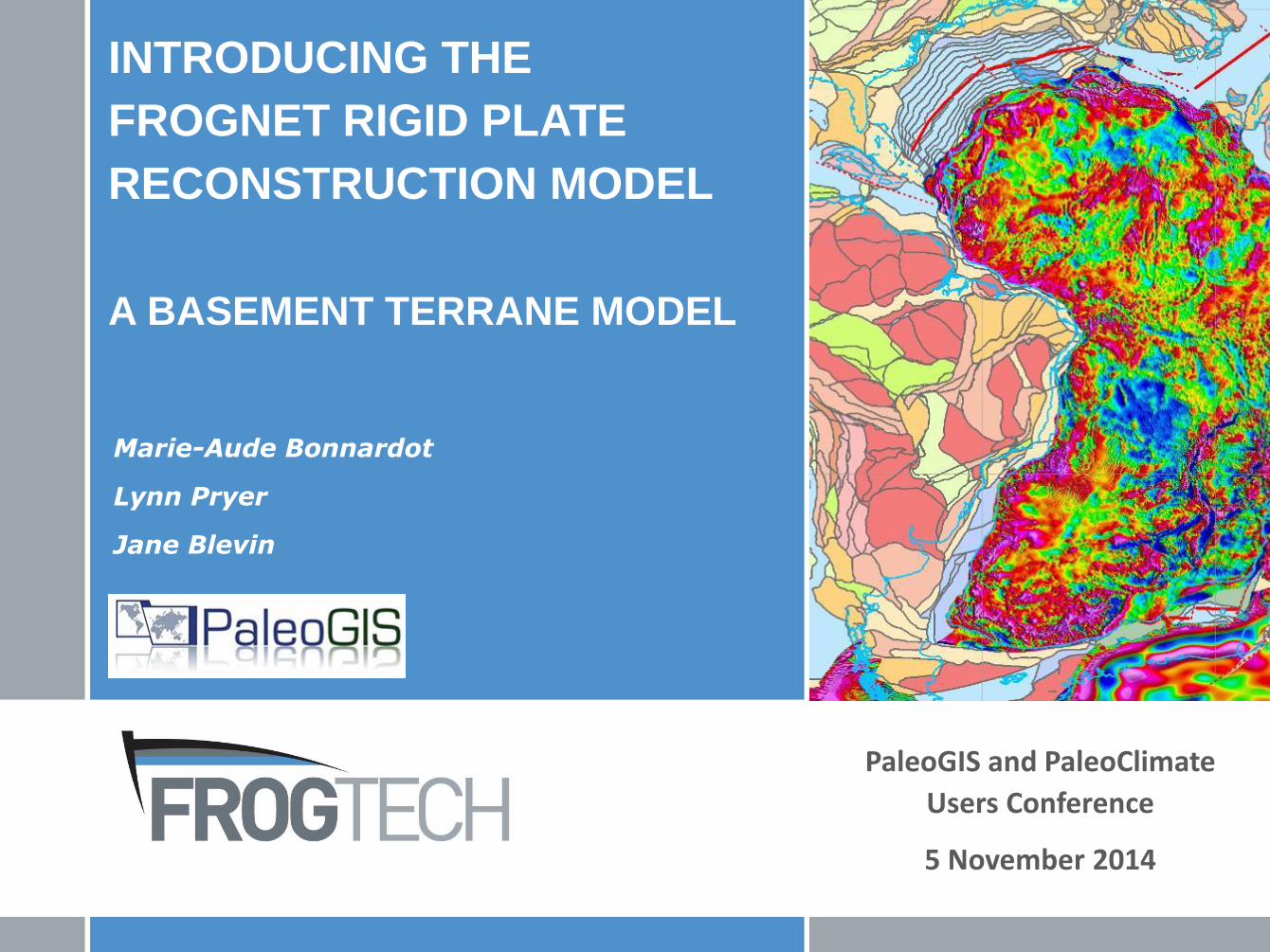
INTRODUCING THE
FROGNET RIGID PLATE
RECONSTRUCTION MODEL
A BASEMENT TERRANE MODEL
PaleoGIS and PaleoClimate
Users Conference
5 November 2014
Marie-Aude Bonnardot
Lynn Pryer
Jane Blevin
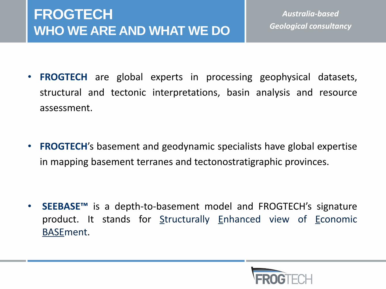
• FROGTECH are global experts in processing geophysical datasets,
structural and tectonic interpretations, basin analysis and resource
assessment.
• FROGTECH’s basement and geodynamic specialists have global expertise
in mapping basement terranes and tectonostratigraphic provinces.
• SEEBASE™ is a depth-to-basement model and FROGTECH’s signatureproduct. It stands for Structurally Enhanced view of EconomicBASEment.
FROGTECHWHO WE ARE AND WHAT WE DO
Australia-based
Geological consultancy
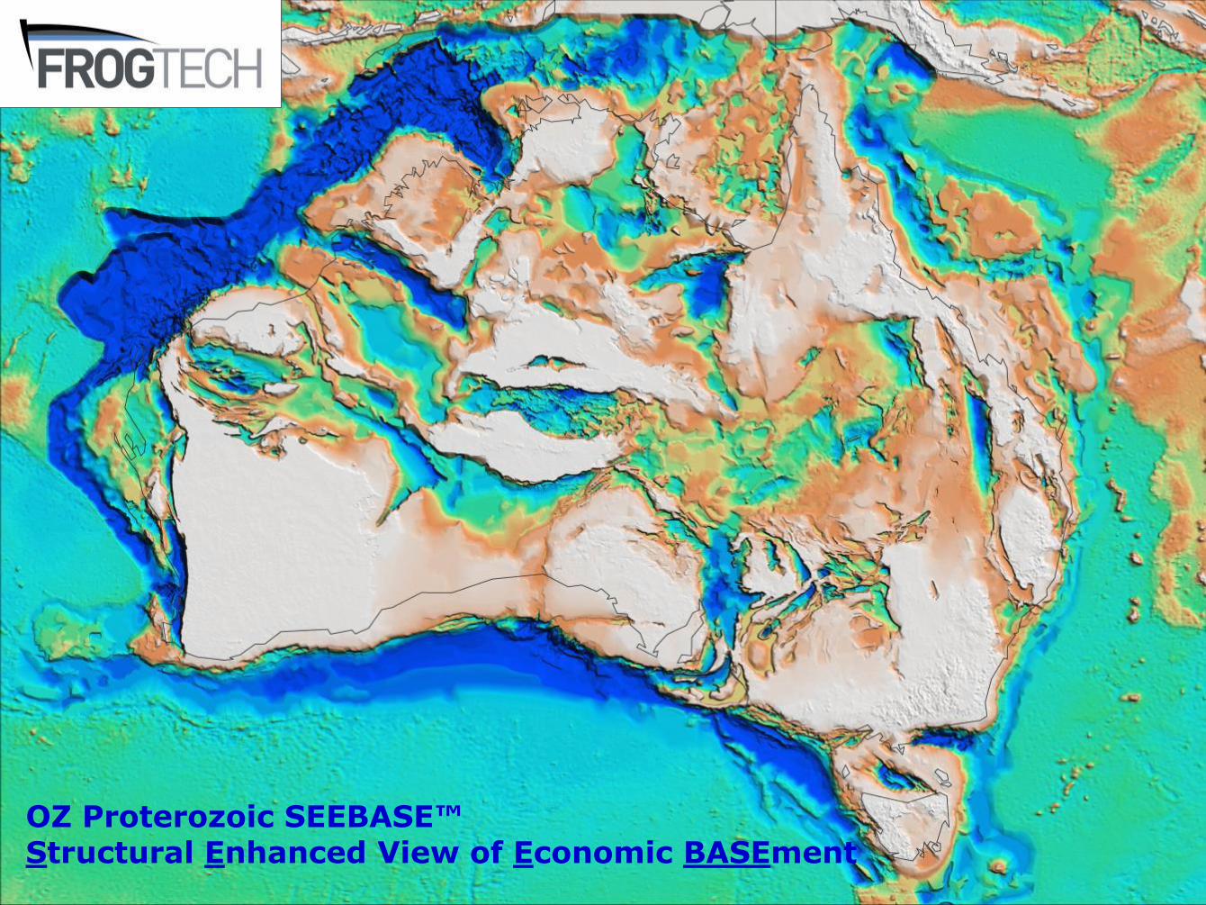
OZ Proterozoic SEEBASE™Structural Enhanced View of Economic BASEment
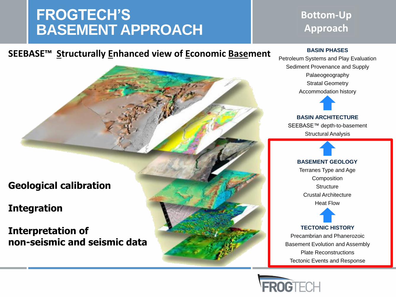
Geological calibration
Integration
Interpretation of non-seismic and seismic data
SEEBASE™ Structurally Enhanced view of Economic Basement
Bottom-UpApproach
FROGTECH’SBASEMENT APPROACH
TECTONIC HISTORY
Precambrian and Phanerozoic
Basement Evolution and Assembly
Plate Reconstructions
Tectonic Events and Response
BASIN PHASES
Petroleum Systems and Play Evaluation
Sediment Provenance and Supply
Palaeogeography
Stratal Geometry
Accommodation history
BASEMENT GEOLOGY
Terranes Type and Age
Composition
Structure
Crustal Architecture
Heat Flow
BASIN ARCHITECTURE
SEEBASE™ depth-to-basement
Structural Analysis
Bottom-UpApproach
FROGTECH’SBASEMENT APPROACH
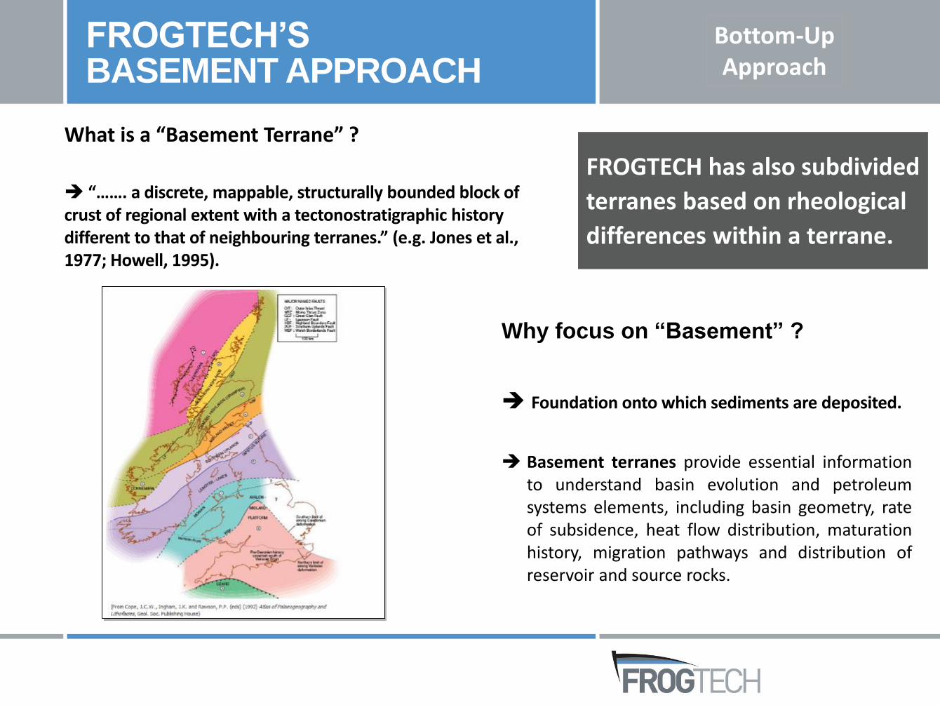
What is a “Basement Terrane” ?
“……. a discrete, mappable, structurally bounded block of crust of regional extent with a tectonostratigraphic history different to that of neighbouring terranes.” (e.g. Jones et al., 1977; Howell, 1995).
FROGTECH has also subdivided
terranes based on rheological
differences within a terrane.
Why focus on “Basement” ?
Foundation onto which sediments are deposited.
Basement terranes provide essential informationto understand basin evolution and petroleumsystems elements, including basin geometry, rateof subsidence, heat flow distribution, maturationhistory, migration pathways and distribution ofreservoir and source rocks.
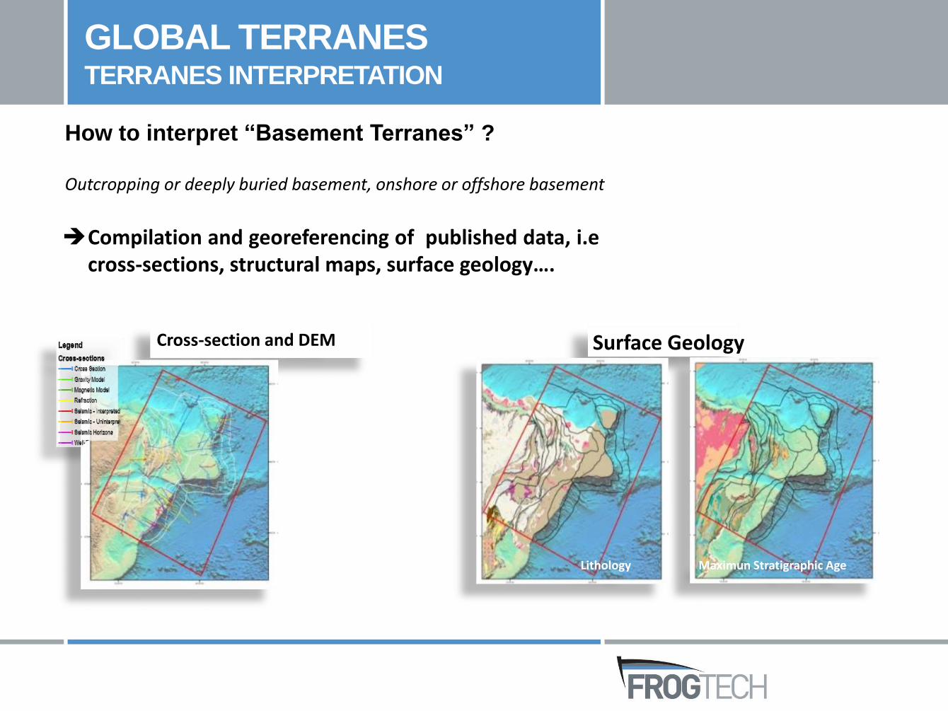
GLOBAL TERRANES TERRANES INTERPRETATION
How to interpret “Basement Terranes” ?
Outcropping or deeply buried basement, onshore or offshore basement
Cross-section and DEM
Lithology Maximun Stratigraphic Age
Surface Geology
Compilation and georeferencing of published data, i.ecross-sections, structural maps, surface geology….
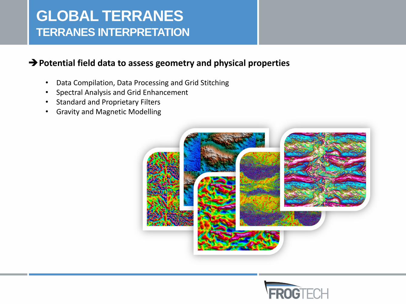
• Data Compilation, Data Processing and Grid Stitching• Spectral Analysis and Grid Enhancement• Standard and Proprietary Filters• Gravity and Magnetic Modelling
GLOBAL TERRANES TERRANES INTERPRETATION
Potential field data to assess geometry and physical properties
GLOBAL TERRANES TERRANES INTERPRETATION
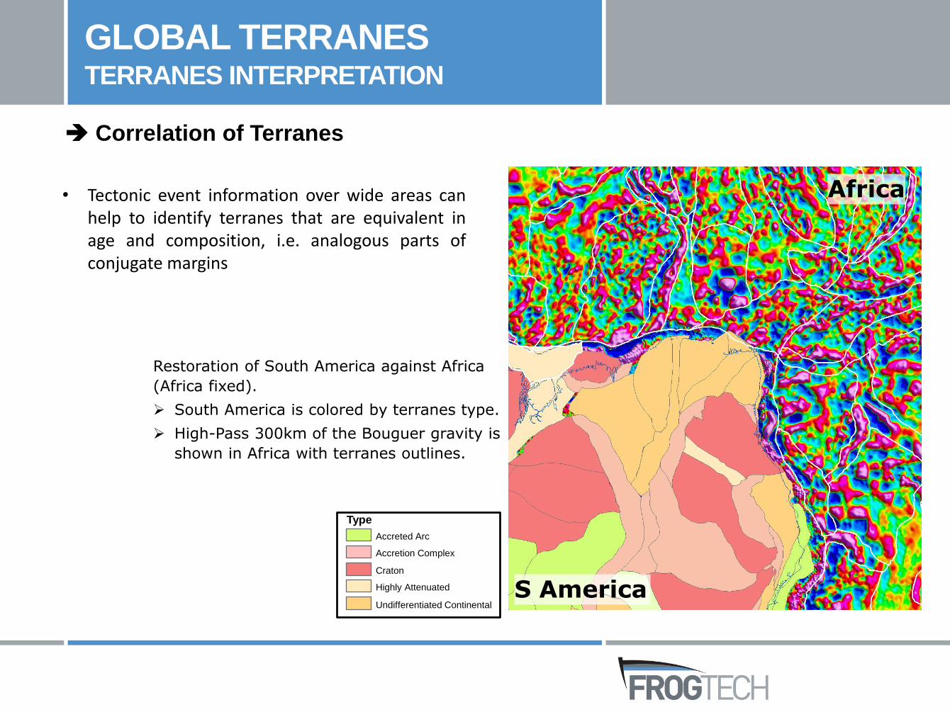
• Tectonic event information over wide areas canhelp to identify terranes that are equivalent inage and composition, i.e. analogous parts ofconjugate margins
Correlation of Terranes
Africa
S America
Type
Accreted Arc
Accretion Complex
Craton
Highly Attenuated
Undifferentiated Continental
Restoration of South America against Africa
(Africa fixed).
South America is colored by terranes type.
High-Pass 300km of the Bouguer gravity is
shown in Africa with terranes outlines.
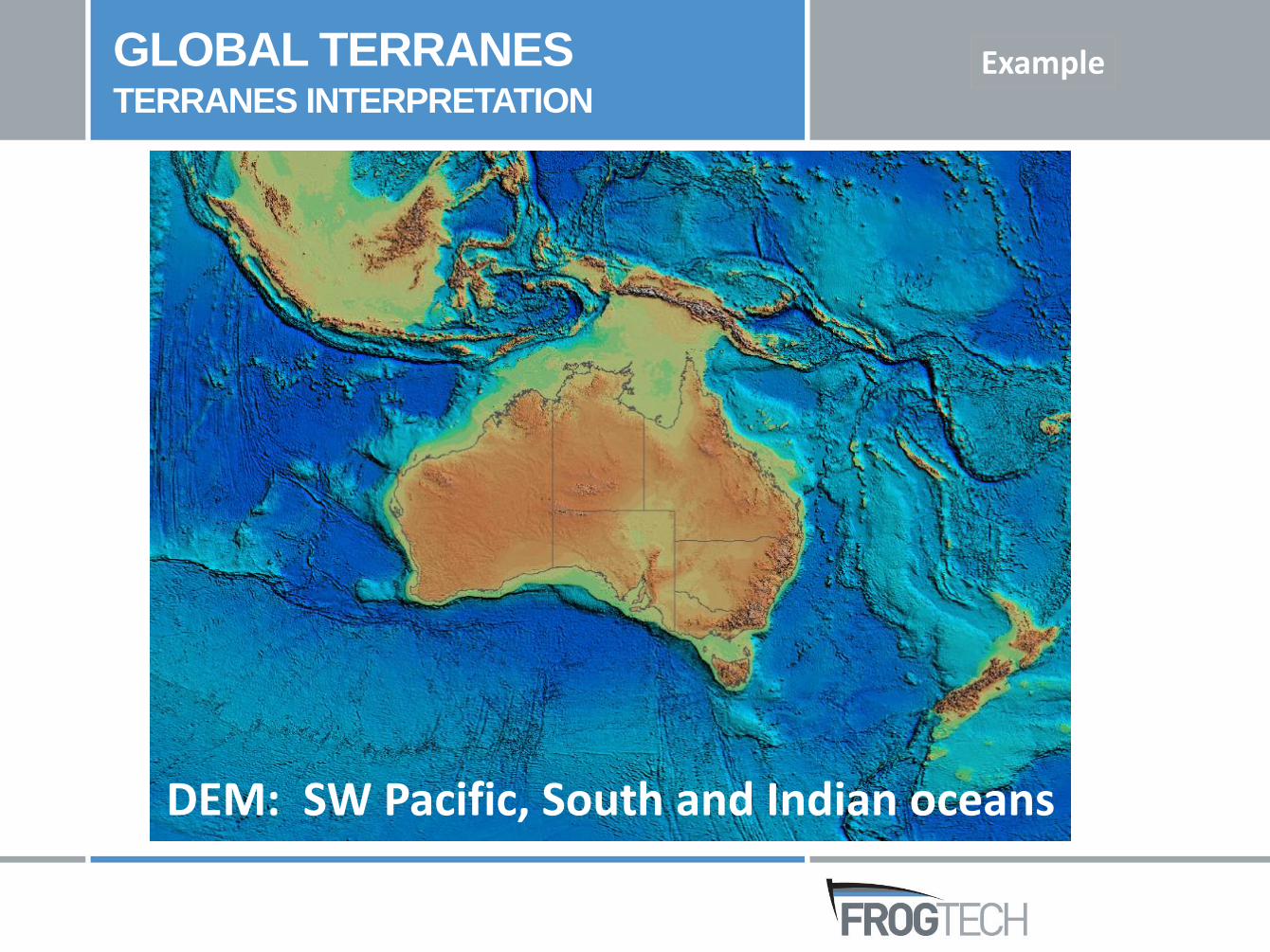
DEM: SW Pacific, South and Indian oceans
GLOBAL TERRANES TERRANES INTERPRETATION
Example
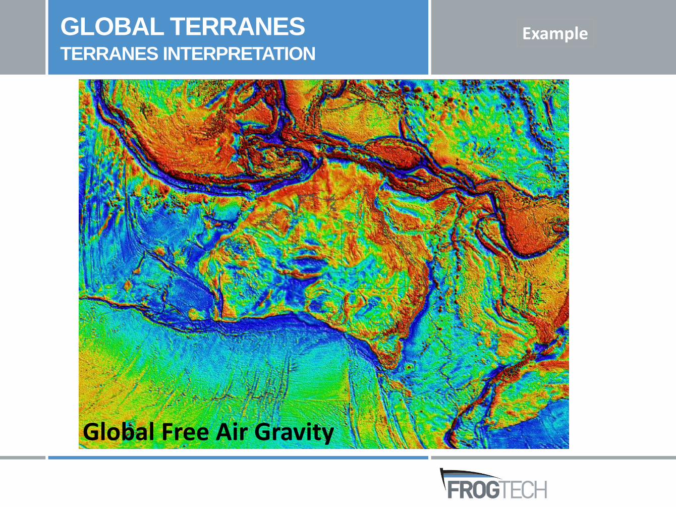
Global Free Air Gravity
GLOBAL TERRANES TERRANES INTERPRETATION
Example
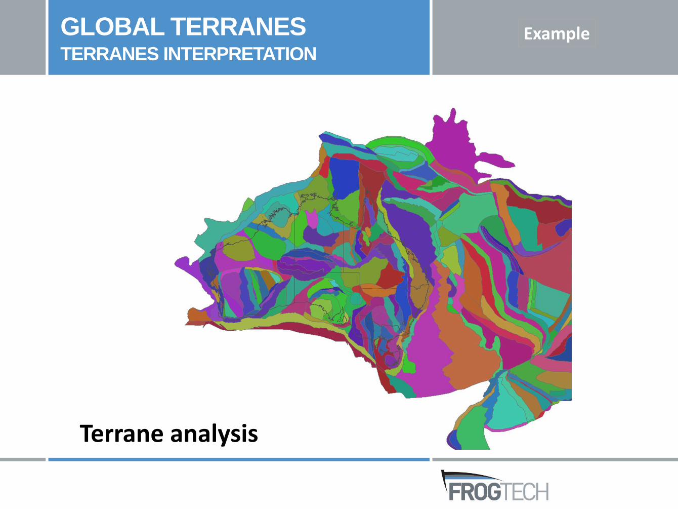
Terrane analysis
GLOBAL TERRANES TERRANES INTERPRETATION
Example
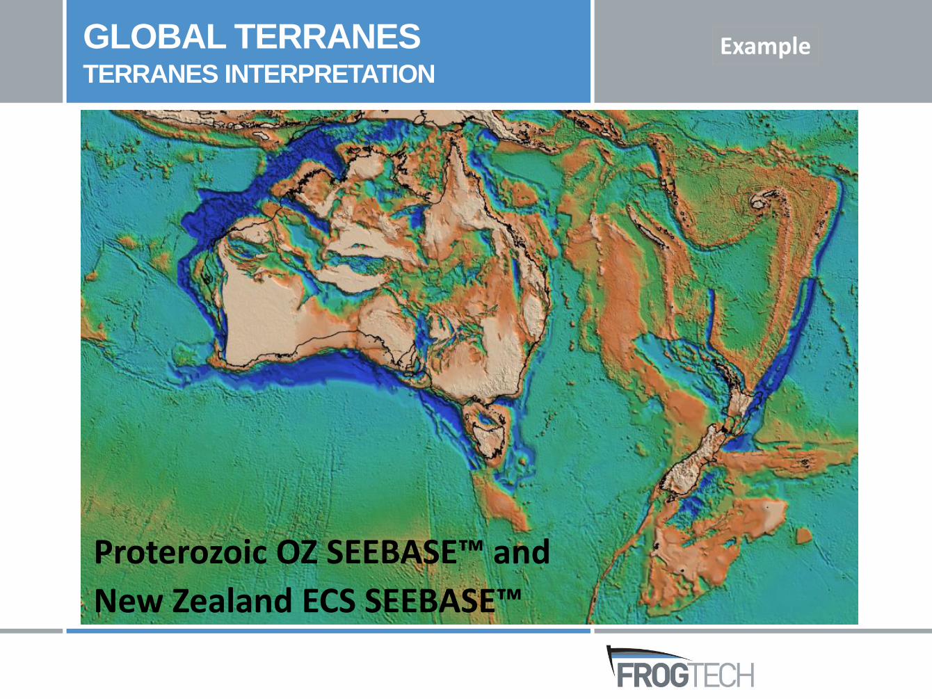
Proterozoic OZ SEEBASE™ and
New Zealand ECS SEEBASE™
GLOBAL TERRANES TERRANES INTERPRETATION
Example
FROGNETRIGID PLATERECONSTRUCTION MODEL
R & D
PLATE POLYGONS
ROTATIONS
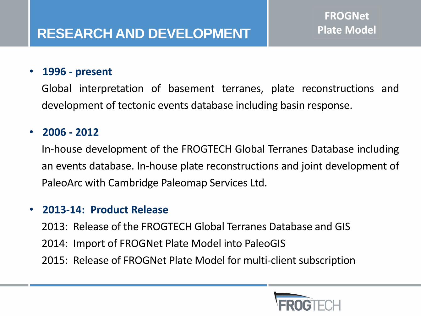
• 1996 - present
Global interpretation of basement terranes, plate reconstructions and
development of tectonic events database including basin response.
• 2006 - 2012
In-house development of the FROGTECH Global Terranes Database including
an events database. In-house plate reconstructions and joint development of
PaleoArc with Cambridge Paleomap Services Ltd.
• 2013-14: Product Release
2013: Release of the FROGTECH Global Terranes Database and GIS
2014: Import of FROGNet Plate Model into PaleoGIS
2015: Release of FROGNet Plate Model for multi-client subscription
RESEARCH AND DEVELOPMENT
FROGNetPlate Model
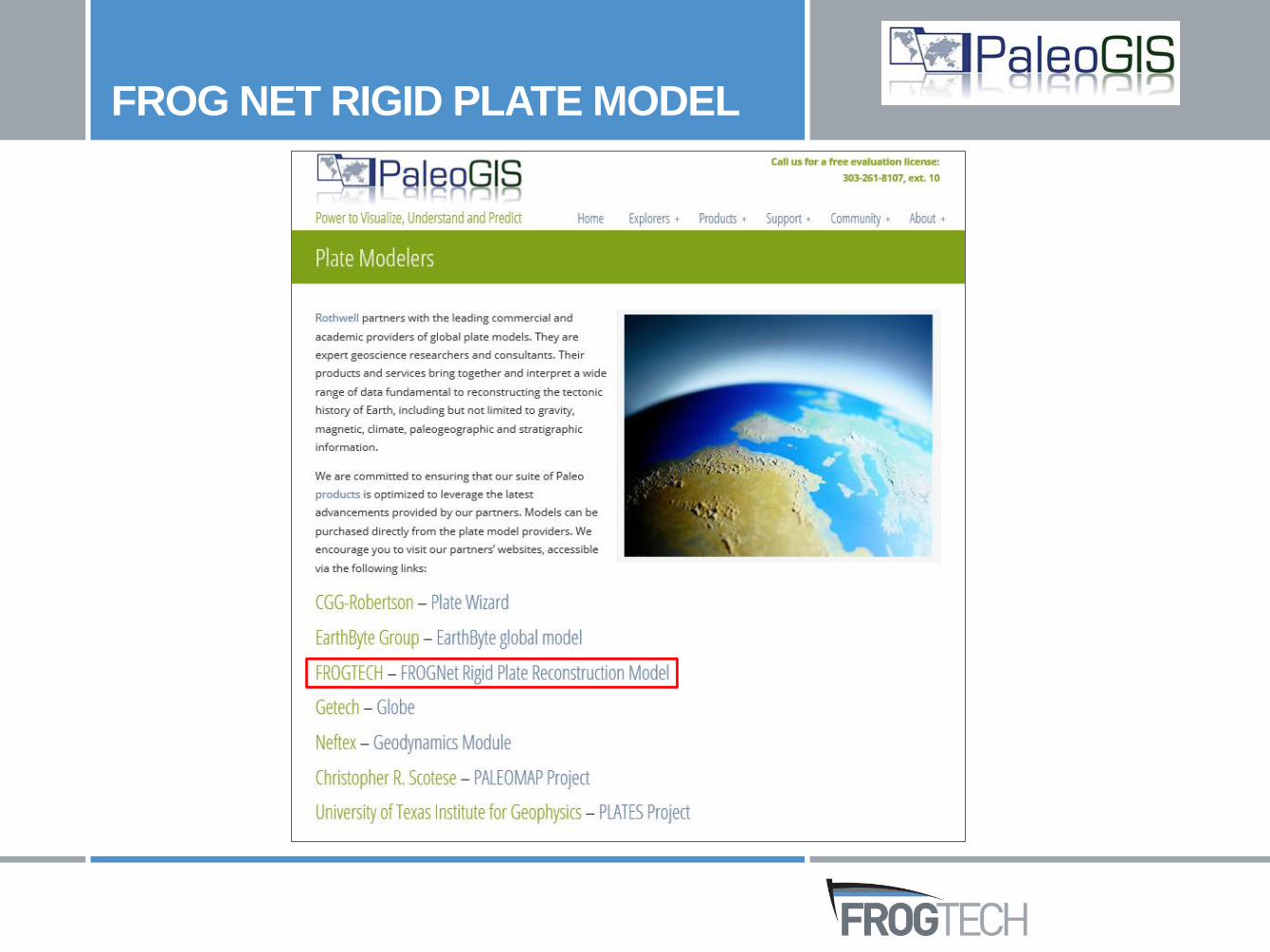
FROG NET RIGID PLATE MODEL
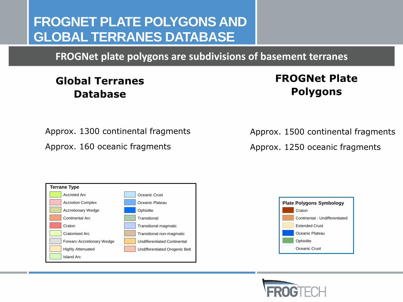
Terrane Type
Accreted Arc
Accretion Complex
Accretionary Wedge
Continental Arc
Craton
Cratonised Arc
Forearc-Accretionary Wedge
Highly Attenuated
Island Arc
Oceanic Crust
Oceanic Plateau
Ophiolite
Transitional
Transitional magmatic
Transitional non-magmatic
Undifferentiated Continental
Undifferentiated Orogenic Belt
FROGNet plate polygons are subdivisions of basement terranes
Approx. 1500 continental fragments
Approx. 1250 oceanic fragments
Plate Polygons Symbology
Craton
Continental - Undifferentiated
Extended Crust
Oceanic Plateau
Ophiolite
Oceanic Crust
FROGNET PLATE POLYGONS ANDGLOBAL TERRANES DATABASE
Global Terranes
Database
FROGNet Plate
Polygons
Approx. 1300 continental fragments
Approx. 160 oceanic fragments
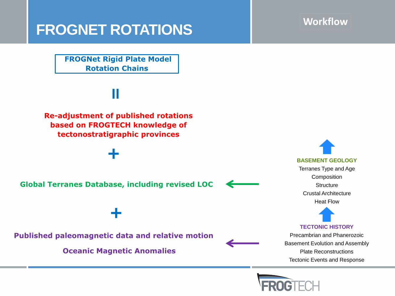
FROGNET ROTATIONS
Re-adjustment of published rotations
based on FROGTECH knowledge of
tectonostratigraphic provinces
+
Global Terranes Database, including revised LOC
+
=
FROGNet Rigid Plate Model
Rotation Chains
Published paleomagnetic data and relative motion
Oceanic Magnetic Anomalies
Workflow
TECTONIC HISTORY
Precambrian and Phanerozoic
Basement Evolution and Assembly
Plate Reconstructions
Tectonic Events and Response
BASEMENT GEOLOGY
Terranes Type and Age
Composition
Structure
Crustal Architecture
Heat Flow
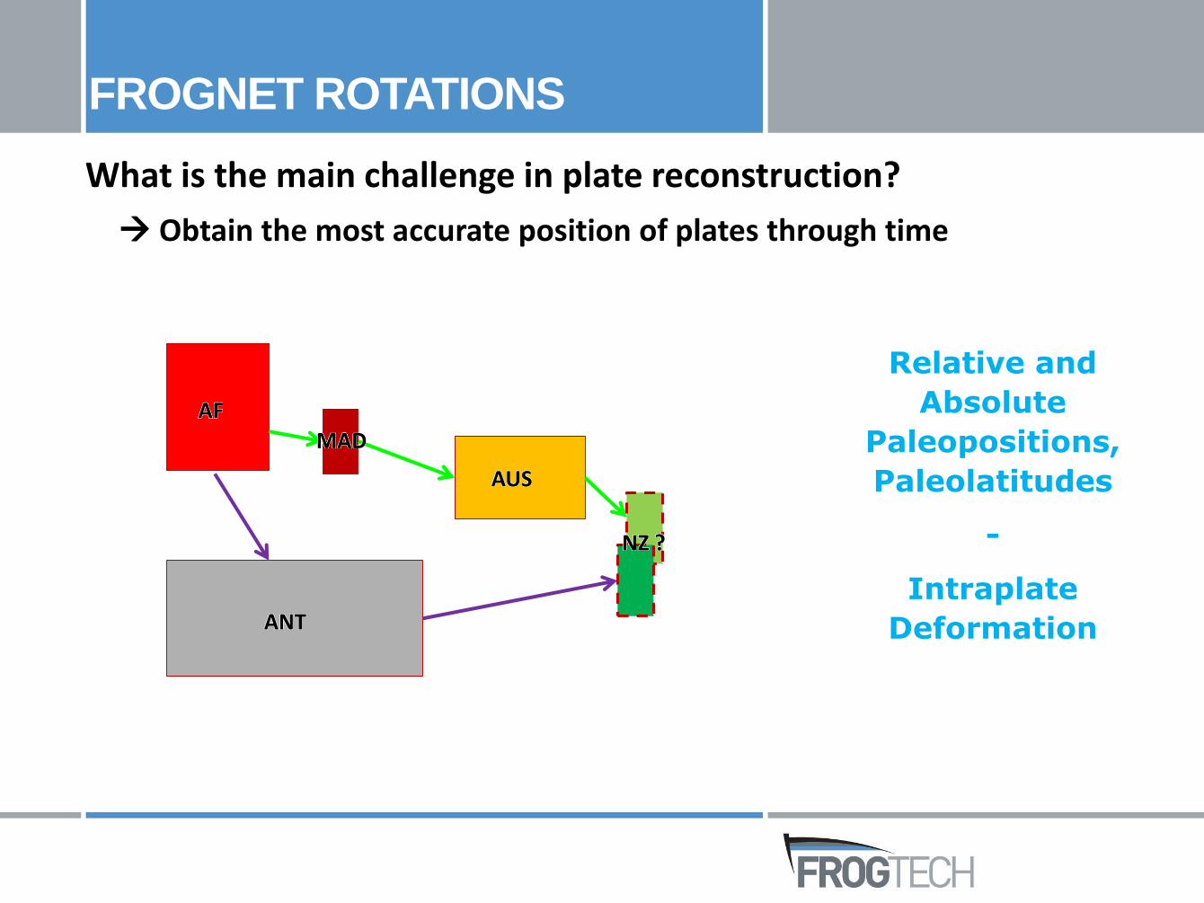
Obtain the most accurate position of plates through time
FROGNET ROTATIONS
Relative and
Absolute
Paleopositions,
Paleolatitudes
-
Intraplate
Deformation
AF
MAD
AUS
ANT
NZ ?
What is the main challenge in plate reconstruction?
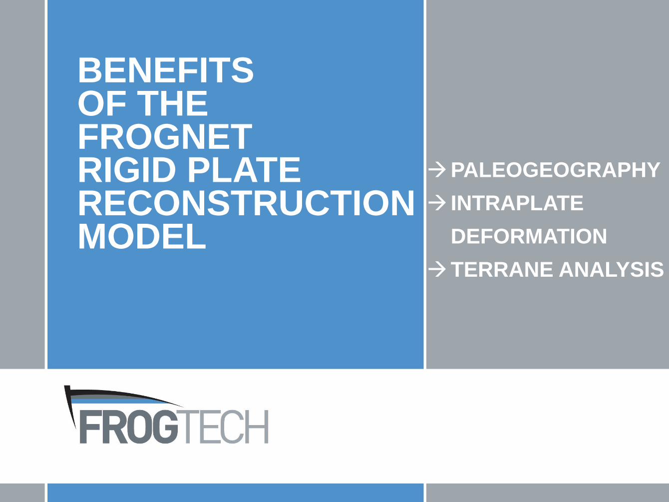
BENEFITS OF THE FROGNETRIGID PLATERECONSTRUCTION MODEL
PALEOGEOGRAPHY
INTRAPLATE
DEFORMATION
TERRANE ANALYSIS

A high resolution terrane map
to refine paleopositions
• Complete geological description of plates provides more constraints to improve relative paleopositions.
• Mimic deformation processes:
Change of plate geometry at megaterrane scale based on basement terrane information, i.e. terrane maximum age
Example-1PALEOGEOGRAPHY
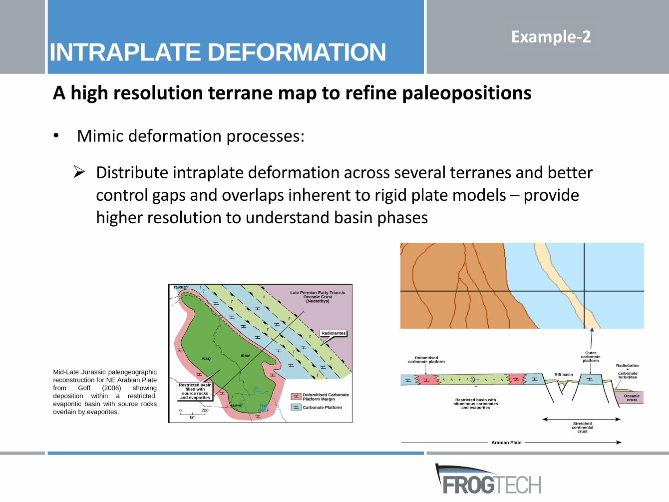
A high resolution terrane map to refine paleopositions
• Mimic deformation processes:
Distribute intraplate deformation across several terranes and better control gaps and overlaps inherent to rigid plate models – provide higher resolution to understand basin phases
Example-2INTRAPLATE DEFORMATION
Dolomitised CarbonatePlatform Margin
Carbonate Platform
r
r
r
r
r
r
r
r
IRANIRAQ
THEGULF
KUWAIT
Restricted basinfilled with
source rocksand evaporites
TURKEY
Late Permian-Early TriassicOceanic Crust
(Neotethys)
Radiolarites
0 200
km
S
Dolomitisedcarbonate platform
Restricted basin withbituminous carbonates
and evaporites
Outercarbonateplatform
Rift basin
Radiolarites+
carbonateturbidites
Stretchedcontinental
crust
Oceaniccrust
Arabian Plate
Mid-Late Jurassic paleogeographic
reconstruction for NE Arabian Plate
from Goff (2006) showing
deposition within a restricted,
evaporitic basin with source rocks
overlain by evaporites.
Terrane analysis
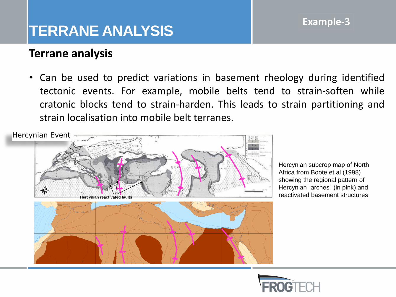
• Can be used to predict variations in basement rheology during identifiedtectonic events. For example, mobile belts tend to strain-soften whilecratonic blocks tend to strain-harden. This leads to strain partitioning andstrain localisation into mobile belt terranes.
TERRANE ANALYSIS
Hercynian reactivated faults
N
Hercynian Event
Hercynian subcrop map of North
Africa from Boote et al (1998)
showing the regional pattern of
Hercynian “arches” (in pink) and
reactivated basement structures
Example-3
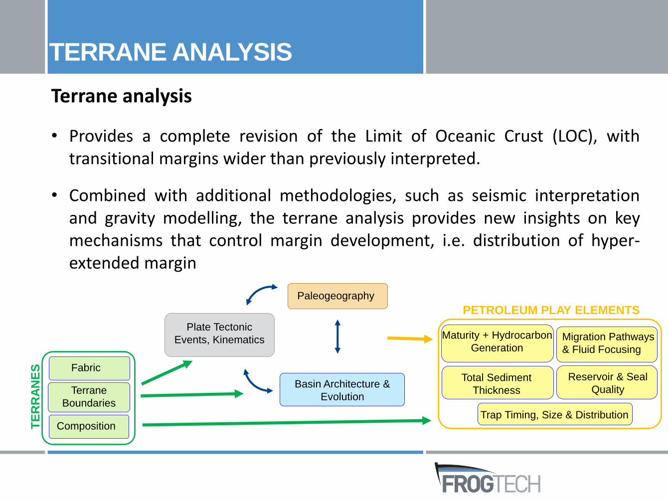
Terrane analysis
• Provides a complete revision of the Limit of Oceanic Crust (LOC), withtransitional margins wider than previously interpreted.
• Combined with additional methodologies, such as seismic interpretationand gravity modelling, the terrane analysis provides new insights on keymechanisms that control margin development, i.e. distribution of hyper-extended margin
TERRANE ANALYSIS
Plate Tectonic
Events, Kinematics
Basin Architecture &
Evolution
Paleogeography
Terrane
Boundaries
Composition
Fabric
TE
RR
AN
ES
Total Sediment
Thickness
Migration Pathways
& Fluid Focusing
Reservoir & Seal
Quality
Trap Timing, Size & Distribution
Maturity + Hydrocarbon
Generation
PETROLEUM PLAY ELEMENTS
FROGNET IN PALEOGIS
DATA
TERRANES
ATTRIBUTES
TIME SLICES
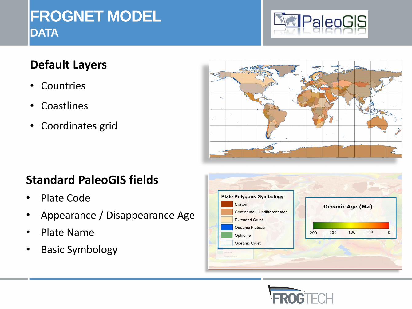
Standard PaleoGIS fields
• Plate Code
• Appearance / Disappearance Age
• Plate Name
• Basic Symbology
FROGNET MODELDATA
Default Layers
• Countries
• Coastlines
• Coordinates grid
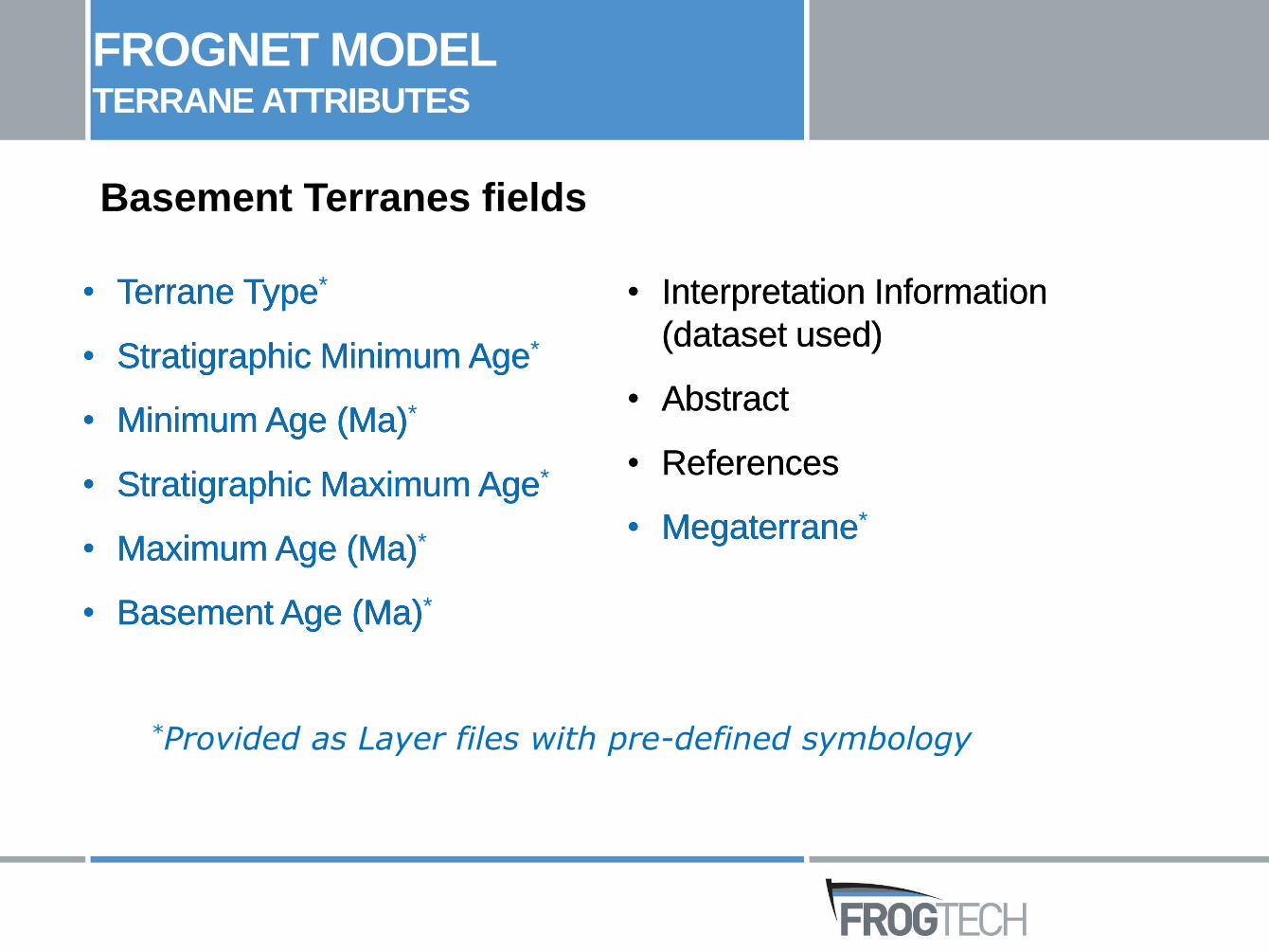
Basement Terranes fields
• Terrane Type
• Stratigraphic Minimum Age
• Minimum Age (Ma)
• Stratigraphic Maximum Age
• Maximum Age (Ma)
• Basement Age (Ma)
• Interpretation Information
(dataset used)
• Abstract
• References
• Megaterrane
*Provided as Layer files with pre-defined symbology
FROGNET MODELTERRANE ATTRIBUTES
• Terrane Type*
• Stratigraphic Minimum Age*
• Minimum Age (Ma)*
• Stratigraphic Maximum Age*
• Maximum Age (Ma)*
• Basement Age (Ma)*
• Interpretation Information
(dataset used)
• Abstract
• References
• Megaterrane*
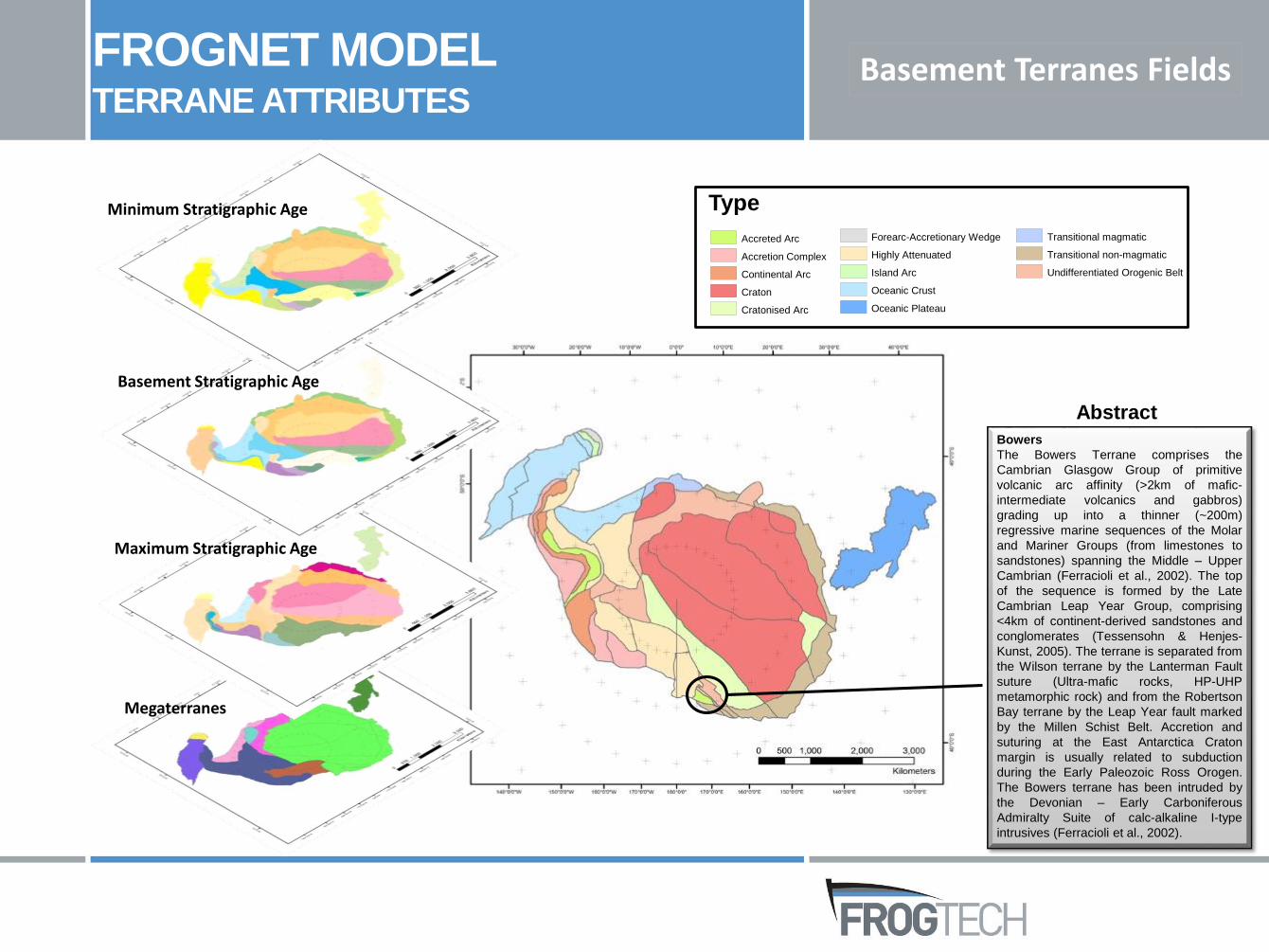
Bowers
The Bowers Terrane comprises the
Cambrian Glasgow Group of primitive
volcanic arc affinity (>2km of mafic-
intermediate volcanics and gabbros)
grading up into a thinner (~200m)
regressive marine sequences of the Molar
and Mariner Groups (from limestones to
sandstones) spanning the Middle – Upper
Cambrian (Ferracioli et al., 2002). The top
of the sequence is formed by the Late
Cambrian Leap Year Group, comprising
<4km of continent-derived sandstones and
conglomerates (Tessensohn & Henjes-
Kunst, 2005). The terrane is separated from
the Wilson terrane by the Lanterman Fault
suture (Ultra-mafic rocks, HP-UHP
metamorphic rock) and from the Robertson
Bay terrane by the Leap Year fault marked
by the Millen Schist Belt. Accretion and
suturing at the East Antarctica Craton
margin is usually related to subduction
during the Early Paleozoic Ross Orogen.
The Bowers terrane has been intruded by
the Devonian – Early Carboniferous
Admiralty Suite of calc-alkaline I-type
intrusives (Ferracioli et al., 2002).
Abstract
FROGNET MODELTERRANE ATTRIBUTES
Type
Accreted Arc
Accretion Complex
Continental Arc
Craton
Cratonised Arc
Forearc-Accretionary Wedge
Highly Attenuated
Island Arc
Oceanic Crust
Oceanic Plateau
Transitional magmatic
Transitional non-magmatic
Undifferentiated Orogenic Belt
Minimum Stratigraphic Age
Basement Stratigraphic Age
Maximum Stratigraphic Age
Megaterranes
Basement Terranes Fields
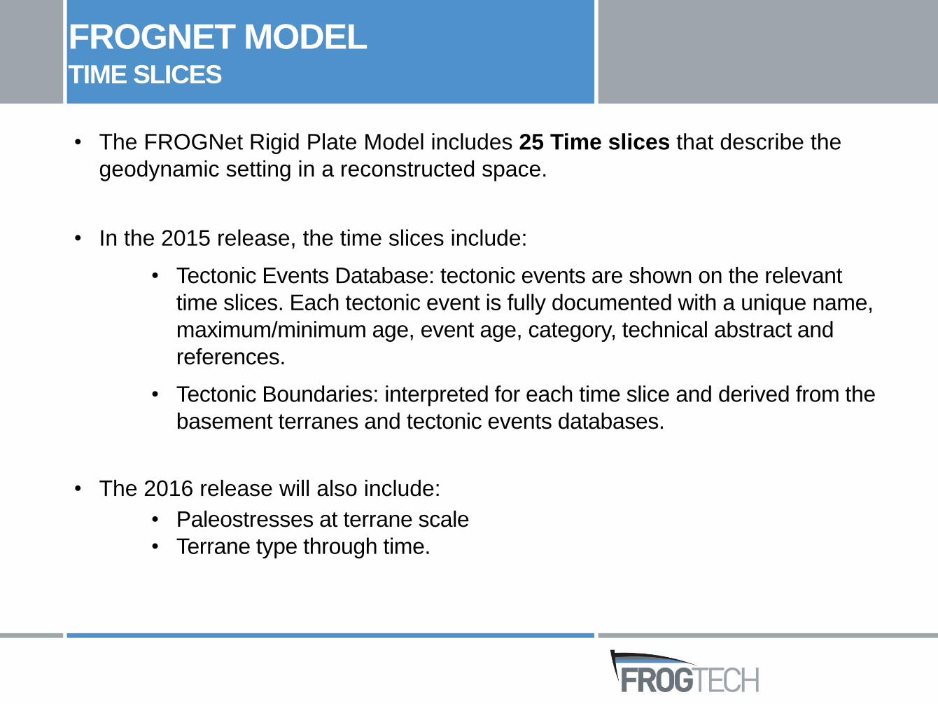
• The FROGNet Rigid Plate Model includes 25 Time slices that describe the
geodynamic setting in a reconstructed space.
• In the 2015 release, the time slices include:
• Tectonic Events Database: tectonic events are shown on the relevant
time slices. Each tectonic event is fully documented with a unique name,
maximum/minimum age, event age, category, technical abstract and
references.
• Tectonic Boundaries: interpreted for each time slice and derived from the
basement terranes and tectonic events databases.
• The 2016 release will also include:
• Paleostresses at terrane scale
• Terrane type through time.
FROGNET MODELTIME SLICES

CONCLUSIONS
• Geology-driven plate model
• Detailed integration and interpretation of georeferenced
scientific datasets (geological maps, potential field
datasets, wells, seismic data)
• Quick access to global summary of key characteristics of
basement terranes/plate polygons (type, age, major
composition, tectonostratigraphic history)
Enhances understanding of the relationship between
basement terranes, the overlying sedimentary basins and
their mineral and petroleum resources
CONCLUSIONS
FROGNet Rigid Plate Model
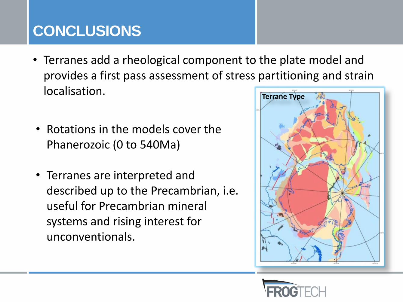
• Terranes add a rheological component to the plate model and provides a first pass assessment of stress partitioning and strain localisation.
CONCLUSIONS
Terrane Type
• Rotations in the models cover the Phanerozoic (0 to 540Ma)
• Terranes are interpreted and described up to the Precambrian, i.e. useful for Precambrian mineral systems and rising interest for unconventionals.
FROGNET RELEASE

FROGTECH Pty Ltd
Suite 17F, Level 1
2 King Street
Deakin West ACT 2600
T +61 (0)2 6283 4800
F +61 (0)2 6283 4801
W frogtech.com.au
Contacts:
Marie-Aude Bonnardot, PhD
Senior Geoscientist
Jane Blevin, PhD
CEO and Business Development
Lynn Pryer, PhD
Principal Geoscientist