introduction to applied geophysicsgeophysical applications • whole earth geophysics - classical...
TRANSCRIPT

Introduction to Applied Geophysics • Non-mathematical - but you will still need your calculators!!!• Basic Principles• Applications
Relevant Text• Milsom: Field Geophysics, 1996. Open University Press.• Kearey and Brooks: An Introduction to Geophysical Exploration., Blackwell
Science 1991(ISBN 0-632-02923-4).• Telford, Geldhart, Sheriff & Keys: Applied Geophysics,1990. Cambridge
University Press• Reynolds: An Introduction to Applied and Environmental Geophysics. Wiley
1997. (ISBN 0-471-95555-8)Relevant Journals• Geophysics• Geophysical Prospecting• Applied Geophysics• Environmental and Engineering GeophysicsOther Relevant information Sources• CSM see: http://magma.mines.edu/fs_home/tboyd/GP311/• crb at St. Andrews Geoscinece web site
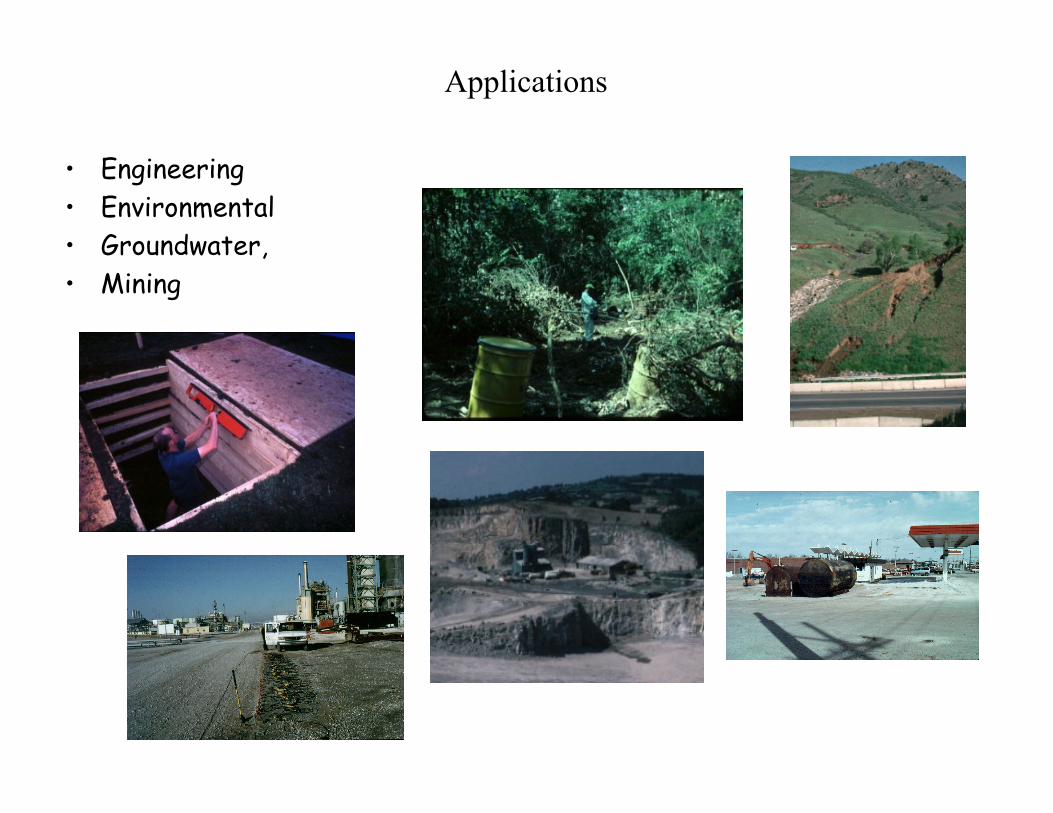
Applications
• Engineering• Environmental• Groundwater,• Mining
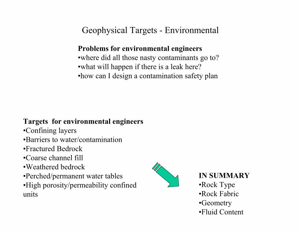
Geophysical Targets - Environmental
Targets for environmental engineers•Confining layers•Barriers to water/contamination•Fractured Bedrock•Coarse channel fill•Weathered bedrock•Perched/permanent water tables•High porosity/permeability confinedunits
IN SUMMARY•Rock Type•Rock Fabric•Geometry•Fluid Content
Problems for environmental engineers•where did all those nasty contaminants go to?•what will happen if there is a leak here?•how can I design a contamination safety plan
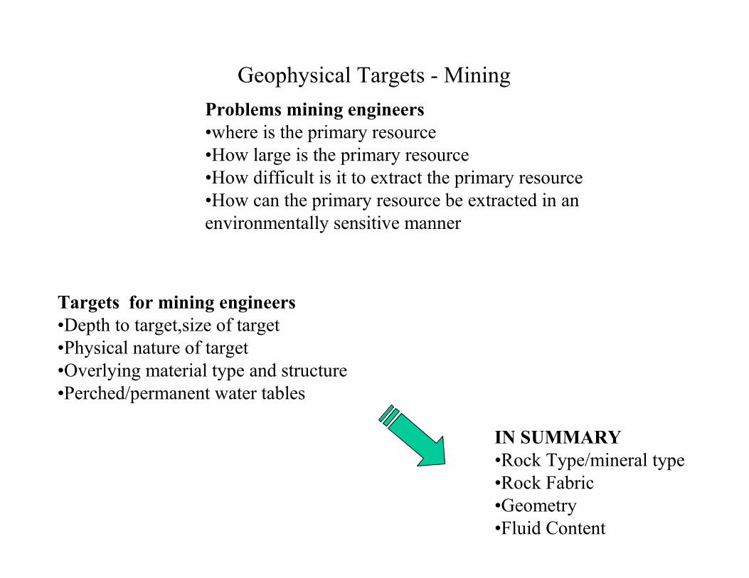
Geophysical Targets - Mining
Targets for mining engineers•Depth to target,size of target•Physical nature of target•Overlying material type and structure•Perched/permanent water tables
IN SUMMARY•Rock Type/mineral type•Rock Fabric•Geometry•Fluid Content
Problems mining engineers•where is the primary resource•How large is the primary resource•How difficult is it to extract the primary resource•How can the primary resource be extracted in an environmentally sensitive manner
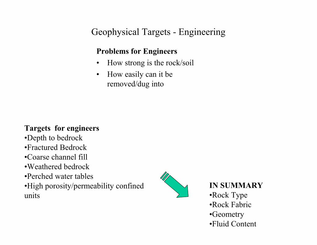
Geophysical Targets - Engineering
Problems for Engineers• How strong is the rock/soil• How easily can it be
removed/dug into
Targets for engineers•Depth to bedrock•Fractured Bedrock•Coarse channel fill•Weathered bedrock•Perched water tables•High porosity/permeability confinedunits
IN SUMMARY•Rock Type•Rock Fabric•Geometry•Fluid Content
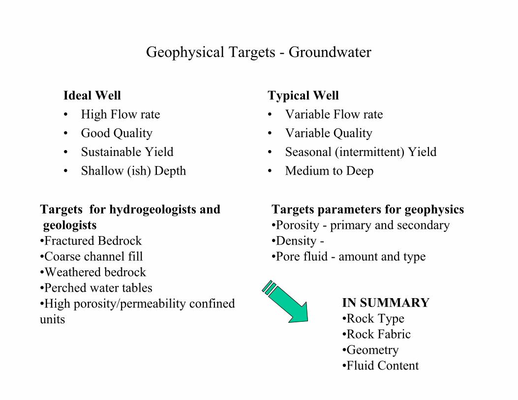
Geophysical Targets - Groundwater
Ideal Well• High Flow rate• Good Quality• Sustainable Yield• Shallow (ish) Depth
Typical Well• Variable Flow rate• Variable Quality• Seasonal (intermittent) Yield• Medium to Deep
Targets for hydrogeologists andgeologists
•Fractured Bedrock•Coarse channel fill•Weathered bedrock•Perched water tables•High porosity/permeability confinedunits
Targets parameters for geophysics•Porosity - primary and secondary•Density -•Pore fluid - amount and type
IN SUMMARY•Rock Type•Rock Fabric•Geometry•Fluid Content
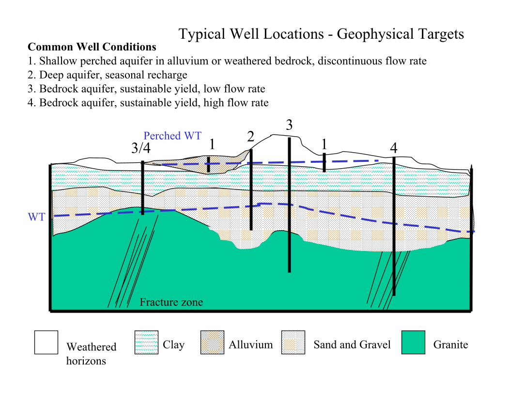
Clay Sand and GravelAlluvium
Fracture zone
Perched WT
Granite
Typical Well Locations - Geophysical Targets
WT
Weathered horizons
Common Well Conditions1. Shallow perched aquifer in alluvium or weathered bedrock, discontinuous flow rate2. Deep aquifer, seasonal recharge3. Bedrock aquifer, sustainable yield, low flow rate4. Bedrock aquifer, sustainable yield, high flow rate
3/43
1 124
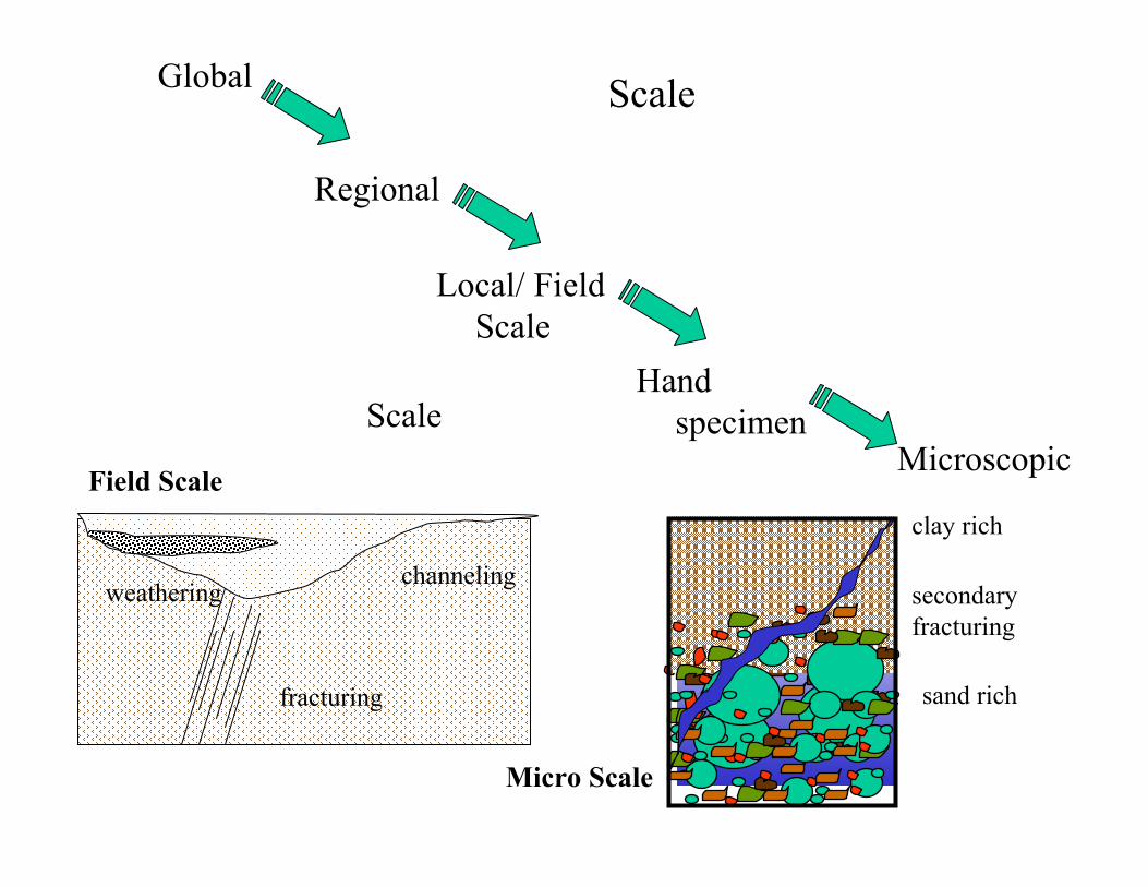
ScaleGlobal
Regional
Local/ Field Scale
Hand specimen
MicroscopicScale
clay rich
sand rich
secondary fracturing
Micro Scale
Field Scale
weathering
fracturing
channeling
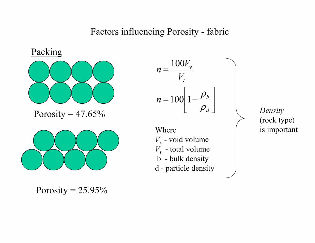
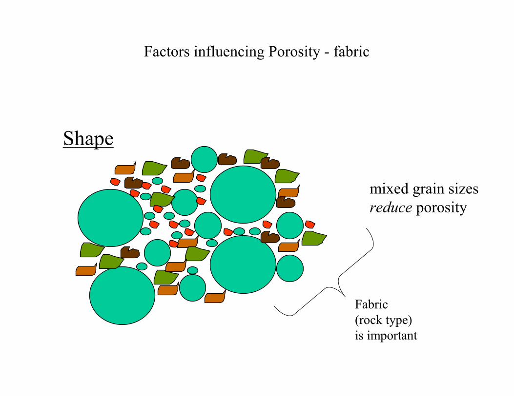
Factors influencing Porosity - fabric
Packing
Porosity = 47.65%
Porosity = 25.95%
−=
=
d
b
t
v
n
VVn
ρρ1100
100
Where Vv - void volumeVt - total volumeb - bulk density
d - particle density
Density (rock type)is important
Factors influencing Porosity - fabric
Shape
mixed grain sizesreduce porosity
Fabric(rock type)is important
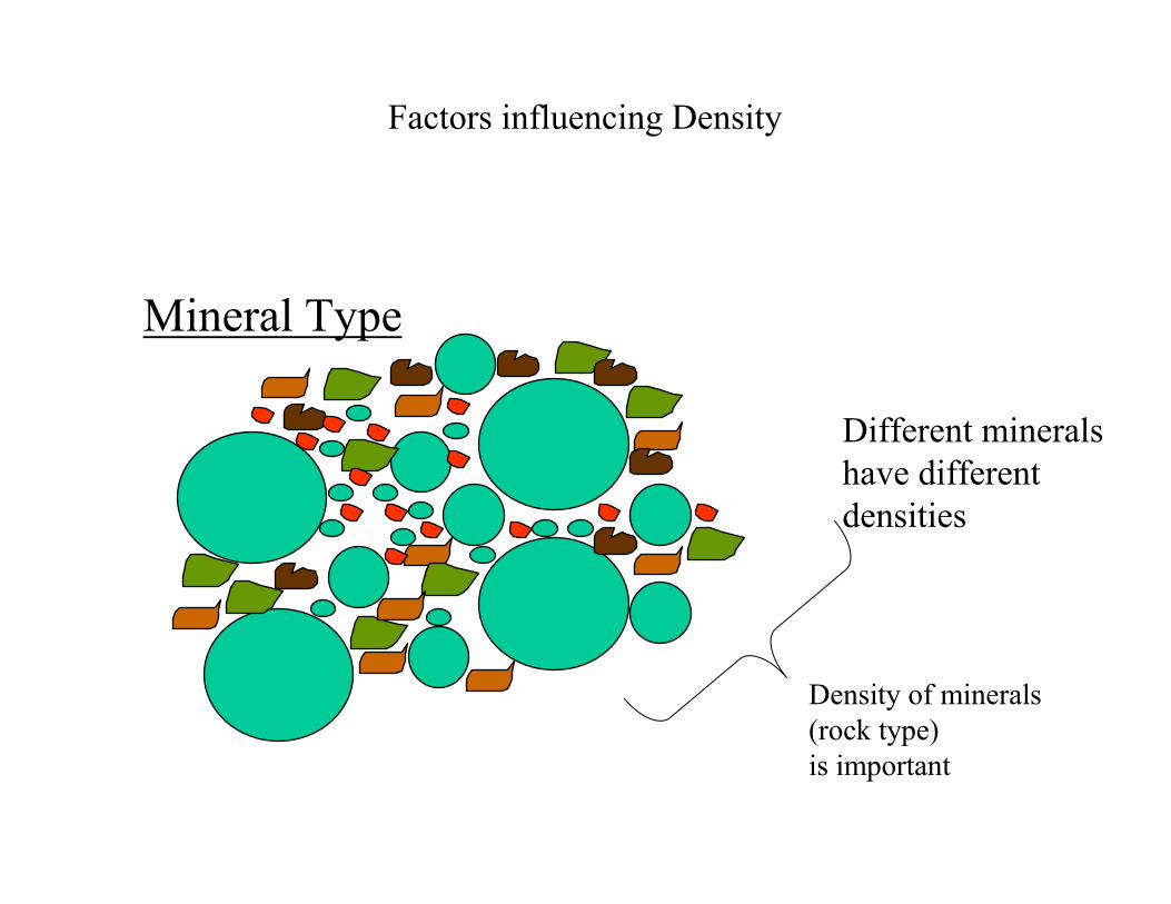
Factors influencing Density
Mineral Type
Different mineralshave different densities
Density of minerals(rock type)is important
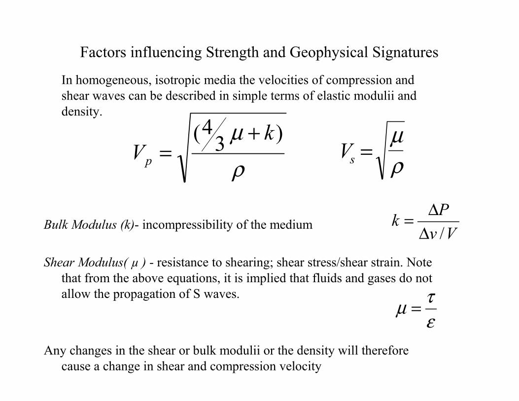
Factors influencing Strength and Geophysical Signatures
In homogeneous, isotropic media the velocities of compression and shear waves can be described in simple terms of elastic modulii and density.
Bulk Modulus (k)- incompressibility of the medium
Shear Modulus( µ ) - resistance to shearing; shear stress/shear strain. Note that from the above equations, it is implied that fluids and gases do not allow the propagation of S waves.
Any changes in the shear or bulk modulii or the density will therefore cause a change in shear and compression velocity
ρµ )3
4( kVp
+= Vs =
µρ
VvPk/∆
∆=
ετµ =
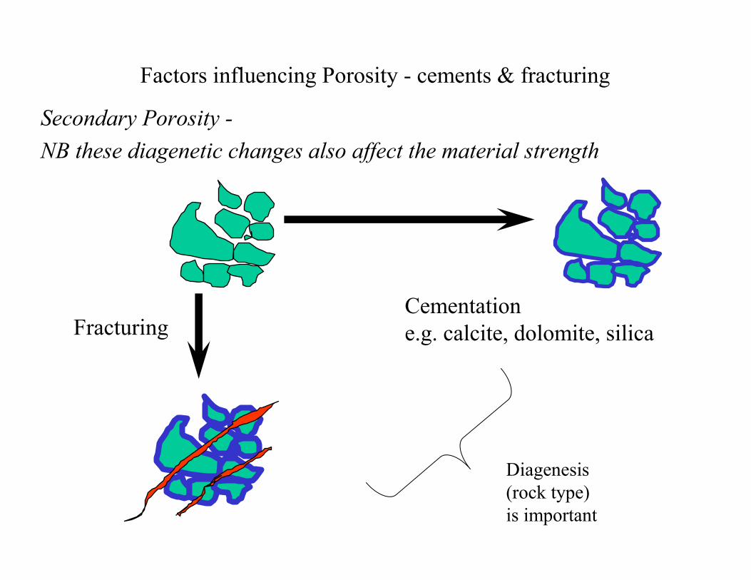
Factors influencing Porosity - cements & fracturing
Secondary Porosity -NB these diagenetic changes also affect the material strength
FracturingCementatione.g. calcite, dolomite, silica
Diagenesis(rock type)is important
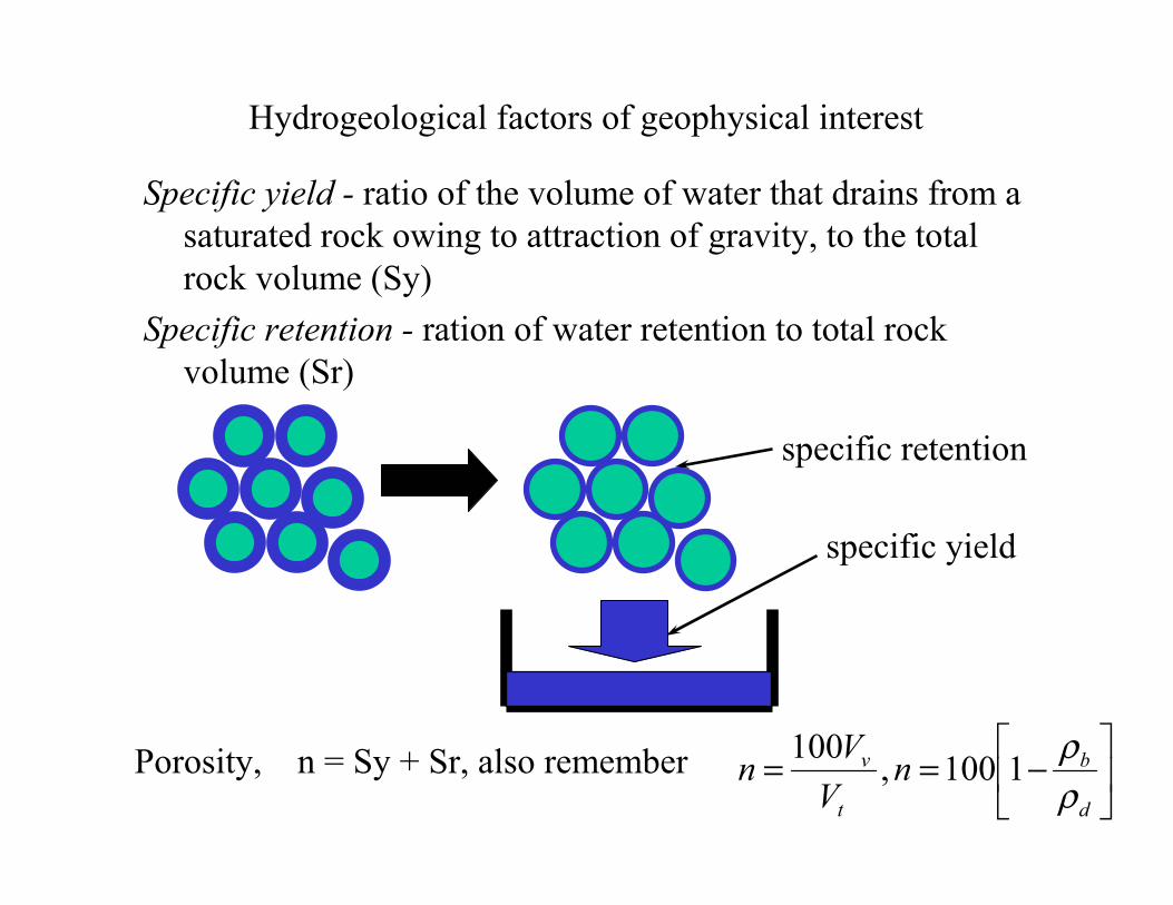
Hydrogeological factors of geophysical interest
Specific yield - ratio of the volume of water that drains from a saturated rock owing to attraction of gravity, to the total rock volume (Sy)
Specific retention - ration of water retention to total rock volume (Sr)
specific retention
specific yield
Porosity, n = Sy + Sr, also remember
−==
d
b
t
v nV
Vnρρ1100,100
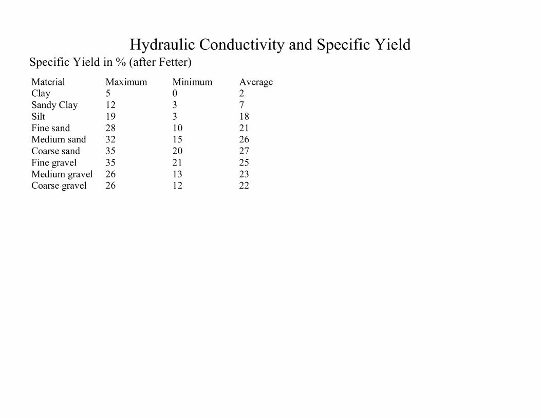
Hydraulic Conductivity and Specific YieldSpecific Yield in % (after Fetter)Material Maximum Minimum AverageClay 5 0 2Sandy Clay 12 3 7Silt 19 3 18Fine sand 28 10 21Medium sand 32 15 26Coarse sand 35 20 27Fine gravel 35 21 25Medium gravel 26 13 23Coarse gravel 26 12 22
Other Geophysical Properties
• Thermal conductivity• Radioactivity

Newton’s Second Law of Gravitation (motion)
However, when measuring the Earth’s gravity we measure the acceleration (g) resulting from the gravitational attraction.
Newton’s Second Law Force is proportional to acceleration
Thus from 1) and 2)
G=6.67x10⁻¹¹Nm2kg-2
F m g= 2
gGmr
= 12
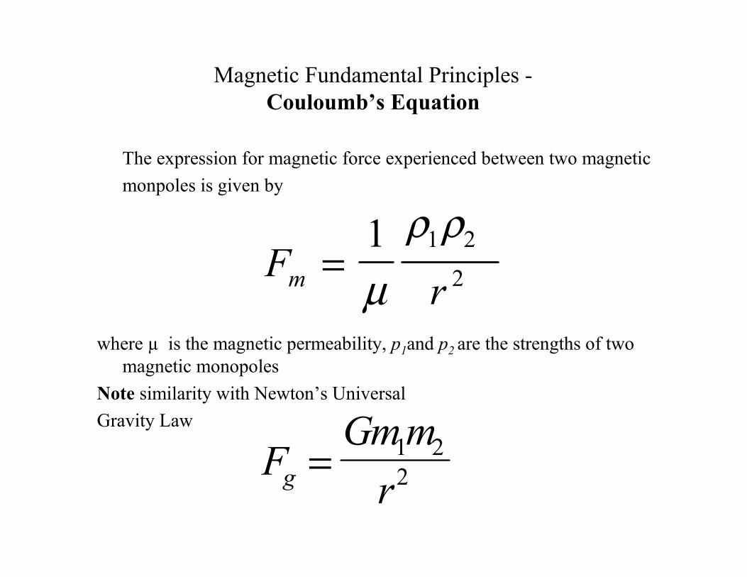
Magnetic Fundamental Principles -Couloumb’s Equation
The expression for magnetic force experienced between two magneticmonpoles is given by
where µ is the magnetic permeability, p1and p2 are the strengths of two magnetic monopoles
Note similarity with Newton’s UniversalGravity Law
FGm m
rg = 1 22
Frm =
1 1 22µ
ρ ρ
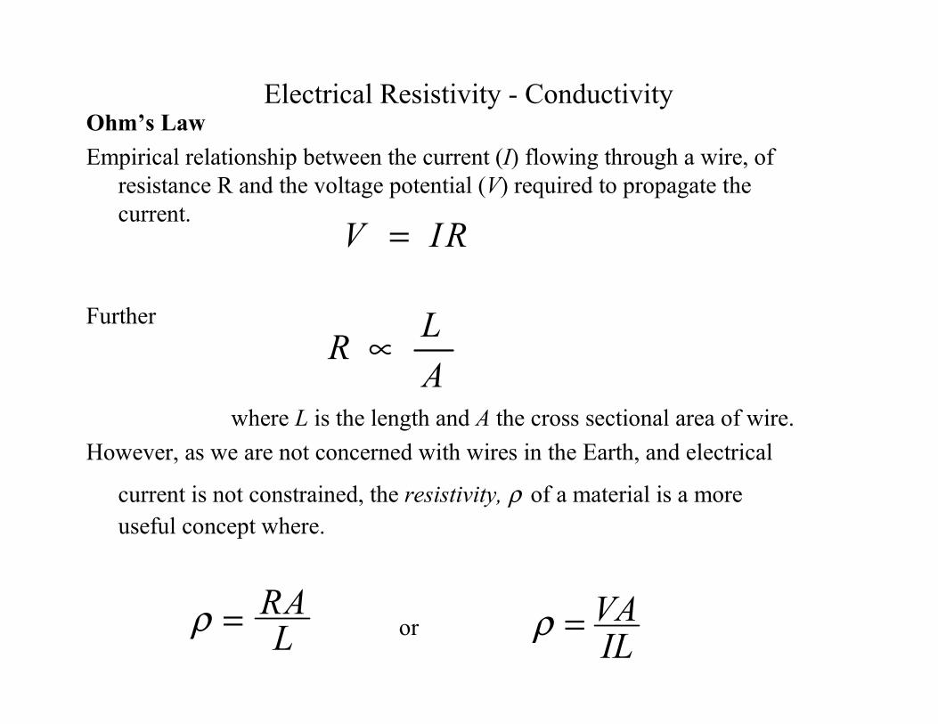
Electrical Resistivity - ConductivityOhm’s LawEmpirical relationship between the current (I) flowing through a wire, of
resistance R and the voltage potential (V) required to propagate the current.
Further
where L is the length and A the cross sectional area of wire.However, as we are not concerned with wires in the Earth, and electrical
current is not constrained, the resistivity, ρ of a material is a more useful concept where.
V IR=
ρ = RAL IL
VA=ρ
ALR ∝
or
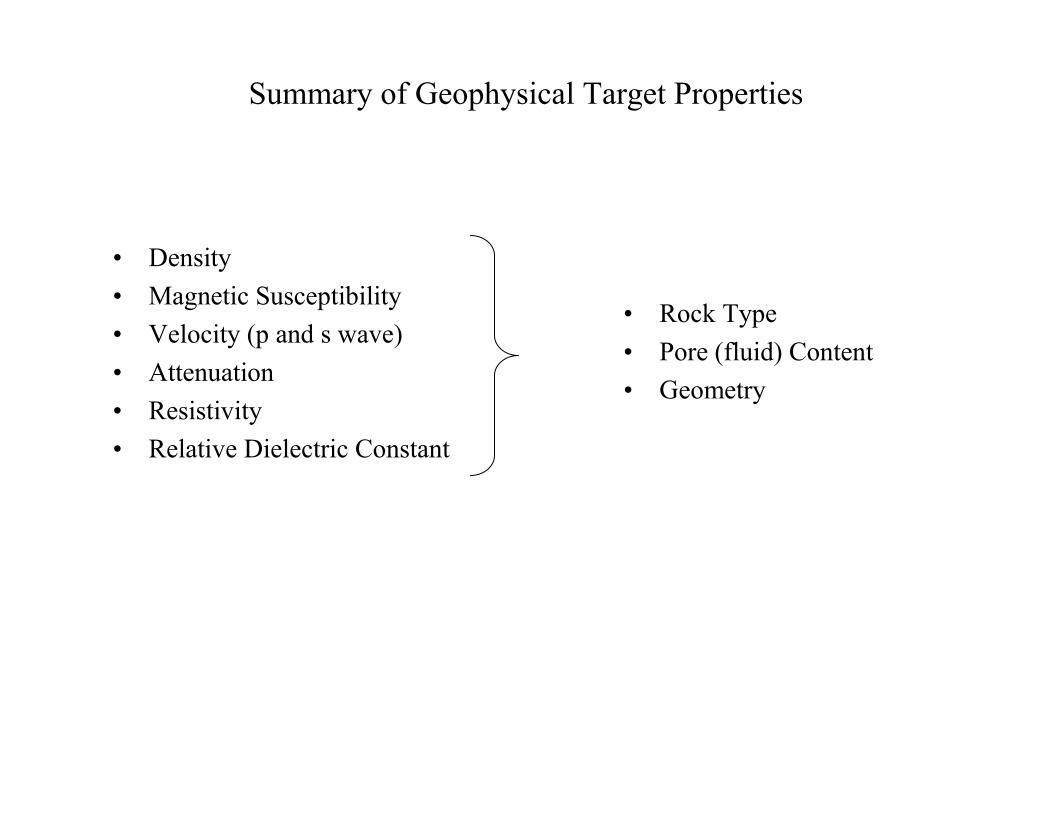
Summary of Geophysical Target Properties
• Density• Magnetic Susceptibility• Velocity (p and s wave)• Attenuation• Resistivity• Relative Dielectric Constant
• Rock Type• Pore (fluid) Content• Geometry
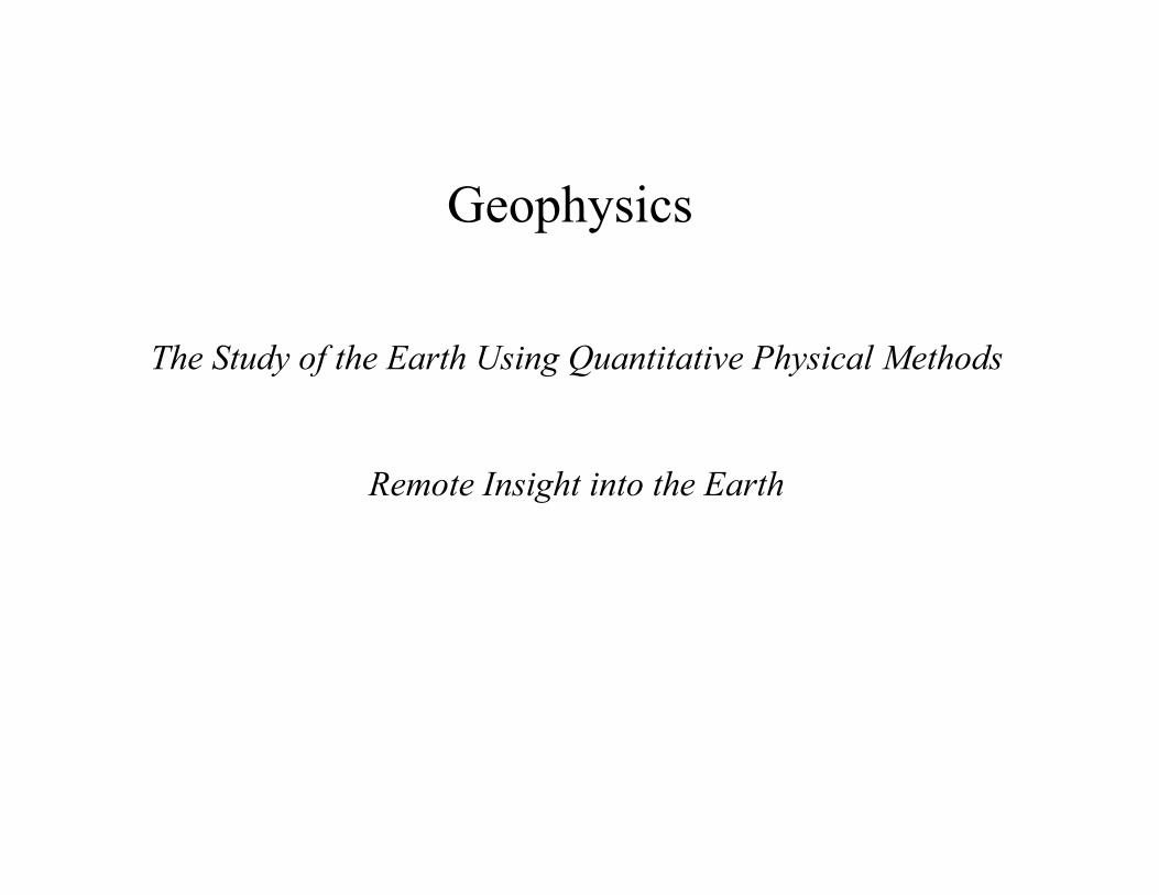
Geophysics
The Study of the Earth Using Quantitative Physical Methods
Remote Insight into the Earth
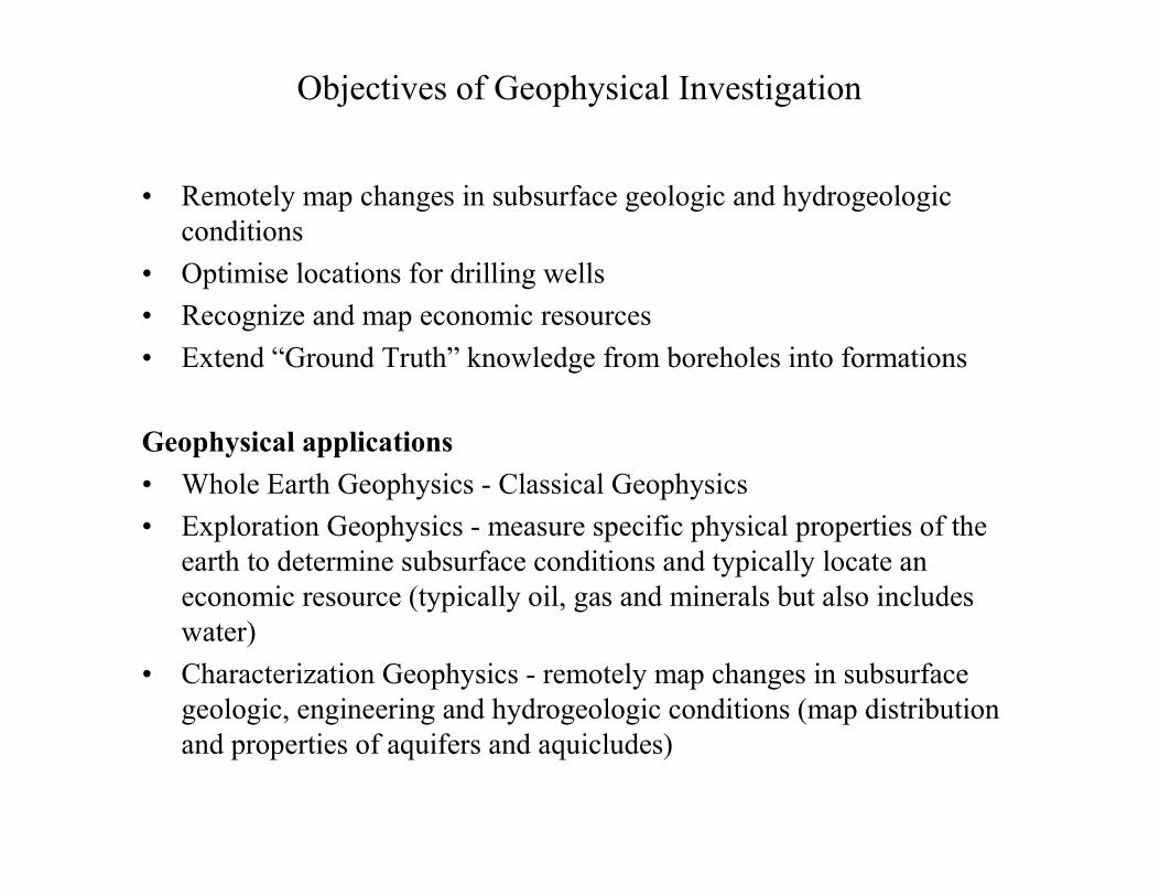
Objectives of Geophysical Investigation
• Remotely map changes in subsurface geologic and hydrogeologicconditions
• Optimise locations for drilling wells• Recognize and map economic resources• Extend “Ground Truth” knowledge from boreholes into formations
Geophysical applications• Whole Earth Geophysics - Classical Geophysics • Exploration Geophysics - measure specific physical properties of the
earth to determine subsurface conditions and typically locate aneconomic resource (typically oil, gas and minerals but also includes water)
• Characterization Geophysics - remotely map changes in subsurface geologic, engineering and hydrogeologic conditions (map distribution and properties of aquifers and aquicludes)
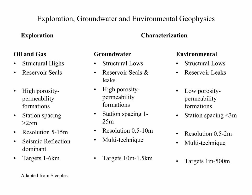
Exploration, Groundwater and Environmental Geophysics
Oil and Gas• Structural Highs• Reservoir Seals
• High porosity-permeability formations
• Station spacing >25m
• Resolution 5-15m• Seismic Reflection
dominant• Targets 1-6km
Groundwater• Structural Lows• Reservoir Seals &
leaks• High porosity-
permeability formations
• Station spacing 1-25m
• Resolution 0.5-10m• Multi-technique
• Targets 10m-1.5km
Environmental• Structural Lows• Reservoir Leaks
• Low porosity-permeability formations
• Station spacing <3m
• Resolution 0.5-2m• Multi-technique
• Targets 1m-500m
Adapted from Steeples
Exploration Characterization
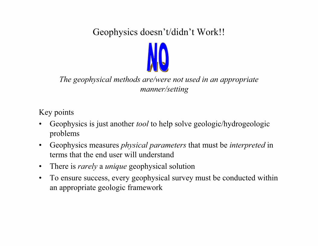
Geophysics doesn’t/didn’t Work!!
The geophysical methods are/were not used in an appropriate manner/setting
Key points• Geophysics is just another tool to help solve geologic/hydrogeologic
problems• Geophysics measures physical parameters that must be interpreted in
terms that the end user will understand• There is rarely a unique geophysical solution • To ensure success, every geophysical survey must be conducted within
an appropriate geologic framework
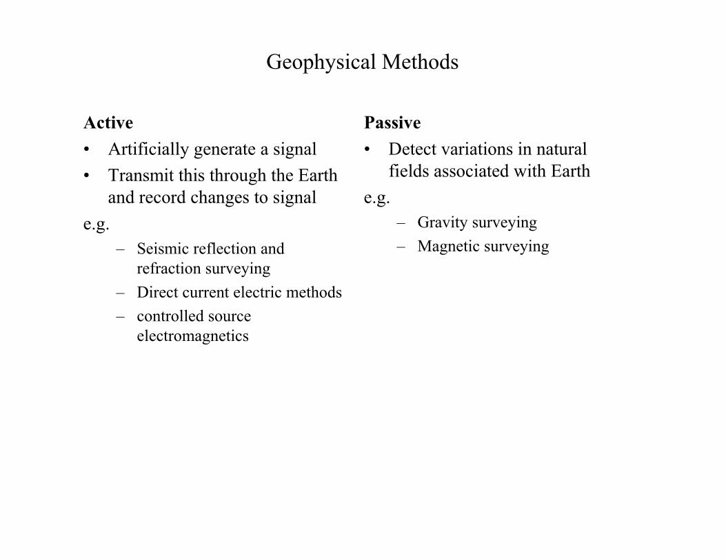
Geophysical Methods
Active• Artificially generate a signal• Transmit this through the Earth
and record changes to signale.g.
– Seismic reflection and refraction surveying
– Direct current electric methods– controlled source
electromagnetics
Passive• Detect variations in natural
fields associated with Earthe.g.
– Gravity surveying– Magnetic surveying
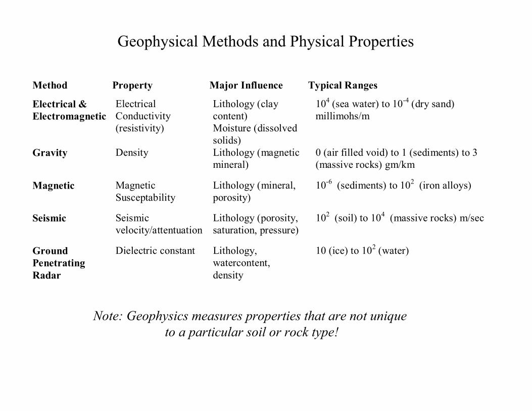
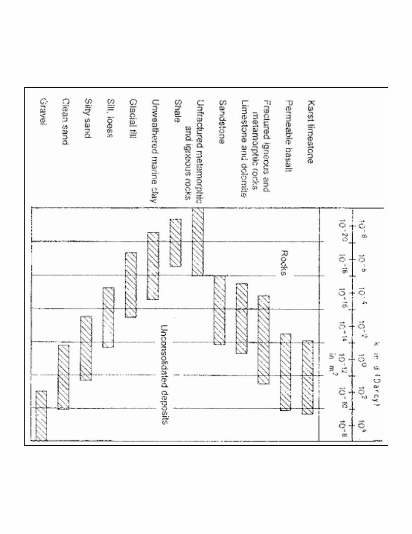
Geophysical Methods and Physical Properties
Method Property Major Influence Typical Ranges
Electrical &Electromagnetic
ElectricalConductivity(resistivity)
Lithology (claycontent)Moisture (dissolvedsolids)
104 (sea water) to 10-4 (dry sand)millimohs/m
Gravity Density Lithology (magneticmineral)
0 (air filled void) to 1 (sediments) to 3(massive rocks) gm/km
Magnetic MagneticSusceptability
Lithology (mineral,porosity)
10-6 (sediments) to 102 (iron alloys)
Seismic Seismicvelocity/attentuation
Lithology (porosity,saturation, pressure)
102 (soil) to 104 (massive rocks) m/sec
GroundPenetratingRadar
Dielectric constant Lithology,watercontent,density
10 (ice) to 102 (water)
Note: Geophysics measures properties that are not uniqueto a particular soil or rock type!

The Geophysical Survey - Budget
• Staffing• Operating Costs
– general logistics - non-specific equipment, transportation, access, damages, politics, social constraints,
– geophysical equipment - cost of rental, depreciation• Insurance - liability• Overhead - administrative, consumables• Development - skills, software• Contingencies - something unplanned for will always happen!
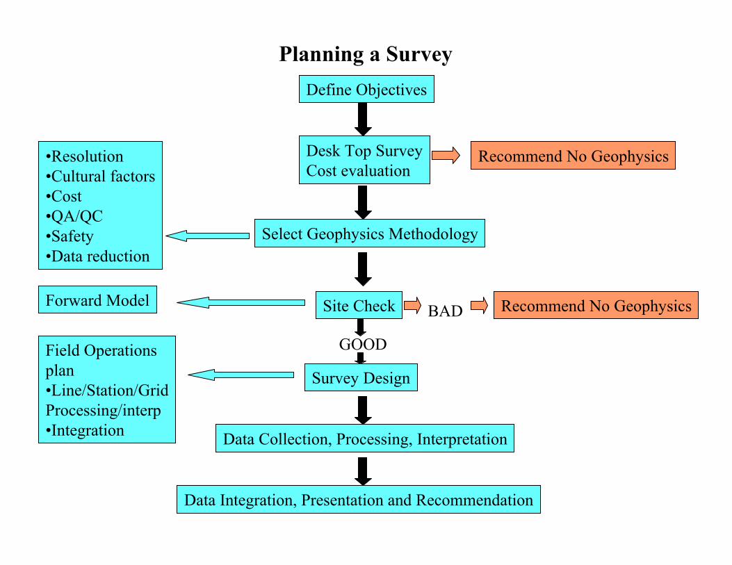
Planning a SurveyDefine Objectives
Desk Top SurveyCost evaluation
Recommend No Geophysics•Resolution•Cultural factors•Cost•QA/QC•Safety•Data reduction
Forward Model Site Check
Select Geophysics Methodology
GOOD
BAD
Field Operationsplan•Line/Station/GridProcessing/interp•Integration
Survey Design
Data Collection, Processing, Interpretation
Data Integration, Presentation and Recommendation
Recommend No Geophysics
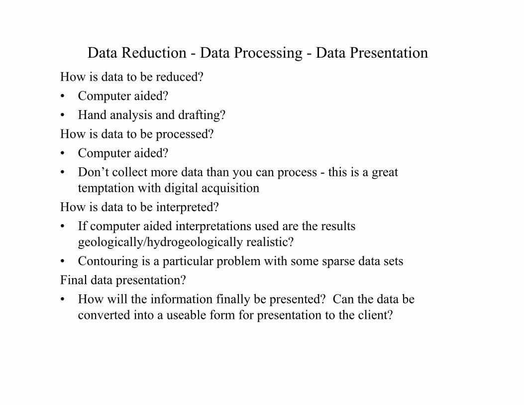
Data Reduction - Data Processing - Data PresentationHow is data to be reduced?• Computer aided?• Hand analysis and drafting?How is data to be processed?• Computer aided?• Don’t collect more data than you can process - this is a great
temptation with digital acquisitionHow is data to be interpreted?• If computer aided interpretations used are the results
geologically/hydrogeologically realistic?• Contouring is a particular problem with some sparse data sets Final data presentation? • How will the information finally be presented? Can the data be
converted into a useable form for presentation to the client?
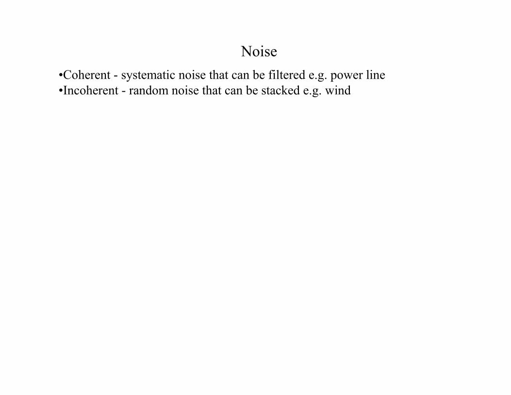
Noise•Coherent - systematic noise that can be filtered e.g. power line•Incoherent - random noise that can be stacked e.g. wind
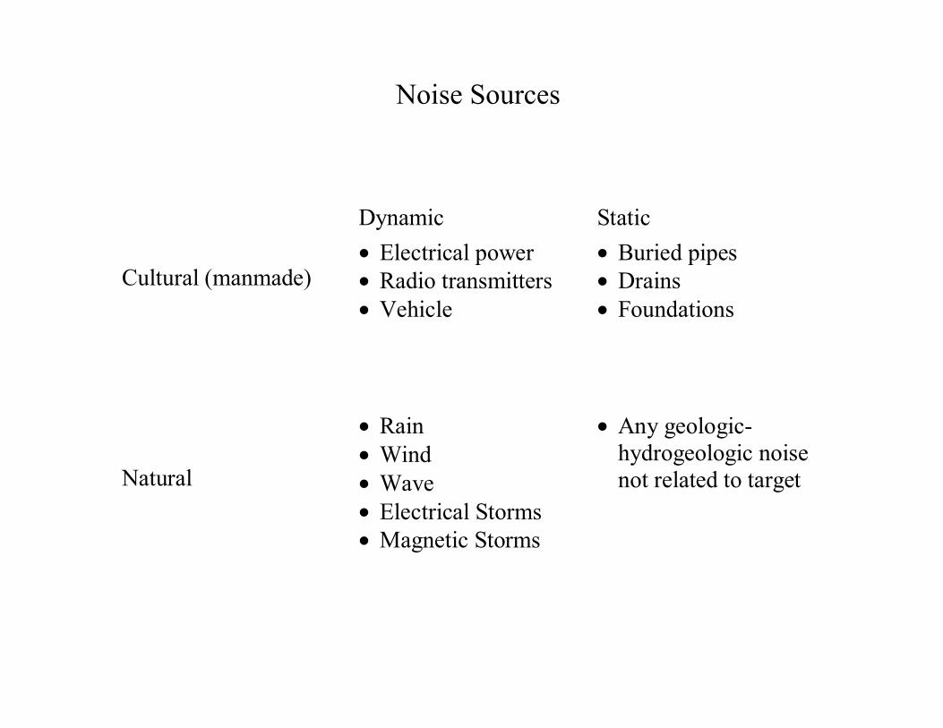
Noise Sources
Dynamic Static
Cultural (manmade)• Electrical power• Radio transmitters• Vehicle
• Buried pipes• Drains• Foundations
Natural
• Rain• Wind• Wave• Electrical Storms• Magnetic Storms
• Any geologic-hydrogeologic noisenot related to target

Noise Sources
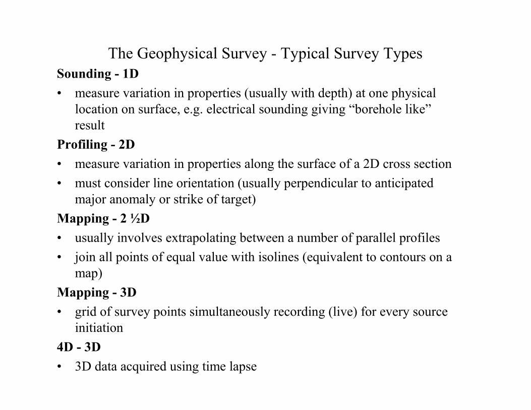
The Geophysical Survey - Typical Survey TypesSounding - 1D• measure variation in properties (usually with depth) at one physical
location on surface, e.g. electrical sounding giving “borehole like” result
Profiling - 2D• measure variation in properties along the surface of a 2D cross section• must consider line orientation (usually perpendicular to anticipated
major anomaly or strike of target)Mapping - 2 ½D• usually involves extrapolating between a number of parallel profiles• join all points of equal value with isolines (equivalent to contours on a
map)Mapping - 3D• grid of survey points simultaneously recording (live) for every source
initiation4D - 3D• 3D data acquired using time lapse
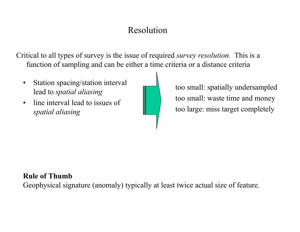
Resolution
Critical to all types of survey is the issue of required survey resolution. This is a function of sampling and can be either a time criteria or a distance criteria
Rule of ThumbGeophysical signature (anomaly) typically at least twice actual size of feature.
too small: spatially undersampledtoo small: waste time and moneytoo large: miss target completely
• Station spacing/station interval lead to spatial aliasing
• line interval lead to issues of spatial aliasing

Spatial Aliasing
• (spatial) loss of high frequency information
2D - True Profile Data
3D example - “Bulls Eye” Effect
Aliased (undersampled)
Optimally sampled
Oversampled
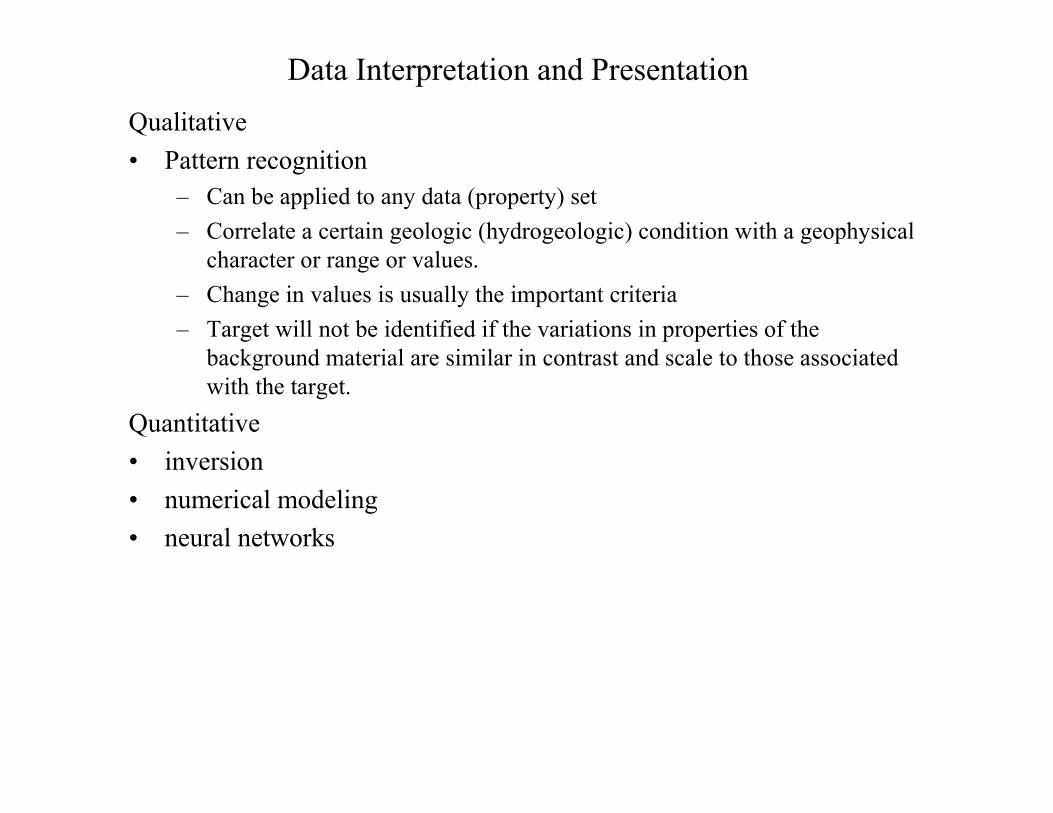
Data Interpretation and PresentationQualitative• Pattern recognition
– Can be applied to any data (property) set– Correlate a certain geologic (hydrogeologic) condition with a geophysical
character or range or values. – Change in values is usually the important criteria– Target will not be identified if the variations in properties of the
background material are similar in contrast and scale to those associated with the target.
Quantitative• inversion• numerical modeling• neural networks
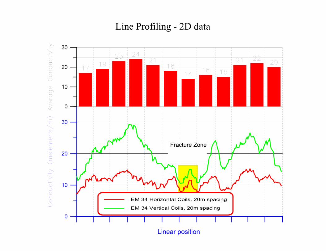
Line Profiling - 2D data
Linear position
0
10
20
30
0
10
20
30
Fracture Zone
EM 34 Horizontal Coils, 20m spacing
EM 34 Vertical Coils, 20m spacing
160.00 170.00 180.00 190.00 200.00 210.00
145.00
150.00
155.00
160.00
165.00
170.00
175.00
180.00
10.0015.0020.0025.0030.0035.0040.0045.0050.0055.0060.0065.0070.0075.0080.0085.0090.00
160.00 170.00 180.00 190.00 200.00 210.00
145.00
150.00
155.00
160.00
165.00
170.00
175.00
180.00
160.00 170.00 180.00 190.00 200.00 210.00
145.00
150.00
155.00
160.00
165.00
170.00
175.00
180.00
160.00 170.00 180.00 190.00 200.00 210.00
145.00
150.00
155.00
160.00
165.00
170.00
175.00
180.00
15.0020.0025.0030.0035.0040.0045.0050.0055.0060.0065.0070.0075.0080.0085.0090.00
160.00 170.00 180.00 190.00 200.00 210.00
145.00
150.00
155.00
160.00
165.00
170.00
175.00
180.00
10.0015.0020.0025.0030.0035.0040.0045.0050.0055.0060.0065.0070.0075.0080.0085.0090.00
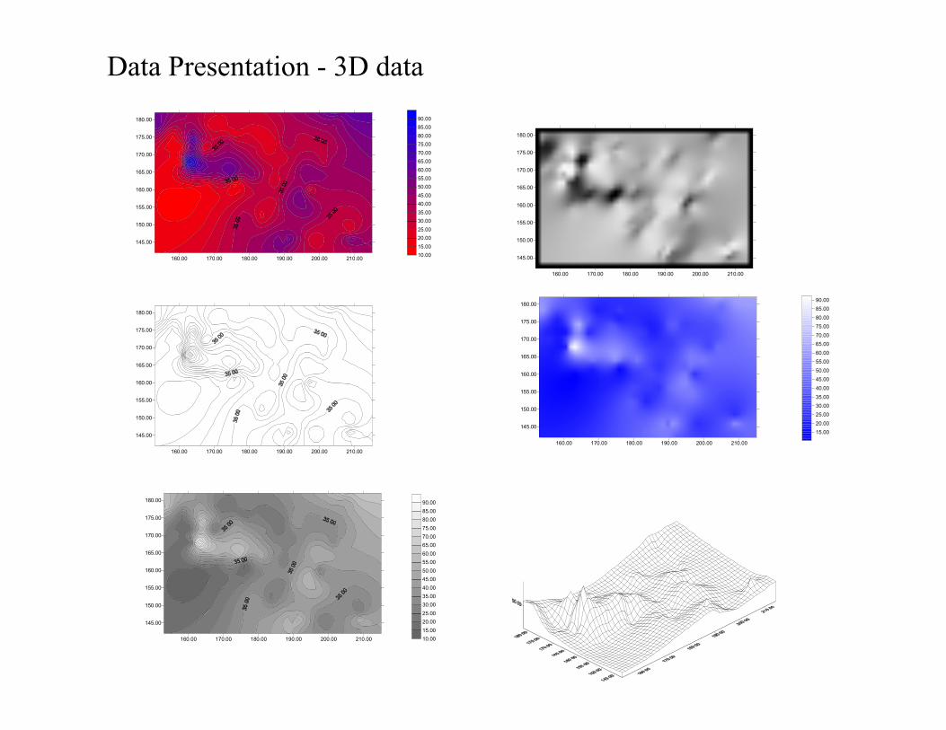
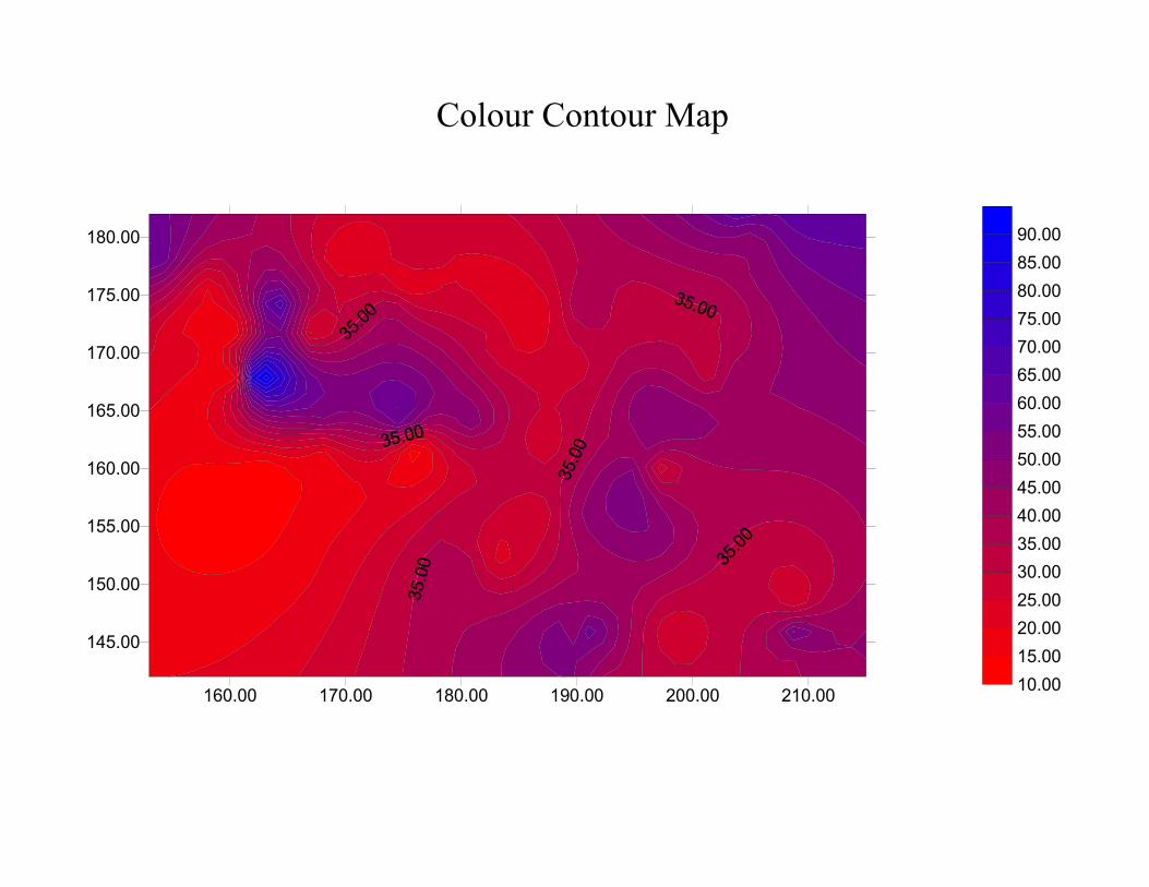
Data Presentation - 3D data
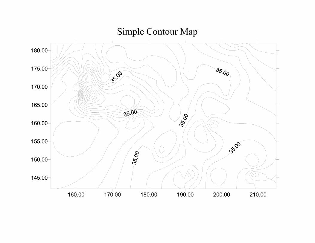
Simple Contour Map
160.00 170.00 180.00 190.00 200.00 210.00
145.00
150.00
155.00
160.00
165.00
170.00
175.00
180.00
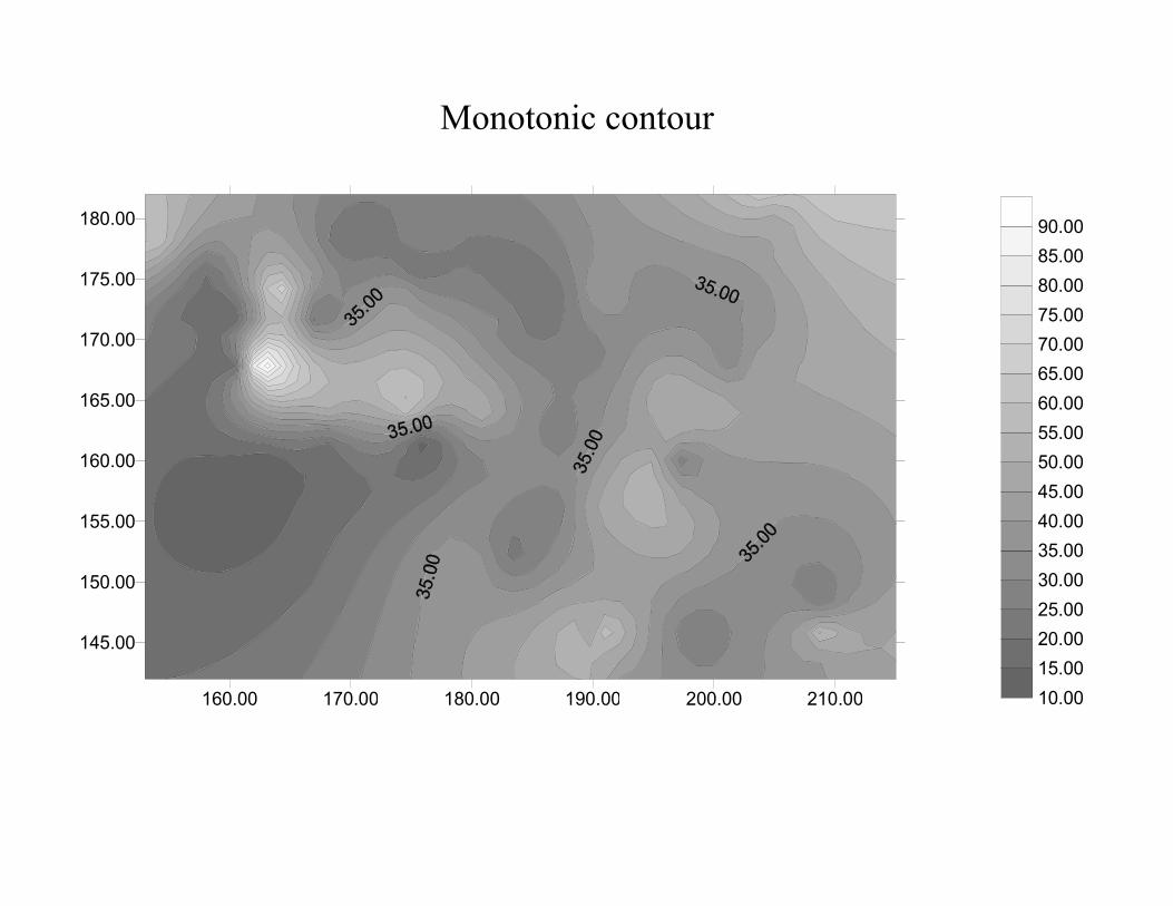
Monotonic contour
160.00 170.00 180.00 190.00 200.00 210.00
145.00
150.00
155.00
160.00
165.00
170.00
175.00
180.00
10.0015.0020.0025.0030.0035.0040.0045.0050.0055.0060.0065.0070.0075.0080.0085.0090.00
160.00 170.00 180.00 190.00 200.00 210.00
145.00
150.00
155.00
160.00
165.00
170.00
175.00
180.00
10.0015.0020.0025.0030.0035.0040.0045.0050.0055.0060.0065.0070.0075.0080.0085.0090.00
Colour Contour Map
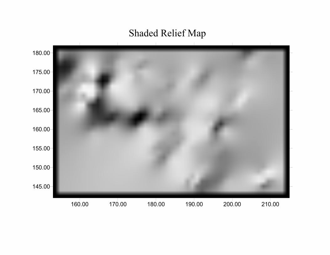
Shaded Relief Map
160.00 170.00 180.00 190.00 200.00 210.00
145.00
150.00
155.00
160.00
165.00
170.00
175.00
180.00
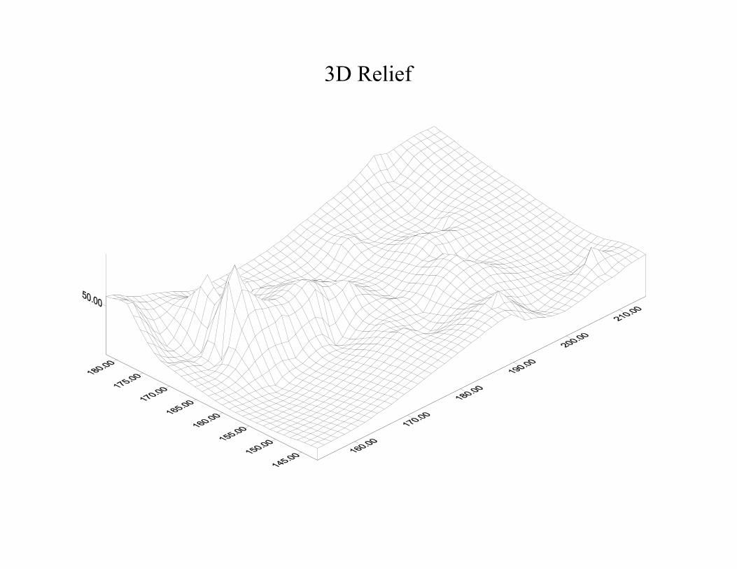
3D Relief