introduction to arcgis maps for office - esri · 2018. 7. 31. · -living atlas –access high...
TRANSCRIPT

Introduction to
ArcGIS Maps for OfficeGreg Ponto
Scott Ball

Agenda
• What is Maps for Office?
• Platform overview
• What are Apps for the Office?
• ArcGIS Maps for Office features
- Visualization
- Geoenrichment (+demo)
- Location Analysis (+demo)
- Sharing & collaboration (+demo)
- What’s new (+demo)
• Additional resources

ArcGIS Maps for Office
Map spreadsheet data
Create interactive maps in PPT
Do light spatial analysis

ArcGIS Maps for OfficeIncluded with ArcGIS Online and ArcGIS Enterprise

ArcGIS Platform Overview

ArcGISAn integrated Web GIS
Desktop
(Files)
Server
(Databases)
Web GISDesktop Web Device
Server Online Content
and Services
portal

Apps Are Bringing the Power of GIS to EveryoneExtending the Reach of GIS
Dashboards
Story Maps
Social MediaViewer AppsDesign Apps
Business Apps
Field Apps
Across Organizations and Beyond

And how do they fit into the ArcGIS platform?
What are ArcGIS apps?

ArcGIS includes many out of the box Apps
• 4 main themes
- Based on common business workflows
Focused, powerful, ready to use
FieldOffice Community Builders

Why are Apps important
• Manager
- Leverage the full potential of your GIS investment
- Apps solve common business workflows
- Deploy the “web GIS” pattern with your organization
- Have everyone in your organization work with the same data
• GIS Analyst
- Share your work to other parts of the organization
- Enable other departments to leverage your geospatial assets
- Curator of the authoritative datasets in your organization

Apps for the Office
• Apps that are used in the workplace
• Can also be used by other departments in your organization
- Enable non-traditional GIS user to leverage your geospatial assets
Hoping people make good decisions
ArcGIS
EarthArcGIS Maps
for Adobe
Creative
Cloud
Esri Business
Analyst
Insights
for ArcGIS
GeoPlanner
for ArcGIS
Esri
CityEngineOperations
Dashboard
for ArcGIS
Maps for
Office
Maps for
SharePoint
http://www.esri.com/apps

Use maps to Visualize, Analyze, Share, Present.
ArcGIS Maps for Office

Traditional GIS
Office plus ArcGIS

What can
ArcGIS Maps for Office
QUICKLY make BETTER DECISIONS and COMMUNICATE them
do?

What can ArcGIS Maps for Office do?
Visualize your data in new ways

Put your data in context with the world
What can ArcGIS Maps for Office do?

Geoenrichment
Demo

Analyze your spreadsheet data spatially
What can ArcGIS Maps for Office do?

Location Analysis
Demo

Collaborate with your peers
What can ArcGIS Maps for Office do?

Tell your story better
What can ArcGIS Maps for Office do?

Sharing and
Collaboration
Demo
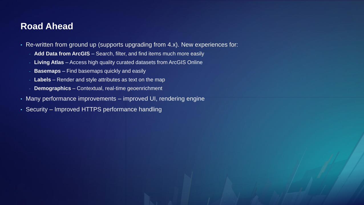
Road Ahead
• Re-written from ground up (supports upgrading from 4.x). New experiences for:
- Add Data from ArcGIS – Search, filter, and find items much more easily
- Living Atlas – Access high quality curated datasets from ArcGIS Online
- Basemaps – Find basemaps quickly and easily
- Labels – Render and style attributes as text on the map
- Demographics – Contextual, real-time geoenrichment
• Many performance improvements – improved UI, rendering engine
• Security – Improved HTTPS performance handling

Demo
5.0 Sneak Preview

App islandUse the product! Meet the team!

ArcGIS Maps for Office
Documentation
(RTFM: read the fabulous manual)
http://doc.arcgis.com/en/maps-for-office
Blogs
(learn about new stuff)
https://blogs.esri.com/esri/arcgis/
Ideas site
(help us know what to build)
https://ideas.esri.com
Learn more!

Please Take Our Survey on the App
Download the Esri Events
app and find your event
Select the session
you attended
Scroll down to find the
feedback section
Complete answers
and select “Submit”
