introduction to the adapting to rising tides existing
TRANSCRIPT

Existing Conditions and Stressors Report – Contaminated Lands
1
INTRODUCTION TO THE ADAPTING TO RISING TIDES EXISTING CONDITIONS AND STRESSORS REPORT The Adapting to Rising Tides (ART) project evaluated the current condition of shoreline and community assets, and the stressors affecting them, because understanding existing conditions and stressors can inform an understanding of individual asset resilience (or lack thereof) to projected climate impacts, including sea level rise and storm events. Stressors can also provide information on current and future trends and how those trends may affect resilience. The existing conditions and stressors were analyzed and summarized for each asset category included in the ART project assessment. This analysis served as a foundation for the ART vulnerability and risk assessment, which examined asset exposure to five potential climate impacts, sensitivity of assets to these impacts, and the ability of assets to accommodate or adjust to these impacts with little financial or structural intervention. The following Existing Conditions and Stressors report chapter includes:
• a definition of the asset category; • a synthesis of information about current conditions and stressors; and • discussion of these conditions through the lenses of sustainability organized by society
and equity, environment, economy and governance. The complete ART Existing Conditions and Stressors Report is available at the ART Portfolio website.

Existing Conditions and Stressors Report – Contaminated Lands
2
CONTAMINATED LANDS I. Definition Contaminated lands are sites known to be contaminated with materials that pose a hazard to people and/or the environment. In general, the threat posed by contaminated sites depends on:
• The likelihood that a site has released or has the potential to release hazardous substances into the environment.
• The characteristics of the waste (e.g., toxicity and waste quantity). • People or other sensitive receptors potentially affected by the release.
The release of hazardous substances occurs through four pathways: groundwater migration, surface water flow, soil exposure, and release to the air (vaporization). These pathways lead to effects on receptors through contamination of drinking water and food chains, as well as direct exposures to human populations and sensitive ecosystems (US EPA, Hazard Ranking System). This report identifies four types of contaminated lands: federal Superfund sites, State of California Cleanup program sites, sites with leaking underground storage tanks (USTs), and landfills. It does not address sites that were contaminated in the past but have been successfully cleaned up or permitted facilities for transport, use, and storage of hazardous materials.
• A federal Superfund site is an abandoned area where hazardous waste is located, possibly affecting local ecosystems or people (US EPA, Pacific Southwest). These areas have been designated on a National Priorities List through the federal Superfund cleanup program (see below).
• Cleanup program sites (under the jurisdiction of the California State Water Resources Control Board’s Site Cleanup Program and the State Department of Toxic Substances Control) are locations that have had chemical releases that contaminated soil and/or groundwater.
• Leaking USTs are sites that have or had leaking USTs. The vast majority of leaking UST sites are contaminated with petroleum products associated with gasoline service station operation. Tetrachloroethylene (TCE) is another common contaminant from leaking USTs and is commonly associated with the dry cleaning process (Water Board, Brownfields Program, Regional Board, UST Program).
• A landfill is a solid waste management facility where waste is or once was disposed of on land. Landfills do not include surface impoundments, waste piles, land treatment units, injection wells, or soil amendments (CalRecycle, Solid Waste Facilities).
II. Locations and Physical Features
There are two Superfund sites in the ART study area (see Figure 1). The Alameda Naval Air Station (now known as Alameda Point) is a closed Navy installation located on Alameda Island, adjacent to the City of Alameda (US EPA, Superfund Site Reports). The boundaries of the former installation are roughly rectangular (approximately 2 miles in length and 1 mile in width) and occupy 2,634 acres. Of the total acreage, approximately 1,636 acres are dry land and 998 acres are submerged. The site is bordered by the Oakland Inner Harbor to the north, and by

Existing Conditions and Stressors Report – Contaminated Lands
3
San Francisco Bay on the west and south. To the east is a mixture of residential, commercial, industrial, and public lands including single-family homes, restaurants, retail stores, schools, shipyards, and a state beach. Contaminants historically generated at the site include industrial solvents, acids, paint strippers, degreasers, caustic cleaners, pesticides, chromium and cyanide wastes, waste oils containing PCBs, radium associated with dial painting and stripping, medical debris, and unexploded ordnance.
Alameda Point (former Alameda Naval Air Station) Superfund site. Source: Telstar Logistics’, Flickr Commons.

Existing Conditions and Stressors Report – Contaminated Lands
4
Figure 1. Map of Contaminated Lands in the ART Project Area

Existing Conditions and Stressors Report – Contaminated Lands
5
The other Superfund site is the former AMCO Chemical Facility at 1414 3rd Street in Oakland, one block south of the West Oakland Bay Area Rapid Transit (BART) station. The site is bordered on the north by a vacant lot owned by BART, on the west by residences, on the south by 3rd Street, and on the east by Nelson Mandela Parkway. The size of the AMCO property is approximately 0.9 acre. The I-880 Freeway corridor crosses just to the south, passing over 3rd Street near the southeast corner of the property. The site is currently used for storage of cables. Land use in surrounding areas is a mix of commercial/light industrial and residential. The nearest residences are immediately adjacent along 3rd and Center Streets. Investigations of the site have confirmed the presence of chlorinated solvents and other contaminants (including vinyl chloride) in soil, soil gas, and groundwater on or near the site. In the ART study area, more than 400 cleanup program sites are associated with many types of shoreline land uses (see Figure 9). The majority of sites are clustered in current industrial and retail land use areas, such as along Doolittle Drive in Oakland, and in San Leandro. However, cleanup program sites are also found in residential areas where past industrial land uses are being replaced by housing and mixed-use developments, for example in Emeryville. Approximately a dozen cleanup program sites are located in or adjacent to parks or recreational areas (for example, Union Point Park on the Oakland Inner Harbor). Although none are located in natural areas (such as wetlands), a few are in close proximity, such as in Union City near the former salt ponds at the Eden Landing restoration area. There are approximately 450 leaking underground storage sites in the study area (see Figure 9). These storage tank sites are located in and adjacent to similar land uses as cleanup program sites but they are more dispersed throughout the area (DTSC, Envirostor, August 1, 2011, Regional Board, GeoTracker, August 10, 2011). Twenty-four active and closed landfills are located in the ART project area (see Figure 9).1 A few of the landfills are co-located with the other types of contaminated lands (e.g., three closed landfills on the Alameda Naval Air Station Superfund site and the closed landfill at Oyster Bay Regional Shoreline; photo below). With only three exceptions, the landfills in the study area are located adjacent to or in the Bay, and thus are near natural habitat areas. Other adjacent land uses include industrial, recreation, and residential.
1 Tri-‐Cities Landfill is an active commercial Class III (i.e., it accepts nonhazardous wastes) solid waste disposal facility located just south of the study area in Newark.

Existing Conditions and Stressors Report – Contaminated Lands
6
Oyster Bay Regional Shoreline, located on a former landfill that closed in the early 1980s. Source: Bing Maps (www.bing.com/maps).
The five active landfills include a composting facility for biosolids and another for green wastes, a chipping and grinding operation, and two processing facilities for construction debris. Of the nineteen closed landfills, eight were solid waste disposal sites that accepted primarily municipal, or household, wastes (Personal communication, Terry Seward, San Francisco Regional Water Quality Control Board, August 30, 2011). Other types of closed landfills include composting operations; transfer and processing facilities for construction debris; a disposal site for foundry wastes; a dredge disposal site; and military sites that accepted all types of wastes, including hazardous materials. Two of the closed landfills were developed as golf courses, another two into shoreline parks, and one site was developed for residential use (Regional Board, GeoTracker, August 10, 2011, CalRecycle, SWIS, August, 16, 2011).
Existing Conditions and Stressors Report – Contaminated Lands
7
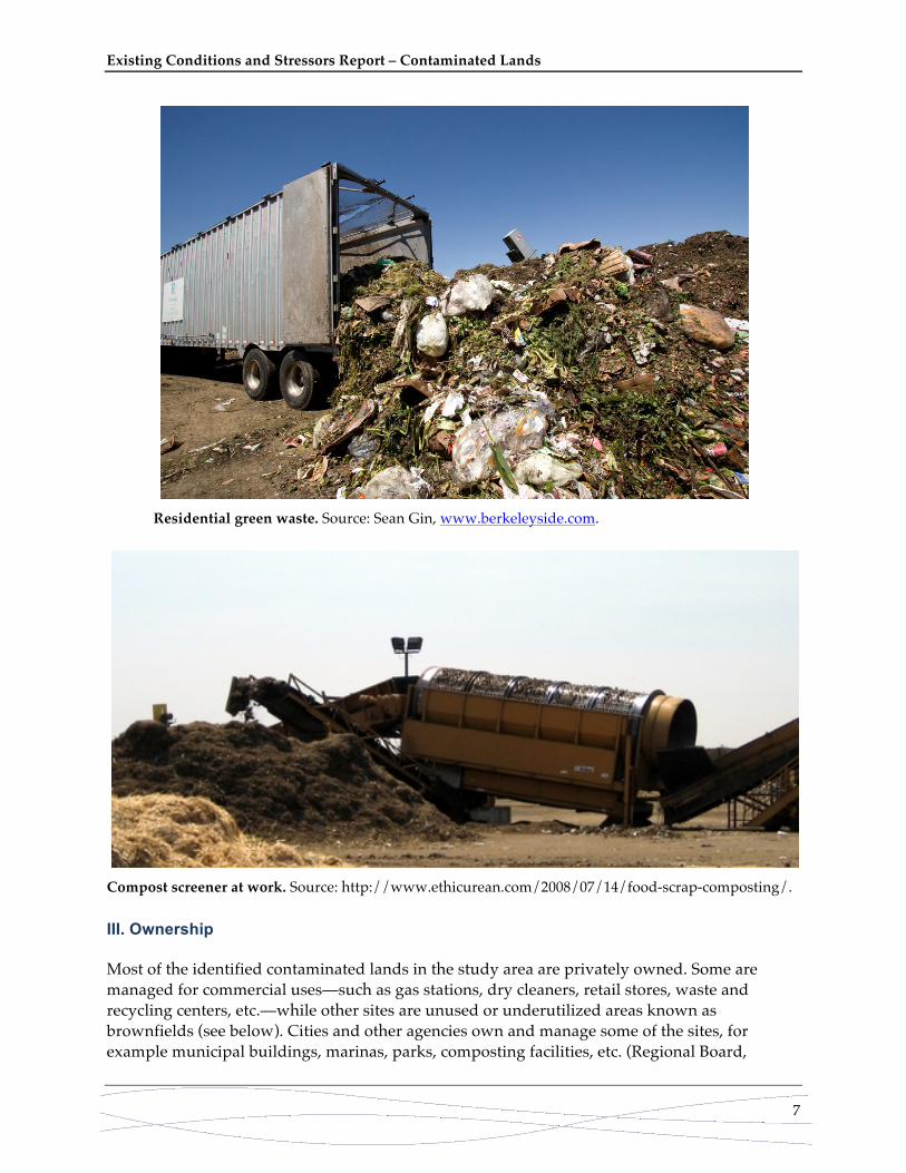
Residential green waste. Source: Sean Gin, www.berkeleyside.com.
Compost screener at work. Source: http://www.ethicurean.com/2008/07/14/food-scrap-composting/. III. Ownership Most of the identified contaminated lands in the study area are privately owned. Some are managed for commercial uses—such as gas stations, dry cleaners, retail stores, waste and recycling centers, etc.—while other sites are unused or underutilized areas known as brownfields (see below). Cities and other agencies own and manage some of the sites, for example municipal buildings, marinas, parks, composting facilities, etc. (Regional Board,

Existing Conditions and Stressors Report – Contaminated Lands
8
GeoTracker, August 10, 2011, CalRecycle, SWIS, August, 16, 2011). The majority of the closed landfills are owned by municipalities. Approximately 15% of cleanup program sites and leaking UST sites are owned by the Department of Defense. (State and local agencies work with the Department on cleanup of these sites.) IV. Existing Stressors Managers of the two Superfund sites face unique challenges related to the characteristics of the sites. At the Alameda Naval Air Station, remediating the large contaminant plume will be especially difficult. At the AMCO Chemical site, ongoing negotiations between the US EPA and potentially responsible parties could delay the final cleanup. For both Superfund sites, treatment such as soil excavations to remove contaminants can lead to additional exposures. This can raise concerns and even opposition to cleanup among nearby communities and other interested stakeholders. Most cleanup program sites and leaking UST sites are funded by the party that caused the spill or contamination or the land owner, or both. In some cases, these sites benefit from the brownfields program, which provides funding for cleanups as well as mechanisms for liability relief. Even with these incentives, barriers involving funding and reticence on the part of the discharger deter cleanups (Per review by Linsay Whalin, Regional Water Quality Control Board. October 3, 2011, and Wheeler, 2001). Lack of resources for the regulatory agency is considered a significant hurdle to cleaning contaminated sites (Per review by Linsay Whalin, Regional Water Quality Control Board. October 3, 2011). At some sites the nature of the contamination (e.g., type, amount, location) can limit treatment or removal options and result in contaminants having to be left in place. For example, at Union Point Park on the Oakland Inner Harbor, metal-contaminated soil was excavated and placed under an engineered cap. Uses and activities (e.g., excavations) at the site are restricted through a legal covenant between the site owner (the Port of Oakland) and the Regional Board to prevent additional exposures (Regional Board, Union Point Park). At some landfills, identification and prevention of contamination is a significant challenge. For example, at Turk Island Landfill in Union City, the final landfill cover was designed and constructed to provide water infiltration protection and proper drainage. However, settlement and animal burrowing seeps developed, and cap repairs have not resolved these issues (Regional Board, 1997). Some closed landfills do not have leachate collection and recovery systems as required today at active landfills; instead leachate is extracted via wells. This occurs at West Winton Landfill in Hayward. Leachate at that site is not highly toxic (toxicity has degraded over time), but the landfill is surrounded on three sides by wetlands. In the event of an earthquake, the proximity of the landfills to the Hayward and Calaveras faults is a potential stressor on the integrity of landfill protection structures (e.g., liners, collection systems and caps). V. Governance Superfund is the name of the fund established by the Comprehensive Environmental Response, Compensation and Liability Act of 1980, as amended. This law allows the U.S. Environmental

Existing Conditions and Stressors Report – Contaminated Lands
9
Protection Agency (US EPA) to clean up Superfund sites and to compel responsible parties to perform cleanups or reimburse the government for US EPA-led cleanups. Sites are listed on a National Priorities List upon completion of Hazard Ranking System screening, public solicitation of comments about the proposed site, and after all comments have been addressed (US EPA, National Priorities List). For the Alameda Naval Air Station, the Navy is the lead agency responsible for cleanup of the site. US EPA is the lead regulatory agency charged with oversight of the Navy, with assistance from the California Department of Toxic Substances Control (DTSC) and the San Francisco Bay Regional Water Quality Control Board (Regional Board). The Navy, with US EPA oversight, has conducted investigations of all contaminated sites, or “response sites,” at the Naval Air Station. The response sites are at various stages in the Superfund cleanup process. Six response sites are undergoing remedial investigations or feasibility studies to determine the nature and extent of contamination. Twenty have records of decision that explain which cleanup alternatives will be used; of those, five required no remediation, while the remainder are undergoing remediation (US EPA, Superfund Site Reports). Currently US EPA is the lead agency for the responses at the AMCO Chemical Superfund site. The agency is investigating parties that may be responsible for the contamination. The US EPA Emergency Response Program operated a treatment system to remove vinyl-chloride-contaminated groundwater and soil vapors until July 1998, when it was turned off in response to community concern over potential exposure to contaminants from the system’s exhaust stack. The US EPA later conducted a preliminary assessment and site investigation that led to listing of the AMCO Chemical facility on the National Priorities List in 2003 (US EPA, Superfund Site Reports). The US EPA has a Superfund process (i.e., a plan) for remediation of the site. Interim remediation actions, including excavation of contaminated soils and removal of subsurface liquid organic compounds, are planned for fall and winter 2011. Following these remedial actions, the US EPA will conduct a site-wide assessment and develop a final remedy for remaining contamination (e.g., of groundwater) that the agency anticipates will take at least 10 years (US EPA, 2010). Remediation of cleanup program sites is managed through the California State Water Resources Control Board’s (Water Board’s) Site Cleanup Program (SCP), which is implemented by the Regional Board or by the Department of Toxic Substance Control (DTSC) Brownfields and Environmental Restoration Program. The Water Board’s SCP focuses on unauthorized releases of pollutants to soils and groundwater, but in some cases also to surface waters. Sites that are investigated and remediated within the SCP include those with contamination from recent or historical surface spills, subsurface releases (e.g., pipelines, sumps), and all other unauthorized discharges that pollute or threaten to pollute surface or groundwater. The SCP also includes groundwater cleanup at brownfields, refineries, and other large industrial facilities. The program provides oversight at these sites and requires that responsible parties implement site investigations, source removals, soil and groundwater treatment, and monitoring. Because many SCP sites also have leaking USTs, the SCP interacts closely with the UST Program (Regional Board, Site Cleanup Program).

Existing Conditions and Stressors Report – Contaminated Lands
10
Under contract with the state and in coordination with the Regional Board, the Alameda County Environmental Health Department (ACEH) manages the SCP program for Emeryville, Oakland, Alameda, and San Lorenzo. The Regional Board and the Cities oversee Berkeley, San Leandro, and Hayward. The Regional Board and Alameda County Water District (ACWD) oversee Fremont, Newark, and Union City (ACEH, LUFT/SLIC Program). (Note that Berkeley, Fremont, and Newark are not within the study area.) In addition to remediation of cleanup program sites, DTSC’s Brownfields and Environmental Restoration Program oversees the cleanup of State Superfund Sites. State Superfund sites are also called Annual Workplan sites, listed sites, or Cortese List sites. EnviroStor, DTSC’s tracking database, provides site-specific information. These are sites with evidence of a hazardous substance release or releases that could pose a significant threat to public health and/or the environment. DTSC issues Orders to responsible parties to compel the cleanup of these sites. Where no responsible parties can be found or where they do not take proper and timely action, DTSC may use State funds to undertake the cleanup. If necessary, emergency actions may be taken. Due to their known or suspected contamination, many of these sites become “Brownfields.” The process used to address these sites is generally consistent with the National Oil and Hazardous Substances Contingency Plan (the "National Contingency Plan" NCP). DTSC also has other programs such as the Voluntary Cleanup Program, where a project proponent can ask DTSC to provide oversight for an investigation and cleanup. Leaking UST sites are addressed through the Water Board’s UST Program. Underground storage tank owners or operators are required to report a leak to a local regional agency within 24 hours of detection. To encourage reporting, the site investigation and cleanup costs can only be reimbursed by a cleanup fund once the leak has been reported to the Regional Board or other local regulatory agency. Similarly to the SCP, the Water Board contracts with ACEH, the Cities, and ACWD to manage the UST program for leaking underground fuel tanks. The Regional Board, authorized by the Water Board, directly oversees many storage tank investigations and cleanups (Regional Board, UST Program, ACEH, LUFT/SLIC Program). Once a site has been identified, a site assessment is conducted to provide details about the size and magnitude of the release and to determine an appropriate cleanup strategy. Cleanup is conducted under the direction of the lead regulatory agency and may include free product removal, vapor extraction, ozone sparging, or technologies such as groundwater extraction. In some cases, soil excavation and disposal completes the cleanup (Regional Board, UST Program). Some cleanup program and leaking UST sites are also brownfields. A brownfield site is “a property, the expansion, redevelopment, or reuse of which may be complicated by the presence or potential presence of a hazardous substance, pollutant, or contaminant. Cleaning up and reinvesting in these properties protects the environment, reduces blight, and takes development pressures off greenspaces and working lands.” The California Environmental Protection Agency (CalEPA) oversees management of a brownfields program through the Water Board (which authorizes the Regional Board to implement the program) and DTSC, which share oversight of cleanups through a 2004 Memorandum of Agreement (Water Board, Brownfields Program , CalEPA, Brownfields Program).

Existing Conditions and Stressors Report – Contaminated Lands
11
California law makes landfill owners and operators responsible for maintaining active and closed landfills in a manner that does not present a threat to public health, safety, or the environment. Further, owner/operators must provide financial assurances to the State for closed landfills to ensure their ongoing maintenance (CalRecycle, 2009). The California Department of Resources Recycling and Recovery (CalRecycle) manages a program for review of permits for active solid waste facilities that are issued by local enforcement agencies (e.g., ACEH). Permits include design, operational, financial, and closure/postclosure requirements. CalRecycle is also responsible for ensuring that operators demonstrate adequate financial assurances for closure and postclosure maintenance, corrective action, and operating liability (CalRecycle, Solid Waste Facilities). The Regional Board regulates both active and closed landfills to ensure that non-hazardous wastes contained in these facilities do not escape to either surface water or groundwater. Regulation consists of design standards for protective features (e.g., liners, covers), environmental monitoring, and cleanup when necessary (Regional Board, Landfills). Some of CalRecycle’s and the Regional Board’s regulatory duties overlap (e.g., margin of safety), while others are split (e.g., the Regional Board’s focus on water and leachate and CalRecycle’s focus on landfill gas). DTSC regulates the disposal of wastes classified as hazardous through its permitting and enforcement program. Other local, state, or federal permits or approvals for solid waste facilities may also be required. VI. Environment By virtue of inclusion in the National Priorities List, Superfund sites pose high risks to people and or the environment. The Hazard Ranking System screening that is used to assess potential Superfund sites has three categories of risk factors (US EPA, Hazard Ranking System):
• Likelihood that a site has released or has the potential to release hazardous substances into the environment.
• Characteristics of the waste (e.g., toxicity and waste quantity). • People or sensitive environments (targets) affected by the release.
The two Superfund sites in the ART project area pose significant hazards to people and the environment and require challenging and lengthy remediations. Large quantities of highly toxic solid wastes that were generated at the Alameda Naval Air Station were disposed into two on-base landfills that are adjacent to San Francisco Bay. One of the landfills surrounds both fresh and saltwater wetlands, which provide nesting and foraging habitat for a wide range of migratory and native birds. Liquid industrial wastewaters were discharged untreated into Seaplane Lagoon and the Oakland Inner Harbor, posing a threat to the surrounding San Francisco Bay aquatic life and a potential threat to terrestrial ecological receptors. “Past activities at the base have resulted in a three acre plume of mostly dense non aqueous phase liquid (DNAPL) contamination … These plumes pose a potential long term human health threat from inhalation of volatile vapors and possible ingestion of groundwater” (US EPA, Superfund Site Reports). The AMCO Chemical Superfund site has chlorinated solvents that are human carcinogens. Although monitoring has indicated that the site poses no immediate threat to residents, there is concern that if nothing is done to remedy the contamination, it will pose a threat. The EPA

Existing Conditions and Stressors Report – Contaminated Lands
12
facility report notes that the groundwater beneath the site is not being used by the community as a drinking water source (US EPA, Superfund Site Reports). Contamination at cleanup program sites can include trichloroethylene (TCE), polychlorinated biphenyls (PCBs) and other chlorinated hydrocarbons, metals (e.g., lead, chromium, nickel), and solvents such as acetone and benzene. At leaking UST sites, the most frequently found contaminants are gasoline, diesel, and petroleum byproducts (e.g., benzene). The vast majority of cleanup program sites and leaking USTs (where the contaminated media has been determined) have contamination of groundwater that is not used as a drinking water source. Some of these sites also have soil and soil vapor contamination. Drinking water is contaminated at relatively few sites (Regional Board, GeoTracker, August 10, 2011). Releases of leachates, or contaminated waters from active and closed solid waste landfills, pose a potential environmental threat. Many older landfills that are now closed were not lined (e.g., Turk Island Landfill in Union City) or were lined inadequately to prevent leachate contamination of surrounding lands and/or waters. Often, a natural geologic barrier provides some leak protection. For instance, the Bay margin landfills have a layer of bay mud, a natural clay that typically has very low permeability. When combined with pressure from the overburden (weight of waste) causing compaction, the bay mud acts as a liner in many ways. This is not to say that leaks never exist, but that they are infrequent and are generally detected as the majority of these sites are monitored and regulated by the Regional Board (Per review by Linsay Whalin, Regional Water Quality Control Board. October 3, 2011). Despite this, new exposures to water (e.g., due to higher groundwater levels) could lead to leaching. Both groundwater and surface waters at the landfills are monitored regularly, and some of the closed landfills and all active ones have leachate collection systems to prevent environmental contamination (Per conversation with Terry Seward, San Francisco Regional Water Quality Control Board, on August 30, 2011). Landfill methane (a byproduct of organic waste decomposition) also poses public health and environmental risks. Collection systems for landfill gas are required, and the methane is burned or used for the production of electricity, to prevent air pollution. VII. Economy/Equity The negative public health and environmental impacts of exposures to pollution released from contaminated lands, as well as the financial burden of addressing these impacts and cleaning up sites, have significant social, economic, and environmental consequences in the study area. At the same time, remediation and redevelopment or restoration of these sites offer opportunities for economic growth, community services (e.g., additional parks), and even habitat creation. Coordinating and streamlining regulatory agency oversight, and offering incentives for cleanups, are important governance mechanisms that make it easier to take advantage of these opportunities.

Existing Conditions and Stressors Report – Contaminated Lands
13
References Alameda County Environmental Health (ACEH). LUFT/SLIC Program [Internet]. Accessed at:
http://www.acgov.org/aceh/lop/index.htm California Environmental Protection Agency (CalEPA). Brownfields Program [Internet].
Accessed at: http://www.calepa.ca.gov/Brownfields/ CalRecycle. 2009. Report to the Legislature: AB 2296 (Montanez). Publication # DRRR-2011-010.
Accessed at: www.calrecycle.ca.gov/Publications/ CalRecycle. Regulatory Agencies with Permitting Authority Over Solid Waste Facilities
[Internet]. Accessed at: http://www.calrecycle.ca.gov/SWFacilities/Permitting/PermitType/OtherPermits.htm
CalRecycle. Solid Waste Facilities: Landfills [Internet]. Accessed at:
http://www.calrecycle.ca.gov/SWFacilities/Landfills/ CalRecycle. Solid Waste Information System (SWIS). Data downloaded on August 16, 2011.
Accessed at: http://www.calrecycle.ca.gov/SWFacilities/Directory/Default.htm Department of Toxic Substances Control (DTSC). Envirostor. Data downloaded on August 1,
2011. Accessed at: http://www.envirostor.dtsc.ca.gov/public/ San Francisco Bay Regional Water Quality Control Board (Regional Board). Underground
Storage Tank (UST) Program [Internet]. Accessed at: http://www.swrcb.ca.gov/rwqcb2/undergrd.shtml
San Francisco Bay Regional Water Quality Control Board (Regional Board). GeoTracker. Data
downloaded on August 10, 2011. Accessed at: http://geotracker.swrcb.ca.gov/ San Francisco Bay Regional Water Quality Control Board (Regional Board). Site Cleanup
Program [Internet]. Accessed at: http://www.waterboards.ca.gov/sanfranciscobay/sitecleanupprogram.shtml
San Francisco Bay Regional Water Quality Control Board (Regional Board). Landfills [Internet].
Accessed at: http://www.swrcb.ca.gov/sanfranciscobay/water_issues/programs/index.shtml#landfills
San Francisco Bay Regional Water Quality Control Board (Regional Board). GeoTracker. Union
Point Park. Accessed at: http://geotracker.swrcb.ca.gov/profile_report.asp?global_id=SL1821H607
San Francisco Bay Regional Water Quality Control Board (Regional Board). 1997. Order No.
97_026. UPDATED WASTE DISCHARGE REQUIREMENTS AND RECISION OF WDRNO. 88-O4O FOR: Turk Island Company Turk Island Class III Landfill, Union City, Alameda

Existing Conditions and Stressors Report – Contaminated Lands
14
County. Accessed at: http://www.swrcb.ca.gov/rwqcb2/board_decisions/enforcement.shtml
State Water Resources Control Board (Water Board). Brownfields Program [Internet]. Accessed
at: http://www.swrcb.ca.gov/water_issues/programs/brownfields/ US Environmental Protection Agency (US EPA). Superfund Site Reports [Internet]. Accessed at:
http://www.epa.gov/region9/superfund/superfundsites.html US Environmental Protection Agency (US EPA). Introduction to the Hazard Ranking System
[Internet]. Accessed at: http://www.epa.gov/superfund/programs/npl_hrs/hrsint.htm US Environmental Protection Agency (US EPA). Pacific Southwest, Region 9, Superfund Sites
[Internet]. Accessed at: http://www.epa.gov/region9/superfund/superfundsites.html US Environmental Protection Agency (US EPA). National Priorities List [Internet]. Accessed at:
http://www.epa.gov/superfund/sites/npl/npl_hrs.htm US Environmental Protection Agency (US EPA). Pacific Southwest, Region 9 [Internet].
Accessed at: http://www.epa.gov/region9/superfund/aboutus.html US Environmental Protection Agency (US EPA). 2010. Handouts: Superfund Process at AMCO
Chemical Site; Interim Remedial Action. Accessed at: http://yosemite.epa.gov/r9/sfund/r9sfdocw.nsf/vwsoalphabetic?openview
Wheeler, SM. 2001. INFILL DEVELOPMENT IN THE SAN FRANCISCO BAY AREA:
CURRENT OBSTACLES AND RESPONSES. A Paper Presented at the Annual Conference of the Association of Collegiate Schools of Planning, Cleveland, Ohio. Accessed at: http://www.mrsc.org/subjects/planning/infill_art.pdf