introduction - victoria county history · both acquired 12th-century castles guarding river...
TRANSCRIPT

VCH Oxfordshire • Texts in Progress • Ascott (Nov. 2016) • © University of London • Intro. • p. 1
Ascott-under-Wychwood is a rural parish in the Evenlode valley, and lies on the northern
flank of the former Wychwood forest c.2 km (1¼ miles) east of Shipton, of which it was
formerly a satellite and chapelry. Unlike Shipton’s other hamlets, however, it was counted a
separate parish from at least the 18th century.1 Settlement is largely restricted to Ascott
village, which comprises the two adjacent hamlets and former manors of Ascott D’Oyley and
Ascott Earl. Both acquired 12th-century castles guarding river crossings, of which that at
Ascott D’Oyley was succeeded by a medieval manor house partly preserved in Manor Farm.
Until the 20th century most parishioners made a living from agriculture, although the arrival
of the railway in 1853 and the opening of two stations in the parish encouraged dependent
trades and the opening of a coal-fired flour mill in 1912. Lords and curates were
1 Above, Shipton, intro.; below (boundaries); relig. hist.
VCH Oxfordshire Texts in Progress
Ascott-under-Wychwood
Introduction
The former village school (now Windrush Valley school), built in 1872, photographed from the village green. The benches around the tree
commemorate the ‘Ascott Martyrs’.

VCH Oxfordshire • Texts in Progress • Ascott (Nov. 2016) • © University of London • Intro. • p. 2
predominantly non-resident, contributing to the growth of religious Dissent and the building
of a Baptist chapel in 1816. The village achieved national notoriety in 1873, when the
imprisonment of 16 local women (the ‘Ascott Martyrs’) during an agricultural labourers’
dispute sparked public outrage.
Parish and Township Boundaries
Ascott remained a chapelry of Shipton parish until 1763, but achieved civil independence
much earlier, having its own parish officers in the 16th century.2 Its boundaries (derived
presumably from those of the two pre-Conquest manors) are partly defined by natural
features, with long stretches following the river Evenlode and tributary streams. In the north
the Burford–Chipping Norton road (perhaps part of an Anglo-Saxon salt-way) forms most of
the border with Lyneham,3 and elsewhere the boundary follows hedges or former field
divisions. In 1881 the parish comprised 1,839 acres.4
The boundary was perambulated in 1591 when it already followed its later course,
beginning in the north-east at a spring called ‘Holliewell head’ which bordered Chilson in
Charlbury parish. From there it continued north-westwards along a hedge to the Burford–
Chipping Norton road, which it followed south-westwards to ‘Lyneham cross’, thereafter
2 Below, relig. hist.; local govt.
3 Below (communications).
4 OS Area Bk (1881).
The parish of Ascott-under-Wychwood c.1850. Source: K. Tiller and G. Darkes (eds), An Historical Atlas of Oxfordshire (ORS 67, 2010).

VCH Oxfordshire • Texts in Progress • Ascott (Nov. 2016) • © University of London • Intro. • p. 3
doglegging between marker stones across open fields and meadows as far as the Evenlode,
which divided Ascott from Shipton. Following the river eastwards (save for a section near
Shipton village), it crossed a ford at Ascott Earl before following Coldwell brook southwards
to the ‘forest hedge’ (below), which formed the entire southern boundary with Wychwood
forest as far as the junction with Chilson. From there it returned north along ‘Ascott hedge’
towards the Evenlode and along a stream called ‘Back brook’, following a hedge north-
westwards back to Holliewell head.5
The ‘forest hedge’ was also perambulated in 1300 as part of the bounds of
Wychwood forest, from which the entire parish was excluded. From ‘Prestesgrove’ (Priest
Grove) in the west it passed five further landmarks including ‘Boynhale’ (Boynal) and
‘Brestenhale’ (Brasswell), as part of an erratic course first east and then north to the junction
with Chilson.6 In the 17th century most of the hedge was replaced with a high stone wall
punctuated by gates and stiles, which through Ascott (as through several other places)
extended beyond the forest to encompass outlying forest ‘purlieus’, here comprising Boynal,
Priest Grove, and Woefield green. Those areas nevertheless remained an integral part of
Ascott parish.7 Within the forest proper an area comprising High Lodge and its bailiwick or
walk was also regarded as part of Ascott from at least 1607 until c.1850,8 while conversely a
6-a. field in the parish near Brasswell Gate, allotted to Lord Churchill at inclosure in 1838 as
the ‘keeper’s plot’, formed a detached part of the forest until disafforestation in 1857.9
In 1852 the Ascott–Shipton boundary along the Evenlode was adjusted to follow the
newly-straightened river,10 and in 1954 a total of 83 a. (including Shipton railway station and
houses along Station Road accommodating 33 people) were transferred to Shipton, leaving
Ascott with 1,755 a. (710 ha.).11 The boundaries remained essentially unchanged
thereafter,12 meaning that houses west of Coldwell brook (including Coldstone Farm,
Langley Mill, and Wychwood Manor) remained technically in Shipton parish despite being
physically part of Ascott village.13
The medieval township and manorial boundary between Ascott D’Oyley and Ascott
Earl broadly followed the route north-westwards from Brasswell Gate across Ascott bridge to
5 TNA, DL 42/117, ff. 67–68; below, Wychwood.
6 B. Schumer, ‘The 1298/1300 Perambulations of Wychwood Forest - and after’, Oxoniensia 69
(2004), 1–28. 7 Below, econ. hist. (agric. landscape; woods); cf. below, Leafield; Ramsden; Wychwood.
8 OHC, par. reg. transcript, burial 1607; Wychwood Parl. Rept (1792), 32; Census, 1801–41; Bryant,
Oxon. Map (1824); below, Wychwood. 9 OHC, Ascott inclo. award and map (1838), no. 166; Cornbury and Wychwood inclo. award and map
(1857), no. 216. The 6 a. were presumably awarded in lieu of 4 a. of common meadow near Ascott mill which were previously attached to High Lodge: Wychwood Parl. Rept (1792), 34. 10
Above, Shipton, par. intro. (boundaries); below (landscape). 11
Census, 1951–61. 12
Ibid. 1971–2011 (latterly giving 707 ha. without explanation). 13
Their histories are mainly given under Shipton.
VCH Oxfordshire • Texts in Progress • Ascott (Nov. 2016) • © University of London • Intro. • p. 4
the Burford–Chipping Norton road, although open-field land and perhaps also some houses
lay intermingled. In part the division was defined by those areas titheable to (respectively)
the Ascott Priory and Shipton prebendal estates.14 In 1589 an Ascott D’Oyley man was fined
for building a wall across the Ascott Earl boundary, which was marked by an old boundary
stone;15 two years later, however, it was claimed that the two manors and townships could
only be distinguished by ‘very great deliberation’,16 and any clear memory of the boundary
was probably lost soon after.17
Geology and Landscape
Ascott is bisected by the river Evenlode, which flows north-eastwards across the centre of
the parish. From the floodplain (at 90 m.) land rises steadily on both sides of the valley,
reaching 177 m. near Five Shilling corner in the north-east and 178 m. at Woefield green in
the south-west. Ascott village stands just south of the river on damp ground formed from
alluvium, silts, and Charmouth Mudstones, which also underlie the heavy clay soils of the
riverside meadows and pastures. On the rising ground, copious springs mark the transition
to limestone formations (mainly Chipping Norton, Hampen, and Taynton Limestones, with
White Limestone and Forest Marble in the south); there the soils (used mostly for arable) are
free-draining stonebrash,18 while the limestone itself has long been quarried for wall stones
and roof slates. Woodland is restricted to high ground in the south-west, its extent reduced
through medieval assarting and later inclosure. Woods called Priest Grove (referring to
ownership by Shipton’s prebendaries) and Boynal (‘Boia’s nook’) were so named by the
1270s, the latter presumably of Anglo-Saxon origin.19
The Evenlode (called ‘Bladenstreme’ in 1456)20 was partly straightened at Shipton’s
inclosure in 1852, cutting off meanders.21 Streams flowing into it include Coldwell brook
(‘Cawdell brook’ in 1591), and another called ‘Back brook’ enters the river north of Ascott
mill. The spring feeding the latter brook was called ‘Holliewell’ (presumably ‘holy well’) in
1591,22 and other named springs include Kittswell near Honeydale Farm and Smallwell
14
OHC, tithe award and map (1840); TNA, DL 42/117, f. 68; below manors (Ascott Priory; other estates). 15
OHC, M120/1/CR/1, ct 26 March 1589. 16
TNA, DL 42/117, f. 68. 17
cf. BL, Add. MS 79410 A; below, local govt (manor cts). 18
Geol. Surv. Map 1:50000 (solid and drift), sheet 236 (1982 edn); Geol. Surv. Map 1:63360 (solid and drift), sheet 218 (1968 edn); OS Maps 1:25000, sheets 45, 180, and 191 (2015 edn); below, econ. hist. (agric. landscape). 19
Below, econ. hist. (woods; quarrying); PN Oxon. II, 336. 20
TNA, DL 29/654/10582. For ‘Bladen’ as an ancient name for the Evenlode, PN Oxon. I, 7. 21
Above, Shipton, par. intro. (landscape). 22
TNA, DL 42/117, ff. 67–68; above (boundaries).

VCH Oxfordshire • Texts in Progress • Ascott (Nov. 2016) • © University of London • Intro. • p. 5
south-east of Yew Tree Farm.23 Such springs (together with wells) provided the sole water
supply until the arrival of mains water in the 1960s.24 A fishpond on Coldwell brook,
mentioned in 1764,25 was perhaps of medieval origin, and was later converted into a
sheepwash which was restored in 1998.26 River flooding has periodically affected parts of
the village, causing a drowning in 1606.27
Communications
Roads and Bridges
Two principal long-distance routes cross the parish. In the north, the Burford–Chipping
Norton road (the modern A361) forms a long stretch of Ascott’s boundary with Lyneham, and
was perhaps part of an Anglo-Saxon salt-way from Bampton to Droitwich (Worcs.) via
Chipping Norton.28 The route was turnpiked from 1770 until 1871,29 and in 1856 acquired a
tollhouse (Pike House) near Shipton station,30 sold to Lord Churchill in 1877.31 The Burford–
Charlbury road (the modern B4437) passes south of the village and was called ‘Burford way’
23
BL, Add. MS 79410 A. Kittswell was apparently ‘Kekeswell’ in 1456: TNA, DL 29/654/10582. 24
Ascott W.I. scrapbook (1965): in private possession; below, social hist. (since 1900). 25
OHC, Christie I/1, p. 62; BL, Add. MS 79410 A. 26
HER, PRN 9389; D. Minson, 'Sheepwashing and the Ascott Sheepwash', Wychwoods Hist. 12 (1997), 39–42. 27
OHC, par. reg. transcript, burial 1606; E.R. Moss, ‘Walk Humble, My Son’: growing up in Ascott-under-Wychwood 1918–1939 (1999), 48–50; ‘Ascott-under-Wychwood flood report’ (WODC, 2008): accessed online Sept. 2016. 28
HER, PRN 8851; VCH Oxon. XV, 206; PN Oxon. I, 3. 29
Turnpike Acts, 10 Geo. III, c 101; 34 & 35 Vic. c 115; see also J. Howard-Drake, 'The Burford to Banbury Turnpike Road', Wychwoods Hist. 15 (2000), 55–64. 30
Below (settlement); econ. hist. (quarrying). 31
OHC, O170/D/4.
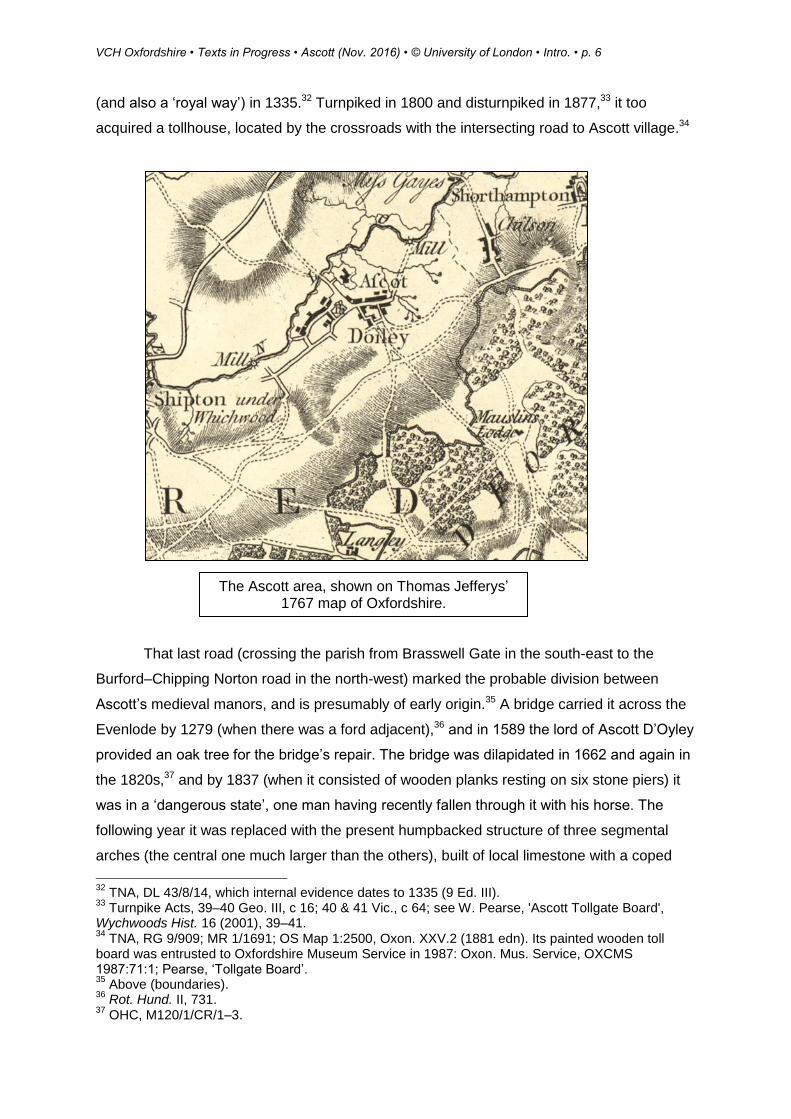
Ascott bridge on the River Evenlode, rebuilt in 1838. A crossing here is documented from 1279.
VCH Oxfordshire • Texts in Progress • Ascott (Nov. 2016) • © University of London • Intro. • p. 6
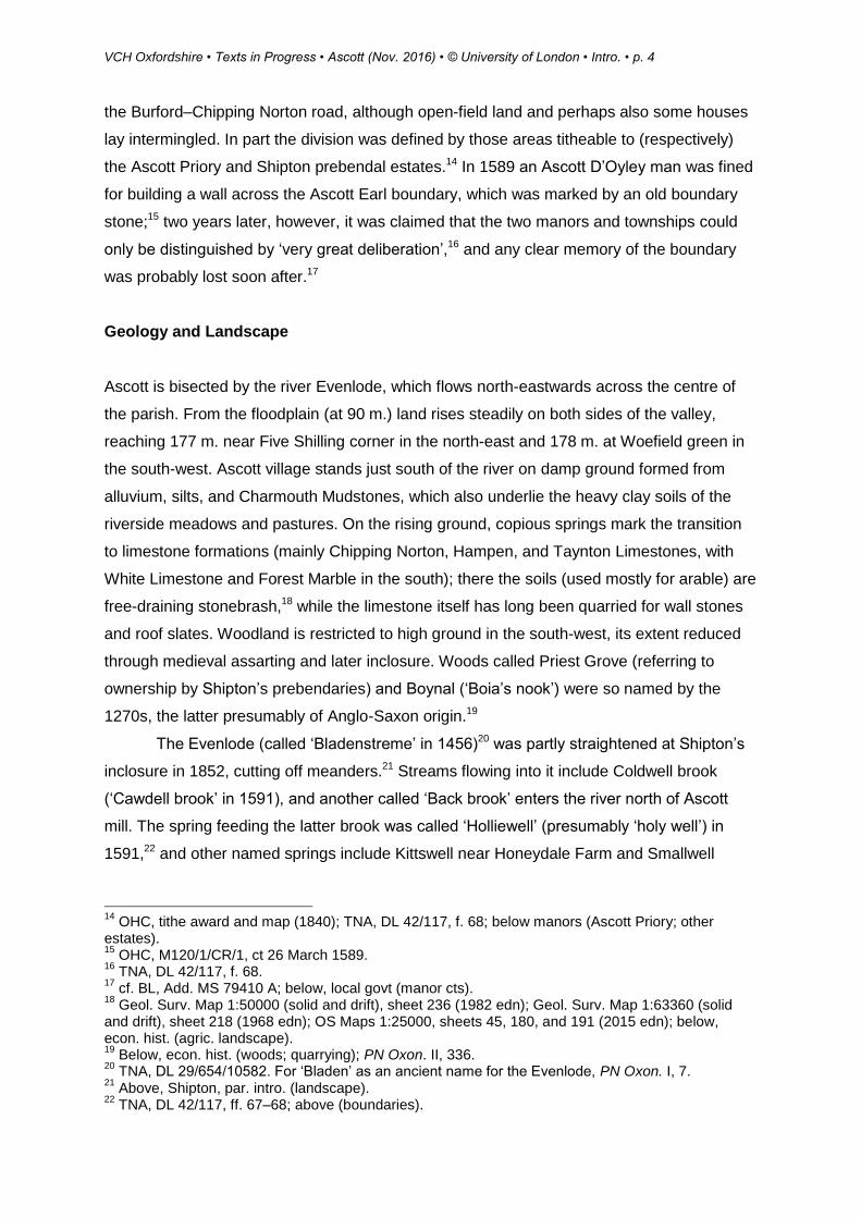
(and also a ‘royal way’) in 1335.32 Turnpiked in 1800 and disturnpiked in 1877,33 it too
acquired a tollhouse, located by the crossroads with the intersecting road to Ascott village.34
That last road (crossing the parish from Brasswell Gate in the south-east to the
Burford–Chipping Norton road in the north-west) marked the probable division between
Ascott’s medieval manors, and is presumably of early origin.35 A bridge carried it across the
Evenlode by 1279 (when there was a ford adjacent),36 and in 1589 the lord of Ascott D’Oyley
provided an oak tree for the bridge’s repair. The bridge was dilapidated in 1662 and again in
the 1820s,37 and by 1837 (when it consisted of wooden planks resting on six stone piers) it
was in a ‘dangerous state’, one man having recently fallen through it with his horse. The
following year it was replaced with the present humpbacked structure of three segmental
arches (the central one much larger than the others), built of local limestone with a coped
32
TNA, DL 43/8/14, which internal evidence dates to 1335 (9 Ed. III). 33
Turnpike Acts, 39–40 Geo. III, c 16; 40 & 41 Vic., c 64; see W. Pearse, 'Ascott Tollgate Board', Wychwoods Hist. 16 (2001), 39–41. 34
TNA, RG 9/909; MR 1/1691; OS Map 1:2500, Oxon. XXV.2 (1881 edn). Its painted wooden toll board was entrusted to Oxfordshire Museum Service in 1987: Oxon. Mus. Service, OXCMS 1987:71:1; Pearse, ‘Tollgate Board’. 35
Above (boundaries). 36
Rot. Hund. II, 731. 37
OHC, M120/1/CR/1–3.
The Ascott area, shown on Thomas Jefferys’ 1767 map of Oxfordshire.
VCH Oxfordshire • Texts in Progress • Ascott (Nov. 2016) • © University of London • Intro. • p. 7
parapet.38 Despite such difficulties the road was significant for long-distance traffic to
Gloucestershire and beyond,39 and in the 18th century it also continued south-eastwards
through Wychwood forest to Leafield and Witney.40 The stretch between the Burford–
Charlbury road and the village green was called London Lane by 1764.41 A level crossing
over the railway line by Ascott station was constructed in 1853,42 and the road was
straightened in 1858–9.43 Other surviving routes running south into the former forest via
Woefield Gate and north-east to Ascott mill are certainly of medieval or earlier origin, giving
access respectively to manorial woods at Boynal and to the village’s long-lived corn mill.44
Inclosure in 1838 suppressed several field paths and tracks but also created some
new ones, including Gypsy Lane, which connected Ascott Earl with the Burford–Chipping
Norton road via a ‘newly erected’ single-arched stone bridge across the Evenlode.45 Possibly
that lane in part reinstated a lost route north-west from Ascott Earl, which had earlier forded
the river near the bridge.46 The bridge carrying the Burford–Charlbury road across Coldwell
brook was repaired in 1857.47
Carriers and Post
Thomas Moss was a carrier in 1824,48 and in the 1850s–60s the grocer William Venvill and
his successor Richard Weaver carried to Chipping Norton and Witney on the towns’
respective market days (Wednesdays and Thursdays).49 William Hunt (operating from
London Lane) continued a carrier service in 1887.50 Daily motorized bus services to
Chipping Norton and Witney began in the 1920s,51 and by 1960 there were three buses on
weekdays and six on market days and Saturdays.52 Buses to Burford, Witney, Chipping
38
Ibid. QSB/30; QS1838/2/A12/4; Bldgs List, IoE 251712. Thos Groves of Milton provided freestone for this or the Gypsy Lane bridge in 1837: OHC, B117/F/1. 39
Below, econ. hist. (since 1800). 40
e.g. TNA, MR 1/353; now mostly a bridleway. 41
OHC, Christie I/1, p. 35; cf. ‘Top of London’: ibid. M120/1/CR/1, ct 19 July 1592. 42
OS Map 1:2500, Oxon. XX.14 (1881 edn); below (railway). 43
Bodl. MS Top. Oxon. c 103, ff. 16–17; cf. OHC, Ascott common inclo. map (1859); altered tithe map (1860). 44
cf. below, econ. hist. (woods; milling); OHC, M120/1/CR/1, ct 19 July 1592 (mentioning ‘mill way’). 45
OHC, Ascott inclo. award and map (1838); now mostly a bridleway. The name Gypsy Lane was established by 1910: ibid. DV/X/10. 46
TNA, DL 42/117, f. 67v.; Jefferys, Oxon. Map (1767); above (boundaries); below (settlement). 47
N. Frost, 'The Groves Family of Milton-under-Wychwood: Cotswold Stonemasons for 400 Years, Part 2', Wychwoods Hist. 8 (1993), 31. 48
OHC, par. reg. transcript, baptism 1824. 49
Lascelles' Dir. Oxon. (1853); PO Dir. Oxon. (1864 and 1869 edns). 50
Kelly's Dir. Oxon. (1887); TNA, RG 12/1178. 51
Ascott school scrapbook (1955): in private possession; Kelly's Dir. Oxon. (1928). 52
Oxf. Times, 2 Sept. 1960.

VCH Oxfordshire • Texts in Progress • Ascott (Nov. 2016) • © University of London • Intro. • p. 8
Norton, and Stow-on-the-Wold (Glos.) continued in 2016, though a Charlbury service had
been recently withdrawn.53
Post was delivered in the 1830s through Burford,54 and before 1853 the publican
John Morris established a sub-post office in the Churchill Arms,55 which he later moved to
his cottage in High Street.56 By 1903 it was also a money order office, savings bank, and
annuity and insurance office, while telegraphs could be sent from Shipton and Ascott
stations.57 During the 20th century the post office moved to various locations58 including,
from 1946 to 1961, a corrugated iron hut in the village pound.59 Following its closure before
198960 staff from Milton post office ran a weekly service first in the Swan inn and (from 2007)
in the village (or Tiddy) hall.61
Railway and Stations
The Oxford, Worcester, and Wolverhampton Railway (absorbed into the West Midland
Railway in 1860 and the Great Western Railway in 1863) opened in 1853 as a double line
linking Dudley (Worcs.) and Oxford.62 The line (crossing the parish from east to west)
included stations at both Shipton and Ascott, the former, some distance from Shipton village,
lying actually in Ascott parish. Both had a stationmaster’s house as well as two platforms
and a goods yard: at Ascott the main building (demolished in 1969)63 was of wood, while a
surviving signal box was added in 1883, partly to control remotely the gates of the adjacent
level crossing.64 Shipton’s original wooden building was replaced in 1888 by a much larger
one of brick and stone, with a hipped roof, tall chimneys, and a projecting canopy;65 an
associated signal box there was built in 1884 and remained in use until 1965, after which it
was demolished.66 The Shipton stationmaster’s house was dismantled c.1909 to make way
for Matthews’ flour mill, built in 1911 and served by a private siding, while the house itself
53
Ascott Grapevine, 91 (2016), 26, 28–9. 54
OHC, MS Oxf. Dioc. b 38, f. 11. 55
Lascelles' Dir. Oxon. (1853); PO Dir. Oxon. (1854). 56
cf. TNA, RG 11/1518; Kelly's Dir. Oxon. (1883); OS Map 1:2500, Oxon. XX.14 (1899 edn). 57
Kelly’s Dir. Oxon. (1903). 58
Ascott Grapevine, 28 (2000), 4–5; OS Maps 1:2500, Oxon. XX.14 (1922 edn); SP 30 18 (1975 edn). 59
Ascott W.I. scrapbook; Oxf. Times, 2 Sept. 1960. 60
J. Rawlins, 'Fifty Years of Change', Wychwoods Hist. 5 (1989), 73. 61
Ascott Grapevine, 8 (1995), 13; 56 (2007), 56 (2007), 54; 91 (2016), 57. 62
E.T. MacDermot and C.R. Clinker, Hist. Gt Western Railway (1964), II, 261, 276; J. Boynton, The Oxford, Worcester and Wolverhampton Railway (2002), 34. 63
Moss, Walk Humble, 136. 64
Chipping Norton Deanery Mag. May 1883: copy in OHC; J. Stretton and T. Maddocks, The Cotswold Line Past and Present (2011), 107–8. 65
S.C. Jenkins, Oxford, Worcester and Wolverhampton Railway Through Time (2013), 31–7; TNA, RG 9/909; Oxf. Jnl, 22 Sept. 1888. 66
V. Mitchell and K. Smith, Oxford to Moreton-in-Marsh (2003), 73.
VCH Oxfordshire • Texts in Progress • Ascott (Nov. 2016) • © University of London • Intro. • p. 9
was rebuilt on Milton Road in Shipton.67 In 1971 the line between Ascott and Wolvercote was
reduced to a single track, and though the stretch between Ascott and Charlbury was
reinstated in 2011 along with Ascott’s north platform, both Ascott and Shipton stations then
had only basic platform shelters and no ticket offices.68
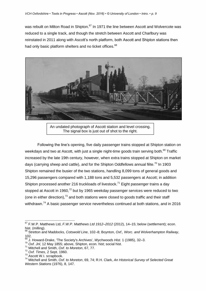
Following the line’s opening, five daily passenger trains stopped at Shipton station on
weekdays and two at Ascott, with just a single night-time goods train serving both.69 Traffic
increased by the late 19th century, however, when extra trains stopped at Shipton on market
days (carrying sheep and cattle), and for the Shipton Oddfellows annual fête.70 In 1903
Shipton remained the busier of the two stations, handling 8,099 tons of general goods and
15,296 passengers compared with 1,188 tons and 5,532 passengers at Ascott; in addition
Shipton processed another 216 truckloads of livestock.71 Eight passenger trains a day
stopped at Ascott in 1960,72 but by 1965 weekday passenger services were reduced to two
(one in either direction),73 and both stations were closed to goods traffic and their staff
withdrawn.74 A basic passenger service nevertheless continued at both stations, and in 2016
67
F.W.P. Matthews Ltd, F.W.P. Matthews Ltd 1912–2012 (2012), 14–15; below (settlement); econ. hist. (milling). 68
Stretton and Maddocks, Cotswold Line, 102–8; Boynton, Oxf., Worc. and Wolverhampton Railway, 102. 69
J. Howard-Drake, 'The Society's Archives', Wychwoods Hist. 1 (1985), 32–3. 70
Oxf. Jnl, 12 May 1855; above, Shipton, econ. hist; social hist. 71
Mitchell and Smith, Oxf. to Moreton, 67, 77. 72
Oxf. Times, 2 Sept. 1960. 73
Ascott W.I. scrapbook. 74
Mitchell and Smith, Oxf. to Moreton, 69, 74; R.H. Clark, An Historical Survey of Selected Great Western Stations (1976), 8, 147.
An undated photograph of Ascott station and level crossing. The signal box is just out of shot to the right.
VCH Oxfordshire • Texts in Progress • Ascott (Nov. 2016) • © University of London • Intro. • p. 10
on weekdays two trains a day stopped at Ascott (one each way), and five at Shipton (three
westbound and two eastbound).75
Population
In 1086 Ascott D’Oyley manor had 14 recorded tenants and Ascott Earl manor 13.76 Of the
54 Ascott D’Oyley tenants mentioned in 1279, some (especially freeholders) were probably
non-resident; even so the population had clearly risen substantially, especially as Ascott
Earl’s inhabitants may have been separately recorded under Shipton.77 Ascott D’Oyley
remained the more populous of the two hamlets in 1327, when 29 landholders paid tax there
compared with eight in Ascott Earl. 78 The Black Death presumably resulted in mortalities,
although in 1377 there were some 71 poll-tax payers aged 14 or over (more than in
neighbouring Shipton or Lyneham, but fewer than in Milton), perhaps representing a total
population approaching 200.79 Similar numbers may have been present in 1524, when
Ascott D’Oyley had 12 taxpayers and Ascott Earl seven,80 while 43 communicants
(‘houseling people’) were noted in 1548.81 Parish registers (kept from 1569) nevertheless
suggest a growing population, with baptisms consistently outnumbering burials.82
In 1642 the obligatory protestation oath was sworn by 81 men,83 and 35
householders were assessed for hearth tax in 1662.84 The estimated numbers of 191 adults
in 1676 and 70 houses in 1738 suggest a stable population in the century or so before the
first census in 1801,85 when Ascott had 410 inhabitants occupying 79 houses. Following a
steady increase to 462 (in 100 houses) in 1871, overseas emigration and the First World
War contributed to a steep decline to 317 (in 91 houses) by 1931. Recovery followed the
Second World War, the 19th-century peak being surpassed by 1981 when 482 people
occupied 172 houses. Housebuilding contributed to a sharp increase over the next three
decades, and by 2011 there were 560 people in 229 dwellings.86
75
Jenkins, Oxf., Worc. and Wolverhampton Railway, 31–7; www.oxfordshirecotswolds.org (accessed Sept. 2016). 76
VCH Oxon. I, 407, 414–15. 77
Rot. Hund. II, 730–1; below, manors (Ascott Earl); econ. hist. (Middle Ages). 78
TNA, E 179/161/9. 79
Poll Taxes 1377–81, ed. Fenwick, II, 290; cf. Shipton, Lyneham, Milton. 80
TNA, E 179/161/170. 81
Chantry Certs, 40. 82
OHC, par. reg. transcript. 83
Prot. Retns, 80. 84
TNA, E 179/255/4. 85
Compton Census, ed. Whiteman, 421; Secker's Visit. 10. 86
Census, 1801–2011; below (settlement): social hist. (19th cent.).

VCH Oxfordshire • Texts in Progress • Ascott (Nov. 2016) • © University of London • Intro. • p. 11
Settlement
Prehistoric to Anglo-Saxon
Ascott has been occupied intermittently since at least the 8th millennium BC, when a
Mesolithic hunting camp overlooked Coldwell brook, east of the present-day Coldwell bridge.
In the early 4th millennium BC the site was re-used for a small Neolithic farming settlement
established in open grassland cleared from woodland; by c.3750 BC that too had gone out
of use, although a long barrow constructed in its place received burials for a century or so,
eventually containing 21 inhumations. Their remains, along with most of the barrow itself,
were excavated between 1965 and 1969,87 and in 2016 the massive stones (orthostats)
used to line the barrow’s burial chambers survived reset in the village pound.88 A second
Neolithic long barrow, about which comparatively little is known, stands west of Smallstones
Farm.89
Later prehistoric (Bronze-Age and Iron-Age) activity is known mainly from scatters of
worked flints found during fieldwalking north of the village,90 although cropmarks of a
possible enclosure have been observed south of Five Shilling corner.91 Both Iron-Age and
87
HER, PRN D4102; D. Benson and A. Whittle, Building Memories: The Neolithic Cotswold Long Barrow at Ascott-under-Wychwood, Oxfordshire (2007). 88
Onsite interpretation panel (2016). 89
HER, PRN 10925; L. Brown, 'A Survey of the Condition of Oxfordshire Long Barrows', Oxoniensia 43 (1978), 243. 90
HER, PRN 26269, 26283; M. Ware, ‘The Society’s Fieldwalk Programme: The Final Report’, Wychwoods Hist. 22 (2007), 46–60. 91
NHL, No. 1459230.
Stones (orthostats) excavated from the
Coldwell brook Neolithic long barrow in the 1960s
and reset in Ascott’s village pound.

VCH Oxfordshire • Texts in Progress • Ascott (Nov. 2016) • © University of London • Intro. • p. 12
Romano-British pottery has been recovered east of Honeydale Farm,92 c.500 m. from where
a small Roman settlement is thought to have existed beside a spring. A higher-status Roman
settlement (perhaps a villa) is indicated by finds of tesserae, wall plaster, pottery, and roof
tiles north-west of Ascott bridge,93 and several Roman coins are reputed to have been found
in gardens off High Street,94 perhaps indicating further occupation close by.95
Small amounts of Anglo-Saxon pottery have been found in the present-day village,96
and field-names apparently derived from Old English tūnstede (i.e. ‘farmstead’) may recall a
lost isolated dwelling.97 By the later Anglo-Saxon period Ascott (meaning ‘eastern cottages’)
had developed as an eastern satellite of Shipton, contained within its large minster parish
and royal estate,98 and probably beginning as a single settlement. Before 1066, however, its
division between two independent manors created two distinct foci and two separate
manorial communities, both still ecclesiastically dependent on Shipton.99
Medieval Development
During the Middle Ages the two manors spawned adjacent hamlets, which over time
coalesced to form Ascott village. The eastern hamlet was called Ascott D’Oyley by 1268, its
affix derived from the d’Oilly family as lords of the manor.100 The western hamlet of Ascott
Earl was so named by 1316, presumably reflecting its then ownership by the de Clare earls
of Gloucester as lords of neighbouring Shipton.101
92
HER, PRN 26283; J. Wallace and M. Ware, ‘Fieldwalk at Honeydale Farm, Shipton’, Wychwoods Hist. 13 (1998), 49–50. 93
HER, PRN 5559; M. and F. Ware, 'Fieldwalking a Romano-British Site above Shipton', Wychwoods Hist. 8 (1993), 50–65. 94
Ascott school scrapbook. 95
The suggestive field-name ‘Black Piece’, mapped in 1771 just east of High Street, was perhaps the ‘Blakelond’ recorded in 1335: BL, Add. MS 79410 A; TNA, DL 43/8/14; cf. M. Aston and C. Gerrard, Interpreting the English Village (2013), 117. 96
HER, PRN 16751; Oxon. Mus. Service, OXCMS:2003.131. 97
‘Mecheltonnstede’, ‘Lyttletonnstede’ in 1335: TNA, DL 43/8/14; cf. K. Cameron, English Place-Names (1996), 149. Possibly they correspond with ‘Townstreets’, east of High Street, mapped in 1771: BL, Add. MS 79410 A. 98
Above, Shipton, par. intro. 99
Below, manors; relig. hist. 100
Oxon. Fines, p. 197; below, manors (Ascott D’Oyley). 101
Feudal Aids, IV, 165; below, manors (Ascott Earl); cf. PN Oxon. II, 336, mistakenly suggesting derivation from the Despenser earls of Winchester.

VCH Oxfordshire • Texts in Progress • Ascott (Nov. 2016) • © University of London • Intro. • p. 13
By 1130 Ascott D’Oyley had acquired a manorial complex including a chapel,
presumably on or near the site of a motte-and-bailey castle constructed soon afterwards,
and which incorporated a stone tower. A similar but larger (and perhaps slightly earlier)
castle was built at Ascott Earl, c.800 m. to the south-west. Both castles overlooked fords on
the Evenlode, and may have been constructed to secure the river crossings.102 A potential
third motte-and-bailey castle site, surviving as earthworks c.500 m. north-east of Ascott
D’Oyley castle,103 was perhaps a temporary and short-lived predecessor, and may have
been abandoned due to river flooding. Both castles were probably accompanied by small
settlements, that at Ascott D’Oyley (on the evidence of earthworks) apparently laid out with
regular crofts on both sides of a street running south-westwards from the castle. The whole,
including the castle, was contained within a single outer enclosure.104
Around 1180 Ascott D’Oyley castle was demolished, to be replaced soon afterwards
by a manor house of which parts survive at Manor Farm.105 The planned settlement
adjoining the castle may have been partly or completely cleared at the same time to make
way for gardens, orchards, and a dovecot;106 if so the displaced peasants were presumably
resettled on present-day High Street c.300 m. to the south, where property boundaries
display evidence of medieval planning. On the street’s south side (adjoining Priory Lane)107
stood a house belonging to St Frideswide’s priory, Oxford, perhaps originally intended for the
102
Below, manors (Ascott D’Oyley; Ascott Earl); above (communications). 103
HER, PRN 3399. Its mound was shown on a map of 1771: BL, Add. MS 79410 A. 104
J. Bond, ‘Earthen Castles, Outer Enclosures and the Earthworks at Ascott d’Oilly Castle, Oxfordshire’, Oxoniensia 66 (2001), 43–70. 105
Below, manors (Ascott D’Oyley). 106
All three were present in 1335: TNA, DL 43/8/14; cf. below, manors (Ascott D’Oyley). 107
So called by 1759: OHC, E 25/3D/1.
Manor Farm with the adjacent Ascott D’Oyley castle site (no. 145) and early village enclosure (‘Moat’), as shown on a 1921 map (OHC,
O138/11/D3). Note the proximity of Ascott bridge (left).
VCH Oxfordshire • Texts in Progress • Ascott (Nov. 2016) • © University of London • Intro. • p. 14
chaplain serving the manorial chapel,108 while a short distance to the west stood the glebe
house assigned to the curate of Ascott.109 Medieval ‘Wychwood ’ pottery (perhaps made in
the village) has been found in several gardens along High Street.110
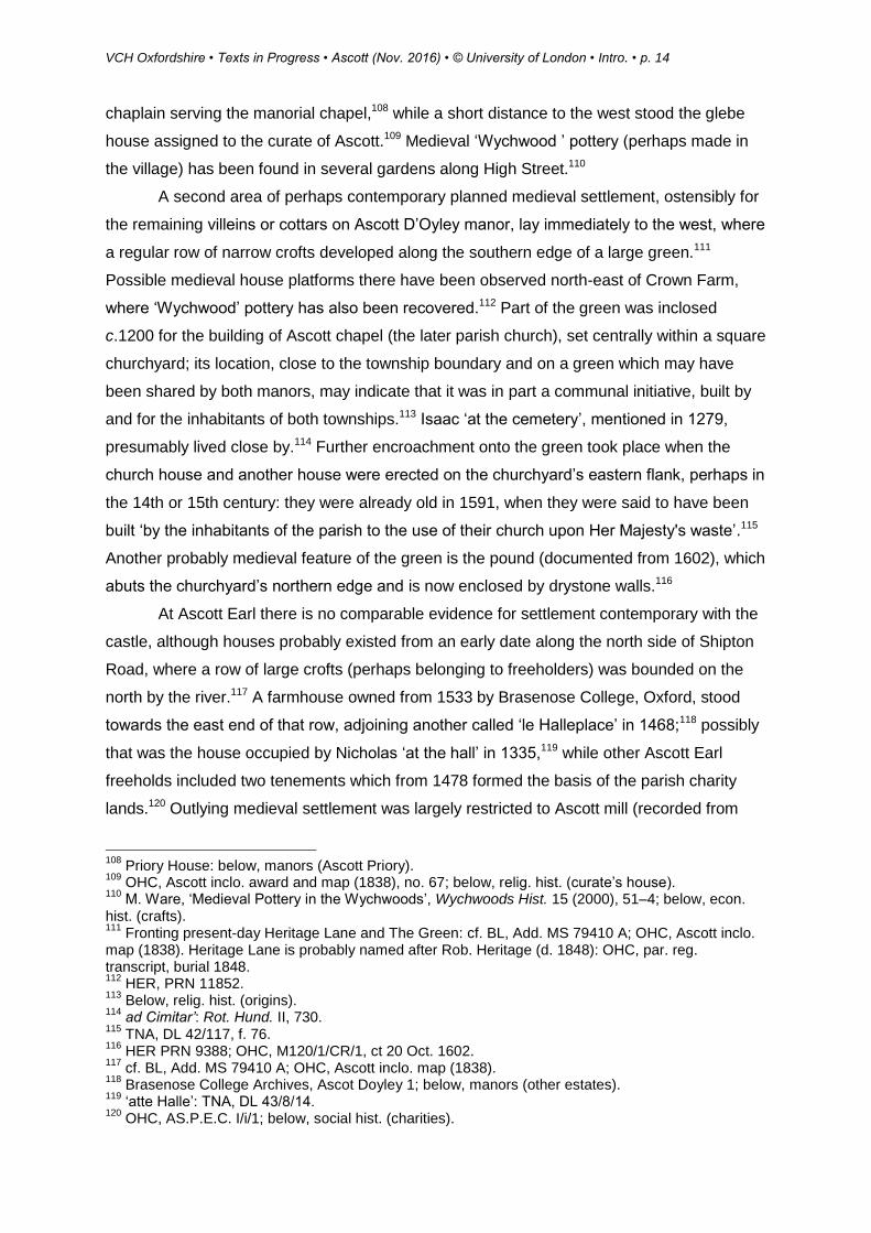
A second area of perhaps contemporary planned medieval settlement, ostensibly for
the remaining villeins or cottars on Ascott D’Oyley manor, lay immediately to the west, where
a regular row of narrow crofts developed along the southern edge of a large green.111
Possible medieval house platforms there have been observed north-east of Crown Farm,
where ‘Wychwood’ pottery has also been recovered.112 Part of the green was inclosed
c.1200 for the building of Ascott chapel (the later parish church), set centrally within a square
churchyard; its location, close to the township boundary and on a green which may have
been shared by both manors, may indicate that it was in part a communal initiative, built by
and for the inhabitants of both townships.113 Isaac ‘at the cemetery’, mentioned in 1279,
presumably lived close by.114 Further encroachment onto the green took place when the
church house and another house were erected on the churchyard’s eastern flank, perhaps in
the 14th or 15th century: they were already old in 1591, when they were said to have been
built ‘by the inhabitants of the parish to the use of their church upon Her Majesty's waste’.115
Another probably medieval feature of the green is the pound (documented from 1602), which
abuts the churchyard’s northern edge and is now enclosed by drystone walls.116
At Ascott Earl there is no comparable evidence for settlement contemporary with the
castle, although houses probably existed from an early date along the north side of Shipton
Road, where a row of large crofts (perhaps belonging to freeholders) was bounded on the
north by the river.117 A farmhouse owned from 1533 by Brasenose College, Oxford, stood
towards the east end of that row, adjoining another called ‘le Halleplace’ in 1468;118 possibly
that was the house occupied by Nicholas ‘at the hall’ in 1335,119 while other Ascott Earl
freeholds included two tenements which from 1478 formed the basis of the parish charity
lands.120 Outlying medieval settlement was largely restricted to Ascott mill (recorded from
108
Priory House: below, manors (Ascott Priory). 109
OHC, Ascott inclo. award and map (1838), no. 67; below, relig. hist. (curate’s house). 110
M. Ware, ‘Medieval Pottery in the Wychwoods’, Wychwoods Hist. 15 (2000), 51–4; below, econ. hist. (crafts). 111
Fronting present-day Heritage Lane and The Green: cf. BL, Add. MS 79410 A; OHC, Ascott inclo. map (1838). Heritage Lane is probably named after Rob. Heritage (d. 1848): OHC, par. reg. transcript, burial 1848. 112
HER, PRN 11852. 113
Below, relig. hist. (origins). 114
ad Cimitar’: Rot. Hund. II, 730. 115
TNA, DL 42/117, f. 76. 116
HER PRN 9388; OHC, M120/1/CR/1, ct 20 Oct. 1602. 117
cf. BL, Add. MS 79410 A; OHC, Ascott inclo. map (1838). 118
Brasenose College Archives, Ascot Doyley 1; below, manors (other estates). 119
‘atte Halle’: TNA, DL 43/8/14. 120
OHC, AS.P.E.C. I/i/1; below, social hist. (charities).

VCH Oxfordshire • Texts in Progress • Ascott (Nov. 2016) • © University of London • Intro. • p. 15
1086),121 though in the 14th century Richard ‘of Boynal’ (the woodward) and William ‘at the
ash’ (a collier or charcoal maker) perhaps both lived near Ascott’s southern woods, adjoining
Wychwood forest.122
Development from the 17th Century
Despite substantial rebuilding in the 17th and 18th centuries123 (including some on
previously unoccupied sites),124 the village’s shape remained little altered until the 20th
century. Nonetheless some housing may have spread southwards along London Lane, the
site, perhaps, of a house called Little London in 1621,125 and of a surviving cottage reputedly
dating from 1663.126 By 1713 much of Church View, facing the west side of the churchyard,
was taken up by poor-quality charity housing known as The Row,127 while further
encroachment on the green occurred in the mid 18th century, when a smithy was erected on
121
VCH Oxon. I, 415; below, econ. hist. (milling). 122
‘de Boynhale’, ‘atte Nashe’: below, econ. hist. (woods; crafts). 123
Below (built character). 124
e.g. TNA, DL 42/117, f. 76; C 104/254, deed 20 Aug. 1664. 125
Oxf. Ch. Ct Deposns 1616–22, p. 71. 126
Old Post Office: Ascott school scrapbook; Ascott W.I. scrapbook. 127
OHC, AS.P.E.C. I/iv/1; TNA, HO 107/878; below, social hist. (charities).
Ascott village on the 1859 inclosure map (in OHC), comprising Ascott Earl (left) and Ascott D’Oyley (right). Note the square churchyard (centre) and
regular property boundaries south of the church and along High Street (right).
VCH Oxfordshire • Texts in Progress • Ascott (Nov. 2016) • © University of London • Intro. • p. 16
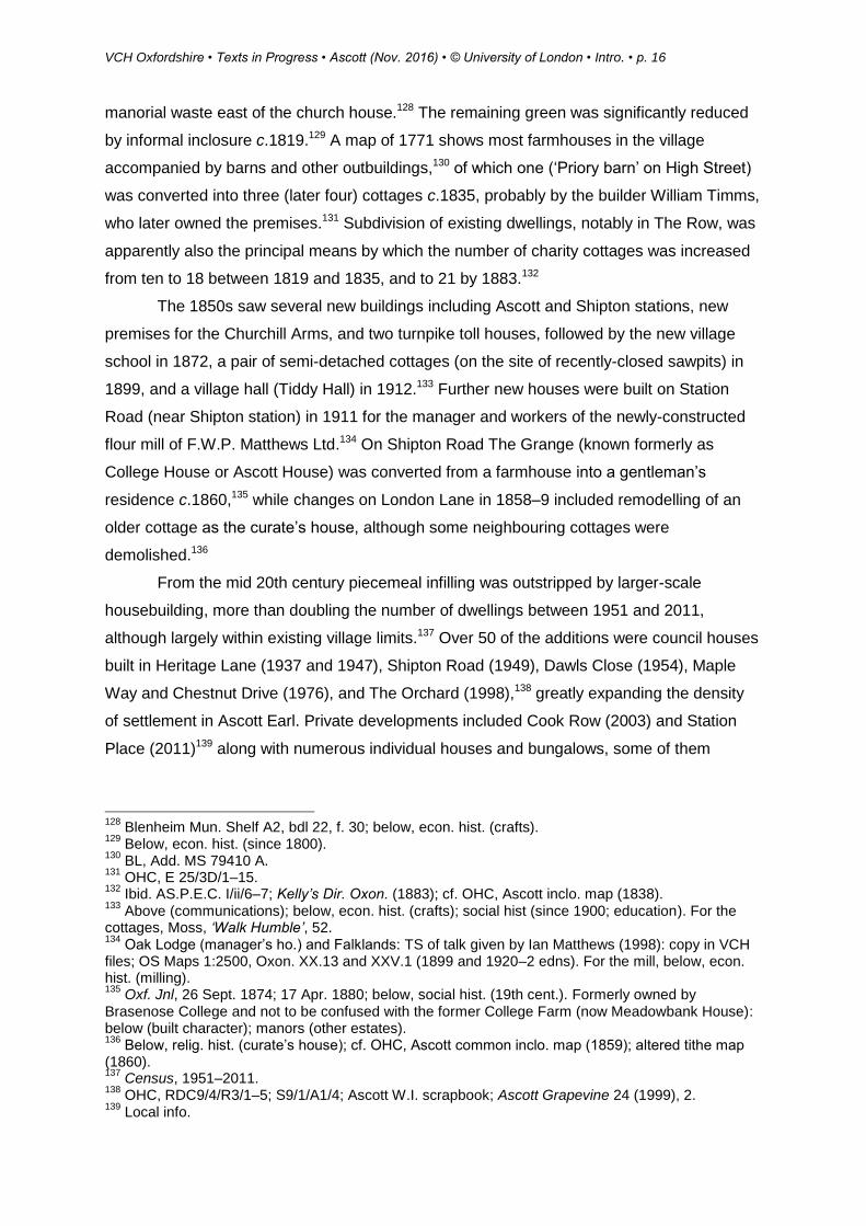
manorial waste east of the church house.128 The remaining green was significantly reduced
by informal inclosure c.1819.129 A map of 1771 shows most farmhouses in the village
accompanied by barns and other outbuildings,130 of which one (‘Priory barn’ on High Street)
was converted into three (later four) cottages c.1835, probably by the builder William Timms,
who later owned the premises.131 Subdivision of existing dwellings, notably in The Row, was
apparently also the principal means by which the number of charity cottages was increased
from ten to 18 between 1819 and 1835, and to 21 by 1883.132
The 1850s saw several new buildings including Ascott and Shipton stations, new
premises for the Churchill Arms, and two turnpike toll houses, followed by the new village
school in 1872, a pair of semi-detached cottages (on the site of recently-closed sawpits) in
1899, and a village hall (Tiddy Hall) in 1912.133 Further new houses were built on Station
Road (near Shipton station) in 1911 for the manager and workers of the newly-constructed
flour mill of F.W.P. Matthews Ltd.134 On Shipton Road The Grange (known formerly as
College House or Ascott House) was converted from a farmhouse into a gentleman’s
residence c.1860,135 while changes on London Lane in 1858–9 included remodelling of an
older cottage as the curate’s house, although some neighbouring cottages were
demolished.136
From the mid 20th century piecemeal infilling was outstripped by larger-scale
housebuilding, more than doubling the number of dwellings between 1951 and 2011,
although largely within existing village limits.137 Over 50 of the additions were council houses
built in Heritage Lane (1937 and 1947), Shipton Road (1949), Dawls Close (1954), Maple
Way and Chestnut Drive (1976), and The Orchard (1998),138 greatly expanding the density
of settlement in Ascott Earl. Private developments included Cook Row (2003) and Station
Place (2011)139 along with numerous individual houses and bungalows, some of them
128
Blenheim Mun. Shelf A2, bdl 22, f. 30; below, econ. hist. (crafts). 129
Below, econ. hist. (since 1800). 130
BL, Add. MS 79410 A. 131
OHC, E 25/3D/1–15. 132
Ibid. AS.P.E.C. I/ii/6–7; Kelly’s Dir. Oxon. (1883); cf. OHC, Ascott inclo. map (1838). 133
Above (communications); below, econ. hist. (crafts); social hist (since 1900; education). For the cottages, Moss, ‘Walk Humble’, 52. 134
Oak Lodge (manager’s ho.) and Falklands: TS of talk given by Ian Matthews (1998): copy in VCH files; OS Maps 1:2500, Oxon. XX.13 and XXV.1 (1899 and 1920–2 edns). For the mill, below, econ. hist. (milling). 135
Oxf. Jnl, 26 Sept. 1874; 17 Apr. 1880; below, social hist. (19th cent.). Formerly owned by Brasenose College and not to be confused with the former College Farm (now Meadowbank House): below (built character); manors (other estates). 136
Below, relig. hist. (curate’s house); cf. OHC, Ascott common inclo. map (1859); altered tithe map (1860). 137
Census, 1951–2011. 138
OHC, RDC9/4/R3/1–5; S9/1/A1/4; Ascott W.I. scrapbook; Ascott Grapevine 24 (1999), 2. 139
Local info.

VCH Oxfordshire • Texts in Progress • Ascott (Nov. 2016) • © University of London • Intro. • p. 17
erected by the Ascott builder Eric Moss. Several barns were also converted into dwellings.140
Settlement remained largely confined to the village, save for Ascott mill to the east141 and
some new outlying farmhouses to the north,142 of which College Farm originated as hill
buildings on College farm (previously worked from Meadowbank House),143 and Honeydale
farmhouse was completed in 1954 on land formerly part of Coldstone farm.144 In the same
year nine houses near Shipton station (six of them built since 1922) were transferred to
Shipton parish.145
The Built Character
Most of Ascott’s older buildings are constructed from local limestone rubble with ashlar
dressings, and several retain traditional Cotswold slate roofs. Thatch (absent from the village
in 2016) was formerly common,146 and blue slates were sometimes used in the 19th century.
Bricks were rare before 1850, but were routinely used (together with wood) in buildings
associated with Ascott and Shipton stations, some of them perhaps made at a short-lived
brickworks near Ascott bridge.147 From the mid 20th century most new houses had
reconstituted stone façades and imitation stone slate roofs.
Apart from the church, Ascott’s only known medieval building is Manor Farm, parts of
which date from the 13th century. The building was remodelled as a farmhouse in the 16th
140
Ascott school scrapbook; Ascott W.I. scrapbook. 141
Below, econ. hist. (milling). 142
cf. OS Maps 1:10560, SP 21 NE (1955 edn); 1:10000, SP 21 NE (1981 edn). 143
Sale Partics, College and Coldstone farms (1931). 144
Ascott Grapevine 81 (2014), 9; below, econ. hist. (since 1800). 145
Above (boundaries); cf. OS Maps 1:10560, Oxon. XXV.NW (1922 and 1955 edns). 146
Sale Partics, College and Coldstone farms (1931); Cornbury estate properties in Ascott (1952): copies in private possession; Ascott school scrapbook. 147
Below, econ. hist. (crafts).
The Old Vicarage (left), remodelled as the curate’s house in 1858–9 and extended in 2013–14; and the village shop (right), part of the Cook Row development of 2003.
VCH Oxfordshire • Texts in Progress • Ascott (Nov. 2016) • © University of London • Intro. • p. 18
and 17th centuries and is described below, along with the 12th-century castle which
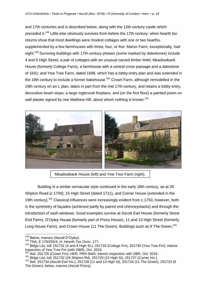
preceded it.148 Little else obviously survives from before the 17th century, when hearth tax
returns show that most dwellings were modest cottages with one or two hearths,
supplemented by a few farmhouses with three, four, or five: Manor Farm, exceptionally, had
eight.149 Surviving buildings with 17th-century phases (some marked by datestones) include
4 and 6 High Street, a pair of cottages with an unusual carved timber lintel; Meadowbank
House (formerly College Farm), a farmhouse with a central cross passage and a datestone
of 1641; and Yew Tree Farm, dated 1698, which has a lobby-entry plan and was extended in
the 19th century to include a former bakehouse.150 Crown Farm, although remodelled in the
19th century on an L plan, dates in part from the mid 17th century, and retains a lobby entry,
decorative beam stops, a large inglenook fireplace, and (on the first floor) a painted poem on
wall plaster signed by one Matthew Hill, about whom nothing is known.151
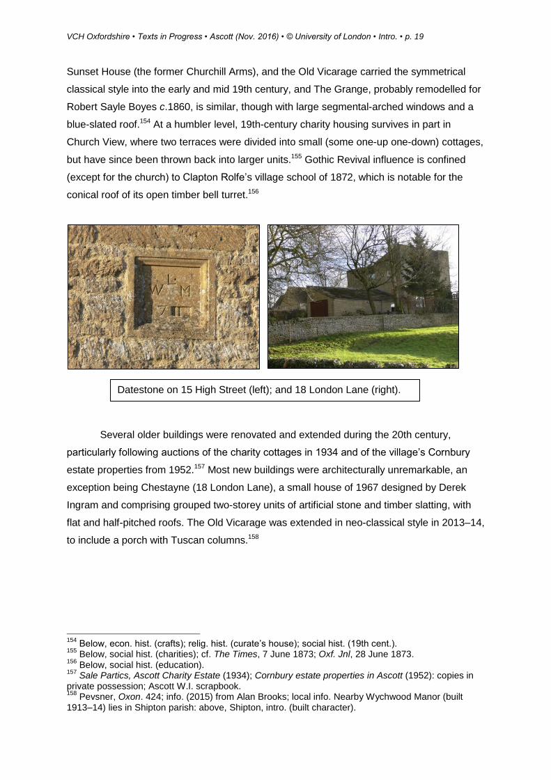
Building in a similar vernacular style continued in the early 18th century, as at 26
Shipton Road (c.1700), 15 High Street (dated 1711), and Corner House (extended in the
19th century).152 Classical influences were increasingly evident from c.1750, however, both
in the symmetry of façades (achieved partly by paired end chimneystacks) and through the
introduction of sash windows. Good examples survive at Ascott Earl House (formerly Stone
End Farm), D’Oyley House (formerly part of Priory House), 11 and 13 High Street (formerly
Long House Farm), and Crown House (11 The Green). Buildings such as 9 The Green,153
148
Below, manors (Ascott D’Oyley). 149
TNA, E 179/255/4; cf. Hearth Tax Oxon. 177. 150
Bldgs List, IoE 251731 (4 and 6 High St.), 251733 (College Fm), 251730 (Yew Tree Fm); interior inspection of Yew Tree Fm (with OBR), Oct. 2016. 151
Ibid. 251725 (Crown Fm); HER, PRN 9445; interior inspection with OBR, Oct. 2016. 152
Bldgs List, IoE 251732 (26 Shipton Rd), 251729 (15 High St), 251727 (Corner Ho.). 153
Ibid. 251734 (Ascott Earl Ho.), 251728 (11 and 13 High St), 251724 (11 The Green), 251723 (9 The Green); below, manors (Ascott Priory).
Meadowbank House (left) and Yew Tree Farm (right).
VCH Oxfordshire • Texts in Progress • Ascott (Nov. 2016) • © University of London • Intro. • p. 19
Sunset House (the former Churchill Arms), and the Old Vicarage carried the symmetrical
classical style into the early and mid 19th century, and The Grange, probably remodelled for
Robert Sayle Boyes c.1860, is similar, though with large segmental-arched windows and a
blue-slated roof.154 At a humbler level, 19th-century charity housing survives in part in
Church View, where two terraces were divided into small (some one-up one-down) cottages,
but have since been thrown back into larger units.155 Gothic Revival influence is confined
(except for the church) to Clapton Rolfe’s village school of 1872, which is notable for the
conical roof of its open timber bell turret.156
Several older buildings were renovated and extended during the 20th century,
particularly following auctions of the charity cottages in 1934 and of the village’s Cornbury
estate properties from 1952.157 Most new buildings were architecturally unremarkable, an
exception being Chestayne (18 London Lane), a small house of 1967 designed by Derek
Ingram and comprising grouped two-storey units of artificial stone and timber slatting, with
flat and half-pitched roofs. The Old Vicarage was extended in neo-classical style in 2013–14,
to include a porch with Tuscan columns.158
154
Below, econ. hist. (crafts); relig. hist. (curate’s house); social hist. (19th cent.). 155
Below, social hist. (charities); cf. The Times, 7 June 1873; Oxf. Jnl, 28 June 1873. 156
Below, social hist. (education). 157
Sale Partics, Ascott Charity Estate (1934); Cornbury estate properties in Ascott (1952): copies in private possession; Ascott W.I. scrapbook. 158
Pevsner, Oxon. 424; info. (2015) from Alan Brooks; local info. Nearby Wychwood Manor (built 1913–14) lies in Shipton parish: above, Shipton, intro. (built character).
Datestone on 15 High Street (left); and 18 London Lane (right).