issues paper - consultation draft
TRANSCRIPT

1
Local Plan 2017 – 2037
Issues Paper - Consultation Draft
February 2017

2
Contents
1. Introduction and Background ......................................................................................... 3
2. Our Vision and Strategic Priorities ................................................................................. 8
Our Vision ................................................................................................................................. 8
3. Broad Policy Themes and Key Issues ......................................................................... 10
Spatial Strategy ................................................................................................................... 12
Community Facilities and Infrastructure .............................................................................. 14
Housing and Employment ................................................................................................... 18
Transport and Access ......................................................................................................... 22
Farming and Estates ........................................................................................................... 25
Natural Environment ........................................................................................................... 29
Historic Environment ........................................................................................................... 35
Leisure and Tourism ........................................................................................................... 39
Minerals and Waste ............................................................................................................ 43

3
1. Introduction and Background
Introduction
The purpose of this paper is to begin the process of deciding how development should be managed in the National Park over the next 20 years. A key influence in where development goes, what it looks like and how it is used is local planning policy. This is contained in a document called the Local Plan which is the basis for all planning decisions in the National Park.
What will be included in the Local Plan?
The Local Plan should set out the opportunities for development and clear policies on what will or will not be permitted. It should:
be aspirational but realistic and deliverable;
be rooted in robust evidence that justifies its policies;
consider cross-boundary implications;
be responsive to change;
be consistent with national policy.
It will need to:
contain a collective vision that reflects the aspirations of local communities. This will require meaningful engagement and collaboration with residents, Parish Councils, local organisations, businesses, public, private and voluntary sectors.
define the overarching ‘strategic priorities’ for the area – a list of development needs (including housing, business, infrastructure and local facilities) balanced with the conservation and enhancement of the natural and historic environment and climate change mitigation & adaptation;
indicate broad locations for development on a key diagram and more specific site allocations, land-use designations and areas protected from development on a proposals map;
contain policies that provide a clear indication of how decision makers should react
to development proposals. These will be divided into strategic and specific policies.

4
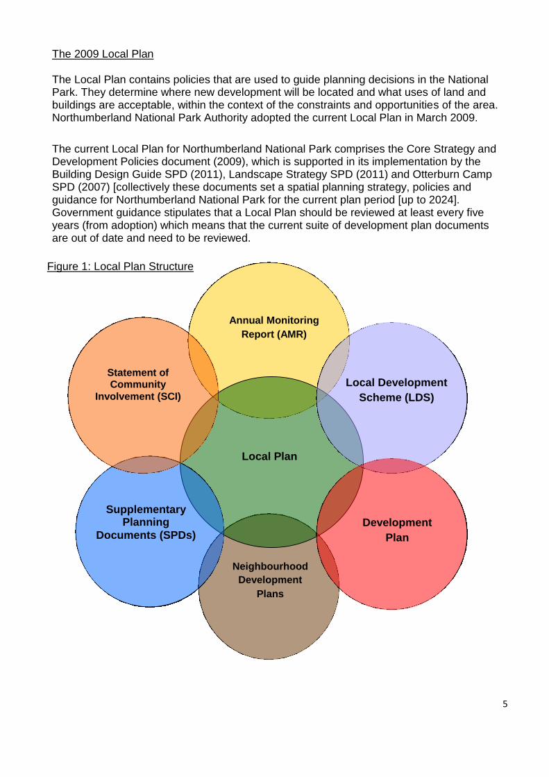
The purpose of this Issues paper is to begin the process of deciding how development should be managed in the National Park over the next 20 years. It identifies the ‘key issues’, i.e. what should the vision for the future of the National Park be, what should be the strategic priorities for the Local Plan, and what the overall spatial strategy should be. The strategic priorities are in essence a wish list that sets out what the Local Plan should achieve by defining the issues that we think are most important and need to be tackled by the Plan. The strategic priorities/issues are the ‘what’ and the policies/options are the ‘how’. The Northumberland National Park Management Plan 2016 – 2021 sets the broad strategic aims and objectives for the future management of the National Park. This Issues paper highlights which of the strategic aims and objectives are most relevant to relevant Local Plan policy theme which will help to deliver the spatial aspects of the Management Plan where possible through the land-use planning system. Figure 1: Where the Local Plan sites in relation to other National Park Authority plans
5
The 2009 Local Plan
The Local Plan contains policies that are used to guide planning decisions in the National Park. They determine where new development will be located and what uses of land and buildings are acceptable, within the context of the constraints and opportunities of the area. Northumberland National Park Authority adopted the current Local Plan in March 2009.
The current Local Plan for Northumberland National Park comprises the Core Strategy and Development Policies document (2009), which is supported in its implementation by the Building Design Guide SPD (2011), Landscape Strategy SPD (2011) and Otterburn Camp SPD (2007) [collectively these documents set a spatial planning strategy, policies and guidance for Northumberland National Park for the current plan period [up to 2024]. Government guidance stipulates that a Local Plan should be reviewed at least every five years (from adoption) which means that the current suite of development plan documents are out of date and need to be reviewed.
Figure 1: Local Plan Structure
Annual Monitoring
Report (AMR)
Local Plan
Local Development
Scheme (LDS)
Development
Plan
Neighbourhood
Development
Plans
Supplementary Planning
Documents (SPDs)
Statement of Community
Involvement (SCI)

6
About this consultation
There are two main strands:
1. the ‘key issues’ – what should the vision for the future of the National Park be, what are the strategic priorities for the Local Plan, and what should be our spatial approach to planning for future development.
2. the more detailed aspects, organised by individual broad policy themes.
How to respond
We want as many people as possible to give us their views. We will be raising awareness of the review of Local Plan policy in a number of ways:
1) Drop in events – We will be holding five drop-in events during February and April
2017 to give residents the opportunity to talk informally to planning officers about the policy issues.
Bardon Mill
Bellingham
Rothbury
Wooler
Haltwhistle
2) Community Workshops – We will also be holding a number of facilitated workshops with local communities in order to get residents’ views on what they think are the most important planning issues in their localities.
Elsdon
Falstone
Harbottle
Kirknewton
Stonehaugh
3) Parish Council Workshops – We will also be holding two facilitated engagement sessions with representatives from Parish Councils covering the National Park. The aim will be to help the Authority to better understand specific local issues and potential opportunities.
Further details can be found on our website at: www.nnpa.org.uk/localplanconsultation Any comments on the draft documents should be made in writing, by emailing [email protected] or by post to the address below: Forward Planning, Northumberland National Park Authority, Eastburn, South Park, Hexham, Northumberland, NE46 1BS.
Comments should reach the Authority by no later than 4:30 p.m. on Friday the 28th of April 2017. Please note that any comments you make may be made publicly available.

7
The draft documents will available to view at the following locations from the 27th February 2017 during normal office/opening hours. NNPA offices/information points:
Eastburn, South Park, Hexham, Northumberland, NE46 1BS
Coquetdale Centre, Church Street, Rothbury, Northumberland, NE65 7UP
Libraries:
Bellingham Library, Bellingham Town Hall, Manchester Square, Bellingham, NE48 2AS
Haltwhistle Library, Westgate, Haltwhistle, NE49 0AX
Haydon Bridge Library, Church Street, Haydon Bridge, NE47 6JQ
Hexham Library, Queens Hall, Beaumont Street, Hexham, NE46 3LS
Kielder Library, Kielder Community First School, Kielder, NE48 1HQ
Rothbury Library, Front Street, Rothbury, NE65 7TZ
Wooler Library, Cheviot Centre, Padgepool Place, Wooler, NE71 6BL
Library opening times can be found on the mylibrary website at: http://www.mylibrary.co.uk
The documents can also be found on the Authority’s website at: http://www.nnpa.org.uk/localplanconsultation

8
2. Our Vision and Strategic Priorities
Our Vision
‘Northumberland National Park will be a truly welcoming and distinctive place, easily accessible to all. Its inspiring and changing landscapes, characterised by open spaces, tranquillity, diverse habitats, geology and rich cultural heritage, will be widely recognised and valued. The living, working landscape will contribute positively to the well-being of the thriving and vibrant communities in and around the Park.’
The role of the Local Plan is to transpose this vision into a framework of policies that will meet local development needs over the next 20 years. We would like you to tell us what you think about the vision – does it reflect your aspirations for the future of the National Park, is it ambitious enough, do you think it is achievable? Our Strategic priorities
The strategic priorities are essentially a wish list that sets out what the Local Plan should achieve. It should define those issues that are most important and need to be tackled by the Plan. In short, the strategic priorities are the ‘what’ and the policies are the ‘how’. The Management Plan review public consultation carried out in Autumn 2015 has already given us a general indication of what matters most to people who live in or visit the National Park. This is also borne out by data contained within our State of the National Park report (2015). The Management Plan 2016 – 2021 ‘Distinctive Places, Open Spaces’ sets out our approach for the future management of the National Park taking into account the public consultation responses. The Management Plan outlines five strategic aims to achieve our vision, these are:
Aim 1 – A Welcoming Park: To put people and their connections with the landscape at the heart of the National Park. Aim 2 – A Distinctive Place: To manage, conserve and enhance the distinctive natural and cultural qualities of the National Park. Aim 3 – A Living Working Landscape for Now and the Future: To adapt to change by applying new approaches, together with traditional techniques. Aim 4 – Thriving Communities: To ensure the thriving and vibrant communities have a strong sense of place and an economy grounded in the natural and cultural qualities of the National Park. Aim 5 – A Valued Asset: To ensure the National Park is valued as a local, regional and national asset, with influence beyond its boundaries that is worth looking after now and for generations to come.

9
We have therefore derived a set of strategic priorities for the Local Plan taking into account
the Management Plan’s strategic aims and objectives. These are as follows:
Strategic Priority 1: To support sustainable development and land management that conserves and enhances the National Park’s distinctive natural and cultural qualities and protects its assets. Strategic Priority 2: To support sustainable use of ecosystem products and services thereby enhancing natural capital across the landscape of the National Park, contributing positively to health and wellbeing.
Strategic Priority 3: To support and encourage sustainable economic growth to allow our local communities to thrive. Strategic Priority 4: To support the provision of a range of housing that encourages more working age people and families to live in the National Park or one of its gateway settlements. Strategic Priority 5: To support the retention and enhancement of community facilities, infrastructure and rural services in order to sustain our thriving communities.
The next step is to focus on these priorities further and get your views on what are the issues
that the planning system can help to tackle in order to achieve these strategic priorities?
i. Do you think that there is pressure for a particular type of development in your local area?
ii. Do you think that this issue has been adequately addressed by our existing planning policies?
iii. Are there specific planning issues affecting your locality that you think need to be addressed? (e.g. community facilities, infrastructure, housing, employment, renewable energy)
iv. Are there any sites in your locality that you would consider suitable for use as housing or employment land?
v. Do you think that any of the issues you have identified for your local area would apply to the wider National Park area?
Our Spatial approach
The Local Plan will contain a key diagram that provides a geographical representation of how the National Park functions. It will show where the key settlements are, what their function is, how they interact with each other, where the principal transport corridors are, where the functional sub-areas of the National Park might be and what the relationship of communities and settlements inside and outside the Park is.
We need your help in drawing up this map, which will help us to decide how policies will be tailored to reflect the needs and aspirations of communities. We would like your views on how the National Park and its communities function so that we can plan to reflect this, for example:
Which are the main service centres/gateway settlements and where are their
catchments?
How do these different settlements and communities relate to one another?
What are the transport linkages? Where do people live and work?
10
3. Broad Policy Themes and Key Issues This section is concerned with the more detailed aspects of planning policy. We’ve split it up into a number of themes, although there are of course relationships and overlaps between each. The themes are as follows: Spatial Strategy Community Facilities and Infrastructure Housing and Employment Transport and Access Farming and Estates Natural Environment Historic Environment Leisure and Tourism Minerals and Waste
To help summarise the issues, they are organised into a table, which contains the following key information:
Headlines We appreciate that not everyone will have the time to read through each topic in detail, so this section gives a brief overview of what it is about and some of the key issues the Local Plan might need to address.
What National Policy Says
Local policies that are prepared for Northumberland National Park need to be consistent with the NPPF, otherwise they cannot be adopted. The NPPF is quite generic, so there is often flexibility to adapt its approach to local circumstances. It may be necessary for the Local Plan to provide an interpretation of them in a local context. The NPPF was published in March 2012 and is supportive of new sustainable development in principle and requires Local Plans to be supportive also. It expects local plans to positively seek opportunities to meet objectively assessed development needs with flexibility to respond to changing circumstances. The only circumstances where development needs might not be catered for are where this results in adverse impacts that significantly and demonstrably outweigh the benefits, or where there are specific national policies that restrict development. In particular it states that great weight should be given to conserving landscape and scenic beauty in National Parks.
Other key factors - policies, regulations & partners.
In addition to the NPPF, there are other factors and controls that affect how and where development can take place in a National Park. This includes other regulatory systems, statutory designations as well as influential reports and the strategies of partners that have an interest in the Park. It is important that these are understood before embarking on a review of policy, as they may limit the scope of the Plan.
11
Key facts, figures & trends.
It is important that we have evidence that tells us what the needs and main issues are and whether the proposed policies will be effective in tackling them. At present, we have general information on the National Park’s key characteristics, which is useful for providing context. As the Local Plan progresses, it will be necessary to undertake further evidence gathering to inform some of the more detailed aspects of policy.
What the current (2009) Plan says
The 2009 Local Plan is now 8 years old. Although many policies are still applicable, changing circumstances will require a change in approach. It is important therefore that we understand what will and what will not be allowed under the current policies so that they can identify where change is needed.
Relevant Management Plan aim(s) and objective(s)
The Northumberland National Park Management Plan 2016 – 2021 sets the broad strategic aims and objectives for the management of the National Park for a five year period. This section highlights which of the strategic aims and objectives are most relevant to the Local Plan policy theme which will help to deliver the spatial aspects of the Management Plan where possible through the land-use planning system.
Issues identified
Before we decide what the policies are going to say, we need to have a full understanding of what issues are going to be tackled. We need to back these issues up with evidence so that the Plan is properly informed. When the Local Plan reaches its final stages, an independent planning inspector will examine it formally. He or she will need to be convinced that its policies are based in fact and are justified by the available evidence. Once we have explored the issues, we can begin to develop options for tackling them, which we will consult on at a later date. There are often a range of approaches that could be taken to different issues. Each of these has advantages and disadvantages that need to be appreciated before deciding which is preferred. The Inspector will need to be convinced that we have considered all realistic options and their respective impacts, before arriving at a preferred option.
Each of the broad policy themes are dealt with in turn on the following pages.

12
Spatial Strategy: Including the overall strategy for where new development is allowed.
Headlines
The ‘spatial strategy’ describes where different types of development are acceptable in different areas of the National Park.
What National Policy Says
Local Plans should be tailored to the needs of each area in terms of their strategy and the policies required. They should focus on the key issues that need to be addressed and be aspirational but realistic in what they propose. The test of soundness ensuring that a Local Plan is justified refers to the Plan being the most appropriate strategy when considered against the reasonable alternatives, based on proportionate evidence. Local Planning Authorities also have a duty to co-operate on planning issues that cross administrative boundaries, particularly those which relate to the strategic priorities. Joint working should enable local planning authorities to work together to meet development requirements which cannot wholly be met within their own areas – for instance because of a lack of physical capacity or because to do so would cause significant harm to the principles and policies of the National Planning Policy framework (NPPF).
Other key factors - policies, regulations & partners.
Northumberland County Local Plan Core Strategy 2015-2030 Draft Policy 2 - Spatial Distribution - identifies several gateway towns as ‘key-hubs’ for growth in terms of housing, employment, education, healthcare and retail including: Haltwhistle, Hexham, Bellingham, Corbridge, Rothbury, Wooler and Haydon Bridge. Draft Policy 6 – Hierarchy of Settlements - identifies a number of gateway settlements as larger village centres in their retail centre hierarchy including; Rothbury, Wooler, Corbridge, Bellingham and Haydon Bridge.
Key statistics and trends
Northumberland National Park has a population of fewer than 2,000 (2011 Census) and is the least populated of all English National Parks. It follows then that Northumberland is also the most sparsely populated of the National Parks, with an average population density of just 0.02 persons per hectare. The largest single settlement is Elsdon, located in the east of the National Park, with a population of around 240 across the Parish (2011 Census). Other key settlements include Alwinton, Falstone, Greenhaugh, Harbottle, Holystone, Lanehead and Stannersburn, referred to in the current Core Strategy as the ‘Local Centres’. The larger ‘gateway’ settlements, including Bellingham, Haltwhistle, Rothbury and Wooler are more populous, however these towns are predominantly outside the National Park boundary and so only a fraction of their populations are resident within the Park.

13
What the current (2009) Plan says
Core Strategy policies 1, 2 and 3 support the principles of sustainable development and the mitigation of, and adaptation to climate change.
Policy 4 limits major development to that where it is proven to be in the public interest and would not adversely affect the National Park’s special qualities.
Policy 5 focuses new development, such as housing and new business premises, in the 8 largest local centres, then the smaller villages which are more sustainable locations.
This is supplemented by Policy 6 supporting the sequential development of sites prioritizing previously developed land and sites located adjacent to existing built up settlements.
Policy 7 allows the conversion of existing buildings outside of the identified settlements for employment use and only allows conversion to residential for affordable housing where a proven need exists.
Relevant Management Plan aim(s) and objective(s)
Aim 2: A Distinctive Place
Objective 2.1.3 - To ensure that all new development within or on the fringe of the National Park will conserve or enhance the natural and cultural qualities of the National Park.
Objective 2.1.4 - To ensure that visitor and recreational use is sympathetic to the character and capacity of the locations in which it takes place.
Aim 4: Thriving Communities
Objective 4.3.1 – There are more young adults and people of working age living in the National Park.
Objective 4.3.2 – There are more opportunities for employment and training in the National Park and its gateway settlements.
Objective 4.3.3 – Reduce the impact from commuting out of the National Park or its gateway communities and encourage more home working.
Issues identified Issue 1: Settlements Do we continue to focus new development in the local centres and
villages as set out by a settlement hierarchy? Is this approach too restrictive?
Should a farm-steading be defined as a settlement?
Is a sequential approach to the prioritisation of development sites still appropriate? Or is a more flexible approach required?
Would it be better to have a more flexible approach to the conversion of existing buildings outside of existing settlements?
Issue 2: Major development Do we need to revise our definition of major development? Are the
criteria too restrictive? Or are they appropriate? Issue 3: Ageing Population The population of the National Park is decreasing. Should we plan for
an increased growth the National Park population? (i.e. more family housing) If so, should this be on sites located within the National Park? or just on sites located outside the National Park? Or both?
14
Community Facilities and Infrastructure: Including health, social and education
facilities, roads and utilities.
Headlines
Community facilities in the National Park include schools, health practices, shops, recreational and meeting places. They are fundamental to the social wellbeing of residents and their quality of life. The role of the Local Plan is to safeguard their existence and support their development, for the benefit of the people who live or work in the Park. Infrastructure includes water supply, water treatment and disposal, telecommunications, electricity and gas supply and power generation. The provision of infrastructure is essential to support new homes, jobs, business, social networks and community facilities.
What National Policy Says
Local Plans should:
promote the retention and development of local services and community facilities in villages, including shops, meeting places, sports venues, cultural buildings, public houses and places of worship;
support the development of high speed broadband technology and other communications networks which plays a vital role in enhancing the provision of local community facilities and services.
promote opportunities for meetings between members of the community who might not otherwise come into contact with each other, including through mixed-use developments, strong neighbourhood centres and active street frontages which bring together those who work, live and play in the vicinity.
promote safe and accessible environments where crime and disorder, and the fear of crime, do not undermine quality of life or community cohesion.
promote safe and accessible developments, containing clear and legible pedestrian routes, and high quality public space, which encourage the active and continual use of public areas.
plan positively for the provision and use of shared space, community facilities (such as local shops, meeting places, sports venues, cultural buildings, public houses and places of worship) and other local services to enhance the sustainability of communities and residential environments.
guard against the unnecessary loss of valued facilities and services, particularly where this would reduce the community’s ability to meet its day-to-day needs.
ensure that established shops, facilities and services are able to develop and modernise in a way that is sustainable, and retained for the benefit of the community.
ensure an integrated approach to considering the location of housing, economic uses and community facilities.
identify for special protection green areas of particular importance to the community where development other than in very special circumstances, will be ruled out.
plan positively for the development and infrastructure required in the area.
15
Local planning authorities should also work with other authorities and providers to: assess the quality and capacity of infrastructure and its ability to meet
forecast demands; and take account of the need for strategic infrastructure including
nationally significant infrastructure. Where practical, a charge should be levied on new development to help pay for infrastructure needed to support it. The Community Infrastructure Levy should support new development and allow a meaningful proportion of the funds raised to be spent in the neighbourhoods where development takes place.
Planning policies should recognise and seek to address potential barriers to investment, including any lack of infrastructure. In drawing up Local Plans, local planning authorities should identify priority areas for infrastructure provision.
High quality communications are essential for sustainable economic growth. The development of high speed broadband and other communications networks play a vital role in enhancing the provision of local community facilities and services.
Other key factors - policies, regulations & partners.
Northumberland County Infrastructure Delivery Plan (IDP), June 2016 - sets out the County’s strategic infrastructure requirements, which will support the delivery of the Core Strategy up until 2031; and identifies (where known) how, when and by whom infrastructure will be delivered, changed or improved.
Parish Plans and Neighbourhood Plans – plans produced by the community to prioritise and agree action to tackle local planning issues. The National Park Authority has a duty to foster the social and economic wellbeing of communities in delivering its conservation and recreation purposes. The County Council is however the local housing, education, transport and social services authority, whilst health services are regulated by clinical commissioning groups.
Key statistics and trends
More than half (51%) of the resident population is aged between 45 and 74 years, relatively high compared to the English National Park average (45%) and certainly high compared to the national average (34%) (2011 Census).
While the number of retired people is higher than the national average, it is lower than the National Park average. Worryingly, the number of young people is in decline (2011 Census).
Local communities have excellent access to natural resources and green
infrastructure such as the footpath network, extensive open access
areas, and opportunities for outdoor recreation, wildlife habitats, rivers,
dark night skies, and tranquillity.

16
100% of properties are not connected to mains gas being reliant on expensive heating fuels. 10% of properties are not connected to mains electricity.
Key services are often located within the gateway settlements just outside the Park or some distance beyond. Many residents travel great distances to reach a hospital or the nearest higher education college. Whilst some shopping can to some extent be delivered into the Park the nearest large supermarkets and comparison shops are all located outside the National Park.
Existing services such as schools, post offices, shops, pubs and churches are closing in some areas.
The combination of distance to services and very low population density is challenging for social cohesion.
The state of public transport within the National Park.
The lack of broadband coverage has been identified as one of the main
issues for local businesses, and residents with only 37% of premises
within the National Park being connected.
The lack of mobile phone coverage is also an issue within the National
Park. Specific progress will be required to ensure adequate broadband
and mobile phone coverage is provided within the National Park to meet
the needs of our local communities and businesses.
What the current (2009) Plan says
Core Strategy Policy 8 encourages and supports the provision and maintenance of community facilities to serve the needs of the Park’s population. Policy 28 supports the development of utilities and infrastructure projects which serve the local community and business needs subject to a number of criteria including impact on the landscape and the Park’s special qualities.
Relevant Management Plan aim(s) and objective(s)
Aim 1: A Welcoming Park
Objective 1.2.1 Achieve a high standard and broad range of facilities, information and services within the National Park.
Objective 1.2.3: To improve information and infrastructure with more sites in the National Park accessible to all.
Objective 1.3.1: Use the resources of the National Park to provide increased access to learning and educational opportunities for young people.
Aim3: A Living, Working Landscape for Now and the Future
Objective 3.2.2: To encourage the production of renewable energy from sources compatible with the National Park’s distinctive qualities.

17
Aim 4: Thriving Communities
Objective 4.2.1: To ensure a balanced range of housing that meets local needs.
Objective 4.2.2: To ensure the retention of rural services.
Objective 4.2.3: To enable an integrated transport network which offers an attractive alternative to the car.
Objective 4.3.1: To have more young adults and people of working age living in the National Park.
Objective 4.3.3: To reduce the impact from commuting out of the National Park or its gateway communities and encourage more home working.
Aim 5: A Valued Asset
Objective 5.1.2: The natural, cultural, social and economic infrastructure of the National Park is sustained through its use as a local and regional asset.
Issues identified Issue 4: Lack of adequate mobile phone coverage and broadband provision within the National Park.
How could future planning policies support broadband and mobile telecommunications service providers to achieve high quality broadband and mobile phone coverage to adequately serve all businesses and citizens in the National Park?
Issue 5: Renewable energy provision
What sort of renewable energy solutions and energy conservation measures would be appropriate in the National Park?
What should the policy on large scale Renewable energy be?
Should planning policies support micro-renewable energy generation in suitable locations to connect off-grid properties?
Issue 6: The maintenance of existing and the provision of new infrastructure and community facilities
How could future planning policy support health service providers and ensure that there is adequate services to meet the needs of our local communities?
Should we charge a levy on all new development to help fund new infrastructure required to support larger development schemes in the Park or outside?
Should we be more explicit in asking for planning obligations for the provision of infrastructure?
How could we prevent the loss of existing infrastructure or plan for the consequences of its loss?
How could planning policies help to support the retention and enhancement of existing infrastructure?
What new infrastructure would be required to support new development e.g. new housing?
18
Housing and Employment: Including new housing, conversions, affordable housing,
homes for agricultural workers, and self-build and also shops, business premises and employment sites.
Headlines
Housing is an important issue, not just for the National Park but also nationally. The Local Plan must strike a balance between supporting thriving settlements and communities, and conserving the National Park’s special qualities. Employment is crucial to the economic wellbeing of the National Park. The Local Plan will play a key role in ensuring there is enough land available for new employment development while supporting existing businesses.
What National Policy Says
Housing The Local Plan should:
address the need for all types of housing, including affordable housing and the needs of different groups in the community (such as families with children, older people, people with disabilities and people wishing to build their own homes)
National guidance for the delivery of housing in rural areas is that local planning authorities should respond to local circumstances and plan for housing development to reflect local needs, particularly for affordable housing, including through exception sites where appropriate.
It also acknowledges that housing supply and affordability are issues in rural areas, recognising the role of housing in supporting the broader sustainability of rural settlements to ensure the viable use of local services and facilities to maintain thriving communities.
Employment The Local Plan should:
support and encourage sustainable economic growth and set out a clear vision and strategy to achieve this;
plan proactively for the development needs of business and be responsive to changes in economic circumstances;
seek to address barriers to investment including a lack of infrastructure or services;
set criteria or identify strategic sites to meet business needs;
support existing and emerging business sectors and facilitate flexible working practices such as the integration of residential and commercial uses in the same unit;
identify priority areas for regeneration, infrastructure provision and environmental enhancement;
avoid protecting employment sites if there is no reasonable prospect of them being used for that purpose;
support sustainable rural economic growth for all business types through conversion & new build while protecting local services such as local shops and public houses;
Have a clear understanding of business needs and economic markets.

19
Other key factors - policies, regulations & partners.
Northumberland Local Plan Core Strategy
Draft Policy 10 – Rural Economy - acknowledges the role of the rural economy and the need to ensure balance between the need to support rural economic development and the protection of the character, diversity and tranquillity of Northumberland's landscape and biodiversity.
Draft Policy 14 – Housing Provision - sets out the scale of future housing provision. This gives a total of approximately 2,320 dwellings that would be provided in gateway towns during the plan period.
Northumberland Housing Strategy 2013-18 outlines a plan for meeting housing needs by delivering new affordable housing, maintaining and improving existing housing stock, and providing housing support to those who need it. The County Council is the local housing authority. Local Enterprise Partnerships (LEPs) were set up in 2011 to replace Regional Development Agencies. The LEPs are made up of local authorities and businesses and determine local economic priorities as well as implementing programmes to drive growth and job creation. One LEP (North East) covers the National Park area.
North East Strategic Economic Plan (March 2014) – Produced by the North East LEP to set a vision and strategy to provide 100,000 new jobs in the region by 2024.
Key statistics and trends
The National Park is a deeply rural area with very low population density (0.02 persons per hectare compared to the average for England of 401 persons per hectare), with a very dispersed settlement pattern (census 2011).
Northumberland National Park has a population of fewer than 2,000 (2011 Census) and is the least populated of all English National Parks.
More than half (51%) of the resident population is aged between 45 and 74 years, relatively high compared to the English National Park average (45%) and certainly high compared to the national average (34%).
Northumberland National Park has a small ‘working age’ population. Paradoxically, the local rate of economic activity (76%) is higher than the English National Park and national averages (70%) and rates of economic inactivity are correspondingly lower than average.
While the number of retired people is higher than the national average, it is lower than the National Park average. Worryingly, the number of young people is in decline.
Households in the Park are smaller than the English average and the proportion of children within them is also below the national average (2011 Census).
Housing is expensive in relation to average household incomes. The National Park is in the top quarter most deprived areas in England in
terms of access to housing (high price) and services (relative isolation).
The proportion of houses with no usual resident (vacant, second or holiday homes) is approximately 20%. This is higher than the average for National Parks’ (19%) and England (4%) (Census 2011).

20
There were approximately 140 businesses operating from 155 establishments in Northumberland National Park in 2012 according to the latest Interdepartmental Business Register (IDBR) data.
This has fallen by around 9% since 2009. The data shows that all local businesses and establishments have fewer than 50 employees and the majority has fewer than ten employees. These local businesses provided employment for 420 people in 2012.
Local employment fell by approximately 14% between 2009 and 2012, which has resulted in the average size of local businesses falling to three people in 2012 (State of the Park Report 2015).
What the current (2009) Plan says
Core Strategy Policy 9 directs new housing development to the most sustainable settlements. Policy 14 supports proposals that would enable the provision and expansion of sustainable rural businesses within the National Park.
Relevant Management Plan aim(s) and objective(s)
Aim 3: A Living, Working Landscape for Now and the Future
Objective 3.3.1 – To strengthen and diversify the markets for businesses that relate to achieving National Park purposes.
Objective 3.3.2 - To grow the tourism market in and around the National Park.
Objective 3.3.3 - To retain, attract and develop new and traditional skills to meet the demand of enterprises and business growth in key sectors.
Aim 4: Thriving Communities
Objective 4.2.1: To ensure a balanced range of housing that meets local needs.
Objective 4.2.2: To ensure the retention of rural services.
Objective 4.2.3: To enable an integrated transport network which offers an attractive alternative to the car.
Objective 4.3.1: To have more young adults and people of working age living in the National Park.
Objective 4.3.2 - There are more opportunities for employment and training in the National Park and its gateway settlements.
Objective 4.3.3: To reduce the impact from commuting out of the National Park or its gateway communities and encourage more home working.
Aim 5: A Valued Asset
Objective 5.1.1 - To optimise opportunities for the National Park to contribute to the social and economic regeneration of Northumberland and wider North East Region.
Objective 5.1.2: The natural, cultural, social and economic infrastructure of the National Park is sustained through its use as a local and regional asset.

21
Issues identified
Issue 7: Meeting our future housing needs.
How could we more effectively plan for a range of house types to accommodate need arising from new employment and the requirements of single persons, couples, the elderly, those with special needs and families?
Should we review the current local occupancy criteria in partnership with Parish Councils and the County Council (as housing authority) to promote better social and economic sustainability for the Park’s communities? Should these remain broadly the same? Or should they be more restrictive? or less restrictive?
How should we address the future need for affordable housing, especially for younger people and families?
Are there any areas that should be priorities for regeneration and how
might this be achieved?
How should planning policies support the provision of self and custom
built housing?
Issue 8: Meeting our future employment needs
How could we more effectively plan for a range of businesses to meet the needs of local communities?
The current policy is supportive of a variety of employment uses in different locations. However, prevailing economic conditions, together with poor accessibility and infrastructure have made running a viable business increasingly difficult. How might these barriers be overcome?
Do we need an even more flexible employment policy approach?
Should this be opportunity-based, facilitating development as and when the need arises?
The current policy allows employment development in a wide range of locations depending on the type of employment proposed – would a more focused approach would be better? or would maintaining flexibility on location be the best approach?
Are there any key employers or employment sectors that deserve special recognition in our policies?
How could we better transfer the historic, cultural and natural assets of the Park into jobs and business opportunities?
What further support should we give to domestic and small scale business/community renewable energy?
Should our approach be more focused in supporting farms and land-based businesses to diversify? Is the current approach too vague?

22
Transport and Access Headlines
The National Park is remote with a limited transport choice and infrastructure, and transport is crucial for the everyday lives of residents and in enabling visitors to access and enjoy the area. The Local Plan needs to consider how development can contribute to improved transport and accessibility for the benefit of communities and visitors alike within the constraints of what is environmentally acceptable, safe and feasible.
What National Policy Says
Local Plans should:
encourage the smarter use of technologies that reduce the need to travel, giving people choice about travel;
acknowledge that different policies and measures will be required in different communities and that sustainable transport solutions will vary in urban and rural areas;
encourage solutions which support a reduction in greenhouse gas emissions and reduce congestion, and which promote and advocate a low carbon economy;
promote partnership working with neighbouring authorities and transport providers to develop strategies for the provision of viable infrastructure to support sustainable transport;
ensure opportunities for sustainable transport modes have been taken up to reduce the need for major infrastructure;
create safe and secure layouts for new developments and provide safe and suitable access to sites for all people, including consideration of the needs of people with disabilities;
locate developments that generate significant movement where the need to travel is minimised and the use of sustainable transport modes can be maximised, and requiring such proposals to be supported by a Transport Statement or Assessment;
locate and design development to ensure the efficient delivery of goods & supplies;
give priority to pedestrian and cycle movements;
incorporate facilities for charging plug in and other ultra-low emission vehicles;
encourage balanced land uses to minimise journey lengths and promote a mix of uses for larger scale residential developments, including key facilities such as primary schools and local shops within walking distance of most properties;
improve the quality of parking in town centres to that it is convenient, safe and secure and set appropriate parking charges that will not undermine the vitality of town centres;
identify and protect sites and routes which are critical to developing infrastructure to widen transport choice;
protect and enhance public rights of way and access and provide better facilities for users for example by adding links to existing rights of way networks including National Trails;

23
Other key factors - policies, regulations & partners.
Draft Cycling and Walking Investment Strategy (DfT March 2016) – aims to make walking and cycling should be a normal part of everyday life, and the natural choice for shorter journeys such as the commute to school, college, work or leisure trips.
Manual for Streets, DfT, March 2007 – offers advice on the design, construction, adoption of residential streets;
Parking Standards, Northumberland County Council – the current Local Plan uses NCC standards to dictate appropriate parking provision for new developments;
Local speed limits, Dept of Transport – consultation currently taking place on reducing the speed on rural roads, with possible implications in terms of changes to surfacing and additional signage;
The Countryside & Rights of Way Act 2000 – gives rights for the public to walk freely on open access land, building on the rights of way rules in the National Parks & Access to the Countryside Act, 1949;
Natural Environment & Rural Communities Act (NERC) 2006. This sets out the vehicular rights, routes and traffic regulation, including in respect of ‘green lanes’;
Local Transport Plan 2011- 2026, prepared by Northumberland County Council and form the basis for investment and work programming decisions in respect of the network of public highways;
Rights of Way Improvement Plans prepared by the County Council sets out areas of priority for maintenance of rights of way.
Key statistics and trends
There are some 1,100 km of rights of way including 707km of public footpath, 422km of public bridleway, 38 km of byway open to all traffic and 50km of restricted byway.
In addition, there is a small network of unsurfaced, unclassified roads which provide complementary links.
75% (750 square kilometers) of the National Park is designated as ‘open
access’ land.
The most popular activity in the National Park is walking, with around 45% of all visitors stating that walking (long and short walks) was the primary motivation for their trip1.
72% of the National Park is ‘open access’ land and there are over 1,140 kilometres of public rights of way. There are a further 90 Km of permissive routes.
About two thirds of the rights of way network is footpaths only accessible to walkers, whilst one third is bridleways accessible to horse riders and bicycles. There are small lengths of byways open to all traffic.
The Pennine Way and Hadrian’s Wall Path National Trails run through the National Park. There are two long distance routes, the St Cuthbert’s Way and St Oswald’s Way. A new long distance mountain bike trail between Berwick and Hexham, the Sandstone Way was opened in 2014.
1 State of the Park Report 2015

24
There are about 100 Km of ‘Rangers Favourite Walks’ promoted on the National Park website.
The ‘ease of use’ of rights of way declined to 55% in 2014/15. Northumberland benchmarks poorly compared to other National Parks where the average ‘ease of use’ is 82%.
Most visitors use a car to get to the National Park (88%) but then walk to get around (66%).
One strategic road the A68 cuts through the National Park.
There limited public transport service available.
What the current (2009) Plan says
Policy 12 aims to maximise accessibility and minimise the environmental impact of traffic. This includes ensuring that the transport and accessibility needs of the whole community and visitors are taken fully into account when planning new development.
Relevant Management Plan aim(s) and objective(s)
Aim 1: A Welcoming Park Objective 1.2.3 – To improve information and infrastructure with more sites in the National Park accessible to all. Aim 4: Thriving Communities Objective 4.2.3 – To enable an integrated transport network which offers and attractive alternative to the private car.
Issues identified
Issue 9: Transport
How could policies contribute to reducing the need to travel and encouraging alternative forms of transport, for example in terms of where development and key services are distributed throughout the Park? Is this realistic given the public transport service limitations and dependency on the private car?
Should we include a policy which supports, or even requires, public and private electric car and bike charging points to encourage low carbon travel?
Our policies need to protect and promote opportunities for the use of sustainable transport modes. Are there any strategic routes or key sites that might need to be identified in the Local Plan to enable this?
What enhancements to the transport network would be required to support new development in the National Park? Are there any types of development that, individually or cumulatively, could generate significant transport movements that we might need to plan for?
Do we need to designate and protect key transport routes, for example where a former railway route might be reinstated, or where there is the potential for a by-pass or similar road network improvement scheme?
How could the Local Plan strike a balance between encouraging public transport and meeting continued demand for car parking facilities? What should be the approach to proposals for new or improved car parks?
How could future planning policies further encourage the use of the bike as an alternative to the car for visitors or residents? Are there practical ways that this could happen in the National Park?
25
Issue 10: Access
Should we widen the scope of our existing policies to ensure that larger developments enhance the rights of way network?
Should new or improved access tracks for forestry, farming and shooting be used to provide opportunities for public access so that they provide wider benefits?
How could planning policies ensure that new routes do not impinge on sensitive habitats?
How could planning policies support the public’s enjoyment of historic routeways within the National Park?
Farming and Estates: (sustainable land management)
Headlines
Farms and estates form one of the dominant land uses in the National Park, provide crucial employment and economic activity, and contribute very strongly to the management of the landscape. The Local Plan will need to support sustainable land management so that it can continue to provide a viable livelihood and conserve what is special about the National Park.
What National Policy Says
Local Plans should:
support the sustainable growth and expansion of all types of rural business through the conversion of existing and well designed new buildings;
promote the development and diversification of agricultural and other land-based rural businesses;
support sustainable rural tourism and leisure developments; that respect the character of the countryside;
avoid isolated homes in the countryside unless there is an essential need for a rural worker to live at or near their place of work, or where the re-use of a building would lead to an enhancement to the immediate setting;
contribute to and enhance the natural and local environment by protecting valued landscapes, minimising impacts on biodiversity and providing net gains where possible.
Other key factors - policies, regulations & partners.
Common Agricultural Policy Reform – From 2014 onwards a new system of subsidised support for upland farms will be implemented (coordinated largely by Natural England). This will inform key investment and business decisions by farms and estates and may have knock on consequences for the planning system in terms of diversification projects, new buildings and structures and the conservation of traditional buildings.
Future uncertainty resulting from Brexit: It is unclear how the government will reform farm subsidies post-Brexit. There could be significant implications for upland hill farmers within the National Park.
Catchment Sensitive Farming – following on from the Water Framework Directive there are efforts to secure improvements to farming practices so that effluent and chemical run off is reduced. This will have implications for farm buildings and other structures.
Uplands Policy Review, Defra (2011) – sets out a range of measures to support hill farming, deliver public goods from the uplands and maintain sustainable upland communities.

26
Poverty amongst farming households: Achieving sustainable livelihoods, Commission for Rural Communities (2010) – identifies issues of poverty amongst farming households that are either caused or intensified by their specific social or economic circumstances to help government policies, institutions and processes recognise and effectively address poverty amongst farming households.
High ground, high potential – a future for England’s upland communities (CRC 2010) – this report noted that the greatest threat to the ‘public goods’ of upland areas, including the historic environment, lies in a lack of recognition that, although in some senses they belong to a different era of land management, they remain embedded in modern day social and economic systems.
Towards a one nation economy: A 10 point plan for boosting productivity in rural areas. - Defra/HM Treasury, (2015) - England’s rural areas are a distinct part of our national character. But they also make a substantial and vitally important contribution to the economy, accounting for around £210 billion, or 16%, of England’s total output. Economic activity in rural areas is diverse, with significant manufacturing and services sectors. It is also becoming increasingly dynamic. Knowledge-based and creative industries are growing rapidly. Flexible, home-working is more prevalent in rural than in urban areas, and tends to involve higher skilled, higher wage roles. We are seeing net internal migration from urban to rural areas, including of highly skilled people attracted by the excellent quality of life on offer.
Key statistics and trends
Farming (and forestry) is the dominant economic sector employing over twice as many residents as any other industry in the National Park. 68% of businesses within the National Park are in the agricultural and forestry sector and account for 55% of employment. This dominance is emphasised when comparing those employed in farming in Northumberland National Park (22%) to the average for other English National Parks’ (6%) and the national average for England (1%).
All of the agricultural land within the National Park (approx. 77,250 hectares) is managed under some form of agri-environment scheme. Over £4.6 million in agri-environment payments were attracted in 2014/15 to maintain traditional upland farming practices in the National Park.
More than three quarters of the Park area is farmed. It is characterised by farmsteads surrounded by enclosed, fertile fields, giving way to open rough grazing or moorland. Farming is mainly sheep and cattle production. Farmers are very vulnerable to market shifts, including commodity prices and the value of their produce.
There are 256 farms within, or partly within, the Park boundary. These farms tend to be larger than the national average for hill farms, but the size does vary considerably with the terrain. In the Cheviots the average farm size is approximately 1,205 hectares, while the average size of the Hadrian’s Wall farms is approx. 293 hectares.
50% of the National Park’s agricultural land is owned by four owners: Northumberland Estates, the Ministry of Defence, Lilburn Estates and College Valley Estates. There are also a number of smaller estates that won agricultural land within the Park. Consequently the vast majority of
27
practical conservation work is undertaken by farmers and landowners, including work supported through subsidised agri-environment schemes.
Many farms are worked by tenants, which is very different when compared with much of the agricultural land outside Northumberland. Often these tenancies have passed down through families for many generations. Many of these tenanted farms also include a “hefted” flock, which is also referred to as a landlord’s flock, which is passed on with a farm to the next tenant. It is very difficult to re-heft a flock (the sheep are instinctively attuned to their home surroundings), it requires very intensive shepherding which is becoming increasingly difficult due to dwindling number of shepherds. Therefore a hefted flock is very important to the landscape we know and love in the Park.
A proportion of the National Park’s uplands (heather moorland) are managed for grouse shooting, which is an important part of the Park’s economy and the management of the uplands.
What the current (2009) Plan says
Policy 21 recognises the varied roles of agriculture including the maintenance and management of the countryside and supports appropriate development proposals enabling farm diversification and that demonstrate good environmental and agricultural practices.
Policy 14 supports proposals that would enable the provision and expansion of sustainable rural businesses within the National Park.
Policy 15 supports proposals for sustainable tourism and recreation developments which align with the National Park’s statutory purposes and duty.
Policy 17 aims to protect, enhance, and restore biodiversity and geological conservation interests across the National Park.
Policy 19 supports development proposals which conserve or enhance the tranquillity of the National Park.
Policy 20 states that development which would adversely affect the quality and character of the landscape will not be permitted.
Policy 22 aimed to ensure that the social, economic and environmental opportunities presented by woodland/forest development would not have a detrimental impact on semi-natural or cultural assets.
Relevant Management Plan aim(s) and objective(s)
Aim 2: A Distinctive Place
Objective 2.1.1 – To protect and enhance tranquillity levels as the highest in England.
Objective 2.1.2 – To conserve and enhance the National Park’s distinctive characteristics and sense of place.
Objective 2.2.1 – To encourage and support land management practices to bring about measurable improvements in the natural environment and deliver the Natural Environment Vision 2014-2035.
Aim 3: A Living, Working Landscape for Now and the Future
Objective 3.1.1 – To encourage and support the uptake of better and more sustainable land management practices which conserve and enhance the National Park’s qualities.

28
Objective 3.2.1 – To promote and implement sustainable land management practices which contribute to ecosystem services using the natural capital provided by the National Park.
Objective 3.3.3 – To retain, attract and develop new and traditional skills to meet the demand of enterprises and business growth in key sectors.
Aim 5: A Valued Asset
Objective 5.1.2: The natural, cultural, social and economic infrastructure of the National Park is sustained through its use as a local and regional asset.
Issues identified
Issue 11: Sustainable land management
The need for farms and estates to be viable and economically successful often results in a need to modernise, with new buildings and infrastructure. This can result in tension between modernity/efficiency versus landscape and other environmental impacts. How should planning policy ensure the right balance is struck?
Development in areas of open upland needs to be strictly controlled to avoid negative impacts on some of the most wild, tranquil and wildlife-rich parts of the Park. How could we accommodate the infrastructure (e.g. tracks) necessary to support the shooting economy without harming the landscape?
Could planning policies encourage and support the uptake of better and more sustainable land management practices which conserve and enhance the National Park’s special qualities?
Could planning policies promote and implement sustainable land management practices which contribute to ecosystem services using the natural capital provided by the National Park?
Issue 12: Sustainable rural economic growth
Could planning policies be used to incentivise the repair and maintenance of traditional farm buildings, for example by permitting modern roofs where the traditional roofing is defective?
While farm diversification is generally seen as a good thing, there is a danger that some businesses may over-diversify so that the farming activity becomes a lesser concern. This brings implications for land management and different sorts of impacts on local communities. Should this be controlled in some way?
Are there other types of land-based rural enterprises beyond traditional farming that our policies should be catering for, for example permaculture or equestrian activities?
Many farm holdings are remote from utilities, either having non- mains supplies or being very prone to supply disruptions. How could future planning policies help to improve infrastructure serving remote holdings without harming the landscape? (e.g. by promoting renewable or low carbon energy generation on farm holdings)
How could planning policies retain, attract and develop new and traditional skills to meet the demand of enterprises and business growth in key sectors?

29
Natural Environment– including, environmental protection, geodiversity, biodiversity,
tranquillity and dark skies
Headlines
It is vital that all development is carried out in a way that doesn’t create harmful impacts for human health and safety or the wider environment. The Local Plan will need to be clear on the circumstances in which development would be unacceptable on the grounds of environmental impacts and ensure that potentially harmful development is carefully examined to ensure adequate mitigation or avoidance measures are adopted. It could also look at ways of promoting best practice for incorporating environmental considerations within development proposals.
What National Policy Says
Local Plans should:
adopt proactive strategies to mitigate and adapt to climate change, taking account of flood risk and water supply/demand and changes to landscape and biodiversity;
avoid increased vulnerability to climate change when planning new development, and where risks are present, ensure they can be suitably managed;
direct development away from areas of high flood risk unless development is absolutely necessary in these locations it can be made safe without increasing flood risk elsewhere;
manage flood risk from all sources.
safeguard land that is required for current and future flood risk management;
use a Strategic Flood Risk Assessment to identify flood risk areas so that development is located sequentially in the lowest risk areas, before looking at higher risk areas, where exceptional justification will need to be made;
prevent new and existing development from contributing to or being put at risk from unacceptable levels of soil, air, water or noise pollution or land instability;
avoid developments that give rise to significant adverse effects on health and quality of life but not place unreasonable restrictions on existing businesses because of changes in nearby land uses;
remediate against derelict, contaminated and unstable land and ensure
that development sites are suitable for their use;
allocate land for development that has the least environmental or amenity value and encourage the use of previously developed land;
take into account cumulative effects of pollution on health, amenity and the natural environment;
identify and protect areas of tranquility that are prized for their recreational and amenity value, ensure compliance with air quality standards and limit light pollution.
Encourage good design, limiting the impact of light pollution from artificial light on local amenity, intrinsically dark landscapes and nature conservation.

30
Other key factors - policies, regulations & partners.
European Directives on nitrates, harmful pollutants, air quality, groundwater, waste, soil and environmental liability set the legislative basis for environmental protection law in this country, typically enforced by the County Council and Environment Agency. European Habitats Directive - aims to protect habitats and species which are considered to be of European interest and importance. Through the designation of Special Areas of Conservation, this together with the existing Special Protection Areas form a network of protected sites across Europe called Natura 2000. European Wild Birds Directive - aims to protect all European wild birds and the habitats of listed species, in particular through the designation of Special Protection Areas.
European Water Framework Directive requires that all inland and coastal waters to reach good status by 2015. This has given rise to initiatives like catchment sensitive farming. Wildlife and Countryside Act 1981 (as amended) - the act gives protection to native species (especially those at threat), controls the release of non-native species, enhances the protection of SSSIs and builds upon the rights of way rules in the National Parks and Access to the Countryside Act 1949. Natural Environment and Rural Communities Act 2006 – concerned with arrangements around governance of the countryside and the bodies concerned with the natural environment and rural affairs (including wildlife, sites of special scientific interest, National Parks and the Broads). It identifies species and habitats of principal importance. Environment Agency Catchment Flood Risk Management Plans – Rivers – highlight the strategic issue of flows generated in the National Park being significant in contributing to downstream flood risk, but also sets out priorities for tackling flood risk within the Park, whether from surface water runoff or fluvial sources.
Environment Agency River Basin Management Plans – North East - sets out numerous actions to ensure compliance with the range of existing regulations, codes of practice and controls on the use of harmful substances and the maintenance of water quality.
Future uncertainty due to the implications of Brexit - Potential implications for environmental assessments, the Habitats Directive and designated wildlife sites such as SPAs, SSSIs and SACs.
Northumberland National Park Natural Environment Vision 2014 2035
outlines the vision for the natural environment of Northumberland National
Park up to the year 2035. It describes how the landscape, habitat and
natural environment should change in response to appropriate human

31
interaction and sustainable environmental and land management, both
within and outside the National Park. Ecosystem services and natural capital - Ecosystem services describe the multiple beneficial ‘services’ derived by society from ecosystems. These services are many and substantial, underpinning basic human health and survival needs as well as supporting economic activities, the fulfilment of potential and enjoyment of life.
Key statistics and trends
The National Park is located at the end of the Tyne (Rede and North Tyne and some South Tyne), Till/Tweed (Breamish, Harthope, College), Coquet and small amounts of the Irthing (Eden catchment) and Font/Wansbeck river catchments. These catchments are good quality water courses under the Water Framework Directive with 65% being classified as good/high.
there is therefore the potential for a great deal of run off to vulnerable settlements downstream. Slowing the rate of runoff from the National Park is a strategic flood risk management issue.
there are a number of known high flood risk areas, both fluvial, and increasingly surface water runoff. In extreme weather these cause damage to property and disruption to key transport corridors;
the area has excellent access to natural resources and green infrastructure such as its footpath network, extensive open access areas, and opportunities for outdoor recreation, however this contrasts with relatively poor infrastructure, for example the reliance on non-mains energy, foul sewage and potable water sources. This increases vulnerability to climate change, fuel poverty and the potential for pollution incidences;
the predominance of farming creates challenges in the control of livestock effluent run off and the control of fertilizers and other substances;
the National Park enjoys high levels of tranquillity, including good air and water quality, being generally peaceful with dark night skies.
12% of the area (12,453 ha) of the National Park is covered by Site of Special Scientific Interest (SSSI) designations. This is below the average for all English National Parks of 24%.
29% of the SSSI area is in ‘favourable’ condition which compares positively to the average for all English National Parks of 25% (and 20% for upland National Parks with similar habitats). The five priority habitats of upland heathland, blanket bog, ancient woodland, upland hay meadows, and rivers and burns cover 31% of the National Park and are all considered to be in improving condition.
Many natural environment designations overlap meaning, for example the Authority managed Greenlee Lough is a National Nature Reserve (NNR), Site of Special Scientific Interest (SSSI), and a Special Area for Conservation (SAC).
Natural environment designations are concentrated in three broad areas of the National Park: the Cheviot Hills and associated river valleys; Simonside and Coquetdale, and; the Hadrian’s Wall corridor and border mires.
32
31% (32,758 ha) of the area of the National Park is comprised of priority habitats. These priority habitats are the most important areas for biodiversity. They are nationally and internationally scarce and are home to a huge variety of wild plants and animals.
About one third (8,873 ha) of priority habitats are protected by SSSI designation but the remaining two thirds have no special protection. However in 2014, a further 21,777 ha of priority habitats were managed under Higher Level Stewardship agri-environment schemes leaving just over 2,000 ha without enhanced management practices.
A large scale survey between 2007 and 2010 of the blanket bog and heathland habitats found that 69% of blanket bogs are intact, 11% fragmented, and 20% degraded. 40% of the heathland habitat is intact, 57% fragmented, and 3% degraded.
Large areas of heathland are being managed through projects and agri-environment schemes to remove drainage grips, reseed heather, manage grazing and burning, and remove conifers. There are 164 Environmental Stewardship agreements covering 55% (58,078ha) of the National Park to maintain, restore, or create moorland habitats.
36% of the National Park is un-improved or semi-improved grassland. In some areas these grassland habitats can be important for bird species and ‘waxcap’ fungi, whilst in other areas they also provide the best opportunities for re-creation and expansion of priority habitats. There are 210 Environmental Stewardship agreements covering 12% (12,424ha) of the National Park to manage, restore, or create low input grasslands.
Conifer plantations cover 20% of the National Park area. Whilst providing habitat for some species and an important refuge for England’s remaining native red squirrel population, their overall landscape and biodiversity impact is negative compared to native habitats. There are only small fragments of ancient woodland covering 704 hectares (0.7%).
Agriculturally improved land covers over 11% of the National Park and includes improved pastures, meadows and arable land and can be important for farmland bird species.
What the current (2009) Plan says
Policy 1 supports sustainable development. Policy 2 supports proposals which allow for the successful adaptation to the impacts of climate change. Policy 3 stipulates that all new development must uphold and promote the principles of sustainable development. Policy 17 aims to protect, enhance, and restore biodiversity and geological conservation interests across the National Park. Policy 19 supports development proposals which conserve or enhance the tranquillity of the National Park.
33
Policy 20 states that development which would adversely affect the quality and character of the landscape will not be permitted. Policy 22 aimed to ensure that the social, economic and environmental opportunities presented by woodland/forest development would not have a detrimental impact on semi-natural or cultural assets. Policy 25 requires new development proposals to be energy efficient and realise the potential for the generation of on-site renewable energy. Policy 27 stipulates that all development should make the most efficient use of water and enhance the sustainable use of the water environment. It also requires new development to be directed away from areas at the highest risk of flooding.
Relevant Management Plan aim(s) and objective(s)
Aim 2: A Distinctive Place Objective 2.1.1 – To protect and enhance tranquillity levels as the highest in England. Objective 2.1.2 – To conserve and enhance the National Park’s distinctive characteristics and sense of place. Objective 2.1.5 – To support the Otterburn Ranges in conserving and enhancing natural and cultural qualities and tranquillity. Objective 2.2.1 – To encourage and support land management practices to bring about measurable improvements in the natural environment and deliver the Natural Environment Vision 2014 – 2035. Objective 2.2.2 – To enhance geology and habitats to ensure resilience and that habitats are linked. Aim 3: A Living, Working Landscape for Now and the Future Objective 3.1.2 – To ensure that all the National Park’s rivers are of the highest quality and minimise the flood risk and impacts to communities and businesses. Objective 3.2.1 – To promote and implement sustainable land management practices which contribute to ecosystem services using the natural capital provided by the National Park. Objective 3.2.2 – To encourage the production of renewable energy from sources compatible with the National Park’s distinctive qualities. Aim 5: A Valued Asset Objective 5.1.2 – The natural, cultural, social and economic infrastructure of the National Park is sustained through its use as a local and regional asset. Objective 5.2.1 - To ensure the National Park has a role in leading on protected area management which relates to its natural and cultural assets.
34
Issues identified Issue 13: Protecting the Natural Environment
How could future planning policies support environmentally sensitive modern farming that secures effective control of pollutants without harming the landscape?
Should there be designated ‘quiet areas’ in the National Park where little or no development is allowed to protect tranquillity?
Should planning policy be stronger in protecting the quality of our night skies?
How could future planning policies ensure that the National Park becomes more resilient to climate change?
To what extent should there be a requirement to develop previously developed (brownfield) as opposed to greenfield land? Should we have a target figure in mind? What issues does this raise in terms of managing contaminated sites?
How could future planning policies support ecosystem services/public goods (other than food and biodiversity)?
How could future planning policies encourage an ecosystems approach to development within the National Park?
Issue 14: Flood Risk
Should our policies require that new developments include measures for non-mains surface water discharge, for example ‘sustainable urban drainage’ systems?
Are there particular issues in areas not served by mains sewers? Are non-mains solutions adequate?
Are there other ways in which the Local Plan (as opposed to land management) could reduce or slow the rate of run off so as to reduce downstream flood risk? Are there areas of land that should be safeguarded especially to accommodate flood water?
Are there any areas of particular flood risk significance, especially where there are surface water runoff or drainage capacity issues?
Are there particular areas that should be safeguarded against development because of unstable land?

35
Historic Environment
Headlines
Northumberland National Park has a rich and varied historic environment that deserves protection. The historic environment should not be seen as a barrier to change, but as an enabler, guiding sustainable development in ways which enhance quality of place, making the National Park more attractive to visitors whilst helping to encourage economic prosperity. It is a finite and irreplaceable resource, but is capable of adapting to change. The Local Plan will set the framework through which development will be managed in a balanced way.
What National Policy Says
Local Plans should:
set out a positive strategy for the conservation and enjoyment of the historic environment, including the heritage assets most at risk;
recognise that heritage assets are an irreplaceable resource and conserve them in a manner appropriate to their significance;
put heritage assets to viable uses consistent with their conservation;
ensure new development makes a positive contribution to local character and distinctiveness;
give great weight to the conservation of designated heritage assets, require convincing justification for any harm;
only permit substantial harm in exceptional circumstances where public benefits clearly outweigh that harm, or where harm is less than substantial, carefully weight this against public benefits offered;
carefully assess the merits of permitting a proposal that conflicts with planning policy but that would secure the conservation of a heritage asset (enabling development);
identify for special protection green areas of particular importance to communities and rule out development there other than in special circumstances;
plan positively and set out clear expectations for the achievement of high quality inclusive design without being too prescriptive;
give great weight to outstanding or innovative designs but refuse poor design that fails to take opportunities for improving the character and quality of the area;
control advertisements that have an appreciable impact on a building or its surroundings;
support the growth of businesses and enterprise in rural areas through conversion of existing buildings, but avoid conversions that produce isolated homes in the countryside unless it would lead to an enhancement to the immediate setting.
Other key factors - policies, regulations & partners.
Heritage 2020 is a framework that aims to demonstrate how partnership working can add value and lead to the delivery of outcomes which will enhance the understanding, protection, and enjoyment of the historic environment in England. This will be done through five themes: discovery, identification and understanding; constructive conservation and sustainable management; public engagement; capacity building; and advocacy.

36
NNP Historic Environment Vision: will set out what the Authority will do to help achieve the current objectives in the National Park Management Plan with regards to the historic environment and cultural heritage. Conservation Principles, Policies and Guidance for the sustainable management of the historic environment, English Heritage (2008) – provides guidance on conserving historic features in a manner appropriate to their significance, as well as promoting the historic environment as a shared resource that everyone can enjoy. The Historic Environment in Local Plans: Historic Environment Good Practice Advice in Planning 1 (Historic England July 2015) - provides information to assist local authorities, planning and other consultants, owners, applicants and other interested parties in implementing historic environment policy in the National Planning Policy Framework (NPPF) and the related guidance given in the National Planning Practice Guide (PPG).
The Culture White Paper, (DCMS 2016) outlines a vision of culture in action that is rejuvenating our society and our national and local economies. It also looks at how culture can be used in place-making including maximising opportunities provided by the Great Exhibition of the North. The North East of England’s Case for Culture’, Culture North East (July 2015) - a positive statement of ambition for the next 15 years, building on the strengths of our diverse communities and pointing to the opportunities for further investment in arts and heritage right across the North East. The Ancient Monuments and Archaeological Areas Act 1979 – the act gives protection to archaeological heritage, in particular scheduled ancient monuments or "any other monument which in the opinion of the Secretary of State is of public interest by reason of the historic, architectural, traditional, artistic or archaeological interest attaching to it”.
Wildlife and Countryside Act 1981 (as amended) - the act gives protection to native species (especially those at threat), controls the release of non-native species, enhances the protection of SSSIs and builds upon the rights of way rules in the National Parks and Access to the Countryside Act 1949.
Key statistics and trends
The building design and historic building policies in the current Local Plan are the most used policies in day to day planning applications. These issues are considered in some form in the majority of all planning applications determined.
The Historic Environment Record for the National Park contains references and descriptions of over 4000 historic sites, finds and features. This includes nationally designated historic features: 229 listed buildings;425 Scheduled Monuments; and, 1Registered Parks and Gardens. Part of 2 Registered Battlefields – Homildon Hill and Otterburn.
The National Park contains one designated Conservation Area2. 2 Technically a joint Conservation Area with half of its area being situated outside of the National Park – a joint designation with
the former Alnwick District Council in 1996.

37
The well preserved and popular central section of the – Frontiers of the Roman Empire World Heritage Site: Hadrian’s Wall.
Status of listed buildings and scheduled monuments 425 Scheduled Monuments and 20 Grade I and II* Listed Buildings and 209 Grade II listed buildings. Protected in law (1979 and 1990 Acts).
There are currently 49 Scheduled Monuments and 29 Listed Buildings on the Heritage at risk Register.
What the current (2009) Plan says
Policy 18 supports proposals which conserve, enhance, and promote the quality and integrity of the National Park. Policy 20 states that development which would adversely affect the quality and character of the landscape will not be permitted.
Relevant Management Plan aim(s) and objective(s)
Aim 1: A Welcoming Park
Objective 1.3.4 – To ensure understanding of the special qualities of the National Park amongst existing visitors.
Aim 2: A Distinctive Place
Objective 2.1.2 – To conserve and enhance the National Park’s distinctive characteristics and sense of place.
Objective 2.1.5 – To support the Otterburn Ranges in conserving and enhancing natural and cultural qualities and tranquillity.
Objective 2.3.1 – To protect and enhance the historic environment and archaeological sites within the National Park.
Objective 2.3.2 – To develop further understanding of the cultural heritage of the National Park.
Objective 2.4.1 – To perpetuate the vibrant traditions of the National Park and its gateway communities as part of the distinctive character of the area.
Aim 4: Thriving Communities
Objective 4.1.1. – To increase understanding of the distinctive natural and cultural qualities of the National Park so that communities have strong connections and a recognisable sense of identity.
Aim 5: A Valued Asset
Objective 5.1.2 - The natural, cultural, social and economic infrastructure of the National Park is sustained through its use as a local and regional asset.
Objective 5.2.1 - To ensure the National Park has a role in leading on protected area management which relates to its natural and cultural assets.
38
Issues Identified
Issue 15: Heritage Assets (including those at risk)
To what extent should a historic building that is redundant and/or at risk of serious decay/collapse provide justification for a proposed use that otherwise wouldn’t be acceptable (i.e. enabling development proportionate to its significance)?
The National Park’s designated heritage assets (listed buildings, scheduled monuments, conservation areas) do not reflect everything that is important about the historic environment. What level of protection should be afforded to locally important assets such as unlisted traditional buildings, drystone walls, limekilns and other features?
How could future planning policies best support landscape scale protection of heritage assets?
Issue 16: Design
Although our policies will only be able to set out general design principles, what should these principles be, and what should the detailed guidelines that follow say? What are the particular issues in terms of replacement windows, use of traditional materials, general appearance, that are causing problems at the moment? How could we best promote understanding of the historic environment and its needs to guide design proposals?
How should we balance the need to complement the predominantly vernacular architecture of the Park with the need to support new and more innovative design? Should we try and replicate old building styles or try something completely new? what sort of advertisements are acceptable or not?
Issue 17: Listed buildings, conservation areas
What criteria should we use to decide which areas are protected against development? are there any areas that you can suggest as candidates? How should we protect our archaeological landscapes?
Should we allow remote former houses to be converted in order to prevent their loss, or would this change their character too much and give rise to unwanted access tracks etc?
How much alteration to listed buildings should be permitted?

39
Leisure and Tourism (including visitor facilities) Headlines
Leisure, sport and recreational uses include the development of playing fields, green spaces, and the construction and adaptation of buildings for indoor use and development of artificial facilities. Provision and use of leisure, sport and recreational facilities is a part of health and wellbeing and can be a part of the public enjoyment purpose of National Park. The role of the Local Plan is to identify and support the development of leisure, sport and recreation facilities for the benefit of communities and visitors, whilst having regard to the impact on the special qualities of the area. Visitor facilities include accommodation, attractions, catering, retail, signage, information and toilets. Tourism is a key contributor to the National Park economy. Promoting public enjoyment of the areas qualities is a statutory purpose of the National Park Authority. Therefore the development of appropriate facilities for people visiting and enjoying the National Park is an important role of the Local Plan.
What National Policy Says
Local Plans should: Be based on robust and up to date assessments of the needs for open space, sports and recreation facilities and opportunities for new provision. Information gained from the assessments should be used to determine what open space, sports and recreational provision is required.
Existing open space, sports and recreational buildings and land, including playing fields, should not be lost unless:
an assessment has been undertaken which has clearly shown the open space, buildings or land to be surplus to requirements; or
the loss resulting from the proposed development would be replaced by equivalent or better provision in terms of quantity and quality in a suitable location; or
the development is for alternative sports and recreational provision, the needs for which clearly outweigh the loss.
Support sustainable rural tourism and leisure developments that benefit businesses in rural areas, communities and visitors, and which respect the character of the countryside. This should include supporting the provision and expansion of tourist and visitor facilities in appropriate locations, where identified needs are not met by existing facilities in rural service centres.
Other key factors - policies, regulations & partners.
Northumberland County Local Plan Core Strategy
Draft Policy 11 – Tourism - supports rural tourism and contains a criterion (h) that specifically protects dark skies, ecological value and landscape value.

40
NCC Sports Strategy: The County Council has a strategy to increase participation in sport and work in partnership to develop facilities and extend the health benefits of sport to their resident populations. Sport England – This is the government agency responsible for extending sport further into people lives. It aims to improve facilities funding and opportunities for all. Northumberland Destination Management Plan 2015-2020 - Aims to influence and co-ordinate the management of all aspects of Northumberland’s destinations that contribute to a visitor’s experience, taking into account the needs of the visitor, local residents, business and the environment. It is a shared statement of intent and articulates the roles of the different stakeholders and the actions they will take to play their part in achieving collective ambitions for Northumberland.
Key statistics and trends
The special qualities of the National Park make it attractive for recreational challenge events such as fell races, charity walks, cycling challenges, triathlon, motor vehicle rallies, trials etc. Some of these events attract hundreds of competitors and supporters.
In 2014, 1.69 million people visited the National Park and the surrounding ‘Action Areas’3.
Of the 1.69m visitors to the wider ‘Action Areas’ most (1.42m) visited the National Park, but the majority stayed and spent money outside of the National Park in the gateway settlements.
Visitor numbers to the main ‘pay entry’ visitor attractions in the Hadrian’s Wall corridor fell by 10% from 586,000 in 2007 to 529,000 in 2011 (Information not currently available beyond 2011).
In 2014 55% of visitors were from the North East region (59% in 2011) and 6% were from overseas (8% in 2011). There has been an increase in the proportion of visitors from elsewhere in the United Kingdom between 2011 and 2014.
First time and overseas visitors tend to go to the Hadrian’s Wall area whilst the Cheviots tends to attract regular repeat visitors from within the North East region.
In 2014 around half of visitors were ‘day visitors’ whilst a further 43% were ‘overnight visitors’ staying in the North East region. This represents a significant increase in the proportion of staying visitors and more visitors are staying in or close to the National Park as opposed to elsewhere in the North East region since 2011.
In 2014 25% of overnight visitors used serviced accommodation (B&B and hotels) compared to 14% in 2011 (37% in 2007) whilst
3 Areas of influence beyond the National Park boundary that recognise that role of ‘gateway’ and other Settlements outside the
Park such as Kielder and Otterburn have in maintaining strong and sustainable communities within the Park itself.
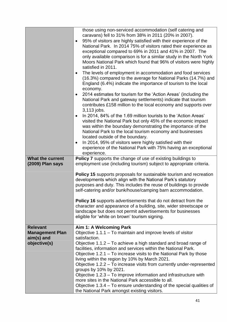
41
those using non-serviced accommodation (self catering and caravans) fell to 31% from 38% in 2011 (20% in 2007).
95% of visitors are highly satisfied with their experience of the National Park. In 2014 75% of visitors rated their experience as exceptional compared to 69% in 2011 and 41% in 2007. The only available comparison is for a similar study in the North York Moors National Park which found that 96% of visitors were highly satisfied in 2011.
The levels of employment in accommodation and food services (16.3%) compared to the average for National Parks (14.7%) and England (6.4%) indicate the importance of tourism to the local economy.
2014 estimates for tourism for the ‘Action Areas’ (including the National Park and gateway settlements) indicate that tourism contributes £158 million to the local economy and supports over 3,113 jobs.
In 2014, 84% of the 1.69 million tourists to the ‘Action Areas’ visited the National Park but only 45% of the economic impact was within the boundary demonstrating the importance of the National Park to the local tourism economy and businesses located outside of the boundary.
In 2014, 95% of visitors were highly satisfied with their experience of the National Park with 75% having an exceptional experience.
What the current (2009) Plan says
Policy 7 supports the change of use of existing buildings to employment use (including tourism) subject to appropriate criteria. Policy 15 supports proposals for sustainable tourism and recreation developments which align with the National Park’s statutory purposes and duty. This includes the reuse of buildings to provide self-catering and/or bunk/house/camping barn accommodation. Policy 16 supports advertisements that do not detract from the character and appearance of a building, site, wider streetscape or landscape but does not permit advertisements for businesses eligible for ‘white on brown’ tourism signing.
Relevant Management Plan aim(s) and objective(s)
Aim 1: A Welcoming Park Objective 1.1.1 – To maintain and improve levels of visitor satisfaction. Objective 1.1.2 – To achieve a high standard and broad range of facilities, information and services within the National Park. Objective 1.2.1 – To increase visits to the National Park by those living within the region by 10% by March 2021. Objective 1.2.2 – To increase visits from currently under-represented groups by 10% by 2021. Objective 1.2.3 – To improve information and infrastructure with more sites in the National Park accessible to all. Objective 1.3.4 – To ensure understanding of the special qualities of the National Park amongst existing visitors.

42
Aim 2: A Distinctive Place
Objective 2.1.4 – To ensure that visitor and recreational use is sympathetic to the character and capacity of the location in which it takes place.
Aim 3: A Living, Working Landscape for Now and the Future
Objective 3.3.2 – To grow the tourism market in and around the National Park.
Aim 5: A Valued Asset
Objective 5.1.2 – The natural, cultural, social and economic infrastructure of the National park is sustained through its use as a local and regional asset.
Issues identified
Issue 18: Recreation and sport facilities
Are our existing planning policies sufficient to continue protecting existing sport and recreational facilities against future pressures and to weigh their loss where it is unavoidable?
Should there be a policy specifying the delivery of improved recreational and sporting facilities as a part of a large scale development proposals?
Issue 19: Holiday accommodation, visitor facilities and sustainable tourism
Should planning policy be more supportive of new budget visitor accommodation i.e. camp sites, camping pods, touring caravans and barn pods?
Should planning policy make it more difficult to permit the loss of visitor accommodation and visitor facilities, by for example requiring marketing evidence before making a decision that would lead to the permanent loss of facilities
Should planning policy prevent the loss of touring caravan and camping pitches?
Should the National Park Authority allow change of use of barns and other traditional buildings, in appropriate places, to additional self-contained holiday accommodation?
Should planning policy permit bespoke new build self contained visitor accommodation in specifically defined circumstances?
Should planning policy be stronger in supporting dark-skies tourism?
Should we explore the opportunities to support the provision of Sill ‘satellite’ developments in suitable locations to further improve visitor facilities in the Park?
Is there a need to develop new tourism products that a) help spread the benefits of the visitor economy across the National Park and b) extend the holiday season to make the National Park an all-year-round destination?

43
Minerals and Waste Headlines
There is one aggregate quarry in the National Park. This supplies material for the construction industry and provide employment, but the operations and associated transport have an impact on the environment and local amenity. The Local Plan needs to set out whether further permissions for quarrying should be granted and, if so, under what circumstances and subject to what environmental criteria and controls. Domestic and commercial waste is collected by the County Council which is the waste disposal authority. There are no licensed waste disposal sites in the National Park and it is not expected that there will be a need for any significant waste disposal or processing facilities. The main issues are therefore the development of localised re-use and recycling facilities.
What National Policy Says
Great weight should be given to conserving landscape and scenic beauty in National Parks. Planning permission should be refused for major developments in these designated areas except in exceptional circumstances and where it can be demonstrated they are in the public interest.
When determining planning applications, local planning authorities should as far as practical, provide for the maintenance of landbanks of non-energy minerals from outside National Parks.
Local planning authorities should safeguard existing, planned and potential rail heads (and) rail links to quarries.
Mineral planning authorities should prepare an annual Local Aggregate Assessment, either individually or jointly by agreement with other mineral planning authorities.
Local planning authorities should consider how to meet any demand for small-scale extraction of building stone.
Each Waste Planning Authority (WPA) in the UK has an obligation to plan for sustainable waste management in accordance with the Waste Framework Directive 2008.
Waste Management Plan for England (Defra, December 2013) - aims to help achieve sustainable waste management by securing adequate provision of new waste management facilities of the right type, in the right place and at the right time. Waste planning authorities should identify in their local waste plans sites and areas suitable for new or enhanced facilities for the waste management needs of their area. In deciding which sites and areas to identify for such facilities, waste planning authorities should assess their suitability against the criteria set out in the policy. This includes the physical and environmental constraints on development, existing and proposed neighbouring land uses, and any significant adverse impacts on the quality of the local environment.

44
Other key factors - policies, regulations & partners.
North East Local Aggregates Assessment (JLAA) 2016 - The National Park Authority will maintain cooperation with regional Mineral Planning Authorities (particularly the County Council) in order to ensure that provision can be made from areas outside the National Park Area without having a significant adverse effect on the purpose and special qualities of the National Park whilst taking into account all other relevant factors. North East Waste Management Capacity Study (2012) Each Waste Planning Authority (WPA) in the UK has an obligation to plan for sustainable waste management in accordance with the Waste Framework Directive 2008. The WPAs in the North East of England comprise Tyne & Wear, Durham and Northumberland (including the separate Northumberland National Park WPA). Northumberland County Local Plan Core Strategy - This will guide future development decisions on waste management. They are relevant to residents of the National Park because they are likely to address the longer term management and disposal of waste arisings across the county up until 2030. Northumberland National Park Geodiversity Audit and Action Plan 2007: Introduces and examines the geodiversity resource within the National Park and identifies ways of exploiting it sustainably.
Key statistics and trends
Minerals There is one crushed rock quarry (Harden) within the National Park with estimated permitted reserves of approximately 1,500,000 tonnes4. The current planning permission for the Harden Quarry site allows for extraction until 2029 with an anticipated output of up to 150,000 tonnes per annum. The Joint LAA recommends that generally future provision for the extraction of crushed rock should be made outside the National Park where practical, recognising the resource that is available outside of this area with a large level of permitted reserves. There are currently no sand and gravel quarries in Northumberland National Park. The JLAA recommends that provision of sand and gravel should be made outside of the National Park in line with national planning policy. It also recommends that this resource is safeguarded in the NNP Local Plan in order to ensure that the sand and gravel resource within the National Park is not be needlessly sterilised by non-mineral development and is protected over the longer-term. Waste The County Council disposed of an average of 1.5 tonnes of waste from residents and businesses during 2014/155. If these figures are assumed for each household resident in the National Park, then this would equate to about 1,635 tonnes of waste arising in the National Park each year. In addition to that the amounts of industrial and specialist waste will be very low. Farm waste, such as slurry, is mostly treated and disposed within the farm holding.
4 As at 31
st December 2014
5 Northumberland County Local Plan (Pre-submission draft 2015)

45
What the current (2009) Plan says
Policy 23 permits minerals extraction where it would have no significant environmental effects and would be of a scale that would be appropriate to meet a need for local stone materials for repairs to historic buildings where the need for the stone could not be met elsewhere outside the National Park. Policy 26 only permits the development of waste management facilities where the waste is generated from communities located within the National park and the facility would recycle compost or enable energy recovery from the waste.
Relevant Management Plan aim(s) and objective(s)
Aim 2: A Distinctive Place
Objective 2.1.1 – To protect and enhance tranquillity levels as the highest in England.
Objective 2.1.2 – To conserve and enhance the National Park’s distinctive characteristics and sense of place.
Objective 2.2.1 – To encourage and support land management practices to bring about measurable improvements in the natural environment and deliver the Natural Environment Vision 2014 – 2035.
Issues identified
Issue 20: Ensuring a sustainable supply of minerals
To what extent, if at all, should permission be granted for additional working from existing quarries? Would further working within existing quarry footprints be acceptable and, if so, under what circumstances?
Is nature conversation the most appropriate after-use for restored quarries in the National Park? How should restored quarries be managed for the long-term benefit of residents and visitors?
Should environmentally acceptable small-scale working of walling and roofing stone be encouraged?
Should the Local Plan introduce a policy to safeguard future minerals supplies within the National Park?
Issue 21: Sustainable waste management
In what circumstances should the reuse of mineral waste, such as lead mining spoil be permitted?
What provision should be made for local recycling sites and how should re-use and recycling be encouraged?
Should future planning policy make provision for the disposal of inert waste produced within the National Park? Could the majority of this material be put to beneficial use or be recycled?
Should future planning policy make provision for any other types of waste produced within the National Park? (e.g. energy from farm waste)