japanmsrformhowe 1 20100623 - scripps institution...
TRANSCRIPT

Application for Consent to Conduct Marine Scientific Research in Japan
Addendum Date: 24 June 2010
Addendum to: State Dept # 2009-101 Approved under MOFA Dipnote 4867
1. General Information
1.1 Project name and/or #: PhilSea10 Gliders 1.2 Undertaking institution: Scripps Institution of Oceanography Name: Rose Dufour/ Elizabeth Brenner Address: University of California
9602 La Jolla Shores Drive La Jolla, CA 92037 858-534-2841 [email protected]
Name of Director: Dr. Tony Haymet
1.4 Scientist in charge of the project: Name: Dr. Bruce Howe Address: Department of Ocean and Resources
Engineering School of Ocean and Earth Science and Technology University of Hawai'i at Manoa 2540 Dole Street, Holmes Hall 402 Honolulu, Hawaii 96822
Telephone: (808) 956-0466 Telex: Telefax: (808) 956-3498 E-mail Address: [email protected] 1.5 Scientist(s) from Japan involved in the planning of the project: Name(s): None
1.3 Government Agency Responsible for Supervising the Project: Name Dr. Ellen Livingston, 321 OA Address U.S. Office of Naval Research
875 North Randolph Street, Suit 1425 Arlington, VA 22203-1995

Address:
2. Description of Project (Attach additional pages as necessary)
2.1 Nature and objectives of the project: The University of Hawaii (UH) plans to deploy five oceanographic underwater gliders in the Philippine Sea during November 2010 – April 2011 as part of a one-year-long acoustic propagation experiment, referred to as PhilSea10. The 2010–2011 PhilSea10 experiment will combine measurements of acoustic propagation and ambient noise with the use of an ocean acoustic tomography array to help characterize this oceanographically complex and highly dynamic region. The tomographic array consists of six acoustic transceivers that both transmit and record low-frequency acoustic signals. It has a radius of approximately 330 km, spanning much of the northern Philippine Sea. The tomographic measurements, when combined with satellite and other in situ measurements and with ocean models, will help characterize the structure of the rapidly varying oceanographic environment in the northern Philippine Sea, providing an eddy-resolving, 4-D sound-speed field for use in making acoustic predictions. The source transmissions will be recorded the UH-deployed acoustic receivers on five underwater seagliders (Figure 1) to study deep-water propagation, long-range underwater navigation, and to augment the tomographic measurements with both the acoustic data as well as profiles of temperature and salinity. A seventh mooring with a distributed vertical line array (DVLA) receiver will provide additional acoustic data. The results will be presented at international conferences and published in scientific journals. This unclassified academic effort is funded by the Office of Naval Research. The PhilSea10 objectives are to (i) understand the impacts of fronts, eddies, and internal tides on acoustic propagation in this highly variable region, (ii) determine whether acoustic methods, together with satellite, glider and other measurements and coupled with ocean modeling, can yield estimates of the time-evolving ocean state useful for making improved acoustic predictions and for understanding the local ocean dynamics, (iii) improve our understanding of the basic physics of scattering by small-scale oceanographic variability due to internal waves and spice, and (iv) characterize the ambient noise field, particularly its variation over the year and its depth dependence.

Fig. 1. A Seaglider. The Iridium/GPS antenna sits at the end of the tail. Sensors
are mounted on or in the tail-cone section Size: 180 cm long by 30 cm diameter, total wing span 1 m Weight: 52 kg Materials: fiberglass body with internal aluminum pressure case housing electronics and batteries Number: 5 units, serial numbers 022, 023, 500, 511, 513 The instruments will be recovered. There will be no digging activity. Seagliders are small, reusable, long-range (3000 – 4000 km) autonomous underwater vehicles designed to glide from the ocean surface to as deep as 1000 m and back while collecting profiles of temperature and salinity, as well as recording acoustic data. Gliders steer through the water by controlling attitude (pitch and roll) and can thus navigate between waypoints to execute survey patterns; or they hold station while profiling and collect Eulerian time series as a ‘virtual mooring’. Mission durations depend largely on ambient stratification and profile depth, but for this application should be approximately 5 months. Gliders are commanded remotely and report their measurements via Iridium satellite telephone at the conclusion of each dive. The vehicles archive data to onboard storage for delayed mode transmission or post-recovery interrogation. They use GPS navigation at the sea surface to dead reckon toward commanded targets by assimilation with a Kalman filter or though other algorithms. Navigation and knowledge of vehicle buoyancy and pitch angle allows estimation of depth-averaged current and suitably energetic vertical velocity fluctuations. Gliders have been deployed and recovered from a wide range of platforms including small rubber boats, chartered fishing vessels and large research ships. Because the vehicles are relatively small and light, special handling gear is not required and field teams typically consist of one or two individuals.

Seven subsurface oceanographic moorings have already been deployed during PhilSea10 in April 2010 by P. Worcester (Scripps Institution of Oceanography, University of California at San Diego (SIO-UCSD) from R/V Roger Revelle. Six of the moorings have Webb Research Corporation (WRC) swept-frequency acoustic sources, with integrated Simple Tomographic Acoustic Receiver (STAR) controller and data acquisition systems, at a depth of 1050 m. These sources transmit acoustic signals with center frequencies of approximately 250 Hz and bandwidths of approximately 100 Hz. Each WRC acoustic source includes a STAR controller and data acquisition system to provide precise timing and scheduling for the source transmissions and to record the transmissions from the other WRC sources. The seventh mooring supports the DVLA receiver, designed to record low-frequency acoustic signals, including those transmitted by the WRC sources, other acoustic sources, and ambient noise. PhilSea10 is taking place in the northern Philippine Sea (Table 1 and Figure 2). The DVLA location is in international waters. The location of WRC source mooring T1 is in Japan’s Exclusive Economic Zone (EEZ; denoted by thin yellow line). The locations of WRC source moorings T2, T3, and T6 are in international waters. The locations of WRC source moorings T4 and T5 are in the EEZ of the Philippines. The moorings were deployed during spring 2010 and the moorings and gliders will be recovered approximately one year later, during spring 2011. Glider operations in the PhilSea10 domain are shown in Figure 2. Glider paths are indicated by orange lines. All five gliders will be deployed at the DVLA in international waters. At the DVLA site they will cross-calibrate sensors (e.g., temperature and salinity) against each other and against the sensors on the DVLA mooring. If all gliders cannot be deployed at DVLA, then they can be deployed at T6, also in international waters. After five days at the DVLA they all fly to the central mooring T6, then out on radials to T1-T5, respectively. They then fly clockwise around the pentagon on straight-line segments between moorings. At each mooring site, the gliders will loiter for a day repeating the cross-calibration operation. As the time for the glider recovery approaches, during the April 2011 mooring recovery cruise, the gliders will be pre-positioned at appropriate transceiver mooring sites to facilitate their recovery. Given a nominal 20 km/day glider speed, they will be able to go about 3000 km in the 150 days, or 1.4 times around the pentagon (i.e., the glider going first to T1 will end at T3). The R/V Roger Revelle will be used for glider deployment 6-26 November 2010. The R/V Roger Revelle will likely be used for the mooring and glider recovery cruise in April/May 2011. The dates for the recovery cruise have not been set.
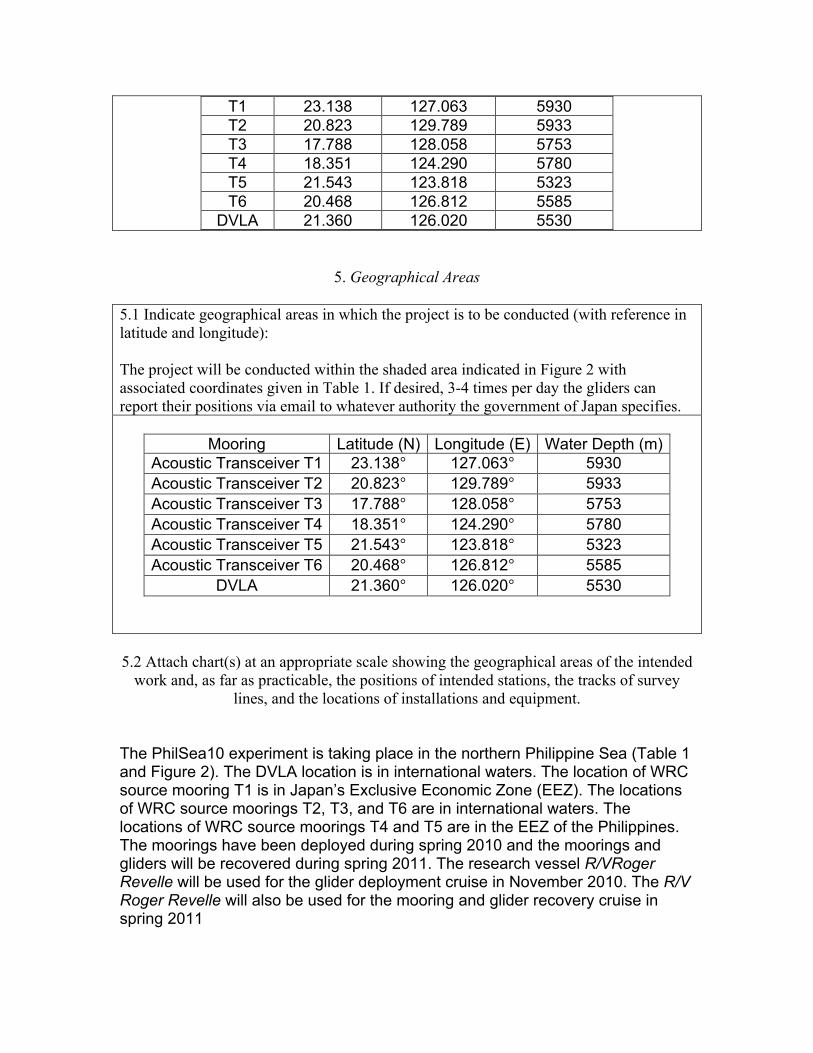
Mooring Latitude (N) Longitude (E) Water Depth (m)
T1 23.138 127.063 5930 T2 20.823 129.789 5933 T3 17.788 128.058 5753

T4 18.351 124.290 5780 T5 21.543 123.818 5323 T6 20.468 126.812 5585
DVLA 21.360 126.020 5530
Table 1. PhilSea10 mooring locations and (corrected) water depths for the six acoustic transceivers (T1, T2, … T6) and the DVLA receiver. Gliders will operate
within the area defined by these coordinates. 2.2 Relevant previous or future research cruises: April 2010 NPAL Philippine Sea Experiment Deployment [Japan - State Dept. State Dept # 2009-101 Approved under MOFA Dipnote 4867) 2.3 Previously published research data relating to the project: None
3. Methods and Means to be Used
3.1 Particulars of vessel: Name: R/V Roger Revelle Type: Research Vessel Nationality: USA Flag Owner: U.S. Navy Operator: University of California, San Diego,
Scripps Institution of Oceanography Overall length: 84 m [275'] Maximum draught: 5.2 m [17'] Gross tonnage: 3,180 long tons Propulsion: Two 3000 hp Propulsion General
Electric Bow Thruster: 1180 hp Azimuthing jet Type Elliot Gill Model 50T 35 Propulsors: Two 3000 hp Z-Drives Lips Type FS 2500-450/1510BO
Cruising speed: 12 knots Maximum speed: 14 knots Call sign: KAOU Method and capability of communication (including telex, frequencies):
Email, [email protected] Inmarsat-B, Telephone,

Indian, 011-873-336780030 Alternate, 011-873-336780020 Fax, Primary, 011-873-336780031 Alternate, 011-873-336780021 Telex, Primary, 336780033 (AnsBk=KAOU) Alternate, 336780022 (AnsBk=KAOU) Inmarsat-C, 436780010 Radio, Vessels guard standard GMDSS frequencies for calling, distress and dissemination of marine safety information. MMSI #, 367800100 SELCAL #, 71410 Telex, Primary, 336780033 (AnsBk=KAOU) Alternate, 336780022 (AnsBk=KAOU) Inmarsat-C, 436780010 Radio, Vessels guard standard GMDSS frequencies for calling, distress and dissemination of marine safety information. MMSI #, 367800100 SELCAL #, 71410
Name of master: Tom Desjardins Number of crew: 22 Number of scientists on board: No more than 37 3.2 Aircraft or other craft to be used in the project: None 3.3 Particulars of methods and scientific instruments
Types of samples and data Methods to be used Instruments to be used
Acoustic propagation data Section 2.1; Glider acoustic receiver system
Single hydrophone acoustic receiver
Temperature/salinity profiles Glider mounted CTD Seabird CTD (conductivity, temperature, depth)
**Water velocity profiles Ship-based surveys Shipboard ADCP, GPS, GPS attitude
**Metorological variables (e.g. wind speed, heat flux, air
Ship-based surveys Shipboard meteorological sensors

tempertature, etc) **Underway (UW) multibeam Swath mapping
Simrad 12khz
**UW Mags Magnetometer deployment
Marine Magnetics total field gradiometer
**UW Gravity Gravimeter Bell Gravimeter *Indicate type and specification of instruments (e.g. length and number of cables towed) **This data collection in ancillary to the main science program and will be collected in a no interference mode. 3.4 Indicate whether harmful substances will be used: None 3.5 Indicate whether drilling will be carried out: None
3.6 Indicate whether explosives will be used (Type and trade name, Chemical content, Depth of trade class and stowage, Size, Depth of detonation, Frequency of detonation, and Position in latitude and longitude): None 3.7 Indicate whether the project involves catching, taking, or exploration of marine mammals and plants: None N.B. When the research project involves catching, taking or exploration of marine mammals and/or plants in the exclusive economic zone of Japan, a separate approval from the Ministry of Agriculture, Forestry, and Fisheries of Japan under the Law on the Exercise of Sovereign Rights Concerning Fisheries in the Exclusive Economic Zone shall also be necessary. Applicants may submit the application form provided in Annex II through diplomatic channels. Catching and taking of marine Mammals and/or plants in the territorial Sea of Japan is generally prohibited by the Law for Regulation for Fishing Operation of Foreign Nationals and shall not be approved.
4. Installations and Equipment
Details of installations and equipment (type, specification; dates of laying, servicing, recovery; exact locations and depth): Gliders will be deployed in the vicinity of DVLA or T6 in international waters; they will be recovered at moorings T1-T5. Gliders will operate autonomously between the surface and 1000 m water depth within the area indicated in Figure 2. There will be no contact with the bottom. They will operate without the presence of the ship between deployment in November 2010 and recovery in April/May 2011.
Mooring Latitude (N) Longitude (E) Water Depth (m)
T1 23.138 127.063 5930 T2 20.823 129.789 5933 T3 17.788 128.058 5753 T4 18.351 124.290 5780 T5 21.543 123.818 5323 T6 20.468 126.812 5585
DVLA 21.360 126.020 5530
5. Geographical Areas
5.1 Indicate geographical areas in which the project is to be conducted (with reference in latitude and longitude): The project will be conducted within the shaded area indicated in Figure 2 with associated coordinates given in Table 1. If desired, 3-4 times per day the gliders can report their positions via email to whatever authority the government of Japan specifies.
Mooring Latitude (N) Longitude (E) Water Depth (m) Acoustic Transceiver T1 23.138° 127.063° 5930 Acoustic Transceiver T2 20.823° 129.789° 5933 Acoustic Transceiver T3 17.788° 128.058° 5753 Acoustic Transceiver T4 18.351° 124.290° 5780 Acoustic Transceiver T5 21.543° 123.818° 5323 Acoustic Transceiver T6 20.468° 126.812° 5585
DVLA 21.360° 126.020° 5530
5.2 Attach chart(s) at an appropriate scale showing the geographical areas of the intended
work and, as far as practicable, the positions of intended stations, the tracks of survey lines, and the locations of installations and equipment.
The PhilSea10 experiment is taking place in the northern Philippine Sea (Table 1 and Figure 2). The DVLA location is in international waters. The location of WRC source mooring T1 is in Japan’s Exclusive Economic Zone (EEZ). The locations of WRC source moorings T2, T3, and T6 are in international waters. The locations of WRC source moorings T4 and T5 are in the EEZ of the Philippines. The moorings have been deployed during spring 2010 and the moorings and gliders will be recovered during spring 2011. The research vessel R/VRoger Revelle will be used for the glider deployment cruise in November 2010. The R/V Roger Revelle will also be used for the mooring and glider recovery cruise in spring 2011

Mooring Latitude (N) Longitude (E) Water Depth (m)
T1 23.138 127.063 5930 T2 20.823 129.789 5933 T3 17.788 128.058 5753 T4 18.351 124.290 5780 T5 21.543 123.818 5323 T6 20.468 126.812 5585
DVLA 21.360 126.020 5530 Table 1. PhilSea10 approximate mooring locations and (corrected) water depths for the six acoustic transceivers (T1, T2, … T6) and the DVLA receiver. Gliders
will operate within the area defined by these coordinates.
Figure 3. Plan view of the PhilSea10 mooring geometry, with of six acoustic transceivers (T1, T2, … T6) and the DVLA. Gliders will operate within the area
defined by these moorings, nominally along the orange connecting lines.
6. Dates
6.1 Expected dates of first entry into and final departure from the research area of the

research vessel: This request is for glider operations between deployment and recovery cruises. The glider deployment cruise is scheduled for 06-26 November 2010. The recovery cruise is tentatively scheduled for April/May 2011 (P. Worcester, Chief Scientist). 6.2 Indicated if multiple entry is expected: Gliders will operate within the area autonomously without ships.
7. Port Calls
7.1 Dates and names of intended ports of call: None in the Japan Deployment cruise: Depart Kao-hsiung, Taiwan on 6 November 2010, return to Chi-Lung, Taiwan 26 November 2010. Recovery Cruise: ports to be determined, April/May 2011. N.B. A separate request should be submitted by Note Verbales for intended port calls by public vessels. 7.2 Name/Address/Telephone of shipping agent (if available): Mr. H.M. Chao Jardine Shipping Services 5F, No.21 Chung HWA 3rd Road Kao-hsiung, Taiwan Ph# 886-7-281-2804 Fax # 886-7-201-5492 Cell # 886-929-639-939 Email: [email protected] or [email protected]
8. Participation
8.1 Extent to which Japanese scientists or officials will be enabled to participate or to be represented in the research project: Participation by Japanese colleagues encouraged. Two bunks will be held for possible Japanese participation on the recovery cruise. Dr. Worcester invited a graduate student from Graduate School of Engineering, Hiroshima University to participate on the cruise. 8.2 Proposed dates and ports for embarkation / disembarkation: Embarkation: Currently the departure date from Kao-hsiung is 6 November 2010. Disembarkation: Currently the arrival date into Chi-Lung is 26 November 2010.
9. Access to data, samples and research results

9.1 Expected dates of submission to the Ministry of Foreign Affairs of Japan of preliminary reports and data which should include the expected dates of submission of the final results: No more than 30 days from the end date of the cruise. 9.2 Proposed means for access by Japanese scientists or officials to samples: CD or DVD provided, with further access to the data via internet download or CD/DVD on request. 9.3 Proposed means to provide Japan with assessment of data, samples and research results or provide assistance in their assessment or interpretation: Participation in international data analysis workshops and science symposia during the analysis phase of the project. 9.4 Proposed means of making results internationally available: Publication in scientific journals and reports. (Revised August 27, 2003) English Language Summary (first paragraph of 2.1) Japanese Language translation of Summary
