jurisdiction location : perth citation … · michael ron van dongen v kml .no. 2 ... 1 at 8.36 am...
TRANSCRIPT

[20171 WAMW 17
JURISDICTION : MINING WARDEN
LOCATION : PERTH
CITATION : 2017 WAMW 17
CORAM : WARDEN J O’SULLIVAN
HEARD : 10 July 2017
DELIVERED : 27 July 2017
FILE NO/S : Application for Prospecting Licence 47/1818 andObjection 492685
TENEMENT NO/S : Application for Prospecting Licence 47/1818
Between:
MICHAEL RON VAN DONGENApplicant
and
KML No. 2 PTY LTDObjector
Catchwords: Prospecting Licence - Objection - Marking Out - Form 20 - Failure to identify boundaries - Amendment
Michael Ron Van Dongen v KML .No. 2 Pty L td Page 1
Legislation:
[2017] WAMW 17
• Mining Act 1978 ssl05, 105A and 142• Mining Regulations 1981 regs 59, 90
Cases referred to:
• Hunter Resources Ltd v Melville (1988) 164 CLR 234
• Rv Lane; Ex parte Para Holdings Pty Ltd; in Re Goldfan Ltd (1990) 2 WAR 486
• Wescombe & Others v Barrack Gold of Australia Ltd & Kalgoorlie Lake View Pty Ltd [2009] WAMW16
• Softley v Brewer.; unreported; Coolgardie Warden’s Court; 1/3/90; Noted 9 AMPLA Bull 55
• Pollock v Johnson; unreported; Leonora Warden’s Court; 29/8/88.
Michael Ron Van Dongen v KML No. 2 Pty Ltd Page 2
Result:
1. The application for Prospecting Licence 47/1818 is refused.
[2017] WAMW 17
Representation:
Applicant : Mr M Tolcon
Objector : Mr G Lawton
Solicitors:
Applicant
Objector
Forbes Kirby
Lawton Lawyers
Michael Ron Van Dongen v KML No. 2 Pty Ltd Page 3
REASONS FOR DECISION
[20171 WAMW 17
Introduction
1 At 8.36 am on 29 July 2016 the Applicant purported to mark out the land the
subject of these proceedings.
2 On 1 August 2016, the Applicant lodged application for Prospecting Licence
PL47/1818 with the Department of Mines and Petroleum (“DMP”).
3 Also on 1 August 2016 the Applicant lodged a Form 30 with the DMP seeking
to amend the application.
4 On 23 August 2016, the Objector filed an objection to the application. The
grounds of objection are many. However, for present purposes it is apt to
observe that the Objector takes issue with whether the Applicant complied with
the marking out requirements.
5 On 24 March 2017 Warden Maughan made programing orders directed to
resolving a preliminary issue concerning the Form 20. The issue for
determination is recorded as follows
“The parties agree that the question of whether by virtue of defects in the Form 20, the Applicant has successfully marked out Prospecting Licence 47/1818 be resolved as a preliminary issue
The Legislative Framework
6 Sections 105 and 105 A of the Mining Act 1978 (“the Act”) provide:
“105. Marking out of mining tenement
(1) Before an application for a mining tenement other than an exploration licence, a retention licence or a miscellaneous licence is made, the land in relation to which the mining tenement is sought shall be marked out in the prescribed manner and in the prescribed shape, and for the purpose of any claim for compensation for loss or damage suffered or likely to be suffered resulting or arising therefrom under section 123, or for an order under section 124(2), the activities
Michael Ron Van Dongen v KML Mo. 2 Pty Ltd Page 4

120171 WAMW 17
involved in the marking out shall he taken to he activities relating to prospecting and, as such, to constitute mining”.
105A. Priorities between applicants for certain tenements
(1) Subject to section 111A, where more than one application is received for a mining tenement (other than a miscellaneous licence) in respect of the same land or any part thereof, the applicant who first complies with the initial requirement in relation to his application has, subject to this Act, the right in priority over every other applicant to have granted to him in respect of that land or part the mining tenement to which his application relates.
(2) In subsection (3) applicant means an applicant for a prospecting licence, exploration licence, mining lease or general purpose lease.
(3) Where in respect of any land the warden is satisfied that 2 or more applicants complied with the initial requirement in relation to their applications at the same time or within a prescribed period, priority shall, unless written agreement is concluded by the applicants and lodged in the prescribed manner and within the prescribed time, be determined by ballot conducted by the warden on a date to be determined by the warden and notified to the applicants.
(3a) Each ballot under subsection (3) is to be conducted in public.
(4) In this section a reference to compliance with the initial requirement in relation to an application is a reference —-
(a) in the case of an application for an exploration licence, to lodging that application in the prescribed manner;
(b) in the case of an application for a prospecting licence, mining lease or general purpose lease —
(i) unless subparagraph (ia), (ii) or (iii) applies, to marking out the land concerned in the prescribed manner;
(ia) where the land concerned is land to which section 65(6) applies, lodging that application in the prescribed manner;
(ii) where the land concerned is wholly covered by the sea or the waters of any lake, pond, river or stream, to lodging that application in the prescribed manner;
(iii) where the land concerned is partly covered by the sea or the waters of any lake, pond, river or stream, to marking out in the prescribed manner so much of that land as is not so covered.
(5) If the warden is satisfied that 2 or more applications for a mining tenement have been lodged by or on behalf of the same party for the purpose of affecting the result of a ballot to be conducted under subsection (3), the warden may exclude all but one of those applications from the ballot.
Michael Ron Van Dongen v KML No. 2 Pty Ltd Page 5
[20171 WAMW 17
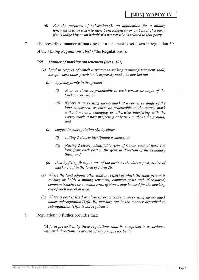
(6) For the purposes of subsection (5) an application for a mining tenement is to be taken to have been lodged by or on behalf of a party if it is lodged by or on behalf of a person who is related to that party.
7 The prescribed manner of marking out a tenement is set down in regulation 59
of the Mining Regulations 1981 (“the Regulations”).
“59. Manner of marking out tenement (Act s. 105)
(1) Land in respect of which a person is seeking a mining tenement shall, except where other provision is expressly made, be marked out —
(a) by fixing firmly in the ground —
(i) at or as close as practicable to each corner or angle of the land concerned; or
(ii) if there is an existing survey mark at a corner or angle of the land concerned, as close as practicable to the survey mark without moving, changing or otherwise interfering with the survey mark, a post projecting at least 1 m above the ground; and
(b) subject to subregulation (3), by either —
(i) cutting 2 clearly identifiable trenches; or
(ii) placing 2 clearly identifiable rows of stones, each at least 1 m long from each post in the general direction of the boundary lines; and
(c) then by fixing firmly to one of the posts as the datum post, notice of marking out in the form of Form 20.
(2) Where the land adjoins other land in respect of which the same person is seeking or holds a mining tenement, common posts and, if required, common trenches or common rows of stones may be used for the marking out of each parcel of land.
(3) Where a post is fixed as close as practicable to an existing survey mark under subregulation (l)(a)(ii), marking out in the manner described in subregulation (l)(b) is not required”.
8 Regulation 90 further provides that:
“A form prescribed by these regulations shall be completed in accordance with such directions as are specified as so prescribed”.
Michael Ron Van Dongen v KML No. 2 Pty Ltd Page 6
The Objector’s Submissions
[2017] WAMW 17
9 The submissions advanced on behalf of the Objector focus on the failure of the
Form 20 to record a description of the boundaries of the tenement as required
by (e). This defect, according to the Objector, is a fatal flaw and cannot be
corrected by amendment.
10 The Objector relies on the principle enunciated by the High Court in Hunter
Resources Ltd v Melville1, that there be strict compliance with the marking out
requirements.
The Applicant’s Submissions
11 The Applicant contends that Hunter Resources is confined to the exercise of
marking out itself and not the completion of the Form 20. Further, the
authorities support the proposition that a misdescription in a Form 20 can be
corrected. The Applicant relies in particular on R v Lane; Ex parte Pard
Holdings Pty Ltd; in Re Goldfan Ltd2
Does the Deficiency in the Form 20 Constitute a Failure to Mark Out?
12 In Hunter Resources the central issue was whether substantial compliance with
a requirement to place pegs a maximum distance of 300 metres apart was
sufficient. The majority held that the marking out requirements involved strict compliance. As Dawson J 3observed:
“ Under si 05A of the Act the applicant who first marks out the land in the prescribed manner has priority. The only practical course if for the Warden to deal first with the application which on the face of it is first in time. If (assuming it to be possible notwithstanding the wording of the regulations) substantial compliance with the marking out requirements were sufficient, then an application which was first in time because short cuts were taken in marking out might achieve priority over an application which was made later because of the delay involved in complying strictly with the requirements ”.
1 (1988) 164 CLR2342 (1990) 2 WAR 4863 at [13]
Michael Ron Van Dongen v KML No. 2 Pty Ltd Page 7

13
[20171 WAMW 17
Although the majority of the High Court upheld that strict compliance was
required when marking out, the High Court did not expressly address the
implications of any deficiencies in the Form 20. Nor was consideration given to
whether a Form 20 could be amended. The majority did, however, make it
clear that if there was a failure to comply with the marking out requirement it
could not be corrected by amendment. A misdescription in a Form 20 was
however, considered by the Court of Appeal of Western Australia in Pard
Holdings.
14 In Pard Holdings the Court of Appeal upheld a decision of the Warden granting
a Miscellaneous Licence notwithstanding that the description of one of the
boundaries in the Form 20 and 21 were some 10° out. The Objector relying, on
Hunter Resources, argued that the obligation of strict compliance rendered to
any error in the Form 20 fatal.
15 The Court of Appeal distinguished Hunter Resources on the basis that the error
or misdescription did not constitute a failure to comply with the marking out
requirements. Wallace J4 held:-
“There is no suggestion that the tenement was not ‘marked out’ in the sense of defining the area of the land in question. What is contended is that there has been a failure to comply with the marking out requirements because there has been a misdescription of the land in form 20, a copy of which we do not have, but the description in which is taken to be identical with that in form 21, namely the application for the miscellaneous licence.It is common ground that the form 20 and accompanying map in accordance with reg 37 were affixed to the datum post. Whilst it is accepted that there was the aforesaid misdescription in the fifth line on form 20, the map showing the land applied for giving the required locality signature of the surveyor and the same date as form 21, contains no description. It is accurate. Accordingly, therefore, in my opinion, no one could have been misled thereby. It is not as if the tenement applied for covered a vast area, since the distances involved in each of its five boundaries ranged from 52.32 m to 206.76 m. This in my opinion is not a Hunter Resources Ltd v Melville (1988) 164 CLR 234, case. In my opinion the learned Warden’s finding was one of fact and was correct”.
4 at p490; Pidgeon J at p496 agreed with both Wallace and Ipp JJ
Michael Ron Van Dongen v KML No. 2 Pty Ltd Page 8

[20171 WAMW 17
16 Ipp J5 provided the most detailed analysis of the issue:
“The applicant’s submission was, in effect, that, because there had been a misdescription of a boundary in the form 20 notice, there had been an error in marking out and a failure, accordingly, by the applicant to comply with s 93(1).
Hunter Resources Ltd v Melville concerned an application for a prospecting licence. Section 105(1) of the Act applies to such a tenement and, like s 93(1), requires an applicant to mark out in the prescribed manner the land in respect of which the mining tenement concerned is sought. Regulation 59 sets out the prescribed manner of marking out. The appellant in Hunter Resources Ltd v Melville relied on very minor discrepancies in the marking out of pegs. The High Court held by a majority that the legislation should be construed as requiring strict compliance with the marking out provisions. 1 accept that there has to be strict compliance with the marking out provisions that relate to miscellaneous licences.
The issue before us, therefore, is whether the misdescription of one angle in the form 20 notice affixed to the datum post results in there being a failure to comply strictly with the marking out provisions of s 93(1) read with reg 37(1) ands 93 (1).
Unlike the position in regard to reg 59, which could be construed on the basis that ‘the words just mean what they say ’ (per Toohey J in Hunter Resources Ltd v Melville, at 256), additional content has to be given to the words “Description of Boundaries” in the form 20 notice in order to determine precisely what is intended thereby.
Regulation 37(1) mentions, relevantly, only that ‘a notice in the form No 20 in the First Schedule ’ should be affixed to the datum post. Form 20, as 1 have indicated, requires only that a description of the boundaries of the land marked out be given. Nothing is said as to what that description should contain or what accuracy it should display. Absolute accuracy would be a most stringent requirement. As is mentioned in Hunter Resources Ltd v Melville, at 244, Rowland J, in the Full Court, remarked that ‘the marking out of land not infrequently involves non-compliance in some respects with the prescribed requirements ’. I would have thought that absolute accuracy in a form 20 notice would ‘not infrequently’ not be achieved. The consequences that would follow, if absolute accuracy were required, would be most serious to an applicant for a miscellaneous licence. In the circumstances, the absence of words denoting that absolute accuracy is a requirement, is, in my view, an indication to the contrary.
It is furthermore significant that the form 20 notice requires only that the ‘approximate area ’ be given. The reference to “approximate ” area makes it plain that absolute accuracy in regard to area - and therefore in regard to the length of the boundaries - is not required.
5 p494-496
Michael Ron Van Dongen v KML No. 2 Ffy Ltd Page 9

[20171 WAMW 17
Further light is cast upon what is required in describing boundaries in the form 20 notice (as it is applicable to the marking out of miscellaneous licences), by the requirement that, together with the form 20 notice, a map on which are ‘clearly delineated the boundaries of (the area concerned) ’ is to be fixed to the datum post.
Presumably a map is required in the case of a miscellaneous licence because such a licence may be granted in respect of land which is already the subject of a mining tenement (s 91(1)). The purpose of the map, it seems to me, is to disclose clearly whether the land in question is land, or part of land, the subject of other mining tenements.
The fact that such a map (in addition to the form 20 notice) has to be fixed to the datum post, is a further indication that the description of the boundaries in the form 20 notice does not have to be given with the precision and accuracy of a diagram certified by a land surveyor. After all, the map itself is required to delineate the boundaries clearly.
It was submitted by senior counsel for the applicant that any description which would require an element of judgment by the reader, in determining where the proposed boundaries lay, would be inadequate. It seems to me, however, that any exercise in determining the locality of boundaries, by reference to a map and a written description, and the application in the field of precise distances and angles, would require a reasonable measure of expertise. The description of boundaries required in the form 20 notice must be considered in this context.
In my view, all that is intended by the requirement in the form 20 notice relating to the description of boundaries is that the boundaries should be described with sufficient detail and accuracy to enable a reader, by making reasonable use of the form 20 notice as a whole, and the map affixed to the datum post, to determine where those boundaries lie.
I now turn to the question whether, in accordance with the aforementioned criterion, there has been non-compliance with the marking out requirements.
A person wishing to determine the locality of the boundaries of the ML Land, by reference to the form 20 notice, would commence at the datum post and follow the lengths of the first four boundaries mentioned by taking into account their lengths and the angles given. At the extremity of each of the boundaries of the pentagonal area of the ML Land a post should be found, erected in terms of reg 37(1). Further, each boundary of the ML Land runs along an existing mining tenement, and therefore, fixed firmly in the ground at intervals not exceeding 300 m along each of the boundaries of the ML Land there should be substantial pegs or cairns of stones as required by reg 59 (which prescribes the manner of marking out mining tenements). All these matters would confirm that at least the first four boundaries of the pentagon were correctly described in the form 20 notice. The person concerned would then come to the fifth (and last) boundary. The fifth boundary is only 206.76 m long. The location of that boundary would be significantly facilitated by the words in the description
Michael Ron Van Dongen v KML Mo. 2 Pfy Ltd Page 10

[2017] WAMW 17
‘back to datum The fifth boundary is also, like the others, described as being along the boundary of another identified mining tenement. There should be pegs or cairns of stones along that boundary. Those indicators should lead directly to the datum post. A person attempting to locate the fifth boundary by following the directions I have mentioned would discover that the length of that boundary determined in that way would coincide with the length specified in the form 20 notice. He would also discover that the angle of the fifth boundary so determined was 268°28’ and not 278°28’ as set out in the form 20 notice. Taking into account the other indiciae to which I have referred it would be plain that an error had been made in regard to the angle. That it was the angle that was in error would be obvious from the fact that by returning to datum along the boundary line of the tenement specified the length would be in accordance with the measurement given. The use of the angle alone would result in the boundary departing from the pegged boundary line of the other tenement and not ending at the datum post, but at some other point within the ML Land. According to a map handed up by senior counsel for the applicant, the fifth boundary would then terminate about some 50 m from the datum post. The small area of the ML Land would also assist in enabling the correct boundaries to be determined reasonably easily by reference to the form 20 notice alone.
In any event, a reference to the map would remove any doubt which may, despite the considerations I have mentioned, exist.
In the circumstance, in my view, the description in the form 20 notice would enable a reader, by making reasonable use thereof, to determine where the correct boundaries of the ML Land lie. If I am wrong in this view I conclude that a reference, in addition, to the map affixed to the datum post would remove any reasonable doubt ”. (My emphasis)
17 As Pard Holdings makes clear where the deficiency in the Form 20 is
fundamental in the sense that any person wishing to determine the localities of
the boundaries by reference to the Form 20 (and associated documents) would
be unable to do so, that constitutes a failure to mark out. The reason that a
deficiency of this kind is fundamental is because the primary purpose of the
Form 20 is to identify the boundaries.
18 Whether a deficiency in a Form 20 can be characterised as a misdescription or a
failure to mark out will of course depend on the nature and extent of the error.
The determining feature seems to be whether the deficiency deprives the reader
of the ability to use the Form 20 to identify the location of the correct
boundaries.
Michael Ron Van Dongen v KML, No. 2 Ffy Ltd Page 11
19 In my view there are material differences between the situation in Pard
Holdings and this case. Pard Holdings involved a misdescription of one of the
boundaries not a complete failure to identify any of the boundaries.
20 Further, any confusion created by the misdescription in the Form 20 in Pard
Holdings was ameliorated by compliance with the requirement to attach the
map of the boundaries. The Applicant’s failure to identify the boundaries in
the Form 20, in this case, was not remedied by the inclusion of a map; there
being no such requirement.
21 Finally, and perhaps of most significance, unlike this case the misdescription in
the Form 20, such as it was, in Pard Holdings did not deprive a reader of the
ability to make reasonable use of it to determine where the correct boundaries
of the land are located.
22 In my opinion, it is no answer to the Applicant’s predicament to say that the
pegs are all in the right place and therefore the boundaries have been identified.
The requirements for marking out in r.59 go beyond simply pegging the
ground; paragraph (l)(c) requires that a Form 20 be attached to the datum post.
Moreover, pegging the ground of itself does not identify the boundaries of the
land (particularly if there are adjoining tenements); hence the need for a Form
20 which identifies the boundaries of the particular application in question.
Any person wanting to ascertain the boundaries of the land the subject of
marking out should not be required to locate each peg. If that were the case, a
Form 20 would be superfluous.
23 When regard is had to the purpose of the Form 20, a failure to identify the
boundaries therein cannot be characterised as a misdescription. Nor can it be
said that the prescribed requirements for marking out have been met. To allow
an amendment in this case would in reality enable the Applicant to complete
the task of marking out rather than simply correct a misdescription.
[20171 WAMW 17
Michael Ron Van Dongen v KML Mo. 2 Pty Ltd Page 12

24 To allow the amendment is also inconsistent with the sentiments expressed in
Hunter Resources and Pard Holdings. Moreover, it would undermine the
object of si05A of the Act which is to give priority to the applicant who “first
complies with the initial requirement in relation to his application”.
25 The characterisation of the defect in the Applicant’s Form 20 as a failure to
mark out is also consistent with Wescombe & Others v Barrack Gold of
Australia Ltd & Kalgoorlie Lake View Pty Ltd 6 and Softley v Brewer1. In
Wescombe the Form 20 did not include any approximate application area,
identify the tenement type and incorrectly stated the easterly co-ordinate of theo
datum peg as a location some 18 km away. Warden Benn found that these
errors constituted a failure to mark out. His Honour held that these errors
together with an error in respect of the location of the datum peg “would have
been likely to cause confusion in any person inspecting the datum peg and
Form 20”.
26 In Softley v Brewer the Form 20 made no reference to the land in question being surveyed land. Interestingly, Warden Brown 6 7 8 9 interpreted the comments
of Dawson J in Hunter Resources to mean that the Form 20 is not part of any
proceedings in the Warden’s Court and doubted that the power of amendment in si 42 of the Act was available.10 In any event Warden Brown 11 concluded:
“It should be appreciated that Regulation 59(b)(i) provides a means of reducing the very precise physical marking out provisions by allowing the description of surveyed boundaries or well defined features to be endorsed on the Form 20. If those surveyed boundaries are not described in the Form 20 it would seem fair that a prospector who examines the Form 20 and intermediate pegs are missing would be justified in marking out the ground and lodging an objection as Mr Brewer has done. In my view that objection must be upheld”.
[20171 WAMW 17
6 [2009] WAMW 167 Unreported; Coolgardie Warden’s Court; 1/3/90; noted 9 AMPLA Bull 558 at pg 99 at pg 6; see also Pollock v Johnson unreported; Leonora Warden’s Court; 29/8/8810 this decision pre-dates the Court of Appeal’s decision in Pard Holdings” at pg 6
Michael Ron Van Dongen v KML No. 2 Pty Ltd Page 13

Conclusion
[20171 WAMW 17
27 In my view the failure to include a description of the boundaries in the Form 20
constitutes a failure to comply with the marking out requirements. Prospecting
Licence 47/1818 is, therefore, refused.
27 July 2017
Michael Ron Van Dongen v KML No. 2 Ply Ltd Page 14