landscape design guidelines - eia...
TRANSCRIPT
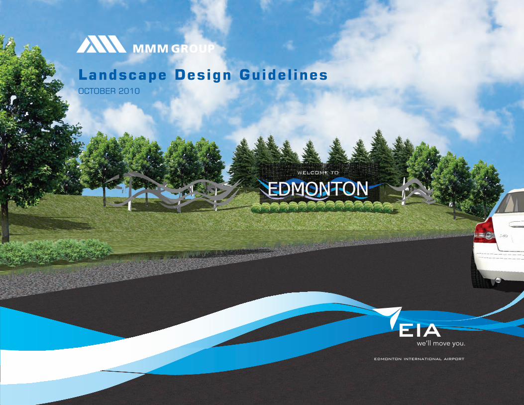
Landscape Design GuidelinesOctOber 2010

3edmonton international airportlandscape design guidelines
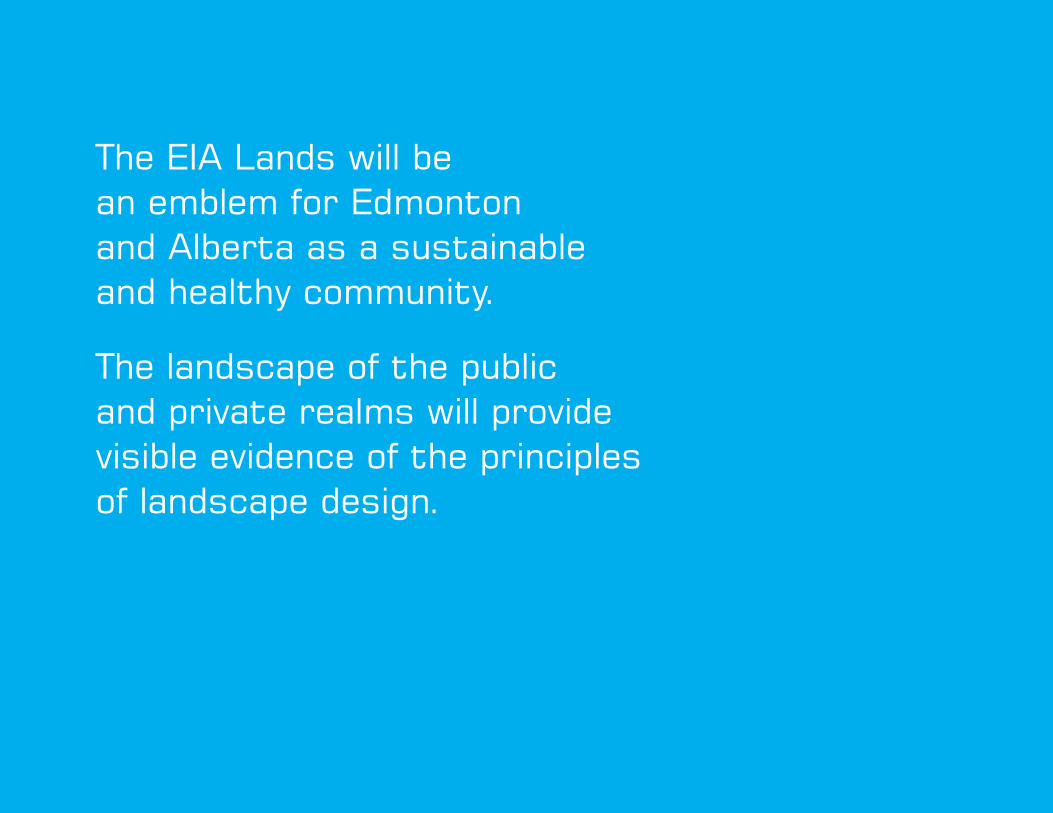
the eIa Lands will be an emblem for edmonton and alberta as a sustainable and healthy community.
the landscape of the public and private realms will provide visible evidence of the principles of landscape design.

iedmonton international airportlandscape design guidelines
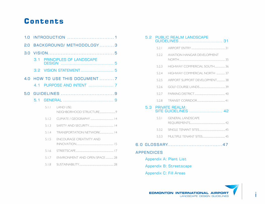
1.0 INtrODUctION ............................. 1
2.0 bacKGrOUND/ MetHODOLOGY ......... 3
3.0 VISION ......................................... 5
3.1 PrINcIPLeS Of LaNDScaPe DeSIGN ........................................ 5
3.2 VISION StateMeNt ......................... 5
4.0 HOW tO USe tHIS DOcUMeNt ......... 7
4.1 PUrPOSe aND INteNt ................... 7
5.0 GUIDeLINeS ................................. 9
5.1 GeNeraL ...................................... 9
5.1.1 LAND USE:
NEIGHBORHOOD STRUCTURE ........................... 9
5.1.2 CLIMATE / GEOGRAPHY ......................................... 14
5.1.3 SAFETY AND SECURITY ........................................... 14
5.1.4 TRANSPORTATION NETWORK ........................ 14
5.1.5 ENCOURAGE CREATIVITY AND
INNOVATION .................................................................. 15
5.1.6 STREETSCAPE ................................................................... 17
5.1.7 ENVIRONMENT AND OPEN SPACE .............. 28
5.1.8 SUSTAINABILITY ............................................................. 28
Contents
5.2 PUbLIc reaLM LaNDScaPe GUIDeLINeS ................................. 31
5.2.1 AIRPORT ENTRY ............................................................ 31
5.2.2 AVIATION HANGAR DEVELOPMENT
NORTH ................................................................................. 35
5.2.3 HIGHWAY COMMERCIAL SOUTH .................. 36
5.2.4 HIGHWAY COMMERCIAL NORTH ............... 37
5.2.5 AIRPORT SUPPORT DEVELOPMENT .............. 38
5.2.6 GOLF COURSE LANDS ............................................. 39
5.2.7 PARKING DISTRICT ...................................................... 40
5.2.8 TRANSIT CORRIDOR ................................................. 41
5.3 PrIVate reaLM: SIte GUIDeLINeS ......................... 42
5.3.1 GENERAL LANDSCAPE
REqUIREMENTS.............................................................. 42
5.3.2 SINGLE TENANT SITES...............................................45
5.3.3 MULTIPLE TENANT SITES ........................................ 45
6.0 GLOSSarY..................................47
aPPeNDIceS
appendix a: Plant List
appendix b: Streetscape
appendix c: fill areas
ii

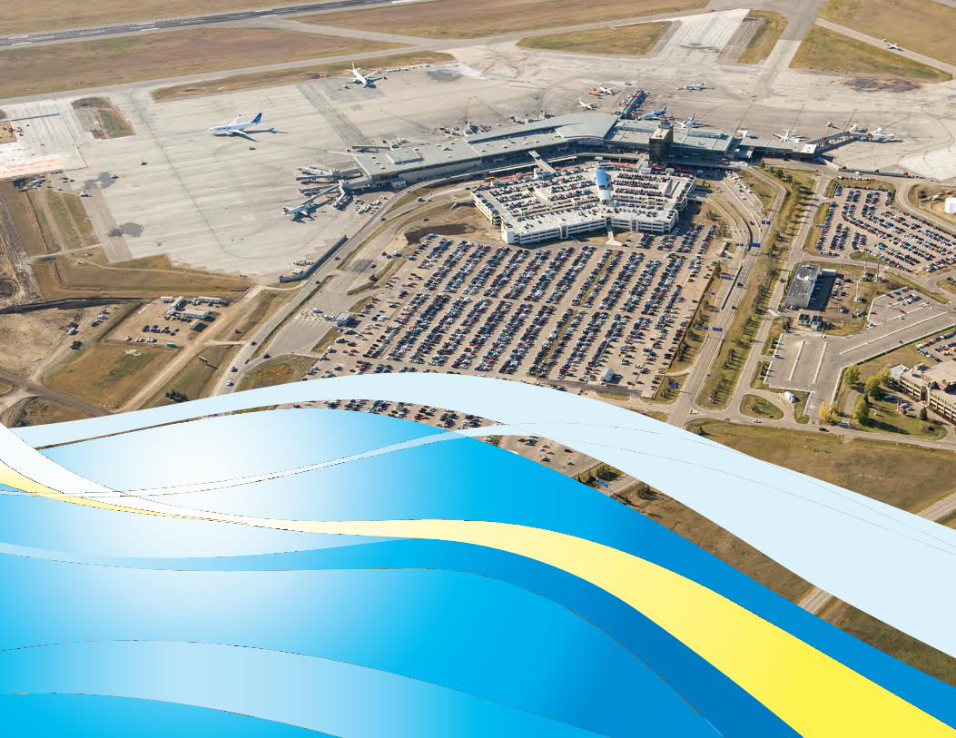
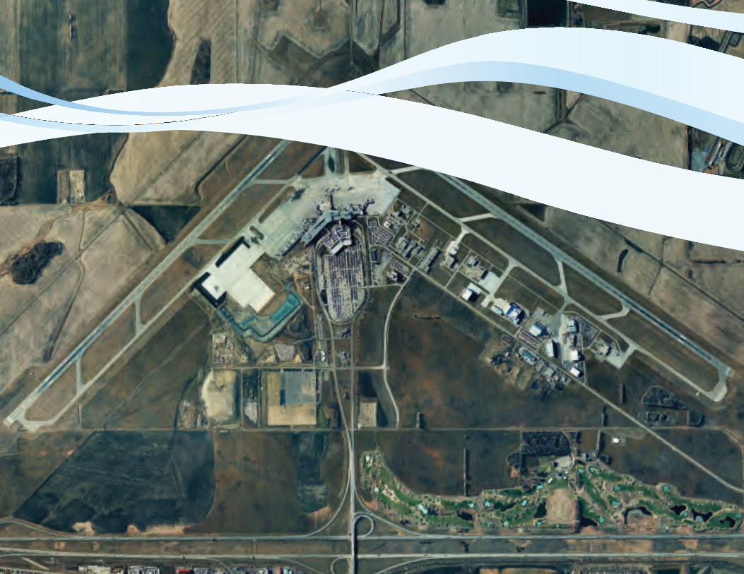
1.0 INTRODUCTION Edmonton International Airport (EIA) is planning for the expansion of the
airport in terms of the impact it will have on the lands surrounding the
airport terminal and runways. The Landscape Design Guidelines establish
the ‘greening’ of the airport and creation of pedestrian-friendly lands to
meet current needs a growing population of the EIA employment district.
These guidelines are based on growth of the airport to and anticipated
16 million passengers (per year). Commercial, service, recreational and
industrial development of the lands will increase the physical activities.
Transit and vehicular traffic will increase. So too will the need to
accommodate pedestrians and cyclists.
EIA is cognizant of the impacts to the land resultant of this new
development. Intensification will result in increased pavements and runoff
potential. These guidelines are intended to assist in the management of
stormwater runoff, while contributing to the aesthetic and recreation
qualities of the Edmonton Airport Community.
1edmonton international airportlandscape design guidelines

2

2.0 BACKGROUND/ METHODOLOGY
Following research, the consultant met with the EIA team to establish the
principles and aspirations of EIA. From the principles were developed a
system of landscape elements that will contribute to an identifiable and
unique community that is intended to attract and sustain growth. Upon
approval of the landscape design guidelines, an implementation plan will be
established.
3edmonton international airportlandscape design guidelines
4

5edmonton international airportlandscape design guidelines
3.2 VISION STATEMENT
The EIA Lands will be an emblem for Edmonton and Alberta as a
sustainable and healthy community. The landscape of the public and private
realms will provide visible evidence of the principles of landscape design.
3.0 VISION
3.1 PRINCIPLES OF LANDSCAPE DESIGN
1. Create a ‘sense of place’ by relating landscape design to the unique
character of the city of Edmonton, as the River Valley City.
2. ‘Greening’ of the airport by use of vegetation throughout the site with
a definitive Highway 2 vegetated edge.
3. Sustainable and Maintainable – use of low impact development
techniques throughout development to mitigate environmental
impacts.
4. Create a welcoming Gateway to the airport to make an impression
on visitors as they travel from the highway to the terminal. Create
complimentary gateways within the airport lands and on its edge.
Recognize that the entry is also an exit.
5. Develop a Healthy Community by providing opportunity for passive
outdoor recreation.
6. Reuse existing on-site materials including boulders and fill excavated
from the apron.
7. Economically feasible.

6
7edmonton international airportlandscape design guidelines
4.0 HOW TO USE THIS DOCUMENT
4.1 PURPOSE AND INTENT
These Landscape Design Guidelines are to be used by all parties
involved in the process of making and reviewing Landscape Plans for the
Edmonton Airport Community. For the Landscape Plan Review process,
the applicant is to use this document as a tool to inform the direction of
design elements on a site. The EIA is to use this document to ensure that
design principles adopted by the EIA are reflected in the design elements
of a site. The EIA can also use this document as a means to present their
community to the local municipality.
EIA staff or their consultants are requested to review development
applications. This document will be a resource to which staff will refer
to judge applicable landscape design components of applications. Upon
submission of applications, staff may use this guide to focus on the principles
upon which this document is based, keeping them in mind as they process
applications for development. First, the General Guidelines apply. The staff
will then review the applicable sections of public or private realms.
THE DEVELOPMENT COMMUNITY
Proponents of new uses for lands within the Community should acquire
a copy of the Landscape Design Guidelines. The Guidelines should also
be provided to their design consultants. For all applicants, the General
Guidelines apply. If the project is a private endeavour, the proponent will
review the general and private realm subsections of the report. A public
agency proposing changes to their lands should, similarly, review the
General and Public Realm sub-sections of the report. Apply the guidelines
to the design and planning of the new project.
8
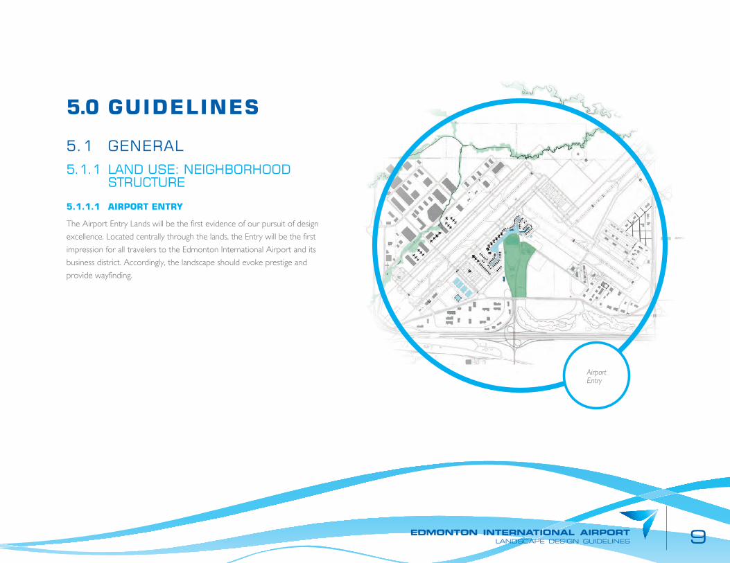
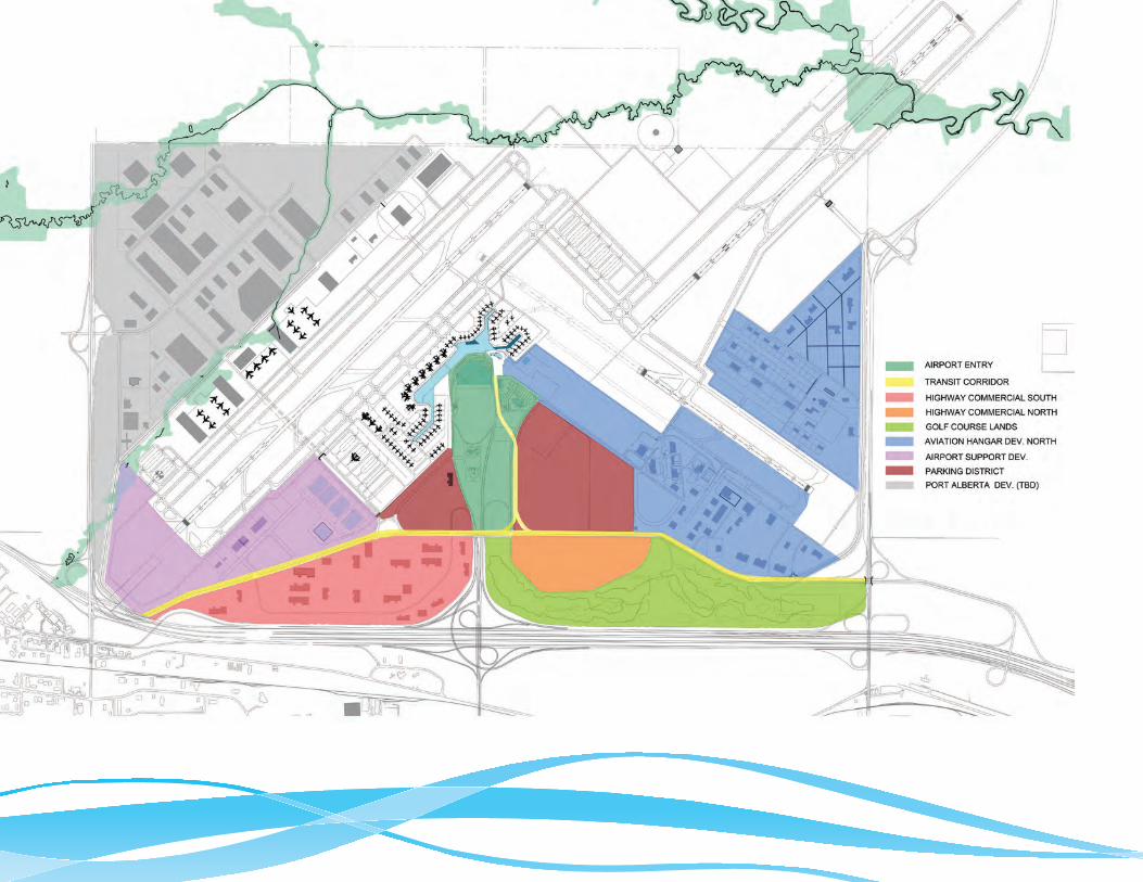
5.0 GUIDELINES
5.1 GENERAL
5.1.1 LAND USE: NEIGHBORHOOD STRUCTURE
5.1.1.1 AIRPORT ENTRY
The Airport Entry Lands will be the first evidence of our pursuit of design
excellence. Located centrally through the lands, the Entry will be the first
impression for all travelers to the Edmonton International Airport and its
business district. Accordingly, the landscape should evoke prestige and
provide wayfinding.
9edmonton international airportlandscape design guidelines
Airport Entry

10
5.1.1.2 TRANSIT CORRIDOR
The EIA Lands will be connected with the City in the future. The corridor
becomes the gateway to the Airport lands. Like the Airport Entry, this will
become the first impression for travelers via future light rail transit. Views
from the corridor should be framed and relate to the speed at which the
transit is entering the lands. The Transit Corridor is both a gateway and
experience that should invigorate passengers as they enter the airport and
introduce them to the city of Edmonton as they leave the airport lands.
Transit Corridor
Highway Commercial South
5.1.1.3 HIGHWAY COMMERCIAL SOUTH
The Highway Commercial South lands will be evident from Highway 2,
thus creating a first impression for visitors from the south to the airport
lands. Consideration should be given to screen deleterious views that
may occur as the result of commercial or industrial activities. The edge
of the lands with the highway should have a strong landscape character
that offers windows into the airport lands. The streets of the Highway
Commercial South should provide vegetated corridors, pleasant for vehicle
drivers and comfortable for pedestrians.
11edmonton international airportlandscape design guidelines
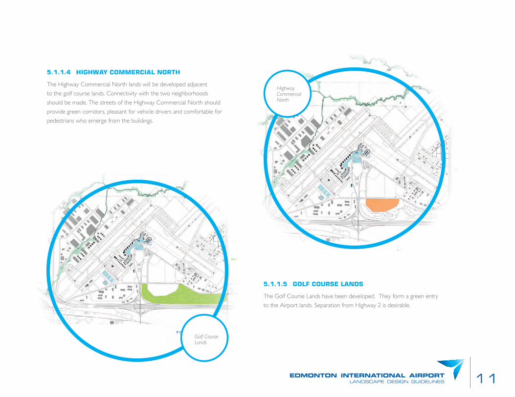
5.1.1.5 GOLF COURSE LANDS
The Golf Course Lands have been developed. They form a green entry
to the Airport lands. Separation from Highway 2 is desirable.
5.1.1.4 HIGHWAY COMMERCIAL NORTH
The Highway Commercial North lands will be developed adjacent
to the golf course lands. Connectivity with the two neighborhoods
should be made. The streets of the Highway Commercial North should
provide green corridors, pleasant for vehicle drivers and comfortable for
pedestrians who emerge from the buildings.
Highway Commercial North
Golf Course Lands
12
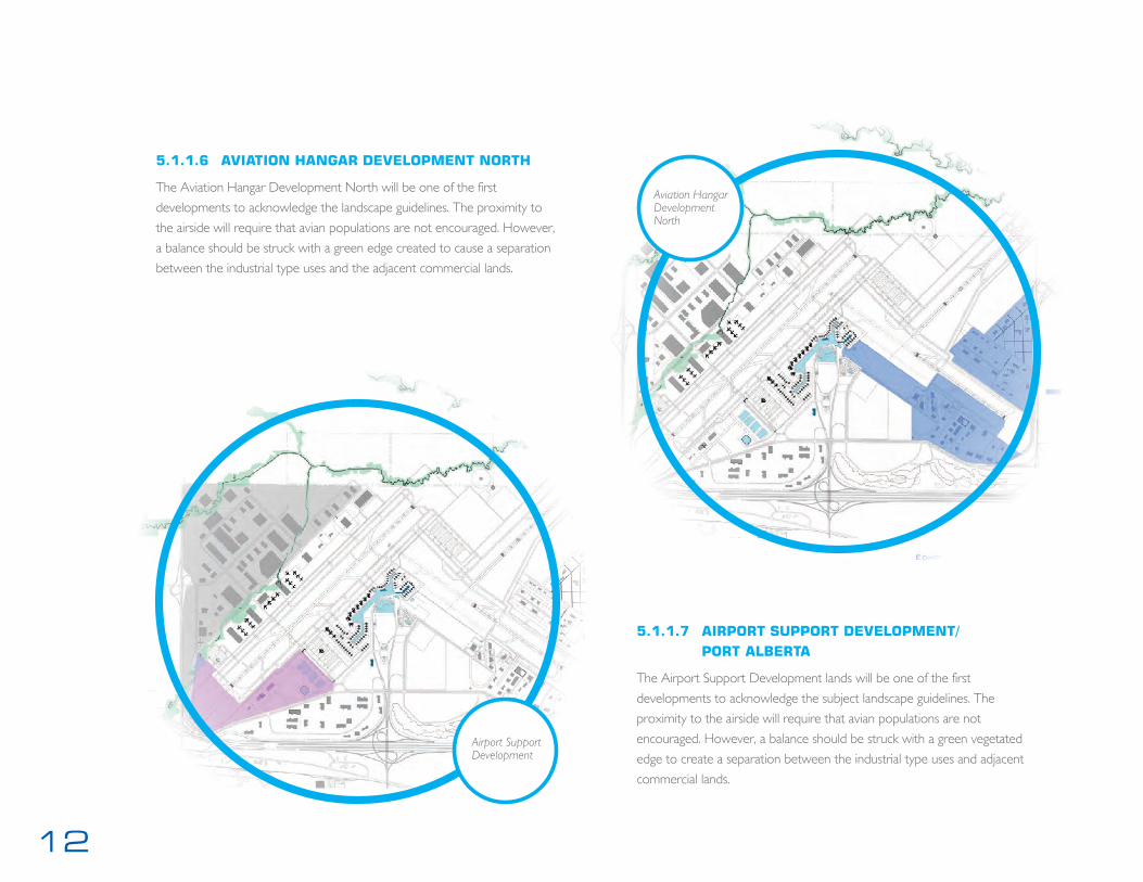
5.1.1.6 AVIATION HANGAR DEVELOPMENT NORTH
The Aviation Hangar Development North will be one of the first
developments to acknowledge the landscape guidelines. The proximity to
the airside will require that avian populations are not encouraged. However,
a balance should be struck with a green edge created to cause a separation
between the industrial type uses and the adjacent commercial lands.
Aviation Hangar Development North
Airport Support Development
5.1.1.7 AIRPORT SUPPORT DEVELOPMENT/ PORT ALBERTA
The Airport Support Development lands will be one of the first
developments to acknowledge the subject landscape guidelines. The
proximity to the airside will require that avian populations are not
encouraged. However, a balance should be struck with a green vegetated
edge to create a separation between the industrial type uses and adjacent
commercial lands.

13edmonton international airportlandscape design guidelines
Parking District
5.1.1.8 PARKING DISTRICT
The EIA Lands require generous parking districts. The expanse of pavement
will provide a canvas for the implementation of planting and environmental
approaches to help create a comfortable environment, reduce the heat
island effect, help manage stormwater and mitigate negative environmental
impacts. Pedestrians will want comfortable access to the airport terminal.
The micro-climatic landscape should be designed provide some climate
control and comfort. Pedestrian routes should provide safe access to
shuttles and the terminal.
14
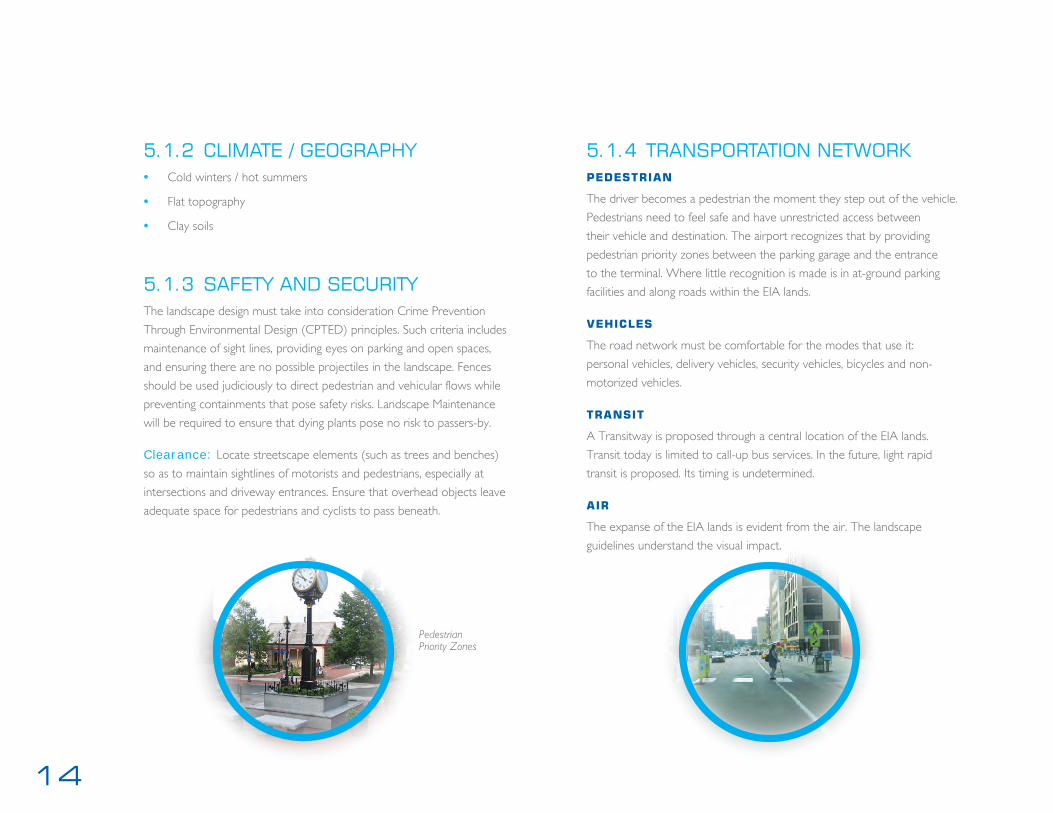
5.1.2 CLIMATE / GEOGRAPHY • Cold winters / hot summers
• Flat topography
• Clay soils
5.1.3 SAFETY AND SECURITYThe landscape design must take into consideration Crime Prevention
Through Environmental Design (CPTED) principles. Such criteria includes
maintenance of sight lines, providing eyes on parking and open spaces,
and ensuring there are no possible projectiles in the landscape. Fences
should be used judiciously to direct pedestrian and vehicular flows while
preventing containments that pose safety risks. Landscape Maintenance
will be required to ensure that dying plants pose no risk to passers-by.
Clearance: Locate streetscape elements (such as trees and benches)
so as to maintain sightlines of motorists and pedestrians, especially at
intersections and driveway entrances. Ensure that overhead objects leave
adequate space for pedestrians and cyclists to pass beneath.
Pedestrian Priority Zones
5.1.4 TRANSPORTATION NETWORKpedestrian
The driver becomes a pedestrian the moment they step out of the vehicle.
Pedestrians need to feel safe and have unrestricted access between
their vehicle and destination. The airport recognizes that by providing
pedestrian priority zones between the parking garage and the entrance
to the terminal. Where little recognition is made is in at-ground parking
facilities and along roads within the EIA lands.
vehicles
The road network must be comfortable for the modes that use it:
personal vehicles, delivery vehicles, security vehicles, bicycles and non-
motorized vehicles.
transit
A Transitway is proposed through a central location of the EIA lands.
Transit today is limited to call-up bus services. In the future, light rapid
transit is proposed. Its timing is undetermined.
air
The expanse of the EIA lands is evident from the air. The landscape
guidelines understand the visual impact.

15edmonton international airportlandscape design guidelines
5.1.5 ENCOURAGE CREATIVITY AND INNOVATION
The Landscape Design Guidelines encourage creativity and innovation through:
• Places that show a balance between the built and natural heritage.
• Places that are environmentally healthy, with well-placed built and
landscape elements.
• Comfortable destinations that have visual interest and reflect the
community.
• Intersections that are visually interesting places and reflect the identity
of the immediate stakeholders.
• Streets that are pedestrian-friendly public places with streetfront identity.
Unique Character: First impressions of the airport will be the most
lasting. Therefore, gateways present high-impact opportunities to convey
the Airport’s unique character.
Gateways: In its most elementary form, a gateway is a form defining
an entrance from one domain to another. A gateway relates to the
speed, mode, and reason for the traveler entering. A true gateway is a
combination of elements that together create an experience announcing
passage into a new domain.
Gateway Components: The entrance features may consist of walls
gates, signs, fences, trees, shrubs, flowers, and any other related component.
Gateway Hierarchy: Create a hierarchy of gateway elements that
reflect the importance of the area. The most important areas determined
should have gateways at a scale that are appropriate for the space. For
example, the gateway at the Airport Lands limits ought to command a
presence when passing through at a higher speed, along a wider road.
Gateways at neighbourhoods within the Airport Lands ought to be
recognizable at a smaller, pedestrian scale.
Public Art: Public art creates character and identity, contributing to the
overall spirit and success of the community. For a small percentage of a
total project budget, public art will provide an added level of sophistication
and quality. A public art strategy is encouraged to identify appropriate
opportunities for art and the requirements for making it happen.
• Public art locations include gathering places, street intersections,
courtyards, and institutional or public building sites.
• Public art should not be installed where no opportunity for casual
surveillance exists. Conversely, pieces should benefit from visibility
from adjacent buildings and/or public streets.
• Public art pieces should be integrated into the appropriate paving
materials that complement the piece. Benches should be located nearby.
• Art should celebrate historic events and figures of Edmonton,
commerce and flight.
• Sites should be reserved for groupings of complementary pieces,
included temporary installations
Identification: The signage component of an entrance feature shall
include the name of the district/ neighbourhood/ community.

16
ROAD HIERARCHY KEY MAP

17edmonton international airportlandscape design guidelines
5.1.6 STREETSCAPE
Collector Industrial – Urban
Divider Arterial – Urban
The streetscape should throughout EIA lands indicate a sense of
place and connectivity between its neighbourhoods. Appendix B
provides graphic product information. B-1 indicates site furnishings to
be used throughout EIA lands. B-2 describes paving and subterranean
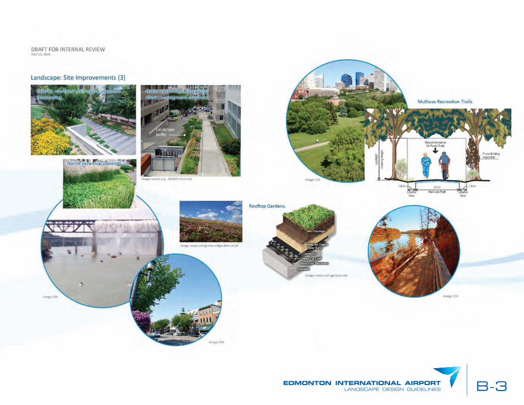
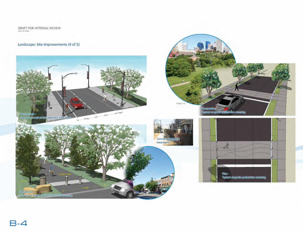
support for pavement and tree planting. B-3, 4, 5 further describes
greenroofs and pavement types for pedestrian areas.
18
Divider Arterial – Rural
5.1.6 STREETSCAPE
Local Industrial – Urban
19edmonton international airportlandscape design guidelines
Building Related Landscape: Provide landscaping at major access
points to the site. Refer to other landscape sections in this document.
Provide landscaping in front of blank walls. Provide appropriate landscaping
and ensure the landscaping does not block views from public streets to the
built form. Feature paving in the public right-of-way should extend to the
building edge. Encourage paved forecourts where front yard setbacks are
less than 3.0 m, and landscape in the form of shrub and flowerbeds or raised
planters could be incorporated in the forecourt areas. Front yard guidelines
for landscaping also apply to exterior side yards. Provide a boulevard
between the sidewalk and the right-of-way where space provides.
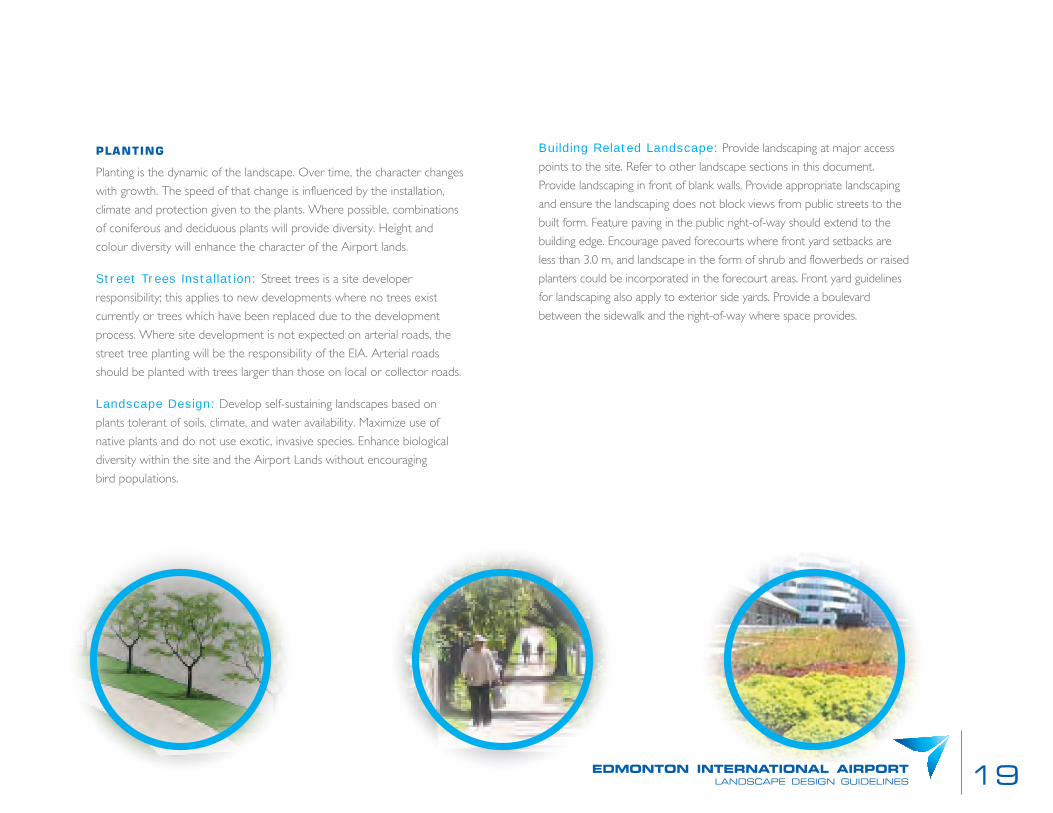
planting
Planting is the dynamic of the landscape. Over time, the character changes
with growth. The speed of that change is influenced by the installation,
climate and protection given to the plants. Where possible, combinations
of coniferous and deciduous plants will provide diversity. Height and
colour diversity will enhance the character of the Airport lands.
Street Trees Installation: Street trees is a site developer
responsibility; this applies to new developments where no trees exist
currently or trees which have been replaced due to the development
process. Where site development is not expected on arterial roads, the
street tree planting will be the responsibility of the EIA. Arterial roads
should be planted with trees larger than those on local or collector roads.
Landscape Design: Develop self-sustaining landscapes based on
plants tolerant of soils, climate, and water availability. Maximize use of
native plants and do not use exotic, invasive species. Enhance biological
diversity within the site and the Airport Lands without encouraging
bird populations.
20
of the tree to the nearest wall. Use root barriers to control the root
systems from interfering with underground structures where conditions
pose potential conflict with roots and surfaces in the future. In existing
conditions, where the landscape strip in combination with available private
property adjacent to the property line exceeds 2.0 m in width, street tree
planting between the sidewalk/curb and the building should be made.
Where redevelopment occurs along local roads, a single row of high-
branching street trees should be provided. These trees should be located
at the same distance from the road’s edge as adjacent trees, and should
also be spaced to match the rhythm of existing trees along that road.
Type: All plant materials shall be of a species capable of healthy growth
in the Edmonton area and shall conform to the specifications of the
Landscape Alberta Nursery Trades Association (LANTA). Trees and
shrubs are not to be the types which will attract birds or provide them
with feed. A list of plant materials is provided in Appendix A. New
plantings shall be minimum 60 mm caliper on all streets. On the entry
arterial road, plant trees minimum 80 mm caliper for immediate impact.
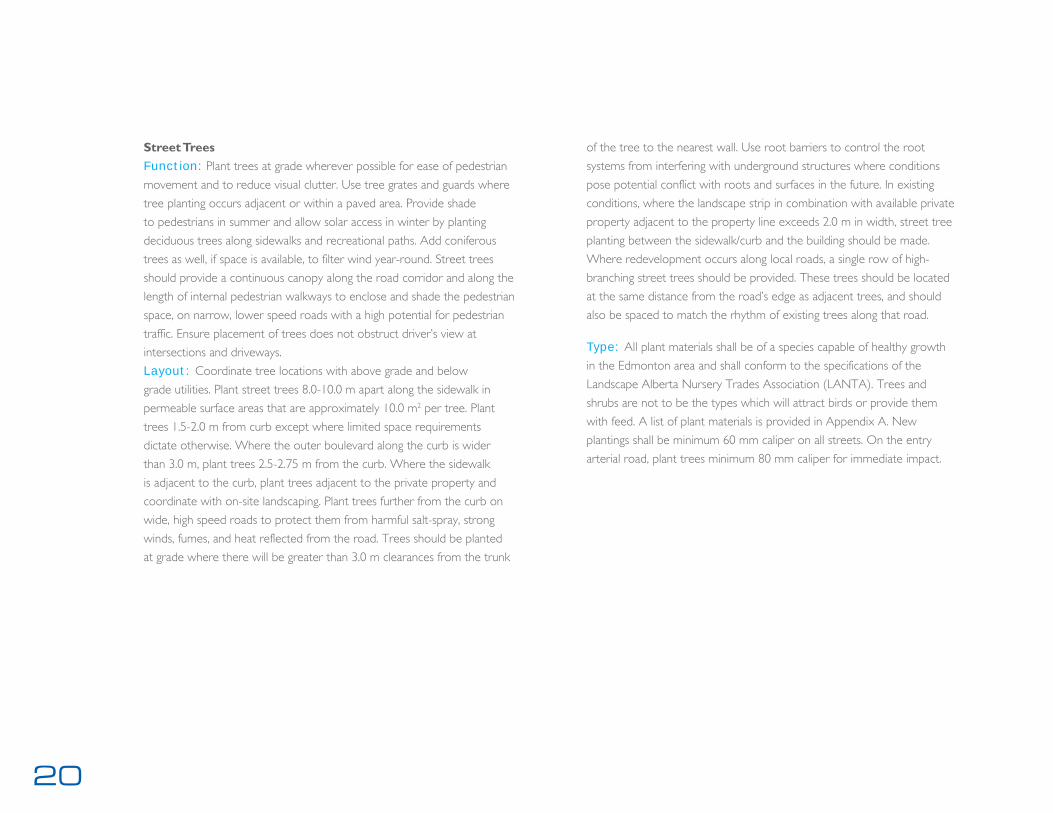
Street TreesFunction: Plant trees at grade wherever possible for ease of pedestrian
movement and to reduce visual clutter. Use tree grates and guards where
tree planting occurs adjacent or within a paved area. Provide shade
to pedestrians in summer and allow solar access in winter by planting
deciduous trees along sidewalks and recreational paths. Add coniferous
trees as well, if space is available, to filter wind year-round. Street trees
should provide a continuous canopy along the road corridor and along the
length of internal pedestrian walkways to enclose and shade the pedestrian
space, on narrow, lower speed roads with a high potential for pedestrian
traffic. Ensure placement of trees does not obstruct driver’s view at
intersections and driveways.
Layout: Coordinate tree locations with above grade and below
grade utilities. Plant street trees 8.0-10.0 m apart along the sidewalk in
permeable surface areas that are approximately 10.0 m2 per tree. Plant
trees 1.5-2.0 m from curb except where limited space requirements
dictate otherwise. Where the outer boulevard along the curb is wider
than 3.0 m, plant trees 2.5-2.75 m from the curb. Where the sidewalk
is adjacent to the curb, plant trees adjacent to the private property and
coordinate with on-site landscaping. Plant trees further from the curb on
wide, high speed roads to protect them from harmful salt-spray, strong
winds, fumes, and heat reflected from the road. Trees should be planted
at grade where there will be greater than 3.0 m clearances from the trunk
21edmonton international airportlandscape design guidelines
Plant Species: Avoid the selection of one species of tree for more
than ten trees in a row within the street boulevard. Provide varieties of
trees with similar characteristics of form, height, and colour. All tree species
should require low maintenance, be pollution- and salt-tolerant, and be a
combination of deciduous and coniferous native species for year-round
character. Standard shade trees planted within landscape strips should
be spaced as recommended above. Refer to the Preferred Street Tree
Species List (see Appendix C). High branching tree species, or columnar
tree species, may be used to allow views through to private commercial
development. Two or three tree species should be used consistently
within landscape strips along corridors and should be comprised of low-
maintenance species that are pollution- and salt-tolerant. Groupings of
the same species of tree can be used provided that there are occasional
plantings of other species to prevent monocultures and their associated
hazards. Accent planting, in the form of small flowering trees, may be used
at the four corner areas to distinguish a specific road intersection. These
plantings should be placed to ensure standard sightline clearances. Consider
using distinctive tree and vegetation species, such as flowering (but not
fruit-bearing) species, in places with a unique identity and profile.
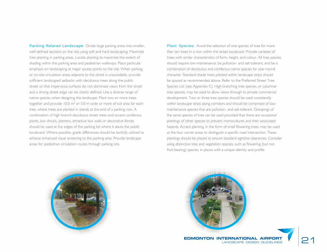
Parking Related Landscape: Divide large parking areas into smaller,
well-defined sections on the site using soft and hard landscaping. Maximize
tree planting in parking areas. Locate planting to maximize the extent of
shading within the parking area and pedestrian walkways. Place particular
emphasis on landscaping at major access points to the site. When parking
or on-site circulation areas adjacent to the street is unavoidable, provide
sufficient landscaped setbacks with deciduous trees along the public
street so that impervious surfaces do not dominate views from the street
and a strong street edge can be clearly defined. Use a diverse range of
native species when designing the landscape. Plant two or more trees
together and provide 10.0 m2 or 3.0 m wide or more of soil area for each
tree, where trees are planted in islands at the end of a parking row. A
combination of high branch deciduous street trees and accent coniferous
plants, low shrubs, planters, attractive low walls or decorative fences
should be used at the edges of the parking lot where it abuts the public
boulevard. Where possible, grade differences should be tactfully utilized to
achieve enhanced visual screening to the parking area. Provide landscape
areas for pedestrian circulation routes through parking lots.
22
pavement
Pavement types, texture and colour can be indicators of use or an
aesthetic for the space it occupies. Asphalt roads indicate a space for
vehicles. The lines on that pavement will variably indicate direction,
speed, crossings or parking. Concrete pavement is often associated with
pedestrian areas: sidewalks or plazas. Alternatively, pedestrian areas may
be enlivened by installing unit pavers or natural stone.
Pedestrian Crossings: Pedestrian crossings may receive special
paving treatment to emphasize their significance. The crossings will be
made of concrete paving. Less permanent solutions may be used on local
roads and include pavement markings, Zebra crossings, and stamped
concrete. Effort must be made to provide durable markings versus painted
lines. The change in pavements indicates pedestrian priority.
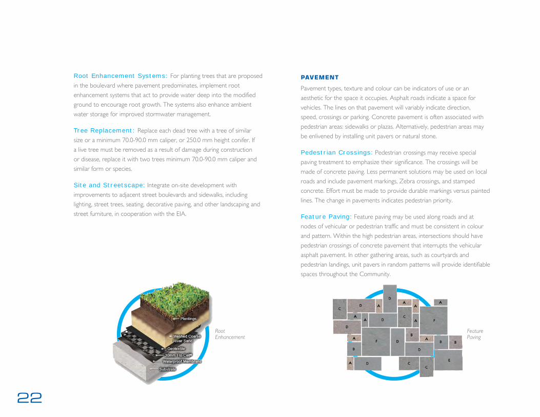
Feature Paving: Feature paving may be used along roads and at
nodes of vehicular or pedestrian traffic and must be consistent in colour
and pattern. Within the high pedestrian areas, intersections should have
pedestrian crossings of concrete pavement that interrupts the vehicular
asphalt pavement. In other gathering areas, such as courtyards and
pedestrian landings, unit pavers in random patterns will provide identifiable
spaces throughout the Community.
Root Enhancement Systems: For planting trees that are proposed
in the boulevard where pavement predominates, implement root
enhancement systems that act to provide water deep into the modified
ground to encourage root growth. The systems also enhance ambient
water storage for improved stormwater management.
Tree Replacement: Replace each dead tree with a tree of similar
size or a minimum 70.0-90.0 mm caliper, or 250.0 mm height conifer. If
a live tree must be removed as a result of damage during construction
or disease, replace it with two trees minimum 70.0-90.0 mm caliper and
similar form or species.
Site and Streetscape: Integrate on-site development with
improvements to adjacent street boulevards and sidewalks, including
lighting, street trees, seating, decorative paving, and other landscaping and
street furniture, in cooperation with the EIA.
Root Enhancement
Feature Paving
23edmonton international airportlandscape design guidelines
Walkway Width: Design walkways for pedestrian comfort. The
minimum width for internal pedestrian walkways is 1.5 m. A width of
2.0 m is the best for sidewalks. Provide a minimum 3.0 m walkway and
forecourt space between parking areas and main building entrance(s) in
order to facilitate pedestrian gathering and access. Ensure walkways and
adjacent parking spaces have a 0.6 m overlap to accommodate the car
overhang in order to avoid the use of precast curbs.
Sidewalk Paving: Distinguish walkways from driving surfaces using a
material and colour change. Keep surface of walkways reasonably level and
design them to prevent ponding of slush and water. Give paving materials
other than asphalt primary consideration for pedestrian walkways.
Encourage the use of special paving along pedestrian walkways that link
to rear parking lots. Ensure sidewalk continuity in terms of material and
slope, to reinforce pedestrian priority. When a sidewalk crosses a private
driveway, grade transitions should be made on the driveway on either side
of the sidewalk, leaving the sidewalk itself level.
Salt Strip: Construct a salt strip around the perimeter of medians
without a hard surface. This salt strip should be constructed of the same
material as other hard surface island treatments (e.g., interlocking brick,
asphalt, or textured concrete), and drain away from the median. The strip
will help prevent winterkill due to salt exposure.
Barrier-Free Access: Slope and curb cuts must be designed to allow
for universal access. Slope the boulevard to allow water to drain away from
the sidewalk, avoiding the formation of puddles and hazardous ice. The
sidewalk should slope toward the curb. Ensure that slope transitions on
the sidewalk are as gradual and unobstructed as possible, where a sidewalk
crosses an intersection.
Pedestrian Access: Walkways should be safe and direct. Provide
direct, uninterrupted pedestrian access from the public sidewalks to
building entries. Provide 2.0-3.0 m wide pedestrian walkways along any
façade with a customer entrance, along any façade adjacent to parking
areas and when the walkway provides the primary access from the public
sidewalk. A minimum 1.5 m wide internal walkway is acceptable for the
balance of the site. Consider providing a secondary building entrance
close to parking. Provide convenient access for non-vehicular users that
are distinct from vehicular access and circulation routes. Locate all clear
pedestrian travel routes at least 0.25 m away from built structures such as
buildings, walls, or fences. Ensure sidewalks have primacy to driveways and
are continuous across driving aisles. Where possible, separate pedestrians
from vehicular routes with a landscape strip.
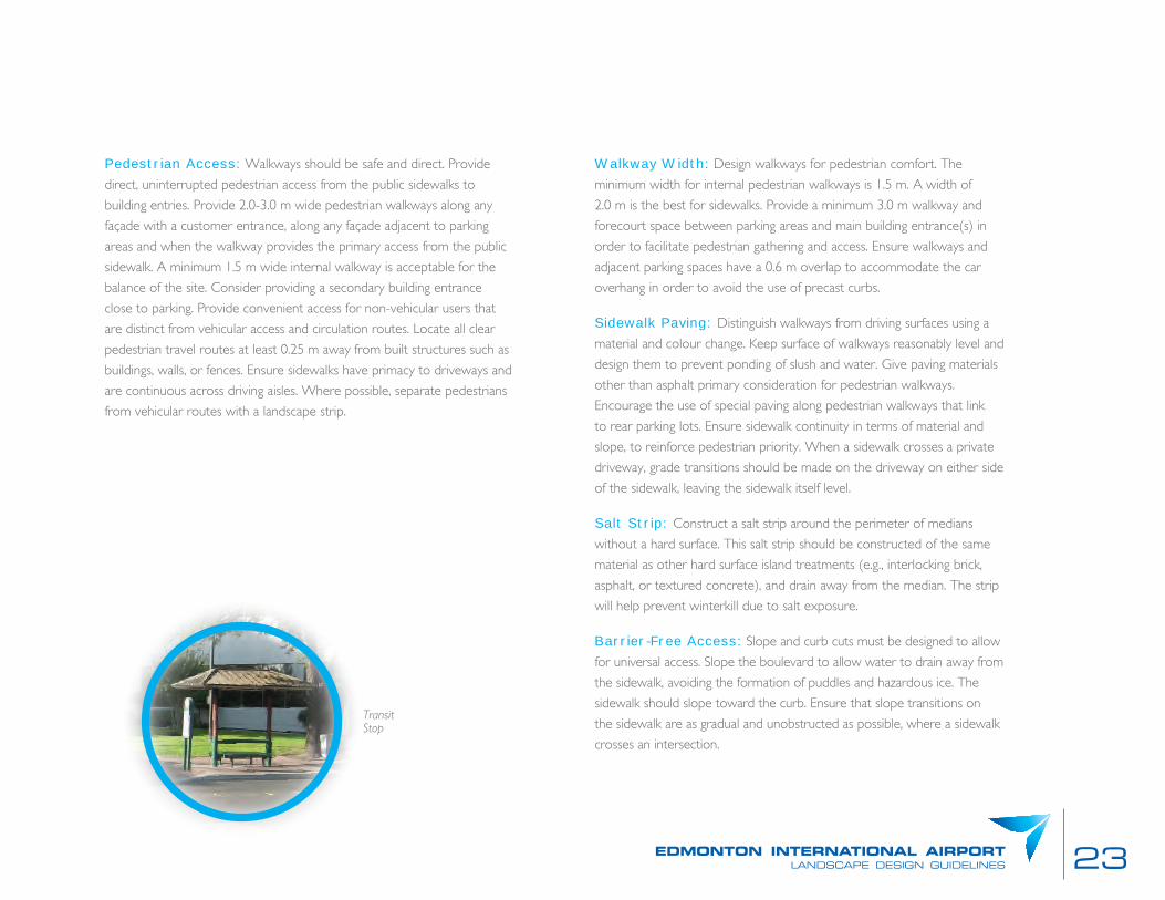
Transit Stop
24
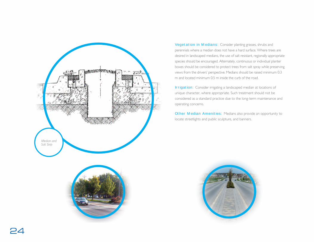
Vegetation in Medians: Consider planting grasses, shrubs and
perennials where a median does not have a hard surface. Where trees are
desired in landscaped medians, the use of salt resistant, regionally appropriate
species should be encouraged. Alternately, continuous or individual planter
boxes should be considered to protect trees from salt spray while preserving
views from the drivers’ perspective. Medians should be raised minimum 0.3
m and located minimum 0.5 m inside the curb of the road.
Irrigation: Consider irrigating a landscaped median at locations of
unique character, where appropriate. Such treatment should not be
considered as a standard practice due to the long-term maintenance and
operating concerns.
Other Median Amenities: Medians also provide an opportunity to
locate streetlights and public sculpture, and banners.
Median and Salt Strip

25edmonton international airportlandscape design guidelines
Streetscape Furnishings: Consider adding street furniture, such as
benches and shelters, in appropriate locations, subject to maintenance and
liability agreements, when located in Airport and municipal rights-of-way.
This furniture should be consistent with the site’s particular context and
streetscape concept. Design detailing and scale of street furnishings should
be coordinated with the overall existing streetscape design and architectural
character. Encourage use of feature paving, pedestrian lighting, hanging
flower baskets, banners, and other amenities. Important Intersections also
should include bollard barriers at the curbside to protect pedestrians.
Group Furnishings: Concentrations of activity are encouraged by
grouping together streetscape furnishing such as benches, planters, waste
receptacles, and newspaper boxes. Locate in conjunction with street trees
and lights, and ensure adequate pedestrian space is accommodated.
Landmark Features: Should be constructed of durable materials and
be in keeping with the scale of surroundings. They should have regard to
the travel speed of the passers-by (i.e. motorists and pedestrians).
street furnishing
The streetscape should be enhanced with furnishings that bring distinction
to the area and increases pedestrian safety and comfort. These Design
Guidelines include general recommendations for the following:
Street Lighting;
Tree Planting;
Pavement;
Street furniture; and
Cross-sectional placement guidelines for pedestrians.
See Appendix B for Furnishings Manufacturers.
Streetscape Amenities: Provide quality pedestrian-friendly amenities
along private walks. Consider opportunities for special paving, street trees,
pedestrian scaled lighting, weather protection, and lighting of the building,
public art, clocks, and well-designed street furniture, such as benches, bike
racks, and coordinated signage.

26
lighting
Lighting provides an illumination and physical presence in the landscape.
During the dark hours, light fixtures illuminate roads and public spaces for
security, safety and aesthetics. For security, dark recesses and confined
spaces should be avoided. For safety, changes in grade such as steps and
ramps should be clearly illuminated. Roads and sidewalks should be clearly
demarcated to allow safe movement through the lands. Consideration
for ensuring Dark Skies must be addressed. Illumination can create an
aesthetic of colour and dynamic change from the daytime. It can be used
to create identifiable areas. Refer to Section 5.1.6.
Street Lighting: Provide direct, well-lit, and accessible pedestrian
walkways between parking facilities and main building entrances as well
as between transit stops/shelters and buildings. Provide appropriate,
continuous illumination and lighting levels along pedestrian routes to
ensure public safety per CPTED guidelines as a minimum.
Site Lighting: Develop energy-efficient site lighting strategy that
minimizes light pollution. Consider using photovoltaic panels to power
outdoor lighting, including parking lots, walkways, and garages.
Pole Locations: Coordinate light pole locations with underground
utilities and trees.
Ample Seating: Provide seating areas in locations adjacent to a barrier-
free path of travel and near transit stop locations wherever possible. Street
furniture design should consider the ease of use by persons with disabilities,
frequency of maintenance, durability, aesthetics, and permanence of use.
Locate seating and trash receptacles 3.0 m away from each other.
Support Structures: Fixtures and poles should provide visual interest
and pedestrian scale during all times of the day, incorporating colour and
detail suitable for the area.
Banners: A “banner” program should be developed for the areas along
important corridors to create a sense of identity and also to identify
seasonal events.
signage
Signage is variably regulatory, warning, wayfinding, provides information,
interpretive or advertising. Regulatory signs are intended to control
particular aspects of travel and are provided to enforce a provincial/federal
law or municipal by-law. Warning signs are used to highlight conditions
that may pose a potential safety or convenience concern. Wayfinding
is critical to the success of the airport, organizing the many modes and
volumes of travelers. Information signs will be used more for areas where
the mode of transportation is slow such as pedestrian areas. Signage
should be integrated into the site plan for each proposed development to
ensure complimentary and overall consistency of design throughout the
study area. Advertising signs are bold and often lighted.
Refer to sign master plan for details.

27edmonton international airportlandscape design guidelines
Light Shields: Locate lamps and provide additional shielding of lamp
fixtures to avoid glare.
Light Levels: Provide minimum illumination in accordance with Municipal
and Regional illumination requirements. Provide overlap of light distribution.
Provide sufficient lighting coverage including building recesses or inside
corners. Use lighting to accentuate and animate buildings and public spaces.
Uniformity: Provide uniform lighting without sudden light-to-dark
transitions. Coordinate spacing and height of lamps with landscaping to
ensure lighting coverage is not interrupted by tree canopies.
Assist in Wayfinding: Provide illumination to improve legibility of
nodes, landmarks, and circulation areas. Provide illumination to articulate
steps and changes in grade. Align lamps in consistent, recognizable, and
unambiguous patterns. Provide a uniform and modest brightness along
paths of travel. Ensure mid-block pedestrian walkways or ‘mews’ that link
rear lanes or parking areas to the Corridors are lit.
Luminaire: Light luminaires should be chosen to integrate into the
overall streetscape design and architectural character.
Pedestrian Lighting: Pedestrian streetlights should be located
along intensively used areas and where pedestrian use is foreseen or
encouraged. Consider pedestrian-scale light fixtures either in conjunction
with vehicular lighting or as freestanding elements. Lighting at a suitable
height for pedestrians may be added to existing vehicular light poles.
Energy Conservation: Employ alternatives to incandescent or mercury
vapour lamps. Maintain light levels within recommended footcandle range
set out by IES guidelines. Dim down lighting to minimum levels after normal
operating hours. Consider solar-powered lights, either at light source or a
separate location.
Light Pollution Reduction: Provide full cut-off lighting (0 percent
of peak intensity radiating above 90 degrees and 10 percent of peak
intensity above 80 degrees). Employ low cut-off where full cut-off lighting
alternatives are not feasible. Beacon or flashing lights are regulated by Nav
Canada. Locate lamps to direct light away from neighbouring properties
and provide supplementary shielding of lamps. Provide lamp fixture
mounting heights that avoid glare to the vantage point of neighbouring
residential units and provide recessed light fixtures that avoid glare.

28
Bicycle Path: Safely separate bicycle and in-line skating recreational
paths from pedestrian paths where applicable. In some situations, a wider
path (3.0-4.0 m wide) can facilitate shared uses separated by a painted
line. Bicycle lanes should be on the street and have a route line painted
separate from vehicular traffic.
Sustainable Sites: Explore opportunities to enhance community,
pedestrian/transportation linkages, and open space networks, and embed
these into the design concept. Develop a site plan and massing concept
to preserve natural site features and restore degraded habitat areas
and improve hydrology. Provide facilities for transportation alternatives,
including bicycles and public transportation. Encourage occupants to use
low-emitting, high efficiency vehicles. Provide facilities for sustainable
transportation, including walking, cycling, and carpooling. Reduce
impervious surface areas to encourage groundwater recharge. Develop
stormwater management strategies to support groundwater recharge,
natural filtration, and stream channel protection. Use light coloured paving
and provide shade on paved areas to reduce the urban heat island effect.
Water Efficiency: Integrate into the design concept consideration of
water harvesting and reuse as well as alternative wastewater treatment.
Reduce reliance on irrigation systems. Where required, use efficient
systems and seek alternatives to use of potable water for irrigation
systems.
Stormwater Management: The stormwater management system
will be comprised of dry ponds, bioretention areas and permeability which
will form part of the green space for the Airport lands. Where possible,
the paved areas of all public areas should absorb and retain runoff.
5.1.7 ENVIRONMENT AND OPEN SPACEThese landscape guidelines will consider the impact of urban development
on the environment and open space. Where possible, the soft landscape
design should enhance the ability of the land to retain moisture and
regenerate without human intervention. The landscape is considered open
space and should invite users by creating a comfortable environment that
is cool in the summer and protected in the winter. The open space of the
airport lands should encourage passive and active recreation.
Outdoor Amenity Spaces: Create public and semi-public outdoor
amenity spaces or gathering places, such as courtyards, space for soft
landscaping, outdoor cafés, seating, observation areas and rooftop gardens.
5.1.8 SUSTAINABILITYIn 25 years, the airport lands will have matured and the materials used
will continue to function with the added benefit of a patina that identifies
its age. Accordingly, these landscape design guidelines will emphasize
the ability of landscape spaces to stand the test of time and encourage
reduced carbon footprint.
Pedestrian and Cycling Priority: Consider providing materials and
measures, such as bollards, distinct paving materials and colours, and grade
changes to emphasize pedestrian and cycling priority. Increase the visibility
of crossings and improve pedestrian safety in appropriate locations.
Bicycle Parking: Provide bicycle parking that is convenient, safe, and
secure near the building entrance.

29edmonton international airportlandscape design guidelines
Surface Parking Lots ‘Greening: Sustainable design principles will
be applied to the parking lot design, which will address correct locations
and efficient stall layouts in relation to street corridors and building egress.
The parking area will have landscaped bio-retention areas for better soil
and water quality and flow management. Efficient lighting fixtures and
appropriate luminaires such as solar-powered lighting will also help to set
the parking areas’ long term environmental goals. Finally, the parking layout
is required to provide a direct and continuous pedestrian network amidst
an efficient automotive circulation.
Cut and Fill: Construction of roads and sites will be compelled to
balance cut and fill. Any fill generated by construction will be placed in
locations designated by EIA and as shown in Appendix C. Material must
be tested for toxins. Clean fill will be placed in locations designated and
compacted to 98% SPD.

31edmonton international airportlandscape design guidelines
5.2 PUBLIC REALM LANDSCAPE GUIDELINES
5.2.1 AIRPORT ENTRYGeneral: Follow General Guidelines, Section 5.1 of this report unless
modified by the articles in this section.
Streetscape Amenities: Provide high-quality, pedestrian-friendly
amenities along the Airport Entry Corridor. Consider opportunities for
special paving, street trees, pedestrian scaled lighting, weather protection,
and lighting, public art, clocks, and well-designed street furniture, such as
benches, bike racks, and coordinated signage.
Fill Areas: Anticipating that there will be fill removed from developing
sites, Appendix C shows locations for clean fill to be deposited to create
buffers and features in the landscape. Upon completion of final grading
plans, 150 mm of topsoil should be placed on all berms and seeded.Outdoor Amenity Space
Exisiting Outdoor Amenity Space

32
Outdoor Amenity Spaces: Create public and semi-public outdoor
amenity spaces or gathering places, such as courtyards, outdoor cafés, seating,
and rooftop gardens on commercial developments within the Corridor.
The wedge shaped land mass between inbound and outbound traffic
should become a usable park space and double as a grand gateway to the
Airport Lands. This area can be recipient to both excess fill and topsoil
from other developments within the Airport Lands.
Gateway: The experience of entering should be dramatic. Travelers
from Highway 2 into the lands must pass through the shaped land mass.
Until the development of the transit corridor, the road into and out of the
Airport Lands should pierce the land mass that rises to a height of 6 m on
either side of the road. After construction of the Transit Corridor, a rail
bridge will further define the gateway. Once the traveler passes the land
mass and bridges, they will have sensed a change in character of the land.
They have entered the Airport Community.
Street TreesSpacing: 8 m in line and parallel to the roadway pavement. See Section
5.1.6 Streetscape for road cross-sections.
Varieties: The rows of street trees should vary every 10th tree.
Rhythm: The spacing and consistent shapes of the trees will give a
rhythm to the street for travelers.
Boulevard Landscape Buffer: In addition to the street trees, the
landscape of the corridor will be strengthened by a treed buffer that will
emphasize the green approach to the Airport Community. The buffer will
be at the north and south edges of the corridor defined by minimum two
rows of deciduous and two rows of coniferous trees.
Outdoor Amenity Space

33edmonton international airportlandscape design guidelines
Gateway

34
Streetscape Furnishings: Consider adding street furniture, such as
benches and shelters, in appropriate locations, subject to maintenance and
liability agreements, when located in Airport and municipal rights-of-way.
This furniture should be consistent with the Airport Community’s particular
context and streetscape concept. Design detailing and scale of street
furnishings should be coordinated with the overall existing streetscape design
and architectural character. Encourage use of feature paving, pedestrian
lighting, hanging flower baskets, banners, and other amenities. Attached is a
recommended family of Street Furnishings (see graphic on following page)
Signage: Directional/Informational: Signs should create a welcome as
the traveler enters the Airport Community. The space of Entry from
Highway 2 to the Transit Corridor should remain free of advertising.
Directional signage should begin as the travelers enter between the
earth mounds and pass beneath the transit corridor bridge. Beyond the
transit corridor and within the community, the Airport Entry will require a
sophisticated wayfinding sign system. Electronic and changeable signs will
provide an innovative appeal to the district.
Street Lights: The lights in this corridor should be distinct from those
of the rest of the community. The poles should be larger than the typical
street lights. They should provide space for banners and they should be
part of the Family of furnishings.
Pedestrian and Cycling Priority: Cyclists should be
accommodated on road on the overpass over Highway 2. Upon entering
the Airport lands, a separate 3m wide multiuse recreation trail should be
accommodated in the road boulevard on both sides of the access road.
This trail will provide for both cyclists and pedestrians.
Landmark Features: Within the park, a landmark feature will identify
the site of the Airport Community. It should include the words Edmonton
International Airport, but also elaborate on the other land uses within the
Community.
Entry Buffers: On the sides of the ramps leading to and from
Highway 2 and the Airport Lands, excess fill from other developments can
be used to create berms to define the vehicular entry edges. The berms
should not impede on the adjacent land uses of Highway Commercial and
Golf Course Lands, but should be built with 3:1 slopes and planted/seeded
to create a dense green mass. The planting should be developed to help
control winds and snow deposition.
Landmark Feature
35edmonton international airportlandscape design guidelines
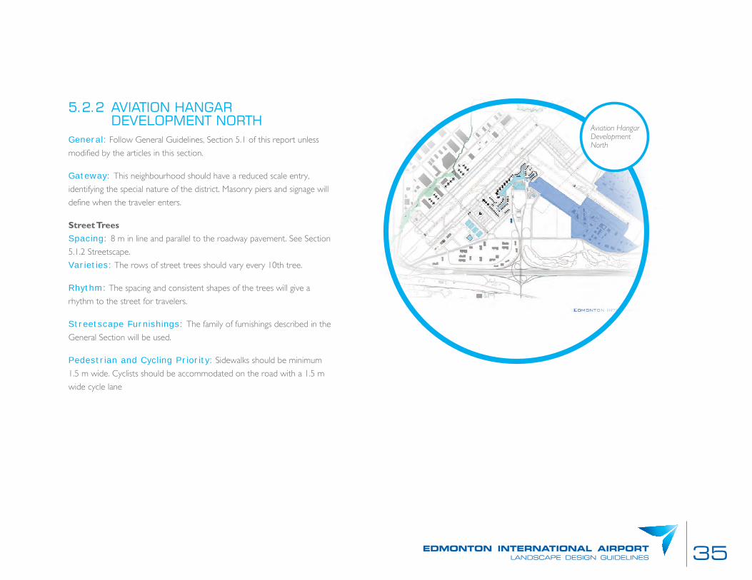
5.2.2 AVIATION HANGAR DEVELOPMENT NORTH
General: Follow General Guidelines, Section 5.1 of this report unless
modified by the articles in this section.
Gateway: This neighbourhood should have a reduced scale entry,
identifying the special nature of the district. Masonry piers and signage will
define when the traveler enters.
Street TreesSpacing: 8 m in line and parallel to the roadway pavement. See Section
5.1.2 Streetscape.
Varieties: The rows of street trees should vary every 10th tree.
Rhythm: The spacing and consistent shapes of the trees will give a
rhythm to the street for travelers.
Streetscape Furnishings: The family of furnishings described in the
General Section will be used.
Pedestrian and Cycling Priority: Sidewalks should be minimum
1.5 m wide. Cyclists should be accommodated on the road with a 1.5 m
wide cycle lane
Aviation Hangar Development North
36
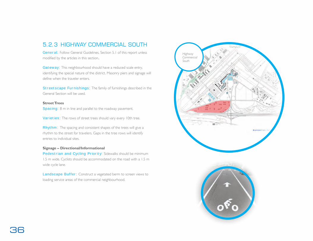
5.2.3 HIGHWAY COMMERCIAL SOUTHGeneral: Follow General Guidelines, Section 5.1 of this report unless
modified by the articles in this section..
Gateway: This neighbourhood should have a reduced scale entry,
identifying the special nature of the district. Masonry piers and signage will
define when the traveler enters.
Streetscape Furnishings: The family of furnishings described in the
General Section will be used.
Street TreesSpacing: 8 m in line and parallel to the roadway pavement.
Varieties: The rows of street trees should vary every 10th tree.
Rhythm: The spacing and consistent shapes of the trees will give a
rhythm to the street for travelers. Gaps in the tree rows will identify
entries to individual sites.
Signage – Directional/InformationalPedestrian and Cycling Priority: Sidewalks should be minimum
1.5 m wide. Cyclists should be accommodated on the road with a 1.5 m
wide cycle lane.
Landscape Buffer: Construct a vegetated berm to screen views to
loading service areas of the commercial neighbourhood.
Highway Commercial South

37edmonton international airportlandscape design guidelines
5.2.4 HIGHWAY COMMERCIAL NORTH General: Follow General Guidelines, Section 5.1 of this report unless
modified by the articles in this section.
Gateway: This neighbourhood should have a reduced scale entry,
identifying the special nature of the district. Masonry piers and signage will
define the golf course and the new facilities.
Street TreesSpacing: 8 m in line and parallel to the roadway pavement.
Varieties: The rows of street trees should vary every 10th tree.
Rhythm: The spacing and consistent shapes of the trees will give a
rhythm to the street for travelers. Gaps in the tree rows will identify
entries to individual sites.
Streetscape Furnishings: The family of furnishings described in the
General Section will be used.
Signage – Directional/InformationalPedestrian and Cycling Priority: Sidewalks should be minimum
1.5 m wide. Cyclists should be accommodated on the road with a 1.5 m
wide cycle lane.
Streetscape Furnishings: The family of furnishings described in the
General Section will be used.
Highway Commercial North

38
5.2.5 AIRPORT SUPPORT DEVELOPMENT
General: Follow General Guidelines, Section 5.1 of this report unless
modified by the articles in this section.
Gateway: This neighbourhood should have a reduced scale entry,
identifying the special nature of the district. Masonry piers and signage will
define when the traveler enters.
Street TreesSpacing: 8 m in line and parallel to the roadway pavement.
Varieties: The rows of street trees should vary every 10th tree.
Rhythm: The spacing and consistent shapes of the trees will give a
rhythm to the street for travelers. Gaps in the tree rows will identify
entries to individual sites.
Streetscape Furnishings: The family of furnishings described in the
General Section will be used.
Signage – Directional/InformationalPedestrian and Cycling Priority: Sidewalks should be minimum
1.5 m wide. Cyclists should be accommodated on the road with a 1.5 m
wide cycle lane.
Airport Support Development

39edmonton international airportlandscape design guidelines
5.2.6 GOLF COURSE LANDSGeneral: Follow General Guidelines, Section 5.1 of this report unless
modified by the articles in this section.
Gateway: This neighbourhood should have a reduced scale entry,
identifying the special nature of the district. Masonry piers and signage will
define the golf course and the Highway Commercial North Districts.
Street TreesSpacing: 6 m in line and parallel to the roadway pavement.
Varieties: The rows of street trees should vary every 10th tree.
Rhythm: The reduced spacing of trees will introduce the green concept
of the Golf Course Lands, while providing protection from errant balls.
Highway 2 Buffer: The golf course is visible from Highway 2.
Consequently, the playout area of the golf course includes the buffer area.
For further protection for the highway, the buffer should be increased
with the addition of fill and topsoil in a rolling berm. Plantings should be
increased to encourage the future development of a grove of mixed
coniferous and deciduous trees.
Streetscape Furnishings: The family of furnishings described in the
General Section will be used.
Pedestrian and Cycling Priority: Sidewalks should be minimum
1.5 m wide. Cyclists should be accommodated on the road with a 1.5 m
wide cycle lane.
Golf Course Lands

40
5.2.7 PARKING DISTRICTGeneral: Follow General Guidelines, Section 5.1 of this report unless modified by
the articles in this section.
Gateway: This neighbourhood should have a reduced scale entry, identifying the special
nature of the district. Masonry piers and signage will define when the traveler enters.
Street Trees: The streets will introduce a green character to this area that will become
an expanse of parking. It should set the tone for development of the parking areas.
Spacing: 10 m in line and parallel to the roadway pavement.
Varieties: The rows of street trees should vary every 10th tree.
Rhythm: The spacing and consistent shapes of the trees will give a rhythm to the
street for travelers. Gaps in the tree rows will identify entries to individual sites.
Streetscape Furnishings: The family of furnishings described in the General
Section will be used.
Signage: Directional/Informational: Directional signage will be key to the success of this
parking District. Such signage will need to address travelers in vehicles and on foot.
Pedestrian and Cycling Priority: Sidewalks should be minimum 1.5 m wide.
Cyclists should be accommodated on the road with a 1.5 m wide cycle lane.
Surface Parking Lots ‘Greening’: Sustainable design principles will be
applied to the parking lot design, which will address correct locations and efficient
stall layouts in relation to street corridors and building egress. The parking area
will have landscaped bio-retention areas for better soil and water quality and flow
management. Efficient lighting fixtures and appropriate luminaires such as solar-
powered lighting will also help to set the parking areas’ long term environmental
goals. Finally, the parking layout is required to provide a direct and continuous
pedestrian network amidst an efficient automotive circulation.
Parking District
41edmonton international airportlandscape design guidelines
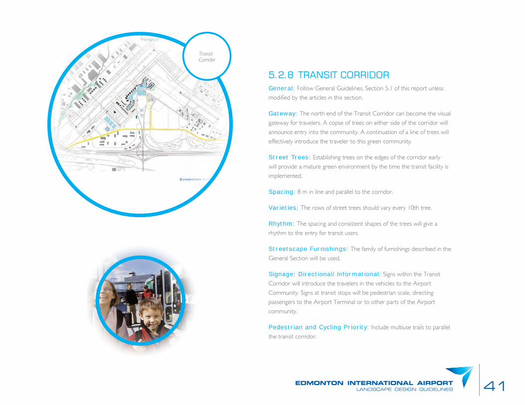
5.2.8 TRANSIT CORRIDORGeneral: Follow General Guidelines, Section 5.1 of this report unless
modified by the articles in this section.
Gateway: The north end of the Transit Corridor can become the visual
gateway for travelers. A copse of trees on either side of the corridor will
announce entry into the community. A continuation of a line of trees will
effectively introduce the traveler to this green community.
Street Trees: Establishing trees on the edges of the corridor early
will provide a mature green environment by the time the transit facility is
implemented.
Spacing: 8 m in line and parallel to the corridor.
Varieties: The rows of street trees should vary every 10th tree.
Rhythm: The spacing and consistent shapes of the trees will give a
rhythm to the entry for transit users.
Streetscape Furnishings: The family of furnishings described in the
General Section will be used.
Signage: Directional/Informational: Signs within the Transit
Corridor will introduce the travelers in the vehicles to the Airport
Community. Signs at transit stops will be pedestrian scale, directing
passengers to the Airport Terminal or to other parts of the Airport
community.
Pedestrian and Cycling Priority: Include multiuse trails to parallel
the transit corridor.
Transit Corridor
42
5.3 PRIVATE REALM: SITE GUIDELINES
5.3.1 GENERAL LANDSCAPE REQUIREMENTS
Follow General Guidelines, Section 5.1 of this report unless modified by
the articles in this section. The landscape character of each of the sites
within the Edmonton Airport Lands contributes to the overall vision of
the Community.
Landscape Plan: Each site is to be landscaped in accordance with
the plan approved by Edmonton International Airports. Landscaping in
accordance with the approved plans must be installed onsite within 60 days
of completion of the building. A letter of credit in the amount of 50% is to
be provided as security. Plans, specifications, and inspections for landscaping
shall be prepared and completed by a professional Landscape Architect.
The landscape will be maintained and warranted for two years from date of
completion. Upon written acceptance by the landscape architect at the end
of the warranty period, the letter of credit will be released.
Plant Size: The minimum size of trees and shrubs are to be as follows:
deciduous trees – 60 mm (2") caliper; coniferous trees – 2.5 m (8') height
and shrubs – 400 mm (1'-6") height or spread. Coniferous trees and
shrubs shall comprise a minimum proportion of 50% of all trees planted.
Plant Species: All plant materials shall be of a species capable
of healthy growth in the Edmonton area and shall conform to the
specifications of the Landscape Alberta Nursery Trades Association
(LANTA). Trees and shrubs are not to be the types which will attract
birds or provide them with feed. See Appendix A.
Side and Rear Yard Planting: 4 m wide buffer will include a dense
planting of conifers and deciduous plants that, when mature will provide
a continuous canopy or vegetative barrier. Where buffers are wide
enough, consider clusters of planting. For narrow areas, rows of plantings
are appropriate.
Landscape Site Perimeter: Maximize landscaping along the
perimeters of sites. Space trees to screen the development site from
adjacent uses. Provide high branching street trees and low shrub planting
in medians and at major access driveways, which do not obstruct vehicular
views. Provide streetscape of trees and shrubs to screen cars/headlights
while allowing safety and views. Create a 4.0 m wide landscape buffer to
separate development from adjacent uses that may be negatively affected
(e.g. other offices). Plant the buffer with coniferous and deciduous trees and
provide a screening wall/fence to separate conflicting land uses. Create a
minimum 1.5-3.0 m wide landscape strip adjacent to non-sensitive uses such
as other commercial use for visual screening and environmental benefits.
Street Tree Planting: Site developers are responsible for street tree
planting in the boulevards of streets adjoining the property. See section 5.1.6.
Front Yard Planting: Consider the location of street trees with
respect to the front yard planting. Provide screening of parking located
between the building and street. Parking screening will include a
combination of earth shaping, shrub planting and hard features. Implement
continuous foundation plantings of shrubs and perennials adjacent to the
buildings. Consider the use of trees for sun and wind control.
Lawn Areas: To the extent possible, minimize areas of weekly
maintenance such as lawns. However, it is expected that there may be
some locations where this is warranted. Accordingly, all sites shall have
properly maintained grass along the front of each site, between the road
right-of-way and the building, or between the road right-of-way and the
parking area.

43edmonton international airportlandscape design guidelines
Driveway Length: Driveways should be as short as possible. This
saves construction costs, reduces maintenance and snow removal costs
and is better for the environment.
Parking Dividers: Large parking areas should be broken into smaller lots
each containing 100 spaces or less, separated by a minimum 3.0 m wide
landscaped strip. The strip should be planted with primarily deciduous trees
to allow for visibility for safety while providing shade in summer and some
wind control in winter. The parking dividers can also act as access routes
for pedestrians. They should be planned and oriented to allow pedestrians
direct access to their destinations, transit stops or shuttles. As a minimum,
Site Furnishings: The family of furnishings described in the General
Section may be used or consider site furnishings that complement the
district furnishings in colour and form.
Pedestrian Scale: Incorporate signs into low walls, located at the
edges of sidewalks, and in landscape areas, making sure that a clear path of
travel exists and that visibility is maintained.
Parking Areas: Parking areas should be screened from public roads
and properties by topography or landscaping to minimize its visual impact.
Parking Dividers

44
for every ten (10) parking stalls, an area equivalent to one (1) stall is to be
landscaped with a minimum of one (1) canopy tree and shrubs, entry ways
to parking lots are to be landscaped to define their location.
Thematic Design: Encourage thematic design of signage for multiple tenant
retail developments, such that it contributes to a unified building presence.
Garbage Storage: Sustainable material (i.e. metal/concrete) graphic.
Waste Collection On-Site: Waste disposal will be temporarily stored
on site with appropriate landscape screening away from the public amenity
areas. This central storage and collection area will have fence enclosures
and will be easily accessible by garbage collection vehicles.
Clarity: A high level of clarity, visibility and visual interest should be
attained with minimal visual clutter and impact on adjacent uses.
Pedestrian and Cycling Priority: Walks should be minimum 1.5 m wide.
Provide bicycle stands at a rate of one space per 20 car parking spaces.
Green Roofs: Use of green roof technology and any other sustainable
building technologies are strongly encouraged.
Stormwater Management Areas Landscaping: As part of the overall
development and servicing of the Airport lands, a stormwater management
system will be developed for each site. The stormwater management system
of sites will require that runoff post development matches pre-development
flows. This will form part of the green space for the Airport lands. If dry ponds
are proposed as part of the stormwater management system, they are to be
landscaped at a minimum rate of 75 plants per hectare of developed area.
Consider rain gardens as part of the development to retain flows and increase
the green space. Coniferous trees are to comprise a minimum of 50% of all
tree species for the stormwater management areas. Permeable paving should
be incorporated into the project to assist with stormwater management. No
permanent standing water will be proposed.
Dry Pond
Green Roof

45edmonton international airportlandscape design guidelines
5.3.2 SINGLE TENANT SITESFront Yards: Where possible buildings will be sited at the front setback.
Front Yard Parking: Where parking is provided between the street
and building direct pedestrian access will be provided from the sidewalk to
the front entrance. Planting will screen vehicles while maintaining CPTED
principles. Example is shown.
5.3.3 MULTIPLE TENANT SITESDriveways: Driveway design will provide for stacking to meet the needs
of the parking size. Planted medians will be 3 m wide to accommodate
sidewalk and tree planting (1 tree per 5 m)
Multiple-Tenant Signs: Multi-tenant commercial developments
should develop locations and signage guidelines that accommodate the
need for unique tenant signage, while at the same time, ensure a degree of
continuity of architectural design elements.
Pedestrian Access: Sidewalks will be provided to give sage access
from all parking to the primary building entrance. Walkways will provide
direct pedestrian access from the road to primary building entrance.
Foundation Planting: Planting will be provided at the foundation
of buildings between entrances. Example is shown.

47edmonton international airportlandscape design guidelines
6.0 GLOSSARYCorridors: Areas of street-oriented uses which incorporate a mix of
retail, employment and residential uses, developed at medium densities,
located along arterial or collector roads serving as major transit routes.
Such corridors may form the boundaries of residential subdivisions or
neighbourhoods, but should act as a linear focus for activities and uses
within the community.
Nodes: Compact, transit-oriented, pedestrian-friendly areas where the
highest concentrations of residential, employment, retail and other uses in
the urban area are located. Activity nodes are generally located at points
where two or more transit routes or travel modes intersect.
Area Municipality: An incorporated city, town, village or township
within a regional municipality, county or district municipality.
Density, High, Medium, Low: Generally, low density development
refers to detached single family residential development, or the low-
rise commercial or industrial development densities usually found in
auto-oriented industrial parks or along highway-commercial strips;
medium density development refers to low-rise multi-family residential
development or low-rise commercial/residential development usually
found along a pedestrian-oriented “Main Street”; and high density
development refers to the more concentrated development patterns
typically found in the centres of urban areas.
District: An intermediate scale of planning area, smaller than a local
municipality, but comprising a number of neighbourhoods within a
municipality. Detailed land use planning policies at the district level are
usually addressed in secondary plans.
Established Front Building Line: Average front yard depth, as measured
from the street line to the main wall of the existing building situated on
two lots on the same side of the same street, which immediately abut the
property, at the time of the application for a building permit. In the case
of a corner lot, or where one or both of the abutting lots are vacant, the
next adjacent non-vacant lot shall be used in calculating the Established
Front Building Line.
Major Intersection: The point at which two or more arterial roads cross.
Mixed-Use Development: Areas characterized by a wide variety of
shopping, employment, entertainment, light industrial and residential uses.
Mixed-use development may occur at the level of individual buildings or
complexes, or at a larger scale within activity nodes or corridors.
Neighbourhood: A collection of one or more subdivisions, usually
served by local park facilities, a public school, and a variety of locally -
oriented commercial and retail facilities.
Pedestrian: Refers to all people on foot or moving at walking speed,
including those who use mobility aids (wheelchairs, scooters etc.), persons
with strollers and buggies, and frail elderly persons.
Pedestrian-Oriented Uses: Uses which rely on pedestrian traffic for
the majority of their business. Such uses typically include specialized retail
and food stores, restaurants, personal service establishments, convenience
stores, repair shops, etc. Wherever possible, these uses should be located
at street level along activity corridors and in activity nodes, and their major
entrances should open directly onto the street.
48
Transit: Transit includes public buses, streetcars, subways, and commuter
rail lines. In this document transit also encompasses public trains; ferries;
buses (including intercity buses) operated by private companies and
available to the public; Board of Education transportation systems; private
company/institutional vans made available to employees, customers, or
residents; taxis; and related pedestrian activities, as well as specialized
transit services.
Transit Corridor: A section of a transit route, usually located in a major
activity corridor or town centre, where transit vehicles are the exclusive or
dominant form of transportation in association with pedestrian travel and
possibly bicycling.
Private Realm: The parts of a village, town or city (whether publicly or
privately owned) that are only available to a private organization of people
where entry and use is regulated and monitored.
Public Realm: The parts of a village, town or city (whether publicly or
privately owned) that are available, without charge, for everyone to use or
see, including streets, squares and parks.
Roads, Arterial: Major traffic and transit routes, intended to carry large
volumes of vehicular traffic. Arterial roads should provide continuous
routes across urban areas.
Roads, Collector: Traffic and transit routes designed to carry lower
volumes of traffic than arterial roads, and providing continuous access
across neighbourhoods. Collector roads should be bordered by higher
density uses than surrounding low density residential areas, to support
their role as transit routes.
Roads, Local: Roads designed to carry low traffic volumes, at low
speeds, which are intended primarily to provide access to abutting uses,
rather than to provide through traffic routes.
Secondary Plan: A land use policy plan for a district or large
neighbourhood within a municipality which provides more detailed land
use policies and designations than those found in a municipal official plan.
Streetscape: The visual appearance of a vehicular-dominated corridor
formed by the location of physical features such as buildings, pedestrian,
cycling and vehicular facilities and landscaping. Applies to the cross-section
of the Transit Corridor as well.
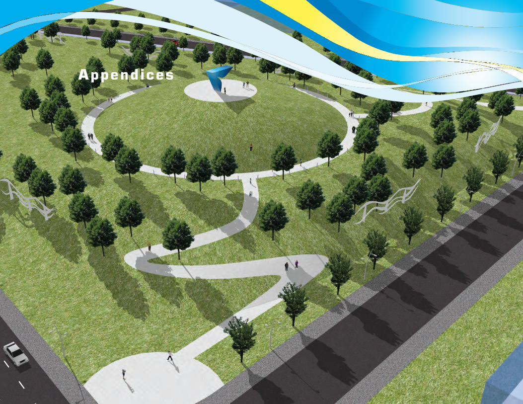
Appendices

Appendix A: Plant List
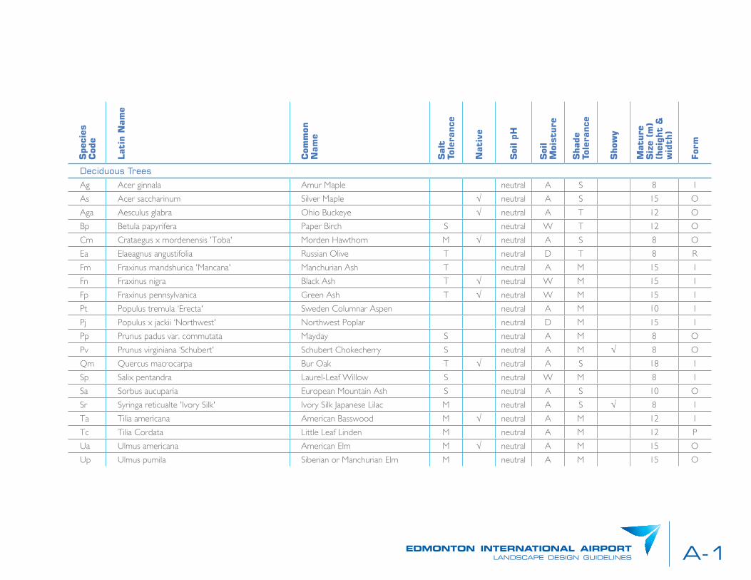
A-1edmonton international airportlandscape design guidelines
Spe
cies
C
ode
Lat
in N
ame
Com
mon
N
ame
Sal
t To
lera
nce
Nat
ive
Soi
l pH
Soi
l M
oist
ure
Sha
de
Tole
ranc
e
Sho
wy
Mat
ure
Siz
e (m
) (h
eigh
t &
w
idth
)
For
m
Deciduous TreesAg Acer ginnala Amur Maple neutral A S 8 I
As Acer saccharinum Silver Maple √ neutral A S 15 O
Aga Aesculus glabra Ohio Buckeye √ neutral A T 12 O
Bp Betula papyrifera Paper Birch S neutral W T 12 O
Cm Crataegus x mordenensis 'Toba' Morden Hawthorn M √ neutral A S 8 O
Ea Elaeagnus angustifolia Russian Olive T neutral D T 8 R
Fm Fraxinus mandshurica 'Mancana' Manchurian Ash T neutral A M 15 I
Fn Fraxinus nigra Black Ash T √ neutral W M 15 I
Fp Fraxinus pennsylvanica Green Ash T √ neutral W M 15 I
Pt Populus tremula ‘Erecta' Sweden Columnar Aspen neutral A M 10 I
Pj Populus x jackii ‘Northwest' Northwest Poplar neutral D M 15 I
Pp Prunus padus var. commutata Mayday S neutral A M 8 O
Pv Prunus virginiana ‘Schubert' Schubert Chokecherry S neutral A M √ 8 O
Qm Quercus macrocarpa Bur Oak T √ neutral A S 18 I
Sp Salix pentandra Laurel-Leaf Willow S neutral W M 8 I
Sa Sorbus aucuparia European Mountain Ash S neutral A S 10 O
Sr Syringa reticualte 'Ivory Silk' Ivory Silk Japanese Lilac M neutral A S √ 8 I
Ta Tilia americana American Basswood M √ neutral A M 12 I
Tc Tilia Cordata Little Leaf Linden M neutral A M 12 P
Ua Ulmus americana American Elm M √ neutral A M 15 O
Up Ulmus pumila Siberian or Manchurian Elm M neutral A M 15 O
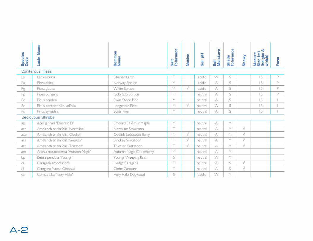
A-2
Spe
cies
C
ode
Lat
in N
ame
Com
mon
N
ame
Sal
t To
lera
nce
Nat
ive
Soi
l pH
Soi
l M
oist
ure
Sha
de
Tole
ranc
e
Sho
wy
Mat
ure
Siz
e (m
) (h
eigh
t &
w
idth
)
For
m
Coniferous TreesLs Larix sibirica Siberian Larch T acidic W S 15 P
Pa Picea abies Norway Spruce M acidic A S 15 P
Pg Picea glauca White Spruce M √ acidic A S 15 P
Pp Picea pungens Colorado Spruce T neutral A S 15 P
Pc Pinus cembra Swiss Stone Pine M neutral A S 15 I
Pcl Pinus contorta var. latifolia Lodgepole Pine M √ neutral A S 15 I
Ps Pinus sylvestris Scots Pine M neutral A S 15 I
Deciduous Shrubsag Acer ginnala 'Emerald Elf' Emerald Elf Amur Maple M neutral A M
aan Amelanchier alnifolia 'Northline' Northline Saskatoon T neutral A M √aao Amelanchier alnifolia 'Obelisk' Obelisk Saskatoon Berry T √ neutral A M √aas Amelanchier alnifolia 'Smokey' Smokey Saskatoon T √ neutral A M √aat Amelanchier alnifolia 'Thiessen' Thiessen Saskatoon T √ neutral A M √am Aronia melanocarpa 'Autumn Magic' Autumn Magic Chokeberry M neutral A M
bp Betula pendula 'Youngii' Youngii Weeping Birch S neutral W M
ca Caragana arborescens Hedge Caragana T neutral A S √cf Caragana frutex 'Globosa' Globe Caragana T neutral A S √ca Cornus alba 'Ivory Halo' Ivory Halo Dogwood S acidic W M

A-3edmonton international airportlandscape design guidelines
Spe
cies
C
ode
Lat
in N
ame
Com
mon
N
ame
Sal
t To
lera
nce
Nat
ive
Soi
l pH
Soi
l M
oist
ure
Sha
de
Tole
ranc
e
Sho
wy
Mat
ure
Siz
e (m
) (h
eigh
t &
w
idth
)
For
m
Coniferous Shrubs
ab Abies balsamea 'Nana' Dwarf Balsam Fir S acidic A M
ap Andromeda polifolia 'Blue Ice' Blue Ice Bog Rosemary acidic W S
au Arctostaphylos uva-ursi Bearberry M √ acidic A S
jc Juniperus communis 'Alpine Carpet' Alpine Carpet Juniper S acidic A S
jha Juniperus horizontalis 'Alpina' Alpine Creeping Juniper S acidic A S
jhb Juniperus horizontalis 'Blue Chip' Blue Chip Juniper S acidic A S
jhh Juniperus horizontalis 'Hughes' Hughes Juniper S acidic A S
jhi Juniperus horizontalis 'Icee Blue' Icee Blue Juniper S acidic A S
Salt Tolerance: S - Sensitive, M - Moderately Sensitive, T - Tolerant
Soil pH: On scale of 1.0 (acid) to 14.0 (base) with 7.0 (neutral)
Soil Moisture: W - Moist, A - Average, D - Dry
Soil Compation Tolerance: S - Sensitive, M - Moderately Sensitive, T - Tolerant
Shade Tolerance: T - Tolerance of Shade, M - Moderately Tolerant of Shade (Semi-shade), S - Sensitive to Shade (Prefers Sun)
Form: O - Oval, R - Round, F - Fastigate, I - Irregular, P - Pyramidal


Appendix B: Streetscape

B-1edmonton international airportlandscape design guidelines

B-2
B-3edmonton international airportlandscape design guidelines
B-4
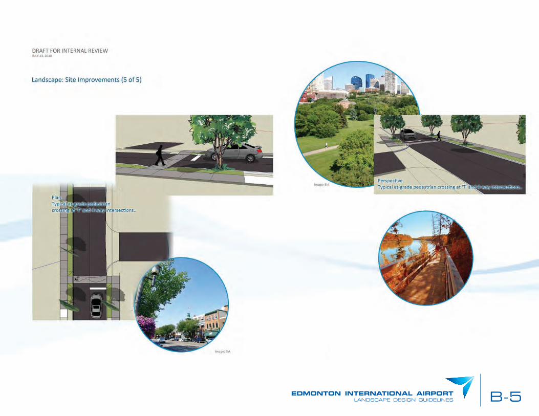
B-5edmonton international airportlandscape design guidelines


Appendix C: Fi l l Areas

C-1edmonton international airportlandscape design guidelines
Fill Area


