landslides in bulgaria -...
TRANSCRIPT

LANDSLIDES IN BULGARIA
Nikolai Dobrev, Plamen Ivanov, Boyko Berov
Geological Institute "Strashimir Dimitrov"
Department of Geohazards
A SCIENTIFIC NETWORK FOR EARTHQUAKE, LANDSLIDE AND
FLOOD HAZARD PREVENTION - SciNetNatHazPrev - PROJECT
WORKSHOP, MARCH 13-14, 2014, ISTANBUL, TURKEY
The landslide problem
Bulgaria is characterized with a high prevalence of landslides, which are the order of thousands. Every year, landslides cause serious problems in the country as damages and losses of properties in urban areas, interrupting major roads and railways, affecting agricultural areas. Damages are estimated at millions of euros. Although rare, they cause losses of lives. There is a clash between the high rate of urbanization and the severe consequences of the many active landslides.
Landslides are one of the main elements forming the geological hazard in Bulgaria. They are widely but unevenly developed in the country territory. There are all known and described in the literature types of landslides: ancient and recent, active and potential, shallow and deep, etc. Almost all landslide types described in Varnes’ classification are represented in Bulgaria.
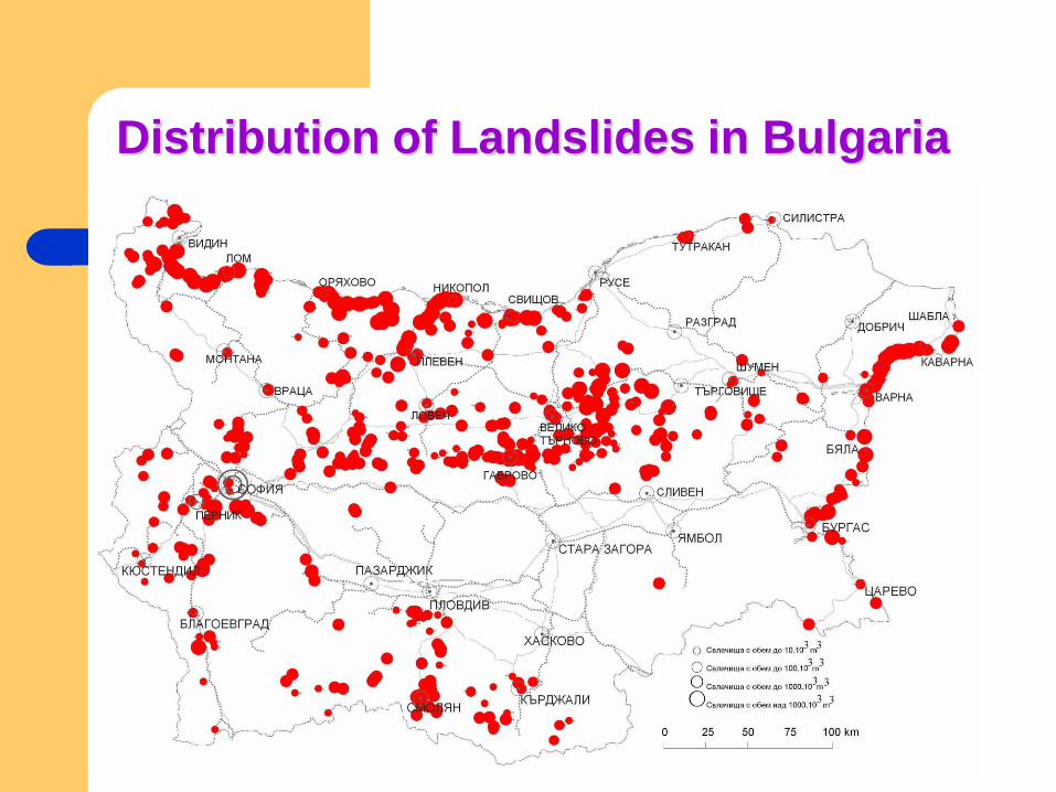
Distribution of Landslides in Bulgaria

Number of landslides and their volume
0
20
40
60
80
100
120
140
160
180
< 1 1 - 10 10 - 100 > 100
V, mln m3
Брой
6
5
4
3
2
1
Number of landslides and their volume (V) in the different region in Bulgaria: 1. Danube coast; 2. Black sea coast; 3. South-west Bulgaria; 4. Maritsa-Iztok; 5. Rhodope region; 6. Balkan and Fore-Balkan

Main destabilising factors
Upon the occurrence and activation of landslides affect many
factors - endogenous and exogenous.
Neotectonic and contemporary movements
Earthquakes
Erosion and abrasion
Surface and groundwater
Precipitation
Man-made impacts
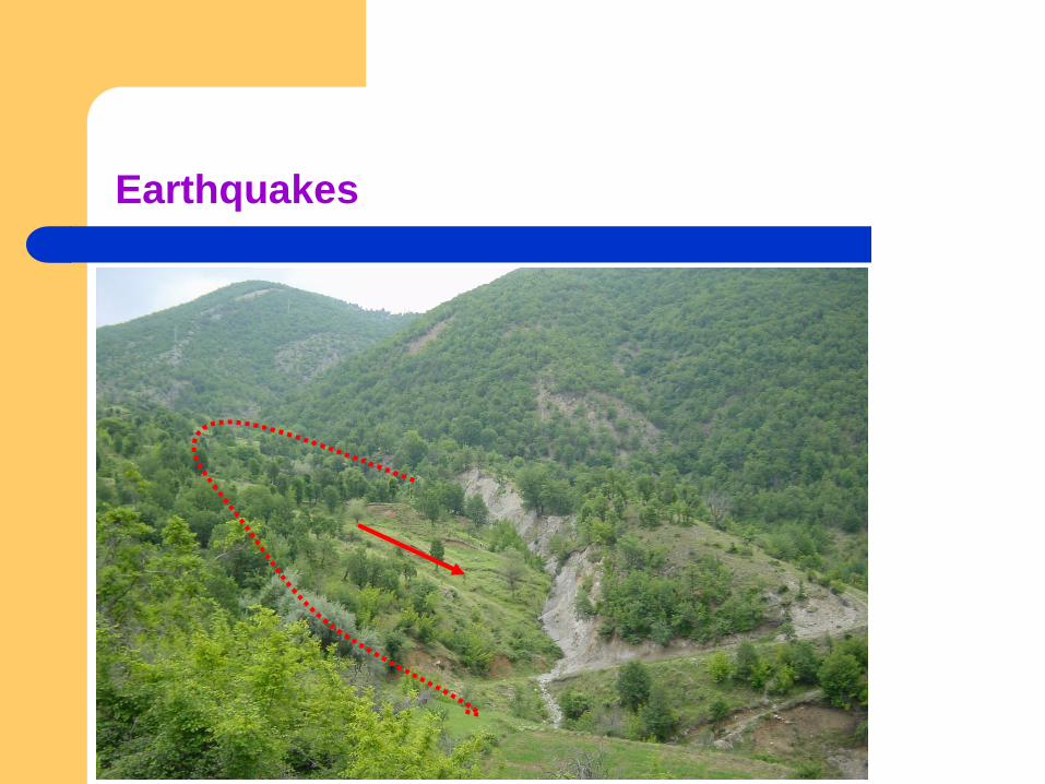
Earthquakes

Earthquakes
Chirakman Cape (near
Kavarna town). The
Greek colony Bizonе
was destroyed during an
earthquake in the
second half of I century
BC.
Then, most of the colony
sank into the sea. Pro-
cess of destruction has
passed very quickly
including a manifesta-
tion of rock fall and
mudflow.

Erosion and abrasion
River erosion (deep and lateral) is observed at steep slopes in Balkan Mts, East Rhodopes, W Bulgaria and Danube River bank.
Abrasion is displayed approx. on 70 % of the length of the Bulgarian Black Sea coast. The maximum values for abrasion are observed in the coastal sections near Kavarna, Balchik, Kranevo, Ravda and Sarafovo.

Erosion and abrasion

Surface and ground water, precipitation
Kabakum Landslide (1996) – North Black Sea coast

MAP OF LANDSLIDES IN BULGARIA
The data-base of the landslides in towns and villages and a map of their distribution in scale 1: 500000 have been composed in 1999. The informa-tion about 917 landslides was collected in unified questionnaire. In 2006 the map was added with 55 new appeared landslides in the towns and villages and 135 landslides along roads.

Landslide inventory mapping
Romanian – Bulgarian Cross-border Joint Natural and
Technological Hazards Assessment in the Danube Floodplain.
The Calafat- Vidin - Turnu Măgurele - Nikopole Sector –
ROBUHAZ-DUN

Landslide inventory mapping
Detail of
Landslide map of
Vidin-Nikopol
sector, by state of
activity (acc. to
WPWLI 1993)

Landslide inventory mapping
Map of Landslides in Bulgaria,
scale 1:100,000 (2000-2002) Landslide Map for local use,
scale 1:25,000 (2008)

Landslide susceptibility mapping
Landslide susceptibility map of Oryahovo, by
safety factor, in scale 1:5000
Landslide susceptibility map of Simitli graben,
SW Bulgaria, isopleth method, in scale 1:25000

Monitoring
Use of 3D mechano-optical
extensometers for in-situ monitoring

Monitoring

Taukliman-Rusalka Landslide

Rhodopes deep-seated landslides

Orsoya Landslide, Lom area (1978) West Danube River bank
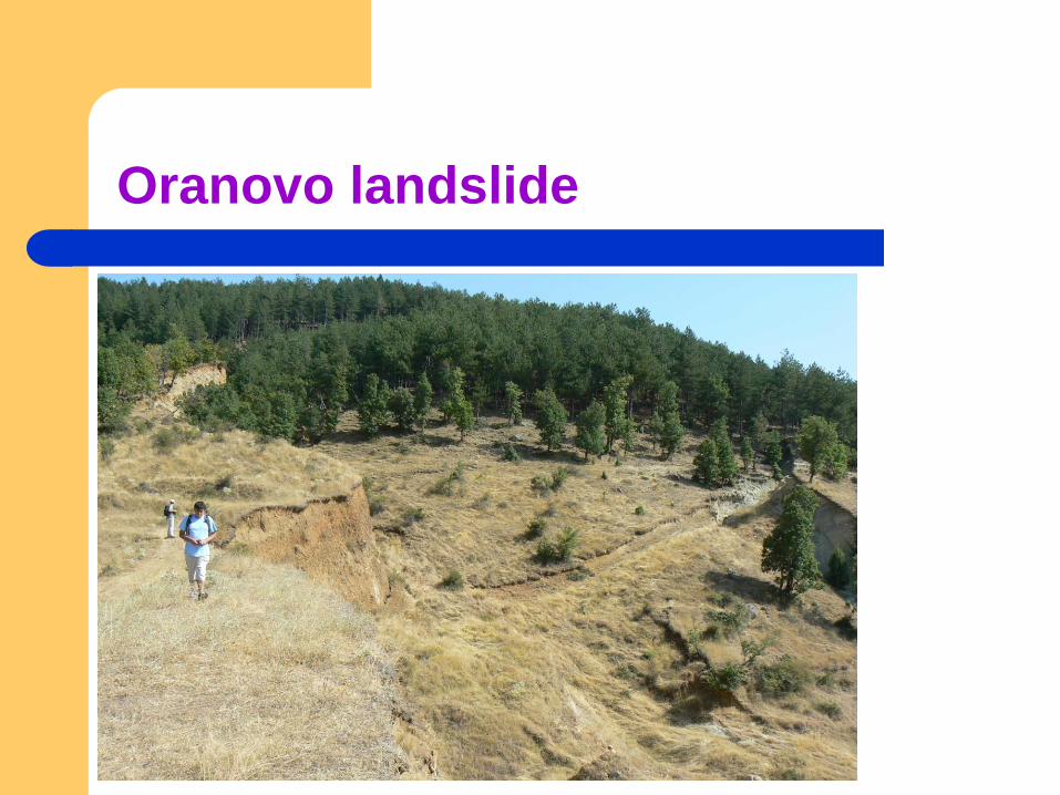
Oranovo landslide
Conclusion
The most hazardous regions are determined to be built of slightly
lithified Paleogenic and Neogenic clayey sediments, wide fault
zones, all subjected to the intensive action of erosion,abrasion,
earthquakes and man-made impact. Such regions are the
Western Danubian Bank, the Northern Black Sea coast, the East
Rhodopes Mts., and Tertiary grabens.

THANK YOU FOR ATTENTION!