landslides of the panama canal
TRANSCRIPT

LANDSLIDES of the PANAMA CANAL
J. David Rogers, Ph.D., P.E., P.G.
Missouri University of Science & Technology for the
2011 Pacific Section Meeting American Association for the Advancement of Science
San Diego, California June 13, 2011
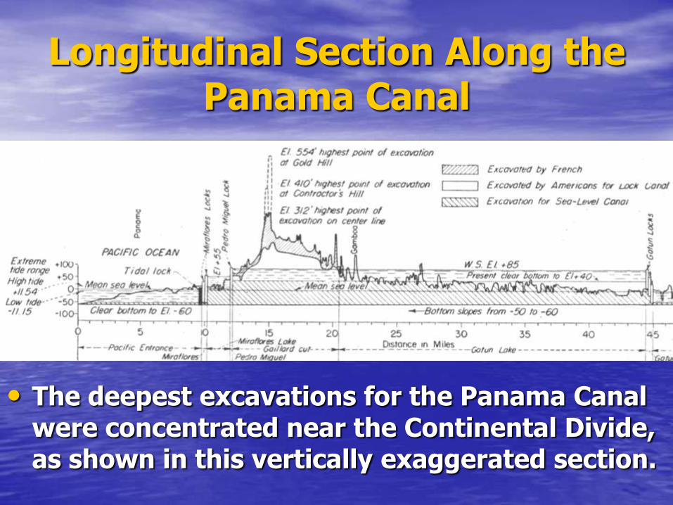
Longitudinal Section Along the Panama Canal
• The deepest excavations for the Panama Canal were concentrated near the Continental Divide, as shown in this vertically exaggerated section.
1910
The Canal’s completion is within sight
when….
the earth starts moving
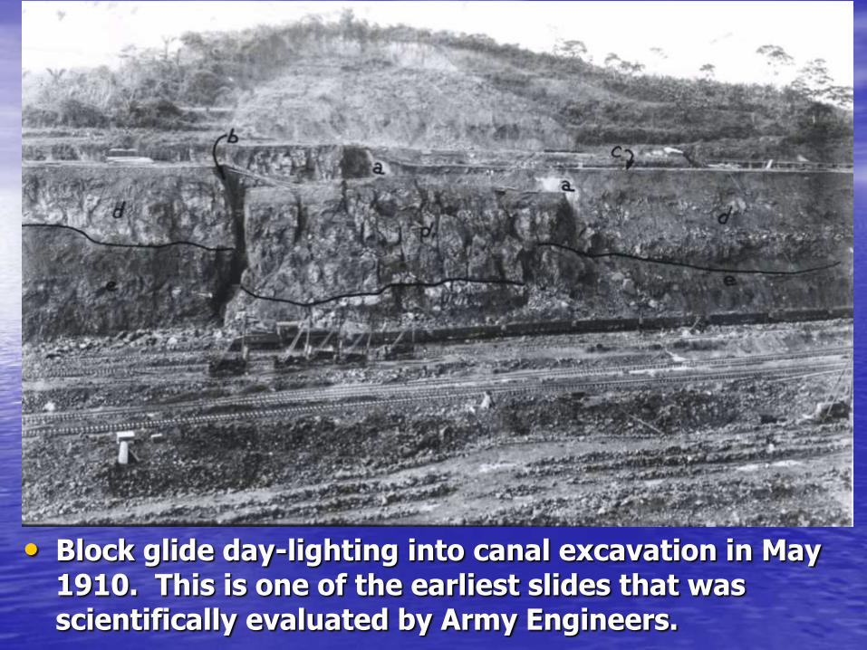
• Block glide day-lighting into canal excavation in May 1910. This is one of the earliest slides that was scientifically evaluated by Army Engineers.

• One of the early landslides at Cucaracha, on the south side of Gold Hill, near the Continental Divide, on July 5, 1911.

• Ground view of the same slide of July 5, 1911 at Cucaracha, showing buried steam shovel.
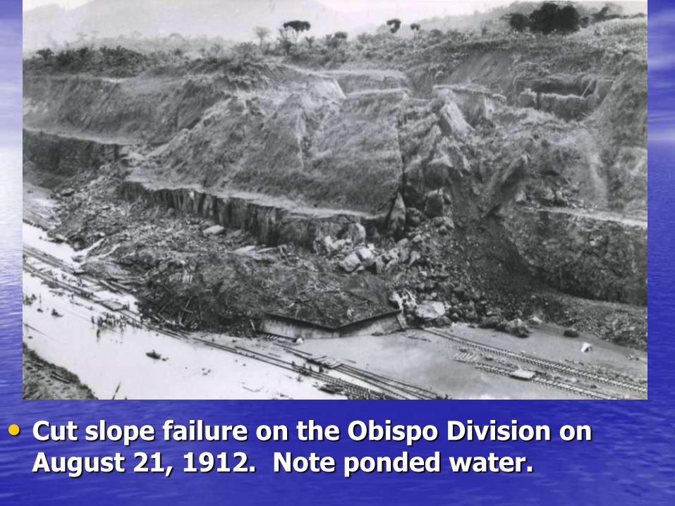
• Cut slope failure on the Obispo Division on August 21, 1912. Note ponded water.

Engineer’s attempts to arrest landslippage
prove futile
Like a bad dream…
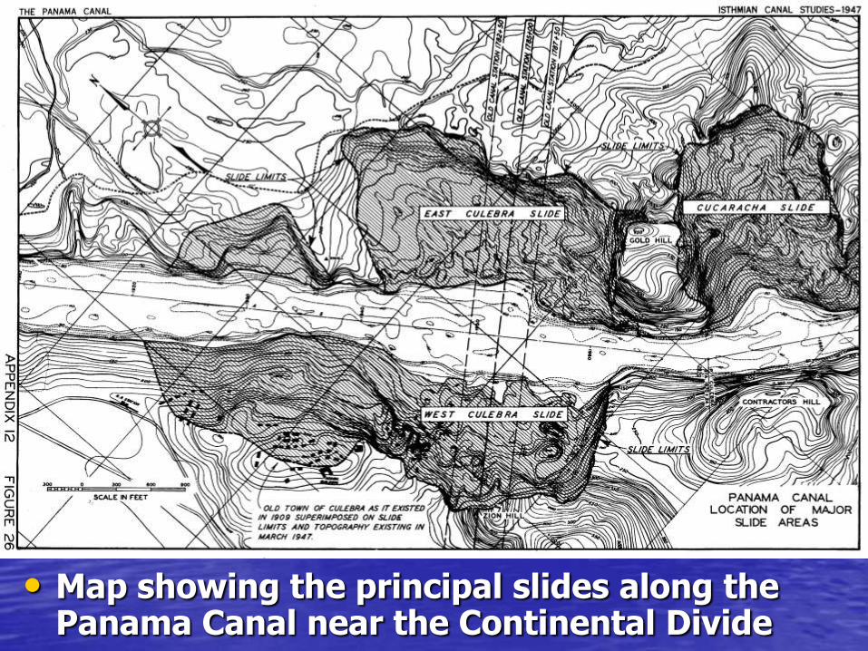
• Map showing the principal slides along the Panama Canal near the Continental Divide
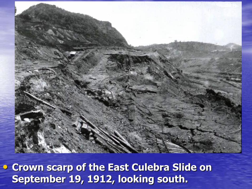
• Crown scarp of the East Culebra Slide on September 19, 1912, looking south.

• Excavating the toe of the West Culebra slide with steam shovels, and allowing the slide debris to disintegrate and slide into the hole.
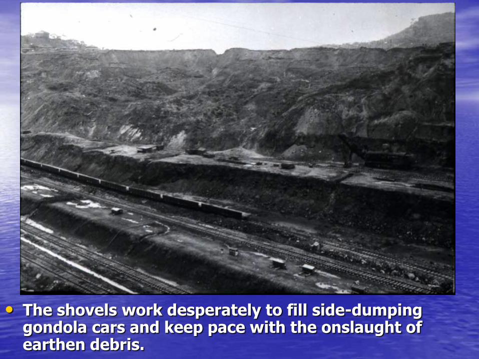
• The shovels work desperately to fill side-dumping gondola cars and keep pace with the onslaught of earthen debris.
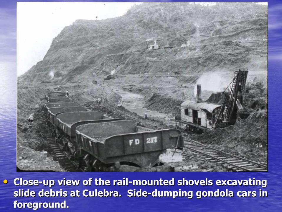
• Close-up view of the rail-mounted shovels excavating slide debris at Culebra. Side-dumping gondola cars in foreground.

• Large deep-seated slump on the East Culebra Slide blocks the canal excavation, May 27, 1913.
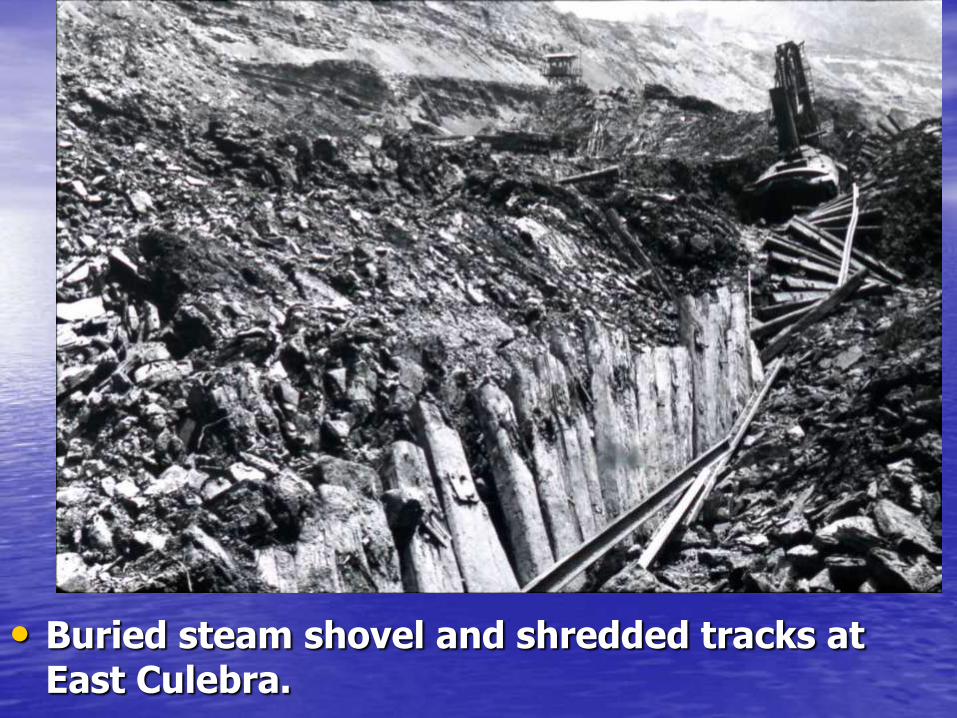
• Buried steam shovel and shredded tracks at East Culebra.
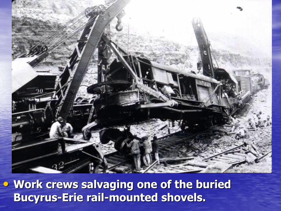
• Work crews salvaging one of the buried Bucyrus-Erie rail-mounted shovels.
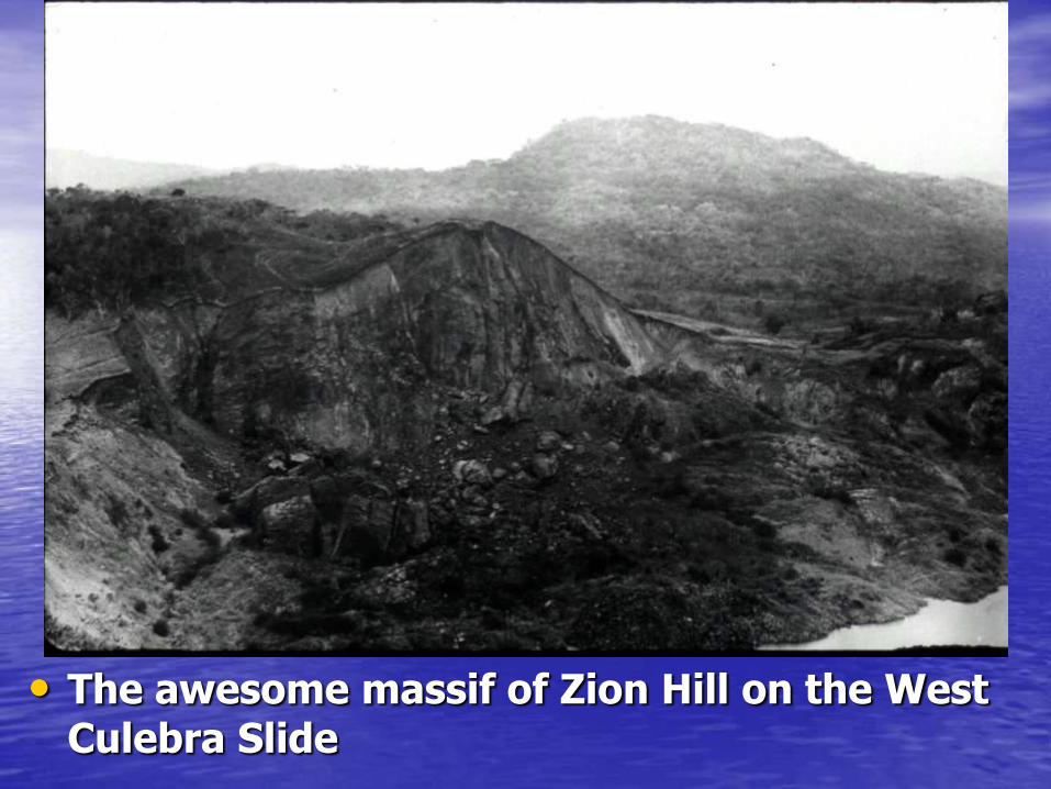
• The awesome massif of Zion Hill on the West Culebra Slide
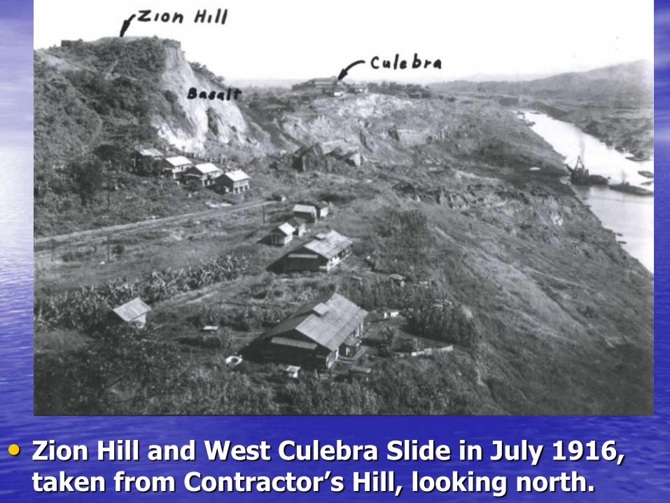
• Zion Hill and West Culebra Slide in July 1916, taken from Contractor’s Hill, looking north.

• The headscarp of the West Culebra Landslide swallowed up part of the town of Culebra
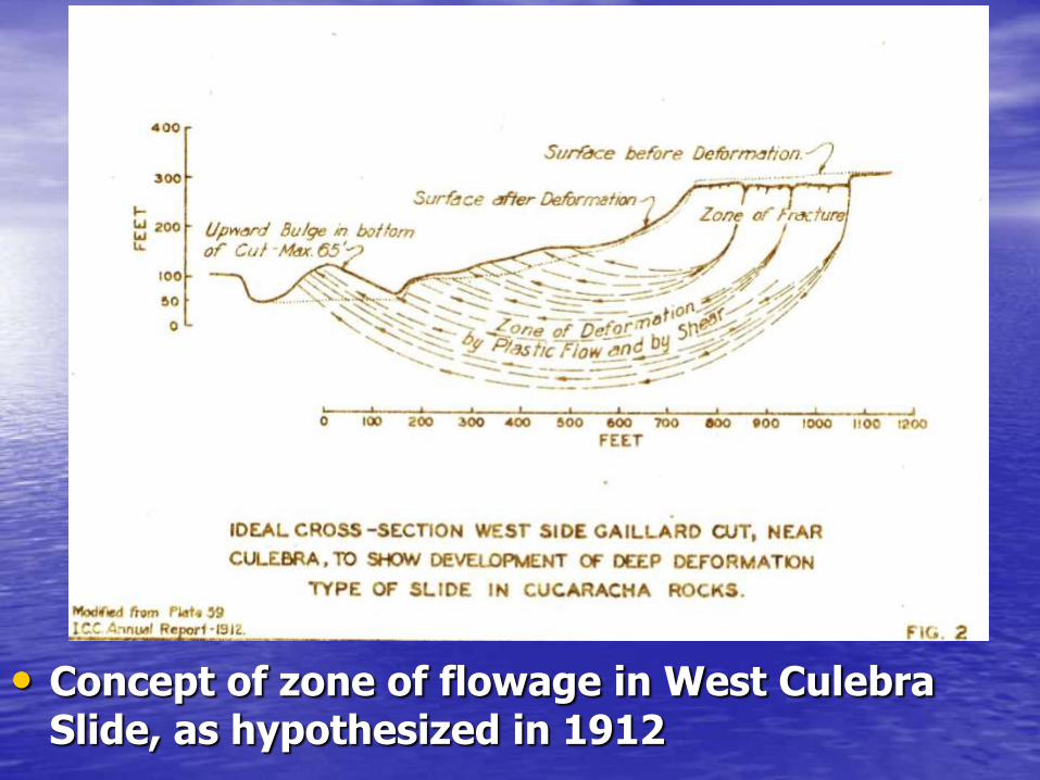
• Concept of zone of flowage in West Culebra Slide, as hypothesized in 1912
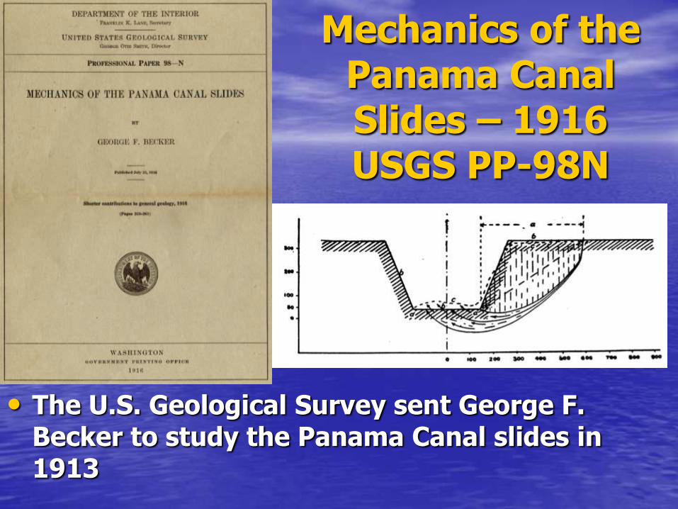
Mechanics of the Panama Canal Slides – 1916 USGS PP-98N
• The U.S. Geological Survey sent George F. Becker to study the Panama Canal slides in 1913
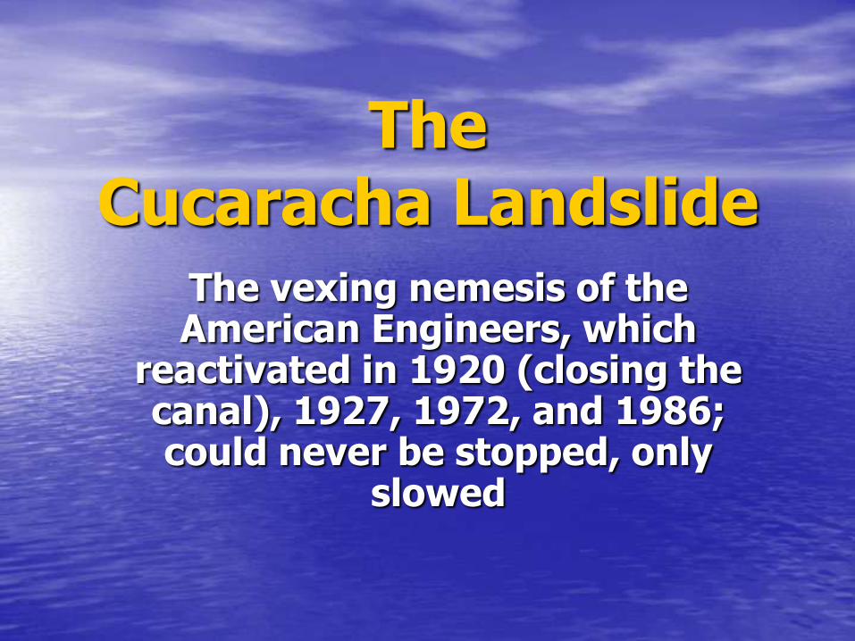
The Cucaracha Landslide
The vexing nemesis of the American Engineers, which
reactivated in 1920 (closing the canal), 1927, 1972, and 1986; could never be stopped, only
slowed

• Map showing the principal slides near the Continental Divide
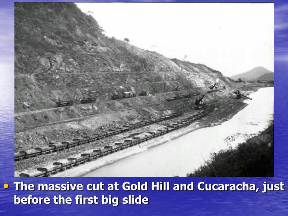
• The massive cut at Gold Hill and Cucaracha, just before the first big slide
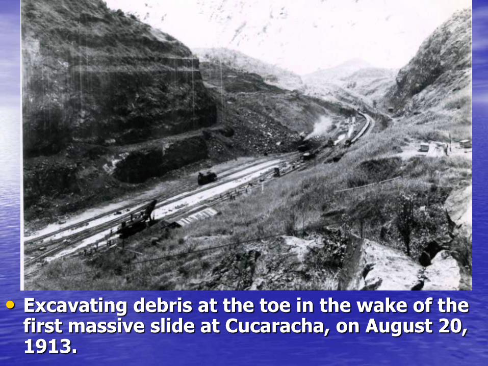
• Excavating debris at the toe in the wake of the first massive slide at Cucaracha, on August 20, 1913.
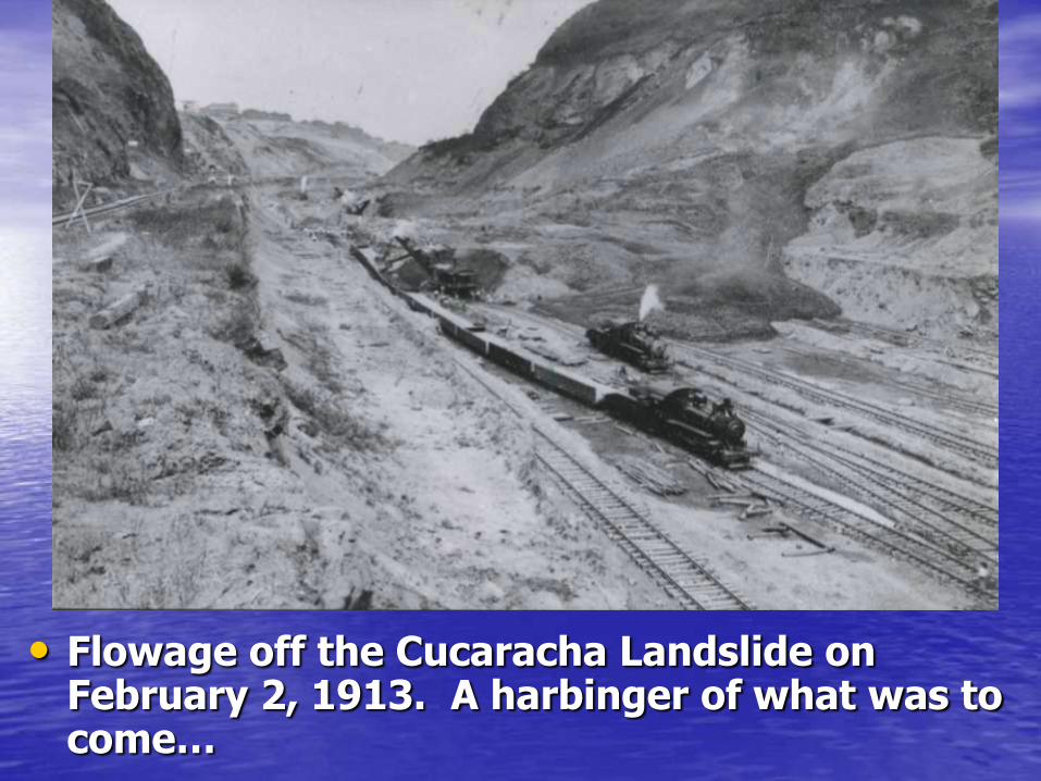
• Flowage off the Cucaracha Landslide on February 2, 1913. A harbinger of what was to come…

Goethals floods the channel and steps up
the dredging
“This will take years…”
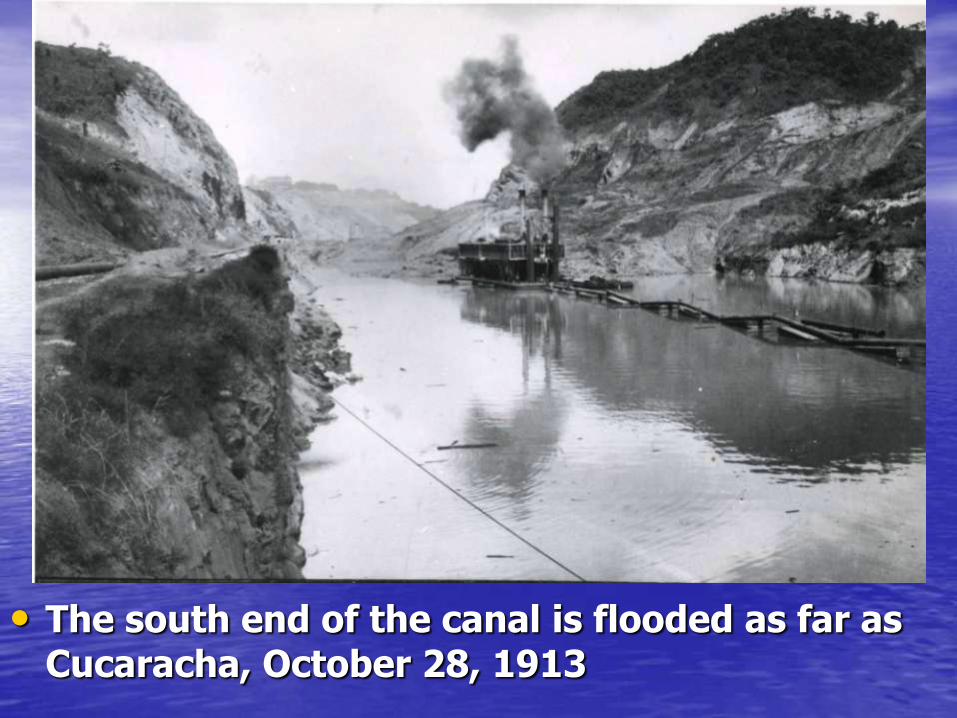
• The south end of the canal is flooded as far as Cucaracha, October 28, 1913
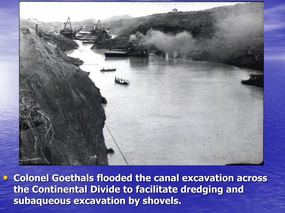
• Colonel Goethals flooded the canal excavation across the Continental Divide to facilitate dredging and subaqueous excavation by shovels.

• Shovel dredge working the face of the East Culebra Slide after the canal was flooded.

• Fleet of suction dredges working the toe of the Cucaracha Slide - February 8, 1914
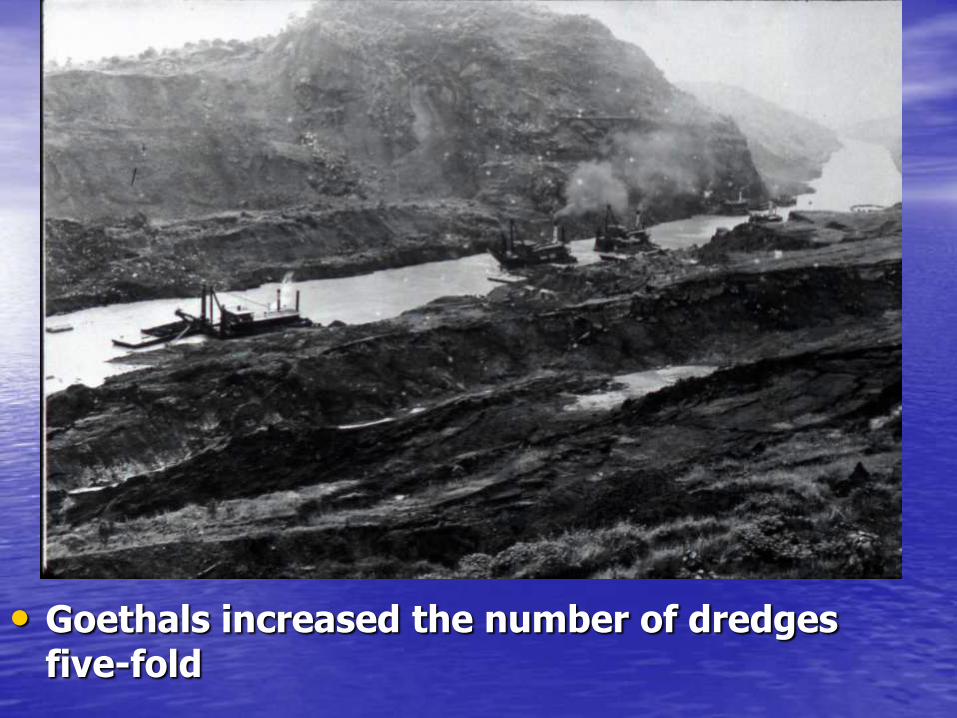
• Goethals increased the number of dredges five-fold

• Dredging the half-mile gap closed by landslides on September 18, 1915, which required excavation of 10 million cubic yards of slide debris over 9 months. This closure triggered the appointment of a commission drawn from the National Academy of Sciences, which reported to President Woodrow Wilson.

• Dredges battling with the slides at Culebra on November 8, 1915

• Still dredging at Culebra on December 20, 1915
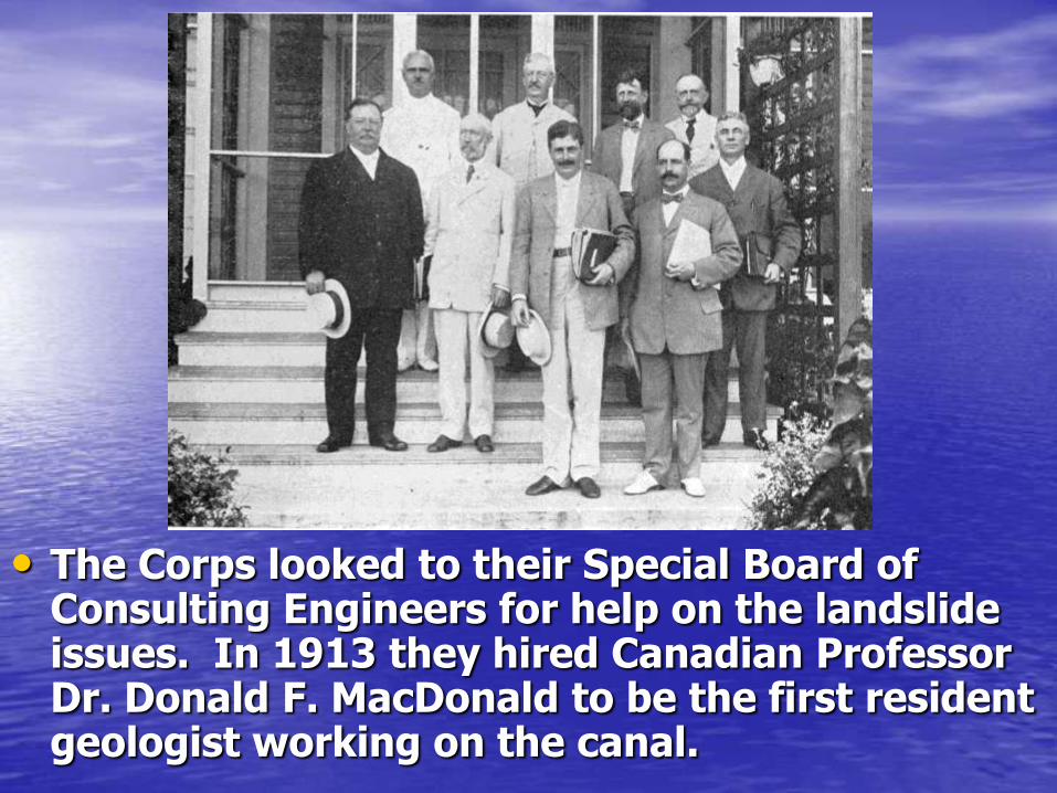
• The Corps looked to their Special Board of Consulting Engineers for help on the landslide issues. In 1913 they hired Canadian Professor Dr. Donald F. MacDonald to be the first resident geologist working on the canal.
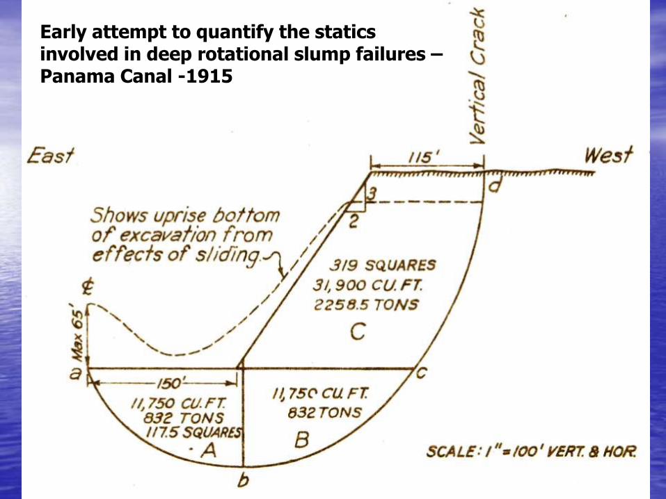
Early attempt to quantify the statics involved in deep rotational slump failures – Panama Canal -1915

• Early compressive strength tests on the Culebra formation

August 1914 The Canal Opens for
Business
Trumpeted as an American Triumph

• The S.S. Ancon makes the historic first passage through the canal, from the Atlantic to the Pacific on August 15, 1914. Note dredges.
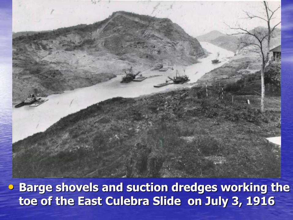
• Barge shovels and suction dredges working the toe of the East Culebra Slide on July 3, 1916

Landslippage continues
after the canal opens
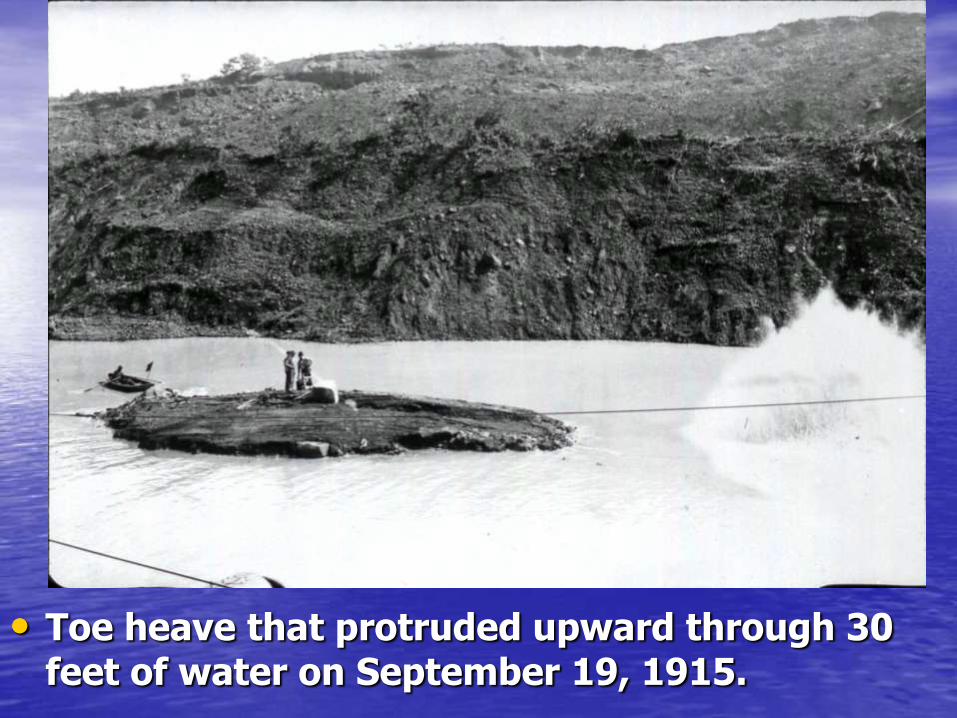
• Toe heave that protruded upward through 30 feet of water on September 19, 1915.
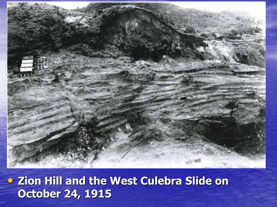
• Zion Hill and the West Culebra Slide on October 24, 1915
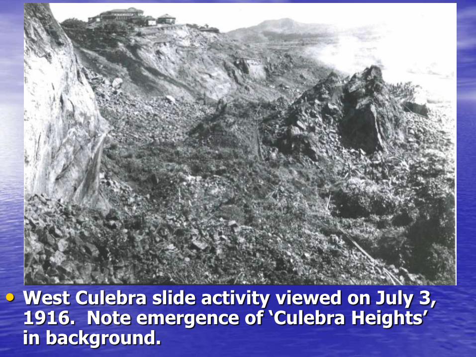
• West Culebra slide activity viewed on July 3, 1916. Note emergence of ‘Culebra Heights’ in background.
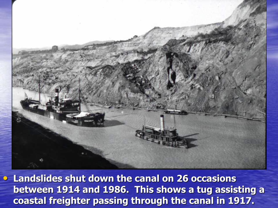
• Landslides shut down the canal on 26 occasions between 1914 and 1986. This shows a tug assisting a coastal freighter passing through the canal in 1917.

• Ship transiting canal around the East Culebra Slide. Note dredges and muck barges

• When landslides partially blocked the channel, ships were queued up on either side of the construction and escorted through the gap.
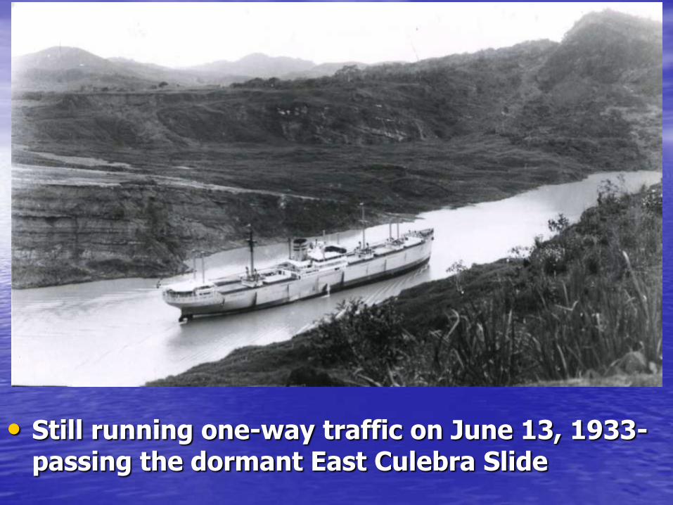
• Still running one-way traffic on June 13, 1933- passing the dormant East Culebra Slide

Evolving the Concept of Residual Strength
Materials that get weaker as they shear

• East Culebra Slide as seen from the crest of Gold Hill on June 19, 1923. The shear strength of the slide debris had obviously been transformed to a much lower value.

• Dredges continue to work the zone between Obispo and East Culebra on April 25, 1924, ten years after the canal opened
Tensile scarps
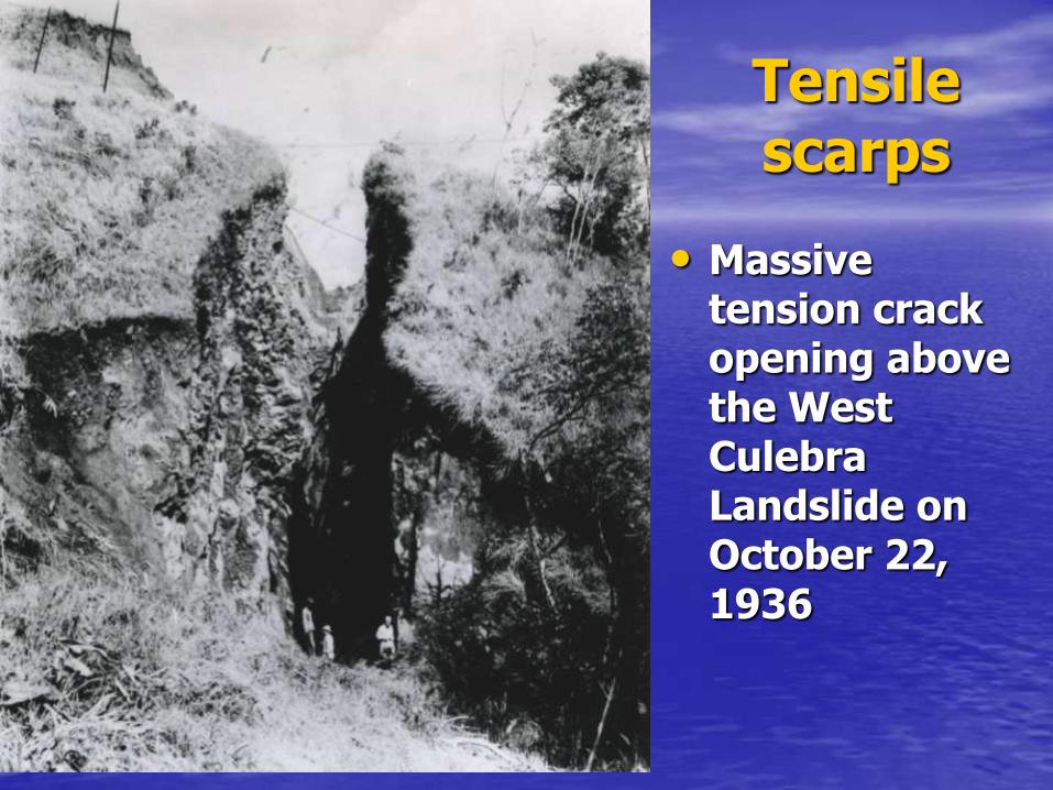
• Massive tension crack opening above the West Culebra Landslide on October 22, 1936

• Head scarp of the West Culebra Slide, 25 years later, on January 26, 1937

The 1924 study
Landslides Along the Panama Canal
by the
National Academy of Sciences
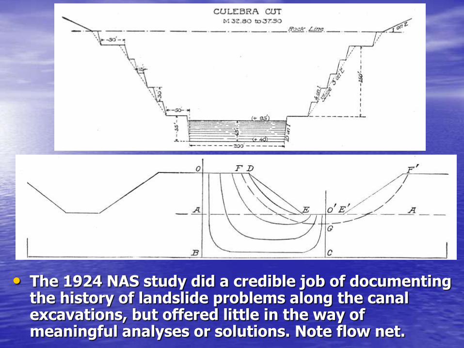
• The 1924 NAS study did a credible job of documenting the history of landslide problems along the canal excavations, but offered little in the way of meaningful analyses or solutions. Note flow net.

The Third Locks Project
During World War II 1939-47
and
Modern Slope Stability Analyses
1947
Geologic Strip Map
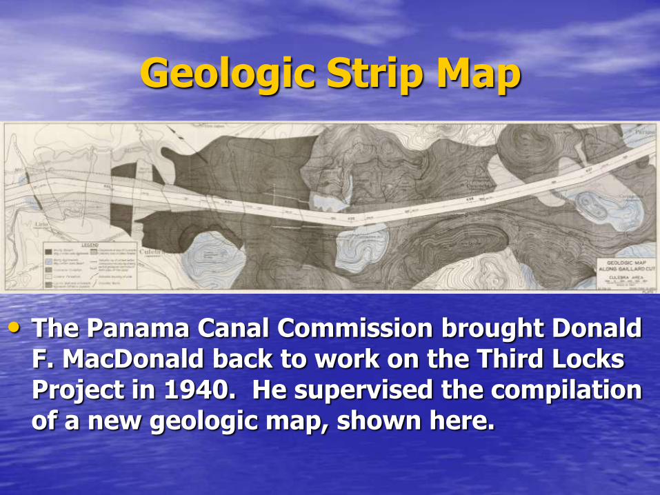
• The Panama Canal Commission brought Donald F. MacDonald back to work on the Third Locks Project in 1940. He supervised the compilation of a new geologic map, shown here.

Geologic Studies
• Dr. Donald F. MacDonald returned to Panama in 1940 to perform detailed geological studies for the Third Locks Project.
• He died of a heart attack in the Canal Zone in June 1942, after the lock excavations were completed
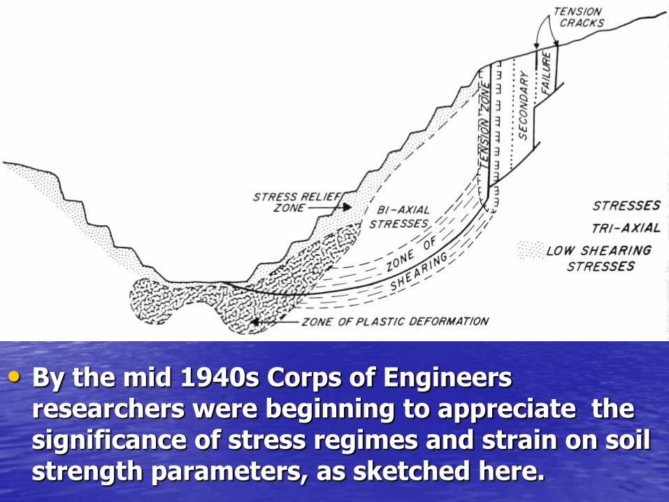
• By the mid 1940s Corps of Engineers researchers were beginning to appreciate the significance of stress regimes and strain on soil strength parameters, as sketched here.

• Shear vs effective normal stress plots. Note impact of disturbance, or plastic strain, on mobilized shear strength.

Residual Strength
• The concept of residual strength came out of tests on the Cucaracha Shale in the late 1940s for the Corps of Engineers, shown here. Overconsolidated shales tend to
exhibit strain softening behavior

• In 1947 the Corps evolved the first design charts for the most problematic units along the canal; these are for the Cucaracha Shale
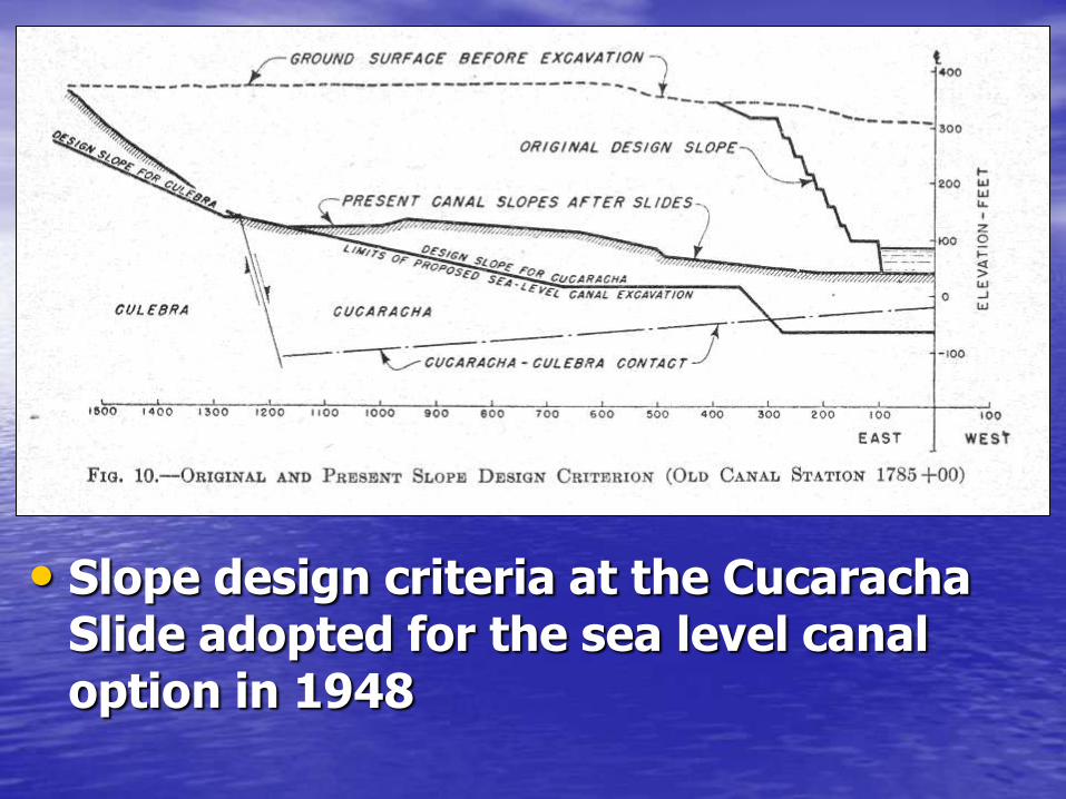
• Slope design criteria at the Cucaracha Slide adopted for the sea level canal option in 1948
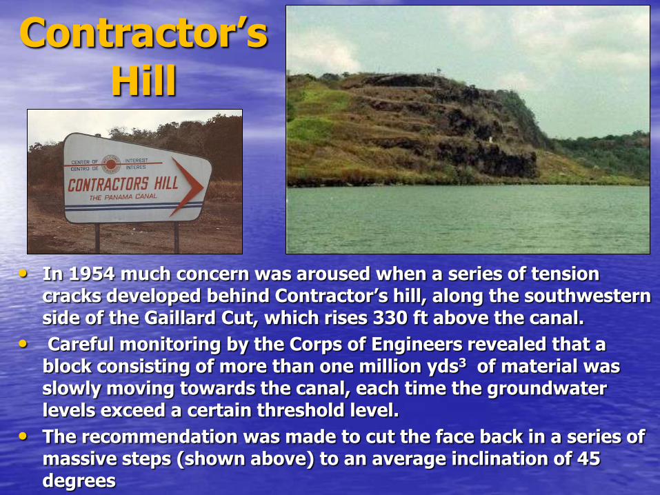
Contractor’s Hill
• In 1954 much concern was aroused when a series of tension cracks developed behind Contractor’s hill, along the southwestern side of the Gaillard Cut, which rises 330 ft above the canal.
• Careful monitoring by the Corps of Engineers revealed that a block consisting of more than one million yds3 of material was slowly moving towards the canal, each time the groundwater levels exceed a certain threshold level.
• The recommendation was made to cut the face back in a series of massive steps (shown above) to an average inclination of 45 degrees
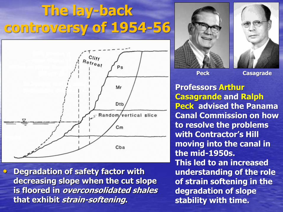
• Degradation of safety factor with decreasing slope when the cut slope is floored in overconsolidated shales that exhibit strain-softening.
The lay-back controversy of 1954-56
Professors Arthur Casagrande and Ralph Peck advised the Panama Canal Commission on how to resolve the problems with Contractor’s Hill moving into the canal in the mid-1950s. This led to an increased understanding of the role of strain softening in the degradation of slope stability with time.
Peck Casagrade
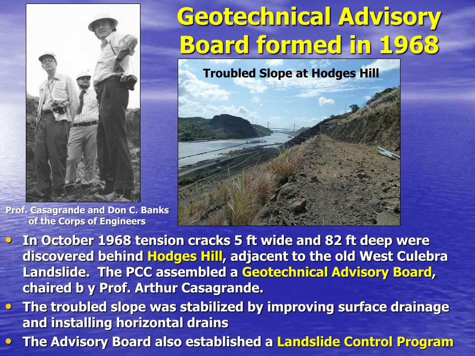
Geotechnical Advisory Board formed in 1968
• In October 1968 tension cracks 5 ft wide and 82 ft deep were discovered behind Hodges Hill, adjacent to the old West Culebra Landslide. The PCC assembled a Geotechnical Advisory Board, chaired b y Prof. Arthur Casagrande.
• The troubled slope was stabilized by improving surface drainage and installing horizontal drains
• The Advisory Board also established a Landslide Control Program
Prof. Casagrande and Don C. Banks of the Corps of Engineers
Troubled Slope at Hodges Hill

Applying Everything We Know….in the
computer age
The Corps of Engineers continues unraveling the
slope stability issues in the 1970s
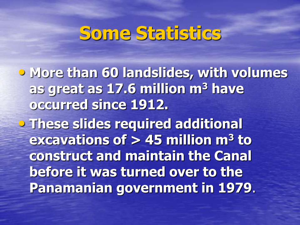
Some Statistics
• More than 60 landslides, with volumes as great as 17.6 million m3 have occurred since 1912.
• These slides required additional excavations of > 45 million m3 to construct and maintain the Canal before it was turned over to the Panamanian government in 1979.
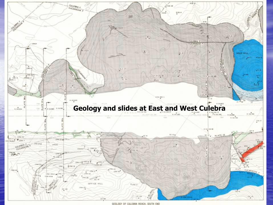
Geology and slides at East and West Culebra

• Longitudinal section at south end of Culebra, where slides encroached both sides of the canal
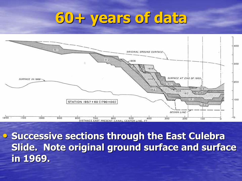
60+ years of data
• Successive sections through the East Culebra Slide. Note original ground surface and surface in 1969.

• By the early 1970s the Corps had amassed 60 years of data. This shows a section through the East Culebra Landslide, showing retrogression of the head scarp, progressive deflation, and the controlling stratigraphy.
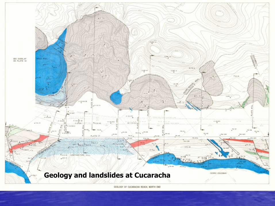
Geology and landslides at Cucaracha

• Longitudinal section through Cucaracha, showing floating nature of Gold Hill.
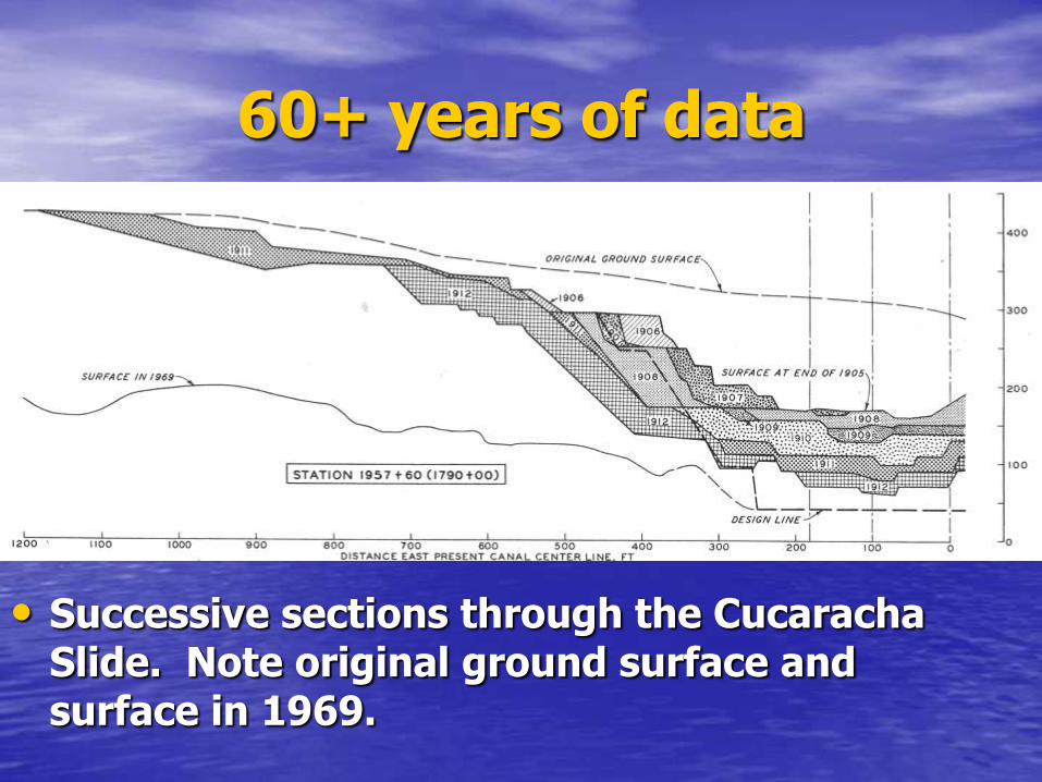
60+ years of data
• Successive sections through the Cucaracha Slide. Note original ground surface and surface in 1969.

• This shows a section through the troublesome Cucaracha Landslide, showing retrogression of the head scarp, progressive deflation, and controlling stratigraphy.
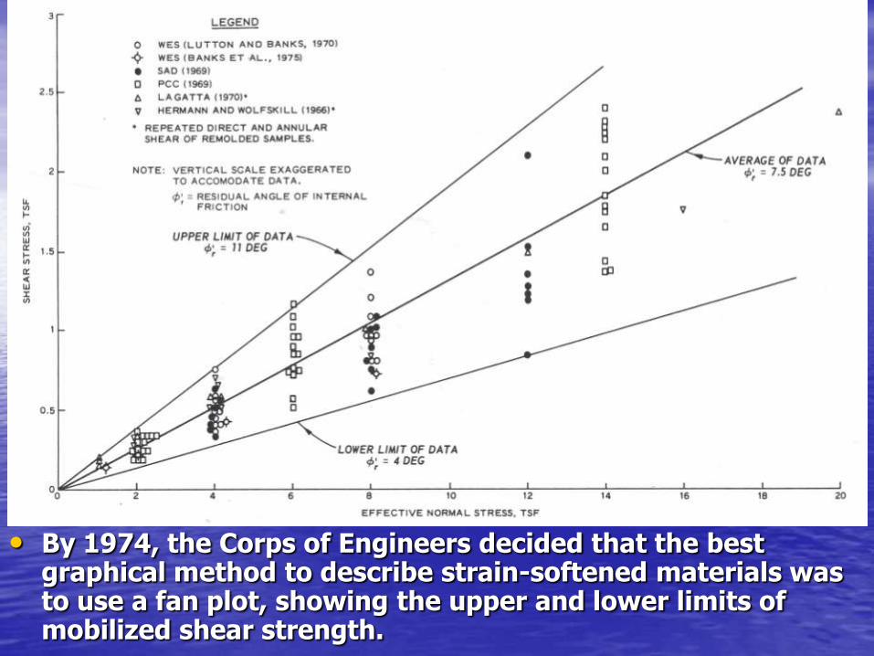
• By 1974, the Corps of Engineers decided that the best graphical method to describe strain-softened materials was to use a fan plot, showing the upper and lower limits of mobilized shear strength.

• On October 13,1986 the eastern side of the Cucaracha Slide reactivated, spilling 526,000 yds3 of debris into the canal, narrowing the opening to just 115 ft! The slope had crept 13 ft towards the canal during the previous 4 years before rupturing.
• The Canal’s experienced pilots were able to keep ships moving at a reduced speed and the debris was removed using dredges.
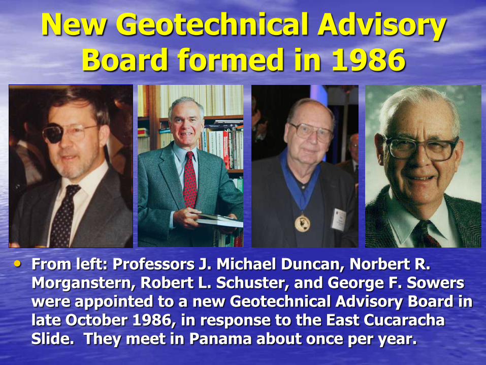
New Geotechnical Advisory Board formed in 1986
• From left: Professors J. Michael Duncan, Norbert R. Morganstern, Robert L. Schuster, and George F. Sowers were appointed to a new Geotechnical Advisory Board in late October 1986, in response to the East Cucaracha Slide. They meet in Panama about once per year.
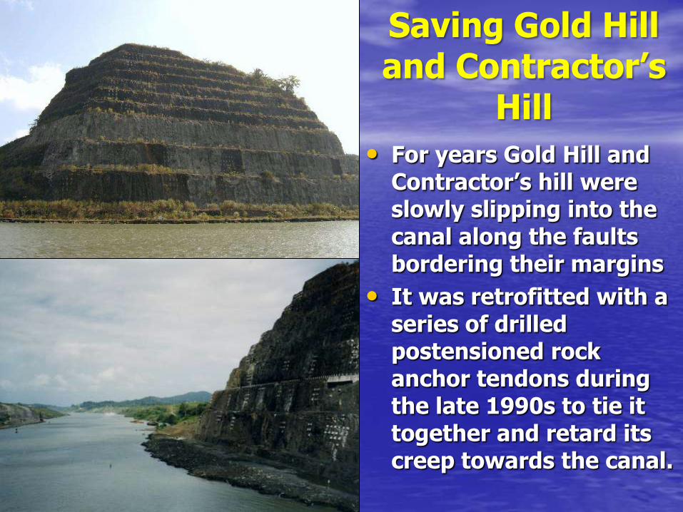
• For years Gold Hill and Contractor’s hill were slowly slipping into the canal along the faults bordering their margins
• It was retrofitted with a series of drilled postensioned rock anchor tendons during the late 1990s to tie it together and retard its creep towards the canal.
Saving Gold Hill and Contractor’s
Hill
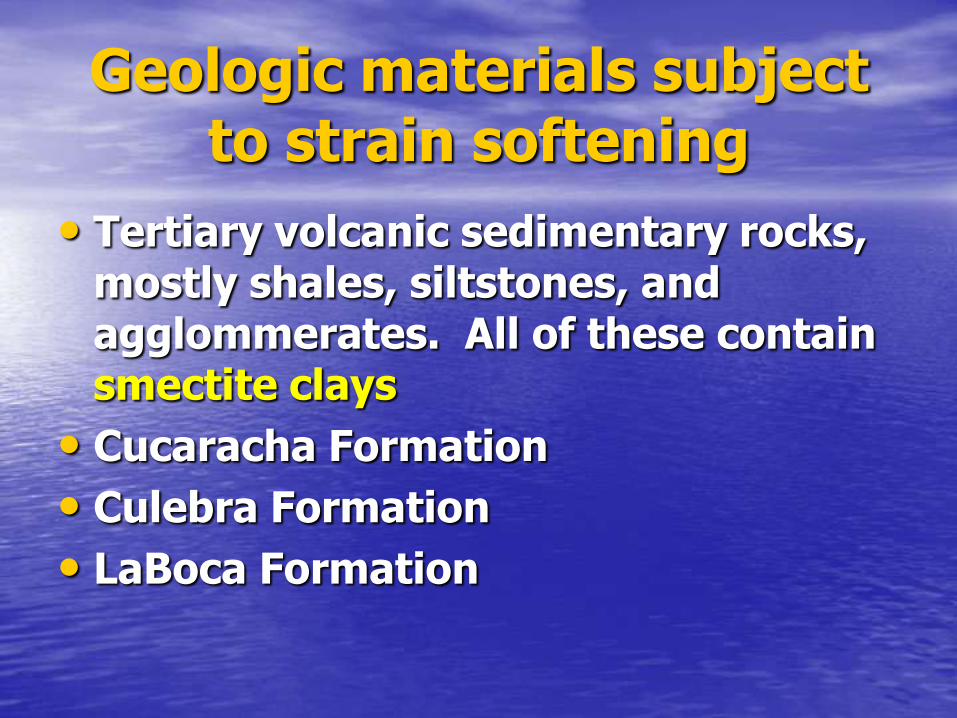
Geologic materials subject to strain softening
• Tertiary volcanic sedimentary rocks, mostly shales, siltstones, and agglommerates. All of these contain smectite clays
• Cucaracha Formation
• Culebra Formation
• LaBoca Formation

Strain Softening
• For initial unloading/relaxation of cut slopes, the effective strength parameters are close to peak shear strength.
• For reactivated slides, the effective strength parameters degrade to residual values, about 75% less than peak strength.
Strain Incompatibility • Relative strain, and the rate of strain,
appear to be important triggers in strain softening materials.
• Strain tends to concentrate at interfaces of materials with dissimilar stiffness and modulus, such as the interface between sandstone and clay
• Strain can also be caused by: 1) loss of lateral support; 2) simple unloading (relaxation); 3) incremental slope creep; and 4) weathering.

Mitigation Measures
• Most slope movements are driven by increased pore pressure. Drainage is essential to limiting incremental movements triggered by pore pressure conductance.
• Strain-softening materials lose strength when some limiting strain threshold is exceeded.
• Our focus must be upon limiting movements, by whatever means possible.