lc change detection and planning indicators - gwf 2018 … · 26/5/2016 · lc change detection and...
TRANSCRIPT

LC change detection
and planning indicators
Rui Reis, Maria José Vale, Marcelo Ribeiro, Bruno Meneses
Geospatial World Forum 2016, 23-26 May 2016, Rotterdam
1. Introduction
2. Pilot overview
3. Data description
4. Inspire data harmonization
• Mapping and transformation
• Validation
5. Metadata
6. Tools used and functionalities
7. Exploitation of the pilot
8. Main contributions
Summary
Geospatial World Forum 2016, 23-26 May 2016, Rotterdam

Atlantic
Ocean
• eENVplus Project:
– The objective is to create an open and interoperable
infrastructure capable to integrate existing infrastructures
according to the requirements of Inspire and international
standards.
• Portuguese pilot:
– Objective is to develop an application to monitor land cover
changes between different dates for an area defined by the
user and
– Enabling the characterization of the territory using indicators,
built from census information, with the objective to monitor
urban dynamics.
• Rationale:
‒ Monitoring territorial evolution can help understand
development strategies and induce more effective planning
Introduction
Geospatial World Forum 2016, 23-26 May 2016, Rotterdam
Pilot overview
• What was made
• Demonstration Example:
- Lisbon Metropolitan Area(AML)
• Inspire data harmonization (LC: COS, CLC; LU: CRUS; AU: CAOP) and
validation
• Creation and validation of Metadata: COS, CLC, CRUS and CAOP.
• Creation of indicators to monitor urban dynamics
• Geoportal (WFS, WMS and WPS), Open source
Geospatial World Forum 2016, 23-26 May 2016, Rotterdam
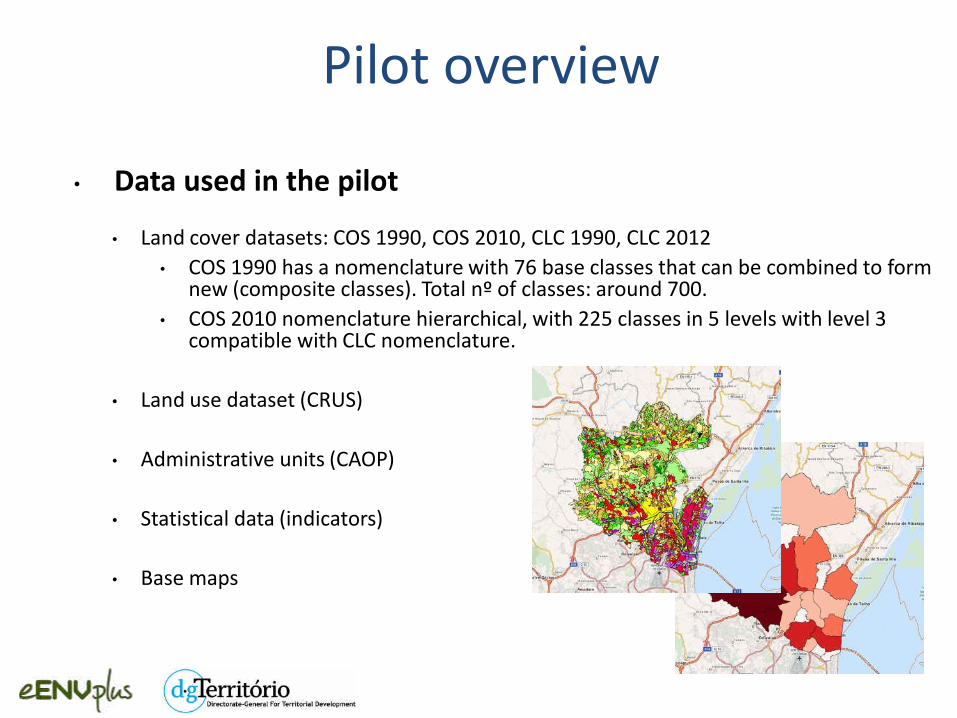
• Data used in the pilot
• Land cover datasets: COS 1990, COS 2010, CLC 1990, CLC 2012
• COS 1990 has a nomenclature with 76 base classes that can be combined to form new (composite classes). Total nº of classes: around 700.
• COS 2010 nomenclature hierarchical, with 225 classes in 5 levels with level 3 compatible with CLC nomenclature.
• Land use dataset (CRUS)
• Administrative units (CAOP)
• Statistical data (indicators)
• Base maps
Pilot overview

Source dataset &
Inspire data specifications
Remodeled dataset
Inspire compliant
Rules
Transformation Mapping Data models Validation
Validated dataset
Data Harmonization
Geospatial World Forum 2016, 23-26 May 2016, Rotterdam

Data Model
• The following Inspire application schemas were used:
• LC theme:
• LandCoverVector
• LandCoverNomenclature
• LU theme:
• PlannedLandUse
• LandUseNomenclature
• AU theme:
• AdministrativeUnits
Geospatial World Forum 2016, 23-26 May 2016, Rotterdam

• Mapping and Transformation: rules creation and implementation
• Use of software (HALE – Humboldt Alignment Editor)
• Validation
Altova XMLspy
XML schema validation
OGC & Inspire validation tests
GML Test engine; Inspire conformance
• Metadata
EUOSME and thesaurus
Geospatial World Forum 2016, 23-26 May 2016, Rotterdam
Methodology

HALE workflow (for each LC dataset/COS):
1. Study of Inspire data specification for land cover;
2. Formalization of the data model for the LC dataset to be harmonized;
3. Download of Inspire data model – xsd format (LandCoverVector);
4. Alignment:
1. Mapping of COS entities and attributes with Inspire app. schema,
2. Matching between COS and CLC nomenclatures.
5. Output: GML file created after the harmonization proccess.
Land Cover
Geospatial World Forum 2016, 23-26 May 2016, Rotterdam
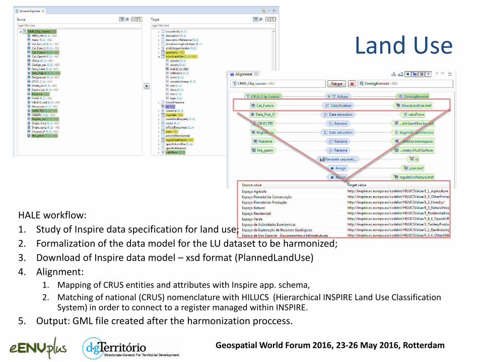
Land Use
HALE workflow:
1. Study of Inspire data specification for land use;
2. Formalization of the data model for the LU dataset to be harmonized;
3. Download of Inspire data model – xsd format (PlannedLandUse)
4. Alignment:
1. Mapping of CRUS entities and attributes with Inspire app. schema,
2. Matching of national (CRUS) nomenclature with HILUCS (Hierarchical INSPIRE Land Use Classification System) in order to connect to a register managed within INSPIRE.
5. Output: GML file created after the harmonization proccess.
Geospatial World Forum 2016, 23-26 May 2016, Rotterdam

Administrative units
HALE workflow:
1. Study of Inspire data specification for administrative units;
2. Formalization of the data model for the AU dataset to be harmonized;
3. Download of Inspire data model – xsd format (AdministrativeUnits);
4. Alignment:
1. Mapping of CAOP entities and attributes with Inspire app. Schema,
2. CAOP has 3 levels of AUs (Distrito, Município, Freguesia),
3. Matching between these levels and AdministrativeHierarchyLevel (Levels of administration in the national administrative hierarchy).
5. Output: GML file created after the harmonization proccess.
Geospatial World Forum 2016, 23-26 May 2016, Rotterdam

• Mapping and Transformation: rules creation and implementation
• Use of software (HALE – Humboldt Alignment Editor)
• Validation
Altova XMLspy
XML schema validation
OGC & Inspire validation tests
GML Test engine; Inspire conformance
• Metadata
EUOSME and thesaurus
Geospatial World Forum 2016, 23-26 May 2016, Rotterdam
Methodology

Validation
Altova XML spy
Upload the harmonized datasets (xml file) and run the process. Success
essage if the har o izatio OK. If ot, there’s a essage explai i g where it fails.
Geospatial World Forum 2016, 23-26 May 2016, Rotterdam

Validation
OGC Validation tests (GML)
Inspire conformance (ETS)
eENVplus Validator: http://showcase.eenvplus.eu/client/validation.htm
Geospatial World Forum 2016, 23-26 May 2016, Rotterdam

• Mapping and Transformation: rules creation and implementation
• Use of software (HALE – Humboldt Alignment Editor)
• Validation
Altova XMLspy
XML schema validation
OGC & Inspire validation tests
GML Test engine; Inspire conformance
• Metadata
EUOSME and thesaurus
Geospatial World Forum 2016, 23-26 May 2016, Rotterdam
Methodology

• EUOSME (European Open Source Metadata Editor) has been extended to access the eENVplus Catalogue
Service and to navigate through Thesaurus Framework services.
• LusTRE (Linked Thesaurus fRamework for Environment) is a multilingual Thesaurus Framework for the
environment whose objective is to improve metadata compilation and metadata discovery.
EUOSME: http://showcase.eenvplus.eu/euosmegwt_eenvplus/
LusTRE: http://showcase.eenvplus.eu/client/thesaurus.htm
Geospatial World Forum 2016, 23-26 May 2016, Rotterdam
Pilot overview
• Tools used
• Data harmonization – HALE
• Arcgis
• Geoportal Client:
• OpenLayers 3 (OL3)
• Jquery
• Bootstrap
• Server:
• Python
• Flask
• Map services:
• Databases: Postgres/Postgis
• Map servers: Geoserver
Geospatial World Forum 2016, 23-26 May 2016, Rotterdam
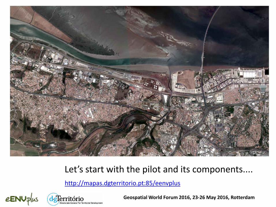
Let’s start with the pilot a d its co po e ts....
Geospatial World Forum 2016, 23-26 May 2016, Rotterdam
http://mapas.dgterritorio.pt:85/eenvplus

Pilot functionalities
• Visualize LC, LU and AU data
• Visualize base cartography or other datasets of interest
• Select area and data for processing
• Determine change between datasets (WPS)
• Visualize & download results
• Analyse results:
• Characterize the area using indicators
• Relate LC changes with socio-economic data
Geospatial World Forum 2016, 23-26 May 2016, Rotterdam

Geospatial World Forum 2016, 23-26 May 2016, Rotterdam

Geospatial World Forum 2016, 23-26 May 2016, Rotterdam

Geospatial World Forum 2016, 23-26 May 2016, Rotterdam

Geospatial World Forum 2016, 23-26 May 2016, Rotterdam

Indicators visualization: Artificial Surfaces per Capita per Civil Parish
Portuguese Pilot - LC Change detection and planning indicators
Geospatial World Forum 2016, 23-26 May 2016, Rotterdam
• Enables the assessment of the adequacy of available datasets to evaluate the
sustainability of urban growth combined with the socio-economic evolution and
environmental pressures.

Pilot main contributions
• Demonstration Example:
• Lisbon Metropolitan Area (AML)
• Inspire data harmonization (LC: COS, CLC; LU: CRUS, AU: CAOP) and validation
• Creation and validation of Metadata (INSPIRE compliant).
• Characterization of the territory using indicators to monitor Land Cover Changes over time. Ex: urban dynamics
• Geoportal development (WFS, WMS and WPS) - Open Source
Geospatial World Forum 2016, 23-26 May 2016, Rotterdam

• Authors:
Rui Reis, Maria José Vale, Marcelo Ribeiro, Bruno Meneses
• Contact:
LC change detection and planning indicators
Geospatial World Forum 2016, 23-26 May 2016, Rotterdam
http://www.eenvplus.eu/
http://www.dgterritorio.pt/