leonard hospital 74 new turnpike rd troy, ny 12182 inquiry
TRANSCRIPT

FORM-STD-LMH
®kcehCoeG htiw tropeR ™paM suidaR RDE ehT
440 Wheelers Farms RoadMilford, CT 06461Toll Free: 800.352.0050www.edrnet.com
Leonard Hospital74 New Turnpike RdTroy, NY 12182
Inquiry Number: 3612414.2sMay 21, 2013

SECTION PAGE
Executive Summary ES1
Overview Map 2
Detail Map 3
Map Findings Summary 4
Map Findings 8
Orphan Summary 65
Government Records Searched/Data Currency Tracking GR-1
GEOCHECK ADDENDUM
Physical Setting Source Addendum A-1
Physical Setting Source Summary A-2
Physical Setting SSURGO Soil Map A-5
Physical Setting Source Map A-13
Physical Setting Source Map Findings A-15
Physical Setting Source Records Searched A-18
TC3612414.2s Page 1
Thank you for your business.Please contact EDR at 1-800-352-0050
with any questions or comments.
Disclaimer - Copyright and Trademark Notice
This Report contains certain information obtained from a variety of public and other sources reasonably available to Environmental DataResources, Inc. It cannot be concluded from this Report that coverage information for the target and surrounding properties does not exist fromother sources. NO WARRANTY EXPRESSED OR IMPLIED, IS MADE WHATSOEVER IN CONNECTION WITH THIS REPORT. ENVIRONMENTALDATA RESOURCES, INC. SPECIFICALLY DISCLAIMS THE MAKING OF ANY SUCH WARRANTIES, INCLUDING WITHOUT LIMITATION,MERCHANTABILITY OR FITNESS FOR A PARTICULAR USE OR PURPOSE. ALL RISK IS ASSUMED BY THE USER. IN NO EVENT SHALLENVIRONMENTAL DATA RESOURCES, INC. BE LIABLE TO ANYONE, WHETHER ARISING OUT OF ERRORS OR OMISSIONS, NEGLIGENCE,ACCIDENT OR ANY OTHER CAUSE, FOR ANY LOSS OF DAMAGE, INCLUDING, WITHOUT LIMITATION, SPECIAL, INCIDENTAL,CONSEQUENTIAL, OR EXEMPLARY DAMAGES. ANY LIABILITY ON THE PART OF ENVIRONMENTAL DATA RESOURCES, INC. IS STRICTLYLIMITED TO A REFUND OF THE AMOUNT PAID FOR THIS REPORT. Purchaser accepts this Report "AS IS". Any analyses, estimates, ratings,environmental risk levels or risk codes provided in this Report are provided for illustrative purposes only, and are not intended to provide, norshould they be interpreted as providing any facts regarding, or prediction or forecast of, any environmental risk for any property. Only a Phase IEnvironmental Site Assessment performed by an environmental professional can provide information regarding the environmental risk for anyproperty. Additionally, the information provided in this Report is not to be construed as legal advice.
Copyright 2013 by Environmental Data Resources, Inc. All rights reserved. Reproduction in any media or format, in wholeor in part, of any report or map of Environmental Data Resources, Inc., or its affiliates, is prohibited without prior written permission.
EDR and its logos (including Sanborn and Sanborn Map) are trademarks of Environmental Data Resources, Inc. or its affiliates. All othertrademarks used herein are the property of their respective owners.
TABLE OF CONTENTS

EXECUTIVE SUMMARY
TC3612414.2s EXECUTIVE SUMMARY 1
A search of available environmental records was conducted by Environmental Data Resources, Inc (EDR).The report was designed to assist parties seeking to meet the search requirements of EPA’s Standardsand Practices for All Appropriate Inquiries (40 CFR Part 312), the ASTM Standard Practice forEnvironmental Site Assessments (E 1527-05) or custom requirements developed for the evaluation ofenvironmental risk associated with a parcel of real estate.
TARGET PROPERTY INFORMATION
ADDRESS
74 NEW TURNPIKE RDTROY, NY 12182
COORDINATES
42.7917000 - 42˚ 47’ 30.12’’Latitude (North): 73.6636000 - 73˚ 39’ 48.96’’Longitude (West): Zone 18Universal Tranverse Mercator: 609298.9UTM X (Meters): 4738335.0UTM Y (Meters): 66 ft. above sea levelElevation:
USGS TOPOGRAPHIC MAP ASSOCIATED WITH TARGET PROPERTY
42073-G6 TROY NORTH, NYTarget Property Map:1980Most Recent Revision:
AERIAL PHOTOGRAPHY IN THIS REPORT
2011Photo Year:USDASource:
TARGET PROPERTY SEARCH RESULTS
The target property was identified in the following records. For more information on thisproperty see page 8 of the attached EDR Radius Map report:
EPA IDDatabase(s)Site
LEONARD HOSPITAL74 NEW TURNPIKE RDTROY, NY 12182
NYD020663464RCRA NonGen / NLRFINDSHIST USTHIST AST
LEONARD HOSPITAL SETON NEW TURNPI74 NEW TURNPIKE RDTROY, NY
N/AMANIFESTNY SpillsSpill Number/Closed Date: 9507909 / 12/7/1998Spill Number/Closed Date: 9813565 / 2/8/1999Spill Number/Closed Date: 9112037 / 9/3/1992
LEONARD HOSPITAL74 NEW TURNPIKE RDTROY, NY 12182
N/AUSTAST

EXECUTIVE SUMMARY
TC3612414.2s EXECUTIVE SUMMARY 2
DATABASES WITH NO MAPPED SITES
No mapped sites were found in EDR’s search of available ("reasonably ascertainable ") governmentrecords either on the target property or within the search radius around the target property for thefollowing databases:
STANDARD ENVIRONMENTAL RECORDS
Federal NPL site list
Proposed NPL Proposed National Priority List SitesNPL LIENS Federal Superfund Liens
Federal Delisted NPL site list
Delisted NPL National Priority List Deletions
Federal CERCLIS list
FEDERAL FACILITY Federal Facility Site Information listing
Federal CERCLIS NFRAP site List
CERC-NFRAP CERCLIS No Further Remedial Action Planned
Federal RCRA CORRACTS facilities list
CORRACTS Corrective Action Report
Federal RCRA non-CORRACTS TSD facilities list
RCRA-TSDF RCRA - Treatment, Storage and Disposal
Federal RCRA generators list
RCRA-LQG RCRA - Large Quantity GeneratorsRCRA-SQG RCRA - Small Quantity GeneratorsRCRA-CESQG RCRA - Conditionally Exempt Small Quantity Generator
Federal institutional controls / engineering controls registries
LUCIS Land Use Control Information System
Federal ERNS list
ERNS Emergency Response Notification System
State- and tribal - equivalent CERCLIS
VAPOR REOPENED Vapor Intrusion Legacy Site List

EXECUTIVE SUMMARY
TC3612414.2s EXECUTIVE SUMMARY 3
State and tribal landfill and/or solid waste disposal site lists
SWF/LF Facility Register
State and tribal leaking storage tank lists
HIST LTANKS Listing of Leaking Storage TanksINDIAN LUST Leaking Underground Storage Tanks on Indian Land
State and tribal registered storage tank lists
TANKS Storage Tank Faciliy ListingCBS UST Chemical Bulk Storage DatabaseMOSF UST Major Oil Storage Facilities DatabaseCBS AST Chemical Bulk Storage DatabaseMOSF AST Major Oil Storage Facilities DatabaseMOSF Major Oil Storage Facility Site ListingCBS Chemical Bulk Storage Site ListingINDIAN UST Underground Storage Tanks on Indian LandFEMA UST Underground Storage Tank Listing
State and tribal institutional control / engineering control registries
ENG CONTROLS Registry of Engineering ControlsINST CONTROL Registry of Institutional ControlsRES DECL Restrictive Declarations Listing
State and tribal voluntary cleanup sites
INDIAN VCP Voluntary Cleanup Priority ListingVCP Voluntary Cleanup Agreements
State and tribal Brownfields sites
ERP Environmental Restoration Program ListingBROWNFIELDS Brownfields Site List
ADDITIONAL ENVIRONMENTAL RECORDS
Local Brownfield lists
US BROWNFIELDS A Listing of Brownfields Sites
Local Lists of Landfill / Solid Waste Disposal Sites
DEBRIS REGION 9 Torres Martinez Reservation Illegal Dump Site LocationsODI Open Dump InventorySWRCY Registered Recycling Facility ListSWTIRE Registered Waste Tire Storage & Facility ListINDIAN ODI Report on the Status of Open Dumps on Indian Lands
Local Lists of Hazardous waste / Contaminated Sites
US CDL Clandestine Drug Labs

EXECUTIVE SUMMARY
TC3612414.2s EXECUTIVE SUMMARY 4
DEL SHWS Delisted Registry SitesUS HIST CDL National Clandestine Laboratory Register
Local Land Records
LIENS 2 CERCLA Lien InformationLIENS Spill Liens Information
Records of Emergency Release Reports
HMIRS Hazardous Materials Information Reporting SystemNY Hist Spills SPILLS DatabaseSPILLS 90 SPILLS 90 data from FirstSearchSPILLS 80 SPILLS 80 data from FirstSearch
Other Ascertainable Records
DOT OPS Incident and Accident DataDOD Department of Defense SitesFUDS Formerly Used Defense SitesUMTRA Uranium Mill Tailings SitesUS MINES Mines Master Index FileTRIS Toxic Chemical Release Inventory SystemTSCA Toxic Substances Control ActFTTS FIFRA/ TSCA Tracking System - FIFRA (Federal Insecticide, Fungicide, & Rodenticide Act)/TSCA (Toxic Substances Control Act)HIST FTTS FIFRA/TSCA Tracking System Administrative Case ListingSSTS Section 7 Tracking SystemsICIS Integrated Compliance Information SystemPADS PCB Activity Database SystemMLTS Material Licensing Tracking SystemRADINFO Radiation Information DatabaseRAATS RCRA Administrative Action Tracking SystemRMP Risk Management PlansHSWDS Hazardous Substance Waste Disposal Site InventoryUIC Underground Injection Control WellsDRYCLEANERS Registered DrycleanersSPDES State Pollutant Discharge Elimination SystemAIRS Air Emissions DataE DESIGNATION E DESIGNATION SITE LISTINGINDIAN RESERV Indian ReservationsSCRD DRYCLEANERS State Coalition for Remediation of Drycleaners ListingCOAL ASH Coal Ash Disposal Site ListingPRP Potentially Responsible PartiesCOAL ASH EPA Coal Combustion Residues Surface Impoundments ListFinancial Assurance Financial Assurance Information ListingLEAD SMELTERS Lead Smelter Sites2020 COR ACTION 2020 Corrective Action Program ListUS AIRS Aerometric Information Retrieval System Facility SubsystemPCB TRANSFORMER PCB Transformer Registration DatabaseUS FIN ASSUR Financial Assurance InformationEPA WATCH LIST EPA WATCH LISTCOAL ASH DOE Steam-Electric Plant Operation Data
EDR HIGH RISK HISTORICAL RECORDS
EDR Exclusive Records
EDR MGP EDR Proprietary Manufactured Gas Plants

EXECUTIVE SUMMARY
TC3612414.2s EXECUTIVE SUMMARY 5
EDR US Hist Auto Stat EDR Exclusive Historic Gas StationsEDR US Hist Cleaners EDR Exclusive Historic Dry Cleaners
SURROUNDING SITES: SEARCH RESULTS
Surrounding sites were identified in the following databases.
Elevations have been determined from the USGS Digital Elevation Model and should be evaluated ona relative (not an absolute) basis. Relative elevation information between sites of close proximityshould be field verified. Sites with an elevation equal to or higher than the target property have beendifferentiated below from sites with an elevation lower than the target property.Page numbers and map identification numbers refer to the EDR Radius Map report where detaileddata on individual sites can be reviewed.
Sites listed in bold italics are in multiple databases.
Unmappable (orphan) sites are not considered in the foregoing analysis.
STANDARD ENVIRONMENTAL RECORDS
Federal NPL site list
NPL: Also known as Superfund, the National Priority List database is a subset of CERCLIS andidentifies over 1,200 sites for priority cleanup under the Superfund program. The source of this database isthe U.S. EPA.
A review of the NPL list, as provided by EDR, and dated 02/01/2013 has revealed that there is 1 NPL site within approximately 1 mile of the target property.
PageMap IDDirection / Distance Address Equal/Higher Elevation ____________________ ________ ___________________ _____ _____
HUDSON RIVER PCBS NO STREET APPLICABLE WNW 1/4 - 1/2 (0.361 mi.) 0 22
Federal CERCLIS list
CERCLIS: The Comprehensive Environmental Response, Compensation and Liability Information Systemcontains data on potentially hazardous waste sites that have been reported to the USEPA by states,municipalities, private companies and private persons, pursuant to Section 103 of the ComprehensiveEnvironmental Response, Compensation and Liability Act (CERCLA). CERCLIS contains sites which are eitherproposed to or on the National Priorities List (NPL) and sites which are in the screening and assessment phasefor possible inclusion on the NPL.
A review of the CERCLIS list, as provided by EDR, and dated 02/04/2013 has revealed that there is 1 CERCLIS site within approximately 0.5 miles of the target property.
PageMap IDDirection / Distance Address Equal/Higher Elevation ____________________ ________ ___________________ _____ _____
HUDSON RIVER PCBS NO STREET APPLICABLE WNW 1/4 - 1/2 (0.361 mi.) 0 22

EXECUTIVE SUMMARY
TC3612414.2s EXECUTIVE SUMMARY 6
Federal institutional controls / engineering controls registries
US ENG CONTROLS: A listing of sites with engineering controls in place.
A review of the US ENG CONTROLS list, as provided by EDR, and dated 03/14/2013 has revealed that there is 1 US ENG CONTROLS site within approximately 0.5 miles of the target property.
PageMap IDDirection / Distance Address Equal/Higher Elevation ____________________ ________ ___________________ _____ _____
HUDSON RIVER PCBS NO STREET APPLICABLE WNW 1/4 - 1/2 (0.361 mi.) 0 22
US INST CONTROL: A listing of sites with institutional controls in place. Institutional controls includeadministrative measures, such as groundwater use restrictions, construction restrictions, property userestrictions, and post remediation care requirements intended to prevent exposure to contaminants remaining onsite. Deed restrictions are generally required as part of the institutional controls.
A review of the US INST CONTROL list, as provided by EDR, and dated 03/14/2013 has revealed that there is 1 US INST CONTROL site within approximately 0.5 miles of the target property.
PageMap IDDirection / Distance Address Equal/Higher Elevation ____________________ ________ ___________________ _____ _____
HUDSON RIVER PCBS NO STREET APPLICABLE WNW 1/4 - 1/2 (0.361 mi.) 0 22
State- and tribal - equivalent CERCLIS
SHWS: The State Hazardous Waste Sites records are the states’ equivalent to CERCLIS. These sitesmay or may not already be listed on the federal CERCLIS list. Priority sites planned for cleanup using statefunds (state equivalent of Superfund) are identified along with sites where cleanup will be paid for bypotentially responsible parties. The data come from the Department of Environmental Conservation’s InactiveHazardous waste Disposal Sites in New York State.
A review of the SHWS list, as provided by EDR, and dated 03/21/2013 has revealed that there is 1 SHWS site within approximately 1 mile of the target property.
PageMap IDDirection / Distance Address Lower Elevation ____________________ ________ ___________________ _____ _____
FORMER FORD MANUFACTURING COMP 121-125 2ND STREET W 1/2 - 1 (0.551 mi.) 12 62
State and tribal leaking storage tank lists
LTANKS: Leaking Storage Tank Incident Reports. These records contain an inventory of reportedleaking storage tank incidents reported from 4/1/86 through the most recent update. They can be either leakingunderground storage tanks or leaking aboveground storage tanks. The causes of the incidents are tank testfailures, tank failures or tank overfills
A review of the LTANKS list, as provided by EDR, and dated 04/05/2013 has revealed that there are 3 LTANKS sites within approximately 0.5 miles of the target property.
PageMap IDDirection / Distance Address Lower Elevation ____________________ ________ ___________________ _____ _____
PITTMAN RES LANSING AVE 386 LANSING AVE NW 1/4 - 1/2 (0.336 mi.) 9 59Spill Number/Closed Date: 9208420 / 11/2/1992
ROBINSON RES LANSING AVE 350 LANSING AVE NNW 1/4 - 1/2 (0.369 mi.) 10 60Spill Number/Closed Date: 9909437 / 11/4/1999

EXECUTIVE SUMMARY
TC3612414.2s EXECUTIVE SUMMARY 7
PageMap IDDirection / Distance Address Lower Elevation ____________________ ________ ___________________ _____ _____
GENDRONS SUNOCO 5TH AVE 885 5TH AVE SSW 1/4 - 1/2 (0.383 mi.) 11 61Spill Number/Closed Date: 9900608 / 12/1/1999
State and tribal registered storage tank lists
UST: The Underground Storage Tank database contains registered USTs. USTs are regulated underSubtitle I of the Resource Conservation and Recovery Act (RCRA). The data come from the Department ofEnvironmental Conservation’s Petroleum Bulk Storage (PBS) Database
A review of the UST list, as provided by EDR, and dated 04/02/2013 has revealed that there is 1 UST site within approximately 0.25 miles of the target property.
PageMap IDDirection / Distance Address Lower Elevation ____________________ ________ ___________________ _____ _____
TURNPIKE ELEMENTARY SCHOOL TURNPIKE RD SW 0 - 1/8 (0.113 mi.) B8 55
ADDITIONAL ENVIRONMENTAL RECORDS
Local Lists of Registered Storage Tanks
HIST UST: The Underground Storage Tank database contains registered USTs. USTs are regulated underSubtitle I of the Resource Conservation and Recovery Act (RCRA). The data come from the Department ofEnvironmental Conservation’s Petroleum Bulk Storage (PBS) Database
A review of the HIST UST list, as provided by EDR, and dated 01/01/2002 has revealed that there is 1 HIST UST site within approximately 0.25 miles of the target property.
PageMap IDDirection / Distance Address Lower Elevation ____________________ ________ ___________________ _____ _____
TURNPIKE ELEMENTARY SCHOOL TURNPIKE RD SW 0 - 1/8 (0.113 mi.) B8 55
Records of Emergency Release Reports
NY Spills: Data collected on spills reported to NYSDEC. is required by one or more of the following:Article 12 of the Navigation Law, 6 NYCRR Section 613.8 (from PBS regs), or 6 NYCRR Section 595.2 (from CBSregs). It includes spills active as of April 1, 1986, as well as spills occurring since this date.
A review of the NY Spills list, as provided by EDR, and dated 04/05/2013 has revealed that there are 4 NY Spills sites within approximately 0.125 miles of the target property.
PageMap IDDirection / Distance Address Equal/Higher Elevation ____________________ ________ ___________________ _____ _____
BRAMAN RES NEW TURNPIKE RD 82 NEW TURNPIKE RD W 0 - 1/8 (0.002 mi.) 4 50Spill Number/Closed Date: 1012970 / 5/11/2011
HIGHGATE MANOR NEW TURNPIKE RD 100 NEW TURNPIKE RD NE 0 - 1/8 (0.060 mi.) 5 52Spill Number/Closed Date: 9811629 / 12/18/1998
PageMap IDDirection / Distance Address Lower Elevation ____________________ ________ ___________________ _____ _____
TURNPIKE ELEM SCHOOL NEW TURNP 55 NEW TURNPIKE RD SCHO SW 0 - 1/8 (0.095 mi.) B6 53Spill Number/Closed Date: 9804817 / 10/2/1998

EXECUTIVE SUMMARY
TC3612414.2s EXECUTIVE SUMMARY 8
PageMap IDDirection / Distance Address Lower Elevation ____________________ ________ ___________________ _____ _____
LUCEY RES NEW TURNPIKE RD 121 NEW TURNPIKE RD N 0 - 1/8 (0.097 mi.) 7 54Spill Number/Closed Date: 9804256 / 2/25/2003
Other Ascertainable Records
CONSENT: Major Legal settlements that establish responsibility and standards for cleanup at NPL(superfund) sites. Released periodically by U.S. District Courts after settlement by parties to litigationmatters.
A review of the CONSENT list, as provided by EDR, and dated 12/31/2011 has revealed that there is 1 CONSENT site within approximately 1 mile of the target property.
PageMap IDDirection / Distance Address Equal/Higher Elevation ____________________ ________ ___________________ _____ _____
HUDSON RIVER PCBS NO STREET APPLICABLE WNW 1/4 - 1/2 (0.361 mi.) 0 22
ROD: Record of Decision. ROD documents mandate a permanent remedy at an NPL (Superfund) sitecontaining technical and health information to aid the cleanup.
A review of the ROD list, as provided by EDR, and dated 12/18/2012 has revealed that there is 1 ROD site within approximately 1 mile of the target property.
PageMap IDDirection / Distance Address Equal/Higher Elevation ____________________ ________ ___________________ _____ _____
HUDSON RIVER PCBS NO STREET APPLICABLE WNW 1/4 - 1/2 (0.361 mi.) 0 22

EXECUTIVE SUMMARY
TC3612414.2s EXECUTIVE SUMMARY 9
Due to poor or inadequate address information, the following sites were not mapped. Count: 19 records.
Site Name Database(s)____________ ____________
HURLEYS GARAGE INC RCRA NonGen / NLR, FINDS, MANIFEST
WARREN W FANE INC MANIFESTNYS DOT CONT #259054 RCRA-SQG, FINDS, MANIFESTGRAND UNION RCRA NonGen / NLR, FINDS,
MANIFESTD&H, B&M, RAILROAD YARD CERCLIS, FINDSSLUSPSKI LF CERC-NFRAPCLEMENTE CEMENT DISPOSAL SWF/LFHURLEY’S GARAGE INC. USTOLD TROY MUNI INCINERATOR - NYSDEC RCRA-SQGHURLEYS GARAGE INC RCRA NonGen / NLRSUNOCO SERVICE STATION RCRA NonGen / NLR, FINDSGRAND UNION SUBSTATION RCRA NonGen / NLR, FINDSWARREN W FANE INC US MINES, FINDSRIFENBURG CONSTRUCTION NY SpillsGARDINER RES RT 40 HASTINGS NY SpillsROADWAY NY SpillsNAT GRID TRANSFORMER N. LAKE NY SpillsMPM NY SpillsWILLAM J. KELLER & SONS CONSTRUCTI US MINES

EDR Inc.EDR Inc.EDR Inc.EDR Inc.EDR Inc.EDR Inc.EDR Inc.EDR Inc.EDR Inc.EDR Inc.EDR Inc.EDR Inc.EDR Inc.EDR Inc.EDR Inc.EDR Inc.EDR Inc.EDR Inc.EDR Inc.EDR Inc.EDR Inc.EDR Inc.EDR Inc.EDR Inc.EDR Inc.EDR Inc.EDR Inc.EDR Inc.EDR Inc.EDR Inc.EDR Inc.EDR Inc.EDR Inc.EDR Inc.EDR Inc.EDR Inc.EDR Inc.EDR Inc.EDR Inc.EDR Inc.
0
0
0
0
0
0
0
0
0
0
0
0 0
0
0
0
0
0
0
0
48
04
80
4
80
4 4 0
4
44
0
40
4
40
4 0
80
4 0 0
2
0 0
80
40
40
2 0 0
2
0 0
20
0
2 0 020 0
4 4 0
440
4 40
4408
0
4 0
400
40
0
20
0
0
0
6 0
16
0
0 12
0
80
80
40
40
40
40
40
40
40
40
80
80
80
12
0
120
120
1 6 0
1 6 0
1 6 0
16
0
16
0
16
0
24
0
2 4 0
24
0
2
40
280
280
28
0
320
3 2 0
32
0
3 2 0
32
0
320
360
360
36
0
3 6 0
36
0
36
0
40
0
400
40 0
40
0
40
0
40
0
44
0

EDR Inc.EDR Inc.EDR Inc.EDR Inc.EDR Inc.EDR Inc.EDR Inc.EDR Inc.EDR Inc.EDR Inc.EDR Inc.EDR Inc.EDR Inc.EDR Inc.EDR Inc.EDR Inc.EDR Inc.EDR Inc.EDR Inc.EDR Inc.EDR Inc.EDR Inc.EDR Inc.EDR Inc.EDR Inc.EDR Inc.EDR Inc.EDR Inc.EDR Inc.EDR Inc.EDR Inc.EDR Inc.EDR Inc.EDR Inc.EDR Inc.EDR Inc.EDR Inc.EDR Inc.EDR Inc.EDR Inc.
0
0
0
80
80
4 0 40
40
200
2 0 0
40
40
80
120
160
160
240

MAP FINDINGS SUMMARY
SearchTargetDistance Total
Database Property(Miles) < 1/8 1/8 - 1/4 1/4 - 1/2 1/2 - 1 > 1 Plotted
STANDARD ENVIRONMENTAL RECORDS
Federal NPL site list
1 NR 0 1 0 0 1.000NPL 0 NR 0 0 0 0 1.000Proposed NPL 0 NR NR NR NR NR TPNPL LIENS
Federal Delisted NPL site list
0 NR 0 0 0 0 1.000Delisted NPL
Federal CERCLIS list
1 NR NR 1 0 0 0.500CERCLIS 0 NR NR 0 0 0 0.500FEDERAL FACILITY
Federal CERCLIS NFRAP site List
0 NR NR 0 0 0 0.500CERC-NFRAP
Federal RCRA CORRACTS facilities list
0 NR 0 0 0 0 1.000CORRACTS
Federal RCRA non-CORRACTS TSD facilities list
0 NR NR 0 0 0 0.500RCRA-TSDF
Federal RCRA generators list
0 NR NR NR 0 0 0.250RCRA-LQG 0 NR NR NR 0 0 0.250RCRA-SQG 0 NR NR NR 0 0 0.250RCRA-CESQG
Federal institutional controls /engineering controls registries
1 NR NR 1 0 0 0.500US ENG CONTROLS 1 NR NR 1 0 0 0.500US INST CONTROL 0 NR NR 0 0 0 0.500LUCIS
Federal ERNS list
0 NR NR NR NR NR TPERNS
State- and tribal - equivalent CERCLIS
1 NR 1 0 0 0 1.000SHWS 0 NR 0 0 0 0 1.000VAPOR REOPENED
State and tribal landfill and/orsolid waste disposal site lists
0 NR NR 0 0 0 0.500SWF/LF
State and tribal leaking storage tank lists
3 NR NR 3 0 0 0.500LTANKS 0 NR NR 0 0 0 0.500HIST LTANKS 0 NR NR 0 0 0 0.500INDIAN LUST
TC3612414.2s Page 4

MAP FINDINGS SUMMARY
SearchTargetDistance Total
Database Property(Miles) < 1/8 1/8 - 1/4 1/4 - 1/2 1/2 - 1 > 1 Plotted
State and tribal registered storage tank lists
0 NR NR NR 0 0 0.250TANKS 2 NR NR NR 0 1 0.250 1UST 0 NR NR NR 0 0 0.250CBS UST 0 NR NR 0 0 0 0.500MOSF UST 1 NR NR NR 0 0 0.250 1AST 0 NR NR NR 0 0 0.250CBS AST 0 NR NR 0 0 0 0.500MOSF AST 0 NR NR 0 0 0 0.500MOSF 0 NR NR NR 0 0 0.250CBS 0 NR NR NR 0 0 0.250INDIAN UST 0 NR NR NR 0 0 0.250FEMA UST
State and tribal institutionalcontrol / engineering control registries
0 NR NR 0 0 0 0.500ENG CONTROLS 0 NR NR 0 0 0 0.500INST CONTROL 0 NR NR NR NR 0 0.125RES DECL
State and tribal voluntary cleanup sites
0 NR NR 0 0 0 0.500INDIAN VCP 0 NR NR 0 0 0 0.500VCP
State and tribal Brownfields sites
0 NR NR 0 0 0 0.500ERP 0 NR NR 0 0 0 0.500BROWNFIELDS
ADDITIONAL ENVIRONMENTAL RECORDS
Local Brownfield lists
0 NR NR 0 0 0 0.500US BROWNFIELDS
Local Lists of Landfill / SolidWaste Disposal Sites
0 NR NR 0 0 0 0.500DEBRIS REGION 9 0 NR NR 0 0 0 0.500ODI 0 NR NR 0 0 0 0.500SWRCY 0 NR NR 0 0 0 0.500SWTIRE 0 NR NR 0 0 0 0.500INDIAN ODI
Local Lists of Hazardous waste /Contaminated Sites
0 NR NR NR NR NR TPUS CDL 0 NR 0 0 0 0 1.000DEL SHWS 0 NR NR NR NR NR TPUS HIST CDL
Local Lists of Registered Storage Tanks
2 NR NR NR 0 1 0.250 1HIST UST 1 NR NR NR NR NR TP 1HIST AST
TC3612414.2s Page 5

MAP FINDINGS SUMMARY
SearchTargetDistance Total
Database Property(Miles) < 1/8 1/8 - 1/4 1/4 - 1/2 1/2 - 1 > 1 Plotted
Local Land Records
0 NR NR NR NR NR TPLIENS 2 0 NR NR NR NR NR TPLIENS
Records of Emergency Release Reports
0 NR NR NR NR NR TPHMIRS 5 NR NR NR NR 4 0.125 1NY Spills 0 NR NR NR NR 0 0.125NY Hist Spills 0 NR NR NR NR 0 0.125SPILLS 90 0 NR NR NR NR 0 0.125SPILLS 80
Other Ascertainable Records
1 NR NR NR 0 0 0.250 1RCRA NonGen / NLR 0 NR NR NR NR NR TPDOT OPS 0 NR 0 0 0 0 1.000DOD 0 NR 0 0 0 0 1.000FUDS 1 NR 0 1 0 0 1.000CONSENT 1 NR 0 1 0 0 1.000ROD 0 NR NR 0 0 0 0.500UMTRA 0 NR NR NR 0 0 0.250US MINES 0 NR NR NR NR NR TPTRIS 0 NR NR NR NR NR TPTSCA 0 NR NR NR NR NR TPFTTS 0 NR NR NR NR NR TPHIST FTTS 0 NR NR NR NR NR TPSSTS 0 NR NR NR NR NR TPICIS 0 NR NR NR NR NR TPPADS 0 NR NR NR NR NR TPMLTS 0 NR NR NR NR NR TPRADINFO 1 NR NR NR NR NR TP 1FINDS 0 NR NR NR NR NR TPRAATS 0 NR NR NR NR NR TPRMP 0 NR NR 0 0 0 0.500HSWDS 0 NR NR NR NR NR TPUIC 1 NR NR NR 0 0 0.250 1MANIFEST 0 NR NR NR 0 0 0.250DRYCLEANERS 0 NR NR NR NR NR TPSPDES 0 NR NR NR NR NR TPAIRS 0 NR NR NR NR 0 0.125E DESIGNATION 0 NR 0 0 0 0 1.000INDIAN RESERV 0 NR NR 0 0 0 0.500SCRD DRYCLEANERS 0 NR NR 0 0 0 0.500COAL ASH 0 NR NR NR NR NR TPPRP 0 NR NR 0 0 0 0.500COAL ASH EPA 0 NR NR NR NR NR TPFinancial Assurance 0 NR NR NR NR NR TPLEAD SMELTERS 0 NR NR NR 0 0 0.2502020 COR ACTION 0 NR NR NR NR NR TPUS AIRS 0 NR NR NR NR NR TPPCB TRANSFORMER 0 NR NR NR NR NR TPUS FIN ASSUR
TC3612414.2s Page 6

MAP FINDINGS SUMMARY
SearchTargetDistance Total
Database Property(Miles) < 1/8 1/8 - 1/4 1/4 - 1/2 1/2 - 1 > 1 Plotted
0 NR NR NR NR NR TPEPA WATCH LIST 0 NR NR NR NR NR TPCOAL ASH DOE
EDR HIGH RISK HISTORICAL RECORDS
EDR Exclusive Records
0 NR 0 0 0 0 1.000EDR MGP 0 NR NR NR 0 0 0.250EDR US Hist Auto Stat 0 NR NR NR 0 0 0.250EDR US Hist Cleaners
NOTES:
TP = Target Property
NR = Not Requested at this Search Distance
Sites may be listed in more than one database
TC3612414.2s Page 7

MAP FINDINGSMap IDDirection
EDR ID NumberDistanceEPA ID NumberDatabase(s)SiteElevation
NoUser oil refiner: NoUsed oil processor: NoUsed oil fuel burner: NoFurnace exemption: NoOn-site burner exemption: NoUnderground injection activity: NoTreater, storer or disposer of HW: NoTransporter of hazardous waste: NoRecycler of hazardous waste: NoMixed waste (haz. and radioactive): NoU.S. importer of hazardous waste:
Handler Activities Summary:
Not reportedOwner/Op end date: Not reportedOwner/Op start date: OwnerOwner/Operator Type: PrivateLegal status: (518) 235-0310Owner/operator telephone: USOwner/operator country: TROY, NY 12182 74 NEW TURNPIKE RDOwner/operator address: LEONARD HOSPITALOwner/operator name:
Not reportedOwner/Op end date: Not reportedOwner/Op start date: OperatorOwner/Operator Type: PrivateLegal status: (518) 235-0310Owner/operator telephone: USOwner/operator country: TROY, NY 12182 74 NEW TURNPIKE RDOwner/operator address: LEONARD HOSPITALOwner/operator name:
Owner/Operator Summary:
Handler: Non-Generators do not presently generate hazardous wasteDescription: Non-GeneratorClassification: PrivateLand type: 02EPA Region: Not reportedContact email: Not reportedContact telephone: USContact country: TROY, NY 12182 NEW TURNPIKE RDContact address: Not reportedContact: TROY, NY 12182 NEW TURNPIKE RDMailing address: NYD020663464EPA ID: TROY, NY 121821412 74 NEW TURNPIKE RDFacility address: LEONARD HOSPITALFacility name: 01/01/2007Date form received by agency:
RCRA NonGen / NLR:
Site 1 of 3 in cluster AHIST AST
Actual:66 ft.
Property HIST USTTROY, NY 12182Target FINDS74 NEW TURNPIKE RD NYD020663464A1 RCRA NonGen / NLRLEONARD HOSPITAL 1000307421
TC3612414.2s Page 8

MAP FINDINGSMap IDDirection
EDR ID NumberDistanceEPA ID NumberDatabase(s)SiteElevation
Corporate/CommercialOwner Type: (518) 272-5000Owner Telephone: TROY, NY 12180Owner City,St,Zip: 1300 MASSACHUSETTS AVE.Owner Address: SETON HEALTH SYSTEMOwner Name: (518) 235-0310Operator Telephone: FRANK COCCAOperator: (518) 272-5000Emergency Telephone: FACILITIES DIRECTOREmergency Contact: Not reportedSPDES Number: 4-020125PBS Number:
HIST UST:
environmental facility information found across the State.of Environmental Conservation (DEC) information system for trackingFIS (New York - Facility Information System) is New York’s Department
corrective action activities required under RCRA.program staff to track the notification, permit, compliance, andand treat, store, or dispose of hazardous waste. RCRAInfo allows RCRAevents and activities related to facilities that generate, transport,Conservation and Recovery Act (RCRA) program through the tracking ofRCRAInfo is a national information system that supports the Resource Environmental Interest/Information System
110004351255Registry ID:
FINDS:
StateEvaluation lead agency: Not reportedDate achieved compliance: Not reportedArea of violation: COMPLIANCE EVALUATION INSPECTION ON-SITEEvaluation: 02/07/1991Evaluation date:
Evaluation Action Summary:
No violations foundViolation Status:
Small Quantity GeneratorClassification: LEONARD HOSPITALFacility name: 07/07/1992Date form received by agency:
Not a generator, verifiedClassification: LEONARD HOSPITALFacility name: 07/08/1999Date form received by agency:
Not a generator, verifiedClassification: LEONARD HOSPITALFacility name: 01/01/2006Date form received by agency:
Historical Generators:
NoUsed oil transporter: NoUsed oil transfer facility: NoUsed oil Specification marketer: NoUsed oil fuel marketer to burner:
LEONARD HOSPITAL (Continued) 1000307421
TC3612414.2s Page 9

MAP FINDINGSMap IDDirection
EDR ID NumberDistanceEPA ID NumberDatabase(s)SiteElevation
Not reportedDate Closed: No Missing DataMissing Data for Tank: Not reportedNext Test Date: Not reportedDate Tested: SuctionDispenser: High Level Alarm, Product Level GaugeOverfill Prot: ElectronicLeak Detection: Vault (w/access)Second Containment: FiberglassPipe External: NonePipe Internal: STAINLESS STEEL ALLOYPipe Type: UndergroundPipe Location: FiberglassTank External: NoneTank Internal: Steel/carbon steelTank Type: DIESELProduct Stored: 5000Capacity (gals): 19981201Install Date: In ServiceTank Status: UNDERGROUND, VAULTED, WITH ACCESSTank Location: 1Tank Id:
4Region: 17Town or City: 38County Code: TROY (C)Town or City: Not reportedCBS Number: FalseDead Letter: No Missing DataTank Screen: No Missing DataOwner Screen: No Missing DataFacility Screen: TrueFAMT: 5500Total Capacity: Not reportedRenewal Date: FalseRenew Flag: 05/31/2005Expiration Date: 08/17/2000Certification Date: FalseCertification Flag: Not reportedFederal ID: Not reportedInspection Result: D.O’BInspector: 19950803Inspected Date: OTHERFacility Type: Not reportedOld PBS Number: 3817SWIS ID: Not reportedFacility Addr2: or not at the facility. greater than 1,100 gallons, regardless if Subpart 360-14 tanks exist 1 - Active PBS facility, i.e. total capacity of the PBS tanks isFacility Status: Second OwnerOwner Mark: (518) 270-2550Mailing Telephone: FACILITIES DIRECTORMailing Contact: TROY, NY 12180Mailing City,St,Zip: Not reportedMailing Address 2: 1300 MASSACHUSETTS AVE.Mailing Address: SETON HEALTH SYSTEM - FACILITIESMailing Name: Not reportedOwner Subtype:
LEONARD HOSPITAL (Continued) 1000307421
TC3612414.2s Page 10

MAP FINDINGSMap IDDirection
EDR ID NumberDistanceEPA ID NumberDatabase(s)SiteElevation
TrueUpdated: FalseDeleted: Not reportedTest Method: 07/01/1992Date Closed: Minor Data MissingMissing Data for Tank: Not reportedNext Test Date: Not reportedDate Tested: SuctionDispenser: Not reportedOverfill Prot: NoneLeak Detection: NoneSecond Containment: Not reportedPipe External: Not reportedPipe Internal: GALVANIZED STEELPipe Type: Not reportedPipe Location: Not reportedTank External: Not reportedTank Internal: Steel/carbon steelTank Type: UNLEADED GASOLINEProduct Stored: 500Capacity (gals): 19720101Install Date: Closed-RemovedTank Status: UNDERGROUNDTank Location: 2Tank Id:
Not reportedLat/long: TrueUpdated: FalseDeleted: Horner EZ CheckTest Method: Not reportedDate Closed: No Missing DataMissing Data for Tank: Not reportedNext Test Date: 09/01/1995Date Tested: SuctionDispenser: NoneOverfill Prot: NoneLeak Detection: DikingSecond Containment: Painted/Asphalt CoatingPipe External: NonePipe Internal: STEEL/IRONPipe Type: Aboveground/Underground CombinationPipe Location: Painted/Asphalt CoatingTank External: NoneTank Internal: Steel/carbon steelTank Type: DIESELProduct Stored: 5000Capacity (gals): 19750401Install Date: Closed-RemovedTank Status: UNDERGROUNDTank Location: 1Tank Id:
Not reportedLat/long: TrueUpdated: FalseDeleted: Not reportedTest Method:
LEONARD HOSPITAL (Continued) 1000307421
TC3612414.2s Page 11

MAP FINDINGSMap IDDirection
EDR ID NumberDistanceEPA ID NumberDatabase(s)SiteElevation
0Tank Internal: Steel/carbon steelTank Type: UNLEADED GASOLINEProduct Stored: 500Capacity (Gal): 19920701Install Date: Temporarily Out Of ServiceTank Status: ABOVEGROUND ON SADDLES LEGS, STILTS, RACK, OR CRADLETank Location: 3Tank ID:
4Region: 17Town or City Code: 38County Code: TROY (C)Town or City: Not reportedCBS Number: FalseDead Letter: No Missing DataTank Screen: No Missing DataOwner Screen: No Missing DataFacility Screen: TrueFAMT: 5500Total Capacity: Not reportedRenew Date: FalseRenew Flag: 05/31/2005Expiration: 08/17/2000Certification Date: FalseCertification Flag: or not at the facility. greater than 1,100 gallons, regardless if Subpart 360-14 tanks exist 1 - Active PBS facility, i.e. total capacity of the PBS tanks isFacility Status: Second OwnerOwner Mark: (518) 270-2550Mailing Telephone: TROY, NY 12180Mailing City,St,Zip: Not reportedMailing Address 2: 1300 MASSACHUSETTS AVE.Mailing Address: SETON HEALTH SYSTEM - FACILITIESMailing Name: FACILITIES DIRECTORMailing Contact: Not reportedOwner Subtype: Corporate/CommercialOwner Type: (518) 272-5000Owner Tel: Not reportedFederal ID: TROY, NY 12180Owner City,St,Zip: 1300 MASSACHUSETTS AVE.Owner Address: SETON HEALTH SYSTEMOwner Name: Not reportedResult of Inspection: D.O’BInspector: 19950803Date Inspected: Not reportedOld PBSNO: (518) 272-5000Emergency Tel: FACILITIES DIRECTOREmergency: OTHERFacility Type: Not reportedFacility Addr2: (518) 235-0310Facility Phone: FRANK COCCAOperator: 3817SWIS Code: 4-020125PBS Number:
HIST AST:
Not reportedLat/long:
LEONARD HOSPITAL (Continued) 1000307421
TC3612414.2s Page 12

MAP FINDINGSMap IDDirection
EDR ID NumberDistanceEPA ID NumberDatabase(s)SiteElevation
Not reportedLat/Long: Not reportedSPDES Number: TrueUpdated: FalseDeleted: Not reportedTest Method: Not reportedDate Closed: No Missing DataMissing Data for Tank: Not reportedNext Test Date: Not reportedDate Tested: SuctionDispenser Method: 4Overfill Protection: 9Leak Detection: Excavation/Tranch LinerTank Containment: 1Pipe External: NonePipe Internal: STEEL/IRONPipe Type: AbovegroundPipe Location: 19Tank External:
LEONARD HOSPITAL (Continued) 1000307421
9/27/1995Reported to Dept: Not reportedReferred To: WEBLAINInvestigator: 4217SWIS: Willing Responsible Party. Corrective action taken. Known release that creates potential for fire or hazard. DEC Response.Spill Class: Equipment FailureSpill Cause: 9507909 / 12/7/1998Spill Number/Closed Date: 9/27/1995Spill Date: 4DEC Region: 264214Site ID: ERFacility Type: 432124DER Facility ID: 9507909Facility ID:
SPILLS:
No Manifest Records AvailableNY MANIFEST:
518-235-0310Mailing Phone: USAMailing Country: 1412Mailing Zip4: 12182Mailing Zip: NYMailing State: TROYMailing City: Not reportedMailing Address 2: 74 NEW TURNPIKE RDMailing Address: GINNY BADACHMailing Contact: LEONARD HOSPITALMailing Name: USACountry: NYD020663464EPA ID:
NY MANIFEST:
Site 2 of 3 in cluster A
Actual:66 ft.
Property TROY, NY Target NY Spills74 NEW TURNPIKE RD N/AA2 MANIFESTLEONARD HOSPITAL SETON NEW TURNPIKE RD S102156168
TC3612414.2s Page 13

MAP FINDINGSMap IDDirection
EDR ID NumberDistanceEPA ID NumberDatabase(s)SiteElevation
Known release with minimal potential for fire or hazard. DEC Response.Spill Class: Equipment FailureSpill Cause: 9813565 / 2/8/1999Spill Number/Closed Date: 2/5/1999Spill Date: 4DEC Region: 264215Site ID: ERFacility Type: 432119DER Facility ID: 9813565Facility ID:
Tank Test:
FalseOxygenate: Not reportedResource Affected: NoRecovered: GallonsUnits: 0Quantity: PetroleumMaterial FA: Not reportedCase No.: DieselMaterial Name: 0008Material Code: 362352Material ID: 01Operable Unit: 1022525Operable Unit ID: 264214Site ID:
Material:
REPORTED ANYWAY CENTER - DID NOT FEEL IT WAS A PROBLEMBUT SUGGESTED THAT IT BE TRACE CONTAMINAITION ON ONE OF FOUR SAMPLESTHAT WERE DONE 6FT ON CONTAMINATION FOR COST ESTIMATE WHEN TANK ISREPLACED - THERE WAS 1996 - SAMPLES WERE BEING DONE TO FIND OUT IFTHERE WAS ANY COMPANY WAS DOING SAMPLES OF SOIL FOR A TANK THAT WILL BEREPLACED INRemarks: records found. removed.DEC doesn’t have submittals. Check with Hosp. 4/03. No "BLAIN"SEE 9112037, 9813565. PBS 4-020125Tank and cont. soil Prior to Sept, 2004 data translation this spill Lead_DEC Field wasDEC Memo: (518) 270-2550Contact Phone: SCHOB,DONContact Name: 001Spiller Company: TROY, NYSpiller City,St,Zip: 74 NEW TURNPIKE RDSpiller Address: LEONARD HOSPITAL SETONSpiller Company: SCHOB,DONSpiller Name: 12/17/2012Spill Record Last Update: 9/27/1995Date Entered In Computer: 0Remediation Phase: TrueUST Trust: FalseRecommended Penalty: Not reportedLast Inspection: TrueCleanup Meets Std: Not reportedCleanup Ceased: Responsible PartySpill Notifier: Institutional, Educational, Gov., OtherSpill Source: Not reportedWater Affected: 199CID:
LEONARD HOSPITAL SETON NEW TURNPIKE RD (Continued) S102156168
TC3612414.2s Page 14

MAP FINDINGSMap IDDirection
EDR ID NumberDistanceEPA ID NumberDatabase(s)SiteElevation
Willing Responsible Party. Corrective action taken. Known release that creates potential for fire or hazard. DEC Response.Spill Class: UnknownSpill Cause: 9112037 / 9/3/1992Spill Number/Closed Date: 2/20/1992Spill Date: 4DEC Region: 264213Site ID: ERFacility Type: 215350DER Facility ID: 9112037Facility ID:
Tank Test:
FalseOxygenate: Not reportedResource Affected: NoRecovered: GallonsUnits: 1Quantity: PetroleumMaterial FA: Not reportedCase No.: DieselMaterial Name: 0008Material Code: 310279Material ID: 01Operable Unit: 1074002Operable Unit ID: 264215Site ID:
Material:
RESPONSE. LESS THAN 1 GAL LEAKED OUT OF AN EXCAVATOR THROUGH A PETCOCK.NO DECRemarks: "BLAIN"9112037, 9507909. PBS 4-020125NO DEC RESPONSE. Prior to Sept, 2004 data translation this spill Lead_DEC Field wasDEC Memo: Not reportedContact Phone: Not reportedContact Name: 001Spiller Company: DELLINGHAM, MA 02019-Spiller City,St,Zip: 12 WILLIAM WAYSpiller Address: PETROLEUM ENGINEERINGSpiller Company: BRIAN REYNOLDSSpiller Name: 12/17/2012Spill Record Last Update: 2/5/1999Date Entered In Computer: 0Remediation Phase: FalseUST Trust: FalseRecommended Penalty: Not reportedLast Inspection: TrueCleanup Meets Std: Not reportedCleanup Ceased: Responsible PartySpill Notifier: Commercial VehicleSpill Source: Not reportedWater Affected: 312CID: 2/5/1999Reported to Dept: Not reportedReferred To: WEBLAINInvestigator: 4217SWIS: Willing Responsible Party. Corrective action taken.
LEONARD HOSPITAL SETON NEW TURNPIKE RD (Continued) S102156168
TC3612414.2s Page 15

MAP FINDINGSMap IDDirection
EDR ID NumberDistanceEPA ID NumberDatabase(s)SiteElevation
Tank Test:
FalseOxygenate: Not reportedResource Affected: NoRecovered: GallonsUnits: 0Quantity: PetroleumMaterial FA: Not reportedCase No.: GasolineMaterial Name: 0009Material Code: 417027Material ID: 01Operable Unit: 962201Operable Unit ID: 264213Site ID:
Material:
CONT. SOIL REMOVED. 2/20-ODORS. 2/21-ANDERSON PUMPED OUT TANK, TO REMOVE. 6/30-TANK &Remarks: "BLAIN"SEE Edocs; 9507909, 9813565. PBS 4-020125 Prior to Sept, 2004 data translation this spill Lead_DEC Field wasDEC Memo: Not reportedContact Phone: Not reportedContact Name: 001Spiller Company: TROY, ZZSpiller City,St,Zip: 74 NEW TURNPIKE RDSpiller Address: LEONARD HOSPITALSpiller Company: Not reportedSpiller Name: 12/17/2012Spill Record Last Update: 3/2/1992Date Entered In Computer: 0Remediation Phase: TrueUST Trust: FalseRecommended Penalty: 7/7/1992Last Inspection: TrueCleanup Meets Std: 7/7/1992Cleanup Ceased: Responsible PartySpill Notifier: Institutional, Educational, Gov., OtherSpill Source: Not reportedWater Affected: Not reportedCID: 2/24/1992Reported to Dept: Not reportedReferred To: WEBLAINInvestigator: 4217SWIS:
LEONARD HOSPITAL SETON NEW TURNPIKE RD (Continued) S102156168
N/AExpiration Date: PBSProgram Type: 4DEC Region: STATERegion: 4-020125 / UnregulatedId/Status:
UST:
Site 3 of 3 in cluster A
Actual:66 ft.
Property TROY, NY 12182Target AST74 NEW TURNPIKE RD N/AA3 USTLEONARD HOSPITAL U004063393
TC3612414.2s Page 16

MAP FINDINGSMap IDDirection
EDR ID NumberDistanceEPA ID NumberDatabase(s)SiteElevation
9/19/2005Date Last Modified: RJSCHOWEModified By: Not reportedFax Number: Not reportedEmail: Not reportedPhone Ext: (518) 272-5000Phone: 999Country Code: Not reportedZip Code: NNState: Not reportedCity: Not reportedAddress2: Not reportedAddress1: FACILITIES DIRECTORContact Name: Not reportedContact Type: SETON HEALTH SYSTEMCompany Name: Emergency ContactAffiliation Type: 34965Site Id:
9/19/2005Date Last Modified: RJSCHOWEModified By: Not reportedFax Number: Not reportedEmail: Not reportedPhone Ext: (518) 235-0310Phone: 001Country Code: Not reportedZip Code: NYState: Not reportedCity: Not reportedAddress2: Not reportedAddress1: FRANK COCCAContact Name: Not reportedContact Type: LEONARD HOSPITALCompany Name: On-Site OperatorAffiliation Type: 34965Site Id:
2/10/2006Date Last Modified: RJSCHOWEModified By: Not reportedFax Number: [email protected]: Not reportedPhone Ext: (718) 534-1800Phone: 001Country Code: 11219Zip Code: NYState: BROOKLYNCity: Not reportedAddress2: 1274 49TH STREET, PMB #302Address1: REUVEN RIVLINContact Name: Not reportedContact Type: BHY PARNERS NY LLCCompany Name: Mail ContactAffiliation Type: 34965Site Id:
Affiliation Records:
4738461.47126UTM Y: 609131.52535999997UTM X:
LEONARD HOSPITAL (Continued) U004063393
TC3612414.2s Page 17

MAP FINDINGSMap IDDirection
EDR ID NumberDistanceEPA ID NumberDatabase(s)SiteElevation
Not reportedPipe Model: Steel/carbon steelTank Type: Closed - RemovedTank Status: 84874Tank ID: 2-ATank Number:
34965Site ID:
03/04/2004Last Modified: TRANSLATModified By: TrueRegistered: 09/01/1995Date Test: Steel/carbon steelTank Type: 5Tank Location: Not reportedDate Tank Closed: Not reportedNext Test Date: 03Tightness Test Method: 5000Capacity Gallons: 04/01/1975Install Date: I00 - Overfill - None H00 - Tank Leak Detection - None F01 - Pipe External Protection - Painted/Asphalt Coating C03 - Pipe Location - Aboveground/Underground Combination B01 - Tank External Protection - Painted/Asphalt Coating J02 - Dispenser - Suction Dispenser D01 - Pipe Type - Steel/Carbon Steel/Iron A00 - Tank Internal Protection - None G03 - Tank Secondary Containment - Vault (w/o access)
Equipment Records:
Not reportedPipe Model: Steel/carbon steelTank Type: Closed - RemovedTank Status: 95657Tank ID: 1-ATank Number:
34965Site ID:Tank Info:
2/10/2006Date Last Modified: RJSCHOWEModified By: Not reportedFax Number: Not reportedEmail: Not reportedPhone Ext: (718) 534-1800Phone: 001Country Code: 11219Zip Code: NYState: BROOKLYNCity: Not reportedAddress2: 1274 49TH STREET, PMB #302Address1: REUVEN RIVLINContact Name: MANAGERContact Type: BHY PARTNERS NY LLCCompany Name: Facility OwnerAffiliation Type: 34965Site Id:
LEONARD HOSPITAL (Continued) U004063393
TC3612414.2s Page 18

MAP FINDINGSMap IDDirection
EDR ID NumberDistanceEPA ID NumberDatabase(s)SiteElevation
Not reportedAddress1: FRANK COCCAContact Name: Not reportedContact Type: LEONARD HOSPITALCompany Name: On-Site OperatorAffiliation Type: 34965Site Id:
2/10/2006Date Last Modified: RJSCHOWEModified By: Not reportedFax Number: [email protected]: Not reportedPhone Ext: (718) 534-1800Phone: 001Country Code: 11219Zip Code: NYState: BROOKLYNCity: Not reportedAddress2: 1274 49TH STREET, PMB #302Address1: REUVEN RIVLINContact Name: Not reportedContact Type: BHY PARNERS NY LLCCompany Name: Mail ContactAffiliation Type: 34965Site Id:
Affiliation Records:
N/AExpiration Date: 4738461.47126UTM Y: 609131.52535999997UTM X: PBSProgram Type: 4-020125Facility Id: UnregulatedSite Status: 4DEC Region: STATERegion:
AST:
07/17/2006Last Modified: RJSCHOWEModified By: TrueRegistered: Not reportedDate Test: Steel/carbon steelTank Type: 5Tank Location: 07/01/1992Date Tank Closed: Not reportedNext Test Date: NNTightness Test Method: 500Capacity Gallons: 01/01/1972Install Date: H00 - Tank Leak Detection - None F00 - Pipe External Protection - None C00 - Pipe Location - No Piping B00 - Tank External Protection - None J02 - Dispenser - Suction Dispenser D02 - Pipe Type - Galvanized Steel A00 - Tank Internal Protection - None G00 - Tank Secondary Containment - None I00 - Overfill - None
Equipment Records:
LEONARD HOSPITAL (Continued) U004063393
TC3612414.2s Page 19

MAP FINDINGSMap IDDirection
EDR ID NumberDistanceEPA ID NumberDatabase(s)SiteElevation
I02 - Overfill - High Level Alarm H01 - Tank Leak Detection - Interstitial - Electronic Monitoring C02 - Pipe Location - Underground/On-ground
Equipment Records:
95656Tank Id: 1Tank Number:
Tank Info:
2/10/2006Date Last Modified: RJSCHOWEModified By: Not reportedFax Number: Not reportedEmail: Not reportedPhone Ext: (718) 534-1800Phone: 001Country Code: 11219Zip Code: NYState: BROOKLYNCity: Not reportedAddress2: 1274 49TH STREET, PMB #302Address1: REUVEN RIVLINContact Name: MANAGERContact Type: BHY PARTNERS NY LLCCompany Name: Facility OwnerAffiliation Type: 34965Site Id:
9/19/2005Date Last Modified: RJSCHOWEModified By: Not reportedFax Number: Not reportedEmail: Not reportedPhone Ext: (518) 272-5000Phone: 999Country Code: Not reportedZip Code: NNState: Not reportedCity: Not reportedAddress2: Not reportedAddress1: FACILITIES DIRECTORContact Name: Not reportedContact Type: SETON HEALTH SYSTEMCompany Name: Emergency ContactAffiliation Type: 34965Site Id:
9/19/2005Date Last Modified: RJSCHOWEModified By: Not reportedFax Number: Not reportedEmail: Not reportedPhone Ext: (518) 235-0310Phone: 001Country Code: Not reportedZip Code: NYState: Not reportedCity: Not reportedAddress2:
LEONARD HOSPITAL (Continued) U004063393
TC3612414.2s Page 20

MAP FINDINGSMap IDDirection
EDR ID NumberDistanceEPA ID NumberDatabase(s)SiteElevation
Equipment Records:
94019Tank Id: 3Tank Number:
07/17/2006Last Modified: RJSCHOWEModified By: TrueRegister: 04/03/2006Date Tank Closed: Not reportedNext Test Date: Not reportedDate Test: NNTightness Test Method: 300Capacity Gallons: Not reportedInstall Date: Not reportedPipe Model: Closed - RemovedTank Status: Steel/Carbon Steel/IronTank Type: 3Tank Location: L00 - Piping Leak Detection - None H00 - Tank Leak Detection - None E00 - Piping Secondary Containment - None C01 - Pipe Location - Aboveground J02 - Dispenser - Suction Dispenser D01 - Pipe Type - Steel/Carbon Steel/Iron A00 - Tank Internal Protection - None F00 - Pipe External Protection - None B01 - Tank External Protection - Painted/Asphalt Coating G00 - Tank Secondary Containment - None K00 - Spill Prevention - None I00 - Overfill - None
Equipment Records:
212687Tank Id: 2Tank Number:
07/17/2006Last Modified: RJSCHOWEModified By: TrueRegister: 04/03/2006Date Tank Closed: Not reportedNext Test Date: Not reportedDate Test: NNTightness Test Method: 4000Capacity Gallons: 12/01/1998Install Date: Not reportedPipe Model: Closed - RemovedTank Status: Steel/Carbon Steel/IronTank Type: 6Tank Location: B04 - Tank External Protection - Fiberglass G04 - Tank Secondary Containment - Double-Walled (Underground) D06 - Pipe Type - Fiberglass Reinforced Plastic (FRP) I04 - Overfill - Product Level Gauge (A/G) F04 - Pipe External Protection - Fiberglass L09 - Piping Leak Detection - Exempt Suction Piping J02 - Dispenser - Suction Dispenser A00 - Tank Internal Protection - None
LEONARD HOSPITAL (Continued) U004063393
TC3612414.2s Page 21

MAP FINDINGSMap IDDirection
EDR ID NumberDistanceEPA ID NumberDatabase(s)SiteElevation
07/17/2006Last Modified: RJSCHOWEModified By: TrueRegister: 04/03/2006Date Tank Closed: Not reportedNext Test Date: Not reportedDate Test: NNTightness Test Method: 500Capacity Gallons: 07/01/1992Install Date: Not reportedPipe Model: Closed - RemovedTank Status: Steel/Carbon Steel/IronTank Type: 3Tank Location: F01 - Pipe External Protection - Painted/Asphalt Coating C01 - Pipe Location - Aboveground I04 - Overfill - Product Level Gauge (A/G) B01 - Tank External Protection - Painted/Asphalt Coating L09 - Piping Leak Detection - Exempt Suction Piping J02 - Dispenser - Suction Dispenser G01 - Tank Secondary Containment - Diking (Aboveground) D01 - Pipe Type - Steel/Carbon Steel/Iron B99 - Tank External Protection - Other A00 - Tank Internal Protection - None H99 - Tank Leak Detection - Other
LEONARD HOSPITAL (Continued) U004063393
NYSite State: HUDSON RIVERSite City: 12801Site Zip: FinalSite Status: HUDSON RIVER PCBSSite Name:
Site Details:
10Category Value: Distance To Nearest Population-> 0 And <= 1/4 MileCategory Description: Currently on the Final NPLNPL Status:
0Category Value: Depth To Aquifer-<= 10 FeetCategory Description: Currently on the Final NPLNPL Status:
Category Details:
1984-09-21 00:00:00Final Date: NFederal: 02EPA Region: NYD980763841EPA ID:
NPL:
PRPNY Spills
FINDSROD
CONSENT1908 ft. US INST CONTROL1/4-1/2 US ENG CONTROLSWNW RCRA-LQGHUDSON RIVER, NY 12801Region CERCLISNO STREET APPLICABLE NYD980763841NPL NPLHUDSON RIVER PCBS 1000384273
TC3612414.2s Page 22

MAP FINDINGSMap IDDirection
EDR ID NumberDistanceEPA ID NumberDatabase(s)SiteElevation
09/21/1984Final Date: 09/08/1983Proposed Date: FinalNPL Status:
Site Status Details:
parties notifying them of possible legal action under CERCLA.has been completed, and EPA has sent letters to two potentially responsiblesearch for partiespotentially responsible for wastes associated with the sitedraft feasibility study identifying alternatives for remedial action. Asystem at Waterford, New York. Status June 1984): EPA has completed aatthe remnant areas and for evaluating the effectiveness of the water supplyAdministrator has determined that CERCLA funds may be used for remedial actionfeasibility study to evaluate alternative remedial actions under CERCLA. Thevarious dredging alternatives for a demonstration project. EPA has prepared aEPA issued a final Environmental Impact Statement in October 1982 evaluatingAdministrator could authori e a 75 percent grant, not to exceed 20 million.Reclamation Demonstration Project. Under this legislation, the EPAamendment to the Clean Water Act CWA) that included the Hudson River PCBthe remnant areas from erosion. In September 1980, Congress passed anof the Fort Edward Dam. The State has taken initial measures to stabili eriver sediments exposed when thelevel of the river was lowered due to removalof PCBs. Also included in the site are five remnant areas, which aredefined as sediments contaminated with greater than 50 parts per million ppm)PCBs into this stretch of river. The State has identified 40 hot spots,York. General Electric Co. discharged an estimated l.l million pounds of40-mile stretch of the Hudson River between Mechanicville and Fort Edward, NewConditions at listing September 1983): The Hudson River PCBs Site is a
Summary Details:
4Scoring: SURFACE WATER PATHWAYPathway: 1336-36-3CAS #: POLYCHLORINATED BIPHENYLSSubstance: A046Substance ID: Currently on the Final NPLNPL Status:
4Scoring: AIR PATHWAYPathway: 1336-36-3CAS #: POLYCHLORINATED BIPHENYLSSubstance: A046Substance ID: Currently on the Final NPLNPL Status:
Not reportedScoring: Not reportedPathway: Not reportedCAS #: Not reportedSubstance: Not reportedSubstance ID: Currently on the Final NPLNPL Status:
Substance Details:
09/21/84Date Finalized: Not reportedDate Deleted: 09/08/83Date Proposed: 02EPA Region: WASHINGTONSite County: NoFederal Site:
HUDSON RIVER PCBS (Continued) 1000384273
TC3612414.2s Page 23

MAP FINDINGSMap IDDirection
EDR ID NumberDistanceEPA ID NumberDatabase(s)SiteElevation
HUDSON RIVER PCBSAlias Name: 102Alias ID: WARREN, NY Not reportedAlias Address: HUDSON RIVER PCBSAlias Name: 101Alias ID:
CERCLIS Site Alias Name(s):
Not reportedContact Email: Remedial Project Manager (RPM)Contact Title: (212) 637-4328Contact Tel: JENNIFER LAPOMAContact Name: 13002796.00000Contact ID:
CERCLIS Site Contact Name(s):
Not reportedSite FUDS Flag: Not reportedAlias EPA ID: Not reportedCC Concurrence FY: / /CC Concurrence Date: 36115Site Fips Code: / /Non NPL Status Date: Not reportedNon NPL Status: Not reportedRResp Fed Agency Code: Not reportedRBRAC Code: Not reportedDMNSN Unit Code: Currently on the Final NPLNPL Status: SUSite Settings Code: Waterways/Creeks/RiversClassification: 02EPA Region: Not reportedRST Code: Not reportedParent ID: Not reportedNFRAP Flag: Not reportedSite Init By Prog: Not reportedUSGS Quadrangle: Not reportedRCRA ID: NSite Orphan Flag: 0.00000DMNSN Number: Not a Federal FacilityFederal Facility: 02020003USGC Hydro Unit: 2975SMSA Number: 0284IFMS ID: 20Congressional District: HUDSON RIVER PCBSShort Name: WASHINGTONFacility County: NYD980763841EPA ID: 0202229Site ID:
CERCLIS:
NYState: HUDSON RIVERCity: HUDSON RIVER PCBSNPL Name:
Narratives Details:
Not reportedDeleted Date:
HUDSON RIVER PCBS (Continued) 1000384273
TC3612414.2s Page 24

MAP FINDINGSMap IDDirection
EDR ID NumberDistanceEPA ID NumberDatabase(s)SiteElevation
also indicate that contaminated sediments in River Sections 1, 2 and 3 continuesediment by cleaner materials is not universally or uniformly occurring. DataBattery. The preponderance of data indicates that burial of contaminatedcohesive deposits, redepositing them farther downstream all the way to theother mechanisms have mobilized PCB- contaminated sediments from the extensivecohesive sediments within the Upper Hudson River. River scouring/ erosion andHistorically, the highest PCB sediment concentrations have been detected in thedownstream distribution of PCBs that had accumulated behind the dam.behind the dam. The removal of the dam in 1973 resulted in a remobilization andaccumulating downstream of the old Fort Edward Dam as well as accumulatingother depositional areas. Historic fish and sediment data indicated PCBs weresediment and accumulated downstream as they settled in impounded pools andhumans. Once discharged from the GE plants, the PCBs adhered to rivereffects based on observations in animals and emerging evidence incarcinogens. They are also linked to other serious non- cancer adverse healththis decision document, have been classified by EPA as probable humanremediation are implemented. PCBs, the chemicals of concern addressed inreduced PCB loading to the river from these sources once the State’s plans forthis source of PCBs to the river. EPA’s analysis assumes a significantlysediment in this area of the Upper Hudson River shoreline in order to eliminatein January 2000 that calls for the excavation of PCB-contaminated soil andDepartment of Environmental Conservation (NYSDEC) issued a Record of Decisionoutfall to the Hudson River from the GE Fort Edward plant, New York Stateriver continues to be a source of PCB contamination. Regarding the formerplant, leakage of non-aqueous phase PCB-bearing oils through bedrock to thedischarged a substantial amount of PCBs into the river. At the GE Hudson FallsHudson Falls and the Town of Fort Edward. Over a 30-year period, the plantsThe plants are located adjacent to or near the Hudson River in the Village ofHudson River were two capacitor manufacturing plants owned and operated by GE.Poughkeepsie. The predominant sources of PCB contamination to the UpperHudson River, extends from the Federal Dam at Troy to just south ofYork City. The Mid-Hudson River, which is primarily a subset of the Lowerfrom the Federal Dam to the southern tip of Manhattan at the Battery in NewTroy, a distance of just over 43 river miles. The Lower Hudson River extendsthe Site extends from the Fenimore Bridge in Hudson Falls to the Federal Dam atremoval of the Fort Edward Dam in 1973. The Upper Hudson River portion ofsediment that became exposed after the river water level dropped followingSite also includes five Remnant Deposits, which are areas of PCB-contaminatedsections known as River Section 1, River Section 2, and River Section 3. Thethis project, EPA further divided the Upper Hudson River area into three mainlength of river between Federal Dam at Troy and the Battery. For purposes ofthe Federal Dam at Troy, New York and the Lower Hudson River which is thethe Upper Hudson River which is the length of river between Hudson Falls andthe in-place sediments of the Upper Hudson River. The Site is divided intoand ecological receptors associated with polychlorinated biphenyls (PCBs) inThis federal Superfund Record of Decision (ROD) addresses the risks to peopleHeritage River because of its important role in American history and culture.Battery in New York City. The Hudson River has been designated an AmericanHudson River in eastern New York State from the Village of Hudson Falls to theThe Hudson River PCBs Site includes a nearly 200 river-mile stretch of theSite Description: Not reportedAlias Comments: HUDSON RIVER, NY 12801 NO STREET APPLICABLEAlias Address: HUDSON RIVER PCBSAlias Name: 103Alias ID: NO CITY APPLICABLE, NY 12801 NO STREET APPLICABLEAlias Address:
HUDSON RIVER PCBS (Continued) 1000384273
TC3612414.2s Page 25

MAP FINDINGSMap IDDirection
EDR ID NumberDistanceEPA ID NumberDatabase(s)SiteElevation
farmlands surround urban centers and historic villages. There are appleTroy (Federal Dam) and Hudson Falls. Within these four counties, forests andremediation in River Sections 1, 2 and 3) of the Upper Hudson River betweenadjacent to the more highly contaminated portions (areas of proposed activeHarbor. Four counties (Albany, Washington, Rensselaer, and Saratoga) liedifferent counties as the river flows to its final discharge point in New Yorkland use are known, nor are any new uses expected. The Site passes through 14the river are projected to remain the same. At this time, no changes in futurecommercial and industrial activities. Use of the river and lands surroundinguse are described below. Current land use includes a variety of residential,culture. Current and reasonably-anticipated future land use and surface waterAmerican Heritage River because of its important role in American history andhistory, culture, and economy of the area. The Hudson has been designated anrivers, the Hudson has played and will continue to play a major role in theconducting the remedial design for that ROD. As one of America’s greatRecord of Decision for the Fort Edward plant Outfall 004. The NYSDEC isNYSDEC. The company has thus far declined to implement the January 2000 NYSDECnear the Hudson Falls and Fort Edward plants pursuant to Orders on Consent withSites Remedial program. The company currently is conducting remedial activitiesEdward are listed under the New York State Inactive Hazardous Waste DisposalCERCLA ?121(c). The company’s manufacturing plants in Hudson Falls and Fort5-year review of the Remnant Deposit containment remedy, performed pursuant toneed for further remedial action for the Remnant Deposits after completion of aRemnant Deposits under a 1990 Consent Decree with EPA. EPA will evaluate theRemnant Deposits. The company constructed the in-place containment of thecompany requiring the company to construct and maintain the access roads to thethat design. EPA also issued a September 27, 1989 Administrative Order to theincorporating the NYSDEC-prepared design, plus any EPA-approved refinements tosubmit a design for the in-place containment of the Remnant Depositsreport for the construction of access roads to the Remnant Deposits and toConsent to the company which required the company to prepare a remedial designthe Remnant Deposits. EPA issued a September 27, 1989 Administrative Order onresponsibility for the implementation of the in-place containment remedy fordesign was completed in 1988. In March 1989, the company offered to assumeprepared a design for the in- place containment of the Remnant Deposits. ThisEPA, conducted the evaluation at the Waterford Water Works. In addition, NYSDECevaluation. The company declined EPA’s offer. NYSDEC, with funding provided byrespect to the Remnant Deposits and the Waterford drinking water supplyoffered the company the opportunity to implement the selected remedy withthe company that had the two plants of the remedy selected in the 1984 ROD andFort Edward Dam area were scoured and transported downstream. EPA notifiedRemnant Deposits. During subsequent floods, PCB-contaminated sediments from thelevel when the Fort Edward Dam was removed. These five areas are known as thePCB-contaminated sediments were exposed due to the lowering of the river watercondition, the Fort Edward Dam was removed in 1973. Five areas ofother depositional areas farther downstream. Because of its deterioratingas they settled in the impounded pool behind the Fort Edward Dam, as well asdischarged to the river adhered to sediments and accumulated with the sedimentsare as high as 1,330,000 pounds (about 605,000 kg). Many of the PCBsdischarged directly from the two plants into the river from the 1940s to 19771975, permit exceedances occurred. Estimates of the total quantity of PCBsnon-permitted and permitted discharges. Even after permits were received inindirectly from these plants into the Hudson River. This included bothEdward, New York facilities. PCB oils were discharged both directly andPCBs were used in capacitor manufacturing operations Hudson Falls and Fortthe Upper Hudson River. During an approximate 30-year period ending in 1977,to serve as the major source of PCBs to the water column and the fish within
HUDSON RIVER PCBS (Continued) 1000384273
TC3612414.2s Page 26

MAP FINDINGSMap IDDirection
EDR ID NumberDistanceEPA ID NumberDatabase(s)SiteElevation
001Action Code:
For detailed financial records, contact EDR for a Site Report.:
Not reportedAction Anomaly: Not reportedUrgency Indicator: Not reportedPlanning Status: EPA Fund-FinancedPrimary Responsibility: SITEWIDEOperable Unit: Low priority for further assessmentPriority Level: 09/01/83Date Completed: / /Date Started: PRELIMINARY ASSESSMENTAction: 001Action Code:
For detailed financial records, contact EDR for a Site Report.:
Not reportedAction Anomaly: Not reportedUrgency Indicator: Not reportedPlanning Status: EPA Fund-FinancedPrimary Responsibility: SITEWIDEOperable Unit: Higher priority for further assessmentPriority Level: 09/01/83Date Completed: 08/01/83Date Started: SITE INSPECTIONAction: 001Action Code:
For detailed financial records, contact EDR for a Site Report.:
Not reportedAction Anomaly: Not reportedUrgency Indicator: Not reportedPlanning Status: EPA Fund-FinancedPrimary Responsibility: SITEWIDEOperable Unit: Not reportedPriority Level: 07/01/83Date Completed: / /Date Started: DISCOVERYAction: 001Action Code:
CERCLIS Assessment History:
completed in February 2002.was completed in September 1984. A Record of Decision addressing OU 2 wasPCBs Site. A Record of Decision (ROD) addressing operable unit 1 (OU 01)population of just over 60,000 and is just to the northwest of the Hudson River700,000. Warren County, in which the City of Glens Falls is located, has aestimates by the US Department of Commerce Bureau of the Census, is just underrespectively. Total population of these four counties, according to July 1999have experienced population declines of 1.9 percent and 0.3 percent,percent and 1.4 percent, respectively, while Rensselaer and Albany CountiesCounties have experienced population growth between 1990 and 1999 of 10.2companies, oil service companies and food companies. Saratoga and Washingtonthe GE Hudson Falls and Fort Edward plants, the area is home to technologyorchards and dairy farms, parks, nature preserves and gardens. In addition to
HUDSON RIVER PCBS (Continued) 1000384273
TC3612414.2s Page 27

MAP FINDINGSMap IDDirection
EDR ID NumberDistanceEPA ID NumberDatabase(s)SiteElevation
Not reportedPriority Level: 09/25/84Date Completed: / /Date Started: RECORD OF DECISIONAction: 001Action Code:
For detailed financial records, contact EDR for a Site Report.:
Not reportedAction Anomaly: Not reportedUrgency Indicator: PrimaryPlanning Status: EPA Fund-FinancedPrimary Responsibility: REMNANT DEPOSIT CAPPINGOperable Unit: Not reportedPriority Level: 09/25/84Date Completed: 03/30/84Date Started: COMBINED REMEDIAL INVESTIGATION/FEASIBILITY STUDYAction: 001Action Code:
For detailed financial records, contact EDR for a Site Report.:
Not reportedAction Anomaly: Not reportedUrgency Indicator: Not reportedPlanning Status: EPA Fund-FinancedPrimary Responsibility: SITEWIDEOperable Unit: Not reportedPriority Level: 09/21/84Date Completed: / /Date Started: FINAL LISTING ON NATIONAL PRIORITIES LISTAction: 001Action Code:
For detailed financial records, contact EDR for a Site Report.:
Not reportedAction Anomaly: Not reportedUrgency Indicator: Not reportedPlanning Status: Federal EnforcementPrimary Responsibility: SITEWIDEOperable Unit: Search Complete, Viable PRPsPriority Level: 11/15/83Date Completed: / /Date Started: NATIONAL PRIORITIES LIST RESPONSIBLE PARTY SEARCHAction: 001Action Code:
For detailed financial records, contact EDR for a Site Report.:
Not reportedAction Anomaly: Not reportedUrgency Indicator: Not reportedPlanning Status: EPA Fund-FinancedPrimary Responsibility: SITEWIDEOperable Unit: Not reportedPriority Level: 09/08/83Date Completed: / /Date Started: PROPOSAL TO NATIONAL PRIORITIES LISTAction:
HUDSON RIVER PCBS (Continued) 1000384273
TC3612414.2s Page 28

MAP FINDINGSMap IDDirection
EDR ID NumberDistanceEPA ID NumberDatabase(s)SiteElevation
Not reportedUrgency Indicator: AlternatePlanning Status: Federal EnforcementPrimary Responsibility: SITEWIDEOperable Unit: Not reportedPriority Level: 09/27/89Date Completed: 06/09/89Date Started: REMEDIAL DESIGN/REMEDIAL ACTION NEGOTIATIONSAction: 003Action Code:
For detailed financial records, contact EDR for a Site Report.:
Original Action Take OverAction Anomaly: Not reportedUrgency Indicator: PrimaryPlanning Status: EPA Fund-FinancedPrimary Responsibility: REMNANT DEPOSIT CAPPINGOperable Unit: Not reportedPriority Level: 06/05/89Date Completed: 02/02/89Date Started: REMEDIAL DESIGNAction: 002Action Code:
For detailed financial records, contact EDR for a Site Report.:
Not reportedAction Anomaly: Not reportedUrgency Indicator: PrimaryPlanning Status: Federal EnforcementPrimary Responsibility: SITEWIDEOperable Unit: Not reportedPriority Level: 05/04/88Date Completed: / /Date Started: ADMINISTATIVE/VOLUNTARY COST RECOVERYAction: 001Action Code:
For detailed financial records, contact EDR for a Site Report.:
Not reportedAction Anomaly: Not reportedUrgency Indicator: PrimaryPlanning Status: Federal EnforcementPrimary Responsibility: SITEWIDEOperable Unit: Not reportedPriority Level: 09/28/84Date Completed: 10/27/83Date Started: REMEDIAL DESIGN/REMEDIAL ACTION NEGOTIATIONSAction: 001Action Code:
For detailed financial records, contact EDR for a Site Report.:
Not reportedAction Anomaly: Not reportedUrgency Indicator: PrimaryPlanning Status: EPA Fund-FinancedPrimary Responsibility: REMNANT DEPOSIT CAPPINGOperable Unit:
HUDSON RIVER PCBS (Continued) 1000384273
TC3612414.2s Page 29

MAP FINDINGSMap IDDirection
EDR ID NumberDistanceEPA ID NumberDatabase(s)SiteElevation
For detailed financial records, contact EDR for a Site Report.:
Not reportedAction Anomaly: Not reportedUrgency Indicator: AlternatePlanning Status: Federal EnforcementPrimary Responsibility: SITEWIDEOperable Unit: Not reportedPriority Level: 04/06/90Date Completed: 03/03/89Date Started: REMEDIAL DESIGN/REMEDIAL ACTION NEGOTIATIONSAction: 004Action Code:
For detailed financial records, contact EDR for a Site Report.:
Not reportedAction Anomaly: Not reportedUrgency Indicator: PrimaryPlanning Status: Federal EnforcementPrimary Responsibility: SITEWIDEOperable Unit: Not reportedPriority Level: 09/27/89Date Completed: / /Date Started: UNILATERAL ADMIN ORDERAction: 001Action Code:
For detailed financial records, contact EDR for a Site Report.:
Not reportedAction Anomaly: Not reportedUrgency Indicator: PrimaryPlanning Status: Federal EnforcementPrimary Responsibility: REMNANT DEPOSIT CAPPINGOperable Unit: Not reportedPriority Level: 09/27/89Date Completed: / /Date Started: ADMINISTRATIVE ORDER ON CONSENTAction: 001Action Code:
For detailed financial records, contact EDR for a Site Report.:
Not reportedAction Anomaly: Not reportedUrgency Indicator: PrimaryPlanning Status: Federal EnforcementPrimary Responsibility: SITEWIDEOperable Unit: Not reportedPriority Level: 09/27/89Date Completed: 06/09/89Date Started: REMEDIAL DESIGN/REMEDIAL ACTION NEGOTIATIONSAction: 002Action Code:
For detailed financial records, contact EDR for a Site Report.:
Not reportedAction Anomaly:
HUDSON RIVER PCBS (Continued) 1000384273
TC3612414.2s Page 30

MAP FINDINGSMap IDDirection
EDR ID NumberDistanceEPA ID NumberDatabase(s)SiteElevation
Not reportedPriority Level: 09/28/90Date Completed: 09/27/89Date Started: POTENTIALLY RESPONSIBLE PARTY REMEDIAL DESIGNAction: 002Action Code:
For detailed financial records, contact EDR for a Site Report.:
Not reportedAction Anomaly: Not reportedUrgency Indicator: PrimaryPlanning Status: EPA Fund-FinancedPrimary Responsibility: SITEWIDEOperable Unit: StabilizedPriority Level: 08/21/90Date Completed: 04/17/90Date Started: REMOVAL ASSESSMENTAction: 001Action Code:
For detailed financial records, contact EDR for a Site Report.:
Not reportedAction Anomaly: Not reportedUrgency Indicator: PrimaryPlanning Status: Federal EnforcementPrimary Responsibility: REMNANT DEPOSIT CAPPINGOperable Unit: Not reportedPriority Level: 07/21/90Date Completed: 04/06/90Date Started: CONSENT DECREEAction: 001Action Code:
For detailed financial records, contact EDR for a Site Report.:
Not reportedAction Anomaly: Not reportedUrgency Indicator: Not reportedPlanning Status: Federal EnforcementPrimary Responsibility: REMNANT DEPOSIT CAPPINGOperable Unit: Not reportedPriority Level: 05/18/90Date Completed: / /Date Started: Lodged By DOJAction: 001Action Code:
For detailed financial records, contact EDR for a Site Report.:
Original Action Take OverAction Anomaly: Not reportedUrgency Indicator: PrimaryPlanning Status: State, Fund FinancedPrimary Responsibility: REMNANT DEPOSIT CAPPINGOperable Unit: Not reportedPriority Level: 05/18/90Date Completed: 09/28/84Date Started: REMEDIAL DESIGNAction: 001Action Code:
HUDSON RIVER PCBS (Continued) 1000384273
TC3612414.2s Page 31

MAP FINDINGSMap IDDirection
EDR ID NumberDistanceEPA ID NumberDatabase(s)SiteElevation
Not reportedAction Anomaly: Not reportedUrgency Indicator: PrimaryPlanning Status: Responsible PartyPrimary Responsibility: REMNANT DEPOSIT CAPPINGOperable Unit: Not reportedPriority Level: 09/29/92Date Completed: 09/28/90Date Started: POTENTIALLY RESPONSIBLE PARTY REMEDIAL ACTIONAction: 002Action Code:
For detailed financial records, contact EDR for a Site Report.:
Not reportedAction Anomaly: Not reportedUrgency Indicator: PrimaryPlanning Status: Responsible PartyPrimary Responsibility: REMNANT DEPOSIT CAPPINGOperable Unit: Not reportedPriority Level: 09/29/92Date Completed: 10/13/89Date Started: POTENTIALLY RESPONSIBLE PARTY REMEDIAL ACTIONAction: 001Action Code:
For detailed financial records, contact EDR for a Site Report.:
New Action Resulting from Take OverAction Anomaly: Not reportedUrgency Indicator: PrimaryPlanning Status: Responsible PartyPrimary Responsibility: REMNANT DEPOSIT CAPPINGOperable Unit: Not reportedPriority Level: 01/07/91Date Completed: 05/18/89Date Started: POTENTIALLY RESPONSIBLE PARTY REMEDIAL DESIGNAction: 001Action Code:
For detailed financial records, contact EDR for a Site Report.:
Not reportedAction Anomaly: Not reportedUrgency Indicator: AlternatePlanning Status: Federal EnforcementPrimary Responsibility: SITEWIDEOperable Unit: Not reportedPriority Level: 10/04/90Date Completed: 03/12/90Date Started: REMEDIAL INVESTIGATION/FEASIBILITY STUDY NEGOTIATIONSAction: 001Action Code:
For detailed financial records, contact EDR for a Site Report.:
New Action Resulting from Take OverAction Anomaly: Not reportedUrgency Indicator: PrimaryPlanning Status: Responsible PartyPrimary Responsibility: REMNANT DEPOSIT CAPPINGOperable Unit:
HUDSON RIVER PCBS (Continued) 1000384273
TC3612414.2s Page 32

MAP FINDINGSMap IDDirection
EDR ID NumberDistanceEPA ID NumberDatabase(s)SiteElevation
/ /Date Started: Public Notice PublishedAction: 001Action Code:
For detailed financial records, contact EDR for a Site Report.:
Not reportedAction Anomaly: Not reportedUrgency Indicator: Not reportedPlanning Status: EPA Fund-FinancedPrimary Responsibility: ROGER’S ISLANDOperable Unit: Not reportedPriority Level: 06/24/99Date Completed: 06/03/98Date Started: REMOVAL ASSESSMENTAction: 003Action Code:
For detailed financial records, contact EDR for a Site Report.:
Not reportedAction Anomaly: Not reportedUrgency Indicator: Not reportedPlanning Status: EPA Fund-FinancedPrimary Responsibility: ROGER’S ISLANDOperable Unit: Not reportedPriority Level: 01/07/99Date Completed: 10/14/98Date Started: REMOVAL ASSESSMENTAction: 004Action Code:
For detailed financial records, contact EDR for a Site Report.:
Not reportedAction Anomaly: Not reportedUrgency Indicator: Not reportedPlanning Status: Federal EnforcementPrimary Responsibility: SITEWIDEOperable Unit: Not reportedPriority Level: 11/02/98Date Completed: / /Date Started: COMFORT/STATUS LETTERAction: 001Action Code:
For detailed financial records, contact EDR for a Site Report.:
Not reportedAction Anomaly: Not reportedUrgency Indicator: PrimaryPlanning Status: EPA Fund-FinancedPrimary Responsibility: ROGER’S ISLANDOperable Unit: StabilizedPriority Level: 12/01/92Date Completed: 11/19/92Date Started: REMOVAL ASSESSMENTAction: 002Action Code:
For detailed financial records, contact EDR for a Site Report.:
HUDSON RIVER PCBS (Continued) 1000384273
TC3612414.2s Page 33

MAP FINDINGSMap IDDirection
EDR ID NumberDistanceEPA ID NumberDatabase(s)SiteElevation
Not reportedPlanning Status: Federal EnforcementPrimary Responsibility: REASSESSMENT RIVEROperable Unit: Not reportedPriority Level: 02/04/02Date Completed: / /Date Started: Special Notice IssuedAction: 002Action Code:
For detailed financial records, contact EDR for a Site Report.:
Not reportedAction Anomaly: Not reportedUrgency Indicator: PrimaryPlanning Status: EPA Fund-FinancedPrimary Responsibility: REASSESSMENT RIVEROperable Unit: Final Remedy Selected at SitePriority Level: 02/01/02Date Completed: / /Date Started: RECORD OF DECISIONAction: 002Action Code:
For detailed financial records, contact EDR for a Site Report.:
Not reportedAction Anomaly: Not reportedUrgency Indicator: PrimaryPlanning Status: EPA Fund-FinancedPrimary Responsibility: REASSESSMENT RIVEROperable Unit: Not reportedPriority Level: 02/01/02Date Completed: 07/25/90Date Started: COMBINED REMEDIAL INVESTIGATION/FEASIBILITY STUDYAction: 002Action Code:
For detailed financial records, contact EDR for a Site Report.:
Not reportedAction Anomaly: Time CriticalUrgency Indicator: PrimaryPlanning Status: EPA Fund-FinancedPrimary Responsibility: ROGER’S ISLANDOperable Unit: StabilizedPriority Level: 09/14/01Date Completed: 10/06/99Date Started: REMOVALAction: 001Action Code:
For detailed financial records, contact EDR for a Site Report.:
Not reportedAction Anomaly: Not reportedUrgency Indicator: Not reportedPlanning Status: EPA Fund-FinancedPrimary Responsibility: SITEWIDEOperable Unit: Not reportedPriority Level: 03/28/00Date Completed:
HUDSON RIVER PCBS (Continued) 1000384273
TC3612414.2s Page 34

MAP FINDINGSMap IDDirection
EDR ID NumberDistanceEPA ID NumberDatabase(s)SiteElevation
Not reportedAction Anomaly: Not reportedUrgency Indicator: Not reportedPlanning Status: Federal EnforcementPrimary Responsibility: REASSESSMENT RIVEROperable Unit: Not reportedPriority Level: 07/23/02Date Completed: / /Date Started: ADMINISTRATIVE ORDER ON CONSENTAction: 002Action Code:
For detailed financial records, contact EDR for a Site Report.:
Not reportedAction Anomaly: Not reportedUrgency Indicator: PrimaryPlanning Status: Federal EnforcementPrimary Responsibility: REASSESSMENT RIVEROperable Unit: Not reportedPriority Level: 07/23/02Date Completed: 02/04/02Date Started: REMEDIAL DESIGN/REMEDIAL ACTION NEGOTIATIONSAction: 005Action Code:
For detailed financial records, contact EDR for a Site Report.:
Not reportedAction Anomaly: Not reportedUrgency Indicator: Not reportedPlanning Status: Federal EnforcementPrimary Responsibility: REASSESSMENT RIVEROperable Unit: Not reportedPriority Level: 02/04/02Date Completed: / /Date Started: Special Notice IssuedAction: 001Action Code:
For detailed financial records, contact EDR for a Site Report.:
Not reportedAction Anomaly: Not reportedUrgency Indicator: Not reportedPlanning Status: Federal EnforcementPrimary Responsibility: FLOODPLAINS OUOperable Unit: Not reportedPriority Level: 02/04/02Date Completed: / /Date Started: Special Notice IssuedAction: 003Action Code:
For detailed financial records, contact EDR for a Site Report.:
Not reportedAction Anomaly: Not reportedUrgency Indicator:
HUDSON RIVER PCBS (Continued) 1000384273
TC3612414.2s Page 35

MAP FINDINGSMap IDDirection
EDR ID NumberDistanceEPA ID NumberDatabase(s)SiteElevation
For detailed financial records, contact EDR for a Site Report.:
Not reportedAction Anomaly: Not reportedUrgency Indicator: Not reportedPlanning Status: Federal EnforcementPrimary Responsibility: REASSESSMENT RIVEROperable Unit: Not reportedPriority Level: 09/06/05Date Completed: 02/04/02Date Started: REMEDIAL DESIGN/REMEDIAL ACTION NEGOTIATIONSAction: 007Action Code:
For detailed financial records, contact EDR for a Site Report.:
Not reportedAction Anomaly: Not reportedUrgency Indicator: Not reportedPlanning Status: EPA Fund-FinancedPrimary Responsibility: SITEWIDEOperable Unit: Referred to Removal, no further Rmdl AsmtPriority Level: 08/31/05Date Completed: / /Date Started: EXPANDED SITE INSPECTION/REMEDIAL INVESTIGATIONAction: 001Action Code:
For detailed financial records, contact EDR for a Site Report.:
Not reportedAction Anomaly: Not reportedUrgency Indicator: Not reportedPlanning Status: Federal EnforcementPrimary Responsibility: REASSESSMENT RIVEROperable Unit: Not reportedPriority Level: 08/13/03Date Completed: / /Date Started: ADMINISTRATIVE ORDER ON CONSENTAction: 003Action Code:
For detailed financial records, contact EDR for a Site Report.:
Not reportedAction Anomaly: Not reportedUrgency Indicator: Not reportedPlanning Status: Federal EnforcementPrimary Responsibility: REASSESSMENT RIVEROperable Unit: Not reportedPriority Level: 08/13/03Date Completed: 07/23/02Date Started: REMEDIAL DESIGN/REMEDIAL ACTION NEGOTIATIONSAction: 006Action Code:
For detailed financial records, contact EDR for a Site Report.:
HUDSON RIVER PCBS (Continued) 1000384273
TC3612414.2s Page 36

MAP FINDINGSMap IDDirection
EDR ID NumberDistanceEPA ID NumberDatabase(s)SiteElevation
Not reportedPriority Level: 03/29/07Date Completed: / /Date Started: UNILATERAL ADMIN ORDERAction: 002Action Code:
For detailed financial records, contact EDR for a Site Report.:
Not reportedAction Anomaly: Not reportedUrgency Indicator: Not reportedPlanning Status: Federal EnforcementPrimary Responsibility: REASSESSMENT RIVEROperable Unit: Not reportedPriority Level: 11/02/06Date Completed: 09/06/05Date Started: CONSENT DECREEAction: 002Action Code:
For detailed financial records, contact EDR for a Site Report.:
Not reportedAction Anomaly: RemedialUrgency Indicator: Not reportedPlanning Status: EPA Fund-FinancedPrimary Responsibility: REASSESSMENT RIVEROperable Unit: Not reportedPriority Level: 11/02/06Date Completed: 03/25/02Date Started: COMMUNITY INVOLVEMENTAction: 002Action Code:
For detailed financial records, contact EDR for a Site Report.:
Not reportedAction Anomaly: Not reportedUrgency Indicator: Not reportedPlanning Status: Federal EnforcementPrimary Responsibility: REASSESSMENT RIVEROperable Unit: Not reportedPriority Level: 10/06/05Date Completed: / /Date Started: Lodged By DOJAction: 002Action Code:
For detailed financial records, contact EDR for a Site Report.:
Not reportedAction Anomaly: Not reportedUrgency Indicator: Not reportedPlanning Status: EPA Fund-FinancedPrimary Responsibility: SITEWIDEOperable Unit: Not reportedPriority Level: 09/20/05Date Completed: 09/29/95Date Started: TECHNICAL ASSISTANCE GRANTAction: 001Action Code:
HUDSON RIVER PCBS (Continued) 1000384273
TC3612414.2s Page 37

MAP FINDINGSMap IDDirection
EDR ID NumberDistanceEPA ID NumberDatabase(s)SiteElevation
EmergencyUrgency Indicator: Not reportedPlanning Status: Responsible PartyPrimary Responsibility: SITEWIDEOperable Unit: Cleaned upPriority Level: 08/27/07Date Completed: 08/24/07Date Started: POTENTIALLY RESPONSIBLE PARTY EMERGENCY REMOVALAction: 001Action Code:
For detailed financial records, contact EDR for a Site Report.:
Not reportedAction Anomaly: Not reportedUrgency Indicator: Not reportedPlanning Status: Federal EnforcementPrimary Responsibility: FLOODPLAINS OUOperable Unit: Not reportedPriority Level: 07/11/07Date Completed: / /Date Started: ADMINISTRATIVE ORDER ON CONSENTAction: 005Action Code:
For detailed financial records, contact EDR for a Site Report.:
Not reportedAction Anomaly: Not reportedUrgency Indicator: Not reportedPlanning Status: Federal EnforcementPrimary Responsibility: FLOODPLAINS OUOperable Unit: Not reportedPriority Level: 07/11/07Date Completed: / /Date Started: REMOVAL NEGOTIATIONSAction: 001Action Code:
For detailed financial records, contact EDR for a Site Report.:
Not reportedAction Anomaly: Not reportedUrgency Indicator: PrimaryPlanning Status: EPA Fund-FinancedPrimary Responsibility: REASSESSMENT RIVEROperable Unit: Not reportedPriority Level: 04/03/07Date Completed: 02/22/91Date Started: STATE SUPPORT AGENCY COOPERATIVE AGREEMENTAction: 002Action Code:
For detailed financial records, contact EDR for a Site Report.:
Not reportedAction Anomaly: Not reportedUrgency Indicator: Not reportedPlanning Status: Federal EnforcementPrimary Responsibility: SITEWIDEOperable Unit:
HUDSON RIVER PCBS (Continued) 1000384273
TC3612414.2s Page 38

MAP FINDINGSMap IDDirection
EDR ID NumberDistanceEPA ID NumberDatabase(s)SiteElevation
For detailed financial records, contact EDR for a Site Report.:
Not reportedAction Anomaly: Not reportedUrgency Indicator: Not reportedPlanning Status: Federal EnforcementPrimary Responsibility: SITEWIDEOperable Unit: Not reportedPriority Level: 09/05/08Date Completed: / /Date Started: UNILATERAL ADMIN ORDERAction: 003Action Code:
For detailed financial records, contact EDR for a Site Report.:
Not reportedAction Anomaly: Not reportedUrgency Indicator: Not reportedPlanning Status: Federal EnforcementPrimary Responsibility: SITEWIDEOperable Unit: Not reportedPriority Level: 09/05/08Date Completed: / /Date Started: UNILATERAL ADMIN ORDERAction: 004Action Code:
For detailed financial records, contact EDR for a Site Report.:
Not reportedAction Anomaly: Not reportedUrgency Indicator: Not reportedPlanning Status: Federal EnforcementPrimary Responsibility: SITEWIDEOperable Unit: Not reportedPriority Level: 07/28/08Date Completed: 09/27/07Date Started: SECTION 104(E) REF LITIGATIONAction: 001Action Code:
For detailed financial records, contact EDR for a Site Report.:
Phased StartAction Anomaly: Not reportedUrgency Indicator: Not reportedPlanning Status: Responsible PartyPrimary Responsibility: REASSESSMENT RIVEROperable Unit: Not reportedPriority Level: 01/25/08Date Completed: 08/14/03Date Started: POTENTIALLY RESPONSIBLE PARTY REMEDIAL DESIGNAction: 004Action Code:
For detailed financial records, contact EDR for a Site Report.:
Not reportedAction Anomaly:
HUDSON RIVER PCBS (Continued) 1000384273
TC3612414.2s Page 39

MAP FINDINGSMap IDDirection
EDR ID NumberDistanceEPA ID NumberDatabase(s)SiteElevation
/ /Date Started: UNILATERAL ADMIN ORDERAction: 007Action Code:
For detailed financial records, contact EDR for a Site Report.:
Not reportedAction Anomaly: Not reportedUrgency Indicator: Not reportedPlanning Status: Federal EnforcementPrimary Responsibility: SITEWIDEOperable Unit: Not reportedPriority Level: 10/14/08Date Completed: / /Date Started: UNILATERAL ADMIN ORDERAction: 006Action Code:
For detailed financial records, contact EDR for a Site Report.:
Not reportedAction Anomaly: Not reportedUrgency Indicator: Not reportedPlanning Status: Federal EnforcementPrimary Responsibility: SITEWIDEOperable Unit: Not reportedPriority Level: 09/11/08Date Completed: / /Date Started: UNILATERAL ADMIN ORDERAction: 005Action Code:
For detailed financial records, contact EDR for a Site Report.:
Not reportedAction Anomaly: Not reportedUrgency Indicator: Not reportedPlanning Status: Federal EnforcementPrimary Responsibility: FLOODPLAINS OUOperable Unit: Not reportedPriority Level: 09/08/08Date Completed: / /Date Started: ADMINISTRATIVE ORDER ON CONSENTAction: 006Action Code:
For detailed financial records, contact EDR for a Site Report.:
Not reportedAction Anomaly: Not reportedUrgency Indicator: Not reportedPlanning Status: Federal EnforcementPrimary Responsibility: FLOODPLAINS OUOperable Unit: Not reportedPriority Level: 09/08/08Date Completed: 02/04/02Date Started: REMEDIAL INVESTIGATION/FEASIBILITY STUDY NEGOTIATIONSAction: 002Action Code:
HUDSON RIVER PCBS (Continued) 1000384273
TC3612414.2s Page 40

MAP FINDINGSMap IDDirection
EDR ID NumberDistanceEPA ID NumberDatabase(s)SiteElevation
Time CriticalUrgency Indicator: Not reportedPlanning Status: Responsible PartyPrimary Responsibility: FLOODPLAINS OUOperable Unit: StabilizedPriority Level: 04/10/12Date Completed: 09/11/07Date Started: POTENTIALLY RESPONSIBLE PARTY REMOVALAction: 001Action Code:
For detailed financial records, contact EDR for a Site Report.:
Not reportedAction Anomaly: Not reportedUrgency Indicator: Not reportedPlanning Status: Responsible PartyPrimary Responsibility: REASSESSMENT RIVEROperable Unit: Not reportedPriority Level: 04/26/11Date Completed: 08/14/03Date Started: POTENTIALLY RESPONSIBLE PARTY REMEDIAL DESIGNAction: 006Action Code:
For detailed financial records, contact EDR for a Site Report.:
Not reportedAction Anomaly: Not reportedUrgency Indicator: Not reportedPlanning Status: EPA Fund-FinancedPrimary Responsibility: REASSESSMENT RIVEROperable Unit: Final RA ReportPriority Level: 12/23/09Date Completed: 12/04/08Date Started: REMEDIAL ACTIONAction: 003Action Code:
For detailed financial records, contact EDR for a Site Report.:
Not reportedAction Anomaly: Not reportedUrgency Indicator: Not reportedPlanning Status: Special Account Financed Action - EPAPrimary Responsibility: REASSESSMENT RIVEROperable Unit: Final RA ReportPriority Level: 11/24/09Date Completed: 05/09/08Date Started: REMEDIAL ACTIONAction: 002Action Code:
For detailed financial records, contact EDR for a Site Report.:
Not reportedAction Anomaly: Not reportedUrgency Indicator: Not reportedPlanning Status: Federal EnforcementPrimary Responsibility: SITEWIDEOperable Unit: Not reportedPriority Level: 02/03/09Date Completed:
HUDSON RIVER PCBS (Continued) 1000384273
TC3612414.2s Page 41

MAP FINDINGSMap IDDirection
EDR ID NumberDistanceEPA ID NumberDatabase(s)SiteElevation
POTENTIALLY RESPONSIBLE PARTY REMEDIAL DESIGNAction: 003Action Code:
For detailed financial records, contact EDR for a Site Report.:
Other Completion AnomalyAction Anomaly: Not reportedUrgency Indicator: PrimaryPlanning Status: Special Account Financed Action - EPAPrimary Responsibility: REASSESSMENT RIVEROperable Unit: Not reportedPriority Level: / /Date Completed: 02/15/02Date Started: REMEDIAL DESIGNAction: 003Action Code:
For detailed financial records, contact EDR for a Site Report.:
Not reportedAction Anomaly: Not reportedUrgency Indicator: Not reportedPlanning Status: EPA Fund-FinancedPrimary Responsibility: REASSESSMENT RIVEROperable Unit: Not reportedPriority Level: / /Date Completed: 09/30/97Date Started: TECHNICAL ASSISTANCEAction: 001Action Code:
For detailed financial records, contact EDR for a Site Report.:
Not reportedAction Anomaly: Not reportedUrgency Indicator: Not reportedPlanning Status: Responsible PartyPrimary Responsibility: REASSESSMENT RIVEROperable Unit: Not reportedPriority Level: 09/04/12Date Completed: 09/06/05Date Started: POTENTIALLY RESPONSIBLE PARTY REMEDIAL ACTIONAction: 003Action Code:
For detailed financial records, contact EDR for a Site Report.:
Not reportedAction Anomaly: Not reportedUrgency Indicator: Not reportedPlanning Status: EPA Fund-FinancedPrimary Responsibility: SITEWIDEOperable Unit: Not reportedPriority Level: 06/01/12Date Completed: / /Date Started: FIVE-YEAR REVIEWAction: 001Action Code:
For detailed financial records, contact EDR for a Site Report.:
Not reportedAction Anomaly:
HUDSON RIVER PCBS (Continued) 1000384273
TC3612414.2s Page 42

MAP FINDINGSMap IDDirection
EDR ID NumberDistanceEPA ID NumberDatabase(s)SiteElevation
Not reportedPlanning Status: Responsible PartyPrimary Responsibility: FLOODPLAINS OUOperable Unit: Not reportedPriority Level: / /Date Completed: 09/08/08Date Started: STUDY POTENTIALLY RESPONSIBLE PARTY REMEDIAL INVESTIGATION/FEASIBILITYAction: 001Action Code:
For detailed financial records, contact EDR for a Site Report.:
Not reportedAction Anomaly: Not reportedUrgency Indicator: Not reportedPlanning Status: Not reportedPrimary Responsibility: REASSESSMENT RIVEROperable Unit: Not reportedPriority Level: / /Date Completed: 02/15/08Date Started: REAL PROPERTY ACQUISITIONAction: 001Action Code:
For detailed financial records, contact EDR for a Site Report.:
Other Start and Completion AnomalyAction Anomaly: Not reportedUrgency Indicator: Not reportedPlanning Status: Special Account Financed Action - StatePrimary Responsibility: REASSESSMENT RIVEROperable Unit: Not reportedPriority Level: / /Date Completed: 01/19/07Date Started: REMEDIAL ACTIONAction: 001Action Code:
For detailed financial records, contact EDR for a Site Report.:
Not reportedAction Anomaly: Not reportedUrgency Indicator: Not reportedPlanning Status: EPA Fund-FinancedPrimary Responsibility: REASSESSMENT RIVEROperable Unit: Not reportedPriority Level: / /Date Completed: 07/08/03Date Started: TECHNICAL ASSISTANCEAction: 002Action Code:
For detailed financial records, contact EDR for a Site Report.:
Phased Start & CompletionAction Anomaly: Not reportedUrgency Indicator: Not reportedPlanning Status: Responsible PartyPrimary Responsibility: REASSESSMENT RIVEROperable Unit: Not reportedPriority Level: / /Date Completed: 07/23/02Date Started:
HUDSON RIVER PCBS (Continued) 1000384273
TC3612414.2s Page 43

MAP FINDINGSMap IDDirection
EDR ID NumberDistanceEPA ID NumberDatabase(s)SiteElevation
[email protected] email: (518) 746-5253Contact telephone: USContact country: FORT EDWARD, NY 12828 BROADWAY, BLDG 40Contact address: ROBERT G GIBSONContact: FORT EDWARD, NY 12828 BROADWAY, BLDG 40Mailing address: NYD980763841EPA ID: HUDSON FALLS, NY 12839 446 LOCK 8 WAYFacility address: FACILITY GE HUDSON RIVER SEDIMENT REMEDIATION PROCESSING AND TRANSPORTATIONFacility name: 03/01/2012Date form received by agency:
RCRA-LQG:
3130 additional US CERCLIS Financial: record(s) in the EDR Site Report.Click this hyperlink while viewing on your computer to access
40674Page Number: 48Fed Register Volume: 09/08/83Fed Register Date:
37070Page Number: 49Fed Register Volume: 09/21/84Fed Register Date:
Federal Register Details:
For detailed financial records, contact EDR for a Site Report.:
Not reportedAction Anomaly: Not reportedUrgency Indicator: Not reportedPlanning Status: Responsible PartyPrimary Responsibility: REASSESSMENT RIVEROperable Unit: Not reportedPriority Level: / /Date Completed: 12/31/10Date Started: POTENTIALLY RESPONSIBLE PARTY REMEDIAL ACTIONAction: 004Action Code:
For detailed financial records, contact EDR for a Site Report.:
Not reportedAction Anomaly: Not reportedUrgency Indicator: Not reportedPlanning Status: EPA Fund-FinancedPrimary Responsibility: SITEWIDEOperable Unit: Not reportedPriority Level: / /Date Completed: 11/17/09Date Started: TECHNICAL ASSISTANCE GRANTAction: 002Action Code:
For detailed financial records, contact EDR for a Site Report.:
Not reportedAction Anomaly: Not reportedUrgency Indicator:
HUDSON RIVER PCBS (Continued) 1000384273
TC3612414.2s Page 44

MAP FINDINGSMap IDDirection
EDR ID NumberDistanceEPA ID NumberDatabase(s)SiteElevation
GE HUDSON RIVER SEDIMENT REMEDIATION PROCESSING AND TRANSPORTATIONFacility name: 03/03/2010Date form received by agency:
Historical Generators:
NoUsed oil transporter: NoUsed oil transfer facility: NoUsed oil Specification marketer: NoUsed oil fuel marketer to burner: NoUser oil refiner: NoUsed oil processor: NoUsed oil fuel burner: NoFurnace exemption: NoOn-site burner exemption: NoUnderground injection activity: NoTreater, storer or disposer of HW: NoTransporter of hazardous waste: NoRecycler of hazardous waste: NoMixed waste (haz. and radioactive): NoU.S. importer of hazardous waste:
Handler Activities Summary:
Not reportedOwner/Op end date: 05/02/2007Owner/Op start date: OwnerOwner/Operator Type: StateLegal status: Not reportedOwner/operator telephone: USOwner/operator country: NY Not reportedOwner/operator address: SEE SECTION 11 COMMENTSOwner/operator name:
Not reportedOwner/Op end date: 04/23/2007Owner/Op start date: OperatorOwner/Operator Type: PrivateLegal status: Not reportedOwner/operator telephone: Not reportedOwner/operator country: Not reported Not reportedOwner/operator address: GENERAL ELECTRIC COMPANYOwner/operator name:
Owner/Operator Summary:
100 kg of that material at any time hazardous waste during any calendar month, and accumulates more than from the cleanup of a spill, into or on any land or water, of acutely of any residue or contaminated soil, waste or other debris resulting kg of acutely hazardous waste at any time; or generates 100 kg or less hazardous waste during any calendar month, and accumulates more than 1 waste during any calendar month; or generates 1 kg or less of acutely cleanup of a spill, into or on any land or water, of acutely hazardous residue or contaminated soil, waste or other debris resulting from the during any calendar month; or generates more than 100 kg of any calendar month; or generates more than 1 kg of acutely hazardous waste Handler: generates 1,000 kg or more of hazardous waste during anyDescription: Large Quantity GeneratorClassification: 02EPA Region:
HUDSON RIVER PCBS (Continued) 1000384273
TC3612414.2s Page 45

MAP FINDINGSMap IDDirection
EDR ID NumberDistanceEPA ID NumberDatabase(s)SiteElevation
09/25/84Action Completion date: RECORD OF DECISIONAction Name: 001Action ID:
Containment, (N.O.S.)Engineering Control: SedimentContaminated Media : 01Operable Unit: 09/25/84Action Completion date: RECORD OF DECISIONAction Name: 001Action ID:
12/30/01Actual Date: Not reportedEvent Code: WASHINGTONCounty: 02EPA Region: HUDSON RIVER, NY 12801 NO STREET APPLICABLEAddress: HUDSON RIVER PCBSName: 0202229Site ID: NYD980763841EPA ID:
US ENG CONTROLS:
No violations foundViolation Status:
B007Waste name: B007Waste code:
B002Waste name: B002Waste code:
Hazardous Waste Summary:
Large Quantity GeneratorClassification: HUDSON RIVER PCBS (ROGERS ISLAND) USEPASite name: FACILITY GE HUDSON RIVER SEDIMENT REMEDIATION PROCESSING AND TRANSPORTATIONFacility name: 01/01/2001Date form received by agency:
Not a generator, verifiedClassification: HUDSON RIVER PCBS (ROGERS ISLAND) USEPASite name: FACILITY GE HUDSON RIVER SEDIMENT REMEDIATION PROCESSING AND TRANSPORTATIONFacility name: 01/01/2006Date form received by agency:
Not a generator, verifiedClassification: HUDSON RIVER PCBS (ROGERS ISLAND) USEPASite name: FACILITY GE HUDSON RIVER SEDIMENT REMEDIATION PROCESSING AND TRANSPORTATIONFacility name: 01/01/2007Date form received by agency:
Large Quantity GeneratorClassification: HUDSON RIVER PCBS (ROGERS ISLAND) SUPERFUND USEPASite name: FACILITY GE HUDSON RIVER SEDIMENT REMEDIATION PROCESSING AND TRANSPORTATIONFacility name: 08/29/2008Date form received by agency:
Large Quantity GeneratorClassification: FACILITY
HUDSON RIVER PCBS (Continued) 1000384273
TC3612414.2s Page 46

MAP FINDINGSMap IDDirection
EDR ID NumberDistanceEPA ID NumberDatabase(s)SiteElevation
02Operable Unit: 02/01/02Action Completion date: RECORD OF DECISIONAction Name: 002Action ID:
MonitoringEngineering Control: Surface WaterContaminated Media : 02Operable Unit: 02/01/02Action Completion date: RECORD OF DECISIONAction Name: 002Action ID:
Solidification/Stabilization (Ex-Situ)Engineering Control: SedimentContaminated Media : 02Operable Unit: 02/01/02Action Completion date: RECORD OF DECISIONAction Name: 002Action ID:
ExcavationEngineering Control: SedimentContaminated Media : 02Operable Unit: 02/01/02Action Completion date: RECORD OF DECISIONAction Name: 002Action ID:
DisposalEngineering Control: SedimentContaminated Media : 02Operable Unit: 02/01/02Action Completion date: RECORD OF DECISIONAction Name: 002Action ID:
DewateringEngineering Control: SedimentContaminated Media : 02Operable Unit: 02/01/02Action Completion date: RECORD OF DECISIONAction Name: 002Action ID:
Slope StabilizationEngineering Control: SedimentContaminated Media : 01Operable Unit: 09/25/84Action Completion date: RECORD OF DECISIONAction Name: 001Action ID:
RevegetationEngineering Control: SedimentContaminated Media : 01Operable Unit: 09/25/84Action Completion date: RECORD OF DECISIONAction Name: 001Action ID:
No ActionEngineering Control: SedimentContaminated Media : 01Operable Unit:
HUDSON RIVER PCBS (Continued) 1000384273
TC3612414.2s Page 47

MAP FINDINGSMap IDDirection
EDR ID NumberDistanceEPA ID NumberDatabase(s)SiteElevation
it Headquarters. A future release of ICIS will replace the Permitinformation is maintained in ICIS by EPA in the Regional offices andFederal Administrative and Judicial enforcement actions. Thisa single repository for that information. Currently, ICIS contains allreplace EPA’s independent databases that contain Enforcement data withinformation across most of EPA’s programs. The vision for ICIS is tocomplete, will contain integrated Enforcement and ComplianceCompliance Information System and provides a database that, whenICIS (Integrated Compliance Information System) is the Integrated
and financial information.including an inventory of sites, planned and actual site activities,system contains information on all aspects of hazardous waste sites,to support management in all phases of the Superfund program. TheLiability Information System) is the Superfund database that is usedCERCLIS (Comprehensive Environmental Response, Compensation, and Environmental Interest/Information System
110009302879Registry ID:
FINDS:
Full-text of USEPA Record of Decision(s) is available from EDR.ROD:
Executive. States District Court is available from EDR. Contact your EDR Account Full-text of the consent decree for this site issued by the United 11/02/06Entered Date: New York, NorthDistrict: 05-1270Court Num: U.S.V. GENERAL ELECTRIC COMPANY (HUDSON RIVER) (EPA-SUPERFUND)Case Title: 0284Site ID: NYD980763841EPA ID:
CONSENT:
Surface WaterContaminated Media : 02Operable Unit: 2/1/2002Complet. Date: 12/30/2001Actual Date: Fishing AdvisoryInst. Control: Not reportedEvent Code: WASHINGTONCounty: 02EPA Region: HUDSON RIVER, NY 12801 NO STREET APPLICABLEAddress: RECORD OF DECISIONAction Name: HUDSON RIVER PCBSName: 0202229Site ID: NYD980763841EPA ID:
US INST CONTROL:
Natural AttenuationEngineering Control: Surface WaterContaminated Media :
HUDSON RIVER PCBS (Continued) 1000384273
TC3612414.2s Page 48

MAP FINDINGSMap IDDirection
EDR ID NumberDistanceEPA ID NumberDatabase(s)SiteElevation
PetroleumMaterial FA: Not reportedCase No.: UNKNOWN PETROLEUMMaterial Name: 0066AMaterial Code: 501630Material ID: 01Operable Unit: 874400Operable Unit ID: 237813Site ID:
Material:
- USCG IS REPOSNDING TO THE SITE CALL TO NRC REPORTING A 55 GALLON DRUM OF UNKNOWN PETROLEUM FLOATINGRemarks: Container did not leak. "SMITH"10/31/03: MEG hired by USCG to remove test and dispose. Prior to Sept, 2004 data translation this spill Lead_DEC Field wasDEC Memo: (718) 354-4121Contact Phone: PETTY OFFFICER HAWKINSContact Name: 001Spiller Company: ZZ -Spiller City,St,Zip: Not reportedSpiller Address: UNKNOWNSpiller Company: Not reportedSpiller Name: 11/6/2003Spill Record Last Update: 10/31/2003Date Entered In Computer: 0Remediation Phase: FalseUST Trust: FalseRecommended Penalty: Not reportedLast Inspection: TrueCleanup Meets Std: Not reportedCleanup Ceased: Federal GovernmentSpill Notifier: UnknownSpill Source: HUDSON RIVERWater Affected: 297CID: 10/31/2003Reported to Dept: Not reportedReferred To: rxamatoInvestigator: 6000SWIS: Corrective action taken. release with no damage. DEC Response. Willing Responsible Party. Possible release with minimal potential for fire or hazard or KnownSpill Class: Abandoned DrumsSpill Cause: 0308107 / 10/31/2003Spill Number/Closed Date: 10/31/2003Spill Date: 3DEC Region: 237813Site ID: ERFacility Type: 278391DER Facility ID: 0308107Facility ID:
SPILLS:
Incident Tracking, Compliance Assistance, and Compliance Monitoring.that support Compliance and Enforcement programs. These include;has the capability to track other activities occurring in the Regionthat information with Federal actions already in the system. ICIS alsoCompliance System (PCS) which supports the NPDES and will integrate
HUDSON RIVER PCBS (Continued) 1000384273
TC3612414.2s Page 49

MAP FINDINGSMap IDDirection
EDR ID NumberDistanceEPA ID NumberDatabase(s)SiteElevation
WATER COMMISSIONERS OF THE TOWN OF WATERFORD VILLAGE OF STILLWATER TOWN OF HALFMOON NEW YORK NIAGARA MOHAWK POWER COMPANY NEW YORK STATE CANAL CORPORATION GOLUB PROPERTIES OF WATERVLIET INC GENERAL ELECTRIC COMPANY GENERAL ELECTRIC COMPANY GENERAL ELECTRIC COMPANY GENERAL ELECTRIC COMPANY GENERAL ELECTRIC COMPANY GENERAL ELECTRIC COMPANY GENERAL ELECTRIC COMPANY GENERAL ELECTRIC COMPANY DELAWARE AND HUDSON RAILWAY CO INCPRP name:
PRP:
Tank Test:
FalseOxygenate: Not reportedResource Affected: NoRecovered: GallonsUnits: 55Quantity:
HUDSON RIVER PCBS (Continued) 1000384273
0Remediation Phase: FalseUST Trust: FalseRecommended Penalty: Not reportedLast Inspection: FalseCleanup Meets Std: Not reportedCleanup Ceased: OtherSpill Notifier: Private DwellingSpill Source: Not reportedWater Affected: Not reportedCID: 3/29/2011Reported to Dept: Not reportedReferred To: JDUTBERGInvestigator: 4217SWIS: Willing Responsible Party. Corrective action taken. Known release that creates potential for fire or hazard. DEC Response.Spill Class: Equipment FailureSpill Cause: 1012970 / 5/11/2011Spill Number/Closed Date: 3/29/2011Spill Date: 4DEC Region: 447271Site ID: ERFacility Type: 401875DER Facility ID: 1012970Facility ID:
SPILLS:
11 ft.0.002 mi.
Relative:Higher
Actual:70 ft.
< 1/8 TROY, NY West 82 NEW TURNPIKE RD N/A4 NY SpillsBRAMAN RES NEW TURNPIKE RD S110769494
TC3612414.2s Page 50

MAP FINDINGSMap IDDirection
EDR ID NumberDistanceEPA ID NumberDatabase(s)SiteElevation
Tank Test:
FalseOxygenate: Not reportedResource Affected: Not reportedRecovered: Not reportedUnits: Not reportedQuantity: PetroleumMaterial FA: Not reportedCase No.: #2 Fuel OilMaterial Name: 0001AMaterial Code: 2193729Material ID: 01Operable Unit: 1197412Operable Unit ID: 447271Site ID:
Material:
in tohe soil. Clean up is pending. Caller advised received soil samples and came back showing fuel oilRemarks: Edocs. reciepts were recieved. See E-docs. Spill can be closed -JDU See reciepts are recieved. - JDU5/11/11 Closure report and disposal disposed of at colonie landfill. Spill can be closed when disposal excavated due to the nearby structures. Excavated soil will be showed some contaminated soil remained however, it could not be with pads. PID readings taken from all 4 walls of the excavation Small amount of free pruduct in perched groundwater was picked up retaining wall limited the excavation from removing any more soil. off valve. Soil was removed to about 3’ below grade. The garage and Hydrotech. Tank was removed and had some oil staining around the shut go ahead before sending them to lab. DP5/6/11 - On site with reading of 33 ppm at 10’ deep. Took water and soil samples but needs borings near tanks and got PID readings near 275 AST which included a garage and located in tight area) no longer in use and empty. Did a 1000 gallon UST (for house) still in use and a 275 gallon AST (for indicated they were doing site assessment at residence. Residence has 03/29/11 - TC with Jeff Wink (Northeastern Environmental Tech). HeDEC Memo: Not reportedContact Phone: JEFF WINKContact Name: 999Spiller Company: NYSpiller City,St,Zip: Not reportedSpiller Address: UNKNOWNSpiller Company: olive bramanSpiller Name: 12/17/2012Spill Record Last Update: 3/29/2011Date Entered In Computer:
BRAMAN RES NEW TURNPIKE RD (Continued) S110769494
TC3612414.2s Page 51

MAP FINDINGSMap IDDirection
EDR ID NumberDistanceEPA ID NumberDatabase(s)SiteElevation
Not reportedCase No.: #2 Fuel OilMaterial Name: 0001AMaterial Code: 311913Material ID: 01Operable Unit: 1068923Operable Unit ID: 319520Site ID:
Material:
oil. Unlikely to persist. locate source. Vapors significant throughout area, but no recoverable req dec to call them. Blain onsite 01:00. Slight release, unable to company was removing gas tanks in the area of where the spill is they unk type gas product going towards a creek they state a constructionRemarks: several locations, no accumulation.SEE 9811603. into area drainage, and then into Oil Mill Creek. Checked creek in went a hundred feet from the tank to the large generator. Oil got mechanism was found. It was most likely from the U/G copper line that Release was associated with a tank replacement project, but no actual One wing of the nursing home was evacuated due to the vapor problem.DEC Memo: (518) 270-5252Contact Phone: DISPATCHER RABBITTContact Name: 001Spiller Company: PLEASANTDALE (TROY), ZZSpiller City,St,Zip: 100 NEW TURNPIKE RDSpiller Address: HIGHGATE MANOR MEDITRUSTSpiller Company: RENSCO HAZMATSpiller Name: 12/21/2012Spill Record Last Update: 12/16/1998Date Entered In Computer: 0Remediation Phase: FalseUST Trust: FalseRecommended Penalty: 12/18/1998Last Inspection: TrueCleanup Meets Std: Not reportedCleanup Ceased: Police DepartmentSpill Notifier: Institutional, Educational, Gov., OtherSpill Source: Not reportedWater Affected: 216CID: 12/16/1998Reported to Dept: Not reportedReferred To: WEBLAINInvestigator: 4242SWIS: Responsible Party. Corrective action taken. Known release that creates a file or hazard. DEC Response. WillingSpill Class: UnknownSpill Cause: 9811629 / 12/18/1998Spill Number/Closed Date: 12/16/1998Spill Date: 4DEC Region: 319520Site ID: ERFacility Type: 257432DER Facility ID: 9811629Facility ID:
SPILLS:
317 ft.0.060 mi.
Relative:Higher
Actual:88 ft.
< 1/8 TROY SCHAGHTICOKE, NY NE 100 NEW TURNPIKE RD N/A5 NY SpillsHIGHGATE MANOR NEW TURNPIKE RD (MEDITRUST) S103575490
TC3612414.2s Page 52

MAP FINDINGSMap IDDirection
EDR ID NumberDistanceEPA ID NumberDatabase(s)SiteElevation
Tank Test:
FalseOxygenate: Not reportedResource Affected: 3Recovered: GallonsUnits: 3Quantity: PetroleumMaterial FA:
HIGHGATE MANOR NEW TURNPIKE RD (MEDITRUST) (Continued) S103575490
BEEN STOCK PILED FOR REMOVAL. CALLERS PAGER 518-865-0377. UPON EXCAVATION OF TANK SOIL CONTAMINATION WAS DISCOVERED-SOIL HASRemarks: Closed. WB rec’d. Ten tons of soil disposed.TCLP soil tests meet standards. closure report being done. Will submit. 10/02/98. Closure report "BLAIN" PBS 4-0366259/1/98 Blain telecon Chas. Story. Spill cleaned, Prior to Sept, 2004 data translation this spill Lead_DEC Field wasDEC Memo: (518) 235-0401Contact Phone: CHARLES STORYContact Name: 999Spiller Company: TROY, ZZSpiller City,St,Zip: 55 NEW TURNPIKE RDSpiller Address: TURNPIKE SCHOOL LANSINGBURGHSpiller Company: CHARLES STORYSpiller Name: 12/17/2012Spill Record Last Update: 7/17/1998Date Entered In Computer: 0Remediation Phase: FalseUST Trust: FalseRecommended Penalty: Not reportedLast Inspection: TrueCleanup Meets Std: Not reportedCleanup Ceased: OtherSpill Notifier: Institutional, Educational, Gov., OtherSpill Source: Not reportedWater Affected: 252CID: 7/17/1998Reported to Dept: Not reportedReferred To: WEBLAINInvestigator: 4217SWIS: Willing Responsible Party. Corrective action taken. Known release that creates potential for fire or hazard. DEC Response.Spill Class: Equipment FailureSpill Cause: 9804817 / 10/2/1998Spill Number/Closed Date: 7/17/1998Spill Date: 4DEC Region: 148285Site ID: ERFacility Type: 126209DER Facility ID: 9804817Facility ID:
SPILLS:
502 ft. Site 1 of 2 in cluster B0.095 mi.
Relative:Lower
Actual:64 ft.
< 1/8 TROY, NY SW 55 NEW TURNPIKE RD SCHOOL N/AB6 NY SpillsTURNPIKE ELEM SCHOOL NEW TURNPIKE RD S104073828
TC3612414.2s Page 53

MAP FINDINGSMap IDDirection
EDR ID NumberDistanceEPA ID NumberDatabase(s)SiteElevation
Tank Test:
FalseOxygenate: Not reportedResource Affected: NoRecovered: GallonsUnits: 0Quantity: PetroleumMaterial FA: Not reportedCase No.: #4 Fuel OilMaterial Name: 0002AMaterial Code: 319583Material ID: 01Operable Unit: 1062723Operable Unit ID: 148285Site ID:
Material:
TURNPIKE ELEM SCHOOL NEW TURNPIKE RD (Continued) S104073828
CHRIS LUCEYContact Name: 001Spiller Company: TROY, ZZSpiller City,St,Zip: 121 NEW TURNPIKE RDSpiller Address: CHRIS LUCEYSpiller Company: Not reportedSpiller Name: 12/17/2012Spill Record Last Update: 7/5/1998Date Entered In Computer: 0Remediation Phase: FalseUST Trust: FalseRecommended Penalty: 7/6/1998Last Inspection: TrueCleanup Meets Std: Not reportedCleanup Ceased: Responsible PartySpill Notifier: Private DwellingSpill Source: Not reportedWater Affected: 199CID: 7/5/1998Reported to Dept: Not reportedReferred To: AJKOKOCKInvestigator: 4217SWIS: Willing Responsible Party. Corrective action taken. Known release that creates potential for fire or hazard. DEC Response.Spill Class: Equipment FailureSpill Cause: 9804256 / 2/25/2003Spill Number/Closed Date: 7/4/1998Spill Date: 4DEC Region: 63718Site ID: ERFacility Type: 61505DER Facility ID: 9804256Facility ID:
SPILLS:
512 ft.0.097 mi.
Relative:Lower
Actual:56 ft.
< 1/8 TROY, NY North 121 NEW TURNPIKE RD N/A7 NY SpillsLUCEY RES NEW TURNPIKE RD S103478793
TC3612414.2s Page 54

MAP FINDINGSMap IDDirection
EDR ID NumberDistanceEPA ID NumberDatabase(s)SiteElevation
UnknownTest Method: 10/1/2004Last Modified: SpillsModified By: Not reportedGross Fail: 0Leak Rate: 00Test Method: 0Tank Size: Not reportedTank Number: 1546058Spill Tank Test: 63718Site ID:
Tank Test:
FalseOxygenate: Not reportedResource Affected: NoRecovered: GallonsUnits: 0Quantity: PetroleumMaterial FA: Not reportedCase No.: #2 Fuel OilMaterial Name: 0001AMaterial Code: 318976Material ID: 01Operable Unit: 1065119Operable Unit ID: 63718Site ID:
Material:
is still a strong odor of fuel oil just noticed it yesterday - tank removed from the basementbut there tank in the basement of the residence stated leaking a few daysago -Remarks: "KOKOCKI"Closed 7/7/98. Letter sent, see rpt. (edoc) Prior to Sept, 2004 data translation this spill Lead_DEC Field wasDEC Memo: (518) 235-9492Contact Phone:
LUCEY RES NEW TURNPIKE RD (Continued) S103478793
Not reportedAddress2: 320 7TH AVEAddress1: MAURICE K. DUNCANContact Name: Not reportedContact Type: LANSINGBURGH CENTRAL SCHL DISTCompany Name: Mail ContactAffiliation Type: 35101Site Id:
Affiliation Records:
4756199.5228700005UTM Y: 360514.74794999999UTM X: N/AExpiration Date: PBSProgram Type: 4DEC Region: STATERegion: 4-036625 / UnregulatedId/Status:
UST:
598 ft. Site 2 of 2 in cluster B0.113 mi.
Relative:Lower
Actual:60 ft.
< 1/8 TROY, NY 12182SW HIST USTTURNPIKE RD N/AB8 USTTURNPIKE ELEMENTARY SCHOOL U001844891
TC3612414.2s Page 55

MAP FINDINGSMap IDDirection
EDR ID NumberDistanceEPA ID NumberDatabase(s)SiteElevation
12182Zip Code: NYState: TROYCity: Not reportedAddress2: 320 7TH AVEAddress1: Not reportedContact Name: Not reportedContact Type: LANSINGBURGH CENTRAL SCHL DISTCompany Name: Facility OwnerAffiliation Type: 35101Site Id:
3/4/2004Date Last Modified: TRANSLATModified By: Not reportedFax Number: Not reportedEmail: Not reportedPhone Ext: (518) 235-1910Phone: 001Country Code: Not reportedZip Code: NNState: Not reportedCity: Not reportedAddress2: Not reportedAddress1: JOSEPH E. HARDYContact Name: Not reportedContact Type: LANSINGBURGH CENTRAL SCHL DISTCompany Name: Emergency ContactAffiliation Type: 35101Site Id:
3/4/2004Date Last Modified: TRANSLATModified By: Not reportedFax Number: Not reportedEmail: Not reportedPhone Ext: (518) 235-1910Phone: 001Country Code: Not reportedZip Code: NNState: Not reportedCity: Not reportedAddress2: Not reportedAddress1: LANSINGBURGH CENTRAL SCHL DISTContact Name: Not reportedContact Type: TURNPIKE ELEMENTARY SCHOOLCompany Name: On-Site OperatorAffiliation Type: 35101Site Id:
3/4/2004Date Last Modified: TRANSLATModified By: Not reportedFax Number: Not reportedEmail: Not reportedPhone Ext: (518) 235-1910Phone: 001Country Code: 12182Zip Code: NYState: TROYCity:
TURNPIKE ELEMENTARY SCHOOL (Continued) U001844891
TC3612414.2s Page 56

MAP FINDINGSMap IDDirection
EDR ID NumberDistanceEPA ID NumberDatabase(s)SiteElevation
MAURICE K. DUNCANMailing Contact: TROY, NY 12182Mailing City,St,Zip: Not reportedMailing Address 2: 320 7TH AVEMailing Address: LANSINGBURGH CENTRAL SCHL DISTMailing Name: Not reportedOwner Subtype: Local GovernmentOwner Type: (518) 235-1910Owner Telephone: TROY, NY 12182Owner City,St,Zip: 320 7TH AVEOwner Address: LANSINGBURGH CENTRAL SCHL DISTOwner Name: (518) 235-1910Operator Telephone: LANSINGBURGH CENTRAL SCHL DISTOperator: (518) 235-1910Emergency Telephone: JOSEPH E. HARDYEmergency Contact: Not reportedSPDES Number: 4-036625PBS Number:
HIST UST:
03/04/2004Last Modified: TRANSLATModified By: TrueRegistered: 08/01/1993Date Test: Steel/carbon steelTank Type: 5Tank Location: 07/01/1998Date Tank Closed: Not reportedNext Test Date: 01Tightness Test Method: 15000Capacity Gallons: 12/01/1975Install Date: J02 - Dispenser - Suction Dispenser D02 - Pipe Type - Galvanized Steel A00 - Tank Internal Protection - None C02 - Pipe Location - Underground/On-ground H00 - Tank Leak Detection - None G00 - Tank Secondary Containment - None I04 - Overfill - Product Level Gauge (A/G) F00 - Pipe External Protection - None B00 - Tank External Protection - None
Equipment Records:
Not reportedPipe Model: Steel/carbon steelTank Type: Closed - RemovedTank Status: 85161Tank ID: TPETank Number:
35101Site ID:Tank Info:
3/4/2004Date Last Modified: TRANSLATModified By: Not reportedFax Number: Not reportedEmail: Not reportedPhone Ext: (518) 235-1910Phone: 001Country Code:
TURNPIKE ELEMENTARY SCHOOL (Continued) U001844891
TC3612414.2s Page 57

MAP FINDINGSMap IDDirection
EDR ID NumberDistanceEPA ID NumberDatabase(s)SiteElevation
Not reportedLat/long: TrueUpdated: FalseDeleted: Petro-TiteTest Method: 07/01/1998Date Closed: No Missing DataMissing Data for Tank: Not reportedNext Test Date: 08/01/1993Date Tested: SuctionDispenser: Product Level GaugeOverfill Prot: NoneLeak Detection: NoneSecond Containment: NonePipe External: NonePipe Internal: GALVANIZED STEELPipe Type: UndergroundPipe Location: NoneTank External: NoneTank Internal: Steel/carbon steelTank Type: NOS 1,2, OR 4 FUEL OILProduct Stored: 15000Capacity (gals): 19751201Install Date: Closed-RemovedTank Status: UNDERGROUNDTank Location: TPETank Id:
4Region: 17Town or City: 38County Code: TROY (C)Town or City: Not reportedCBS Number: FalseDead Letter: 0Tank Screen: No Missing DataOwner Screen: No Missing DataFacility Screen: TrueFAMT: 0Total Capacity: Not reportedRenewal Date: FalseRenew Flag: 10/17/2001Expiration Date: 12/31/1996Certification Date: FalseCertification Flag: Not reportedFederal ID: Not reportedInspection Result: Not reportedInspector: Not reportedInspected Date: SCHOOLFacility Type: Not reportedOld PBS Number: 3817SWIS ID: Not reportedFacility Addr2: and Subpart 360-14. 2 - Unregulated by PBS (the total capacity is less than 1,101 gallons)Facility Status: First OwnerOwner Mark: (518) 235-1910Mailing Telephone:
TURNPIKE ELEMENTARY SCHOOL (Continued) U001844891
TC3612414.2s Page 58

MAP FINDINGSMap IDDirection
EDR ID NumberDistanceEPA ID NumberDatabase(s)SiteElevation
FalseOxygenate: Not reportedResource Affected: NoRecovered: GallonsUnits: 1Quantity: PetroleumMaterial FA: Not reportedCase No.: #2 Fuel OilMaterial Name: 0001AMaterial Code: 405519Material ID: 01Operable Unit: 971982Operable Unit ID: 157898Site ID:
Material:
TANK LEAKED, KING EMPTIED, USED SPEEDIDRY, TO REPLACE TANK 10/22.Remarks: "BLAIN" Prior to Sept, 2004 data translation this spill Lead_DEC Field wasDEC Memo: 133482DER Facility ID: 4DEC Region: Not reportedSpiller Extention: Not reportedSpiller Phone: Not reportedSpiller Contact: 001Spiller County: ZZSpiller City,St,Zip: Not reportedSpiller Address: DOROTHY PITTMANSpiller Company: Not reportedSpiller Name: 10/27/1999Spill Record Last Update: 11/2/1992Date Entered In Computer: 0Remediation Phase: FalseUST Involvement: FalseRecommended Penalty: Not reportedLast Inspection: OtherSpill Notifier: Not reportedWater Affected: Not reportedCID: 10/21/1992Reported to Dept: Not reportedReferred To: WEBLAINInvestigator: 4217SWIS: TrueCleanup Meets Standard: 10/21/1992Cleanup Ceased: Willing Responsible Party. Corrective action taken. Known release with minimal potential for fire or hazard. DEC Response.Spill Class: Private DwellingSpill Source: Tank FailureSpill Cause: 10/21/1992Spill Date: 9208420 / 11/2/1992Spill Number/Closed Date: 157898Site ID:
LTANKS:
1772 ft.0.336 mi.
Relative:Lower
Actual:47 ft.
1/4-1/2 TROY, NY NW 386 LANSING AVE N/A9 LTANKSPITTMAN RES LANSING AVE S104275950
TC3612414.2s Page 59

MAP FINDINGSMap IDDirection
EDR ID NumberDistanceEPA ID NumberDatabase(s)SiteElevation
Tank Test:
PITTMAN RES LANSING AVE (Continued) S104275950
Not reportedCase No.: #2 Fuel OilMaterial Name: 0001AMaterial Code: 298524Material ID: 01Operable Unit: 1088122Operable Unit ID: 217384Site ID:
Material:
tank fitting on the tank itself was loose - caused spillRemarks: closed. replacement. Routine.Resident noted odors in house.NYSDOH notified. Blain onsite. cleanup adequate. Gave owner advice on venting and tank "BLAIN"11/04/1999 Old tank shifted some. overfilled by Ray & sons. Prior to Sept, 2004 data translation this spill Lead_DEC Field wasDEC Memo: 179975DER Facility ID: 4DEC Region: Not reportedSpiller Extention: (000) 000-0000Spiller Phone: MR ROBINSONSpiller Contact: 001Spiller County: TROY, NY 12180-Spiller City,St,Zip: 2900 6TH AVESpiller Address: ROBINSON? RAY & SONS??Spiller Company: KEN RAYSpiller Name: 11/5/1999Spill Record Last Update: 11/3/1999Date Entered In Computer: 0Remediation Phase: FalseUST Involvement: FalseRecommended Penalty: 11/4/1999Last Inspection: Local AgencySpill Notifier: Not reportedWater Affected: 390CID: 11/3/1999Reported to Dept: Not reportedReferred To: WEBLAINInvestigator: 4217SWIS: TrueCleanup Meets Standard: Not reportedCleanup Ceased: Willing Responsible Party. Corrective action taken. Known release that creates potential for fire or hazard. DEC Response.Spill Class: Private DwellingSpill Source: Tank FailureSpill Cause: 11/3/1999Spill Date: 9909437 / 11/4/1999Spill Number/Closed Date: 217384Site ID:
LTANKS:
1946 ft.0.369 mi.
Relative:Lower
Actual:48 ft.
1/4-1/2 TROY, NY NNW 350 LANSING AVE N/A10 LTANKSROBINSON RES LANSING AVE S104278626
TC3612414.2s Page 60

MAP FINDINGSMap IDDirection
EDR ID NumberDistanceEPA ID NumberDatabase(s)SiteElevation
Tank Test:
FalseOxygenate: Not reportedResource Affected: 8Recovered: GallonsUnits: 10Quantity: PetroleumMaterial FA:
ROBINSON RES LANSING AVE (Continued) S104278626
- NO ODOR COMING FROM THE HOLE - GRAY SOIL WHILE PULLING A 500GAL UST (WASTE OIL) NOTICED IT HAS NUMEROUS HOLESRemarks: closed slightly exceed some of the metals standards. Report resides in PBS. 9/25/99 Albany Tank submitted report. Samples clean for oil, and very "BLAIN"SEE 8503972 (PIN FILE).Removal of an old waste oil tank. Prior to Sept, 2004 data translation this spill Lead_DEC Field wasDEC Memo: 66620DER Facility ID: 4DEC Region: Not reportedSpiller Extention: (518) 237-9185Spiller Phone: HANK GENDRONSpiller Contact: 001Spiller County: TROY, NYSpiller City,St,Zip: 885 5TH AVESpiller Address: GENDRON SUNOCO NORTHSpiller Company: HANK GENDRONSpiller Name: 12/1/1999Spill Record Last Update: 4/16/1999Date Entered In Computer: 0Remediation Phase: FalseUST Involvement: FalseRecommended Penalty: Not reportedLast Inspection: OtherSpill Notifier: Not reportedWater Affected: 312CID: 4/16/1999Reported to Dept: Not reportedReferred To: WEBLAINInvestigator: 4217SWIS: FalseCleanup Meets Standard: Not reportedCleanup Ceased: Willing Responsible Party. Corrective action taken. Known release that creates potential for fire or hazard. DEC Response.Spill Class: Gasoline StationSpill Source: Tank FailureSpill Cause: 4/16/1999Spill Date: 9900608 / 12/1/1999Spill Number/Closed Date: 70142Site ID:
LTANKS:
2024 ft.0.383 mi.
Relative:Lower
Actual:55 ft.
1/4-1/2 TROY, NY SSW 885 5TH AVE N/A11 LTANKSGENDRONS SUNOCO 5TH AVE S103940879
TC3612414.2s Page 61
MAP FINDINGSMap IDDirection
EDR ID NumberDistanceEPA ID NumberDatabase(s)SiteElevation
Tank Test:
FalseOxygenate: Not reportedResource Affected: NoRecovered: GallonsUnits: 0Quantity: PetroleumMaterial FA: Not reportedCase No.: Waste Oil/Used OilMaterial Name: 0022Material Code: 307734Material ID: 01Operable Unit: 1079371Operable Unit ID: 70142Site ID:
Material:
GENDRONS SUNOCO 5TH AVE (Continued) S103940879
2010. The 20,000 gallon underground tank, it’s contents, and Environmental completed a Site Assessment Report in September of and petroleum contaminated soils in the area of the tank. Shaw at the location by Waterford identified a 20,000 gallon petroleum UST Nature and Extent of Contamination: Limited Phase II work completedEnv Problem: No contaminants of concern remain or were further identified on site. near the tank removed and disposed of as IRMs during site assessment. underground tank, it’s contents, and contaminated subsurface soils using an EPA Targeted Site Assessment Grant. The 20,000 gallon Environmental completed a Site Assessment Report in September of 2010 petroleum storage tank and significant contaminated soils. Shaw investigation conducted by the Town identified a 20,000 gallon Waterford took possession of the property in 1986. An initial deteriorating mill complex was demolished in the 1970s. The Town of a mill complex in the 1960’s, portions of the abandoned and Water Treatment Plant. Historical Use: The site was last utilized as proposed future use of the site is a new, upgraded Town of Waterford portion of the site.Current Zoning: The site is zoned commercial. The the Waterford Water Works. The Hudson River borders the eastern field. The site is used for access to and for employee parking for 2.5 acres in size. Site Features: The majority of the site is an open 2nd Street in the Village of Waterford, Saratoga County. The site is Location: The Former Ford Manufacturing Mill Site is located at 127Site Description:RDHUYCKUpdated By:11/29/2011Record Upd:07/15/2008Record Add:546053HW Code:2.460Acres:5Region:COMPLETEDClassification:401206Site Code:HWProgram:
SHWS:
2910 ft.0.551 mi.
Relative:Lower
Actual:29 ft.
1/2-1 WATERFORD, NY 12188West ERP121-125 2ND STREET N/A12 SHWSFORMER FORD MANUFACTURING COMPANY MILL SITE S108984458
TC3612414.2s Page 62

MAP FINDINGSMap IDDirection
EDR ID NumberDistanceEPA ID NumberDatabase(s)SiteElevation
were demolished in the 1970s. The Town of Waterford took possession in the 1960s Portions of the abandoned and deteriorating mill complex The site is 2.5 acres in size and was last utilized as a mill complexSite Description: RDHUYCKUpdated By: 02/25/2009Record Updated: 10/24/2007Record Added: 2.460Acres: WaterfordTown: 5Region: 4654SWIS: AClass N: ASite Class: E546053HW Code: ERPProgram: 388920Site Code:
ERP:
Not reportedUpdated By: Not reportedRecord Updated: Not reportedRecord Added Date: Not reportedCross Ref Type: Not reportedCross Ref Type Code: Not reportedCrossref ID: Not reportedWaste Code: Not reportedWaste Quantity: Not reportedWaste Type: Not reportedHW Code: United States of AmericaOwner Country: Waterford, NY 12188-0489Owner City,St,Zip: Not reportedOwner Addr2: 127 Second StreetOwner Address: Waterford Water CommissionersOwner Company: Ed HernadezOwner Name: C01Sub Type: OwnerOwn Op: Not reportedUpdated By: Not reportedRecord Upd: Not reportedRecord Add: Not reportedDell: Not reportedLat/Long: Not reportedDisp Term: Not reportedDisp Start: Not reportedPond: Not reportedLandfill: Not reportedLagoon: Not reportedStructure: Not reportedDump: this contamination. the area is served by a public water supply that is not affected by are not coming into contact with the contaminated groundwater because contact with it unless they dig below the surface material. People ground surface, therefore it is not expected that people will come in Low level residual soil contamination remains at the site below theHealth Problem: other locations. Special Resources Impacted/Threatened: None of concern remain near the tank or were identified at the site in and disposed of as IRMs during the site assessment. No contaminants petroleum contaminated subsurface soils near the tank were removed
FORMER FORD MANUFACTURING COMPANY MILL SITE (Continued) S108984458
TC3612414.2s Page 63

MAP FINDINGSMap IDDirection
EDR ID NumberDistanceEPA ID NumberDatabase(s)SiteElevation
Not reportedHealth Problem: contamination expected at the location. No assessment completed to date, significant subsurface petroleumEnv Problem: storage tank and significant contaminated soils. by the Town has identified a 20,000 gallon petroleum underground Waterford Water Treatment Plant. Initial investigation work conducted The proposed future use of the site is a new, upgraded Town of of the property in 1986; the majority ofthe site is an open field.
FORMER FORD MANUFACTURING COMPANY MILL SITE (Continued) S108984458
TC3612414.2s Page 64

ORPHAN SUMMARY
City EDR ID Site Name Site Address Zip Database(s)
Count: 19 records.
BRUNSWICK 1012186386 OLD TROY MUNI INCINERATOR - NYSDEC OAKWOOD AVE RTE 40 12182 RCRA-SQGRENSSELAER COUNTY M300005318 WILLAM J. KELLER & SONS CONSTRUCTI ROUTE 150 PIT US MINESTROY S103936825 RIFENBURG CONSTRUCTION RT 142 NY SpillsTROY 1000283500 HURLEYS GARAGE INC 509 RT 40 12182 RCRA NonGen / NLR, FINDS,
MANIFESTTROY 1001493724 HURLEYS GARAGE INC 509 RT 40 12182 RCRA NonGen / NLRTROY S109829321 GARDINER RES RT 40 HASTINGS RT 40 NY SpillsTROY 1012220320 WARREN W FANE INC 449 RTE 40 12182 US MINES, FINDSTROY S112148239 ROADWAY 8TH ST NY SpillsTROY S109413547 NAT GRID TRANSFORMER N. LAKE 383 N LAKE POLE NY SpillsTROY U004079103 HURLEY’S GARAGE INC. 509 STATE HIGHWAY 40 12182 USTTROY S110306190 WARREN W FANE INC 449 STATE 40 12182 MANIFESTTROY 1000329174 SUNOCO SERVICE STATION TROY MELROSE HWY 12182 RCRA NonGen / NLR, FINDSTROY S108930424 CLEMENTE CEMENT DISPOSAL UNKNOWN SWF/LFWATERFORD 1005905716 NYS DOT CONT #259054 RT 32 12188 RCRA-SQG, FINDS, MANIFESTWATERFORD 1000310026 GRAND UNION SUBSTATION RT 4 12188 RCRA NonGen / NLR, FINDSWATERFORD 1000310027 GRAND UNION RT 4 & 32ND 12188 RCRA NonGen / NLR, FINDS,
MANIFESTWATERFORD 1000138181 D&H, B&M, RAILROAD YARD RT 67 12188 CERCLIS, FINDSWATERFORD 1003863635 SLUSPSKI LF RT 97 12188 CERC-NFRAPWATERFORD S113405904 MPM 14 N SIDE 12188 NY Spills
TC3612414.2s Page 65

To maintain currency of the following federal and state databases, EDR contacts the appropriate governmental agencyon a monthly or quarterly basis, as required.
Number of Days to Update: Provides confirmation that EDR is reporting records that have been updated within 90 daysfrom the date the government agency made the information available to the public.
STANDARD ENVIRONMENTAL RECORDS
Federal NPL site list
NPL: National Priority ListNational Priorities List (Superfund). The NPL is a subset of CERCLIS and identifies over 1,200 sites for prioritycleanup under the Superfund Program. NPL sites may encompass relatively large areas. As such, EDR provides polygoncoverage for over 1,000 NPL site boundaries produced by EPA’s Environmental Photographic Interpretation Center(EPIC) and regional EPA offices.
Date of Government Version: 02/01/2013Date Data Arrived at EDR: 03/01/2013Date Made Active in Reports: 03/13/2013Number of Days to Update: 12
Source: EPATelephone: N/ALast EDR Contact: 05/09/2013Next Scheduled EDR Contact: 07/22/2013Data Release Frequency: Quarterly
NPL Site Boundaries
Sources:
EPA’s Environmental Photographic Interpretation Center (EPIC)Telephone: 202-564-7333
EPA Region 1 EPA Region 6Telephone 617-918-1143 Telephone: 214-655-6659
EPA Region 3 EPA Region 7Telephone 215-814-5418 Telephone: 913-551-7247
EPA Region 4 EPA Region 8Telephone 404-562-8033 Telephone: 303-312-6774
EPA Region 5 EPA Region 9Telephone 312-886-6686 Telephone: 415-947-4246
EPA Region 10Telephone 206-553-8665
Proposed NPL: Proposed National Priority List SitesA site that has been proposed for listing on the National Priorities List through the issuance of a proposed rulein the Federal Register. EPA then accepts public comments on the site, responds to the comments, and places onthe NPL those sites that continue to meet the requirements for listing.
Date of Government Version: 02/01/2013Date Data Arrived at EDR: 03/01/2013Date Made Active in Reports: 03/13/2013Number of Days to Update: 12
Source: EPATelephone: N/ALast EDR Contact: 05/09/2013Next Scheduled EDR Contact: 07/22/2013Data Release Frequency: Quarterly
NPL LIENS: Federal Superfund LiensFederal Superfund Liens. Under the authority granted the USEPA by CERCLA of 1980, the USEPA has the authorityto file liens against real property in order to recover remedial action expenditures or when the property ownerreceived notification of potential liability. USEPA compiles a listing of filed notices of Superfund Liens.
Date of Government Version: 10/15/1991Date Data Arrived at EDR: 02/02/1994Date Made Active in Reports: 03/30/1994Number of Days to Update: 56
Source: EPATelephone: 202-564-4267Last EDR Contact: 08/15/2011Next Scheduled EDR Contact: 11/28/2011Data Release Frequency: No Update Planned
TC3612414.2s Page GR-1
GOVERNMENT RECORDS SEARCHED / DATA CURRENCY TRACKING

Federal Delisted NPL site list
DELISTED NPL: National Priority List DeletionsThe National Oil and Hazardous Substances Pollution Contingency Plan (NCP) establishes the criteria that theEPA uses to delete sites from the NPL. In accordance with 40 CFR 300.425.(e), sites may be deleted from theNPL where no further response is appropriate.
Date of Government Version: 02/01/2013Date Data Arrived at EDR: 03/01/2013Date Made Active in Reports: 03/13/2013Number of Days to Update: 12
Source: EPATelephone: N/ALast EDR Contact: 05/09/2013Next Scheduled EDR Contact: 07/22/2013Data Release Frequency: Quarterly
Federal CERCLIS list
CERCLIS: Comprehensive Environmental Response, Compensation, and Liability Information SystemCERCLIS contains data on potentially hazardous waste sites that have been reported to the USEPA by states, municipalities,private companies and private persons, pursuant to Section 103 of the Comprehensive Environmental Response, Compensation,and Liability Act (CERCLA). CERCLIS contains sites which are either proposed to or on the National PrioritiesList (NPL) and sites which are in the screening and assessment phase for possible inclusion on the NPL.
Date of Government Version: 02/04/2013Date Data Arrived at EDR: 03/01/2013Date Made Active in Reports: 03/13/2013Number of Days to Update: 12
Source: EPATelephone: 703-412-9810Last EDR Contact: 04/05/2013Next Scheduled EDR Contact: 06/10/2013Data Release Frequency: Quarterly
FEDERAL FACILITY: Federal Facility Site Information listingA listing of National Priority List (NPL) and Base Realignment and Closure (BRAC) sites found in the ComprehensiveEnvironmental Response, Compensation and Liability Information System (CERCLIS) Database where EPA Federal FacilitiesRestoration and Reuse Office is involved in cleanup activities.
Date of Government Version: 07/31/2012Date Data Arrived at EDR: 10/09/2012Date Made Active in Reports: 12/20/2012Number of Days to Update: 72
Source: Environmental Protection AgencyTelephone: 703-603-8704Last EDR Contact: 04/10/2013Next Scheduled EDR Contact: 07/22/2013Data Release Frequency: Varies
Federal CERCLIS NFRAP site List
CERCLIS-NFRAP: CERCLIS No Further Remedial Action PlannedArchived sites are sites that have been removed and archived from the inventory of CERCLIS sites. Archived statusindicates that, to the best of EPA’s knowledge, assessment at a site has been completed and that EPA has determinedno further steps will be taken to list this site on the National Priorities List (NPL), unless information indicatesthis decision was not appropriate or other considerations require a recommendation for listing at a later time.This decision does not necessarily mean that there is no hazard associated with a given site; it only means that,based upon available information, the location is not judged to be a potential NPL site.
Date of Government Version: 02/05/2013Date Data Arrived at EDR: 03/01/2013Date Made Active in Reports: 03/13/2013Number of Days to Update: 12
Source: EPATelephone: 703-412-9810Last EDR Contact: 04/05/2013Next Scheduled EDR Contact: 03/11/2013Data Release Frequency: Quarterly
Federal RCRA CORRACTS facilities list
CORRACTS: Corrective Action ReportCORRACTS identifies hazardous waste handlers with RCRA corrective action activity.
TC3612414.2s Page GR-2
GOVERNMENT RECORDS SEARCHED / DATA CURRENCY TRACKING

Date of Government Version: 02/12/2013Date Data Arrived at EDR: 02/21/2013Date Made Active in Reports: 02/27/2013Number of Days to Update: 6
Source: EPATelephone: 800-424-9346Last EDR Contact: 05/02/2013Next Scheduled EDR Contact: 07/15/2013Data Release Frequency: Quarterly
Federal RCRA non-CORRACTS TSD facilities list
RCRA-TSDF: RCRA - Treatment, Storage and DisposalRCRAInfo is EPA’s comprehensive information system, providing access to data supporting the Resource Conservationand Recovery Act (RCRA) of 1976 and the Hazardous and Solid Waste Amendments (HSWA) of 1984. The databaseincludes selective information on sites which generate, transport, store, treat and/or dispose of hazardous wasteas defined by the Resource Conservation and Recovery Act (RCRA). Transporters are individuals or entities thatmove hazardous waste from the generator offsite to a facility that can recycle, treat, store, or dispose of thewaste. TSDFs treat, store, or dispose of the waste.
Date of Government Version: 02/12/2013Date Data Arrived at EDR: 02/15/2013Date Made Active in Reports: 02/27/2013Number of Days to Update: 12
Source: Environmental Protection AgencyTelephone: (212) 637-3660Last EDR Contact: 05/02/2013Next Scheduled EDR Contact: 07/15/2013Data Release Frequency: Quarterly
Federal RCRA generators list
RCRA-LQG: RCRA - Large Quantity GeneratorsRCRAInfo is EPA’s comprehensive information system, providing access to data supporting the Resource Conservationand Recovery Act (RCRA) of 1976 and the Hazardous and Solid Waste Amendments (HSWA) of 1984. The databaseincludes selective information on sites which generate, transport, store, treat and/or dispose of hazardous wasteas defined by the Resource Conservation and Recovery Act (RCRA). Large quantity generators (LQGs) generateover 1,000 kilograms (kg) of hazardous waste, or over 1 kg of acutely hazardous waste per month.
Date of Government Version: 02/12/2013Date Data Arrived at EDR: 02/15/2013Date Made Active in Reports: 02/27/2013Number of Days to Update: 12
Source: Environmental Protection AgencyTelephone: (212) 637-3660Last EDR Contact: 05/02/2013Next Scheduled EDR Contact: 07/15/2013Data Release Frequency: Quarterly
RCRA-SQG: RCRA - Small Quantity GeneratorsRCRAInfo is EPA’s comprehensive information system, providing access to data supporting the Resource Conservationand Recovery Act (RCRA) of 1976 and the Hazardous and Solid Waste Amendments (HSWA) of 1984. The databaseincludes selective information on sites which generate, transport, store, treat and/or dispose of hazardous wasteas defined by the Resource Conservation and Recovery Act (RCRA). Small quantity generators (SQGs) generatebetween 100 kg and 1,000 kg of hazardous waste per month.
Date of Government Version: 02/12/2013Date Data Arrived at EDR: 02/15/2013Date Made Active in Reports: 02/27/2013Number of Days to Update: 12
Source: Environmental Protection AgencyTelephone: (212) 637-3660Last EDR Contact: 05/02/2013Next Scheduled EDR Contact: 07/15/2013Data Release Frequency: Quarterly
RCRA-CESQG: RCRA - Conditionally Exempt Small Quantity GeneratorsRCRAInfo is EPA’s comprehensive information system, providing access to data supporting the Resource Conservationand Recovery Act (RCRA) of 1976 and the Hazardous and Solid Waste Amendments (HSWA) of 1984. The databaseincludes selective information on sites which generate, transport, store, treat and/or dispose of hazardous wasteas defined by the Resource Conservation and Recovery Act (RCRA). Conditionally exempt small quantity generators(CESQGs) generate less than 100 kg of hazardous waste, or less than 1 kg of acutely hazardous waste per month.
Date of Government Version: 02/12/2013Date Data Arrived at EDR: 02/15/2013Date Made Active in Reports: 02/27/2013Number of Days to Update: 12
Source: Environmental Protection AgencyTelephone: (212) 637-3660Last EDR Contact: 05/02/2013Next Scheduled EDR Contact: 07/15/2013Data Release Frequency: Varies
TC3612414.2s Page GR-3
GOVERNMENT RECORDS SEARCHED / DATA CURRENCY TRACKING

Federal institutional controls / engineering controls registries
US ENG CONTROLS: Engineering Controls Sites ListA listing of sites with engineering controls in place. Engineering controls include various forms of caps, buildingfoundations, liners, and treatment methods to create pathway elimination for regulated substances to enter environmentalmedia or effect human health.
Date of Government Version: 03/14/2013Date Data Arrived at EDR: 03/29/2013Date Made Active in Reports: 05/10/2013Number of Days to Update: 42
Source: Environmental Protection AgencyTelephone: 703-603-0695Last EDR Contact: 03/11/2013Next Scheduled EDR Contact: 06/24/2013Data Release Frequency: Varies
US INST CONTROL: Sites with Institutional ControlsA listing of sites with institutional controls in place. Institutional controls include administrative measures,such as groundwater use restrictions, construction restrictions, property use restrictions, and post remediationcare requirements intended to prevent exposure to contaminants remaining on site. Deed restrictions are generallyrequired as part of the institutional controls.
Date of Government Version: 03/14/2013Date Data Arrived at EDR: 03/29/2013Date Made Active in Reports: 05/10/2013Number of Days to Update: 42
Source: Environmental Protection AgencyTelephone: 703-603-0695Last EDR Contact: 03/11/2013Next Scheduled EDR Contact: 06/24/2013Data Release Frequency: Varies
LUCIS: Land Use Control Information SystemLUCIS contains records of land use control information pertaining to the former Navy Base Realignment and Closureproperties.
Date of Government Version: 12/09/2005Date Data Arrived at EDR: 12/11/2006Date Made Active in Reports: 01/11/2007Number of Days to Update: 31
Source: Department of the NavyTelephone: 843-820-7326Last EDR Contact: 05/20/2013Next Scheduled EDR Contact: 09/02/2013Data Release Frequency: Varies
Federal ERNS list
ERNS: Emergency Response Notification SystemEmergency Response Notification System. ERNS records and stores information on reported releases of oil and hazardoussubstances.
Date of Government Version: 12/31/2012Date Data Arrived at EDR: 01/17/2013Date Made Active in Reports: 02/15/2013Number of Days to Update: 29
Source: National Response Center, United States Coast GuardTelephone: 202-267-2180Last EDR Contact: 04/02/2013Next Scheduled EDR Contact: 07/15/2013Data Release Frequency: Annually
State- and tribal - equivalent CERCLIS
SHWS: Inactive Hazardous Waste Disposal Sites in New York StateReferred to as the State Superfund Program, the Inactive Hazardous Waste Disposal Site Remedial Program is thecleanup program for inactive hazardous waste sites and now includes hazardous substance sites
Date of Government Version: 03/21/2013Date Data Arrived at EDR: 03/21/2013Date Made Active in Reports: 05/03/2013Number of Days to Update: 43
Source: Department of Environmental ConservationTelephone: 518-402-9622Last EDR Contact: 03/21/2013Next Scheduled EDR Contact: 06/03/2013Data Release Frequency: Annually
TC3612414.2s Page GR-4
GOVERNMENT RECORDS SEARCHED / DATA CURRENCY TRACKING

VAPOR REOPENED: Vapor Intrustion Legacy Site ListNew York is currently re-evaluating previous assumptions and decisions regarding the potential for soil vaporintrusion exposures at sites. As a result, all past, current, and future contaminated sites will be evaluatedto determine whether these sites have the potential for exposures related to soil vapor intrusion.
Date of Government Version: 01/01/2013Date Data Arrived at EDR: 02/20/2013Date Made Active in Reports: 03/15/2013Number of Days to Update: 23
Source: Department of Environmenal ConservationTelephone: 518-402-9814Last EDR Contact: 02/20/2013Next Scheduled EDR Contact: 06/03/2013Data Release Frequency: Varies
State and tribal landfill and/or solid waste disposal site lists
SWF/LF: Facility RegisterSolid Waste Facilities/Landfill Sites. SWF/LF type records typically contain an inventory of solid waste disposalfacilities or landfills in a particular state. Depending on the state, these may be active or inactive facilitiesor open dumps that failed to meet RCRA Subtitle D Section 4004 criteria for solid waste landfills or disposalsites.
Date of Government Version: 01/07/2013Date Data Arrived at EDR: 01/09/2013Date Made Active in Reports: 01/16/2013Number of Days to Update: 7
Source: Department of Environmental ConservationTelephone: 518-457-2051Last EDR Contact: 04/08/2013Next Scheduled EDR Contact: 07/22/2013Data Release Frequency: Semi-Annually
State and tribal leaking storage tank lists
LTANKS: Spills Information DatabaseLeaking Storage Tank Incident Reports. These records contain an inventory of reported leaking storage tank incidentsreported from 4/1/86 through the most recent update. They can be either leaking underground storage tanks or leakingaboveground storage tanks. The causes of the incidents are tank test failures, tank failures or tank overfills.
Date of Government Version: 04/05/2013Date Data Arrived at EDR: 04/05/2013Date Made Active in Reports: 05/08/2013Number of Days to Update: 33
Source: Department of Environmental ConservationTelephone: 518-402-9549Last EDR Contact: 04/05/2013Next Scheduled EDR Contact: 06/03/2013Data Release Frequency: Varies
HIST LTANKS: Listing of Leaking Storage TanksA listing of leaking underground and aboveground storage tanks. The causes of the incidents are tank test failures,tank failures or tank overfills. In 2002, the Department of Environmental Conservation stopped providing updatesto its original Spills Information Database. This database includes fields that are no longer available from theNYDEC as of January 1, 2002. Current information may be found in the NY LTANKS database. Department of EnvironmentalConservation.
Date of Government Version: 01/01/2002Date Data Arrived at EDR: 07/08/2005Date Made Active in Reports: 07/14/2005Number of Days to Update: 6
Source: Department of Environmental ConservationTelephone: 518-402-9549Last EDR Contact: 07/07/2005Next Scheduled EDR Contact: N/AData Release Frequency: No Update Planned
INDIAN LUST R10: Leaking Underground Storage Tanks on Indian LandLUSTs on Indian land in Alaska, Idaho, Oregon and Washington.
Date of Government Version: 02/05/2013Date Data Arrived at EDR: 02/06/2013Date Made Active in Reports: 04/12/2013Number of Days to Update: 65
Source: EPA Region 10Telephone: 206-553-2857Last EDR Contact: 04/29/2013Next Scheduled EDR Contact: 08/12/2013Data Release Frequency: Quarterly
TC3612414.2s Page GR-5
GOVERNMENT RECORDS SEARCHED / DATA CURRENCY TRACKING

INDIAN LUST R8: Leaking Underground Storage Tanks on Indian LandLUSTs on Indian land in Colorado, Montana, North Dakota, South Dakota, Utah and Wyoming.
Date of Government Version: 08/27/2012Date Data Arrived at EDR: 08/28/2012Date Made Active in Reports: 10/16/2012Number of Days to Update: 49
Source: EPA Region 8Telephone: 303-312-6271Last EDR Contact: 04/29/2013Next Scheduled EDR Contact: 08/12/2013Data Release Frequency: Quarterly
INDIAN LUST R6: Leaking Underground Storage Tanks on Indian LandLUSTs on Indian land in New Mexico and Oklahoma.
Date of Government Version: 09/12/2011Date Data Arrived at EDR: 09/13/2011Date Made Active in Reports: 11/11/2011Number of Days to Update: 59
Source: EPA Region 6Telephone: 214-665-6597Last EDR Contact: 04/29/2013Next Scheduled EDR Contact: 08/12/2013Data Release Frequency: Varies
INDIAN LUST R7: Leaking Underground Storage Tanks on Indian LandLUSTs on Indian land in Iowa, Kansas, and Nebraska
Date of Government Version: 12/31/2012Date Data Arrived at EDR: 02/28/2013Date Made Active in Reports: 04/12/2013Number of Days to Update: 43
Source: EPA Region 7Telephone: 913-551-7003Last EDR Contact: 04/29/2013Next Scheduled EDR Contact: 08/12/2013Data Release Frequency: Varies
INDIAN LUST R1: Leaking Underground Storage Tanks on Indian LandA listing of leaking underground storage tank locations on Indian Land.
Date of Government Version: 09/28/2012Date Data Arrived at EDR: 11/01/2012Date Made Active in Reports: 04/12/2013Number of Days to Update: 162
Source: EPA Region 1Telephone: 617-918-1313Last EDR Contact: 05/01/2013Next Scheduled EDR Contact: 08/12/2013Data Release Frequency: Varies
INDIAN LUST R4: Leaking Underground Storage Tanks on Indian LandLUSTs on Indian land in Florida, Mississippi and North Carolina.
Date of Government Version: 02/06/2013Date Data Arrived at EDR: 02/08/2013Date Made Active in Reports: 04/12/2013Number of Days to Update: 63
Source: EPA Region 4Telephone: 404-562-8677Last EDR Contact: 04/29/2013Next Scheduled EDR Contact: 08/12/2013Data Release Frequency: Semi-Annually
INDIAN LUST R9: Leaking Underground Storage Tanks on Indian LandLUSTs on Indian land in Arizona, California, New Mexico and Nevada
Date of Government Version: 03/01/2013Date Data Arrived at EDR: 03/01/2013Date Made Active in Reports: 04/12/2013Number of Days to Update: 42
Source: Environmental Protection AgencyTelephone: 415-972-3372Last EDR Contact: 04/29/2013Next Scheduled EDR Contact: 08/12/2013Data Release Frequency: Quarterly
State and tribal registered storage tank lists
TANKS: Storage Tank Faciliy ListingThis database contains records of facilities that are or have been regulated under Bulk Storage Program. Tankinformation for these facilities may not be releasable by the state agency.
TC3612414.2s Page GR-6
GOVERNMENT RECORDS SEARCHED / DATA CURRENCY TRACKING

Date of Government Version: 04/02/2013Date Data Arrived at EDR: 04/03/2013Date Made Active in Reports: 05/03/2013Number of Days to Update: 30
Source: Department of Environmental ConservationTelephone: 518-402-9543Last EDR Contact: 04/03/2013Next Scheduled EDR Contact: 07/15/2013Data Release Frequency: Quarterly
UST: Petroleum Bulk Storage (PBS) DatabaseFacilities that have petroleum storage capacities in excess of 1,100 gallons and less than 400,000 gallons.
Date of Government Version: 04/02/2013Date Data Arrived at EDR: 04/03/2013Date Made Active in Reports: 05/03/2013Number of Days to Update: 30
Source: Department of Environmental ConservationTelephone: 518-402-9549Last EDR Contact: 04/03/2013Next Scheduled EDR Contact: 07/15/2013Data Release Frequency: No Update Planned
CBS UST: Chemical Bulk Storage DatabaseFacilities that store regulated hazardous substances in underground tanks of any size
Date of Government Version: 01/01/2002Date Data Arrived at EDR: 02/20/2002Date Made Active in Reports: 03/22/2002Number of Days to Update: 30
Source: NYSDECTelephone: 518-402-9549Last EDR Contact: 10/24/2005Next Scheduled EDR Contact: 01/23/2006Data Release Frequency: No Update Planned
MOSF UST: Major Oil Storage Facilities DatabaseFacilities that may be onshore facilities or vessels, with petroleum storage capacities of 400,000 gallons orgreater.
Date of Government Version: 01/01/2002Date Data Arrived at EDR: 02/20/2002Date Made Active in Reports: 03/22/2002Number of Days to Update: 30
Source: NYSDECTelephone: 518-402-9549Last EDR Contact: 07/25/2005Next Scheduled EDR Contact: 10/24/2005Data Release Frequency: Varies
AST: Petroleum Bulk StorageRegistered Aboveground Storage Tanks.
Date of Government Version: 04/02/2013Date Data Arrived at EDR: 04/03/2013Date Made Active in Reports: 05/03/2013Number of Days to Update: 30
Source: Department of Environmental ConservationTelephone: 518-402-9549Last EDR Contact: 04/03/2013Next Scheduled EDR Contact: 07/15/2013Data Release Frequency: No Update Planned
CBS AST: Chemical Bulk Storage DatabaseFacilities that store regulated hazardous substances in aboveground tanks with capacities of 185 gallons or greater,and/or in underground tanks of any size.
Date of Government Version: 01/01/2002Date Data Arrived at EDR: 02/20/2002Date Made Active in Reports: 03/22/2002Number of Days to Update: 30
Source: NYSDECTelephone: 518-402-9549Last EDR Contact: 07/25/2005Next Scheduled EDR Contact: 10/24/2005Data Release Frequency: No Update Planned
MOSF AST: Major Oil Storage Facilities DatabaseFacilities that may be onshore facilities or vessels, with petroleum storage capacities of 400,000 gallons orgreater.
Date of Government Version: 01/01/2002Date Data Arrived at EDR: 02/20/2002Date Made Active in Reports: 03/22/2002Number of Days to Update: 30
Source: NYSDECTelephone: 518-402-9549Last EDR Contact: 07/25/2005Next Scheduled EDR Contact: 10/24/2005Data Release Frequency: No Update Planned
TC3612414.2s Page GR-7
GOVERNMENT RECORDS SEARCHED / DATA CURRENCY TRACKING

CBS: Chemical Bulk Storage Site ListingThese facilities store regulated hazardous substances in aboveground tanks with capacities of 185 gallons or greater,and/or in underground tanks of any size
Date of Government Version: 04/02/2013Date Data Arrived at EDR: 04/03/2013Date Made Active in Reports: 05/03/2013Number of Days to Update: 30
Source: Department of Environmental ConservationTelephone: 518-402-9549Last EDR Contact: 04/03/2013Next Scheduled EDR Contact: 07/15/2013Data Release Frequency: Quarterly
MOSF: Major Oil Storage Facility Site ListingThese facilities may be onshore facilities or vessels, with petroleum storage capacities of 400,000 gallons orgreater.
Date of Government Version: 04/02/2013Date Data Arrived at EDR: 04/03/2013Date Made Active in Reports: 05/03/2013Number of Days to Update: 30
Source: Department of Environmental ConservationTelephone: 518-402-9549Last EDR Contact: 04/03/2013Next Scheduled EDR Contact: 07/15/2013Data Release Frequency: Quarterly
INDIAN UST R4: Underground Storage Tanks on Indian LandThe Indian Underground Storage Tank (UST) database provides information about underground storage tanks on Indianland in EPA Region 4 (Alabama, Florida, Georgia, Kentucky, Mississippi, North Carolina, South Carolina, Tennesseeand Tribal Nations)
Date of Government Version: 02/06/2013Date Data Arrived at EDR: 02/08/2013Date Made Active in Reports: 04/12/2013Number of Days to Update: 63
Source: EPA Region 4Telephone: 404-562-9424Last EDR Contact: 04/29/2013Next Scheduled EDR Contact: 08/12/2013Data Release Frequency: Semi-Annually
INDIAN UST R1: Underground Storage Tanks on Indian LandThe Indian Underground Storage Tank (UST) database provides information about underground storage tanks on Indianland in EPA Region 1 (Connecticut, Maine, Massachusetts, New Hampshire, Rhode Island, Vermont and ten TribalNations).
Date of Government Version: 09/28/2012Date Data Arrived at EDR: 11/07/2012Date Made Active in Reports: 04/12/2013Number of Days to Update: 156
Source: EPA, Region 1Telephone: 617-918-1313Last EDR Contact: 04/29/2013Next Scheduled EDR Contact: 08/12/2013Data Release Frequency: Varies
INDIAN UST R5: Underground Storage Tanks on Indian LandThe Indian Underground Storage Tank (UST) database provides information about underground storage tanks on Indianland in EPA Region 5 (Michigan, Minnesota and Wisconsin and Tribal Nations).
Date of Government Version: 08/02/2012Date Data Arrived at EDR: 08/03/2012Date Made Active in Reports: 11/05/2012Number of Days to Update: 94
Source: EPA Region 5Telephone: 312-886-6136Last EDR Contact: 04/29/2013Next Scheduled EDR Contact: 08/12/2013Data Release Frequency: Varies
INDIAN UST R6: Underground Storage Tanks on Indian LandThe Indian Underground Storage Tank (UST) database provides information about underground storage tanks on Indianland in EPA Region 6 (Louisiana, Arkansas, Oklahoma, New Mexico, Texas and 65 Tribes).
Date of Government Version: 05/10/2011Date Data Arrived at EDR: 05/11/2011Date Made Active in Reports: 06/14/2011Number of Days to Update: 34
Source: EPA Region 6Telephone: 214-665-7591Last EDR Contact: 04/29/2013Next Scheduled EDR Contact: 08/12/2013Data Release Frequency: Semi-Annually
TC3612414.2s Page GR-8
GOVERNMENT RECORDS SEARCHED / DATA CURRENCY TRACKING

INDIAN UST R7: Underground Storage Tanks on Indian LandThe Indian Underground Storage Tank (UST) database provides information about underground storage tanks on Indianland in EPA Region 7 (Iowa, Kansas, Missouri, Nebraska, and 9 Tribal Nations).
Date of Government Version: 12/31/2012Date Data Arrived at EDR: 02/28/2013Date Made Active in Reports: 04/12/2013Number of Days to Update: 43
Source: EPA Region 7Telephone: 913-551-7003Last EDR Contact: 04/29/2013Next Scheduled EDR Contact: 08/12/2013Data Release Frequency: Varies
INDIAN UST R8: Underground Storage Tanks on Indian LandThe Indian Underground Storage Tank (UST) database provides information about underground storage tanks on Indianland in EPA Region 8 (Colorado, Montana, North Dakota, South Dakota, Utah, Wyoming and 27 Tribal Nations).
Date of Government Version: 08/27/2012Date Data Arrived at EDR: 08/28/2012Date Made Active in Reports: 10/16/2012Number of Days to Update: 49
Source: EPA Region 8Telephone: 303-312-6137Last EDR Contact: 04/29/2013Next Scheduled EDR Contact: 08/12/2013Data Release Frequency: Quarterly
INDIAN UST R10: Underground Storage Tanks on Indian LandThe Indian Underground Storage Tank (UST) database provides information about underground storage tanks on Indianland in EPA Region 10 (Alaska, Idaho, Oregon, Washington, and Tribal Nations).
Date of Government Version: 02/05/2013Date Data Arrived at EDR: 02/06/2013Date Made Active in Reports: 04/12/2013Number of Days to Update: 65
Source: EPA Region 10Telephone: 206-553-2857Last EDR Contact: 04/29/2013Next Scheduled EDR Contact: 08/12/2013Data Release Frequency: Quarterly
INDIAN UST R9: Underground Storage Tanks on Indian LandThe Indian Underground Storage Tank (UST) database provides information about underground storage tanks on Indianland in EPA Region 9 (Arizona, California, Hawaii, Nevada, the Pacific Islands, and Tribal Nations).
Date of Government Version: 02/21/2013Date Data Arrived at EDR: 02/26/2013Date Made Active in Reports: 04/12/2013Number of Days to Update: 45
Source: EPA Region 9Telephone: 415-972-3368Last EDR Contact: 04/29/2013Next Scheduled EDR Contact: 08/12/2013Data Release Frequency: Quarterly
FEMA UST: Underground Storage Tank ListingA listing of all FEMA owned underground storage tanks.
Date of Government Version: 01/01/2010Date Data Arrived at EDR: 02/16/2010Date Made Active in Reports: 04/12/2010Number of Days to Update: 55
Source: FEMATelephone: 202-646-5797Last EDR Contact: 04/18/2013Next Scheduled EDR Contact: 07/29/2013Data Release Frequency: Varies
State and tribal institutional control / engineering control registries
ENG CONTROLS: Registry of Engineering ControlsEnvironmental Remediation sites that have engineering controls in place.
Date of Government Version: 03/21/2013Date Data Arrived at EDR: 03/21/2013Date Made Active in Reports: 05/03/2013Number of Days to Update: 43
Source: Department of Environmental ConservationTelephone: 518-402-9553Last EDR Contact: 03/21/2013Next Scheduled EDR Contact: 06/03/2013Data Release Frequency: Quarterly
TC3612414.2s Page GR-9
GOVERNMENT RECORDS SEARCHED / DATA CURRENCY TRACKING

INST CONTROL: Registry of Institutional ControlsEnvironmental Remediation sites that have institutional controls in place.
Date of Government Version: 03/21/2013Date Data Arrived at EDR: 03/21/2013Date Made Active in Reports: 05/03/2013Number of Days to Update: 43
Source: Department of Environmental ConservationTelephone: 518-402-9553Last EDR Contact: 03/21/2013Next Scheduled EDR Contact: 06/03/2013Data Release Frequency: Quarterly
RES DECL: Restrictive Declarations ListingA restrictive declaration is a covenant running with the land which binds the present and future owners of theproperty. As a condition of certain special permits, the City Planning Commission may require an applicant tosign and record a restrictive declaration that places specified conditions on the future use and development ofthe property. Certain restrictive declarations are indicated by a D on zoning maps.
Date of Government Version: 11/18/2010Date Data Arrived at EDR: 12/23/2010Date Made Active in Reports: 02/11/2011Number of Days to Update: 50
Source: NYC Department of City PlanningTelephone: 212-720-3401Last EDR Contact: 03/29/2013Next Scheduled EDR Contact: 07/08/2013Data Release Frequency: No Update Planned
State and tribal voluntary cleanup sites
INDIAN VCP R7: Voluntary Cleanup Priority LisitngA listing of voluntary cleanup priority sites located on Indian Land located in Region 7.
Date of Government Version: 03/20/2008Date Data Arrived at EDR: 04/22/2008Date Made Active in Reports: 05/19/2008Number of Days to Update: 27
Source: EPA, Region 7Telephone: 913-551-7365Last EDR Contact: 04/20/2009Next Scheduled EDR Contact: 07/20/2009Data Release Frequency: Varies
INDIAN VCP R1: Voluntary Cleanup Priority ListingA listing of voluntary cleanup priority sites located on Indian Land located in Region 1.
Date of Government Version: 09/28/2012Date Data Arrived at EDR: 10/02/2012Date Made Active in Reports: 10/16/2012Number of Days to Update: 14
Source: EPA, Region 1Telephone: 617-918-1102Last EDR Contact: 04/05/2013Next Scheduled EDR Contact: 07/15/2013Data Release Frequency: Varies
VCP: Voluntary Cleanup AgreementsNew York established its Voluntary Cleanup Program (VCP) to address the environmental, legal and financial barriersthat often hinder the redevelopment and reuse of contaminated properties. The Voluntary Cleanup Program was developedto enhance private sector cleanup of brownfields by enabling parties to remediate sites using private rather thanpublic funds and to reduce the development pressures on "greenfield" sites.
Date of Government Version: 03/21/2013Date Data Arrived at EDR: 03/21/2013Date Made Active in Reports: 05/03/2013Number of Days to Update: 43
Source: Department of Environmental ConservationTelephone: 518-402-9711Last EDR Contact: 03/21/2013Next Scheduled EDR Contact: 06/03/2013Data Release Frequency: Semi-Annually
State and tribal Brownfields sites
ERP: Environmental Restoration Program ListingIn an effort to spur the cleanup and redevelopment of brownfields, New Yorkers approved a $200 million EnvironmentalRestoration or Brownfields Fund as part of the $1.75 billion Clean Water/Clean Air Bond Act of 1996 (1996 BondAct). Enhancements to the program were enacted on October 7, 2003. Under the Environmental Restoration Program,the State provides grants to municipalities to reimburse up to 90 percent of on-site eligible costs and 100% ofoff-site eligible costs for site investigation and remediation activities. Once remediated, the property may thenbe reused for commercial, industrial, residential or public use.
TC3612414.2s Page GR-10
GOVERNMENT RECORDS SEARCHED / DATA CURRENCY TRACKING

Date of Government Version: 03/21/2013Date Data Arrived at EDR: 03/21/2013Date Made Active in Reports: 05/03/2013Number of Days to Update: 43
Source: Department of Environmental ConservationTelephone: 518-402-9622Last EDR Contact: 03/21/2013Next Scheduled EDR Contact: 06/03/2013Data Release Frequency: Quarterly
BROWNFIELDS: Brownfields Site ListA Brownfield is any real property where redevelopment or re-use may be complicated by the presence or potentialpresence of a hazardous waste, petroleum, pollutant, or contaminant.
Date of Government Version: 03/21/2013Date Data Arrived at EDR: 03/21/2013Date Made Active in Reports: 05/03/2013Number of Days to Update: 43
Source: Department of Environmental ConservationTelephone: 518-402-9764Last EDR Contact: 03/21/2013Next Scheduled EDR Contact: 06/03/2013Data Release Frequency: Semi-Annually
ADDITIONAL ENVIRONMENTAL RECORDS
Local Brownfield lists
US BROWNFIELDS: A Listing of Brownfields SitesBrownfields are real property, the expansion, redevelopment, or reuse of which may be complicated by the presenceor potential presence of a hazardous substance, pollutant, or contaminant. Cleaning up and reinvesting in theseproperties takes development pressures off of undeveloped, open land, and both improves and protects the environment.Assessment, Cleanup and Redevelopment Exchange System (ACRES) stores information reported by EPA Brownfieldsgrant recipients on brownfields properties assessed or cleaned up with grant funding as well as information onTargeted Brownfields Assessments performed by EPA Regions. A listing of ACRES Brownfield sites is obtained fromCleanups in My Community. Cleanups in My Community provides information on Brownfields properties for which informationis reported back to EPA, as well as areas served by Brownfields grant programs.
Date of Government Version: 12/10/2012Date Data Arrived at EDR: 12/11/2012Date Made Active in Reports: 12/20/2012Number of Days to Update: 9
Source: Environmental Protection AgencyTelephone: 202-566-2777Last EDR Contact: 03/26/2013Next Scheduled EDR Contact: 07/08/2013Data Release Frequency: Semi-Annually
Local Lists of Landfill / Solid Waste Disposal Sites
ODI: Open Dump InventoryAn open dump is defined as a disposal facility that does not comply with one or more of the Part 257 or Part 258Subtitle D Criteria.
Date of Government Version: 06/30/1985Date Data Arrived at EDR: 08/09/2004Date Made Active in Reports: 09/17/2004Number of Days to Update: 39
Source: Environmental Protection AgencyTelephone: 800-424-9346Last EDR Contact: 06/09/2004Next Scheduled EDR Contact: N/AData Release Frequency: No Update Planned
DEBRIS REGION 9: Torres Martinez Reservation Illegal Dump Site LocationsA listing of illegal dump sites location on the Torres Martinez Indian Reservation located in eastern RiversideCounty and northern Imperial County, California.
Date of Government Version: 01/12/2009Date Data Arrived at EDR: 05/07/2009Date Made Active in Reports: 09/21/2009Number of Days to Update: 137
Source: EPA, Region 9Telephone: 415-947-4219Last EDR Contact: 04/29/2013Next Scheduled EDR Contact: 08/12/2013Data Release Frequency: No Update Planned
SWRCY: Registered Recycling Facility ListA listing of recycling facilities.
TC3612414.2s Page GR-11
GOVERNMENT RECORDS SEARCHED / DATA CURRENCY TRACKING

Date of Government Version: 01/07/2013Date Data Arrived at EDR: 01/09/2013Date Made Active in Reports: 01/16/2013Number of Days to Update: 7
Source: Department of Environmental ConservationTelephone: 518-402-8705Last EDR Contact: 04/08/2013Next Scheduled EDR Contact: 07/22/2013Data Release Frequency: Semi-Annually
SWTIRE: Registered Waste Tire Storage & Facility ListA listing of facilities registered to accept waste tires.
Date of Government Version: 08/01/2006Date Data Arrived at EDR: 11/15/2006Date Made Active in Reports: 11/30/2006Number of Days to Update: 15
Source: Department of Environmental ConservationTelephone: 518-402-8694Last EDR Contact: 04/26/2013Next Scheduled EDR Contact: 08/05/2013Data Release Frequency: Annually
INDIAN ODI: Report on the Status of Open Dumps on Indian LandsLocation of open dumps on Indian land.
Date of Government Version: 12/31/1998Date Data Arrived at EDR: 12/03/2007Date Made Active in Reports: 01/24/2008Number of Days to Update: 52
Source: Environmental Protection AgencyTelephone: 703-308-8245Last EDR Contact: 05/03/2013Next Scheduled EDR Contact: 08/19/2013Data Release Frequency: Varies
Local Lists of Hazardous waste / Contaminated Sites
US CDL: Clandestine Drug LabsA listing of clandestine drug lab locations. The U.S. Department of Justice ("the Department") provides thisweb site as a public service. It contains addresses of some locations where law enforcement agencies reportedthey found chemicals or other items that indicated the presence of either clandestine drug laboratories or dumpsites.In most cases, the source of the entries is not the Department, and the Department has not verified the entryand does not guarantee its accuracy. Members of the public must verify the accuracy of all entries by, for example,contacting local law enforcement and local health departments.
Date of Government Version: 03/04/2013Date Data Arrived at EDR: 03/12/2013Date Made Active in Reports: 05/10/2013Number of Days to Update: 59
Source: Drug Enforcement AdministrationTelephone: 202-307-1000Last EDR Contact: 03/04/2013Next Scheduled EDR Contact: 06/17/2013Data Release Frequency: Quarterly
DEL SHWS: Delisted Registry SitesA database listing of sites delisted from the Registry of Inactive Hazardous Waste Disposal Sites.
Date of Government Version: 03/21/2013Date Data Arrived at EDR: 03/21/2013Date Made Active in Reports: 05/03/2013Number of Days to Update: 43
Source: Department of Environmental ConservationTelephone: 518-402-9622Last EDR Contact: 03/21/2013Next Scheduled EDR Contact: 06/03/2013Data Release Frequency: Annually
US HIST CDL: National Clandestine Laboratory RegisterA listing of clandestine drug lab locations. The U.S. Department of Justice ("the Department") provides thisweb site as a public service. It contains addresses of some locations where law enforcement agencies reportedthey found chemicals or other items that indicated the presence of either clandestine drug laboratories or dumpsites.In most cases, the source of the entries is not the Department, and the Department has not verified the entryand does not guarantee its accuracy. Members of the public must verify the accuracy of all entries by, for example,contacting local law enforcement and local health departments.
Date of Government Version: 09/01/2007Date Data Arrived at EDR: 11/19/2008Date Made Active in Reports: 03/30/2009Number of Days to Update: 131
Source: Drug Enforcement AdministrationTelephone: 202-307-1000Last EDR Contact: 03/23/2009Next Scheduled EDR Contact: 06/22/2009Data Release Frequency: No Update Planned
TC3612414.2s Page GR-12
GOVERNMENT RECORDS SEARCHED / DATA CURRENCY TRACKING

Local Lists of Registered Storage Tanks
HIST UST: Historical Petroleum Bulk Storage DatabaseThese facilities have petroleum storage capacities in excess of 1,100 gallons and less than 400,000 gallons. Thisdatabase contains detailed information per site. It is no longer updated due to the sensitive nature of the informationinvolved. See UST for more current data.
Date of Government Version: 01/01/2002Date Data Arrived at EDR: 06/02/2006Date Made Active in Reports: 07/20/2006Number of Days to Update: 48
Source: Department of Environmental ConservationTelephone: 518-402-9549Last EDR Contact: 10/23/2006Next Scheduled EDR Contact: 01/22/2007Data Release Frequency: Varies
HIST AST: Historical Petroleum Bulk Storage DatabaseThese facilities have petroleum storage capabilities in excess of 1,100 gallons and less than 400,000 gallons.This database contains detailed information per site. No longer updated due to the sensitive nature of the informationinvolved. See AST for more current data.
Date of Government Version: 01/01/2002Date Data Arrived at EDR: 06/02/2006Date Made Active in Reports: 07/20/2006Number of Days to Update: 48
Source: Department of Environmental ConservationTelephone: 518-402-9549Last EDR Contact: 10/23/2006Next Scheduled EDR Contact: 01/22/2007Data Release Frequency: No Update Planned
Local Land Records
LIENS 2: CERCLA Lien InformationA Federal CERCLA (’Superfund’) lien can exist by operation of law at any site or property at which EPA has spentSuperfund monies. These monies are spent to investigate and address releases and threatened releases of contamination.CERCLIS provides information as to the identity of these sites and properties.
Date of Government Version: 02/06/2013Date Data Arrived at EDR: 04/25/2013Date Made Active in Reports: 05/10/2013Number of Days to Update: 15
Source: Environmental Protection AgencyTelephone: 202-564-6023Last EDR Contact: 04/29/2013Next Scheduled EDR Contact: 08/12/2013Data Release Frequency: Varies
LIENS: Spill Liens InformationLien information from the Oil Spill Fund.
Date of Government Version: 02/22/2013Date Data Arrived at EDR: 02/27/2013Date Made Active in Reports: 03/15/2013Number of Days to Update: 16
Source: Office of the State ComptrollerTelephone: 518-474-9034Last EDR Contact: 05/13/2013Next Scheduled EDR Contact: 08/26/2013Data Release Frequency: Varies
Records of Emergency Release Reports
HMIRS: Hazardous Materials Information Reporting SystemHazardous Materials Incident Report System. HMIRS contains hazardous material spill incidents reported to DOT.
Date of Government Version: 12/31/2012Date Data Arrived at EDR: 01/03/2013Date Made Active in Reports: 02/27/2013Number of Days to Update: 55
Source: U.S. Department of TransportationTelephone: 202-366-4555Last EDR Contact: 04/02/2013Next Scheduled EDR Contact: 07/15/2013Data Release Frequency: Annually
SPILLS: Spills Information DatabaseData collected on spills reported to NYSDEC as required by one or more of the following: Article 12 of the NavigationLaw, 6 NYCRR Section 613.8 (from PBS regs), or 6 NYCRR Section 595.2 (from CBS regs). It includes spills activeas of April 1, 1986, as well as spills occurring since this date.
TC3612414.2s Page GR-13
GOVERNMENT RECORDS SEARCHED / DATA CURRENCY TRACKING

Date of Government Version: 04/05/2013Date Data Arrived at EDR: 04/05/2013Date Made Active in Reports: 05/08/2013Number of Days to Update: 33
Source: Department of Environmental ConservationTelephone: 518-402-9549Last EDR Contact: 04/05/2013Next Scheduled EDR Contact: 06/03/2013Data Release Frequency: Varies
HIST SPILLS: SPILLS DatabaseThis database contains records of chemical and petroleum spill incidents. Under State law, petroleum and hazardouschemical spills that can impact the waters of the state must be reported by the spiller (and, in some cases,by anyone who has knowledge of the spills). In 2002, the Department of Environmental Conservation stopped providingupdates to its original Spills Information Database. This database includes fields that are no longer availablefrom the NYDEC as of January 1, 2002. Current information may be found in the NY SPILLS database. Department ofEnvironmental Conservation.
Date of Government Version: 01/01/2002Date Data Arrived at EDR: 07/08/2005Date Made Active in Reports: 07/14/2005Number of Days to Update: 6
Source: Department of Environmental ConservationTelephone: 518-402-9549Last EDR Contact: 07/07/2005Next Scheduled EDR Contact: N/AData Release Frequency: No Update Planned
SPILLS 80: SPILLS80 data from FirstSearchSpills 80 includes those spill and release records available from FirstSearch databases prior to 1990. Typically,they may include chemical, oil and/or hazardous substance spills recorded before 1990. Duplicate records thatare already included in EDR incident and release records are not included in Spills 80.
Date of Government Version: 11/02/2010Date Data Arrived at EDR: 01/03/2013Date Made Active in Reports: 03/07/2013Number of Days to Update: 63
Source: FirstSearchTelephone: N/ALast EDR Contact: 01/03/2013Next Scheduled EDR Contact: N/AData Release Frequency: No Update Planned
SPILLS 90: SPILLS90 data from FirstSearchSpills 90 includes those spill and release records available exclusively from FirstSearch databases. Typically,they may include chemical, oil and/or hazardous substance spills recorded after 1990. Duplicate records that arealready included in EDR incident and release records are not included in Spills 90.
Date of Government Version: 12/14/2012Date Data Arrived at EDR: 01/03/2013Date Made Active in Reports: 02/12/2013Number of Days to Update: 40
Source: FirstSearchTelephone: N/ALast EDR Contact: 01/03/2013Next Scheduled EDR Contact: N/AData Release Frequency: No Update Planned
Other Ascertainable Records
RCRA NonGen / NLR: RCRA - Non GeneratorsRCRAInfo is EPA’s comprehensive information system, providing access to data supporting the Resource Conservationand Recovery Act (RCRA) of 1976 and the Hazardous and Solid Waste Amendments (HSWA) of 1984. The databaseincludes selective information on sites which generate, transport, store, treat and/or dispose of hazardous wasteas defined by the Resource Conservation and Recovery Act (RCRA). Non-Generators do not presently generate hazardouswaste.
Date of Government Version: 02/12/2013Date Data Arrived at EDR: 02/15/2013Date Made Active in Reports: 02/27/2013Number of Days to Update: 12
Source: Environmental Protection AgencyTelephone: (212) 637-3660Last EDR Contact: 05/02/2013Next Scheduled EDR Contact: 07/15/2013Data Release Frequency: Varies
DOT OPS: Incident and Accident DataDepartment of Transporation, Office of Pipeline Safety Incident and Accident data.
TC3612414.2s Page GR-14
GOVERNMENT RECORDS SEARCHED / DATA CURRENCY TRACKING

Date of Government Version: 07/31/2012Date Data Arrived at EDR: 08/07/2012Date Made Active in Reports: 09/18/2012Number of Days to Update: 42
Source: Department of Transporation, Office of Pipeline SafetyTelephone: 202-366-4595Last EDR Contact: 05/07/2013Next Scheduled EDR Contact: 08/19/2013Data Release Frequency: Varies
DOD: Department of Defense SitesThis data set consists of federally owned or administered lands, administered by the Department of Defense, thathave any area equal to or greater than 640 acres of the United States, Puerto Rico, and the U.S. Virgin Islands.
Date of Government Version: 12/31/2005Date Data Arrived at EDR: 11/10/2006Date Made Active in Reports: 01/11/2007Number of Days to Update: 62
Source: USGSTelephone: 888-275-8747Last EDR Contact: 04/19/2013Next Scheduled EDR Contact: 07/29/2013Data Release Frequency: Semi-Annually
FUDS: Formerly Used Defense SitesThe listing includes locations of Formerly Used Defense Sites properties where the US Army Corps of Engineersis actively working or will take necessary cleanup actions.
Date of Government Version: 12/31/2011Date Data Arrived at EDR: 02/26/2013Date Made Active in Reports: 03/13/2013Number of Days to Update: 15
Source: U.S. Army Corps of EngineersTelephone: 202-528-4285Last EDR Contact: 03/11/2013Next Scheduled EDR Contact: 06/24/2013Data Release Frequency: Varies
CONSENT: Superfund (CERCLA) Consent DecreesMajor legal settlements that establish responsibility and standards for cleanup at NPL (Superfund) sites. Releasedperiodically by United States District Courts after settlement by parties to litigation matters.
Date of Government Version: 12/31/2011Date Data Arrived at EDR: 01/15/2013Date Made Active in Reports: 03/13/2013Number of Days to Update: 57
Source: Department of Justice, Consent Decree LibraryTelephone: VariesLast EDR Contact: 04/01/2013Next Scheduled EDR Contact: 07/15/2013Data Release Frequency: Varies
ROD: Records Of DecisionRecord of Decision. ROD documents mandate a permanent remedy at an NPL (Superfund) site containing technicaland health information to aid in the cleanup.
Date of Government Version: 12/18/2012Date Data Arrived at EDR: 03/13/2013Date Made Active in Reports: 04/12/2013Number of Days to Update: 30
Source: EPATelephone: 703-416-0223Last EDR Contact: 03/13/2013Next Scheduled EDR Contact: 06/24/2013Data Release Frequency: Annually
UMTRA: Uranium Mill Tailings SitesUranium ore was mined by private companies for federal government use in national defense programs. When the millsshut down, large piles of the sand-like material (mill tailings) remain after uranium has been extracted fromthe ore. Levels of human exposure to radioactive materials from the piles are low; however, in some cases tailingswere used as construction materials before the potential health hazards of the tailings were recognized.
Date of Government Version: 09/14/2010Date Data Arrived at EDR: 10/07/2011Date Made Active in Reports: 03/01/2012Number of Days to Update: 146
Source: Department of EnergyTelephone: 505-845-0011Last EDR Contact: 02/25/2013Next Scheduled EDR Contact: 06/10/2013Data Release Frequency: Varies
US MINES: Mines Master Index FileContains all mine identification numbers issued for mines active or opened since 1971. The data also includesviolation information.
TC3612414.2s Page GR-15
GOVERNMENT RECORDS SEARCHED / DATA CURRENCY TRACKING

Date of Government Version: 02/05/2013Date Data Arrived at EDR: 04/18/2013Date Made Active in Reports: 05/10/2013Number of Days to Update: 22
Source: Department of Labor, Mine Safety and Health AdministrationTelephone: 303-231-5959Last EDR Contact: 03/06/2013Next Scheduled EDR Contact: 06/17/2013Data Release Frequency: Semi-Annually
TRIS: Toxic Chemical Release Inventory SystemToxic Release Inventory System. TRIS identifies facilities which release toxic chemicals to the air, water andland in reportable quantities under SARA Title III Section 313.
Date of Government Version: 12/31/2009Date Data Arrived at EDR: 09/01/2011Date Made Active in Reports: 01/10/2012Number of Days to Update: 131
Source: EPATelephone: 202-566-0250Last EDR Contact: 02/26/2013Next Scheduled EDR Contact: 06/10/2013Data Release Frequency: Annually
TSCA: Toxic Substances Control ActToxic Substances Control Act. TSCA identifies manufacturers and importers of chemical substances included on theTSCA Chemical Substance Inventory list. It includes data on the production volume of these substances by plantsite.
Date of Government Version: 12/31/2006Date Data Arrived at EDR: 09/29/2010Date Made Active in Reports: 12/02/2010Number of Days to Update: 64
Source: EPATelephone: 202-260-5521Last EDR Contact: 03/28/2013Next Scheduled EDR Contact: 07/08/2013Data Release Frequency: Every 4 Years
FTTS: FIFRA/ TSCA Tracking System - FIFRA (Federal Insecticide, Fungicide, & Rodenticide Act)/TSCA (Toxic Substances Control Act)FTTS tracks administrative cases and pesticide enforcement actions and compliance activities related to FIFRA,TSCA and EPCRA (Emergency Planning and Community Right-to-Know Act). To maintain currency, EDR contacts theAgency on a quarterly basis.
Date of Government Version: 04/09/2009Date Data Arrived at EDR: 04/16/2009Date Made Active in Reports: 05/11/2009Number of Days to Update: 25
Source: EPA/Office of Prevention, Pesticides and Toxic SubstancesTelephone: 202-566-1667Last EDR Contact: 02/25/2013Next Scheduled EDR Contact: 06/10/2013Data Release Frequency: Quarterly
FTTS INSP: FIFRA/ TSCA Tracking System - FIFRA (Federal Insecticide, Fungicide, & Rodenticide Act)/TSCA (Toxic Substances Control Act)A listing of FIFRA/TSCA Tracking System (FTTS) inspections and enforcements.
Date of Government Version: 04/09/2009Date Data Arrived at EDR: 04/16/2009Date Made Active in Reports: 05/11/2009Number of Days to Update: 25
Source: EPATelephone: 202-566-1667Last EDR Contact: 02/25/2013Next Scheduled EDR Contact: 06/10/2013Data Release Frequency: Quarterly
HIST FTTS: FIFRA/TSCA Tracking System Administrative Case ListingA complete administrative case listing from the FIFRA/TSCA Tracking System (FTTS) for all ten EPA regions. Theinformation was obtained from the National Compliance Database (NCDB). NCDB supports the implementation of FIFRA(Federal Insecticide, Fungicide, and Rodenticide Act) and TSCA (Toxic Substances Control Act). Some EPA regionsare now closing out records. Because of that, and the fact that some EPA regions are not providing EPA Headquarterswith updated records, it was decided to create a HIST FTTS database. It included records that may not be includedin the newer FTTS database updates. This database is no longer updated.
Date of Government Version: 10/19/2006Date Data Arrived at EDR: 03/01/2007Date Made Active in Reports: 04/10/2007Number of Days to Update: 40
Source: Environmental Protection AgencyTelephone: 202-564-2501Last EDR Contact: 12/17/2007Next Scheduled EDR Contact: 03/17/2008Data Release Frequency: No Update Planned
TC3612414.2s Page GR-16
GOVERNMENT RECORDS SEARCHED / DATA CURRENCY TRACKING

HIST FTTS INSP: FIFRA/TSCA Tracking System Inspection & Enforcement Case ListingA complete inspection and enforcement case listing from the FIFRA/TSCA Tracking System (FTTS) for all ten EPAregions. The information was obtained from the National Compliance Database (NCDB). NCDB supports the implementationof FIFRA (Federal Insecticide, Fungicide, and Rodenticide Act) and TSCA (Toxic Substances Control Act). SomeEPA regions are now closing out records. Because of that, and the fact that some EPA regions are not providingEPA Headquarters with updated records, it was decided to create a HIST FTTS database. It included records thatmay not be included in the newer FTTS database updates. This database is no longer updated.
Date of Government Version: 10/19/2006Date Data Arrived at EDR: 03/01/2007Date Made Active in Reports: 04/10/2007Number of Days to Update: 40
Source: Environmental Protection AgencyTelephone: 202-564-2501Last EDR Contact: 12/17/2008Next Scheduled EDR Contact: 03/17/2008Data Release Frequency: No Update Planned
SSTS: Section 7 Tracking SystemsSection 7 of the Federal Insecticide, Fungicide and Rodenticide Act, as amended (92 Stat. 829) requires allregistered pesticide-producing establishments to submit a report to the Environmental Protection Agency by March1st each year. Each establishment must report the types and amounts of pesticides, active ingredients and devicesbeing produced, and those having been produced and sold or distributed in the past year.
Date of Government Version: 12/31/2009Date Data Arrived at EDR: 12/10/2010Date Made Active in Reports: 02/25/2011Number of Days to Update: 77
Source: EPATelephone: 202-564-4203Last EDR Contact: 04/29/2013Next Scheduled EDR Contact: 08/12/2013Data Release Frequency: Annually
ICIS: Integrated Compliance Information SystemThe Integrated Compliance Information System (ICIS) supports the information needs of the national enforcementand compliance program as well as the unique needs of the National Pollutant Discharge Elimination System (NPDES)program.
Date of Government Version: 07/20/2011Date Data Arrived at EDR: 11/10/2011Date Made Active in Reports: 01/10/2012Number of Days to Update: 61
Source: Environmental Protection AgencyTelephone: 202-564-5088Last EDR Contact: 04/15/2013Next Scheduled EDR Contact: 07/29/2013Data Release Frequency: Quarterly
PADS: PCB Activity Database SystemPCB Activity Database. PADS Identifies generators, transporters, commercial storers and/or brokers and disposersof PCB’s who are required to notify the EPA of such activities.
Date of Government Version: 11/01/2012Date Data Arrived at EDR: 01/16/2013Date Made Active in Reports: 05/10/2013Number of Days to Update: 114
Source: EPATelephone: 202-566-0500Last EDR Contact: 04/19/2013Next Scheduled EDR Contact: 07/29/2013Data Release Frequency: Annually
MLTS: Material Licensing Tracking SystemMLTS is maintained by the Nuclear Regulatory Commission and contains a list of approximately 8,100 sites whichpossess or use radioactive materials and which are subject to NRC licensing requirements. To maintain currency,EDR contacts the Agency on a quarterly basis.
Date of Government Version: 06/21/2011Date Data Arrived at EDR: 07/15/2011Date Made Active in Reports: 09/13/2011Number of Days to Update: 60
Source: Nuclear Regulatory CommissionTelephone: 301-415-7169Last EDR Contact: 03/11/2013Next Scheduled EDR Contact: 06/24/2013Data Release Frequency: Quarterly
RADINFO: Radiation Information DatabaseThe Radiation Information Database (RADINFO) contains information about facilities that are regulated by U.S.Environmental Protection Agency (EPA) regulations for radiation and radioactivity.
TC3612414.2s Page GR-17
GOVERNMENT RECORDS SEARCHED / DATA CURRENCY TRACKING

Date of Government Version: 04/09/2013Date Data Arrived at EDR: 04/11/2013Date Made Active in Reports: 05/10/2013Number of Days to Update: 29
Source: Environmental Protection AgencyTelephone: 202-343-9775Last EDR Contact: 04/11/2013Next Scheduled EDR Contact: 07/22/2013Data Release Frequency: Quarterly
FINDS: Facility Index System/Facility Registry SystemFacility Index System. FINDS contains both facility information and ’pointers’ to other sources that contain moredetail. EDR includes the following FINDS databases in this report: PCS (Permit Compliance System), AIRS (AerometricInformation Retrieval System), DOCKET (Enforcement Docket used to manage and track information on civil judicialenforcement cases for all environmental statutes), FURS (Federal Underground Injection Control), C-DOCKET (CriminalDocket System used to track criminal enforcement actions for all environmental statutes), FFIS (Federal FacilitiesInformation System), STATE (State Environmental Laws and Statutes), and PADS (PCB Activity Data System).
Date of Government Version: 10/23/2011Date Data Arrived at EDR: 12/13/2011Date Made Active in Reports: 03/01/2012Number of Days to Update: 79
Source: EPATelephone: (212) 637-3000Last EDR Contact: 03/12/2013Next Scheduled EDR Contact: 06/24/2013Data Release Frequency: Quarterly
RAATS: RCRA Administrative Action Tracking SystemRCRA Administration Action Tracking System. RAATS contains records based on enforcement actions issued under RCRApertaining to major violators and includes administrative and civil actions brought by the EPA. For administrationactions after September 30, 1995, data entry in the RAATS database was discontinued. EPA will retain a copy ofthe database for historical records. It was necessary to terminate RAATS because a decrease in agency resourcesmade it impossible to continue to update the information contained in the database.
Date of Government Version: 04/17/1995Date Data Arrived at EDR: 07/03/1995Date Made Active in Reports: 08/07/1995Number of Days to Update: 35
Source: EPATelephone: 202-564-4104Last EDR Contact: 06/02/2008Next Scheduled EDR Contact: 09/01/2008Data Release Frequency: No Update Planned
RMP: Risk Management PlansWhen Congress passed the Clean Air Act Amendments of 1990, it required EPA to publish regulations and guidancefor chemical accident prevention at facilities using extremely hazardous substances. The Risk Management ProgramRule (RMP Rule) was written to implement Section 112(r) of these amendments. The rule, which built upon existingindustry codes and standards, requires companies of all sizes that use certain flammable and toxic substancesto develop a Risk Management Program, which includes a(n): Hazard assessment that details the potential effectsof an accidental release, an accident history of the last five years, and an evaluation of worst-case and alternativeaccidental releases; Prevention program that includes safety precautions and maintenance, monitoring, and employeetraining measures; and Emergency response program that spells out emergency health care, employee training measuresand procedures for informing the public and response agencies (e.g the fire department) should an accident occur.
Date of Government Version: 05/08/2012Date Data Arrived at EDR: 05/25/2012Date Made Active in Reports: 07/10/2012Number of Days to Update: 46
Source: Environmental Protection AgencyTelephone: 202-564-8600Last EDR Contact: 04/29/2013Next Scheduled EDR Contact: 08/12/2013Data Release Frequency: Varies
BRS: Biennial Reporting SystemThe Biennial Reporting System is a national system administered by the EPA that collects data on the generationand management of hazardous waste. BRS captures detailed data from two groups: Large Quantity Generators (LQG)and Treatment, Storage, and Disposal Facilities.
Date of Government Version: 12/31/2011Date Data Arrived at EDR: 02/26/2013Date Made Active in Reports: 04/19/2013Number of Days to Update: 52
Source: EPA/NTISTelephone: 800-424-9346Last EDR Contact: 02/26/2013Next Scheduled EDR Contact: 06/10/2013Data Release Frequency: Biennially
TC3612414.2s Page GR-18
GOVERNMENT RECORDS SEARCHED / DATA CURRENCY TRACKING

HSWDS: Hazardous Substance Waste Disposal Site InventoryThe list includes any known or suspected hazardous substance waste disposal sites. Also included are sites delistedfrom the Registry of Inactive Hazardous Waste Disposal Sites and non-Registry sites that U.S. EPA PreliminaryAssessment (PA) reports or Site Investigation (SI) reports were prepared. Hazardous Substance Waste DisposalSites are eligible to be Superfund sites now that the New York State Superfund has been refinanced and changed.This means that the study inventory has served its purpose and will no longer be maintained as a separate entity.The last version of the study inventory is frozen in time. The sites on the study will not automatically be madeSuperfund sites, rather each site will be further evaluated for listing on the Registry. So overtime they willbe added to the registry or not.
Date of Government Version: 01/01/2003Date Data Arrived at EDR: 10/20/2006Date Made Active in Reports: 11/30/2006Number of Days to Update: 41
Source: Department of Environmental ConservationTelephone: 518-402-9564Last EDR Contact: 05/26/2009Next Scheduled EDR Contact: 08/24/2009Data Release Frequency: No Update Planned
UIC: Underground Injection Control WellsA listing of enhanced oil recovery underground injection wells.
Date of Government Version: 03/11/2013Date Data Arrived at EDR: 03/13/2013Date Made Active in Reports: 05/03/2013Number of Days to Update: 51
Source: Department of Environmental ConservationTelephone: 518-402-8056Last EDR Contact: 03/13/2013Next Scheduled EDR Contact: 06/24/2013Data Release Frequency: Quarterly
NY MANIFEST: Facility and Manifest DataManifest is a document that lists and tracks hazardous waste from the generator through transporters to a TSDfacility.
Date of Government Version: 02/01/2013Date Data Arrived at EDR: 02/07/2013Date Made Active in Reports: 03/15/2013Number of Days to Update: 36
Source: Department of Environmental ConservationTelephone: 518-402-8651Last EDR Contact: 05/09/2013Next Scheduled EDR Contact: 08/19/2013Data Release Frequency: Annually
DRYCLEANERS: Registered DrycleanersA listing of all registered drycleaning facilities.
Date of Government Version: 04/19/2013Date Data Arrived at EDR: 04/19/2013Date Made Active in Reports: 05/03/2013Number of Days to Update: 14
Source: Department of Environmental ConservationTelephone: 518-402-8403Last EDR Contact: 03/18/2013Next Scheduled EDR Contact: 07/01/2013Data Release Frequency: Varies
SPDES: State Pollutant Discharge Elimination SystemNew York State has a state program which has been approved by the United States Environmental Protection Agencyfor the control of wastewater and stormwater discharges in accordance with the Clean Water Act. Under New YorkState law the program is known as the State Pollutant Discharge Elimination System (SPDES) and is broader inscope than that required by the Clean Water Act in that it controls point source discharges to groundwaters aswell as surface waters.
Date of Government Version: 01/28/2013Date Data Arrived at EDR: 01/30/2013Date Made Active in Reports: 03/15/2013Number of Days to Update: 44
Source: Department of Environmental ConservationTelephone: 518-402-8233Last EDR Contact: 04/29/2013Next Scheduled EDR Contact: 07/29/2013Data Release Frequency: No Update Planned
AIRS: Air Emissions DataPoint source emissions inventory data.
TC3612414.2s Page GR-19
GOVERNMENT RECORDS SEARCHED / DATA CURRENCY TRACKING

Date of Government Version: 12/31/2011Date Data Arrived at EDR: 08/02/2012Date Made Active in Reports: 10/03/2012Number of Days to Update: 62
Source: Department of Environmental ConservationTelephone: 518-402-8452Last EDR Contact: 04/29/2013Next Scheduled EDR Contact: 08/12/2013Data Release Frequency: Annually
E DESIGNATION: E DESIGNATION SITE LISTINGThe (E (Environmental)) designation would ensure that sampling and remediation take place on the subject properties,and would avoid any significant impacts related to hazardous materials at these locations. The (E) designationswould require that the fee owner of the sites conduct a testing and sampling protocol, and remediation where appropriate,to the satisfaction of the NYCDEP before the issuance of a building permit by the Department of Buildings pursuantto the provisions of Section 11-15 of the Zoning Resolution (Environmental Requirements). The (E) designationsalso include a mandatory construction-related health and safety plan which must be approved by NYCDEP.
Date of Government Version: 03/20/2013Date Data Arrived at EDR: 03/29/2013Date Made Active in Reports: 05/03/2013Number of Days to Update: 35
Source: New York City Department of City PlanningTelephone: 718-595-6658Last EDR Contact: 03/26/2013Next Scheduled EDR Contact: 07/08/2013Data Release Frequency: Varies
INDIAN RESERV: Indian ReservationsThis map layer portrays Indian administered lands of the United States that have any area equal to or greaterthan 640 acres.
Date of Government Version: 12/31/2005Date Data Arrived at EDR: 12/08/2006Date Made Active in Reports: 01/11/2007Number of Days to Update: 34
Source: USGSTelephone: 202-208-3710Last EDR Contact: 04/19/2013Next Scheduled EDR Contact: 07/29/2013Data Release Frequency: Semi-Annually
SCRD DRYCLEANERS: State Coalition for Remediation of Drycleaners ListingThe State Coalition for Remediation of Drycleaners was established in 1998, with support from the U.S. EPA Officeof Superfund Remediation and Technology Innovation. It is comprised of representatives of states with establisheddrycleaner remediation programs. Currently the member states are Alabama, Connecticut, Florida, Illinois, Kansas,Minnesota, Missouri, North Carolina, Oregon, South Carolina, Tennessee, Texas, and Wisconsin.
Date of Government Version: 03/07/2011Date Data Arrived at EDR: 03/09/2011Date Made Active in Reports: 05/02/2011Number of Days to Update: 54
Source: Environmental Protection AgencyTelephone: 615-532-8599Last EDR Contact: 05/06/2013Next Scheduled EDR Contact: 08/05/2013Data Release Frequency: Varies
US AIRS MINOR: Air Facility System DataA listing of minor source facilities.
Date of Government Version: 01/23/2013Date Data Arrived at EDR: 01/30/2013Date Made Active in Reports: 05/10/2013Number of Days to Update: 100
Source: EPATelephone: 202-564-5962Last EDR Contact: 04/01/2013Next Scheduled EDR Contact: 07/15/2013Data Release Frequency: Annually
FEDLAND: Federal and Indian LandsFederally and Indian administrated lands of the United States. Lands included are administrated by: Army Corpsof Engineers, Bureau of Reclamation, National Wild and Scenic River, National Wildlife Refuge, Public Domain Land,Wilderness, Wilderness Study Area, Wildlife Management Area, Bureau of Indian Affairs, Bureau of Land Management,Department of Justice, Forest Service, Fish and Wildlife Service, National Park Service.
Date of Government Version: 12/31/2005Date Data Arrived at EDR: 02/06/2006Date Made Active in Reports: 01/11/2007Number of Days to Update: 339
Source: U.S. Geological SurveyTelephone: 888-275-8747Last EDR Contact: 04/19/2013Next Scheduled EDR Contact: 07/29/2013Data Release Frequency: N/A
TC3612414.2s Page GR-20
GOVERNMENT RECORDS SEARCHED / DATA CURRENCY TRACKING

EPA WATCH LIST: EPA WATCH LISTEPA maintains a "Watch List" to facilitate dialogue between EPA, state and local environmental agencies on enforcementmatters relating to facilities with alleged violations identified as either significant or high priority. Beingon the Watch List does not mean that the facility has actually violated the law only that an investigation byEPA or a state or local environmental agency has led those organizations to allege that an unproven violationhas in fact occurred. Being on the Watch List does not represent a higher level of concern regarding the allegedviolations that were detected, but instead indicates cases requiring additional dialogue between EPA, state andlocal agencies - primarily because of the length of time the alleged violation has gone unaddressed or unresolved.
Date of Government Version: 12/31/2012Date Data Arrived at EDR: 02/18/2013Date Made Active in Reports: 05/10/2013Number of Days to Update: 81
Source: Environmental Protection AgencyTelephone: 617-520-3000Last EDR Contact: 05/10/2013Next Scheduled EDR Contact: 08/26/2013Data Release Frequency: Quarterly
US FIN ASSUR: Financial Assurance InformationAll owners and operators of facilities that treat, store, or dispose of hazardous waste are required to provideproof that they will have sufficient funds to pay for the clean up, closure, and post-closure care of their facilities.
Date of Government Version: 03/04/2013Date Data Arrived at EDR: 03/15/2013Date Made Active in Reports: 05/10/2013Number of Days to Update: 56
Source: Environmental Protection AgencyTelephone: 202-566-1917Last EDR Contact: 05/20/2013Next Scheduled EDR Contact: 09/02/2013Data Release Frequency: Quarterly
2020 COR ACTION: 2020 Corrective Action Program ListThe EPA has set ambitious goals for the RCRA Corrective Action program by creating the 2020 Corrective ActionUniverse. This RCRA cleanup baseline includes facilities expected to need corrective action. The 2020 universecontains a wide variety of sites. Some properties are heavily contaminated while others were contaminated buthave since been cleaned up. Still others have not been fully investigated yet, and may require little or no remediation.Inclusion in the 2020 Universe does not necessarily imply failure on the part of a facility to meet its RCRA obligations.
Date of Government Version: 11/11/2011Date Data Arrived at EDR: 05/18/2012Date Made Active in Reports: 05/25/2012Number of Days to Update: 7
Source: Environmental Protection AgencyTelephone: 703-308-4044Last EDR Contact: 05/17/2013Next Scheduled EDR Contact: 08/26/2013Data Release Frequency: Varies
COAL ASH: Coal Ash Disposal Site ListingA listing of coal ash disposal site locations.
Date of Government Version: 01/08/2013Date Data Arrived at EDR: 01/09/2013Date Made Active in Reports: 01/16/2013Number of Days to Update: 7
Source: Department of Environmental ConservationTelephone: 518-402-8660Last EDR Contact: 04/08/2013Next Scheduled EDR Contact: 07/22/2013Data Release Frequency: Varies
COAL ASH DOE: Sleam-Electric Plan Operation DataA listing of power plants that store ash in surface ponds.
Date of Government Version: 12/31/2005Date Data Arrived at EDR: 08/07/2009Date Made Active in Reports: 10/22/2009Number of Days to Update: 76
Source: Department of EnergyTelephone: 202-586-8719Last EDR Contact: 04/18/2013Next Scheduled EDR Contact: 07/29/2013Data Release Frequency: Varies
COAL ASH EPA: Coal Combustion Residues Surface Impoundments ListA listing of coal combustion residues surface impoundments with high hazard potential ratings.
TC3612414.2s Page GR-21
GOVERNMENT RECORDS SEARCHED / DATA CURRENCY TRACKING

Date of Government Version: 08/17/2010Date Data Arrived at EDR: 01/03/2011Date Made Active in Reports: 03/21/2011Number of Days to Update: 77
Source: Environmental Protection AgencyTelephone: N/ALast EDR Contact: 03/15/2013Next Scheduled EDR Contact: 06/24/2013Data Release Frequency: Varies
Financial Assurance 2: Financial Assurance Information ListingA listing of financial assurance information for hazardous waste facilities. Financial assurance is intended toensure that resources are available to pay for the cost of closure, post-closure care, and corrective measuresif the owner or operator of a regulated facility is unable or unwilling to pay.
Date of Government Version: 10/31/2008Date Data Arrived at EDR: 11/25/2008Date Made Active in Reports: 12/11/2008Number of Days to Update: 16
Source: Department of Environmental ConservationTelephone: 518-402-8712Last EDR Contact: 04/08/2013Next Scheduled EDR Contact: 07/22/2013Data Release Frequency: Varies
Financial Assurance 1: Financial Assurance Information ListingFinancial assurance information.
Date of Government Version: 04/11/2013Date Data Arrived at EDR: 04/11/2013Date Made Active in Reports: 05/03/2013Number of Days to Update: 22
Source: Department of Environmental ConservationTelephone: 518-402-8660Last EDR Contact: 04/08/2013Next Scheduled EDR Contact: 07/22/2013Data Release Frequency: Quarterly
LEAD SMELTER 1: Lead Smelter SitesA listing of former lead smelter site locations.
Date of Government Version: 01/29/2013Date Data Arrived at EDR: 02/14/2013Date Made Active in Reports: 02/27/2013Number of Days to Update: 13
Source: Environmental Protection AgencyTelephone: 703-603-8787Last EDR Contact: 04/08/2013Next Scheduled EDR Contact: 07/22/2013Data Release Frequency: Varies
LEAD SMELTER 2: Lead Smelter SitesA list of several hundred sites in the U.S. where secondary lead smelting was done from 1931and 1964. These sitesmay pose a threat to public health through ingestion or inhalation of contaminated soil or dust
Date of Government Version: 04/05/2001Date Data Arrived at EDR: 10/27/2010Date Made Active in Reports: 12/02/2010Number of Days to Update: 36
Source: American Journal of Public HealthTelephone: 703-305-6451Last EDR Contact: 12/02/2009Next Scheduled EDR Contact: N/AData Release Frequency: No Update Planned
US AIRS (AFS): Aerometric Information Retrieval System Facility Subsystem (AFS)The database is a sub-system of Aerometric Information Retrieval System (AIRS). AFS contains compliance dataon air pollution point sources regulated by the U.S. EPA and/or state and local air regulatory agencies. Thisinformation comes from source reports by various stationary sources of air pollution, such as electric power plants,steel mills, factories, and universities, and provides information about the air pollutants they produce. Action,air program, air program pollutant, and general level plant data. It is used to track emissions and compliancedata from industrial plants.
Date of Government Version: 01/23/2013Date Data Arrived at EDR: 01/30/2013Date Made Active in Reports: 05/10/2013Number of Days to Update: 100
Source: EPATelephone: 202-564-5962Last EDR Contact: 04/01/2013Next Scheduled EDR Contact: 07/15/2013Data Release Frequency: Annually
TC3612414.2s Page GR-22
GOVERNMENT RECORDS SEARCHED / DATA CURRENCY TRACKING

PRP: Potentially Responsible PartiesA listing of verified Potentially Responsible Parties
Date of Government Version: 12/02/2012Date Data Arrived at EDR: 01/03/2013Date Made Active in Reports: 03/13/2013Number of Days to Update: 69
Source: EPATelephone: 202-564-6023Last EDR Contact: 04/04/2013Next Scheduled EDR Contact: 07/15/2013Data Release Frequency: Quarterly
PCB TRANSFORMER: PCB Transformer Registration DatabaseThe database of PCB transformer registrations that includes all PCB registration submittals.
Date of Government Version: 02/01/2011Date Data Arrived at EDR: 10/19/2011Date Made Active in Reports: 01/10/2012Number of Days to Update: 83
Source: Environmental Protection AgencyTelephone: 202-566-0517Last EDR Contact: 05/03/2013Next Scheduled EDR Contact: 08/12/2013Data Release Frequency: Varies
EDR HIGH RISK HISTORICAL RECORDS
EDR Exclusive Records
EDR MGP: EDR Proprietary Manufactured Gas PlantsThe EDR Proprietary Manufactured Gas Plant Database includes records of coal gas plants (manufactured gas plants)compiled by EDR’s researchers. Manufactured gas sites were used in the United States from the 1800’s to 1950’sto produce a gas that could be distributed and used as fuel. These plants used whale oil, rosin, coal, or a mixtureof coal, oil, and water that also produced a significant amount of waste. Many of the byproducts of the gas production,such as coal tar (oily waste containing volatile and non-volatile chemicals), sludges, oils and other compoundsare potentially hazardous to human health and the environment. The byproduct from this process was frequentlydisposed of directly at the plant site and can remain or spread slowly, serving as a continuous source of soiland groundwater contamination.
Date of Government Version: N/ADate Data Arrived at EDR: N/ADate Made Active in Reports: N/ANumber of Days to Update: N/A
Source: EDR, Inc.Telephone: N/ALast EDR Contact: N/ANext Scheduled EDR Contact: N/AData Release Frequency: No Update Planned
EDR US Hist Auto Stat: EDR Exclusive Historic Gas StationsEDR has searched selected national collections of business directories and has collected listings of potentialgas station/filling station/service station sites that were available to EDR researchers. EDR’s review was limitedto those categories of sources that might, in EDR’s opinion, include gas station/filling station/service stationestablishments. The categories reviewed included, but were not limited to gas, gas station, gasoline station,filling station, auto, automobile repair, auto service station, service station, etc. This database falls withina category of information EDR classifies as "High Risk Historical Records", or HRHR. EDR’s HRHR effort presentsunique and sometimes proprietary data about past sites and operations that typically create environmental concerns,but may not show up in current government records searches.
Date of Government Version: N/ADate Data Arrived at EDR: N/ADate Made Active in Reports: N/ANumber of Days to Update: N/A
Source: EDR, Inc.Telephone: N/ALast EDR Contact: N/ANext Scheduled EDR Contact: N/AData Release Frequency: Varies
EDR US Hist Cleaners: EDR Exclusive Historic Dry CleanersEDR has searched selected national collections of business directories and has collected listings of potentialdry cleaner sites that were available to EDR researchers. EDR’s review was limited to those categories of sourcesthat might, in EDR’s opinion, include dry cleaning establishments. The categories reviewed included, but werenot limited to dry cleaners, cleaners, laundry, laundromat, cleaning/laundry, wash & dry etc. This database fallswithin a category of information EDR classifies as "High Risk Historical Records", or HRHR. EDR’s HRHR effortpresents unique and sometimes proprietary data about past sites and operations that typically create environmentalconcerns, but may not show up in current government records searches.
TC3612414.2s Page GR-23
GOVERNMENT RECORDS SEARCHED / DATA CURRENCY TRACKING

Date of Government Version: N/ADate Data Arrived at EDR: N/ADate Made Active in Reports: N/ANumber of Days to Update: N/A
Source: EDR, Inc.Telephone: N/ALast EDR Contact: N/ANext Scheduled EDR Contact: N/AData Release Frequency: Varies
EDR US Hist Cleaners: EDR Proprietary Historic Dry Cleaners - Cole
Date of Government Version: N/ADate Data Arrived at EDR: N/ADate Made Active in Reports: N/ANumber of Days to Update: N/A
Source: N/ATelephone: N/ALast EDR Contact: N/ANext Scheduled EDR Contact: N/AData Release Frequency: Varies
EDR US Hist Auto Stat: EDR Proprietary Historic Gas Stations - Cole
Date of Government Version: N/ADate Data Arrived at EDR: N/ADate Made Active in Reports: N/ANumber of Days to Update: N/A
Source: N/ATelephone: N/ALast EDR Contact: N/ANext Scheduled EDR Contact: N/AData Release Frequency: Varies
COUNTY RECORDS
CORTLAND COUNTY:
Cortland County Storage Tank ListingA listing of aboveground storage tank sites located in Cortland County.
Date of Government Version: 03/12/2013Date Data Arrived at EDR: 03/13/2013Date Made Active in Reports: 05/03/2013Number of Days to Update: 51
Source: Cortland County Health DepartmentTelephone: 607-753-5035Last EDR Contact: 05/06/2013Next Scheduled EDR Contact: 08/19/2013Data Release Frequency: Quarterly
Cortland County Storage Tank ListingA listing of underground storage tank sites located in Cortland County.
Date of Government Version: 03/12/2013Date Data Arrived at EDR: 03/13/2013Date Made Active in Reports: 05/03/2013Number of Days to Update: 51
Source: Cortland County Health DepartmentTelephone: 607-753-5035Last EDR Contact: 05/06/2013Next Scheduled EDR Contact: 08/19/2013Data Release Frequency: Quarterly
NASSAU COUNTY:
Registered Tank DatabaseA listing of aboveground storage tank sites located in Nassau County.
Date of Government Version: 05/21/2003Date Data Arrived at EDR: 05/27/2003Date Made Active in Reports: 06/09/2003Number of Days to Update: 13
Source: Nassau County Health DepartmentTelephone: 516-571-3314Last EDR Contact: 04/08/2013Next Scheduled EDR Contact: 07/22/2013Data Release Frequency: No Update Planned
Storage Tank DatabaseA listing of aboveground storage tank sites located in Nassau County.
TC3612414.2s Page GR-24
GOVERNMENT RECORDS SEARCHED / DATA CURRENCY TRACKING

Date of Government Version: 02/15/2011Date Data Arrived at EDR: 02/23/2011Date Made Active in Reports: 03/29/2011Number of Days to Update: 34
Source: Nassau County Office of the Fire MarshalTelephone: 516-572-1000Last EDR Contact: 05/03/2013Next Scheduled EDR Contact: 08/19/2013Data Release Frequency: Varies
Registered Tank DatabaseA listing of underground storage tank sites located in Nassau County.
Date of Government Version: 05/21/2003Date Data Arrived at EDR: 05/27/2003Date Made Active in Reports: 06/09/2003Number of Days to Update: 13
Source: Nassau County Health DepartmentTelephone: 516-571-3314Last EDR Contact: 04/08/2013Next Scheduled EDR Contact: 07/22/2013Data Release Frequency: No Update Planned
Storage Tank DatabaseA listing of underground storage tank sites located in Nassau County.
Date of Government Version: 02/15/2011Date Data Arrived at EDR: 02/23/2011Date Made Active in Reports: 03/29/2011Number of Days to Update: 34
Source: Nassau County Office of the Fire MarshalTelephone: 516-572-1000Last EDR Contact: 05/03/2013Next Scheduled EDR Contact: 08/19/2013Data Release Frequency: Varies
ROCKLAND COUNTY:
Petroleum Bulk Storage DatabaseA listing of aboveground storage tank sites located in Rockland County.
Date of Government Version: 04/08/2013Date Data Arrived at EDR: 04/10/2013Date Made Active in Reports: 05/10/2013Number of Days to Update: 30
Source: Rockland County Health DepartmentTelephone: 914-364-2605Last EDR Contact: 03/11/2013Next Scheduled EDR Contact: 06/24/2013Data Release Frequency: Quarterly
Petroleum Bulk Storage DatabaseA listing of underground storage tank sites located in Rockland County.
Date of Government Version: 04/08/2013Date Data Arrived at EDR: 04/10/2013Date Made Active in Reports: 05/10/2013Number of Days to Update: 30
Source: Rockland County Health DepartmentTelephone: 914-364-2605Last EDR Contact: 03/11/2013Next Scheduled EDR Contact: 06/24/2013Data Release Frequency: Quarterly
SUFFOLK COUNTY:
Storage Tank DatabaseA listing of aboveground storage tank sites located in Suffolk County.
Date of Government Version: 09/13/2006Date Data Arrived at EDR: 01/11/2007Date Made Active in Reports: 02/07/2007Number of Days to Update: 27
Source: Suffolk County Department of Health ServicesTelephone: 631-854-2521Last EDR Contact: 05/03/2013Next Scheduled EDR Contact: 08/19/2013Data Release Frequency: Annually
Storage Tank DatabaseA listing of underground storage tank sites located in Suffolk County.
TC3612414.2s Page GR-25
GOVERNMENT RECORDS SEARCHED / DATA CURRENCY TRACKING

Date of Government Version: 09/13/2006Date Data Arrived at EDR: 01/11/2007Date Made Active in Reports: 02/07/2007Number of Days to Update: 27
Source: Suffolk County Department of Health ServicesTelephone: 631-854-2521Last EDR Contact: 05/03/2013Next Scheduled EDR Contact: 08/19/2013Data Release Frequency: Annually
WESTCHESTER COUNTY:
Listing of Storage TanksA listing of aboveground storage tank sites located in Westchester County.
Date of Government Version: 02/20/2013Date Data Arrived at EDR: 02/21/2013Date Made Active in Reports: 03/15/2013Number of Days to Update: 22
Source: Westchester County Department of HealthTelephone: 914-813-5161Last EDR Contact: 05/06/2013Next Scheduled EDR Contact: 08/19/2013Data Release Frequency: Varies
Listing of Storage TanksA listing of underground storage tank sites located in Westchester County.
Date of Government Version: 02/20/2013Date Data Arrived at EDR: 02/21/2013Date Made Active in Reports: 03/15/2013Number of Days to Update: 22
Source: Westchester County Department of HealthTelephone: 914-813-5161Last EDR Contact: 05/06/2013Next Scheduled EDR Contact: 08/19/2013Data Release Frequency: Varies
OTHER DATABASE(S)
Depending on the geographic area covered by this report, the data provided in these specialty databases may or may not becomplete. For example, the existence of wetlands information data in a specific report does not mean that all wetlands in thearea covered by the report are included. Moreover, the absence of any reported wetlands information does not necessarilymean that wetlands do not exist in the area covered by the report.
CT MANIFEST: Hazardous Waste Manifest DataFacility and manifest data. Manifest is a document that lists and tracks hazardous waste from the generator throughtransporters to a tsd facility.
Date of Government Version: 02/18/2013Date Data Arrived at EDR: 02/18/2013Date Made Active in Reports: 03/21/2013Number of Days to Update: 31
Source: Department of Energy & Environmental ProtectionTelephone: 860-424-3375Last EDR Contact: 05/21/2013Next Scheduled EDR Contact: 09/02/2013Data Release Frequency: Annually
NJ MANIFEST: Manifest InformationHazardous waste manifest information.
Date of Government Version: 12/31/2011Date Data Arrived at EDR: 07/19/2012Date Made Active in Reports: 08/28/2012Number of Days to Update: 40
Source: Department of Environmental ProtectionTelephone: N/ALast EDR Contact: 04/19/2013Next Scheduled EDR Contact: 07/29/2013Data Release Frequency: Annually
PA MANIFEST: Manifest InformationHazardous waste manifest information.
Date of Government Version: 12/31/2011Date Data Arrived at EDR: 07/23/2012Date Made Active in Reports: 09/18/2012Number of Days to Update: 57
Source: Department of Environmental ProtectionTelephone: 717-783-8990Last EDR Contact: 04/23/2013Next Scheduled EDR Contact: 08/05/2013Data Release Frequency: Annually
TC3612414.2s Page GR-26
GOVERNMENT RECORDS SEARCHED / DATA CURRENCY TRACKING

RI MANIFEST: Manifest informationHazardous waste manifest information
Date of Government Version: 12/31/2011Date Data Arrived at EDR: 06/22/2012Date Made Active in Reports: 07/31/2012Number of Days to Update: 39
Source: Department of Environmental ManagementTelephone: 401-222-2797Last EDR Contact: 02/25/2013Next Scheduled EDR Contact: 06/10/2013Data Release Frequency: Annually
VT MANIFEST: Hazardous Waste Manifest DataHazardous waste manifest information.
Date of Government Version: 02/15/2013Date Data Arrived at EDR: 02/21/2013Date Made Active in Reports: 03/15/2013Number of Days to Update: 22
Source: Department of Environmental ConservationTelephone: 802-241-3443Last EDR Contact: 01/21/2013Next Scheduled EDR Contact: 05/06/2013Data Release Frequency: Annually
WI MANIFEST: Manifest InformationHazardous waste manifest information.
Date of Government Version: 12/31/2011Date Data Arrived at EDR: 07/19/2012Date Made Active in Reports: 09/27/2012Number of Days to Update: 70
Source: Department of Natural ResourcesTelephone: N/ALast EDR Contact: 03/18/2013Next Scheduled EDR Contact: 07/01/2013Data Release Frequency: Annually
Oil/Gas Pipelines: This data was obtained by EDR from the USGS in 1994. It is referred to by USGS as GeoData Digital Line Graphsfrom 1:100,000-Scale Maps. It was extracted from the transportation category including some oil, but primarilygas pipelines.
Electric Power Transmission Line DataSource: Rextag Strategies Corp.Telephone: (281) 769-2247U.S. Electric Transmission and Power Plants Systems Digital GIS Data
Sensitive Receptors: There are individuals deemed sensitive receptors due to their fragile immune systems and special sensitivityto environmental discharges. These sensitive receptors typically include the elderly, the sick, and children. While the location of allsensitive receptors cannot be determined, EDR indicates those buildings and facilities - schools, daycares, hospitals, medical centers,and nursing homes - where individuals who are sensitive receptors are likely to be located.
AHA Hospitals:Source: American Hospital Association, Inc.Telephone: 312-280-5991The database includes a listing of hospitals based on the American Hospital Association’s annual survey of hospitals.
Medical Centers: Provider of Services ListingSource: Centers for Medicare & Medicaid ServicesTelephone: 410-786-3000A listing of hospitals with Medicare provider number, produced by Centers of Medicare & Medicaid Services,a federal agency within the U.S. Department of Health and Human Services.
Nursing HomesSource: National Institutes of HealthTelephone: 301-594-6248Information on Medicare and Medicaid certified nursing homes in the United States.
Public SchoolsSource: National Center for Education StatisticsTelephone: 202-502-7300The National Center for Education Statistics’ primary database on elementaryand secondary public education in the United States. It is a comprehensive, annual, national statisticaldatabase of all public elementary and secondary schools and school districts, which contains data that arecomparable across all states.
Private SchoolsSource: National Center for Education StatisticsTelephone: 202-502-7300The National Center for Education Statistics’ primary database on private school locations in the United States.
TC3612414.2s Page GR-27
GOVERNMENT RECORDS SEARCHED / DATA CURRENCY TRACKING

Daycare Centers: Day Care ProvidersSource: Department of HealthTelephone: 212-676-2444
Flood Zone Data: This data, available in select counties across the country, was obtained by EDR in 2003 & 2011 from the FederalEmergency Management Agency (FEMA). Data depicts 100-year and 500-year flood zones as defined by FEMA.
NWI: National Wetlands Inventory. This data, available in select counties across the country, was obtained by EDRin 2002 and 2005 from the U.S. Fish and Wildlife Service.
State Wetlands Data: Freshwater WetlandsSource: Department of Environmental ConservationTelephone: 518-402-8961
Scanned Digital USGS 7.5’ Topographic Map (DRG)Source: United States Geologic SurveyA digital raster graphic (DRG) is a scanned image of a U.S. Geological Survey topographic map. The map imagesare made by scanning published paper maps on high-resolution scanners. The raster imageis georeferenced and fit to the Universal Transverse Mercator (UTM) projection.
STREET AND ADDRESS INFORMATION
© 2010 Tele Atlas North America, Inc. All rights reserved. This material is proprietary and the subject of copyright protectionand other intellectual property rights owned by or licensed to Tele Atlas North America, Inc. The use of this material is subjectto the terms of a license agreement. You will be held liable for any unauthorized copying or disclosure of this material.
TC3612414.2s Page GR-28
GOVERNMENT RECORDS SEARCHED / DATA CURRENCY TRACKING
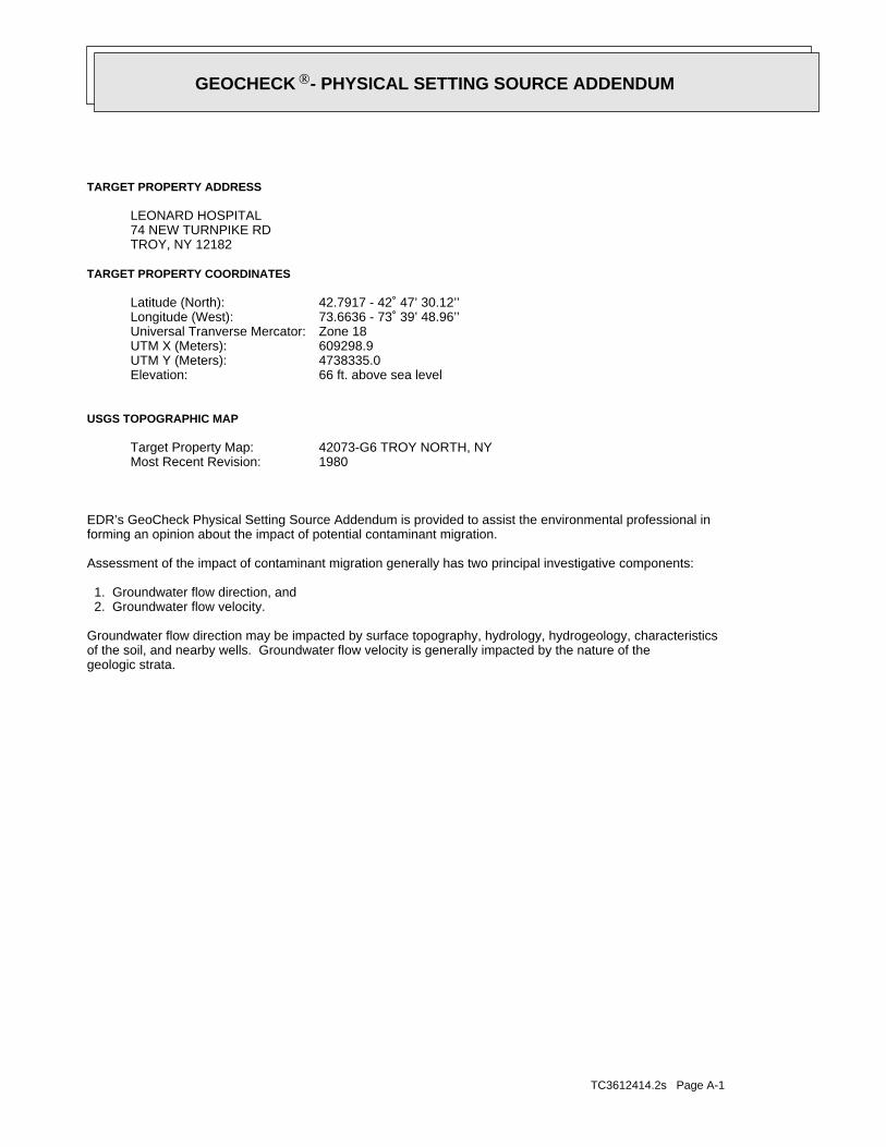
TC3612414.2s Page A-1
geologic strata.of the soil, and nearby wells. Groundwater flow velocity is generally impacted by the nature of theGroundwater flow direction may be impacted by surface topography, hydrology, hydrogeology, characteristics
2. Groundwater flow velocity. 1. Groundwater flow direction, and
Assessment of the impact of contaminant migration generally has two principal investigative components:
forming an opinion about the impact of potential contaminant migration.EDR’s GeoCheck Physical Setting Source Addendum is provided to assist the environmental professional in
1980Most Recent Revision:42073-G6 TROY NORTH, NYTarget Property Map:
USGS TOPOGRAPHIC MAP
66 ft. above sea levelElevation:4738335.0UTM Y (Meters): 609298.9UTM X (Meters): Zone 18Universal Tranverse Mercator: 73.6636 - 73˚ 39’ 48.96’’Longitude (West): 42.7917 - 42˚ 47’ 30.12’’Latitude (North):
TARGET PROPERTY COORDINATES
TROY, NY 1218274 NEW TURNPIKE RDLEONARD HOSPITAL
TARGET PROPERTY ADDRESS
®GEOCHECK - PHYSICAL SETTING SOURCE ADDENDUM®

TC3612414.2s Page A-2
should be field verified.on a relative (not an absolute) basis. Relative elevation information between sites of close proximitySource: Topography has been determined from the USGS 7.5’ Digital Elevation Model and should be evaluated
SURROUNDING TOPOGRAPHY: ELEVATION PROFILES
Ele
vatio
n (f
t)E
leva
tion
(ft)
TP
TP0 1/2 1 Miles
✩Target Property Elevation: 66 ft.
North South
West East
287237
205
1721099786787366585246
49329
20191761 39 34 29 9 9
39
52
63
66
101
152
239
265
313
355
385
388
413
General WNWGeneral Topographic Gradient:TARGET PROPERTY TOPOGRAPHY
should contamination exist on the target property, what downgradient sites might be impacted.assist the environmental professional in forming an opinion about the impact of nearby contaminated properties or,Surface topography may be indicative of the direction of surficial groundwater flow. This information can be used toTOPOGRAPHIC INFORMATION
collected on nearby properties, and regional groundwater flow information (from deep aquifers).sources of information, such as surface topographic information, hydrologic information, hydrogeologic datausing site-specific well data. If such data is not reasonably ascertainable, it may be necessary to rely on otherGroundwater flow direction for a particular site is best determined by a qualified environmental professionalGROUNDWATER FLOW DIRECTION INFORMATION
®GEOCHECK - PHYSICAL SETTING SOURCE SUMMARY®

TC3612414.2s Page A-3
Not Reported
GENERAL DIRECTIONLOCATIONGROUNDWATER FLOWFROM TPMAP ID
hydrogeologically, and the depth to water table.authorities at select sites and has extracted the date of the report, groundwater flow direction as determinedflow at specific points. EDR has reviewed reports submitted by environmental professionals to regulatoryEDR has developed the AQUIFLOW Information System to provide data on the general direction of groundwater
AQUIFLOW®
Search Radius: 1.000 Mile.
Not found Status:1.25 miles Search Radius:
Site-Specific Hydrogeological Data*:
* ©1996 Site−specific hydrogeological data gathered by CERCLIS Alerts, Inc., Bainbridge Island, WA. All rights reserved. All of the information and opinions presented are those of the cited EPA report(s), which were completed undera Comprehensive Environmental Response Compensation and Liability Information System (CERCLIS) investigation.
contamination exist on the target property, what downgradient sites might be impacted.environmental professional in forming an opinion about the impact of nearby contaminated properties or, shouldof groundwater flow direction in the immediate area. Such hydrogeologic information can be used to assist theHydrogeologic information obtained by installation of wells on a specific site can often be an indicatorHYDROGEOLOGIC INFORMATION
YES - refer to the Overview Map and Detail MapTROY NORTH
NATIONAL WETLAND INVENTORYNWI ElectronicData CoverageNWI Quad at Target Property
3600060005B - FEMA Q3 Flood data3611300005B - FEMA Q3 Flood data3611680019A - FEMA Q3 Flood data3611680016A - FEMA Q3 Flood data36091C0691E - FEMA Q3 Flood dataAdditional Panels in search area:
3606770001B - FEMA Q3 Flood dataFlood Plain Panel at Target Property:
YES - refer to the Overview Map and Detail MapRENSSELAER, NY
FEMA FLOOD ZONEFEMA FloodElectronic DataTarget Property County
and bodies of water).Refer to the Physical Setting Source Map following this summary for hydrologic information (major waterways
contamination exist on the target property, what downgradient sites might be impacted.the environmental professional in forming an opinion about the impact of nearby contaminated properties or, shouldSurface water can act as a hydrologic barrier to groundwater flow. Such hydrologic information can be used to assistHYDROLOGIC INFORMATION
®GEOCHECK - PHYSICAL SETTING SOURCE SUMMARY®

TC3612414.2s Page A-4
Map, USGS Digital Data Series DDS - 11 (1994).of the Conterminous U.S. at 1:2,500,000 Scale - a digital representation of the 1974 P.B. King and H.M. BeikmanGeologic Age and Rock Stratigraphic Unit Source: P.G. Schruben, R.E. Arndt and W.J. Bawiec, Geology
ROCK STRATIGRAPHIC UNIT GEOLOGIC AGE IDENTIFICATION
Eugeosynclinal DepositsCategory:PaleozoicEra:OrdovicianSystem:OrdovicianSeries:OeCode: (decoded above as Era, System & Series)
at which contaminant migration may be occurring.Geologic information can be used by the environmental professional in forming an opinion about the relative speedGEOLOGIC INFORMATION IN GENERAL AREA OF TARGET PROPERTY
move more quickly through sandy-gravelly types of soils than silty-clayey types of soils.characteristics data collected on nearby properties and regional soil information. In general, contaminant plumesto rely on other sources of information, including geologic age identification, rock stratigraphic unit and soilusing site specific geologic and soil strata data. If such data are not reasonably ascertainable, it may be necessaryGroundwater flow velocity information for a particular site is best determined by a qualified environmental professionalGROUNDWATER FLOW VELOCITY INFORMATION
®GEOCHECK - PHYSICAL SETTING SOURCE SUMMARY®

EDR Inc.EDR Inc.EDR Inc.EDR Inc.EDR Inc.EDR Inc.EDR Inc.EDR Inc.EDR Inc.EDR Inc.EDR Inc.EDR Inc.EDR Inc.EDR Inc.EDR Inc.EDR Inc.EDR Inc.EDR Inc.EDR Inc.EDR Inc.EDR Inc.EDR Inc.EDR Inc.EDR Inc.EDR Inc.EDR Inc.EDR Inc.EDR Inc.EDR Inc.EDR Inc.EDR Inc.EDR Inc.EDR Inc.EDR Inc.EDR Inc.EDR Inc.EDR Inc.EDR Inc.EDR Inc.EDR Inc.
5
1
4
5
6
3
7
2
3
0 1/16 1/8 1/4 Miles

TC3612414.2s Page A-6
Somewhat poorly drainedSoil Drainage Class:
drained and are classified.Class A/D - Drained/undrained hydrology class of soils that can beHydrologic Group:
silt loamSoil Surface Texture:
DumpsSoil Component Name:
Soil Map ID: 2
Min: 5.6Max: 7.2
Min: 0.42Max: 141
Clayey sand.Sands with fines,SOILS, Sands,COARSE-GRAINED
Soils.200), Siltypassing No.than 35 pct.Materials (moreSilt-Clay
loamgravelly silt59 inches 5 inches 2
Min: 5.6Max: 7.2
Min: 0.42Max: 141
Clayey sand.Sands with fines,SOILS, Sands,COARSE-GRAINED
Soils.200), Siltypassing No.than 35 pct.Materials (moreSilt-Claysilt loam 5 inches 0 inches 1
Soil Layer Information
Boundary Classification Saturatedhydraulicconductivitymicro m/sec
Layer Upper Lower Soil Texture Class AASHTO Group Unified Soil Soil Reaction(pH)
> 0 inchesDepth to Watertable Min:
> 0 inchesDepth to Bedrock Min:
HighCorrosion Potential - Uncoated Steel:
Hydric Status: Partially hydric
Poorly drainedSoil Drainage Class:
water table, or are shallow to an impervious layer.Class D - Very slow infiltration rates. Soils are clayey, have a highHydrologic Group:
silt loamSoil Surface Texture:
FluvaquentsSoil Component Name:
Soil Map ID: 1
in a landscape. The following information is based on Soil Conservation Service SSURGO data.for privately owned lands in the United States. A soil map in a soil survey is a representation of soil patternsSurvey (NCSS) and is responsible for collecting, storing, maintaining and distributing soil survey informationThe U.S. Department of Agriculture’s (USDA) Soil Conservation Service (SCS) leads the National Cooperative Soil
DOMINANT SOIL COMPOSITION IN GENERAL AREA OF TARGET PROPERTY
®GEOCHECK - PHYSICAL SETTING SOURCE SUMMARY®

TC3612414.2s Page A-7
4.5Max: 6 Min:
Min: 141Max: 141
Gravel.Poorly GradedClean gravels,SOILS, Gravels,COARSE-GRAINED
Sand.Gravel andFragments,200), Stonepassing No.pct. or lessmaterials (35Granular
sandy loamvery gravelly22 inches 9 inches 2
4.5Max: 6 Min:
Min: 141Max: 141
Gravel.Poorly GradedClean gravels,SOILS, Gravels,COARSE-GRAINED
Sand.Gravel andFragments,200), Stonepassing No.pct. or lessmaterials (35Granular
loamgravelly sandy 9 inches 0 inches 1
Soil Layer Information
Boundary Classification Saturatedhydraulicconductivitymicro m/sec
Layer Upper Lower Soil Texture Class AASHTO Group Unified Soil Soil Reaction(pH)
> 0 inchesDepth to Watertable Min:
> 0 inchesDepth to Bedrock Min:
LowCorrosion Potential - Uncoated Steel:
Hydric Status: Not hydric
Somewhat excessively drainedSoil Drainage Class:
excessively drained sands and gravels.Class A - High infiltration rates. Soils are deep, well drained toHydrologic Group:
gravelly sandy loamSoil Surface Texture:
HoosicSoil Component Name:
Soil Map ID: 3
No Layer Information available.
> 137 inchesDepth to Watertable Min:
> 0 inchesDepth to Bedrock Min:
Not ReportedCorrosion Potential - Uncoated Steel:
Hydric Status: Not hydric
®GEOCHECK - PHYSICAL SETTING SOURCE SUMMARY®

TC3612414.2s Page A-8
4.5Max: 6 Min:
Min: 141Max: 141
Gravel.Poorly GradedClean gravels,SOILS, Gravels,COARSE-GRAINED
Sand.Gravel andFragments,200), Stonepassing No.pct. or lessmaterials (35Granular
loamgravelly sandy 9 inches 0 inches 1
Soil Layer Information
Boundary Classification Saturatedhydraulicconductivitymicro m/sec
Layer Upper Lower Soil Texture Class AASHTO Group Unified Soil Soil Reaction(pH)
> 0 inchesDepth to Watertable Min:
> 0 inchesDepth to Bedrock Min:
LowCorrosion Potential - Uncoated Steel:
Hydric Status: Not hydric
Somewhat excessively drainedSoil Drainage Class:
excessively drained sands and gravels.Class A - High infiltration rates. Soils are deep, well drained toHydrologic Group:
gravelly sandy loamSoil Surface Texture:
HoosicSoil Component Name:
Soil Map ID: 4
4.5Max: 6 Min:
Min: 141Max: 141
Gravel.Poorly GradedClean gravels,SOILS, Gravels,COARSE-GRAINED
Sand.Gravel andFragments,200), Stonepassing No.pct. or lessmaterials (35Granular
sandvery gravelly59 inches22 inches 3
Soil Layer Information
Boundary Classification Saturatedhydraulicconductivitymicro m/sec
Layer Upper Lower Soil Texture Class AASHTO Group Unified Soil Soil Reaction(pH)
®GEOCHECK - PHYSICAL SETTING SOURCE SUMMARY®

TC3612414.2s Page A-9
Max: Min: Min: 0Max: 0.42 Not reported
and Sand.Clayey Gravel200), Silty, orpassing No.pct. or lessmaterials (35Granular
silt loamvery channery 7 inches 0 inches 1
Soil Layer Information
Boundary Classification Saturatedhydraulicconductivitymicro m/sec
Layer Upper Lower Soil Texture Class AASHTO Group Unified Soil Soil Reaction(pH)
> 0 inchesDepth to Watertable Min:
> 38 inchesDepth to Bedrock Min:
LowCorrosion Potential - Uncoated Steel:
Hydric Status: Not hydric
Somewhat excessively drainedSoil Drainage Class:
movement of water, or soils with moderately fine or fine textures.Class C - Slow infiltration rates. Soils with layers impeding downwardHydrologic Group:
very channery silt loamSoil Surface Texture:
NassauSoil Component Name:
Soil Map ID: 5
4.5Max: 6 Min:
Min: 141Max: 141
Gravel.Poorly GradedClean gravels,SOILS, Gravels,COARSE-GRAINED
Sand.Gravel andFragments,200), Stonepassing No.pct. or lessmaterials (35Granular
sandvery gravelly59 inches22 inches 3
4.5Max: 6 Min:
Min: 141Max: 141
Gravel.Poorly GradedClean gravels,SOILS, Gravels,COARSE-GRAINED
Sand.Gravel andFragments,200), Stonepassing No.pct. or lessmaterials (35Granular
sandy loamvery gravelly22 inches 9 inches 2
Soil Layer Information
Boundary Classification Saturatedhydraulicconductivitymicro m/sec
Layer Upper Lower Soil Texture Class AASHTO Group Unified Soil Soil Reaction(pH)
®GEOCHECK - PHYSICAL SETTING SOURCE SUMMARY®

TC3612414.2s Page A-10
Max: Min: Min: 0Max: 0.42 Not reported
and Sand.Clayey Gravel200), Silty, orpassing No.pct. or lessmaterials (35Granular
silt loamvery channery 7 inches 0 inches 1
Soil Layer Information
Boundary Classification Saturatedhydraulicconductivitymicro m/sec
Layer Upper Lower Soil Texture Class AASHTO Group Unified Soil Soil Reaction(pH)
> 0 inchesDepth to Watertable Min:
> 38 inchesDepth to Bedrock Min:
LowCorrosion Potential - Uncoated Steel:
Hydric Status: Not hydric
Somewhat excessively drainedSoil Drainage Class:
movement of water, or soils with moderately fine or fine textures.Class C - Slow infiltration rates. Soils with layers impeding downwardHydrologic Group:
very channery silt loamSoil Surface Texture:
NassauSoil Component Name:
Soil Map ID: 6
Max: Min: Min: 0Max: 0.42 Not reported
and Sand.Clayey Gravel200), Silty, orpassing No.pct. or lessmaterials (35Granular
bedrockunweathered18 inches14 inches 3
Max: Min: Min: 0Max: 0.42 Not reported
and Sand.Clayey Gravel200), Silty, orpassing No.pct. or lessmaterials (35Granular
loamvery channery14 inches 7 inches 2
Soil Layer Information
Boundary Classification Saturatedhydraulicconductivitymicro m/sec
Layer Upper Lower Soil Texture Class AASHTO Group Unified Soil Soil Reaction(pH)
®GEOCHECK - PHYSICAL SETTING SOURCE SUMMARY®

TC3612414.2s Page A-11
Min: 6.6Max: 8.4
Min: 0.42Max: 1.4
more), Fat Clay.limit 50% orClays (liquidSOILS, Silts andFINE-GRAINED
Soils.200), Clayeypassing No.than 35 pct.Materials (moreSilt-Claysilt loam 7 inches 0 inches 1
Soil Layer Information
Boundary Classification Saturatedhydraulicconductivitymicro m/sec
Layer Upper Lower Soil Texture Class AASHTO Group Unified Soil Soil Reaction(pH)
> 54 inchesDepth to Watertable Min:
> 0 inchesDepth to Bedrock Min:
HighCorrosion Potential - Uncoated Steel:
Hydric Status: Not hydric
Moderately well drainedSoil Drainage Class:
movement of water, or soils with moderately fine or fine textures.Class C - Slow infiltration rates. Soils with layers impeding downwardHydrologic Group:
silt loamSoil Surface Texture:
HudsonSoil Component Name:
Soil Map ID: 7
Max: Min: Min: 0Max: 0.42 Not reported
and Sand.Clayey Gravel200), Silty, orpassing No.pct. or lessmaterials (35Granular
bedrockunweathered18 inches14 inches 3
Max: Min: Min: 0Max: 0.42 Not reported
and Sand.Clayey Gravel200), Silty, orpassing No.pct. or lessmaterials (35Granular
loamvery channery14 inches 7 inches 2
Soil Layer Information
Boundary Classification Saturatedhydraulicconductivitymicro m/sec
Layer Upper Lower Soil Texture Class AASHTO Group Unified Soil Soil Reaction(pH)
®GEOCHECK - PHYSICAL SETTING SOURCE SUMMARY®

TC3612414.2s Page A-12
FEDERAL FRDS PUBLIC WATER SUPPLY SYSTEM INFORMATION
LOCATIONFROM TPWELL IDMAP ID
1/2 - 1 Mile SEUSGS40000862293 31/2 - 1 Mile NNEUSGS40000862541 2
FEDERAL USGS WELL INFORMATION
LOCATIONFROM TPWELL IDMAP ID
1.000State DatabaseNearest PWS within 1 mileFederal FRDS PWS1.000Federal USGS
WELL SEARCH DISTANCE INFORMATION
SEARCH DISTANCE (miles)DATABASE
opinion about the impact of contaminant migration on nearby drinking water wells.professional in assessing sources that may impact ground water flow direction, and in forming anEDR Local/Regional Water Agency records provide water well information to assist the environmental
LOCAL / REGIONAL WATER AGENCY RECORDS
Min: 6.6Max: 8.4
Min: 0.42Max: 1.4
more), Fat Clay.limit 50% orClays (liquidSOILS, Silts andFINE-GRAINED
Soils.200), Clayeypassing No.than 35 pct.Materials (moreSilt-Claysilty clay59 inches27 inches 4
Min: 6.6Max: 8.4
Min: 0.42Max: 1.4
more), Fat Clay.limit 50% orClays (liquidSOILS, Silts andFINE-GRAINED
Soils.200), Clayeypassing No.than 35 pct.Materials (moreSilt-Claysilty clay27 inches16 inches 3
Min: 6.6Max: 8.4
Min: 0.42Max: 1.4
more), Fat Clay.limit 50% orClays (liquidSOILS, Silts andFINE-GRAINED
Soils.200), Clayeypassing No.than 35 pct.Materials (moreSilt-Claysilty clay16 inches 7 inches 2
Soil Layer Information
Boundary Classification Saturatedhydraulicconductivitymicro m/sec
Layer Upper Lower Soil Texture Class AASHTO Group Unified Soil Soil Reaction(pH)
®GEOCHECK - PHYSICAL SETTING SOURCE SUMMARY®

TC3612414.2s Page A-13
No Wells Found
STATE DATABASE WELL INFORMATION
LOCATIONFROM TPWELL IDMAP ID
Note: PWS System location is not always the same as well location.
1/2 - 1 Mile WNWNY0000173 1
FEDERAL FRDS PUBLIC WATER SUPPLY SYSTEM INFORMATION
LOCATIONFROM TPWELL IDMAP ID
®GEOCHECK - PHYSICAL SETTING SOURCE SUMMARY®

EDR Inc.EDR Inc.EDR Inc.EDR Inc.EDR Inc.EDR Inc.EDR Inc.EDR Inc.EDR Inc.EDR Inc.EDR Inc.EDR Inc.EDR Inc.EDR Inc.EDR Inc.EDR Inc.EDR Inc.EDR Inc.EDR Inc.EDR Inc.EDR Inc.EDR Inc.EDR Inc.EDR Inc.EDR Inc.EDR Inc.EDR Inc.EDR Inc.EDR Inc.EDR Inc.EDR Inc.EDR Inc.EDR Inc.EDR Inc.EDR Inc.EDR Inc.EDR Inc.EDR Inc.EDR Inc.EDR Inc.
240
4 0
52
0
20
0
48
04
80
80
4 4 0
4 4 0
44
0
4
0
44 0
40
4 0
80
4 0 0
2
0 08 0
40
40
2 0 0
2
0 0
20
0
2 0 0
20
0
2 0 0200
40
4 40
440
80
40
80
4 0
40
4004
00
64
0
40
0
40
52
0
0 0
20
0
20
0
56
0
52
0
52
0
40
1 6 0
16
0
1 6 0
16
0
16
0
2 0
12
0 12
0
12
0
8 0
80
80
80
4 0
40
40
40
4 0
40
40
40
40
40
80
80
80
80
80
1 2
1 20
12
0
12
0
1 20
12
0
16
0
1 6 0
1 6 0
1 6 0
16
0
16
0
16
0
2 4 02 4 0
24
0
2 4 0
24
0
2
40
24
0
2 8 0
280
280
28
0
28
0
3
320
3 2 0
32
0
3 2 0
32
0
32
0
32
0
36
0
3 6 0
360
36
0
36
0
3 6 0
36
0
36
0
36
0
40
0
40
0
40
0
4 00
40
0
40
0
40
0
40
0
44
04
40
44
0
44
0
40
48 0
NY

TC3612414.2s Page A-15
Ground-water levels, Number of Measurements: 0
Not ReportedWellholedepth units:Not ReportedWellholedepth:ftWelldepth units:100Welldepth:Not ReportedConstruction date:
Not ReportedAquifer type:Not ReportedFormation type:Not ReportedAquifername:
USCountrycode:NGVD29Vert coord refsys:Interpolated from topographic mapVertcollection method:feetVert accmeasure units:
10Vertacc measure val:feetVert measure units:40Vert measure val:NAD83Horiz coord refsys:
Interpolated from mapHoriz Collection method:secondsHoriz Acc measure units:10Horiz Acc measure:24000Sourcemap scale:-73.6590066Longitude:42.8011888Latitude:Not ReportedContrib drainagearea units:Not ReportedContrib drainagearea:Not ReportedDrainagearea Units:Not ReportedDrainagearea value:Not ReportedHuc code:
Not ReportedMonloc desc:WellMonloc type:RE 595Monloc name:USGS-424804073393401Monloc Identifier:USGS New York Water Science CenterFormal name:USGS-NYOrg. Identifier:
2NNE1/2 - 1 MileLower
USGS40000862541FED USGS
Violations information not reported.
Not ReportedPopulation:Not ReportedTreatment ClassWATERFORDCity Served:
073 40 27Facility Longitude:42 47 42Facility Latitude:
WATERFORD, NY 12188PO BOX 489BOARD OF WATER COMMISSIONERSCERONE DANIELSystem Owner/Responsible PartyAddressee / Facility:
WATERFORD, NY 12188PO BOX 489WATERFORD WATER WORKSPWS Name:
Not ReportedDate Deactivated:Not ReportedDate Initiated:NY0000173PWS ID:
1WNW1/2 - 1 MileLower
NY0000173FRDS PWS
Map IDDirectionDistanceElevation EDR ID NumberDatabase
®GEOCHECK - PHYSICAL SETTING SOURCE MAP FINDINGS®

TC3612414.2s Page A-16
Ground-water levels, Number of Measurements: 0
Not ReportedWellholedepth units:Not ReportedWellholedepth:ftWelldepth units:162Welldepth:Not ReportedConstruction date:
Not ReportedAquifer type:Not ReportedFormation type:Not ReportedAquifername:
USCountrycode:NGVD29Vert coord refsys:Interpolated from topographic mapVertcollection method:feetVert accmeasure units:
10Vertacc measure val:feetVert measure units:300Vert measure val:NAD83Horiz coord refsys:
Interpolated from mapHoriz Collection method:secondsHoriz Acc measure units:10Horiz Acc measure:24000Sourcemap scale:-73.6509509Longitude:42.7850778Latitude:Not ReportedContrib drainagearea units:Not ReportedContrib drainagearea:Not ReportedDrainagearea Units:Not ReportedDrainagearea value:Not ReportedHuc code:
Not ReportedMonloc desc:WellMonloc type:RE 10Monloc name:USGS-424706073390501Monloc Identifier:USGS New York Water Science CenterFormal name:USGS-NYOrg. Identifier:
3SE1/2 - 1 MileHigher
USGS40000862293FED USGS
Map IDDirectionDistanceElevation EDR ID NumberDatabase
®GEOCHECK - PHYSICAL SETTING SOURCE MAP FINDINGS®

TC3612414.2s Page A-17
4%31%66%2.890 pCi/LBasement0%13%87%1.570 pCi/LLiving Area
% >20 pCi/L% 4-20 pCi/L% <4 pCi/LAverage ActivityArea
Number of sites tested: 85
Federal Area Radon Information for RENSSELAER COUNTY, NY
: Zone 3 indoor average level < 2 pCi/L. : Zone 2 indoor average level >= 2 pCi/L and <= 4 pCi/L. Note: Zone 1 indoor average level > 4 pCi/L.
Federal EPA Radon Zone for RENSSELAER County: 1
134.73.085.97498TROYRENSSELAER23.33.235.3529STEPHENTOWNRENSSELAER103.24.28.3247SCHODACKRENSSELAER19.34.025.5942SCHAGHTICOKERENSSELAER37.73.16.23169SAND LAKERENSSELAER65.32.695.72122RENSSELAERRENSSELAER31.44.196.4548POESTENKILLRENSSELAER74.22.926.4327PITTSTOWNRENSSELAER22.13.64.6936PETERSBURGRENSSELAER130.64.289.06211NO. GREENBUSHRENSSELAER38.13.176.5676NASSAURENSSELAER19.62.573.6840HOOSICKRENSSELAER17.72.133.8331GRAFTONRENSSELAER56.13.367.13220E. GREENBUSHRENSSELAER92.23.677.3796BRUNSWICKRENSSELAER255.557.7919BERLINRENSSELAER
_________________________________________Max ResultGeo MeanAvg ResultNum TestsTownCounty
Radon Test Results
State Database: NY Radon
AREA RADON INFORMATION
®GEOCHECK - PHYSICAL SETTING SOURCE MAP FINDINGSRADON
®

TOPOGRAPHIC INFORMATION
USGS 7.5’ Digital Elevation Model (DEM)Source: United States Geologic SurveyEDR acquired the USGS 7.5’ Digital Elevation Model in 2002 and updated it in 2006. The 7.5 minute DEM correspondsto the USGS 1:24,000- and 1:25,000-scale topographic quadrangle maps. The DEM provides elevation datawith consistent elevation units and projection.
Scanned Digital USGS 7.5’ Topographic Map (DRG)Source: United States Geologic SurveyA digital raster graphic (DRG) is a scanned image of a U.S. Geological Survey topographic map. The map imagesare made by scanning published paper maps on high-resolution scanners. The raster imageis georeferenced and fit to the Universal Transverse Mercator (UTM) projection.
HYDROLOGIC INFORMATION
Flood Zone Data: This data, available in select counties across the country, was obtained by EDR in 2003 & 2011 from the FederalEmergency Management Agency (FEMA). Data depicts 100-year and 500-year flood zones as defined by FEMA.
NWI: National Wetlands Inventory. This data, available in select counties across the country, was obtained by EDRin 2002 and 2005 from the U.S. Fish and Wildlife Service.
State Wetlands Data: Freshwater WetlandsSource: Department of Environmental ConservationTelephone: 518-402-8961
HYDROGEOLOGIC INFORMATION
AQUIFLOW Information SystemR
Source: EDR proprietary database of groundwater flow informationEDR has developed the AQUIFLOW Information System (AIS) to provide data on the general direction of groundwater
flow at specific points. EDR has reviewed reports submitted to regulatory authorities at select sites and hasextracted the date of the report, hydrogeologically determined groundwater flow direction and depth to water tableinformation.
GEOLOGIC INFORMATION
Geologic Age and Rock Stratigraphic UnitSource: P.G. Schruben, R.E. Arndt and W.J. Bawiec, Geology of the Conterminous U.S. at 1:2,500,000 Scale - A digitalrepresentation of the 1974 P.B. King and H.M. Beikman Map, USGS Digital Data Series DDS - 11 (1994).
STATSGO: State Soil Geographic DatabaseSource: Department of Agriculture, Natural Resources Conservation ServicesThe U.S. Department of Agriculture’s (USDA) Natural Resources Conservation Service (NRCS) leads the nationalConservation Soil Survey (NCSS) and is responsible for collecting, storing, maintaining and distributing soilsurvey information for privately owned lands in the United States. A soil map in a soil survey is a representationof soil patterns in a landscape. Soil maps for STATSGO are compiled by generalizing more detailed (SSURGO)soil survey maps.
SSURGO: Soil Survey Geographic DatabaseSource: Department of Agriculture, Natural Resources Conservation Services (NRCS)Telephone: 800-672-5559SSURGO is the most detailed level of mapping done by the Natural Resources Conservation Services, mappingscales generally range from 1:12,000 to 1:63,360. Field mapping methods using national standards are used toconstruct the soil maps in the Soil Survey Geographic (SSURGO) database. SSURGO digitizing duplicates theoriginal soil survey maps. This level of mapping is designed for use by landowners, townships and countynatural resource planning and management.
TC3612414.2s Page A-18
PHYSICAL SETTING SOURCE RECORDS SEARCHED

LOCAL / REGIONAL WATER AGENCY RECORDS
FEDERAL WATER WELLS
PWS: Public Water SystemsSource: EPA/Office of Drinking WaterTelephone: 202-564-3750Public Water System data from the Federal Reporting Data System. A PWS is any water system which provides water to at
least 25 people for at least 60 days annually. PWSs provide water from wells, rivers and other sources.
PWS ENF: Public Water Systems Violation and Enforcement DataSource: EPA/Office of Drinking WaterTelephone: 202-564-3750Violation and Enforcement data for Public Water Systems from the Safe Drinking Water Information System (SDWIS) after
August 1995. Prior to August 1995, the data came from the Federal Reporting Data System (FRDS).
USGS Water Wells: USGS National Water Inventory System (NWIS)This database contains descriptive information on sites where the USGS collects or has collected data on surfacewater and/or groundwater. The groundwater data includes information on wells, springs, and other sources of groundwater.
STATE RECORDS
New York Public Water WellsSource: New York Department of HealthTelephone: 518-458-6731
OTHER STATE DATABASE INFORMATION
Oil and Gas Well DatabaseDepartment of Environmental ConservationTelephone: 518-402-8072These files contain records, in the database, of wells that have been drilled.
RADON
State Database: NY RadonSource: Department of HealthTelephone: 518-402-7556Radon Test Results
Area Radon InformationSource: USGSTelephone: 703-356-4020The National Radon Database has been developed by the U.S. Environmental Protection Agency(USEPA) and is a compilation of the EPA/State Residential Radon Survey and the National Residential Radon Survey.The study covers the years 1986 - 1992. Where necessary data has been supplemented by information collected atprivate sources such as universities and research institutions.
EPA Radon ZonesSource: EPATelephone: 703-356-4020Sections 307 & 309 of IRAA directed EPA to list and identify areas of U.S. with the potential for elevated indoorradon levels.
OTHER
Airport Landing Facilities: Private and public use landing facilitiesSource: Federal Aviation Administration, 800-457-6656
Epicenters: World earthquake epicenters, Richter 5 or greaterSource: Department of Commerce, National Oceanic and Atmospheric Administration
TC3612414.2s Page A-19
PHYSICAL SETTING SOURCE RECORDS SEARCHED

STREET AND ADDRESS INFORMATION
© 2010 Tele Atlas North America, Inc. All rights reserved. This material is proprietary and the subject of copyright protectionand other intellectual property rights owned by or licensed to Tele Atlas North America, Inc. The use of this material is subjectto the terms of a license agreement. You will be held liable for any unauthorized copying or disclosure of this material.
TC3612414.2s Page A-20
PHYSICAL SETTING SOURCE RECORDS SEARCHED

ORPHAN SUMMARY
City EDR ID Site Name Site Address Zip Database(s)
Count: 19 records
BRUNSWICK 1012186386 OLD TROY MUNI INCINERATOR - NYSDEC OAKWOOD AVE RTE 40 12182 RCRA-SQGID#4-42-001
RENSSELAER COUNTY M300005318 WILLAM J. KELLER & SONS CONSTRUCTION CORP. ROUTE 150 PIT US MINESTROY S103936825 RIFENBURG CONSTRUCTION RT 142 NY SpillsMELROSE 1000283500 HURLEYS GARAGE INC RTE 40 12121 RCRA NonGen / NLR, FINDS,
MANIFESTTROY 1001493724 HURLEYS GARAGE INC 509 RTE 40 12182 RCRA NonGen / NLRTROY S109829321 GARDINER RES RT 40 HASTINGS RT 40 NY SpillsTROY 1012220320 WARREN W FANE INC 449 RTE 40 12182 US MINES, FINDSTROY S112148239 ROADWAY 8TH STREET AND WINSLOW BUILDING NY SpillsTROY S109413547 NAT GRID TRANSFORMER N. LAKE 383 N. LAKE POLE # 41 NY SpillsTROY U004079103 HURLEY’S GARAGE INC. 509 ROUTE 40 12182 USTTROY S110306190 WARREN W FANE INC 449 RTE 40 12182 MANIFESTTROY 1000329174 SUNOCO SERVICE STATION TROY MELROSE HWY RTE 40 RD 2 12182 RCRA NonGen / NLR, FINDSTROY S108930424 CLEMENTE CEMENT DISPOSAL UNKNOWN 00000 SWF/LFWATERFORD 1005905716 NYS DEPT OF TRANSPORTATION BIN:4022510 RTE 32 OVER BARGE CANAL 12188 RCRA-SQG, FINDS, MANIFESTWATERFORD 1000310026 GRAND UNION SUBSTATION RTE 4 12188 RCRA NonGen / NLR, FINDSMECHANICVILLE 1000310027 GRAND UNION GARAGE 66 MECHANICVILLE RD 12188 RCRA NonGen / NLR, FINDS,
MANIFESTHALFMOON/MECHANICVIL 1000138181 D&H, B&M, RAILROAD YARD ROUTE 67 12188 CERCLIS, FINDSWATERFORD 1003863635 SLUSPSKI LF RTE 97 12188 CERC-NFRAPWATERFORD S113405904 MPM B14 NORTH SIDE 12188 NY Spills
TC3612414.2s Page 1 of 1

DETAILED ORPHAN LISTING
EDR ID NumberEPA ID NumberDatabase(s)Site
NoUsed oil fuel burner: NoFurnace exemption: NoOn-site burner exemption: NoUnderground injection activity: NoTreater, storer or disposer of HW: NoTransporter of hazardous waste: NoRecycler of hazardous waste: NoMixed waste (haz. and radioactive): NoU.S. importer of hazardous waste:
Handler Activities Summary:
Not reportedOwner/Op end date: 06/01/2006Owner/Op start date: OwnerOwner/Operator Type: PrivateLegal status: Not reportedOwner/operator telephone: USOwner/operator country: TROY, NY 12182 HIALEAH DROwner/operator address: TOM MURLEYOwner/operator name:
Not reportedOwner/Op end date: 03/01/2005Owner/Op start date: OperatorOwner/Operator Type: StateLegal status: Not reportedOwner/operator telephone: Not reportedOwner/operator country: Not reported Not reportedOwner/operator address: NYSDECOwner/operator name:
Owner/Operator Summary:
hazardous waste at any time waste during any calendar month, and accumulates more than 1000 kg of hazardous waste at any time; or generates 100 kg or less of hazardous waste during any calendar month and accumulates less than 6000 kg of Handler: generates more than 100 and less than 1000 kg of hazardousDescription: Small Small Quantity GeneratorClassification: 02EPA Region: [email protected] email: (518) 402-9767Contact telephone: USContact country: ALBANY, NY 122337013 BROADWAYContact address: RANDY HOUGHContact: ALBANY, NY 122337013 BROADWAYMailing address: NYR000162479EPA ID: BRUNSWICK, NY 12182 INACTIVE HAZ WASTE SITE OAKWOOD AVE RTE 40Facility address: OLD TROY MUNI INCINERATOR - NYSDEC ID#4-42-001Facility name: 12/30/2008Date form received by agency:
RCRA-SQG:
BRUNSWICK, NY 12182OAKWOOD AVE RTE 40 NYR000162479
RCRA-SQGOLD TROY MUNI INCINERATOR - NYSDEC ID#4-42-001 1012186386
ORPHAN DETAIL TC3612414.2s Page 1

DETAILED ORPHAN LISTING
EDR ID NumberEPA ID NumberDatabase(s)Site
No violations foundViolation Status:
BENZENEWaste name: D018Waste code:
Hazardous Waste Summary:
NoUsed oil transporter: NoUsed oil transfer facility: NoUsed oil Specification marketer: NoUsed oil fuel marketer to burner: NoUser oil refiner: NoUsed oil processor:
1012186386OLD TROY MUNI INCINERATOR - NYSDEC ID#4-42-001 (Continued)
The facility is both a mine and a plantSite Type: -73.6904Longitude: 42.5469Latitude: Sand and GravelCommodity: 5519Mine ID:
Ferrous and Nonferrous Metal Mines Database:
RENSSELAER COUNTY, NY ROUTE 150 PIT N/A
US MINESWILLAM J. KELLER & SONS CONSTRUCTION CORP. M300005318
GEORGE RIFENBURGSpiller Name: 1/23/2002Spill Record Last Update: 5/1/1999Date Entered In Computer: 0Remediation Phase: FalseUST Trust: FalseRecommended Penalty: Not reportedLast Inspection: FalseCleanup Meets Std: Not reportedCleanup Ceased: CitizenSpill Notifier: Commercial/IndustrialSpill Source: Not reportedWater Affected: 384CID: 5/1/1999Reported to Dept: Not reportedReferred To: WEBLAINInvestigator: 4217SWIS: required. release with no damage. No DEC Response. No corrective action Possible release with minimal potential for fire or hazard or KnownSpill Class: DeliberateSpill Cause: 9901221 / 1/23/2002Spill Number/Closed Date: 4/1/1999Spill Date: 4DEC Region: 72870Site ID: ERFacility Type: 68681DER Facility ID: 9901221Facility ID:
SPILLS:
TROY, NY RT 142 N/A
NY SpillsRIFENBURG CONSTRUCTION S103936825
ORPHAN DETAIL TC3612414.2s Page 2

DETAILED ORPHAN LISTING
EDR ID NumberEPA ID NumberDatabase(s)Site
UnknownTest Method: 10/1/2004Last Modified: SpillsModified By: Not reportedGross Fail: 0Leak Rate: 00Test Method: 0Tank Size: Not reportedTank Number: 1547139Spill Tank Test: 72870Site ID:
Tank Test:
FalseOxygenate: Not reportedResource Affected: NoRecovered: GallonsUnits: 0Quantity: PetroleumMaterial FA: Not reportedCase No.: Waste Oil/Used OilMaterial Name: 0022Material Code: 304769Material ID: 01Operable Unit: 1075989Operable Unit ID: 72870Site ID:
Material:
OFF TO THE RIGHT OF GARAGE. CALLER STATES ABOVE COMPANY DUG A HOLE AND BURIED WASTE OIL. BURIEDRemarks: 9007612, 9811400.No DEC response to anonymous caller with no details. "BLAIN"NO FAX COPY IN DATA ENTRY TRAY. 8603161, 8705578, 9307978; Prior to Sept, 2004 data translation this spill Lead_DEC Field wasDEC Memo: (518) 279-3265Contact Phone: GEORGE RIFENBURGContact Name: 001Spiller Company: TROY, NY 12180-Spiller City,St,Zip: RTE 142Spiller Address: RIFENBURG CONSTRUCTIONSpiller Company:
S103936825RIFENBURG CONSTRUCTION (Continued)
(518) 235-4531Contact telephone: USContact country: TROY, NY 12182 RD 2 BOX 47Contact address: JACK HURLEYContact: TROY, NY 12182 RD 2 BOX 47Mailing address: NYD982716599EPA ID: MELROSE, NY 12121 RTE 40Facility address: HURLEYS GARAGE INCFacility name: 01/01/2007Date form received by agency:
RCRA NonGen / NLR:
MANIFESTMELROSE, NY 12121FINDSRTE 40 NYD982716599
RCRA NonGen / NLRHURLEYS GARAGE INC 1000283500
ORPHAN DETAIL TC3612414.2s Page 3

DETAILED ORPHAN LISTING
EDR ID NumberEPA ID NumberDatabase(s)Site
FINDS:
No violations foundViolation Status:
Small Quantity GeneratorClassification: HURLEYS GARAGE INCFacility name: 10/14/1988Date form received by agency:
Not a generator, verifiedClassification: HURLEYS GARAGE INCFacility name: 01/01/2006Date form received by agency:
Historical Generators:
NoUsed oil transporter: NoUsed oil transfer facility: NoUsed oil Specification marketer: NoUsed oil fuel marketer to burner: NoUser oil refiner: NoUsed oil processor: NoUsed oil fuel burner: NoFurnace exemption: NoOn-site burner exemption: NoUnderground injection activity: NoTreater, storer or disposer of HW: NoTransporter of hazardous waste: NoRecycler of hazardous waste: NoMixed waste (haz. and radioactive): NoU.S. importer of hazardous waste:
Handler Activities Summary:
Not reportedOwner/Op end date: Not reportedOwner/Op start date: OwnerOwner/Operator Type: PrivateLegal status: (212) 555-1212Owner/operator telephone: USOwner/operator country: NOT REQUIRED, WY 99999 NOT REQUIREDOwner/operator address: HURLEYS GARAGE INCOwner/operator name:
Not reportedOwner/Op end date: Not reportedOwner/Op start date: OperatorOwner/Operator Type: PrivateLegal status: (212) 555-1212Owner/operator telephone: USOwner/operator country: NOT REQUIRED, WY 99999 NOT REQUIREDOwner/operator address: HURLEYS GARAGE INCOwner/operator name:
Owner/Operator Summary:
Handler: Non-Generators do not presently generate hazardous wasteDescription: Non-GeneratorClassification: 02EPA Region: Not reportedContact email:
1000283500HURLEYS GARAGE INC (Continued)
ORPHAN DETAIL TC3612414.2s Page 4

DETAILED ORPHAN LISTING
EDR ID NumberEPA ID NumberDatabase(s)Site
891024Trans1 Recv Date: 891024Generator Ship Date: Not reportedTrans2 State ID: P78-064ILTrans1 State ID: Completed copyManifest Status: NYA8196318Document ID:
97Year: 100Specific Gravity: B Incineration, heat recovery, burning.Handling Method: DM - Metal drums, barrelsContainer Type: 001Number of Containers: G - Gallons (liquids only)* (8.3 pounds)Units: 00008Quantity: D001 - NON-LISTED IGNITABLE WASTESWaste Code: CTD021816889TSDF ID: Not reportedTrans2 EPA ID: CTD021816889Trans1 EPA ID: NYD982716599Generator EPA ID: 970306Part B Recv Date: Not reportedPart A Recv Date: 970214TSD Site Recv Date: Not reportedTrans2 Recv Date: 970213Trans1 Recv Date: 970213Generator Ship Date: Not reportedTrans2 State ID: CT17012ATrans1 State ID: Completed copyManifest Status: CTF0599527Document ID:
518-235-4531Mailing Phone: USAMailing Country: Not reportedMailing Zip4: 12121Mailing Zip: NYMailing State: MELROSEMailing City: Not reportedMailing Address 2: ROUTE 40Mailing Address: JACK HURLEYMailing Contact: HURLEYS GARAGE INCMailing Name: USACountry: NYD982716599EPA ID:
NY MANIFEST:
corrective action activities required under RCRA.program staff to track the notification, permit, compliance, andand treat, store, or dispose of hazardous waste. RCRAInfo allows RCRAevents and activities related to facilities that generate, transport,Conservation and Recovery Act (RCRA) program through the tracking ofRCRAInfo is a national information system that supports the Resource Environmental Interest/Information System
110006104072Registry ID:
1000283500HURLEYS GARAGE INC (Continued)
ORPHAN DETAIL TC3612414.2s Page 5

DETAILED ORPHAN LISTING
EDR ID NumberEPA ID NumberDatabase(s)Site
D001 - NON-LISTED IGNITABLE WASTESWaste Code: CT17012ATSDF ID: Not reportedTrans2 EPA ID: CTD021816889Trans1 EPA ID: NYD982716599Generator EPA ID: Not reportedPart B Recv Date: Not reportedPart A Recv Date: 01/16/1998TSD Site Recv Date: Not reportedTrans2 Recv Date: 01/15/1998Trans1 Recv Date: 01/15/1998Generator Ship Date: Not reportedTrans2 State ID: CTD021816889Trans1 State ID: Not reportedManifest Status: CTF0647679Document ID:
97Year: 100Specific Gravity: B Incineration, heat recovery, burning.Handling Method: DM - Metal drums, barrelsContainer Type: 001Number of Containers: G - Gallons (liquids only)* (8.3 pounds)Units: 00008Quantity: D001 - NON-LISTED IGNITABLE WASTESWaste Code: CTD021816889TSDF ID: Not reportedTrans2 EPA ID: CTD021816889Trans1 EPA ID: NYD982716599Generator EPA ID: 970827Part B Recv Date: Not reportedPart A Recv Date: 970729TSD Site Recv Date: Not reportedTrans2 Recv Date: 970729Trans1 Recv Date: 970729Generator Ship Date: Not reportedTrans2 State ID: CT17012ATrans1 State ID: Completed after the designated time period for a TSDF to get a copy to the DECManifest Status: CTF0662278Document ID:
89Year: 100Specific Gravity: B Incineration, heat recovery, burning.Handling Method: TT - Cargo tank, tank trucksContainer Type: 001Number of Containers: G - Gallons (liquids only)* (8.3 pounds)Units: 00025Quantity: F005 - UNKNOWNWaste Code: NYD049836679TSDF ID: Not reportedTrans2 EPA ID: ILD099202681Trans1 EPA ID: NYD982716599Generator EPA ID: 891114Part B Recv Date: 891109Part A Recv Date: 891030TSD Site Recv Date: Not reportedTrans2 Recv Date:
1000283500HURLEYS GARAGE INC (Continued)
ORPHAN DETAIL TC3612414.2s Page 6

DETAILED ORPHAN LISTING
EDR ID NumberEPA ID NumberDatabase(s)Site
97Year: 100Specific Gravity: B Incineration, heat recovery, burning.Handling Method: DM - Metal drums, barrelsContainer Type: 001Number of Containers: G - Gallons (liquids only)* (8.3 pounds)Units: 00008Quantity: D001 - NON-LISTED IGNITABLE WASTESWaste Code: CTD021816889TSDF ID: Not reportedTrans2 EPA ID: CTD021816889Trans1 EPA ID: NYD982716599Generator EPA ID: 971113Part B Recv Date: Not reportedPart A Recv Date: 971023TSD Site Recv Date: Not reportedTrans2 Recv Date: 971022Trans1 Recv Date: 971022Generator Ship Date: Not reportedTrans2 State ID: CT17012ATrans1 State ID: Completed copyManifest Status: CTF0661957Document ID:
98Year: 01.00Specific Gravity: B Incineration, heat recovery, burning.Handling Method: DM - Metal drums, barrelsContainer Type: 001Number of Containers: G - Gallons (liquids only)* (8.3 pounds)Units: 00008Quantity:
1000283500HURLEYS GARAGE INC (Continued)
NON REGULATEDOwner/operator name:Owner/Operator Summary:
Handler: Non-Generators do not presently generate hazardous wasteDescription: Non-GeneratorClassification: PrivateLand type: 02EPA Region: Not reportedContact email: Not reportedContact telephone: USContact country: TROY, NY 12182 HURLEY DRContact address: Not reportedContact: TROY, NY 12182 HURLEY DRMailing address: NYU005001649EPA ID: TROY, NY 12182 509 RTE 40Facility address: HURLEYS GARAGE INCFacility name: 01/01/2007Date form received by agency:
RCRA NonGen / NLR:
TROY, NY 12182509 RTE 40 NYU005001649
RCRA NonGen / NLRHURLEYS GARAGE INC 1001493724
ORPHAN DETAIL TC3612414.2s Page 7

DETAILED ORPHAN LISTING
EDR ID NumberEPA ID NumberDatabase(s)Site
EPAEvaluation lead agency: Not reportedDate achieved compliance: Not reportedArea of violation: COMPLIANCE EVALUATION INSPECTION ON-SITEEvaluation: 06/28/1999Evaluation date:
Evaluation Action Summary:
No violations foundViolation Status:
Conditionally Exempt Small Quantity GeneratorClassification: HURLEYS GARAGE INCFacility name: 08/11/1999Date form received by agency:
Not a generator, verifiedClassification: HURLEYS GARAGE INCFacility name: 01/01/2006Date form received by agency:
Historical Generators:
NoUsed oil transporter: NoUsed oil transfer facility: NoUsed oil Specification marketer: NoUsed oil fuel marketer to burner: NoUser oil refiner: NoUsed oil processor: NoUsed oil fuel burner: NoFurnace exemption: NoOn-site burner exemption: NoUnderground injection activity: NoTreater, storer or disposer of HW: NoTransporter of hazardous waste: NoRecycler of hazardous waste: NoMixed waste (haz. and radioactive): NoU.S. importer of hazardous waste:
Handler Activities Summary:
Not reportedOwner/Op end date: Not reportedOwner/Op start date: OperatorOwner/Operator Type: PrivateLegal status: (518) 555-1212Owner/operator telephone: USOwner/operator country: NOT REQUIRED, NY 99999 NOT REQUIREDOwner/operator address: NON REGULATEDOwner/operator name:
Not reportedOwner/Op end date: Not reportedOwner/Op start date: OwnerOwner/Operator Type: PrivateLegal status: (518) 555-1212Owner/operator telephone: USOwner/operator country: NOT REQUIRED, NY 99999 NOT REQUIREDOwner/operator address:
1001493724HURLEYS GARAGE INC (Continued)
ORPHAN DETAIL TC3612414.2s Page 8

DETAILED ORPHAN LISTING
EDR ID NumberEPA ID NumberDatabase(s)Site
FalseOxygenate: Not reportedResource Affected: 40Recovered: GallonsUnits: 40Quantity: PetroleumMaterial FA: Not reportedCase No.: #2 Fuel OilMaterial Name: 0001AMaterial Code: 472402Material ID: 01Operable Unit: 904436Operable Unit ID: 287594Site ID:
Material:
HASTINGS IS CLEANING UP.Remarks: FURTHER RESPONSE IS ANTICIPATED. "BLAIN" / / : SPOKE WITH HOMEOWNER- HE IS SATISFIED WITH CLEANUP. NO Prior to Sept, 2004 data translation this spill Lead_DEC Field wasDEC Memo: (518) 237-9556Contact Phone: THOMAS GARDINERContact Name: 001Spiller Company: TROY, ZZSpiller City,St,Zip: Not reportedSpiller Address: HASTINGS OIL HEATINGSpiller Company: Not reportedSpiller Name: 7/18/2012Spill Record Last Update: 2/10/1987Date Entered In Computer: 0Remediation Phase: FalseUST Trust: FalseRecommended Penalty: Not reportedLast Inspection: TrueCleanup Meets Std: 2/7/1987Cleanup Ceased: Responsible PartySpill Notifier: Tank TruckSpill Source: Not reportedWater Affected: Not reportedCID: 2/7/1987Reported to Dept: Not reportedReferred To: WEBLAINInvestigator: 4217SWIS: Improbable) Known release that creates potential for fire or hazard. (HighlySpill Class: UnknownSpill Cause: 8606841 / 2/7/1987Spill Number/Closed Date: 2/7/1987Spill Date: 4DEC Region: 287594Site ID: ERFacility Type: 232980DER Facility ID: 8606841Facility ID:
SPILLS:
TROY, NY RT 40 N/A
NY SpillsGARDINER RES RT 40 HASTINGS S109829321
ORPHAN DETAIL TC3612414.2s Page 9

DETAILED ORPHAN LISTING
EDR ID NumberEPA ID NumberDatabase(s)Site
Tank Test:
S109829321GARDINER RES RT 40 HASTINGS (Continued)
104(a)Action Type: 12/13/1983Status Date: IntermittentMine Status: 11/05/2008Date Issued: 6061100Violation Number:
Violations Details:
000 00 00Longitude: 00 00 00Latitude: 0Number of plants: 0Number of shops: non-Coal MiningOperation Class: 20050912Status date: 4Status: RENSSELAERCounty FIPS code: NYState FIPS code: WARREN W FANE INCCompany: PERRY PITEntity name: 14410 00000 00000 00000 00000 00000SIC code(s): 3002551Mine ID:
000 00 00Longitude: 00 00 00Latitude: 0Number of plants: 0Number of shops: non-Coal MiningOperation Class: 20120821Status date: 2Status: RENSSELAERCounty FIPS code: NYState FIPS code: WARREN W FANE INCCompany: EAGLE CRUSHEREntity name: 14290 00000 00000 00000 00000 00000SIC code(s): 3003592Mine ID:
073 40 04Longitude: 42 53 00Latitude: 0Number of plants: 0Number of shops: non-Coal MiningOperation Class: 19831213Status date: 2Status: RENSSELAERCounty FIPS code: NYState FIPS code: WARREN W FANE INCCompany: HEMSTREET PARK PITEntity name: 14410 00000 00000 00000 00000 00000SIC code(s): 3002648Mine ID:
US MINES:
TROY, NY 12182FINDS449 RTE 40 110040529568
US MINESWARREN W FANE INC 1012220320
ORPHAN DETAIL TC3612414.2s Page 10

DETAILED ORPHAN LISTING
EDR ID NumberEPA ID NumberDatabase(s)Site
11/01/2011Date Issued: 8651270Violation Number:
2011Year: 100.00Assessment Amount: ProposedAssess. Case Status code: ClosedAssessment Status code: 100.00Paid Penalty: 100.00Proposed Penalty: NSig and Sub Designation: CitationCitation/Order: 11/01/2011Date Abated: 104(a)Action Type: 12/13/1983Status Date: IntermittentMine Status: 11/01/2011Date Issued: 8651271Violation Number:
2008Year: 100.00Assessment Amount: ProposedAssess. Case Status code: ClosedAssessment Status code: 100.00Paid Penalty: 100.00Proposed Penalty: NSig and Sub Designation: CitationCitation/Order: 11/05/2008Date Abated: 104(a)Action Type: 12/13/1983Status Date: IntermittentMine Status: 11/05/2008Date Issued: 6531001Violation Number:
2008Year: 100.00Assessment Amount: ProposedAssess. Case Status code: ClosedAssessment Status code: 100.00Paid Penalty: 100.00Proposed Penalty: NSig and Sub Designation: CitationCitation/Order: 11/05/2008Date Abated: 104(a)Action Type: 12/13/1983Status Date: IntermittentMine Status: 11/05/2008Date Issued: 6531002Violation Number:
2008Year: 100.00Assessment Amount: ProposedAssess. Case Status code: ClosedAssessment Status code: 100.00Paid Penalty: 100.00Proposed Penalty: NSig and Sub Designation: CitationCitation/Order: 11/05/2008Date Abated:
1012220320WARREN W FANE INC (Continued)
ORPHAN DETAIL TC3612414.2s Page 11

DETAILED ORPHAN LISTING
EDR ID NumberEPA ID NumberDatabase(s)Site
2005Year: 60.00Assessment Amount: ProposedAssess. Case Status code: ClosedAssessment Status code: 60.00Paid Penalty: 60.00Proposed Penalty: NSig and Sub Designation: CitationCitation/Order: 10/24/2005Date Abated: 104(a)Action Type: 12/13/1983Status Date: IntermittentMine Status: 10/24/2005Date Issued: 6027591Violation Number:
2005Year: 60.00Assessment Amount: ProposedAssess. Case Status code: ClosedAssessment Status code: 60.00Paid Penalty: 60.00Proposed Penalty: NSig and Sub Designation: CitationCitation/Order: 10/26/2005Date Abated: 104(a)Action Type: 12/13/1983Status Date: IntermittentMine Status: 10/24/2005Date Issued: 6027592Violation Number:
2005Year: 60.00Assessment Amount: ProposedAssess. Case Status code: ClosedAssessment Status code: 60.00Paid Penalty: 60.00Proposed Penalty: NSig and Sub Designation: CitationCitation/Order: 10/26/2005Date Abated: 104(a)Action Type: 12/13/1983Status Date: IntermittentMine Status: 10/24/2005Date Issued: 6027590Violation Number:
2011Year: 100.00Assessment Amount: ProposedAssess. Case Status code: ClosedAssessment Status code: 100.00Paid Penalty: 100.00Proposed Penalty: NSig and Sub Designation: CitationCitation/Order: 11/01/2011Date Abated: 104(a)Action Type: 12/13/1983Status Date: IntermittentMine Status:
1012220320WARREN W FANE INC (Continued)
ORPHAN DETAIL TC3612414.2s Page 12

DETAILED ORPHAN LISTING
EDR ID NumberEPA ID NumberDatabase(s)Site
ProposedAssess. Case Status code: ClosedAssessment Status code: 100.00Paid Penalty: 100.00Proposed Penalty: YSig and Sub Designation: CitationCitation/Order: 09/29/2009Date Abated: 104(a)Action Type: 12/13/1983Status Date: IntermittentMine Status: 09/29/2009Date Issued: 6540809Violation Number:
2009Year: 100.00Assessment Amount: ProposedAssess. Case Status code: ClosedAssessment Status code: 100.00Paid Penalty: 100.00Proposed Penalty: YSig and Sub Designation: CitationCitation/Order: 10/01/2009Date Abated: 104(a)Action Type: 12/13/1983Status Date: IntermittentMine Status: 09/29/2009Date Issued: 6540810Violation Number:
2005Year: 60.00Assessment Amount: ProposedAssess. Case Status code: ClosedAssessment Status code: 60.00Paid Penalty: 60.00Proposed Penalty: NSig and Sub Designation: CitationCitation/Order: 10/24/2005Date Abated: 104(a)Action Type: 12/13/1983Status Date: IntermittentMine Status: 10/24/2005Date Issued: 6027594Violation Number:
2005Year: 60.00Assessment Amount: ProposedAssess. Case Status code: ClosedAssessment Status code: 60.00Paid Penalty: 60.00Proposed Penalty: NSig and Sub Designation: CitationCitation/Order: 10/24/2005Date Abated: 104(a)Action Type: 12/13/1983Status Date: IntermittentMine Status: 10/24/2005Date Issued: 6027593Violation Number:
1012220320WARREN W FANE INC (Continued)
ORPHAN DETAIL TC3612414.2s Page 13

DETAILED ORPHAN LISTING
EDR ID NumberEPA ID NumberDatabase(s)Site
100.00Proposed Penalty: NSig and Sub Designation: CitationCitation/Order: 08/23/2011Date Abated: 104(a)Action Type: 12/13/1983Status Date: IntermittentMine Status: 08/23/2011Date Issued: 8648368Violation Number:
2009Year: 100.00Assessment Amount: ProposedAssess. Case Status code: ClosedAssessment Status code: 100.00Paid Penalty: 100.00Proposed Penalty: YSig and Sub Designation: CitationCitation/Order: 10/01/2009Date Abated: 104(a)Action Type: 12/13/1983Status Date: IntermittentMine Status: 09/29/2009Date Issued: 6540806Violation Number:
2009Year: 100.00Assessment Amount: ProposedAssess. Case Status code: ClosedAssessment Status code: 100.00Paid Penalty: 100.00Proposed Penalty: YSig and Sub Designation: CitationCitation/Order: 09/29/2009Date Abated: 104(a)Action Type: 12/13/1983Status Date: IntermittentMine Status: 09/29/2009Date Issued: 6540807Violation Number:
2009Year: 117.00Assessment Amount: ProposedAssess. Case Status code: ClosedAssessment Status code: 117.00Paid Penalty: 117.00Proposed Penalty: YSig and Sub Designation: CitationCitation/Order: 10/01/2009Date Abated: 104(a)Action Type: 12/13/1983Status Date: IntermittentMine Status: 09/29/2009Date Issued: 6540808Violation Number:
2009Year: 100.00Assessment Amount:
1012220320WARREN W FANE INC (Continued)
ORPHAN DETAIL TC3612414.2s Page 14

DETAILED ORPHAN LISTING
EDR ID NumberEPA ID NumberDatabase(s)Site
05/17/2007Date Abated: 104(a)Action Type: 12/13/1983Status Date: IntermittentMine Status: 05/16/2007Date Issued: 6048440Violation Number:
2007Year: 100.00Assessment Amount: ProposedAssess. Case Status code: ClosedAssessment Status code: 100.00Paid Penalty: 100.00Proposed Penalty: NSig and Sub Designation: CitationCitation/Order: 05/17/2007Date Abated: 104(a)Action Type: 12/13/1983Status Date: IntermittentMine Status: 05/16/2007Date Issued: 6048441Violation Number:
2003Year: 60Assessment Amount: ProposedAssess. Case Status code: ClosedAssessment Status code: 60Paid Penalty: 60Proposed Penalty: NSig and Sub Designation: CitationCitation/Order: 08/07/2003Date Abated: 104(a)Action Type: 12/13/1983Status Date: IntermittentMine Status: 08/05/2003Date Issued: 6008728Violation Number:
2003Year: 60Assessment Amount: ProposedAssess. Case Status code: ClosedAssessment Status code: 60Paid Penalty: 60Proposed Penalty: NSig and Sub Designation: CitationCitation/Order: 08/05/2003Date Abated: 104(a)Action Type: 12/13/1983Status Date: IntermittentMine Status: 08/05/2003Date Issued: 6008727Violation Number:
2011Year: 100.00Assessment Amount: ProposedAssess. Case Status code: ClosedAssessment Status code: 100.00Paid Penalty:
1012220320WARREN W FANE INC (Continued)
ORPHAN DETAIL TC3612414.2s Page 15

DETAILED ORPHAN LISTING
EDR ID NumberEPA ID NumberDatabase(s)Site
corrective action activities required under RCRA.program staff to track the notification, permit, compliance, andand treat, store, or dispose of hazardous waste. RCRAInfo allows RCRAevents and activities related to facilities that generate, transport,Conservation and Recovery Act (RCRA) program through the tracking ofRCRAInfo is a national information system that supports the Resource Environmental Interest/Information System
110040529568Registry ID:
FINDS:
Please contact your EDR Account Executive for more informationThe US_MINES: database contains 10 additional records for this site.
2007Year: 100.00Assessment Amount: ProposedAssess. Case Status code: ClosedAssessment Status code: 100.00Paid Penalty: 100.00Proposed Penalty: NSig and Sub Designation: CitationCitation/Order:
1012220320WARREN W FANE INC (Continued)
Commercial VehicleSpill Source: STORM DRAINWater Affected: Not reportedCID: 8/1/2012Reported to Dept: Not reportedReferred To: JDUTBERGInvestigator: 4217SWIS: Willing Responsible Party. Corrective action taken. Known release with minimal potential for fire or hazard. DEC Response.Spill Class: Equipment FailureSpill Cause: 1204363 / 11/29/2012Spill Number/Closed Date: 8/1/2012Spill Date: 4DEC Region: 467248Site ID: ERFacility Type: 421575DER Facility ID: 1204363Facility ID:
SPILLS:
TROY, NY 8TH STREET AND WINSLOW BUILDING N/A
NY SpillsROADWAY S112148239
ORPHAN DETAIL TC3612414.2s Page 16

DETAILED ORPHAN LISTING
EDR ID NumberEPA ID NumberDatabase(s)Site
Tank Test:
FalseOxygenate: Not reportedResource Affected: Not reportedRecovered: GallonsUnits: 4Quantity: PetroleumMaterial FA: Not reportedCase No.: Hydraulic OilMaterial Name: 0010Material Code: 2215466Material ID: 01Operable Unit: 1217204Operable Unit ID: 467248Site ID:
Material:
PERFROMED INITIAL CLEANUP. SPILL FROM BOOM LIFT TO ROADWAY/STORM DRAIN, CLEAN HARBORS INC.Remarks: No further complaints. Spill can be closed. site. Roadway has been cleaned up. No evidence of impacts to sewer. boom in sewer overnight. Will pick up boom tomorrow.11/27/12 JDU on 8/1/12 TS called Chism, Clean harbors completed cleanup and left aDEC Memo: 518-276-6114Contact Phone: ANNETTE CHISMContact Name: 999Spiller Company: NYSpiller City,St,Zip: Not reportedSpiller Address: RPISpiller Company: Not reportedSpiller Name: 12/4/2012Spill Record Last Update: 8/1/2012Date Entered In Computer: 0Remediation Phase: FalseUST Trust: FalseRecommended Penalty: 11/27/2012Last Inspection: FalseCleanup Meets Std: Not reportedCleanup Ceased: OtherSpill Notifier:
S112148239ROADWAY (Continued)
4222SWIS: Willing Responsible Party. Corrective action taken. Known release with minimal potential for fire or hazard. DEC Response.Spill Class: OtherSpill Cause: 0810376 / 12/17/2008Spill Number/Closed Date: 12/15/2008Spill Date: 4DEC Region: 407894Site ID: ERFacility Type: 357151DER Facility ID: 0810376Facility ID:
SPILLS:
TROY, NY 383 N. LAKE POLE # 41 N/A
NY SpillsNAT GRID TRANSFORMER N. LAKE S109413547
ORPHAN DETAIL TC3612414.2s Page 17

DETAILED ORPHAN LISTING
EDR ID NumberEPA ID NumberDatabase(s)Site
Tank Test:
FalseOxygenate: Not reportedResource Affected: Not reportedRecovered: GallonsUnits: 5Quantity: PetroleumMaterial FA: Not reportedCase No.: TRANSFORMER OILMaterial Name: 0020AMaterial Code: 2155804Material ID: 01Operable Unit: 1164429Operable Unit ID: 407894Site ID:
Material:
CLEAN UP IS PENDING. FELL SPILLING ABOUT 5 GALLONS TO SOIL. UNK IF IT CONTAINES PCB’S. CALLER STATES THAT DUE TO THE STORM A POLE BROKE AND THE TRANSFORMERRemarks: nonPCB cleanup complete closedIce storm.DEC Memo: (518) 368-5901Contact Phone: MARK LAUSTRUPContact Name: 999Spiller Company: TROY, NYSpiller City,St,Zip: 383 NORTH LAKESpiller Address: NATIONAL GRID NIMOSpiller Company: MARK LAUSTRUPSpiller Name: 12/18/2008Spill Record Last Update: 12/15/2008Date Entered In Computer: 0Remediation Phase: FalseUST Trust: FalseRecommended Penalty: Not reportedLast Inspection: TrueCleanup Meets Std: Not reportedCleanup Ceased: Responsible PartySpill Notifier: Commercial/IndustrialSpill Source: Not reportedWater Affected: Not reportedCID: 12/15/2008Reported to Dept: Not reportedReferred To: WEBLAINInvestigator:
S109413547NAT GRID TRANSFORMER N. LAKE (Continued)
4740501.1991400002UTM Y: 611664.90281UTM X: 2016/12/02Expiration Date: PBSProgram Type: 4DEC Region: STATERegion: 4-051659 / ActiveId/Status:
UST:
TROY, NY 12182509 ROUTE 40 N/A
USTHURLEY’S GARAGE INC. U004079103
ORPHAN DETAIL TC3612414.2s Page 18

DETAILED ORPHAN LISTING
EDR ID NumberEPA ID NumberDatabase(s)Site
35212Site Id:
9/26/2006Date Last Modified: TMKOCHModified By: Not reportedFax Number: Not reportedEmail: Not reportedPhone Ext: (518) 235-4531Phone: 001Country Code: Not reportedZip Code: NNState: Not reportedCity: Not reportedAddress2: Not reportedAddress1: JACK A. HURLEYContact Name: Not reportedContact Type: HURLEYS GARAGE INC.Company Name: On-Site OperatorAffiliation Type: 35212Site Id:
9/26/2006Date Last Modified: TMKOCHModified By: Not reportedFax Number: Not reportedEmail: Not reportedPhone Ext: (518) 235-6479Phone: 001Country Code: 12182Zip Code: NYState: TROYCity: Not reportedAddress2: 4 HURLEY DRIVEAddress1: JACK A. HURLEYContact Name: Not reportedContact Type: HURLEYS GARAGE INC.Company Name: Mail ContactAffiliation Type: 35212Site Id:
12/19/2011Date Last Modified: JDUTBERGModified By: Not reportedFax Number: Not reportedEmail: Not reportedPhone Ext: (518) 235-4531Phone: 001Country Code: 12182Zip Code: NYState: TROYCity: Not reportedAddress2: 4 HURLEY DRIVEAddress1: JACK A HURLEYContact Name: PRESIDENTContact Type: JACK A .HURLEYCompany Name: Facility OwnerAffiliation Type: 35212Site Id:
Affiliation Records:
U004079103HURLEY’S GARAGE INC. (Continued)
ORPHAN DETAIL TC3612414.2s Page 19

DETAILED ORPHAN LISTING
EDR ID NumberEPA ID NumberDatabase(s)Site
Equipment Records:
Not reportedPipe Model: Steel/carbon steelTank Type: Closed - RemovedTank Status: 85524Tank ID: 2Tank Number:
35212Site ID:
03/04/2004Last Modified: TRANSLATModified By: TrueRegistered: 11/01/1995Date Test: Steel/carbon steelTank Type: 5Tank Location: 12/01/1998Date Tank Closed: Not reportedNext Test Date: 01Tightness Test Method: 4000Capacity Gallons: 12/01/1983Install Date: I00 - Overfill - None H99 - Tank Leak Detection - Other G00 - Tank Secondary Containment - None J02 - Dispenser - Suction Dispenser D02 - Pipe Type - Galvanized Steel A00 - Tank Internal Protection - None F00 - Pipe External Protection - None C02 - Pipe Location - Underground/On-ground B00 - Tank External Protection - None
Equipment Records:
Not reportedPipe Model: Steel/carbon steelTank Type: Closed - RemovedTank Status: 85523Tank ID: 1Tank Number:
35212Site ID:Tank Info:
9/26/2006Date Last Modified: TMKOCHModified By: Not reportedFax Number: Not reportedEmail: Not reportedPhone Ext: (518) 235-6479Phone: 999Country Code: Not reportedZip Code: NNState: Not reportedCity: Not reportedAddress2: Not reportedAddress1: JACK A. HURLEYContact Name: Not reportedContact Type: JACK A .HURLEYCompany Name: Emergency ContactAffiliation Type:
U004079103HURLEY’S GARAGE INC. (Continued)
ORPHAN DETAIL TC3612414.2s Page 20

DETAILED ORPHAN LISTING
EDR ID NumberEPA ID NumberDatabase(s)Site
Steel/carbon steelTank Type: Closed - RemovedTank Status: 85526Tank ID: 4Tank Number:
35212Site ID:
03/04/2004Last Modified: TRANSLATModified By: TrueRegistered: 11/01/1995Date Test: Steel/carbon steelTank Type: 5Tank Location: 12/01/1998Date Tank Closed: Not reportedNext Test Date: 01Tightness Test Method: 4000Capacity Gallons: 12/01/1983Install Date: I00 - Overfill - None J02 - Dispenser - Suction Dispenser D02 - Pipe Type - Galvanized Steel A00 - Tank Internal Protection - None F00 - Pipe External Protection - None C02 - Pipe Location - Underground/On-ground H99 - Tank Leak Detection - Other G00 - Tank Secondary Containment - None B00 - Tank External Protection - None
Equipment Records:
Not reportedPipe Model: Steel/carbon steelTank Type: Closed - RemovedTank Status: 85525Tank ID: 3Tank Number:
35212Site ID:
03/04/2004Last Modified: TRANSLATModified By: TrueRegistered: 11/01/1995Date Test: Steel/carbon steelTank Type: 5Tank Location: 12/01/1998Date Tank Closed: Not reportedNext Test Date: 01Tightness Test Method: 4000Capacity Gallons: 12/01/1983Install Date: I00 - Overfill - None H99 - Tank Leak Detection - Other G00 - Tank Secondary Containment - None J02 - Dispenser - Suction Dispenser D02 - Pipe Type - Galvanized Steel A00 - Tank Internal Protection - None F00 - Pipe External Protection - None C02 - Pipe Location - Underground/On-ground B00 - Tank External Protection - None
U004079103HURLEY’S GARAGE INC. (Continued)
ORPHAN DETAIL TC3612414.2s Page 21

DETAILED ORPHAN LISTING
EDR ID NumberEPA ID NumberDatabase(s)Site
03/04/2004Last Modified: TRANSLATModified By: TrueRegistered: Not reportedDate Test: Steel/carbon steelTank Type: 5Tank Location: 08/01/1996Date Tank Closed: Not reportedNext Test Date: NNTightness Test Method: 1000Capacity Gallons: 12/01/1980Install Date: I00 - Overfill - None B00 - Tank External Protection - None H00 - Tank Leak Detection - None G00 - Tank Secondary Containment - None J02 - Dispenser - Suction Dispenser D10 - Pipe Type - Copper A00 - Tank Internal Protection - None F00 - Pipe External Protection - None C02 - Pipe Location - Underground/On-ground
Equipment Records:
Not reportedPipe Model: Steel/carbon steelTank Type: Tank Converted to Non-Regulated UseTank Status: 96009Tank ID: 5Tank Number:
35212Site ID:
03/04/2004Last Modified: TRANSLATModified By: TrueRegistered: Not reportedDate Test: Steel/carbon steelTank Type: 5Tank Location: 12/01/1998Date Tank Closed: Not reportedNext Test Date: NNTightness Test Method: 1000Capacity Gallons: 11/01/1978Install Date: I00 - Overfill - None H00 - Tank Leak Detection - None J02 - Dispenser - Suction Dispenser D02 - Pipe Type - Galvanized Steel A00 - Tank Internal Protection - None F00 - Pipe External Protection - None C02 - Pipe Location - Underground/On-ground G00 - Tank Secondary Containment - None B00 - Tank External Protection - None
Equipment Records:
Not reportedPipe Model:
U004079103HURLEY’S GARAGE INC. (Continued)
ORPHAN DETAIL TC3612414.2s Page 22

DETAILED ORPHAN LISTING
EDR ID NumberEPA ID NumberDatabase(s)Site
Not reportedTrans2 State ID: NYD013277454Trans1 State ID: Not reportedManifest Status: Not reportedDocument ID:
H141Mgmt Method Type Code: Not reportedAlt Fac Sign Date: Not reportedAlt Fac RCRA Id: Not reportedManifest Ref Num: NDiscr Full Reject Ind: NDiscr Partial Reject Ind: NDiscr Residue Ind: NDiscr Type Ind: NDiscr Quantity Ind: NExport Ind: NImport Ind: 006644760JJKManifest Tracking Num: 2010Year: 1.0Specific Gravity: B Incineration, heat recovery, burning.Handling Method: DM - Metal drums, barrelsContainer Type: 2.0Number of Containers: G - Gallons (liquids only)* (8.3 pounds)Units: 32.0Quantity: Not reportedWaste Code: NYD013277454TSDF ID: Not reportedTrans2 EPA ID: Not reportedTrans1 EPA ID: NYR000172429Generator EPA ID: Not reportedPart B Recv Date: Not reportedPart A Recv Date: 2010-02-02TSD Site Recv Date: Not reportedTrans2 Recv Date: 2010-02-02Trans1 Recv Date: 2010-02-02Generator Ship Date: Not reportedTrans2 State ID: NYD013277454Trans1 State ID: Not reportedManifest Status: Not reportedDocument ID:
518-235-5531Mailing Phone: USAMailing Country: Not reportedMailing Zip4: 12182Mailing Zip: NYMailing State: TROYMailing City: Not reportedMailing Address 2: 42 LEVERSEE ROADMailing Address: LARRY LAVIGIGNEMailing Contact: WARREN W FANE INCMailing Name: USACountry: NYR000172429EPA ID:
NY MANIFEST:
TROY, NY 12182449 RTE 40 N/A
MANIFESTWARREN W FANE INC S110306190
ORPHAN DETAIL TC3612414.2s Page 23

DETAILED ORPHAN LISTING
EDR ID NumberEPA ID NumberDatabase(s)Site
NExport Ind: NImport Ind: 003565561FLEManifest Tracking Num: 2010Year: 1.0Specific Gravity: B Incineration, heat recovery, burning.Handling Method: DM - Metal drums, barrelsContainer Type: 1.0Number of Containers: G - Gallons (liquids only)* (8.3 pounds)Units: 55.0Quantity: Not reportedWaste Code: NYD013277454TSDF ID: Not reportedTrans2 EPA ID: Not reportedTrans1 EPA ID: NYR000172429Generator EPA ID: Not reportedPart B Recv Date: Not reportedPart A Recv Date: 2010-10-12TSD Site Recv Date: Not reportedTrans2 Recv Date: 2010-10-12Trans1 Recv Date: 2010-10-12Generator Ship Date: Not reportedTrans2 State ID: NYD013277454Trans1 State ID: Not reportedManifest Status: Not reportedDocument ID:
H141Mgmt Method Type Code: Not reportedAlt Fac Sign Date: Not reportedAlt Fac RCRA Id: Not reportedManifest Ref Num: NDiscr Full Reject Ind: NDiscr Partial Reject Ind: NDiscr Residue Ind: NDiscr Type Ind: NDiscr Quantity Ind: NExport Ind: NImport Ind: 003565548FLEManifest Tracking Num: 2010Year: 1.0Specific Gravity: B Incineration, heat recovery, burning.Handling Method: DM - Metal drums, barrelsContainer Type: 1.0Number of Containers: G - Gallons (liquids only)* (8.3 pounds)Units: 32.0Quantity: Not reportedWaste Code: NYD013277454TSDF ID: Not reportedTrans2 EPA ID: Not reportedTrans1 EPA ID: NYR000172429Generator EPA ID: Not reportedPart B Recv Date: Not reportedPart A Recv Date: 2010-10-04TSD Site Recv Date: Not reportedTrans2 Recv Date: 2010-10-04Trans1 Recv Date: 2010-10-04Generator Ship Date:
S110306190WARREN W FANE INC (Continued)
ORPHAN DETAIL TC3612414.2s Page 24

DETAILED ORPHAN LISTING
EDR ID NumberEPA ID NumberDatabase(s)Site
Not reportedPart B Recv Date: Not reportedPart A Recv Date: 2010-12-21TSD Site Recv Date: Not reportedTrans2 Recv Date: 2010-12-21Trans1 Recv Date: 2010-12-21Generator Ship Date: Not reportedTrans2 State ID: NYD013277454Trans1 State ID: Not reportedManifest Status: Not reportedDocument ID:
H141Mgmt Method Type Code: Not reportedAlt Fac Sign Date: Not reportedAlt Fac RCRA Id: Not reportedManifest Ref Num: NDiscr Full Reject Ind: NDiscr Partial Reject Ind: NDiscr Residue Ind: NDiscr Type Ind: NDiscr Quantity Ind: NExport Ind: NImport Ind: 003565680FLEManifest Tracking Num: 2010Year: 1.0Specific Gravity: B Incineration, heat recovery, burning.Handling Method: DM - Metal drums, barrelsContainer Type: 2.0Number of Containers: G - Gallons (liquids only)* (8.3 pounds)Units: 32.0Quantity: Not reportedWaste Code: NYD013277454TSDF ID: Not reportedTrans2 EPA ID: Not reportedTrans1 EPA ID: NYR000172429Generator EPA ID: Not reportedPart B Recv Date: Not reportedPart A Recv Date: 2010-11-09TSD Site Recv Date: Not reportedTrans2 Recv Date: 2010-11-09Trans1 Recv Date: 2010-11-09Generator Ship Date: Not reportedTrans2 State ID: NYD013277454Trans1 State ID: Not reportedManifest Status: Not reportedDocument ID:
H141Mgmt Method Type Code: Not reportedAlt Fac Sign Date: Not reportedAlt Fac RCRA Id: Not reportedManifest Ref Num: NDiscr Full Reject Ind: NDiscr Partial Reject Ind: NDiscr Residue Ind: NDiscr Type Ind: NDiscr Quantity Ind:
S110306190WARREN W FANE INC (Continued)
ORPHAN DETAIL TC3612414.2s Page 25

DETAILED ORPHAN LISTING
EDR ID NumberEPA ID NumberDatabase(s)Site
Not reportedManifest Ref Num: NDiscr Full Reject Ind: NDiscr Partial Reject Ind: NDiscr Residue Ind: NDiscr Type Ind: NDiscr Quantity Ind: NExport Ind: NImport Ind: 006643023JJKManifest Tracking Num: 2010Year: 1.0Specific Gravity: B Incineration, heat recovery, burning.Handling Method: DM - Metal drums, barrelsContainer Type: 1.0Number of Containers: G - Gallons (liquids only)* (8.3 pounds)Units: 32.0Quantity: Not reportedWaste Code: NYD013277454TSDF ID: Not reportedTrans2 EPA ID: Not reportedTrans1 EPA ID: NYR000172429Generator EPA ID: Not reportedPart B Recv Date: Not reportedPart A Recv Date: 2010-06-08TSD Site Recv Date: Not reportedTrans2 Recv Date: 2010-06-08Trans1 Recv Date: 2010-06-08Generator Ship Date: Not reportedTrans2 State ID: NYD013277454Trans1 State ID: Not reportedManifest Status: Not reportedDocument ID:
H141Mgmt Method Type Code: Not reportedAlt Fac Sign Date: Not reportedAlt Fac RCRA Id: Not reportedManifest Ref Num: NDiscr Full Reject Ind: NDiscr Partial Reject Ind: NDiscr Residue Ind: NDiscr Type Ind: NDiscr Quantity Ind: NExport Ind: NImport Ind: 003565835FLEManifest Tracking Num: 2010Year: 1.0Specific Gravity: B Incineration, heat recovery, burning.Handling Method: DM - Metal drums, barrelsContainer Type: 2.0Number of Containers: G - Gallons (liquids only)* (8.3 pounds)Units: 32.0Quantity: Not reportedWaste Code: NYD013277454TSDF ID: Not reportedTrans2 EPA ID: Not reportedTrans1 EPA ID: NYR000172429Generator EPA ID:
S110306190WARREN W FANE INC (Continued)
ORPHAN DETAIL TC3612414.2s Page 26

DETAILED ORPHAN LISTING
EDR ID NumberEPA ID NumberDatabase(s)Site
32.0Quantity: Not reportedWaste Code: NYD013277454TSDF ID: Not reportedTrans2 EPA ID: Not reportedTrans1 EPA ID: NYR000172429Generator EPA ID: Not reportedPart B Recv Date: Not reportedPart A Recv Date: 2010-08-24TSD Site Recv Date: Not reportedTrans2 Recv Date: 2010-08-24Trans1 Recv Date: 2010-08-24Generator Ship Date: Not reportedTrans2 State ID: NYD013277454Trans1 State ID: Not reportedManifest Status: Not reportedDocument ID:
H141Mgmt Method Type Code: Not reportedAlt Fac Sign Date: Not reportedAlt Fac RCRA Id: Not reportedManifest Ref Num: NDiscr Full Reject Ind: NDiscr Partial Reject Ind: NDiscr Residue Ind: NDiscr Type Ind: NDiscr Quantity Ind: NExport Ind: NImport Ind: 006643169JJKManifest Tracking Num: 2010Year: 1.0Specific Gravity: B Incineration, heat recovery, burning.Handling Method: DM - Metal drums, barrelsContainer Type: 1.0Number of Containers: G - Gallons (liquids only)* (8.3 pounds)Units: 32.0Quantity: Not reportedWaste Code: NYD013277454TSDF ID: Not reportedTrans2 EPA ID: Not reportedTrans1 EPA ID: NYR000172429Generator EPA ID: Not reportedPart B Recv Date: Not reportedPart A Recv Date: 2010-07-13TSD Site Recv Date: Not reportedTrans2 Recv Date: 2010-07-13Trans1 Recv Date: 2010-07-13Generator Ship Date: Not reportedTrans2 State ID: NYD013277454Trans1 State ID: Not reportedManifest Status: Not reportedDocument ID:
H141Mgmt Method Type Code: Not reportedAlt Fac Sign Date: Not reportedAlt Fac RCRA Id:
S110306190WARREN W FANE INC (Continued)
ORPHAN DETAIL TC3612414.2s Page 27

DETAILED ORPHAN LISTING
EDR ID NumberEPA ID NumberDatabase(s)Site
Not reportedDocument ID:
H141Mgmt Method Type Code: Not reportedAlt Fac Sign Date: Not reportedAlt Fac RCRA Id: Not reportedManifest Ref Num: NDiscr Full Reject Ind: NDiscr Partial Reject Ind: NDiscr Residue Ind: NDiscr Type Ind: NDiscr Quantity Ind: NExport Ind: NImport Ind: 006644760JJKManifest Tracking Num: 2010Year: 1.0Specific Gravity: B Incineration, heat recovery, burning.Handling Method: DM - Metal drums, barrelsContainer Type: 2.0Number of Containers: G - Gallons (liquids only)* (8.3 pounds)Units: 32.0Quantity: Not reportedWaste Code: NYD013277454TSDF ID: Not reportedTrans2 EPA ID: Not reportedTrans1 EPA ID: NYR000172429Generator EPA ID: Not reportedPart B Recv Date: Not reportedPart A Recv Date: 2010-02-02TSD Site Recv Date: Not reportedTrans2 Recv Date: 2010-02-02Trans1 Recv Date: 2010-02-02Generator Ship Date: Not reportedTrans2 State ID: NYD013277454Trans1 State ID: Not reportedManifest Status: Not reportedDocument ID:
H141Mgmt Method Type Code: Not reportedAlt Fac Sign Date: Not reportedAlt Fac RCRA Id: Not reportedManifest Ref Num: NDiscr Full Reject Ind: NDiscr Partial Reject Ind: NDiscr Residue Ind: NDiscr Type Ind: NDiscr Quantity Ind: NExport Ind: NImport Ind: 006643329JJKManifest Tracking Num: 2010Year: 1.0Specific Gravity: B Incineration, heat recovery, burning.Handling Method: DM - Metal drums, barrelsContainer Type: 1.0Number of Containers: G - Gallons (liquids only)* (8.3 pounds)Units:
S110306190WARREN W FANE INC (Continued)
ORPHAN DETAIL TC3612414.2s Page 28

DETAILED ORPHAN LISTING
EDR ID NumberEPA ID NumberDatabase(s)Site
2012Year: 1.0Specific Gravity: B Incineration, heat recovery, burning.Handling Method: DM - Metal drums, barrelsContainer Type: 1.0Number of Containers: G - Gallons (liquids only)* (8.3 pounds)Units: 30.0Quantity: Not reportedWaste Code: NYD013277454TSDF ID: Not reportedTrans2 EPA ID: Not reportedTrans1 EPA ID: NYR000172429Generator EPA ID: Not reportedPart B Recv Date: Not reportedPart A Recv Date: 2012-09-24TSD Site Recv Date: Not reportedTrans2 Recv Date: 2012-09-24Trans1 Recv Date: 2012-09-24Generator Ship Date: Not reportedTrans2 State ID: NYD013277454Trans1 State ID: Not reportedManifest Status: Not reportedDocument ID:
H141Mgmt Method Type Code: Not reportedAlt Fac Sign Date: Not reportedAlt Fac RCRA Id: Not reportedManifest Ref Num: NDiscr Full Reject Ind: NDiscr Partial Reject Ind: NDiscr Residue Ind: NDiscr Type Ind: NDiscr Quantity Ind: NExport Ind: NImport Ind: 006644832JJKManifest Tracking Num: 2010Year: 1.0Specific Gravity: B Incineration, heat recovery, burning.Handling Method: DM - Metal drums, barrelsContainer Type: 2.0Number of Containers: G - Gallons (liquids only)* (8.3 pounds)Units: 32.0Quantity: Not reportedWaste Code: NYD013277454TSDF ID: Not reportedTrans2 EPA ID: Not reportedTrans1 EPA ID: NYR000172429Generator EPA ID: Not reportedPart B Recv Date: Not reportedPart A Recv Date: 2010-04-20TSD Site Recv Date: Not reportedTrans2 Recv Date: 2010-04-20Trans1 Recv Date: 2010-04-20Generator Ship Date: Not reportedTrans2 State ID: NYD013277454Trans1 State ID: Not reportedManifest Status:
S110306190WARREN W FANE INC (Continued)
ORPHAN DETAIL TC3612414.2s Page 29

DETAILED ORPHAN LISTING
EDR ID NumberEPA ID NumberDatabase(s)Site
Not reportedTrans2 Recv Date: 2012-03-05Trans1 Recv Date: 2012-03-05Generator Ship Date: Not reportedTrans2 State ID: NYD013277454Trans1 State ID: Not reportedManifest Status: Not reportedDocument ID:
H141Mgmt Method Type Code: Not reportedAlt Fac Sign Date: Not reportedAlt Fac RCRA Id: Not reportedManifest Ref Num: NDiscr Full Reject Ind: NDiscr Partial Reject Ind: NDiscr Residue Ind: NDiscr Type Ind: NDiscr Quantity Ind: NExport Ind: NImport Ind: 004998922FLEManifest Tracking Num: 2012Year: 1.0Specific Gravity: B Incineration, heat recovery, burning.Handling Method: DM - Metal drums, barrelsContainer Type: 2.0Number of Containers: G - Gallons (liquids only)* (8.3 pounds)Units: 32.0Quantity: Not reportedWaste Code: NYD013277454TSDF ID: Not reportedTrans2 EPA ID: Not reportedTrans1 EPA ID: NYR000172429Generator EPA ID: Not reportedPart B Recv Date: Not reportedPart A Recv Date: 2012-01-24TSD Site Recv Date: Not reportedTrans2 Recv Date: 2012-01-24Trans1 Recv Date: 2012-01-24Generator Ship Date: Not reportedTrans2 State ID: NYD013377454Trans1 State ID: Not reportedManifest Status: Not reportedDocument ID:
H141Mgmt Method Type Code: Not reportedAlt Fac Sign Date: Not reportedAlt Fac RCRA Id: Not reportedManifest Ref Num: NDiscr Full Reject Ind: NDiscr Partial Reject Ind: NDiscr Residue Ind: NDiscr Type Ind: NDiscr Quantity Ind: NExport Ind: NImport Ind: 004060372JJKManifest Tracking Num:
S110306190WARREN W FANE INC (Continued)
ORPHAN DETAIL TC3612414.2s Page 30

DETAILED ORPHAN LISTING
EDR ID NumberEPA ID NumberDatabase(s)Site
NDiscr Residue Ind: NDiscr Type Ind: NDiscr Quantity Ind: NExport Ind: NImport Ind: 004999233FLEManifest Tracking Num: 2012Year: 1.0Specific Gravity: B Incineration, heat recovery, burning.Handling Method: DM - Metal drums, barrelsContainer Type: 1.0Number of Containers: G - Gallons (liquids only)* (8.3 pounds)Units: 55.0Quantity: Not reportedWaste Code: NYD013277454TSDF ID: Not reportedTrans2 EPA ID: Not reportedTrans1 EPA ID: NYR000172429Generator EPA ID: Not reportedPart B Recv Date: Not reportedPart A Recv Date: 2012-03-19TSD Site Recv Date: Not reportedTrans2 Recv Date: 2012-03-19Trans1 Recv Date: 2012-03-19Generator Ship Date: Not reportedTrans2 State ID: NYD013277454Trans1 State ID: Not reportedManifest Status: Not reportedDocument ID:
H141Mgmt Method Type Code: Not reportedAlt Fac Sign Date: Not reportedAlt Fac RCRA Id: Not reportedManifest Ref Num: NDiscr Full Reject Ind: NDiscr Partial Reject Ind: NDiscr Residue Ind: NDiscr Type Ind: NDiscr Quantity Ind: NExport Ind: NImport Ind: 004999166FLEManifest Tracking Num: 2012Year: 1.0Specific Gravity: B Incineration, heat recovery, burning.Handling Method: DM - Metal drums, barrelsContainer Type: 2.0Number of Containers: G - Gallons (liquids only)* (8.3 pounds)Units: 32.0Quantity: Not reportedWaste Code: NYD013277454TSDF ID: Not reportedTrans2 EPA ID: Not reportedTrans1 EPA ID: NYR000172429Generator EPA ID: Not reportedPart B Recv Date: Not reportedPart A Recv Date: 2012-03-05TSD Site Recv Date:
S110306190WARREN W FANE INC (Continued)
ORPHAN DETAIL TC3612414.2s Page 31

DETAILED ORPHAN LISTING
EDR ID NumberEPA ID NumberDatabase(s)Site
Not reportedTrans2 EPA ID: Not reportedTrans1 EPA ID: NYR000172429Generator EPA ID: Not reportedPart B Recv Date: Not reportedPart A Recv Date: 2012-06-04TSD Site Recv Date: Not reportedTrans2 Recv Date: 2012-06-04Trans1 Recv Date: 2012-06-04Generator Ship Date: Not reportedTrans2 State ID: NYD013277454Trans1 State ID: Not reportedManifest Status: Not reportedDocument ID:
H141Mgmt Method Type Code: Not reportedAlt Fac Sign Date: Not reportedAlt Fac RCRA Id: Not reportedManifest Ref Num: NDiscr Full Reject Ind: NDiscr Partial Reject Ind: NDiscr Residue Ind: NDiscr Type Ind: NDiscr Quantity Ind: NExport Ind: NImport Ind: 005159914FLEManifest Tracking Num: 2012Year: 1.0Specific Gravity: B Incineration, heat recovery, burning.Handling Method: DM - Metal drums, barrelsContainer Type: 2.0Number of Containers: G - Gallons (liquids only)* (8.3 pounds)Units: 32.0Quantity: Not reportedWaste Code: NYD013277454TSDF ID: Not reportedTrans2 EPA ID: Not reportedTrans1 EPA ID: NYR000172429Generator EPA ID: Not reportedPart B Recv Date: Not reportedPart A Recv Date: 2012-04-16TSD Site Recv Date: Not reportedTrans2 Recv Date: 2012-04-16Trans1 Recv Date: 2012-04-16Generator Ship Date: Not reportedTrans2 State ID: NYD013277454Trans1 State ID: Not reportedManifest Status: Not reportedDocument ID:
H141Mgmt Method Type Code: Not reportedAlt Fac Sign Date: Not reportedAlt Fac RCRA Id: Not reportedManifest Ref Num: NDiscr Full Reject Ind: NDiscr Partial Reject Ind:
S110306190WARREN W FANE INC (Continued)
ORPHAN DETAIL TC3612414.2s Page 32

DETAILED ORPHAN LISTING
EDR ID NumberEPA ID NumberDatabase(s)Site
H141Mgmt Method Type Code: Not reportedAlt Fac Sign Date: Not reportedAlt Fac RCRA Id: Not reportedManifest Ref Num: NDiscr Full Reject Ind: NDiscr Partial Reject Ind: NDiscr Residue Ind: NDiscr Type Ind: NDiscr Quantity Ind: NExport Ind: NImport Ind: 005716361FLEManifest Tracking Num: 2012Year: 1.0Specific Gravity: B Incineration, heat recovery, burning.Handling Method: DM - Metal drums, barrelsContainer Type: 1.0Number of Containers: G - Gallons (liquids only)* (8.3 pounds)Units: 30.0Quantity: Not reportedWaste Code: NYD013277454TSDF ID: Not reportedTrans2 EPA ID: Not reportedTrans1 EPA ID: NYR000172429Generator EPA ID: Not reportedPart B Recv Date: Not reportedPart A Recv Date: 2012-07-09TSD Site Recv Date: Not reportedTrans2 Recv Date: 2012-07-09Trans1 Recv Date: 2012-07-09Generator Ship Date: Not reportedTrans2 State ID: NYD013277454Trans1 State ID: Not reportedManifest Status: Not reportedDocument ID:
H141Mgmt Method Type Code: Not reportedAlt Fac Sign Date: Not reportedAlt Fac RCRA Id: Not reportedManifest Ref Num: NDiscr Full Reject Ind: NDiscr Partial Reject Ind: NDiscr Residue Ind: NDiscr Type Ind: NDiscr Quantity Ind: NExport Ind: NImport Ind: 005160140FLEManifest Tracking Num: 2012Year: 1.0Specific Gravity: B Incineration, heat recovery, burning.Handling Method: DM - Metal drums, barrelsContainer Type: 2.0Number of Containers: G - Gallons (liquids only)* (8.3 pounds)Units: 32.0Quantity: Not reportedWaste Code: NYD013277454TSDF ID:
S110306190WARREN W FANE INC (Continued)
ORPHAN DETAIL TC3612414.2s Page 33

DETAILED ORPHAN LISTING
EDR ID NumberEPA ID NumberDatabase(s)Site
1.0Specific Gravity: B Incineration, heat recovery, burning.Handling Method: DM - Metal drums, barrelsContainer Type: 1.0Number of Containers: G - Gallons (liquids only)* (8.3 pounds)Units: 32.0Quantity: Not reportedWaste Code: NYD013277454TSDF ID: Not reportedTrans2 EPA ID: Not reportedTrans1 EPA ID: NYR000172429Generator EPA ID: Not reportedPart B Recv Date: Not reportedPart A Recv Date: 2012-11-13TSD Site Recv Date: Not reportedTrans2 Recv Date: 2012-11-13Trans1 Recv Date: 2012-11-13Generator Ship Date: Not reportedTrans2 State ID: NYD013277454Trans1 State ID: Not reportedManifest Status: Not reportedDocument ID:
H141Mgmt Method Type Code: Not reportedAlt Fac Sign Date: Not reportedAlt Fac RCRA Id: Not reportedManifest Ref Num: NDiscr Full Reject Ind: NDiscr Partial Reject Ind: NDiscr Residue Ind: NDiscr Type Ind: NDiscr Quantity Ind: NExport Ind: NImport Ind: 005716558FLEManifest Tracking Num: 2012Year: 1.0Specific Gravity: B Incineration, heat recovery, burning.Handling Method: DM - Metal drums, barrelsContainer Type: 1.0Number of Containers: G - Gallons (liquids only)* (8.3 pounds)Units: 30.0Quantity: Not reportedWaste Code: NYD013277454TSDF ID: Not reportedTrans2 EPA ID: Not reportedTrans1 EPA ID: NYR000172429Generator EPA ID: Not reportedPart B Recv Date: Not reportedPart A Recv Date: 2012-08-20TSD Site Recv Date: Not reportedTrans2 Recv Date: 2012-08-20Trans1 Recv Date: 2012-08-20Generator Ship Date: Not reportedTrans2 State ID: NYD013277454Trans1 State ID: Not reportedManifest Status: Not reportedDocument ID:
S110306190WARREN W FANE INC (Continued)
ORPHAN DETAIL TC3612414.2s Page 34

DETAILED ORPHAN LISTING
EDR ID NumberEPA ID NumberDatabase(s)Site
Please contact your EDR Account Executive for more informationThe NY_MANIFEST: database contains 17 additional records for this site.
H141Mgmt Method Type Code: Not reportedAlt Fac Sign Date: Not reportedAlt Fac RCRA Id: Not reportedManifest Ref Num: NDiscr Full Reject Ind: NDiscr Partial Reject Ind: NDiscr Residue Ind: NDiscr Type Ind: NDiscr Quantity Ind: NExport Ind: NImport Ind: 005717903FLEManifest Tracking Num: 2012Year: 1.0Specific Gravity: B Incineration, heat recovery, burning.Handling Method: DM - Metal drums, barrelsContainer Type: 2.0Number of Containers: G - Gallons (liquids only)* (8.3 pounds)Units: 34.0Quantity: Not reportedWaste Code: NYD013277454TSDF ID: Not reportedTrans2 EPA ID: Not reportedTrans1 EPA ID: NYR000172429Generator EPA ID: Not reportedPart B Recv Date: Not reportedPart A Recv Date: 2012-12-17TSD Site Recv Date: Not reportedTrans2 Recv Date: 2012-12-17Trans1 Recv Date: 2012-12-17Generator Ship Date: Not reportedTrans2 State ID: NYD013277454Trans1 State ID: Not reportedManifest Status: Not reportedDocument ID:
H141Mgmt Method Type Code: Not reportedAlt Fac Sign Date: Not reportedAlt Fac RCRA Id: Not reportedManifest Ref Num: NDiscr Full Reject Ind: NDiscr Partial Reject Ind: NDiscr Residue Ind: NDiscr Type Ind: NDiscr Quantity Ind: NExport Ind: NImport Ind: 005716712FLEManifest Tracking Num: 2012Year:
S110306190WARREN W FANE INC (Continued)
ORPHAN DETAIL TC3612414.2s Page 35

DETAILED ORPHAN LISTING
EDR ID NumberEPA ID NumberDatabase(s)Site
NoUsed oil transporter: NoUsed oil transfer facility: NoUsed oil Specification marketer: NoUsed oil fuel marketer to burner: NoUser oil refiner: NoUsed oil processor: NoUsed oil fuel burner: NoFurnace exemption: NoOn-site burner exemption: NoUnderground injection activity: NoTreater, storer or disposer of HW: NoTransporter of hazardous waste: NoRecycler of hazardous waste: NoMixed waste (haz. and radioactive): NoU.S. importer of hazardous waste:
Handler Activities Summary:
Not reportedOwner/Op end date: Not reportedOwner/Op start date: OperatorOwner/Operator Type: PrivateLegal status: (212) 555-1212Owner/operator telephone: USOwner/operator country: NOT REQUIRED, WY 99999 NOT REQUIREDOwner/operator address: SUN OIL COMPANY OF PENNSYLVANIAOwner/operator name:
Not reportedOwner/Op end date: Not reportedOwner/Op start date: OwnerOwner/Operator Type: PrivateLegal status: (212) 555-1212Owner/operator telephone: USOwner/operator country: NOT REQUIRED, WY 99999 NOT REQUIREDOwner/operator address: SUN OIL COMPANY OF PENNSYLVANIAOwner/operator name:
Owner/Operator Summary:
Handler: Non-Generators do not presently generate hazardous wasteDescription: Non-GeneratorClassification: 02EPA Region: Not reportedContact email: Not reportedContact telephone: USContact country: TROY, NY 12182 TROY MELROSE HWY RTE 40 RD 2Contact address: Not reportedContact: NYD000702761EPA ID: TROY, NY 12182 TROY MELROSE HWY RTE 40 RD 2Facility address: SUNOCO SERVICE STATIONFacility name: 01/01/2007Date form received by agency:
RCRA NonGen / NLR:
TROY, NY 12182FINDSTROY MELROSE HWY RTE 40 RD 2 NYD000702761
RCRA NonGen / NLRSUNOCO SERVICE STATION 1000329174
ORPHAN DETAIL TC3612414.2s Page 36

DETAILED ORPHAN LISTING
EDR ID NumberEPA ID NumberDatabase(s)Site
corrective action activities required under RCRA.program staff to track the notification, permit, compliance, andand treat, store, or dispose of hazardous waste. RCRAInfo allows RCRAevents and activities related to facilities that generate, transport,Conservation and Recovery Act (RCRA) program through the tracking ofRCRAInfo is a national information system that supports the Resource Environmental Interest/Information System
110007993886Registry ID:
FINDS:
No violations foundViolation Status:
Large Quantity GeneratorClassification: SUNOCO SERVICE STATIONFacility name: 08/18/1980Date form received by agency:
Not a generator, verifiedClassification: SUNOCO SERVICE STATIONFacility name: 07/08/1999Date form received by agency:
Not a generator, verifiedClassification: SUNOCO SERVICE STATIONFacility name: 01/01/2006Date form received by agency:
Historical Generators:
1000329174SUNOCO SERVICE STATION (Continued)
Not reportedWaste Type: NoneRegulatory Status: Not reportedAccuracy Code: Not reportedNorth Coordinate: Not reportedEast Coordinate: NoActive: [42D52]Activity Number: Landfill - construction and demolition debrisActivity Desc: Not reportedContact Phone: Not reportedContact Email: Not reportedContact City,St,Zip: Not reportedContact Addr2: Not reportedContact Address: Not reportedContact Name: Not reportedOwner Phone: Not reportedOwner Email: MENANDS, NY 12206Owner City,St,Zip: Not reportedOwner Addr2: 28 PARK HILL DRIVEOwner Address: PrivateOwner Type: ROBERT JORDANOwner Name: Not reportedPhone Number: 4Region Code: INACTIVEFlag:
SWF/LF:
TROY, NY 00000UNKNOWN N/A
SWF/LFCLEMENTE CEMENT DISPOSAL S108930424
ORPHAN DETAIL TC3612414.2s Page 37

DETAILED ORPHAN LISTING
EDR ID NumberEPA ID NumberDatabase(s)Site
Not reportedExpiration Date: Not reportedAuthorization Date: Not reportedAuthorization #:
S108930424CLEMENTE CEMENT DISPOSAL (Continued)
NoTransporter of hazardous waste: NoRecycler of hazardous waste: NoMixed waste (haz. and radioactive): NoU.S. importer of hazardous waste:
Handler Activities Summary:
Not reportedOwner/Op end date: 12/31/1979Owner/Op start date: OwnerOwner/Operator Type: StateLegal status: Not reportedOwner/operator telephone: USOwner/operator country: SCHENECTADY, NY 12305 STATE STOwner/operator address: NYSDOTOwner/operator name:
Not reportedOwner/Op end date: 12/31/1979Owner/Op start date: OperatorOwner/Operator Type: StateLegal status: Not reportedOwner/operator telephone: USOwner/operator country: SCHENECTADY, NY 12305 STATE STOwner/operator address: NEW YORK STATEOwner/operator name:
Owner/Operator Summary:
hazardous waste at any time waste during any calendar month, and accumulates more than 1000 kg of hazardous waste at any time; or generates 100 kg or less of hazardous waste during any calendar month and accumulates less than 6000 kg of Handler: generates more than 100 and less than 1000 kg of hazardousDescription: Small Small Quantity GeneratorClassification: 02EPA Region: [email protected] email: (518) 388-0188Contact telephone: USContact country: SCHENECTADY, NY 12305 STATE STContact address: DAVID K RICHARDSContact: SCHENECTADY, NY 12305 STATE STMailing address: NYR000108019EPA ID: WATERFORD, NY 12188 RTE 32 OVER BARGE CANALFacility address: NYS DEPT OF TRANSPORTATION BIN:4022510Facility name: 01/01/2007Date form received by agency:
RCRA-SQG:
MANIFESTWATERFORD, NY 12188FINDSRTE 32 OVER BARGE CANAL NYR000108019
RCRA-SQGNYS DEPT OF TRANSPORTATION BIN:4022510 1005905716
ORPHAN DETAIL TC3612414.2s Page 38

DETAILED ORPHAN LISTING
EDR ID NumberEPA ID NumberDatabase(s)Site
Not reportedTransporter 8 EPA ID: Not reportedTransporter 7 EPA ID: Not reportedTransporter 6 EPA ID: Not reportedTransporter 5 EPA ID: Not reportedTransporter 4 EPA ID: Not reportedTransporter 3 EPA ID: Not reportedTransporter 2 EPA ID: NYD046765574Transporter EPA ID: NJD991291105TSDF EPA ID: 05/11/2004Date Shipped: NYR000108019EPA ID: NJA5104703Manifest Code:
NJ MANIFEST:
HAZARDOUS WASTE BIENNIAL REPORTER
corrective action activities required under RCRA.program staff to track the notification, permit, compliance, andand treat, store, or dispose of hazardous waste. RCRAInfo allows RCRAevents and activities related to facilities that generate, transport,Conservation and Recovery Act (RCRA) program through the tracking ofRCRAInfo is a national information system that supports the Resource Environmental Interest/Information System
110012568104Registry ID:
FINDS:
No violations foundViolation Status:
Large Quantity GeneratorClassification: NYSDOT BIN 4022510Site name: NYS DEPT OF TRANSPORTATION BIN:4022510Facility name: 07/18/2002Date form received by agency:
Large Quantity GeneratorClassification: NYS DEPT OF TRANSPORTATION BIN:4022510Facility name: 02/25/2004Date form received by agency:
Large Quantity GeneratorClassification: NYS DEPT OF TRANSPORTATION BIN:4022510Facility name: 01/01/2006Date form received by agency:
Historical Generators:
NoUsed oil transporter: NoUsed oil transfer facility: NoUsed oil Specification marketer: NoUsed oil fuel marketer to burner: NoUser oil refiner: NoUsed oil processor: NoUsed oil fuel burner: NoFurnace exemption: NoOn-site burner exemption: NoUnderground injection activity: NoTreater, storer or disposer of HW:
1005905716NYS DEPT OF TRANSPORTATION BIN:4022510 (Continued)
ORPHAN DETAIL TC3612414.2s Page 39

DETAILED ORPHAN LISTING
EDR ID NumberEPA ID NumberDatabase(s)Site
Not reportedTransporter 10 EPA ID: Not reportedTransporter 8 EPA ID: Not reportedTransporter 7 EPA ID: Not reportedTransporter 6 EPA ID: Not reportedTransporter 5 EPA ID: Not reportedTransporter 4 EPA ID: Not reportedTransporter 3 EPA ID: Not reportedTransporter 2 EPA ID: NYD046765574Transporter EPA ID: NJD991291105TSDF EPA ID: 05/11/2004Date Shipped: NYR000108019EPA ID: NJA5104704Manifest Code:
Not reportedHand Code: Not reportedUnit: Not reportedQuantity: Not reportedManifest Year: Not reportedWaste Code: Not reportedReason Load Was Rejected: NoWas Load Rejected (Y/N): Not reportedReference Manifest Number: 05260425Data Entry Number: Not reportedManifest Discrepancy Type: Not reportedDate Accepted: Not reportedWaste Type Code 6: Not reportedWaste Type Code 5: Not reportedWaste Type Code 4: Not reportedWaste Type Code 3: Not reportedWaste Type Code 2: Not reportedWaste SEQ ID: Not reportedTransporter-1 Date: Not reportedTransporter SEQ ID: Not reportedQTY Units: Not reportedTSDF EPA Facility Name: Not reportedTransporter-5 EPA Facility Name: Not reportedTransporter-4 EPA Facility Name: Not reportedTransporter-3 EPA Facility Name: Not reportedTransporter-2 EPA Facility Name: Not reportedTransporter-1 EPA Facility Name: Not reportedGenerator EPA Facility Name: Not reportedTranporter 2 Decal: Not reportedTranporter 1 Decal: 05/11/2004Date TSDF Received Waste: Not reportedDate Trans10 Transported Waste: Not reportedDate Trans9 Transported Waste: Not reportedDate Trans8 Transported Waste: Not reportedDate Trans7 Transported Waste: Not reportedDate Trans6 Transported Waste: Not reportedDate Trans5 Transported Waste: Not reportedDate Trans4 Transported Waste: Not reportedDate Trans3 Transported Waste: Not reportedDate Trans2 Transported Waste: 05/11/2004Date Trans1 Transported Waste: Not reportedTransporter 10 EPA ID:
1005905716NYS DEPT OF TRANSPORTATION BIN:4022510 (Continued)
ORPHAN DETAIL TC3612414.2s Page 40

DETAILED ORPHAN LISTING
EDR ID NumberEPA ID NumberDatabase(s)Site
Not reportedHand Code: Not reportedUnit: Not reportedQuantity: Not reportedManifest Year: Not reportedWaste Code: Not reportedReason Load Was Rejected: NoWas Load Rejected (Y/N): Not reportedReference Manifest Number: 05260425Data Entry Number: Not reportedManifest Discrepancy Type: Not reportedDate Accepted: Not reportedWaste Type Code 6: Not reportedWaste Type Code 5: Not reportedWaste Type Code 4: Not reportedWaste Type Code 3: Not reportedWaste Type Code 2: Not reportedWaste SEQ ID: Not reportedTransporter-1 Date: Not reportedTransporter SEQ ID: Not reportedQTY Units: Not reportedTSDF EPA Facility Name: Not reportedTransporter-5 EPA Facility Name: Not reportedTransporter-4 EPA Facility Name: Not reportedTransporter-3 EPA Facility Name: Not reportedTransporter-2 EPA Facility Name: Not reportedTransporter-1 EPA Facility Name: Not reportedGenerator EPA Facility Name: Not reportedTranporter 2 Decal: Not reportedTranporter 1 Decal: 05/11/2004Date TSDF Received Waste: Not reportedDate Trans10 Transported Waste: Not reportedDate Trans9 Transported Waste: Not reportedDate Trans8 Transported Waste: Not reportedDate Trans7 Transported Waste: Not reportedDate Trans6 Transported Waste: Not reportedDate Trans5 Transported Waste: Not reportedDate Trans4 Transported Waste: Not reportedDate Trans3 Transported Waste: Not reportedDate Trans2 Transported Waste: 05/11/2004Date Trans1 Transported Waste:
1005905716NYS DEPT OF TRANSPORTATION BIN:4022510 (Continued)
ERIE BLVD WContact address: Not reportedContact: SYRACUSE, NY 13202 ERIE BLVD WMailing address: NYD981076706EPA ID: WATERFORD, NY 12188 RTE 4Facility address: GRAND UNION SUBSTATIONFacility name: 01/01/2007Date form received by agency:
RCRA NonGen / NLR:
WATERFORD, NY 12188FINDSRTE 4 NYD981076706
RCRA NonGen / NLRGRAND UNION SUBSTATION 1000310026
ORPHAN DETAIL TC3612414.2s Page 41

DETAILED ORPHAN LISTING
EDR ID NumberEPA ID NumberDatabase(s)Site
Not a generator, verifiedClassification: GRAND UNION SUBSTATIONFacility name: 04/06/1995Date form received by agency:
Not a generator, verifiedClassification: GRAND UNION SUBSTATIONFacility name: 01/01/2006Date form received by agency:
Historical Generators:
NoUsed oil transporter: NoUsed oil transfer facility: NoUsed oil Specification marketer: NoUsed oil fuel marketer to burner: NoUser oil refiner: NoUsed oil processor: NoUsed oil fuel burner: NoFurnace exemption: NoOn-site burner exemption: NoUnderground injection activity: NoTreater, storer or disposer of HW: NoTransporter of hazardous waste: NoRecycler of hazardous waste: NoMixed waste (haz. and radioactive): NoU.S. importer of hazardous waste:
Handler Activities Summary:
Not reportedOwner/Op end date: Not reportedOwner/Op start date: OwnerOwner/Operator Type: PrivateLegal status: (212) 555-1212Owner/operator telephone: USOwner/operator country: NOT REQUIRED, WY 99999 NOT REQUIREDOwner/operator address: Not reportedOwner/operator name:
Not reportedOwner/Op end date: Not reportedOwner/Op start date: OperatorOwner/Operator Type: PrivateLegal status: (212) 555-1212Owner/operator telephone: USOwner/operator country: NOT REQUIRED, WY 99999 NOT REQUIREDOwner/operator address: Not reportedOwner/operator name:
Owner/Operator Summary:
Handler: Non-Generators do not presently generate hazardous wasteDescription: Non-GeneratorClassification: 02EPA Region: Not reportedContact email: Not reportedContact telephone: USContact country: SYRACUSE, NY 13202
1000310026GRAND UNION SUBSTATION (Continued)
ORPHAN DETAIL TC3612414.2s Page 42

DETAILED ORPHAN LISTING
EDR ID NumberEPA ID NumberDatabase(s)Site
corrective action activities required under RCRA.program staff to track the notification, permit, compliance, andand treat, store, or dispose of hazardous waste. RCRAInfo allows RCRAevents and activities related to facilities that generate, transport,Conservation and Recovery Act (RCRA) program through the tracking ofRCRAInfo is a national information system that supports the Resource Environmental Interest/Information System
110008017109Registry ID:
FINDS:
No violations foundViolation Status:
Large Quantity GeneratorClassification: GRAND UNION SUBSTATIONFacility name: 04/15/1985Date form received by agency:
1000310026GRAND UNION SUBSTATION (Continued)
USOwner/operator country: NOT REQUIRED, WY 99999 NOT REQUIREDOwner/operator address: GRAND UNIONOwner/operator name:
Not reportedOwner/Op end date: Not reportedOwner/Op start date: OwnerOwner/Operator Type: PrivateLegal status: (212) 555-1212Owner/operator telephone: USOwner/operator country: NOT REQUIRED, WY 99999 NOT REQUIREDOwner/operator address: GRAND UNIONOwner/operator name:
Owner/Operator Summary:
Handler: Non-Generators do not presently generate hazardous wasteDescription: Non-GeneratorClassification: Facility is not located on Indian land. Additional information is not known.Land type: 02EPA Region: Not reportedContact email: Not reportedContact telephone: USContact country: WATERFORD, NY 12188 MECHANICVILLE RDContact address: Not reportedContact: WATERFORD, NY 12188 MECHANICVILLE RDMailing address: NYD981561137EPA ID: MECHANICVILLE, NY 12188 66 MECHANICVILLE RDFacility address: GRAND UNION GARAGEFacility name: 01/01/2007Date form received by agency:
RCRA NonGen / NLR:
MANIFESTMECHANICVILLE, NY 12188FINDS66 MECHANICVILLE RD NYD981561137
RCRA NonGen / NLRGRAND UNION GARAGE 1000310027
ORPHAN DETAIL TC3612414.2s Page 43

DETAILED ORPHAN LISTING
EDR ID NumberEPA ID NumberDatabase(s)Site
corrective action activities required under RCRA.program staff to track the notification, permit, compliance, andand treat, store, or dispose of hazardous waste. RCRAInfo allows RCRAevents and activities related to facilities that generate, transport,Conservation and Recovery Act (RCRA) program through the tracking ofRCRAInfo is a national information system that supports the Resource Environmental Interest/Information System
110006445276Registry ID:
FINDS:
StateEvaluation lead agency: Not reportedDate achieved compliance: Not reportedArea of violation: COMPLIANCE EVALUATION INSPECTION ON-SITEEvaluation: 07/07/1994Evaluation date:
Evaluation Action Summary:
No violations foundViolation Status:
Large Quantity GeneratorClassification: GRAND UNION GARAGEFacility name: 09/22/1986Date form received by agency:
Not a generator, verifiedClassification: GRAND UNION GARAGEFacility name: 07/08/1999Date form received by agency:
Not a generator, verifiedClassification: GRAND UNION GARAGEFacility name: 01/01/2006Date form received by agency:
Historical Generators:
NoUsed oil transporter: NoUsed oil transfer facility: NoUsed oil Specification marketer: NoUsed oil fuel marketer to burner: NoUser oil refiner: NoUsed oil processor: NoUsed oil fuel burner: NoFurnace exemption: NoOn-site burner exemption: NoUnderground injection activity: NoTreater, storer or disposer of HW: NoTransporter of hazardous waste: NoRecycler of hazardous waste: NoMixed waste (haz. and radioactive): NoU.S. importer of hazardous waste:
Handler Activities Summary:
Not reportedOwner/Op end date: Not reportedOwner/Op start date: OperatorOwner/Operator Type: PrivateLegal status: (212) 555-1212Owner/operator telephone:
1000310027GRAND UNION GARAGE (Continued)
ORPHAN DETAIL TC3612414.2s Page 44

DETAILED ORPHAN LISTING
EDR ID NumberEPA ID NumberDatabase(s)Site
P - PoundsUnits: 00303Quantity: D001 - NON-LISTED IGNITABLE WASTESWaste Code: NJD069039626TSDF ID: ILD051060408Trans2 EPA ID: ILD051060408Trans1 EPA ID: NYD981561137Generator EPA ID: 910708Part B Recv Date: 910619Part A Recv Date: 910614TSD Site Recv Date: 910613Trans2 Recv Date: 910611Trans1 Recv Date: 910611Generator Ship Date: NJDEPS869Trans2 State ID: NYLH2917Trans1 State ID: Completed after the designated time period for a TSDF to get a copy to the DECManifest Status: NJA1136936Document ID:
93Year: 100Specific Gravity: T Chemical, physical, or biological treatment.Handling Method: DM - Metal drums, barrelsContainer Type: 003Number of Containers: G - Gallons (liquids only)* (8.3 pounds)Units: 00165Quantity: F003 - UNKNOWNWaste Code: VTD982766537TSDF ID: Not reportedTrans2 EPA ID: VTD982766537Trans1 EPA ID: NYD981561137Generator EPA ID: 930713Part B Recv Date: 930701Part A Recv Date: 930621TSD Site Recv Date: Not reportedTrans2 Recv Date: 930617Trans1 Recv Date: 930617Generator Ship Date: Not reportedTrans2 State ID: VT70A30Trans1 State ID: Completed after the designated time period for a TSDF to get a copy to the DECManifest Status: VTA0052983Document ID:
518-237-1040Mailing Phone: USAMailing Country: Not reportedMailing Zip4: 12188Mailing Zip: NYMailing State: WATERFORDMailing City: Not reportedMailing Address 2: ROUTE 4 & 32Mailing Address: BARNEY CMailing Contact: GRAND UNIONMailing Name: USACountry: NYD981561137EPA ID:
NY MANIFEST:
1000310027GRAND UNION GARAGE (Continued)
ORPHAN DETAIL TC3612414.2s Page 45

DETAILED ORPHAN LISTING
EDR ID NumberEPA ID NumberDatabase(s)Site
91Year: 100Specific Gravity: R Material recovery of more than 75 percent of the total material.Handling Method: DM - Metal drums, barrelsContainer Type: 002Number of Containers: P - PoundsUnits: 00172Quantity: D001 - NON-LISTED IGNITABLE WASTESWaste Code: NJD069039626TSDF ID: ILD051060408Trans2 EPA ID: ILD051060408Trans1 EPA ID: NYD981561137Generator EPA ID: 911205Part B Recv Date: Not reportedPart A Recv Date: 911122TSD Site Recv Date: 911121Trans2 Recv Date: 911118Trans1 Recv Date: 911118Generator Ship Date: NJDEPS869Trans2 State ID: NYDX1658Trans1 State ID: Completed copyManifest Status: NJA1342730Document ID:
91Year: 100Specific Gravity: R Material recovery of more than 75 percent of the total material.Handling Method: DM - Metal drums, barrelsContainer Type: 004Number of Containers:
1000310027GRAND UNION GARAGE (Continued)
and financial information.including an inventory of sites, planned and actual site activities,system contains information on all aspects of hazardous waste sites,to support management in all phases of the Superfund program. TheLiability Information System) is the Superfund database that is usedCERCLIS (Comprehensive Environmental Response, Compensation, and Environmental Interest/Information System
110009303280Registry ID:
FINDS:
HALFMOON/MECHANICVILLE, NY 12188FINDSROUTE 67 NYD982272916
CERCLISD&H, B&M, RAILROAD YARD 1000138181
WATERFORD, NY 12188RTE 97 NYD089113484
CERC-NFRAPSLUSPSKI LF 1003863635
ORPHAN DETAIL TC3612414.2s Page 46

DETAILED ORPHAN LISTING
EDR ID NumberEPA ID NumberDatabase(s)Site
FalseOxygenate: Not reportedResource Affected: 0.01Recovered: GallonsUnits: 0.01Quantity: PetroleumMaterial FA: Not reportedCase No.: Motor OilMaterial Name: 0015Material Code: 2227553Material ID: 01Operable Unit: 1229747Operable Unit ID: 480029Site ID:
Material:
of B14. <1 ounce motor oil from unknown vehicle to non-intact pavement northRemarks: Not reportedDEC Memo: Not reportedContact Phone: CALLERContact Name: 999Spiller Company: waterford, NY 12188Spiller City,St,Zip: 260 hudson river roadSpiller Address: mpmSpiller Company: Not reportedSpiller Name: 3/22/2013Spill Record Last Update: 3/22/2013Date Entered In Computer: 0Remediation Phase: FalseUST Trust: FalseRecommended Penalty: Not reportedLast Inspection: FalseCleanup Meets Std: Not reportedCleanup Ceased: Responsible PartySpill Notifier: Commercial/IndustrialSpill Source: Not reportedWater Affected: Not reportedCID: 2/13/2013Reported to Dept: Not reportedReferred To: RDHUYCKInvestigator: 4654SWIS: Corrective action taken. release with no damage. DEC Response. Willing Responsible Party. Possible release with minimal potential for fire or hazard or KnownSpill Class: Equipment FailureSpill Cause: 1216640 / 3/22/2013Spill Number/Closed Date: 2/13/2013Spill Date: 5DEC Region: 480029Site ID: ERFacility Type: 435332DER Facility ID: 1216640Facility ID:
SPILLS:
WATERFORD, NY 12188B14 NORTH SIDE N/A
NY SpillsMPM S113405904
ORPHAN DETAIL TC3612414.2s Page 47

DETAILED ORPHAN LISTING
EDR ID NumberEPA ID NumberDatabase(s)Site
Tank Test:
S113405904MPM (Continued)
ORPHAN DETAIL TC3612414.2s Page 48

FORM-NULL-PVC
tropeR paM suidaR yrammuS RDE
440 Wheelers Farms RoadMilford, CT 06461Toll Free: 800.352.0050www.edrnet.com
Leonard Hospital74 New Turnpike RdTroy, NY 12182
Inquiry Number: 3612414.2sMay 21, 2013

SECTION PAGE
Executive Summary ES1
Overview Map 2
Detail Map 3
Map Findings Summary 4
Map Findings 8
Orphan Summary 65
Government Records Searched/Data Currency Tracking GR-1
GEOCHECK ADDENDUM
Physical Setting Source Addendum A-1
Physical Setting Source Summary A-2
Physical Setting SSURGO Soil Map A-5
Physical Setting Source Map A-13
Physical Setting Source Map Findings A-15
Physical Setting Source Records Searched A-18
TC3612414.2s Page 1
Thank you for your business.Please contact EDR at 1-800-352-0050
with any questions or comments.
Disclaimer - Copyright and Trademark Notice
This Report contains certain information obtained from a variety of public and other sources reasonably available to Environmental DataResources, Inc. It cannot be concluded from this Report that coverage information for the target and surrounding properties does not exist fromother sources. NO WARRANTY EXPRESSED OR IMPLIED, IS MADE WHATSOEVER IN CONNECTION WITH THIS REPORT. ENVIRONMENTALDATA RESOURCES, INC. SPECIFICALLY DISCLAIMS THE MAKING OF ANY SUCH WARRANTIES, INCLUDING WITHOUT LIMITATION,MERCHANTABILITY OR FITNESS FOR A PARTICULAR USE OR PURPOSE. ALL RISK IS ASSUMED BY THE USER. IN NO EVENT SHALLENVIRONMENTAL DATA RESOURCES, INC. BE LIABLE TO ANYONE, WHETHER ARISING OUT OF ERRORS OR OMISSIONS, NEGLIGENCE,ACCIDENT OR ANY OTHER CAUSE, FOR ANY LOSS OF DAMAGE, INCLUDING, WITHOUT LIMITATION, SPECIAL, INCIDENTAL,CONSEQUENTIAL, OR EXEMPLARY DAMAGES. ANY LIABILITY ON THE PART OF ENVIRONMENTAL DATA RESOURCES, INC. IS STRICTLYLIMITED TO A REFUND OF THE AMOUNT PAID FOR THIS REPORT. Purchaser accepts this Report "AS IS". Any analyses, estimates, ratings,environmental risk levels or risk codes provided in this Report are provided for illustrative purposes only, and are not intended to provide, norshould they be interpreted as providing any facts regarding, or prediction or forecast of, any environmental risk for any property. Only a Phase IEnvironmental Site Assessment performed by an environmental professional can provide information regarding the environmental risk for anyproperty. Additionally, the information provided in this Report is not to be construed as legal advice.
Copyright 2013 by Environmental Data Resources, Inc. All rights reserved. Reproduction in any media or format, in wholeor in part, of any report or map of Environmental Data Resources, Inc., or its affiliates, is prohibited without prior written permission.
EDR and its logos (including Sanborn and Sanborn Map) are trademarks of Environmental Data Resources, Inc. or its affiliates. All othertrademarks used herein are the property of their respective owners.
TABLE OF CONTENTS

EXECUTIVE SUMMARY
TC3612414.2s EXECUTIVE SUMMARY 1
A search of available environmental records was conducted by Environmental Data Resources, Inc (EDR).The report was designed to assist parties seeking to meet the search requirements of EPA’s Standardsand Practices for All Appropriate Inquiries (40 CFR Part 312), the ASTM Standard Practice forEnvironmental Site Assessments (E 1527-05) or custom requirements developed for the evaluation ofenvironmental risk associated with a parcel of real estate.
TARGET PROPERTY INFORMATION
ADDRESS
74 NEW TURNPIKE RDTROY, NY 12182
COORDINATES
42.7917000 - 42˚ 47’ 30.12’’Latitude (North): 73.6636000 - 73˚ 39’ 48.96’’Longitude (West): Zone 18Universal Tranverse Mercator: 609298.9UTM X (Meters): 4738335.0UTM Y (Meters): 66 ft. above sea levelElevation:
USGS TOPOGRAPHIC MAP ASSOCIATED WITH TARGET PROPERTY
TP Target Property:USGS 7.5 min quad indexSource:
AERIAL PHOTOGRAPHY IN THIS REPORT
2011Photo Year:USDASource:

3612414.2s Page 2
12 FORMER FORD MANUFACT 121-125 2ND STREET SHWS, ERP Lower 2910, West
11 GENDRONS SUNOCO 5TH 885 5TH AVE LTANKS Lower 2024, SSW
10 ROBINSON RES LANSING 350 LANSING AVE LTANKS Lower 1946, NNW
9 PITTMAN RES LANSING 386 LANSING AVE LTANKS Lower 1772, NW
B8 TURNPIKE ELEMENTARY TURNPIKE RD UST, HIST UST Lower 598, SW
7 LUCEY RES NEW TURNPI 121 NEW TURNPIKE RD NY Spills Lower 512, North
B6 TURNPIKE ELEM SCHOOL 55 NEW TURNPIKE RD S NY Spills Lower 502, SW
5 HIGHGATE MANOR NEW T 100 NEW TURNPIKE RD NY Spills Higher 317, NE
4 BRAMAN RES NEW TURNP 82 NEW TURNPIKE RD NY Spills Higher 11, West
Reg HUDSON RIVER PCBS NO STREET APPLICABLE NPL, CERCLIS, RCRA-LQG, US ENG CONTROLS, US INST... Same 1908, WNW
A3 LEONARD HOSPITAL 74 NEW TURNPIKE RD UST, AST TP
A2 LEONARD HOSPITAL SET 74 NEW TURNPIKE RD MANIFEST, NY Spills TP
A1 LEONARD HOSPITAL 74 NEW TURNPIKE RD RCRA NonGen / NLR, FINDS, HIST UST, HIST AST TP
MAPPED SITES SUMMARY
Target Property Address:74 NEW TURNPIKE RDTROY, NY 12182
Click on Map ID to see full detail.
MAP RELATIVE DIST (ft.)ID DATABASE ACRONYMS ELEVATION DIRECTIONSITE NAME ADDRESS

EXECUTIVE SUMMARY
TC3612414.2s EXECUTIVE SUMMARY 3
TARGET PROPERTY SEARCH RESULTS
The target property was identified in the following records. For more information on thisproperty see page 8 of the attached EDR Radius Map report:
EPA IDDatabase(s)Site
LEONARD HOSPITAL74 NEW TURNPIKE RDTROY, NY 12182
NYD020663464RCRA NonGen / NLRFINDSHIST USTHIST AST
LEONARD HOSPITAL SET74 NEW TURNPIKE RDTROY, NY
N/AMANIFESTNY SpillsSpill Number/Closed Date: 9507909 / 12/7/1998Spill Number/Closed Date: 9813565 / 2/8/1999Spill Number/Closed Date: 9112037 / 9/3/1992
LEONARD HOSPITAL74 NEW TURNPIKE RDTROY, NY 12182
N/AUSTAST
SURROUNDING SITES: SEARCH RESULTS
Surrounding sites were identified in the following databases.
Elevations have been determined from the USGS Digital Elevation Model and should be evaluated ona relative (not an absolute) basis. Relative elevation information between sites of close proximityshould be field verified. Sites with an elevation equal to or higher than the target property have beendifferentiated below from sites with an elevation lower than the target property.Page numbers and map identification numbers refer to the EDR Radius Map report where detaileddata on individual sites can be reviewed.
Sites listed in bold italics are in multiple databases.
Unmappable (orphan) sites are not considered in the foregoing analysis.
STANDARD ENVIRONMENTAL RECORDS
Federal NPL site list
NPL: A review of the NPL list, as provided by EDR, and dated 02/01/2013 has revealed that there is 1NPL site within approximately 1 mile of the target property.
PageMap IDDirection / Distance Address Equal/Higher Elevation ____________________ ________ ___________________ _____ _____
HUDSON RIVER PCBS NO STREET APPLICABLE WNW 1/4 - 1/2 (0.361 mi.) 0 8

EXECUTIVE SUMMARY
TC3612414.2s EXECUTIVE SUMMARY 4
Federal CERCLIS list
CERCLIS: A review of the CERCLIS list, as provided by EDR, and dated 02/04/2013 has revealed thatthere is 1 CERCLIS site within approximately 0.5 miles of the target property.
PageMap IDDirection / Distance Address Equal/Higher Elevation ____________________ ________ ___________________ _____ _____
HUDSON RIVER PCBS NO STREET APPLICABLE WNW 1/4 - 1/2 (0.361 mi.) 0 8
Federal institutional controls / engineering controls registries
US ENG CONTROLS: A review of the US ENG CONTROLS list, as provided by EDR, and dated 03/14/2013 hasrevealed that there is 1 US ENG CONTROLS site within approximately 0.5 miles of the targetproperty.
PageMap IDDirection / Distance Address Equal/Higher Elevation ____________________ ________ ___________________ _____ _____
HUDSON RIVER PCBS NO STREET APPLICABLE WNW 1/4 - 1/2 (0.361 mi.) 0 8
US INST CONTROL: A review of the US INST CONTROL list, as provided by EDR, and dated 03/14/2013 hasrevealed that there is 1 US INST CONTROL site within approximately 0.5 miles of the targetproperty.
PageMap IDDirection / Distance Address Equal/Higher Elevation ____________________ ________ ___________________ _____ _____
HUDSON RIVER PCBS NO STREET APPLICABLE WNW 1/4 - 1/2 (0.361 mi.) 0 8
State- and tribal - equivalent CERCLIS
SHWS: A review of the SHWS list, as provided by EDR, and dated 03/21/2013 has revealed that there is1 SHWS site within approximately 1 mile of the target property.
PageMap IDDirection / Distance Address Lower Elevation ____________________ ________ ___________________ _____ _____
FORMER FORD MANUFACT 121-125 2ND STREET W 1/2 - 1 (0.551 mi.) 12 10
State and tribal leaking storage tank lists
LTANKS: A review of the LTANKS list, as provided by EDR, and dated 04/05/2013 has revealed that thereare 3 LTANKS sites within approximately 0.5 miles of the target property.
PageMap IDDirection / Distance Address Lower Elevation ____________________ ________ ___________________ _____ _____
PITTMAN RES LANSING 386 LANSING AVE NW 1/4 - 1/2 (0.336 mi.) 9 10Spill Number/Closed Date: 9208420 / 11/2/1992
ROBINSON RES LANSING 350 LANSING AVE NNW 1/4 - 1/2 (0.369 mi.) 10 10Spill Number/Closed Date: 9909437 / 11/4/1999

EXECUTIVE SUMMARY
TC3612414.2s EXECUTIVE SUMMARY 5
PageMap IDDirection / Distance Address Lower Elevation ____________________ ________ ___________________ _____ _____
GENDRONS SUNOCO 5TH 885 5TH AVE SSW 1/4 - 1/2 (0.383 mi.) 11 10Spill Number/Closed Date: 9900608 / 12/1/1999
State and tribal registered storage tank lists
UST: A review of the UST list, as provided by EDR, and dated 04/02/2013 has revealed that there is 1UST site within approximately 0.25 miles of the target property.
PageMap IDDirection / Distance Address Lower Elevation ____________________ ________ ___________________ _____ _____
TURNPIKE ELEMENTARY TURNPIKE RD SW 0 - 1/8 (0.113 mi.) B8 10
ADDITIONAL ENVIRONMENTAL RECORDS
Local Lists of Registered Storage Tanks
HIST UST: A review of the HIST UST list, as provided by EDR, and dated 01/01/2002 has revealed thatthere is 1 HIST UST site within approximately 0.25 miles of the target property.
PageMap IDDirection / Distance Address Lower Elevation ____________________ ________ ___________________ _____ _____
TURNPIKE ELEMENTARY TURNPIKE RD SW 0 - 1/8 (0.113 mi.) B8 10
Records of Emergency Release Reports
NY Spills: A review of the NY Spills list, as provided by EDR, and dated 04/05/2013 has revealed thatthere are 4 NY Spills sites within approximately 0.125 miles of the target property.
PageMap IDDirection / Distance Address Equal/Higher Elevation ____________________ ________ ___________________ _____ _____
BRAMAN RES NEW TURNP 82 NEW TURNPIKE RD W 0 - 1/8 (0.002 mi.) 4 9Spill Number/Closed Date: 1012970 / 5/11/2011
HIGHGATE MANOR NEW T 100 NEW TURNPIKE RD NE 0 - 1/8 (0.060 mi.) 5 9Spill Number/Closed Date: 9811629 / 12/18/1998
PageMap IDDirection / Distance Address Lower Elevation ____________________ ________ ___________________ _____ _____
TURNPIKE ELEM SCHOOL 55 NEW TURNPIKE RD S SW 0 - 1/8 (0.095 mi.) B6 9Spill Number/Closed Date: 9804817 / 10/2/1998
LUCEY RES NEW TURNPI 121 NEW TURNPIKE RD N 0 - 1/8 (0.097 mi.) 7 9Spill Number/Closed Date: 9804256 / 2/25/2003

EXECUTIVE SUMMARY
TC3612414.2s EXECUTIVE SUMMARY 6
Other Ascertainable Records
CONSENT: A review of the CONSENT list, as provided by EDR, and dated 12/31/2011 has revealed thatthere is 1 CONSENT site within approximately 1 mile of the target property.
PageMap IDDirection / Distance Address Equal/Higher Elevation ____________________ ________ ___________________ _____ _____
HUDSON RIVER PCBS NO STREET APPLICABLE WNW 1/4 - 1/2 (0.361 mi.) 0 8
ROD: A review of the ROD list, as provided by EDR, and dated 12/18/2012 has revealed that there is 1ROD site within approximately 1 mile of the target property.
PageMap IDDirection / Distance Address Equal/Higher Elevation ____________________ ________ ___________________ _____ _____
HUDSON RIVER PCBS NO STREET APPLICABLE WNW 1/4 - 1/2 (0.361 mi.) 0 8

ED
R Inc.
ED
R Inc.
ED
R Inc.
ED
R Inc.
ED
R Inc.
ED
R Inc.
ED
R Inc.
ED
R Inc.
ED
R Inc.
ED
R Inc.
ED
R Inc.
ED
R Inc.
ED
R Inc.
ED
R Inc.
ED
R Inc.
ED
R Inc.
ED
R Inc.
ED
R Inc.
ED
R Inc.
ED
R Inc.
ED
R Inc.
ED
R Inc.
ED
R Inc.
ED
R Inc.
ED
R Inc.
ED
R Inc.
ED
R Inc.
ED
R Inc.
ED
R Inc.
ED
R Inc.
ED
R Inc.
ED
R Inc.
ED
R Inc.
ED
R Inc.
ED
R Inc.
ED
R Inc.
ED
R Inc.
ED
R Inc.
ED
R Inc.
ED
R Inc.
ORPHAN SUMMARY
City EDR ID Site Name Site Address Zip Database(s)
Count: 19 records.
BRUNSWICK 1012186386 OLD TROY MUNI INCINERATOR - NYSDEC OAKWOOD AVE RTE 40 12182 RCRA-SQGRENSSELAER COUNTY M300005318 WILLAM J. KELLER & SONS CONSTRUCTI ROUTE 150 PIT US MINESTROY S103936825 RIFENBURG CONSTRUCTION RT 142 NY SpillsTROY 1000283500 HURLEYS GARAGE INC 509 RT 40 12182 RCRA NonGen / NLR, FINDS,
MANIFESTTROY 1001493724 HURLEYS GARAGE INC 509 RT 40 12182 RCRA NonGen / NLRTROY S109829321 GARDINER RES RT 40 HASTINGS RT 40 NY SpillsTROY 1012220320 WARREN W FANE INC 449 RTE 40 12182 US MINES, FINDSTROY S112148239 ROADWAY 8TH ST NY SpillsTROY S109413547 NAT GRID TRANSFORMER N. LAKE 383 N LAKE POLE NY SpillsTROY U004079103 HURLEY’S GARAGE INC. 509 STATE HIGHWAY 40 12182 USTTROY S110306190 WARREN W FANE INC 449 STATE 40 12182 MANIFESTTROY 1000329174 SUNOCO SERVICE STATION TROY MELROSE HWY 12182 RCRA NonGen / NLR, FINDSTROY S108930424 CLEMENTE CEMENT DISPOSAL UNKNOWN SWF/LFWATERFORD 1005905716 NYS DOT CONT #259054 RT 32 12188 RCRA-SQG, FINDS, MANIFESTWATERFORD 1000310026 GRAND UNION SUBSTATION RT 4 12188 RCRA NonGen / NLR, FINDSWATERFORD 1000310027 GRAND UNION RT 4 & 32ND 12188 RCRA NonGen / NLR, FINDS,
MANIFESTWATERFORD 1000138181 D&H, B&M, RAILROAD YARD RT 67 12188 CERCLIS, FINDSWATERFORD 1003863635 SLUSPSKI LF RT 97 12188 CERC-NFRAPWATERFORD S113405904 MPM 14 N SIDE 12188 NY Spills
TC3612414.2s Page 65

EDR Inc.EDR Inc.EDR Inc.EDR Inc.EDR Inc.EDR Inc.EDR Inc.EDR Inc.EDR Inc.EDR Inc.EDR Inc.EDR Inc.EDR Inc.EDR Inc.EDR Inc.EDR Inc.EDR Inc.EDR Inc.EDR Inc.EDR Inc.EDR Inc.EDR Inc.EDR Inc.EDR Inc.EDR Inc.EDR Inc.EDR Inc.EDR Inc.EDR Inc.EDR Inc.EDR Inc.EDR Inc.EDR Inc.EDR Inc.EDR Inc.EDR Inc.EDR Inc.EDR Inc.EDR Inc.EDR Inc.
0
0
0
0
0
0
0
0
0
0
0
0 0
0
0
0
0
0
0
0
48
04
80
4
80
4 4 0
4
44
0
40
4
40
4 0
80
4 0 0
2
0 0
80
40
40
2 0 0
2
0 0
20
0
2 0 020 0
4 4 0
440
4 40
4408
0
4 0
400
40
0
20
0
0
0
6 0
16
0
0 12
0
80
80
40
40
40
40
40
40
40
40
80
80
80
12
0
120
120
1 6 0
1 6 0
1 6 0
16
0
16
0
16
0
24
0
2 4 0
24
0
2
40
280
280
28
0
320
3 2 0
32
0
3 2 0
32
0
320
360
360
36
0
3 6 0
36
0
36
0
40
0
400
40 0
40
0
40
0
40
0
44
0

EDR Inc.EDR Inc.EDR Inc.EDR Inc.EDR Inc.EDR Inc.EDR Inc.EDR Inc.EDR Inc.EDR Inc.EDR Inc.EDR Inc.EDR Inc.EDR Inc.EDR Inc.EDR Inc.EDR Inc.EDR Inc.EDR Inc.EDR Inc.EDR Inc.EDR Inc.EDR Inc.EDR Inc.EDR Inc.EDR Inc.EDR Inc.EDR Inc.EDR Inc.EDR Inc.EDR Inc.EDR Inc.EDR Inc.EDR Inc.EDR Inc.EDR Inc.EDR Inc.EDR Inc.EDR Inc.EDR Inc.
0
0
0
80
80
4 0 40
40
200
2 0 0
40
40
80
120
160
160
240

EDR Inc.EDR Inc.EDR Inc.EDR Inc.EDR Inc.EDR Inc.EDR Inc.EDR Inc.EDR Inc.EDR Inc.EDR Inc.EDR Inc.EDR Inc.EDR Inc.EDR Inc.EDR Inc.EDR Inc.EDR Inc.EDR Inc.EDR Inc.EDR Inc.EDR Inc.EDR Inc.EDR Inc.EDR Inc.EDR Inc.EDR Inc.EDR Inc.EDR Inc.EDR Inc.EDR Inc.EDR Inc.EDR Inc.EDR Inc.EDR Inc.EDR Inc.EDR Inc.EDR Inc.EDR Inc.EDR Inc.
MAP FINDINGS SUMMARY
SearchTargetDistance Total
Database Property(Miles) < 1/8 1/8 - 1/4 1/4 - 1/2 1/2 - 1 > 1 Plotted
STANDARD ENVIRONMENTAL RECORDS
Federal NPL site list
1 NR 0 1 0 0 1.000NPL 0 NR 0 0 0 0 1.000Proposed NPL 0 NR NR NR NR NR TPNPL LIENS
Federal Delisted NPL site list
0 NR 0 0 0 0 1.000Delisted NPL
Federal CERCLIS list
1 NR NR 1 0 0 0.500CERCLIS 0 NR NR 0 0 0 0.500FEDERAL FACILITY
Federal CERCLIS NFRAP site List
0 NR NR 0 0 0 0.500CERC-NFRAP
Federal RCRA CORRACTS facilities list
0 NR 0 0 0 0 1.000CORRACTS
Federal RCRA non-CORRACTS TSD facilities list
0 NR NR 0 0 0 0.500RCRA-TSDF
Federal RCRA generators list
0 NR NR NR 0 0 0.250RCRA-LQG 0 NR NR NR 0 0 0.250RCRA-SQG 0 NR NR NR 0 0 0.250RCRA-CESQG
Federal institutional controls /engineering controls registries
1 NR NR 1 0 0 0.500US ENG CONTROLS 1 NR NR 1 0 0 0.500US INST CONTROL 0 NR NR 0 0 0 0.500LUCIS
Federal ERNS list
0 NR NR NR NR NR TPERNS
State- and tribal - equivalent CERCLIS
1 NR 1 0 0 0 1.000SHWS 0 NR 0 0 0 0 1.000VAPOR REOPENED
State and tribal landfill and/orsolid waste disposal site lists
0 NR NR 0 0 0 0.500SWF/LF
State and tribal leaking storage tank lists
3 NR NR 3 0 0 0.500LTANKS 0 NR NR 0 0 0 0.500HIST LTANKS 0 NR NR 0 0 0 0.500INDIAN LUST
TC3612414.2s Page 4

MAP FINDINGS SUMMARY
SearchTargetDistance Total
Database Property(Miles) < 1/8 1/8 - 1/4 1/4 - 1/2 1/2 - 1 > 1 Plotted
State and tribal registered storage tank lists
0 NR NR NR 0 0 0.250TANKS 2 NR NR NR 0 1 0.250 1UST 0 NR NR NR 0 0 0.250CBS UST 0 NR NR 0 0 0 0.500MOSF UST 1 NR NR NR 0 0 0.250 1AST 0 NR NR NR 0 0 0.250CBS AST 0 NR NR 0 0 0 0.500MOSF AST 0 NR NR 0 0 0 0.500MOSF 0 NR NR NR 0 0 0.250CBS 0 NR NR NR 0 0 0.250INDIAN UST 0 NR NR NR 0 0 0.250FEMA UST
State and tribal institutionalcontrol / engineering control registries
0 NR NR 0 0 0 0.500ENG CONTROLS 0 NR NR 0 0 0 0.500INST CONTROL 0 NR NR NR NR 0 0.125RES DECL
State and tribal voluntary cleanup sites
0 NR NR 0 0 0 0.500INDIAN VCP 0 NR NR 0 0 0 0.500VCP
State and tribal Brownfields sites
0 NR NR 0 0 0 0.500ERP 0 NR NR 0 0 0 0.500BROWNFIELDS
ADDITIONAL ENVIRONMENTAL RECORDS
Local Brownfield lists
0 NR NR 0 0 0 0.500US BROWNFIELDS
Local Lists of Landfill / SolidWaste Disposal Sites
0 NR NR 0 0 0 0.500DEBRIS REGION 9 0 NR NR 0 0 0 0.500ODI 0 NR NR 0 0 0 0.500SWRCY 0 NR NR 0 0 0 0.500SWTIRE 0 NR NR 0 0 0 0.500INDIAN ODI
Local Lists of Hazardous waste /Contaminated Sites
0 NR NR NR NR NR TPUS CDL 0 NR 0 0 0 0 1.000DEL SHWS 0 NR NR NR NR NR TPUS HIST CDL
Local Lists of Registered Storage Tanks
2 NR NR NR 0 1 0.250 1HIST UST 1 NR NR NR NR NR TP 1HIST AST
TC3612414.2s Page 5

MAP FINDINGS SUMMARY
SearchTargetDistance Total
Database Property(Miles) < 1/8 1/8 - 1/4 1/4 - 1/2 1/2 - 1 > 1 Plotted
Local Land Records
0 NR NR NR NR NR TPLIENS 2 0 NR NR NR NR NR TPLIENS
Records of Emergency Release Reports
0 NR NR NR NR NR TPHMIRS 5 NR NR NR NR 4 0.125 1NY Spills 0 NR NR NR NR 0 0.125NY Hist Spills 0 NR NR NR NR 0 0.125SPILLS 90 0 NR NR NR NR 0 0.125SPILLS 80
Other Ascertainable Records
1 NR NR NR 0 0 0.250 1RCRA NonGen / NLR 0 NR NR NR NR NR TPDOT OPS 0 NR 0 0 0 0 1.000DOD 0 NR 0 0 0 0 1.000FUDS 1 NR 0 1 0 0 1.000CONSENT 1 NR 0 1 0 0 1.000ROD 0 NR NR 0 0 0 0.500UMTRA 0 NR NR NR 0 0 0.250US MINES 0 NR NR NR NR NR TPTRIS 0 NR NR NR NR NR TPTSCA 0 NR NR NR NR NR TPFTTS 0 NR NR NR NR NR TPHIST FTTS 0 NR NR NR NR NR TPSSTS 0 NR NR NR NR NR TPICIS 0 NR NR NR NR NR TPPADS 0 NR NR NR NR NR TPMLTS 0 NR NR NR NR NR TPRADINFO 1 NR NR NR NR NR TP 1FINDS 0 NR NR NR NR NR TPRAATS 0 NR NR NR NR NR TPRMP 0 NR NR 0 0 0 0.500HSWDS 0 NR NR NR NR NR TPUIC 1 NR NR NR 0 0 0.250 1MANIFEST 0 NR NR NR 0 0 0.250DRYCLEANERS 0 NR NR NR NR NR TPSPDES 0 NR NR NR NR NR TPAIRS 0 NR NR NR NR 0 0.125E DESIGNATION 0 NR 0 0 0 0 1.000INDIAN RESERV 0 NR NR 0 0 0 0.500SCRD DRYCLEANERS 0 NR NR 0 0 0 0.500COAL ASH 0 NR NR NR NR NR TPPRP 0 NR NR 0 0 0 0.500COAL ASH EPA 0 NR NR NR NR NR TPFinancial Assurance 0 NR NR NR NR NR TPLEAD SMELTERS 0 NR NR NR 0 0 0.2502020 COR ACTION 0 NR NR NR NR NR TPUS AIRS 0 NR NR NR NR NR TPPCB TRANSFORMER 0 NR NR NR NR NR TPUS FIN ASSUR
TC3612414.2s Page 6

MAP FINDINGS SUMMARY
SearchTargetDistance Total
Database Property(Miles) < 1/8 1/8 - 1/4 1/4 - 1/2 1/2 - 1 > 1 Plotted
0 NR NR NR NR NR TPEPA WATCH LIST 0 NR NR NR NR NR TPCOAL ASH DOE
EDR HIGH RISK HISTORICAL RECORDS
EDR Exclusive Records
0 NR 0 0 0 0 1.000EDR MGP 0 NR NR NR 0 0 0.250EDR US Hist Auto Stat 0 NR NR NR 0 0 0.250EDR US Hist Cleaners
NOTES:
TP = Target Property
NR = Not Requested at this Search Distance
Sites may be listed in more than one database
TC3612414.2s Page 7

TC3612414.2s Page 8
NPL NPLHUDSON RIVER PCBS 1000384273Region CERCLISNO STREET APPLICABLE NYD980763841WNW RCRA-LQGHUDSON RIVER, NY 12801
Click here for full text details
1/4-1/2 US ENG CONTROLS1908 ft. US INST CONTROL
CONSENTROD
FINDSNY Spills
PRP
NPL
A3 USTLEONARD HOSPITAL U004063393Target AST74 NEW TURNPIKE RD N/AProperty TROY, NY 12182
Actual:66 ft.
Click here for full text details
UST Id/Status:: 4-020125 / Unregulated Id/Status:: 4-020125
AST Facility Id: 4-020125
A2 MANIFESTLEONARD HOSPITAL SETON NEW TURNPIKE RD S102156168Target NY Spills74 NEW TURNPIKE RD N/AProperty TROY, NY
Actual:66 ft.
Click here for full text details
NY Spills Spill Number/Closed Date: 9507909 / 12/7/1998 Spill Number/Closed Date: 9813565 / 2/8/1999 Spill Number/Closed Date: 9112037 / 9/3/1992
A1 RCRA NonGen / NLRLEONARD HOSPITAL 1000307421Target FINDS74 NEW TURNPIKE RD NYD020663464Property HIST USTTROY, NY 12182
Actual:66 ft.
Click here for full text details
HIST AST
RCRA NonGen / NLR EPA Id: NYD020663464
HIST UST PBS Number: 4-020125
HIST AST PBS Number: 4-020125
MAP FINDINGSMap IDDirection
EDR ID NumberDistanceEPA ID NumberDatabase(s)SiteElevation

TC3612414.2s Page 9
7 NY SpillsLUCEY RES NEW TURNPIKE RD S103478793North 121 NEW TURNPIKE RD N/A< 1/8 TROY, NY
Relative:Lower
Click here for full text details
0.097 mi.512 ft.
NY Spills Spill Number/Closed Date: 9804256 / 2/25/2003
B6 NY SpillsTURNPIKE ELEM SCHOOL NEW TURNPIKE RD S104073828SW 55 NEW TURNPIKE RD SCHOOL N/A< 1/8 TROY, NY
Relative:Lower
Click here for full text details
0.095 mi.502 ft.
NY Spills Spill Number/Closed Date: 9804817 / 10/2/1998
5 NY SpillsHIGHGATE MANOR NEW TURNPIKE RD (MEDITRUST) S103575490NE 100 NEW TURNPIKE RD N/A< 1/8 TROY SCHAGHTICOKE, NY
Relative:Higher
Click here for full text details
0.060 mi.317 ft.
NY Spills Spill Number/Closed Date: 9811629 / 12/18/1998
4 NY SpillsBRAMAN RES NEW TURNPIKE RD S110769494West 82 NEW TURNPIKE RD N/A< 1/8 TROY, NY
Relative:Higher
Click here for full text details
0.002 mi.11 ft.
NY Spills Spill Number/Closed Date: 1012970 / 5/11/2011
HUDSON RIVER PCBS (Continued) 1000384273
EPA Id: NYD980763841
CERCLIS EPA Id: NYD980763841
RCRA-LQG EPA Id: NYD980763841
NY Spills Spill Number/Closed Date: 0308107 / 10/31/2003
MAP FINDINGSMap IDDirection
EDR ID NumberDistanceEPA ID NumberDatabase(s)SiteElevation

TC3612414.2s Page 10
12 SHWSFORMER FORD MANUFACTURING COMPANY MILL SITE S108984458West ERP121-125 2ND STREET N/A1/2-1 WATERFORD, NY 12188
Relative:Lower
Click here for full text details
0.551 mi.2910 ft.
11 LTANKSGENDRONS SUNOCO 5TH AVE S103940879SSW 885 5TH AVE N/A1/4-1/2 TROY, NY
Relative:Lower
Click here for full text details
0.383 mi.2024 ft.
LTANKS Spill Number/Closed Date: 9900608 / 12/1/1999
10 LTANKSROBINSON RES LANSING AVE S104278626NNW 350 LANSING AVE N/A1/4-1/2 TROY, NY
Relative:Lower
Click here for full text details
0.369 mi.1946 ft.
LTANKS Spill Number/Closed Date: 9909437 / 11/4/1999
9 LTANKSPITTMAN RES LANSING AVE S104275950NW 386 LANSING AVE N/A1/4-1/2 TROY, NY
Relative:Lower
Click here for full text details
0.336 mi.1772 ft.
LTANKS Spill Number/Closed Date: 9208420 / 11/2/1992
B8 USTTURNPIKE ELEMENTARY SCHOOL U001844891SW HIST USTTURNPIKE RD N/A< 1/8 TROY, NY 12182
Relative:Lower
Click here for full text details
0.113 mi.598 ft.
UST Id/Status:: 4-036625 / Unregulated Id/Status:: 4-036625
HIST UST PBS Number: 4-036625
MAP FINDINGSMap IDDirection
EDR ID NumberDistanceEPA ID NumberDatabase(s)SiteElevation

ED
R Inc.
ED
R Inc.
ED
R Inc.
ED
R Inc.
ED
R Inc.
ED
R Inc.
ED
R Inc.
ED
R Inc.
ED
R Inc.
ED
R Inc.
ED
R Inc.
ED
R Inc.
ED
R Inc.
ED
R Inc.
ED
R Inc.
ED
R Inc.
ED
R Inc.
ED
R Inc.
ED
R Inc.
ED
R Inc.
ED
R Inc.
ED
R Inc.
ED
R Inc.
ED
R Inc.
ED
R Inc.
ED
R Inc.
ED
R Inc.
ED
R Inc.
ED
R Inc.
ED
R Inc.
ED
R Inc.
ED
R Inc.
ED
R Inc.
ED
R Inc.
ED
R Inc.
ED
R Inc.
ED
R Inc.
ED
R Inc.
ED
R Inc.
ED
R Inc.
ED
R Inc.
ED
R Inc.
ED
R Inc.
ED
R Inc.
ED
R Inc.
ED
R Inc.
ED
R Inc.
ED
R Inc.
ED
R Inc.
ED
R Inc.
ED
R Inc.
ED
R Inc.
ED
R Inc.
ED
R Inc.
ED
R Inc.
ED
R Inc.
ED
R Inc.
ED
R Inc.
ED
R Inc.
ED
R Inc.
ED
R Inc.
ED
R Inc.
ED
R Inc.
ED
R Inc.
ED
R Inc.
ED
R Inc.
ED
R Inc.
ED
R Inc.
ED
R Inc.
ED
R Inc.
ED
R Inc.
ED
R Inc.
ED
R Inc.
ED
R Inc.
ED
R Inc.
ED
R Inc.
ED
R Inc.
ED
R Inc.
ED
R Inc.
ED
R Inc.
NY AIRS Air Emissions Data Department of Environmental Conservation 12/31/2011 08/02/2012 10/03/2012NY AST Petroleum Bulk Storage Department of Environmental Conservation 04/02/2013 04/03/2013 05/03/2013NY BROWNFIELDS Brownfields Site List Department of Environmental Conservation 03/21/2013 03/21/2013 05/03/2013NY CBS Chemical Bulk Storage Site Listing Department of Environmental Conservation 04/02/2013 04/03/2013 05/03/2013NY CBS AST Chemical Bulk Storage Database NYSDEC 01/01/2002 02/20/2002 03/22/2002NY CBS UST Chemical Bulk Storage Database NYSDEC 01/01/2002 02/20/2002 03/22/2002NY COAL ASH Coal Ash Disposal Site Listing Department of Environmental Conservation 01/08/2013 01/09/2013 01/16/2013NY DEL SHWS Delisted Registry Sites Department of Environmental Conservation 03/21/2013 03/21/2013 05/03/2013NY DRYCLEANERS Registered Drycleaners Department of Environmental Conservation 04/19/2013 04/19/2013 05/03/2013NY E DESIGNATION E DESIGNATION SITE LISTING New York City Department of City Planning 03/20/2013 03/29/2013 05/03/2013NY ENG CONTROLS Registry of Engineering Controls Department of Environmental Conservation 03/21/2013 03/21/2013 05/03/2013NY ERP Environmental Restoration Program Listing Department of Environmental Conservation 03/21/2013 03/21/2013 05/03/2013NY Financial Assurance 1 Financial Assurance Information Listing Department of Environmental Conservation 04/11/2013 04/11/2013 05/03/2013NY Financial Assurance 2 Financial Assurance Information Listing Department of Environmental Conservation 10/31/2008 11/25/2008 12/11/2008NY HIST AST Historical Petroleum Bulk Storage Database Department of Environmental Conservation 01/01/2002 06/02/2006 07/20/2006NY HIST LTANKS Listing of Leaking Storage Tanks Department of Environmental Conservation 01/01/2002 07/08/2005 07/14/2005NY HIST SPILLS SPILLS Database Department of Environmental Conservation 01/01/2002 07/08/2005 07/14/2005NY HIST UST Historical Petroleum Bulk Storage Database Department of Environmental Conservation 01/01/2002 06/02/2006 07/20/2006NY HSWDS Hazardous Substance Waste Disposal Site Inventory Department of Environmental Conservation 01/01/2003 10/20/2006 11/30/2006NY INST CONTROL Registry of Institutional Controls Department of Environmental Conservation 03/21/2013 03/21/2013 05/03/2013NY LIENS Spill Liens Information Office of the State Comptroller 02/22/2013 02/27/2013 03/15/2013NY LTANKS Spills Information Database Department of Environmental Conservation 04/05/2013 04/05/2013 05/08/2013NY MOSF Major Oil Storage Facility Site Listing Department of Environmental Conservation 04/02/2013 04/03/2013 05/03/2013NY MOSF AST Major Oil Storage Facilities Database NYSDEC 01/01/2002 02/20/2002 03/22/2002NY MOSF UST Major Oil Storage Facilities Database NYSDEC 01/01/2002 02/20/2002 03/22/2002NY NY MANIFEST Facility and Manifest Data Department of Environmental Conservation 02/01/2013 02/07/2013 03/15/2013NY RES DECL Restrictive Declarations Listing NYC Department of City Planning 11/18/2010 12/23/2010 02/11/2011NY SHWS Inactive Hazardous Waste Disposal Sites in New York State Department of Environmental Conservation 03/21/2013 03/21/2013 05/03/2013NY SPDES State Pollutant Discharge Elimination System Department of Environmental Conservation 01/28/2013 01/30/2013 03/15/2013NY SPILLS Spills Information Database Department of Environmental Conservation 04/05/2013 04/05/2013 05/08/2013NY SPILLS 80 SPILLS80 data from FirstSearch FirstSearch 11/02/2010 01/03/2013 03/07/2013NY SPILLS 90 SPILLS90 data from FirstSearch FirstSearch 12/14/2012 01/03/2013 02/12/2013NY SWF/LF Facility Register Department of Environmental Conservation 01/07/2013 01/09/2013 01/16/2013NY SWRCY Registered Recycling Facility List Department of Environmental Conservation 01/07/2013 01/09/2013 01/16/2013NY SWTIRE Registered Waste Tire Storage & Facility List Department of Environmental Conservation 08/01/2006 11/15/2006 11/30/2006NY TANKS Storage Tank Faciliy Listing Department of Environmental Conservation 04/02/2013 04/03/2013 05/03/2013NY UIC Underground Injection Control Wells Department of Environmental Conservation 03/11/2013 03/13/2013 05/03/2013NY UST Petroleum Bulk Storage (PBS) Database Department of Environmental Conservation 04/02/2013 04/03/2013 05/03/2013NY VAPOR REOPENED Vapor Intrustion Legacy Site List Department of Environmenal Conservation 01/01/2013 02/20/2013 03/15/2013NY VCP Voluntary Cleanup Agreements Department of Environmental Conservation 03/21/2013 03/21/2013 05/03/2013US 2020 COR ACTION 2020 Corrective Action Program List Environmental Protection Agency 11/11/2011 05/18/2012 05/25/2012US BRS Biennial Reporting System EPA/NTIS 12/31/2011 02/26/2013 04/19/2013US CERCLIS Comprehensive Environmental Response, Compensation, and Liab EPA 02/04/2013 03/01/2013 03/13/2013US CERCLIS-NFRAP CERCLIS No Further Remedial Action Planned EPA 02/05/2013 03/01/2013 03/13/2013US COAL ASH DOE Sleam-Electric Plan Operation Data Department of Energy 12/31/2005 08/07/2009 10/22/2009US COAL ASH EPA Coal Combustion Residues Surface Impoundments List Environmental Protection Agency 08/17/2010 01/03/2011 03/21/2011US CONSENT Superfund (CERCLA) Consent Decrees Department of Justice, Consent Decree Library 12/31/2011 01/15/2013 03/13/2013
TC3612414.2s Page GR-1
GOVERNMENT RECORDS SEARCHED / DATA CURRENCY TRACKING
St Acronym Full Name Government Agency Gov Date Arvl. Date Active Date

US CORRACTS Corrective Action Report EPA 02/12/2013 02/21/2013 02/27/2013US DEBRIS REGION 9 Torres Martinez Reservation Illegal Dump Site Locations EPA, Region 9 01/12/2009 05/07/2009 09/21/2009US DELISTED NPL National Priority List Deletions EPA 02/01/2013 03/01/2013 03/13/2013US DOD Department of Defense Sites USGS 12/31/2005 11/10/2006 01/11/2007US DOT OPS Incident and Accident Data Department of Transporation, Office of Pipeli 07/31/2012 08/07/2012 09/18/2012US EDR MGP EDR Proprietary Manufactured Gas Plants EDR, Inc.US EDR US Hist Auto Stat EDR Proprietary Historic Gas Stations - ColeUS EDR US Hist Auto Stat EDR Exclusive Historic Gas Stations EDR, Inc.US EDR US Hist Cleaners EDR Proprietary Historic Dry Cleaners - ColeUS EDR US Hist Cleaners EDR Exclusive Historic Dry Cleaners EDR, Inc.US EPA WATCH LIST EPA WATCH LIST Environmental Protection Agency 12/31/2012 02/18/2013 05/10/2013US ERNS Emergency Response Notification System National Response Center, United States Coast 12/31/2012 01/17/2013 02/15/2013US FEDERAL FACILITY Federal Facility Site Information listing Environmental Protection Agency 07/31/2012 10/09/2012 12/20/2012US FEDLAND Federal and Indian Lands U.S. Geological Survey 12/31/2005 02/06/2006 01/11/2007US FEMA UST Underground Storage Tank Listing FEMA 01/01/2010 02/16/2010 04/12/2010US FINDS Facility Index System/Facility Registry System EPA 10/23/2011 12/13/2011 03/01/2012US FTTS FIFRA/ TSCA Tracking System - FIFRA (Federal Insecticide, Fu EPA/Office of Prevention, Pesticides and Toxi 04/09/2009 04/16/2009 05/11/2009US FTTS INSP FIFRA/ TSCA Tracking System - FIFRA (Federal Insecticide, Fu EPA 04/09/2009 04/16/2009 05/11/2009US FUDS Formerly Used Defense Sites U.S. Army Corps of Engineers 12/31/2011 02/26/2013 03/13/2013US HIST FTTS FIFRA/TSCA Tracking System Administrative Case Listing Environmental Protection Agency 10/19/2006 03/01/2007 04/10/2007US HIST FTTS INSP FIFRA/TSCA Tracking System Inspection & Enforcement Case Lis Environmental Protection Agency 10/19/2006 03/01/2007 04/10/2007US HMIRS Hazardous Materials Information Reporting System U.S. Department of Transportation 12/31/2012 01/03/2013 02/27/2013US ICIS Integrated Compliance Information System Environmental Protection Agency 07/20/2011 11/10/2011 01/10/2012US INDIAN LUST R1 Leaking Underground Storage Tanks on Indian Land EPA Region 1 09/28/2012 11/01/2012 04/12/2013US INDIAN LUST R10 Leaking Underground Storage Tanks on Indian Land EPA Region 10 02/05/2013 02/06/2013 04/12/2013US INDIAN LUST R4 Leaking Underground Storage Tanks on Indian Land EPA Region 4 02/06/2013 02/08/2013 04/12/2013US INDIAN LUST R6 Leaking Underground Storage Tanks on Indian Land EPA Region 6 09/12/2011 09/13/2011 11/11/2011US INDIAN LUST R7 Leaking Underground Storage Tanks on Indian Land EPA Region 7 12/31/2012 02/28/2013 04/12/2013US INDIAN LUST R8 Leaking Underground Storage Tanks on Indian Land EPA Region 8 08/27/2012 08/28/2012 10/16/2012US INDIAN LUST R9 Leaking Underground Storage Tanks on Indian Land Environmental Protection Agency 03/01/2013 03/01/2013 04/12/2013US INDIAN ODI Report on the Status of Open Dumps on Indian Lands Environmental Protection Agency 12/31/1998 12/03/2007 01/24/2008US INDIAN RESERV Indian Reservations USGS 12/31/2005 12/08/2006 01/11/2007US INDIAN UST R1 Underground Storage Tanks on Indian Land EPA, Region 1 09/28/2012 11/07/2012 04/12/2013US INDIAN UST R10 Underground Storage Tanks on Indian Land EPA Region 10 02/05/2013 02/06/2013 04/12/2013US INDIAN UST R4 Underground Storage Tanks on Indian Land EPA Region 4 02/06/2013 02/08/2013 04/12/2013US INDIAN UST R5 Underground Storage Tanks on Indian Land EPA Region 5 08/02/2012 08/03/2012 11/05/2012US INDIAN UST R6 Underground Storage Tanks on Indian Land EPA Region 6 05/10/2011 05/11/2011 06/14/2011US INDIAN UST R7 Underground Storage Tanks on Indian Land EPA Region 7 12/31/2012 02/28/2013 04/12/2013US INDIAN UST R8 Underground Storage Tanks on Indian Land EPA Region 8 08/27/2012 08/28/2012 10/16/2012US INDIAN UST R9 Underground Storage Tanks on Indian Land EPA Region 9 02/21/2013 02/26/2013 04/12/2013US INDIAN VCP R1 Voluntary Cleanup Priority Listing EPA, Region 1 09/28/2012 10/02/2012 10/16/2012US INDIAN VCP R7 Voluntary Cleanup Priority Lisitng EPA, Region 7 03/20/2008 04/22/2008 05/19/2008US LEAD SMELTER 1 Lead Smelter Sites Environmental Protection Agency 01/29/2013 02/14/2013 02/27/2013US LEAD SMELTER 2 Lead Smelter Sites American Journal of Public Health 04/05/2001 10/27/2010 12/02/2010US LIENS 2 CERCLA Lien Information Environmental Protection Agency 02/06/2013 04/25/2013 05/10/2013US LUCIS Land Use Control Information System Department of the Navy 12/09/2005 12/11/2006 01/11/2007US MLTS Material Licensing Tracking System Nuclear Regulatory Commission 06/21/2011 07/15/2011 09/13/2011
TC3612414.2s Page GR-2
GOVERNMENT RECORDS SEARCHED / DATA CURRENCY TRACKING
St Acronym Full Name Government Agency Gov Date Arvl. Date Active Date

US NPL National Priority List EPA 02/01/2013 03/01/2013 03/13/2013US NPL LIENS Federal Superfund Liens EPA 10/15/1991 02/02/1994 03/30/1994US ODI Open Dump Inventory Environmental Protection Agency 06/30/1985 08/09/2004 09/17/2004US PADS PCB Activity Database System EPA 11/01/2012 01/16/2013 05/10/2013US PCB TRANSFORMER PCB Transformer Registration Database Environmental Protection Agency 02/01/2011 10/19/2011 01/10/2012US PRP Potentially Responsible Parties EPA 12/02/2012 01/03/2013 03/13/2013US Proposed NPL Proposed National Priority List Sites EPA 02/01/2013 03/01/2013 03/13/2013US RAATS RCRA Administrative Action Tracking System EPA 04/17/1995 07/03/1995 08/07/1995US RADINFO Radiation Information Database Environmental Protection Agency 04/09/2013 04/11/2013 05/10/2013US RCRA NonGen / NLR RCRA - Non Generators Environmental Protection Agency 02/12/2013 02/15/2013 02/27/2013US RCRA-CESQG RCRA - Conditionally Exempt Small Quantity Generators Environmental Protection Agency 02/12/2013 02/15/2013 02/27/2013US RCRA-LQG RCRA - Large Quantity Generators Environmental Protection Agency 02/12/2013 02/15/2013 02/27/2013US RCRA-SQG RCRA - Small Quantity Generators Environmental Protection Agency 02/12/2013 02/15/2013 02/27/2013US RCRA-TSDF RCRA - Treatment, Storage and Disposal Environmental Protection Agency 02/12/2013 02/15/2013 02/27/2013US RMP Risk Management Plans Environmental Protection Agency 05/08/2012 05/25/2012 07/10/2012US ROD Records Of Decision EPA 12/18/2012 03/13/2013 04/12/2013US SCRD DRYCLEANERS State Coalition for Remediation of Drycleaners Listing Environmental Protection Agency 03/07/2011 03/09/2011 05/02/2011US SSTS Section 7 Tracking Systems EPA 12/31/2009 12/10/2010 02/25/2011US TRIS Toxic Chemical Release Inventory System EPA 12/31/2009 09/01/2011 01/10/2012US TSCA Toxic Substances Control Act EPA 12/31/2006 09/29/2010 12/02/2010US UMTRA Uranium Mill Tailings Sites Department of Energy 09/14/2010 10/07/2011 03/01/2012US US AIRS (AFS) Aerometric Information Retrieval System Facility Subsystem ( EPA 01/23/2013 01/30/2013 05/10/2013US US AIRS MINOR Air Facility System Data EPA 01/23/2013 01/30/2013 05/10/2013US US BROWNFIELDS A Listing of Brownfields Sites Environmental Protection Agency 12/10/2012 12/11/2012 12/20/2012US US CDL Clandestine Drug Labs Drug Enforcement Administration 03/04/2013 03/12/2013 05/10/2013US US ENG CONTROLS Engineering Controls Sites List Environmental Protection Agency 03/14/2013 03/29/2013 05/10/2013US US FIN ASSUR Financial Assurance Information Environmental Protection Agency 03/04/2013 03/15/2013 05/10/2013US US HIST CDL National Clandestine Laboratory Register Drug Enforcement Administration 09/01/2007 11/19/2008 03/30/2009US US INST CONTROL Sites with Institutional Controls Environmental Protection Agency 03/14/2013 03/29/2013 05/10/2013US US MINES Mines Master Index File Department of Labor, Mine Safety and Health A 02/05/2013 04/18/2013 05/10/2013
CT CT MANIFEST Hazardous Waste Manifest Data Department of Energy & Environmental Protecti 02/18/2013 02/18/2013 03/21/2013NJ NJ MANIFEST Manifest Information Department of Environmental Protection 12/31/2011 07/19/2012 08/28/2012PA PA MANIFEST Manifest Information Department of Environmental Protection 12/31/2011 07/23/2012 09/18/2012RI RI MANIFEST Manifest information Department of Environmental Management 12/31/2011 06/22/2012 07/31/2012VT VT MANIFEST Hazardous Waste Manifest Data Department of Environmental Conservation 02/15/2013 02/21/2013 03/15/2013WI WI MANIFEST Manifest Information Department of Natural Resources 12/31/2011 07/19/2012 09/27/2012
TC3612414.2s Page GR-3
GOVERNMENT RECORDS SEARCHED / DATA CURRENCY TRACKING
St Acronym Full Name Government Agency Gov Date Arvl. Date Active Date

US Oil/Gas Pipelines GeoData Digital Line Graphs from 1:100,000-Scale Maps USGSUS Electric Power Lines Electric Power Transmission Line Data Rextag Strategies Corp.
US AHA Hospitals Sensitive Receptor: AHA Hospitals American Hospital Association, Inc.US Medical Centers Sensitive Receptor: Medical Centers Centers for Medicare & Medicaid ServicesUS Nursing Homes Sensitive Receptor: Nursing Homes National Institutes of HealthUS Public Schools Sensitive Receptor: Public Schools National Center for Education StatisticsUS Private Schools Sensitive Receptor: Private Schools National Center for Education StatisticsNY Daycare Centers Sensitive Receptor: Day Care Providers Department of Health
US Flood Zones 100-year and 500-year flood zones Emergency Management Agency (FEMA)US NWI National Wetlands Inventory U.S. Fish and Wildlife ServiceNY State Wetlands Freshwater Wetlands Department of Environmental ConservationUS USGS 7.5’ Topographic Map Scanned Digital USGS 7.5’ Topographic Map (DRG) USGS
STREET AND ADDRESS INFORMATION
© 2010 Tele Atlas North America, Inc. All rights reserved. This material is proprietary and the subject of copyright protectionand other intellectual property rights owned by or licensed to Tele Atlas North America, Inc. The use of this material is subjectto the terms of a license agreement. You will be held liable for any unauthorized copying or disclosure of this material.
TC3612414.2s Page GR−4
GOVERNMENT RECORDS SEARCHED / DATA CURRENCY TRACKING
St Acronym Full Name Government Agency Gov Date Arvl. Date Active Date

TC3612414.2s Page A-1
geologic strata.of the soil, and nearby wells. Groundwater flow velocity is generally impacted by the nature of theGroundwater flow direction may be impacted by surface topography, hydrology, hydrogeology, characteristics
2. Groundwater flow velocity. 1. Groundwater flow direction, and
Assessment of the impact of contaminant migration generally has two principal investigative components:
forming an opinion about the impact of potential contaminant migration.EDR’s GeoCheck Physical Setting Source Addendum is provided to assist the environmental professional in
1980Most Recent Revision:42073-G6 TROY NORTH, NYTarget Property Map:
USGS TOPOGRAPHIC MAP
66 ft. above sea levelElevation:4738335.0UTM Y (Meters): 609298.9UTM X (Meters): Zone 18Universal Tranverse Mercator: 73.6636 - 73˚ 39’ 48.96’’Longitude (West): 42.7917 - 42˚ 47’ 30.12’’Latitude (North):
TARGET PROPERTY COORDINATES
TROY, NY 1218274 NEW TURNPIKE RDLEONARD HOSPITAL
TARGET PROPERTY ADDRESS
®GEOCHECK - PHYSICAL SETTING SOURCE ADDENDUM®

TC3612414.2s Page A-2
should be field verified.on a relative (not an absolute) basis. Relative elevation information between sites of close proximitySource: Topography has been determined from the USGS 7.5’ Digital Elevation Model and should be evaluated
SURROUNDING TOPOGRAPHY: ELEVATION PROFILES
Ele
vatio
n (f
t)E
leva
tion
(ft)
TP
TP0 1/2 1 Miles
✩Target Property Elevation: 66 ft.
North South
West East
287237
205
1721099786787366585246
49329
20191761 39 34 29 9 9
39
52
63
66
101
152
239
265
313
355
385
388
413
General WNWGeneral Topographic Gradient:TARGET PROPERTY TOPOGRAPHY
should contamination exist on the target property, what downgradient sites might be impacted.assist the environmental professional in forming an opinion about the impact of nearby contaminated properties or,Surface topography may be indicative of the direction of surficial groundwater flow. This information can be used toTOPOGRAPHIC INFORMATION
collected on nearby properties, and regional groundwater flow information (from deep aquifers).sources of information, such as surface topographic information, hydrologic information, hydrogeologic datausing site-specific well data. If such data is not reasonably ascertainable, it may be necessary to rely on otherGroundwater flow direction for a particular site is best determined by a qualified environmental professionalGROUNDWATER FLOW DIRECTION INFORMATION
®GEOCHECK - PHYSICAL SETTING SOURCE SUMMARY®

TC3612414.2s Page A-3
Not Reported
GENERAL DIRECTIONLOCATIONGROUNDWATER FLOWFROM TPMAP ID
hydrogeologically, and the depth to water table.authorities at select sites and has extracted the date of the report, groundwater flow direction as determinedflow at specific points. EDR has reviewed reports submitted by environmental professionals to regulatoryEDR has developed the AQUIFLOW Information System to provide data on the general direction of groundwater
AQUIFLOW®
Search Radius: 1.000 Mile.
Not found Status:1.25 miles Search Radius:
Site-Specific Hydrogeological Data*:
* ©1996 Site−specific hydrogeological data gathered by CERCLIS Alerts, Inc., Bainbridge Island, WA. All rights reserved. All of the information and opinions presented are those of the cited EPA report(s), which were completed undera Comprehensive Environmental Response Compensation and Liability Information System (CERCLIS) investigation.
contamination exist on the target property, what downgradient sites might be impacted.environmental professional in forming an opinion about the impact of nearby contaminated properties or, shouldof groundwater flow direction in the immediate area. Such hydrogeologic information can be used to assist theHydrogeologic information obtained by installation of wells on a specific site can often be an indicatorHYDROGEOLOGIC INFORMATION
YES - refer to the Overview Map and Detail MapTROY NORTH
NATIONAL WETLAND INVENTORYNWI ElectronicData CoverageNWI Quad at Target Property
3600060005B - FEMA Q3 Flood data3611300005B - FEMA Q3 Flood data3611680019A - FEMA Q3 Flood data3611680016A - FEMA Q3 Flood data36091C0691E - FEMA Q3 Flood dataAdditional Panels in search area:
3606770001B - FEMA Q3 Flood dataFlood Plain Panel at Target Property:
YES - refer to the Overview Map and Detail MapRENSSELAER, NY
FEMA FLOOD ZONEFEMA FloodElectronic DataTarget Property County
and bodies of water).Refer to the Physical Setting Source Map following this summary for hydrologic information (major waterways
contamination exist on the target property, what downgradient sites might be impacted.the environmental professional in forming an opinion about the impact of nearby contaminated properties or, shouldSurface water can act as a hydrologic barrier to groundwater flow. Such hydrologic information can be used to assistHYDROLOGIC INFORMATION
®GEOCHECK - PHYSICAL SETTING SOURCE SUMMARY®

TC3612414.2s Page A-4
Map, USGS Digital Data Series DDS - 11 (1994).of the Conterminous U.S. at 1:2,500,000 Scale - a digital representation of the 1974 P.B. King and H.M. BeikmanGeologic Age and Rock Stratigraphic Unit Source: P.G. Schruben, R.E. Arndt and W.J. Bawiec, Geology
ROCK STRATIGRAPHIC UNIT GEOLOGIC AGE IDENTIFICATION
Eugeosynclinal DepositsCategory:PaleozoicEra:OrdovicianSystem:OrdovicianSeries:OeCode: (decoded above as Era, System & Series)
at which contaminant migration may be occurring.Geologic information can be used by the environmental professional in forming an opinion about the relative speedGEOLOGIC INFORMATION IN GENERAL AREA OF TARGET PROPERTY
move more quickly through sandy-gravelly types of soils than silty-clayey types of soils.characteristics data collected on nearby properties and regional soil information. In general, contaminant plumesto rely on other sources of information, including geologic age identification, rock stratigraphic unit and soilusing site specific geologic and soil strata data. If such data are not reasonably ascertainable, it may be necessaryGroundwater flow velocity information for a particular site is best determined by a qualified environmental professionalGROUNDWATER FLOW VELOCITY INFORMATION
®GEOCHECK - PHYSICAL SETTING SOURCE SUMMARY®

EDR Inc.EDR Inc.EDR Inc.EDR Inc.EDR Inc.EDR Inc.EDR Inc.EDR Inc.EDR Inc.EDR Inc.EDR Inc.EDR Inc.EDR Inc.EDR Inc.EDR Inc.EDR Inc.EDR Inc.EDR Inc.EDR Inc.EDR Inc.EDR Inc.EDR Inc.EDR Inc.EDR Inc.EDR Inc.EDR Inc.EDR Inc.EDR Inc.EDR Inc.EDR Inc.EDR Inc.EDR Inc.EDR Inc.EDR Inc.EDR Inc.EDR Inc.EDR Inc.EDR Inc.EDR Inc.EDR Inc.
5
1
4
5
6
3
7
2
3
0 1/16 1/8 1/4 Miles

TC3612414.2s Page A-6
Somewhat poorly drainedSoil Drainage Class:
drained and are classified.Class A/D - Drained/undrained hydrology class of soils that can beHydrologic Group:
silt loamSoil Surface Texture:
DumpsSoil Component Name:
Soil Map ID: 2
Min: 5.6Max: 7.2
Min: 0.42Max: 141
Clayey sand.Sands with fines,SOILS, Sands,COARSE-GRAINED
Soils.200), Siltypassing No.than 35 pct.Materials (moreSilt-Clay
loamgravelly silt59 inches 5 inches 2
Min: 5.6Max: 7.2
Min: 0.42Max: 141
Clayey sand.Sands with fines,SOILS, Sands,COARSE-GRAINED
Soils.200), Siltypassing No.than 35 pct.Materials (moreSilt-Claysilt loam 5 inches 0 inches 1
Soil Layer Information
Boundary Classification Saturatedhydraulicconductivitymicro m/sec
Layer Upper Lower Soil Texture Class AASHTO Group Unified Soil Soil Reaction(pH)
> 0 inchesDepth to Watertable Min:
> 0 inchesDepth to Bedrock Min:
HighCorrosion Potential - Uncoated Steel:
Hydric Status: Partially hydric
Poorly drainedSoil Drainage Class:
water table, or are shallow to an impervious layer.Class D - Very slow infiltration rates. Soils are clayey, have a highHydrologic Group:
silt loamSoil Surface Texture:
FluvaquentsSoil Component Name:
Soil Map ID: 1
in a landscape. The following information is based on Soil Conservation Service SSURGO data.for privately owned lands in the United States. A soil map in a soil survey is a representation of soil patternsSurvey (NCSS) and is responsible for collecting, storing, maintaining and distributing soil survey informationThe U.S. Department of Agriculture’s (USDA) Soil Conservation Service (SCS) leads the National Cooperative Soil
DOMINANT SOIL COMPOSITION IN GENERAL AREA OF TARGET PROPERTY
®GEOCHECK - PHYSICAL SETTING SOURCE SUMMARY®

TC3612414.2s Page A-7
4.5Max: 6 Min:
Min: 141Max: 141
Gravel.Poorly GradedClean gravels,SOILS, Gravels,COARSE-GRAINED
Sand.Gravel andFragments,200), Stonepassing No.pct. or lessmaterials (35Granular
sandy loamvery gravelly22 inches 9 inches 2
4.5Max: 6 Min:
Min: 141Max: 141
Gravel.Poorly GradedClean gravels,SOILS, Gravels,COARSE-GRAINED
Sand.Gravel andFragments,200), Stonepassing No.pct. or lessmaterials (35Granular
loamgravelly sandy 9 inches 0 inches 1
Soil Layer Information
Boundary Classification Saturatedhydraulicconductivitymicro m/sec
Layer Upper Lower Soil Texture Class AASHTO Group Unified Soil Soil Reaction(pH)
> 0 inchesDepth to Watertable Min:
> 0 inchesDepth to Bedrock Min:
LowCorrosion Potential - Uncoated Steel:
Hydric Status: Not hydric
Somewhat excessively drainedSoil Drainage Class:
excessively drained sands and gravels.Class A - High infiltration rates. Soils are deep, well drained toHydrologic Group:
gravelly sandy loamSoil Surface Texture:
HoosicSoil Component Name:
Soil Map ID: 3
No Layer Information available.
> 137 inchesDepth to Watertable Min:
> 0 inchesDepth to Bedrock Min:
Not ReportedCorrosion Potential - Uncoated Steel:
Hydric Status: Not hydric
®GEOCHECK - PHYSICAL SETTING SOURCE SUMMARY®

TC3612414.2s Page A-8
4.5Max: 6 Min:
Min: 141Max: 141
Gravel.Poorly GradedClean gravels,SOILS, Gravels,COARSE-GRAINED
Sand.Gravel andFragments,200), Stonepassing No.pct. or lessmaterials (35Granular
loamgravelly sandy 9 inches 0 inches 1
Soil Layer Information
Boundary Classification Saturatedhydraulicconductivitymicro m/sec
Layer Upper Lower Soil Texture Class AASHTO Group Unified Soil Soil Reaction(pH)
> 0 inchesDepth to Watertable Min:
> 0 inchesDepth to Bedrock Min:
LowCorrosion Potential - Uncoated Steel:
Hydric Status: Not hydric
Somewhat excessively drainedSoil Drainage Class:
excessively drained sands and gravels.Class A - High infiltration rates. Soils are deep, well drained toHydrologic Group:
gravelly sandy loamSoil Surface Texture:
HoosicSoil Component Name:
Soil Map ID: 4
4.5Max: 6 Min:
Min: 141Max: 141
Gravel.Poorly GradedClean gravels,SOILS, Gravels,COARSE-GRAINED
Sand.Gravel andFragments,200), Stonepassing No.pct. or lessmaterials (35Granular
sandvery gravelly59 inches22 inches 3
Soil Layer Information
Boundary Classification Saturatedhydraulicconductivitymicro m/sec
Layer Upper Lower Soil Texture Class AASHTO Group Unified Soil Soil Reaction(pH)
®GEOCHECK - PHYSICAL SETTING SOURCE SUMMARY®

TC3612414.2s Page A-9
Max: Min: Min: 0Max: 0.42 Not reported
and Sand.Clayey Gravel200), Silty, orpassing No.pct. or lessmaterials (35Granular
silt loamvery channery 7 inches 0 inches 1
Soil Layer Information
Boundary Classification Saturatedhydraulicconductivitymicro m/sec
Layer Upper Lower Soil Texture Class AASHTO Group Unified Soil Soil Reaction(pH)
> 0 inchesDepth to Watertable Min:
> 38 inchesDepth to Bedrock Min:
LowCorrosion Potential - Uncoated Steel:
Hydric Status: Not hydric
Somewhat excessively drainedSoil Drainage Class:
movement of water, or soils with moderately fine or fine textures.Class C - Slow infiltration rates. Soils with layers impeding downwardHydrologic Group:
very channery silt loamSoil Surface Texture:
NassauSoil Component Name:
Soil Map ID: 5
4.5Max: 6 Min:
Min: 141Max: 141
Gravel.Poorly GradedClean gravels,SOILS, Gravels,COARSE-GRAINED
Sand.Gravel andFragments,200), Stonepassing No.pct. or lessmaterials (35Granular
sandvery gravelly59 inches22 inches 3
4.5Max: 6 Min:
Min: 141Max: 141
Gravel.Poorly GradedClean gravels,SOILS, Gravels,COARSE-GRAINED
Sand.Gravel andFragments,200), Stonepassing No.pct. or lessmaterials (35Granular
sandy loamvery gravelly22 inches 9 inches 2
Soil Layer Information
Boundary Classification Saturatedhydraulicconductivitymicro m/sec
Layer Upper Lower Soil Texture Class AASHTO Group Unified Soil Soil Reaction(pH)
®GEOCHECK - PHYSICAL SETTING SOURCE SUMMARY®

TC3612414.2s Page A-10
Max: Min: Min: 0Max: 0.42 Not reported
and Sand.Clayey Gravel200), Silty, orpassing No.pct. or lessmaterials (35Granular
silt loamvery channery 7 inches 0 inches 1
Soil Layer Information
Boundary Classification Saturatedhydraulicconductivitymicro m/sec
Layer Upper Lower Soil Texture Class AASHTO Group Unified Soil Soil Reaction(pH)
> 0 inchesDepth to Watertable Min:
> 38 inchesDepth to Bedrock Min:
LowCorrosion Potential - Uncoated Steel:
Hydric Status: Not hydric
Somewhat excessively drainedSoil Drainage Class:
movement of water, or soils with moderately fine or fine textures.Class C - Slow infiltration rates. Soils with layers impeding downwardHydrologic Group:
very channery silt loamSoil Surface Texture:
NassauSoil Component Name:
Soil Map ID: 6
Max: Min: Min: 0Max: 0.42 Not reported
and Sand.Clayey Gravel200), Silty, orpassing No.pct. or lessmaterials (35Granular
bedrockunweathered18 inches14 inches 3
Max: Min: Min: 0Max: 0.42 Not reported
and Sand.Clayey Gravel200), Silty, orpassing No.pct. or lessmaterials (35Granular
loamvery channery14 inches 7 inches 2
Soil Layer Information
Boundary Classification Saturatedhydraulicconductivitymicro m/sec
Layer Upper Lower Soil Texture Class AASHTO Group Unified Soil Soil Reaction(pH)
®GEOCHECK - PHYSICAL SETTING SOURCE SUMMARY®

TC3612414.2s Page A-11
Min: 6.6Max: 8.4
Min: 0.42Max: 1.4
more), Fat Clay.limit 50% orClays (liquidSOILS, Silts andFINE-GRAINED
Soils.200), Clayeypassing No.than 35 pct.Materials (moreSilt-Claysilt loam 7 inches 0 inches 1
Soil Layer Information
Boundary Classification Saturatedhydraulicconductivitymicro m/sec
Layer Upper Lower Soil Texture Class AASHTO Group Unified Soil Soil Reaction(pH)
> 54 inchesDepth to Watertable Min:
> 0 inchesDepth to Bedrock Min:
HighCorrosion Potential - Uncoated Steel:
Hydric Status: Not hydric
Moderately well drainedSoil Drainage Class:
movement of water, or soils with moderately fine or fine textures.Class C - Slow infiltration rates. Soils with layers impeding downwardHydrologic Group:
silt loamSoil Surface Texture:
HudsonSoil Component Name:
Soil Map ID: 7
Max: Min: Min: 0Max: 0.42 Not reported
and Sand.Clayey Gravel200), Silty, orpassing No.pct. or lessmaterials (35Granular
bedrockunweathered18 inches14 inches 3
Max: Min: Min: 0Max: 0.42 Not reported
and Sand.Clayey Gravel200), Silty, orpassing No.pct. or lessmaterials (35Granular
loamvery channery14 inches 7 inches 2
Soil Layer Information
Boundary Classification Saturatedhydraulicconductivitymicro m/sec
Layer Upper Lower Soil Texture Class AASHTO Group Unified Soil Soil Reaction(pH)
®GEOCHECK - PHYSICAL SETTING SOURCE SUMMARY®

TC3612414.2s Page A-12
FEDERAL FRDS PUBLIC WATER SUPPLY SYSTEM INFORMATION
LOCATIONFROM TPWELL IDMAP ID
1/2 - 1 Mile SEUSGS40000862293 31/2 - 1 Mile NNEUSGS40000862541 2
FEDERAL USGS WELL INFORMATION
LOCATIONFROM TPWELL IDMAP ID
1.000State DatabaseNearest PWS within 1 mileFederal FRDS PWS1.000Federal USGS
WELL SEARCH DISTANCE INFORMATION
SEARCH DISTANCE (miles)DATABASE
opinion about the impact of contaminant migration on nearby drinking water wells.professional in assessing sources that may impact ground water flow direction, and in forming anEDR Local/Regional Water Agency records provide water well information to assist the environmental
LOCAL / REGIONAL WATER AGENCY RECORDS
Min: 6.6Max: 8.4
Min: 0.42Max: 1.4
more), Fat Clay.limit 50% orClays (liquidSOILS, Silts andFINE-GRAINED
Soils.200), Clayeypassing No.than 35 pct.Materials (moreSilt-Claysilty clay59 inches27 inches 4
Min: 6.6Max: 8.4
Min: 0.42Max: 1.4
more), Fat Clay.limit 50% orClays (liquidSOILS, Silts andFINE-GRAINED
Soils.200), Clayeypassing No.than 35 pct.Materials (moreSilt-Claysilty clay27 inches16 inches 3
Min: 6.6Max: 8.4
Min: 0.42Max: 1.4
more), Fat Clay.limit 50% orClays (liquidSOILS, Silts andFINE-GRAINED
Soils.200), Clayeypassing No.than 35 pct.Materials (moreSilt-Claysilty clay16 inches 7 inches 2
Soil Layer Information
Boundary Classification Saturatedhydraulicconductivitymicro m/sec
Layer Upper Lower Soil Texture Class AASHTO Group Unified Soil Soil Reaction(pH)
®GEOCHECK - PHYSICAL SETTING SOURCE SUMMARY®

TC3612414.2s Page A-13
No Wells Found
STATE DATABASE WELL INFORMATION
LOCATIONFROM TPWELL IDMAP ID
Note: PWS System location is not always the same as well location.
1/2 - 1 Mile WNWNY0000173 1
FEDERAL FRDS PUBLIC WATER SUPPLY SYSTEM INFORMATION
LOCATIONFROM TPWELL IDMAP ID
®GEOCHECK - PHYSICAL SETTING SOURCE SUMMARY®

EDR Inc.EDR Inc.EDR Inc.EDR Inc.EDR Inc.EDR Inc.EDR Inc.EDR Inc.EDR Inc.EDR Inc.EDR Inc.EDR Inc.EDR Inc.EDR Inc.EDR Inc.EDR Inc.EDR Inc.EDR Inc.EDR Inc.EDR Inc.EDR Inc.EDR Inc.EDR Inc.EDR Inc.EDR Inc.EDR Inc.EDR Inc.EDR Inc.EDR Inc.EDR Inc.EDR Inc.EDR Inc.EDR Inc.EDR Inc.EDR Inc.EDR Inc.EDR Inc.EDR Inc.EDR Inc.EDR Inc.
240
4 0
52
0
20
0
48
04
80
80
4 4 0
4 4 0
44
0
4
0
44 0
40
4 0
80
4 0 0
2
0 08 0
40
40
2 0 0
2
0 0
20
0
2 0 0
20
0
2 0 0200
40
4 40
440
80
40
80
4 0
40
4004
00
64
0
40
0
40
52
0
0 0
20
0
20
0
56
0
52
0
52
0
40
1 6 0
16
0
1 6 0
16
0
16
0
2 0
12
0 12
0
12
0
8 0
80
80
80
4 0
40
40
40
4 0
40
40
40
40
40
80
80
80
80
80
1 2
1 20
12
0
12
0
1 20
12
0
16
0
1 6 0
1 6 0
1 6 0
16
0
16
0
16
0
2 4 02 4 0
24
0
2 4 0
24
0
2
40
24
0
2 8 0
280
280
28
0
28
0
3
320
3 2 0
32
0
3 2 0
32
0
32
0
32
0
36
0
3 6 0
360
36
0
36
0
3 6 0
36
0
36
0
36
0
40
0
40
0
40
0
4 00
40
0
40
0
40
0
40
0
44
04
40
44
0
44
0
40
48 0
NY

EDR Inc.EDR Inc.EDR Inc.EDR Inc.EDR Inc.EDR Inc.EDR Inc.EDR Inc.EDR Inc.EDR Inc.EDR Inc.EDR Inc.EDR Inc.EDR Inc.EDR Inc.EDR Inc.EDR Inc.EDR Inc.EDR Inc.EDR Inc.EDR Inc.EDR Inc.EDR Inc.EDR Inc.EDR Inc.EDR Inc.EDR Inc.EDR Inc.EDR Inc.EDR Inc.EDR Inc.EDR Inc.EDR Inc.EDR Inc.EDR Inc.EDR Inc.EDR Inc.EDR Inc.EDR Inc.EDR Inc.
GEOCHECK - PHYSICAL SETTING SOURCE MAP FINDINGS®
Map IDDirectionDistanceElevation EDR ID NumberDatabase
1WNW1/2 - 1 MileLower
NY0000173FRDS PWSClick here for full text details
2NNE1/2 - 1 MileLower
USGS40000862541FED USGSClick here for full text details
3SE1/2 - 1 MileHigher
USGS40000862293FED USGSClick here for full text details
Page: 1

4%31%66%2.890 pCi/LBasement0%13%87%1.570 pCi/LLiving Area
% >20 pCi/L% 4-20 pCi/L% <4 pCi/LAverage ActivityArea
Number of sites tested: 85
Federal Area Radon Information for RENSSELAER COUNTY, NY
: Zone 3 indoor average level < 2 pCi/L. : Zone 2 indoor average level >= 2 pCi/L and <= 4 pCi/L. Note: Zone 1 indoor average level > 4 pCi/L.
Federal EPA Radon Zone for RENSSELAER County: 1
134.73.085.97498TROYRENSSELAER23.33.235.3529STEPHENTOWNRENSSELAER103.24.28.3247SCHODACKRENSSELAER19.34.025.5942SCHAGHTICOKERENSSELAER37.73.16.23169SAND LAKERENSSELAER65.32.695.72122RENSSELAERRENSSELAER31.44.196.4548POESTENKILLRENSSELAER74.22.926.4327PITTSTOWNRENSSELAER22.13.64.6936PETERSBURGRENSSELAER130.64.289.06211NO. GREENBUSHRENSSELAER38.13.176.5676NASSAURENSSELAER19.62.573.6840HOOSICKRENSSELAER17.72.133.8331GRAFTONRENSSELAER56.13.367.13220E. GREENBUSHRENSSELAER92.23.677.3796BRUNSWICKRENSSELAER255.557.7919BERLINRENSSELAER
_________________________________________Max ResultGeo MeanAvg ResultNum TestsTownCounty
Radon Test Results
State Database: NY Radon
AREA RADON INFORMATION
®GEOCHECK - PHYSICAL SETTING SOURCE MAP FINDINGSRADON
®
TC3612414.2s Page 2

EDR Inc.EDR Inc.EDR Inc.EDR Inc.EDR Inc.EDR Inc.EDR Inc.EDR Inc.EDR Inc.EDR Inc.EDR Inc.EDR Inc.EDR Inc.EDR Inc.EDR Inc.EDR Inc.EDR Inc.EDR Inc.EDR Inc.EDR Inc.EDR Inc.EDR Inc.EDR Inc.EDR Inc.EDR Inc.EDR Inc.EDR Inc.EDR Inc.EDR Inc.EDR Inc.EDR Inc.EDR Inc.EDR Inc.EDR Inc.EDR Inc.EDR Inc.EDR Inc.EDR Inc.EDR Inc.EDR Inc.
TOPOGRAPHIC INFORMATION
USGS 7.5’ Digital Elevation Model (DEM)Source: United States Geologic SurveyEDR acquired the USGS 7.5’ Digital Elevation Model in 2002 and updated it in 2006. The 7.5 minute DEM correspondsto the USGS 1:24,000- and 1:25,000-scale topographic quadrangle maps. The DEM provides elevation datawith consistent elevation units and projection.
Scanned Digital USGS 7.5’ Topographic Map (DRG)Source: United States Geologic SurveyA digital raster graphic (DRG) is a scanned image of a U.S. Geological Survey topographic map. The map imagesare made by scanning published paper maps on high-resolution scanners. The raster imageis georeferenced and fit to the Universal Transverse Mercator (UTM) projection.
HYDROLOGIC INFORMATION
Flood Zone Data: This data, available in select counties across the country, was obtained by EDR in 2003 & 2011 from the FederalEmergency Management Agency (FEMA). Data depicts 100-year and 500-year flood zones as defined by FEMA.
NWI: National Wetlands Inventory. This data, available in select counties across the country, was obtained by EDRin 2002 and 2005 from the U.S. Fish and Wildlife Service.
State Wetlands Data: Freshwater WetlandsSource: Department of Environmental ConservationTelephone: 518-402-8961
HYDROGEOLOGIC INFORMATION
AQUIFLOW Information SystemR
Source: EDR proprietary database of groundwater flow informationEDR has developed the AQUIFLOW Information System (AIS) to provide data on the general direction of groundwater
flow at specific points. EDR has reviewed reports submitted to regulatory authorities at select sites and hasextracted the date of the report, hydrogeologically determined groundwater flow direction and depth to water tableinformation.
GEOLOGIC INFORMATION
Geologic Age and Rock Stratigraphic UnitSource: P.G. Schruben, R.E. Arndt and W.J. Bawiec, Geology of the Conterminous U.S. at 1:2,500,000 Scale - A digitalrepresentation of the 1974 P.B. King and H.M. Beikman Map, USGS Digital Data Series DDS - 11 (1994).
STATSGO: State Soil Geographic DatabaseSource: Department of Agriculture, Natural Resources Conservation ServicesThe U.S. Department of Agriculture’s (USDA) Natural Resources Conservation Service (NRCS) leads the nationalConservation Soil Survey (NCSS) and is responsible for collecting, storing, maintaining and distributing soilsurvey information for privately owned lands in the United States. A soil map in a soil survey is a representationof soil patterns in a landscape. Soil maps for STATSGO are compiled by generalizing more detailed (SSURGO)soil survey maps.
SSURGO: Soil Survey Geographic DatabaseSource: Department of Agriculture, Natural Resources Conservation Services (NRCS)Telephone: 800-672-5559SSURGO is the most detailed level of mapping done by the Natural Resources Conservation Services, mappingscales generally range from 1:12,000 to 1:63,360. Field mapping methods using national standards are used toconstruct the soil maps in the Soil Survey Geographic (SSURGO) database. SSURGO digitizing duplicates theoriginal soil survey maps. This level of mapping is designed for use by landowners, townships and countynatural resource planning and management.
TC3612414.2s Page A-18
PHYSICAL SETTING SOURCE RECORDS SEARCHED

LOCAL / REGIONAL WATER AGENCY RECORDS
FEDERAL WATER WELLS
PWS: Public Water SystemsSource: EPA/Office of Drinking WaterTelephone: 202-564-3750Public Water System data from the Federal Reporting Data System. A PWS is any water system which provides water to at
least 25 people for at least 60 days annually. PWSs provide water from wells, rivers and other sources.
PWS ENF: Public Water Systems Violation and Enforcement DataSource: EPA/Office of Drinking WaterTelephone: 202-564-3750Violation and Enforcement data for Public Water Systems from the Safe Drinking Water Information System (SDWIS) after
August 1995. Prior to August 1995, the data came from the Federal Reporting Data System (FRDS).
USGS Water Wells: USGS National Water Inventory System (NWIS)This database contains descriptive information on sites where the USGS collects or has collected data on surfacewater and/or groundwater. The groundwater data includes information on wells, springs, and other sources of groundwater.
STATE RECORDS
New York Public Water WellsSource: New York Department of HealthTelephone: 518-458-6731
OTHER STATE DATABASE INFORMATION
Oil and Gas Well DatabaseDepartment of Environmental ConservationTelephone: 518-402-8072These files contain records, in the database, of wells that have been drilled.
RADON
State Database: NY RadonSource: Department of HealthTelephone: 518-402-7556Radon Test Results
Area Radon InformationSource: USGSTelephone: 703-356-4020The National Radon Database has been developed by the U.S. Environmental Protection Agency(USEPA) and is a compilation of the EPA/State Residential Radon Survey and the National Residential Radon Survey.The study covers the years 1986 - 1992. Where necessary data has been supplemented by information collected atprivate sources such as universities and research institutions.
EPA Radon ZonesSource: EPATelephone: 703-356-4020Sections 307 & 309 of IRAA directed EPA to list and identify areas of U.S. with the potential for elevated indoorradon levels.
OTHER
Airport Landing Facilities: Private and public use landing facilitiesSource: Federal Aviation Administration, 800-457-6656
Epicenters: World earthquake epicenters, Richter 5 or greaterSource: Department of Commerce, National Oceanic and Atmospheric Administration
TC3612414.2s Page A-19
PHYSICAL SETTING SOURCE RECORDS SEARCHED

STREET AND ADDRESS INFORMATION
© 2010 Tele Atlas North America, Inc. All rights reserved. This material is proprietary and the subject of copyright protectionand other intellectual property rights owned by or licensed to Tele Atlas North America, Inc. The use of this material is subjectto the terms of a license agreement. You will be held liable for any unauthorized copying or disclosure of this material.
TC3612414.2s Page A-20
PHYSICAL SETTING SOURCE RECORDS SEARCHED

MAP FINDINGSMap IDDirection
EDR ID NumberDistanceEPA ID NumberDatabase(s)SiteElevation
9 LTANKSPITTMAN RES LANSING AVE S104275950NW 386 LANSING AVE N/A1/4-1/2 TROY, NY
Relative:Lower
Actual:47 ft.
0.336 mi.1772 ft.
LTANKS: 157898Site ID: 9208420 / 11/2/1992Spill Number/Closed Date: 10/21/1992Spill Date: Tank FailureSpill Cause: Private DwellingSpill Source: Known release with minimal potential for fire or hazard. DEC Response.Spill Class: Willing Responsible Party. Corrective action taken. 10/21/1992Cleanup Ceased: TrueCleanup Meets Standard: 4217SWIS: WEBLAINInvestigator: Not reportedReferred To: 10/21/1992Reported to Dept: Not reportedCID: Not reportedWater Affected: OtherSpill Notifier: Not reportedLast Inspection: FalseRecommended Penalty: FalseUST Involvement: 0Remediation Phase: 11/2/1992Date Entered In Computer: 10/27/1999Spill Record Last Update: Not reportedSpiller Name: DOROTHY PITTMANSpiller Company: Not reportedSpiller Address: ZZSpiller City,St,Zip: 001Spiller County: Not reportedSpiller Contact: Not reportedSpiller Phone: Not reportedSpiller Extention: 4DEC Region: 133482DER Facility ID: Prior to Sept, 2004 data translation this spill Lead_DEC Field wasDEC Memo: "BLAIN" TANK LEAKED, KING EMPTIED, USED SPEEDIDRY, TO REPLACE TANK 10/22.Remarks:
Material: 157898Site ID: 971982Operable Unit ID: 01Operable Unit: 405519Material ID: 0001AMaterial Code: #2 Fuel OilMaterial Name: Not reportedCase No.: PetroleumMaterial FA: 1Quantity: GallonsUnits: NoRecovered: Not reportedResource Affected: FalseOxygenate:
Page: 1

MAP FINDINGSMap IDDirection
EDR ID NumberDistanceEPA ID NumberDatabase(s)SiteElevation
Tank Test:
Page: 2

MAP FINDINGSMap IDDirection
EDR ID NumberDistanceEPA ID NumberDatabase(s)SiteElevation
10 LTANKSROBINSON RES LANSING AVE S104278626NNW 350 LANSING AVE N/A1/4-1/2 TROY, NY
Relative:Lower
Actual:48 ft.
0.369 mi.1946 ft.
LTANKS: 217384Site ID: 9909437 / 11/4/1999Spill Number/Closed Date: 11/3/1999Spill Date: Tank FailureSpill Cause: Private DwellingSpill Source: Known release that creates potential for fire or hazard. DEC Response.Spill Class: Willing Responsible Party. Corrective action taken. Not reportedCleanup Ceased: TrueCleanup Meets Standard: 4217SWIS: WEBLAINInvestigator: Not reportedReferred To: 11/3/1999Reported to Dept: 390CID: Not reportedWater Affected: Local AgencySpill Notifier: 11/4/1999Last Inspection: FalseRecommended Penalty: FalseUST Involvement: 0Remediation Phase: 11/3/1999Date Entered In Computer: 11/5/1999Spill Record Last Update: KEN RAYSpiller Name: ROBINSON? RAY & SONS??Spiller Company: 2900 6TH AVESpiller Address: TROY, NY 12180-Spiller City,St,Zip: 001Spiller County: MR ROBINSONSpiller Contact: (000) 000-0000Spiller Phone: Not reportedSpiller Extention: 4DEC Region: 179975DER Facility ID: Prior to Sept, 2004 data translation this spill Lead_DEC Field wasDEC Memo: "BLAIN"11/04/1999 Old tank shifted some. overfilled by Ray & sons. Blain onsite. cleanup adequate. Gave owner advice on venting and tank replacement. Routine.Resident noted odors in house.NYSDOH notified. closed. tank fitting on the tank itself was loose - caused spillRemarks:
Material: 217384Site ID: 1088122Operable Unit ID: 01Operable Unit: 298524Material ID: 0001AMaterial Code: #2 Fuel OilMaterial Name: Not reportedCase No.:
PetroleumMaterial FA: 10Quantity: GallonsUnits: 8Recovered:
Page: 1

MAP FINDINGSMap IDDirection
EDR ID NumberDistanceEPA ID NumberDatabase(s)SiteElevation
Not reportedResource Affected: FalseOxygenate:
Tank Test:
Page: 2

MAP FINDINGSMap IDDirection
EDR ID NumberDistanceEPA ID NumberDatabase(s)SiteElevation
12 SHWSFORMER FORD MANUFACTURING COMPANY MILL SITE S108984458West ERP121-125 2ND STREET N/A1/2-1 WATERFORD, NY 12188
Relative:Lower
Actual:29 ft.
0.551 mi.2910 ft.
SHWS:HWProgram:401206Site Code:COMPLETEDClassification:5Region:2.460Acres:546053HW Code:07/15/2008Record Add:11/29/2011Record Upd:RDHUYCKUpdated By: Location: The Former Ford Manufacturing Mill Site is located at 127Site Description: 2nd Street in the Village of Waterford, Saratoga County. The site is 2.5 acres in size. Site Features: The majority of the site is an open field. The site is used for access to and for employee parking for the Waterford Water Works. The Hudson River borders the eastern portion of the site.Current Zoning: The site is zoned commercial. The proposed future use of the site is a new, upgraded Town of Waterford Water Treatment Plant. Historical Use: The site was last utilized as a mill complex in the 1960’s, portions of the abandoned and deteriorating mill complex was demolished in the 1970s. The Town of Waterford took possession of the property in 1986. An initial investigation conducted by the Town identified a 20,000 gallon petroleum storage tank and significant contaminated soils. Shaw Environmental completed a Site Assessment Report in September of 2010 using an EPA Targeted Site Assessment Grant. The 20,000 gallon underground tank, it’s contents, and contaminated subsurface soils near the tank removed and disposed of as IRMs during site assessment. No contaminants of concern remain or were further identified on site. Nature and Extent of Contamination: Limited Phase II work completedEnv Problem: at the location by Waterford identified a 20,000 gallon petroleum UST and petroleum contaminated soils in the area of the tank. Shaw Environmental completed a Site Assessment Report in September of 2010. The 20,000 gallon underground tank, it’s contents, and
petroleum contaminated subsurface soils near the tank were removed and disposed of as IRMs during the site assessment. No contaminants of concern remain near the tank or were identified at the site in other locations. Special Resources Impacted/Threatened: None Low level residual soil contamination remains at the site below theHealth Problem: ground surface, therefore it is not expected that people will come in contact with it unless they dig below the surface material. People are not coming into contact with the contaminated groundwater because the area is served by a public water supply that is not affected by this contamination. Not reportedDump: Not reportedStructure: Not reportedLagoon: Not reportedLandfill: Not reportedPond: Not reportedDisp Start: Not reportedDisp Term: Not reportedLat/Long: Not reportedDell: Not reportedRecord Add:
Page: 1

MAP FINDINGSMap IDDirection
EDR ID NumberDistanceEPA ID NumberDatabase(s)SiteElevation
Not reportedRecord Upd: Not reportedUpdated By: OwnerOwn Op: C01Sub Type: Ed HernadezOwner Name: Waterford Water CommissionersOwner Company: 127 Second StreetOwner Address: Not reportedOwner Addr2: Waterford, NY 12188-0489Owner City,St,Zip: United States of AmericaOwner Country: Not reportedHW Code: Not reportedWaste Type: Not reportedWaste Quantity: Not reportedWaste Code: Not reportedCrossref ID: Not reportedCross Ref Type Code: Not reportedCross Ref Type: Not reportedRecord Added Date: Not reportedRecord Updated: Not reportedUpdated By:
ERP: 388920Site Code: ERPProgram: E546053HW Code: ASite Class: AClass N: 4654SWIS: 5Region: WaterfordTown: 2.460Acres: 10/24/2007Record Added: 02/25/2009Record Updated: RDHUYCKUpdated By: The site is 2.5 acres in size and was last utilized as a mill complexSite Description: in the 1960s Portions of the abandoned and deteriorating mill complex were demolished in the 1970s. The Town of Waterford took possession
of the property in 1986; the majority ofthe site is an open field. The proposed future use of the site is a new, upgraded Town of Waterford Water Treatment Plant. Initial investigation work conducted by the Town has identified a 20,000 gallon petroleum underground storage tank and significant contaminated soils. No assessment completed to date, significant subsurface petroleumEnv Problem: contamination expected at the location. Not reportedHealth Problem:
Page: 2

MAP FINDINGSMap IDDirection
EDR ID NumberDistanceEPA ID NumberDatabase(s)SiteElevation
4 NY SpillsBRAMAN RES NEW TURNPIKE RD S110769494West 82 NEW TURNPIKE RD N/A< 1/8 TROY, NY
Relative:Higher
Actual:70 ft.
0.002 mi.11 ft.
SPILLS: 1012970Facility ID: 401875DER Facility ID: ERFacility Type: 447271Site ID: 4DEC Region: 3/29/2011Spill Date: 1012970 / 5/11/2011Spill Number/Closed Date: Equipment FailureSpill Cause: Known release that creates potential for fire or hazard. DEC Response.Spill Class: Willing Responsible Party. Corrective action taken. 4217SWIS: JDUTBERGInvestigator: Not reportedReferred To: 3/29/2011Reported to Dept: Not reportedCID: Not reportedWater Affected: Private DwellingSpill Source: OtherSpill Notifier: Not reportedCleanup Ceased: FalseCleanup Meets Std: Not reportedLast Inspection: FalseRecommended Penalty: FalseUST Trust: 0Remediation Phase:
3/29/2011Date Entered In Computer: 12/17/2012Spill Record Last Update: olive bramanSpiller Name: UNKNOWNSpiller Company: Not reportedSpiller Address: NYSpiller City,St,Zip: 999Spiller Company: JEFF WINKContact Name: Not reportedContact Phone: 03/29/11 - TC with Jeff Wink (Northeastern Environmental Tech). HeDEC Memo: indicated they were doing site assessment at residence. Residence has a 1000 gallon UST (for house) still in use and a 275 gallon AST (for garage and located in tight area) no longer in use and empty. Did borings near tanks and got PID readings near 275 AST which included a reading of 33 ppm at 10’ deep. Took water and soil samples but needs go ahead before sending them to lab. DP5/6/11 - On site with Hydrotech. Tank was removed and had some oil staining around the shut off valve. Soil was removed to about 3’ below grade. The garage and retaining wall limited the excavation from removing any more soil. Small amount of free pruduct in perched groundwater was picked up with pads. PID readings taken from all 4 walls of the excavation showed some contaminated soil remained however, it could not be excavated due to the nearby structures. Excavated soil will be disposed of at colonie landfill. Spill can be closed when disposal reciepts are recieved. - JDU5/11/11 Closure report and disposal reciepts were recieved. See E-docs. Spill can be closed -JDU See Edocs. Caller advised received soil samples and came back showing fuel oilRemarks:
Page: 1

MAP FINDINGSMap IDDirection
EDR ID NumberDistanceEPA ID NumberDatabase(s)SiteElevation
in tohe soil. Clean up is pending.
Material: 447271Site ID: 1197412Operable Unit ID: 01Operable Unit: 2193729Material ID: 0001AMaterial Code: #2 Fuel OilMaterial Name: Not reportedCase No.: PetroleumMaterial FA: Not reportedQuantity: Not reportedUnits: Not reportedRecovered: Not reportedResource Affected: FalseOxygenate:
Tank Test:
Page: 2

MAP FINDINGSMap IDDirection
EDR ID NumberDistanceEPA ID NumberDatabase(s)SiteElevation
B8 USTTURNPIKE ELEMENTARY SCHOOL U001844891SW HIST USTTURNPIKE RD N/A< 1/8 TROY, NY 12182
Relative:Lower
Actual:60 ft.
0.113 mi.598 ft. Site 2 of 2 in cluster B
UST: 4-036625 / UnregulatedId/Status: STATERegion: 4DEC Region: PBSProgram Type: N/AExpiration Date: 360514.74794999999UTM X: 4756199.5228700005UTM Y:
Affiliation Records: 35101Site Id: Mail ContactAffiliation Type: LANSINGBURGH CENTRAL SCHL DISTCompany Name: Not reportedContact Type: MAURICE K. DUNCANContact Name: 320 7TH AVEAddress1: Not reportedAddress2:
TROYCity: NYState: 12182Zip Code: 001Country Code: (518) 235-1910Phone: Not reportedPhone Ext: Not reportedEmail: Not reportedFax Number: TRANSLATModified By: 3/4/2004Date Last Modified:
35101Site Id: On-Site OperatorAffiliation Type: TURNPIKE ELEMENTARY SCHOOLCompany Name: Not reportedContact Type: LANSINGBURGH CENTRAL SCHL DISTContact Name: Not reportedAddress1: Not reportedAddress2: Not reportedCity: NNState: Not reportedZip Code: 001Country Code: (518) 235-1910Phone: Not reportedPhone Ext: Not reportedEmail: Not reportedFax Number: TRANSLATModified By: 3/4/2004Date Last Modified:
35101Site Id: Emergency ContactAffiliation Type: LANSINGBURGH CENTRAL SCHL DISTCompany Name: Not reportedContact Type: JOSEPH E. HARDYContact Name: Not reportedAddress1: Not reportedAddress2:
Page: 1

MAP FINDINGSMap IDDirection
EDR ID NumberDistanceEPA ID NumberDatabase(s)SiteElevation
Not reportedCity: NNState: Not reportedZip Code: 001Country Code: (518) 235-1910Phone: Not reportedPhone Ext: Not reportedEmail: Not reportedFax Number: TRANSLATModified By: 3/4/2004Date Last Modified:
35101Site Id: Facility OwnerAffiliation Type: LANSINGBURGH CENTRAL SCHL DISTCompany Name: Not reportedContact Type: Not reportedContact Name: 320 7TH AVEAddress1: Not reportedAddress2: TROYCity: NYState: 12182Zip Code:
001Country Code: (518) 235-1910Phone: Not reportedPhone Ext: Not reportedEmail: Not reportedFax Number: TRANSLATModified By: 3/4/2004Date Last Modified:
Tank Info: 35101Site ID:
TPETank Number: 85161Tank ID: Closed - RemovedTank Status: Steel/carbon steelTank Type: Not reportedPipe Model:
Equipment Records: B00 - Tank External Protection - None F00 - Pipe External Protection - None I04 - Overfill - Product Level Gauge (A/G) G00 - Tank Secondary Containment - None H00 - Tank Leak Detection - None C02 - Pipe Location - Underground/On-ground A00 - Tank Internal Protection - None D02 - Pipe Type - Galvanized Steel J02 - Dispenser - Suction Dispenser 12/01/1975Install Date: 15000Capacity Gallons: 01Tightness Test Method: Not reportedNext Test Date: 07/01/1998Date Tank Closed: 5Tank Location: Steel/carbon steelTank Type: 08/01/1993Date Test: TrueRegistered: TRANSLATModified By: 03/04/2004Last Modified:
Page: 2

MAP FINDINGSMap IDDirection
EDR ID NumberDistanceEPA ID NumberDatabase(s)SiteElevation
HIST UST: 4-036625PBS Number: Not reportedSPDES Number: JOSEPH E. HARDYEmergency Contact: (518) 235-1910Emergency Telephone: LANSINGBURGH CENTRAL SCHL DISTOperator: (518) 235-1910Operator Telephone: LANSINGBURGH CENTRAL SCHL DISTOwner Name: 320 7TH AVEOwner Address: TROY, NY 12182Owner City,St,Zip: (518) 235-1910Owner Telephone: Local GovernmentOwner Type: Not reportedOwner Subtype: LANSINGBURGH CENTRAL SCHL DISTMailing Name: 320 7TH AVEMailing Address: Not reportedMailing Address 2: TROY, NY 12182Mailing City,St,Zip: MAURICE K. DUNCANMailing Contact:
(518) 235-1910Mailing Telephone: First OwnerOwner Mark: 2 - Unregulated by PBS (the total capacity is less than 1,101 gallons)Facility Status: and Subpart 360-14. Not reportedFacility Addr2: 3817SWIS ID: Not reportedOld PBS Number: SCHOOLFacility Type: Not reportedInspected Date: Not reportedInspector: Not reportedInspection Result: Not reportedFederal ID: FalseCertification Flag: 12/31/1996Certification Date: 10/17/2001Expiration Date: FalseRenew Flag: Not reportedRenewal Date: 0Total Capacity: TrueFAMT: No Missing DataFacility Screen: No Missing DataOwner Screen: 0Tank Screen: FalseDead Letter: Not reportedCBS Number: TROY (C)Town or City: 38County Code: 17Town or City: 4Region:
TPETank Id: UNDERGROUNDTank Location: Closed-RemovedTank Status: 19751201Install Date: 15000Capacity (gals): NOS 1,2, OR 4 FUEL OILProduct Stored: Steel/carbon steelTank Type: NoneTank Internal: NoneTank External: UndergroundPipe Location: GALVANIZED STEELPipe Type: NonePipe Internal:
Page: 3

MAP FINDINGSMap IDDirection
EDR ID NumberDistanceEPA ID NumberDatabase(s)SiteElevation
NonePipe External: NoneSecond Containment: NoneLeak Detection: Product Level GaugeOverfill Prot: SuctionDispenser: 08/01/1993Date Tested: Not reportedNext Test Date: No Missing DataMissing Data for Tank: 07/01/1998Date Closed: Petro-TiteTest Method: FalseDeleted: TrueUpdated: Not reportedLat/long:
Page: 4

MAP FINDINGSMap IDDirection
EDR ID NumberDistanceEPA ID NumberDatabase(s)SiteElevation
A3 USTLEONARD HOSPITAL U004063393Target AST74 NEW TURNPIKE RD N/AProperty TROY, NY 12182
Actual:66 ft.
Site 3 of 3 in cluster A
UST: 4-020125 / UnregulatedId/Status: STATERegion: 4DEC Region: PBSProgram Type: N/AExpiration Date:
609131.52535999997UTM X: 4738461.47126UTM Y:
Affiliation Records: 34965Site Id: Mail ContactAffiliation Type: BHY PARNERS NY LLCCompany Name: Not reportedContact Type: REUVEN RIVLINContact Name: 1274 49TH STREET, PMB #302Address1: Not reportedAddress2: BROOKLYNCity: NYState: 11219Zip Code: 001Country Code: (718) 534-1800Phone: Not reportedPhone Ext: [email protected]: Not reportedFax Number: RJSCHOWEModified By: 2/10/2006Date Last Modified:
34965Site Id: On-Site OperatorAffiliation Type: LEONARD HOSPITALCompany Name: Not reportedContact Type: FRANK COCCAContact Name: Not reportedAddress1: Not reportedAddress2: Not reportedCity: NYState: Not reportedZip Code: 001Country Code: (518) 235-0310Phone: Not reportedPhone Ext: Not reportedEmail: Not reportedFax Number: RJSCHOWEModified By: 9/19/2005Date Last Modified:
34965Site Id: Emergency ContactAffiliation Type: SETON HEALTH SYSTEMCompany Name: Not reportedContact Type: FACILITIES DIRECTORContact Name: Not reportedAddress1: Not reportedAddress2:
Page: 1

MAP FINDINGSMap IDDirection
EDR ID NumberDistanceEPA ID NumberDatabase(s)SiteElevation
Not reportedCity: NNState: Not reportedZip Code: 999Country Code: (518) 272-5000Phone: Not reportedPhone Ext: Not reportedEmail: Not reportedFax Number: RJSCHOWEModified By: 9/19/2005Date Last Modified:
34965Site Id: Facility OwnerAffiliation Type: BHY PARTNERS NY LLCCompany Name: MANAGERContact Type: REUVEN RIVLINContact Name: 1274 49TH STREET, PMB #302Address1: Not reportedAddress2: BROOKLYNCity: NYState: 11219Zip Code: 001Country Code: (718) 534-1800Phone: Not reportedPhone Ext: Not reportedEmail: Not reportedFax Number: RJSCHOWEModified By: 2/10/2006Date Last Modified:
Tank Info: 34965Site ID:
1-ATank Number: 95657Tank ID: Closed - RemovedTank Status: Steel/carbon steelTank Type: Not reportedPipe Model:
Equipment Records: G03 - Tank Secondary Containment - Vault (w/o access) A00 - Tank Internal Protection - None D01 - Pipe Type - Steel/Carbon Steel/Iron J02 - Dispenser - Suction Dispenser B01 - Tank External Protection - Painted/Asphalt Coating C03 - Pipe Location - Aboveground/Underground Combination F01 - Pipe External Protection - Painted/Asphalt Coating H00 - Tank Leak Detection - None I00 - Overfill - None 04/01/1975Install Date: 5000Capacity Gallons: 03Tightness Test Method: Not reportedNext Test Date: Not reportedDate Tank Closed: 5Tank Location: Steel/carbon steelTank Type: 09/01/1995Date Test: TrueRegistered: TRANSLATModified By: 03/04/2004Last Modified:
Page: 2

MAP FINDINGSMap IDDirection
EDR ID NumberDistanceEPA ID NumberDatabase(s)SiteElevation
34965Site ID:
2-ATank Number: 84874Tank ID: Closed - RemovedTank Status: Steel/carbon steelTank Type: Not reportedPipe Model:
Equipment Records: I00 - Overfill - None G00 - Tank Secondary Containment - None A00 - Tank Internal Protection - None D02 - Pipe Type - Galvanized Steel J02 - Dispenser - Suction Dispenser B00 - Tank External Protection - None C00 - Pipe Location - No Piping F00 - Pipe External Protection - None H00 - Tank Leak Detection - None 01/01/1972Install Date: 500Capacity Gallons: NNTightness Test Method: Not reportedNext Test Date: 07/01/1992Date Tank Closed: 5Tank Location: Steel/carbon steelTank Type: Not reportedDate Test: TrueRegistered: RJSCHOWEModified By: 07/17/2006Last Modified:
AST: STATERegion: 4DEC Region: UnregulatedSite Status: 4-020125Facility Id: PBSProgram Type: 609131.52535999997UTM X: 4738461.47126UTM Y: N/AExpiration Date:
Affiliation Records: 34965Site Id: Mail ContactAffiliation Type: BHY PARNERS NY LLCCompany Name: Not reportedContact Type: REUVEN RIVLINContact Name: 1274 49TH STREET, PMB #302Address1: Not reportedAddress2: BROOKLYNCity: NYState: 11219Zip Code: 001Country Code: (718) 534-1800Phone: Not reportedPhone Ext: [email protected]: Not reportedFax Number: RJSCHOWEModified By: 2/10/2006Date Last Modified:
34965Site Id:
Page: 3

MAP FINDINGSMap IDDirection
EDR ID NumberDistanceEPA ID NumberDatabase(s)SiteElevation
On-Site OperatorAffiliation Type: LEONARD HOSPITALCompany Name: Not reportedContact Type: FRANK COCCAContact Name: Not reportedAddress1:
Not reportedAddress2: Not reportedCity: NYState: Not reportedZip Code: 001Country Code: (518) 235-0310Phone: Not reportedPhone Ext: Not reportedEmail: Not reportedFax Number: RJSCHOWEModified By: 9/19/2005Date Last Modified:
34965Site Id: Emergency ContactAffiliation Type: SETON HEALTH SYSTEMCompany Name: Not reportedContact Type: FACILITIES DIRECTORContact Name: Not reportedAddress1: Not reportedAddress2: Not reportedCity: NNState: Not reportedZip Code: 999Country Code: (518) 272-5000Phone: Not reportedPhone Ext: Not reportedEmail: Not reportedFax Number: RJSCHOWEModified By: 9/19/2005Date Last Modified:
34965Site Id: Facility OwnerAffiliation Type: BHY PARTNERS NY LLCCompany Name: MANAGERContact Type: REUVEN RIVLINContact Name: 1274 49TH STREET, PMB #302Address1: Not reportedAddress2: BROOKLYNCity: NYState: 11219Zip Code: 001Country Code: (718) 534-1800Phone: Not reportedPhone Ext: Not reportedEmail: Not reportedFax Number: RJSCHOWEModified By: 2/10/2006Date Last Modified:
Tank Info:
1Tank Number: 95656Tank Id:
Equipment Records:
Page: 4

MAP FINDINGSMap IDDirection
EDR ID NumberDistanceEPA ID NumberDatabase(s)SiteElevation
C02 - Pipe Location - Underground/On-ground H01 - Tank Leak Detection - Interstitial - Electronic Monitoring I02 - Overfill - High Level Alarm
A00 - Tank Internal Protection - None J02 - Dispenser - Suction Dispenser L09 - Piping Leak Detection - Exempt Suction Piping F04 - Pipe External Protection - Fiberglass I04 - Overfill - Product Level Gauge (A/G) D06 - Pipe Type - Fiberglass Reinforced Plastic (FRP) G04 - Tank Secondary Containment - Double-Walled (Underground) B04 - Tank External Protection - Fiberglass 6Tank Location: Steel/Carbon Steel/IronTank Type: Closed - RemovedTank Status: Not reportedPipe Model: 12/01/1998Install Date: 4000Capacity Gallons: NNTightness Test Method: Not reportedDate Test: Not reportedNext Test Date: 04/03/2006Date Tank Closed: TrueRegister: RJSCHOWEModified By: 07/17/2006Last Modified:
2Tank Number: 212687Tank Id:
Equipment Records: I00 - Overfill - None K00 - Spill Prevention - None G00 - Tank Secondary Containment - None B01 - Tank External Protection - Painted/Asphalt Coating F00 - Pipe External Protection - None A00 - Tank Internal Protection - None D01 - Pipe Type - Steel/Carbon Steel/Iron J02 - Dispenser - Suction Dispenser C01 - Pipe Location - Aboveground E00 - Piping Secondary Containment - None H00 - Tank Leak Detection - None L00 - Piping Leak Detection - None 3Tank Location: Steel/Carbon Steel/IronTank Type: Closed - RemovedTank Status: Not reportedPipe Model: Not reportedInstall Date: 300Capacity Gallons: NNTightness Test Method: Not reportedDate Test: Not reportedNext Test Date: 04/03/2006Date Tank Closed: TrueRegister: RJSCHOWEModified By: 07/17/2006Last Modified:
3Tank Number: 94019Tank Id:
Page: 5

MAP FINDINGSMap IDDirection
EDR ID NumberDistanceEPA ID NumberDatabase(s)SiteElevation
Equipment Records:
H99 - Tank Leak Detection - Other A00 - Tank Internal Protection - None B99 - Tank External Protection - Other D01 - Pipe Type - Steel/Carbon Steel/Iron G01 - Tank Secondary Containment - Diking (Aboveground) J02 - Dispenser - Suction Dispenser L09 - Piping Leak Detection - Exempt Suction Piping B01 - Tank External Protection - Painted/Asphalt Coating I04 - Overfill - Product Level Gauge (A/G) C01 - Pipe Location - Aboveground F01 - Pipe External Protection - Painted/Asphalt Coating 3Tank Location: Steel/Carbon Steel/IronTank Type: Closed - RemovedTank Status: Not reportedPipe Model: 07/01/1992Install Date: 500Capacity Gallons: NNTightness Test Method: Not reportedDate Test: Not reportedNext Test Date: 04/03/2006Date Tank Closed: TrueRegister: RJSCHOWEModified By: 07/17/2006Last Modified:
Page: 6

GEOCHECK - PHYSICAL SETTING SOURCE MAP FINDINGS®
Map IDDirectionDistanceElevation EDR ID NumberDatabase
1WNW1/2 - 1 MileLower
NY0000173FRDS PWS
NY0000173PWS ID:Not ReportedDate Deactivated:Not ReportedDate Initiated:
WATERFORD WATER WORKSPWS Name:PO BOX 489WATERFORD, NY 12188System Owner/Responsible PartyAddressee / Facility: CERONE DANIELBOARD OF WATER COMMISSIONERSPO BOX 489WATERFORD, NY 12188
073 40 27Facility Longitude:42 47 42Facility Latitude:WATERFORDCity Served:
Not ReportedPopulation:Not ReportedTreatment ClassViolations information not reported.
Page: 1

GEOCHECK - PHYSICAL SETTING SOURCE MAP FINDINGS®
Map IDDirectionDistanceElevation EDR ID NumberDatabase
3SE1/2 - 1 MileHigher
USGS40000862293FED USGS
USGS-NYOrg. Identifier:USGS New York Water Science CenterFormal name:USGS-424706073390501Monloc Identifier:RE 10Monloc name:WellMonloc type:Not ReportedMonloc desc:
Not ReportedDrainagearea value:Not ReportedHuc code:Not ReportedContrib drainagearea:Not ReportedDrainagearea Units:42.7850778Latitude:Not ReportedContrib drainagearea units:24000Sourcemap scale:-73.6509509Longitude:secondsHoriz Acc measure units:10Horiz Acc measure:
Interpolated from mapHoriz Collection method:300Vert measure val:NAD83Horiz coord refsys:10Vertacc measure val:feetVert measure units:
feetVert accmeasure units:Interpolated from topographic mapVertcollection method:
USCountrycode:NGVD29Vert coord refsys:Not ReportedAquifername:Not ReportedFormation type:Not ReportedAquifer type:
162Welldepth:Not ReportedConstruction date:Not ReportedWellholedepth:ftWelldepth units:
Not ReportedWellholedepth units:Ground-water levels, Number of Measurements: 0
Page: 1

GEOCHECK - PHYSICAL SETTING SOURCE MAP FINDINGS®
Map IDDirectionDistanceElevation EDR ID NumberDatabase
2NNE1/2 - 1 MileLower
USGS40000862541FED USGS
USGS-NYOrg. Identifier:USGS New York Water Science CenterFormal name:USGS-424804073393401Monloc Identifier:RE 595Monloc name:WellMonloc type:Not ReportedMonloc desc:
Not ReportedDrainagearea value:Not ReportedHuc code:Not ReportedContrib drainagearea:Not ReportedDrainagearea Units:42.8011888Latitude:Not ReportedContrib drainagearea units:24000Sourcemap scale:-73.6590066Longitude:secondsHoriz Acc measure units:10Horiz Acc measure:
Interpolated from mapHoriz Collection method:40Vert measure val:NAD83Horiz coord refsys:10Vertacc measure val:feetVert measure units:
feetVert accmeasure units:Interpolated from topographic mapVertcollection method:
USCountrycode:NGVD29Vert coord refsys:Not ReportedAquifername:Not ReportedFormation type:Not ReportedAquifer type:
100Welldepth:Not ReportedConstruction date:Not ReportedWellholedepth:ftWelldepth units:
Not ReportedWellholedepth units:Ground-water levels, Number of Measurements: 0
Page: 1

MAP FINDINGSMap IDDirection
EDR ID NumberDistanceEPA ID NumberDatabase(s)SiteElevation
A1 RCRA NonGen / NLRLEONARD HOSPITAL 1000307421Target FINDS74 NEW TURNPIKE RD NYD020663464Property HIST USTTROY, NY 12182
Actual:66 ft.
HIST ASTSite 1 of 3 in cluster A
RCRA NonGen / NLR: 01/01/2007Date form received by agency: LEONARD HOSPITALFacility name: 74 NEW TURNPIKE RDFacility address: TROY, NY 121821412 NYD020663464EPA ID: NEW TURNPIKE RDMailing address: TROY, NY 12182 Not reportedContact: NEW TURNPIKE RDContact address: TROY, NY 12182 USContact country: Not reportedContact telephone: Not reportedContact email: 02EPA Region: PrivateLand type: Non-GeneratorClassification: Handler: Non-Generators do not presently generate hazardous wasteDescription:
Owner/Operator Summary: LEONARD HOSPITALOwner/operator name: 74 NEW TURNPIKE RDOwner/operator address: TROY, NY 12182 USOwner/operator country: (518) 235-0310Owner/operator telephone: PrivateLegal status: OperatorOwner/Operator Type: Not reportedOwner/Op start date: Not reportedOwner/Op end date:
LEONARD HOSPITALOwner/operator name: 74 NEW TURNPIKE RDOwner/operator address: TROY, NY 12182 USOwner/operator country: (518) 235-0310Owner/operator telephone: PrivateLegal status: OwnerOwner/Operator Type: Not reportedOwner/Op start date: Not reportedOwner/Op end date:
Handler Activities Summary: NoU.S. importer of hazardous waste: NoMixed waste (haz. and radioactive): NoRecycler of hazardous waste: NoTransporter of hazardous waste: NoTreater, storer or disposer of HW: NoUnderground injection activity: NoOn-site burner exemption: NoFurnace exemption: NoUsed oil fuel burner: NoUsed oil processor: NoUser oil refiner:
Page: 1

MAP FINDINGSMap IDDirection
EDR ID NumberDistanceEPA ID NumberDatabase(s)SiteElevation
NoUsed oil fuel marketer to burner: NoUsed oil Specification marketer: NoUsed oil transfer facility: NoUsed oil transporter:
Historical Generators: 01/01/2006Date form received by agency: LEONARD HOSPITALFacility name: Not a generator, verifiedClassification:
07/08/1999Date form received by agency: LEONARD HOSPITALFacility name: Not a generator, verifiedClassification:
07/07/1992Date form received by agency: LEONARD HOSPITALFacility name: Small Quantity GeneratorClassification:
No violations foundViolation Status:
Evaluation Action Summary: 02/07/1991Evaluation date: COMPLIANCE EVALUATION INSPECTION ON-SITEEvaluation: Not reportedArea of violation: Not reportedDate achieved compliance: StateEvaluation lead agency:
FINDS:
110004351255Registry ID:
Environmental Interest/Information SystemRCRAInfo is a national information system that supports the ResourceConservation and Recovery Act (RCRA) program through the tracking ofevents and activities related to facilities that generate, transport,and treat, store, or dispose of hazardous waste. RCRAInfo allows RCRAprogram staff to track the notification, permit, compliance, andcorrective action activities required under RCRA.
FIS (New York - Facility Information System) is New York’s Departmentof Environmental Conservation (DEC) information system for trackingenvironmental facility information found across the State.
HIST UST: 4-020125PBS Number: Not reportedSPDES Number: FACILITIES DIRECTOREmergency Contact: (518) 272-5000Emergency Telephone: FRANK COCCAOperator: (518) 235-0310Operator Telephone: SETON HEALTH SYSTEMOwner Name: 1300 MASSACHUSETTS AVE.Owner Address: TROY, NY 12180Owner City,St,Zip: (518) 272-5000Owner Telephone: Corporate/CommercialOwner Type:
Not reportedOwner Subtype: SETON HEALTH SYSTEM - FACILITIESMailing Name:
Page: 2

MAP FINDINGSMap IDDirection
EDR ID NumberDistanceEPA ID NumberDatabase(s)SiteElevation
1300 MASSACHUSETTS AVE.Mailing Address: Not reportedMailing Address 2: TROY, NY 12180Mailing City,St,Zip: FACILITIES DIRECTORMailing Contact: (518) 270-2550Mailing Telephone: Second OwnerOwner Mark: 1 - Active PBS facility, i.e. total capacity of the PBS tanks isFacility Status: greater than 1,100 gallons, regardless if Subpart 360-14 tanks exist or not at the facility. Not reportedFacility Addr2: 3817SWIS ID: Not reportedOld PBS Number: OTHERFacility Type: 19950803Inspected Date: D.O’BInspector: Not reportedInspection Result: Not reportedFederal ID: FalseCertification Flag: 08/17/2000Certification Date: 05/31/2005Expiration Date: FalseRenew Flag: Not reportedRenewal Date: 5500Total Capacity: TrueFAMT: No Missing DataFacility Screen: No Missing DataOwner Screen: No Missing DataTank Screen: FalseDead Letter: Not reportedCBS Number: TROY (C)Town or City: 38County Code: 17Town or City: 4Region:
1Tank Id: UNDERGROUND, VAULTED, WITH ACCESSTank Location: In ServiceTank Status: 19981201Install Date: 5000Capacity (gals): DIESELProduct Stored: Steel/carbon steelTank Type: NoneTank Internal: FiberglassTank External: UndergroundPipe Location: STAINLESS STEEL ALLOYPipe Type: NonePipe Internal: FiberglassPipe External: Vault (w/access)Second Containment: ElectronicLeak Detection: High Level Alarm, Product Level GaugeOverfill Prot: SuctionDispenser: Not reportedDate Tested: Not reportedNext Test Date: No Missing DataMissing Data for Tank: Not reportedDate Closed:
Not reportedTest Method: FalseDeleted: TrueUpdated: Not reportedLat/long:
Page: 3

MAP FINDINGSMap IDDirection
EDR ID NumberDistanceEPA ID NumberDatabase(s)SiteElevation
1Tank Id: UNDERGROUNDTank Location: Closed-RemovedTank Status: 19750401Install Date: 5000Capacity (gals): DIESELProduct Stored: Steel/carbon steelTank Type: NoneTank Internal: Painted/Asphalt CoatingTank External: Aboveground/Underground CombinationPipe Location: STEEL/IRONPipe Type: NonePipe Internal: Painted/Asphalt CoatingPipe External: DikingSecond Containment: NoneLeak Detection: NoneOverfill Prot: SuctionDispenser: 09/01/1995Date Tested: Not reportedNext Test Date: No Missing DataMissing Data for Tank: Not reportedDate Closed: Horner EZ CheckTest Method: FalseDeleted: TrueUpdated: Not reportedLat/long:
2Tank Id: UNDERGROUNDTank Location: Closed-RemovedTank Status: 19720101Install Date: 500Capacity (gals): UNLEADED GASOLINEProduct Stored: Steel/carbon steelTank Type: Not reportedTank Internal: Not reportedTank External: Not reportedPipe Location: GALVANIZED STEELPipe Type: Not reportedPipe Internal: Not reportedPipe External: NoneSecond Containment: NoneLeak Detection: Not reportedOverfill Prot: SuctionDispenser: Not reportedDate Tested: Not reportedNext Test Date: Minor Data MissingMissing Data for Tank: 07/01/1992Date Closed: Not reportedTest Method: FalseDeleted: TrueUpdated:
Not reportedLat/long:
HIST AST: 4-020125PBS Number: 3817SWIS Code: FRANK COCCAOperator: (518) 235-0310Facility Phone: Not reportedFacility Addr2:
Page: 4

MAP FINDINGSMap IDDirection
EDR ID NumberDistanceEPA ID NumberDatabase(s)SiteElevation
OTHERFacility Type: FACILITIES DIRECTOREmergency: (518) 272-5000Emergency Tel: Not reportedOld PBSNO: 19950803Date Inspected: D.O’BInspector: Not reportedResult of Inspection: SETON HEALTH SYSTEMOwner Name: 1300 MASSACHUSETTS AVE.Owner Address: TROY, NY 12180Owner City,St,Zip: Not reportedFederal ID: (518) 272-5000Owner Tel: Corporate/CommercialOwner Type: Not reportedOwner Subtype: FACILITIES DIRECTORMailing Contact: SETON HEALTH SYSTEM - FACILITIESMailing Name: 1300 MASSACHUSETTS AVE.Mailing Address: Not reportedMailing Address 2: TROY, NY 12180Mailing City,St,Zip: (518) 270-2550Mailing Telephone: Second OwnerOwner Mark: 1 - Active PBS facility, i.e. total capacity of the PBS tanks isFacility Status: greater than 1,100 gallons, regardless if Subpart 360-14 tanks exist or not at the facility. FalseCertification Flag: 08/17/2000Certification Date: 05/31/2005Expiration: FalseRenew Flag: Not reportedRenew Date: 5500Total Capacity: TrueFAMT: No Missing DataFacility Screen: No Missing DataOwner Screen: No Missing DataTank Screen: FalseDead Letter: Not reportedCBS Number: TROY (C)Town or City: 38County Code: 17Town or City Code: 4Region:
3Tank ID: ABOVEGROUND ON SADDLES LEGS, STILTS, RACK, OR CRADLETank Location: Temporarily Out Of ServiceTank Status: 19920701Install Date: 500Capacity (Gal): UNLEADED GASOLINEProduct Stored: Steel/carbon steelTank Type: 0Tank Internal:
19Tank External: AbovegroundPipe Location: STEEL/IRONPipe Type: NonePipe Internal: 1Pipe External: Excavation/Tranch LinerTank Containment: 9Leak Detection: 4Overfill Protection: SuctionDispenser Method: Not reportedDate Tested:
Page: 5

MAP FINDINGSMap IDDirection
EDR ID NumberDistanceEPA ID NumberDatabase(s)SiteElevation
Not reportedNext Test Date: No Missing DataMissing Data for Tank: Not reportedDate Closed: Not reportedTest Method: FalseDeleted: TrueUpdated: Not reportedSPDES Number: Not reportedLat/Long:
Page: 6

MAP FINDINGSMap IDDirection
EDR ID NumberDistanceEPA ID NumberDatabase(s)SiteElevation
NPL NPLHUDSON RIVER PCBS 1000384273Region CERCLISNO STREET APPLICABLE NYD980763841WNW RCRA-LQGHUDSON RIVER, NY 128011/4-1/2 US ENG CONTROLS1908 ft. US INST CONTROL
CONSENTROD
FINDSNY Spills
PRP
NPL: NYD980763841EPA ID: 02EPA Region: NFederal: 1984-09-21 00:00:00Final Date:
Category Details: Currently on the Final NPLNPL Status: Depth To Aquifer-<= 10 FeetCategory Description: 0Category Value:
Currently on the Final NPLNPL Status: Distance To Nearest Population-> 0 And <= 1/4 MileCategory Description: 10Category Value:
Site Details: HUDSON RIVER PCBSSite Name: FinalSite Status: 12801Site Zip: HUDSON RIVERSite City: NYSite State:
NoFederal Site: WASHINGTONSite County: 02EPA Region: 09/08/83Date Proposed: Not reportedDate Deleted: 09/21/84Date Finalized:
Substance Details: Currently on the Final NPLNPL Status: Not reportedSubstance ID: Not reportedSubstance: Not reportedCAS #: Not reportedPathway: Not reportedScoring:
Currently on the Final NPLNPL Status: A046Substance ID: POLYCHLORINATED BIPHENYLSSubstance: 1336-36-3CAS #: AIR PATHWAYPathway: 4Scoring:
Currently on the Final NPLNPL Status: A046Substance ID: POLYCHLORINATED BIPHENYLSSubstance: 1336-36-3CAS #:
Page: 1

MAP FINDINGSMap IDDirection
EDR ID NumberDistanceEPA ID NumberDatabase(s)SiteElevation
SURFACE WATER PATHWAYPathway: 4Scoring:
Summary Details:Conditions at listing September 1983): The Hudson River PCBs Site is a40-mile stretch of the Hudson River between Mechanicville and Fort Edward, NewYork. General Electric Co. discharged an estimated l.l million pounds ofPCBs into this stretch of river. The State has identified 40 hot spots,defined as sediments contaminated with greater than 50 parts per million ppm)of PCBs. Also included in the site are five remnant areas, which areriver sediments exposed when thelevel of the river was lowered due to removalof the Fort Edward Dam. The State has taken initial measures to stabili ethe remnant areas from erosion. In September 1980, Congress passed anamendment to the Clean Water Act CWA) that included the Hudson River PCBReclamation Demonstration Project. Under this legislation, the EPAAdministrator could authori e a 75 percent grant, not to exceed 20 million.EPA issued a final Environmental Impact Statement in October 1982 evaluatingvarious dredging alternatives for a demonstration project. EPA has prepared afeasibility study to evaluate alternative remedial actions under CERCLA. TheAdministrator has determined that CERCLA funds may be used for remedial actionatthe remnant areas and for evaluating the effectiveness of the water supplysystem at Waterford, New York. Status June 1984): EPA has completed adraft feasibility study identifying alternatives for remedial action. Asearch for partiespotentially responsible for wastes associated with the sitehas been completed, and EPA has sent letters to two potentially responsibleparties notifying them of possible legal action under CERCLA.
Site Status Details: FinalNPL Status: 09/08/1983Proposed Date: 09/21/1984Final Date:
Not reportedDeleted Date:
Narratives Details: HUDSON RIVER PCBSNPL Name: HUDSON RIVERCity: NYState:
CERCLIS: 0202229Site ID: NYD980763841EPA ID: WASHINGTONFacility County: HUDSON RIVER PCBSShort Name: 20Congressional District: 0284IFMS ID: 2975SMSA Number: 02020003USGC Hydro Unit: Not a Federal FacilityFederal Facility: 0.00000DMNSN Number: NSite Orphan Flag: Not reportedRCRA ID: Not reportedUSGS Quadrangle: Not reportedSite Init By Prog: Not reportedNFRAP Flag: Not reportedParent ID: Not reportedRST Code: 02EPA Region:
Page: 2

MAP FINDINGSMap IDDirection
EDR ID NumberDistanceEPA ID NumberDatabase(s)SiteElevation
Waterways/Creeks/RiversClassification: SUSite Settings Code: Currently on the Final NPLNPL Status: Not reportedDMNSN Unit Code: Not reportedRBRAC Code: Not reportedRResp Fed Agency Code: Not reportedNon NPL Status: / /Non NPL Status Date: 36115Site Fips Code: / /CC Concurrence Date: Not reportedCC Concurrence FY: Not reportedAlias EPA ID: Not reportedSite FUDS Flag:
CERCLIS Site Contact Name(s): 13002796.00000Contact ID: JENNIFER LAPOMAContact Name: (212) 637-4328Contact Tel: Remedial Project Manager (RPM)Contact Title: Not reportedContact Email:
CERCLIS Site Alias Name(s): 101Alias ID: HUDSON RIVER PCBSAlias Name: Not reportedAlias Address: WARREN, NY 102Alias ID: HUDSON RIVER PCBSAlias Name:
NO STREET APPLICABLEAlias Address: NO CITY APPLICABLE, NY 12801 103Alias ID: HUDSON RIVER PCBSAlias Name: NO STREET APPLICABLEAlias Address: HUDSON RIVER, NY 12801 Not reportedAlias Comments:The Hudson River PCBs Site includes a nearly 200 river-mile stretch of theSite Description:Hudson River in eastern New York State from the Village of Hudson Falls to theBattery in New York City. The Hudson River has been designated an AmericanHeritage River because of its important role in American history and culture.This federal Superfund Record of Decision (ROD) addresses the risks to peopleand ecological receptors associated with polychlorinated biphenyls (PCBs) inthe in-place sediments of the Upper Hudson River. The Site is divided intothe Upper Hudson River which is the length of river between Hudson Falls andthe Federal Dam at Troy, New York and the Lower Hudson River which is thelength of river between Federal Dam at Troy and the Battery. For purposes ofthis project, EPA further divided the Upper Hudson River area into three mainsections known as River Section 1, River Section 2, and River Section 3. TheSite also includes five Remnant Deposits, which are areas of PCB-contaminatedsediment that became exposed after the river water level dropped followingremoval of the Fort Edward Dam in 1973. The Upper Hudson River portion ofthe Site extends from the Fenimore Bridge in Hudson Falls to the Federal Dam atTroy, a distance of just over 43 river miles. The Lower Hudson River extendsfrom the Federal Dam to the southern tip of Manhattan at the Battery in NewYork City. The Mid-Hudson River, which is primarily a subset of the LowerHudson River, extends from the Federal Dam at Troy to just south ofPoughkeepsie. The predominant sources of PCB contamination to the UpperHudson River were two capacitor manufacturing plants owned and operated by GE.The plants are located adjacent to or near the Hudson River in the Village of
Page: 3

MAP FINDINGSMap IDDirection
EDR ID NumberDistanceEPA ID NumberDatabase(s)SiteElevation
Hudson Falls and the Town of Fort Edward. Over a 30-year period, the plantsdischarged a substantial amount of PCBs into the river. At the GE Hudson Fallsplant, leakage of non-aqueous phase PCB-bearing oils through bedrock to theriver continues to be a source of PCB contamination. Regarding the formeroutfall to the Hudson River from the GE Fort Edward plant, New York StateDepartment of Environmental Conservation (NYSDEC) issued a Record of Decisionin January 2000 that calls for the excavation of PCB-contaminated soil andsediment in this area of the Upper Hudson River shoreline in order to eliminatethis source of PCBs to the river. EPA’s analysis assumes a significantlyreduced PCB loading to the river from these sources once the State’s plans forremediation are implemented. PCBs, the chemicals of concern addressed inthis decision document, have been classified by EPA as probable humancarcinogens. They are also linked to other serious non- cancer adverse healtheffects based on observations in animals and emerging evidence inhumans. Once discharged from the GE plants, the PCBs adhered to riversediment and accumulated downstream as they settled in impounded pools andother depositional areas. Historic fish and sediment data indicated PCBs wereaccumulating downstream of the old Fort Edward Dam as well as accumulatingbehind the dam. The removal of the dam in 1973 resulted in a remobilization anddownstream distribution of PCBs that had accumulated behind the dam.Historically, the highest PCB sediment concentrations have been detected in thecohesive sediments within the Upper Hudson River. River scouring/ erosion andother mechanisms have mobilized PCB- contaminated sediments from the extensivecohesive deposits, redepositing them farther downstream all the way to theBattery. The preponderance of data indicates that burial of contaminatedsediment by cleaner materials is not universally or uniformly occurring. Dataalso indicate that contaminated sediments in River Sections 1, 2 and 3 continue
to serve as the major source of PCBs to the water column and the fish withinthe Upper Hudson River. During an approximate 30-year period ending in 1977,PCBs were used in capacitor manufacturing operations Hudson Falls and FortEdward, New York facilities. PCB oils were discharged both directly andindirectly from these plants into the Hudson River. This included bothnon-permitted and permitted discharges. Even after permits were received in1975, permit exceedances occurred. Estimates of the total quantity of PCBsdischarged directly from the two plants into the river from the 1940s to 1977are as high as 1,330,000 pounds (about 605,000 kg). Many of the PCBsdischarged to the river adhered to sediments and accumulated with the sedimentsas they settled in the impounded pool behind the Fort Edward Dam, as well asother depositional areas farther downstream. Because of its deterioratingcondition, the Fort Edward Dam was removed in 1973. Five areas ofPCB-contaminated sediments were exposed due to the lowering of the river waterlevel when the Fort Edward Dam was removed. These five areas are known as theRemnant Deposits. During subsequent floods, PCB-contaminated sediments from theFort Edward Dam area were scoured and transported downstream. EPA notifiedthe company that had the two plants of the remedy selected in the 1984 ROD andoffered the company the opportunity to implement the selected remedy withrespect to the Remnant Deposits and the Waterford drinking water supplyevaluation. The company declined EPA’s offer. NYSDEC, with funding provided byEPA, conducted the evaluation at the Waterford Water Works. In addition, NYSDECprepared a design for the in- place containment of the Remnant Deposits. Thisdesign was completed in 1988. In March 1989, the company offered to assumeresponsibility for the implementation of the in-place containment remedy forthe Remnant Deposits. EPA issued a September 27, 1989 Administrative Order onConsent to the company which required the company to prepare a remedial designreport for the construction of access roads to the Remnant Deposits and tosubmit a design for the in-place containment of the Remnant Depositsincorporating the NYSDEC-prepared design, plus any EPA-approved refinements tothat design. EPA also issued a September 27, 1989 Administrative Order to thecompany requiring the company to construct and maintain the access roads to the
Page: 4

MAP FINDINGSMap IDDirection
EDR ID NumberDistanceEPA ID NumberDatabase(s)SiteElevation
Remnant Deposits. The company constructed the in-place containment of theRemnant Deposits under a 1990 Consent Decree with EPA. EPA will evaluate theneed for further remedial action for the Remnant Deposits after completion of a5-year review of the Remnant Deposit containment remedy, performed pursuant toCERCLA ?121(c). The company’s manufacturing plants in Hudson Falls and FortEdward are listed under the New York State Inactive Hazardous Waste DisposalSites Remedial program. The company currently is conducting remedial activitiesnear the Hudson Falls and Fort Edward plants pursuant to Orders on Consent withNYSDEC. The company has thus far declined to implement the January 2000 NYSDECRecord of Decision for the Fort Edward plant Outfall 004. The NYSDEC isconducting the remedial design for that ROD. As one of America’s greatrivers, the Hudson has played and will continue to play a major role in thehistory, culture, and economy of the area. The Hudson has been designated anAmerican Heritage River because of its important role in American history andculture. Current and reasonably-anticipated future land use and surface wateruse are described below. Current land use includes a variety of residential,commercial and industrial activities. Use of the river and lands surroundingthe river are projected to remain the same. At this time, no changes in futureland use are known, nor are any new uses expected. The Site passes through 14different counties as the river flows to its final discharge point in New YorkHarbor. Four counties (Albany, Washington, Rensselaer, and Saratoga) lieadjacent to the more highly contaminated portions (areas of proposed activeremediation in River Sections 1, 2 and 3) of the Upper Hudson River betweenTroy (Federal Dam) and Hudson Falls. Within these four counties, forests andfarmlands surround urban centers and historic villages. There are apple
orchards and dairy farms, parks, nature preserves and gardens. In addition tothe GE Hudson Falls and Fort Edward plants, the area is home to technologycompanies, oil service companies and food companies. Saratoga and WashingtonCounties have experienced population growth between 1990 and 1999 of 10.2percent and 1.4 percent, respectively, while Rensselaer and Albany Countieshave experienced population declines of 1.9 percent and 0.3 percent,respectively. Total population of these four counties, according to July 1999estimates by the US Department of Commerce Bureau of the Census, is just under700,000. Warren County, in which the City of Glens Falls is located, has apopulation of just over 60,000 and is just to the northwest of the Hudson RiverPCBs Site. A Record of Decision (ROD) addressing operable unit 1 (OU 01)was completed in September 1984. A Record of Decision addressing OU 2 wascompleted in February 2002.
CERCLIS Assessment History:
001Action Code: DISCOVERYAction: / /Date Started: 07/01/83Date Completed: Not reportedPriority Level: SITEWIDEOperable Unit: EPA Fund-FinancedPrimary Responsibility: Not reportedPlanning Status: Not reportedUrgency Indicator: Not reportedAction Anomaly:
For detailed financial records, contact EDR for a Site Report.:
001Action Code: SITE INSPECTIONAction: 08/01/83Date Started: 09/01/83Date Completed: Higher priority for further assessmentPriority Level:
Page: 5

MAP FINDINGSMap IDDirection
EDR ID NumberDistanceEPA ID NumberDatabase(s)SiteElevation
SITEWIDEOperable Unit: EPA Fund-FinancedPrimary Responsibility: Not reportedPlanning Status: Not reportedUrgency Indicator: Not reportedAction Anomaly:
For detailed financial records, contact EDR for a Site Report.:
001Action Code: PRELIMINARY ASSESSMENTAction: / /Date Started: 09/01/83Date Completed: Low priority for further assessmentPriority Level: SITEWIDEOperable Unit: EPA Fund-FinancedPrimary Responsibility: Not reportedPlanning Status: Not reportedUrgency Indicator: Not reportedAction Anomaly:
For detailed financial records, contact EDR for a Site Report.:
001Action Code:
PROPOSAL TO NATIONAL PRIORITIES LISTAction: / /Date Started: 09/08/83Date Completed: Not reportedPriority Level: SITEWIDEOperable Unit: EPA Fund-FinancedPrimary Responsibility: Not reportedPlanning Status: Not reportedUrgency Indicator: Not reportedAction Anomaly:
For detailed financial records, contact EDR for a Site Report.:
001Action Code: NATIONAL PRIORITIES LIST RESPONSIBLE PARTY SEARCHAction: / /Date Started: 11/15/83Date Completed: Search Complete, Viable PRPsPriority Level: SITEWIDEOperable Unit: Federal EnforcementPrimary Responsibility: Not reportedPlanning Status: Not reportedUrgency Indicator: Not reportedAction Anomaly:
For detailed financial records, contact EDR for a Site Report.:
001Action Code: FINAL LISTING ON NATIONAL PRIORITIES LISTAction: / /Date Started: 09/21/84Date Completed: Not reportedPriority Level: SITEWIDEOperable Unit: EPA Fund-FinancedPrimary Responsibility: Not reportedPlanning Status: Not reportedUrgency Indicator: Not reportedAction Anomaly:
Page: 6

MAP FINDINGSMap IDDirection
EDR ID NumberDistanceEPA ID NumberDatabase(s)SiteElevation
For detailed financial records, contact EDR for a Site Report.:
001Action Code: COMBINED REMEDIAL INVESTIGATION/FEASIBILITY STUDYAction: 03/30/84Date Started: 09/25/84Date Completed: Not reportedPriority Level: REMNANT DEPOSIT CAPPINGOperable Unit: EPA Fund-FinancedPrimary Responsibility: PrimaryPlanning Status: Not reportedUrgency Indicator: Not reportedAction Anomaly:
For detailed financial records, contact EDR for a Site Report.:
001Action Code: RECORD OF DECISIONAction: / /Date Started: 09/25/84Date Completed: Not reportedPriority Level:
REMNANT DEPOSIT CAPPINGOperable Unit: EPA Fund-FinancedPrimary Responsibility: PrimaryPlanning Status: Not reportedUrgency Indicator: Not reportedAction Anomaly:
For detailed financial records, contact EDR for a Site Report.:
001Action Code: REMEDIAL DESIGN/REMEDIAL ACTION NEGOTIATIONSAction: 10/27/83Date Started: 09/28/84Date Completed: Not reportedPriority Level: SITEWIDEOperable Unit: Federal EnforcementPrimary Responsibility: PrimaryPlanning Status: Not reportedUrgency Indicator: Not reportedAction Anomaly:
For detailed financial records, contact EDR for a Site Report.:
001Action Code: ADMINISTATIVE/VOLUNTARY COST RECOVERYAction: / /Date Started: 05/04/88Date Completed: Not reportedPriority Level: SITEWIDEOperable Unit: Federal EnforcementPrimary Responsibility: PrimaryPlanning Status: Not reportedUrgency Indicator: Not reportedAction Anomaly:
For detailed financial records, contact EDR for a Site Report.:
002Action Code: REMEDIAL DESIGNAction: 02/02/89Date Started:
Page: 7

MAP FINDINGSMap IDDirection
EDR ID NumberDistanceEPA ID NumberDatabase(s)SiteElevation
06/05/89Date Completed: Not reportedPriority Level: REMNANT DEPOSIT CAPPINGOperable Unit: EPA Fund-FinancedPrimary Responsibility: PrimaryPlanning Status: Not reportedUrgency Indicator: Original Action Take OverAction Anomaly:
For detailed financial records, contact EDR for a Site Report.:
003Action Code: REMEDIAL DESIGN/REMEDIAL ACTION NEGOTIATIONSAction: 06/09/89Date Started: 09/27/89Date Completed: Not reportedPriority Level: SITEWIDEOperable Unit: Federal EnforcementPrimary Responsibility: AlternatePlanning Status: Not reportedUrgency Indicator:
Not reportedAction Anomaly:
For detailed financial records, contact EDR for a Site Report.:
002Action Code: REMEDIAL DESIGN/REMEDIAL ACTION NEGOTIATIONSAction: 06/09/89Date Started: 09/27/89Date Completed: Not reportedPriority Level: SITEWIDEOperable Unit: Federal EnforcementPrimary Responsibility: PrimaryPlanning Status: Not reportedUrgency Indicator: Not reportedAction Anomaly:
For detailed financial records, contact EDR for a Site Report.:
001Action Code: ADMINISTRATIVE ORDER ON CONSENTAction: / /Date Started: 09/27/89Date Completed: Not reportedPriority Level: REMNANT DEPOSIT CAPPINGOperable Unit: Federal EnforcementPrimary Responsibility: PrimaryPlanning Status: Not reportedUrgency Indicator: Not reportedAction Anomaly:
For detailed financial records, contact EDR for a Site Report.:
001Action Code: UNILATERAL ADMIN ORDERAction: / /Date Started: 09/27/89Date Completed: Not reportedPriority Level: SITEWIDEOperable Unit: Federal EnforcementPrimary Responsibility: PrimaryPlanning Status: Not reportedUrgency Indicator:
Page: 8

MAP FINDINGSMap IDDirection
EDR ID NumberDistanceEPA ID NumberDatabase(s)SiteElevation
Not reportedAction Anomaly:
For detailed financial records, contact EDR for a Site Report.:
004Action Code: REMEDIAL DESIGN/REMEDIAL ACTION NEGOTIATIONSAction: 03/03/89Date Started: 04/06/90Date Completed: Not reportedPriority Level: SITEWIDEOperable Unit: Federal EnforcementPrimary Responsibility: AlternatePlanning Status: Not reportedUrgency Indicator: Not reportedAction Anomaly:
For detailed financial records, contact EDR for a Site Report.:
001Action Code: REMEDIAL DESIGNAction: 09/28/84Date Started: 05/18/90Date Completed: Not reportedPriority Level: REMNANT DEPOSIT CAPPINGOperable Unit: State, Fund FinancedPrimary Responsibility: PrimaryPlanning Status: Not reportedUrgency Indicator: Original Action Take OverAction Anomaly:
For detailed financial records, contact EDR for a Site Report.:
001Action Code: Lodged By DOJAction: / /Date Started: 05/18/90Date Completed: Not reportedPriority Level: REMNANT DEPOSIT CAPPINGOperable Unit: Federal EnforcementPrimary Responsibility: Not reportedPlanning Status: Not reportedUrgency Indicator: Not reportedAction Anomaly:
For detailed financial records, contact EDR for a Site Report.:
001Action Code: CONSENT DECREEAction: 04/06/90Date Started: 07/21/90Date Completed: Not reportedPriority Level: REMNANT DEPOSIT CAPPINGOperable Unit: Federal EnforcementPrimary Responsibility: PrimaryPlanning Status: Not reportedUrgency Indicator: Not reportedAction Anomaly:
For detailed financial records, contact EDR for a Site Report.:
001Action Code: REMOVAL ASSESSMENTAction:
Page: 9

MAP FINDINGSMap IDDirection
EDR ID NumberDistanceEPA ID NumberDatabase(s)SiteElevation
04/17/90Date Started: 08/21/90Date Completed: StabilizedPriority Level: SITEWIDEOperable Unit: EPA Fund-FinancedPrimary Responsibility: PrimaryPlanning Status: Not reportedUrgency Indicator: Not reportedAction Anomaly:
For detailed financial records, contact EDR for a Site Report.:
002Action Code: POTENTIALLY RESPONSIBLE PARTY REMEDIAL DESIGNAction: 09/27/89Date Started: 09/28/90Date Completed: Not reportedPriority Level:
REMNANT DEPOSIT CAPPINGOperable Unit: Responsible PartyPrimary Responsibility: PrimaryPlanning Status: Not reportedUrgency Indicator: New Action Resulting from Take OverAction Anomaly:
For detailed financial records, contact EDR for a Site Report.:
001Action Code: REMEDIAL INVESTIGATION/FEASIBILITY STUDY NEGOTIATIONSAction: 03/12/90Date Started: 10/04/90Date Completed: Not reportedPriority Level: SITEWIDEOperable Unit: Federal EnforcementPrimary Responsibility: AlternatePlanning Status: Not reportedUrgency Indicator: Not reportedAction Anomaly:
For detailed financial records, contact EDR for a Site Report.:
001Action Code: POTENTIALLY RESPONSIBLE PARTY REMEDIAL DESIGNAction: 05/18/89Date Started: 01/07/91Date Completed: Not reportedPriority Level: REMNANT DEPOSIT CAPPINGOperable Unit: Responsible PartyPrimary Responsibility: PrimaryPlanning Status: Not reportedUrgency Indicator: New Action Resulting from Take OverAction Anomaly:
For detailed financial records, contact EDR for a Site Report.:
001Action Code: POTENTIALLY RESPONSIBLE PARTY REMEDIAL ACTIONAction: 10/13/89Date Started: 09/29/92Date Completed: Not reportedPriority Level: REMNANT DEPOSIT CAPPINGOperable Unit: Responsible PartyPrimary Responsibility: PrimaryPlanning Status: Not reportedUrgency Indicator:
Page: 10

MAP FINDINGSMap IDDirection
EDR ID NumberDistanceEPA ID NumberDatabase(s)SiteElevation
Not reportedAction Anomaly:
For detailed financial records, contact EDR for a Site Report.:
002Action Code: POTENTIALLY RESPONSIBLE PARTY REMEDIAL ACTIONAction: 09/28/90Date Started: 09/29/92Date Completed: Not reportedPriority Level: REMNANT DEPOSIT CAPPINGOperable Unit: Responsible PartyPrimary Responsibility: PrimaryPlanning Status: Not reportedUrgency Indicator: Not reportedAction Anomaly:
For detailed financial records, contact EDR for a Site Report.:
002Action Code: REMOVAL ASSESSMENTAction: 11/19/92Date Started: 12/01/92Date Completed: StabilizedPriority Level: ROGER’S ISLANDOperable Unit: EPA Fund-FinancedPrimary Responsibility: PrimaryPlanning Status: Not reportedUrgency Indicator: Not reportedAction Anomaly:
For detailed financial records, contact EDR for a Site Report.:
001Action Code: COMFORT/STATUS LETTERAction: / /Date Started: 11/02/98Date Completed: Not reportedPriority Level: SITEWIDEOperable Unit: Federal EnforcementPrimary Responsibility: Not reportedPlanning Status: Not reportedUrgency Indicator: Not reportedAction Anomaly:
For detailed financial records, contact EDR for a Site Report.:
004Action Code: REMOVAL ASSESSMENTAction: 10/14/98Date Started: 01/07/99Date Completed: Not reportedPriority Level: ROGER’S ISLANDOperable Unit: EPA Fund-FinancedPrimary Responsibility: Not reportedPlanning Status: Not reportedUrgency Indicator: Not reportedAction Anomaly:
For detailed financial records, contact EDR for a Site Report.:
003Action Code: REMOVAL ASSESSMENTAction: 06/03/98Date Started: 06/24/99Date Completed:
Page: 11

MAP FINDINGSMap IDDirection
EDR ID NumberDistanceEPA ID NumberDatabase(s)SiteElevation
Not reportedPriority Level: ROGER’S ISLANDOperable Unit: EPA Fund-FinancedPrimary Responsibility: Not reportedPlanning Status: Not reportedUrgency Indicator: Not reportedAction Anomaly:
For detailed financial records, contact EDR for a Site Report.:
001Action Code: Public Notice PublishedAction: / /Date Started:
03/28/00Date Completed: Not reportedPriority Level: SITEWIDEOperable Unit: EPA Fund-FinancedPrimary Responsibility: Not reportedPlanning Status: Not reportedUrgency Indicator: Not reportedAction Anomaly:
For detailed financial records, contact EDR for a Site Report.:
001Action Code: REMOVALAction: 10/06/99Date Started: 09/14/01Date Completed: StabilizedPriority Level: ROGER’S ISLANDOperable Unit: EPA Fund-FinancedPrimary Responsibility: PrimaryPlanning Status: Time CriticalUrgency Indicator: Not reportedAction Anomaly:
For detailed financial records, contact EDR for a Site Report.:
002Action Code: COMBINED REMEDIAL INVESTIGATION/FEASIBILITY STUDYAction: 07/25/90Date Started: 02/01/02Date Completed: Not reportedPriority Level: REASSESSMENT RIVEROperable Unit: EPA Fund-FinancedPrimary Responsibility: PrimaryPlanning Status: Not reportedUrgency Indicator: Not reportedAction Anomaly:
For detailed financial records, contact EDR for a Site Report.:
002Action Code: RECORD OF DECISIONAction: / /Date Started: 02/01/02Date Completed: Final Remedy Selected at SitePriority Level: REASSESSMENT RIVEROperable Unit: EPA Fund-FinancedPrimary Responsibility: PrimaryPlanning Status: Not reportedUrgency Indicator: Not reportedAction Anomaly:
For detailed financial records, contact EDR for a Site Report.:
Page: 12

MAP FINDINGSMap IDDirection
EDR ID NumberDistanceEPA ID NumberDatabase(s)SiteElevation
002Action Code: Special Notice IssuedAction: / /Date Started: 02/04/02Date Completed: Not reportedPriority Level: REASSESSMENT RIVEROperable Unit: Federal EnforcementPrimary Responsibility: Not reportedPlanning Status:
Not reportedUrgency Indicator: Not reportedAction Anomaly:
For detailed financial records, contact EDR for a Site Report.:
003Action Code: Special Notice IssuedAction: / /Date Started: 02/04/02Date Completed: Not reportedPriority Level: FLOODPLAINS OUOperable Unit: Federal EnforcementPrimary Responsibility: Not reportedPlanning Status: Not reportedUrgency Indicator: Not reportedAction Anomaly:
For detailed financial records, contact EDR for a Site Report.:
001Action Code: Special Notice IssuedAction: / /Date Started: 02/04/02Date Completed: Not reportedPriority Level: REASSESSMENT RIVEROperable Unit: Federal EnforcementPrimary Responsibility: Not reportedPlanning Status: Not reportedUrgency Indicator: Not reportedAction Anomaly:
For detailed financial records, contact EDR for a Site Report.:
005Action Code: REMEDIAL DESIGN/REMEDIAL ACTION NEGOTIATIONSAction: 02/04/02Date Started: 07/23/02Date Completed: Not reportedPriority Level: REASSESSMENT RIVEROperable Unit: Federal EnforcementPrimary Responsibility: PrimaryPlanning Status: Not reportedUrgency Indicator: Not reportedAction Anomaly:
For detailed financial records, contact EDR for a Site Report.:
002Action Code: ADMINISTRATIVE ORDER ON CONSENTAction: / /Date Started: 07/23/02Date Completed: Not reportedPriority Level:
Page: 13

MAP FINDINGSMap IDDirection
EDR ID NumberDistanceEPA ID NumberDatabase(s)SiteElevation
REASSESSMENT RIVEROperable Unit: Federal EnforcementPrimary Responsibility: Not reportedPlanning Status: Not reportedUrgency Indicator: Not reportedAction Anomaly:
For detailed financial records, contact EDR for a Site Report.:
006Action Code: REMEDIAL DESIGN/REMEDIAL ACTION NEGOTIATIONSAction: 07/23/02Date Started: 08/13/03Date Completed: Not reportedPriority Level: REASSESSMENT RIVEROperable Unit: Federal EnforcementPrimary Responsibility: Not reportedPlanning Status: Not reportedUrgency Indicator: Not reportedAction Anomaly:
For detailed financial records, contact EDR for a Site Report.:
003Action Code: ADMINISTRATIVE ORDER ON CONSENTAction: / /Date Started: 08/13/03Date Completed: Not reportedPriority Level: REASSESSMENT RIVEROperable Unit: Federal EnforcementPrimary Responsibility: Not reportedPlanning Status: Not reportedUrgency Indicator: Not reportedAction Anomaly:
For detailed financial records, contact EDR for a Site Report.:
001Action Code: EXPANDED SITE INSPECTION/REMEDIAL INVESTIGATIONAction: / /Date Started: 08/31/05Date Completed: Referred to Removal, no further Rmdl AsmtPriority Level: SITEWIDEOperable Unit: EPA Fund-FinancedPrimary Responsibility: Not reportedPlanning Status: Not reportedUrgency Indicator: Not reportedAction Anomaly:
For detailed financial records, contact EDR for a Site Report.:
007Action Code: REMEDIAL DESIGN/REMEDIAL ACTION NEGOTIATIONSAction: 02/04/02Date Started: 09/06/05Date Completed: Not reportedPriority Level: REASSESSMENT RIVEROperable Unit: Federal EnforcementPrimary Responsibility: Not reportedPlanning Status: Not reportedUrgency Indicator: Not reportedAction Anomaly:
Page: 14

MAP FINDINGSMap IDDirection
EDR ID NumberDistanceEPA ID NumberDatabase(s)SiteElevation
For detailed financial records, contact EDR for a Site Report.:
001Action Code: TECHNICAL ASSISTANCE GRANTAction: 09/29/95Date Started: 09/20/05Date Completed: Not reportedPriority Level: SITEWIDEOperable Unit: EPA Fund-FinancedPrimary Responsibility: Not reportedPlanning Status: Not reportedUrgency Indicator: Not reportedAction Anomaly:
For detailed financial records, contact EDR for a Site Report.:
002Action Code: Lodged By DOJAction: / /Date Started: 10/06/05Date Completed: Not reportedPriority Level: REASSESSMENT RIVEROperable Unit: Federal EnforcementPrimary Responsibility: Not reportedPlanning Status: Not reportedUrgency Indicator: Not reportedAction Anomaly:
For detailed financial records, contact EDR for a Site Report.:
002Action Code: COMMUNITY INVOLVEMENTAction: 03/25/02Date Started: 11/02/06Date Completed: Not reportedPriority Level: REASSESSMENT RIVEROperable Unit: EPA Fund-FinancedPrimary Responsibility: Not reportedPlanning Status: RemedialUrgency Indicator: Not reportedAction Anomaly:
For detailed financial records, contact EDR for a Site Report.:
002Action Code: CONSENT DECREEAction: 09/06/05Date Started: 11/02/06Date Completed: Not reportedPriority Level: REASSESSMENT RIVEROperable Unit: Federal EnforcementPrimary Responsibility: Not reportedPlanning Status: Not reportedUrgency Indicator: Not reportedAction Anomaly:
For detailed financial records, contact EDR for a Site Report.:
002Action Code: UNILATERAL ADMIN ORDERAction: / /Date Started: 03/29/07Date Completed:
Page: 15

MAP FINDINGSMap IDDirection
EDR ID NumberDistanceEPA ID NumberDatabase(s)SiteElevation
Not reportedPriority Level:
SITEWIDEOperable Unit: Federal EnforcementPrimary Responsibility: Not reportedPlanning Status: Not reportedUrgency Indicator: Not reportedAction Anomaly:
For detailed financial records, contact EDR for a Site Report.:
002Action Code: STATE SUPPORT AGENCY COOPERATIVE AGREEMENTAction: 02/22/91Date Started: 04/03/07Date Completed: Not reportedPriority Level: REASSESSMENT RIVEROperable Unit: EPA Fund-FinancedPrimary Responsibility: PrimaryPlanning Status: Not reportedUrgency Indicator: Not reportedAction Anomaly:
For detailed financial records, contact EDR for a Site Report.:
001Action Code: REMOVAL NEGOTIATIONSAction: / /Date Started: 07/11/07Date Completed: Not reportedPriority Level: FLOODPLAINS OUOperable Unit: Federal EnforcementPrimary Responsibility: Not reportedPlanning Status: Not reportedUrgency Indicator: Not reportedAction Anomaly:
For detailed financial records, contact EDR for a Site Report.:
005Action Code: ADMINISTRATIVE ORDER ON CONSENTAction: / /Date Started: 07/11/07Date Completed: Not reportedPriority Level: FLOODPLAINS OUOperable Unit: Federal EnforcementPrimary Responsibility: Not reportedPlanning Status: Not reportedUrgency Indicator: Not reportedAction Anomaly:
For detailed financial records, contact EDR for a Site Report.:
001Action Code: POTENTIALLY RESPONSIBLE PARTY EMERGENCY REMOVALAction: 08/24/07Date Started: 08/27/07Date Completed: Cleaned upPriority Level: SITEWIDEOperable Unit: Responsible PartyPrimary Responsibility: Not reportedPlanning Status: EmergencyUrgency Indicator:
Not reportedAction Anomaly:
Page: 16

MAP FINDINGSMap IDDirection
EDR ID NumberDistanceEPA ID NumberDatabase(s)SiteElevation
For detailed financial records, contact EDR for a Site Report.:
004Action Code: POTENTIALLY RESPONSIBLE PARTY REMEDIAL DESIGNAction: 08/14/03Date Started: 01/25/08Date Completed: Not reportedPriority Level: REASSESSMENT RIVEROperable Unit: Responsible PartyPrimary Responsibility: Not reportedPlanning Status: Not reportedUrgency Indicator: Phased StartAction Anomaly:
For detailed financial records, contact EDR for a Site Report.:
001Action Code: SECTION 104(E) REF LITIGATIONAction: 09/27/07Date Started: 07/28/08Date Completed: Not reportedPriority Level: SITEWIDEOperable Unit: Federal EnforcementPrimary Responsibility: Not reportedPlanning Status: Not reportedUrgency Indicator: Not reportedAction Anomaly:
For detailed financial records, contact EDR for a Site Report.:
004Action Code: UNILATERAL ADMIN ORDERAction: / /Date Started: 09/05/08Date Completed: Not reportedPriority Level: SITEWIDEOperable Unit: Federal EnforcementPrimary Responsibility: Not reportedPlanning Status: Not reportedUrgency Indicator: Not reportedAction Anomaly:
For detailed financial records, contact EDR for a Site Report.:
003Action Code: UNILATERAL ADMIN ORDERAction: / /Date Started: 09/05/08Date Completed: Not reportedPriority Level: SITEWIDEOperable Unit: Federal EnforcementPrimary Responsibility: Not reportedPlanning Status: Not reportedUrgency Indicator: Not reportedAction Anomaly:
For detailed financial records, contact EDR for a Site Report.:
002Action Code: REMEDIAL INVESTIGATION/FEASIBILITY STUDY NEGOTIATIONSAction: 02/04/02Date Started:
Page: 17

MAP FINDINGSMap IDDirection
EDR ID NumberDistanceEPA ID NumberDatabase(s)SiteElevation
09/08/08Date Completed: Not reportedPriority Level: FLOODPLAINS OUOperable Unit: Federal EnforcementPrimary Responsibility: Not reportedPlanning Status: Not reportedUrgency Indicator: Not reportedAction Anomaly:
For detailed financial records, contact EDR for a Site Report.:
006Action Code: ADMINISTRATIVE ORDER ON CONSENTAction: / /Date Started: 09/08/08Date Completed: Not reportedPriority Level: FLOODPLAINS OUOperable Unit: Federal EnforcementPrimary Responsibility: Not reportedPlanning Status: Not reportedUrgency Indicator: Not reportedAction Anomaly:
For detailed financial records, contact EDR for a Site Report.:
005Action Code: UNILATERAL ADMIN ORDERAction: / /Date Started: 09/11/08Date Completed: Not reportedPriority Level: SITEWIDEOperable Unit: Federal EnforcementPrimary Responsibility: Not reportedPlanning Status: Not reportedUrgency Indicator: Not reportedAction Anomaly:
For detailed financial records, contact EDR for a Site Report.:
006Action Code: UNILATERAL ADMIN ORDERAction: / /Date Started: 10/14/08Date Completed: Not reportedPriority Level: SITEWIDEOperable Unit: Federal EnforcementPrimary Responsibility: Not reportedPlanning Status: Not reportedUrgency Indicator: Not reportedAction Anomaly:
For detailed financial records, contact EDR for a Site Report.:
007Action Code: UNILATERAL ADMIN ORDERAction: / /Date Started:
02/03/09Date Completed: Not reportedPriority Level: SITEWIDEOperable Unit: Federal EnforcementPrimary Responsibility: Not reportedPlanning Status:
Page: 18

MAP FINDINGSMap IDDirection
EDR ID NumberDistanceEPA ID NumberDatabase(s)SiteElevation
Not reportedUrgency Indicator: Not reportedAction Anomaly:
For detailed financial records, contact EDR for a Site Report.:
002Action Code: REMEDIAL ACTIONAction: 05/09/08Date Started: 11/24/09Date Completed: Final RA ReportPriority Level: REASSESSMENT RIVEROperable Unit: Special Account Financed Action - EPAPrimary Responsibility: Not reportedPlanning Status: Not reportedUrgency Indicator: Not reportedAction Anomaly:
For detailed financial records, contact EDR for a Site Report.:
003Action Code: REMEDIAL ACTIONAction: 12/04/08Date Started: 12/23/09Date Completed: Final RA ReportPriority Level: REASSESSMENT RIVEROperable Unit: EPA Fund-FinancedPrimary Responsibility: Not reportedPlanning Status: Not reportedUrgency Indicator: Not reportedAction Anomaly:
For detailed financial records, contact EDR for a Site Report.:
006Action Code: POTENTIALLY RESPONSIBLE PARTY REMEDIAL DESIGNAction: 08/14/03Date Started: 04/26/11Date Completed: Not reportedPriority Level: REASSESSMENT RIVEROperable Unit: Responsible PartyPrimary Responsibility: Not reportedPlanning Status: Not reportedUrgency Indicator: Not reportedAction Anomaly:
For detailed financial records, contact EDR for a Site Report.:
001Action Code: POTENTIALLY RESPONSIBLE PARTY REMOVALAction: 09/11/07Date Started: 04/10/12Date Completed: StabilizedPriority Level: FLOODPLAINS OUOperable Unit: Responsible PartyPrimary Responsibility: Not reportedPlanning Status: Time CriticalUrgency Indicator:
Not reportedAction Anomaly:
For detailed financial records, contact EDR for a Site Report.:
001Action Code: FIVE-YEAR REVIEWAction: / /Date Started:
Page: 19

MAP FINDINGSMap IDDirection
EDR ID NumberDistanceEPA ID NumberDatabase(s)SiteElevation
06/01/12Date Completed: Not reportedPriority Level: SITEWIDEOperable Unit: EPA Fund-FinancedPrimary Responsibility: Not reportedPlanning Status: Not reportedUrgency Indicator: Not reportedAction Anomaly:
For detailed financial records, contact EDR for a Site Report.:
003Action Code: POTENTIALLY RESPONSIBLE PARTY REMEDIAL ACTIONAction: 09/06/05Date Started: 09/04/12Date Completed: Not reportedPriority Level: REASSESSMENT RIVEROperable Unit: Responsible PartyPrimary Responsibility: Not reportedPlanning Status: Not reportedUrgency Indicator: Not reportedAction Anomaly:
For detailed financial records, contact EDR for a Site Report.:
001Action Code: TECHNICAL ASSISTANCEAction: 09/30/97Date Started: / /Date Completed: Not reportedPriority Level: REASSESSMENT RIVEROperable Unit: EPA Fund-FinancedPrimary Responsibility: Not reportedPlanning Status: Not reportedUrgency Indicator: Not reportedAction Anomaly:
For detailed financial records, contact EDR for a Site Report.:
003Action Code: REMEDIAL DESIGNAction: 02/15/02Date Started: / /Date Completed: Not reportedPriority Level: REASSESSMENT RIVEROperable Unit: Special Account Financed Action - EPAPrimary Responsibility: PrimaryPlanning Status: Not reportedUrgency Indicator: Other Completion AnomalyAction Anomaly:
For detailed financial records, contact EDR for a Site Report.:
003Action Code: POTENTIALLY RESPONSIBLE PARTY REMEDIAL DESIGNAction:
07/23/02Date Started: / /Date Completed: Not reportedPriority Level: REASSESSMENT RIVEROperable Unit: Responsible PartyPrimary Responsibility: Not reportedPlanning Status: Not reportedUrgency Indicator: Phased Start & CompletionAction Anomaly:
For detailed financial records, contact EDR for a Site Report.:
Page: 20

MAP FINDINGSMap IDDirection
EDR ID NumberDistanceEPA ID NumberDatabase(s)SiteElevation
002Action Code: TECHNICAL ASSISTANCEAction: 07/08/03Date Started: / /Date Completed: Not reportedPriority Level: REASSESSMENT RIVEROperable Unit: EPA Fund-FinancedPrimary Responsibility: Not reportedPlanning Status: Not reportedUrgency Indicator: Not reportedAction Anomaly:
For detailed financial records, contact EDR for a Site Report.:
001Action Code: REMEDIAL ACTIONAction: 01/19/07Date Started: / /Date Completed: Not reportedPriority Level: REASSESSMENT RIVEROperable Unit: Special Account Financed Action - StatePrimary Responsibility: Not reportedPlanning Status: Not reportedUrgency Indicator: Other Start and Completion AnomalyAction Anomaly:
For detailed financial records, contact EDR for a Site Report.:
001Action Code: REAL PROPERTY ACQUISITIONAction: 02/15/08Date Started: / /Date Completed: Not reportedPriority Level: REASSESSMENT RIVEROperable Unit: Not reportedPrimary Responsibility: Not reportedPlanning Status: Not reportedUrgency Indicator: Not reportedAction Anomaly:
For detailed financial records, contact EDR for a Site Report.:
001Action Code: POTENTIALLY RESPONSIBLE PARTY REMEDIAL INVESTIGATION/FEASIBILITYAction: STUDY 09/08/08Date Started: / /Date Completed: Not reportedPriority Level: FLOODPLAINS OUOperable Unit: Responsible PartyPrimary Responsibility: Not reportedPlanning Status:
Not reportedUrgency Indicator: Not reportedAction Anomaly:
For detailed financial records, contact EDR for a Site Report.:
002Action Code: TECHNICAL ASSISTANCE GRANTAction: 11/17/09Date Started: / /Date Completed: Not reportedPriority Level: SITEWIDEOperable Unit: EPA Fund-FinancedPrimary Responsibility: Not reportedPlanning Status:
Page: 21

MAP FINDINGSMap IDDirection
EDR ID NumberDistanceEPA ID NumberDatabase(s)SiteElevation
Not reportedUrgency Indicator: Not reportedAction Anomaly:
For detailed financial records, contact EDR for a Site Report.:
004Action Code: POTENTIALLY RESPONSIBLE PARTY REMEDIAL ACTIONAction: 12/31/10Date Started: / /Date Completed: Not reportedPriority Level: REASSESSMENT RIVEROperable Unit: Responsible PartyPrimary Responsibility: Not reportedPlanning Status: Not reportedUrgency Indicator: Not reportedAction Anomaly:
For detailed financial records, contact EDR for a Site Report.:
Federal Register Details: 09/21/84Fed Register Date: 49Fed Register Volume: 37070Page Number:
09/08/83Fed Register Date: 48Fed Register Volume: 40674Page Number:
Click this hyperlink while viewing on your computer to access 3130 additional US CERCLIS Financial: record(s) in the EDR Site Report.
RCRA-LQG: 03/01/2012Date form received by agency: GE HUDSON RIVER SEDIMENT REMEDIATION PROCESSING AND TRANSPORTATIONFacility name: FACILITY 446 LOCK 8 WAYFacility address: HUDSON FALLS, NY 12839 NYD980763841EPA ID: BROADWAY, BLDG 40Mailing address: FORT EDWARD, NY 12828 ROBERT G GIBSONContact: BROADWAY, BLDG 40Contact address: FORT EDWARD, NY 12828 USContact country: (518) 746-5253Contact telephone: [email protected] email:
02EPA Region: Large Quantity GeneratorClassification: Handler: generates 1,000 kg or more of hazardous waste during anyDescription: calendar month; or generates more than 1 kg of acutely hazardous waste during any calendar month; or generates more than 100 kg of any residue or contaminated soil, waste or other debris resulting from the cleanup of a spill, into or on any land or water, of acutely hazardous waste during any calendar month; or generates 1 kg or less of acutely hazardous waste during any calendar month, and accumulates more than 1 kg of acutely hazardous waste at any time; or generates 100 kg or less of any residue or contaminated soil, waste or other debris resulting from the cleanup of a spill, into or on any land or water, of acutely hazardous waste during any calendar month, and accumulates more than 100 kg of that material at any time
Page: 22

MAP FINDINGSMap IDDirection
EDR ID NumberDistanceEPA ID NumberDatabase(s)SiteElevation
Owner/Operator Summary: GENERAL ELECTRIC COMPANYOwner/operator name: Not reportedOwner/operator address: Not reported Not reportedOwner/operator country: Not reportedOwner/operator telephone: PrivateLegal status: OperatorOwner/Operator Type: 04/23/2007Owner/Op start date: Not reportedOwner/Op end date:
SEE SECTION 11 COMMENTSOwner/operator name: Not reportedOwner/operator address: NY USOwner/operator country: Not reportedOwner/operator telephone: StateLegal status: OwnerOwner/Operator Type: 05/02/2007Owner/Op start date: Not reportedOwner/Op end date:
Handler Activities Summary: NoU.S. importer of hazardous waste: NoMixed waste (haz. and radioactive): NoRecycler of hazardous waste: NoTransporter of hazardous waste: NoTreater, storer or disposer of HW: NoUnderground injection activity: NoOn-site burner exemption: NoFurnace exemption: NoUsed oil fuel burner: NoUsed oil processor: NoUser oil refiner: NoUsed oil fuel marketer to burner: NoUsed oil Specification marketer: NoUsed oil transfer facility: NoUsed oil transporter:
Historical Generators: 03/03/2010Date form received by agency: GE HUDSON RIVER SEDIMENT REMEDIATION PROCESSING AND TRANSPORTATIONFacility name:
FACILITY Large Quantity GeneratorClassification:
08/29/2008Date form received by agency: GE HUDSON RIVER SEDIMENT REMEDIATION PROCESSING AND TRANSPORTATIONFacility name: FACILITY HUDSON RIVER PCBS (ROGERS ISLAND) SUPERFUND USEPASite name: Large Quantity GeneratorClassification:
01/01/2007Date form received by agency: GE HUDSON RIVER SEDIMENT REMEDIATION PROCESSING AND TRANSPORTATIONFacility name: FACILITY HUDSON RIVER PCBS (ROGERS ISLAND) USEPASite name: Not a generator, verifiedClassification:
01/01/2006Date form received by agency: GE HUDSON RIVER SEDIMENT REMEDIATION PROCESSING AND TRANSPORTATIONFacility name:
Page: 23

MAP FINDINGSMap IDDirection
EDR ID NumberDistanceEPA ID NumberDatabase(s)SiteElevation
FACILITY HUDSON RIVER PCBS (ROGERS ISLAND) USEPASite name: Not a generator, verifiedClassification:
01/01/2001Date form received by agency: GE HUDSON RIVER SEDIMENT REMEDIATION PROCESSING AND TRANSPORTATIONFacility name: FACILITY HUDSON RIVER PCBS (ROGERS ISLAND) USEPASite name: Large Quantity GeneratorClassification:
Hazardous Waste Summary: B002Waste code: B002Waste name:
B007Waste code: B007Waste name:
No violations foundViolation Status:
US ENG CONTROLS: NYD980763841EPA ID: 0202229Site ID: HUDSON RIVER PCBSName: NO STREET APPLICABLEAddress: HUDSON RIVER, NY 12801 02EPA Region: WASHINGTONCounty: Not reportedEvent Code: 12/30/01Actual Date:
001Action ID: RECORD OF DECISIONAction Name: 09/25/84Action Completion date: 01Operable Unit: SedimentContaminated Media : Containment, (N.O.S.)Engineering Control:
001Action ID: RECORD OF DECISIONAction Name: 09/25/84Action Completion date:
01Operable Unit: SedimentContaminated Media : No ActionEngineering Control:
001Action ID: RECORD OF DECISIONAction Name: 09/25/84Action Completion date: 01Operable Unit: SedimentContaminated Media : RevegetationEngineering Control:
001Action ID: RECORD OF DECISIONAction Name: 09/25/84Action Completion date: 01Operable Unit: SedimentContaminated Media : Slope StabilizationEngineering Control:
002Action ID:
Page: 24

MAP FINDINGSMap IDDirection
EDR ID NumberDistanceEPA ID NumberDatabase(s)SiteElevation
RECORD OF DECISIONAction Name: 02/01/02Action Completion date: 02Operable Unit: SedimentContaminated Media : DewateringEngineering Control:
002Action ID: RECORD OF DECISIONAction Name: 02/01/02Action Completion date: 02Operable Unit: SedimentContaminated Media : DisposalEngineering Control:
002Action ID: RECORD OF DECISIONAction Name: 02/01/02Action Completion date: 02Operable Unit: SedimentContaminated Media : ExcavationEngineering Control:
002Action ID: RECORD OF DECISIONAction Name: 02/01/02Action Completion date: 02Operable Unit: SedimentContaminated Media : Solidification/Stabilization (Ex-Situ)Engineering Control:
002Action ID: RECORD OF DECISIONAction Name: 02/01/02Action Completion date: 02Operable Unit: Surface WaterContaminated Media : MonitoringEngineering Control:
002Action ID: RECORD OF DECISIONAction Name: 02/01/02Action Completion date: 02Operable Unit:
Surface WaterContaminated Media : Natural AttenuationEngineering Control:
US INST CONTROL: NYD980763841EPA ID: 0202229Site ID: HUDSON RIVER PCBSName: RECORD OF DECISIONAction Name: NO STREET APPLICABLEAddress: HUDSON RIVER, NY 12801 02EPA Region: WASHINGTONCounty: Not reportedEvent Code: Fishing AdvisoryInst. Control: 12/30/2001Actual Date: 2/1/2002Complet. Date: 02Operable Unit: Surface WaterContaminated Media :
Page: 25

MAP FINDINGSMap IDDirection
EDR ID NumberDistanceEPA ID NumberDatabase(s)SiteElevation
CONSENT: NYD980763841EPA ID: 0284Site ID: U.S.V. GENERAL ELECTRIC COMPANY (HUDSON RIVER) (EPA-SUPERFUND)Case Title: 05-1270Court Num: New York, NorthDistrict: 11/02/06Entered Date: Full-text of the consent decree for this site issued by the United States District Court is available from EDR. Contact your EDR Account Executive.
ROD: Full-text of USEPA Record of Decision(s) is available from EDR.
FINDS:
110009302879Registry ID:
Environmental Interest/Information SystemCERCLIS (Comprehensive Environmental Response, Compensation, andLiability Information System) is the Superfund database that is usedto support management in all phases of the Superfund program. Thesystem contains information on all aspects of hazardous waste sites,including an inventory of sites, planned and actual site activities,and financial information.
ICIS (Integrated Compliance Information System) is the IntegratedCompliance Information System and provides a database that, whencomplete, will contain integrated Enforcement and Complianceinformation across most of EPA’s programs. The vision for ICIS is toreplace EPA’s independent databases that contain Enforcement data witha single repository for that information. Currently, ICIS contains allFederal Administrative and Judicial enforcement actions. Thisinformation is maintained in ICIS by EPA in the Regional offices andit Headquarters. A future release of ICIS will replace the Permit
Compliance System (PCS) which supports the NPDES and will integratethat information with Federal actions already in the system. ICIS alsohas the capability to track other activities occurring in the Regionthat support Compliance and Enforcement programs. These include;Incident Tracking, Compliance Assistance, and Compliance Monitoring.
SPILLS: 0308107Facility ID: 278391DER Facility ID: ERFacility Type: 237813Site ID: 3DEC Region: 10/31/2003Spill Date: 0308107 / 10/31/2003Spill Number/Closed Date: Abandoned DrumsSpill Cause: Possible release with minimal potential for fire or hazard or KnownSpill Class: release with no damage. DEC Response. Willing Responsible Party. Corrective action taken. 6000SWIS: rxamatoInvestigator: Not reportedReferred To: 10/31/2003Reported to Dept:
Page: 26

MAP FINDINGSMap IDDirection
EDR ID NumberDistanceEPA ID NumberDatabase(s)SiteElevation
297CID: HUDSON RIVERWater Affected: UnknownSpill Source: Federal GovernmentSpill Notifier: Not reportedCleanup Ceased: TrueCleanup Meets Std: Not reportedLast Inspection: FalseRecommended Penalty: FalseUST Trust: 0Remediation Phase: 10/31/2003Date Entered In Computer: 11/6/2003Spill Record Last Update: Not reportedSpiller Name: UNKNOWNSpiller Company: Not reportedSpiller Address: ZZ -Spiller City,St,Zip: 001Spiller Company: PETTY OFFFICER HAWKINSContact Name: (718) 354-4121Contact Phone: Prior to Sept, 2004 data translation this spill Lead_DEC Field wasDEC Memo: "SMITH"10/31/03: MEG hired by USCG to remove test and dispose. Container did not leak. CALL TO NRC REPORTING A 55 GALLON DRUM OF UNKNOWN PETROLEUM FLOATINGRemarks: - USCG IS REPOSNDING TO THE SITE
Material: 237813Site ID: 874400Operable Unit ID: 01Operable Unit: 501630Material ID: 0066AMaterial Code: UNKNOWN PETROLEUMMaterial Name: Not reportedCase No.: PetroleumMaterial FA:
55Quantity: GallonsUnits: NoRecovered: Not reportedResource Affected: FalseOxygenate:
Tank Test:
PRP: DELAWARE AND HUDSON RAILWAY CO INCPRP name: GENERAL ELECTRIC COMPANY GENERAL ELECTRIC COMPANY GENERAL ELECTRIC COMPANY GENERAL ELECTRIC COMPANY GENERAL ELECTRIC COMPANY GENERAL ELECTRIC COMPANY GENERAL ELECTRIC COMPANY GENERAL ELECTRIC COMPANY GOLUB PROPERTIES OF WATERVLIET INC NEW YORK STATE CANAL CORPORATION NIAGARA MOHAWK POWER COMPANY TOWN OF HALFMOON NEW YORK VILLAGE OF STILLWATER WATER COMMISSIONERS OF THE TOWN OF WATERFORD
Page: 27

MAP FINDINGSMap IDDirection
EDR ID NumberDistanceEPA ID NumberDatabase(s)SiteElevation
A2 MANIFESTLEONARD HOSPITAL SETON NEW TURNPIKE RD S102156168Target NY Spills74 NEW TURNPIKE RD N/AProperty TROY, NY
Actual:66 ft.
Site 2 of 3 in cluster A
NY MANIFEST: NYD020663464EPA ID: USACountry: LEONARD HOSPITALMailing Name: GINNY BADACHMailing Contact: 74 NEW TURNPIKE RDMailing Address: Not reportedMailing Address 2: TROYMailing City: NYMailing State: 12182Mailing Zip: 1412Mailing Zip4: USAMailing Country: 518-235-0310Mailing Phone:
NY MANIFEST:No Manifest Records Available
SPILLS: 9507909Facility ID: 432124DER Facility ID: ERFacility Type: 264214Site ID: 4DEC Region: 9/27/1995Spill Date: 9507909 / 12/7/1998Spill Number/Closed Date: Equipment FailureSpill Cause: Known release that creates potential for fire or hazard. DEC Response.Spill Class: Willing Responsible Party. Corrective action taken. 4217SWIS: WEBLAINInvestigator: Not reportedReferred To: 9/27/1995Reported to Dept:
199CID: Not reportedWater Affected: Institutional, Educational, Gov., OtherSpill Source: Responsible PartySpill Notifier: Not reportedCleanup Ceased: TrueCleanup Meets Std: Not reportedLast Inspection: FalseRecommended Penalty: TrueUST Trust: 0Remediation Phase: 9/27/1995Date Entered In Computer: 12/17/2012Spill Record Last Update: SCHOB,DONSpiller Name: LEONARD HOSPITAL SETONSpiller Company: 74 NEW TURNPIKE RDSpiller Address: TROY, NYSpiller City,St,Zip: 001Spiller Company: SCHOB,DONContact Name: (518) 270-2550Contact Phone: Prior to Sept, 2004 data translation this spill Lead_DEC Field wasDEC Memo:
Page: 1

MAP FINDINGSMap IDDirection
EDR ID NumberDistanceEPA ID NumberDatabase(s)SiteElevation
"BLAIN"SEE 9112037, 9813565. PBS 4-020125Tank and cont. soil removed.DEC doesn’t have submittals. Check with Hosp. 4/03. No records found. COMPANY WAS DOING SAMPLES OF SOIL FOR A TANK THAT WILL BEREPLACED INRemarks: 1996 - SAMPLES WERE BEING DONE TO FIND OUT IFTHERE WAS ANY CONTAMINATION FOR COST ESTIMATE WHEN TANK ISREPLACED - THERE WAS TRACE CONTAMINAITION ON ONE OF FOUR SAMPLESTHAT WERE DONE 6FT ON CENTER - DID NOT FEEL IT WAS A PROBLEMBUT SUGGESTED THAT IT BE REPORTED ANYWAY
Material: 264214Site ID: 1022525Operable Unit ID: 01Operable Unit: 362352Material ID: 0008Material Code: DieselMaterial Name: Not reportedCase No.: PetroleumMaterial FA: 0Quantity: GallonsUnits: NoRecovered: Not reportedResource Affected: FalseOxygenate:
Tank Test:
9813565Facility ID: 432119DER Facility ID: ERFacility Type: 264215Site ID: 4DEC Region: 2/5/1999Spill Date: 9813565 / 2/8/1999Spill Number/Closed Date: Equipment FailureSpill Cause: Known release with minimal potential for fire or hazard. DEC Response.Spill Class:
Willing Responsible Party. Corrective action taken. 4217SWIS: WEBLAINInvestigator: Not reportedReferred To: 2/5/1999Reported to Dept: 312CID: Not reportedWater Affected: Commercial VehicleSpill Source: Responsible PartySpill Notifier: Not reportedCleanup Ceased: TrueCleanup Meets Std: Not reportedLast Inspection: FalseRecommended Penalty: FalseUST Trust: 0Remediation Phase: 2/5/1999Date Entered In Computer: 12/17/2012Spill Record Last Update: BRIAN REYNOLDSSpiller Name: PETROLEUM ENGINEERINGSpiller Company: 12 WILLIAM WAYSpiller Address: DELLINGHAM, MA 02019-Spiller City,St,Zip: 001Spiller Company:
Page: 2

MAP FINDINGSMap IDDirection
EDR ID NumberDistanceEPA ID NumberDatabase(s)SiteElevation
Not reportedContact Name: Not reportedContact Phone: Prior to Sept, 2004 data translation this spill Lead_DEC Field wasDEC Memo: "BLAIN"9112037, 9507909. PBS 4-020125NO DEC RESPONSE. LESS THAN 1 GAL LEAKED OUT OF AN EXCAVATOR THROUGH A PETCOCK.NO DECRemarks: RESPONSE.
Material: 264215Site ID: 1074002Operable Unit ID: 01Operable Unit: 310279Material ID: 0008Material Code: DieselMaterial Name: Not reportedCase No.: PetroleumMaterial FA: 1Quantity: GallonsUnits: NoRecovered: Not reportedResource Affected: FalseOxygenate:
Tank Test:
9112037Facility ID: 215350DER Facility ID: ERFacility Type: 264213Site ID: 4DEC Region: 2/20/1992Spill Date: 9112037 / 9/3/1992Spill Number/Closed Date: UnknownSpill Cause: Known release that creates potential for fire or hazard. DEC Response.Spill Class: Willing Responsible Party. Corrective action taken.
4217SWIS: WEBLAINInvestigator: Not reportedReferred To: 2/24/1992Reported to Dept: Not reportedCID: Not reportedWater Affected: Institutional, Educational, Gov., OtherSpill Source: Responsible PartySpill Notifier: 7/7/1992Cleanup Ceased: TrueCleanup Meets Std: 7/7/1992Last Inspection: FalseRecommended Penalty: TrueUST Trust: 0Remediation Phase: 3/2/1992Date Entered In Computer: 12/17/2012Spill Record Last Update: Not reportedSpiller Name: LEONARD HOSPITALSpiller Company: 74 NEW TURNPIKE RDSpiller Address: TROY, ZZSpiller City,St,Zip: 001Spiller Company: Not reportedContact Name: Not reportedContact Phone: Prior to Sept, 2004 data translation this spill Lead_DEC Field wasDEC Memo:
Page: 3

MAP FINDINGSMap IDDirection
EDR ID NumberDistanceEPA ID NumberDatabase(s)SiteElevation
"BLAIN"SEE Edocs; 9507909, 9813565. PBS 4-020125 2/20-ODORS. 2/21-ANDERSON PUMPED OUT TANK, TO REMOVE. 6/30-TANK &Remarks: CONT. SOIL REMOVED.
Material: 264213Site ID: 962201Operable Unit ID: 01Operable Unit: 417027Material ID: 0009Material Code: GasolineMaterial Name: Not reportedCase No.: PetroleumMaterial FA: 0Quantity: GallonsUnits: NoRecovered: Not reportedResource Affected: FalseOxygenate:
Tank Test:
Page: 4

MAP FINDINGSMap IDDirection
EDR ID NumberDistanceEPA ID NumberDatabase(s)SiteElevation
7 NY SpillsLUCEY RES NEW TURNPIKE RD S103478793North 121 NEW TURNPIKE RD N/A< 1/8 TROY, NY
Relative:Lower
Actual:56 ft.
0.097 mi.512 ft.
SPILLS: 9804256Facility ID: 61505DER Facility ID: ERFacility Type: 63718Site ID: 4DEC Region: 7/4/1998Spill Date: 9804256 / 2/25/2003Spill Number/Closed Date: Equipment FailureSpill Cause: Known release that creates potential for fire or hazard. DEC Response.Spill Class: Willing Responsible Party. Corrective action taken. 4217SWIS: AJKOKOCKInvestigator: Not reportedReferred To: 7/5/1998Reported to Dept: 199CID: Not reportedWater Affected: Private DwellingSpill Source: Responsible PartySpill Notifier: Not reportedCleanup Ceased: TrueCleanup Meets Std: 7/6/1998Last Inspection: FalseRecommended Penalty: FalseUST Trust: 0Remediation Phase: 7/5/1998Date Entered In Computer: 12/17/2012Spill Record Last Update: Not reportedSpiller Name: CHRIS LUCEYSpiller Company: 121 NEW TURNPIKE RDSpiller Address: TROY, ZZSpiller City,St,Zip: 001Spiller Company: CHRIS LUCEYContact Name:
(518) 235-9492Contact Phone: Prior to Sept, 2004 data translation this spill Lead_DEC Field wasDEC Memo: "KOKOCKI"Closed 7/7/98. Letter sent, see rpt. (edoc) tank in the basement of the residence stated leaking a few daysago -Remarks: just noticed it yesterday - tank removed from the basementbut there is still a strong odor of fuel oil
Material: 63718Site ID: 1065119Operable Unit ID: 01Operable Unit: 318976Material ID: 0001AMaterial Code: #2 Fuel OilMaterial Name: Not reportedCase No.: PetroleumMaterial FA: 0Quantity: GallonsUnits: NoRecovered: Not reportedResource Affected:
Page: 1

MAP FINDINGSMap IDDirection
EDR ID NumberDistanceEPA ID NumberDatabase(s)SiteElevation
FalseOxygenate:
Tank Test: 63718Site ID: 1546058Spill Tank Test: Not reportedTank Number: 0Tank Size: 00Test Method: 0Leak Rate: Not reportedGross Fail: SpillsModified By: 10/1/2004Last Modified: UnknownTest Method:
Page: 2

MAP FINDINGSMap IDDirection
EDR ID NumberDistanceEPA ID NumberDatabase(s)SiteElevation
5 NY SpillsHIGHGATE MANOR NEW TURNPIKE RD (MEDITRUST) S103575490NE 100 NEW TURNPIKE RD N/A< 1/8 TROY SCHAGHTICOKE, NY
Relative:Higher
Actual:88 ft.
0.060 mi.317 ft.
SPILLS: 9811629Facility ID: 257432DER Facility ID: ERFacility Type: 319520Site ID: 4DEC Region: 12/16/1998Spill Date: 9811629 / 12/18/1998Spill Number/Closed Date: UnknownSpill Cause: Known release that creates a file or hazard. DEC Response. WillingSpill Class: Responsible Party. Corrective action taken. 4242SWIS: WEBLAINInvestigator: Not reportedReferred To: 12/16/1998Reported to Dept: 216CID: Not reportedWater Affected: Institutional, Educational, Gov., OtherSpill Source: Police DepartmentSpill Notifier: Not reportedCleanup Ceased: TrueCleanup Meets Std: 12/18/1998Last Inspection: FalseRecommended Penalty: FalseUST Trust: 0Remediation Phase: 12/16/1998Date Entered In Computer: 12/21/2012Spill Record Last Update: RENSCO HAZMATSpiller Name: HIGHGATE MANOR MEDITRUSTSpiller Company: 100 NEW TURNPIKE RDSpiller Address: PLEASANTDALE (TROY), ZZSpiller City,St,Zip: 001Spiller Company: DISPATCHER RABBITTContact Name: (518) 270-5252Contact Phone: One wing of the nursing home was evacuated due to the vapor problem.DEC Memo: Release was associated with a tank replacement project, but no actual mechanism was found. It was most likely from the U/G copper line that went a hundred feet from the tank to the large generator. Oil got into area drainage, and then into Oil Mill Creek. Checked creek in several locations, no accumulation.SEE 9811603. unk type gas product going towards a creek they state a constructionRemarks: company was removing gas tanks in the area of where the spill is they req dec to call them. Blain onsite 01:00. Slight release, unable to locate source. Vapors significant throughout area, but no recoverable oil. Unlikely to persist.
Material: 319520Site ID: 1068923Operable Unit ID: 01Operable Unit: 311913Material ID: 0001AMaterial Code: #2 Fuel OilMaterial Name: Not reportedCase No.:
Page: 1

MAP FINDINGSMap IDDirection
EDR ID NumberDistanceEPA ID NumberDatabase(s)SiteElevation
PetroleumMaterial FA: 3Quantity: GallonsUnits: 3Recovered: Not reportedResource Affected: FalseOxygenate:
Tank Test:
Page: 2

MAP FINDINGSMap IDDirection
EDR ID NumberDistanceEPA ID NumberDatabase(s)SiteElevation
11 LTANKSGENDRONS SUNOCO 5TH AVE S103940879SSW 885 5TH AVE N/A1/4-1/2 TROY, NY
Relative:Lower
Actual:55 ft.
0.383 mi.2024 ft.
LTANKS: 70142Site ID: 9900608 / 12/1/1999Spill Number/Closed Date: 4/16/1999Spill Date: Tank FailureSpill Cause: Gasoline StationSpill Source: Known release that creates potential for fire or hazard. DEC Response.Spill Class: Willing Responsible Party. Corrective action taken. Not reportedCleanup Ceased: FalseCleanup Meets Standard: 4217SWIS: WEBLAINInvestigator: Not reportedReferred To: 4/16/1999Reported to Dept: 312CID: Not reportedWater Affected: OtherSpill Notifier: Not reportedLast Inspection: FalseRecommended Penalty: FalseUST Involvement: 0Remediation Phase: 4/16/1999Date Entered In Computer: 12/1/1999Spill Record Last Update: HANK GENDRONSpiller Name: GENDRON SUNOCO NORTHSpiller Company: 885 5TH AVESpiller Address: TROY, NYSpiller City,St,Zip: 001Spiller County: HANK GENDRONSpiller Contact: (518) 237-9185Spiller Phone: Not reportedSpiller Extention: 4DEC Region: 66620DER Facility ID: Prior to Sept, 2004 data translation this spill Lead_DEC Field wasDEC Memo: "BLAIN"SEE 8503972 (PIN FILE).Removal of an old waste oil tank. 9/25/99 Albany Tank submitted report. Samples clean for oil, and very slightly exceed some of the metals standards. Report resides in PBS. closed WHILE PULLING A 500GAL UST (WASTE OIL) NOTICED IT HAS NUMEROUS HOLESRemarks: - NO ODOR COMING FROM THE HOLE - GRAY SOIL
Material: 70142Site ID: 1079371Operable Unit ID: 01Operable Unit: 307734Material ID: 0022Material Code: Waste Oil/Used OilMaterial Name: Not reportedCase No.: PetroleumMaterial FA: 0Quantity: GallonsUnits:
Page: 1

MAP FINDINGSMap IDDirection
EDR ID NumberDistanceEPA ID NumberDatabase(s)SiteElevation
NoRecovered: Not reportedResource Affected: FalseOxygenate:
Tank Test:
Page: 2

MAP FINDINGSMap IDDirection
EDR ID NumberDistanceEPA ID NumberDatabase(s)SiteElevation
B6 NY SpillsTURNPIKE ELEM SCHOOL NEW TURNPIKE RD S104073828SW 55 NEW TURNPIKE RD SCHOOL N/A< 1/8 TROY, NY
Relative:Lower
Actual:64 ft.
0.095 mi.502 ft. Site 1 of 2 in cluster B
SPILLS: 9804817Facility ID: 126209DER Facility ID: ERFacility Type: 148285Site ID: 4DEC Region: 7/17/1998Spill Date: 9804817 / 10/2/1998Spill Number/Closed Date: Equipment FailureSpill Cause: Known release that creates potential for fire or hazard. DEC Response.Spill Class: Willing Responsible Party. Corrective action taken. 4217SWIS: WEBLAINInvestigator: Not reportedReferred To: 7/17/1998Reported to Dept: 252CID: Not reportedWater Affected: Institutional, Educational, Gov., OtherSpill Source: OtherSpill Notifier: Not reportedCleanup Ceased: TrueCleanup Meets Std: Not reportedLast Inspection: FalseRecommended Penalty: FalseUST Trust: 0Remediation Phase: 7/17/1998Date Entered In Computer: 12/17/2012Spill Record Last Update: CHARLES STORYSpiller Name: TURNPIKE SCHOOL LANSINGBURGHSpiller Company: 55 NEW TURNPIKE RDSpiller Address: TROY, ZZSpiller City,St,Zip: 999Spiller Company: CHARLES STORYContact Name: (518) 235-0401Contact Phone: Prior to Sept, 2004 data translation this spill Lead_DEC Field wasDEC Memo: "BLAIN" PBS 4-0366259/1/98 Blain telecon Chas. Story. Spill cleaned, closure report being done. Will submit. 10/02/98. Closure report rec’d. Ten tons of soil disposed.TCLP soil tests meet standards. Closed. WB UPON EXCAVATION OF TANK SOIL CONTAMINATION WAS DISCOVERED-SOIL HASRemarks: BEEN STOCK PILED FOR REMOVAL. CALLERS PAGER 518-865-0377.
Material: 148285Site ID: 1062723Operable Unit ID: 01Operable Unit: 319583Material ID: 0002AMaterial Code: #4 Fuel OilMaterial Name: Not reportedCase No.: PetroleumMaterial FA: 0Quantity: GallonsUnits:
Page: 1

MAP FINDINGSMap IDDirection
EDR ID NumberDistanceEPA ID NumberDatabase(s)SiteElevation
NoRecovered: Not reportedResource Affected: FalseOxygenate:
Tank Test:
Page: 2