lesser slave
TRANSCRIPT
32
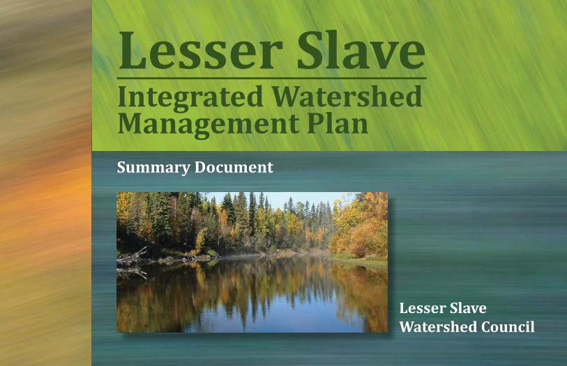
Lesser Slave Integrated Watershed Management PlanSummary Document
Lesser Slave Watershed Council
32
Table of ContentsIntroduction .........................................1
The Watershed ....................................2
Lesser Slave Plan .................................4
Stakeholder Engagement ....................5
Scope of Issues ....................................6
Goals and Objectives .........................10
Indicators ...........................................12
Key Recommendations ......................14
Implementation .................................20
Living Document ................................24
For More Information ........................24
This summary document can be cited as:
Palliser Environmental Services Ltd. 2018. Lesser Slave Integrated Watershed Management Plan: Summary Document. Lesser Slave Watershed Council, High Prairie, AB. 24 pp.
32
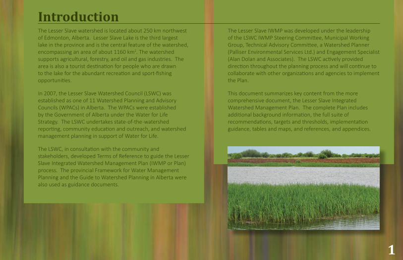
IntroductionThe Lesser Slave watershed is located about 250 km northwest of Edmonton, Alberta. Lesser Slave Lake is the third largest lake in the province and is the central feature of the watershed, encompassing an area of about 1160 km2. The watershed supports agricultural, forestry, and oil and gas industries. The area is also a tourist destination for people who are drawn to the lake for the abundant recreation and sport-fishing opportunities.
In 2007, the Lesser Slave Watershed Council (LSWC) was established as one of 11 Watershed Planning and Advisory Councils (WPACs) in Alberta. The WPACs were established by the Government of Alberta under the Water for Life Strategy. The LSWC undertakes state-of-the -watershed reporting, community education and outreach, and watershed management planning in support of Water for Life.
The LSWC, in consultation with the community and stakeholders, developed Terms of Reference to guide the Lesser Slave Integrated Watershed Management Plan (IWMP or Plan) process. The provincial Framework for Water Management Planning and the Guide to Watershed Planning in Alberta were also used as guidance documents.
The Lesser Slave IWMP was developed under the leadership of the LSWC IWMP Steering Committee, Municipal Working Group, Technical Advisory Committee, a Watershed Planner (Palliser Environmental Services Ltd.) and Engagement Specialist (Alan Dolan and Associates). The LSWC actively provided direction throughout the planning process and will continue to collaborate with other organizations and agencies to implement the Plan.
This document summarizes key content from the more comprehensive document, the Lesser Slave Integrated Watershed Management Plan. The complete Plan includes additional background information, the full suite of recommendations, targets and thresholds, implementation guidance, tables and maps, and references, and appendices.
1
322
0 10 20 40 Kilometres
32
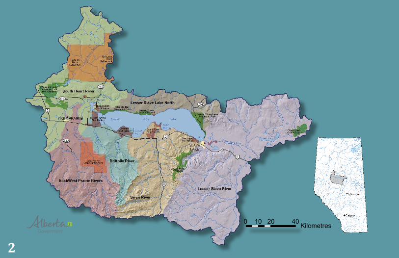
The WatershedThe Lesser Slave watershed is comprised of seven sub-basins. The sub-basins that contribute flow to Lesser Slave Lake are the South Heart River, West Prairie River, East Prairie River, Driftpile River, Swan River, and the Lesser Slave Lake North basin (drained by Straw Creek and Narrows Creek). Lesser Slave Lake is drained by the Lesser Slave River. Sawridge Creek and the Otauwau, Salteaux, Driftwood, and Fawcett rivers flow into the Lesser Slave River before it joins the Athabasca River.
The watershed is situated in the Foothills and Boreal Natural Regions of Alberta. The Upper Foothills Natural Region, represented by the Swan Hills, is characterized by cool wet summers and moist winters that generate relatively large runoff volumes. The Lower Foothills, represented by the Marten Hills and Pelican Mountains northeast of Lesser Slave Lake, is slightly drier and has a longer growing season and greater forest diversity compared to the Upper Foothills Natural Region.
The Boreal Natural Region is comprised of the Central Mixedwood subregion found throughout the northern part of the watershed, parts of the southern area nearest the lake, and the central part of the West Prairie River. The Dry Mixedwood subregion, also part of the Boreal Natural Region, is situated in the area west of the Lesser Slave Lake around High Prairie and Winagami Lake. Large parts of this area were cleared for agriculture.
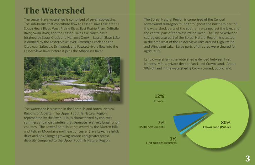
Land ownership in the watershed is divided between First Nations, Métis, private deeded land, and Crown Land. About 80% of land in the watershed is Crown owned, public land.
Crown Land (Public)
First Nations Reserves
Métis Settlements80%
1%
7%
Private12%
3
32
Lesser Slave PlanInformation Assembled
The Lesser Slave IWMP builds on community consultations and the most relevant scientific studies conducted in the watershed. Relevant plans, policies and technical reports for the watershed were compiled. The Lesser Slave State of the Watershed Report and Technical Update for the Lesser Slave Watershed were considered. In some instances, raw data was collected and analyzed to support recommendations. Provincial spatial data was also accessed and a series of maps developed.
Alignment with Other Planning Processes
The Lesser Slave plan aligns with provincial planning initiatives, and municipal plans and policies.
Some of the previous provincial plans that were considered included:
• Lesser Slave Lake Regulation Project (1984)
• Buffalo Bay/Horse Lakes Water Management Plan Program (1992)
• Lesser Slave Water Management Plan - Phase 1 (2009)
The Lesser Slave IWMP may inform future planning initiatives, such as the Upper Athabasca Regional Plan.
Purpose, Intent and Authority
The Lesser Slave Integrated Watershed Management Plan is a guidance document and planning tool for resource managers. It identifies issues, and establishes common goals and objectives for the long-term management of land and water resources in the basin. Recommendations are made to meet goals and objectives.
4
32
The LSWC engaged with municipal governments, First Nations and Métis communities, the provincial government, non-government organizations, stakeholders and residents at key junctures in the planning process. Workshops and meetings were hosted at multiple locations to accommodate participation. Feedback on the draft Plan was collected during open discussion at workshops, and through online surveys.
Stakeholder Engagement
5
2012-13
2015
2016
Stakeholder Workshops - Established Vision and Identified IssuesStakeholder Workshop - Informed Terms of Reference
Communication and Engagement StrategyTerms of Reference CirculatedTechnical Advisory Committee EstablishedStakeholder Engagement - Re-affirmed Issues, Roles and Responsibilities
Watershed Planner ContractedMunicipal Working Group EstablishedStakeholder Workshops - Reviewed IWMP Early DraftTechnical Advisory Committee Meetings; Municipal Working Group Meetings
Draft II IWMP Available; Technical Advisory Committee MeetingsMunicipal Working Group Meetings; Draft III IWMP AvailableStakeholder Engagement via Online Response Forms - IWMP Draft IIIGOA Feedback ReceivedLSWC Steering Committee and Board ReviewLesser Slave IWMP Completed
2017Indigenous Communities
Since 2016, the LSWC has been meeting with indigenous communities in the watershed. The LSWC is at an early stage of building a relationship with these communities. Conversations have covered a variety of subjects including watershed planning, but these conversations in no way represent any sort of formal consultation process. The LSWC hopes to continue these meetings and share information that will be beneficial to both the LSWC and indigenous communities.
32
Scope of Issues
6
The following issues were identified through ongoing stakeholder engagement and a review of research, monitoring and other studies completed in the basin.
Water Quantity
Historic data and climate models predict a general trend of decreased precipitation and increased evaporation in the future (with local weather patterns varying annually). The impact of this change is likely to result in:
Lower streamflows in the Lesser Slave River and potentially poorer water quality for downstream users
Lower streamflows in tributaries to Lesser Slave Lake, and low lake levels that may cause source water supply concerns for communities, and prevent boat access to the lake by marina operators and other users of the lake
Substantial change to river morphology has occurred (e.g., at West and East Prairie, South Heart and Lesser Slave rivers). Channelization (straightening) was undertaken for flood mitigation purposes and increased local drainage. Channelization of natural rivers reduces channel length, increases erosion, and reduces flooding and sediment deposition in the floodplain.
An estimated 22% of riparian areas and wetlands have been impacted (e.g., encroached on or altered) by human activity. Channelization and loss of riparian areas and wetlands have a cumulative impact on watershed hydrology, which are not well understood.
High water levels that result in flooding, and ice ridges that may increase streambank and shoreline erosion.
Low water levels and grounded ice that may impact fish spawning and migration into the Buffalo Bay area.
Lack of general knowledge on groundwater resources in the watershed.
32 7
Water Quality
Nutrient loading has a negative effect on water quality and drives algal growth in Lesser Slave Lake. Nutrients in the lake originate from internal sources (bottom sediments), and from external inputs (Noton 1998; Hutchinson et al. 2015).
Ability to maintain and improve the quality of Lesser Slave Lake in the long-term due to substantial internal nutrient loading.
Suspended sediment transported to Lesser Slave Lake by either natural processes or human-caused alterations. Increased sediment:
Carries nutrients to the lake
May settle out and bury important spawning grounds
Is deposited in the lake limiting access to some areas
Reduces flows in the Lesser Slave River
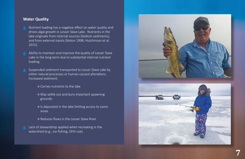
Lack of stewardship applied when recreating in the watershed (e.g., ice-fishing, OHV use).
32
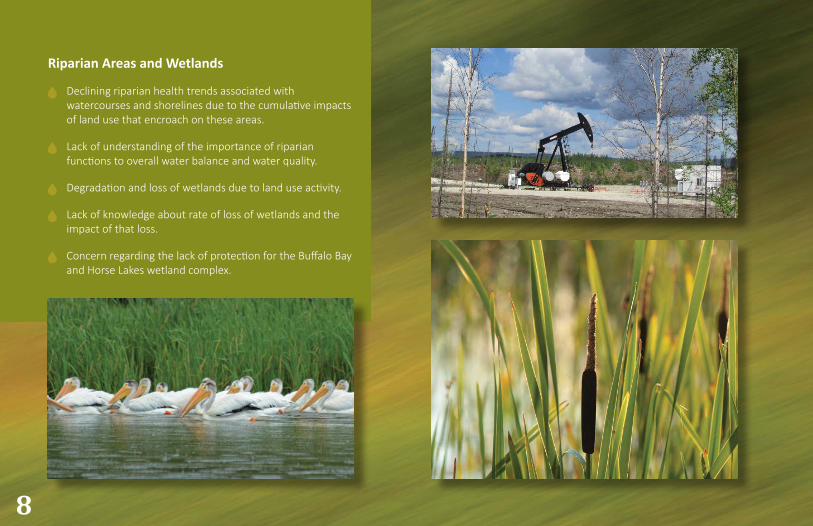
Riparian Areas and Wetlands
Declining riparian health trends associated with watercourses and shorelines due to the cumulative impacts of land use that encroach on these areas.
Lack of understanding of the importance of riparian functions to overall water balance and water quality.
Degradation and loss of wetlands due to land use activity.
Lack of knowledge about rate of loss of wetlands and the impact of that loss.
Concern regarding the lack of protection for the Buffalo Bay and Horse Lakes wetland complex.
8
32
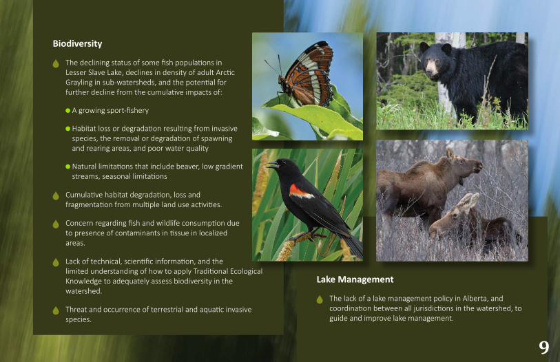
Biodiversity
The declining status of some fish populations in Lesser Slave Lake, declines in density of adult Arctic Grayling in sub-watersheds, and the potential for further decline from the cumulative impacts of:
A growing sport-fishery
Habitat loss or degradation resulting from invasive species, the removal or degradation of spawning and rearing areas, and poor water quality
Natural limitations that include beaver, low gradient streams, seasonal limitations
Cumulative habitat degradation, loss and fragmentation from multiple land use activities.
Concern regarding fish and wildlife consumption due to presence of contaminants in tissue in localized areas.
Lack of technical, scientific information, and the limited understanding of how to apply Traditional Ecological Knowledge to adequately assess biodiversity in the watershed.
Threat and occurrence of terrestrial and aquatic invasive species.
9
Lake Management
The lack of a lake management policy in Alberta, and coordination between all jurisdictions in the watershed, to guide and improve lake management.
32
Goals and objectives were developed for four main themes identified by the Lesser Slave Watershed Council: water quantity, water quality, riparian areas and wetlands, and biodiversity (Table 1).
Goals and objectives provide clear direction of purpose for the Lesser Slave Integrated Watershed Management Plan. Goals are broad statements that emphasize what the plan will accomplish (outcomes of the plan). Objectives guide the planning process and offer the mechanism to achieve the goals.
10
Goals and Objectives
Theme Goal (Outcome) Objective
Water Quantity
1
Surface water and groundwater are managed to support communities, aquatic ecosystems, recreation, wildlife and economic opportunities.
1Update the water balance model for Lesser Slave Lake.
2
Recommend actions needed to sustain water levels in Lesser Slave Lake and streamflows in the Lesser Slave River.
3
Recommend water conservation strategies that promote the efficient use of water.
4
Identify actions needed to better understand groundwater resources in the watershed, including its role in overall Lesser Slave Lake water balance.
Table 1: Goals and objectives outlined in the Lesser Slave IWMP.
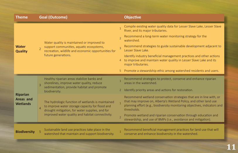
32 11
Theme Goal (Outcome) Objective
Water Quality
2
Water quality is maintained or improved to support communities, aquatic ecosystems, recreation, wildlife and economic opportunities for future generations.
1Compile existing water quality data for Lesser Slave Lake, Lesser Slave River, and its major tributaries.
2Recommend a long-term water monitoring strategy for the watershed.
3Recommend strategies to guide sustainable development adjacent to Lesser Slave Lake.
4Identify industry beneficial management practices and other actions to improve and maintain water quality in Lesser Slave Lake and its major tributaries.
5 Promote a stewardship ethic among watershed residents and users.
Riparian Areas and Wetlands
3
Healthy riparian areas stabilize banks and shorelines, improve water quality, reduce sedimentation, provide habitat and promote biodiversity.
1Recommend strategies to protect, conserve and enhance riparian areas in the watershed.
2 Identify priority areas and actions for restoration.
4
The hydrologic function of wetlands is maintained to improve water storage capacity for flood and drought mitigation, for water supplies, and for improved water quality and habitat connectivity.
1
Recommend wetland conservation strategies that are in line with, or that may improve on, Alberta’s Wetland Policy, and other land use planning effort (e.g., biodiversity monitoring objectives, indicators and thresholds.
2Promote wetland and riparian conservation through education and stewardship, and use of BMPs (i.e., avoidance and mitigation).
Biodiversity 5 Sustainable land use practices take place in the watershed that maintain and support biodiversity.
1Recommend beneficial management practices for land use that will conserve and enhance biodiversity in the watershed.
32
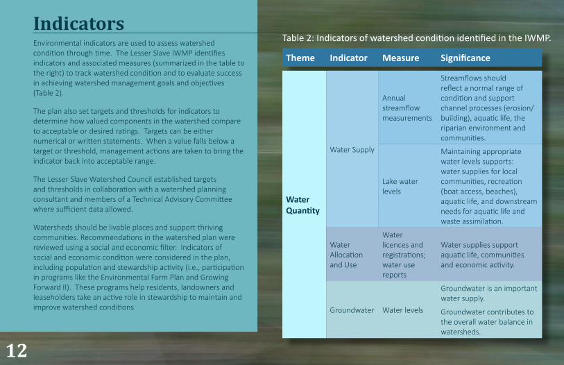
Environmental indicators are used to assess watershed condition through time. The Lesser Slave IWMP identifies indicators and associated measures (summarized in the table to the right) to track watershed condition and to evaluate success in achieving watershed management goals and objectives (Table 2).
The plan also set targets and thresholds for indicators to determine how valued components in the watershed compare to acceptable or desired ratings. Targets can be either numerical or written statements. When a value falls below a target or threshold, management actions are taken to bring the indicator back into acceptable range.
The Lesser Slave Watershed Council established targets and thresholds in collaboration with a watershed planning consultant and members of a Technical Advisory Committee where sufficient data allowed.
Watersheds should be livable places and support thriving communities. Recommendations in the watershed plan were reviewed using a social and economic filter. Indicators of social and economic condition were considered in the plan, including population and stewardship activity (i.e., participation in programs like the Environmental Farm Plan and Growing Forward II). These programs help residents, landowners and leaseholders take an active role in stewardship to maintain and improve watershed conditions.
Indicators
12
Theme Indicator Measure Significance
Water Quantity
Water Supply
Annual streamflow measurements
Streamflows should reflect a normal range of condition and support channel processes (erosion/building), aquatic life, the riparian environment and communities.
Lake water levels
Maintaining appropriate water levels supports: water supplies for local communities, recreation (boat access, beaches), aquatic life, and downstream needs for aquatic life and waste assimilation.
Water Allocation and Use
Water licences and registrations; water use reports
Water supplies support aquatic life, communities and economic activity.
Groundwater Water levels
Groundwater is an important water supply.
Groundwater contributes to the overall water balance in watersheds.
Table 2: Indicators of watershed condition identified in the IWMP.

32 13
Theme Indicator Measure Significance
Water Quality
Lake Trophic Status Nutrients, chlorophyll a, sediment, sechhi disk depth, metals, pathogens and other toxins (e.g., PCBs, dioxins, furans, arsenic). Concentration and/or loading rates
Deviation from normal conditions (established through long-term trend analysis) suggests a change in water quality (e.g., a degradation or improvement). Surface water quality should support designated or desired end uses.Spatial and temporal trends
Riparian Areas and Wetlands
Riparian function (lotic systems) Riparian Health Inventory
Functioning riparian areas and wetlands contribute to water supply, water quality, river channel and shoreline stability, and biodiversity.
Wetland cover (lentic systems)
Percentage wetland area
Impact thresholds (i.e., footprint on each wetland type)
BiodiversityFish, Wildlife and Vegetation, including Species at Risk
Species composition
Aquatic and upland systems that support a diverse group of fish, wildlife, and plant species is more resilient to ecological adversity or changes in environmental condition.
Population (a variety of seasonal, resident species)
Invasive, disturbance and rare plants
Land cover (footprint, linear disturbance, critical habitat)
32
Watershed management is a shared responsibility. There are numerous governments, agencies, organizations, and industries represented in the Lesser Slave watershed; all have varying levels of responsibility for land and water resource management. Implementation action tables accompany the comprehensive Plan. The tables highlight those who have a role or regulatory responsibility for implementing the recommendation, and a preliminary timeline for implementation. Some of the key recommendations are summarized below according to the main themes in the IWMP. For the complete list of recommendations, refer to the comprehensive Plan.
14
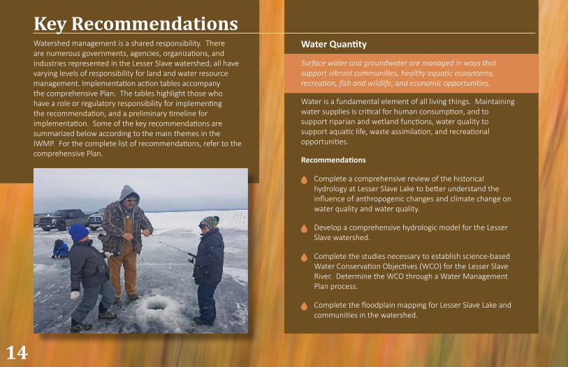
Key RecommendationsWater Quantity
Surface water and groundwater are managed in ways that support vibrant communities, healthy aquatic ecosystems, recreation, fish and wildlife, and economic opportunities.
Water is a fundamental element of all living things. Maintaining water supplies is critical for human consumption, and to support riparian and wetland functions, water quality to support aquatic life, waste assimilation, and recreational opportunities.
Recommendations
Complete a comprehensive review of the historical hydrology at Lesser Slave Lake to better understand the influence of anthropogenic changes and climate change on water quality and water quality.
Develop a comprehensive hydrologic model for the Lesser Slave watershed.
Complete the studies necessary to establish science-based Water Conservation Objectives (WCO) for the Lesser Slave River. Determine the WCO through a Water Management Plan process.
Complete the floodplain mapping for Lesser Slave Lake and communities in the watershed.
32
Lesser Slave River
The Lesser Slave Water Management Plan Phase I (2009) established an interim minimum flow objective of 6 m3/s to maintain water quality for aquatic life. This minimum flow is particularly important in winter when dissolved oxygen may reach critical, low concentrations. Additional studies were recommended to better understand the long-term consequences of future water management decisions, including the minimum flow objective, on the Lesser Slave River.
Maintaining minimum flows in Lesser Slave River continues to pose a challenge. A continual supply of sediment exists at the outlet of Lesser Slave Lake that is transported into the Lesser Slave River by littoral drift. The minimum instream flow target in the Lesser Slave River may not be achieved if lake water levels are naturally low in dry years, if sediment deposition has blocked flow at the outlet of Lesser Slave Lake upstream of the weir, or in winter if the river freezes to the bottom. The weir was upgraded in 2015 with a gate that can pass a maximum of 6 m3/s should water levels fall below the weir crest; this eliminates the need for syphoning water over the weir in future.
Although four main water users undertook dredging activities to remove accumulated sediment and restore river flows in the past, these water users are not responsible for maintaining minimum flows in Lesser Slave River in the future. Impacted water users may choose to submit an application to Alberta Environment and Parks under the Water Act requesting approval for dredging activity in the future, but this is not a legislated requirement.
15
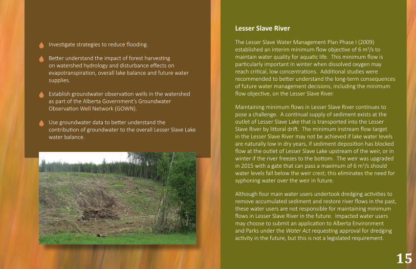
Investigate strategies to reduce flooding.
Better understand the impact of forest harvesting on watershed hydrology and disturbance effects on evapotranspiration, overall lake balance and future water supplies.
Establish groundwater observation wells in the watershed as part of the Alberta Government’s Groundwater Observation Well Network (GOWN).
Use groundwater data to better understand the contribution of groundwater to the overall Lesser Slave Lake water balance.
32
Develop and implement a comprehensive long-term lake monitoring program for Lesser Slave Lake, and other recreational lakes in the watershed.
Develop and implement a comprehensive long-term water monitoring program for tributaries upstream of Lesser Slave Lake should be implemented.
Improve understanding regarding the volume and rate of sediment deposition to Lesser Slave Lake.
Continue to monitor surface water quality to detect unique pollutants (e.g., PCBs, dioxins, furans, arsenic and heavy metals).
Educate the public regarding the need for erosion and sediment controls at Lesser Slave Lake.
16
Water Quality
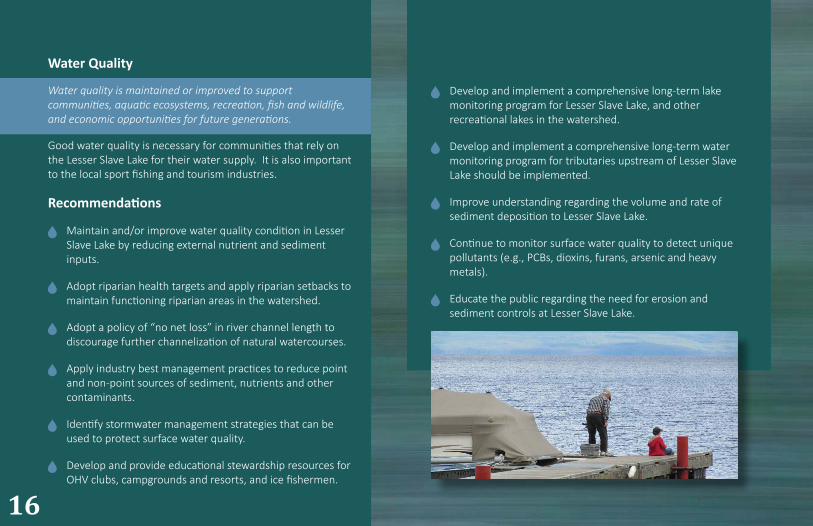
Water quality is maintained or improved to support communities, aquatic ecosystems, recreation, fish and wildlife, and economic opportunities for future generations.
Good water quality is necessary for communities that rely on the Lesser Slave Lake for their water supply. It is also important to the local sport fishing and tourism industries.
Recommendations
Maintain and/or improve water quality condition in Lesser Slave Lake by reducing external nutrient and sediment inputs.
Adopt riparian health targets and apply riparian setbacks to maintain functioning riparian areas in the watershed.
Adopt a policy of “no net loss” in river channel length to discourage further channelization of natural watercourses.
Apply industry best management practices to reduce point and non-point sources of sediment, nutrients and other contaminants.
Identify stormwater management strategies that can be used to protect surface water quality.
Develop and provide educational stewardship resources for OHV clubs, campgrounds and resorts, and ice fishermen.
32
Adhere to established industry setbacks from watercourses.
Implement restoration measures at West Prairie, South Heart, and Lower Swan rivers.
Implement restoration measures at Lesser Slave Lake and other lakes where appropriate.
Investigate the potential to designate “beach area” as a land use, opposed to natural beach area/shoreline, for community enjoyment, and to support tourism and recreation. Strategically design and maintain designated beaches (e.g., vegetation clearing, garbage/debris removal) within natural beach areas/shoreline to achieve environmental and social objectives.
Improve community understanding of riparian functions, management strategies to maintain function, and encourage local restoration efforts where needed.
17
Riparian Areas
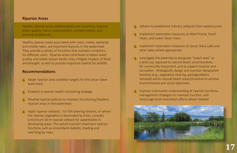
Healthy riparian areas stabilize banks and shorelines, improve water quality, reduce sedimentation, provide habitat, and promote biodiversity.
Healthy riparian areas associated with rivers, creeks, wetlands and smaller lakes, are important features in the watershed. They provide a variety of functions that maintain conditions for different users. Riparian areas contribute to better water quality, and stable stream banks; they mitigate impacts of flood and drought, as well as provide important habitat for wildlife.
Recommendations
Adopt riparian area condition targets for the Lesser Slave watershed.
Establish a riparian health monitoring strategy.
Develop riparian policies to maintain functioning (healthy) riparian areas in the watershed.
Apply riparian setbacks. For fish-bearing streams, or where the riparian vegetation is dominated by trees, consider a minimum 30 m riparian setback for waterbodies in developing areas. This would maintain important riparian functions such as streambank stability, shading and overhang by trees.
32
Apply Beneficial Management Practices (BMPs) to mitigate impacts of road construction on wetlands.
Minimize impacts on wetlands that may result from livestock access or cropping practices.
Maintain and restore connectivity between wetlands and natural drainages where possible.
Promote wetland protection and conservation in the watershed.
18
Wetlands
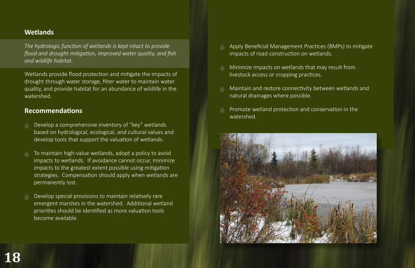
The hydrologic function of wetlands is kept intact to provide flood and drought mitigation, improved water quality, and fish and wildlife habitat.
Wetlands provide flood protection and mitigate the impacts of drought through water storage, filter water to maintain water quality, and provide habitat for an abundance of wildlife in the watershed.
Recommendations
Develop a comprehensive inventory of “key” wetlands based on hydrological, ecological, and cultural values and develop tools that support the valuation of wetlands.
To maintain high-value wetlands, adopt a policy to avoid impacts to wetlands. If avoidance cannot occur, minimize impacts to the greatest extent possible using mitigation strategies. Compensation should apply when wetlands are permanently lost.
Develop special provisions to maintain relatively rare emergent marshes in the watershed. Additional wetland priorities should be identified as more valuation tools become available.
32
Maintain water inputs to the Horse Lake complex and do not permit drainage activities or diversion from the complex to protect important Walleye habitat.
Maintain Walleye access to Class A waterbodies.
Development activities on Class B waterbodies related to pipelines, telecommunication lines, watercourse crossings, outfall structures and hydrostatic testing to adhere to the guidelines provided by the applicable provincial Codes of Practice (Water Act).
Report the results of the annual fall index netting (FIN), used by Alberta Environment and Parks to primarily monitor Walleye and Northern Pike populations, publicly on the GOA website.
Implement strategies to mitigate the potential for aquatic invasive species (AIS).
Create a unified access management plan for the Lesser Slave watershed to maintain quality habitat for fish and wildlife.
Address recovery priorities for Grizzly Bear and increase effort to maintain quality habitat in sufficient size to support Woodland Caribou.
Establish a landowner stewardship program to enhance conservation of shoreline habitat.
19
Biodiversity
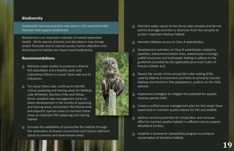
Sustainable land use practices take place in the watershed that maintain and support biodiversity.
Biodiversity is an important indicator of overall watershed health. While species diversity and abundance may change and/or fluctuate due to natural causes, human alteration and disturbance to habitat can impact local biodiversity.
Recommendations
Maintain water quality to preserve a diverse fish population and a healthy sport and subsistence fishery in Lesser Slave Lake and its tributaries.
For Lesser Slave Lake: continue to identify critical spawning and rearing areas for Walleye, Lake Whitefish, Northern Pike and Yellow Perch; establish lake management zones to direct development in the vicinity of spawning and rearing areas; and protect the littoral zone and adjacent riparian areas to maintain these areas as important fish spawning and rearing habitat.
Increase the availability of productive fish habitat through the restoration of stream connectivity and reduce sediment inputs to streams and downstream areas.
32
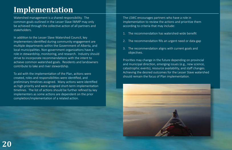
Watershed management is a shared responsibility. The common goals outlined in the Lesser Slave IWMP may only be achieved through the collective action of all partners and stakeholders.
In addition to the Lesser Slave Watershed Council, key implementers identified during community engagement are multiple departments within the Government of Alberta, and local municipalities. Non-government organizations have a role in stewardship, monitoring, and research. Industry should strive to incorporate recommendations with the intent to achieve common watershed goals. Residents and landowners contribute to lake and river stewardship.
To aid with the implementation of the Plan, actions were created, roles and responsibilities were identified, and preliminary timelines assigned. Many actions were identified as high priority and were assigned short-term implementation timelines. The list of actions should be further refined by key implementers as some actions are dependent on the prior completion/implementation of a related action.
The LSWC encourages partners who have a role in implementation to review the actions and prioritize them according to criteria that may include:
1. The recommendation has watershed-wide benefit
2. The recommendation fills an urgent need or data gap
3. The recommendation aligns with current goals and objectives.
Priorities may change in the future depending on provincial and municipal direction, emerging issues (e.g., new science, catastrophic events), resource availability, and staff changes. Achieving the desired outcomes for the Lesser Slave watershed should remain the focus of Plan implementation.
20
Implementation

32 21
LSWC Priorities and Work Plan
The LSWC encourages implementation of the Lesser Slave IWMP by all partners and stakeholders. The LSWC is committed to assisting partners with implementation wherever possible, by:
Providing resources (e.g., tools, information) that support implementation
Identifying and addressing data gaps (e.g., monitoring, new science)
Developing common, watershed-scale resources (e.g., maps, model)
Reporting on watershed condition (e.g., How are we doing?)
Supporting collaboration, education and stewardship in watershed management (e.g., inter-municipal share-forums, workshops)
The IWMP Steering Committee discussed the immediate work plan for LSWC to support the implementation of the plan.

3222
Administrative Priorities
1. Work with partners to identify priorities and refine implementation actions according to short-, medium-, and long-term timelines.
2. Identify and seek funding and in-kind resource support.
3. Review plan implementation progress annually.
32 23
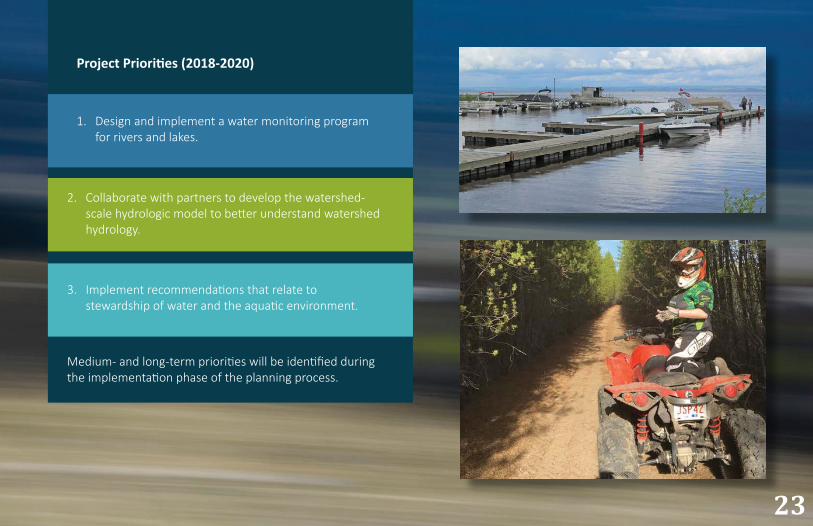
Project Priorities (2018-2020)
1. Design and implement a water monitoring program for rivers and lakes.
3. Implement recommendations that relate to stewardship of water and the aquatic environment.
Medium- and long-term priorities will be identified during the implementation phase of the planning process.
2. Collaborate with partners to develop the watershed-scale hydrologic model to better understand watershed hydrology.
3224
For More InformationLesser Slave Watershed Council
Box 2607, High Prairie, AB T0G 1E0
Phone: 780-523-9800
Email: [email protected]
www.lswc.ca
Living DocumentAs a living document, the Lesser Slave IWMP will be reviewed and updated periodically by the LSWC to reflect current knowledge and advances in the watershed.
Photo Credits Thank-you to the following people for generously providing photos for this document:
Doug Badger Kelsey Cox Ron Davis Danielle Denoncourt Kaylyn Jackson Kayla Killoran
Cori Klassen Meghan Payne Sandi Riemersma Colin Ross Liz Saunders Cathy Wilcox
32
Lesser Slave Lake and its watershed are a precious resource that we all value and enjoy. Stewardship and protection of our wonderful natural assets is everyone’s responsibility. We need to ensure our grandchildren can enjoy our beautiful lake as we have.
Brian Elliott, Past Chairman (April 6, 1936 - May 7, 2018)
“
“
23
Printed in Canada
May 2018