lesson 1-1 maps have two features to help you read and understand the map: a series of symbols...
TRANSCRIPT
Maps have two features to help you read and understand the map: a series of symbols called a map legend, and a ratio, which establishes the map scale.
Understanding Maps (cont.)

A map legend is a key that lists all the symbols used on the map that help you interpret the symbols.
Understanding Maps (cont.)
map legend
Understanding Maps (cont.)
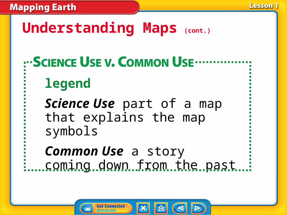
legend
Science Use part of a map that explains the map symbols
Common Use a story coming down from the past
Model builders typically use scale to make the model measurements accurate to the measurements of the real object.
Understanding Maps (cont.)
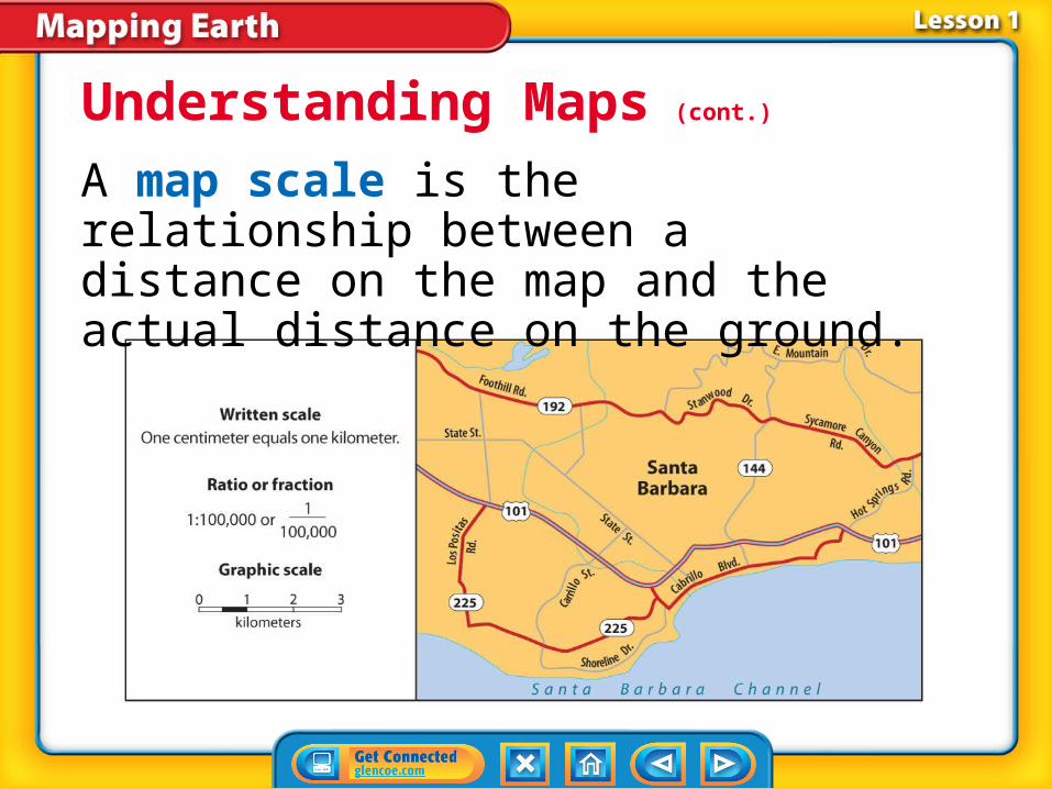
A map scale is the relationship between a distance on the map and the actual distance on the ground.
Understanding Maps (cont.)
• Long ago, mapmakers created a grid system of two sets of imaginary lines, called longitude and latitude, which encircle Earth.
• Mapmakers started the grid system with a vertical line that circled Earth and passes through the North Pole and the South Pole.
Reading Maps
• The half of this vertical circle that passes through Greenwich, England, is known as the prime meridian.
• The other half of this vertical circle is the 180° meridian.
Reading Maps (cont.)

Similar circles are drawn at every degree east and west of the prime meridian. These lines are referred to as lines of longitude.
Reading Maps (cont.)
longitude
from Latin longitudo, means “length”
• A location’s longitude is the distance in degrees east or west of the prime meridian.
• The prime meridian and the 180° meridian divide Earth into the Eastern Hemisphere and the Western Hemisphere.
Reading Maps (cont.)
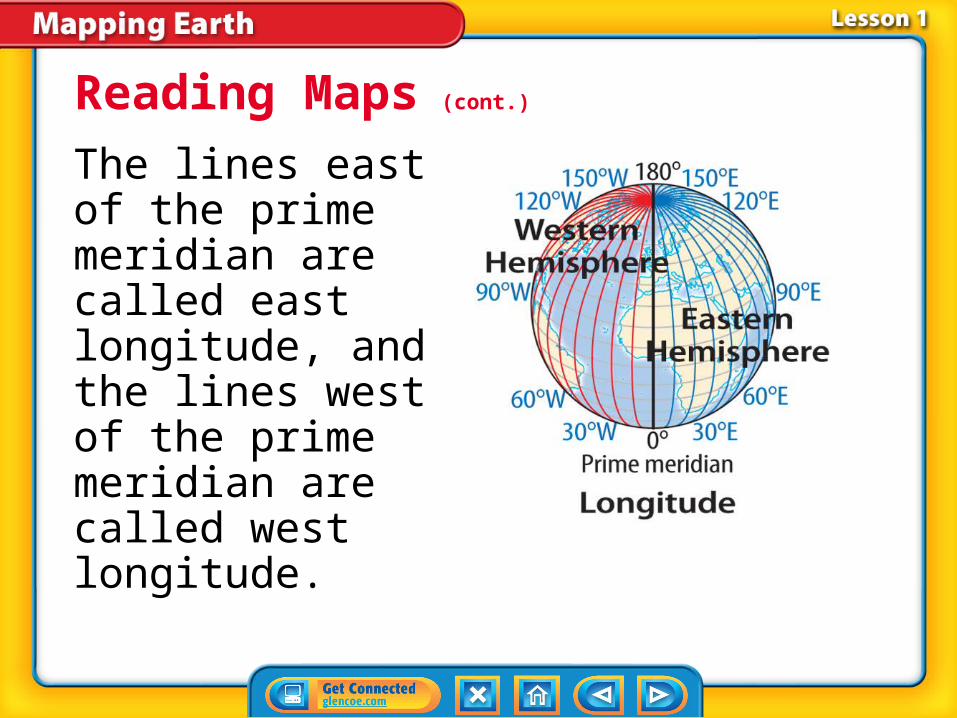
The lines east of the prime meridian are called east longitude, and the lines west of the prime meridian are called west longitude.
Reading Maps (cont.)
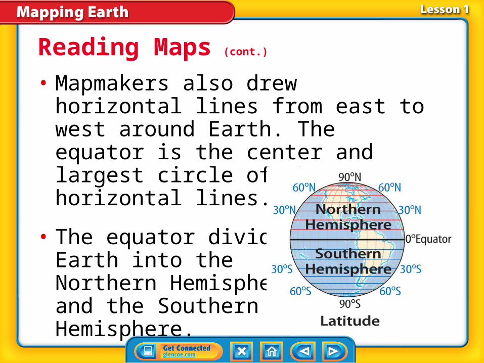
• Mapmakers also drew horizontal lines from east to west around Earth. The equator is the center and largest circle of these horizontal lines.
• The equator divides Earth into the Northern Hemisphere and the Southern Hemisphere.
Reading Maps (cont.)
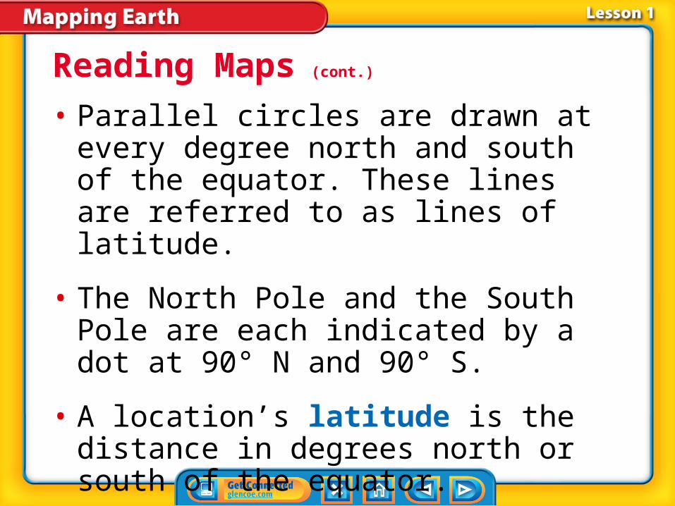
• Parallel circles are drawn at every degree north and south of the equator. These lines are referred to as lines of latitude.
• The North Pole and the South Pole are each indicated by a dot at 90° N and 90° S.
• A location’s latitude is the distance in degrees north or south of the equator.
Reading Maps (cont.)

Reading Maps (cont.)
Together, longitude and latitude are used to pinpoint a location on Earth.

Reading Maps (cont.)
What relationship do lines of longitude and lines of latitude have?

• Any location on Earth can be described by the intersection of the closest line of latitude and the closest line of longitude.
• Because longitude and latitude lines are far apart, we divide each degree into 60 minutes (') and each minute into 60 seconds (") to help pinpoint locations.
Plotting Locations

How do latitude and longitude describe a location on Earth?
Plotting Locations (cont.)
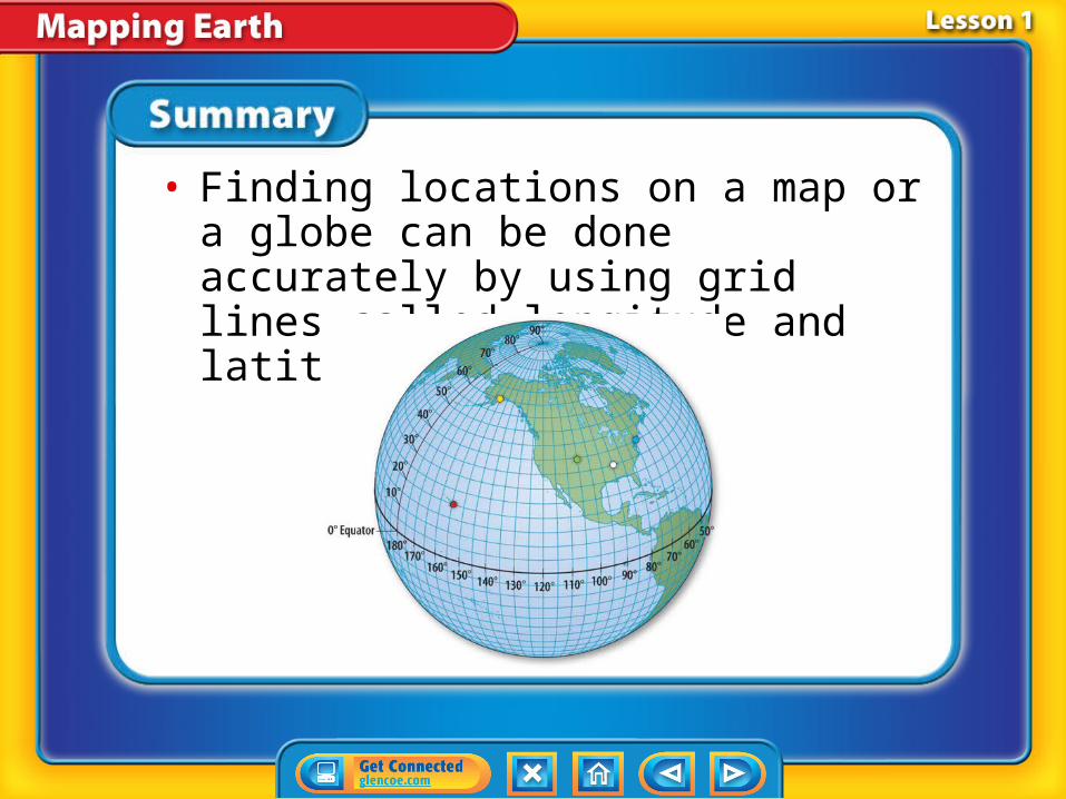
• Finding locations on a map or a globe can be done accurately by using grid lines called longitude and latitude.

A. size C. scale
B. weight D. legend
What do model builders use to make model measurements accurate to the measurements of the real object?
A. longitude
B. latitude
C. scale
D. ratio
Which of these terms refers to the distance in degrees north or south of the equator?
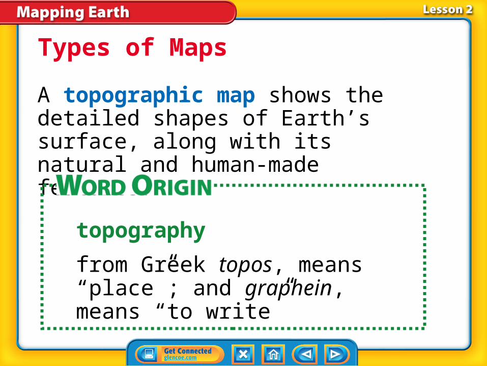
A topographic map shows the detailed shapes of Earth’s surface, along with its natural and human-made features.
Types of Maps
topography
from Greek topos, means “place”; and graphein, means “to write”

A topographic map helps give you a picture of what the landscape looks like without seeing it.
Types of Maps (cont.)
Robert Glusic/Getty Images

• The height above sea level of any point on Earth’s surface is its elevation.
• The difference in elevation between the highest and lowest point in an area is called relief.
Types of Maps (cont.)

Contour lines are lines on a topographic map that connect points of equal elevation.
Types of Maps (cont.)

• The elevation difference between contours that are next to each other is called the contour interval.
• Slope is a measure of the steepness of the land.
Types of Maps (cont.)
• If the contours are spaced far apart, the slope is gradual or flat, but if the contours are close together, the slope is steep.
• The information contour lines provide on a topographic map can be used to draw an accurate profile of the topography.
Types of Maps (cont.)

Types of Maps (cont.)
What can you learn about the features at Earth’s surface from studying contour lines?

Making Maps Today (cont.)
The Global Positioning System (GPS) is a group of 24 satellites orbiting Earth used for navigation.
• The signals relayed by GPS satellites are used to calculate the distance to the satellite based on the average time of the signal.
• GPS is used by mapmakers to accurately locate reference points.
Making Maps Today (cont.)
• Geographic Information Systems (GIS) are computerized information systems used to store and analyze map data.
• GIS creates different map layers of the same location using database view, map view, and model view.
Making Maps Today (cont.)

• Topographic maps use contour lines to help describe the elevation and relief of the surface of Earth at that spot.

• Geologic maps are useful in determining the kind of rocks, the age of rocks, and the formations they are found in for an area.
A. slope
B. contour interval
C. elevation
D. cross section
What is the height above sea level of any point on Earth’s surface called?
A. navigation
B. mapping
C. modeling
D. remote sensing
Which term refers to the process of collecting information about an area without coming into physical contact with it?

A. latitude
B. longitude
C. scale
D. time zone
Which of these refers to the distance in degrees east or west of the prime meridian?
A. slope
B. topography
C. relief
D. elevation
What is the difference in elevation between the highest and lowest point in an area is called?
A. contour lines
B. cross sections
C. contour intervals
D. geologic maps
What feature of a topographic map connects points of equal elevation?
A. slope
B. contour interval
C. steepness
D. relief
Which term refers to the elevation difference between contours that are next to each other?

A. map key
B. map scale
C. profile view
D. map legend
Which term refers to the key that lists all the symbols used on the map to help you interpret the symbols?

A. prime meridian
B. longitude
C. equator
D. legend
What is the center line of latitude?
A. contour
B. slope
C. elevation
D. topography
Which term is a measure of the steepness of land?

Which term refers to the elevation difference between contours that are next to each other?
A. the Geographic Information System
B. sonar
C. the Global Positioning System
D. the contour interval