lesson 1 five themes of geography of ecuador · pdf filelesson 1 five themes of geography of...
TRANSCRIPT

LESSON 1 Five Themes of Geography of Ecuador Lesson Objective The students will be able to:
!" find the five themes of geography (location, movement, human/environment interaction, place, and region) of Ecuador using pictures and maps.
!" find the five themes of geography (location, movement, human/environment interaction, place, and region) using pictures
!" compare information gathered
Materials and Resources Activity 1 - Location: Absolute and Relative ! Handout 1 - Five Themes of Geography
! Handout 2 - Map of Western Hemisphere ! Worksheet 1
Activity 2- Place: Human and Physical
! Handout 1 - Five Themes of Geography ! Story - “ECUADOR WOW!”
! Worksheet 2 Activity 3 - Human/Environment Interaction ! Handout 1 - Five Themes of Geography ! Worksheet 3 Activity 4 - Movement ! Handout 1 - Five Themes of Geography ! Story “ECUADOR WOW!” ! Worksheet 4 Activity 5 - Region ! Handout 1 - Five Themes of Geography ! Story - “ECUADOR WOW!” ! Worksheet 5 Activity 6 - Comparing Cities ! Handouts and Worksheets used in Activities 1-5 ! Worksheet 6

Lesson Introduction
In the following activities students will be using information from the text, pictures, and maps in the story “ECUADOR WOW!” to discover the geography of Ecuador. Students will be using the Five Themes of Geography as an organizational tool. Read the story to the class as a whole. Then divide students into small groups and have each group reread the story together. Then have the students find information on each of the Five Themes of Geography, and record it on the individual theme worksheet.
Next, have each group examine the pictures for additional Five Themes of Geography facts. They may need to have a magnifying glass to find some of the finer details in the photographs, such as telephone poles (movement or human feature of place) and some buildings. While students are doing this they should write down why they chose to place a specific fact under that theme. If they choose to put a fact under more than one theme they will need to explain why. It is much easier for students to write down their reasons as they are doing their work than after they are finished. REMEMBER: The geography themes overlap, for example, telephone poles are movement of ideas, as well as, human feature of place (staying in close touch with our friends and businesses are part of our culture). Houses fit the theme of place—human feature (man-made) and human/environment interaction (adapting to our environment).
Activity 1 – Location
Students need to find the absolute and relative locations of Ecuador and its capital, Quito. Distribute copies of handout 1, “Five Themes of Geography,” which will be used as a visual reference for students to help them remember the geography themes as they work through each activity in this lesson. Then distribute copies of handout 2, the map of the Western Hemisphere, and copies of worksheet 1. Using the map, have students determine the absolute location of Quito, Ecuador. Also, have them determine which lines of latitude and longitude Ecuador falls between. Remind them that latitude helps to determine climate in an area.
Next, have students determine the relative location of Ecuador and then record it on the information worksheet. Relative location is your location in relationship to other places (north of, south of, northeast of, next to, across from) and is given with at least two, preferably three, reference points (such as most of the United States is south of Canada, west of the Atlantic Ocean and north of Mexico).
Activity 2 – Place
Students will need to find the human characteristics and the physical characteristics of Ecuador by using photographs and text. Distribute copies of the story “ECUADOR WOW!” and worksheet 2.
Students will need to examine each photo closely to find the human and physical characteristics of Ecuador. On worksheet 2, they need to list all of the physical features (gifts of nature) they see in the photographs or have read about in the story. Students should also list climate in this section, which is part of nature. Remind students that due to Ecuador’s location on the Equator, the ocean currents, and its landforms, it has four diverse climate zones.
Next, they need to look for the human features (what makes a place unique—culture) that they can find in the photographs and text, then record them on worksheet 2. Remind them to look at the clothing, buildings, foods, celebrations, and landscape of the region.

Activity 2 (continued) Another way this can be done is to give each group four copies of worksheet 2 and have
them look for the human and physical features of each of the four geographic regions in Ecuador.
Activity Three- Human/Environment Interaction
Students will need to examine photographs and read the text in the story, and use the “Five Themes of Geography” (handout 1) to find how people have adapted to, modified/changed, and depend on the environment in Ecuador. Distribute a copy of worksheet 3 to each group. Again students will need to look closely to find how humans have interacted with the environment.
Remind students that themes overlap and that a bridge which shows how humans have modified the environment also shows a human feature of place. Students need to record the information that they find on their worksheets.
Activity Four – Movement
Students will need to examine the photographs and read the text in the story and use handout 1, “Five Themes of Geography,” to find how goods, ideas, and people move in and out of Ecuador, and record them on worksheet 4. They should also look for migration patterns of humans. They will need to look closely at the photographs for things like roads, TV towers, newspaper stands, trucks, etc. which are examples of movement.
Activity 5- Region
Students will need all of the handouts used in activities 1-4 to help them decide what type(s) of region(s) that Ecuador fits into with other countries of South America, or they can determine the different types of regions within Ecuador. Pass out copies of handout 3 and worksheet 5.
Region is the hardest theme for students to understand because it involves characteristics that one place has in common with other places. The region may be defined as an economic region, geographic region, or one defined by human or physical characteristics. Depending on the abilities of your students, you may want to give your students the region type. A geographic region may be the easiest.
Students can compare the United States to Ecuador, since both countries have many diverse regions. However, even with the similarities there are many differences. Students will need to find the similarities and differences.
Activity 6 – Comparing Cities
Students will need all of their worksheets and handouts from activities 1-5 to complete this activity. Students will also need a copy of worksheet 6. Students need to look for characteristics their state has in common with Ecuador, and characteristics that are different. Depending on the age of your students you may want to set the number of similarities and differences that they should find.
Lessons and Activities Created by: Susan Husiak, Sixth Grade Teacher. Whitehall District Schools
Whitehall, Michigan 49461 Michigan Geographic Alliance Teacher Consultant Fulbright-Hays Participant to Ecuador - 2005

1. Location Where is it?
Why is it located there? ! Absolute location is given in degrees of latitude and
longitude.
! Relative location depends upon point of reference, e.g., near, far, a short drive.
2. Place What is it like? ! Physical Characteristics - landforms (mountains, plains, etc.),
bodies of water (oceans, lakes, bay, etc.), ecosystems (soil, plants, animals, and climate)
! Human Characteristics - bridges, roads, buildings, culture, language
All places have features that distinguish them from other places.
3. Human/Environment Interaction How do people interact with and change their environment?
! Depend on the environment ! Adapt to the environment ! Modify the environment
4. Movement How are people and places linked by communication and the flow of people, ideas and goods?
! Transportation, communication, trade ! Patterns of movement such as migration ! Linkages and connections
5. Regions What are their unifying features and how do they form and change over time?
! Regions a basic unit for geographic study. Midwest
! Geographers divide the world into regions to help them interpret
Great Lakes ! Regions can be defined on the basis of: physical and human characteristics.
The Five Themes of Geography
Handout 1

Handout 2
Whitehall

Handout 3

LOCATION Where is it?
Absolute _______________________________________________________________________________________________________________________________________________________________________________________________________________________________________________________________
Relative _______________________________________________________________________________________________________________________________________________________________________________________________________________________________________________________________
Worksheet 1

Place What is it like?
Physical Features Phy _______________________________
PLACE
Physical Features Human Features
Worksheet 2
Include all aspects of Human Culture, (learned behavior : language, beliefs, customs, religion, and goods—such as food, clothing, shelter, roads, tools, buildings, etc.) ________________________________________________________________________________________________________________________________________________________________________________________________________________________________________________________________________________________________________________________________________________________________________________________________________________
Landforms: Bodies of Water:(plain, hill, (ocean, sea, gulf, mountain, bay, lakes, rivers) animals, plants, climate) ______________________________________________________________________________________________________________________________________________________________________________________________________________________________________________________________________________________________________________________________________________________________________________________________________________________

Human/Environment Interaction
What are the relationships within a place? People interact with their environments in different ways...
Worksheet 3
Depend upon the environment
_______________________________________________________________________________________________________________________________________________
Adapt to the environment
_______________________________________________________________________________________________________________________________________________
Modify/Change the environment
_______________________________________________________________________________________________________________________________________________

Movement (people, goods, and ideas)
People
____________________________________________________________________________________________________________________________________________________________________________________________________
Goods
____________________________________________________________________________________________________________________________________________________________
Ideas
__________________________________________________________________________________________________________________________________________________________
Worksheet 4

REGION Places that have similar economic, political, physical, or human characteristics (features) that you are comparing. A place may be in
more than one region.
REGION NAME OR
CHARACTERISTICS
Places with like characteristics
(features)
Similar Characteristics
(features)
Is this a geographic, political, or
economic region? Explain.
Worksheet 5

Your State’s Your State’s and Ecuador’s Differences Ecuador’s Differences Similarities
Worksheet 6

Lesson 2 Map Search of Ecuador Materials and resources
!" Map 1: Blank Outline Map of Ecuador !" Map 2: Physical/Political Map of Ecuador !" Map 3: Forests and Protected Areas of Ecuador !" Map 4: Vegetation Map !" Map 5: Ecuador, South America !" Map 6: Reference Map 2002 !" Story: “Ecuador WOW!”
Divide students into groups and pass out a copy of maps 1-6 to each group and a copy of the story. Students will need to read the story and then map out C.J.’s travels through Ecuador. Instruct students to use the blank outline map to draw C.J.’s route. The students will use the other maps as visual aids to figure out where C.J. saw the mangrove swamps, the indigenous market, the penguins, the Inca ruins, etc.
The maps are wonderful visuals for the students and they will learn more than they ever planned on by looking at and studying them. They are in color and hopefully you will have a color printer, or they can view them on the computer, which will enhance their value.
You can also use them for another activity. Have student groups make up questions about Ecuador from the maps. Then give these questions to another group to answer using their set of maps.

C.J.’s Trip Itinerary Whitehall, Michigan Muskegon, Michigan Detroit, Michigan Houston, Texas Quito, Ecuador North on the Pan-American Highway to Otavalo, Ecuador Peguche, Ecuador Cotacachi, Ecuador Galapagos Islands San Cristobal, Ecuador Mangrove swamps Guayaquil, Ecuador Puerto Lopez, Ecuador Ecuadorian National Park Manta, Ecuador Cuenca, Ecuador Ingapirca (Inca Ruins) Parque Nacional Cajas Cuenca, Ecuador Quito, Ecuador Napo River Napo River rainforest Quito, Ecuador
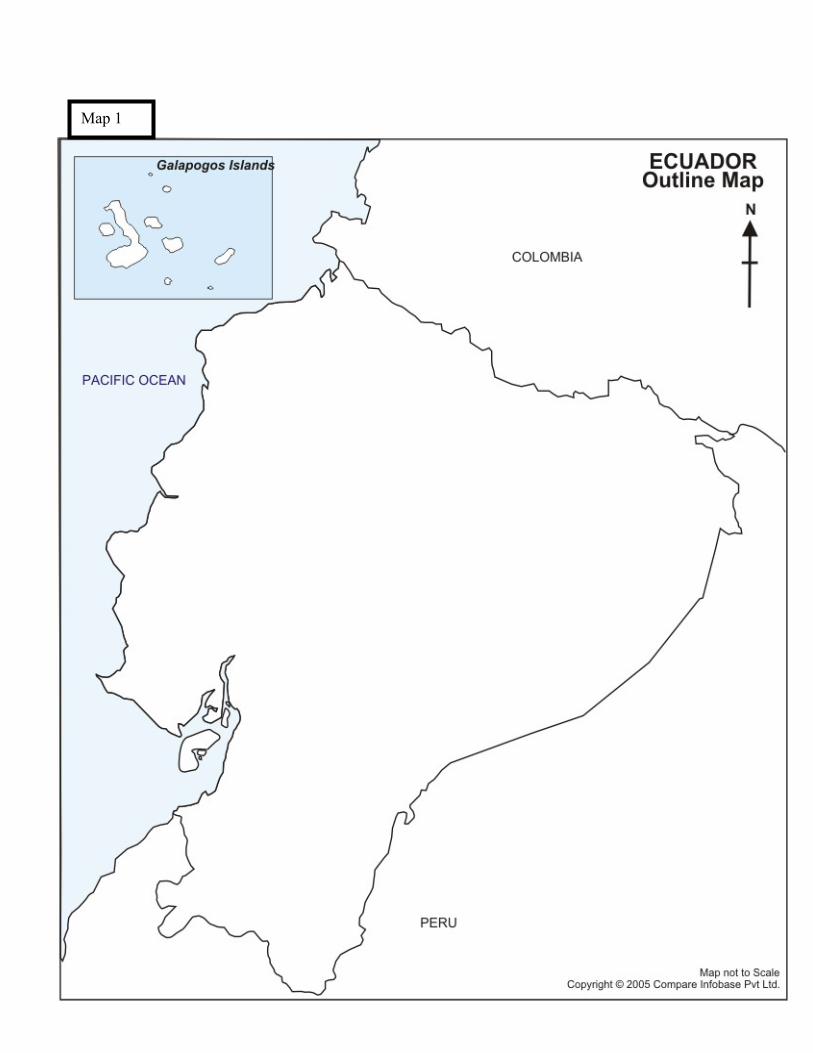
Map 1

Map 2

Map 1
Map 3

Map 4

Map 3
Ecuador’s Highways
Railroad and Road Map
Map 5

Map 6

CREDITS
Outline map: http://www.mapsofworld.com/ecuador/ecuador-outline-map.html Western Hemisphere Map: http://www.macalester.edu/research/economics/image/americas.jpg South America Map: http://www.america-atlas.com/ Ecuador, South America Map and road/railroad Map: www.minelinks.com/ ecuador/maps.html Reference Map of Ecuador 2002:
http://www.ecuadorexplorer.com/html/basic_ecuador_map.html Ecuador, South America Map – Major Volcanoes:
http://www.libraries.psu.edu/maps/refmaps/CSAMERICA/ECUADOR_SR.jpg Vegetation Map: http://www.libraries.psu.edu/maps/refmaps/csamericamaps.htm