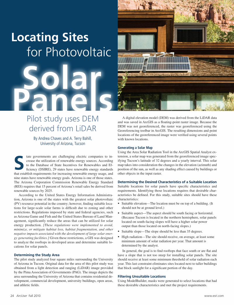
24 ArcUser Fall 2010 www.esri.com tate governments are challenging electric companies to in- crease the utilization of renewable energy sources. According to the Database of State Incentives for Renewables and Ef- ficiency (DSIRE), 29 states have renewable energy standards that establish requirements for increasing renewable energy usage, and nine states have renewable energy goals. Arizona is one of those states. The Arizona Corporation Commission Renewable Energy Standard (RES) requires that 15 percent of Arizona’s retail sales be derived from renewable sources by 2025. According to the United States Energy Information Administra- tion, Arizona is one of the states with the greatest solar photovoltaic (PV) resource potential in the country; however, finding suitable loca- tions for large-scale solar farms is difficult due to zoning and other restrictions. Regulations imposed by state and federal agencies, such as Arizona Game and Fish and the United States Bureau of Land Man- agement, significantly reduce the areas that can be utilized for solar energy production. [These regulations were implemented to avoid, minimize, or mitigate habitat loss, habitat fragmentation, and other negative impacts associated with the development of large solar ener- gy generating facilities.] Given these restrictions, a GIS was designed to analyze the rooftops in developed areas and determine suitable lo- cations for solar panels. Determining the Study Area The pilot study analyzed four square miles surrounding the University of Arizona in Tucson. Original data for the area of this pilot study was obtained from a light detection and ranging (LiDAR) image provided by the Pima Association of Governments (PAG). The image depicts the area surrounding the University of Arizona that contains residential de- velopment, commercial development, university buildings, open areas, and athletic fields. A digital elevation model (DEM) was derived from the LiDAR data and was saved in ArcGIS as a floating-point raster image. Because the DEM was not georeferenced, the raster was georeferenced using the Georeferencing toolbar in ArcGIS. The resulting dimensions and point locations of the georeferenced image were verified using several points with known locations. Generating a Solar Map Using the Area Solar Radiation Tool in the ArcGIS Spatial Analyst ex- tension, a solar map was generated from the georeferenced image spec- ifying Tucson’s latitude of 32 degrees and a yearly interval. This solar map takes into consideration the changes in the elevation (azimuth) and position of the sun, as well as any shading effect caused by buildings or other objects in the input raster. Determining the Desired Characteristics of a Suitable Location Suitable locations for solar panels have specific characteristics and requirements. Identifying those locations requires that desirable char- acteristics be defined. For this study, suitable sites should have these characteristics: Suitable elevation—The location must be on top of a building. (It should not be at ground level.) Suitable aspect—The aspect should be south facing or horizontal. (Because Tucson is located in the northern hemisphere, solar panels located on south-facing slopes will have a higher solar power output than those located on north-facing slopes.) Suitable slope—The slope should be less than 35 degrees. High radiation—The site should receive, on average, at least some minimum amount of solar radiation per year. That amount is determined by the analyst. In general, the goal is to find rooftops that face south or are flat and have a slope that is not too steep for installing solar panels. The site should receive at least some minimum threshold of solar radiation each year. This last constraint eliminates sites located next to taller buildings that block sunlight for a significant portion of the day. Filtering Unsuitable Locations Using ModelBuilder, masks were generated to select locations that had these desirable characteristics and met the project requirements. Locating Sites for Photovoltaic Solar Panels Pilot study uses DEM derived from LiDAR S By Andrea Chaves and A. Terry Bahill, University of Arizona, Tucson