map legend (map on reverse) dockton forest legend (map on reverse) trailheads hiking, ... express or...
TRANSCRIPT
Map Legend (map on reverse)
Trailheadshiking, horseback riding, mountain biking
Trails
maintained
unmaintained
forest maintenance road
approximate distance in miles between trail junctions
Facilities
restrooms
parking area
boat launch
picnic shelter
play equipment
public dock
Publicly owned land
King County park land
Other basemap features
unincorporated King County
local street
gate
elevation contour (interval = 50 ft.)
0.24
This information is availablein alternative formats upon request.Please call 206-477-4527or 1-800-325-6165.Washington Relay Service: 1-800-833-6388.
For information about King County Parks,please call 206-477-4527.
Visit King County Parks on the Internet at www.kingcounty.gov/parks.
Map created by the King County Parks and Recreation Division and the King County GIS Center: www.kingcounty.gov/gis.
Printed on recycled paper.
©2009, 2016 King County, Washington.The information included on this map has been compiled by King County staff from a variety of sources and is subject to change without notice. King County makes no representations or warranties, express or implied, as to accuracy, completeness, timeliness, or rights to the use of such information. This document is not intended for use as a survey product. King County shall not be liable for any general, special, indirect, incidental, or consequential damages including, but not limited to, lost revenues or lost profits resulting from the use or misuse of the information contained on this map. Any sale of this map or information on this map is prohibited except by written permission of King County.
December 2016
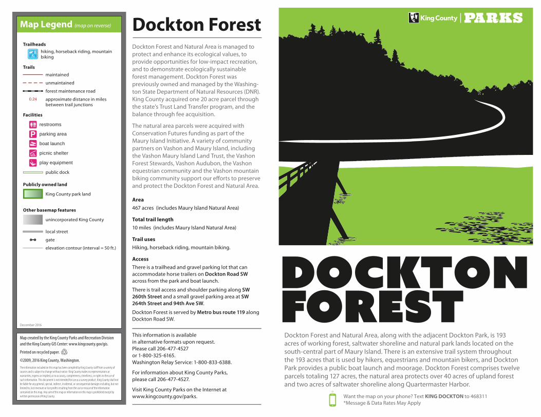
Dockton Forest and Natural Area, along with the adjacent Dockton Park, is 193 acres of working forest, saltwater shoreline and natural park lands located on the south-central part of Maury Island. There is an extensive trail system throughout the 193 acres that is used by hikers, equestrians and mountain bikers, and Dockton Park provides a public boat launch and moorage. Dockton Forest comprises twelve parcels totaling 127 acres, the natural area protects over 40 acres of upland forest and two acres of saltwater shoreline along Quartermaster Harbor.
Want the map on your phone? Text KING DOCKTON to 468311*Message & Data Rates May Apply
Dockton ForestDockton Forest and Natural Area is managed to protect and enhance its ecological values, to provide opportunities for low-impact recreation, and to demonstrate ecologically sustainable forest management. Dockton Forest was previously owned and managed by the Washing-ton State Department of Natural Resources (DNR). King County acquired one 20 acre parcel through the state’s Trust Land Transfer program, and the balance through fee acquisition.
The natural area parcels were acquired with Conservation Futures funding as part of the Maury Island Initiative. A variety of community partners on Vashon and Maury Island, including the Vashon Maury Island Land Trust, the Vashon Forest Stewards, Vashon Audubon, the Vashon equestrian community and the Vashon mountain biking community support our e�orts to preserve and protect the Dockton Forest and Natural Area.
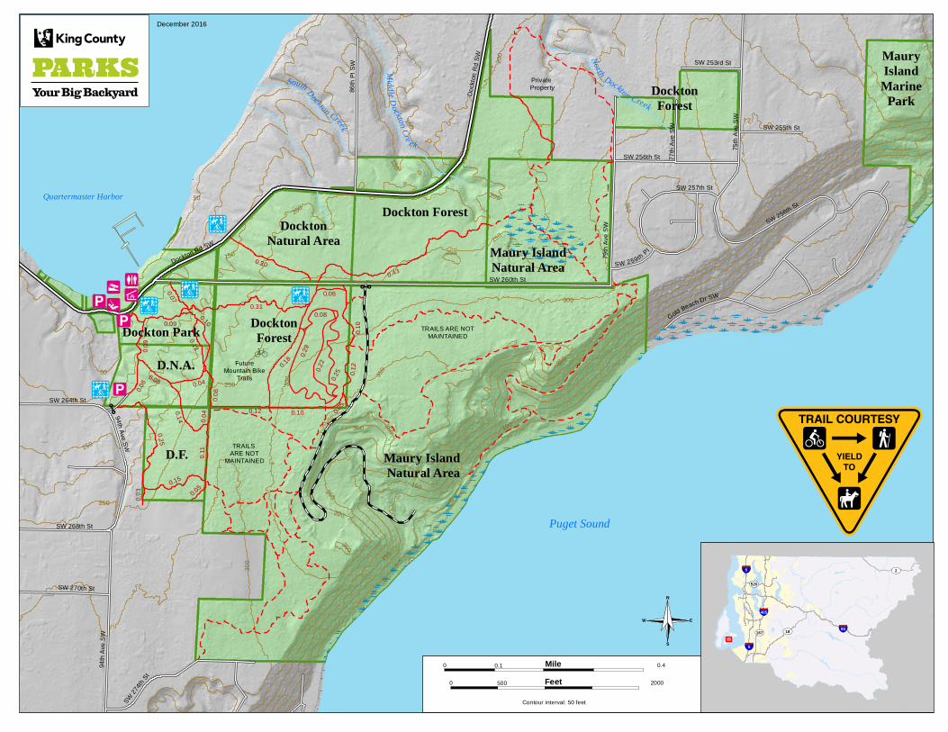
Area467 acres (includes Maury Island Natural Area)
Total trail length10 miles (includes Maury Island Natural Area)
Trail usesHiking, horseback riding, mountain biking.
AccessThere is a trailhead and gravel parking lot that can accommodate horse trailers on Dockton Road SW across from the park and boat launch.
There is trail access and shoulder parking along SW 260th Street and a small gravel parking area at SW 264th Street and 94th Ave SW.
Dockton Forest is served by Metro bus route 119 along Dockton Road SW.
A
A
7
7
<
*
* *
* ; 3
0
7 *
DocktonNatural Area
DocktonForestDockton Park
Dockton Forest
Doc
kton
Rd
SW
SW 260th St
SW 256th St
79th
Ave
SW
SW 259thPl
86th
Pl S
W
Dockton Rd SW
SW 264th St
94th Ave SW
SW 268th St
SW 270th St
SW 2
74th
St
S W
275t
h
St
94th
Ave
SW
0.20
0.06
0.120.1
8
0.31
0.12 0.10
0.08
0.10
0.12
0.07
0.09
0.08
0.08
0.09
0.04
Puget Sound
South Dockton Creek
Midd le Dockton Cre ek
North Dockton Creek
0.05
0.10
0.43
Quartermaster Harbor
Maury Island Natural Area
Maury IslandNatural Area
Private Property
TRAILS ARE NOTMAINTAINED
TRAILS ARE NOT
MAINTAINED
DocktonForest
77th
Ave
SW
75th
Ave
SW
SW 253rd St
Gold Beach Dr SW
MauryIslandMarine
Park
0.14
0.25
0.03
0.15
0.04
0.11
0.05
D.F.
D.N.A. FutureMountain Bike
Trails
SW 257th St
SW 256th St
SW 255th St
0.29
0.22
0.25
0.08
250
200
150
100
300
150
250
250
300
50
350
350
50
300
350
300
150
350
200
50
300
150
200
350
150
150
250
250
Contour interval: 50 feet
0
0 500
0.1
2000
0.4
§̈¦90
§̈¦5
§̈¦5
§̈¦405
UV18
UV520
UV167
UV2
December 2016
MileFeet