map-making with the nhd bill wheaton research triangle institute [email protected], (919) 541-6158
TRANSCRIPT
Map-Making with the NHD
Bill WheatonBill Wheaton
Research Triangle InstituteResearch Triangle Institute
[email protected], (919) [email protected], (919) 541-6158
Mapmaking with the NHD
TopicsTopics Map Design and LayoutMap Design and Layout Using NHD Content in MapsUsing NHD Content in Maps Displaying Other Data with NHDDisplaying Other Data with NHD
Map Design and Layout
Modern Tools Don’t Alleviate the Need for Modern Tools Don’t Alleviate the Need for Proper Map Design and LayoutProper Map Design and Layout Who is the audience?Who is the audience? What is the map communicating?What is the map communicating? What are the uses for the map?What are the uses for the map? Colors, projections, use of white space, Colors, projections, use of white space,
etc.etc.

Feature Issues
What are the NHD Feature Classes?What are the NHD Feature Classes? Region.wb : WaterbodiesRegion.wb : Waterbodies Region.rch : Waterbody ReachesRegion.rch : Waterbody Reaches Region.lm : Area LandmarksRegion.lm : Area Landmarks Route.drain : Network FeaturesRoute.drain : Network Features Route.rch : Linear ReachesRoute.rch : Linear Reaches Route.lm : Linear LandmarksRoute.lm : Linear Landmarks nhdpt.pat : Point featuresnhdpt.pat : Point features nhdduu.patdom : Digital Update Units (quad/cu bdy)nhdduu.patdom : Digital Update Units (quad/cu bdy)
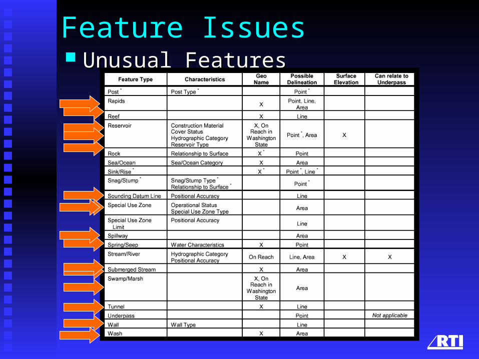
Feature Issues Unusual FeaturesUnusual Features
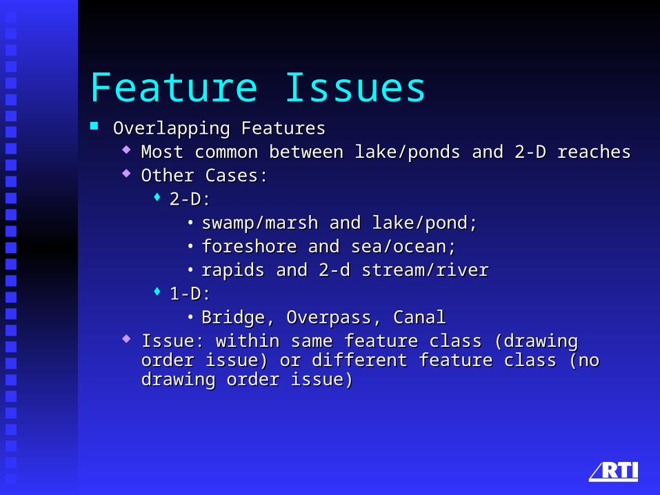
Feature Issues Overlapping FeaturesOverlapping Features
Most common between lake/ponds and 2-D reachesMost common between lake/ponds and 2-D reaches Other Cases: Other Cases:
2-D: 2-D: • swamp/marsh and lake/pond; swamp/marsh and lake/pond; • foreshore and sea/ocean; foreshore and sea/ocean; • rapids and 2-d stream/riverrapids and 2-d stream/river
1-D:1-D:• Bridge, Overpass, CanalBridge, Overpass, Canal
Issue: within same feature class (drawing order issue) or different Issue: within same feature class (drawing order issue) or different feature class (no drawing order issue)feature class (no drawing order issue)
Feature Issues
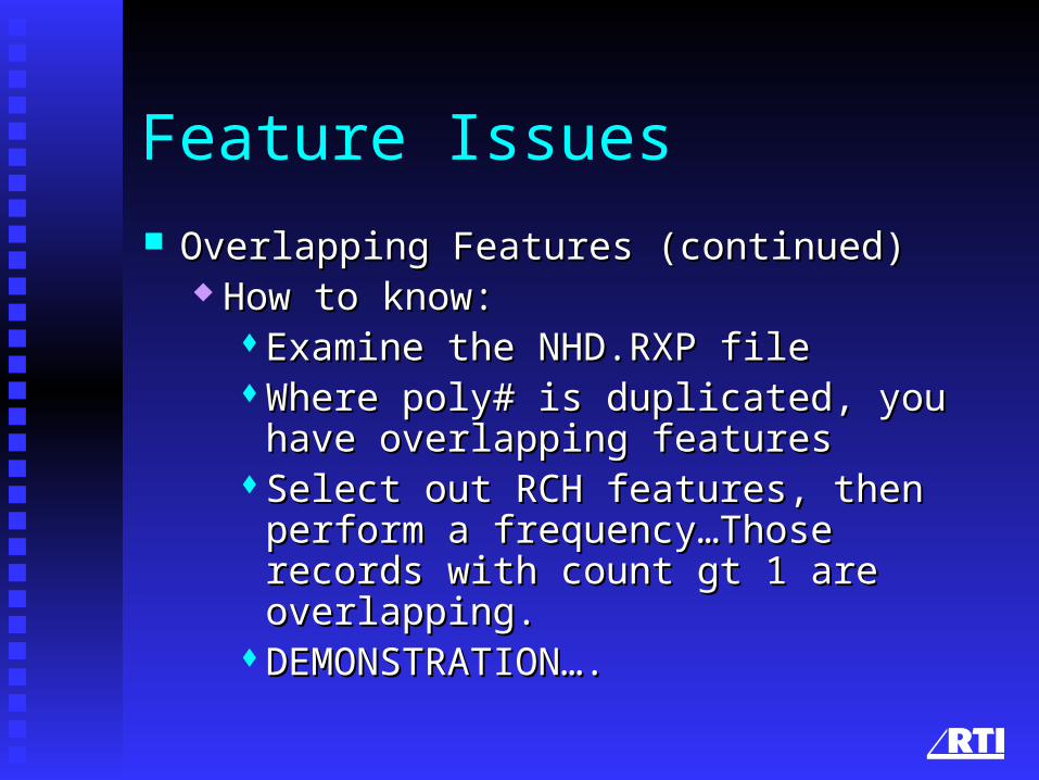
Overlapping Features (continued)Overlapping Features (continued) How to know:How to know:
Examine the NHD.RXP fileExamine the NHD.RXP fileWhere poly# is duplicated, you have Where poly# is duplicated, you have
overlapping featuresoverlapping featuresSelect out RCH features, then perform a Select out RCH features, then perform a
frequency…Those records with count gt 1 frequency…Those records with count gt 1 are overlapping.are overlapping.
DEMONSTRATION….DEMONSTRATION….
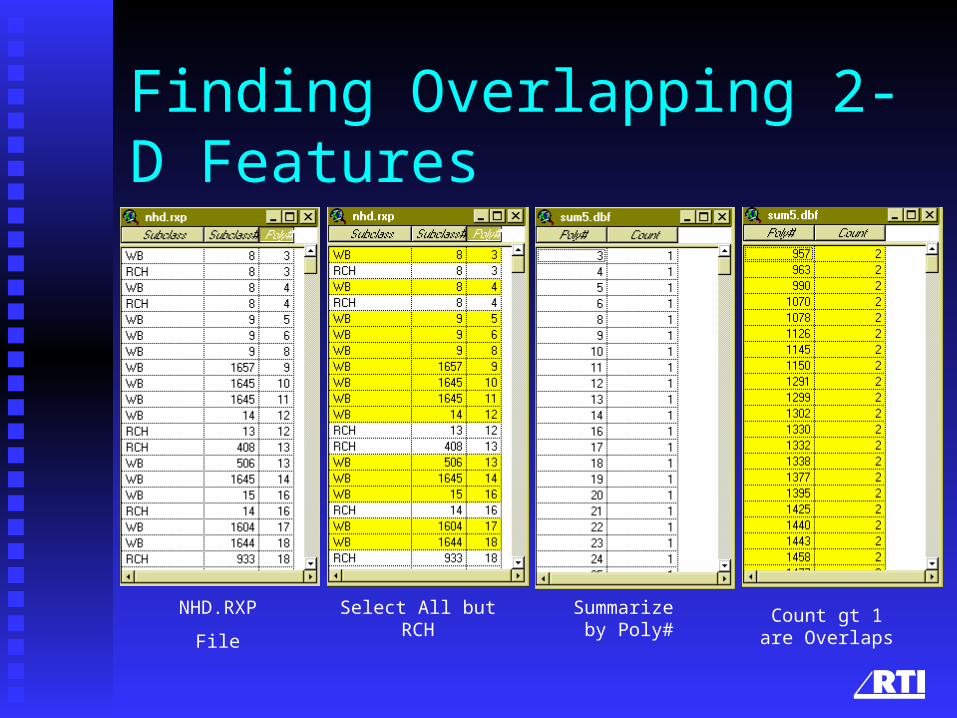
Finding Overlapping 2-D Features
NHD.RXP
File
Select All butRCH
Summarize by Poly#
Count gt 1are Overlaps
Feature Issues
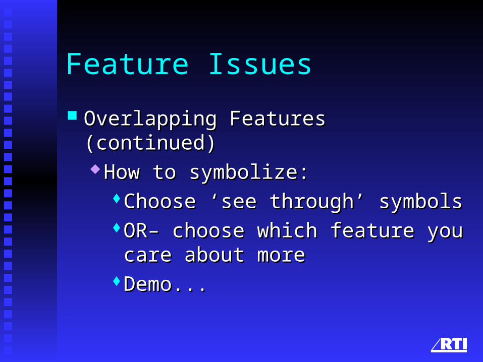
Overlapping Features (continued)Overlapping Features (continued) How to symbolize:How to symbolize:
Choose ‘see through’ symbolsChoose ‘see through’ symbolsOR– choose which feature you care OR– choose which feature you care
about moreabout moreDemo...Demo...

2-D Overlaps...
Sea/Ocean Foreshore Lake/Pond Submerged Stream/River
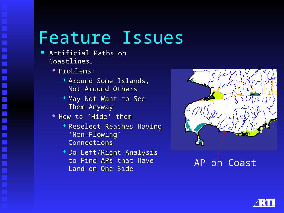
Feature Issues Artificial Paths on Coastlines…Artificial Paths on Coastlines…
Problems: Problems: Around Some Islands, Not Around Some Islands, Not
Around OthersAround Others May Not Want to See Them May Not Want to See Them
AnywayAnyway How to ‘Hide’ themHow to ‘Hide’ them
Reselect Reaches Having Reselect Reaches Having ‘Non-Flowing’ Connections‘Non-Flowing’ Connections
Do Left/Right Analysis to Do Left/Right Analysis to Find APs that Have Land on Find APs that Have Land on One SideOne Side
AP on Coast
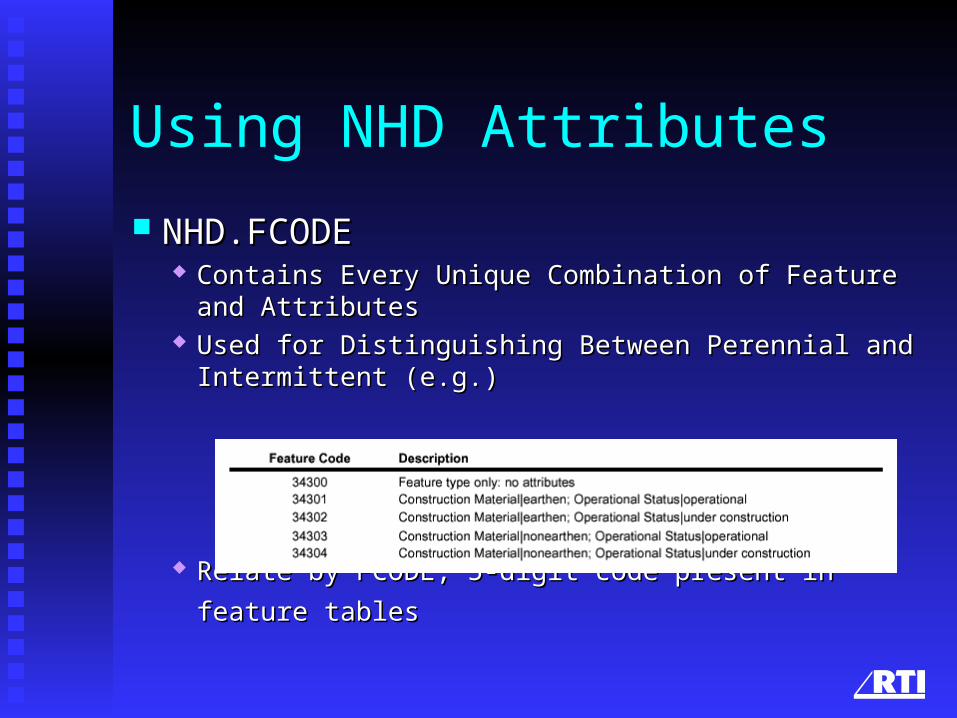
Using NHD Attributes
NHD.FCODENHD.FCODE Contains Every Unique Combination of Feature and Contains Every Unique Combination of Feature and
AttributesAttributes Used for Distinguishing Between Perennial and Intermittent Used for Distinguishing Between Perennial and Intermittent
(e.g.)(e.g.)
Relate by FCODE, 5-digit code present in feature tablesRelate by FCODE, 5-digit code present in feature tables
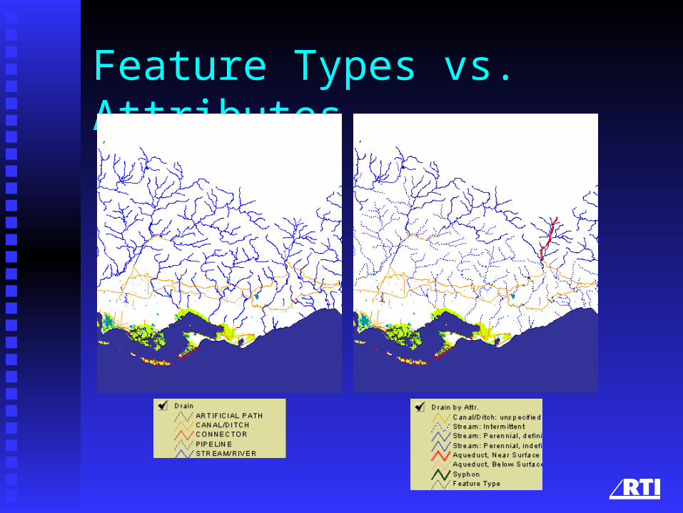
Feature Types vs. Attributes
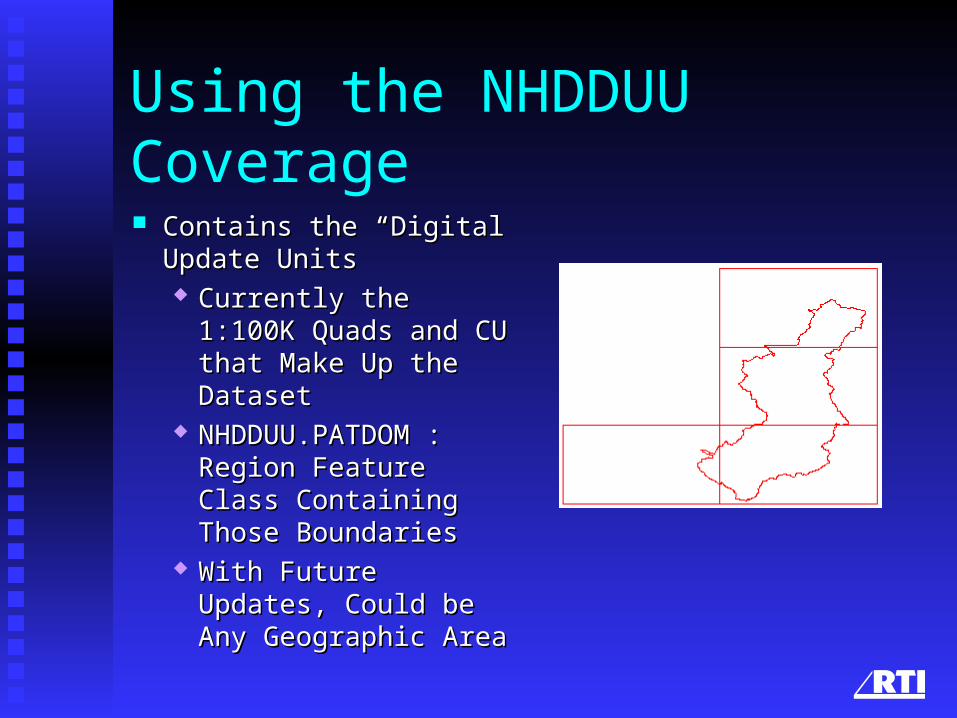
Using the NHDDUU Coverage
Contains the “Digital Contains the “Digital Update Units”Update Units” Currently the 1:100K Currently the 1:100K
Quads and CU that Quads and CU that Make Up the DatasetMake Up the Dataset
NHDDUU.PATDOM : NHDDUU.PATDOM : Region Feature Class Region Feature Class Containing Those Containing Those BoundariesBoundaries
With Future Updates, With Future Updates, Could be Any Could be Any Geographic AreaGeographic Area
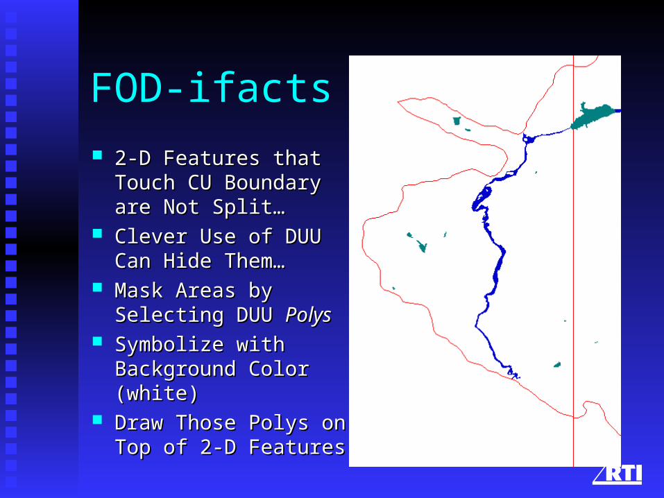
FOD-ifacts
2-D Features that Touch 2-D Features that Touch CU Boundary are Not CU Boundary are Not Split…Split…
Clever Use of DUU Can Clever Use of DUU Can Hide Them…Hide Them…
Mask Areas by Selecting Mask Areas by Selecting DUU DUU PolysPolys
Symbolize with Symbolize with Background Color Background Color (white)(white)
Draw Those Polys on Draw Those Polys on Top of 2-D FeaturesTop of 2-D Features

Labeling NHD Features
Names are on:Names are on: Route.RCH: streams/riversRoute.RCH: streams/rivers Region.RCH: lake/pondRegion.RCH: lake/pond Region.WB: Other 2-D waterbodiesRegion.WB: Other 2-D waterbodies Region.LM: Big Dams, etc.Region.LM: Big Dams, etc. Route.LM: Small Dams, etc.Route.LM: Small Dams, etc. NHDPT: Springs, Seeps, Waterfalls, etc.NHDPT: Springs, Seeps, Waterfalls, etc.
Handling Multiple CUs
““One at a Time” is Tedious for Large AreasOne at a Time” is Tedious for Large Areas Use append_NHD (available on NHD Web Use append_NHD (available on NHD Web
Site)Site) AMLAML Initial Release or Flow Validated Inputs, Initial Release or Flow Validated Inputs,
but Not a Mixturebut Not a Mixture Handles Overlaps/Duplicate Features, and Handles Overlaps/Duplicate Features, and
Other NastinessOther Nastiness
Displaying Reaches
What’s the Point Unless You Have What’s the Point Unless You Have Additional Information Related to Them?Additional Information Related to Them?
Displaying EventsDisplaying Events Displaying Flow, Displaying Stream Order, Displaying Flow, Displaying Stream Order,
etc.etc.
Projections
NHD Delivered in “non-projected”, NHD Delivered in “non-projected”, Decimal-Degree CoordinatesDecimal-Degree Coordinates
Project On-the-fly or Permanently for Project On-the-fly or Permanently for Proper MapsProper Maps
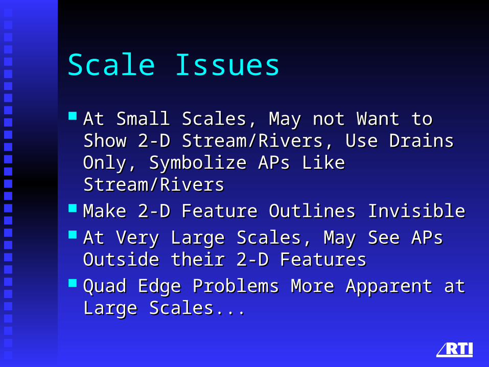
Scale Issues
At Small Scales, May not Want to Show 2-D At Small Scales, May not Want to Show 2-D Stream/Rivers, Use Drains Only, Symbolize Stream/Rivers, Use Drains Only, Symbolize APs Like Stream/RiversAPs Like Stream/Rivers
Make 2-D Feature Outlines InvisibleMake 2-D Feature Outlines Invisible At Very Large Scales, May See APs Outside At Very Large Scales, May See APs Outside
their 2-D Featurestheir 2-D Features Quad Edge Problems More Apparent at Quad Edge Problems More Apparent at
Large Scales...Large Scales...
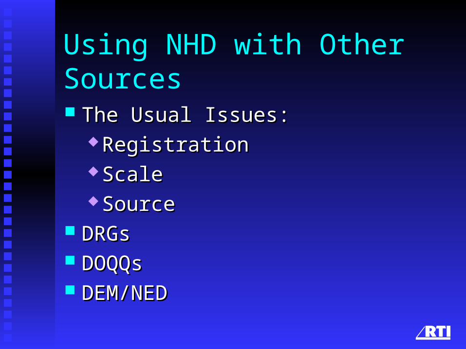
Using NHD with Other Sources
The Usual Issues:The Usual Issues: RegistrationRegistration ScaleScale SourceSource
DRGsDRGs DOQQsDOQQs DEM/NEDDEM/NED
Happy Mapping!