mapping fire events using an open source tool. department of the interior u.s. geological survey...
TRANSCRIPT

U.S. Department of the Interior
U.S. Geological Survey
Mapping Fire Events Using an Open Source
ToolSouth Dakota Statewide Geospatial Conference, Mitchell, SD
7/25/2017
Josh Picotte
ASRC Federal InuTeq LLC, Contractor to the U.S. Geological Survey (USGS), Earth Resources Observation and Science (EROS) Center, Contract Number G13PC00028

Special Thanks To:
USGS Project Lead: Steve Howard
Tool Project Lead: Michelle Anthony
Tool Developers: Cheryl Holen and Karthik
Vanumamalai
NASA Applied Sciences Program-
Wildfires: Project NNH12AU71I

Overview Defining burn severity
Overview of Monitoring Trends in Burn
Severity (MTBS)
MTBS Mapping protocols
Demonstration of QGIS Fire Event Mapping
Tool (EMT)

Fire (Burn) Severity
The effect of a fire on ecosystem properties,
often defined by the degree of mortality of
vegetation.
Degree to which a site has been altered or
disrupted by fire; loosely, a product of fire
intensity and residence time.
Photo courtesy of Stefan Doerr
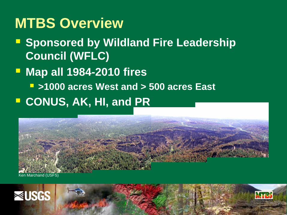
MTBS Overview
Sponsored by Wildland Fire Leadership
Council (WFLC)
Map all 1984-2010 fires
>1000 acres West and > 500 acres East
CONUS, AK, HI, and PR
Ken Marchand (USFS)
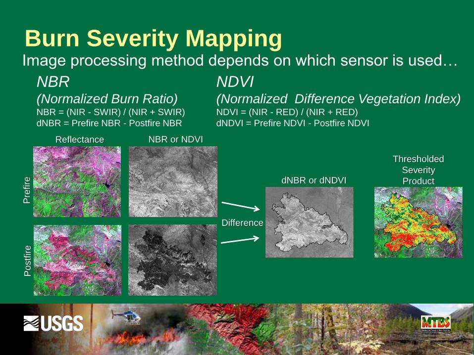
Burn Severity MappingP
refire
Po
stf
ire
dNBR or dNDVI
Thresholded
Severity
Product
Reflectance NBR or NDVI
Difference
Image processing method depends on which sensor is used…
NBR(Normalized Burn Ratio)NBR = (NIR - SWIR) / (NIR + SWIR)
dNBR = Prefire NBR - Postfire NBR
NDVI(Normalized Difference Vegetation Index)NDVI = (NIR - RED) / (NIR + RED)
dNDVI = Prefire NDVI - Postfire NDVI

QGIS Event Mapping
Tool (EMT)
Demonstration

2016 Range 12 Fire
7/30/2016-
8/7/2017
Latitude:
46.599
Longitude:
-120.203
176,600 acres
14 Miles East
of Yakima
Sagebrush
SteppeInciWeb: https://inciweb.nwcg.gov/incident/4915/

EMT Mapping Demonstration:
2016 Fire Detections

QGIS Background
http://www.qgis.org/en/site/
QGIS
Interface

QGIS Event Mapping Tool (EMT)

EMT Mapping Demonstration:
EMT Tool

EMT Mapping Demonstration:
Search Landsat Archive
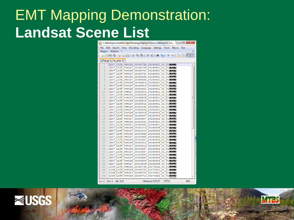
EMT Mapping Demonstration:
Landsat Scene List
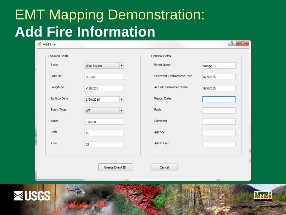
EMT Mapping Demonstration:
Add Fire Information
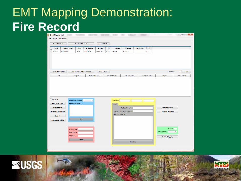
EMT Mapping Demonstration:
Fire Record

EMT Mapping Demonstration:
Load Landsat Image

EMT Mapping Demonstration:
Post-Fire Landsat Image

EMT Mapping Demonstration:
2016 Fire Detections
*
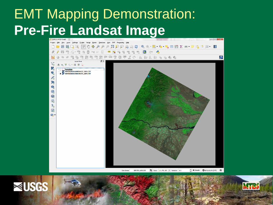
EMT Mapping Demonstration:
Pre-Fire Landsat Image

EMT Mapping Demonstration:
Identify Analysis Images
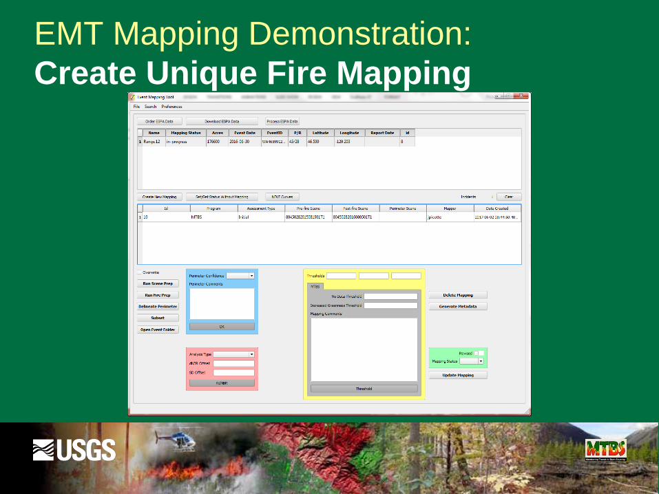
EMT Mapping Demonstration:
Create Unique Fire Mapping

EMT Mapping Demonstration:
Create dNBR Image
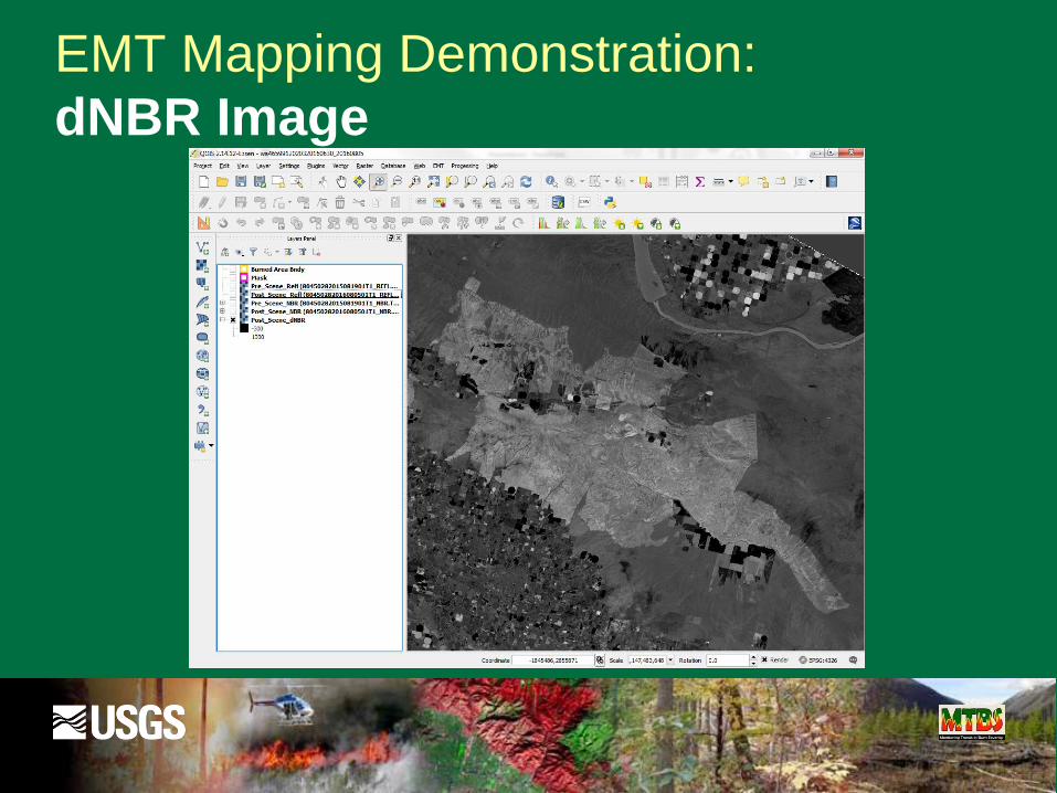
EMT Mapping Demonstration:
dNBR Image
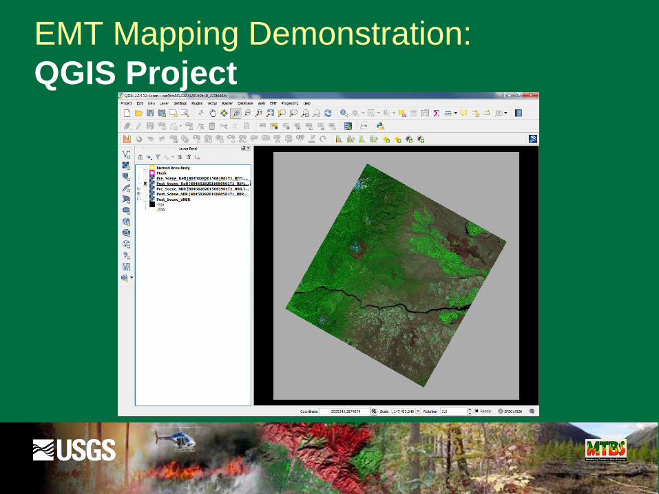
EMT Mapping Demonstration:
QGIS Project

EMT Mapping Demonstration:
Map Fire (Burned Area Bndy)

EMT Mapping Demonstration:
Mapped Fire Perimeter

EMT Mapping Demonstration:
Mask Problem Areas (e.g. Clouds)
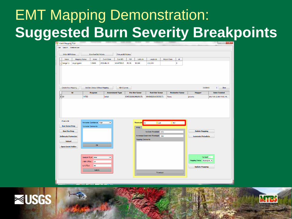
EMT Mapping Demonstration:
Suggested Burn Severity Breakpoints

EMT Mapping Demonstration:
Create Burn Severity Image
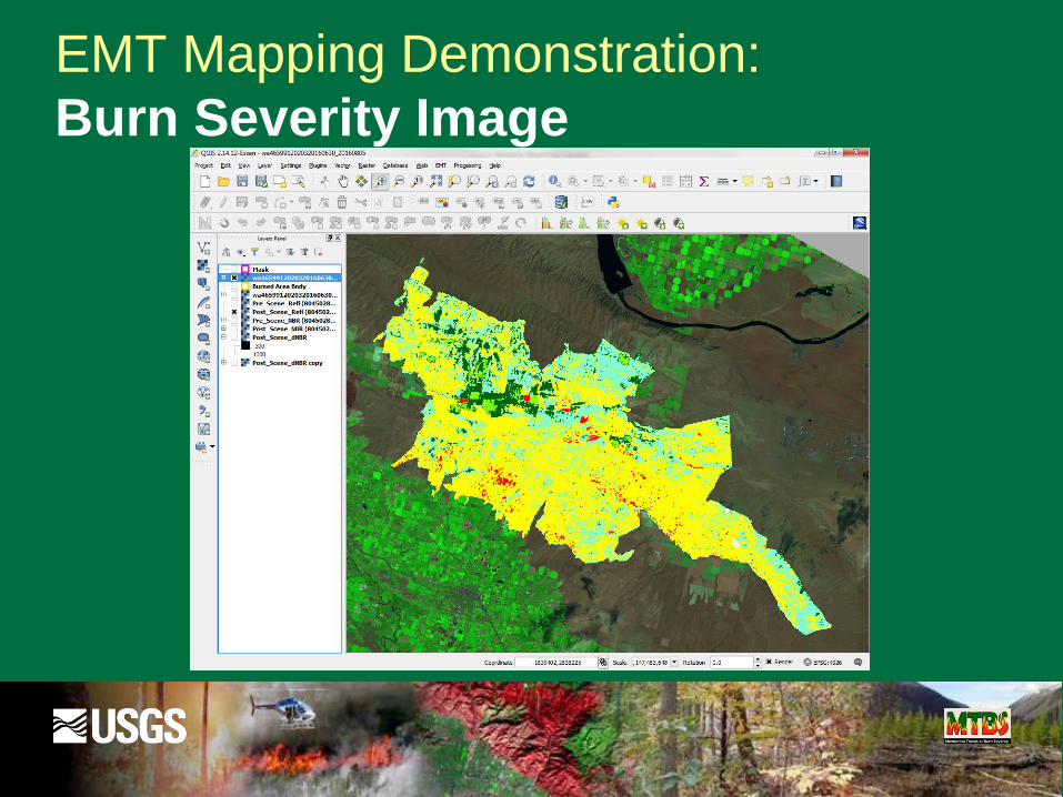
EMT Mapping Demonstration:
Burn Severity Image

EMT Mapping Demonstration:
Severity Problems in Agriculture
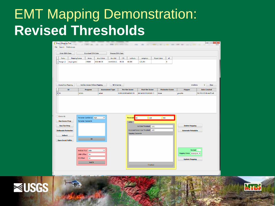
EMT Mapping Demonstration:
Revised Thresholds
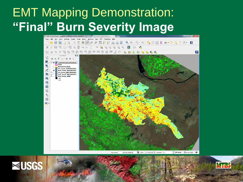
EMT Mapping Demonstration:
“Final” Burn Severity Image
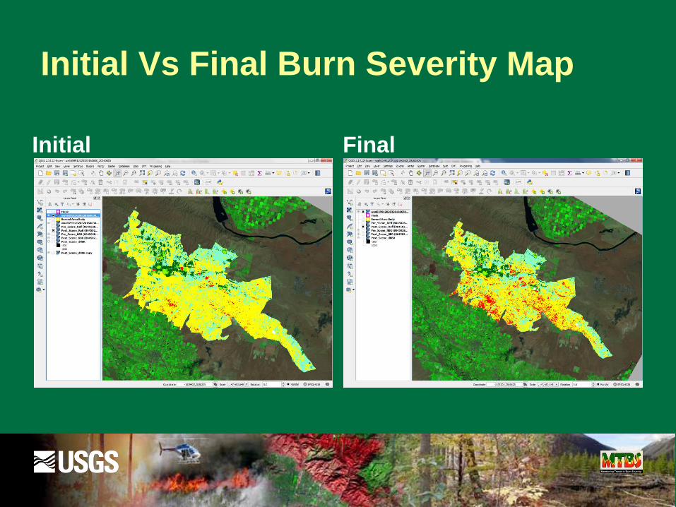
Initial Vs Final Burn Severity Map
Initial Final
Comments/[email protected]