mapping the mountain state wv association of geospatial professionals promoting and sharing...
TRANSCRIPT
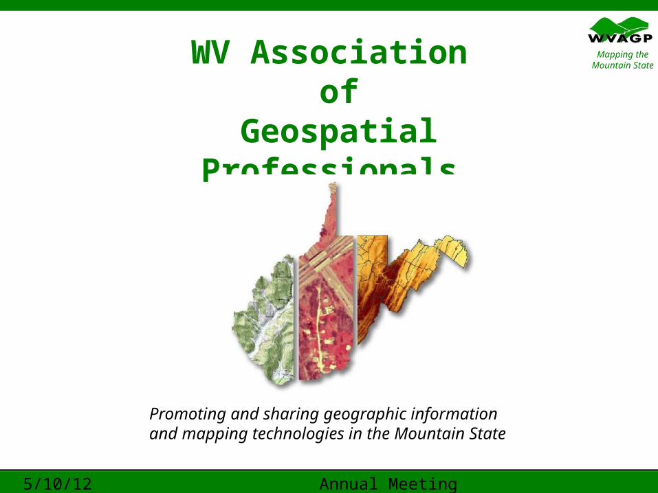
Mapping the Mountain StateWV Association
of Geospatial Professionals
Promoting and sharing geographic information and mapping technologies in the Mountain State
5/10/12 Annual Meeting Robert Shaffer, President, WVAGP

Mapping the Mountain State- Final call for ballots
- Call to Order
- Approval of 3 Nov 2011Minutes - Special Order: Board Election Appointment of election tellers (Jessica DeWitt & Timothy Bishop)
10 May 2012 WVAGP Annual Meeting 2

Mapping the Mountain State
Reports of Officers
President’s Report
10 May 2012 WVAGP Annual Meeting 3
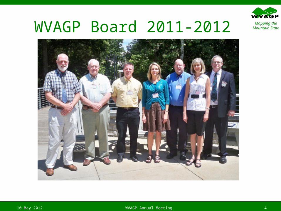
Mapping the Mountain StateWVAGP Board 2011-2012
10 May 2012 WVAGP Annual Meeting 4
Mapping the Mountain State
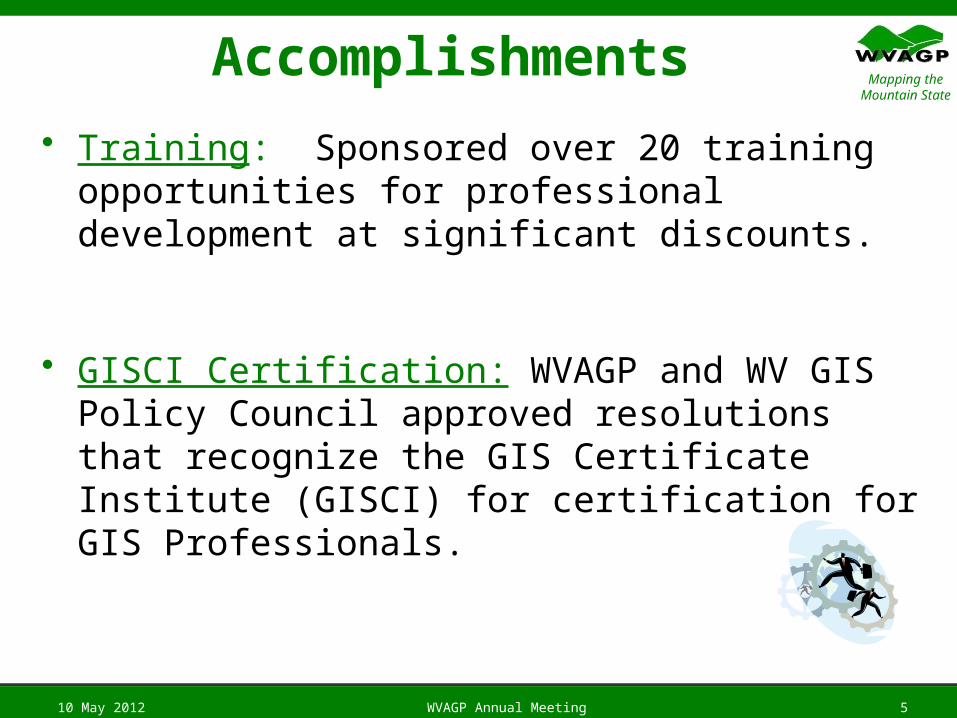
Accomplishments
• Training: Sponsored over 20 training opportunities for professional development at significant discounts.
• GISCI Certification: WVAGP and WV GIS Policy Council approved resolutions that recognize the GIS Certificate Institute (GISCI) for certification for GIS Professionals.
10 May 2012 WVAGP Annual Meeting 5
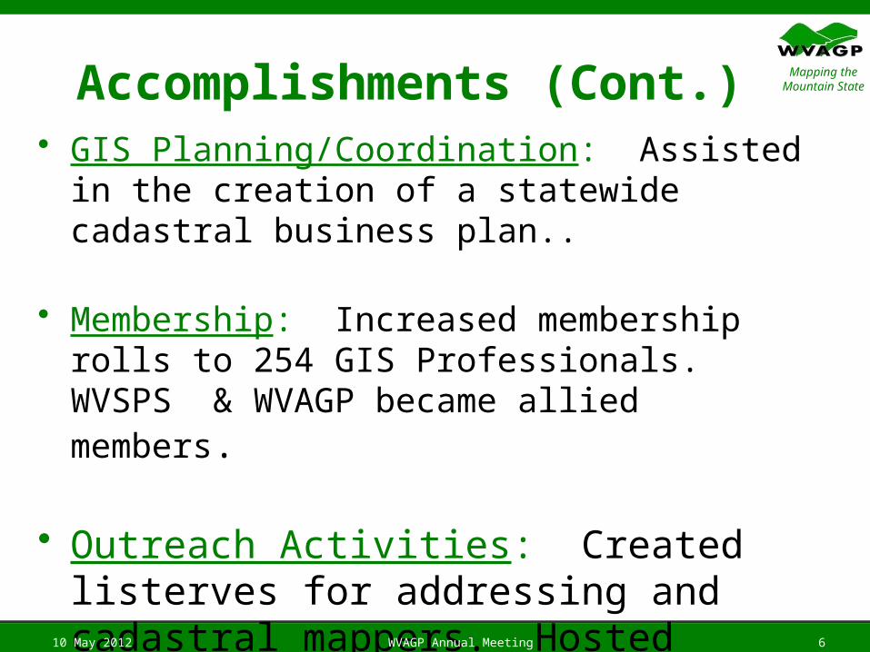
Mapping the Mountain StateAccomplishments (Cont.)
• GIS Planning/Coordination: Assisted in the creation of a statewide cadastral business plan..
• Membership: Increased membership rolls to 254 GIS Professionals. WVSPS & WVAGP became allied members.
• Outreach Activities: Created listerves for addressing and cadastral mappers. Hosted biennial 2012 WV GIS Conference.
10 May 2012 WVAGP Annual Meeting 6
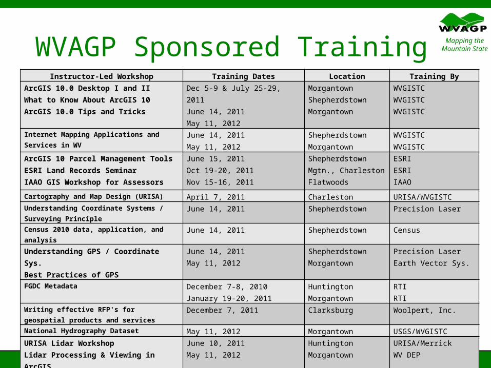
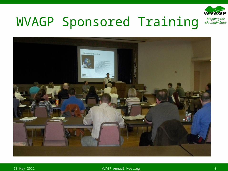
Mapping the Mountain StateWVAGP Sponsored Training
10 May 2012 WVAGP Annual Meeting 7
Instructor-Led Workshop Training Dates Location Training ByArcGIS 10.0 Desktop I and IIWhat to Know About ArcGIS 10ArcGIS 10.0 Tips and Tricks
Dec 5-9 & July 25-29, 2011June 14, 2011May 11, 2012
MorgantownShepherdstownMorgantown
WVGISTCWVGISTCWVGISTC
Internet Mapping Applications and Services in WV
June 14, 2011May 11, 2012
ShepherdstownMorgantown
WVGISTCWVGISTC
ArcGIS 10 Parcel Management ToolsESRI Land Records SeminarIAAO GIS Workshop for Assessors
June 15, 2011Oct 19-20, 2011Nov 15-16, 2011
ShepherdstownMgtn., CharlestonFlatwoods
ESRIESRIIAAO
Cartography and Map Design (URISA) April 7, 2011 Charleston URISA/WVGISTCUnderstanding Coordinate Systems / Surveying Principle
June 14, 2011 Shepherdstown Precision Laser
Census 2010 data, application, and analysis June 14, 2011 Shepherdstown Census
Understanding GPS / Coordinate Sys.Best Practices of GPS
June 14, 2011May 11, 2012
ShepherdstownMorgantown
Precision LaserEarth Vector Sys.
FGDC Metadata December 7-8, 2010January 19-20, 2011
HuntingtonMorgantown
RTIRTI
Writing effective RFP's for geospatial products and services
December 7, 2011 Clarksburg Woolpert, Inc.
National Hydrography Dataset May 11, 2012 Morgantown USGS/WVGISTCURISA Lidar WorkshopLidar Processing & Viewing in ArcGIS
June 10, 2011May 11, 2012
HuntingtonMorgantown
URISA/Merrick WV DEP
Census Boundary and Annexations Surveys (BAS)
January 11, 2012January 12, 2012
Morgantown,Charleston
CensusCensus
Mapping the Mountain StateWVAGP Sponsored Training
10 May 2012 WVAGP Annual Meeting 8
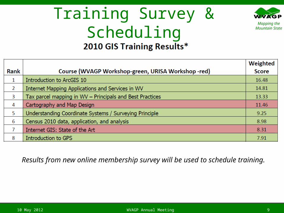
Mapping the Mountain StateTraining Survey & Scheduling
10 May 2012 WVAGP Annual Meeting 9
Results from new online membership survey will be used to schedule training.
Mapping the Mountain State
10 May 2012 WVAGP Annual Meeting 10
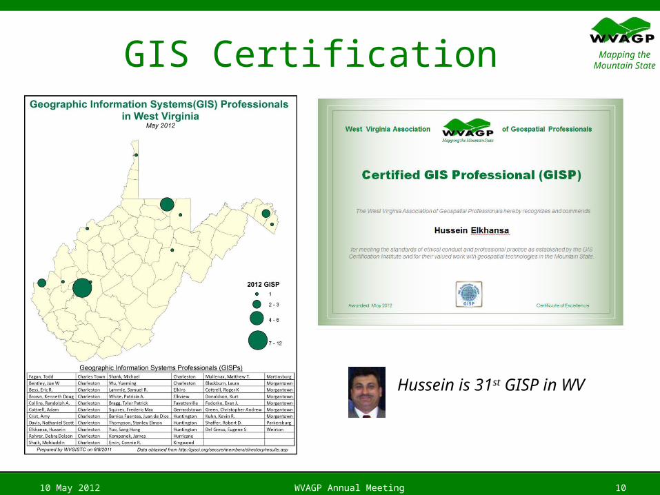
Hussein is 31st GISP in WV
GIS Certification
Mapping the Mountain StateSo Long…My term ENDs in 50 days
10 May 2012 WVAGP Annual Meeting 11
Mapping the Mountain State
Vice-President’s Report
10 May 2012 WVAGP Annual Meeting 12
Mapping the Mountain State
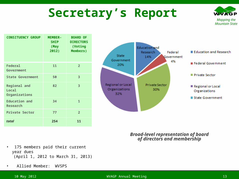
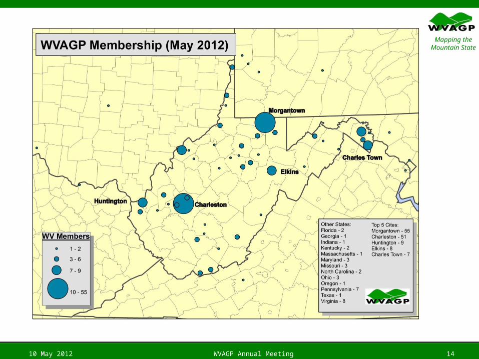
Secretary’s Report
10 May 2012 WVAGP Annual Meeting 13
Broad-level representation of board of directors and membership
CONSITUENCY GROUP
MEMBER-SHIP
(May 2012)
BOARD OF DIRECTORS
(Voting Members)
Federal Government 11 2
State Government 50 3
Regional and Local Organizations
82 3
Education and Research
34 1
Private Sector 77 2
total 254 11
• 175 members paid their current year dues (April 1, 2012 to March 31, 2013)
• Allied Member: WVSPS
Mapping the Mountain State
10 May 2012 WVAGP Annual Meeting 14
Mapping the Mountain StateAnnual Report
• Written 2012 annual report will be posted on the WVAGP website:
10 May 2012 WVAGP Annual Meeting 15
Mapping the Mountain State
Treasurer’s Report
10 May 2012 WVAGP Annual Meeting 16
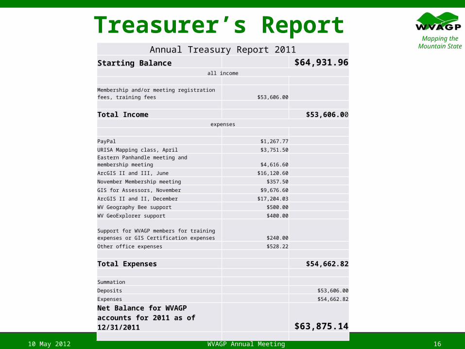
Annual Treasury Report 2011Starting Balance $64,931.96
all income
Membership and/or meeting registration fees, training fees $53,606.00
Total Income $53,606.00expenses
PayPal $1,267.77
URISA Mapping class, April $3,751.50
Eastern Panhandle meeting and membership meeting $4,616.60
ArcGIS II and III, June $16,120.60
November Membership meeting $357.50
GIS for Assessors, November $9,676.60
ArcGIS II and II, December $17,204.03
WV Geography Bee support $500.00
WV GeoExplorer support $400.00
Support for WVAGP members for training expenses or GIS Certification expenses $240.00
Other office expenses $528.22
Total Expenses $54,662.82
Summation
Deposits $53,606.00
Expenses $54,662.82
Net Balance for WVAGP accounts for 2011 as of 12/31/2011 $63,875.14
Mapping the Mountain State
Treasurer’s Report (Cont.)
• Renewed WVAGP non-profit business license
• Successfully filed federal tax documents on time and with no problems
• 2011 WVAGP budget completed with a negative balance gain of $1,000. ($53K income, $54K expenses)
10 May 2012 WVAGP Annual Meeting 17
Mapping the Mountain State
Reports of Standing Committees• Election
– To report and recommend on nomination and election procedures.
• Communications– To report and recommend on matters and methods of communication
with the membership and the public.
• Conference– To report and recommend on plans for the annual conference.
• Technical Issues– To report and recommend on issues relevant to strategic planning, data
development, standards, and shared services.
• Outreach– To report and recommend on methods for exchanging information and for
promoting an awareness of geospatial technologies.
– `10 May 2012 WVAGP Annual Meeting 18
Mapping the Mountain State
Election Committee
10 May 2012 WVAGP Annual Meeting 19
Mapping the Mountain State
Outreach Committee
10 May 2012 WVAGP Annual Meeting 20
Mapping the Mountain State
Communications Committee
10 May 2012 WVAGP Annual Meeting 21
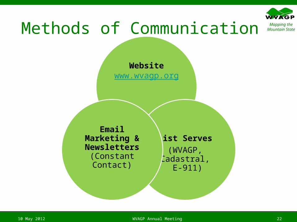
Mapping the Mountain StateMethods of Communication
10 May 2012 WVAGP Annual Meeting 22
Websitewww.wvagp.org
List Serves
(WVAGP, Cadastral,
E-911)
Email Marketing & Newsletters
(Constant Contact)
Mapping the Mountain State
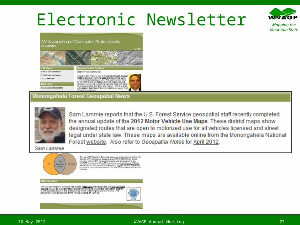
Electronic Newsletter
10 May 2012 WVAGP Annual Meeting 23
Mapping the Mountain State
Conference Committee
10 May 2012 WVAGP Annual Meeting 24
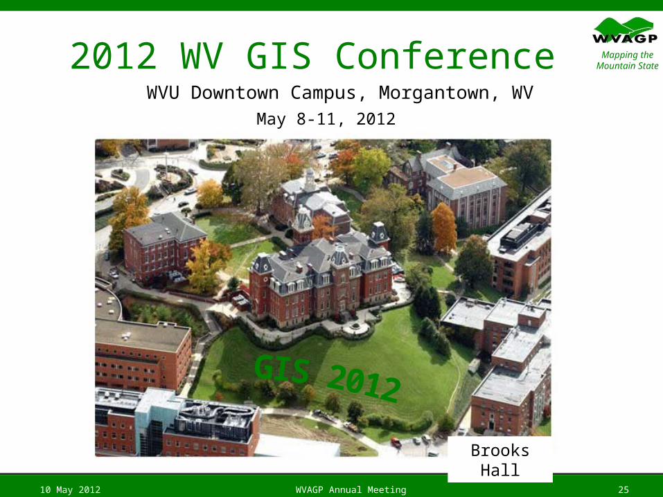
Mapping the Mountain State2012 WV GIS Conference
10 May 2012 WVAGP Annual Meeting 25
WVU Downtown Campus, Morgantown, WV
May 8-11, 2012
Brooks Hall
Mapping the Mountain StateConference Survey
Online survey:
www.wvagp.org/survey
10 May 2012 WVAGP Annual Meeting 26
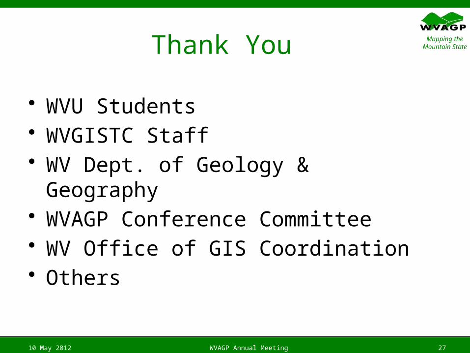
Mapping the Mountain StateThank You
• WVU Students• WVGISTC Staff• WV Dept. of Geology & Geography• WVAGP Conference Committee• WV Office of GIS Coordination• Others
10 May 2012 WVAGP Annual Meeting 27
Mapping the Mountain State
Technical Issues Committee
10 May 2012 WVAGP Annual Meeting 28
Mapping the Mountain State
Reports of Special Committees
Audit Committee
10 May 2012 WVAGP Annual Meeting 29
Mapping the Mountain State
Report of WV GIS Coordinator
10 May 2012 WVAGP Annual Meeting 30
Mapping the Mountain State
Report of Allied Member
WV Society of ProfessionalSurveyors
10 May 2012 WVAGP Annual Meeting 31
Mapping the Mountain State
New Business
10 May 2012 WVAGP Annual Meeting 32
Mapping the Mountain State
Good of the Order / Discussions
Adjournment
10 May 2012 WVAGP Annual Meeting 33
Mapping the Mountain StateQuestions?
10 May 2012 WVAGP Annual Meeting 34
Contact:
Robert Shaffer, PresidentWV Association of Geospatial Professionals
P.O. Box 3903Charleston, WV 25339Web: http://www.wvagp.orgPhone: (304) 558-5380E-mail: [email protected]