mapping the sea: knowledge for natural resources management
TRANSCRIPT

8/2/2019 Mapping the Sea: Knowledge for Natural Resources Management
http://slidepdf.com/reader/full/mapping-the-sea-knowledge-for-natural-resources-management 1/2
Knowledge Showcase
Mapping the Sea: Knowledge for Natural Resources ManagementBy Crispen Wilson and Pieter Smidt
With loss of life from the devastating tsunami of 2004, knowledge of shing grounds around Acehwas reduced: the locations of reefs and otherunderwater hazards became less clear to theremaining shers; consequently, they frequentlydamaged or lost their nets.
To restore knowledge of shing grounds,the ADB-assisted Earthquake and TsunamiEmergency Support Project partnered withthe Panglima Laot—Aceh’s traditional shingauthority—and with shers to conduct acommunity-based bathymetric survey and mapthe ocean oor.
The beneciaries collected data to help producemaps of hazardous coastal areas, potentialshing grounds, and ocean currents.
Because of the survey, the Panglima Laot andshers learned to partner with others and theircapacity to keep more transparent accounts wasimproved.
Challenge
When a tsunami struck Aceh in Northern Sumatra, Indonesiaon 26 December 2004, it killed 186,000 people and causedwidespread destruction. ADB and other organizations providedemergency support through the Earthquake and Tsunami Emer-gency Support Project.
Many shers died and, as a consequence, much knowledge of coastal areas, shing grounds, ocean currents and navigationalhazards disappeared. Over the centuries, such informationhad been transferred from father to son. With its loss, shersoften damaged or lost their nets on underwater obstructions,and faced difculties in identifying their position at sea.Thisimpacted the livelihoods of boat owners, captains, crews, andfamilies.
Approach
To recover shing know-how, the project partnered with thePanglima Laot, Aceh’s traditional shing authority, to undertakea community-based bathymetric survey and map the oceanoor.
In existence for more than 4 centuries, the Panglima Laot is anetwork of local shers’ associations that share a strict set of rules and regulations. There are currently 193 Panglima Laotin Aceh, each one centered on an estuary or a harbor. PanglimaLaot is both the name of the institution as well as the title of theelders who lead the organization. Their responsibilities includearbitrating disputes, regulating shing areas, and organizingrescues. Should a sher violate its strict code of conduct, the
•
•
•
• Panglima Laot can “ground” the boat. If the sher continuesto disobey rules, the Panglima Laot can forbid him to sell shin the market, conscate the catch, and, in rare cases, prohibita sher from operating in the area.
Results
The survey used readily available and affordable techno-
logy. The participating captains were provided with 63 GlobalPositioning System (GPS) sounders that are locally availableat a cost of $750 per boat. With the installation of the soun-ders on artisanal shing boats selected by the Panglima Laot,shers could navigate more easily and automatically gather the data needed to map the ocean oor.
In return for installation of the GPS sounders, facilitated bytraining, captains allowed project staff to come onboard,download map data, and copy catch logs. New navigationalmaps were drawn from the data. These were then distributedat navigational training courses to over 486 captains, sheriesdepartment staff, and enforcement ofcials. It was the rsttime that many had ever seen such maps.
The survey’s bottom-up approach worked better than expec-ted. In a little over 7 months, shers were able to collect over 5 million data points and produce a better map of the areathan had ever been made before. Comparing their collectivetraditional know-how with currently available navigationaland scientic knowledge, they were able to identify 3 pre-viously unmapped sea mounts, 4 unmapped geologic faults,and a large number of formerly “unknown” coral areas. Asignicant direct benet was that the incidence of damagednets fell from an average of 38 per year to just 1.
Survey-related project activities built capacities sector-wide.Fishers learned to frame and respond to a variety of organiza-tional, technical, and scientic questions. The Panglima Laotalso developed more transparent accounting practices andreporting procedures. As a group, the shers greatly improved
October 2009
Disaster Risk ManagemenIndonesia
All hands on deck on an Acehnese shing boat
19
8/2/2019 Mapping the Sea: Knowledge for Natural Resources Management
http://slidepdf.com/reader/full/mapping-the-sea-knowledge-for-natural-resources-management 2/2
their relationships with the provincial Department of Fishe-ries, the Marine Police, the Department of the Interior, and localacademic institutions.
Other Outcomes
Several benecial outcomes from the project had not beenanticipated:
fishers saved fuel by navigating directly to and from fishinggrounds;
one of the 3 previously unmapped sea mounts may add about13,000 square kilometers to Indonesian waters, therebyextending the country’s boundaries;
in one case, and there may have been more, knowing exactlywhere they were saved the lives of a captain and his 18 crewmembers who were able to radio their position after their boat broke; and
close cooperation between the Panglima Laot, governmentagencies, and local universities set the stage for better management of Aceh’s coastal resources.
•
•
•
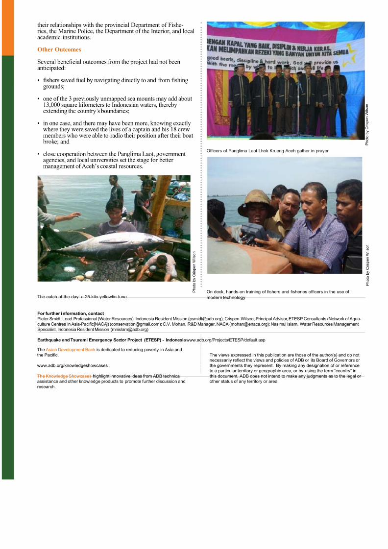
•Ofcers of Panglima Laot Lhok Krueng Aceh gather in prayer
The catch of the day: a 25-kilo yellown tunaOn deck, hands-on training of shers and sheries ofcers in the use of
modern technology
For further information, contact
Pieter Smidt, Lead Professional (Water Resources), Indonesia Resident Mission ([email protected]); Crispen Wilson, Principal Advisor, ETESP Consultants (Network of Aqua-
culture Centres in Asia-Pacic[NACA]) ([email protected]); C.V. Mohan, R&D Manager, NACA ([email protected]); Nasimul Islam, Water Resources Management
Specialist, Indonesia Resident Mission ([email protected])
Earthquake and Tsunami Emergency Sector Project (ETESP) - Indonesiawww.adb.org/Projects/ETESP/default.asp
P h o t o b y C r i s p e n W i l s o n
The Asian Development Bank is dedicated to reducing poverty in Asia and
the Pacic.
www.adb.org/knowledgeshowcases
The Knowledge Showcases highlight innovative ideas from ADB technical
assistance and other knowledge products to promote further discussion and
research.
The views expressed in this publication are those of the author(s) and do notnecessarily reect the views and policies of ADB or its Board of Governors or
the governments they represent. By making any designation of or reference
to a particular territory or geographic area, or by using the term “country” in
this document, ADB does not intend to make any judgments as to the legal or
other status of any territory or area.