mapserver – county map viewer - welcome to oklahoma's ... - county mapping viewer... ·...
TRANSCRIPT
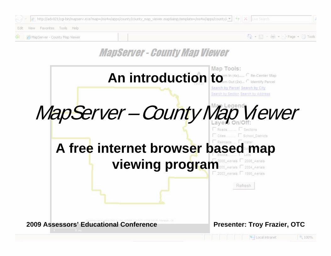
MapServer – County Map ViewerAn introduction to
A free internet browser based map viewing program
2009 Assessors’ Educational Conference Presenter: Troy Frazier, OTC
MapServer – a short historyMapServer was originally developed by the University of Minnesota “ForNet” project in cooperation with NASA and the Minnesota Department of Natural Resources. Later it was hosted by the “TerraSIP” project, a NASA sponsored project between the university and a consortium of land management interests.
MapServer is now a project of the Open Source Geospatial Foundation. The OSGeo was “created to support and build the highest-quality open source geospatial software.” As such, MapServer is currently being supported by nearly 20 developers world-wide. This group is continually making improvements to MapServer. The current version is 5.4.1.
MapServer – and the Oklahoma Tax CommissionAs a part of our continuing effort to support the assessor mapping, we look for ways to supply you with free mapping software. So far, all such software has been for viewing only.
This process started with ESRI’s ArcExplorer 2. ArcExplorer allowed you to view your mapping on top of the digital aerial photography. For many of you, this was the first time that this could be done! However, ArcExplorer 2 was written before the latest versions of Mr. SID compression were created, and ESRI has not updated this “stand alone” program. (ESRI has newer versions of a web-based ArcExplorer which requires a live connection to ESRI to run.)
MapServer – and the Oklahoma Tax CommissionWe next found TatukGIS. This free map viewer is written and supported by a company in Poland. We found this program as we were looking at federal mapping sites for more mapping data for you.
The TatukGIS is a very powerful program. It allows data from different projections without the need of re-projecting. It allows for “halo’ing” text on the map. It prints in full color.
The problems are that it measures only in the map units (which are usually in meters), and it is hard to set up and to search data with.

MapServer – and the Oklahoma Tax CommissionWe had found MapServer a few years ago, but we had a hard time doing anything with it. With the issues of ArcExplorer’s poor color printing and its inability to use the 2005, 2006, and 2008 aerials and TatukGIS lack of easy of use, we revisited MapServer.
It seemed that a cloud was lifted, everything seemed to be so easy. MapServer wasn’t as hard to understand as it had been just a couple of years previously. It was easy to customize and install. As a result, here is
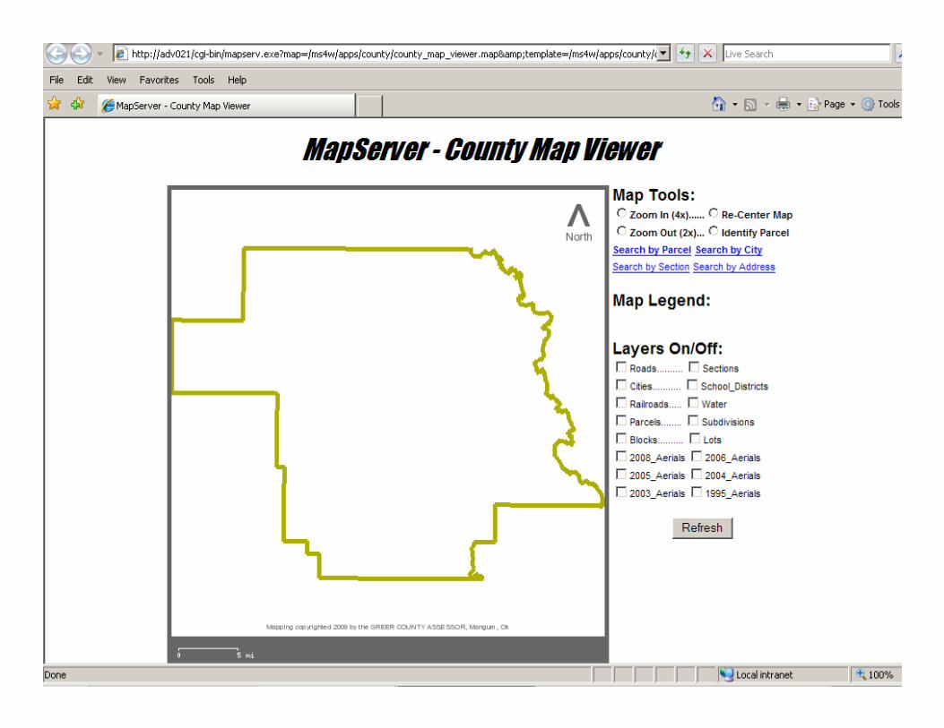
MapServer – County Map Viewer
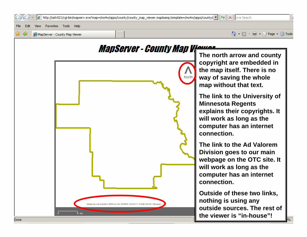
The north arrow and county copyright are embedded in the map itself. There is no way of saving the whole map without that text.
The link to the University of Minnesota Regents explains their copyrights. It will work as long as the computer has an internet connection.
The link to the Ad Valorem Division goes to our main webpage on the OTC site. It will work as long as the computer has an internet connection.
Outside of these two links, nothing is using any outside sources. The rest of the viewer is “in-house”!
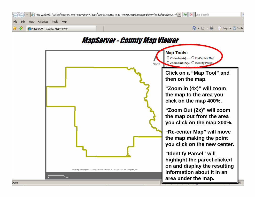
Click on a “Map Tool” and then on the map.
“Zoom in (4x)” will zoom the map to the area you click on the map 400%.
“Zoom Out (2x)” will zoom the map out from the area you click on the map 200%.
“Re-center Map” will move the map making the point you click on the new center.
“Identify Parcel” will highlight the parcel clicked on and display the resulting information about it in an area under the map.
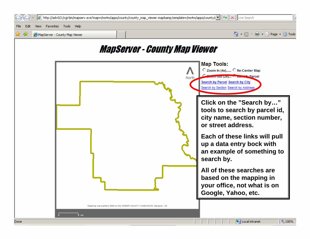
Click on the ”Search by…”tools to search by parcel id, city name, section number, or street address.
Each of these links will pull up a data entry bock with an example of something to search by.
All of these searches are based on the mapping in your office, not what is on Google, Yahoo, etc.
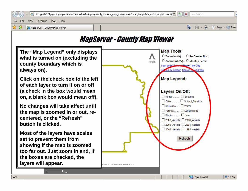
The “Map Legend” only displays what is turned on (excluding the county boundary which is always on).
Click on the check box to the left of each layer to turn it on or off (a check in the box would mean on, a blank box would mean off).
No changes will take affect until the map is zoomed in or out, re-centered, or the “Refresh”button is clicked.
Most of the layers have scales set to prevent them from showing if the map is zoomed too far out. Just zoom in and, if the boxes are checked, the layers will appear.
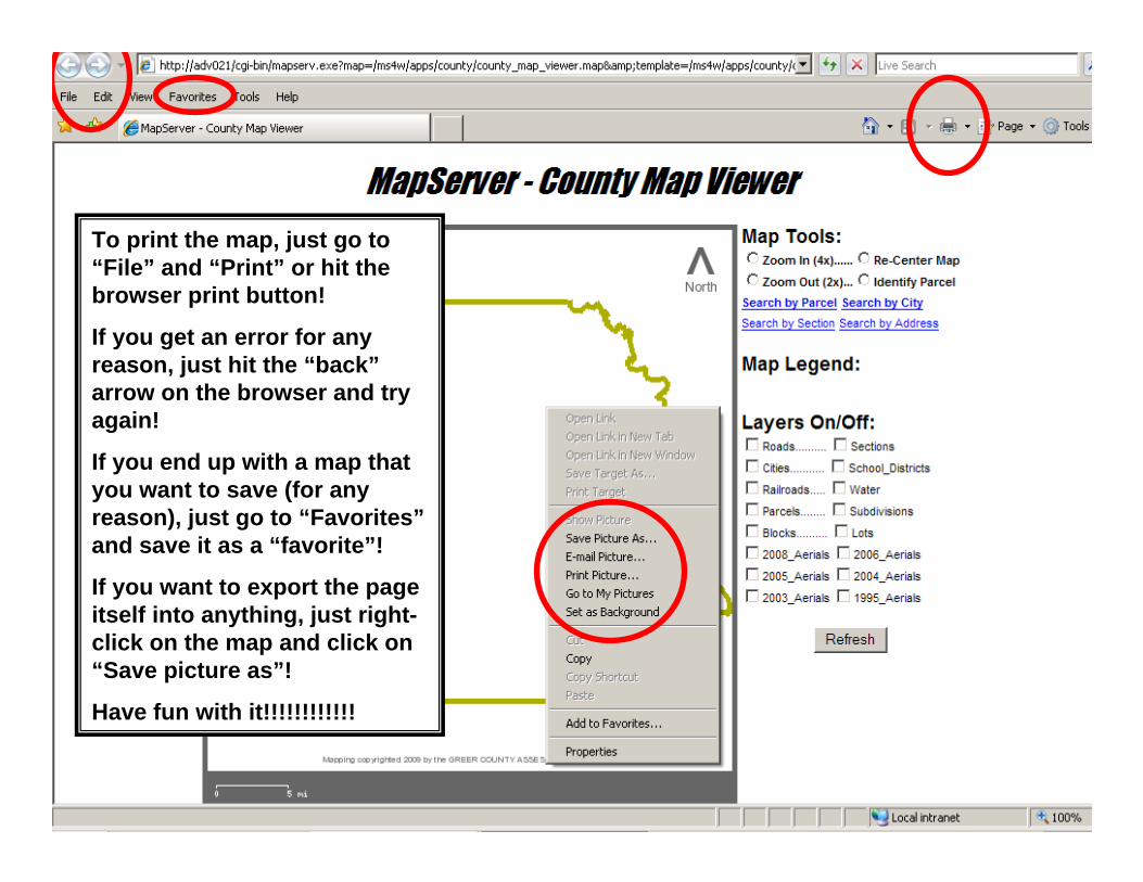
To print the map, just go to “File” and “Print” or hit the browser print button!
If you get an error for any reason, just hit the “back”arrow on the browser and try again!
If you end up with a map that you want to save (for any reason), just go to “Favorites”and save it as a “favorite”!
If you want to export the page itself into anything, just right-click on the map and click on “Save picture as”!
Have fun with it!!!!!!!!!!!!
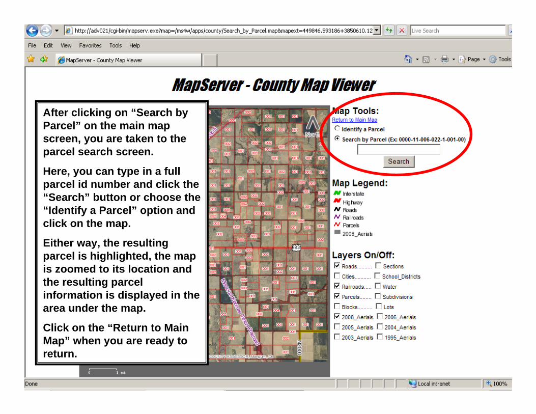
After clicking on “Search by Parcel” on the main map screen, you are taken to the parcel search screen.
Here, you can type in a full parcel id number and click the “Search” button or choose the “Identify a Parcel” option and click on the map.
Either way, the resulting parcel is highlighted, the map is zoomed to its location and the resulting parcel information is displayed in the area under the map.
Click on the “Return to Main Map” when you are ready to return.
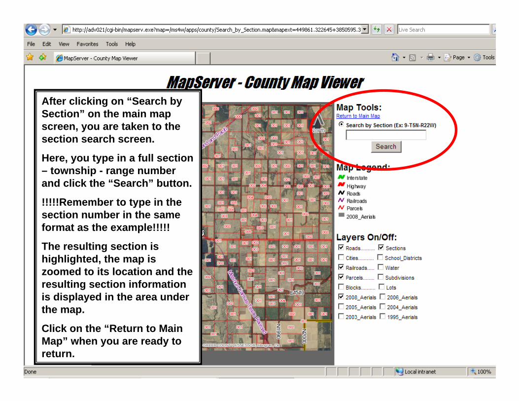
After clicking on “Search by Section” on the main map screen, you are taken to the section search screen.
Here, you type in a full section – township - range number and click the “Search” button.
!!!!!Remember to type in the section number in the same format as the example!!!!!
The resulting section is highlighted, the map is zoomed to its location and the resulting section information is displayed in the area under the map.
Click on the “Return to Main Map” when you are ready to return.
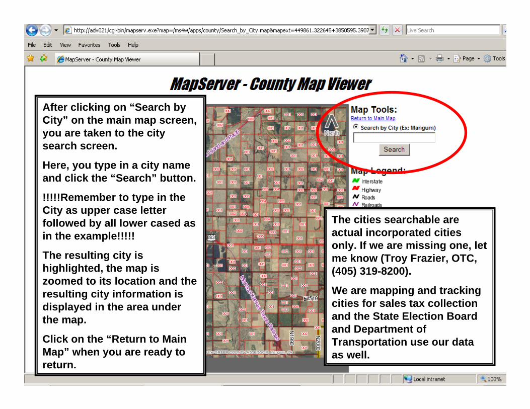
After clicking on “Search by City” on the main map screen, you are taken to the city search screen.
Here, you type in a city name and click the “Search” button.
!!!!!Remember to type in the City as upper case letter followed by all lower cased as in the example!!!!!
The resulting city is highlighted, the map is zoomed to its location and the resulting city information is displayed in the area under the map.
Click on the “Return to Main Map” when you are ready to return.
The cities searchable are actual incorporated cities only. If we are missing one, let me know (Troy Frazier, OTC, (405) 319-8200).
We are mapping and tracking cities for sales tax collection and the State Election Board and Department of Transportation use our data as well.
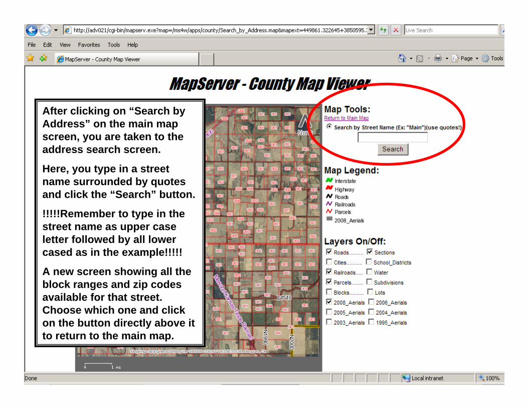
After clicking on “Search by Address” on the main map screen, you are taken to the address search screen.
Here, you type in a street name surrounded by quotes and click the “Search” button.
!!!!!Remember to type in the street name as upper case letter followed by all lower cased as in the example!!!!!
A new screen showing all the block ranges and zip codes available for that street. Choose which one and click on the button directly above it to return to the main map.
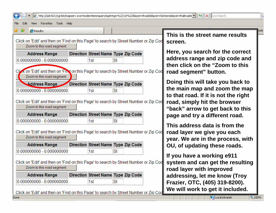
This is the street name results screen.
Here, you search for the correct address range and zip code and then click on the “Zoom to this road segment” button.
Doing this will take you back to the main map and zoom the map to that road. If it is not the right road, simply hit the browser “back” arrow to get back to this page and try a different road.
This address data is from the road layer we give you each year. We are in the process, with OU, of updating these roads.
If you have a working e911 system and can get the resulting road layer with improved addressing, let me know (Troy Frazier, OTC, (405) 319-8200). We will work to get it included.

MapServer – in conclusionMapServer can give all your computers map viewing capability with installation on one computer. Any computer connected to your network can access this mapping (public view stations, computers in connected offices like treasurers or county clerks). It is even possible to share this viewer directly to the internet.
MapServer actually only runs on the computer it is installed on. It creates pictures and “servers” them up through the browser. At no time is any other computer getting direct access to your actual mapping layers!
Unfortunately, MapServer can not use MIMS or dxf layers. We are working on a free dxf to shapefile converter.
Remember, MIMS counties always have the option of buying Dr. Paul Bendt’s MIM2SHP conversion program.