maritime boundary dispute settlement: the nonemergence of
TRANSCRIPT

NOTES
MARITIME BOUNDARY DISPUTE SETTLEMENT: THENONEMERGENCE OF GUIDING PRINCIPLES
I. INTRODUCTION
Only in the past fifty years have nations fully realized the re-source potential of the continental shelf. The discovery of offshoreoil reserves and advances in technology allowing extraction engen-dered an interest in areas recently considered economically barrenand undeserving of the effort involved in claiming sovereignty.,The ensuing scramble to assert jurisdiction over areas that mightharbor precious resources rapidly gave rise to a new frontier that,to the naked eye at least, possessed none of the natural barriersthat often define land boundaries.
Predictably, jurisdictional claims over the continental shelf oftenhave overlapped. Many conflicting claims have been settledthrough negotiation or by judicial determination.2 Still others re-main unresolved.3 Conflict may arise in two general areas: wheretwo states are adjacent, sharing a common land boundary that ter-minates at the ocean, or where two states are located on oppositesides of a relatively narrow body of water.4
This Note examines the resolution of sovereignty disputes con-
Small areas of coastal waters have been considered subject to the jurisdiction of adja-cent states for centuries, and principles for determining sea boundaries were proposed asearly as 1672. Rhee, Sea Boundary Delimitation Between States Before World War II, 76Am. J. INT'L L. 555, 556 (1982). These early claims generally extended only as far as therange of cannons in use at the time, a practice that eventually evolved into a three-mile rule.Id. at 558. The recent establishment of exclusive economic zones enlarges present claims ofsovereignty to 200 miles and involves both the marine resources and the underlying seabed.See infra notes 121-24 and accompanying text.
2 For a partial list of claims resolved by agreement, see Rhee, Equitable Solutions to theMaritime Boundary Dispute Between the United States and Canada in the Gulf of Maine,75 Am. J. INT'L L. 590, 606 nn. 86-87 (1981). The four modern examples of judicial resolutionare discussed in the text of this Note.
I The advent of the 200-mile exclusive economic zone created an estimated 331 new mari-time boundaries. Hodgson & Smith, Boundary Issues Created by Extended NationalMarine Jurisdiction, 69 GEOGRAPHICAL REV. 423, 426 (1979). As of 1979, 252 of these bound-aries remained unresolved. Id.
The distinction between adjacent and opposite shores generally has been recognized asrequiring separate methods of boundary resolution. Rhee, supra note 1, at 559 n.24.

GA. J. INT'L & COMP. L.
cerning the continental shelf, with emphasis on the decisions of theInternational Court of Justice (ICJ). In particular, this Note fo-cuses on the most recent ICJ decision, a dispute between Canadaand the United States concerning claims of jurisdiction over thecontinental shelf and the superadjacent water column5 in the Gulfof Maine area. The absence of a clear course of action by the ICJin resolving such disputes is noted, and suggestions for a more pre-dictable approach are advanced in an effort to encourage settle-ment, without resort to a judicial body, in areas currently underdispute.
A. Competing Claims in the Gulf of Maine
The Gulf of Maine area' historically has demonstrated its rich-ness in marine resources both to United States fishermen and,later, to those of other nations. 7 Perhaps the most distinctive geo-graphical characteristic of this area is the Georges Bank, a sub-merged plateau lying just seaward of the Gulf's closing line.8 Tra-ditionally known for its large quantities of lobster, scallops, andfish, the Georges Bank recently has been recognized as the poten-tial site of vast oil reserves.9
While United States claims to the Gulf of Maine area trace backto the Truman Proclamation of September 28, 1945,10 conflictingclaims of Canada did not materialize until the 1960's.11 In 1964,
5 "Superadjacent" water is a term frequently used to refer to the water above the area ofseabed under discussion. See, e.g., Delimitation of the Maritime Boundary in the Gulf ofMaine Area (Can. v. U.S.), 1984 I.C.J. 246, 277 (Judgment of Oct. 12), reprinted in 23 I.L.M.1197 (1984) [hereinafter cited as Gulf of Maine Case].
0 The Gulf of Maine is an approximate semicircle running from Nantucket Island andCape Cod around to the Canadian-United States border and up to Cape Sable on the Coastof Nova Scotia. It covers approximately 65,000 square kilometers with an average depth of150 meters. Rhee, supra note 2, at 590 n.1.
7 The foreign catch in the Gulf of Maine area was insignificant until the 1950's, but by1972 foreign fleets accounted for almost ninety percent of the catch in the region. See SEN-ATE COMM. ON COMMERCE, 94TH CONG., 2D SEss., A LEGISLATIVE HISTORY OF THE FISHERY CON-
SERVATION AND MANAGEMENT AcT 669 (Comm. Print 1976).1 The Georges Bank is an oval-shaped plateau with an area of about 30,000 square kilo-
meters and depths from thirty to eighty meters. Rhee, supra note 2, at 590 n.1.* Exploration permits for oil and gas reserves on the Georges Bank were first issued in
1970 and have since been issued by both nations. Gulf of Maine Case, supra note 5, at 279.See also infra notes 11-12 and accompanying text.
10 Proclamation No. 2667, Policy of the United States with Respect to the Natural Re-sources of the Subsoil and Sea Bed of the Continental Shelf, 3 C.F.R. 67 (1943-1948), re-printed in 13 DEI'T ST. BULL. 485 (1945).
" The claims were initiated when Canada issued permits for oil exploration on theGeorges Bank. In issuing these permits, Canada applied a strict equidistance theory to as-
592 [Vol. 15:591

19851 MARITIME BOUNDARY DISPUTES
both the United States and Canada issued exploration permits forthe Gulf of Maine area.1" This contemporaneous issuance led to anexchange of correspondence between the two nations' s that contin-ued for several years. 4 In 1968, the United States suggested thatnegotiations be opened to resolve conflicting claims of sovereigntyand that activity in the disputed area of the Georges Bank be tem-porarily suspended. 15 Canada rejected the moratorium proposed bythe United States but agreed to negotiate.' 6
Negotiations between the parties opened in 1970.'1 The UnitedStates claimed jurisdiction over an area extending to the NortheastChannel and including the entire Georges Bank, relying on thetheory of natural prolongation's and the existence of "special cir-cumstances" in the area.'9 These claims were based on the 1969decision of the International Court of Justice (ICJ) in the NorthSea Continental Shelf Cases.20 Canada refused to recognize any''special circumstances," taking the position that a line should be
sert jurisdiction over the northeastern third of the Georges Bank. Feldman & Colson, TheMaritime Boundaries of the United States, 75 AM. J. INT'L L. 729, 755 (1981).
12 Gulf of Maine Case, supra note 5, at 279.13 Initial exchanges occurred between the Assistant Director for Lands and Minerals of
the United States Bureau of Land Management of the Department of the Interior and theChief of the Resources Division of the Department of Northern Affairs and Natural Re-sources of Canada; the Bureau of Land Management requested information regarding thelocation of Canadian exploration permits. Id. at 280. Canada subsequently claimed that thefailure of United States officials to object to the reply showing the locations constitutedacquiescence by the United States in the line constructed by Canada at that time. Id. at281.
" The initial exchange of letters occurred in 1965, and the two countries continued tocorrespond until the opening of negotiations in 1970. Id. at 280-81.
'6 Id. at 280.Id. at 281.
' Negotiations began July 9, 1970. Id.IS See U.S. DEP'T OF STATE, FILE POL 33-51, MARMME NEGOTIATIONS WITH CANADA- THE
GULF OF MAINE AREA 5 (May 17, 1977). Natural prolongation is based on the idea that eachstate should have sovereign rights over that part of the continental shelf that is the naturalextension of its land mass. In the Gulf of Maine, the United States claimed that the North-east Channel marked the boundary between the extensions of the Canadian and UnitedStates land masses. See id.
"5 The United States particularly noted the combined effect of a concave New Englandcoastline and the convex shape of Nova Scotia on the Gulf of Maine. These conditionscaused a line of equidistance to be "pulled" toward the United States coast, producing, inthe opinion of the United States, an inequitable result. Rhee, supra note 2, at 609.
'o North Sea Continental Shelf Cases (W. Ger. v. Den./W.Ger. v. Neth.), 1969 I.C.J. 3(Judgment of Feb. 20), reprinted in 8 I.L.M. 340 (1969). There, the ICJ used the term "rele-vant circumstances" in considering the general configuration of the coastline, the geologicalcharacteristics of the shelf, the distribution of seabed deposits, and proportionality, or rela-tive lengths of the appertaining coastlines. Rhee, supra note 2, at 606-07.

GA. J. INT'L & COMP. L. [Vol. 15:591
drawn following a course of equidistance21 as advocated in the 1958Geneva Convention on the Continental Shelf.2 2 Such a line wouldgive Canada sovereignty over the northeast portion of the GeorgesBank.2"
While negotiations continued, the United States in 1975 and1976 took preliminary steps to begin oil exploration on the GeorgesBank;24 twenty-eight of the tracts offered in the "Call for Nomina-tions" from interested companies were in the area claimed by Ca-nada.2" A protest from Canada brought the reply that the area inquestion was under the jurisdiction of the United States.26 Biddingon the dispute tracts was temporarily suspended by the UnitedStates, however, to avoid further deterioration of the ongoing nego-tiations concerning the conflicting sovereignty claims.27
Progress toward a negotiated settlement was severely hamperedby developments at the Third United Nations Conference on theLaw of the Sea,2" prompting both parties to establish a 200-milefishery zone. 29 The overlapping of areas claimed by the two nations
21 See Canadian Dep't of External Affairs, Canadian View of the Gulf of Maine/Georges
Bank Boundary Line, Press Release, June 10, 1977." 15 U.S.T. 471, T.I.A.S. No. 5578, 499 U.N.T.S. 311 [hereinafter cited as 1958
Convention]:1. Where the same continental shelf is adjacent to the territories of two or moreStates whose coasts are opposite each other, the boundary of the continental shelfappertaining to such States shall be determined by agreement between them. Inthe absence of agreement, and unless another boundary line is justified by specialcircumstances, the boundary is the median line, every point of which is equidis-tant from the nearest points of the baselines from which the breadth of the terri-torial sea of each State is measured.2. Where the same continental shelf is adjacent to the territories of two adjacentStates, the boundary of the continental shelf shall be determined by agreementbetween them. In the absence of agreement, and unless another boundary line isjustified by special circumstances, the boundary shall be determined by applica-tion of the principle of equidistance from the nearest point of the baselines fromwhich the breadth of the territorial sea of each State is measured.
Id. at art. VI. Canada did not adopt the treaty until 1970, the year negotiations began, andit attached a disclaimer that rejected any interruption in the shelf by a feature such as theNortheast Channel. See Rhee, supra note 2, at 592.
13 Feldman & Colson, supra note 11, at 755.21 Gulf of Maine Case, supra note 5, at 282.2 Id.26 Id.27 Id.Il While the Convention has not entered into force, many of the concepts approved at the
Conference are widely accepted, including the 200-mile fishery zone. See infra notes 122-24and accompanying text.
19 Canada was first to establish a 200-mile Exclusive Economic Zone, enlarging its claimbeginning Jan. 1, 1977. Order-in-Council P.C. 1977-1, 110 Can. Gaz., Extra No. 101 (Nov. 1,

1985] MARITIME BOUNDARY DISPUTES 595
enlarged the dispute area so that it included not only the continen-tal shelf, but also the superadjacent waters.3 0 Efforts to concludeinterim fisheries agreements between Canada and the UnitedStates pending a boundary settlement produced only limited suc-cess. 1 In fact, at one point a long-standing tradition of cooperativeuse deteriorated to the stage where each country closed its territo-rial sea to the fishermen of the other nation.32
While the dispute over the Gulf of Maine remained unsettled,the international community had occasion to consider similar con-flicting claims relating to the English Channel in the France-United Kingdom Arbitration on the Delimitation of the Conti-nental Shelf.3 3 In this case, the Court of Arbitration found thatcertain coastal irregularities could be disregarded in constructingbasepoints34 for the delimitation. 5 Immediately after this decision,the Canadian government submitted a new claim to reflect its in-terpretation of the Court of Arbitration's opinion.36 Canada revisedits claim to treat Cape Cod, Nantucket Island, and Martha's Vine-yard as "special circumstances" not to be considered part of theUnited States coastline.37 Under this approach, the new "equitable
1976), reprinted in 15 I.L.M. 1372 (1976). The United States' 200-mile zone took effect onlytwo months later. Fishery Conservation and Management Act of 1976, Pub. L. No. 94-265,90 Stat. 331, 336 (codified as amended at 16 U.S.C. 1801, 1811 (1982)).
30 Gulf of Maine Case, supra note 5, at 283." Existing agreements initially were extended to preserve "existing patterns" of fishing,
but disputes eventually prevented both renegotiation and extension. See id.33 Id.33 Arbitration between the United Kingdom of Great Britain and Northern Ireland and
the French Republic on the Delimitation of the Continental Shelf, Command Paper 7438,Decision of June 30, 1977, reprinted in 18 I.L.M. 397 (1979) [hereinafter cited as Anglo-French Case].
" The construction of baselines to depict the shoreline is the initial step in the construc-tion of a delimitation line. It is a particularly important step where the equidistance methodis employed, as the line constructed to delimit will be equidistant from the nearest baselineof each state. Thus, if the baselines of one state are moved toward the second state, the linedividing the area in between will move in the same direction. See generally 1 A. SHALOWrrz,SHORE AND SEA BOUNDARIES 27-30 (1962).
"5 Anglo-French Case, supra note 33, at 55. Canada had maintained a position similar tothat of the United Kingdom in the Anglo-French Case in asserting that there is a presump-tion in favor of equidistance as a method of delimitation, but the Court of Arbitration re-jected this proposal. Id. at 48. See also Feldman & Colson, supra note 11, at 757-58 (dis-cussing the Court of Arbitration's treatment of the presumption in favor of equidistance).
' See 112 Can. Gaz., Extra No. 79, pt. I (Sept. 15, 1978).37 The Canadian Government stated that "certain projections of the United States' coast
have a distorting effect on the placement of the equidistance line and, therefore, constitute'special circumstances' under international law." Canadian Dep't of External Affairs, Ca-nada/USA Interim Reciprocal Fisheries Agreement, Communique No. 39 at 2 (Apr. 12,1978).

GA. J. INT'L & COMP. L. [Vol. 15:591
equidistance" line enlarged the area claimed by Canada by essen-tially moving the United States coast away from Nova Scotiabefore drawing the line of equidistance.38 The United States flatlyrejected the new claim and threatened to arrest any Canadian ves-sels fishing in the area. 9
B. Submission to the ICJ
With negotiation failing to produce a delimiting line, the partiesin 1979 drew up two treaties - a fisheries agreement40 and anagreement to submit the boundary dispute to binding third-partyarbitration.1 In 1981, President Reagan reacted to pressure fromthe Senate42 by withdrawing the fisheries agreement from consider-ation,43 while the agreement to submit to arbitration received mi-nor amendment and passed separately. 44 Canada later agreed topass the arbitration treaty without the fisheries agreement.45
Pursuant to the treaty, the dispute was submitted to a Chamber
"The baselines representing the United States shore were moved from Cape Cod inlandas if the peninsula did not exist, moving the point between the Canadian and United Statesbaselines toward the United States. Canada's new claim included 1500 square miles of theGeorges Bank. Rhee, supra note 2, at 594.
39 U.S. DEP'T OF STATE, File No. P78 0160-2316, reprinted in 73 AM. J. INT'L L. 132 (1979).See also Expanded Canadian Maritime Boundary Claim, 78 DrPT. ST. BULL., Dec. 1978, at43.
40 SEN. COMM. ON FOREIGN RELATIONS, AGREEMENT ON EAST COAST FISHERY RESOURCES
WITH CANADA, S. Exec. Doc. V, 96th Cong., 1st Sess. 13 (1979) (message from the President)."1 Treaty Between the Government of the United States of America and the Government
of Canada to Submit to Binding Dispute Settlement the Delimitation of the MaritimeBoundary in the Gulf of Maine Area, Mar. 29, 1979, United States-Canada, - U.S.T. -,T.I.A.S. No. 10,204, reprinted in 20 .L.M. 1377 (1981) [hereinafter cited as Treaty for De-limitation]. This is the version as amended and passed by the Senate. See infra note 44 andaccompanying text.4, Two objections to the fisheries agreement surfaced: claims that entitlements given to
United States fishermen were unfair (particularly the allotment of over 70% of the scallopstocks in the Georges Bank area to Canada) and a sentiment that such an agreement shouldnot be linked to the boundary settlement. See Rhee, supra note 2, at 596-97 & nn. 45-46.
43 SEN. COMM. ON FOREIGN RELATIONS, MARITIME BOUNDARY SETTLEMENT TREATY WITH CA-
NADA, S. EXEC. REP. No. 5, 97th Cong., 1st Sess. 2 (1981)." 127 CONG. REc. 7689 (1981) (vote of 91-0). The two treaties had originally been linked
so that neither would come into force unless each party ratified both. Treaty for Delimita-tion, supra note 41, art. IV. Since the fisheries agreement would remain effective irrespec-tive of the outcome of the arbitration, the possibility of an "all or nothing" decision wouldhave been decreased. See Hearings Before the Senate Comm. on Foreign Relations on S.Exec. Doc. U., Maritime Boundary Dispute Settlement with Canada, and S. Exec. Doc. V.Agreement on East Coast Fisheries Resources with Canada, 96th Cong., 2d Sess. 34-35, 61-62 (1980) (statements of Lloyd Cutler and Leigh Ratiner).4'8 Ottawa Citizen, Nov. 21, 1981, at 7, col. 3.

MARITIME BOUNDARY DISPUTES
of the ICJ.46 In the initial stages of the proceedings, the UnitedStates responded to Canada's "equitable equidistance" line byamending its own claim to assert jurisdiction over a greater portionof the area than initial United States claims had indicated. 7 Thus,with the two parties more divergent in their positions than whenthey began negotiations in 1970, the delimitation of the Gulf ofMaine area was placed before a Chamber of the ICJ in 1981.
II. LEGAL HISTORY OF CONTINENTAL SHELF JURISDICTION
The history of national jurisdiction over adjacent seabeds beganwith the Truman Proclamation of September 28, 1945,48 in whichthe United States asserted the first major claim of sovereignty overthe continental shelf by announcing that:
the Government of the United States regards the natural re-sources of the subsoil and sea bed of the continental shelf be-neath the high seas but contiguous to the coasts of the UnitedStates as appertaining to the United States, subject to its juris-diction and control.49
In cases of overlapping claims with a neighboring state, the bound-ary was to be determined by agreement "in accordance with equi-table principles. '50
Following the lead of the United States, other coastal states rap-idly moved to assert jurisdiction over the continental shelf adja-cent to their land mass,5 1 and by the late 1950's the concept ofcontrol over the continental shelf had become so firmly entrenchedin international law that it was included in the 1958 Geneva Con-
" Treaty for Delimitation, supra note 41, art. I. The Chamber was composed of fivejudges from industrialized nations and received great attention as the first time a specialchamber of the ICJ had been used. See generally McRae, Adjudication of the MaritimeBoundary in the Gulf of Maine, 17 CAN. Y.B. INT'L L. 292 (1979). The concept of a specialchamber was developed in an attempt to encourage the use of the ICJ, but concerns havearisen as to a possible diminution of respect for the Court in the international community.See, e.g., Recent Development, International Adjudication: Settlement of the UnitedStates-Canada Maritime Boundary Dispute, 23 HARv. INT'L L.J. 138 (1982).
" The "adjusted perpendicular" proposed by the United States was based largely uponthe same principles as the earlier line, and the Northeast Channel was still seen as a naturalboundary. See Gulf of Maine Case, supra note 5, at 286."4 Supra note 10.4I Id.80 Id." See Comment, Boundary Delimitation in the Economic Zone: The Gulf of Maine Dis-
pute, 30 ME. L. REv. 207, 211 (1979).
1985]

GA. J. INT'L & COMP. L.
vention on the Continental Shelf (1958 Convention). 2 This Con-vention provided that where the continental shelf was adjacent tomultiple states, the boundary was to be "determined by agreementbetween them." 53 If such an agreement were not reached, the 1958Convention provided separate guidelines for finding the boundarybetween states with opposite coasts and those with adjacentshores." In the case of opposite shores, the 1958 Convention pro-vided that "unless another boundary line is justified by special cir-cumstances, the boundary is the median line, every point of whichis equidistant from the nearest points of the baselines from whichthe breadth of the territorial sea of each state is measured. '65
The procedure for establishing boundaries between states withadjacent shores was identical except that "the boundary shall bedetermined by application of the principle of equidistance"6
where there was neither agreement nor "special circumstances"justifying a different result. The equidistance approach providesfor the construction of a line of delimitation 57 so that each stateobtains sovereignty over that part of the sea that is closer to itsrespective shoreline than to the shore of the other state. 8
A. The North Sea Continental Shelf Cases
Despite the guidelines provided by the 1958 Convention, con-flicts arose concerning control of the continental shelf. The prob-lem first reached the ICJ in the North Sea Continental ShelfCases.59 This series of cases arose out of an agreement betweenDenmark and the Netherlands delimiting a portion of the conti-nental shelf in the North Sea. Both countries claimed that equidis-tance, as defined in the 1958 Convention, had become the custom-ary rule of international law for delimitation. 0
The North Sea shoreline of these two states, together with thatof the Federal Republic of Germany (Germany), forms a continu-
See supra note 22.Id. at art. 6, para. 2.See Comment, supra note 51, at 218 & n.38.1958 Convention, supra note 22, at art. 6, para. 1.Id. at para. 2."Delimitation" is a term frequently used in describing the process of constructing a
boundary to divide the continental shelf and, more recently, the overlying water column.For a general discussion of maritime boundary delimitation, see Comment, supra note 51.
See id. at 212 n.19.6' North Sea Continental Shelf Cases (W. Ger. v. Den./W.Ger. v. Neth.), 1969 I.C.J. 3
(Judgment of Feb. 20), reprinted in 8 I.L.M. 340 (1969)."' Id. at 10-12.
598 [Vol. 15:591

MARITIME BOUNDARY DISPUTES
ous coast roughly opposite to the eastern shore of England, withGermany situated between the other two states. Due to the con-cavity of the German coastline, the equidistance line advanced byDenmark and the Netherlands left Germany with a small sector ofcontinental shelf that was cut off from the center of the North Seaby the claims of the other two states.61
Germany objected to the delimitation line constructed by Den-mark and the Netherlands, contending that equidistance had notbecome a customary rule of international law." Germany also as-serted that because it had never become a party to the 1958 Con-vention, equidistance should not apply.a3 Instead, Germany ad-vanced the theory that each coastal state is entitled to a "just andequitable share" of the continental shelf.64 In reaching its decision,the ICJ found that delimitation is a process which involves estab-lishing the boundaries of an area already, in principle, appertain-ing to the coastal State and not the delimitation de novo of suchan area.
65
Thus, delimitation did not necessitate an equal apportionmentof area or resources; rather, the process involved the discovery ofthe boundaries that naturally existed. Consistent with the TrumanProclamation's emphasis on mutual agreement and equitable prin-ciples, the ICJ noted that "[tihese two concepts . .. have un-derlain all the subsequent history of the subject."6
The court found that equidistance was not a principle of inter-national law that must be applied in all situations.17 Instead, theICJ emphasized equitable principles, 8 with the "special circum-stance" of the concavity of Germany's coast requiring an adjust-ment of the delimitation line to account for the proportional
61 The discovery of large oil reserves in the region had greatly increased the importance of
sovereignty over the continental shelf of the North Sea, and each of the three states desiredas large an area as possible. See Swan, That Gulf of Maine Dispute: Canada and theUnited States Delimit the Atlantic Continental Shelf, 10 NAT. RESOURCEs LAW. 405, 421-23 (1977). See also Figure 1.
"' North Sea Continental Shelf Cases, 1969 I.C.J. at 9.63 Friedmann, The North Sea Continental Shelf Cases - A Critique, 64 AM. J. INT'L L.
229, 230 (1970). Even if Germany had been a party, equidistance under the 1958 Conventionwould apply "only in the absence of agreement." Id. at n.4.
" North Sea Continental Shelf Cases, 1969 I.C.J. at 20." Id. at 22." Id. at 33.61 The Court found that the application of the equidistance principle was "almost im-
promptu, and certainly contingent." Id. at 35." See id. at 33.
19851 599

GA. J. INT'L & COMP. L.
FIGURE 1The North Sea Continental Shelf Case
-Previously Established Boundaries
0 0 0 0 Boundary Claimed by Denmark & the Netherlands
Boundary Drawn in Agreement Between Denmark & the Netherlands
- - - Approximate Boundary Claim of Germany
Reprinted from 1969 I.C.J. 3, 16.
[Vol. 15:591

MARITIME BOUNDARY DISPUTES
lengths of the three nations' coastlines. 9
The ICJ further stated that the rights of sovereignty over thecontinental shelf were grounded in the concept of natural prolon-gation. Under this concept, each state must receive that portion ofthe shelf which is the most natural extension of its territory. 0
Coastal "irregularities," here the concavity of the German coast-line, could not be disregarded under this concept due to the postu-late that "the land dominates the sea."'71
B. The Anglo-French Case
The importance of equitable principles, natural prolongation,and proportionality was further emphasized in the Anglo-FrenchCase.72 This case involved a dispute between two parties to the1958 Convention over the delimitation of the English Channel andthe adjacent area of the Atlantic Ocean.7 3 Both France and Eng-land agreed that a median line should divide the English Channel,but they disagreed sharply on the location of base points7 4 for theconstruction of that line.78 The parties were divided more sharplyover delimitation of the Atlantic. Great Britain advocated a strictapplication of equidistance under the 1958 Convention 7 6 with theScilly Islands treated as a continuation of the English mainland.7 7
France, on the other hand, cited the Scilly Islands as a "specialcircumstance" and advocated delimitation by the bisector of theangle formed by the lines continuing the general direction of thetwo coastlines.78
11 Id. at 17, 49. The lengths of the respective coastlines are taken into account throughapplication of the proportionality doctrine, which attempts to divide the continental shelf inproportion to the lengths of the coasts of nations appertaining to the shelf in the area. Seeid. at 54.
70 Id. at 22, 31." Id. at 52.71 Supra note 33. The case was decided by a five-man Court of Arbitration.7' For a brief discussion of the geography of the area, see Note, The United Kingdom-
France Continental Shelf Arbitration, 72 A. J. INT'L L. 95, 96 (1978). See also Figure 2.7, For a discussion of the construction of basepoints and their importance on the outcome
of a boundary delimitation, see generally 1 A. SHALOWITZ, supra note 34, at 27-30.7' Much of the dispute centered on the effect that the Scilly and Channel Islands, both
part of the Great Britain's territory, were to have on the construction of the baselines. SeeNote, supra note 73, at 97-99.7' France had argued that the 1958 Convention was not in force between the parties due
to reservations made by France when signing the treaty and subseqent British objections tothose reservations. Id. at 98, 101 n.14.
'7 See id. at 109.71 France contended that such a line was more equitable than one constructed by the
equidistance method and better reflected natural prolongation. Id. at 98.
19851

GA. J. INT'L & COMP. L. [Vol. 15:591602
C4
cq6*

MARITIME BOUNDARY DISPUTES
The Court of Arbitration found that, contrary to the contentionsof Great Britain, there was no presumption in favor of equidis-tance that required rebuttal by a party claiming special circum-stances.7 9 The judges reasoned that article 6 of the 1958 Conven-tion provided a combined equidistance-special circumstances rule80
with emphasis on an equitable result: "the equidistance-special cir-cumstances rule and the rules of customary law have the same ob-ject-the delimitation of the boundary in accordance with equita-ble principles. 8 1 The Court of Arbitration went on to limit theprinciple of equidistance to only one possible method of arriving atan equitable result, stating that "geographical and other circum-stances" might justify the principle's use "as the means of achiev-ing an equitable solution" but also discounting "the inherent qual-ity of the method as a legal norm of delimitation." 82
The Court of Arbitration further noted that the distinction be-tween opposite and adjacent states might provide guidance in de-termining when equidistance will apply because opposite coastsmore often present a situation where equidistance provides an eq-uitable division.83 When applied to adjacent coasts, however, dis-tortions caused by geographical irregularities often are magnifiedas the delimitation line extends away from the shore, so that equi-distance will not provide an equitable delimitation."
One such possible distorting factor that confronted the Court ofArbitration in the Anglo-French Case was the treatment of theScilly Islands.8 5 The judges found the islands to be a "special cir-cumstance" because they would have a distorting effect on the de-limitation line if they were given the same treatment as the main-land for the purpose of constructing baselines.88 Noting theeconomic significance of the islands, however, the Court of Arbitra-tion felt that their presence could not be ignored. 7 To arrive at anequitable delimitation, the Scilly Islands were given half effect, es-sentially splitting the difference between treating them as part of
70 Anglo-French Case, supra note 33, at 48.80 See Note, supra note 73, at 103.
81 Anglo-French Case, supra note 33, at 50.82 Id. at 49.83 Id. at 59.84 The Court of Arbitration noted that "a lateral equidistance line extending outwards
from the coasts of adjacent States for long distances may not infrequently result in an ineq-uitable delimitation by reason of the distorting effect of individual geographic features." Id.
85 See Note, supra note 73, at 109-10.86 Anglo-French Case, supra note 33, at 114.
81 Id. at 116.
1985]

GA. J. INT'L & COMP. L.
the mainland and completely ignoring their presence.88
The court in the Anglo-French Case also discussed natural pro-longation as a possible theory of delimitation, utilizing this princi-ple primarily as a means of rejecting the French approach to thedelimitation of the Atlantic region. The Court found that theFrench method of drawing two lines to reflect the general directionof the two opposite shores, then splitting the area between the twolines as they extended into the Atlantic, was unacceptable.89 Sucha delimitation failed to maintain the necessary nexus between thedelimiting line and the adjacent land mass as mandated by thenatural prolongation principle.90 Natural prolongation was of littleimportance in the affirmative construction of a delimitation line,however, because the continental shelf in the area was found to bean extension of the land mass of both countries. 1
Finally, the Court of Arbitration discussed proportionality, stat-ing that the principle is not so general as to be applied in allcases. 2 Rather, proportionality is a factor considered after the con-struction of the delimitation line to determine if the result reachedis equitable. 93 This role may nonetheless be an important onewhere the respective lengths of the shorelines of two states differgreatly.9
4
C. The Tunisia-Libya Case
Five years after the Court of Arbitration's decision in the Anglo-French Case, the ICJ again was called upon to address delimita-tion of the continental shelf.95 This case involved Tunisia andLibya, two states that are adjacent at the termination of their landboundary. Both parties had rejected equidistance as the appropri-
88 See Blecher, Equitable Delimitation of Continental Shelf, 73 AM J. INT'L L. 60, 82
(1979) (questioning the "half-effect" approach as an arbitrary principle used to "refashiongeography").
89 Anglo-French Case, supra note 33, at 115.90 Id.
" Id. at 93. This is likely to be the situation in most cases, especially where the partiesare opposite states that are relatively close to each other. See Blecher, supra note 88, at 62-63.
11 Anglo-French Case, supra note 33, at 60-61.93 Id." The shores of Great Britain and France on the English Channel are approximately
equal, but the after-the-fact test proposed in the Anglo-French Case should necessitatesome adjustment in the delimitation where radically disproportionate coastlines render aline inequitable.
'5 Continental Shelf (Tunisia v. Libyan Arab Jamahiriya), 1982 I.C.J. 18 (Judgment ofFeb. 24), reprinted in 21 I.L.M. 225 (1982) [hereinafter cited as Tunisia-Libya Case].
[Vol. 15:591604

MARITIME BOUNDARY DISPUTES
ate means of delimitation ee due to the general concavity of theTunisian shore and its change in direction in the back of the Gulfof Gabes.9
7
Instead of equidistance, both parties advanced natural prolonga-tion as the controlling principle,98 with each proposing a differentgeological theory to demonstrate that the adjacent continentalshelf was a continuation of its own land mass."9 Tunisia alsoclaimed that the delimitation could not interfere with historicrights that it enjoyed in the area. 100 In response to this claim,Libya asserted that historic rights were irrelevant to the delimita-tion of the shelf.101
In its opinion, the ICJ limited the application of the doctrine ofnatural prolongation by deciding that neither party's assessment ofgeological facts was controlling, but that such evidence fell into thecategory of "relevant circumstances." 2 Since the natural prolon-gation of the two states essentially coincided, the principle wasuseful as a justification for the assertion of jurisdiction over theadjacent shelf, but it offered no guidance for the actualdelimitation. 10 3
The court also rejected historic rights as a factor in the construc-tion of the delimitation line.10 4 Instead, such claims were addi-tional "relevant circumstances" considered after the constructionof a boundary line in determining the appropriateness of the resultreached.
1 05
In constructing such a boundary, the ICJ stated that the equi-
" Id. at 79.
For a general description of the area, see Christie, From the Shoals of Ras Kaboudiato the Shores of Tripoli: The TunisialLibya Continental Shelf Boundary Delimitation, 13GA. J. INT'L & CoMp. L. 1, 19 (1983). See also Figure 3.
98 Tunisia-Libya Case, supra note 95, at 29, 32.
See Christie, supra note 97, at 7-8, 11.
Tunisia-Libya Case, supra note 95, at 27.o Id. at 31.
100 Id. at 53-54.
103 Id. at 58.
'o Id. at 73-74.100 See id. at 85-86.
1985]

GA. J. INT'L & COMP. L.
FIGURE 3The Tunisia-Libya Case
Reprinted from 13 GA. J. INT'L & CoMP. L. 1, 5 (1983).
[Vol. 15:591606

MARITIME BOUNDARY DISPUTES
distance method "may be applied if it leads to an equitable solu-tion; if not, other methods should be employed."106 The fact thatboth parties had rejected equidistance as an equitable methodunder the circumstances was not controlling but was a factor to beconsidered.
10 7
Having found that no particular method of delimitation pro-vided a mandatory starting point,10 8 the ICJ simply noted that itwas "bound to apply equitable principles. '" 10 9 These equitable prin-ciples were defined as those that do not produce an inequitableresult when applied to the particular circumstances of a case.110
The availability of several possible equitable principles for a singledelimitation would allow the court to choose the method that pro-duced the fairest results."'
In pursuit of such an equitable result, the ICJ constructed astraight line approximately perpendicular to the coast at the landborder. The court found that this line produced an equitable resultin light of the relevant circumstances in the area. Most notably,the line divided the disputed area in such a way that locations ofoil leases previously granted by each party remained on the issuingstate's side of the delimitation line. 112 Other "relevant circum-stances" examined in light of the result reached included an his-toric boundary established by Italy" 3 and the fact that the lineconstructed did not encroach upon any of the historic fishingrights claimed by Tunisia."'
The change in direction of Tunisia's coastline, however, wasfound to produce an inequitable result as the perpendicular line
108 Id. at 79.107 Id.'08 The Court rejected the proposition that equidistance was a mandatory starting point,
noting that every continental shelf delimitation must be "considered and judged on its ownmerits, having regard to its peculiar circumstances." Id. at 92.
109 Id. at 60.10 "The test of whether a concept represents an equitable principle is a function of the
result of applying the principle. That is, a principle must be assessed as to its ability toproduce an equitable result; a principle may acquire the quality of equitableness solely byreference to its result." Christie, supra note 97, at 12-13.
Tunisia-Libya Case, supra note 95, at 60.12 Id. at 83-84."3 This modus vivendi line had been constructed by Italy in 1913, when it held sover-
eignty over what is now Libya. The tacit acceptance of this line for so long a period of timewas found to provide some historical justification for the line constructed by the ICJ. SeeChristie, supra note 97, at 14, 18.
"' Tunisia-Libya Case, supra note 95, at 86.
19851 607

GA. J. INT'L & COMP. L.
extended away from the shore.115 Noting that a line perpendicularto the coast will generally become less appropriate as a delimita-tion line as distance from the shore increases,' the court decidedto change the direction of the original line beginning at a pointthat approximated the area where the Tunisian shore changes di-rection.1 7 The line was therefore bent toward the east to parallelthe change in the general direction of the Tunisian coastline." 8
Tunisia's Kerkennah Islands were given half effect 1 9 under thismethod to insure an equitable result. 20
D. UNCLOS III
Many of the principles employed in the above cases delimitingthe continental shelf are also incorporated in the findings of theThird United Nations Conference on the Law of the Sea (UN-CLOS III).21 Although the Convention produced at UNCLOS IIIhas met with opposition and may not come into force,122 many ofthe individual items embodied in the Convention are widely ac-cepted.12 3 As such, the principles of delimitation contained in theConvention cannot be ignored, especially where the increasedclaims of the 200-mile exclusive economic zone contributeproblems not considered in earlier delimitation cases. 2 "
III. THE Gulf of Maine Case
The expanded jurisdictional claim resulting from the establish-ment of an exclusive economic zone was one problem that con-
"1 Id. at 87-88.
I16 Id.
' While the court found that the point where the coast changes direction could not bedetermined as a matter of fact, it chose to use the most westerly point in the Gulf of Gabes.See Christie, supra note 97, at 20.
11 Tunisia-Libya Case, supra note 95, at 94.11, Id. at 89. But cf. supra note 88 and accompanying text (questioning the "half effect"
approach)."' The court found that the line produced a "reasonable and equitable result." Tunisia-
Libya Case, supra note 95, at 88. The court also applied a proportionality test to the resultreached; the line drawn was found to "meet the requirements of the test ... as an aspect ofequity." Id. at 91.
"I See The Informal Composite Negotiating Text Resulting From the Sixth Session ofthe Third United Nations Conference on the Law of the Sea, New York, 23 May to 15 July1977, U.N. Doc. A/CoNF. 62/WP. 10, reprinted in 16 I.L.M. 1108 (1977).
"' Gulf of Maine Case, supra note 5, at 294."'3 Id."' For a discussion of problems that may arise in the delimitation of this expanded re-
gime, see Comment, supra note 51, at 225-32.
[Vol. 15:591

1985] MARITIME BOUNDARY DISPUTES
FIGURE 4The Gulf of Maine Case
I . .... L ........... . 1L .. .. .
Boundary Claimed by Canada as of March 1, 1977
.... Boundary Proposed to the Chamber by Canada
...... Boundary Claimed by the United States as of March 1, 1977
- - - - Boundary Proposed to the Chamber by the United States
Boundary Drawn by the Chamber
Reprinted from 23 I.L.M. 1197, 1217 (1984).

GA. J. INT'L & COMP. L.
fronted the ICJ Chamber in the Gulf of Maine Case,12 5 where bothCanada and the United States claimed 200-mile exclusive fisheryzones. 2 " These enlarged claims presented the additional require-ment that the Chamber delimit not only the continental shelf butthe superadjacent water column as well. 1
17 Noting that this was a
case of first impression, the Chamber reasoned that the methodsappropriate for the delimitation of one of these regimes might pro-duce results unacceptable for delimiting the other. 28 Despite thispossibility, however, the Chamber relied on earlier instances of de-limitation of the continental shelf for useful guidance in the dualdivision it was asked to make. 2 9
The initial problem confronting the Chamber was the barrage ofprinciples of delimitation presented by both parties.'"0 Both Ca-nada and the United States suggested a single delimitation line tothe Chamber, and each asserted multiple facts and theories to sup-port its position. 3 1 Even with this seemingly exhaustive presenta-tion by the parties, however, the Chamber was able to discount theclaims of both states before striking out in its own direction.
A. United States Arguments
The United States' proposed boundary was based on the theoryof natural prolongation 32 as applied in the North Sea ContinentalShelf Cases. 33 Contending that the Northeast Channel marked thetermination of Canada's natural prolongation, the United Statesconstructed a delimiting line that roughly followed this depression,leaving the entire Georges Bank under United States jurisdic-tion.13 4 In support of this division, the United States presented a
115 Supra note 5. See also Figure 4.126 See supra note 29 and accompanying text.117 Gulf of Maine Case, supra note 5, at 283.128 Id. at 317.122 See, e.g., id. at 293-94. The Chamber noted, however, that "the most appropriate crite-
ria. .. can only be determined in relation to each particular case and its specific character-istic." Id. at 290.
130 Over ten-thousand pages of argument and evidence were presented to the Chamber inthe memorials and counter-memorials prepared by each party.
231 See, e.g., infra notes 132-36 (natural prolongation), 146-48 (proportionality and pri-mary/secondary coasts), 155-57 (acquiescence) & 160 (economic factors) and accompanyingtext.
232 See supra note 18 and accompanying text.133 North Sea Continental Shelf Cases, 1969 I.C.J. at 3.
' The United States argued that the Northeast Channel is a natural boundary betweenGeorges Bank and Brown Bank and that the line of delimitation should follow its course inrecognizing that each of the Banks is a natural extension of the land mass of a different
610 [Vol. 15:591

19851 MARITIME BOUNDARY DISPUTES
great deal of evidence demonstrating that the Northeast Channelis the natural dividing line between two distinct and importantecosystems of marine life.13 5 The United States argued that conser-vation of living sea resources through single-nation managementwould be facilitated by acceptance of the Northeast Channelline. 13
The Chamber, however, found that the Northeast Channel in noway marks a division in natural prolongation; rather, "[i]t is quitesimply a natural feature of the area.'13 7 The continental shelf inthe area was proclaimed continuous'38 and was therefore the natu-ral prolongation of both states.13 9 The United States claim of eco-logical distinctions encountered a similar perception of homogene-ity, as the Chamber noted that "it would be vain to seek, in dataderived from the biogeography of the waters covering certain areasof sea-bed, any element sufficient to confer the property of a stablenatural boundary."' 40 A division based upon ecological factors wasalso unacceptable because it emphasizes division of the water col-umn while subrogating the characteristics of the underlying conti-nental shelf.' 4 '
The claim of historic presence in the Georges Bank area was alsorejected by the Chamber. 4" The United States claimed that its na-
state. See supra notes 18-19 and accompanying text. The United States also noted that theChannel meets the 200-meter depth test proposed in the 1958 Convention. See Comment,supra note 51, at 239.
"' The Northeast Channel is the natural boundary between the so-called Virginia andBoreal faunal groupings, naturally occurring divisions of marine life. Comment, supra note51, at 240.
""o This result would arise from the reduction in competitive over-fishing. Gulf of MaineCase, supra note 5, at 278. Dividing the Gulf of Maine along the Northeast Channel wouldpreserve the unity of several important species of fish, while the equidistance line proposedby Canada would preserve the unity of only one variety of flounder. Comment, supra note51, at 240-41.
"' Gulf of Maine Case, supra note 5, at 274. The Chamber noted that deeper depressionshad been found not to break the continuity of the shelf in the Anglo-French Case. Id.
13 See supra note 91 and accompanying text.1" This finding by the Chamber views the entire seabed and superadjacent water in the
area to be delimited as if it were completely homogeneous, a condition obviously disprovenby the efforts of both parties to obtain jurisdiction over one area in particular, the GeorgesBank.
"0 Gulf of Maine Case, supra note 5, at 277..., Id. at 317. The United States argued that the Northeast Channel was a natural break
in the continental shelf as well as the natural boundary for living resources. See supra note134 and accompanying text. In rejecting the proposed dividing lines as not relating to eitherthe continental shelf or the superadjacent waters, the Chamber left itself free to adopt a linethat directly relates to neither.
"' See Gulf of Maine Case, supra note 5, at 277-78. Historic rights were similarly rejected

GA. J. INT'L & COMp. L. [Vol. 15:591
tionals had fished and provided management for the Georges Bankeven before independence and that it had provided navigationalassistance, rescue, and defense in the area. 43 The Chamber dis-missed all such claims by "confirm[ing] its decision not to ascribeany decisive weight, for the purpose of delimitation, . .. to theantiquity or continuity of fishing activities."144
Other assertions raised by the United States were similarly dis-counted. Proportionality was conceded to be a "relevant circum-stance" for subsequent evaluation of the equitable nature of theboundary eventually constructed, but it was not an affirmativemethod of the construction. 4 5 The United States asserted the ap-plication of proportionality because its shoreline on the Gulf ofMaine is significantly longer than Canada's due to the concavity ofthe New England coast.1 4 6 The related distinction drawn by theUnited States between "primary" and "secondary" coasts4 7 wassummarily dismissed. 148
B. Canadian Arguments
The Chamber similarly declined to adopt in toto any of the de-limitation methods advanced by Canada. The Canadian claimswere largely grounded in the principle of equidistance, which hadbeen favorably mentioned by the ICJ in several instances. 4 Ca-
as a delimitation factor in the case between Tunisia and Libya. See supra note 104 andaccompanying text.
"' Gulf of Maine Case, supra note 5, at 340-41.'4' Id. at 341.'" Id. at 323. Proportionality did, however, warrant greater deference from the Chamber
than other "special circumstances" cited by the United States:the need to take this aspect into account constitutes a valid ground for correction,more pressing even than others to which the United States has attached greatimportance when criticizing the Canadian position and the proposed delimitationreflecting that position, even if the Chamber cannot deny, or at any rate not asradically as Canada has done, that those criticisms may be justifiable.
Id.146 See id. at 322-23.'47 "Primary" coasts are those that "follow the general direction of the mainland coastline
as a whole," while "secondary" coasts are those that deviate from this general direction. Id.at 298. Under the distinction made by the United States, areas lying off "primary" coastsare delimited without regard to "secondary" coasts, even if the latter are closer to the areabeing delimited. Id. In the Gulf of Maine, the back of the Gulf where the internationalboundary terminus is located would constitute a "primary" coast, with Nova Scotia and theCape Cod area of New England as "secondary" coasts.
148 The Chamber felt that the distinction was conceived after determining the most ad-vantageous location of the delimitation line in an effort to justify such a location. Id.
"I' See, e.g., supra note 83 and accompanying text (Court of Arbitration recognizing thedistinction in the Anglo-French Case).

MARITIME BOUNDARY DISPUTES
nada's "equitable equidistance" line, however, was not a strict ap-plication of the principle, but rather was adjusted to disregardCape Cod, Nantucket Island, and Martha's Vineyard.'50
The Chamber reiterated that equidistance has not become a gen-eral principle of international law.151 Furthermore, just as UnitedStates assertions of ecological distinctions failed for over-empha-sizing the fishery aspects of the delimitation,'1 5 the Chamber foundthat Canada's equidistance approach over-emphasized the delimi-tation of the continental shelf without sufficiently consideringcharacteristics of the water column. 53 The Chamber also notedthat the adjustments that Canada made in constructing its "equi-table equidistance" line reflected only those "special circum-stances" that inured to Canada's benefit.15 1
Canada's claims of acquiescence by the United States were alsofound to be non-controlling.'5 5 Canada claimed that the UnitedStates failed to object to oil permits issued by the Canadian gov-ernment for the northeastern portion of the Georges Bank1 56 andthat diplomatic exchanges indicating an equidistance line had beenaccepted by the United States without protest.' 57 The Chamberconcluded that while the actions of the United States in the late1960's might have been inconsistent and ambiguous,' 58 the shortperiod and uncertain nature of any failure to protest provided in-sufficient indication of a binding acquiescence. 159
The Canadian claim that economic repercussions of potential di-visions should be considered' 0 was rejected in a manner similar tothe United States claim of historic presence.' 6 ' Only geographical
"I See supra notes 36-38 and accompanying text.,5 Gulf of Maine Case, supra note 5, at 297. See also supra notes 67, 79 & 106 and
accompanying text for similar language in previous delimitations.Supra notes 140-41 and accompanying text.
153 See Gulf of Maine Case, supra note 5, at 301-02.151 While Canada had moved the baseline on the United States shore to treat Cape Cod
as if it were not part of the United States coast, Canada had included Seal Island as a partof the coast of Nova Scotia. Id. at 322.
151 Id. at 307.151 See id. at 305.157 See id. at 305-06.118 Id. at 308.
Id. at 307-08.o Canada argued that the Chamber should consider only the period leading up to the
establishment of exclusive fishery zones to assure "the maintenance of the existing fishingpatterns that are in its view vital to the coastal communities of the region in question." Id.at 341.
I6 See supra notes 142-44 and accompanying text.
6131985]

GA. J. INT'L & COMp. L. [Vol. 15:591
features could be utilized in the construction of the delimitationline. "' 2 The alleged "one-dimensional economy" of Canadian areascould be considered, however, as a "special circumstance." '
3
C. The Chamber's Starting Point
After rejecting the delimitation principles and lines advanced bythe parties, the Chamber also opted not to apply the 1958 Conven-tion."' The Chamber found that there can be no mandatory appli-cation of the Convention's principles where the delimitation is notof the continental shelf alone, even where both parties are signato-ries to the Convention.1 65 The other relevant convention, UNCLOSIII,"66 has yet to come into force. 167
The Chamber thus placed itself in a position where it was notbound to apply any particular guiding principles.' 8 This is appar-ently the case whenever a delimitation is required, as
each specific case is, in the final analysis, different from allothers . . . and . ..more often than not, the most appropriatecriteria, and the method of combination of methods most likely toyield a result consonant with what the law indicates, can only be
102 While the factors cited by Canada involved considerations of a political and economiccharacter, the Chamber declared itself bound to construct the delimitation line in referenceto geographical features. Gulf of Maine Case, supra note 5, at 329.
'6' Id. at 278, 341.160 Id. at 329. See also supra notes 52-58 and accompanying text (discussion of 1958
Convention).' Gulf of Maine Case, supra note 5, at 301. Were the delimitation of the continental
shelf alone, "there would be no doubt as to the mandatory application of the method pre-scribed" in the 1958 Convention, "subject ... to the condition that recourse is to be had toanother method or combination of methods where special circumstances so require." Id.1 Supra note 121.107 See supra notes 122-23 and accompanying text.'60 The Chamber stated that it is "unrewarding ...to look to general international law
to provide a ready-made set of rules that can be used for solving any delimitation problemsthat arise." Gulf of Maine Case, supra note 5, at 299. Instead, the Chamber would apply the"fundamental norm" for maritime delimitation:
(1) No maritime delimitation between States with opposite or adjacent coastsmay be effected unilaterally by one of those States. Such delimitation must besought and effected by means of an agreement, following negotiations conductedin good faith and with the genuine intention of achieving a positive result. Where,however, such agreement cannot be achieved, delimitation should be effected byrecourse to a third party possessing the necessary competence.
(2) In either case, delimitation is to be effected by the application of equitablecriteria and by the use of practical methods capable of ensuring, with regard tothe geographic configuration of the area and other relevant circumstances, an eq-uitable result.
Id. at 299-300.

19851 MARITIME BOUNDARY DISPUTES
determined in relation to each particular case and its specificcharacteristics. 16 9
Thus, the Chamber was guided only by the requirement of apply-ing "equitable criteria and . ..practical methods capable of im-plementing them."'70
D. Construction of the Delimitation Line
Having left itself considerable latitude, the Chamber turned tothe construction of the delimitation line. Baselines were drawn todefine the shore; 171 these lines gave the Gulf of Maine a roughlyrectangular shape.1 72 Finding that the relationship of the shore tothe Gulf changed as a result of the Gulf's concavity,1 73 the Cham-ber decided that two lines would be necessary to delimit the Gulfof Maine's interior.1 7 The first line would reflect the adjacent na-ture of the two states in the back of the Gulf, while the secondsegment of the delimitation line would reflect the opposite natureof Nova Scotia and Massachusetts where the Gulf meets theAtlantic.
175
In constructing the first segment, the Chamber rejected a strictapplication of the equidistance principle for fear of over-emphasiz-ing insignificant low-tide elevations. 76 The Chamber also noted
"0 Id. at 290.170 Id. at 300.' See supra note 74 (baselines in general).
172 See Gulf of Maine Case, supra note 5, at 268-70. The use of a rectangle to approxi-
mate the Gulf appears to unjustifiably emphasize the four points of land that form its "cor-ners": the elbow of Cape Cod, Cape Elizabeth in Maine, the international boundary termi-nus, and Cape Sable in Nova Scotia. The selection of these four points may have beeninfluenced by the Chamber's "striking" discovery that the two short sides of the rectanglethus constructed are almost parallel. Id. at 270. If a geometrical shape were necessary toapproximate the Gulf, however, it appears that a semicircle or parabola would have pro-vided a closer estimate of the Gulf's shape. See also id. at 380 (Gross, J., dissenting) (re-jecting the Chamber's determination that a rectangle adequately approximates the Gulf).
113 See id. at 330-31."I Id. at 331. See also supra notes 115-17 and accompanying text (similar finding in the
Tunisia-Libya Case)." See Gulf of Maine Case, supra note 5, at 334. The adjacency in the back of the Gulf
results from the fact that the short side of the rectangle constructed from Nova Scotia islargely bordered by the Bay of Fundy, not land.,T6 Id. at 332. The Chamber noted that constructing an equidistance line from the nearest
basepointsmight well epitomize the inherent defects of. . .the method . . . inasmuch as thelikely end-result would be the adoption of a line all of whose basepoints would belocated on a handful of isolated rocks, some very distant from the coast, or on afew low-tide elevations: these are the very type of minor geographical features

GA. J. INT'L & COMP. L. [Vol. 15:591
that the point requested by the parties as the beginning of the de-limitation line 177 was not equidistant from the two shores. 178 In-stead of equidistance, the Chamber constructed two lines to re-present the general direction of the coasts of the United States andCanada at the international boundary terminus. 79 The line passingthrough the designated starting point and parallel to the bisectorof the angle formed by the two lines constructed was chosen as thefirst segment of the delimitation.'80 This line avoided coastal irreg-ularities while maintaining the proper nexus between shore geogra-phy and the boundary line.'
A second segment of the delimitation line in the Gulf of Mainewas necessary to reflect the change in shores from adjacent to op-posite as the mouth of the Gulf was approached. 82 Noting that"[t]he absence of an obligation to do something must not be con-fused with an obligation not to do it,"'' the Chamber found thatits earlier rejection of Canada's claims that equidistance must beapplied did not prevent the principle's utilization in constructingthis segment of the delimitation line.'8 A median line roughly par-allel to the closing of the Bay of Fundy was therefore an appropri-
which . .. should be discounted ....Id.... The parties had designated a mandatory starting point for the delimitation line in
their agreement to submit the dispute to the Chamber. See Treaty for Delimitation, supranote 41, art. II. This point was chosen because it was the intersection of the lines submittedby the United States and Canada as representing their claims. Gulf of Maine Case, supranote 5, at 332. The international boundary terminus was rejected as a starting point becauseof a long-standing dispute over the sovereignty of Machias Seal Island, which lies just offthe coast at the nations' land boundary, and the desire of the parties to negotiate the sover-eignty of this island at a later date, independent of third-party arbitration. See id.
'18 Id. Further justification for rejecting equidistance therefore arose from the fact that anequidistance line could not be constructed to begin at the point designated as themandatory starting point.
See supra note 172 and accompanying text."s See Gulf of Maine Case, supra note 5, at 333. This is determined by the construction
of the rectangle approximating the Gulf, further emphasizing the four points of land chosenby the Chamber. See supra note 172.
s ' See supra notes 71 & 176 and accompanying text. The Chamber stated that thismethod "combines the advantages of simplicity and clarity with that of producing, in theinstant case, a result which is probably as close as possible to an equal division" and that"the application of this equitable criterion is not open to any serious objections." Gulf ofMaine Case, supra note 5, at 333. But see supra note 65 and accompanying text (suggestingthat "equal division" may not be the proper goal).l8' See supra notes 173-74 and accompanying text.183 Gulf of Maine Case, supra note 5, at 321.'04 The Chamber stated that in the case of opposite shores, "the application of any
method of geometrical origin, . . . including . . . the 1958 Convention, can in practice onlyresult in the drawing of a median delimitation line." Id. at 334.

1985] MARITIME BOUNDARY DISPUTES 617
ate starting point for the second segment.'85 Nova Scotia's Seal Is-land was given half effect for the purposes of locating this medianline. 88
The Chamber found, however, that an unadjusted median linewould be appropriate only if the Canadian-United States borderintersected the Gulf near the center of its shore. 87 Because theinternational boundary terminus is situated near the closing of theBay of Fundy, northeast of the shore's center, an adjustment tothe median line was necessary.' To accomplish this adjustment,the Chamber resorted to the method of proportionality.' I9 TheChamber found a ratio of United States to Canadian coastlinelengths on the Gulf of Maine' 90 and constructed a line parallel tothe median line that was a distance from United States and Cana-dian shores reflecting this ratio.' 9 '
The construction of the second segment provided an end for thefirst segment at the point where the two intersected. 192 The Cham-ber then constructed a closing line for the Gulf by connecting theclosest points on the opposite shores of Cape Cod and Nova Sco-tia.19 3 The intersection of the closing line and the median line pro-vided an end point for the second segment'9 as well as serving as
" "To adopt the actual median line as final . .. would . . . at first sight appear veryplausible in the light of the equitable criterion, so abundantly endorsed by the Chamber, ofthe equal division . . . of areas where . . . the two States overlap." Id.
I'l Id. at 337. See also supra note 119 and accompanying text.187 Gulf of Maine Case, supra note 5, at 334.'88 Id. at 334-35.18 "[I]t is in the Chamber's view impossible to disregard the circumstance ... that there
is a difference in length between the respective coastlines of the two neighboring States." Id.at 334. The Chamber also pointed out, however, that "it in no way intends to make anautonomous criterion or method of delimitation out of the concept of 'proportionality.'" Id.at 335. See also supra notes 69, 92-94 & 120 and accompanying text (discussion of the use ofproportionality in other cases).
That ratio was 1.32:1 in favor of the United States. Gulf of Maine Case, supra note 5,at 337. But cf. Rhee, supra note 2, at 614 & n.143 (finding a ratio of 3:1 or 4:1). Rhee arguesthat the Bay of Fundy should not be considered part of the Gulf of Maine for delimitationpurposes because Canada has treated the Bay as part of its internal waters. Id. at 614 n.143.The Chamber, however, considered that part of the Bay more than 12 miles wide as part ofthe Gulf, finding that "It]here is no justification for the idea that if a fairly substantial bayopening on to a broader gulf is to be regarded as part of it, its shores must not all belong tothe same State." Gulf of Maine Case, supra, at 336. The Chamber did not address Canada'shistoric treatment of the Bay as internal waters.
"' Gulf of Maine Case, supra note 5, at 336.19 See id. at 333.198 Id. at 336.
',' Id. at 337. These first two segments were intended to delimit only the interior of theGulf. See supra note 174 and accompanying text.

GA. J. INT'L & COMP. L. [Vol. 15:591
the distance line to which the proportionality adjustments wereapplied.1 95
Thus, while the second segment was the shortest,' it was of vi-tal importance in that it provided a starting point for the final seg-ment of the delimitation line.'9 7 This final segment would extendseaward from the closing of the Gulf of Maine and divide the pri-mary bounty of the dispute, the Georges Bank.'
For the final segment of the delimitation, the Chamber chose aline perpendicular to the closing line of the Gulf.' The Chamberchose this method for its simplicity20" and because it approximateda perpendicular to the shore at the back of the Gulf.20' The Cham-ber also found that the perpendicular corresponded to some of thejustifications advanced by the parties in support of their submittedlines.202
C. Justification of the Line Drawn
Having constructed a delimitation line, the Chamber returned todetermine whether the boundary constructed was equitable underthe circumstances. The Chamber summarily affirmed the equitablenature of the two segments located within the Gulf, finding that
"' See Gulf of Maine Case, supra note 5, at 336-37. In effect, the median line could slidealong this line to reflect the proportional lengths of the coastlines.
'" Id. at 333.'7 Id. at 33, 338.
Indeed the Chamber has borne constantly in mind the problem of determining thefinal segment of the delimitation line when applying itself so meticulously to thetask of establishing the previous segments. It would be unthinkable that, in thatpart of the delimitation area which lies outside and over against the Gulf, thedividing line should not follow or continue the line drawn within the Gulf by ref-erence to the particular characteristics of its coasts.
Id. at 338.9"8 See supra note 8 and accompanying text.
'" Gulf of Maine Case, supra note 5, at 337-38. But see supra notes 115-16 and accompa-nying text (perpendicular noted in the Tunisia-Libya Case as producing an inequitable re-sult as distance from the coast increases).
'0 Gulf of Maine Case, supra note 5, at 337-38.201 Id. at 338.1"0 The Chamber noted that the equidistance line proposed by Canada would be roughly
perpendicular to the coast once outside the Gulf, as the same two basepoints would deter-mine the line after the closing line of the Gulf was crossed. Id. The delimitation line pro-posed by the United States was an adjusted perpendicular to the shore, id., but its startingpoint was the original mandatory point inside the Gulf. The perpendicular constructed bythe Chamber, by starting near the middle of the Gulf's closing line, may produce a lineparallel to that proposed by the United States, but it in no way reflects the result theUnited States desired.

MARITIME BOUNDARY DISPUTES
verification is not absolutely necessary where the first two seg-ments of the line are concerned. Within the Gulf . . . it wouldscarcely be possible to assess the equitable character of the delim-itation . . . on the basis of any other than the dominant parame-ters provided by the physical and political geography of the area.And it is precisely those parameters which served the Chamber asa guide in determining [these] parts of the line.203
The fact that the parties did not concentrate their evidence andpresentations on this portion of the delimitation area aided theChamber in easily determining that it had reached an equitableresult.2"4
In evaluating the final segment of the delimitation line, theChamber conceded that "[iut might well appear that other circum-stances ought properly to be taken into consideration" 0 5 to deter-mine whether the line constructed provided an equitable result.The "other circumstances" essentially consisted of "data providedby human and economic geography. ' ' 20 6 Although the Chamber hadpreviously rejected this evidence in formulating criteria to be ap-plied in constructing the delimitation line,07 it felt that these fac-tors were relevant in determining whether the final result wasequitable. 0 8
This additional evidence, although reconsidered, was once againfound insufficient to affect the location of the delimitation line.209
The United States' claims of historic presence were rejected. 10
The Chamber found that the area in question had until recenttimes been mostly international waters and that any predominancethat United States fishermen may have enjoyed did not create anhistoric right.211 With the establishment of 200-mile fishery zones,the portion of the waters on Canada's side of the delimitation line
203 Id. at 340.204 Id. Since the course of the first two segments greatly influenced the direction of the
third, where the parties' evidence was concentrated, it appears obvious that the interiordelimitation was equally important to the parties.
*20 Id.206 Id.'0 See supra notes 137-63 and accompanying text.200 These were "circumstances which, though in the Chamber's opinion ineligible for con-
sideration as criteria to be applied in the delimitation process itself may. . . be relevant toassessment of the equitable character of a delimitation" once completed. Gulf of MaineCase, supra note 5, at 340.
200 See id. at 344."0 See supra notes 142-43 and accompanying text.222 Gulf of Maine Case, supra note 5, at 341-42.
19851 619

GA. J. INT'L & COMP. L.
became part of the Canadian exclusive fishery zone, so the UnitedStates could no longer place reliance on any actual predominancein the area.2 1
The Chamber dealt with Canadian evidence of economic and so-cial factors in a similar manner.1 3 Noting that, like the UnitedStates, Canada had established a 200-mile fishery zone, the Cham-ber remarked that "[t]o take such a step may give rise to draw-backs alongside the unquestionable advantages. 2
11 4 The Chamber,
however, was under no obligation to consider the access to re-sources that a party enjoyed prior to delimitation when construct-ing a boundary.1 5
In general, the Chamber found that fishing, defense, navigation,and oil exploration or exploitation 1 6 "cannot be taken into accountas a relevant circumstance or . . .as an equitable criterion" in fix-ing the delimitation line.21 7 In determining whether a boundary isequitable, the Chamber noted that an unacceptable result will befound only where:
the overall result, even though achieved through the applicationof equitable criteria and the use of appropriate methods for giv-ing them concrete effect, should unexpectedly be revealed as radi-cally inequitable, that is to say, as likely to entail catastrophicrepercussions for the livelihood and economic well-being of thepopulation of the countries concerned.21
The Chamber stated that only a delimitation granting the entireGeorges Bank to one party could produce such a result in the de-limitation of the Gulf of Maine.21 9
After confirming the line constructed as an equitable delimita-tion, it was drawn on Canadian and United States maps submittedfor that purpose220 and submitted as the final boundary22" ' to de-
212 Id. at 342.2M See supra notes 160-63 and accompanying text.214 Gulf of Maine Case, supra note 5, at 342.216 Id. Thus, while embracing the principle of an equal division of area, supra note 181,
the Chamber rejected the consideration of an equal division of resources.214 See supra notes 112-14 and accompanying text (similar claims examined in light of
reaching an equitable result in the Tunisia-Libya Case).2' Gulf of Maine Case, supra note 5, at 342.218 Id.219 Id. at 343. Just such a claim had been made by the United States. See supra note 18
and accompanying text.220 The Chamber was asked to draw the delimitation line on a Canadian and on a United
States chart "for illustrative purposes only." Treaty for Delimitation, supra note 41, art. II.This cautionary language was employed to avoid a situation similar to that arising from the
620 [Vol. 15:591

1985] MARITIME BOUNDARY DISPUTES 621
limit the Gulf of Maine area. Judge Gros, the only dissenting jus-tice, expressed concern over the majority's failure to apply morestringently the equidistance principle where both states are partiesto the 1958 Convention222 and over a perceived "refashioning" ofgeography to reach a desired result.22
IV. CONSTRUCTING A STANDARD PROCEDURE
Not only does the ICJ appear hesitant to follow precedent incases delimiting the continental shelf, but, more importantly, it isdisinclined to create any rules that nations may look to for guid-ance. 224 The failure of the Chamber in the Gulf of Maine Case toformulate principles that could be applied in other contested areasconstitutes the primary weakness of the decision. The developmentof a single method of delimitation would encourage negotiation ofdisputed areas, as states could more accurately estimate thestrength of their position without resort to judicial authority. Incontrast, the present situation discourages both negotiation and ju-dicial resolution, as states are less likely to submit to the jurisdic-tion of the ICJ where the binding result is perceived as arbitraryand unpredictable.
The goal, therefore, should be the establishment of a single prin-ciple or set of principles to apply to every delimitation. Realisti-cally, it may be impossible to formulate a method that will producean unassailable result under any geographic circumstances. Thecertainty and conservation of judicial resources gained from uni-
Anglo-French Case, where resubmission to the Court of Arbitration was necessary to resolvediscrepancies between the line drawn on the charts and the corresponding description of thedelimitation line. See Note, The United Kingdom-France Continental Shelf Arbitration:Interpretive Decision of March 1978, 73 Am. J. INT'L L. 112 (1979).
22 Besides the area between the international boundary terminus and the designatedstarting point for the delimitation, see supra note 177, the parties included provisions fornegotiating a seaward extension of the delimitation line in their agreement to submit toarbitration. Treaty for Delimitation, supra note 41, art. VII.
222 Gulf of Maine Case, supra note 5, at 368-69 (Gros, J., dissenting). "(T]he water hasobliterated all consideration of" the continental shelf "without any opportunity being al-lowed of appreciating how the latter would have prejudiced the former." Id. at 369. JudgeSchwebel also filed an opinion in which he concurred in the result but disagreed with theChamber on its treatment of the Bay of Fundy. Id. at 353 (separate opinion of JudgeSchwebel).
22' See id. at 380-81 (Gros, J., dissenting). Judge Gross stated that "[tihe idea that theGulf is a rectangle has no other utility than to prepare the discovery that an angle in thenorth of the Gulf will enable a disector to be drawn." Id. at 379. See also supra note 172.
224 The lone requirement of applying "equitable criteria" lends little predictability to thedelimitation process. The ICJ Chamber noted that there are no particular guiding principlesto be followed. See supra note 168 and accompanying text.

GA. J. INT'L & COMP. L.
form application of predictable rules, however, would justify theoccasional situation where a different result would be reached ifthe case were decided in a vacuum.
The existence of several possible methods of delimitationpresents the possibility of creating a hierarchy of delimitationmethods. Under such an approach, a serious effort should be madeto determine the boundary under the preferred method. If forsome reason the preferred method does not apply, the next methodin the hierarchy should be attempted until delimitation is possible.It should be important to discourage efforts to find a particularmethod inapplicable simply because the next method in the hierar-chy appears to provide a "better" result. Such a practice wouldrestore the uncertainty that the procedure seeks to eliminate.
A. Historic Presence
Longstanding practice evidenced by a strong historic presenceshould not be disturbed. Judicial bodies are ill-advised to disregarda situation that has been peacefully accepted over a long period oftime. To justify a division based on historic presence, however, theintent of a party to exert continuous jurisdiction over the area,coupled with affirmative action toward that end, should beapparent.
The intent to exercise jurisdiction over an area could be demon-strated by the exclusion of other nations' vessels from the area, butless drastic indications are possible. For example, the unilateralundertaking of conservation or defense measures in the area couldbe indicative of jurisdictional claims, as could the erection andmaintenance of navigational aids.22 5
Only in rare instances, however, will the historic presence of oneparty in an area be strong enough to justify an award of sover-eignty. In most situations, the area to be delimited will have beenregarded as international waters.22 In those cases where a clear
"5 The United States raised claims along these lines in the Gulf of Maine Case, but theChamber gave them only cursory consideration. See supra notes 143-44 and accompanyingtext. An historically justified line was given greater weight in the Tunisia-Libya Case, butonly in considering whether the result reached passed the "equitable" test. See supra note113 and accompanying text.
Ms The 200-mile exclusive economic zone is a relatively recent development. See supranote 29. Prior to the 1970's, most of the waters now included in the exclusive economiczones were considered part of the high seas. The ICJ Chamber argued that this situationprevents claims of historic presence. Gulf of Maine Case, supra note 5, at 341. The fact thatan area of water is part of the high seas should not, however, necessarily lead to the conclu-sion that no nation could have continuously asserted sovereignty over the area; it simply
622 [Vol. 15:591

MARITIME BOUNDARY DISPUTES
historic presence surfaces, however, the status quo should bepreserved.
B. Natural Prolongation
Where neither party can make a sufficient claim of historic pres-ence, the second step in the hierarchy should be a search for natu-ral boundaries. A clear depression or ridge in the sea bed providesa situation analogous to the rivers and mountain ranges that oftenserve as boundaries on land. Delimiting in accordance with naturalboundaries also comports with the concept that a state should havesovereign rights over that part of the continental shelf that is theextension of its land mass.22 7
A further advantage of applying natural prolongation lies in thelikelihood that such a division will preserve the integrity of ex-isting ecosystems.22 8 Single-nation management of fishery stockshelps provide both consistency and incentive in conservationefforts.
Of course, in some cases a natural boundary simply will not ex-ist. Where this occurs, resort to the third step of the hierarchy ispreferred over an exaggeration of a minor feature of the sea bed inan effort to find a natural boundary.
C. Geographic Methods
The final step in the proposed hierarchy constructs a boundaryin reference to the length and direction of the shore. This ap-proach has the advantage of applying to any delimitation, as ashoreline will always be present. In deciding which geographicmethod to apply, however, it is necessary to distinguish among sev-eral general classifications of shoreline characteristics.
1. Opposite Shores
Where the area to be delimited lies between the opposite shoresof states, an equidistance line should be constructed. The equidis-tance method has been noted as providing a particularly equitablesolution when applied to opposite coasts because irregularities in
makes such an occurrence less likely.227 The ICJ followed this principle in the North Sea Continental Shelf Cases, its first
delimitation on the shelf. See supra note 70 and accompanying text.228 The United States raised similar arguments in the Gulf of Maine Case, noting that the
Northeast Channel divides two natural faunal groupings. See supra notes 135-36 and ac-companying text.
1985]
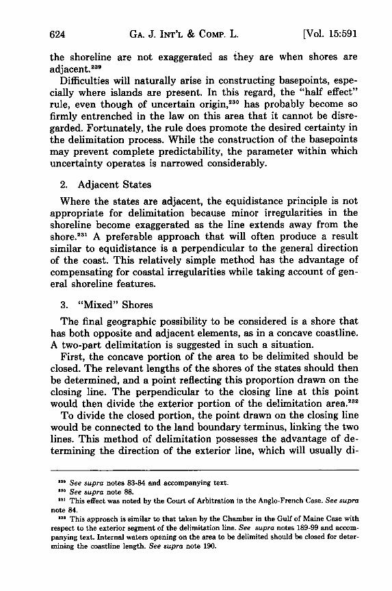
GA. J. INT'L & COMP. L.
the shoreline are not exaggerated as they are when shores areadjacent.
229
Difficulties will naturally arise in constructing basepoints, espe-cially where islands are present. In this regard, the "half effect"rule, even though of uncertain origin, 230 has probably become sofirmly entrenched in the law on this area that it cannot be disre-garded. Fortunately, the rule does promote the desired certainty inthe delimitation process. While the construction of the basepointsmay prevent complete predictability, the parameter within whichuncertainty operates is narrowed considerably.
2. Adjacent States
Where the states are adjacent, the equidistance principle is notappropriate for delimitation because minor irregularities in theshoreline become exaggerated as the line extends away from theshore.23' A preferable approach that will often produce a resultsimilar to equidistance is a perpendicular to the general directionof the coast. This relatively simple method has the advantage ofcompensating for coastal irregularities while taking account of gen-eral shoreline features.
3. "Mixed" Shores
The final geographic possibility to be considered is a shore thathas both opposite and adjacent elements, as in a concave coastline.A two-part delimitation is suggested in such a situation.
First, the concave portion of the area to be delimited should beclosed. The relevant lengths of the shores of the states should thenbe determined, and a point reflecting this proportion drawn on theclosing line. The perpendicular to the closing line at this pointwould then divide the exterior portion of the delimitation area.232
To divide the closed portion, the point drawn on the closing linewould be connected to the land boundary terminus, linking the twolines. This method of delimitation possesses the advantage of de-termining the direction of the exterior line, which will usually di-
220 See supra notes 83-84 and accompanying text.130 See supra note 88.2s This effect was noted by the Court of Arbitration in the Anglo-French Case. See supra
note 84.'3' This approach is similar to that taken by the Chamber in the Gulf of Maine Case with
respect to the exterior segment of the delimitation line. See supra notes 189-99 and accom-panying text. Internal waters opening on the area to be delimited should be closed for deter-mining the coastline length. See supra note 190.
624 [Vol. 15:591

MARITIME BOUNDARY DISPUTES
vide the greatest area, without reference to the end of the interiorsegment. Interior coast features are therefore not permitted to un-duly affect the direction of a line that is far from the coast.
V. CONCLUSION
For those who had hoped that the Chamber's delimitation in theGulf of Maine Case would provide guidance in constructingboundaries in the many disputed areas that remain throughout theworld, the opinion is likely to prove a disappointment. The stan-dard adopted by the Chamber basically allows the construction ofany line that the judges perceive to be fair, with the only limitbeing that the result may not be radically inequitable to eitherside. The certainty that might encourage other states to arbitratetheir similar disputes is lacking, and it appears unlikely that manynations will be amenable to binding arbitration under such circum-stances. Nonetheless, for Canada and the United States, the deci-sion does present the salutary resolution of a border in the dis-puted Gulf of Maine and permits the further development of aneconomically important area. Given the history of cooperation be-tween the two nations, it is unlikely that the decision reached willbe overwhelmingly unconscionable to either.
For the future, however, it is apparent that some method of con-sistency should be developed. While the methods of delimitationsuggested in this Note leave some room for variation, they providemore certainty than the judicial decisions have demonstrated. It isindisputable that no single method will provide a perfect solution;however, the establishment of concrete guidelines would at least bepreferable to the present state of unpredictability.
Marvin A. Fentress
1985] 625
