markscheme - bangkok patana school - the british international … · · 2009-10-26it is the...
TRANSCRIPT

MARKSCHEME
NOVEMBER 2005
GEOGRAPHY
Higher Level and Standard Level
Paper 2
N05/3/GEOGR/BP2/ENG/TZ0/XX/M
27 pages
IB DIPLOMA PROGRAMMEPROGRAMME DU DIPLÔME DU BIPROGRAMA DEL DIPLOMA DEL BI

– 2 – N05/3/GEOGR/BP2/ENG/TZ0/XX/M
This markscheme is confidential and for the exclusive use of examiners in this examination session.
It is the property of the International Baccalaureate and must not be reproduced or distributed to any other person without the authorisation of IBCA.
– 3 – N05/3/GEOGR/BP2/ENG/TZ0/XX/M
SECTION A
A1. Drainage basins and their management
Either
(a) Essay
Describe and evaluate the success of the water management strategies of one named drainage basin. [20 marks]
A drainage basin should be selected where there is more than one strategy and this is likely to be a multipurpose scheme.
The multipurpose function of the chosen management strategies should be described in some detail. It should be recognised that multipurpose basin management schemes aim to match water supply with demand from an increasing range of uses. Such multipurpose functions might include meeting domestic, industrial and agricultural demands as well as those from recreation, energy, transport and conservation. Flood and drought control may also be part of the strategy. Evaluation is an essential requirement of the question and should address the benefits and costs of the scheme from a variety of perspectives. These might include physical and human, local and national, short-term and long-term consequences. A maximum of [12 marks] should be awarded for a descriptive response showing no evaluation. Responses accessing the top markband should include detailed and accurate factual information concerning the specific multipurpose scheme chosen.
Marks should be allocated according to the markbands.
Examiners should be aware that candidates may take a different approach which, if appropriate, should be fully rewarded.
– 4 – N05/3/GEOGR/BP2/ENG/TZ0/XX/M
Or
(b) Structured question
(i) Explain the development of the fluvial landscape shown in each photograph (A and B). Use diagrams to illustrate your answer. [5+5 marks]
Marks should be equally allocated [5 marks + 5 marks] to each explanation of the two fluvial landscapes. In each case a neat and well-annotated sketch may substitute for some of the written explanation. Where diagrams are missing, a maximum of [3 + 3 marks] should be awarded.
Photograph A shows a braided river channel with a number of inter-connected channels separating the islands or eyots [2 marks]. The remaining [3 marks] should be allocated to the explanation of the development of this landscape. The best responses should include the following points:
Braiding is commonly found in rivers with variable discharge carrying a large sediment supply; typically areas of deserts, monsoon climate and snowmelt. When discharge is high, large sediment loads can be transported and when discharge is reduced, the river’s carrying capacity drops resulting in deposition and the formation of eyots.
Photograph B shows a floodplain with a sinuous or meandering river channel [2 marks]. Meanders are promoted by pool and riffle sequences and helicoidal flow. Typically, they migrate resulting in a broad and flat floodplain and features such as ox-bow lakes and meander scrolls [3 marks].
(ii) Using examples, explain how human activity affects the risk of river floods in low lying areas. [10 marks]
Responses should focus on the flooding risk in low lying areas such as flood plains, although the human activity may be located upstream. To move beyond band F a response will take a broad perspective by recognizing that humans can inadvertently increase or deliberately reduce the risk of flooding. Activities which increase the risk might include land use changes in the basin such as urbanization, deforestation, and farming; all which can reduce lag time. Deliberate attempts to reduce this risk might include mitigation strategies such as structural engineering (damming, channel straightening and widening, wing-dykes and levees). In addition, or alternatively afforestation of the drainage basin may address the problem or the river may be left to meander naturally and intense occupation of flood plains avoided. It is expected that candidates will show an understanding of the interaction between humans and the various hydrological processes of a typical drainage basin.
Where examples are entirely missing, responses should not move beyond band E.

– 5 – N05/3/GEOGR/BP2/ENG/TZ0/XX/M
A2. Coasts and their management
Either
(a) Essay
Wave action is the main cause of coastal landforms. Discuss this statement and use examples in your answer. [20 marks]
There should be some detailed discussion of marine activity, but also recognition that coastal landforms result from a range of other interacting forces and factors.
The discussion of marine activity should show an understanding of the factors responsible for a variation in wave energy such as fetch, weather conditions, prevailing wind direction, water depth and coastal alignment and the ways that they produce high and low energy coastlines. Wave characteristics and energy levels should also be linked to erosion and deposition and the coastal features resulting from these processes. Responses should acknowledge that coastal features at any particular location are a response to a range of interacting marine and non-marine factors. The latter includes: coastal orientation, sub-aerial processes on the cliff face, geological resistance and human activity. Human activity may be particularly influential in modifying the action of waves in order to protect coastlines from flooding and erosion.
Examples should be used throughout to illustrate specific processes and landforms.
Candidates discussing only wave action or who fail to use examples should not move beyond band E.
Marks should be allocated according to the markbands.
Examiners should be aware that candidates may take a different approach which, if appropriate, should be fully rewarded.

– 6 – N05/3/GEOGR/BP2/ENG/TZ0/XX/M
Or
(b) Structured question
(i) Choose two of the coastal landforms labelled on the diagram and explain their formation. Illustrate your answer with diagrams. [2+2 marks]
Candidates are expected to explain the formation of their chosen features by discussing the relevant processes involved and the stages in development using well-labelled diagrams.
Sand bar – is formed by the action of breaking waves redistributing sediment into an off-shore sand ridge.
Sea arch – is formed by abrasion and / or hydraulic action upon both sides of a headland, exploiting areas of least resistance in the rock face.
Sea stack – is a further development of an arch involving roof collapse. Sand spit – is formed by the action of longshore drift and changing orientation of the
coastline allowing the growth of deposition across an inlet. Sand-dunes – are comprised of parallel ridges of wind-blown sand that shows evolution
from embryo dunes through to mature dunes and blow-outs.
(ii) Explain the causes of coastal submergence and emergence. [2+2 marks]
An explanation for each process [2 + 2 marks] should include the following points for full marks:
Submergence involves initial depression of the land by ice followed by eustatic rise of sea level when the ice melts and subsequent slow isostatic recovery resulting in coastal emergence. An accurate and detailed explanation of each process in terms of post-glacial changes is sufficient for full marks. Other processes may be involved such as tectonic adjustments and the subsidence of low-lying, heavily sedimented estuaries (Ganges). These latter processes should receive credit, but are not essential given the low mark weighting of this question.
(iii) Briefly explain the formation of one coastal landform that results from coastal submergence and one that results from coastal emergence. [2+2 marks]
Submergent features would include rias, fjords, fjards and Dalmatian coastlines. Emergent features would include raised beaches, platforms, cliff lines and other relict features.
In the case of the chosen features, the mark allocation should be evenly weighted for description and explanation [2 + 2 marks].
– 7 – N05/3/GEOGR/BP2/ENG/TZ0/XX/M
(iv) Using examples, evaluate the effectiveness of “soft”* coastal management strategies. [8 marks]
“Soft” methods of coastal management are designed to manipulate natural processes such as the inputs and outputs of sediment and energy. They are also non-intrusive, aesthetically pleasing, non-polluting, they maintain biodiversity and avoid the use of hard engineering. They may include beach recycling and nourishment, the protection of mangroves, the re-vegetation of sand dunes and cliff faces, and other techniques. A passive policy of managed retreat may be adopted where coastal populations and demand for land are low.
The responses should be evaluative and involve analysis of both the benefits and the costs of such environmentally sensitive, soft strategies. A one-sided discussion which lacks evaluation, or one that lacks examples, should receive a maximum of [5 marks].
* “Soft” strategies are strategies that do not involve major engineering or construction work.

– 8 – N05/3/GEOGR/BP2/ENG/TZ0/XX/M
A3. Arid environments and their management
Either
(a) Essay
Competition for water is a major cause of international conflicts in arid areas. Using examples, explain why such conflicts exist. [20 marks]
In their responses, candidates would be expected to consider the main issues that underlie conflicts arising from competition for water in arid regions.
A principal issue is the discrepancy between supply and demand in areas of water deficit. This arises from rapid population growth, economic development and increasing affluence, all of which have resulted in the controversial building of dams and abstraction of surface and groundwater. Another issue relates to the difficulties that arise in attempting coordinated management and legislation of drainage basins in regions where countries of differing political and religious backgrounds fight for access to the supplies of water.
Examples covered could include the conflict between Iraq, Syria and Turkey over the Euphrates and the disputes and wars in the Middle East over the waters of the River Jordan and the aquifer beneath the West Bank and Gaza Strip. Tensions are also more likely where the mouth of the river is in a relatively dry area of high demand and the source in an area of low demand such as the Nile.
A good essay could conclude on the increasing severity of the water crisis in the arid and less developed world as demand outstrips supply and competition between countries intensifies.
Marks should be allocated according to the markbands, although responses lacking developed examples should not move beyond band E.
Examiners should be aware that candidates may take a different approach which, if appropriate, should be fully rewarded.
– 9 – N05/3/GEOGR/BP2/ENG/TZ0/XX/M
Or
(b) Structured question
(i) Identify and briefly describe the climatic factors labelled A and B on the diagram. [2+2 marks]
A – intense rainstorms, infrequent but very heavy, can cause flash floods and rapid erosion [2 marks].
B – large variation in temperature, resulting from high insolation during the day and radiation at night due to clear skies [2 marks].
(ii) Using diagrams, explain the formation of one desert landform caused by strong winds and one desert landform caused by weathering. [8 marks]
Landforms caused by strong winds might include those formed by deposition such as dunes (seifs and barchans) or those formed by abrasion such as pedestal rocks or undercut rock faces (zeugen and yardangs) [4 marks].
Landforms caused by weathering might include exfoliation domes and scree or talus deposits [4 marks].
(iii) Using examples, explain why there are high concentrations of people in some desert areas. [8 marks]
Candidates should refer to specific examples, which are clearly located and in each case explain the reason for the attraction to the area. High concentrations implies settlement in the form of towns or cities; nomadic pastoralism would not qualify. Valid examples might include the following reasons.
• Areas where mineral deposits have attracted people such as oil in the Middle East or diamonds in Namibia.
• Areas where rivers cross the desert allowing irrigation such as the Nile valley or along the Colorado and Jordan Rivers.
• Areas where there are oases or water can be obtained from aquifers such as Touggourt in Algeria.
• Areas that attract tourists such as Arizona and Colorado, the Dead Sea, the Nile Valley and various coastal resorts including Dubai in UAE. The film industry has brought temporary concentrations of people in areas such as Death Valley, California and the Tunisian Sahara.
• Areas of retirement in the Sunbelt of South West USA, particularly the ‘oasis cities’ – Phoenix Arizona, Las Vegas in Nevada and Palm Springs in California, where the healthy climate is attractive to the elderly.
• Areas of manufacturing industry producing high-tech products and defence equipment associated with military installations in Arizona and Colorado.
For full marks responses should refer to a wide range of reasons for concentrations of people, although not necessarily covering all those mentioned above. A maximum of [5 marks] should be awarded if examples are missing.
The marks should be allocated according to the markbands.
– 10 – N05/3/GEOGR/BP2/ENG/TZ0/XX/M
A4. Lithospheric processes and hazards
Either
(a) Essay
Using examples, examine the long-term socio-economic and environmental consequences of earthquake and volcanic activity. [20 marks]
The focus of this essay is broad allowing for some flexibility in the interpretation. However, there are some restraints and the best responses will acknowledge the key terms in the title. These include “long-term” meaning several weeks to several years after the event, and “socio-economic and environmental consequences”, which should be clearly differentiated.
Long-term negative consequences can be common to both hazards and include:Personal / socio-economic – loss of livelihood, home, possessions, bereavement.
National / economic – loss of revenue, cost of reconstruction and mitigation strategies. Environmental – loss of wild-life and habitats and atmospheric cooling by volcanic dust.
Long-term positive consequences are limited to volcanic activity and include: Fertile soil, building materials (ignimbrite and granite), minerals, geothermal energy and
tourism. Positive consequences of earthquakes are insignificant.
Candidates accessing the top markbands should present a logical sequence of ideas covering a range of consequences including positive and negative, socio-economic and environmental. They should refer to consequences on a range of scales in space (local to global) and time (weeks to years). They should also support their answers with clearly located and relevant case studies. At best, they should draw conclusions, which might focus on the relative severity of earthquake and volcanic impacts or the relative vulnerability of societies who experience the effects. Responses that omit examples may not move beyond band E and responses that generalize or simply describe the consequences with limited examination may not move beyond band F. No credit should be given for immediate effects such as ground shaking and building collapse or lava flows.
The marks should be allocated according to the markbands.
Examiners should be aware that candidates may take a different approach which, if appropriate, should be fully rewarded.

– 11 – N05/3/GEOGR/BP2/ENG/TZ0/XX/M
Or
(b) Structured question
(i) Name the variables X and Y shown on the diagram. [2 marks]
X – speed of movement [1 mark], Y – moisture availability or possibly the risk posed to humans [1 mark].
(ii) Examine the importance of temperature change in two of the mass movement processes shown on the diagram. [2+2 marks]
Relevant examples of mass movement processes responding to temperature change would include two of the following:
avalanches – resulting from short-term temperature change producing snow-pack instability [2 marks];
rockfalls and solifluction both result from more long-term cyclical changes associated freezing and thawing [2 marks].
(iii) Identify and describe three natural* types of weathering that help to cause mass movement processes. [6 marks]
The most likely response will identify the three broad types of weathering: chemical, mechanical and biological and a description of how each process can help either to decompose or disintegrate rock structures (or both) making them more unstable and liable to move downslope under the force of gravity. A maximum of [2 marks] should be allocated to each description. Other acceptable approaches might be adopted which identify weathering sub-types such as freeze-thaw. There are several possibilities, but each type needs to be clearly identified, distinct, and linked to mass movement.
* Natural types of weathering are types of weathering that do not result from human activity.
– 12 – N05/3/GEOGR/BP2/ENG/TZ0/XX/M
(iv) Using examples, examine the ways that humans can influence weathering and mass movement processes. [8 marks]
The term “influence” should be broadly interpreted to cover both cause and remedy. Humans can increase chemical weathering processes by acidification of precipitation, but they can also consciously reverse this process by measures such as reducing fossil fuel emissions and liming.
Humans increase the risk of mass movement by slope clearance, steepening of gradient, road and house-building, traffic vibration, dynamite explosions, and adding weight to the slope. They can also reduce the risk by mitigation measures such as avoiding construction on slopes, regrading, afforestation, drainage and structural methods of slope stabilisation.
The marks need not be allocated evenly between the discussion on weathering and that on mass movement processes, but omission of either would limit the response to a maximum of [5 marks]. Similarly, where there is no recognition that humans can both cause and remedy these processes, a maximum of [5 marks] should be awarded.
Ensure that there is no double crediting of weathering in parts (iii) and (iv).
– 13 – N05/3/GEOGR/BP2/ENG/TZ0/XX/M
A5. Ecosystems and human activity
Either
(a) Essay question
With reference to one ecosystem at any scale, describe how it has been altered by human activity. Discuss the importance of conserving it for future generations. [20 marks]
The chosen ecosystem should be named and located. Some indication of its scale should be given.
In order to explain how it has been altered by human activity, a clear description of the ecosystem in its natural state of dynamic equilibrium should be given. This should refer to the interactions of vegetation and soil as well as the influence of animals, where relevant. It would also be appropriate to discuss other influential factors such as climate, aspect and drainage, where relevant. The structure of the vegetation should be clearly described.
Reasons for the alteration of the ecosystem should be stated and the human activities that have caused this should be described. The effects of human activity should be outlined in terms of the changes to the vegetation structure and soil, the biomass and, where relevant, nutrient cycling. The structure of the resultant vegetation should be described and the effects on the fauna might also be included.
Responses should then give a short, balanced argument addressing the advantages and disadvantages of conservation of the ecosystem in terms of its value to humans in its natural state, compared to that in its altered state.
Generalized responses which fail to draw on one specific and named example to illustrate the argument, should not move beyond band E. Descriptive accounts which fail to discuss the importance of conservation should not move beyond band F.
The marks should be allocated according to the markbands.
Examiners should be aware that candidates may take a different approach which, if appropriate, should be fully rewarded.
– 14 – N05/3/GEOGR/BP2/ENG/TZ0/XX/M
Or
(b) Structured question
(i) Referring to the ecosystems shown in the table, describe the relationship between NPP and biomass. [4 marks]
Responses should note that there is in general a positive correlation between NPP and biomass with forest having the highest NPP and biomass, followed by grasslands with lower NPP and biomass and finally tundra and deserts with very low NPP and biomass [2 marks]. Some quantification should be given as evidence for this [1 mark]. Swamps and marshes and estuaries are anomalies with very high NPP and low biomass. This should be supported by data from the table for [1 mark].
(ii) Select one ecosystem with NPP below 3500 kcals / m2 / year and account for this value. [6 marks]
Responses could include savanna, temperate grasslands, tundra or desert [1 mark]. The NPP level should be stated [1 mark]. Reasons for the NPP level will relate mostly to annual temperature and precipitation patterns and some indication of the climax vegetation should be given [1 mark].
Depending on the ecosystem chosen, an appreciation of the effects of factors such as evapotranspiration, length of the growing season, the effects of fire and soil moisture content should be taken into account. Very good responses might refer to the seasonal water balance [3 marks].
(iii) Examine the positive and negative impacts of agriculture on a forest ecosystem that you have studied. [10 marks]
The chosen forest ecosystem should be clearly stated and located. Responses should briefly describe the structure of the ecosystem and its soils. The impact of agriculture should be evaluated in terms of the effects of removal of the forest on the vegetation, biomass, soils and nutrient cycling, the removal of nutrients from the system, biodiversity, energy transfer and NPP (which may actually increase under some types of intensive farming). The type of agriculture (permanent or shifting cultivation, intensive or extensive, commercial or subsistence) will determine the intensity and duration of the impact. Responses might refer to agro-forestry as having fewer impacts on the ecosystem.
It is important that responses make some assessment rather than just describe the impacts to move beyond band F. This means that some level of judgment needs to be made about the severity of the impacts in terms of the level of destruction of the ecosystem and its potential for recovery.
The marks should be allocated according to the markbands.

– 15 – N05/3/GEOGR/BP2/ENG/TZ0/XX/M
A6. Climatic hazards and change
Either
(a) Essay question
Describe how oceanic and atmospheric conditions change during El Niño events. Examine the consequences of El Niño events. [20 marks]
Initially, responses are expected to address the causes of these events. The explanation should show an understanding of oceanic/atmospheric interactions (ENSO) focusing on the equatorial Pacific. A well-drawn and labelled map could attract up to [5 marks].
The second part should present an analysis of the relevant severity of the physical hazards involved. These hazards include flooding, landslides, drought, fire and ecological disturbance. The severity of their impact depends largely upon the scale and duration of the hazard and also the level of response of those (mostly poor) people living in the affected areas. To access the top markbands G and H there should be reference to more than one event, a wide range of short and long-term, positive and negative consequences for the equatorial Pacific and beyond (through teleconnections). Descriptive responses to this section which avoid analysis and fail to include a specific event, should not move beyond band E.
The marks should be allocated according to the markbands.
Examiners should be aware that candidates may take a different approach which, if appropriate, should be fully rewarded.

– 16 – N05/3/GEOGR/BP2/ENG/TZ0/XX/M
Or
(b) Structured question
(i) Referring to the satellite image and the table above, estimate the date when the satellite image was taken and briefly explain how you determined this date. [2 marks]
There are two possible dates – September 14 or September 15; either date is acceptable for [1 mark]. These dates correspond to the approximate position of the centre of the storm on the satellite image at 67° / 68° West and 23° / 24° North [1 mark].
(ii) Draw a labelled sketch of this hurricane identifying three features that are visible on the satellite image. [4 marks]
The three features might include: the eye, the eye-wall, dense cumulonimbus clouds, peripheral wispy cirrus cloud, counter-clockwise rotation and other possibilities. Award [1 × 3 marks] for visible and accurately located features, and [1 mark] for a well-drawn and labelled sketch.
(iii) Describe and briefly explain the changing relationship between surface air pressure and surface wind speeds between 06 September and 18 September. [4 marks]
Award [1 mark] for an accurate description of the changes in both pressure and wind speed and [1 mark] for the negative nature of the relationship. A brief explanation for the changes in the pressure and wind relationship should be given which shows an understanding of the following processes: the release of latent heat by condensation, falling surface pressure and the convergence of surface air resulting in increasingly strong winds as the system grows [1 mark]. Later, when air pressure rises, due to a reduction in the supply of warm oceanic water and a reduction in energy, wind strength falls [1 mark].

– 17 – N05/3/GEOGR/BP2/ENG/TZ0/XX/M
(iv) Referring to contrasting examples, discuss human responses to hurricanes. [10 marks]
Answers should identify the nature of the hurricane hazard, its primary effects such as storm surges, wind and heavy rain and secondary effects such as flooding, environmental destruction, homelessness and economic disruption.
Discussion should recognise that human responses to hurricanes attempt to reduce the risk and vulnerability of society to the hazards. The level and type of response depends upon the wealth and technological ability of the country concerned and the strategies adopted may be long-term and short-term, internal and external. Mitigation methods might include monitoring, tracking, warning, education, insurance and structural reinforcement in the case of more economically developed countries with adequate funding. In the case of less economically developed countries, the internal response may be more limited and might include less technological solutions such as building of shelters, warning systems or even fatalistic and passive responses. External responses in the form of foreign aid would also be a valid discussion point.
It is essential that the discussion includes examples of hurricane prone areas or countries that are sufficiently contrasting in their level and type of response to the hazard. The examples chosen are most likely to be countries of contrasting levels of economic development. However, there are other possibilities such as the short-term response of two areas or countries to hurricane events of different magnitude.
Responses lacking examples should not move beyond band E and purely descriptive accounts should not move beyond band F.
The marks should be allocated according to the markbands.

– 18 – N05/3/GEOGR/BP2/ENG/TZ0/XX/M
SECTION B
B7. Contemporary issues in geographical regions
Either
(a) Essay question
One definition of a region is “an area of the earth’s surface differentiated (from adjoining areas) by one or more features or characteristics which give it a measure of unity.”
To what extent do you agree with this definition? Refer to any two named regions of similar scale in your answer. [20 marks]
Responses should discuss the concept of regional geography in the context of any two regions studied. (The subject guide requires the study of two regions of similar scale). It is probable that most responses will accept the definition, but if they suggest an alternative that works well for their chosen regions, then full credit should still be available. Responses should discuss each region in some depth, examining both the characteristics that make each region unique and how these characteristics can be utilized to determine the spatial boundaries of each region. The use of sketch maps is not obligatory, but the better responses are likely to use them to show the boundaries and characteristics of their chosen regions. The details of the discussion will vary, depending on the regions selected.
To move beyond band F reference must be made to the validity of the definition provided. Responses that discuss two regions of dissimilar scale will be likely to be self-penalizing and no special action is required on the part of the examiner.
The marks should be allocated according to the markbands.
Examiners should be aware that candidates may take a different approach which, if appropriate, should be fully rewarded.
– 19 – N05/3/GEOGR/BP2/ENG/TZ0/XX/M
Or
(b) Structured question
This question examines the reasons for alternative regional divisions of part of France. No specific knowledge of France is required to answer any part of the question.
(i) Referring to the maps, distinguish between the terms functional region and multi-feature region. [2 marks]
Functional regions are defined by “their combination of economic activities” [1 mark], whereas multi-feature regions are defined by “several characteristics, usually a combination of physical and human” [1 mark] (quoting from the subject guide). Some responses may adopt an alternative definition of functional regions as the non-overlapping spatial territories of a particular service (for example, the functional regions of certain real estate companies are non-overlapping areas, each served by a particular office or franchise). Either definition of functional region is acceptable.
(ii) Describe, and attempt to explain, the influence of physical features (shown on Map 1) on the form of the regions of north-west France (shown on Map 3). [4 marks]
Responses would be expected to note that there is a relationship between the functional regions and the physical geography of the area, particularly with drainage basins [1 mark]. The remaining [3 marks] should be allocated to a development of this statement and a more careful analysis, noting, for instance, that the relationship is stronger in the northern regions, that Rennes does not easily fit the pattern as its southern border follows the river Loire, rather than a watershed, and that Angers also has a river border.
(iii) Draw a large, neatly annotated map to show the distinctive geographical features of your local region. [7 marks]
Marks should be awarded for general accuracy of the region’s limits [1 mark], locational details [1 mark], and the inclusion of some indication of scale and orientation [1 mark]. Clearly marked (or annotated) physical features such as coasts, rivers, highland/lowland areas, political or administrative boundaries, should be awarded a further [3 marks] and the remaining [1 mark] should be awarded for neatness and overall impression.

– 20 – N05/3/GEOGR/BP2/ENG/TZ0/XX/M
(iv) To what extent can the concept of distance decay be used to define the extent of your local region? [7 marks]
Responses should clearly define the characteristic(s) that make the candidate’s local region distinctive and demonstrate how distance decay can be applied to one or more of these characteristics in order to delineate the region. The factors chosen for discussion will vary from region to region; credit should be awarded for any plausible response, bearing in mind that the concept of distance decay is most likely to be applicable when the factor chosen can be readily quantified. The degree to which distance decay can be used to define the local region will depend on the region discussed. It may be appropriate for some responses to conclude that distance decay can not be used to define their region. If no assessment is made, the response may not be awarded more than [4 marks].

– 21 – N05/3/GEOGR/BP2/ENG/TZ0/XX/M
B8. Settlements
Either
(a) Essay question
Describe and explain the causes and consequences of recent changes in the location of shops and offices in large urban areas in MEDCs. Use at least two examples in your answer. [20 marks]
There are two elements in this question, both of which need to be addressed but the emphasis may vary. These are the changes in shop and office location and the resulting consequences. The discussion may integrate these three elements; a variety of approaches to this question are likely. At least two specific examples of large urban areas should be included and where these are missing the marks allocated should not move beyond band E.
A description and explanation for the following changes to retailing and offices should be included:
Retailing changes since 1970 (in many MEDCs) have initially involved the decentralization of food shops, followed by DIY and furniture in the 1980s and the development of large out-of-town regional shopping centres. Decentralization has been a response to rising CBD land values and greater mobility of the population. This has resulted in the decline of the CBD and, in the 1990s, its subsequent revival. This has been achieved through the development of new large-scale retailing centres in the CBD or near its edge. Changes in retailing have also involved convenience stores in the outer urban area. This zone has witnessed the closure of many neighbourhood shops and the opening of chain convenience ‘metro’ stores often attached to petrol stations.
Traditionally, offices were located on the edge of the CBD where they had access to other services, customers and workers. However, CBD locations have become less attractive due to high costs and congestion. Decentralization has occurred recently resulting in the development of suburban business parks offering economies of scale and better accessibility. A further change has been the relocation of offices to brown-field sites in inner urban areas in response to the problem of inner city decline.
Decentralization of both retailing and offices has brought a number of problems. These include the decline of the CBD, suburban traffic pollution, urban sprawl and the exclusion of non-car drivers. Inner city office revival, in the case of prestigious projects such as the London Docklands, has been successful financially, but socially exclusive.
The marks should be allocated according to the markbands.
Examiners should be aware that candidates may take a different approach which, if appropriate, should be fully rewarded.
– 22 – N05/3/GEOGR/BP2/ENG/TZ0/XX/M
Or
(b) Structured question
(i) Identify and briefly describe four of the residential relocations shown in the diagram. [4 marks]
For [4 marks] the relocation process could be identified by name as given below, but must also be described.
• Counter-urbanization (relocation 1) • Suburbanization (relocations 2 and 4) • Social segregation (relocation 3) • Relocation from inner city to edge of town housing estate (relocation 4) • Gentrification or reurbanization (relocation 5) • Intra-urban relocation (relocations 2, 3 and 4).
(ii) Draw a labelled diagram showing land use in a LEDC city. [6 marks]
The diagram might represent a land-use model or actual land use in a specified city; either approach is acceptable, but a diagram showing only relocation should receive a maximum of [3 marks].
(iii) Discuss the effects of transport on urban land-use patterns. You should refer to at least one example of a named city in your answer. [10 marks]
The approach to this question may vary and credit should be given for an historical discussion as well as one that emphasizes more recent effects of transport on urban land use. Responses may refer to the centrifugal movement of people, resulting in the development of suburban residential areas initially in many MEDC cities. This may have been accompanied or followed by the outward movement of manufacturing industry especially along accessible radial routes leading out of the centre. More recently, peripheral motorways and major roads around large urban areas have attracted both retailing and services around their intersections and junctions. Disillusionment with commuting and suburban living in more affluent countries has led to some centripetal movement back towards the city. Urban regeneration and the development of new prestigious and affluent districts close to the centre are typical developments in MEDCs. In LEDCs national and regional transport systems have stimulated the influx of migrants to the suburbs from outside. Within urban areas radial routes have attracted various commercial activities. The discussion should be factual and accurate, acknowledging specific changes in transport and corresponding land-use patterns; reference to both MEDC and LEDC cities is not essential. Generalized responses making no reference to a named city should not move beyond band E.
As the question requires “at least one example”, candidates are not required to give more than one. If candidates use more than one example, they should be rewarded equally, for quality and not for the quantity of examples.
The marks should be allocated according to the markbands.
– 23 – N05/3/GEOGR/BP2/ENG/TZ0/XX/M
B9. Productive activities: aspects of change
Either
(a) Essay question
Evaluate the positive and negative impacts of the industrialization of agriculture (agribusiness) in either LEDCs or MEDCs. [20 marks]
Candidates should define “the industrialization” of agriculture in terms of artificial inputs such as energy subsidies, mechanization, biotechnology and the integration of operations by large companies [2 marks]. The impacts listed below are a framework to be developed by candidates.
Relevant positive impacts might include: • greater food production through improvements in husbandry and crop production • economic improvements by investment from government or a TNC • diversification of land use • the acquisition of new skills and knowledge in agricultural production.
Relevant negative comments might include: • underemployment of local people as mechanization replaces human labour • degradation of soils by wind erosion and agro-chemicals • eutrophication of water courses by fertilisers • poisoning of groundwater by pesticides • replacement of food crops by cash crops.
Responses which are generalized and do not include examples or one that is unconvincing should not move beyond band F. Responses accessing the top markbands should include a wide range of environmental, economic and social impacts; both negative and positive. Case study information should be factual and accurate.
The marks should be allocated according to the markbands.
Examiners should be aware that candidates may take a different approach which, if appropriate, should be fully rewarded.
– 24 – N05/3/GEOGR/BP2/ENG/TZ0/XX/M
Or
(b) Structured question
(i) Describe the trends in the graph. [4 marks]
The description should recognize three distinct trends: the increasing number of different modes of transport [1 mark], the replacement of some modes by others [1 mark], the increase in mean speeds of all transport modes [1 mark]. Relevant data should be quoted from the graph [1 mark]. Credit may be given for alternative valid points.
(ii) Examine the ways in which developments in transport and information communications technology (ICT) have reduced the friction of distance. [6 marks]
New, faster and competing modes of transport have allowed for increased bulk transport and reduced costs. Developments with ICT have diminished the friction of distance still further by allowing access to remote places. Specific types of transport and communication technologies should be examined.
Responses should show a clear understanding that a reduction in the “friction of distance” has meant an increase in accessibility on all scales [2 marks]. The allocation of the remaining [4 marks] need not be evenly spread between the transport and ICT parts of the response, but if only one part is discussed, a maximum of [2 marks] should be awarded.
(iii) Discuss the factors (other than transport and ICT) that have caused a global shift in the distribution of manufacturing industry during the last 30 years. You should refer to at least one type of manufacturing industry in your answer. [10 marks]
The growth and spread of TNCs have been fundamental to the global shift, but this process has been assisted by other factors including: access to cheaper raw materials, a compliant and cheap labour force, the liberalization of trade, tax incentives, and freedom from strict pollution controls on manufacturing. Candidates may cite other valid reasons. Responses lacking reference to a type of manufacturing industry, should not move beyond band E. As the question requires “at least one example”, candidates are not required to give more than one. If candidates use more than one example, they should be rewarded equally, for quality and not for the quantity of examples.
The marks should be allocated according to the markbands.

– 25 – N05/3/GEOGR/BP2/ENG/TZ0/XX/M
B10. Globalization
Either
(a) Essay question
Explain how world economic activity has become increasingly integrated. Refer to examples in your answer. [20 marks]
The essay needs to focus on economic activity on a global scale and the nature of integration. The broad interpretation of ‘how’ should include a description of the means by which it has been occurring. A clear understanding of the terms ‘economic activity’ and ‘integrated’ should be shown and accompanied by valid examples.
The features of economic integration include the free flow of people, goods and capital between nations. This is dominated by the integrated global production systems of TNCs, global markets and global finance. International organizations such as the IMF, World Bank and World Trade Organization contribute to the integration of economies by encouraging the liberalization of trade and the free movement of capital. The process of integration has also been facilitated by development of trading blocs, international trade agreements and the technological improvements in transport and communications. Good responses achieving band F and above should be able to explain the majority of these features citing specific cases of types of economic activity involved. Essays lacking examples and case studies should not move beyond band E.
The marks should be allocated according to the markbands.
Examiners should be aware that candidates may take a different approach which, if appropriate, should be fully rewarded.
– 26 – N05/3/GEOGR/BP2/ENG/TZ0/XX/M
Or
(b) Structured question
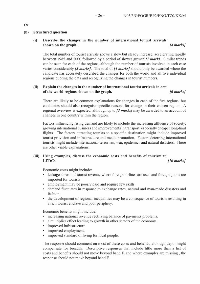
(i) Describe the changes in the number of international tourist arrivals shown on the graph. [4 marks]
The total number of tourist arrivals shows a slow but steady increase, accelerating rapidly between 1985 and 2000 followed by a period of slower growth [1 mark]. Similar trends can be seen for each of the regions, although the number of tourists involved in each case varies considerably [3 marks]. The total of [4 marks] should only be awarded where the candidate has accurately described the changes for both the world and all five individual regions quoting the data and recognizing the changes in tourist numbers.
(ii) Explain the changes in the number of international tourist arrivals in one of the world regions shown on the graph. [6 marks]
There are likely to be common explanations for changes in each of the five regions, but candidates should also recognise specific reasons for change in their chosen region. A regional overview is expected, although up to [3 marks] may be awarded to an account of changes in one country within the region.
Factors influencing rising demand are likely to include the increasing affluence of society, growing international business and improvements in transport, especially cheaper long-haul flights. The factors attracting tourists to a specific destination might include improved tourist provision and infrastructure and media promotion. Factors deterring international tourists might include international terrorism, war, epidemics and natural disasters. There are other viable explanations.
(iii) Using examples, discuss the economic costs and benefits of tourism to LEDCs. [10 marks]
Economic costs might include: • leakage abroad of tourist revenue where foreign airlines are used and foreign goods are
imported for tourists • employment may be poorly paid and require few skills. • demand fluctuates in response to exchange rates, natural and man-made disasters and
fashion. • the development of regional inequalities may be a consequence of tourism resulting in
a rich tourist enclave and poor periphery.
Economic benefits might include: • increasing national revenue rectifying balance of payments problems. • a multiplier effect leading to growth in other sectors of the economy. • improved infrastructure. • improved employment. • improved standard of living for local people.
The response should comment on most of these costs and benefits, although depth might compensate for breadth. Descriptive responses that include little more than a list of costs and benefits should not move beyond band F, and where examples are missing , the response should not move beyond band E.

– 27 – N05/3/GEOGR/BP2/ENG/TZ0/XX/M
SECTION C
C11. Topographic mapping
(a) Name the two places A and B shown on the photograph and the map. [1+1 marks]
A – Dziani Dzaha, B – Labattoir.
(b) Using the map, give the grid reference for point C shown on the photograph. [1 mark]
The grid reference is 306 (7) 837 (8). Allow for error as indicated.
(c) Using the map and the photograph, describe the physical landscape of the island of Petite-Terre. [5 marks]
The contrasts in relief should be described between the west and east of the island including recognition of specific landforms such as eroded volcanic craters and various coastal features [3 marks]. Responses which show an appreciation of the contrasting morphology, without these references to specific volcanic or coastal features should receive [2 marks]. Further description may refer to drainage and vegetation characteristics [2 marks].
(d) Describe the transport network shown on the whole area of the map and identify the factors that influence it. [5 marks]
The road network of the mainland is mainly linear, following the eastern coastline with a few minor tracks inland [1 mark]. On Petite-Terre it shows a similar linear pattern with a main road following the western coastline, but there is a more complex network of internal minor roads [1 mark]. The principal factors influencing the network would include the constraint of high, wooded relief in the interior of the mainland and the east side of Petite-Terre [1 mark] and the relative ease of road construction on the narrow coastal islands where settlements are found [1 mark]. A further [1 mark] could be allocated to any other relevant comments, such as the island location of Petite-Terre, which requires a ferry connection to the mainland. Mention of the airport is only relevant if linked to the road system.
(e) Compare and contrast Plages de Moya (31 87) with the headland at Ironi Be (20 81) as potential locations for a large-scale hotel complex. [7 marks]
It is expected that most responses would refer to Plages de Moya as being located in an attractive area within the eroded volcanic cone, highly accessible from airport, but not from anywhere else, while Ironi Be is on an easily accessible headland. Both are the same distance from main town, but that the former requires a ferry connection, while the latter is on the main road. Both would face east and have good sea views, but the characteristics of their beaches would differ: the one at Plages de Moya being uncovered only at low tide with more difficult access to deeper water, as opposed to Ironi Be where both the beach and deeper water are more accessible.
Valid factors should be credited, but no more than [5 marks] should be awarded if there is no attempt at comparing and contrasting.