mcidas-v : it’s more than just a great application for satellite meteorology tommy jasmin 10 sep...
TRANSCRIPT

McIDAS-V : It’s More Than Just aGreat Application for Satellite Meteorology
Tommy Jasmin
10 Sep 2013
University of WisconsinSpace Science and Engineering Center

Today’s Topics
McIDAS-V Applied to:
• Planetary Science• Education• Socioeconomic Data• Archaeology• GIS Mashups

Venus Express Data in McIDAS-V

Education Section Lead-In
Geospatial Grand Challenges
• Poverty, Disease, Food and Water• Natural Disasters• Environmental Sustainability• Population Growth
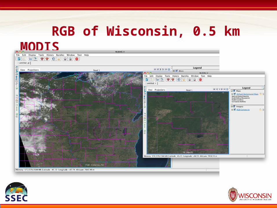
RGB of Wisconsin, 0.5 km MODIS
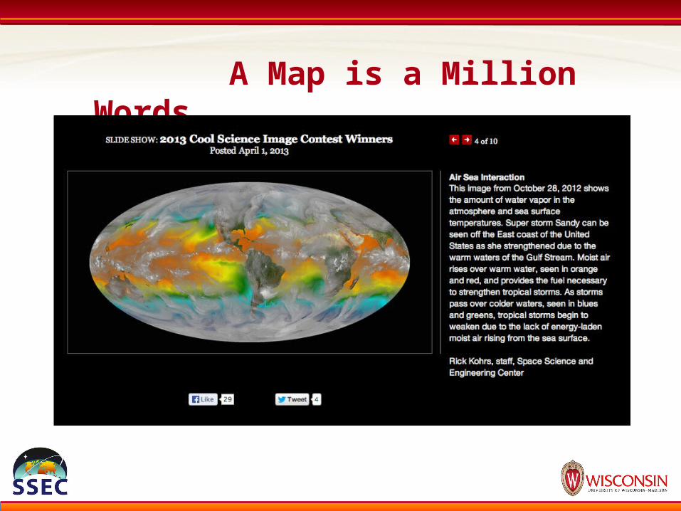
A Map is a Million Words

Velocity of Climate Change
Loarie, et al: Nature, 2009

Socioeconomic Data Lead-In

VIIRS vs. DMSP – Denver, CO

World Population

DNB Clipped to State Boundaries in QGIS

State Population vs. Sum DNB Radiance

CO2 Emissions vs. Sum DNB Radiance

Archaeology Lead-In

Remote Sensing and Archaeology

Mashups Lead-In
Current Accumulation Rate forGeoreferenced Data?
IMO: one of the next big waves of technological innovation will be a direct result of “mixing and matching” Earth-located data in new, novel ways.
McIDAS: First geo-data mashup?

Mashups – Wolf habitat in WI
Linear regression modelDependent variable: wolf pack rangesIndependent variables: human population, prey density, roads, land cover type, land ownership, and more
Wide variety of geospatial data types, sources, and formats used

Wolf Pack Probability Map
What was the biggest factor?

GPS Data in McIDAS-V?
Whale Shark migration route from KML file

Closing Clip: Superstorm Sandy