memoirs of the queensland museum (issn 1440-4788)/media/documents/qm/about+us/publications/... ·...
TRANSCRIPT

MEMOIRS OF THE
QUEENSLAND MUSEUM BRISBANE
© Queensland Museum PO Box 3300, South Brisbane 4101, Australia
Phone 06 7 3840 7555 Fax 06 7 3846 1226
Email [email protected] Website www.qm.qld.gov.au
National Library of Australia card number
ISSN 0079-8835
NOTE Papers published in th is volume and in all previous volumes of the Memoirs of th e
Queensland Museum maybe reproduced for scientif ic research, individual study or o ther educational purposes. Properly acknowledged quotations may be made but queries regarding the republication of any papers should be addre ssed to the Editor in Chief . Copies of th e journal can be purchased from the Queensland Museum Shop.
A Guide to Authors is displayed at the Queensland Museum web site
A Queensland Government Project Typeset at the Queensland Museum

SALTWATER PEOPLE, SALTWATER COUNTRY: GEOMORPHOLOGICAL,ANTHROPOLOGICAL AND ARCHAEOLOGICAL INVESTIGATIONS OF THECOASTAL LANDS IN THE SOUTHERN GULF COUNTRY OF QUEENSLAND
RICHARD P. ROBINS, ERROL C. STOCK AND DAVID S. TRIGGER
Robins, R.P., Stock, E.C. & Trigger, D.S. 1998 04 20: Saltwater people, saltwater country:geomorphological, anthropological and archaeological investigations of the coastal lands inthe southern Gulf Country of Queensland. Memoirs of the Queensland Museum, CulturalHeritage Series 1(1): 75-125. Brisbane. ISSN 1440-4788.
This paper describes the results of an exploratory geomorphological, anthropological and ar-chaeological research project carried out in coastal lands of the southern Gulf of Carpentariabetween 1982 and 1988. This is an area for which there is limited information about Aborigi-nal use of the landscape. The paper describes the pattern of coastal land formation and reportson preliminary investigations relating to chenier development. Anthropological data depictkey features of historic Ganggalida traditional Aboriginal land use and occupation. The trad-itional system of land tenure is described and key sites are identified to enable comparisons tobe made with the archaeological record. The distinctiveness of the coastal area in a regionalAboriginal perspective is established. The characteristics of the archaeological evidence aredescribed for twelve selected areas, and comparisons with the historic record and contempor-ary Aboriginal knowledge are made. The archaeological evidence includes shell scatters,mounded shell middens, wells and fishtraps. Dates obtained from three sites range from1,300BP to 140BP. Geoarchaeological data provide a chronological framework for the un-derstanding of indigenous land use over a period of 2,000 years, and point to similarities witharchaeological evidence on Cape York Peninsula and other areas in northern Australia.Ganggalida country, chenier development, shell mounds, Queensland, archaeology,anthropology, geomorphology, Gulf of Carpentaria.
R.P. Robins, Archaeology Section, Queensland Museum, P.O. Box 3300, South Brisbane,Queensland 4101, Australia; E.C. Stock, Faculty of Environmental Sciences, Griffith Uni-versity, Nathan, Queensland 4111, Australia; D.S. Trigger, Department of Anthropol-ogy, University of Western Australia, Nedlands 6907, Australia; received 01 March 1997.
This paper presents the results of geomorpho-logical, anthropological and archaeological in-vestigations undertaken between 1983 and 1988in the southern Gulf of Carpentaria, Queensland.The study area extends from Point Parker(17°01'S, 139°09'E) westward to Eight-MileCreek (16°47'S, 138°32'E) (Fig. 1).
The aim of the research was to characterise thearchaeological evidence of Aboriginal occupa-tion of the southern Gulf of Carpentaria, and toplace it within a social and environmental con-text. The research reported here is part of a largerproject that sought to identify and explain the cul-tural history of the area and to account for culturaldifferences amongst the Aboriginal inhabitantsof the Wellesley Islands and adjacent coastline ofthe southern Gulf The agenda for this debate hadbeen set by Norman Tindale who, following Roth(1903: 2), argued that the Kaiadilt of Bentinck Is-land have been culturally isolated from the main-land since at least the last post-glacial marinetransgression created Bentinck Island approxi-
mately 6,000 years ago (Tindale, 1962a, 1962b,1977, 1981).
There is a general dearth of information aboutboth the environmental and cultural landscape ofthe southern Gulf. Prior to this fieldwork, geo-morphological reconstructions were based onlyon limited fieldwork, aerial photo interpretationand extrapolation from other coastal areas, par-ticularly to the east (e.g. Rhodes, 1978, 1980;Smart, 1976a, 1976b; Smart, et al. 1980). Stockcommenced the geomorphological studies in1987. The initial aims were to develop a land sys-tem classification for the coastal areas; to under-take a preliminary geomorphological descriptionof the coastal sediments to develop depositionalmodels; and, to establish broad time-limits forsome sedimentary units.
Despite a long history of anthropological workin the southern Gulf of Carpentaria (e.g. Roth,1903; Tindale, 1962a, 1962b, 1977; Cawte, 1974;Memmott, 1979, 1985) no detailed socioculturalresearch relating to the Ganggalida of the south-ern coastal mainland had been undertaken until

76^ MEMOIRS OF THE QUEENSLAND MUSEUM
Trigger conducted fieldwork in this area vari-ously from 1978 onwards (see, e.g. Trigger,1987). A linguistic analysis of the Ganggalidalanguage (also known as Yugulda) was publishedin 1983 (Keen, 1983). Trigger's fieldwork incoastal Ganggalida country was part of broaderanthropological research to document sites ofsignificance, traditional systems of land tenureand use of resources by Aboriginal people inparts of northwest Queensland and northeastNorthern Territory.
There had also been very little archaeological re-search conducted in this part of the Gulf or on theNorth and South Wellesley Islands to complementthe anthropological perspective. Of the little workthat had been done, all was of a preliminary nature,and consisted of passing references to prominent ar-chaeological features (Boyd, 1896; Trigger, 1987),brief archaeological reports (e.g. Robins, 1982;Memmott & Robins, 1984) and limited surveyscoupled with ethnographic research (Roth, 1903;Tindale, 1962a, 1962b). No detailed surveys with aregional focus or excavations (including the datingof archaeological evidence) had been undertaken.
Prior to addressing issues concerning inter-island cultural relationships, basic questionsabout the history and formation of the southernGulf of Carpentaria landscape and the relation-ship between Aboriginal people and that land-scape had to be answered. In this context,fundamental inquiries about Aboriginal socialand economic use of the landscape, the nature andage of the archaeological evidence, and the his-tory of landscape evolution, had to be under-taken. This involved:
a) describing the environmental character ofthe region and its history;
b) documenting aspects of Aboriginal histori-cal, social and economic life prior to, and at thetime of European contact; and,
c) describing the nature of the archaeologicalevidence and establishing a chronological frame-work.
This research thus embraced distinct disci-plines: geomorphology, anthropology, and ar-chaeology — with archaeology playing a pivotalrole. The research was undertaken in two ways:broad general survey and more detailed investi-gation of selected areas.
REGIONAL SETTING
ENVIRONMENTAL CONDITIONSThe climate of the study area is highly seasonal
^ characterised by hot, wet summers and cooler,
dry winters. Average rainfall is about 800mm perannum with the bulk of this falling between Feb-ruary and March. Rainfall ceases abruptly inMarch and little falls until thunderstorm activitycommences October-November. Cyclonic con-ditions can occur from December through March.Temperatures are high with summer maxi-mums between 29-35°C and winter maximumsbetween 15-21°C. The winds in summer are gen-erally from the northwest and in the winter fromthe southeast (Smart et al., 1980: 3; Rhodes,1980: 29).
Mean sea level varies with seasonal variationsin wind direction and flooding. In the study areathere is a fall in mean monthly sea level in winterand a rise in summer. In the southern Gulf, tidalrange varies from 1.8m in the winter to 5.5m inthe summer (PA Management Consultants,1973: 177). Tides are predominantly diurnal.Modelling (Easton, 1970; Webb, 1981; Church& Forbes, 1981) shows how the tide enters fromthe northwest and is propagated clockwisearound the Gulf. The diurnal component is en-hanced and the semi-diurnal reduced throughfriction and absence of resonance. MorningtonIsland is the site of a virtual amphidromic point.
Wave activity due to winds and breezes is sig-nificant because of the shallowness of the Gulf.Wave energy is of importance to shoreline stabil-ity (Rhodes, 1980: 37) and the production of de-positional landforms near the shoreline.
PHYSIOGRAPHYThe study area, from Point Parker to Eight-
Mile Creek, is at the eastern end of the Manan-goora Plains Region that extends into the North-ern Territory and is part of the Carpentaria FallProvince (Jennings & Mabbutt, 1977). Eastwardsfrom the study area the bulk of the coastal zone isin the Karumba Plains Region. Grimes & Doutch(1978: 102) and Grimes (1980: 331) use the termDoomadgee Plain as a rough equivalent to Man-angoora Plains.
In general, the littoral plains consist of anumber of distinct depositional environmentscreated primarily through the progradation of latePleistocene and Holocene sediments in andaround inliers of Tertiary laterites. From the sea,sub-units of the littoral plain generally follow inorder:
1) extensive intertidal mudflats supportingseagrass communities; 2) shelly/sandy beaches;3) fringing mangroves; 4) tidal hypersaline mudflats;5) parallel to sub parallel cheniers or beach ridges sup-porting Acacia, Eucalyptus and Pandanus woodland;

INVESTIGATIONS OF GULF COASTAL LANDS^ 77
6) tidal saltflats; and, 7) Pleistocene dunes withopen woodland.
Further inland are plains of predominantly Ter-tiary laterites with sandy soils or calcareous allu-vium and soil. They extend southwards forseveral hundred kilometres to the lsa Highlands.The area is low in elevation (less than 100m),with Acacia, Eucalyptus and Melaleuca openwoodland to woodland vegetation. Matureephemeral streams with deep channels dissect theplain and develop into extensive estuarine sys-tems near the coast. Unlike the coastal regions tothe east and west, no major river systems flowthrough the study area.
GEOMORPHOLOGY
GEOLOGYDuring the late Pleistocene and Holocene the
Gulf of Carpentaria was a region characterised bycoastal and estuarine sedimentation. From a geo-logical perspective the sediments are the young-est in a 300m-thick pile of Cainozoic sedimentswithin the Karumba Basin. The Karumba Basinitself is superimposed on the Carpentaria Basin,which had been a down-warping structural unitfor most of the Mesozoic. Phipps (1980:382,385) pointed out that the Gulf of Carpentariais one of the few modern analogues of an epicon-tinental sea unaffected by Pleistocene ice, andthat sedimentation here represents a marine ex-tension of that on the coastal plains.
The Gulf of Carpentaria has filled and emptiedto different degrees in response to eustatic varia-tions throughout the Cainozoic. Torgensen et al.(1985) and Jones & Torgensen (1988) recognisedthe importance of a sill at about -53m with respectto today's sea level. The sill acted as an importantthreshold control on the form and depth of Gulfwaters. Jones (1986, 1987) and Jones & Torgen-son (1988) plotted a late Quaternary geologicalhistory, the period of particular interest for hu-man occupation. Over the last 50ka, streams andtheir associated alluvial fans extended from thesouth and merged further out with marine and la-custrine deposits. During and since the last post-glacial transgression, prodelta fluvial sedimentscapped with chenier/beach ridge sediments weredeposited under subaerial conditions and in thenearshore zone to -35m.
There is widespread evidence for Tertiary lat-eritic weathering of Mesozoic rocks around theGulf, and on the Wellesley Islands and inliers ofthe study area the laterites are ferruginous. In
palaeogeographic reconstructions (Grimes,1980: 342) the Wellesley Islands are shown at thenorthwest end of a positive NW-SE trendingstructural block linked to the Donors Plateau oftoday's mainland. In the study area, Bayley Pointhas an Aurukun Surface (Doutch, 1976) Tertiarylaterite inlier of some 2km 2 . At Bayley Point andPoint Parker near-shore shelves of laterite haveprovided rock for fish trap construction.
The manner and timing of the burial of the lat-erite inliers have a bearing on Aboriginal accessto coastal resources, and possibly even on localplace names. As small offshore islands andnear-shore shelves became incorporated into themainland they became more accessible for re-source exploitation and living space.
SEDIMENTATION PATTERNSPhipps (1980: 386) noted a broad area of sand in
the southern Wellesley Islands and a large tidaldelta between the Wellesley Islands and the main-land. He considered the tidal delta and sandbanksindicative of sand movement from the east. If thisinterpretation is correct, transport of sands into thestudy area should be primarily from the east.
Jones (1986, 1987) confirmed two zones ofcontrasting sedimentation activity: an offshorezone of comparatively low rates and a nearshoreactive zone. Jones & Torgensen (1988) reportedmid-Holocene dates for surficial sediments in themid parts of the Gulf. Sandy sediments in thenearshore zone accumulate as shallow deltas andsub-aerial chenier/beach ridges; the fine sus-pended sediments are deposited in waters gener-ally less than 20m deep.
Rhodes (1978) used variations in sand propor-tions to construct a four-zone, shore-parallel sub-division of modern bottom sediments along theeastern side of the Gulf: 1, inshore sand zone; 2,inshore mud zone; 3, offshore sand zone; and, 4,offshore mud zone. The features of these zonesare relevant to the study area because duringcoastal progradation in the Quaternary, sandysediments of the inshore sand zone and thecheniers/beach ridges were deposited over mudsof the inshore mud zone.CHENIER PLAIN DEVELOPMENT
The broad coastal plains in the study area aretypical of Quaternary coastal plains across north-ern Australia. In sedimentological terms they arechenier plains, i.e. relict, beach-ridge plain com-plexes, formed by the progradation of the coast-line. Chenier plains are characterised by: ridges(the cheniers) composed of quartz sand with vari-able proportions of shelly detritus; and inter-

78^ MEMOIRS OF THE QUEENSLAND MUSEUM
chenier areas of lower elevation (swales, flats)composed primarily of mud with small propor-tions of sand and shell.
In parts of the study area many elongate sandyridges are separated by swales, also of sand andnot much mud. These are more correctly beachridges rather than cheniers and can form distinc-tive, sandy, ridge-and-swale depositional unitsup to 600m wide. Some beach ridges along theirlength (several kilometres) may become progres-sively surrounded by mud-rich sediments so thatthey are 'transformed' into cheniers. Under mostsituations in geoarchaeology it is not necessary tomake a formal distinction between cheniers andbeach ridges. Unless verified as a chenier throughfield examination, all ridges described in this re-port will be referred to as beach ridges.
Numerous elongate lagoons are impounded be-tween the ridges, between ridge-and-swale depo-sitional units, and between these units andlateritic inliers. The direction of littoral transportcan commonly be interpreted from the plan-viewform of the end of the ridges where they are remi-niscent of recurved spits. Many ridge-and-swaledepositional units have sharp inland margins thatcut across older units and indicate episodes ofbeach realignment.
Valentin (1961) and Twidale (1966) describeddetails of the ridges and intervening muddy sedi-ments in different areas around the Gulf. In com-mon with the Quaternary ridges on chenier plainsin northern Australia they are white to pale brownin colour. They tend to show a progressive reduc-tion in relief and in carbonate content with age(Grimes, 1980; Clarke et al., 1979; Rhodes, 1980).Older Pleistocene ridges commonly contain nocalcareous components and have very low pro-files. Grimes (1980) recognised two groups ofHolocene ridges on the northern Karumba Plain,with the younger set having sharper relief and gen-erally higher elevation than the older group.Whitehouse (1963), Smart (1976a), Rhodes(1980) and Rhodes et al. (1980) showed that al-most all the Holocene sandy ridges of the Gulfplains overlie grey green marine silts and clayswith variable proportions of shelly clasts and sand.
The formation of chenier plains is a subject ofmuch speculation. Russell & Howe (1935), Rus-sell (1953), Gould & McFarlane (1959), Byrne etal. (1959) and Coleman (1966) studied cheniersalong the Louisiana coast and Smart (1976b)Clarke (1979), Rhodes (1980), Chappell & Grin-drod (1984), Chappell & Thom (1986) and Lees(1987) at various localities in northern Australia.There appears to be consensus that an important
feature of the environments in which chenierplains develop is a periodic variation in the bal-ance between fluvial and marine forces. Wherethe marine hydraulic environment is fairly con-stant, cheniers can be built if the alongshore sedi-ment supply fluctuates. Alternatively, if thesediment supply is relatively steady, an increasein the energy level of the marine hydraulic envi-ronment may switch deposition from dominantlyrnudflat to chenier.
On the chenier plains around the Gulf, Rhodes(1980) and Rhodes et al. (1980) argued that lowfluvial supply led to progradation dominated bycheniers and these were separated by prograda-tion dominated by mudflats with abundant mudssupplied by rivers. Chappell & Grindrod (1984)suggested carbonate sediment supply was impor-tant in the promotion of cheniers in northeasternPrincess Charlotte Bay on the east coast of CapeYork Peninsula. Muddy conditions reduce shellproduction in the lower intertidal and subtidalsource areas and thus reduce the supply of thiscoarse, chenier-building component.
Rhodes (1980) acknowledged that wave en-ergy could be an important secondary factor butthis was most likely to cause modifications in thegeometry of individual ridges. Storm events areknown to generate sufficient wave energy to in-crease the proportion coarser material throughthe removal of fines at the strandline. However,single storms alone cannot be invoked as the ma-jor agent in producing chenier-dominated se-quences (Clarke et al., 1979) because they shouldhave produced a larger number of ridges acrosschenier plains as a whole (Lees & Clements,1987). A secular increase in storminess, particu-larly during periods of lower fluvial supply,could generate groups of coalescing cheniers/beach ridges.
AGE SEQUENCE OF CHENIERS/BEACH RIDGES
At the regional level and in the study area it is es-sential to establish the age of the chenier/beachridge sequence so that a base date can be set forplant and animal colonisation and for Aboriginalaccess to coastal food resources, freshwater sup-plies and camp sites. Recent marine geological andcoastal geomorphological studies confirm the gen-eral patterns of late Quaternary sea-level change,climate and progradation, even though agreementon the details and mechanisms is not available.
Hiscock & Kershaw (1992: 62) noted fair agree-ment between the rate and timing of sea-level riseat northern Australian sites. Today's level was

MORN INGT
Denham Is.Massacre Inlet
Lagoon Ck
Eight Mile Ck.
4;:› Forsyth Is.
BaYleY Pt.^Horseshoe Is.
entinck Is.Allen Is
eSweers Is.
Albert R.Cliffda e Ck.Bynoe R
Flinders R
Archie Ck.
•Lawn Hil
Gregory R.
Leichardt R.
Burketowni:
Nicholson R
Moonli ht Ck
Limit of Study Area
Coastal Flats
Key
Flinders R.
INVESTIGATIONS OF GULF COASTAL LANDS^
79
FIG. 1. Location of study area in southern Gulf of Carpentaria.
reached around or slightly before 6,000BP andthere may have been a fall of up to 2m at some lo-cations. Jones & Torgensen (1988) examined themarine geological record in the southern Gulf ofCarpentaria and, despite their regional approach,
concluded there was no significant uplift or down-warp over the last 5,500 years. Consequently theLate Holocene sequence is primarily one of pro-gradation with little change or only a slight fall insea level.

Key
Coastal Flats
EiiI Open Woodland
Mangrove
Pandanus
• Auger Hole
80^ MEMOIRS OF THE QUEENSLAND MUSEUM
FIG. 2. Plan localities of transects and auger holes at Bayley Point.
Today, older Pleistocene cheniers/beach ridges ofthe Karumba and Manangoora Plains are subparallelto the present coastline and lie near the inland marginof these physiographic units. They are up to 30kmfrom the coast and 6m above sea level. Simpson(1973) considers these inland ridges mark the limit ofthe transgression of Quaternary seas. Along the Pan-danus Yard transect (Rhodes, 1980), which is nearest(100km) to the eastern end of the study area, thePleistocene ridges butt onto the upland surface andare little more than 51cm inland. Holocene ridges,which developed following the post-glacial trans-gression, commence about 5km in from the coast.
Smart (1976b) reported a logical sequence(from older inland to younger seawards) of radio-
carbon dates for Holocene ridges on westernCape York Peninsula. He considered the seareached its present level, or slightly higher,6,500-7,000 years ago. The style of Holoceneridge deposition, according to Smart, wasbarrier-island type between 6ka and 4ka, particu-larly the set mapped as Qhm2. This was followedby an increase in sediment supply and rapid pro-gradation of the coast, and with beach ridges de-veloping in two sets. Smart thus differed withother Gulf researchers who linked chenier forma-tion with lower fluvial inputs.
Rhodes (1980) and Rhodes et al. (1980) arguedfor distinct periods of chenier development in theHolocene: 4,500-2,900BP, 2,000-1,700BP and1,300BP-present. They linked increased chenier

INVESTIGATIONS OF GULF COASTAL LANDS^ 81
development with the lack of fine terrigenousmaterial available from fluvial input for mudflatprogradation. Coupled with this explanation,Rhodes (1980: 299) postulated the Carpentariachenier plains experienced a relative sea-levelfall of about 2.4m during the last 5,500 radiocar-bon years. However, he considers this had rela-tively little influence on ridge development. Onthe Pandanus Yard transect, late Holocene ridgeswere formed between 2,400 and 1,900BP and be-tween 600BP and the present.
Lees & Clements (1987) used radiocarbondates from seven chenier sequences from north-ern Australia (including two from the Gulf ofCarpentaria) to seek regional patterns in the sedi-mentation record. Their statistical analyses indi-cated that a non-random (at about the 1.5 % levelof significance) increase in ridge formation oc-curred 2,800-1,600BP across northern Australia.They concluded that this period is related to a re-duction in fluvial sediment supply to the coastand thus to a period of decreased wet-season pre-cipitation.
STUDY AREA GEOMORPHOLOGY
PATTERNS OF BEACH RIDGESThe coastline of the study area (Fig. 1) exhibits
different orientations about a major nexus at Bay-ley Point. Point Parker and Bayley Point projectto the northeast, each along a line which linksbedrock inliers and island groups. The coastlinetrending southeast from Point Parker is an arcu-ate embayment, which has a centre near BentinkIsland and extends for some 55km to TarrantPoint. The deltaic sediments of the NicholsonRiver and Lily Creek are significant in contribut-ing to the generation of the southern parts of thisdistinctly curved coastline, that cuts across ear-lier prograded deposits. West from Bayley Pointthe coast trends west-northwest. Interruptions tothis general trend are associated with exit pointsof creeks and with bedrock inliers such as be-tween Cliffdale and Eight Mile Creeks.
Pleistocene beach ridges (Qpm) are present intwo distinct types. Ridges parallel to the coast, socommon on the west coast of Cape York Penin-sula, are poorly expressed and are up to 9km in-land. Complex, low sandy forms, wrappedbetween and around lines of bedrock inliers run-ning out through Bayley Point and Point Parker,are more abundant.
Holocene beach ridges are present along thecoastline of most of the study area. Depending on
definitions, three or four well-defined sets(probably equivalent to Smart's (1976b) Qhm2-4units) can be identified for up to 500m inland.Older Holocene ridge remnants (Qhmi) are pres-ent up to 700m inland. The locations of the fieldtransects across the Holocene beach ridges atBayley Point (Fig. 2) are very generalised and donot show the details of the beach ridge sets visiblein air photos observed at other locations.
TOPOGRAPHY AND LITHOLOGY AT STUDYSITES
Ideally, more than one topographic profileshould be located and levelled in across the gen-eral trend of a chenier/beach ridge sequence. Thisallows for improved knowledge of spatial ge-ometry and some assessment of variability inridge shape and position relative to known sea-level or tidal position. However, field conditionsin 1988 (availability of vehicles, accessibility andthe time available at a particular location) meantthat only reconnaissance work could be done.
Three transects were established for geomor-phological work: two at Bayley Point (Fig. 2) andidentified as BPT1 (300m long) and BPT2 (345mlong); and, one at Old Doomadgee (not illus-trated) and identified as ODT1 (1,000m long).Each geomorphological transect was sited to cutacross the linear trends. A topographic profilealong each transect was established by compass,tape and clinometer. Figure 20 shows the topo-graphic profiles and lithologies for transectBPT1. The lithologies in each hole were drawn asdown-the-hole logs. Major lithological featureswere used to make correlations between holes.
Auger hole sites were selected using a knowl-edge of topographic variability and of surfacesoils and lithologies. Three holes were drilled ontransect BPT1 but none on BPT2. Two otherholes were drilled at Bayley Point: hole BPM3was drilled as an extension below an archaeologi-cal excavation of a mounded shell midden (BP3)to test for conditions and lithologies beneath themidden (Fig. 22a); hole BPM3-Al was drilledabout 4m east of the midden to confirm generalridge lithology and to compare with holeBPT1A3 in a similar stratigraphic position (Fig.22a). Four holes were drilled at Old Doomadgeeon °DTI but they are not illustrated here.SHELL MATERIAL FOR AGE DATING
The 4mm fractions were examined to revealdown-the-hole distributions of whole shell andshell fragments. Because of the condition ofwhole shells in holes BPT 1 /Al and BPT1/A3,potential material from near the base of the sedi-

82^ MEMOIRS OF THE QUEENSLAND MUSEUM
TABLE 1. Schematic representation ofGanggalida Classification of environmental zones in the mainland coastalarea.
<^North South^>
malara'sea'
Infirlajalmalallilu/go back/sea/north
nganula`beach'
thannwa... `sand^ridges'
gabara`saltpan'
Gin.gara'flat country'
[inter-tidal zone] ... [multiple ridges] ... [on other side of saltpan]
area containing
<--- munulatnurra---->`islands'
<^ 'saltwater country' ^ >'mainland'
'land'
wambalda
mentary units towards the top of the ridges wereclosely scrutinised for their suitability for 14 Cdating. The Anadara granosa valves selectedfrom depth intervals below 100cm from the sur-face are considered to be below the base (80cm)of the largest mounded shell midden identified atBayley Point. Consequently, the shells' dates arelikely to indicate the last phase of formation oftheir respective chenier ridges.
The lithologies encountered at depth intervalsbelow 100cm in the auger holes are unconsoli-dated, and include a rudaceous, fragmental, shellyquartzose sand in BPTI/A1 80-100cm, a quart-zose sand in BPT1/A3 100-120cm, and a shellysand in BPTI/A3 120-140cm. They do not resem-ble the lithologies from the known mounded shellmiddens. Shell samples were submitted for agedating (Fig. 20). All shell dates reported have beenadjusted for 13 C/ 12 C and for Reservoir effect (-450
35BP). The outer ridge (Al) was dated to670±80BP and the inner ridge (A3) was dated to2,120+80BP.
ANTHROPOLOGY
LANGUAGEThe length of coastline between Point Parker
and Eight-Mile Creek falls within what is knownamong contemporary Aboriginal people as"Ganggalida country", Ganggalida being thename of the language traditionally spoken bythose inhabiting this land. Ganggalida was spo-ken beyond this area, as far westwards as the wideMassacre Inlet (some 22km west of Eight MileCreek), and as far to the southeast as MoonlightCreek (some 30km along the coast from PointParker). While Ganggalida speakers quite likelyextended inland from the coast for a considerabledistance (possibly up to 100km), the focus of thisstudy is on aspects of coastal Ganggalida society.
Linguistic work indicates that the abutting lan-guage inland to the south, Nguburinji (Fig. 3),was mutually intelligible with Ganggalida, and infact that these two, together with Yanggal (onForsyth Island) and Gayardild (on Bentinck Is-land), were dialects of one language. Layardildaor Lardil (on Mornington Island) was a differentbut closely related language (Keen,1983: 192;Evans, 1985: 3). These languages collectivelyconstituted the Tangkic sub-group (Evans,1984); Tindale's discussion of the relative isola-tion (1962a: 278, 1977: 256-257) of the languageof the Bentinck Islanders is inadequate (cf.Evans, 1985: 9).
SOCIAL ORGANISATION
Tindale's failure to consider the relative homo-geneity of an Aranda type kinship systemthroughout this region also renders problematichis suggestions (1977: 258-60) about the lengthyisolation of the Bentinck Islanders. Evans (1985:21-22) suggested a relatively short period of iso-lation of the Gayardild (500-1,000 years), basedpartly on this matter of kinship similarity. How-ever, Tindale (1977: 258-9) referred correctly tothe marked lack of any system of named socialcategories (or class system as he put it) onBentinck Island in comparison with elsewherethroughout the region; though his expression ofthis fact is at best imprecise in implying that thesurrounding groups had sections. Evans' (1985:17) expression of the comparison also lacks pre-cision in suggesting that the Mornington Island-ers and those on the mainland had moieties andsections. What has operated throughout the re-gion, except on Bentinck Island, is a system ofnamed subsections (Trigger, 1985: 69-71, 350-351), though this system can be said to be organ-ised as unnamed patrilineal semi-moieties andmoieties (Sharp, 1935: 159; 1939: 455).

4.1
Mornington Is.
c),\)\\-63),,cs
Q4,14N.!
30 ," Forsyth is1:+2 Men Is.
AGARAWABentinck Is:
Swears Is.^\,0
WAANYILi/
-----^Sir Edward Pellew' , ,Islands Group
100km
—
Burketown
T Limits ofstudy area
1. Bayley Pt.2. Bayley Is.3. Pains Is.4. Pt Parker
-----
1- 9z .0
INVESTIGATIONS OF GULF COASTAL LANDS^
83
FIG. 3. Linguistic territories from an Aboriginal perspective in the study area and nearby areas.
Putting aside the distinctiveness of theBentinck Islanders in this respect, and withoutdiscussing social organisation in detail here, it issufficient to note the situation of the coastalGanggalida people on the mainland. They wereincluded within the mainland bloc stretching tothe southwest in having both male and femalesubsection terms, and were only partly similar tothe inhabitants of the North Wellesley Islands inthat the latter had male subsection terms only(Sharp, 1935: 162, fn. 4). They lacked the namedsemi-moiety terms that operated within at leastthe western parts of Garawa country to the west
of Ganggalida country (Sharp, 1935,1939; Reay,1962; Trigger, 1989).
The coastal Ganggalida also apparently lackedthe institutionalised role distinction of ownershipand managership in relation to land and ritualproperty, which operated to the west and south-west (Trigger, 1985: table 5). Although it is diffi-cult to reconstruct their pre-contact ceremoniallife because of more recent influences from thewest, it is most likely that the coastal Ganggalidalacked the major cult ceremonies in which theownership/managership distinction is so impor-tant. In these respects, they were identical to theinhabitants of all the Wellesley Islands.

84^ MEMOIRS OF THE QUEENSLAND MUSEUM
THE TRADITIONAL SYSTEM OF LANDTENURE
Along the coast the landscape is divided into es-tates, which people term dulmarra, or nowadays inEnglish, countries (Fig. 4). The lines running south-wards from the coastline mark the approximatelines of demarcation between the estates. Each es-tate contains a number of named sites, as well assome places of significance, which are unnamed.The environmental features, which are named, arequite varied. If estate J is taken as an example thenamed features include: the entire Eight Mile Creekwatercourse, a section of beach, saltpan areas, par-ticular swamps/lagoons, a well dug out as a watersource, a place where an area oftrees growing alonga sand ridge stops adjacent to a watercourse, and ashallow crossing place on a watercourse.
Each estate contains within it at least one majortotemic significance or 'dreaming'. There aretypically also other dream ings believed to bepresent in these estates. Some of them are site-specific, while others have significance acrossmore generally defined areas. Each of the majordream ings, and hence each estate, also have whatGanggalida people gloss in English as 'skin' as-sociation. According to Ganggalida ideal belief, askin is shared by a major dreaming, the estate inwhich it is located, and the people who inherit thecountry patrilineally. Each estate has one of fourskin or subsection-couple/semi-moiety associa-tions (Fig. 4).
The system of knowledge regulating tradi-tional land ownership is also complex. People in-herit their fathers' countries, or to put in it termsof the principle of patri lineal descent, they inheritthe estate of their patrician. Thus, men andwomen (and children) have primary ownershiprights to their dulmarra, their father's estate(which is commonly also their father's father'sestate). However, individuals also have impor-tant rights to their mother's father's estate(termed mangayi), and other ties to the estates oftheir mother's mother and father's mother. Yetother ties to land operate through what is termedin the literature 'conception filiation' - that is, aperson is known to have an intimate tie to theplace (and the dreaming there) where he or she isbelieved to have been spiritually conceived.Thus, these (and other) principles in combinationdetermine the relationships between Ganggalidapeople and their country.
Three senior individuals can be taken to illus-trate briefly the ways people were linked closelywith a number of estates in coastal Ganggalidacountry (Fig. 4). For the first woman, her father's
father's country is estate F (and her 'conception'place is also within this estate), her mother's fa-ther's country is estate I, her father's mother'scountry is an area within estate E, and hermother's mother's country is estate G. She wasactually born in estate H. For the other two people(brother and sister), estate F is their mother's fa-ther's country and their mother's mother's coun-try is in an estate on the west side of MassacreInlet; although their father came from an inlandarea of Waanyi country on the Nicholson River,he died at a place in estate J close to Eight MileCreek and this place is thus highly significant forthem. In addition, the brother's conception placeis a site within estate E, and he was actually bornat a site within estate D. Individuals such as thesethree senior people, thus had cross-cutting ties tomany areas within Ganggalida country, and theirdescendants inherit similarly widespread spiri-tual and other links to the landscape.
TRADITIONAL LAND USEIt is important to note the distinctiveness of the
coastal area in the regional Aboriginal perspec-tive. It is described as 'saltwater country', and isdivided into microenvironments in Ganggalidaterminology (Table 1). As the English transla-tions indicate, the environment consists of longsand ridges (supporting open woodland) typi-cally parallel to the beach and dune areas. Theseraised ridges are separated by flat sandy stretchesof ground varying considerably in width. In someareas, `saltpans' or saline coastal flats separatethe sand ridges, but the widest area of saltpan isusually between the most inland sand ridge andthe beginning of sharply defined open scle-rophyll woodland which extends inland to thesouth.
From the Ganggalida perspective the sandridges are termed 'islands' (murndamurra). Thesame term is used for the small islands immedi-ately off-shore. In the Aboriginal view, the 'land'or 'mainland' (wambalda) thus begins at the in-land limit of the saltpan, which also marks the in-land limit of what is generally known as saltwatercountry. The limit of the coastal strip designated'saltwater' country, extends southwards for dis-tances varying between 3-10km from the beach(Fig. 4). At times during the wet season, many ofthe saltpan areas are said to be covered with wa-ter, probably from tidal surges as well as from theflow of fresh water from the inland, leaving the'island' sand ridges isolated with water on allsides.
In the Ganggalida view, the coastal strip is re-

Q10 Gaabula tslandA (Bayley Island)
2 Milmanpala•
1 1%'-' A \-.)
)7t.■^' 7
Allen Wand
Pant Parker
12 Balattggayl
INVESTIGATIONS OF GULF COASTAL LANDS^ 85
DALBAN.G.A—'yKey SUB-SECTION AFFIUATION Forsyth Island \10, km
Sit• invesega•1 ..... 12
neon mentioned • tca^Guramula
• Burralangi/Gamarangi
Ngandbalanoi•angannyi
Estates^13USHFIRE. • Gangala/Yagimari
Inland limit of Salt Pan Bulanyi/BalyarinyiMAR RANGGABAYIPains Island DUARA
— — -• Estate Lines kvf^JURRMANGI Horseshoe Island
FIG. 4. Knowledge of territory in coastal Ganggalida country.
garded as environmentally distinctive and differ-ent from further inland, and is conceived (ingeneral terms at least) as containing areas equiva-lent to the close off-shore small islands. How-ever, this narrow coastal strip should not beconsidered as socially isolated in any way. Figure4 indicates quite definitive boundaries for thecoastal estates, to the east and west; the bounda-ries are hence the sea to the north, and creeks andsalt-arms to the east and west. But the bounded-ness to the south (i.e. in an inland direction) ismuch less clearly defined. All estates except onein the area shown in Fig. 4 extend across the salt-pan to the 'mainland' to include one or more freshwaterholes. In the case of the exceptional estate(F), it includes site F I (Gunamula), a large fresh-water lagoon near the mouth of Cliffdale Ck. Thelagoon is said to contain surface water for a sub-stantial part of the dry season.
Seasonal movements across the saltpan to wa-terholes occurred particularly during the middleand late stages of the dry season. This movementwas not so much because of a lack of fresh water insaltwater country (for this is said to have alwaysbeen available by digging 'soaks'), but in order toobtain certain material resources apparently not atthis time readily available on the 'islands' (e.g.water lilies, Nymphaea sp. and Nymphoides sp.).During parts of the dry season people are also saidto have come to the coastal strip from a consider-
able distance inland. This part of the Gulf coastwas reportedly of particular significance for peo-ple further to the west and inland, because a sitelocated within estate E was regarded as the placeto which the spirits of recently deceased personswent. This temporary sojourn was before thespirits proceeded northwards from the beach to aplace described in English as 'the middle of thesea'. In any case, inlanders apparently rarely re-mained in saltwater country during the wet sea-son because of their lack of tolerance of theincreased number of mosquitoes.
The significant point here is that, apart from therecognition of the environmental distinctiveness ofsaltwater country, people are said to have moved inand out of it constantly. Nevertheless, it was viewedas the distinctive domain appropriate to a conceptu-ally separable group of 'saltwater people'.
Furthermore, movements with in saltwatercountry were reportedly extensive and constant.Land-using groups are said to have typically beenbased within the estate of the patrician core of thegroup. However, people also moved freely alongthe coast, visiting sites and areas to which theytypically had a multitude of social ties. Havingmade this point, it is important to note one group-ing within these saltwater people who were par-ticularly thought to 'belong beach side' in thearea between Bayley Point and Point Parker (i.e.the coastal mainland area immediately oppositeboth the North and South Wellesley Islands, and

86^ MEMOIRS OF THE QUEENSLAND MUSEUM
incorporating a distance along the coastline ofapproximately 20km). These are people said tohave routinely visited several small islands com-paratively close to the mainland (namely Bayleyand Pains Islands approximately 3km and 4.5kinoff Bayley Point respectively, and Allen Islandapproximately 5.5km off Point Parker).
These beach side people were thus regarded byother coastal mainlanders (at least those to thewest) as particularly closely oriented towards theimmediately adjacent small islands to the northand east. Indeed, it is probable that these peoplespent substantial time on the close off-shore is-lands, in regular contact with Yanggal speakersbased on Forsyth Island. They also had occa-sional contact with Layardilda (Lardil) peoplefrom Mornington Island, and perhaps even spo-radic contact with Bentinck Islanders who mayhave travelled across to Allen Island. The lattercontact would have involved safely traversing adistance of 13km by watercraft (raft), and Tindale(1962b: 298-301) gaves accounts of two attempts(in 1940 and late 1946 or early 1947, prior to ma-jor intervention by European Australians) wherelives were lost. In the second attempt, 14 out of 19persons attempting the crossing were drowned,and there is little doubt that such trips would nothave been undertaken without knowledge of thegreat danger. Yet, it is likely that the factors re-portedly leading to the 1940s crossing attempts(particularly quarrels and fights), among others,would have, in earlier days, led to sporadic suc-cessful crossings by small numbers of peoplefrom Bentinck Island to Allen Island. Tindale(1962a: 273, 290-1) cited oral traditions amongthe Bentinck Islanders which recounted occa-sional hostile encounters with mainland Aborigi-nes on Allen Island. Evans (1985: 15-16)suggested that 'whatever contacts there were,that did not end in death or exile, must have beenseparated by decades of isolation'; he also men-tions that nothing was obtained by the BentinckIslanders via trade.
Memmott's (1985) work comparing the mate-rial culture repertoires of the Bentinck and Morn-ington islanders indicated the former ascontaining a much smaller number of artifacts. Itis most likely that the Bentinck Islanders also dif-fered from the mainland coastal Ganggalida inthis respect. Nevertheless, previous research(Trigger, 1987) demonstrated a substantial degreeof similarity in the material culture of coastalmainland and off-shore island societies, com-pared with nearby inland society to the west andsouthwest. As saltwater people occupying salt-
water country, the coastal mainlanders can be re-garded as part of the island cultural bloc insignificant respects. Coastal mainlanders andoff-shore islanders were seemingly oriented to-wards marine resources as the mainstay of theirdiet. This is particularly evident in the case of thebeach side people occupying the two estates be-tween Point Parker and Bayley Point; signifi-cantly, there are fish traps constructed from rockon this section of coastline and also on a numberof the off-shore Wellesley Islands. These werereportedly used to procure substantial quantitiesof marine resources, although this procurementmay well have been more intense during the dryseason than the wet.
Yet the material culture of coastal mainland so-ciety has simultaneously emerged as similar tothat of inland society in certain respects. While thematerial culture repertoires of the mainland coastand islands are strikingly similar in significantways, it would be inaccurate to define them collec-tively as a homogeneous material culture traditioncompletely separate from that of the inland.
DISCUSSION
It seems quite clear that the coastal mainlandenvironment influenced the nature of Ganggalidasociety in a number of important respects. In par-ticular, this society was oriented towards ahunter-gatherer economy focused substantiallyon marine resources. Trigger (1987) pointed outthat stone tools were not produced on the coastthough they were traded from the inland. Thereare several comments in the early literaturewhich posit the coastal (and island) material cul-ture as more 'primitive' than that of inland socie-ties. For example, Roth (1909: 200) describedthe type of spearthrower manufactured here as a'very primitive form of implement'. Similarly,the raft used only along the mainland coast and inthe islands has been portrayed (Davidson, 1935:39-45) as the earliest type of Australian Aborigi-nal watercraft, this design having given way else-where across the northern coastline (except inone area of northwestern Australia) to the sup-posedly more sophisticated and preferred sewnbark and dug-out canoes. However, as Trigger(1987: 76-77, 80) discussed in some detail, thecoastal and island spearthrower cannot be re-garded as underdeveloped in terms of functionalperformance, and the raft may well have offeredgreater stability and safer transportation in thecoastal and island environment.
Dug-out canoes appear to have been used in

INVESTIGATIONS OF GULF COASTAL LANDS^ 87
this region by the late nineteenth century.Yanyuwa people from the west are said to havebeen visiting from this period; at times usingdug-outs with attached sails and mast for propul-sion (Baker, 1988). The technology for makingand using dug-outs was received among Yanyu-wara people (and possibly those in the WellesleyIsland region) from Macassans. Just when dug-outs began being used among coastal Ganggalidapeople is difficult to say; however, this may havebeen occurring by the mid-nineteenth century orearlier (Peterson & Rigsby, in press).
The summary point to be made, is that Gang-galida coastal society shared similarities with anumber of adjacent societies, but was also differ-ent from them in various ways. The ethnographicrecord indicates adjacent societies in differingenvironments involved in a complex pattern ofoverlapping cultural and social forms. On the ba-sis of a more detailed presentation of data else-where (Trigger, 1987), it can be argued that themainlanders' relationship with the North Welles-ley Islanders in particular, has historically rein-forced the maintenance of cultural differencesbetween coast and inland on the mainland.
ARCHAEOLOGY
Prior to this work no detailed archaeological re-search had been undertaken on the southern Gulf ofCarpentaria coastline. Indications of archaeologicalfeatures had been provided by the early descriptionsof the Point Parker fish traps (Boyd, 1896: 57), andConnah & Jones, from the University of New Eng-land, photographed the fish traps at Bayley Pointfrom the air in 1982 (Trigger, 1987). A brief ar-chaeological survey was undertaken of Sweers Is-land in 1982 (Robins, 1982) and of a burial site onMornington Island (Memmott & Robins, 1984).Some archaeological survey work has been done inthe Burketown (Horsfal1,1988) region. The closestrecorded coastal archaeological work is that of Ha-glund (1975) and Thorley (1992) in the vicinity ofthe McCarthur River, some 300km to the west, and700km to the east on the west coast of Cape YorkPeninsula at Aurukun by Cribb (1986) and a further100km to the north at Weipa by Wright (1971), Bai-ley (1977, 1994) and Beaton (pers. comm). Twohundred kilometres to the south, Hiscock (1988)undertook extensive archaeological work in the vi-cinity of Lawn Hill Gorge.
RESEARCH AIMSThe lack of prior archaeological work in this
area necessitated a basic reconnaissance survey
strategy. The aims of the archaeological surveywere threefold:
1) to characterise the range of archaeologicalsites that occur in the study area and place themwithin an environmental context;
2) to compare this evidence with documentedAboriginal use; and,
3) to investigate selected sites in some detailwith a view to obtaining dated occupation se-quences and more detailed archaeological evi-dence.
Through the use of this strategy, some explana-tion for the patterns in the archaeological evi-dence could be derived in addition to obtainingdescriptions of the archaeological evidence.
To do this the survey concentrated on examin-ing:
a) areas where archaeological sites wereknown to exist. This applied particularly to thestone wall fish traps at Bayley Point and PointParker;
b) areas where Aboriginal occupation had con-centrated within the last 100 years; and,
c) areas that represented some of the differentenvironments found in the southern Gulf of Car-pentaria.
The survey was constrained by a number offactors including:
a) a region that was isolated, that had few roadsor tracks and that had difficult survey conditionsincluding extensive saline flats and deep estuar-ine creeks; and,
b) general lack of documentation about the areaincluding detailed maps and faunal, floral or geo-morphological work.
These difficulties were offset to some degreeby detailed Aboriginal knowledge of the area.
Apart from those areas where sites were knownto exist, selection of the areas to visit were largelydictated by Aboriginal people and their desire tore-establish ties with particular areas and to docu-ment the social significance of those areas. Thisproject was, therefore, a joint community-academic research endeavour. The initial surveywas undertaken in September, 1983. The excava-tions at Bayley Point and Old Doomadgee wereconducted in April, 1988.Methods. The area surveyed at each location waslargely dictated by the amount of time that wasneeded to record the social information at thatsite. The exceptions were at Point Parker, where adetailed survey of the fish traps there was under-taken, at Bayley Point where the fish traps weresurveyed and a small mounded shell midden

88^ MEMOIRS OF THE QUEENSLAND MUSEUM
excavated, and at Old Doomadgee, where someexcavation was undertaken.
At each site as large an area as possible was trav-ersed. The general environment, the geomorphiccontext and the presence and type of archaeo-logical material at each locality was recorded. Wherethe archaeological evidence consisted of shellfish re-mains, its condition, depositional context, the taxa rep-resented, its general density, aggregations of particularspecies and the erosion affecting the site were noted.Unless otherwise noted, the shell component of thebeach ridges/cheniers occurred as highly weatheredshell fragments. Culturally derived shell was gener-ally recognisable due to its less weathered and frag-mented character, the relatively few speciesrepresented, the repetitiveness with which those spe-cies occurred, its geographical distribution and itscommon occurrence as small scatters of individualspecies. Some examples of shell were retained for sci-entific and Aboriginal identification. In the case offishtraps, detailed mapping and the recording of individ-ual features was undertaken. Where more detailedmethods were involved, these are outlined in the rele-vant section. The areas investigated are listed below.SURVEY AREA 1
Aboriginal Name. DumbaraLocation. 8km east of the mouth of Eight MileCreek. (Fig. 4).Environment. Dumbara is a triangular piece ofland bounded by the coast on one side and by aforked estuarine creek on the other two. The fore-shore vegetation is dominated by Mangrove com-munities. Immediately behind this is a narrowstrip of saline coastal flats dominated by the salttolerant succulent Halosarcia indica with thecreeper Sesuvium portulacastrum (Fig 5).
Behind this is a series of low, parallel to sub-parallel Holocene beach ridges. The crests of thebeach ridges are relatively narrow and the dunesare close together. They are pock-marked with aseries of large circular depressions and shallowgullies have intersected the dunes in parts. Tus-sock grass is on the crests and open woodland onthe lower slopes and in the swales. The woodlandspecies include Pandanus sp. (Screw Pine), Cel-tis panictilata, Terminalia subacroptera, Hibis-cus tiliaceus (Cotton Tree), Canariumaustralianum and Eucalyptus polycarpa (GreyBloodwood). Opilia amentacea and Asparagussp. are also present. Ground cover varies between40-60%.Ethnographic Significance. People were said to havelived at Dumbara mainly during the dry season, asthere is no tea-tree bark available to use as shelter
from the heavy rains of the wet season. However,given other comments about gradually drying upwater sources on the "islands", it seems mostlikely that occupation would have been intermit-tent rather than continuous during the dry season.
This was a place known among people far tothe west because of its totemic properties; it islinked in a song cycle to Manan.gurra, an areawhich is noted in the ethnographic record as acentre for ceremony during the early decades ofthis century. Manan.gurra is approximately200km west of Dumbara and is known for Cycassp. trees, which provided a major food source forthe ceremonies. Because of the mythic linkagebetween the Dumbara and Manan.gurra areas,people are said to have moved between them attimes. This movement possibly increased duringthe early stages of European contact, and prior tothat, during the period of Macassan contact withthe Yanyula people living in the Manan.gurraarea (and on the Sir Edward Pellew Islands). Itwas from the Macassans that the Yanyula peopleadopted the use (and construction knowledge) ofdug-out canoes, and these watercraft allowedquicker (and probably safer) travel along thecoast. Nevertheless it is possible that substantialmovement between the Dumbara and Manan-gurra areas was not uncommon prior to theYanyula adoption of dug-outs.
Ganggalida oral tradition recounts how cycadtrees once grew on and around the Dumbara "is-land", but that Shark dreaming, after being pro-voked, flew into a rage and pulled all the treesfrom the ground. He tied all the fruit and trees upwith tea-tree bark, and moved off westwardsthrough the sea, leaving some plants at variousplaces, but taking most of them to Manan.gurra.The depressions in the sand dunes at Dumbara aresaid to represent where the cycad trees wereripped out of the ground.
Whether an interpretation of this myth mightposit a previous period when cycad trees actuallygrew on Dumbara is an interesting question; al-ternately, the myth might simply be seen as con-trasting Dumbara with well resourced areas to thewest of the same semi-moiety. The latter inter-pretation views the myth as a type of commentaryon the lack of this major food source at Dumbara,and perhaps more generally, the comparativelack of it throughout Ganggalida country.
A number of myths entail song cycles that linkareas in coastal Ganggalida country with areas ofcountry to the west. Like this Shark myth, thevarious routes are sung in rituals.

Key
Coastal Flats
0 Woodland/Grassland
M Mangrove
- - - Survey Area
01,1 111 . 11111 .)
INVESTIGATIONS OF GULF COASTAL LANDS^ 89
FIG. 5. Extent of archaeological survey at Dumbara.
ARCHAEOLOGICAL EVIDENCE. Area Sur-veyed. 1.5km2 (Fig. 5).Site Description. Archaeological material com-prises shell scatters associated with deflation hol-lows in coarse, compact, pale red, shelly sand
along the length of the crests andupper slopes of parallel beachridges. These dunes are between1.5-2km south of the shoreline.No archaeological material wasfound on the saltflats, the beach,the inter-beach ridge swales or inmangrove areas.
On the first ridge to the south ofthe saltflats shell material is foundin patchy concentrations (to 5m 2 )with shell densities of to 100valves 1m 2 . On the second ridgethe maximum densities are simi-lar, although the average size ofthe shell concentrations are up to25m2 , and the general distributionof shell is greater. Concentrationsof one or two species are commonon both ridges.
Species noted included Ana-dara granosa, Placuna placenta,Katelysia hiantina, Volema coch-lidium and Telescopium tele-scopium. Observations of shelleroding from deflated surfaces in-dicate that none of the in situ de-posits contributing to the scatterswere from depths greater than15cm.
A large tree on the northernslope of the second ridge bearsscars where six footholds (eachapproximately 10cm x 5cm) hadbeen cut into the trunk. People ob-tained water from wells, althoughno wells were located during thesurvey.SURVEY AREA 2Aboriginal Name. MilmangalaLocation. 3.5km southeast of themouth of Eight Mile Creek, 3.5Icmsouth of the coast (Fig. 4).Environment. Milmangala is onthe southern slope of a broad, ex-tensive dune system of probablePleistocene age. The lower slopesof the dune are vegetated with lowopen woodland of Pandanus sp.
and Grevillea sp.; the upper slopes and crestswith grassland where surface visibility was 70%.Immediately to the south lie extensive saline flatswhile to the north lie a series of alternating dune

90^ MEMOIRS OF THE QUEENSLAND MUSEUM
systems and saline flats. These terminate at themangrove fringe 3.5km to the north.Ethnographic Significance. In recent times thiswas used as a well - i.e. known as a reliable watersource. It was said to be a place where large num-bers of people commonly camped, but it was nodoubt used intermittently.
This is one of the sites in estate J which, togetherwith others, illustrate the diversity of environ-mental features which are named — by no meansare only sites known for their rich resources namedand given cultural significance: e.g. the nameLumbuyi is applied to the 'point of timber' wherevegetation stops adjacent to a watercourse.ARCHAEOLOGICAL EVIDENCE. Area Sur-veyed. 1.0km 2
Site Description. The site is located in loose,coarse, red sand on both sides of a small, heavilyvegetated gully that terminates some 200 m to thesouth at the saltflats. Away from the gully thevegetation comprises grasses and the occasionalEucalyptus tessellaris and Grevillea acacia. Thearchaeological evidence consists of a very thinand patchy distribution of shell fragments with<I fragment/10m - over the entire surface of thesurveyed area. The only identifiable fragmentsare of Anadara granosa. A well at the site pro-vided fresh water.SURVEY AREA 3Aboriginal Name. Wambilbayi or Wambilbayi Is.Location. 9.5km west of the mouth of CliffdaleCreek, 2.5km south of the coast (Fig. 4).Environment. Broad, extensive east-west trend-ing dune of probable Pleistocene age. The crest ofthe dune is predominantly open grassland withpatches of shrubs, probably Grewia retusifolia(Turkey Bush) and Ficus opposita var. micrantha(Sandpaper Fig). The mid-slopes are similar tothose of Old Doomadgee (Survey Area 9) withlow open — open woodland of Eucalyptus tessel-laris (Moreton Bay Ash) and Canarium austra-lianum. Surface visibility is approximately 80%.The bases of the northern and southern slopes ofthe dune are vegetated with a dense Pandanus for-est. To the north of the dune are extensive salineflats blocked from the sea by a narrow belt ofHolocene beach ridges. Immediately to the southlie a series of highly eroded dunes interspersedwith mudflats.Ethnographic Significance. A senior man gavethe example of people moving from this site in-land from saltwater country across the saltpan tothe site Manggala, a more permanent waterhole
likely to have water lilies for a longer part of theseasonal cycle than lagoons between the islandssuch as Wambilbayi, where the lilies would onlybe present for a short time after cessation of wetseason rains. The inclusion of Manggala withinthe estate focused on Wambilbayi is also an ex-ample of how most coastal estates encompass atleast one freshwater source inland across the salt-pan, which could be visited easily and constantly.A major totemic feature in this area is Left-handwallaby dreaming (Jagujagu).
ARCHAEOLOGICAL EVIDENCE. Area Sur-veyed 2.0km 2
Site Description. The survey comprised a 200mwide transect from the edge of the southern salineflats to the northern saline flats. Only a verysparse distribution of shell fragments was locatedin the loose, coarse, red sand. Much of the shell isassociated with deflation hollows and had beendisturbed by cattle. The maximum concentra-tions are approximately 1 fragment/20m 2 . Frag-ments of shell exposed in a deflation hollowindicate that shell has been buried up to a depth ofabout 10cm. The shell species found were pre-dominantly Anadara granosa with some Kately-sia hiantina. There were no concentrations ofparticular species. A quartzite grindstone withone abraded surface was also noted (20cm x20cm x 5cm).
An old well was located by a senior Ganggalidaman on the southern side of the dune where itabutts the saline flats, and was re-excavated toobtain freshwater.
SURVEY AREA 4Aboriginal Name. GiwagaraLocation. On the western side of the mouth ofCliffdale Ck (Fig. 4).Environment. A series of low, parallel Holocenebeach ridges bounded by the CI iffdale Creekestuary on the east and a sandy-shelly beach onthe north. Sparse vegetation on the crests consistspredominantly of Mangroves. Hibiscus tiliaceus(Cotton Tree) grow in the swales. Giwagara sup-ports the same vegetation as Gunamula, (SurveyArea 5), which is located immediately oppositeon the eastern side of Cliffdale Creek. Surfacevisibility was 90%.Ethnographic Significance. Because of its poten-tially dangerous totemic qualities (Ngabaya -Devil dreaming), people are said not to havecamped much on `Giwagarra Island'; they aresaid to have camped only in the vicinity of the

INVESTIGATIONS OF GULF COASTAL LANDS^ 91
well. In particular, they did not proceed inland onthe western side of Cliffdale Creek.
ARCHAEOLOGICAL EVIDENCE. Area Sur-veyed. 1.0km 2 (Fig. 6).Site Description. Archaeological evidence at Gi-wigara concentrates around the location of aspring and an old well. This water source is lo-cated at the base of the northern side of the secondline of dunes, 100m south of the coast. Immedi-ately to the north lies a long swale, which con-tains water in the wet. Archaeological material,comprising entirely shell, much of it fragmentedand disturbed by stock, is found in pale yellow tored coarse shelly sand along the crest and north-ern slope of the ridge up to 200m east and west ofthe well site. The density of shell is variable,ranging from 5-100 valves/m 2 . Anadara granosapredominates although Placuna placenta, Kate-lysia hiantina, and Telescopium telescopiumwere also observed. Concentrations of single spe-cies are common.
SURVEY AREA 5Aboriginal Name. Gunamula.Location. On the eastern side of the mouth ofCliffdale Creek (Fig. 4).Environment. The central feature of Gunamula isa large lagoon situated in a dune swale betweenHolocene beach ridges, approximately 200msouth of the beach and 400m east of CliffdaleCreek. A series of broad, low relief Holocenebeach ridges graduate southward into a series ofbroad, low relief Pleistocene ones. Terminationof the dune system occurs at the saline flats ap-proximately I .2km to the south.
Gunamula lagoon is located in open tussockgrassland on bare pale yellow to red sand (coarseto very coarse with some shell grit), with a varietyof widely scattered trees. Rambling and climbingvines are common. Surface visibility is approxi-mately 85 %.
Grasses include Eriachue obtusa, Vetiveriaelongata and spin ifex (probably Spinifex longifo-lius). Rambling and climbing vines present areV itex trifolia, Passiflora foetida (Stinking Pas-sionfruit), Abrus precatorius (Crab's Eyes), Ga-lactia muelleri, and Cassytha sp.
The shrub cover is very sparse but the follow-ing were recorded (in order of decreasing fre-quency); Tephrosia filipes, Cleome viscosa(Tickweed), Grewia retusifolia (Turkey Bush),Indigofera linifolia, Celtis philippinensis and Fi-cus opposita var. micrantha (Sandpaper Fig).Diospyros ferrea var. geminata, Canarium aus-
tralianium, Casuarina littoralis and Hibiscus tili-aceus (Cotton Tree) are the only recorded treesand are widely scattered.
The lagoon itself is fringed with a narrow beltof Pandanus sp. (Screw Pine) with Imperata cy-lindrica var. major (Blady Grass) dominating theground storey below. Plants, additional to thoserecorded in the open tussock grassland, and pres-ent on the sandy rim of the lagoon included Se-curinega melantheso ides, Acacia holosericea,Tribulus cistoides, Nelsonia brunelloides, andthe large tree Timonius timon. To the east of thelagoon there are a series of elongated dunes andswales. The dune swales contain groves of Me-laleuca sp. (Paperbarks) and/or Pandanus sp.(Screw Pine) and/or Acacia spp. (Wattles).
Ethnographic Significance. This is said to havebeen a place where people camped frequently;the lagoon holds water into the dry season, andwells provide water for some time after that. Thesite is associated with at least two dreamings:Devil - a manifestation of which is evident fromthe trees growing in a line along the middle of thelagoon; and Barramundi dreaming. Peoplemoved inland up the creek to the fresh waterholeGunaara, particularly during drier parts of theseasonal cycle.
ARCHAEOLOGICAL EVIDENCE. Area Sur-veyed. 3.0krn 2 (Fig. 6).Site Description. The archaeological evidencecomprises eight discrete areas of shell scatter oreroding, in situ deposits in a series of paralleldunes extending from the coast lkm south. Twothin shell layers exposed in an eroding frontaldune were also recorded.Area I. A shell scatter measuring approximately200m - on the crest of a vegetated, low ridgewithin the first dune system. The distribution ofshell within the scatter is variable with dense con-centrations of up to 1.5m diameter of individualspecies noted. The shell appears to be erodingfrom a deposit approximately 10cm below thesurface. Species noted were Placuna placenta,Anadara granosa and Turritella terebrata.Area 2.Two shell scatters, measuring approxi-mately 200m 2 and 100m2 respectively, in deflationdepressions on the crest of the second dune ridge.The distribution of shell within the scatters is vari-able, ranging from 1-100 shells/m 2 . The speciesrepresented are Anadara granosa and Ostrea sp. •This shell is weathered and fragmented.Area 3. A shell scatter measuring 900m 2 in a de-flation depression in a small ridge within the first

Key
Coastal Flats
E. Beach
El Woodland/Grassland
M Mangrove
E Lagoon
-- Survey Area
• Recorded Sites
— Transect
Ti
kilometres
92^
MEMOIRS OF THE QUEENSLAND MUSEUM
FIG. 6. Extent of archaelogical survey at Giwagara and Gunamula.
dune system. The density of material is variable,ranging from 1-100 shells/m 2 .
The predominant species was Anadara gra-nosa with some Polinices didynia, Placuna pla-centa and Patro cf. australis represented. Theshells are eroding from a 5cm thick deposit, 10-20cm below the surface.Area 4. Deflation depressions with exposed shellexposed over an area of approximately 100m 2
within the first dune ridge. Some shell is erodingfrom a thin, in situ layer 15-20cm below the sur-face. The scatter varies in density from 1-100pieces/m2 . Anadara granosa predominates al-though coral fragments, pumice, a fragment ofMelo amphora and laterite, quartzite and chal-
cedony pebbles were also observed. The shell isweathered and fragmented.Area 5. A thin, 20m 2 shell scatter on the southernedge of a low open ridge to the southeast of theeastern end of the lagoon. The predominant spe-cies is Katelysia hiantina with a variable densityranging from 1-20 pieces/m 2 .
Thin scatters of shell of the same species wereobserved for several hundred metres south of thispoint within a series of low confused dunes be-tween swampy depressions. All this shell ishighly weathered and fragmented.Area 6. A thin, extensive shell scatter on a lowsandy ridge between swampy depressions. Thescatter extends along the northern side of the

INVESTIGATIONS OF GULF COASTAL LANDS^ 93
T
1 '31 ggfroo BBPP Porsihfioeini ia:yderdsates---
Scale (m)500
FIG. 7. Cross sections of Gunamula lagoons with position of dated cultural deposits.
s
ridge crest for approximately 200m. The densityof shell is variable but never more that about 10pieces/m 2 . Anadara granosa predominates withsome Katelysia hiantina represented.
Area 7. A small, sparse shell scatter on the north-ern edge of a dune immediately south of the la-goon. The density of shell (all Anadara granosa)varies from 5-10 fragments/m 2 .
Area 8.A scatter of fragmented and weatheredshell on the crest of the ridge immediately southof the lagoon. The scatter occurs along the dunecrest for 100m and for 30m on either side. It var-ies in density form 1-20 shells/m - . Anadara gra-nosa predominates with Placuna placenta andKatelysia hiantina also represented, sometimesas concentrations of single species. A fragment ofa sandstone grindstone and small quartzite peb-bles were also observed. Shell pieces were ob-served at a depth of up to 30cm in erosion areas.
Frontal Dune Section. Shell was observed erod-ing out of a section of the face of the frontal dune,approximately 600m east of the mouth of Cliff-dale Creek. The deposit in which the layers oc-currs is of a uniform, reddish, dry friable sand.The sand is of medium size (0.5-0.25mm), angu-lar to sub-angular with shell grit and small lateritepebbles throughout. To ascertain the depositionalcontext of this shell and to date it, a small face ap-proximately 30cm deep and 1.6m long was cutinto the dune. This section revealed two thin, dis-crete shell layers. These layers were plotted ontoa cross-section profile of the chenier transects.This profile was obtained using a Tacheometer.
Layer 1 occurrs approximately 1.75m belowthe current crest of the ridge (Fig. 7), although it
dips 5° towards the west. This layer is only 1-2shells thick and comprised a total of 10 shells; 8Anadara granosa and 2 Paphida sp. The shellshave a mixed orientation and cluster towards thewestern end. Dated Anadara granosa shell fromthis layer gave a 14 C date of 140±60BP [Beta12849] (Fig. 7).
Layer 2 occurrs approximately 26cm belowLayer I. It is also dipping at an angle parallel toLayer 1 and is only one-two shells thick. Twentyseven valves were revealed in the profile; 4Pap hida sp. and the remainder Anadara granosa.Small fragments of charcoal were also associatedwith this layer. The orientation of the shell ismostly horizontal and is concentrated towards thewestern end of the cut. Anadara granosa fromthis layer gave a 14 C date of 1,300±80BP [Beta128501 (Fig. 7).
SURVEY AREA 6Aboriginal (European) Name. Dalwajinda (Bun-della Waterholes).Location. Bundella Waterholes are located on anunnamed stream course 15km southeast of themouth of Cliffdale Ck, 10km south of the coast(Fig. 4).Environment. A large waterhole on an intermit-tent creek in gently undulating plains. The plainsare covered with low open woodland dominatedby Melaleuca acacioides (a Paperbark) andEucalyptus pruinosa (Si lverleaf Box) with Mel-aleuca viridiflora (Paperbark) also present. Othertrees include Maytenus cunninghamii and Excoe-caria parvifolia (Gutta-percha), the latter being asolitary record.
Generally shrubs are scattered. Petalostigma

94^ MEMOIRS OF THE QUEENSLAND MUSEUM
banksii (Quinine Bush) are common, occurringin patches; Grevillea striata (Beefwood), andTerminalia canescens are less common. (An un-named Grey//lea sp. was also collected).
The grass layer affords sparse ground cover(0-50%) and contains a number of unidentifiablespecies including spinifex. Acacia nuperrima (awoody plant to I 4cm) are relatively common inthe grass layer.
Elsewhere on the undulating plains Eucalyptussp. (a bloodwood probably E. polycarpa), and oc-casional Pandanus sp. (Screw Pine) are present.Northwards, towards the salt flats the vegetationbecomes more open and is dominated by spin ifex(Triodia sp.) and stands of Cochlospermum sp.
The waterhole itself is fringed with Melalecuanervosa, Melaleuca leucadendron (Paperbarks)and Eucalyptus camaldulensis (River Red Gum).Nymphoides indica (Fringed Water Lily) is grow-ing in the water.Ethnographic Significance. These are permanentfresh waterholes used particularly during drytimes. They are also of importance as a placethrough which deceased persons' spirits are be-lieved to have proceeded on their way to the coastin the vicinity of the mouth of the "Bundellariver". The site is also significant as Brolgadreaming.
ARCHAEOLOGICAL EVIDENCE. Area Sur-veyed. 2.0km 2
Site Description. Three quartzite flakes (each ap-proximately 5cm in length) were found in erodedareas of leached brown alluvia at the southeasternend of the waterhole. Although there was consid-erable gullying throughout the surveyed area, noin situ evidence was found.
SURVEY AREA 7Aboriginal (European) Name. G arrgayinba(Gum Tree Hole).Location. A series of waterholes 4km north eastof Bundella Waterholes, 13km south east of themouth of Cliffdale Ck, 6.5km south of the coast(Fig. 4).Environment. A series of waterholes in gently un-dulating plains. These are the same plains inwhich the Bundella Waterholes (Survey Area 6)are located. Between Bundella Waterholes andGuru Tree Hole the tallest vegetation stratum be-comes more open; Cochlospermum sp., Grey/I-lea striata (Beefwood), and Excoecariaparvifblia (Gutta-percha) becomes more fre-quent. Two species of paperbark including
Melaleuca viridiflora, are also present. Groundcover is 20-60%.Ethnographic Significance.Simply a place vis-ited in the course of movements; a source of freshwater, though a bit 'salty' or brackish during Sep-tember 1983. It probably dries up before the endof the dry season.
ARCHAEOLOGICAL EVIDENCE. Area Sur-veyed. 0.5km 2
Site Description. No archaeological evidencefound.SURVEY AREA 8Aboriginal (European) Name. Ngambuyi(Konka waterholes).Location. 10.5km southwest of the mouth ofPassmore Creek, 8km east of Bundella water-holes, 9km south of the coast (Fig. 4).Environment. A series of waterholes in gently un-dulating plains with open woodland includingEucalptus pruinosa (Silverleaf Box). The water-holes are fringed with Melaleuca acacioides(Paperbarks) and occasional Eucalyptus carnal-dulensis (river red gum). Surface visibility isvariable; 50-100%.Ethnographic Significance. Similar comments toGarrgayinba. This waterhole definitely dries upduring the dry season. It is associated with a mythabout Baby dreaming focusing on an area acrossthe saltpan to the north.ARCHAEOLOGICAL EVIDENCE. Area Sur-veyed 1.0km 2
Site Description. No archaeological evidencefound.SURVEY AREA 9Aboriginal (European) Name. Dumaji (OldDoomadgee).Location. An extensive dune-swale system 7kmsouthwest of the mouth of Passmore Creek, 3kmsouth of the coast (Figs. 4 & 8).Environment. A series of extensive parallel tosub-parallel Quaternary dune ridge systems inparts with well-developed swales forming condi-tions for lagoons. Near the Old Doomadgee mis-sion site the crests of the major dunes are mostlybare coarse reddish sand with some grass, lowplants and rare Ficus opposita var. micrantha.Elsewhere tree regeneration is evident and theopen grassland structure of the major dunes mayalter with time. Air photo evidence suggests thatthe minor dune-swale systems support low openwoodland.

Key
0 Coastal Flats
0 Woodland/Grassland
Emang rove
INVESTIGATIONS OF GULF COASTAL LANDS^ 95
FIG. 8. Location of Old Doomadgee Mission, showing excavated sites and survey area.

96^ MEMOIRS OF THE QUEENSLAND MUSEUM
depth (cm)from datum^0
Excavationunit
number
surlace
210 •3
415 5
310±80 Oft ^ (60)
7 mi•25 8 —Jo30 9
1035
base of40
NW
FIG. 9. Profile of Old Doomadgee 1 with proportion ofcultural material in each Excavation Unit.
The major lagoon was dry at the time of sam-pling in September 1983. Areas of dried grass (in-determinate) and Tyinha orientalis (Bulrush)cover the floor of the lagoon. Solanum sp. andPhyla nodiflora var. longifolia are also present.
The lower slopes of the dunes are well-vegetated to densely vegetated in places and pro-vide a conspicuous fringing community.. Treesinclude Eucalyptus tessellaris (Moreton BayAsh), Pandanus sp. (Screw Pine), Melaleuca spp.(Paperbarks) and Ludwigia octovalvis. GenerallyPandanus spp. dominate the lagoon dune inter-face, being replaced in some places by paper-barks. The lower dune slopes support openMoreton Bay Ash woodland. The most com-monly occurring shrubs are the fig Ficus oppositavar. micrantha, and the more scattered Grewiaretusifolia (Turkey Bush). hnperta cylindricavar. major (Blady Grass) dominates the groundstorey at the edge of the lagoon. To the northsub-parallel Holocene cheniers border extensivesaltpans and mangrove barriers. To the south thePleistocene dunes border extensive salt flats.Ethnographic Significance. The occupation of OldDoomadgee can be divided into three phases: pre-mission, mission, and contemporary outstation.
Old Doomadgee was an important site for rou-tine Aboriginal occupation until the 1930s. Theextensive Lagoon system offered water for con-siderable periods of the year. When that dried upwells dug at the base of the dunes offered waterthroughout the dry times. The lagoons and thesurrounding dune systems also provided impor-tant sources of food.
Several dream ings are present here, includingGroper who made the watercourse (swale) alongthe northern side of the sand ridge which became
the site of the first mission. The name Mawulinjiapplies to a site on the northern side of the swale,used as a well when the swale dried up. Peoplewould cross the saltpan here to travel to othersites such as to Ngambuyi, Yarmganyarrnganaand Mandadarra.
An Afghan man named `Hoosen' (Hussein?)lived here from 1909 for some years, with hiswife of Aboriginal/European descent, and for awhile, his White boss. The site subsequently be-came Old Doomadgee Mission.
In 1931 a Mission was established on the siteby the Christian Bretheren. Due to supply and ad-ministrative problems and the lack of a perma-nent water supply this mission was shifted in1936 to the present site of Doomadgee on theNicholson River.
Between 1936 and 1980 few Aboriginal peoplewent back to this Site. In 1980, Ganggalida peo-ple started to go back to Old Doomadgee in thedry season. An outstation has been established onthe site with a number of permanent structuresand a bore.ARCHAEOLOGICAL EVIDENCE. Area Sur-veyed 21(m 2 (Fig. 8).Site Description. Despite periods of intense occu-pation on this ridge, little evidence of this occupa-tion appears on the surface. The archaeologicalevidence that exists relates to two phases of occu-pation. The first phase comprises pre-Europeanand contact material associated with the old camp,which lay approximately 730m east of the boysdormitory. A thin scatter of shell with a density of1-3/m 2 is spread over about 3000m 2 of the crestand upper slopes or the ridge. Species representedare predominantly Anadara granosa with someKatelysia hiantina. Scattered lumps of coral orcalcareous concretions were stated by older Gang-gal ida people to have been used in the cooking of
Excavationunit surface
MIN5
2
10
15
20
25
30base of^ 10 20 30 40 50 60
excavation^ weight %cuttural material
FIG. 10. Profile of Old Doomadgee 2 with proportionof cultural material in each Excavation Unit.
excavation 10 20 30 40 50 60 70S.W.^weight^cultural material
depth (cm)from datum
0N.W. surface
5
6
78
S.W.
(54)

Sandpaper Fig treetemporary camp of the male missionary
(camped "mission side" of the tree) •
• boys dormitorysingle male missionary dwelling •
Mawulinji well •(located on north side of lagoon)
LAGOON(Seasonal fresh water only) ._
C?* •Approximate location of "Afghan's"
pre-mission camp
"Afghan's" goat yard •
Approximately 440m to the camp:The residence of most adult Abonginies.
(approx. 730 m from boys dormitory)
0•4•,* C; vitit,
LINEPt#
0 20 40Metres
Approximate location of graves of3 Ganggalida men • Gum trees
First missionary familydwelling, then girl's dorm(Also used as school)• • "butcher shop"
• Post-school-age ill's residence
INVESTIGATIONS OF GULF COASTAL LANDS^
97
FIG. II. Plan of Old Doomadgee Mission.
dugong. Fragments of iron were noted and a largeflat sandstone grindstone was also found.
Two small test excavations were carried out atselected locations to better determine the charac-ter of the archaeological evidence, to describe theevidence of documented occupation, and to ob-tain material for dating. These excavations weretermed Old Doomadgee 1 and 2.
EXCAVATIONS
Methods. These locations were excavated using50cm x 50cm pits in the manner described byJohnson (1980). The deposit was sieved on site ina 2mm mesh sieve and all the retained materialcollected and bagged by Excavation Unit (XU).Grab samples of approximately 200g were re-tained from the material that had passed throughthe sieve. Notes on the colour and texture of thedeposit were made.
The material retained in the <2mm sieve waswet sieved, air dried at room temperature andsorted. Shell was sorted according to species andweighed. Whole shells were measured for theirlength, width, cusp height and thickness. Other
material was sorted according to type and re-tained. These were both measured and weighed.The 2mm fraction was not analysed.
OLD DOOMADGEE 1 (OD1) EXCAVATIONThe area where the OD1 excavation was under-
taken was identified by a senior Ganggalida per-son as the site of the main camp in the days priorto the establishment of the mission. He recalled itas the position of a large ti-tree humpy that hismother used (Fig. 8).
This excavation was located in an open area onthe northern side of the ridge just off the crest of thedune. The purpose of the excavation was to deter-mine the nature of the subsurface deposit for a sitewith documented use. The only archaeological in-dications for this site is a sparse scatter of small shellfragments on the surface.
The slope of the dune at this point is about 5 0 .The vegetation of the area is Open Grassland,with a small grove of Pandanus sp. 10m to thenorthwest. The lagoon is about 80m to the north.The Deposit. The test pit reached an averagedepth of 34cm with 133kg of deposit removed in11 units (Fig. 9). The mean mass per Excavation
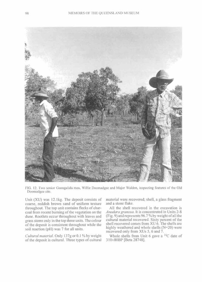
98^ MEMOIRS OF THE QUEENSLAND MUSEUM
FIG. 12. Two senior Ganngalida men, Willie Doomadgee and Major Waldon, inspecting features of the OldDoomadgee site.
Unit (XU) was 12.1kg. The deposit consists ofcoarse, reddish brown sand of uniform texturethroughout. The top unit contains flecks of char-coal from recent burning of the vegetation on thedune. Rootlets occur throughout with leaves andgrass stems only in the top three units. The colourof the deposit is consistent throughout while thesoil reaction (pH) was 7 for all units.
Cultural material. Only 137g or 0.1 % by weightof the deposit is cultural. Three types of cultural
material were recovered; shell, a glass fragmentand a stone flake.
All the shell recovered in the excavation isAnadara granosa. It is concentrated in Units 2-8(Fig. 9) and represents 96.7% by weight of all thecultural material recovered. Sixty percent of theshell recovered comes from XU 6. The shells arehighly weathered and whole shells (N=20) wererecovered only from XUs 5, 6 and 7.
Whole shells from Unit 6 gave a 14C date of310+80BP [Beta 28748].

INVESTIGATIONS OF GULF COASTAL LANDS^ 99
A fragment of clear glass (28m long x 9mmwide) was recovered from XU 2. It had beenflaked from a larger piece of glass and had a pot-lid flake on one surface. A small quartzite flake(I 1.2mm long x 2.8mm wide) was recoveredfrom XU 11.
DISCUSSION. The occupational evidence fromthis deposit is not of great antiquity. The bulk ofthe deposit is younger than 400BP with a termi-nus post quiem probably in the 1930s. The cul-tural material in the deposit is sparse, and theshell highly weathered although less weatheredthan the shell from Old Doomadgee 2.
OLD DOOMADGEE 2 (0D2) EXCAVATIONThe area where the OD 2 excavation was un-
dertaken was identified by Ganggalida people asthe site of the main camp during the time of theMission from 1931-1936 (Fig. 10).
This excavation was located in an open area onthe northern side of the ridge midway betweenthe crest of the ridge and the lagoon, and in theshade of a grove of four small trees (Terminaliasp.). The site was located on the edge of the treeline with open grassland to the south and panda-nus and eucalyptus open woodland to the north.The slope of the ridge is about 5 0 . The lagoon isabout 40m to the north.The Deposit.The test pit reached an averagedepth of 24cm with 98kg of deposit removed in 8Units (Fig. 10). The mean mass of each XU wasI 2.3kg. Like OD1, the deposit consists of coarsereddish brown sand of uniform texture through-out. The top unit contains flecks of charcoal fromrecent burning of the vegetation on the dune.Rootlets occur throughout with leaves and grassstems restricted to the top three units. The colourof the deposit is consistent throughout. The soilreaction (pH) is 7 for all Units.Cultural material. Only 228.2g or 0.2 % byweight of the deposit is cultural. Two types ofcultural material were recovered; shell and metalfragments.
The shell recovered in the excavation is Ana-dara granosa and unidentifiable fragments. Shelloccurs throughout the deposit (Fig. 10) andmakes up 99.6% by weight of all the cultural ma-terial recovered. Fifty-four percent of the shell re-covered came from Unit 3. The shell is highlyweathered and has a chalky texture. Completevalves (N= 34) were recovered only from Units 1,2, 3 and 4. A higher percentage (9% by weight) ofthe shell material was unidentifiable compared
with those from OD1. Small fragments of rustymetal were found in the top three units.DISCUSSION. This deposit is similar to that ofthe Old Doomadgee I deposit. It is predominantlya non-cultural deposit with the inclusion of asmall amount of culturally derived Anadara gra-nosa shell. In this case, however, the densest con-centration of shell occurs closer to the surface. Nodate for this deposit was obtained although thepresence of iron fragments would indicate a re-cent, probably post-contact, date. As for OldDoomadgee 1, the condition of the shell and itsposition in the deposit suggests the rapid destruc-tion and covering of shell deposits in this area.
THE MISSION SURVEYThe second occupational phase at Old
Doomadgee relates to the establishment of theChristian Brethren Mission in 1933 identified bythe remains of buildings evidenced by corrugatediron, a few post remnants, bricks and scraps ofiron. A survey of the remains of the Mission sitewas also undertaken (Fig. 11).
Several senior Ganggalida people pointed toareas or features of significance (Fig. 12). Thesewere then surveyed and notes and photographswere made of the remains.Survey Results. The survey plan of the site is pro-duced in Fig. 11. The following features werenoted
1)the first missionary family dwelling and laterthe older girls dormitory: parts ofthe ant bed floorwere visible. Sheets of corrugated iron, old kero-sene tins, sheets of tin and broken bottles wereevident;
2) post-school-age girls' residence: three circu-lar depressions in the ground about lm across.Other evidence consisted of fragments of glass, afragment of a grindstone, bone and glass frag-ments and a belt buckle;
3) butcher's shop: numerous pieces of flat iron;4) missionaries camp: gearbox, a tin drum,
sheets of corrugated and flat iron, rusted tin cans,glass bottles, and three hearths signified by smallmounds of ash;
5) single male missionary dwelling: a lowmound of ant bed about 4m in diameter. Anumber of sheets of corrugated iron; and,
6) boys' dormitory: one post two metres high,one car axle, a buggy step, wire netting and stripsof iron.
When this site was re-visited in 1988, none ofthis evidence was visible. All the tin had been re-used in the creation of the new outstation.

100^ MEMOIRS OF THE QUEENSLAND MUSEUM
TABLE 2. Description and dimensions of the Bayley Point fish traps.
FeatureNo.
Lengthm)
Max.Wallwidth (m)
MeanHeight (m) Condition Notes
I 75.0 0.80 0."Parts of the wall broken. Southern end bro-ken down. Mangroves growing in wall,
Encrusted with oysters linear with irregularbends. Mud substrate thicker here than withother traps. Exposed wall dark with oxida-tion.
2 72 1.0 0.40 Parts of the wall undercut."U" shaped. Oyster encrusted. Thick mud(.40m) substrate. Retains water for longestperiod at low tide.
3 35 0.80
0.70
0.50
0.40
Southeastern end eroded. Partly undercut.Considerably eroded in some places.
Parts of the wall falling down.
Semicircular shape with a kink in the wall.Tapers in size at northwestern end. Built ona gutter with the tidal flow draining at thepeak. Exposed wall dark with oxidation."U" shaped. Lower levels cemented withoysters.Exposed wall dark with oxidation.4 35
5 175 1.0 0.50 Substantially intact. Undercut in places.iSmall break n north wall.
"U" shap_ed. Lower levels cemented withoysters. Thick mud substrate.
6 35 0.80 0.30 Parts of the wall crumbling."W" shaped located on the boulder surfaceOyster encrustation on lower levels. Ex-posed wall dark with oxidation. "U" shape heavily oyster encrusted. Retainswater late in tide.7 125 1.0 0.50 Water undercutting base of wall.
8 52 1.0 0.50 Water undercutting base of wall. "U" shape heavily oyster encrusted.
SURVEY AREA 10
Aboriginal (European) Name. Gaabula (BayleyPoint).
Location. Bayley Point is located 2km southwestof Bayley Island and 7km east of the mouth ofPassmore Creek (Fig. 4).
Environment. Bayley Point consists of an islandof land surrounded on three sides by estuarinecreeks and on the fourth, by the sea. it is an inlierof Tertiary laterites (Aurukun Surface) uponwhich have formed shallow soils. A series ofHolocene cheniers have formed to the northwestand southeast of the original inlier. Extensivesaltpans and mangrove communities haveformed to the northwest and extensive saltpans tothe south. The undulating ridges of the lateriticinlier are covered in Eucalyptus polycarpa-Acacia hammondii-Petalostigma pubescens(Grey Bloodwood-Wattle-Quinine Bush) shrubwoodland. The Bloodwood trees grow to some10m in height and have a dense shrubby under-storey to 4m as follows:
Acacia hammondii (Wattle), (co-dominant);Petalostigma pubescens (Quinine Bush), (co-dominant); Phyllanthus fuernrohrii, (relativelycommon); Terminalia canescens, (scattered);Acacia umbellata, (scattered); Melaleuca virid-flora (as Paperbark); Hakea arborescens; Coelo-spermum reticulatum (one only); Marsdenia sp.(a vine). Grass covered some 30% of the groundsurface, the remainder being covered with later-itic concretions.
The Holocene cheniers support a floristic andstructural continuum of vegetation encompassingareas of grassland, low open woodland and wood-land. To the northeast of the lateritic inlier, lowsandy dunes (local relief < 1.5m) are covered ingrassland and low open woodland of mixed spe-cies; the tallest stratum includes:Canarium austra-lianum, (dominant); Terminalia subacroptera 6m,(common); Clerodendrum floribundum, (uncom-mon); Diospyros ferrea var. geminata, (uncom-mon); Eucalyptus tesselaris (Moreton Bay Ash),(found only on higher dunes). There is no signifi-cant shrub layer although Securinega melanthesoi-des and Celtis philippinensis are frequent.
Grasses and other ground plants cover some60% of the surface area and include: Heteropo-gon triticeus, (dominant); Indeterminate species,(common);Spinifex longifolius, (common); Tri-chodesma zeylanicum; Aristida brownii; Pass i-flora foetida (a vine).
Due north of the lateritic inlier, undulatingsandy ridges (local relief 2-3m) support Eucalyp-tus tessellaris (Moreton Bay Ash) woodland withnumerous low trees and shrubs. The tallest stra-tum contains Eucalyptus tessellaris (10-20m)and widely scattered Brachychiton diversifoliwn(Kurrajong).
Numerous low trees and shrubs form an inter-mediate stratum up to 8m in height. These in-clude: Pandanus sp. (Screw Pine), (common inplaces); Canarium australianum; Diospyros fer-rea var. geminata; Ficus opposita; Celtis philip-pinensis; Hakea arborescens; Acaciaholosericea.

Key
N^EI Coastal Flats
t El Woodland/Grasslandm Mangrove
El Pandanus
• - - • Survey Area
0^0.5
Kilometres
T RANSECT 1
TRANSECT 3
rock shelf
Fish traps
•••..
FIG. 13. Plan of Bayley Point showing location of survey area and fish traps.
INVESTIGATIONS OF GULF COASTAL LANDS^ 101
Grass covers 35 % of the ground surface, theremainder is bare sand and leaf litter. Enneapo-gon sp. is one of the dominant grasses. Otherplants of grass height are Trichodesma zeylani-cum (Camel Bush), Melhania oblongifolia, Jas-minum didymum, Breynia oblongifolia, andOpilia amentacea.
To the west and northwest of the lateritic inlier,broad flat-crested dunes support a Eucalyptustessellaris (Moreton Bay Ash) woodland withnumerous low trees commonly occurring inclumps. This area is floristically similar to the un-dulating sandy ridges north of the laterite inlier.Additional plants include: Acacia aulacocarpatree, (occurring in clumps); Ischnocarpus frutes-cens, vine; Lysiana spathulata var. spathulata,vine;Marsdenia sp., vine; Cassytha sp., vine;Santa/urn lanceolatum (Sandalwood), shrub;Gotnphrena canescens, forb; Triumfetta appen-diculata, forb.
Extensive saline mud flats to the northwest andsouth are dominated by Halosarcia sp. and Batisargillicola with some Avicennia marina var. aus-tralasica (Grey (Common) Mangrove) corn-
monly confined to theedges of the mud flats. Thelatter vary in height from0.3-2m and 5m, expressingrespectively the shrub andtree form of this variety.Around the mud flats andelsewhere on Bayley "Is-land" there are further elon-gate stands of mangroveattaining 10m in height andoccasionally more. Themangrove species presentinclude Avicennia marinavar. australasica, Ceriopstagal, Bruguiera exaris-tata, Aegiceras cornicula-tum and Excoecaria agal-locha.Ethnographic Signifi-cance.Said to be a placewith fairly constant occu-pation - i.e. on the "island"generally. People wouldtravel, but return to theirhome here. Water was ob-tained from wells or theinter-chenier swales. Peo-ple would camp on thebeach during the dry sea-son, but during the wet, the
saltwater would be rough, there was too muchwind and it was suggested that this made it moredifficult to use the fish traps. The people herewere distinguished particularly as belonging to"beach side". The area is tied into a Dugongdreaming myth, a focal site for which is Bijarr-banda, to the southwest.
ARCHAEOLOGICAL EVIDENCE. Area Sur-veyed. 4km 2 (Fig. 13).Site Description. The archaeological evidence atGaabula was assessed during two surveys. Thefirst, undertaken in 1983, concentrated on a surveyof the fish traps and a general reconnaissance ofthe major environments at Gaabula and of thecheniers to the east (Fig. 13). In the 1988 survey, atest excavation and some geomorphic reconnais-sance was undertaken on the dunes to the north ofthe outlier.Fish Traps.This survey was undertaken to obtainaccurate details of the construction, extent, and con-dition of the traps, and was made with a Tacheome-ter. One station was established on the shell ridgeand a series of radial shots made to the top and base

remains oftrap wall
scatteredmangroves 0
0 cf,
00
0
0o° c)00 o00 0
o o
89?2,°° °0^Scattered small 0
mangroves
C'eCV
3
mud flats
mud Pats
Key
Trap No. /
00
metres
102^ MEMOIRS OF THE QUEENSLAND MUSEUM
break in slope
FIG. 14. Plan of Bayley Point fish traps.
of points along the walls and to other topo-graphic features. Notes on the width, height,construction, substrate, relationship to naturalfeatures and condition of each feature weremade and colour and B&W photographs taken.
Site Description. The fish traps are situated onan extensive laterite rock shelf on the northeasttip of Bayley Point. The rockshelf is strewn withrock rubble and in places is covered with up to40cm of mud. Patchy mangrove communitiesgrow on the shelf To the southwest ofthe traps apoint bar has formed a shelly ridge and beach.To the east and southeast extensive mangrovecommunities are growing on a muddy substrate.Behind these environments are a series of smallridges with grass and shrubs graduating to a lowrise with open woodland.
There are eight distincttraps making a total walllength of 604m (Fig. 14). In-dividual features range from35-175m in length. Descrip-tions of these are given inTable 2. Maximum andminimum distances fromthe shoreline (assessed asthe high water mark) for trapwalls ranged from 10-130m(Figs 14& 15). All the trapswere constructed from later-ite rocks in the immediatevicinity, and range from 5-30cm in diameter.
There are two distinct se-ries of traps. An inner seriesis identifiable by the darkerrock colouring due to greateroxidation, their smaller size,less oyster encrustation andtheir eroded and weatheredcondition (Fig. 16). This in-ner series of walls (labellednumbers 1, 3, 4, 6 ) has acombined length of 180m.An outer series (labellednumbers 2, 5, 7, 8) overlapsthe inner series to the northbut extends further south.There are three interlinkedtraps and one separate trapwith a total wall length of424m. These are identifiableby their U-shape, the freshappearance of the rock, theintegrity of the wall and their
heavy encrustation with oyster growth (Fig. 17).Two of the traps appear to have been con-
structed to take advantage of natural features.Trap number 3 is constructed over a gutter andtrap 6 appears to take advantage of natural con-tours. All the traps are covered at high water andall drain at low water (Figs 16 & 17).
The condition of the traps varies considerably.Traps 2, 5, 7 and 8 are all heavily encrusted withoyster shells (Fig. 17). The shell cements somerocks together, but also lever others apart. Theoyster growths explain the better preserved con-dition of the seaward traps, which are inundatedfor longer periods than the inner ones. It also ac-counts for the greater width of these walls. Partsof the base of the inner walls are also cementedwith oysters, but not to the same degree as with

INVESTIGATIONS OF GULF COASTAL LANDS^ 103
the outer traps. In parts, large sections of thesewalls are eroding or have crumbled. The base ofthe outer walls are eroded by water scouring outthe mud and removing the smaller rocks as thetide ebbs and flows.
These traps are important for Ganggalida peo-ple. While senior Ganggalida people talk of thehuman maintenance of the traps, there is also a to-temic dimension attributed to their origin. Therocks which the traps are constructed from, aresaid to have resulted from the flesh of a Dugongdreaming and came from Bijarrbanda locatedsome 17km inland. The rocks were distributedover the landscape as the dreaming travelleddown a creek, through Bayley Point, out to theoffshore islands and eventually through the seawestwards at least as far as Yanyula country inthe vicinity of the Sir Edward Pellew Islands. Themyth recounts how the dreaming was speared bypeople along the way after it left the inland site,and also how its flesh (now present as rocks) wasconsequently strewn across the landscape in thecourse of being treated haphazardly by those peo-ple. This account apparently allows for humanagency having constructed the traps from theserocks; however, the recounting of the myth seem-ingly also at times conflates this agency with thatof the dreaming itself.
Ganggalida knowledge of the mainland traps isnot as extensive as that held by Gayardilt speak-ing people about the traps located on Bentinckand Sweers Islands. The traps are termed ngurru-warr in Gayardild. However, there appears to beno unambiguous term for them in Ganggalida. Indiscussing the traps, older Ganggalida peoplehave used terms which refer to their long shape,e.g. mundulga. This term is apparently beingused figuratively, for it translates literally as thelong sinew or tendon found in parts of the bodiesof animals. The example commonly given is theAchilles tendon in humans. Another expressionrefers to their trapping function, e.g. 'They usedto put' im that guwarra for bijarrba [dugong], ya-gull [fish] and bangara [sea turtle]', guwarra be-ing a term for put[ting] right round something',i.e. tying up (cf. Keen, 1983: 275).
Apart from these marine foods, crabs were ob-tained from within the crevices of the rock walls,and oysters from on the rocks themselves. Meansof obtaining fish, stingrays and crabs from thetraps are said to have included walking along thewalls with a spear as the tide receded, and alsowalking through the water as it became shallow.Contemporary old people demonstrated use of afreshwater well approximately 1km inland from
the Bayley Point traps which they say was com-monly used as a camping place. In the Point Parkerarea a major freshwater spring similarly existsabout 3km south from the location of the traps, butclose to the beach. People are said to have campedon the beach in the dry season, but to have soughtshelter further inland in the stormy wet season.The local land-using group in the areas containingthe traps (which would typically include a major-ity of members of the owning patriclan) are said tohave exercised proprietorial rights over the traps,but not in a rigidly exclusive fashion.
Limited fieldwork conducted with Gayardildpeople on the subject of the traps on Bentinck andSweers Islands has produced the following infor-mation. People would regularly maintain the trapsby building up the stone walls. Traps are said tohave been controlled quite rigorously by local oc-cupiers; indeed, this fact has been framed in con-versations in terms of the need to be on guardagainst people coming and stealing fish and otherfoods from traps. Such individuals were referredto as wungiji dangga, i.e. 'stealing man'. Whilepeople would certainly travel away from traps,they have been indicated as focal points to whichgroups would regularly return. A number of to-temic figures are said to have originally created thetraps in the South Wellesley Islands.Other Archaeological Evidence. A survey wasundertaken to record the nature and extent of otherarchaeological material in the vicinity of the fishtraps and to find sites that might be suitable formore detailed archaeological investigation.
Approximately 4km2 was surveyed includingthe open woodland on lateritic soils to the west ofthe fish traps, the chenier systems to the south andwest of the fish traps, parts of the estuary banksand the chenier system to the south of the estuary(Fig. 13).Survey and Excavation Results. The 1983 surveyindicated that archaeological material was con-
10(
FIG. 15. Cross sections of Bayley Point fish traps.

104^ MEMOIRS OF THE QUEENSLAND MUSEUM
FIG. 16. Example of inner series of traps (scale = 2m).
centrated on the chenier system to the west of thefish traps (Fig. 13). The densest concentrations ofmaterial are associated with old well sites identi-fied by a senior Ganggalida man, up to I .8kmfrom the shoreline. Six low mounded shell mid-dens, all <lm in height were identified (Fig. 18,Table 3) in this context. The predominant shellspecies represented in these low mounds is Ana-dara granosa, although other species are present.
The results of a transect from the middensalong the crest of the chenier to the shoreline indi-cates that surface density of shell material in thevicinity of the mounds is high, but tapers off awayfrom the wells and towards the shoreline (Fig.19). Densities of 10 shells/m 2 commenced 700mfrom the shoreline and continue to 1.8km. Theshell material is concentrated on the crest andslopes of the chenier ridges and very little is
found in the swales between cheniers or on theridges near the shoreline (Figs 19 & 20). Al-though the predominant shellfish is Anadara gra-nosa, 9 other taxa are present (Fig. 19). Theseoccur as small clusters of one or two species. Twostone flakes, both of quartzite, were observed inthe vicinity of the middens.
Three well sites are identified. These consist ofshallow circular depressions of about 1 m in di-ameter. Two are situated in the swale at the baseof the northwestern slope of the first ridge andone is situated in the centre of a large depressionto the southeast of this ridge (Fig. 18). A Meloamphora shell was found on the lip of one of thewells. Senior Ganggalida men identified these asdigging tools and drinking vessels. Freshwaterwas obtained from Well 2 in September 1983, al-though it was dry in April 1988. No other surfacearchaeological evidence was located.

INVESTIGATIONS OF GULF COASTAL LANDS^
105
FIG. 17. Example of outer series of traps.
Of the archaeological evidence recorded atBayley Point, the mounded shell middens offeredthe best opportunity for dating occupation anddocumenting resource use of the area. All themounds were examined for evidence of distur-bance, particularly from tree and shrub growth.Mound 3 was identified as the least disturbed andthe most suitable for excavation of a test pit. Thepit was placed near the highest point of themound (Figs 21 & 22a).
BAYLEY POINT MOUND 3 (BP3) EXCAVA-TIONMethods. To determine the basic character of thesite and to date the occupation sequence in thetime available it was decided to open the site witha 50 x 50cm 2 test pit. The pit was excavated in Ex-cavation Units (XUs) defined by the amount ofmaterial removed sufficient to fill a 10L bucket
(Johnson, 1980). The pit corners reached a meandepth of 77cm. A total mass of 204kg was re-moved in 19 XUs (Fig. 22b). The average weightof material removed for each XU was 10.7kg.The samples were sieved through nested 2mmand 4mm mesh wire. Material in the 4mm sievewas sorted on site. All non-A nadara shell mate-rial was retained for later sorting. The Anadarashell was weighed with a spring balance and agrab sample of between 600-700g retained. Allthe material in the 2mm sieve and a lkg grab sam-ple of the material that passed through this sievewere bagged and kept for later analysis.
A 2.5m-deep auger hole was made in the bot-tom of the pit, and a 3.5m-deep reference augerhole was made 4m to the east of the mound centre(Figs 21 & 22a). These were drilled to determinethe character and history of the ridge on which themound had formed.

base of chanter^/
^4- crest of chenier \._
General form lines of moundsindicating outer edge and approximatecontour at about 50cm elevation --
55m to Ti —.275m to 12 ---1.54cm to coastline-.
pandanusmound 2
--Cmound 3 — rnound 1
open woodland
1'^Scale 010m
106^
MEMOIRS OF THE QUEENSLAND MUSEUM
TABLE 3. Descriptions of Bayley Point mounded shell middens.
No. Location Max. L.(m)
Max.W.(m)
Max. H.(m) Notes
I In the centre of the chenier crest. 10.0 5.0 0.60 Ninety-five metres north of Well No I. Some dis-turbance. All Anadara granosaIrregular shape. Two eucalyptus growing through
2 On the crest and northern slope of the chenier. 23.0 17.0 0.60 the centre. Sixty-five metres south of Well No 2.All Anadara granosaSome surface disturbance. Oval shape. Seventy-
3 In the centre of the chenier crest. 10.0 5.0 0.50 five metres south of Well No 2. All Anadara gra-nosa
,, North-western slope of a gully bisecting the Oval shape. Some surface disturbance. Seventy4 chenier 10.0 7.0 0.50 metres south of Well No 2. All Anadara gramma
On the lower northern slope of the chenier and Irregular, elongate shape. Some disturbance from5 in the gully bisecting the chenier. 50 25 I .131 gully erosion. Situated in a grove of Pandanus. All
Anadara granara
z.° other mounds.
On centre northern slope of chenier, 50m east of 30.0 10.0 0.50Irregular shape. Twenty metres south of Well No3. Some surface disturbance. Predominantly Ana-dara granosa with some Placuna placenta
The material retained on the 2 and 4mm sieveswas washed and dried at room temperature. It wassorted into its constituent parts of shell, bone,stone artefacts, stone, pumice and gravel.
Each Anadara grab sample was wet sieved andair dried at room temperature. It was then sortedand divided into complete and damaged speci-mens. The complete specimens, both left and rightvalves, were weighed and measured for length andcusp height. A 10%, quartered, subsample was se-lected from XUs 3, 5, 16 and 17 to compare length,width, and thickness. Sawn sections were made tomeasure shell thickness. Noteswere made on the state of pres-ervation of the specimens.
RESULTS
DATING. Four ' 4C dates wereobtained on whole Anadaravalves in good condition fromXUs Surface, 2, 9, and 18 (Ta-ble 4). These dates indicate thatmound formation occurredover a period of 700 years,commencing at about 1,100BPand ceasing at about 400BP.The rate of shell accumulationwas greater within the lowerhalf of the mound, or during thefirst 250 years of formation(Fig. 23). Shell accumulationbegan approximatly 1,000years after the formation of theridge (A3) on which it is situ-ated.
retained in the 4mm sieve was sorted into speciesand an unidentifiable category. Each class wasthen weighed. Weights were preferred to otherindices due to the fact that some species of shell,particularly Placuna placenta, were highly frag-mented, thus precluding recognition of individ-ual specimens. This made determination ofnumbers impossible, although the amount ofshell was significant and aided interpretation.Comparison between the Anadara and non-Ana-dara can only be made on the basis of weights, as
DEPOSIT CONTENTS.Non-Anadara shell. The shell FIG. 18. Plan of mounded shell middens, Bayley Point.

121312161811117111115111411131117113161412111161811511121617Shellspecies
1111^1^11^1111 1^1111 1^12^222 2^2
3 3^333 34 4
EastWest
well^ well
Topographic profile
Height 5A.S.L.(m)^0
1500^1400^1300^1200^1000^900^800^700^600^500^400^300^200^160Distance to shoreline (m)
Maximum 500shelldensity/m'
200.
100,
Key - shell species
1 = Anadara granosa2 = Volema cochlidium3 = Placuna placenta4 = Terebralia palustris5 = Melo amphora6 = Katelysia hiantina7 = Anomia sp.8 = Telescopium telescopium
sea level
INVESTIGATIONS OF GULF COASTAL LANDS^ 107
FIG. 19. Surface distribution of culturally derived shell on Transect 3, Bayley Point.
the Anadara shell was only weighed and notcounted in the field.
Sixteen shell species were identified (Table 5).The total non-Anadara shell retained weighed1,056g compared to 56,945g of Anadara. Thenon-A nadara species constitute between 0.004% and 7.2 % (with an average of 2 %) of shell byweight/XU. The species represented/XU variesbetween 2 and 7. From the Surface to XU 10 amean of 3.4 species are represented; from XUs11-18 a mean of 5.3 species are represented.Eight species occur only in XUs below Unit 11,while only two species occur only in XUs aboveUnit 11. No species (except Anadara granosa)are represented in all Units. Volemacochlidium isthe most represented species in terms of thenumber of XUs (15) and total weight (626g). Therepresentation of each species in XUs throughoutthe excavation varies considerably. This irregu-lar representation of species is also reflected inthe proportions of different species in each XU.Four species occur in 12 or more XUs. However,their occurrence throughout the excavation is ir-regular. Of the 4 species that are represented in 12or more XUs, 3 occur at the surface and continueto XU 16, and 1, Ostrea sp., has 98% of its repre-sentation between XUs 7 and 18.
The percentage of unidentifiable shell is largertowards the bottom of the pit with an increase inthe 4 lowest XUs. This increase can be attributedto the greater representation of less robust and
more difficult to identify species as much as to theincreasing age of the shells.Anadara shell. Anadara granosa makes up 98%by weight of all shell recovered from the 4mmsieve. To illustrate trends in size differences withdepth, mass class proportions of shell have beenused. Laboratory measurements have confirmedthat mass is a useful measure of size, and corre-sponds with changes in length, width and thick-ness. The mass of individual specimens withinXUs varies considerably throughout the excava-tion. On the surface the mean weight is 3.2g. InXUs 1 and 2 this rises to 3.9g and then declines toXU 7 where the mean is 2.7g. The mean weightthen rises, with some minor oscillations, to XUs17 and 18 where it is 5.2g. The variations in massclass proportions with depth are illustrated in Fig.24. The proportion of large Anadara shell ishigher at the base of the midden than at the top,and the proportion of small Anadara shell ishigher at the top than at the base.
TABLE 4. Radiocarbon dates from Bayley Point 3midden.
ExcavationUnit Depth (mm) AgeBP Laboratory
No.Surface 0-17 440±70 Beta 61791
65-97 550±70 Beta 287479 314-348 850±80 Beta 3783518 724 -767 1,100±70 Beta 26903

Maximumshelldensity/m2
200
100
0
Shell mound ridge
Al2120±80 BP
^1 mi Y=2,4^ 40%
Scale 10m^H 1^ — --?.._ _ CaCO,
30-40% grey mud — —carbonate (sand)
A2
60-90% CaCO 3
670±80 BP
\mangroves
Key - shell species
1^1,2
1 = Anadara granosa2 = Volema cochlidium
o auger hole
o excavation pit
limit ofsurface shell
Form lines at 5cmintervals.
108^ MEMOIRS OF THE QUEENSLAND MUSEUM
FIG. 20. Distribution of culturally derived shell and lithologies along Transect 1, Bayley Point.
However, the shell population reflected in the case of the larger shell occurring at the base of theXUs does not show a simple relationship between midden (Fig. 25). In XU 17 the weight range in-midden depth and size. That is, it is not simply a eludes shells <1 g to 14.9g. Twenty two percent of
FIG. 21. Plan of Bayley Point 3 mounded shell midden showing location of excavation pit.

Excavation pit(See enlargedsection below) Hole M3 (m)
0 HoleM3-A1
9clean ferruginous sand& pebbles<20% shell fragments<20% (wt) CaCO3
grey mudcarbonate (nodular, shell)sand
clean ferruginous sand10-30% shell fragments<30% (wt) CaCO3
Silty sand30% shell fragmentsincluding oyster,pumice
INVESTIGATIONS OF GULF COASTAL LANDS^ 109
FIG. 22a. Profile of Bayley Point 3 mounded shell midden showing location of excavation pit and auger holes.
the shell fell within the 5-5.9g class. In XU 14 theweight range is similar. However, there are nolonger any <1g shells and the highest percentage(31%) of heaviest shell has dropped back to the4-4.9g class. By XU9 the weight range is 1-14gm. However, there is no <1g class and the per-centages of shells represented in the 6g andgreater class, has declined. The class with thehighest percentage (46%) is now the 2-2.9g class.Although in XU 3 the weight range is very con-stricted, the shells are becoming larger again. The3-3.9g class dominates with 41 % representation.Although the %/wt is small, large shells (10-10.9g and 14-14.9g classes) are again repre-sented.Bone. Bone remains were recovered from thewashed material retained in the 2mm and 4mmsieve fractions. The total amount of bone materialwas 35.37g, 23% by weight of which were ma-rine taxa and 4% terrestrial taxa. The remainderwere unidentifiable fragments. The total amountof bone is equal to approximately 181g ofbone/m 3 of deposit.
Marine vertebrate remains were foundthroughout the deposit (Fig. 26, Table 6). All ter-restrial fauna occurs between XUs 1 and 8 (Fig.26). Flying Fox is the most commonly repre-sented both by numbers of elements and XUs.Small amounts of unidentifiable bone occurthroughout.Pumice. Small quantities of pumice occur in XUs7-17. It varies in its representation from 0.5g to6.6g. The pumice occurs naturally throughout thesands of the ridge, and has been incorporated intothe fabric of the midden along with sand and shellfragments.
Stone. Laterite pieces recovered from the 4mmsieve were found in Units Surface to 7, 12, and14-17. These pieces were probably not part of thechenier formation and were introduced by theAboriginal occupants. The amount varied con-siderably from 128.6- 0.03g.Gravel. Gravel was recovered from the 2mmsieve. It occurs throughout the deposit with theamounts substantially higher in Units 13-18. Thisgravel was derived originally from a laterite bed-rock and it is a common chenier component. Itwas well rounded and heavily oxidised.Art efacts.Nine stone artefacts were recovered. Ar-tefacts included flakes, flaked pieces, a core and a
Depth from
Excavation pit
—440±70 BPSurfacesurface (cm). 10 ^550±70 BP2
206
30 8
40.9 850±80 BP10 -11
50 1213
60 1415
70 1617
80 18 ^1100±70 BP
90 Sterile
FIG. 22b. Profile of Bayley Point excavation showingexcavation units and dated levels.

110^ MEMOIRS OF THE QUEENSLAND MUSEUM
TABLE 5. Non-Anadara shellfish taxa in 4mm sieve fraction, Bayley Point 3.
ShellSpe-cies
1 2 3 4 5 6 7 8 9 10 II 12 13 14 15 16 17Spe-cies/XU
TotalWt(gm)/XU
TotalWt% /XU
XUSur-face 69 .4 1 .0 3.9 0.4 4 74.7 2.2
1 11.1 9.1 3.6 3 23.8 0.7
2 2.8 5.6 8.8 3 17.2 0.004
3 29.5 42.2 1.0 9.8 1.1 5 83.6 1.9
4 42.6 28.0 2.6 1.3 4 74.5 2.2
5 4.1 0.6 1.9 1.7 4 8.3 6.2
6 60.2 1.7
7 40.6 28.9 2.5 1.4 18.0 6.1 6 97.5 2.9
8 69.5 2.4 4.9 3 76.8 2.0
9 16.7 13.8 11.9 0.7 1.3 4.5 6 48.9 1.7
10 107.0 3.5 0.75 1.5 4 112.0 2.9
11 119.7 0.4 4.0 0.4 1.5 9.3 6.7 7 142.0 3.7
12 38.4 1.5 4.7 2.3 0.1 0.8 1.9 6.7 8 56.4 2.3
13 1.1 31.3 4.0 1.0 2.8 5 40.2 2.1
14 5.8 1.9 0.8 0.5 1.7 0.9 6 11.6 0.4
15 1.3 2.0 5.9 0.5 1.5 5 11.2 0.6
16 13.4 0.6 9.4 2.1 2.7 5.9 5.3 7 39.4 2.0
17 5.6 0.5 0.3 6.9 3.5 7.1 1.1 11.7 8 36.7 3.8
18 2.5 9.3 6.8 15.1 4 33.7 7.2
To-talwt(gm)
626.1 163.2 49.55 35.5 8.2 14 9.4 8.2 12.8 9.0 7.9 18 9.3 1.0 1.7 5.9 76 1055.8
KEY. 1. Volema cochlidium,2.Placuna placenta, 3. Ostrea sp., 4. Katelysia hiantina, 5. Nassarius olivaceus, 6.Anomia sp., 7. Cerithidea sp., 8. Telescopium telescopium, 9. Trisidos tortuosa, 10. Turritella sp., 11. Corbulasp., 12. Melo amphora, 13. Lunella cinerea, 14. Natica pseustes, 15. Murex coppingeri,16. Barbatia sp., 17.unidentifiable
fragment of a grindstone (Table 6). The artefactsare predominantly from quartzite, a raw materialnot occurring in the vicinity and therefore im-ported into the site. The source for this materialmay have been from near the Queensland/North-ern Territory border (Tindale, 1977), thoughstone materials were also recorded from other in-land areas (Trigger, 1987). The sandstone is alsoimported, although the source is unknown.
Other artefacts are made of the locally avail-able laterite. One of the laterite flakes has evi-dence of abrasion, possibly indicating use as asource of ochre. One fragment of sandstone hasone abraded surface with traces of ochre on it.This evidence indicates use of local stone as anochre source.
DISCUSSION
Bayley Point 3 is a mounded shell midden thatwas created by Aboriginal people between about1,100BP and 400BP. It is situated on a chenierthat had formed about 1,000 years previously (i.e.about 2,100BP), and there is a clear distinctionbetween the deposits of the chenier and those ofthe midden. In common with all the recordedmounded middens it was also located in closeproximity to a well. At the time of the commence-ment of the midden, Bayley Point was a distinctisland, and the extensive saltpans and mudflats tothe northwest, west and south that now exist, hadnot formed.
Mound generation is characterised by two dis-tinct phases of accumulation. The earlier phase

INVESTIGATIONS OF GULF COASTAL LANDS^ II I
Depth (mm)
0 ^
100
200
300
400
500
600
700mean age
8000^200^400^600^800^1000
Years (y BP)
FIG. 23. Age depth curve for Bayley Point 3.
was from 1,100 to 850BP and represents thelower half of the deposit. Compared with the up-per half of the deposit, it is characterised by: rela-tively rapid accumulation; an Anadarapopulation with a broad range of shell sizes andgreater mean sizes; a larger number of non-Ana-dara taxa; and an all marine vertebrate fauna. Incontrast, the upper half of the midden is charac-terised by: accumulation over a greater length oftime (400 years compared to 250 years); a smallermean size of A nadara shell with a reduced sizerange; fewer non-A nadara taxa; and terrestrialvertebrate fauna complementing the marine ver-tebrate fauna. However, within the upper layersof the top half of the midden there is some evi-dence of an increase in Anadara shell size.
Stone (1989) argued that mounded middens arethe result of the activities of scrub fowls (Mega-podius reinwardt)who have raked up the surfacesof cheniers/beach ridges to form nests. This is notthe case for BP3. The bulk of shell from themound could not have come from the fabric of thechenier ridge as the shell component was alreadyhighly weathered before the mound was built,and is quite unlike any of the deposits in themound. Samples from Auger hole M3, indicatethat not only were many of the shells highlyweathered and fragmented, the shell taxa repre-sented (A nadara granosa, Paphies elongata,Mactra sp., Corbula sp., Mactra queenslandica,Circe sp., Clypeomorus brevis, Codakia cf. pis Ed-/urn, Glycymeris persimilis, Veneridae sp.) werefewer in number, and, with the exception of Ana-
dara granosa, not the same asthose represented in themounded midden.
The shell in the mound wasalso unlike any of the shellfound in the outer chenier.Samples taken from both theauger hole BPT I/A1 and thesurface indicate that thechenier shell is highly frag-mented, weathered and manyvalves contain evidence ofmarine borer activity. Thehigh degree of fragmentationcannot be attributed solely tothe use of the auger, as much
1200 1400 of the fragmentation did notappear to be fresh, and thecondition of the shell recov-ered from the hole closely re-sembled the appearance of theshell found in exposed sec-
tions of the chenier. More shellfish taxa (Nas-sarius dorsatus, Isanda coronata, Thalotia sp.,Neritina violacea, Corbulafortiscula, Veneridaesp., Circe tumefacta, Clypeomorus sp., aff.Royella sp., Cerithidea sp., Bittium sp., Arcanavicularis, Corbula hydropica, Placamen tiara,Anadara granosa, Pitar sp., Glossidae sp.,Clypeomorus brevis, Mactra sp. Spisula colga-nae, Mytilus sp., Corbula crassa, Spisulatrigonella, Circe sulcata, Gafrarium catillus, Pi-tar regularis, Bembicium auratum, Mactraqueenslandica) were found in the chenier than inthe mounded midden; 28 compared with 16. Ofthe taxa represented in the chenier, only threewere also represented in the midden. Many of thetaxa represented in the chenier were of a sizesmaller than those represented in the midden andsome species were represented by both adults andjuveniles. At least one rare species (P/tar regu-laris) which grows in water at depths of up to 50mwas recorded from this auger hole (T. Whitehead,pers. comm.).
The difference in taxa represented in the middencompared to those of the cheniers; the clear distinc-tion between the character of the chenier depositand that of midden deposit; the predominance ofAnadara in the midden; the good condition of themidden shell compared with that of the cheniershell; and the inclusion of artefacts and non-shellfaunal remains in the midden; precludes the possi-bility that BP3 is the result of scrub fowls raking upchenier deposits to form a mound.

Key• 3-3.9g class• 4-4.99 classci 6-6.9g class
IJ\ 0^•
Depth trend in mass class proportions.
112^ MEMOIRS OF THE QUEENSLAND MUSEUM
TABLE 6. Identified non-Molluscan faunal remainsfrom Bayley Point 3
ExcavationUnit
Marine(No of Elements)
Terrestrial(No of Elements)
Surface -
1 Arius sp. (2) Trichosurus sp.or Pteropu.s. sp. (1)
Sillago malts (1)Eleutherottenta (I)tetradactylini
Pieropus sp. (I)
Pleropus sp. (1)
_Arius sp. (6) Pteropas sp. (1)
Agamidae (I)Pteropus alecto (I)
Elasmobranch (1) -7 Elapidae (1)
Brachyura (1) Pteropu.s. alecto (1)
9 _
10 Arius sp. (2)
11 IaalisLinsg(raah (1)12 Elasmobranch (I)13 Arius sp. (1)14 Arius sp. (2)15
16 Sit/ago analis (1)17
18
Arius sp. = Catfish, Pteropus sp. = Flying Fox, Sillagoanalis= Whiting, Pteropus alecto= Flying Fox, Elas-mobranch = Shark or Ray, Agamid = Dragon Lizard,Eleutheronema tetradactylum = Blue Threadfish,Elapid = FrontFanged Snake, Brachyura = Crab, Tri-chosurus sp. = Brushtail Possum
An alternative explanation for the mounding isthat it is the result of scrubfowls raking up middenscatters from a much wider area. However, thisalso is an unlikely explanation. Scrub fowls buildtheir mounds in dense vegetation, usually vineforests (Mitchell, 1993). This type of vegetationdoes not currently exist at Bayley Point, and isunlikely have done so in the past due to the thin,nutrient-deficient soils of the Tertiary outlier.Scrubfowls build nests with sufficient organicmatter to generate the heat needed to incubate theeggs. This midden is largely comprised of shelland sand and does not have a high organic-mattercontent. The faunal analysis and the sequence ofdates indicates that the mound has a degree of in-tegrity that is not consistent with the constant re-working of shell expected of the nesting activitiesof a scrubfowl (Mitchell, 1993). The presence ofa number of hinged Anadara shells reinforcesthis impression. Also absent are fragments of birdshell that indicate nesting activity (Sullivan &
O'Connor, 1993). Furthermore, the proximity ofmounded middens to wells is more parsimoni-ously explained by invoking human, rather thanavian, causes.
Although this midden does not have obvious,well-differentiated strata, analysis of its contentsindicates a pattern of formation that providesclues to the relationship between a changing en-vironment and the human responses to thosechanges. At the time of the formation of the mid-den, the shoreline was directly to the west of thesite. People exploited a relatively broad range ofshellfish taxa, concentrating on Anadara. TheAnadara exploited were relatively large, al-though shells representing a broad size rangewere also selected. Over the period of the first250 years of accumulation, the size range as wellas the mean size of Anadara, diminished. Thediminution in the size of the Anadara was accom-panied by a reduction in the range of other shell-
2
4
5
6
7
Excavation 8
Unit^9
1 0
11
12
13
14
15
16
17
18
Weight% in Excavation Unit.
FIG. 24. Depth trend in mass class proportions forAna-dara granosa, Bayley Point 3.

Excavation Units
50
45
40
35
30weight %
25
20
15
10
o = 3*= 9• =14• =17
a,^a,• c.?
CD^N-
weight class
0)^0)^(7)(.6^LC)
LT)
INVESTIGATIONS OF GULF COASTAL LANDS^ 113
FIG. 25. Characteristics of Anadara population in Bayley Point 3.
fish taxa represented. At the point where themean Anadara size is at its smallest, terrestrialvertebrate fauna were introduced into the site.
This trend can be interpreted as an indication ofenvironmental stress. However, discriminating be-tween stress induced by environmental change andthat by human over-exploitation is difficult — thedata are limited, and the two forms of stress may notbe mutually exclusive. Due to its immobility, its at-tachment to the substrate and its accessibility, Oys-ter may be a good indicator of stress through humanpredation (Poiner & Catterall 1988). That is to say,if over exploitation of shellfish were occurring,oyster would be amongst the first taxa affected.This would particularly be the case if the oysterscame from the rockshelves near the fish trap, andnot mangroves which are more susceptible to envi-ronmental change. In this midden, the near absenceof oyster after XU 9 is co-incident with the smallestmean size of Anadara and the inclusion of terres-trial fauna, and therefore offers some support for aninterpretation of stress induced by over-exploitation. However, further investigation is re-quired. The sample size, both in terms of the area ofthe midden excavated and the representation ofoyster is small. In addition, the formation of the
outer chenier at about this time, (approximately700 BP) indicates significant environmentalchange, raising the possibility of environmentalstress on the shellfish population causing or exac-erbating, any human-induced stress.
SURVEY AREA 11
European Name. Point Parker.Location. 6km west of Allen Island (Fig. 4).Environment. Point Parker has formed on the lat-erite bedrock of the Tertiary Aurukun surface. Aseries of distinct, broad parallel and sub parallelchenier/beach ridges have formed over the bed-rock. The ridges are broad and distinct, and ex-tensive lagoons form in the swale areas. South ofthe headland they trend north-south, but wraparound the outcropping laterite and continue in aneast-west direction. Extensive saline flats lie be-hind the dunes. The shoreline graduates from asandy shelly beach with spinifex vegetation en-croaching on the upper littoral to a benched later-ite rock platform covered with up to 50cm layerof muddy sand and laterite rubble. The platformsare littered with laterite boulders, some up to1.0m in diameter. Small mangroves grow on the

114^ MEMOIRS OF THE QUEENSLAND MUSEUM
surface
1
2
(0.63g) Mass of faunal remainsshown for selected spits
• Marine fauna
3 ES] Terrestrial faunarir■i■
4 lirff.rrrEzzz;=Excavationunit(spit)
5
6
,Ti! -.r=i (0 639)
7'(0.029)
8 !!!,!!!!
9
10
11
12
13
14
15
16 (0 10g)
17 (0.319)
18
0^10^20^30^40^
50^60
weight %
FIG. 26. Proportions of identifiable marine and terrestrial remains /Excava-tion Unit for Bayley Point 3.
ing: Canarium australianum,Diospyros ferrea var. hum//is,Terminalia subacroptera,Pandanus sp. (Screw Pine),Celtis philippinensis, Ficusopposita var. micrantha(Sandpaper Fig), Parkinsoniaaculeata, Securinega melan-thesoides, and Grewia retusi-folia (Turkey Bush). PurePandanus sp. stands fringe thelagoon.
The ground cover of theopen ridges consists of grasses(Vetiveria elongata and othersnot identified) and ram-bling/climbing vines (includ-ing Vitex trifolia andJasminum didymum).
Grasses (Vetiveria elongataand others not identified),sedges (predominantly Cyperusjavanicus) and other groundherbs (mostly Phyla nodifloravar. longifolia with Cen-taurium erythraca and Crota-laria linifolia) dominate thedepressions with the man-grove Excoecaria agallocharecorded for the depressionnearest the shore line.
At the time of recording thelagoon was dry and its surfacewell grassed. It had been mod-erately grazed by cattle andhorses as well as native ani-mals.
rocky substrate. At low water this rock platformextends up to 1km seawards.
On Point Parker's northern edge there is a standof Luninitzera sp. (Mangrove) in excess of 10mwith Bruguieraexaristata (Mangrove) and Cype-rus javanicus in the understorey. The trees Park-insonia aculeata and Thespesia populneoides,grow in adjacent open areas. Colubrina as/at/carambles over the Parkinsonia species.
To the south of this dark forest lie a series ofridges and swales, one containing a large ephem-eral freshwater lagoon. The ridges and depres-sions attain a maximum width of approximately40m. The ridges are typically very open andsandy with lateritic concretions and shelly frag-ments to varying degrees. Bare ground consti-tutes up to 90 % of the surface area. There arenumerous scattered trees but few shrubs includ-
Ethnographic Significance. Said to have beenvisited regularly; people camping there used thetraps. People would leave from here to go by raftand swimming to off-shore islands. It is also aplace associated with Dingo dreaming whichproceeded from inland to Mornington Island.
ARCHAEOLOGICAL EVIDENCE. Area Sur-veyed. 1km 2 (Fig. 27).
Site Description. Two forms of archaeologicalevidence, a stone walled fish trap complex and asparse scatter of shell were found. The fish trapsat Point Parker were first described by Boyd(1896: 57) as `... a succession of walled-in pad-docks of many acres in extent'. These are dis-cussed in greater detail below.

Key
Coastal Flats
1:1 Woodland/Grassland
M Mangrove
Beach
Lagoon
- - Survey Area
INVESTIGATIONS OF GULF COASTAL LANDS^
115
TABLE 7. Artefacts Recovered from Bayley Point 3.
ExcavationUnit Identification Mass(g) Length (mm) Width (mm) Boiremalth
MaterialRaw Notes
Surface Flaked PieceFlaked Piece
0.10.2
15.113.0
4.06.4
2.73.2
QuartziteQuartzite
5 Flake 4.00 18.8 14.5 4.6 Laterite One abraded surface7 Core 1.28 17.0 11.9 13.0 Laterite ?Ochre nodule
9 Snapped Flake 0.6 4.0 7.6 1.7 Quartzite
10 GrindstoneFragment 0.3 10.1 9.2 4.7 Sandstone Ochre adhering to abraded
surface
14 Flaked PieceFlake
0.0313.9
5.535.2
3.034.3
1.711.1
QuartziteQuartzite
18 Flake 0.02 2.5 6.8 1.4 Laterite
Fish Traps. The survey of the traps was under-taken in September 1983 to obtain accurate detailsof their construction, extent and condition. Thetraps were plotted using a Tacheometer. Three sta-tions were established to obtain adequate cover-age. Key features of the traps, the substrate theywere situated on as well as important environ-
mental features were plotted. Extensive colourand B&W photographic coverage was made andthe traps' construction, condition, size and shapewere noted. Coloured and B&W oblique aerialphotographs were also taken of the traps twoweeks later. A survey of the adjacent mainlandwas made and archaeological evidence noted.
FIG. 27. Extent of archaeology survey, Point Parker.

10050
metres
stunted pandanus
0 44
Extensive muddy rock shelfextends and dries up to 1 km.Strewn with Laterite bouldersup to 1 m. in diameter
Seagrass or °Dugong " weedbeds beyond
00
Key
Trap No. /
116^ MEMOIRS OF THE QUEENSLAND MUSEUM
FIG. 28. Plan of Point Parker fish traps.
Site Description. There are 7 distinctive stone walls(Fig. 28). These form 5 separate embayments and 2straight walls. One of the walls is within an embay-ment and one stands separately, although at one
time it may have abutted the adjacent embay-ment. The traps effectively form two separatecomplexes; four embayments and two straightwalls are constructed on the southern side of the

INVESTIGATIONS OF GULF COASTAL LANDS^ 117
TABLE 8. Description and dimensions of the Point Parker fish traps.
Feature No Length (m) Max. WallWidth (m) Mean Ht. (In) Condition Notes
1 50.0 1.0 0.50 Broken in places. Wall eroding.'V' shaped. Positioned between two rockoutcrops. Sandy base. In places walls are upto 1.2m high.
2 195.0 2.0 0.80Eroding. Broken in places. Somewall rocks scattered up to 4.0m
IP shaped. Sand, mud and rubble base.Built on a1,;utter drawing to the eastern-mostsection of the trap. Walls up to 1.0m high
3 40.0 1.0 0.50Eroding in places. Wall rocksscattered
Straight line, possibly originally part ofNumber 2. Sand, mud and pebble base
4 35.0 1.5 0.5Eroding in places. Wall rocks scat-tered up to 2.0m
'II' shaped. Sand and rubble base. Trap con-struct'1on based on small gutter. Walls up to0.8m high
5 160.0 2.0 0.5Eroding in places. Wall rocks scat-tered up to 2.0m. Indistinct in parts
'11' shape with a small length of straightwall in the centre. Possibly originally twotraps. Sand, mud and rubble base. Walls upto 0.8m high
point and one embayment is formed on the north-ern side of the point.
A total of 480 linear metres of wall is standing.The largest continuous length of wall is 195m andthe smallest 35m. A description of each is given
in Table 8. The traps appear to be constructed totake advantage of existing natural formations, toform pools or to strengthen a wall (Fig. 29). Thewalls are constructed from laterite boulderswhich range in diameter from 20cm-1m. These
FIG. 29. Example of Point Parker fish traps (scale = 2m).

a
D'e'44 ‘
e<^eek0(C.C\
2,CT^ Ns'ak40'*(0
E'
118^ MEMOIRS OF THE QUEENSLAND MUSEUM
A
_
B'
FIG. 30. Cross section of Point Parker fish traps.
boulders were obtained from the rubble on therock shelf. There is some Oyster (Ostrea sp.) en-crustation on the walls.
The height and width of the walls vary consid-erably depending upon their condition. All thewalls are eroded and weathered to some degree.They vary in width from 0.5-2m and in heightfrom 0.2m to about 1.2m (Fig. 30).
Other traps may exist to the south of the maincomplex, however they appear to have beenheavily eroded by wave action and definitivenon-continuous shapes are not readily discerni-ble from ground level.
The only other archaeological evidence presentis a very diffuse scatter of shell on the foredune.Densities vary from 1 fragment/m 2 to 1 frag-ment/50m 2 . Species represented are Ostrea sp.and Anadara granosa.
Lagoons provide a temporary water source.The most reliable water source in the area would
SURVEY AREA 12
Aboriginal Name. Balanggayi.Location. 3.5km south of Point Parker, 500mwest of the coast (Fig. 4).Environment. A broad shore-parallel dune withopen grassland on the crest and with a permanentwatercourse and spring in the eastern borderingswale. The watercourse is fringed with Pandanussp. (Screw Pine) and Melaleuca leucadendron(as Paper Bark). Other trees associated with thespring attain unusual size for the local area. Theseare Canarium australianum (24m), Celtis pa-niculata (25m), Term inalia subacroptera(5.5m), and Diospyros ferrea var. geminata(6m).
The variable understorey consists of shrubs(Securinega melanthesoides, Grewia retus(olia(Turkey Bush), Ludwigia octovalvis, and Meliaazedarach var. australasica), a flat sedge (Cype-rus javanicus), the forb (Phyla nodiflora var.longifolia), Blady Grass (Imperata cylindricavar. major), vines (Abrus precatorius (Crab'sEye)), Tinospora smilacina and Passiflora foet-ida (Passionfruit)). Surface visibility varies from80-100%.Nymphaea violacea (Water Lily) andPolygonum attenuatum grow in the fresh water.Ethnographic Significance. This is an importantcamping place because of the reliability of thewaterhole. However, in late 1978 it was seen in adry condition. Water from wells would still havebeen available though. This site is similar toGunamula in providing a reliable freshwater en-vironment close to the beach.ARCHAEOLOGICAL EVIDENCE. Area Sur-veyed. Ikm 2
Site Description. Extensive, continuous, but gen-erally sparse shell scatters occur in coarse redsand along the crest and upper slopes of the dune.The shell density varies from 1/m2 to 100/m2 .Anadara granosa predominates although somePlacuna placenta was noted. The surface of thedune had been churned by cattle.
SUMMARY AND DISCUSSION
The coastline of the study area is a constantlychanging one, largely through progradation.From the mid-Holocene, chenier/beach ridgeswith associated large lagoon systems have
CM1001^
50
metres
have been provided by springs at Balanggayi,100^3.5km to the south.
• A'

INVESTIGATIONS OF GULF COASTAL LANDS^ 119
formed and some offshore islands have been in-corporated into the mainland as ridges and mud-flats have built up. Over this time, the terrestrialenvironment of the coastal lands generally hasbeen one that has been increasing in area, biodi-versity and richness, although at the local levelthese changes may have adversely affected someenvironments. In terms of resource availabilityfor Aboriginal people, it is unknown whether theincreasing richness of the terrestrial environmentwas gained at the expense of marine resources.However, as the progradation also resulted in thecreation of the extensive, easily exploited salt-pans and mudflats, it is possible that access tomarine resources was also improved.
Twelve areas in the study area were examinedfor archaeological evidence. Of these, ten haveevidence of some sort; nine in the sand systemsnorth of the saltpans and one in the woodlandplains to the south of the saltpans.
Of the three areas surveyed on the woodlandplain only one, Bundella Waterholes, containedarchaeological evidence — an occassionalquartzite flake exposed by erosion. BundellaWaterholes is 1 lkm from the coast and provides apermanent water source. The other two sites, al-though less distant from the coast, provide onlysemi-permanent water.
All the sites in the sand systems consist of shellscatters with the occasional stone artefact, twoassociated with stone wall fish traps.
Two of the sites in the sand systems, BayleyPoint and Gunamula, have evidence of more con-centrated subsurface archaeological deposits. SixRadiocarbon dates from these sites provide agedeterminations ranging from about 1,300BP toabout 140BP. The evidence at the remainder ofthe sites varies in terms of their archaeological in-tegrity from very diffuse, highly weathered anddisturbed shell scatters to relatively unweath-ered, patchy concentrations of eroding shell. Anumber of sites, particularly those close to a freshwater source, have been disturbed by cattle.
Measured from the present day shoreline, thelocation of sites within the sand system variesfrom about 100m to 3.5km. Six sites are within1km of the shoreline. Two sites extend from nearthe shoreline to more than 500m inland.
Three sources of fresh water are available inthe sandsystem; wells, springs or lagoons. Ofthese three, wells dug to intersect the water tableare the most common. Documented wells pro-vide water at four sites and most probably at an-other three. Permanent springs provide a water
source for two of the sites and extensive lagoonsprovide seasonal water for another two. Theavailability of water from a particular source canvary from season to season. In some cases it isdifficult to determine the precise source of fresh-water and at others water availability was unpre-dictable.
The shell species represented in the sites vary.Anadara granosa is the most common, althoughothers, in particular Placuna placenta, Katelysiahiantina, Telescopium telescopium, and Volemacochlidium occur in more than one site. The mixof species and their relative proportions varies. Infour of the surveyed areas there are small, dis-crete concentrations of particular species.
Stone artefacts are rare. As surface evidencethey were found in only three sites, Wambalbayi,Old Doomadgee and Bayley Point. At two loca-tions, a small number of stone artefacts were alsofound through excavation. The raw material forthese artefacts comprise locally available lateriteor imported sandstone and quartzite.
The stone wall fish traps are the most obviousform of archaeological evidence. There appearsto be no strong relationship between fish trapsand the distribution of other archaeological evi-dence. Although there is concentrated archaeo-logical evidence at Bayley Point, it is moreclosely assocoated with wells than it is with thetraps. Furthermore, there is no unequivicol evi-dence of fish trap use represented in other ar-chaeological evidence. The traps at Point Parkerare not associated with concentrations of other ar-chaeological material, and Gunamula has con-centrations of archaeological material, but no fishtraps.
The fish traps nevertheless represent an inter-esting and important aspect of the archaeologicalrecord for this area. Their distribution is limitedto the coastline opposite the North and SouthWellesley Islands (There was no evidence of fishtraps west of Bayley Point) and on those Islands.They represent an aspect of shared material cul-ture throughout this area and emphasise regionalcultural similarities. The issues of similarities inthe construction, use and design of these traps be-tween cultural groups, remains however, an issuefor further investegation
The mounded middens at Bayley Point are an-other imporant piece of archaeological evidencefor the region. Mounded middens are a common,and much debated archaeological feature ofnorthern Australian coastlines. These debatesconcern their origins, age, role and relationship toenvironmental change, particularly the formation

120^ MEMOIRS OF THE QUEENSLAND MUSEUM
of cheniers (e.g. Bailey, 1977, 1994; Beaton,1985; Cribb, 1986; Stone, 1989; Mitchell, 1993;Sullivan & O'Connor, 1993; Hiscock & Mowat,1994; O'Connor & Sullivan, 1994). Much of thedebate has concentrated on the large and spec-tacular mounds found in Princess Charlotte Bay(Beaton, 1985), Weipa (Bailey, 1977), and Auru-kun on Cape York Peninsula and in Ahnem Land(Peterson, 1973; Meehan, 1982), and distinctionshave been drawn between these mounds and the'thick, southern Australian mounds ...' (Stone,1989: 59). Other work has, however, highlightedthe variability of form, shape and content ofnorthern Australian middens, the complex rela-tionship they exhibit with a range of environ-mental factors, and similarities between the largemounds and other forms of middens (Cribb,1986; Woodroffe et al., 1988; O'Connor & Sulli-van, 1994; Hiscock & Mowat, 1994).
Clearly, the Bayley Point middens are differentfrom the reported Cape York Peninsula shellmounds at Princess Charlotte Bay, Weipa andAurukun (Bailey, 1977, 1994; Beaton, 1985;Cribb, 1986). The Bayley Point middens are con-siderably smaller, fewer in number, have a muchmore restricted local distribution and, to date,have been found in only one type of environment.Bayley Point 3 also does not have the shell andashy sediment layers that Bailey (1994) observedin the Kwampter mound. However, there are anumber of similarities between the Cape Yorkmounds and BP3. The contents of all these sitesconsist, in overwhelming proportions, of size-selected Anadara shell, although small numbersof other taxa are represented. In all cases the Ana-dara shell is generally in good condition and hasnot fractured or cracked, indicating that it has notbeen subjected to the heat of campfires, either incooking or through post-depositional heating(Robins & Stock, 1990). Small numbers of othernon-molluscan faunal remains are also a sharedfeature. Like the Princess Charlotte Bay mounds,the BP3 deposit is largely undifferentiated, andlike those sites, it is situated on a chenier. BayleyPoint 3 also falls within the reported dates for theCape sites. Beaton (1985) stated that the PrincessCharlotte Bay mounds are unlikely to be olderthan 1,700 BP and that deposition probablyceased about 500-400 years ago. The Weipa datesfor the Anadara economy' are from about 2,000BP to about 400 BP (J. Beaton pers. comm.). Thedates for the Kwampter mound range from1,180+80 BP near the base to 210+110 BP nearthe surface (Bailey, 1977). Although further
work is required, and despite the apparent differ-ences, the similarities between the Cape sites andthose at Bayley Point, merit the suggestion thatthe BP3 midden represents an extension of thedistribution of late Holocene, Anadara-domi-nated, mounded shell middens into the Gulf ofCarpentaria. This observation raises the question'why mound'?
The debate about mounding in the tropics haslargely been dominated by observations abouttheir location, size, economic significance andorigins. The sheer number of shellfish repre-sented indicates exploitation of a resource withsome economic significance. Clearly, there mustbe a relationship between environmental abun-dance and mound formation: without large num-bers of shellfish the mounds would not exist.Mounds have also been located where some envi-ronmental advantage, such as increased elevationto avoid insects, or to create the preconditions formore conducive and drier campsites, may havebeen gained (Sullivan & O'Connor, 1993). How-ever, the Bayley Point middens are too small torepresent a substantive base for diet, let alone aneconomy. Their creation produces no obvious ad-vantage to camping conditions as the gains toheight or area caused by mounding are minimaland they produce no significant changes to theenvironment. In fact, it can be argued that themounding of shell creates better (i.e. shell free)camping conditions elsewhere on the chenier.Furthermore, it is difficult to see what immediateadvantage accrues for people who invest in be-haviour unlikely to bear dividends (i.e. improvedcamping conditions) for 500 years or more.
Compelling evidence from BP 3 indicates thatthe Bayley Point mounds were not camped on.The disintegration of shell is exacerbated by themethod of food preparation. In Table 9, contem-porary Ganggalida knowledge of some speciesrecovered from surface scatters at Bayley Pointare given. Of the ten species, nine were said to beused for food. Of these, seven are cooked in ashesand four are broken to get the shell out. Experi-mental evidence indicates that when exposed tothe high temperatures of a campfire, shell canoxidise, fracture and disintegrate (Robins &Stock, 1990). The Anadara shell from the mid-den shows no indication of exposure to high tem-peratures. From this it can be concluded that theshell was cooked away from the mound, possiblyin the manner described by Ganggalida people(see also Mehan 1982: 86), collected, and thendiscarded onto the mound. There is also no evi-dence in the form of heat affected shells or ash de-

INVESTIGATIONS OF GULF COASTAL LANDS^ 121
posits, that cooking was done on the mound. Theimplication is that the Bayley Point moundedmiddens were refuse piles.
The behaviour resulting in the creation of thesemounded middens stands in stark contrast to theshell discard behaviour of Ganggalida people to-day. While rules about the discard of some foodremains exist in various parts of NorthQueensland, such as throwing fishbone back intothe fire (Robins & Trigger, 1989) or piling dis-carded shell (Anderson & Robins, 1988) - andthis may result in the concentration of faunal re-mains at some locations - no such rules generallyapply to the discard of shellfish for Ganggalidapeople today. When one senior Ganggalida manwas asked about the etiquette of discarding shell-fish he replied 'You just chuck'im anywhere',confirming observed behaviour. This behaviourapplies as much to Anadara, which can still beeasily gathered in the Gulf (and whose collectionwas demonstrated by senior women in 1988), asit does to other shellfish species. A plausible ex-planation for the mounded middens at BayleyPoint arising from these observations is thatmounding-discard rules applied during the pe-riod of mound formation. The cessation ofmound building may have been caused bychanges to the discard rules applying to shellfish,particularly Anadara.
Discard behaviour can also be used to explainthe general paucity of shellfish remains in the ar-chaeological record of the southern Gulf of Car-pentaria. When shell is discarded over arelatively large area to form a low-density scatterit is subject to rapid weathering, disintegration,and incorporation into the fabric of thechenier/ridge. Comparison between the weath-ered Anadara shells from Old Doomadgee andthe well-preserved shell from BP 3 of the sameage, confirms this argument. The discard of rela-tively large numbers of Anadara at a site will notnecessarily result in the formation of mounds.
Even if a mounding-discard rule for othershellfish existed, their chances of long term pres-ervation is considerably reduced if they werecooked in a campfire. The representation of Ana-dara in these mounds as a reflection of the diet oreconomy of people at Bayley Point therefore,may be highly biased.
The formation of mounds requires a combina-tion of factors which include, amongst otherthings, access to relatively large numbers of ro-bust shellfish, minimal exposure to high tempera-ture from fire, and repeated discard on the same
spot. Accretion of the shell can be caused by a lo-cation that contains the spread of the shellfish, orbehaviour that dictates discard. The latter cantake two forms: either the shell can be discardedonto the mound immediately after consumptionor it can be raked from the chenier/ridge sometime after the initial discard, and deposited intothe mound. However in this environment, shellrapidly breaks down and is quickly incorporatedinto the fabric of the chenier/beach ridge. In thesecircumstances, even relatively large amounts ofshell distributed on the ridge would not prove animpediment to camping. For these reasons, weare suggesting that, in the case of the BayleyPoint middens, mound formation would not haveoccurred if discard rules had not applied.
In the absence of evidence to the contrary, thecessation of mound building may be explainedby: a) local environmental perturbations destroy-ing the Anadara beds or reducing numbers; (b)environmental change (progradation) requiring ashift in gathering strategies resulting in shell dis-card closer to the source of the shellfish beds; (c)a change in discard rules; or, d) a combination ofthe three.
Further work into the relationship betweenmounded middens and environmental change isrequired to clarify this situation. The subtletrends noted in BP 3 identify mounded middensas an important potential source of both environ-mental and cultural information.
In summary, with the exception of the stonewalled fish traps and the small mounded mid-dens, the archaeological evidence from the studyarea is subtle, and largely comprises surface shellscatters. On the basis of the surface evidence,there would appear to be no strong link betweenthe ethnographically recorded behaviour and thearchaeological evidence — a situation common innorthern Australia (e.g. Anderson & Robins,1988). Despite well documented evidence ofpeople, at times considerable numbers of people,occupying the surveyed areas for extended peri-ods of time and exploiting a range of resources,very little evidence for this occupation remains.It is unlikely, for example, that this evidence willenable detailed reconstructions of diet or econ-omy to be undertaken.
On the other hand, the distribution of archaeo-logical evidence attests to the extensive use ofGanggalida lands and waters over long periods oftime. It also supports knowledge of links betweenthe study area and the islands to the north andplaces to the west. Overall, the evidence is poten-tially important in providing a framework for a

122^ MEMOIRS OF THE QUEENSLAND MUSEUM
TABLE 9. Aboriginal names and uses for shellspecies observed on Bayley Point Survey.
SpecimenNo.
ScientificName
GanggalidaName Notes
1Anadaragranosa Lalbadu
Food. Place hinge up insand and coal prace ontop
2Volemacochlidium Wulwangu
Food. Cooked in ashes,shell broken to get themeat out
3Placuna pla-cent(' mala mala Food cooked in ashes
4Terebraliapaluslris Wirrua
Food. Cooked in ashes.Shell broken to get themeat out
5Meloamphora Rabunga
Food. Placed hinge upin sand and coalsplaced
6Kwelysiahianlina Bijurura Food. Cooked in ashes
7 Ationaa sp. BindiliFood. Cooked in ashes.Shell broken to get themeat out
8Telescopiumlelescopiwn Wadudu Food. Eaten raw
9 (Alma sp. no nameFood. Cooked in ashes.Shell broken to get themeat out.
10Xamhonielongelidly=
Gurandaguranda
regional archaeological and geomorphic chro-nology, and demonstrates the possibilities forfurther work in the future.
The key sites for understanding the relation-ship between environmental change and humanoccupation of the coastline will be mounded mid-dens. These sites allow the dating of occupationalsequences and their correlation with environ-mental change. Future work will require more in-tensive examination of particular areas to locatethese sites. This work also needs to be integratedwith geomorphological investigation both at thesite and regional level. As so little is known aboutthe ecology of this part of the Gulf of Carpentaria,such work would greatly enhance further ar-chaeological, anthropological and geomorpho-logical studies.
DEDICATION
This report is dedicated to Lizzie Daylight,Emily Ned and Willie Doomadgee; three seniorGanggalida people without whose assistance andcollaboration this project would not have beenpossible.
ACKNOWLEDGEMENTS
Essential assistance was given by a number ofpeople, without whose help this project would
not have been possible. Paul Hood undertook thesurveying of sites and the plotting of the site planswhile Peter Taylor carried out environmental andbotanical work. During the 1988 trip BryceBarker provided valuable field assistance andAnthony Wicks undertook the transect mappingand auguring. Other field assistance was pro-vided by Jeanette Covacevich, Wayne Long-more, Jeff Johnson and Patrick Couper, all of theQueensland Museum. Trevor Clifford assistedwith botanical identification. John Beaton andFiona Mowatt provided unpublished data.
Assistance in the analysis of the archaeologicalmaterials was provided by Sharyn Robins. Identi-fications were provided by Steven Van Dyck(mammal bone), Rolly McKay and Jeffrey John-son (fish bone), Jeanette Covacevich (reptilebone), Thora Whitehead, Kevin Lamprell andJohn Stanisic (shellfish remains). John Stanisicand Carla Catterall discussed various aspects ofmarine ecology and provided useful references.Alex Cook and Bruno David provided thoughtfuland useful comments on the text.
This project would not have been possiblewithout the co-operation of the Doomadgee Abo-riginal Council and the Ganggalida people inwhose country we were guests. We are particu-larly grateful for the assistance of Willie andThelma Doomadgee, Neville and Alice Ned, Ma-jor Waldon, Ronnie Jupiter, Lizzie Daylight,Emily Ned, Old Ned, and Thelma Jupiter.
Financial support for this project was providedthrough a National Estate Grant and The Board ofthe Queensland Museum.
LITERATURE CITED
ANDERSON, C. & ROBINS, R. 1988. Dismissed dueto lack of evidence: Kuku-Yalangi sites and thearchaeological record. Pp. 182-205. In Jones, R.& Meehan, B. (eds) Is there Archaeology withEthnography: An Australian Perspective. (Aus-tralian National University: Canberra).
BAILEY, G.N. 1977. Shell mounds, shell middens andraised beaches in Cape York Peninsula. Mankind11(2): 132-143.
BAILEY, G. 1994. Shell mounds in 1872 and 1992: Re-flections on recent controversies at Ballina andWeipa. Australian Archaeology 37: 1-18.
BAKER, R.M. 1988. Yanyuwa canoe making. Recordsof the South Australian Museum 22(2): 173-188.
BEATON, J.M. 1985. Evidence for a coastal occupa-tion time-lag at Princess Charlotte Bay (NorthQueensland) and implication for coastal colonisa-tion and population growth theories for Aborigi-nal Australia. Archaeology in Oceania 20: 1-20.
BOYD, A.J. 1896. Narrative of Capt. G. Pennefathersexploration of the Coen, Archer, and Batavia Riv-

INVESTIGATIONS OF GULF COASTAL LANDS^ 123
ers, and of the islands of the western coast of theGulf of Carpentaria in 1880. Proceedings of theRoyal Geographical Society of Australasia,Queensland Branch. 3(10): 46-61.
BYRNE, J.V., LEROY, D.O. & RILEY, C.M. 1959.The chenier plain and its stratigraphy, southwest-ern Louisiana. Trans Gulf Coast Association Geo-logical Society 9: 273-260.
CAWTE, J. 1974. Medicine is the Law. (UniversityPress of Hawaii: Honolulu).
CHAPPELL, J. & GRINDROD, J. 1984. Chenier plainsformation in northern Australia. Pp 197-229. InB.G. Thom (ed.) Coastal geomorphology in Aus-tralia. (Academic Press: Sydney).
CHAPPELL, J. & THOM, B.G. 1986. Coastal morpho-dynamics in North Australia: review and pros-pect. Australian Geographical Studies 24:100-127.
CHURCH, J.A. & FORBES, A.M.G. 1981. Non-linearmodel of the tides in the Gulf of Carpentaria. Aus-tralian Journal of Marine and Freshwater Re-search 32: 685-697.
CLARKE, M.F., WATSON, R.J. & WILLIAMS,M.A.J. 1979. Point Stuart chenier plain and Holo-cene sea-levels in northern Australia. Search10(3): 90-92.
COLEMAN, J.M. 1966. Recent coastal sedimentation -central Louisiana coast. Louisiana State Univer-sity Coastal Studies 17.
CRIBB, R. 1986. A preliminary report on archaeologi-cal findings in Aurukun Shire, western CapeYork. Quensland Archaeological Research3:133-158.
DAVIDSON, D.S. 1935. The chronology of Australianwatercraft, Journal of the Polynesian Society 44:1-16, 69-84, 193-207.
DOUTCH, H.F. 1976. The Karumba Basin, northeasternAustralia and southern New Guinea. Journal of Aus-tralian Geology and Geophysics 1: 131-140.
EASTON, A.K. 1970. Tides of the continent of Austra-lia. Horace Lamb Centre for Oceanographical Re-search. Research Paper No.37 (FlindersUniversity of South Australia: Adelaide).
EVANS, N.R.D. 1985. Kayardild: the language of theBentinck Islanders of north west Queensland.Ph.D thesis, Australian National University, Can-berra (Unpubl.).
GOULD, H.R. & MCFARLANE, E. 1959. Geologicalhistory of the chenier plain, southwestern Louisi-ana. Trans Gulf Coast Association Geological So-ciety 9: 261-270.
GRIMES, K.G. 1980. The tertiary geology of northQueensland. Pp. 329-347. In Henderson, R.A. &Stephenson, P.J. (eds) The Geology and Geophys-ics of Northeastern Australia. (Geological Societyof Australia, Queensland Division).
GRIMES, K.G. & DOUTCH, H.F. 1978. The late Cai-nozoic evolution of the Carpentaria Plains, north-ern Queensland. Journal of Australian Geologyand Geophysics 3: 101-112.
HAGLUND, L. 1975. Survey of sites significant toAborigines. McArthur River region Northern Ter-ritory. Report to Dames & Moore for Mimets De-velopment Pty. Ltd. (Unpubl.).
HISCOCK, P. 1988. Prehistoric settlement patterns andartefact manufacture at Lawn Hill, northwestQueensland. Ph.D. thesis, University ofQueensland. (Unpubl.).
HISCOCK, P. & KERSHAW, P. 1992. Palaeoenviron-ments and prehistory of Australia's tropical TopEnd. Pp. 32-75. In Dodson, J. (ed.) The NaiveLands, Prehistory and Environmental Change inAustralia and the South-west Pacific. (LongmanCheshire: Melbourne).
HISCOCK, P. & MO WATT, F. 1994. Midden variabil-ity in the coastal portion of the Kakadu Region.Australian Archaeology, 37: 18-24.
HORSFALL, N. 1988. Archaeological survey of pro-posed powerline between Burketown and Norman-ton. Report, Heritage Branch. QueenslandDepartment of Environment, Brisbane. (Unpubl.).
JENNINGS, J.N. & MABBUTT, J.A. 1977. Physio-graphic outlines and regions. Pp. 38-52. In Jeans,D.N. (ed.) Australia - a Geography: The NaturalEnvironment (2nd edn.). (Sydney UniversityPress: Sydney).
JONES, M.R. 1986. Surficial sediments of the centralGulf of Carpentaria. Geological Survey ofQueensland, Record 1986/40 (Unpubl.).
1987. Surficial sediments of the western Gulf ofCarpentaria. Australian Journal of Marine andFreshwater Research 38: 151-167.
JONES, M.R. & TORGENSEN, T. 1988. Late Quater-nary evolution of Lake Carpentaria on theAustralia-New Guinea continental shelf. Austra-lian Journal of Earth Science 35: 313-4.
KEEN, S. 1983. Yukulta. Pp 191-304. In Dixon,R.M.W. & Blake, B. (eds) Handbook of Austra-lian Languages. Vol 3. (Australian National Uni-versity Press: Canberra).
LEES, B.G. 1987. Age structure of the Point Stuart chenierplain. A reassessment. Search 18(5): 257-259.
LEES, B.G. & Clements, A.M. 1987. Climatic implica-tions of chenier dates of northern Australia. Ra-diocarbon 29(3): 311-317.
MEEHAN, B. 1982. Shell Bed to Shell Midden. (Aus-tralian Institute of Aboriginal Studies: Canberra).
MEMMOTT, P. 1979. Lardil artefacts and shelters. Oc-casional Papers in Anthropology 9: 107-142.
1985. Aboriginal fish traps in the Gulf of Carpen-taria and Wellesley Islands research project. Re-port on Data Collection and Compilation.Aboriginal Data Archive, University ofQueensland, St Lucia. (Unpubl.).
MEMMOTT, P. & ROBINS, R. 1984. A report on aburial site at Piyal, Mornington Island. MS,Queensland Museum. (Unpubl.).
MITCHELL, S. 1993. Shell mound formation in north-ern Australia: A case study from Croker Island,northwestern Arnhem Land. The Beagle, Records
124^ MEMOIRS OF THE QUEENSLAND MUSEUM
of the Northern Territory Museum of Arts andSciences, 10(1): 179-192.
O'CONNOR, S. & SULLIVAN, M. 1994. Distin-guishing middens and cheniers: A case studyfrom the southern Kimberley, W.A. Archae-ology in Oceania, 29(1): 16-28.
PA MANAGEMENT CONSULTANTS PTY LTD1973. Queensland phosphate project: Prelimi-nary environmental impact study. Report toBroken Hill South Ltd, June 1973. (Unpubl.).
PETERSON, N. 1973. Camp site location amongstAustralian hunter-gatherers: Archaeologicaland ethnographic evidence for a key determi-nant. Archaeology and Physical Anthrpology inOceania. 8(3): 173-193.
PETERSON, N. & RIGSBY, B. IN PRESS. Introduc-tion. In Peterson, N. & Rigsby, B. (eds) Custom-ary Marine Tenure in Australia. (OceaniaMonographs, University of Sydney: Sydney).
PHIPPS, C.V.G. 1980. The Carpentaria Plains. Pp.382-386. In Henderson, R.A. & Stephenson, P.J.(eds) The Geology and Geophysics of North-eastern Australia. (Geological Society of Aus-tralia, Queensland Division).
POINER, I.R. & CATTERALL, C.P. 1988. The effectsof traditional gathering on populations of the ma-rine gastropod Strombus lujuanus Linne 1758, insouthern Papua New Guinea. Oecologia 76: 191-199.
REAY, M. 1962. Subsections at Borroloola. Oceania33: 90-115.
RHODES, E.G. 1978. Bottom sediments of the [east-ern] Gulf of Carpentaria. Report to TropicalPrawn Research Project, Division of Fisheriesand Oceanography, CSIRO, Canberra. (Un-publ.).
1980. Modes of coastal progradation, Gulf of Car-pentaria. Ph.D thesis, Australian National Uni-versity, Canberra.(Unpubl.).
RHODES, E.G., POLACH, H.A. THOM, B.G. &WILSON, S.R. 1980. Age structure of Holocenecoastal sediments: Gulf of Carpentaria. Radio-carbon 22(3): 718-727.
ROBINS, R.P. 1982. Report on a preliminary ar-chaeological reconnaissance of Sweers Island.Report, Queensland Museum. (Unpubl.).
ROBINS, R.P. & STOCK, E.C. 1990. The burningquestion: a study of mulluscan remains from amidden on Moreton Island. Pp 80-100. In Solo-mon, S., Davidson, I. & Watson, D. (eds) Prob-lem Solving in Taphonomy: Archaeological &Paleontological Studies from Europe, Africaand Oceania. Tempus 2. (University ofQueensland: St Lucia).
ROBINS, R. & TRIGGER, D. 1989. A recent phase ofAboriginal occupation in Lawn Hill Gorge: Acase study in ethnoarchaeology. Australian Ar-chaeology 79:39-51.
ROTH, W.E. 1903. Report to the under secretary, De-partment of Lands on a visit to the Wellesley Is-
lands. Report, Archaeology Section Archives,Queensland Museum. (Unpubl.).
1909. North Queensland ethnography bulletinNo.13. Fighting weapons. Records of the Austra-lian Museum 7: 189-211.
RUSSELL, R.J. 1953. Coastal advance and retreat inLouisiana. 19 th International Geological Con-gress, Algiers, SII, IV: 108-118.
RUSSELL, R.J. & HOWE, H.V. 1935. Cheniers ofsouthwest Louisiana. Geographical Review 25:449-461.
SHARP, R.L. 1935. Semi-moieties in north-westernQueensland. Oceania 6: 158-174.
1939. Tribes and totemism in north-east Australia,Oceania 9: 245-275, 439-461.
SIMPSON, C.J. 1973. Explanatory notes on the Nor-manton (Queensland) 1:250 000 Geological Se-ries, Sheet 83/54-7. (Bureau of Mineral ResourcesGeology and Geophysics: Canberra).
SMART, J. 1976a. Auger drilling of beach ridge com-plexes, western Cape York Peninsula, 1973. Re-cords of the Bureau of Mineral Resources, Geologyand Geophysics, Australia. 1876/16. (Unpubl.)
1976b. The nature and origin of beach ridges, west-ern Cape York Peninsula, Queensland. AustralianJournal of Geology and Geophysics 1:211-218.
SMART, J., GRIMES, K.G., DOUTCH, H.F. &PINCHIN, J. 1980. The Mesozoic CarpentariaBasin and the Cainozoic Karumba Basin, northQueensland. Bulletin of the Bureau of MineralResources, Geology and Geophysics 202: 1.
STONE, T. 1989. Origins and environmental signifi-cance of shell and earth mounds in northern Aus-tralia. Archaeology in Oceania 24(2): 59-64.
SULLIVAN, M. & O'CONNOR, S. 1993. Middensand cheniers: Australian research. Antiquity67(257): 776-788.
THORLEY, P. 1992. An archaeological survey of aproposed barge loading facility Bing Bong Sta-tion, Northern Territory McArthur River mineproject draft EIS. Report to Dames & Moore forMt lsa Mines Ltd. (Unpubl.).
TINDALE, N.B., 1962a. Geographical knowledge ofthe Kaiadilt people of Bentinck Island,Queensland. Records of the South Australian Mu-seum 14: 259-296.
1962b. Some population changes among the Kaiad-ilt people of Bentinck Island, Queensland. Re-cords of the South Australian Museum 14:297-336.
1977. Further report on the Kaiadilt people ofBentinck Island, Gulf of Carpentaria,Queensland. Pp. 247-273. In Golson, J. & Jones,R. (eds) Sunda and Sahul: prehistoric studies inSoutheast Asia, Melanesia & Australia. (Aca-demic Press: London).
1981. Prehistory of the Aborigines: Some interest-ing considerations. Pp1761-1798. In Keast, A.(ed) Ecological Biogeography of Australia. Vol.3. ( Dr. W. Junk: The Haig).

INVESTIGATIONS OF GULF COASTAL LANDS^ 125
TORGENSEN, T., JONES, M.R., STEPHENS, A.W.,SEARLE, D.E. & ULLMAN, W.J. 1985. LateQuarternary hydrological changes in the Gulf ofCarpentaria. Nature 313: 785-787.
TORGENSEN, T., LULY, J., DEDECKKER, P.,JONES, M.R., SEARLE, D.E., CHIVAS, A.R &ULLMAN, W.J. 1988. Late Quarternary environ-ments of the Carpentaria Basin, Australia. Palaeo-geography, Palaeoclimatology andPalaeoecology 67: 245-261.
TRIGGER, D.S. 1985. Doomadgee: a study of powerrelation and social action at a north AustralianAboriginal settlement. Ph.D thesis, University ofQueensland, Brisbane. (Unpubl.).
1987. Inland, coast and islands: Traditional Abo-riginal society and material culture in a region ofthe southern Gulf of Carpentaria, Records of theSouth Australian Museum 14: 69-84.
1989. Robinson River (Mugularrangu) land claim. Re-port, Northern Land Council, Darwin. (Unpubl.).
TWIDALE C.R. 1966. Geomorphology of theLeichhardt-Gilbert area north-east Queensland.CSIRO Land Research Series 16: 1-56.
VALENTIN, H. 1961. The central west coast of CapeYork Peninsula. Australian Geographer 8: 65-72.
WEBB, D.J. 1981. Numerical model of the tides in theGulf of Carpentaria and the Arafura Sea. Austra-lian Journal of Marine and Freshwater Research32: 31-44.
WHITEHOUSE, F.W. 1963. The sandhills ofQueensland - coastal and desert. QueenslandNaturalist 17: 1-10.
WOODROFFE, C.D., CHAPPEL, J. & THOM, B.G.1988. Shell middens in the context of extensivedevelopment, South Aligator River, NorthernTerritory. Archaeology in Oceania 23(3): 95-103.
WRIGHT, R.V.S. 1971. Prehistory in the Cape YorkPeninsula. Pp.133-140. In Mulvaney, D.J. & Jol-son, J. (eds) Aboriginal Man and Environment inAustralia (Australian National Uhiversity Press:Canberra).