met manual trail evaluation of ja 9 geno … manual trail evaluation of ja 9 geno silvestri‘s...
TRANSCRIPT

MET MANUAL TRAIL EVALUATION of JA 9 Geno Silvestri‘s Property as a possible site of the 1846 Applegate Trail. Field Trip date: April 26, 2014. Property owner: Geno Silvesteri. Researchers: Mike Walker, Leta Neiderheiser, Bob Black, Jim & Rene Ford. (See group photo, # 1). This analysis was based on the Research Principles, Methods and Guidelines noted in the OCTA MET MANUAL. General Principles Are: Probability: ‘…the exact location of an emigrant trail segment cannot be verified with absolute certainty. …however, the trail researcher can strive for a higher degree of probability by utilizing…accepted procedures.’ Analogy: ‘The location of a possible trail segment can be authenticated only by comparing and contrasting it with what is already known about other verified emigrant trail.’ The Cardinal Rules: For ‘an emigrant trail segment to be considered as verified, it must conform to the following ‘Four Cardinal Rules’. Where conditions exist that any of these four rules do not apply, the probability level is reduced…’ 1. Coherence Rule: ‘There must be a linear uniformity so that trail segments form a continuous sequence; i.e., the trail segment …has to link together (cohere) with the trail segments that precede and follow it.’ YES The trail segment on the Silvestri property is identified by the Hugo Neighborhood Association and Historical Society (HNAHS) and is locate on Red Mt. Drive , T35R6S2 Tax Lot 00800 (See Tax Lot Map A & B) - 2.3 acres: GPS location: 10 T 0469056 E, UTM 4711404 N – Jim Ford, 10 T 0469056 E, UTM 4711398 N – Bob Black, Elevation 1,167 feet. Several historical maps all agree the Applegate Trail crossed on the Silvestri property (Brochure 21 in the Emigrant Trails Series, ‘Applegate Trail: Silvestri Property’, Mike Walker, February 18, 2005, field trip date August 20, 2003, www.hugoneighborhood.org/BROCHURE_21_Silvestri_Property_021805.pdf). The Silvestri segment is well aligned with the adjoining north and south surveyed points on the 1856 GLO map. The surveyed point north of the Silvestri property is designated as JA 10 B. It is 2,264 feet from the Silvestri property (map # 2 ). The surveyed point south of the Silvestri property is designated as JA 9 A. It is 2,435 feet from the Silvestri property (map # 2). These brochures can be easily found by going to www.hugoneighborhood.org: select ‘Brochures’ button; select ‘Inventory Brochures’ on the left side of the page; and look for Brochures # 13, 14 and 21.

2. Corroborative Rule: ‘There must be confirming documentary evidence of the trail; i.e., the trail segment…has to have valid written or cartographic evidence to support (corroborate) its authenticity.’ YES Cartographic evidence is noted above. There is agreement on historical maps: GLO 1855 map; and GLO 1893-94 map. The historic Applegate Trail most certainly crossed the Silvestri property (Brochures 21, 13 and 14). 3. Collateral Rule: ‘There must be accompanying physical and/or topographical evidence of a trail; i.e., the trail segment…has to have some geomorphic or artifact evidence (collateral) to confirm’ its authenticity. YES Physical and Topographical: (See Tax Lot maps 1A and 1B ). The trail segment crossing the Silvestri property extends from the junction of 2 Tax Lots: 900, north of the Silvestri Tax Lot; and Tax Lot 200, east of the Silvestri Tax Lot. The trace extends from the above junction on the NE boundary of the Silvestri Tax Lot and extends for 200 feet to the SW boundary of the Silvestri property at a galvanized wire field fence (Photo # 3). Accurate measurements were taken August 23, 2014 by Jim and Rene Ford and Deno Silvestri. The trail segment then crosses the apex of the adjoining property Tax Lot 700 (Tax Lot Map 1 A) and can be clearly seen as a trace extending SW from the Silvestri property. It is approximately 100 feet and ends at a wooden rail fence at the far boundary of Tax Lot 700. (See photo # 4). “The segment is parallel to Jumpoff Joe Creek.” “It is above Jumpoff Joe Creek and approximately 25 feet above its first bench” (Brochure 21) and is located on the top of the ridge. The trail width was measured on August 23, 2014. The trail segment was measured in 5 locations and did not include the 4-6 inch berm on either side (See Photp # 2). The average width is 7.75 feet which excludes automobiles. Geomorphic and Artifact evidence: The segment is recessed in the ground by about 2-3 inches. The trace is described as a depression (photo # 4). The soil is compacted and a shovel penetrated with foot pressure extends down 1-2 inches in the trail and off to the side a shovel penetrated with foot pressure easily 4-5 inches. There is no tree growth in the trail segment which creates a tunnel effect (photo # 4 & # 5). The largest tree in the proximity of the trail segment is a Sugar Pine with a 9 foot 3.5 inch circumference. This pine tree is near the SW boundary galvanized wire field fence. Gino Silvestri’s father found an ox yoke chain (three joined links) (photo # 7) artifact years ago and Gino displays it. On April 26, 2014, we searched the area with a metal detector and found no additional artifacts of trail vintage.

4. Correlation Rule: ‘There must be overall agreement among all types of evidence; i.e., the evidence resulting from the first three cardinal rules has to mutually support (correlate), and not contradict one another, in order to verify the location of a trail segment.’ YES The evidence resulting from the first three cardinal rules mutually supports and does not contradict one another; verifying the location of the trail segment. There is overall agreement among all types of evidence. Classification Category: Class 1: Unaltered Trail Description: ‘The trail segment retains the essence of its original character and shows no evidence of having been substantially altered by motor vehicles or by modern road improvements. There is visible evidence of original trail in the form of depressions, ruts, swales, tracks, scarring, vegetative differences, rock alignments along the trailside, and eroded trail features.’ YES The trail segment retains the essence of its original character and shows no evidence of having been altered by motor vehicles. Conclusion: There is group agreement of continuity, integrity and feel throughout the trail segment. The Cardinal Rules: 1. Coherence Rule – YES 2. Corroborative Rule – YES 3. Collateral Rule – YES 4. Correlation Rule – YES Classification Category: # 1 Signed, Jim & Rene Ford, Co-Project Leaders/Authenticators Hugo Applegate Trail Marking & Mapping Project Northwest Chapter, Oregon-California Trails Association

Photo # 1: Carsonite marker placed in the middle of the trail. Mike Walker (below), (left to right) Jim
Ford, Deno Silvertri, Rene Ford and Bob Black.
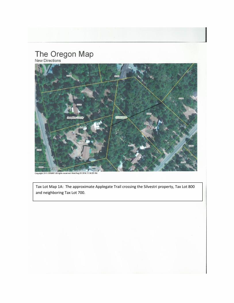
Tax Lot Map 1A: The approximate Applegate Trail crossing the Silvestri property, Tax Lot 800
and neighboring Tax Lot 700.

Tax Lot Map 1B: Applegate Trail crossing the Silvestri property, Tax Lot 800 and
neighboring Tax Lot 700 without ‘line’.

Map #2 - USGS Merlin Quadrangle Map 7.5 minute Series (topographical): The black dot is the location of the Silvestry property. Location of JA 10 B can be located northward by 2,264 feet. Location of JA 9 A can be located southward by 4,699 feet.

Photo # 2: Silvesrti Property: Trail width is indicated, from Deno Silvestri’s right heal to Leta
Neiderheiser’s left heal.

Photo #3: Silvestri Property: SW view across the SW boundary line and through the galvanized wire
field fence to the rail fence showing trail remnants on the adjacent property (Tax Lot 700).
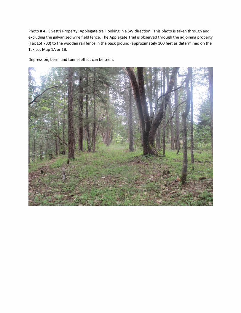
Photo # 4: Sivestri Property: Applegate trail looking in a SW direction. This photo is taken through and
excluding the galvanized wire field fence. The Applegate Trail is observed through the adjoining property
(Tax Lot 700) to the wooden rail fence in the back ground (approximately 100 feet as determined on the
Tax Lot Map 1A or 1B.
Depression, berm and tunnel effect can be seen.

Photo # 5: Silvesri Prpoerty: Applegate trail looking NE. ‘Tunnel effect’ can be seen. Left to right - Jim
Ford, Bob Black and Deno Silvestri.
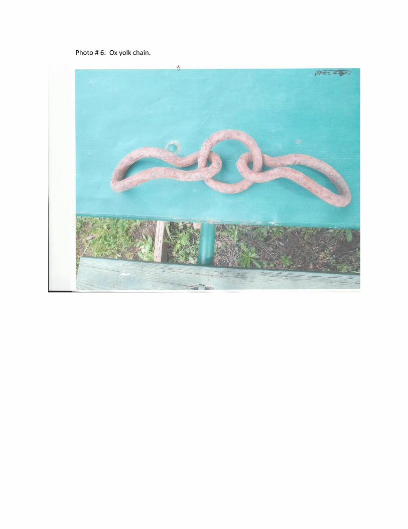
Photo # 6: Ox yolk chain.