meteorology and high- performance cyberinfrastructure: applications … · 2002-11-06 ·...
TRANSCRIPT

Meteorology and HighMeteorology and High--Performance Performance CyberinfrastructureCyberinfrastructure: :
Applications in the ExtremeApplications in the Extreme
Kelvin K. DroegemeierKelvin K. DroegemeierSchool of Meteorology School of Meteorology
Center for Analysis and Prediction of StormsCenter for Analysis and Prediction of StormsUniversity of OklahomaUniversity of Oklahoma
OSCER SymposiumOSCER Symposium
Friday, 13 September 2002Friday, 13 September 2002

The Oklahoma The Oklahoma Weather CenterWeather Center

A unique confederation of 11 Federal, State, and A unique confederation of 11 Federal, State, and University of Oklahoma entities University of Oklahoma entities Employs over 600 professionals Employs over 600 professionals –– largest group of largest group of operational, research and academic operational, research and academic meteorologists in the nationmeteorologists in the nationOver $0.5 billion in infrastructureOver $0.5 billion in infrastructureYearly research expenditures of $65 M Yearly research expenditures of $65 M Injects over $120 M annually into OK economyInjects over $120 M annually into OK economyDevelops much of the technology used Develops much of the technology used operationally within the NWSoperationally within the NWS
The Oklahoma Weather CenterThe Oklahoma Weather Center

• National Severe Storms Laboratory (NSSL)
• Storm Prediction Center (SPC)• National Weather Service Forecast
Office• NEXRAD Operational Support
Facility• Warning Decision Training Branch
• National Severe Storms Laboratory (NSSL)
• Storm Prediction Center (SPC)• National Weather Service Forecast
Office• NEXRAD Operational Support
Facility• Warning Decision Training Branch
• School of Meteorology (SoM)• Center for Analysis and Prediction of
Storms (CAPS)• Oklahoma Climatological Survey
(OCS)• Cooperate Institute for Mesoscale
Meteorological Studies (CIMMS)• Environmental Verification and
Analysis Center (EVAC)• International Center for Natural
Hazard and Disaster Research (ICNHDR)
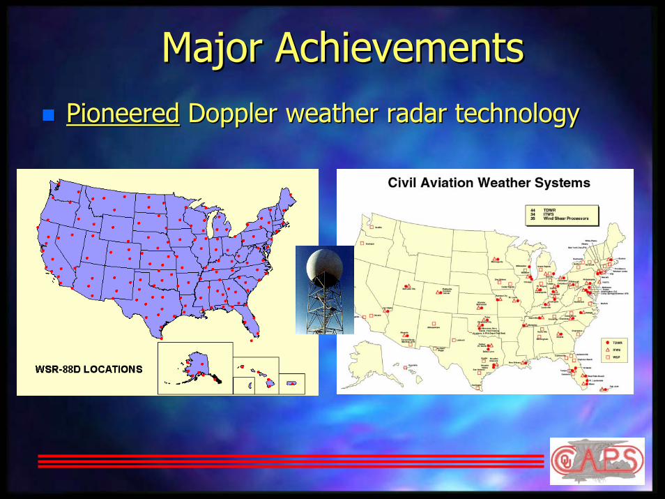
Major AchievementsMajor AchievementsPioneeredPioneered Doppler weather radar technologyDoppler weather radar technology
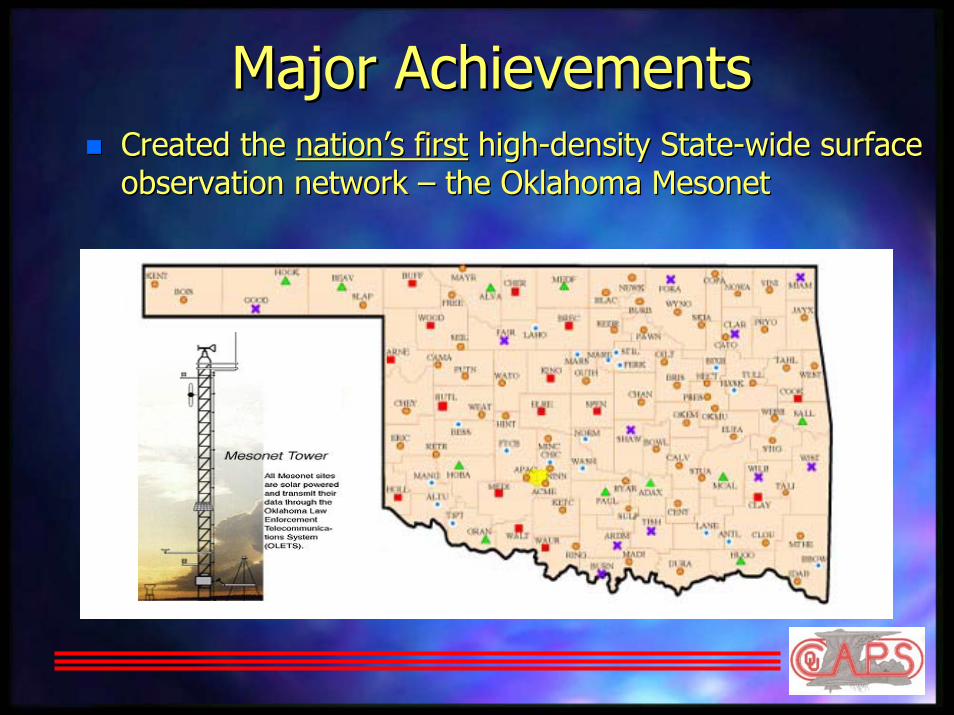
Major AchievementsMajor AchievementsCreated the Created the nation’s firstnation’s first highhigh--density Statedensity State--wide surface wide surface observation network observation network –– the Oklahoma Mesonetthe Oklahoma Mesonet

Major AchievementsMajor AchievementsDeveloped the Developed the world’s firstworld’s first groundground--based mobile Doppler radar based mobile Doppler radar (Doppler on Wheels); recorded (Doppler on Wheels); recorded highest wind speeds on Earthhighest wind speeds on Earth (318 (318 mph) during Moore, Oklahoma F5 tornado on 3 May 1999mph) during Moore, Oklahoma F5 tornado on 3 May 1999
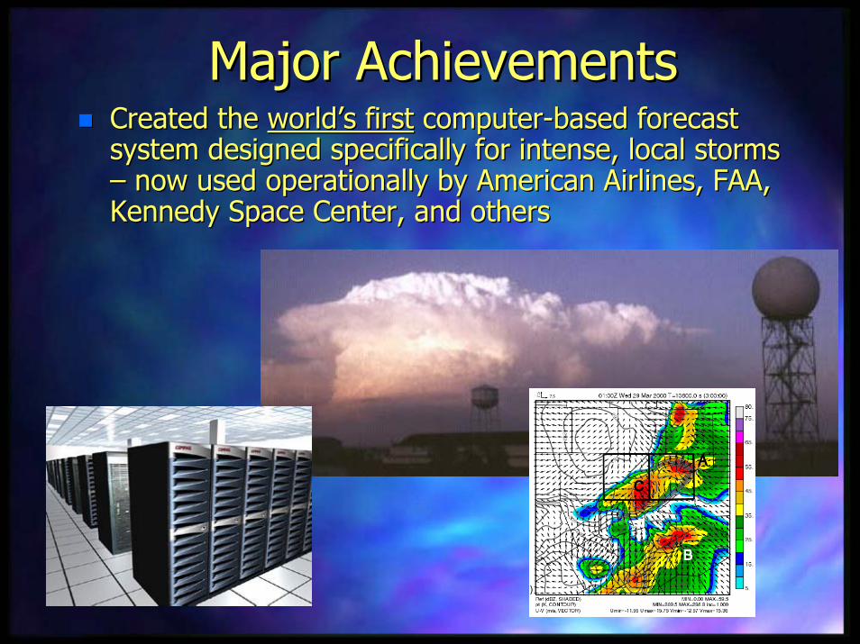
Major AchievementsMajor AchievementsCreated the Created the world’s firstworld’s first computercomputer--based forecast based forecast system designed specifically for intense, local storms system designed specifically for intense, local storms –– now used operationally by American Airlines, FAA, now used operationally by American Airlines, FAA, Kennedy Space Center, and othersKennedy Space Center, and others
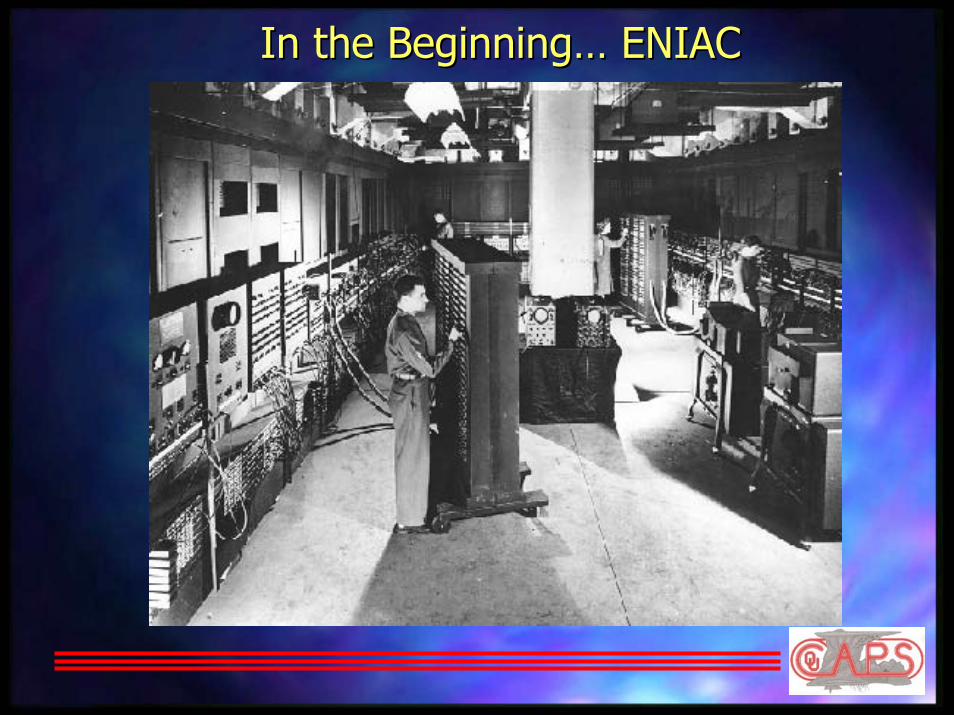
In the Beginning… ENIACIn the Beginning… ENIAC

ENIAC Versus TodayENIAC Versus Today
Weighed 30 tonsWeighed 30 tonsHad 18,000 vacuum tubes, 1,500 relays Had 18,000 vacuum tubes, 1,500 relays thousands of resistors, capacitors, thousands of resistors, capacitors, inductorsinductorsPeak speed of 5000 adds/second and Peak speed of 5000 adds/second and 300 multiplies/sec300 multiplies/secA 1.2 GHz Pentium IV processor is A 1.2 GHz Pentium IV processor is 500,000 times faster than the ENIAC500,000 times faster than the ENIACA desktop PC with 1 A desktop PC with 1 GbyteGbyte of RAM can of RAM can store 5 million times as much data as store 5 million times as much data as the ENIAC the ENIAC

CharneyCharney, , FjortoftFjortoft, and von , and von Neumann (1950)Neumann (1950)
Numerically Numerically integrated one integrated one equation at one equation at one level in the level in the atmosphereatmosphere24 hour forecast24 hour forecast
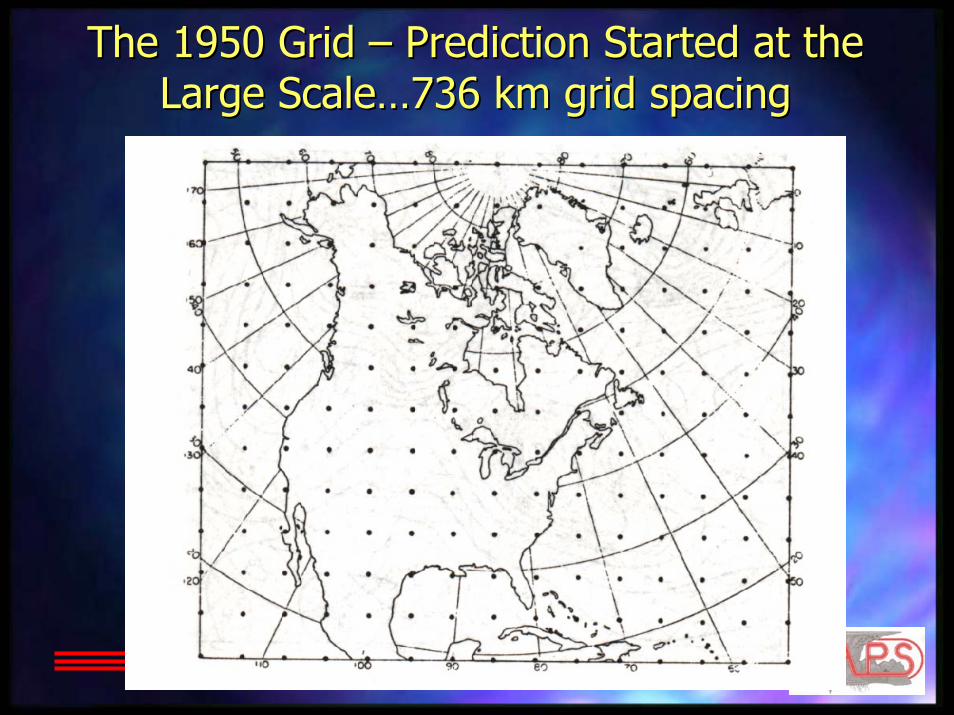
The 1950 Grid The 1950 Grid –– Prediction Started at the Prediction Started at the Large Scale…736 km grid spacingLarge Scale…736 km grid spacing

…And Grid Spacing Has Been…And Grid Spacing Has BeenDecreasing Ever SinceDecreasing Ever Since
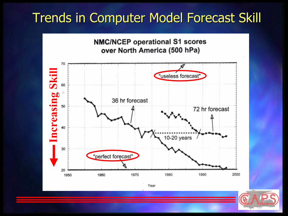
Trends in Computer Model Forecast SkillTrends in Computer Model Forecast Skill
Incr
easi
ng S
kill

Numerical Weather PredictionNumerical Weather Prediction
Collect andProcess Data
Make Observations
Dissemination to End Users
Run Forecast Model on
Supercomputer
Create Products

What Do Operational Forecast Models What Do Operational Forecast Models Currently Predict?Currently Predict?
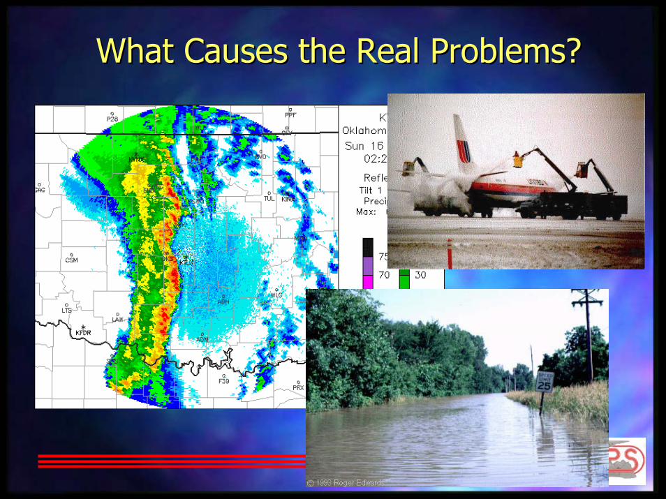
What Causes the Real Problems?What Causes the Real Problems?

Why the Lack of Detail? Why the Lack of Detail?
This ThunderstormFalls Through the Cracks

Why the Lack of Detail? Why the Lack of Detail?
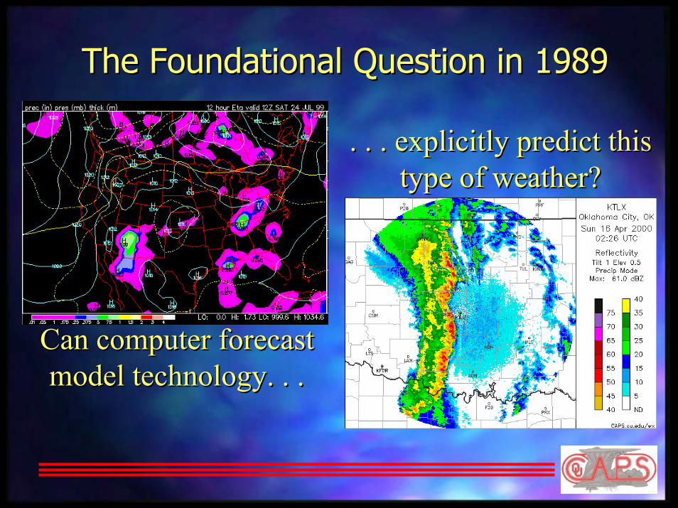
The Foundational Question in 1989The Foundational Question in 1989
Can computer forecastCan computer forecastmodel technology. . .model technology. . .
. . . explicitly predict this. . . explicitly predict thistype of weather?type of weather?
Center for AnalysisCenter for Analysisandand
Prediction of StormsPrediction of Storms
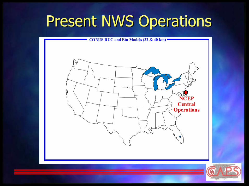
Present NWS OperationsPresent NWS OperationsCONUS RUC and Eta Models (32 & 40 km)
NCEP Central
Operations

SmallSmall--Scale Weather is LOCAL and Scale Weather is LOCAL and heterogeneous!heterogeneous!
SevereThunderstorms
Fog Rain andSnow
Rain andSnow
IntenseTurbulence
Snow andFreezing
Rain
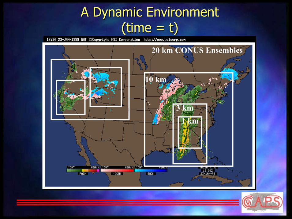
A Dynamic EnvironmentA Dynamic Environment(time = t)(time = t)
10 km
3 km1 km
20 km CONUS Ensembles
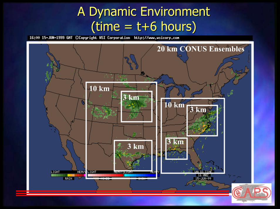
A Dynamic EnvironmentA Dynamic Environment(time = t+6 hours)(time = t+6 hours)
10 km
3 km3 km
3 km 3 km
10 km
20 km CONUS Ensembles
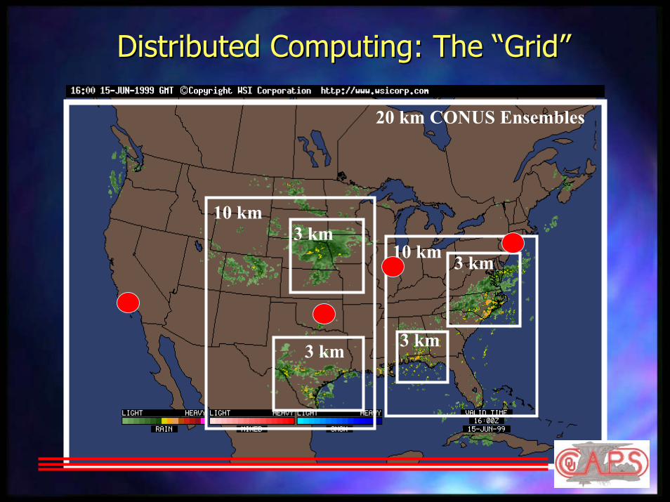
Distributed Computing: The “Grid”Distributed Computing: The “Grid”
10 km
3 km3 km
3 km 3 km
10 km
20 km CONUS Ensembles

Three Key Ingredients forThree Key Ingredients forStormStorm--Scale PredictionScale Prediction
#1 #1 ---- A computer forecast system that A computer forecast system that accurately represents complex accurately represents complex physical physical processesprocesses and operates and operates efficientlyefficiently on on parallel computersparallel computers

Advanced Regional Prediction System (ARPS)Advanced Regional Prediction System (ARPS)
ARPS Data Analysis System (ADAS)
ARPS Numerical Model– Multi-scale non-hydrostatic prediction model with comprehensive physics
– Plots and images – Animations – Diagnostics and statistics – Forecast evaluation
– Ingest – Quality control – Objective analysis – Archival
Single-Doppler Velocity Retrieval (SDVR)
4-D Vari ational
Data Assimilation
Variational Vel -ocity Adjustment
& Thermo-dynamic Retrieval
ARPS Data Assimilation System (ARPSDAS)
ARPSP LT and ARPSV IEW
Inco
min
g da
ta
Oklahoma MesonetWSR-88D Wideband
ASOS/AWOS
SAO
ACARSCLASS
Mobile Mesonet
Profilers
Rawinsondes
Satellite
Lateral boundary conditions from large-scale models
Gridded first guessData Acquisition
& AnalysisData Acquisition
& Analysis
Forecast GenerationForecast Generation
Parameter Retrieval and 4DDAParameter Retrieval and 4DDA
Product Generation and Data Support System
Product Generation and Data Support System
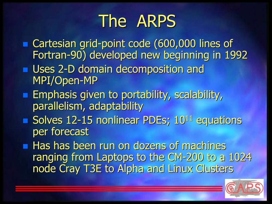
The ARPSThe ARPSCartesian gridCartesian grid--point code (600,000 lines of point code (600,000 lines of FortranFortran--90) developed new beginning in 199290) developed new beginning in 1992Uses 2Uses 2--D domain decomposition and D domain decomposition and MPI/OpenMPI/Open--MPMPEmphasis given to portability, scalability, Emphasis given to portability, scalability, parallelism, adaptabilityparallelism, adaptabilitySolves 12Solves 12--15 nonlinear 15 nonlinear PDEsPDEs; 10; 101111 equations equations per forecastper forecastHas has been run on dozens of machines Has has been run on dozens of machines ranging from Laptops to the CMranging from Laptops to the CM--200 to a 1024 200 to a 1024 node Cray T3E to Alpha and Linux Clustersnode Cray T3E to Alpha and Linux Clusters

ARPS Benchmark Timings19x19x43 3km grid/processor
0
10
20
30
40
50
60
70
80
90
100
0 25 50 75 100 125
Processors
Se
co
nd
sItanium 733MHZCAPS Origin 2000Platinum 1proc/nodePlatinum 2proc/nodeNCSA Origin 2000PSC ES-45PSC ES-40 IBM WHII Power3IBM NHII Power3SUN SF6800SUN-Fire 280-RIBM Regatta Power4P4-1.6Ghz w/P3 CompileSGI Origin 3000-400SGI Origin 3000-600Sun Sparc III 900

ARPS Benchmark Timings19x19x43 3km grid/processor
10
15
20
25
30
35
40
0 25 50 75 100 125
Processors
Se
co
nd
sPSC ES-40
IBM WHII Power3
IBM NHII Power3
SUN SF6800
SUN-Fire 280-R
IBM Regatta Power4
P4-1.6Ghz w/P3 Compile
SGI Origin 3000-400
SGI Origin 3000-600
Sun Sparc III 900
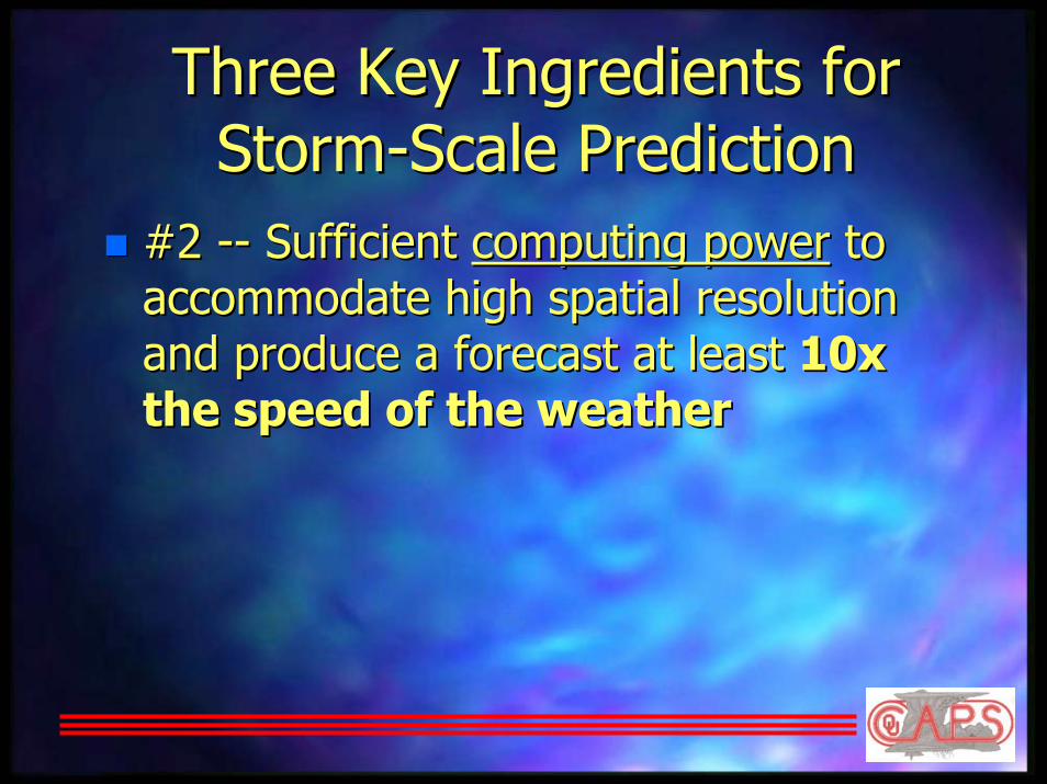
Three Key Ingredients forThree Key Ingredients forStormStorm--Scale PredictionScale Prediction
#2 #2 ---- Sufficient Sufficient computing powercomputing power to to accommodate high spatial resolution accommodate high spatial resolution and produce a forecast at least and produce a forecast at least 10x 10x the speed of the weatherthe speed of the weather


The Need for TeraflopsThe Need for TeraflopsMust fit the prediction model to the Must fit the prediction model to the observations (data assimilation/retrieval)observations (data assimilation/retrieval)–– About 50About 50--100 times as expensive as the forecast100 times as expensive as the forecast
Must use high spatial resolutionMust use high spatial resolution–– 11--3 km resolution in sufficiently large domains3 km resolution in sufficiently large domains
Must quantify forecast uncertainty Must quantify forecast uncertainty (ensembles)(ensembles)–– May need 20May need 20--30 forecasts to produce an ensemble 30 forecasts to produce an ensemble
each forecast cycleeach forecast cycleRequirements: 10Requirements: 10--100 TFLOPS 100 TFLOPS sustainedsustained; 0.5 TB ; 0.5 TB memory; 20 TB storagememory; 20 TB storage
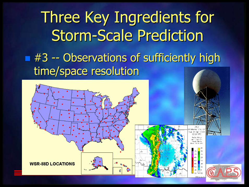
Three Key Ingredients forThree Key Ingredients forStormStorm--Scale PredictionScale Prediction
#3 #3 ---- Observations of sufficiently high Observations of sufficiently high time/space resolutiontime/space resolution

real real windwind
The Challenge of Using Doppler Radar The Challenge of Using Doppler Radar Data in Numerical Weather PredictionData in Numerical Weather Prediction
observedobservedcomponentcomponent
We need ...We need ...–– 3 wind components3 wind components–– temperaturetemperature–– humidityhumidity–– pressurepressure–– water substance (6water substance (6--10 fields)10 fields)
CAPS was created to exploreCAPS was created to exploresolutions to this “retrieval” problemsolutions to this “retrieval” problemand apply them to stormand apply them to storm--scale numericalscale numericalpredictionprediction
The radar observes ...The radar observes ...–– one (radial) wind componentone (radial) wind component–– precipitation intensityprecipitation intensity

The Impact of Regional/Local PredictionThe Impact of Regional/Local Prediction
CAPS 12-hourForecast (32 km)
Radar
Radar(Tornadoes
in Arkansas)

The Impact of Regional/Local PredictionThe Impact of Regional/Local Prediction
Radar(Tornadoes
in Arkansas)
CAPS 6-hour Regional Forecast
(9 km)
Radar
The Impact of Regional/Local PredictionThe Impact of Regional/Local Prediction
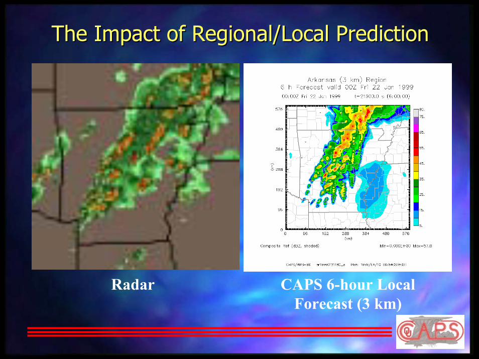
Radar CAPS 6-hour LocalForecast (3 km)

Real Time ForecastsReal Time Forecasts

Data and Process Flow TimelineAMS-99 • Southern Plains (9 km) grid • 9 h forecast
Processed data/Model output
Raw data
ProductsData from OUData from OU
ARPSINTRP40 proc
T–0:30 T+0:00 T+0:30 T+1:00 T+1:30
Boundary conditions
Initial conditions
U.S
. (32
km
grid
)A
RPS
fore
cast
Sate
llite
SurfaceRawinsondeProfilerMDCRS
Data at NCSAData at NCSA
NIDS2ARPS4 proc
28 radars
ARPS121 proc
NEX
RA
D R
etrie
val
ADAS120 proc
SAT2ARPS1 proc
ARPSPLT4 proc
9 min/hN
EXR
AD
(NID
S)


3 May 1999 Oklahoma3 May 1999 OklahomaTornado OutbreakTornado Outbreak
Copyright 1999 The Daily Oklahoman

May 3 Tornado Tracks/IntensityMay 3 Tornado Tracks/Intensity
Courtesy Oklahoma City Area National Weather Service Forecast Office
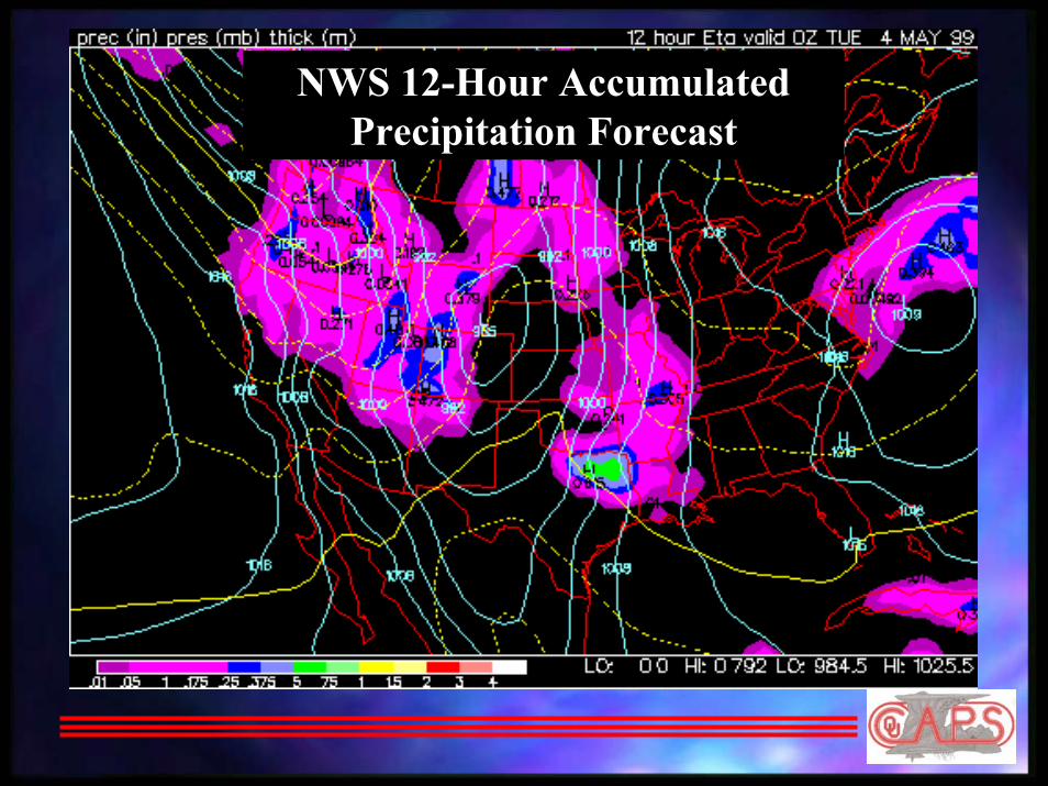
NWS 12-Hour Accumulated Precipitation Forecast
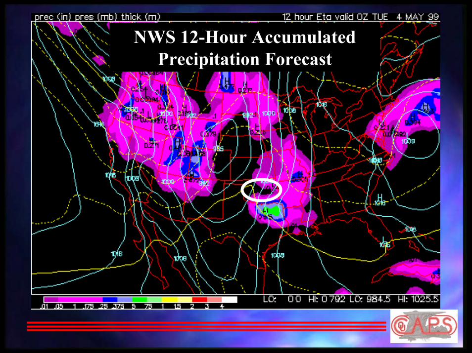
NWS 12-Hour Accumulated Precipitation Forecast

CAPS Numerical Forecasts of the May 3 Tornadic StormsCAPS Numerical Forecasts of the May 3 Tornadic Storms

March 28, 2000 Fort Worth March 28, 2000 Fort Worth TornadoTornado

Fort Worth Tornadic Storm on TV RadarFort Worth Tornadic Storm on TV Radar

NWS 12NWS 12--hr NWS Forecast (32 km resolution) Valid 6 pm CDThr NWS Forecast (32 km resolution) Valid 6 pm CDT(shading indicates 12(shading indicates 12--hr accumulated precipitation)hr accumulated precipitation)
No hint of precipitationin north Texas
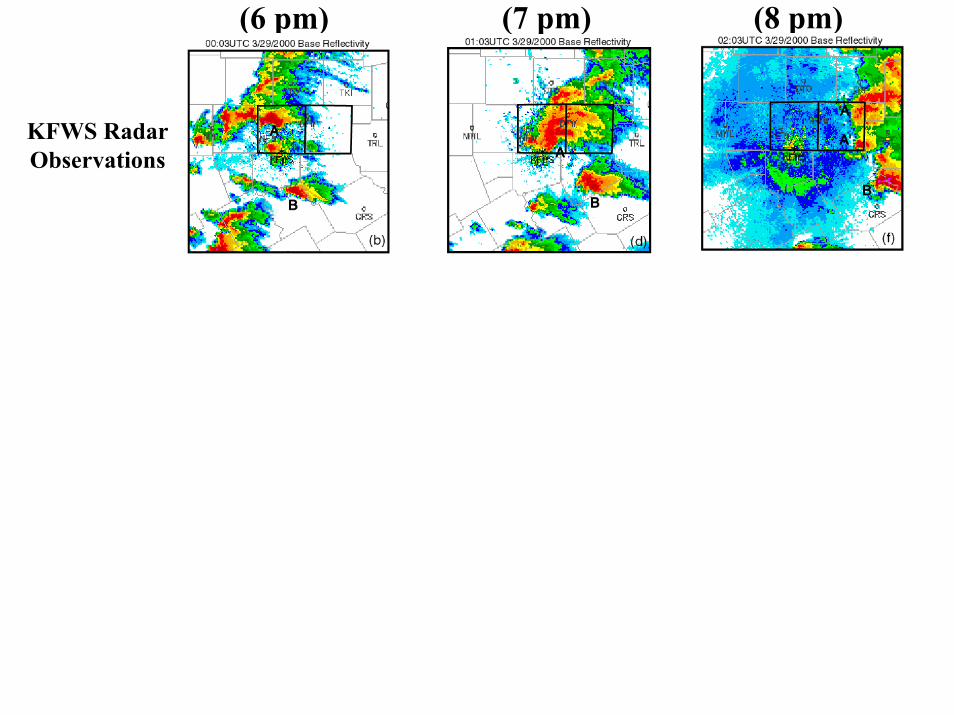
(7 pm) (8 pm)(6 pm)
KFWS RadarObservations

3 hrs (7 pm) 4 hrs (8 pm)2 hrs (6 pm)
KFWS RadarObservations
ARPS 3 kmForecast
With RadarData

3 hrs (7 pm) 4 hrs (8 pm)2 hrs (6 pm)
KFWS RadarObservations
ARPS 3 kmForecast
With RadarData
ARPS 3 kmForecast
Without RadarData

How Good are the Forecasts??How Good are the Forecasts??Forecast Actual Event
D/FW Airport
30 miles
A perfectly predicted storm having a position error A perfectly predicted storm having a position error of 30 miles may be a terrible forecast on the scale of 30 miles may be a terrible forecast on the scale
of a single airportof a single airport
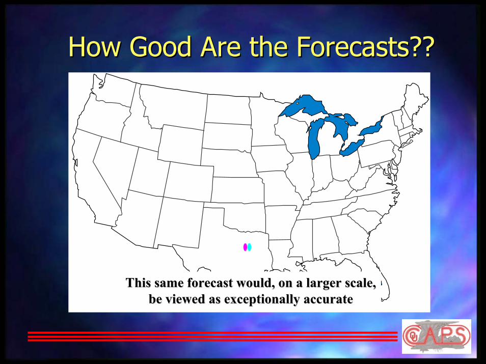
How Good Are the Forecasts??How Good Are the Forecasts??
This same forecast would, on a larger scale,This same forecast would, on a larger scale,be viewed as exceptionally accuratebe viewed as exceptionally accurate

Pinning Your Forecast on a Single Pinning Your Forecast on a Single Model Run???Model Run???
Amarillo
Fort Worth

Pinning Your Forecast on a Single Pinning Your Forecast on a Single Model Run???Model Run???
3 km ARPS Forecast Valid 00Z Monday, 16 June 1997
Amarillo
Fort Worth

StormStorm--Scale Ensembles in ActionScale Ensembles in ActionAmarillo
5-Member, 3 km ARPS Ensemble
Fort Worth
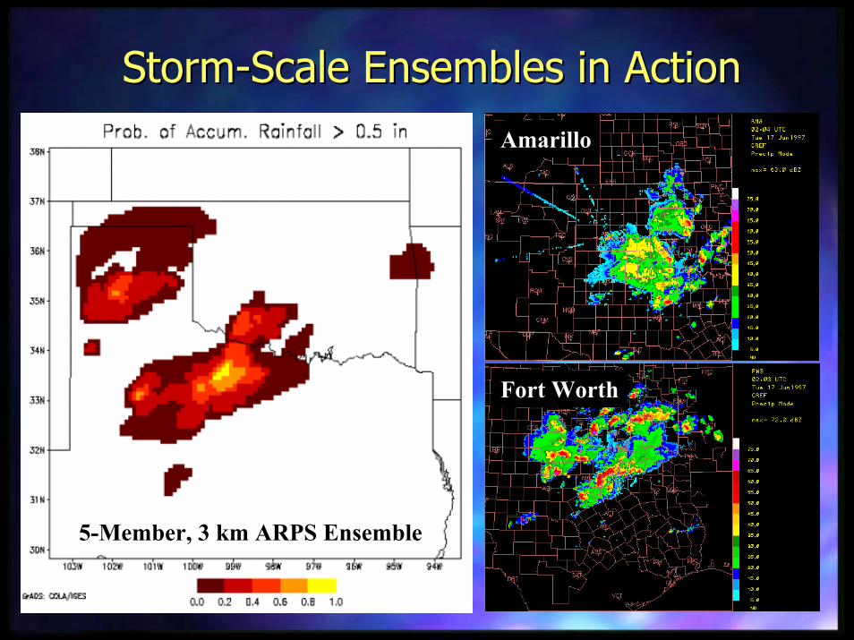
StormStorm--Scale Ensembles in ActionScale Ensembles in Action
5-Member, 3 km ARPS Ensemble
Amarillo
Fort Worth

The Private Sector Enters the The Private Sector Enters the NWP GameNWP Game
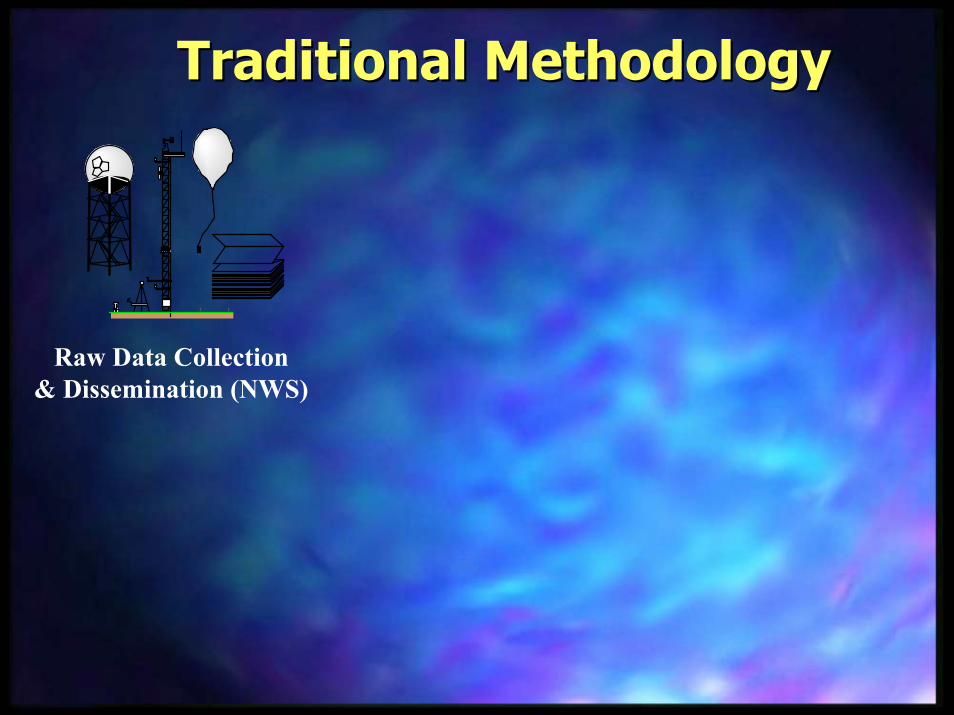
Traditional MethodologyTraditional Methodology
Raw Data Collection& Dissemination (NWS)

Traditional MethodologyTraditional Methodology
Raw Data Collection& Dissemination (NWS) Forecast Models (NWS)
Computer

Traditional MethodologyTraditional Methodology
Raw Data Collection& Dissemination (NWS) Forecast Models (NWS)
Computer Data/Products (NWS)

Traditional MethodologyTraditional Methodology
Raw Data Collection& Dissemination (NWS) Forecast Models (NWS)
Computer Data/Products (NWS)
Analysis, Advice Basedon NWS Information

Traditional MethodologyTraditional Methodology
Raw Data Collection& Dissemination (NWS) Forecast Models (NWS)
Computer Data/Products (NWS)
Analysis, Advice Basedon NWS Information
Decision Makers

Traditional MethodologyTraditional Methodology
Raw Data Collection& Dissemination (NWS)
Data/Products (NWS)
Analysis, Advice Basedon NWS Information
US National Weather ServiceUS National Weather Service
ComputerForecast Models (NWS)
Decision Makers

Traditional MethodologyTraditional Methodology
Analysis, Advice Basedon NWS Information
US National Weather ServiceUS National Weather Service
Private SectorPrivate Sector
Decision Makers
Raw Data Collection& Dissemination (NWS)
Data/Products (NWS)ComputerForecast Models (NWS)
Raw Data Collection& Dissemination
(NWS)
Customized Data
Input to Customized RiskModels and Tools
Customized ComputerForecast Models/Decision
Support Tools
Decision Makers
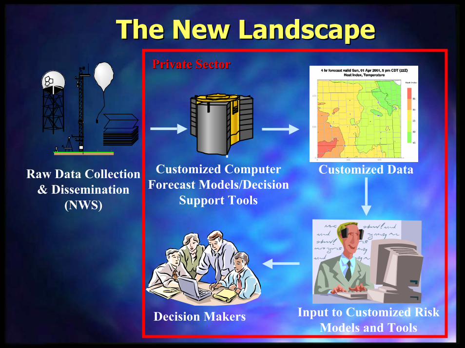
Private SectorPrivate Sector
The New LandscapeThe New Landscape

Raw Data Collection& Dissemination
(NWS)
Customized Data
Input to Customized RiskModels and Tools
Decision Makers
Private SectorPrivate Sector
Customized ComputerForecast Models/Decision
Support Tools
The New LandscapeThe New Landscape

Other Information Other Information Technology ActivitiesTechnology Activities
atat

NEXRAD Radar NetworkNEXRAD Radar Network

Ingesting NEXRAD Radar Data via the InternetIngesting NEXRAD Radar Data via the Internet

Mesocyclone Climatologies Mesocyclone Climatologies Medium ITR GrantMedium ITR Grant
Courtesy Thomas Jones and Kevin McGrath, University of Oklahoma

NEXRAD
in-situ surfaceobservations
NEXRAD
NEXRADGap

Center for Adaptive Sampling of the Center for Adaptive Sampling of the Atmosphere (CASA) Atmosphere (CASA) –– NSF ERC ProposalNSF ERC Proposal
Oklahoma CellNetwork
Concept: Prof. D. Concept: Prof. D. McLaughlin, McLaughlin,
U of MassachusettsU of Massachusetts
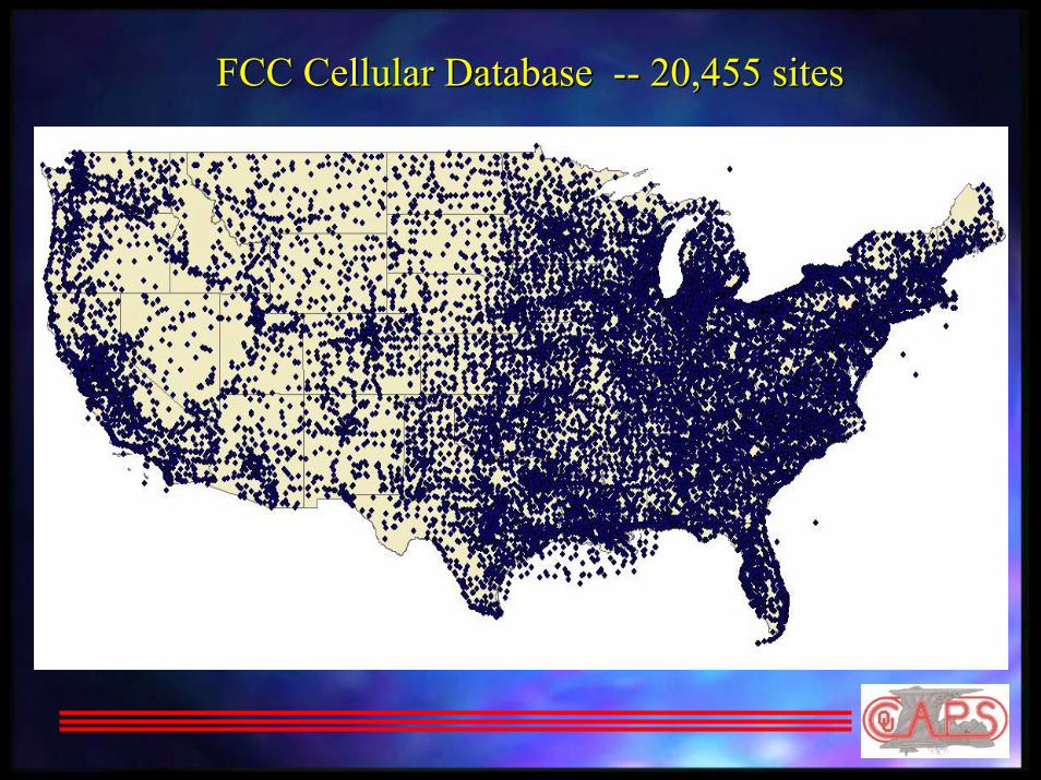
FCC Cellular Database FCC Cellular Database ---- 20,455 sites20,455 sites

Data Handling Requirements
Per Pixel Data storage: 10 bytes per observation
Assume sensor nodes update each minute.
Total Data Volume• Regional Network: 25 Gbytes per observation;
26 Tbytes per day
• Nation-wide Network: 900 Gbytes per observation; 1.3 Pbytes per day

Dealing with the Flood of Information
Generating itGenerating itMoving itMoving itAnalyzing (mining) itAnalyzing (mining) itStoring itStoring itFinding itFinding itAccessing itAccessing itCombining itCombining itAs scientists and engineers, we spend well over As scientists and engineers, we spend well over 50% of our time dealing with the 50% of our time dealing with the logistics of logistics of informationinformation
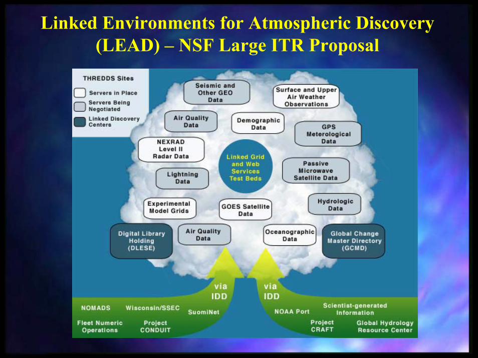
Linked Environments for Atmospheric Discovery (LEAD) – NSF Large ITR Proposal

Linked Environments for Atmospheric Discovery (LEAD) – NSF Large ITR Proposal