mineral assessment report on mineral claim...
TRANSCRIPT

1
Mineral Assessment Report on Mineral Claim Licence No. 10231M (13th Year)
Turks Gut Property, NTS: 01N/06 and 01N/11
submitted by:
Derek H. C. Wilton, P.Geo. 7 Yellowknife St.
St. John’s NL A1A 2Z7
for Copper Hill Resources Inc.
24 Vancouver Street, St. John’s, NL, A1A 2R6 October 28, 2006
Work Year: 2005-2006 Total Claims: 4
Total expenditures: $12,882.30

2
Table of Contents Page I INTRODUCTION……………….………………………….………………………………………2 Scope……………………….…………………………………………….………………...2 Location and Access……….…………………………………………………………….…2 Physiography……………….…………………………………………………………..……2 Claims Ownership and Disposition…..…………………………………………………….2 PreviousWork………………………….…………………………………………………… 5 2006 Exploration Program……………….…………………………………………………5 II GEOLOGY……………………………………………………………………………………….5 Regional geology and mineralization……………………………………………………….5 III MAPPING AND PROSPECTING…………………………………………………………..……6 Prospecting and mapping surveys…………………………………………………………..6 IV CONCLUSIONS AND RECOMMENDATIONS………………………………………………6 REFERENCES CITED………………………………………………………………………………..7 Statement of Qualifications…………………………………………………………………………8 Appendix I (Akkerman report) Appendix II Statement of Expenses

3
I. INTRODUCTION This report describes 13th year exploration work carried out by Copper Hill Resources Inc. on their Turk’s Gut Property, Licence 10231M. The exploration work consisted of mapping, prospecting, and derivation of a compilation report (Appendix I). Scope The scope of this report will be to provide an overview of the prospecting, geologic mapping, and compilation work. The author visited the claims in 1998 and 1999, and wrote earlier assessments reports; he was not directly involved in the 2005-2006 field work. Location and Access The Turks’ Gut Property is located on the west side of Conception Bay 6 km north of the town of Avondale. The property itself is easily accessed by road and is approximately 45 minutes drive from the city of St. John’s (~ 37 km to the westsouthwest). Table 1 lists the Licence Number, number of claims within, and issue date of the licence; the general spatial location of the licence is indicated in Figure 1. Table 1 Licence Number of Claims Issue Date 10231M 4 2003/09/13 Physiography
The claims are distributed north-east to south-west over a predominant ridge, that is approximately 100 m high at its maximum. The seaward side of the ridge is typically quite steep to sheer cliff. The inland side of the ridge can also be quite steep to the point where it is covered in talus. Towards the north-east the top of the ridge has a narrow flat portion. Vegetation can be incredibly thick at times making passage nearly impossible. This type of vegetation is most common on the slopes of the ridge. Claims Disposition and Ownership Vulcan Minerals Ltd. of St. John’s staked Licence No. 4375 in 1992. In late November 1996, Copper Hill Resources Ltd. bought the rights to the Turks Gut Property from Vulcan Minerals Ltd.. Subsequently, Copper Hill Resources Ltd staked a further 40 claims (Licence No.’s 5287M, 5334M and 5461M) on the W and SW of the property.

4
Figure 1: Location of Turks Gut claims
10231M
5
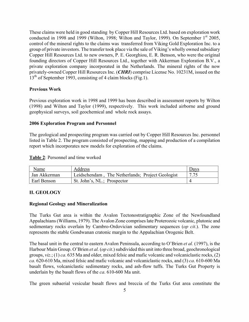
These claims were held in good standing by Copper Hill Resources Ltd. based on exploration work conducted in 1998 and 1999 (Wilton, 1998; Wilton and Taylor, 1999). On September 1st 2005, control of the mineral rights to the claims was transferred from Viking Gold Exploration Inc. to a group of private investors. The transfer took place via the sale of Viking’s wholly owned subsidiary Copper Hill Resources Ltd. to new owners, P. E. Georghiou, E. R. Benson, who were the original founding directors of Copper Hill Resources Ltd., together with Akkerman Exploration B.V., a private exploration company incorporated in the Netherlands. The mineral rights of the now privately-owned Copper Hill Resources Inc. (CHRI) comprise License No. 10231M, issued on the 13th of September 1993, consisting of 4 claim blocks (Fig.1). Previous Work Previous exploration work in 1998 and 1999 has been described in assessment reports by Wilton (1998) and Wilton and Taylor (1999), respectively. This work included airborne and ground geophysical surveys, soil geochemical and whole rock assays. 2006 Exploration Program and Personnel The geological and prospecting program was carried out by Copper Hill Resources Inc. personnel listed in Table 2. The program consisted of prospecting, mapping and production of a compilation report which incorporates new models for exploration of the claims. Table 2: Personnel and time worked
Name Address Days Jan Akkerman Leidschendam , The Netherlands; Project Geologist 7.75 Earl Benson St. John’s, NL.; Prospector 4
II. GEOLOGY Regional Geology and Mineralization The Turks Gut area is within the Avalon Tectonostratigraphic Zone of the Newfoundland Appalachians (Williams, 1979). The Avalon Zone comprises late Proterozoic volcanic, plutonic and sedimentary rocks overlain by Cambro-Ordovician sedimentary sequences (op cit.). The zone represents the stable Gondwanan cratonic margin to the Appalachian Orogenic Belt. The basal unit in the central to eastern Avalon Peninsula, according to O’Brien et al. (1997), is the Harbour Main Group. O’Brien et al. (op cit.) subdivided this unit into three broad, geochronological groups, viz.; (1) ca. 635 Ma and older, mixed felsic and mafic volcanic and volcaniclastic rocks, (2) ca. 620-610 Ma, mixed felsic and mafic volcanic and volcaniclastic rocks, and (3) ca. 610-600 Ma basalt flows, volcaniclastic sedimentary rocks, and ash-flow tuffs. The Turks Gut Property is underlain by the basalt flows of the ca. 610-600 Ma unit. The green subaerial vesicular basalt flows and breccia of the Turks Gut area constitute the

6
stratigraphic top of the Harbour Main Group and are exposed in the western flank of the regional anticline. O’Brien et al. (2001) mapped them as the Blue Hills Basalt. These basalts are conformably underlain felsic tuffs with intercalated red sandstone and conglomerate of the Peak Tuff (op cit). The property contains two adit systems (and shafts). The northernmost one is called Adit No. 1 and is located on the ridge immediately above the road to Turks Gut. Adit No. 2 is located ~ 3.5 km to the SSW of Adit No.1 on the eastern side of the ridge immediately above the shore. Geologists with Vulcan Minerals discovered a strike extension of the mineralization 120 m to SE of the shaft; the so-called Turks Gut East Showing. III MAPPING AND PROSPECTING PROGRAM Prospecting & Mapping Survey The field work was undertaken during three field trips to the property in 2005-2006 by J. Akkerman and E. Benson, principles in Copper Hill Resources Inc. (Akkerman, 2006; Appendix I). According to Akkerman (2006 – Appendix I), the mapping consisted of three main components: 1) Inspection of the primary lithological and textural features of the volcanic host rocks in outcrops on the Man-of-War Ridge, 2) Structural mapping of bedding planes, fault structures and schistosity, and 3) Screening for mineral showings and sampling and characterization of mineralization found. Akkerman (2006) also reported the discovery of bornite-chalcocite with malachite in veins and pods within secondary tension faults along the shore between the Turks Gut wharf and Turks Head over a distance of about 0.5 km. The discovery sites were termed T24, T7, T8, T10, T11 and T12 (op cit.). IV CONCLUSIONS AND RECOMMENDATIONS Akkerman (2006) concluded that the Turks Gut prospect has considerable potential for economic grades and sizes of copper mineralization. He suggested that there were two potential exploration targets on the property, viz.; 1) high-grade copper-silver veins and breccia fillings which crosscut the volcanic stratigraphy along high-angle faults and 2) tabular bodies of lower-grade disseminated copper hosted by porous host rocks, parallel to the volcanic stratigraphy. He recommended that three to four drill holes with a maximum depth of 200 m be drilled at Adit No. 1 and the East Showing in order to define: 1) the strike and depth extension of the main mineralized structure at Adit No.1, 2) the grade and thickness of the vein-type mineralization and possible facies changes, 3) the overall textures and stratigraphy within the vesicular lavas, 4) the grade and thickness of strata containing disseminated, replacement-style copper ore, and 5) the origin of the strong EM conductors detected by the airborne survey. He also recommended that a detailed petrological and mineralogical study be conducted on a series of representative samples from the surface showings and mineralized drill core to better characterize the ore mineralogy.

7
REFERENCES CITED Akkerman, J 2006: Geological Assessment: Turks Gut Copper-Silver Prospect, Avalon Peninsula, Eastern Newfoundland, Canada. Unpublished report to Copper Hill Resources Inc.. O’Brien S J, Dunning G R, Dubé B, O’Driscoll C F, Sparkes B, Israel S, and Ketchum J 2001: New insights into the Neoproterozoic geology of the Central Avalon Peninsula (Parts of NTS Map areas 1N/6, 1N/7, 1N/3), Eastern Newfoundland. Newfoundland Department of Mines and Energy, , Geological Survey Report 2001-1, pages 169-189 O’Brien S J, King A F, and O’Driscoll C F 1997: Late Neoproterozoic Geology of the Central Avalon Peninsula, Newfoundland, with an overview of mineralization and hydrothermal alteration. Newfoundland Department of Mines and Energy, Geological Survey, Report 97-1, pages 257-282
Williams H 1979: Appalachian Orogeny in Canada. Canadian Journal of Earth Sciences, Volume 16, pages 792-807 Wilton, D 1998: Third year Mineral Assessment Report on Geological, Geophysical and Prospecting Surveys covering Mineral Claim License No. 4375 (NTS Mapsheets 11N/11,6), The Turks Gut Property, Newfoundland Wilton, D, and Taylor, R 1999: Fourth year Mineral Assessment Report on Geological, Geophysical and Prospecting Surveys covering Mineral Claim License No. 4375 (NTS Mapsheets 11N/11,6), The Turks Gut, property, Newfoundland

9
APPENDIX I – Akkerman report

AI/1
Geological Assessment:
Turks Gut Copper-Silver Prospect, Avalon Peninsula, Eastern Newfoundland, Canada
Adit No 1 looking south

AI/2
1. Introduction ---------------------------------------------- p. 3 2. Mineral Rights ---------------------------------------------- p. 4 3. Regional Geology ---------------------------------------------- p. 5 4. Local Geology` ---------------------------------------------- p. 7 5. Known Mineralization ------------------------------------- p. 9 6. Previous Exploration ----------------------------------------- p.10 7. Geological Reconnaissance 2005-2006 -------------------- p.11 7.1 Observations on the Volcanic host rocks 7.2 Structural observations 7.3 Observations on mineral showings 8. Mineral Potential ---------------------------------------------- p.21 9. Recommendations ---------------------------------------------- p.22 References ----------------------------------------------------- p.23 Figures: Fig. 1. Copper Hill claim blocks in the Turks Gut area (as at August ’06) Fig. 2. Local geology; setting of Turks Gut area and the distribution of the Blue Hills Basalts Fig. 3. Stratigraphy of the Blue Hills Basalts in the Colliers-Turks Gut region. Photos: Outcrop T03; Photo of Adit No. 1, looking south Outcrop T17; Looking in southwest direction along the Man of War Ridge, parallel to the strike of the basaltic sequence. The dip of the volcanic strata is to the right. Outcrop T13; Impression of volcanic agglomerates of rounded fragments in fine sandy matrix. Turks Head at sea shore. Outcrop T22; Bedding and cleavage developed in metasediments of the Concepcion Bay group, exposed on the northeast side of the Turks Gut inlet. Weak late-stage kink bands can also be seen (sub-horizontal) Outcrop T01; Image of pieces of massive bornite with minor secondary azurite and malachite, selected from the dumps down-slope of Adit No. 1. Sample site T04; Image of mineralized breccia from the East Showing; matrix of coarse calcite and copper sulphide filling cracks, vesicles and pore spaces in the angular volcanic fragments. Sample site T4; As above with stronger impregnation with bornite and chalcocite, along cracks and as disseminations in the matrix and the fragments. Outcrop T10; Massive bornite veins and pods filling open spaces in fault breccia, accompanied by calcite and copper-oxides. Outcrop T12; Irregular pockets of massive bornite with epidote and minor calcite, filling open spaces along irregular cracks. Attachment A: Regional Geological Map and Legend of the central Avalon Peninsula (from S.J. O’Brien et all, 1997) Attachment B: Compilation Maps at 1:5,000 and 1:2,500 scale Attachment C: Description of Volcanic Red Bed Copper model

AI/3
1. Introduction The Turks Gut prospect comprises an old, small-scale copper-sulphide working and several copper oxide showings hosted by a pile of basalts of Upper-Proterozoic age located on the Avalon Peninsula, Eastern Newfoundland. Mining of near-surface, high-grade copper sulphides took place between 1855 and 1868 and was sent as direct smelting ore to Ireland or more likely, Wales. The prospect has seen relatively little exploration to date. The bulk of previous investigations was conducted in the period 1993 to 1999. Thereafter, exploration has been dormant until a Copper Hill Resources Inc. (“CHRI”) acquired the property in September 2005. This report describes the results of initial data compilation, geological reconnaissance and mapping at the Turks Gut copper-silver prospect commissioned by the new owners. The work conducted has focused on the characterization of the known mineralization and highlights newly discovered mineral showings in the vicinity of the old workings. The report concludes with considerations on the prospect’s exploration potential, based on a comparative analyses of the data and information compiled in this study with genetic models and exploration concepts for “Volcanic Red Bed” or “Manto-Type” copper deposits. The Turks Gut property is located on the Avalon Penninsula, Eastern Newfoundland, about 40km WSW of St. John’s and 3.8km SE of the town. The claims are located on a NE-trending ridge of 90m elevation, called the “Man-of-War Ridge” and the “Marysvale Ridge” for the part extending to the SW. The property can be accessed by a small paved road ending at the site of a wharf and old fish processing plant at the Turks Gut inlet. 2. Mineral Rights On September 1st 2005, mineral rights over the Turks Gut Copper-Silver prospect were transferred from the public-listed company Viking Gold Exploration Inc. (“Viking”) to a group of private investors. The transfer took place via the sale of Viking’s wholly owned subsidiary CHRI to the new owners P. E. Georghiou, E. R. Benson, who were the founding directors of CHRI and Copper Hill Corp. (later re-named Viking) together with Akkerman Exploration B.V., a private exploration company incorporated in the Netherlands and led by J.H. Akkerman, former senior exploration manager for Billiton International Metals. The mineral rights of the now privately-owned CHRI comprise License No. 10231M, issued on the 13th of September 1993, consisting of 4 claim blocks (see Fig.1 below): During early 2006, CHRI, staked 7 additional claim blocks north of Turks Gut. Results from reconnaissance visits and initial prospecting in these areas will be described in a separate report.

AI/4
Fig. 1. CHRI claim blocks in the Turks Gut area (as at August ’06)
10231M

AI/5
3. Regional Geology (Source: S.J. O’Brien, et al, 1997 and 2001). The volcanic host rocks at Turks Gut form part of a Late Proterozoic, lithologically complex sequence of volcanic and subordinate sedimentary rocks, deposited on the older Pre-Cambrian crystalline basement of the Avalon Peninsula, Eastern Newfoundland (Williams, 1979). These volcanics and related sediments have historically been grouped together as the Harbour Main Group (Rose, 1952). Depositional conditions for the volcanic products alternated over time between shallow marine and sub-aerial. The complex nature of the Harbour Main Group stems from the large variety of volcanic lithologies in terms of texture and composition. They range from lavas, volcanic agglomerates, tuffs to subaerial ash-flows and reworked volcanics. Their composition varies from mafic to felsic, while in age they span the time period between 635 to 600 Ma. (King, 1988a). The basalts at Turks Gut represent the top part of the Harbour Main Group. The volcanics are locally intruded by a coeval suite of plutonic rocks, referred to as the Holyrood Intrusive Suite, of predominantly granitic and granodioritic composition with minor diorite and gabbro. The Harbour Main Group volcanics and coeval Holyrood intrusives are exposed in the core of a district scale, open anticline, formed during the Appalachian orogeny. They are overlain with an angular unconformity by a sedimentary succession of Cambrian to Early Paleozoic age. These sediments display a progressive shoaling upwards of marine turbidites, deltaic shales to terrestrial silica-rich sands. They are commonly referred to as the Conception Group. Regionally, rocks of the Conception Group occupy the flanks of anticline to both the West and the East. Contacts with the older sequences are often fault-controlled, the larger of which are the Topsail Fault in the East and the Gasters and Marysvale faults to the West, the latter passing at close proximity to Turks Gut. Metamorphic grade is generally low, not exceeding lower greenschist facies. The regional distribution and structure of the various Proterozoic lithologies is shown on the regional geological Map and Legend, added to this report as Attachment A.

AI/6
4. Local Geology The mafic volcanics of the Turks Gut area, occur in the stratigraphic top of the Harbour Main Group and are exposed in the western flank of the regional anticline. They are described as green subaerial vesicular basalt flows and breccia and have recently been denominated the Blue Hills Basalt (S.J. O’Brien et al., 2001). The basalts are concordantly underlain by a series of multicolored felsic tuffs and intercalated red sandstone and conglomer-ate, named the Peak Tuff. The estimated age of this formation is 606 +/- 3 Ma, which provides indirectly the lower age of the overlying basalts. The hanging-wall of the Blue Hills Basalts is made up of green-gray turbidites of the Late NeoProterozoic Conception Group and lower Cambrian shales, dated at 565Ma. The distribution of the above three units is illustrated in Fig. 2 (on the right). The intrusive rocks that are nearest to Turks Gut are a series of narrow sheets and plugs of quartz-feldspar porphyry and granophyre intruded in the Peak Tuff, locally accompanied by narrow fault-controlled zones with hydrothermal alteration. The stratigraphic thickness of the Blue Hills Basalt sequence is estimated to be at least 600m around Colliers Bay). The uppermost part is defined by well- rounded, coarse mixed mafic breccia and agglomerates. Chlorite-epidote-calcite alteration is common and is probably due to local interaction with seawater (spillitization).
Figure 2. Setting of the Turks Gut area and distribution of Blue Hill Basalt host rocks to the copper ore. (Courtesy: S. O’Brien et al., Geol. Survey, Newfoundland and Labrador.)

AI/7
The local stratigraphy of the Blue Hills Basalts and the footwall and hanging wall formations is illustrated in Fig. 3 below. Fig. 3. Stratigraphy of the Blue Hills Basalts in the Colliers-Turks Gut region.
AI/8
5. Known Mineralization Turks Gut Adit No.1 Mining of the copper ore exposed in the old workings on the flank of the ridge with the outcropping basalts, dates back to 1856, as mentioned in a report by Murray dated 1868. The workings were described as a drift of 27-m length along a high-grade ore shoot at an elevation of 33.9 m above sea level and a shaft of 54.86m deep. Past production of Peacock Copper ore is mentioned to be less than 31 tons during three years between 1855 and 1860. High-grade copper ore was hand picked and shipped as direct smelting ore to Wales. The mineral assemblage of the ore has been described as bornite, chalcocite, chalcopyrite with variable amounts of secondary copper oxides (malachite and azurite) set in a coarse crystalline gangue of calcite and silica. Turks Gut “East Showing” Located about 120m SE of Adit No1 and consisting of mineralized float of brecciated vesicular basalt, spread over an area of several square meters. The site was discovered by Laracy and Oates during initial prospecting in the mid-nineteen nineties. Adit No. 2 Consists of a horizontal adit along the coast at some 3.5km SE of Adit No. 1. The adit was cut perpendicular to the cliff with a length of 7m, following a fracture filled with epidote, calcite, malachite and bornite. Disseminated copper mineralization in vesicular basalt is reported from a zone near adit 2, termed the OBD zone (discovered by Oates, Benson and Dymond, 1996). Colliers River Consists of an old shaft surrounded by dumps containing fragments of mineralized vesicular basalts. In recent years the shaft was filled in as part of an environmental and safety hazards program. The site of the shaft and the removed dumps were found during a brief visit to the area by the author, but no trace of copper mineralization could be found. The area was recently staked by a joint venture Atlas Mining Company and KAT Exploration. On the Atlas website, “Colliers”, is described as a stratabound undivided epigenetic volcanic deposit. They report that the deposit has never been drilled but assay results reach as high as 11.7% Cu and 63.7 grams Ag per-ton. The copper mineralization consists of chalcocite, bornite and calcite in an andesitic and basaltic host rock.

AI/9
6. Previous Exploration Work done Modern exploration started in 1992 when exploration claims were staked over Turks Gut by prospectors P. Laracy and B. Oates for Vulcan Minerals Ltd. Work done and results obtained are described in the annual assessment reports issued for license No. 4375 and later reissued as 10231M. The record of past exploration is largely based on a review of these reports. 1994-1995 Detailed prospecting and sampling of the
old workings and surrounding areas; preparation of geological map (1:3,500) and section.
Laracy and Oates
1993 ? Ground VLF-EM and magnetometer survey over the old mine and surrounding areas; 5 profiles with total length of 1600 m 12.5-m station spacing
Verbiski Explorations
1996 Prospecting CHRI; W. Jacobs; E. Benson; P. Georghiou; D. Dymond
1997 Rock and channel sampling of the old workings and surroundings. Detailed sample location map.
CHRI; W. Jacobs; A. Turpin; M. Shore
March-May 1997
Airborne Mag-4 frequency EM survey, 100 line-km over 27 lines at 100-m spacing, flown in a NW direction by helicopter. Terrain clearance was 100 ft.
Aero Surveys Ltd.; S. Lombardo
1998 Soil Geochemistry and mapping using a local grid of 10 profiles at 100-m spacing across the ridge, centered on Adit No. 1. (baseline L98). Profiles extended 400 m to the SW and 500 m to the NE, with samples taken at 25 m intervals; in total 53 samples.
Pearl Resources
1998 Max- Min horizontal loop survey conducted over the same profiles as used for the soil sampling (see above)

AI/10
Highlights of past results
- 1994: “High-grade (>10%) Cu and Ag (>10 oz) in assays from old workings, as well as discovery of “East Showing”, 120m southeast from Adit No.1 on the other side of the ridge;
- 1993: VLF-EM responses (cross-over) coincident with Adit No 1 and the East
Showing;
- 1996: Discovery of disseminated mineralization at the OBD zone near Adit No. 2; - 1997: Several medium-to-strong Airborne Frequency-EM conductors located
northwest of Adit No 1: The conductors are aligned along a NNW-SSE linear trend in an area with relative low magnetic and low resistive values. Ground follow up and drill-testing to date has not been conducted;
- 1997: First geological sketch map of the old workings and indication of bulk
grades based on 1-m long channel samples with grades averaging ranging from 0.11-11.3 % Cu; and 0.07-8.4 oz Ag;
- 1998: Weak anomalous Cu in soil samples (up to 225 g/t Cu) concentrated in area
north of Adit No.1 (lines 101E and 102E). Accompanied by elevated barite, cobalt and manganese contents;
- 1998: Two weak in-phase conductors outlined, one of which (95+00N, 12+50S)
is coincident with the east showing, for the other (95+00N, 12+50S) no apparent source could be found.
The above results have been integrated in the 1:5,000 and 1:2,500 scale compilation maps presented in Attachment B. 6. Geological Reconnaissance 2005-2006 Geological reconnaissance was conducted during 3 field tours conducted in 2005 and 2006 by J.H. Akkerman of Akkerman Consulting B.V. accompanied by E. R. Benson. Both are shareholders of the now private CHRI. Reconnaissance involved:
1. Inspection of the primary lithological and textural features of the volcanic host rocks in outcrops on the Man-of-War Ridge;
2. Structural mapping of bedding planes, fault structures and schistosity; 3. Screening for mineral showings and sampling + characterization of
mineralization found.

AI/11
7.1 Observations on the Volcanic host rocks The outcrops around Adit No 1 consist of a series of thick bedded lavas, volcanic breccias and agglomerates. In the more continuous outcrop along the steep dipping slopes and cliff at the eastern side of the main ridge, lateral facies changes can be observed from thick flows to volcanoclastic lithologies. The lavas are often vesicular, with vesicles ranging in size from a few millimeters to up to 1 cm in few occasions. Most vesicles are empty, but in some cases some infilling with calcite and epidote can be seen. Thickness of individual flows can reach over 1-m. Brecciation occurs at flow tops and in lateral equivalents, with matrix and fragments composed of the same volcanic material, but with differences in texture, the matrix often being aphanitic with less vesicles. Brecciation appears to be primary, caused by breaking up of early consolidated lava tops, broken by the continuing lava flow underneath. However, in several cases brecciation also occurs along fault structures and is more tectonic in origin, although the age of the fault movement relative to the deposition of the volcanics is not known. The volcanic sequence displays a pronounced stratigraphic layering, with a dip of 30-45 degrees to the NW. The north-west side of the Man-of-War Ridge is a clear dip slope with current morphology parallel to the overall dip of the volcanic strata. The south-eastern slope of the ridge cuts at almost right angles through the volcanic pile. This is where the succession can best be seen.
Outcrop T17; Looking in southwest direction along the Man of War Ridge, parallel to the strike of the basaltic sequence. The dip of the volcanic strata is to the right.

AI/12
Volcanic agglomerates are composed of coarse, heterogeneous lava fragments, set in a matrix of fine volcanoclastic material, including volcanic ash and/or fine red mud and sand. Typical examples of this lithology can be found on the northeastern tip of the ridge along the sea shore (see photo below). Towards the top of the sequence along the seashore at Turks Gut, agglomerates become more abundant. Fragments become round with maximum diameter of 1meter, supported by a fine red, hematite-rich sediment, giving the appearance of a conglomerate. Possibly these form part of the Basalt Boulder Conglomerate, described by O’Brien (1997), as the basal conglomerate that marks the angular unconformity between the Blue Hills Basalts and the overlying siliceous silt and sandstone of the Lower Conception Bay Group.
Outcrop T13; Impression of volcanic agglomerates of rounded fragments in fine sandy matrix. Turks Head at sea shore. The primary colors of the volcanics are dark purple-to-red, partly due to the presence of heamatite and manganese oxides, indicative of extrusions under sub-aerial conditions as suggested by previous workers in the area. Reaction with seawater during deposition and/or subsequent alteration and metamorphism have lead to alteration of plagioclase and ferro-magnesian minerals in calcite, epidote and chlorite, introducing typical green and grey alteration colors along fractures and joints. In relation to the mineral potential discussed later on in this report, it should be stated that the combined presence of vesicles, breccias, faults and joints, has lead to a large degree of porosity and permeability of the basalt sequence. This combined with the frequent

AI/13
presence of calcite makes these rocks very suitable as host rocks for replacement-type mineral deposits. 7.2 Structural Observations Bedding At Turks Gut, the Blue Hills Basalts strike consistently northwest and moderately dip to the northeast. This reflects their position in the northeastern flank of the Holyrood horst/anticline. The strike and dip are well reflected in the morphology of the Marysvale and Man-of-War ridges. Dips range from 45 degrees around the old workings to a progressive more shallow dip of 35-20 degrees along the seashore to the tip of the ridge. Schistosity The massive nature of the flows, has prevented the development of an axial plane cleavage, during the compressive phase leading to the regional anticlinal structure. Evidence of such cleavage is clear in the overlying sedimentary sequence. Here the cleavage is the prominent fabric in the rock with original sedimentary bedding only reflected by diffraction of cleavage across bedding planes. Cleavage/ bedding relations indicate that the sequence is dipping normal to the northeast. Locally kink bands can also be observed, possibly related to late stage fault movements.
Outcrop T22; Bedding and cleavage developed in meta sediments of the Conception Bay group, exposed on the northeast side of the Turks Gut inlet. Weak, late-stage kink bands can also be seen (sub-horizontal).
AI/14
Faults and fractures. Within the Blue Hills basalts the most notable structural feature are the numerous high-angle fault structures that crosscut the ridge at relatively high angle.The faults occur in three principle directions:
N 300 E 90 degrees dip N 340 E 90 N 020 E. 90
All of these faults and joints are at relatively high angles to the bedding which strikes consistently N 060 E. Slickensides seen on some of the fault planes indicate both vertical and horizontal movements along these structures. One of the faults in N 350 E direction, mapped by CHRI geologists during the soil sampling in 1998, passes south of Adit No. 1 and is responsible for a considerable left-lateral offset, which places argillite of the overlying sedimentary sequence in contact with Blue Hill Basalts The age of the many faults and joints are difficult to establish, given the lack of clear contact relationships. In some cases the close spatial association of primary volcanic breccias, abrupt facies changes and irregular fault planes cut by later faults, suggests some of the faulting may have taken place at the time of volcanic deposition and could be syn-sedimentary. Larger faults, like the one displacing the upper contact of the basalts are clearly post-deposition and may be related to the subsequent phases of regional compression and folding during the Apalachian orogeny. Contact Relations. The contact between the Blue Hills Basalt and the underlying Peak Tuff formation is not exposed in the area. The inferred position of the contact is located somewhere to the East below the Collier Bay. Similarly, the upper contact between the basalts and the overlying sediments of the Conception Group runs below the inlet of Turks Gut. Inland it is reflected by a river valley filled with recent sediments. The presence of narrow, elongated slices of younger Cambrian sediments (Adeyton and Harcourt groups), suggests the presence of a major fault, referred to as the Marysvale fault. Little is known on the magnitude and sense of displacement of this important fault structure. 7.3 Observations on Mineral Showings Adit No1. Sulphide mineralization from the old copper workings can still be found in the mine dumps down-slope from the main adit and in small vein fillings in the wall on the other side of the adit. The most prominent copper sulphide mineral is bornite, followed by chalcopyrite and chalcocite. Chalcocite is likely to represent secondary replacement of bornite due to supergene processes. Gangue minerals are calcite, epidote, chlorite and aphanitic silica.

AI/15
The remnants of in-situ mineralization can be classified as veintype, filling fractures and open spaces with widths of several centimeters to a few decimeters.
Outcrop T1; Image of pieces of massive bornite with minor secondary azurite and malachite , selected from the dumps down-slope of Adit No. 1. Less obvious is the fact that several of the pieces of mineralized float on the dumps, show disseminated copper sulphide in the basalts and partial infilling of vesicles or other open spaces, often accompanied by epidote and calcite. From this it can be inferred that part of the mineralizing fluids were capable of penetrating the pile of volcanic hostrocks and to fill open spaces and replace part of the original minerals. Assay results yield high grade 10-33 % Cu for samples of selected parts of bornite and chalcopyrite vein fillings (theoretical maximum of bornite is 63.3 %Cu, and for chalcopyrite is 34.5 %), and up to 2 % for disseminated, replacement-style ore. Chemical results also reveal a high concentration of silver, proportional to the copper grade with maximum grades of 12 oz Ag. Work to date has not yet defined the mineral phase in which the silver is contained. Gold contents are low, generally below 0.1 g/t Au, with most anomalous values reaching 0.96 g/t.

AI/16
Multi-element analyses of soil samples indicate a positive correlation of Cu with Mn (6289 ppm), barite (332 ppm) and Co (125 ppm). It is also important that the typical mineral assemblage at Turks Gut does not contain pyrite. Assay information obtained from samples taken to date from Adit No 1 are shown in in the Table below: Sample id Date Sample type Width
(m) Cu (%)
Ag (oz) Au (g/t)
PB-TG-01 Aug. ‘92 chips 7 13.7 10.5 0.08 PB-TG-02 Aug. ‘92 chips 7 6.0 1.2 0.11 PB-TG-03 Aug. ‘92 chips 7 5.4 4.9 0.02 PB-TG-04 Aug. ‘92 chips 7 10.5 4.0 0.07 TGA1QV-001 Jan. ‘97 grab 21.2 11.6 TGA1TR-002 Jan. ‘97 grab 33.0 7.7 TGA1HR-003 Jan. ‘97 grab 5.8 5.1 TG-MS-EB-01 Oct. ‘97 chips 4.4 3.4 0.17 TG-MS-EB-02 Oct. ‘97 chips 13.8 6.4 0.08 TG-MS-EB-03 Oct. ‘97 chips 3.6 1.8 0.13 TG-MS-EB-04 Oct. ‘97 dump 6.8 3.3 0.03 TG-MS-EB-05 Oct. ‘97 chips 4.3 3.4 0.07 TGA1R10M-018 Feb. ‘97 channel 10 4.0 2.4 TGMS-JHC-01 Oct. ‘97 channel 1 1.2 0.8 0.02 TGMS-JHC-02 Oct. ‘97 channel 1 0.1 0.1 <0.01 TGMS-JHC-03 Oct. ‘97 channel 1 1.1 0.8 0.01 TGMS JHC-04 Oct. ‘97 channel 1 1.4 0.5 0.06 TGMS-JHC-05 Oct. ‘97 channel 1 0.3 0.1 0.02 TGMS-JHC-06 Oct. ‘97 channel 1 1.0 0.3 0.09 TGMS-JHC-07 Oct. ‘97 channel 1 1.7 0.1 0.01 TGMS-JHC-08 Oct. ‘97 channel 1 0.1 0.1 <0.01 TGMS-TCH-01 Oct. ‘97 channel 1 11.3 8.4 0.965 TGMS-TCH-02 Oct. ‘97 channel 1 6.0 4.1 0.06 TGMS-TCH-03 Oct. ‘97 channel 1 2.5 2.4 0.03 TGMS-TCH-04 Oct. ‘97 channel 1 1.2 0.4 0.01 East Showing Considerable time was spent during the successive visits by the author to inspect the East Showing (also referred to as the “East Deposit”, “Breccia Zone” and the “SSW Zone”), described by Laracy in his first assessment report. The site was found relatively easily (just across the crest of the Man-of-War Ridge going down some 50 m in the direction of Colliers Bay. The site stands out due to a number of green, malachite-stained pieces of float scattered over an area of some 20m long and 10m

AI/17
wide (down-slope). The float is largely made up of coarse brecciated basalt with large mounts of calcite between the volcanic fragments.
Sample site T4; Image of mineralized breccia from the East Showing ; matrix of coarse calcite and copper sulphide filling cracks, vesicles and pore spaces in the angular volcanic fragments.
Sample site T4; as above with stronger impregnation with bornite and chalcocite, along cracks and as disseminations in the matrix and the fragments.

AI/18
Only one small outcrop was found at site T19, which showed a fracture in N 320 E direction with a 10-cm vein filling of calcite and Cu-oxide after bornite. The mineralized float includes several large angular blocks up to 1 meter size which can be considered to be sub-outcrop having seen displacement of only a few meters down-slope. It is unclear at this stage whether the brecciation seen is of volcanic origin or is caused by later faulting. Given the round nature of several fragments and the heterogeneous composition of the fragments, a primary volcanic origin is quite possible. Assays returned from samples taken at the East Showing are listed in the table below. Sample id Date Sample type Width
(m) Cu (%)
Ag (oz) Au (g/t)
PD-TG-05 Aug. ‘92 chips 1.3 1.7 TG-MS-EB06 Oct. ‘97 chips 5.5 3.4 0.02 TGA1SBR-013 Oct. ‘97 grab 3.6 2.1 TGA1SBR-014 Oct. ‘97 grab 2.2 1.4 TGA1SBR-015 Oct. ‘97 grab 2.2 1.5 Adit no. 2 and OBD zone These showings are outside the limits of the current CHRI claims and therefore were not included in the scope of the current CHRI geological studies. It is sufficient to say here that previous sampling indicates that the mineralization there displays similar mineralogical characteristics and grades as in the case of Adit No. 1 and the East Showing. Sea-shore Showings New showings that have not been reported in previous studies or assessment reports were detected along the shore-line extending between the old Turks Gut wharf and Turks Head over a distance of about 0.5 km. The discovery sites are marked on the 1:2,500 scale map with the numbers T24, T7, T8, T10, T11 and T12. At all of these locations, copper was found in outcrop, mostly corresponding to bornite and chalcocite veins and pods filling open spaces along secondary tension faults and open spaces in fault breccias and partly oxidized to malachite with variable intensity. The width of the sulphide is not impressive, generally limited to a few cm and 20 cm at the most. What is more remarkable is the relative intensity of these mineralized structures, compared to for example, the well-exposed basalts along the steep cliffs facing Colliers Bay. The associated fractures can be grouped in two sets striking N300E and N340E. Preferred sites along these structures are parts where extension conditions prevailed, creating the space necessary for the mineralizing fluids to penetrate.

AI/19
In some cases, like at site T12, the impression is gained that the fractures controlling the mineralization could be synchronous with the episode of basaltic volcanic activity.
Outcrop T10; massive bornite veins and pods filling open spaces in fault breccia, accompanied by calcite and copper-oxides.
Outcrop T12; irregular pockets of massive bornite with epidote and minor calcite, filling open spaces along irregular cracks.

AI/20
8. Mineral Potential The copper-silver ore mined in the 18th century from Turks Gut represents one of the least explored copper-ore containing prospects in Newfoundland. This is remarkable given the long period which has passed since its original discovery in 1856 and the exceptionally high grade of the ore involved. The only possible reason for this discrepancy is the limited size of the known mineralization, constrained to relatively thin veins (<1-m wide) of short lateral extent (< 100 m). The most recent relatively limited exploration efforts between 1993 and 1998 did not succeed in locating larger volumes of mineralization, either as extensions to the known mineralization in Adit No.1 or in newly discovered showings. On the positive side however, several new showings were located by simple prospecting around the old workings, including 5 new occurrences identified during the current prospecting and reconnaissance initiatives. The picture emerging is one where a larger area within the Blue Hills Basalts is carrying copper-sulphides, all characterized by a typical low-sulphur mineral assemblage of bornite-chalcocite and frequently exceeding 10%.
Another very relevant finding in this context was the recognition of lower-grade disseminated copper sulphides in some of the more porous and permeable host rocks adjacent to mineralized veins and breccias. These newly-recognized features point to the possibility that the mineralization of Turks Gut, corresponds to “Volcanic Red Bed Copper”- or “Copper Manto”-type mineralization and opens the possibility for mineralization of much larger size and extent than is known to date.
An overview of this type of mineralization is given by D.V. Lefebure and B.N. Church of the British Geological Survey -forming part of the Mineral Deposit Profiles series- and is attached to this report as Attachment C. From this article it is clear that the copper-silver mineralization of Turks Gut meets nearly all of the diagnostic characteristics for this deposit type. it also illustrates that examples of copper deposits of this type can be of large economic significance. Principle ore controls are believed to be:
- presence of a thick pile of mafic volcanics as the source rock from which copper is leached (during diagenesis or subsequent metamorphism);
- large structures permeable strata to serve as channel ways for fluids traveling upwards;
- oxidized subaerial host rocks (often deposited under arid conditions) to act as trap for the precipitation of copper from the metal bearing fluids;
- high degree of porosity and/or reactivity allowing sufficient metal concentration.
AI/21
Chemical exploration guides are the typical high Cu+Ag element association, together with low zinc and an external halo of pyrite. These clearly apply to the chemical signature as defined to date for the numerous copper showings in the Blue Hills Basalts, especially around the old workings and towards the north as far as Turks Head. Native copper and silver are also common, but have not been reported from Turks Gut to date. The geophysical fingerprint of Volcanic Red Bed copper is much less pronounced. The recommended Induced Polarization has not been applied to date at Turks Gut. Electromagnetic surveys may assist to locate and delineate major vein structures that may have acted as channel ways. In this respect the VLF-EM and Max-Min anomalies detected by the two ground surveys conducted to date, appear to coincide well with known mineralized structures and can be taken as priority zones for ground follow-up work. The significance of a series of strong airborne EM conductors remains enigmatic for the time being. Integration of these conductors with the local geology (compilation maps in Attachment B) has shown that these conductors do not coincide with sites of known mineralization, but instead are located just off-shore, over seawater. They occur in a linear NNW-SSE trend, parallel to the faults and veins trending N340E. This could indicate that they reflect an unknown, larger mineralized structure, extending NNW of the old workings below the sea. However at this stage it cannot be excluded that they represent false anomalies unrelated to mineralization. Exploration at Turks Gut is still in a very early stage, as is apparent from the overview of exploration undertaken in the area until now. Systematic surface mapping and sampling is still lacking and no drilling has been done on the property, nor at any of the other mineral showings in the nearly 10-km strike extension of the Blue Hills Basalts between Turks Gut and Colliers. 9. Conclusions and Recommendations Based on the above, the author is of the opinion that the Turks Gut prospect hosts considerable exploration potential for copper mineralization of economic grade and size. Two types of targets are being proposed for the next phase of exploration;
1. High-grade copper-silver veins and breccia fillings, crosscutting the volcanic stratigraphy along high-angle faults, amenable to underground mining
2. Tabular bodies of lower-grade disseminated copper, parallel to the volcanic
stratigraphy, adjacent to mineralized structures and hosted by porous hostrocks.
Adit No.1 and the East Showing are examples of both target types and have been sufficiently defined by studies to date, to justify testing by an initial program of scout drillholes. It is recommended that CHRI undertake such a drill program, comprising of 3-4 diamond boreholes drilled initially to a maximum depth of 200m.

AI/22
The main objectives of this program are to define the:
- extension of the main mineralized structure of Adit no1 along strike and in depth; - thickness and grade of the vein-type mineralization and possible facies changes; - overall stratigraphy and texture of the pile of vesicular lavas; - grade and thickness of strata with disseminated, replacement-style copper ore - origin of the strong EM conductors detected by the airborne survey.
It is also recommended that to better characterize the ore mineralogy, that a dedicated petrological and mineralogical study on a series of representative samples be collected from surface showings and mineralized drill core. J.H. Akkerman Leidschendam, April 2006
AI/23
References 1880; Murray, A. and Howley, J.P. Report for 1864-1880. Geological Survey of Newfoundland, NFLD MDD File – Nfld. (32) 1952; Rose E.R. Torbay map area, Newfoundland.
Geological Survey of Canada Memoir 265, 64 pages
1979; Williams H., Appalachian Orogeny in Canada. Canadian Journal of earth Sciences, Volume 16, pages 792-807 1986; Cameron, K.J.,
Petrochemistry of mafic rocks from the Harbour Main Group (western block), Conception Bay, Avalon Peninsula, Newfoundland Unpublished M.sc. thesis, Memorial University of Newfoundland, St. John’s, 209 pages
1996; Copper Hill Resources Inc. by P. Laracy
Work Assessment Report – Mineral exploration license 4375; location /N.T.S. -1N/11, 1N/6 Turks Gut
1997 Aero Surveys Inc., by Lombardo, S. Report on combined helicopter-borne magnetic and electromagnetic survey, BRI Block, Brigus area, Newfoundland. Internal report CHRI
1997; O’Brien S.J., King A.F., O’Driscoll C.F., Late Neoproterozoic Geology of the Central Avalon Peninsula, Newfoundland, with an overview of mineralization and hydrothermal alteration. Current research paper, Newfoundland department of Mines and Energy, Geological Survey, Report 97-1, pages 257-282
1998; Copper Hill Resources Inc. by Derek Wilton
Third year Mineral Assessment Report on Geological, Geophysical and Prospecting Surveys covering Mineral Claim License No. 4375 (NTS Mapsheets 11N/11,6), The Turks Gut Property, Newfoundland
1999; Copper Hill Resources Inc. by Derek Wilton and Robert Taylor
Fourth year Mineral Assessment Report on Geological, Geophysical and Prospecting Surveys covering Mineral Claim License No. 4375 (NTS Mapsheets 11N/11,6), The Turks Gut, property, Newfoundland
AI/24
2001; O’Brien S.J., Dunning G.R., Dube B., O’Driscoll C.F., Sparkes B., Israel S., Ketchum J., New insights into the Neoproterozoic geology of the Central Avalon Peninsula (Parts of NTS Map areas 1N/6, 1N/7, 1N/3), Eastern Newfoundland Current research paper 2001, Newfoundland Department of Mines and Energy, , Geological Survey Report 2001-1, pages 169-189

AI/25
Attachment A: Regional Geological Map Geology of the central Avalon Peninsula (from S.J. O’Brien et all, 1997)

PE
AK
PO
ND
FA
ULT
PE
F
ET
R
L
'S
T
RV
EI
RA
U
AVALON WILDERNESSAREA BOUNDARY
CONCEPTION
BAY
MA
RY
SVA
LE
GASTE
RS
FAULT
FA
ULT
FA
ULT
DU
FF
SFA
ULT
TA
UL
OP
SA
IL
FT
D
L
OG
EB
RR
YH
LFA
I
TU
L
HO
LYR
OO
D
py
py
py
pypy
Mo,Au
AuAu
Cu,Pb,py
Cu,Pb,py
Cu,Pb,py
Au
AuAu
pph
pph
pph
pph
py
Au
Cu,Au
py,mt
py
Au
py
Cu
Aupy
py
py
py
py
py
py,Cu
Cu,Pb
PbPb
Au
CuCuCu
Cu,Ag
Cu
Cu
CuCu
Cu
Cu
Cu
0 5
km
27
13
30
30
30
30
17
17
17
17
1818
1818
17
16
30
30
20
25
25
24
26
27
26
24
24
19
14
14
14
19
19
19
19
19
19
19
19
19
19
19
19
19
31
19
19
19
19
19
19
28
14
1515
1515
2
2
2
2192
2
2
8
8
8
9
9
9
9
99
9
9
9
9
98 8
8
8
8
88
8
8
7
77
7
7
7
7
77
7
7
8
2
3
3
3
3
4
2
2
2
2
6
6
6
6
6
6
6
6
6
66
6
6
6
6
6
2
2
2
2
2
2
22
22
2
2
2
2
2
22
2
5
5
5
4
44
5
5
2
2
2
2
2
2
22
2
2
2
2
11
11
23
23
23
2323
23
23
23
23
23
23
23
23
2929
2929
2929
2929
23
30
1323
23
2323
23
23
23
23
22
22
25
23
23
24
1313
13
13
13
24
24
24
24
24
11
11
11
1212
1212
12
1212
12
12
12
12
11
11
11
11
11
11
1010
1010
1010
11
1111
11
16
16
11
11
11
12
23
23
23
23
23
23
23
23
23
26
26
26
26
23
21
21
21
23
23
23
23
23
23
23
23
28
28
23
25
25
26
undividedHarbour Main
andConception
groups
Symbols
geological boundary(includes defined,approximate andassumed depositionaland intrusive contacts)
fault (includes defined,approximate andassumed faults)
sub-Cambrian unconformity
anticline
syncline
hydrothermal alteration zone,with or without gold(excludes Avalon HighAlumina Belt)
Abbreviations
Cu Copper mineralization(mainly chalcocite,bornite and/or chalcopyrite)
Au GoldPb LeadMo MolybdenumPy pyritepph pyrophyllitemt magnetite
47 30O l
47 15O l
53
00
Ol
53
15
Ol
N
AI/27
Attachment B Compilation Maps 1:5,000 and 1:2,500 scale
- covers Man-of-War Ridge and outline of License 10231M - location of Adit No 1 and East Showing discovered by Laracy and Oates - approximate location Adit No 2 - location of East Showing - local grid Verbiski VLF-EM ground survey and main anomalies - Location of EM conductors, Aero Surveys helicopter survey 1997 - Location soil sampling grid 1998 and Max Min survey - outcrop and sample sites J.H. Akkerman - Locations new copper showings


AI/30
Attachment C Model description for “Volcanogenic Red Bed Copper” deposits, by D.V. Lefebure and B.N. Church of the British Geological Survey -forming part of the Mineral Deposit Profiles series.

AI/31
VOLCANIC REDBED Cu D03
by D.V. Lefebure and B.N. Church British Columbia Geological Survey
Lefebure, D.V. and Church, B.N. (1996): Volcanic Redbed Cu, in Selected British Columbia Mineral Deposit Profiles, Volume 1 - Metallic Deposits, Lefebure, D.V. and Hõy, T, Editors, British Columbia Ministry of Employment and Investment, Open File 1996-13, pages 5-7.
IDENTIFICATION
SYNONYMS: Basaltic Cu, volcanic-hosted copper, copper mantos.
COMMODITIES (BYPRODUCTS): Cu (Ag)
EXAMPLES (British Columbia - Canada/International): Sustut Copper (094D063), Shamrock (092HNE092), NH (093L082), North Star (094D032); White River (Yukon, Canada), 47 Zone and June, Coppermine River area (Northwest Territories, Canada) Mountain Grill and Radovan (Alaska, USA), Calumet-Hecla and Kearsarga, Keweenaw Peninsula (Michigan, USA), Mantos Blancos, Ivan and Altamira (Chile).
GEOLOGICAL CHARACTERISTICS
CAPSULE DESCRIPTION: Chalcocite, bornite and/or native copper occur in mafic to felsic volcanic flows, tuff and breccia and related sedimentary rocks as disseminations, veins and infilling amygdules, fractures and flowtop breccias. Some deposits are tabular, stratabound zones, while others are controlled by structures and crosscut stratigraphy.
TECTONIC SETTINGS: These deposits occur in intracontinental rifts with subaerial flood basalt sequences and near plate margins with island-arc and continental-arc volcanics.
DEPOSITIONAL ENVIRONMENT / GEOLOGICAL SETTING: Continental to shallow-marine volcanic settings which formed in “low to intermediate latitudes” with arid to semi-arid environments. The metamorphic grade is sub-greenschist.
AGE OF MINERALIZATION: Proterozoic to Tertiary.
HOST/ASSOCIATED ROCK TYPES: Amygdaloidal basaltic lavas, breccias and coarse volcaniclastic beds with associated volcanic tuffs, siltstone, sandstone and conglomerate are the most common rock types. The volcanics may cover the spectrum from basalt to rhyolite composition. Redbed sedimentary rocks are common and often exhibit shallow water sedimentary structures (small-scale crossbedding, mud cracks, algal mats). Any of these units may host the deposits, although typically it is the mafic volcanics that have widespread elevated background values of copper due to the presence of native copper or chalcocite in amygdules, flow breccias or minor fractures.
AI/32
DEPOSIT FORM: Many deposits are tabular lenses from a few to several tens of metres thick which are roughly concordant with the host strata over several hundred metres. Other deposits are strongly influenced by structural controls and crosscut the stratigraphy as veins, veinlets, fault breccias and disseminated zones.
TEXTURE/STRUCTURE: Disseminations, open-space fillings, veins and some replacement textures. Open spaces may be amygdules, cavities in flowtop breccias or fractures. Mineralization is commonly fine-grained, although spectacular examples of copper “nuggets” are known.
ORE MINERALOGY (Principal and subordinate): Chalcocite, bornite, native copper, digenite, djurleite, chalcopyrite, covellite, native silver and greenockite. Iron sulphides, including pyrite, typically peripheral to the ore. Some deposits are zoned from chalcocite through bornite and chalcopyite to fringing pyrite. Copper-arsenic minerals, such as domeykite, algodonite and whitneyite, occur in fissure veins in the Keewenaw Peninsula.
GANGUE MINERALOGY (Principal and subordinate): Typically minor gangue; hematite, magnetite, calcite, quartz, epidote, chlorite and zeolite minerals.
ALTERATION MINERALOGY: Generally no associated alteration, although many deposits occur in prehnite-pumpellyite grade regionally metamorphosed volcanic rocks with minerals such as calcite, zeolites, epidote, albite, prehnite, pumpellyite, laumontite and chlorite.
WEATHERING: These deposits commonly have no associated gossans or alteration; locally minor malachite or azurite staining.
ORE CONTROLS: Deposits appear to be confined to subaerial to shallow-marine volcanic sequences commonly with intercalated redbeds. One of the major ore controls is zones of high permeability due to volcaniclastics, breccias, amygdules and fractures.
ASSOCIATED DEPOSIT TYPES: Sediment-hosted copper deposits (E04) often occur in the same stratigraphic sequences. The carbonate-hosted copper deposits at Kennicott, Alaska are associated with basaltic Cu deposits in the Nikolai greenstone.
GENETIC MODELS: Most authors have favoured metamorphism of copper-rich, mafic volcanic rocks at greater depth for the source of the metal-bearing fluids, and subsequent deposition higher in the stratigraphic sequence, in oxidized subaerial hostrocks at lower metamorphic grade. More recently analogies have been drawn to diagenetic models for sediment-hosted Cu deposits which predate the metamorphism. Low-temperature fluids migrating updip along permeable strata to the margins of basins, or along structures, deposit copper upon encountering oxidized rocks. These rocks are typically shallow-marine to subaerial volcanic rocks which formed in arid and semi-arid environments. Both models require oxidized rocks as traps, which requires the presence of an oxygen-rich atmosphere; therefore, all deposits must be younger than ~2.4 Ga.
EXPLORATION GUIDES

AI/33
GEOCHEMICAL SIGNATURE: Simple ore mineralogy produces a very specific geochemical signature for Cu and usually Ag. Lithogeochemical and stream sediment samples may return high values of CuñAg, typically high Cu/Zn ratios and low gold values.
GEOPHYSICAL SIGNATURE: Induced polarization surveys can be used to delineate mineralized lenses and areas of more intense veining.
OTHER EXPLORATION GUIDES: Malachite-staining. A red liverwort-like organism (Tentopholia iolithus) is often found in abundance on the surface of outcrops with copper mineralization in northern British Columbia.
ECONOMIC FACTORS
TYPICAL GRADE AND TONNAGE: The deposits range in size from hundreds of thousands to hundreds of millions of tonnes grading from less than 1% Cu to more than 4% Cu. Silver values are only reported for some deposits and vary between 6 and 80 g/t Ag. Sustut contains 43.5 Mt grading 0.82% Cu. The Calumet conglomerate produced 72.4 Mt grading 2.64% Cu.
ECONOMIC LIMITATIONS: Only a few deposits have been high enough grade to support underground mines and the majority of occurrences are too small to be economic as open pit operations.
IMPORTANCE: The Keweenaw Peninsula deposits in Michigan produced 5 Mt of copper between 1845 and 1968. Otherwise production from basaltic copper deposits has been limited; the only currently operating mines producing significant copper are in Chile. However, there are numerous deposits of this type in British Columbia which underlines the potential to find significant copper producers.
REFERENCES
Butler, B.S. and Burbank, W.S. (1929): The Copper Deposits of Michigan; U.S.Geological Survey, Professional Paper 144, 238 pages.
Cox, D.P. (1986): Descriptive Model of Basaltic Cu; in Mineral Deposit Models, Cox, D.P. and Singer, D.A., Editors, U.S. Geological Survey, Bulletin 1693, page 130.
Kindle, E.D. (1972): Classification and Description of Copper Deposits, Coppermine River; Geological Survey of Canada, Bulletin 214, 109 pages.
Kirkham, R.K. (1984): Volcanic Redbed Copper; in Canadian Mineral Deposit Types, A Geological Synopsis, Eckstrand, O.R., Editor, Geological Survey of Canada, Economic Geology Report 36, page 37.
Kirkham, R.K. (in press): Volcanic Redbed Copper; in Geology of Canadian Mineral Deposit Types, Eckstrand, O.R., Sinclair, W.D. and Thorpe, R.I., Editors, Geological Survey of Canada, Geology of Canada, Number 8, pages 243-254.
Lortie, R.H. and Clark, A.H. (1987): Strata-bound Cupriferous Sulphide Mineralization associated with Continental Rhyolitic Volcanic Rocks, Northern

AI/34
Chile: I. The Jardin Silver Copper-Silver Deposit; Economic Geology, Volume 82, pages 546-570.
Sato, T. (1984): Manto Type Copper Deposits in Chile; Bulletin of the Geological Society of Japan, Volume 35, pages 565-582.
Sood, M.K., Wagner, R.J. and Markazi, H.D. (1986): Stratabound Copper Deposits in East South-central Alaska: Their Characteristics and Origin; in Geology and Metallogeny of Copper Deposits, Friedrich, G.H. et al., Editors, Springer- Verlag, Berlin, pages 422-442.
White, W.S. (1968): The Native-Copper Deposits of Northern Michigan; in Ore Deposits of the United States, 1933-1967; The Graton-Sales Voume, Ridge, J.D., Editor, American Institute of Mining, Metallurgy and Petroleum Engineers, Inc., New York, pages 303-325.
Wilton, D.H.C. and Sinclair, A.J. (1988): The Geology and Genesis of a Strata-bound Disseminated Copper Deposit at Sustut, British Columbia, Economic Geology, Volume 83, pages 30-45.

10
APPENDIX II – Statement of Expenses (As supplied by Copper Hill Resources Inc.) APPENDIX II
Statement of Exploration Expenses (provided by Copper Hill Resources Inc.)
Licence # 10231MNo. of claims: 4
Geological prospecting and assessement: J. Akkerman (7.75d) 7,750.00$ Geological assist. & prospecting: E. R. Benson (4d@$450 p.d.) 1,800.00$
Travel (vehicle $0.40/km) (4 return trips to site= 800 km) 320.00$ Accommodation and local travel (J. Akkerman) 317.00$
Final Assessment Report: D.H.C. Wilton, P.Geo. 500.00$ Final Assessment Report compliation and printing P.Georghiou 1d @$450 450.00$
Geological Maps Reproduction 65.00$ Sub-Totals: 11,202.00$
CHRI overheads 15% 1,680.30$ Total exploration expenses (all amounts above are EXCLUSIVE of HST): 12,882.30$