mineral resource update for bald hill lithium and tantalum
TRANSCRIPT
Tawana Resources NL (Incorporated in Australia) (Registration number ACN 085 166 721) Share code on the JSE Limited: TAW JSE ISIN: AU0000TAWDA9 Share code on the Australian Securities Exchange Limited: TAW ASX ISIN: AU000000TAW7 (“the Company” or “Tawana”)
Mineral Resource Update for Bald Hill Lithium and Tantalum Project PLEASE NOTE: ALL GRAPHICSHAVE BEEN REMOVED FOR SENS PURPOSES. PLEASE REFER TO TAWANA
WEBSITE FOR THE COMPLETE ANNOUNCEMENT.
Tawana Resources NL (Tawana) (ASX:TAW) is pleased to announce an updated Indicated and Inferred lithium Mineral Resource for the Bald Hill Lithium and Tantalum Project, located in the Eastern Goldfields region of Western Australia.
Highlights
Total Inferred and Indicated lithium and tantalum resources above 0.5% Li2O or 200pm Ta2O5 total 25.3 million tonnes (Mt), and comprises:
o High-grade lithium resources of 18.9Mt at 1.18% Li2O and 149ppm Ta205 at a 0.5% Li20 cut-off; and
o Additional tantalum resources of 6.4Mt at 330ppm Ta2O5 at a 200ppm Ta2O5 cut-off.
The Resource update represents a 47% increase in total contained lithium.
The 66% increase in contained lithium within Indicated resources is expected to result in a Reserve upgrade later in the year.
The updated Resource covers only 25% of the known southern swarm of lithium pegmatites.
The lithium processing facility is currently in construction, first lithium shipment targeted for Q1 2018.
Tawana Resources Managing Director Mark Calderwood stated: “The 25Mt of combined high-grade lithium and tantalum resources represents a solid uplift from about five months of additional drilling. The additional Indicated Resources are likely to result in additional Reserves based on scoping level pit optimisations completed in June to focus the resource conversion drilling. Infill drilling is continuing and we expect to deliver another upgrade to Indicated Resources later this year.
Due to the fact the resource remains open in several areas I look forward to further step out drilling planned for the new year. Additionally, the recently discovered high grade lithium and tantalum pegmatite located below the starter pit (refer announcement dated 2 August 2017), has not been included in the resource due to insufficient drilling.”

Mineral Resource Estimate
CSA Global Pty Ltd (“CSA Global”) was commissioned by Tawana to update the lithium and tantalum Mineral Resource estimate for the Bald Hill Project.
The Bald Hill Pegmatite Mineral Resource comprises one large, main, sub horizontal pegmatite body, striking north-south, with a strike length of 1,230 metres, and a width at its widest point of 1,080 metres. This main body is surrounded by several smaller discrete pegmatite bodies, sub-parallel to the main, which result in a total strike length for the whole resource of 2,045 metres, and a total width of 1,800 metres. The Mineral Resource has a total vertical depth of 245 metres, beginning 20 metres below the natural surface and plunging gently to the south along its entire strike length.
The Mineral Resource has been classified as Indicated and Inferred in accordance with the JORC Code, 2012 Edition on a qualitative basis; taking into consideration numerous factors including drill holes spacing, estimation quality statistics (kriging slope of regression), number of informing samples, average distance to informing samples in comparison to the semi-variogram model ranges, and overall coherence and continuity of the modelled mineralisation wireframes. All factors that have been considered have been included in Section 1 and Section 3 of Appendix A.
Table 1 | Bald Hill Project, Resources above 0.5% Li2O cut-off
Resource Category
Tonnes (Mt)
Grade Li2O
%
Contained Li2O
Tonnes
Grade Ta2O5 ppm
Contained Ta205
(,000) Lbs
Indicated 8.0 1.18 95,000 190 2,800
Inferred 10.9 1.18 128,300 118 2,300
Total 18.9 1.18 223,300 149 5,100
Table 2 | Bald Hill Project, Resources above 0.5% Li2O and 200ppm Ta2O5 cut-offs
Resource Category
Tonnes (Mt)
Grade Li2O
%
Contained Li2O
Tonnes
Grade Ta2O5 ppm
Contained Ta205
(,000) Lbs
Indicated 2.5 1.20 33,300 315 1,900
Inferred 1.2 1.18 14,500 296 800
Total 4.0 1.20 47,800 309 2,700
Note 1) The tantalum resources form part of the lithium/tantalum resources reported in Table 1.
Table 3 | Bald Hill Project, Resources below 0.5% Li2O and above 200ppm Ta2O5 cut-offs
Resource Category
Tonnes (Mt)
Grade Ta2O5 ppm
Contained Ta205
(,000) Lbs
Indicated 3.9 342 1,700
Inferred 2.5 313 2,950
Total 6.4 330 4,650
Note 1) The tantalum resources reported in Table 3 are additional to those reported in Tables 1 and 2.

About the Bald Hill Project
The Bald Hill Lithium and Tantalum Mine (Bald Hill Mine or the Project) is owned by Singapore Exchange-listed Alliance Mineral Assets Limited (AMAL), with ASX-listed Tawana Resources NL (Tawana) holding 50% of the lithium rights. The project is subject to a 50% earn-in to existing infrastructure and tantalum rights by Tawana through the expenditure of A$12.5m on development costs. Following the 50% earn-in by Tawana, a new Joint Venture will become effective and the Work Program and Budget for remaining project expenditure in excess of the A$12.5m will be subject to Joint Venture approval.
A Pre-Feasibility Study (PFS) finalised in July 2017 confirmed the technical and financial viability of a low capital cost 1.2Mtpa lithium Dense Media Separation circuit (DMS) adjacent to the existing tantalum processing facility (TPF) at Bald Hill.
The first shipment of lithium concentrate is scheduled for March 2018.
EPC Group Primero mobilised to the Bald Hill Mine in July 2017 and construction work commenced, with foundations completed and steel work being erected.
Each of Tawana and AMAL executed an offtake agreement in April 2017 for the supply of lithium concentrate from Bald Hill over a five-year term with pricing for 2018 and 2019 of US$880/t (FOB Esperance) for 6% Li2O. The prepayments from the aforesaid offtake agreement will be used towards the capital costs of the Project. AMAL had on 2 October 2017 entered into a Binding Term Sheet to inter alia, vary certain terms of its offtake agreement entered into in April 2017.
The Project is located 50km south east of Kambalda in the Eastern Goldfields of Western Australia. It is located approximately 75km south east of the Mt Marion Lithium project.
The Project comprises four mining leases, one mining lease application, twelve exploration licenses, eight prospecting licenses and one general purpose lease totalling 790.1km.
Prior Indicated and Inferred lithium Mineral Resources were 12.8 million tonnes at 1.18% Li2O, and 158ppm Ta205 at a 0.5% Li2O cut-off for the Project and Reserves currently stand at 4.3Mt at 1.18% Li2O and 208ppm Ta205, representing a 94% conversion of the June 2017 Indicated Resources above 0.5% Li2O cut-off1. The Project remains significantly underexplored as highlighted by significant exploration drill results post the June resource statement.
ASX Listing Rule 5.8.1 Compliance
Geology and Geological Interpretation
The Bald Hill area is underlain by generally north-striking, steeply dipping Archaean metasediments (schists and greywackes) and granitoids. Felsic porphyries and pegmatite sheets and veins have intruded the Archaean rocks. Generally, the pegmatites cross cut the regional foliation, occurring as gently dipping sheets and as steeply dipping veins.
The pegmatites vary in width and are generally comprised quartz-albite- muscovite-spodumene in varying amounts. Late-stage albitisation in the central part of the main outcrop area has resulted in fine- grained, banded, sugary pegmatites with visible fine-grained, disseminated tantalite. A thin hornfels characterised by needle hornblende crystals is often observed in adjacent country rocks to the pegmatite intrusives. Tantalite generally occurs as fine disseminated crystals commonly associated with fine-grained albite zones, or as coarse crystals associated with cleavelandite.
The geological model developed is based on lithological logging of pegmatites within a metasedimentary host, with occasional hypabyssal intrusions of dioritic composition.
The pegmatites on which this Mineral Resource was defined were domained internally on the basis of a 7,500ppm Li2O cut-off, which itself was determined from exploratory data analysis as a point of inflection within the Li2O grade distribution. This resulted in a high-grade core of Li2O mineralisation surrounded by lower grade pegmatite, and is an interpretation supported by the petrogenetic model for the formation of Li2O bearing pegmatites.
Drilling Techniques
Drilling supporting the Mineral Resource is predominately Reverse Circulation (RC) with minor diamond core drilling (DD) and RC with diamond core tails (RCD). The Bald Hill deposit database includes 902 drill holes for 92,217.49m of drilling, made up of 873 RC holes (87,193.2m), 17 RCD holes (3,773.85m) and 12 DD holes (1,250.44m). The Mineral Resource is based on assay data from 475 RC holes, 17 RCD holes and 12 DD holes.
All historical holes drilled by Haddington Resources Limited (Haddington) were removed from the estimated as they were only assayed for tantalum. Some recent drilling undertaken by Tawana has been excluded where collar and/or down hole surveys have not been completed, and where final assay results have not been received.
Drilling has been angled to achieve the most representative intersections through mineralisation. All diamond drill holes and approx. 98% of RC drill holes are angled. The remaining holes have been drilled vertically. Drilling has been conducted on a 40m by 40m grid extending to 80m by 80m on the peripheries of the deposit, with a 140m by 80m area in the northern portion of the deposit drilled out at 20m by 20m.
Sampling Techniques
RC cuttings were continuously sampled at 1m intervals from the collar to the end of each drill hole using a riffle or cone splitter on-site to produce a subsample less than 5kg.
DD core was typically continuously sampled at 2m intervals from the collar to the end of hole. Where required by changes in lithology, mineralisation or alteration, core samples may be shorter or longer than the typical 2m. Core was cut into half with one half sent for analysis and the other half stored in the core library at the project site.
Sample Analysis Method
Drill samples were jaw crushed and riffle split to 2-2.5kg for pulverizing to 80% passing 75 microns. Prepared samples are fused with sodium peroxide and digested in dilute hydrochloric acid. The resultant solution is analysed by ICP, by Nagrom Laboratory in Perth.

The assay technique is considered to be robust as the method used offers total dissolution of the sample and is useful for mineral matrices that may resist acid digestions.
Standards and duplicates were submitted in varying frequency throughout the exploration campaign and internal laboratory standards, duplicates and replicates are used for verification.
Estimation Methodology
The Bald Hill MRE uses a Surpac block model dimensions with parent cells of 10m by 10m by 5m (XYZ) sub-celled to 2.5 by 2.5 by 1.25m for resolution of volumes at lithological boundaries. This compares to an average drillhole spacing of 20m within the more densely informed areas of the deposit. Kriging Neighbourhood Analysis (KNA) was conducted within the SupervisorTM software package to test a variety of block sizes across the deposit.
Samples were composited to 1m intervals based on assessment of the raw drill hole sample intervals. Various high grade cuts were used for both Li2O and Ta2O5 based on statistical review of each object.
Li2O and Ta2O5 grades for the main mineralised zones were interpolated using ordinary kriging. High and low grade domains were estimated independently with hard boundaries assumed between domains. A two search pass strategy was employed, with successive searches using more relaxed parameters for selection of input composite data, and a greater search radius. Blocks not informed for any given variable after two passes were assigned the Sichel Mean of the input data from that particular domain.
In situ bulk densities for the Bald Hill Mineral Resource have been assigned on a lithological basis for both mineralisation and waste, based 69 cores samples and values taken from those used in similar deposits and lithologies. Fixed density values assigned into the block model included waste back-fill to 1.8t/m3, transitional pegmatite to 2.5t/m3, fresh metasediment waste to 2.74t/m3, fresh diorite dykes to 2.8t/m3 and fresh pegmatite to 2.65t/m3. Additional bulk density analysis is being undertaken utilising DD core.
The resource model was validated both visually and statistically prior to final reporting.
Cut-off Grades
The Bald Hill MRE pegmatite wireframes were generated using logged pegmatite lithologies and a minimum down hole width of 3m, while the internal ‘high grade’ lithium wireframes were generated using a nominal 7,500ppm cut-off grade and a minimum down hole width of 3m determined from exploratory data analysis as a point of inflection within the Li2O grade distribution.
The Mineral Resource is reported above a 0.5% Li2O cut-off (Table 1), which approximates cut-off grade to be applied to run-of-mine ore as determined from the preliminary feasibility study.
Mineral Resource Classification
The Mineral Resource has been classified in the Indicated and Inferred categories, taking into consideration numerous factors including drillholes spacing, estimation quality statistics (kriging slope of regression), number of informing samples, average distance to informing samples in comparison to the semivariogram model ranges, and overall coherence and continuity of the modelled mineralisation wireframes.
Eventual Economic Extraction
The Bald Hill pegmatite deposit has previously been mined for minerals of tantalum pentoxide (Ta2O5), however no account for lithium minerals (Li2O) was undertaken. A positive pre-feasibility study undertaken by Tawana reported that the deposit could be mined economically for lithium via open pit methods. The lithium plant is currently in construction, with first production expected in the first quarter of 2018.
Competent Persons Statement
The information in this news release that relates to Exploration Results is based on and fairly represents information and supporting documentation compiled by Mr Mark Calderwood and Mr Gareth Reynolds, both employees of Tawana Resources NL (“Tawana”). Mr Calderwood is a member of The Australasian Institute of Mining and Metallurgy and Mr Reynolds is a member of the Australian Institute of Geoscientists. Mr Calderwood and Mr Reynolds have sufficient experience relevant to the style of mineralisation under consideration and to the activity which they are undertaking to qualify as a Competent Person as defined in the 2012 edition of the “Australasian Code for Reporting of Exploration Results, Mineral Resources and Ore Reserves”. Mr Calderwood and Mr Reynolds consent to the inclusion in this report of the matters based on their information in the form and context in which it appears.
Mr Calderwood is a significant shareholder in Tawana. Mr Calderwood and Tawana do not consider these to constitute a potential conflict of interest to his role as Competent Person. Mr Calderwood is not aware of any other relationship with Tawana which could constitute a potential for a conflict of interest.
Mr Reynolds is an employee of Tawana. Mr Reynolds is not aware of any other relationship with Tawana which could constitute a potential for a conflict of interest.
The information in this news release that relates to Resource Estimates (excluding prior estimates) is based on and fairly represents information and supporting documentation compiled by Dr Matthew Cobb and Mr Ralph Porter, both employees of CSA Global Pty Ltd. Dr Cobb is a member of both The Australasian Institute of Mining and Metallurgy and Australian Institute of Geoscientists, and Mr Porter is a member of the Australian Institute of Geoscientists. Both Dr Cobb and Mr Porter have sufficient experience relevant to the style of mineralisation under consideration and to the activity which they are undertaking to qualify as a Competent Person as defined in the 2012 edition of the “Australasian Code for Reporting of Exploration Results, Mineral Resources and Ore Reserves”. Dr Cobb and Mr Porter consent to the inclusion in this report of the matters based on their information in the form and context in which it appears.
Forward Looking Statement
This report may contain certain forward looking statements and projections regarding estimated, resources and reserves; planned production and operating costs profiles; planned capital requirements; and planned strategies and corporate objectives. Such forward looking statements/projections are estimates for discussion purposes only and should not be relied upon as representation or warranty, express or implied, of Tawana Resources NL. They are not guarantees of future performance and involve known and unknown risks, uncertainties and other factors many of which are beyond the control of Tawana Resources NL. The forward looking statements/projections are inherently uncertain and may therefore differ materially from results ultimately achieved.
Tawana Resources NL does not make any representations and provides no warranties concerning the accuracy of the projections, and disclaims any obligation to update or revise any forward looking statements/projects based on new information, future events or otherwise except to the extent required by applicable laws. While the information contained in this report has been prepared in good faith, neither Tawana Resources NL nor any of its directors, officers, agents, employees or advisors give any representation or warranty, express or implied, as to the fairness, accuracy, completeness or correctness of the information, opinions and conclusions contained in this presentation. Accordingly, to the maximum extent permitted by law, none of Tawana Resources NL, its directors, employees or agents, advisers, nor any other person accepts any liability whether direct or indirect, express or limited, contractual, tortuous, statutory or otherwise, in respect of, the accuracy or completeness of the information or for any of the opinions contained in this announcement or for any errors, omissions or misstatements or for any loss, howsoever arising, from the use of this announcement.
Notes
1. Refer to ASX announcement on 14 June 2017.
11 October 2017 Sponsor PricewaterhouseCoopers Corporate Finance (Pty) Limited

Appendix A
Section 1 Sampling Techniques and Data
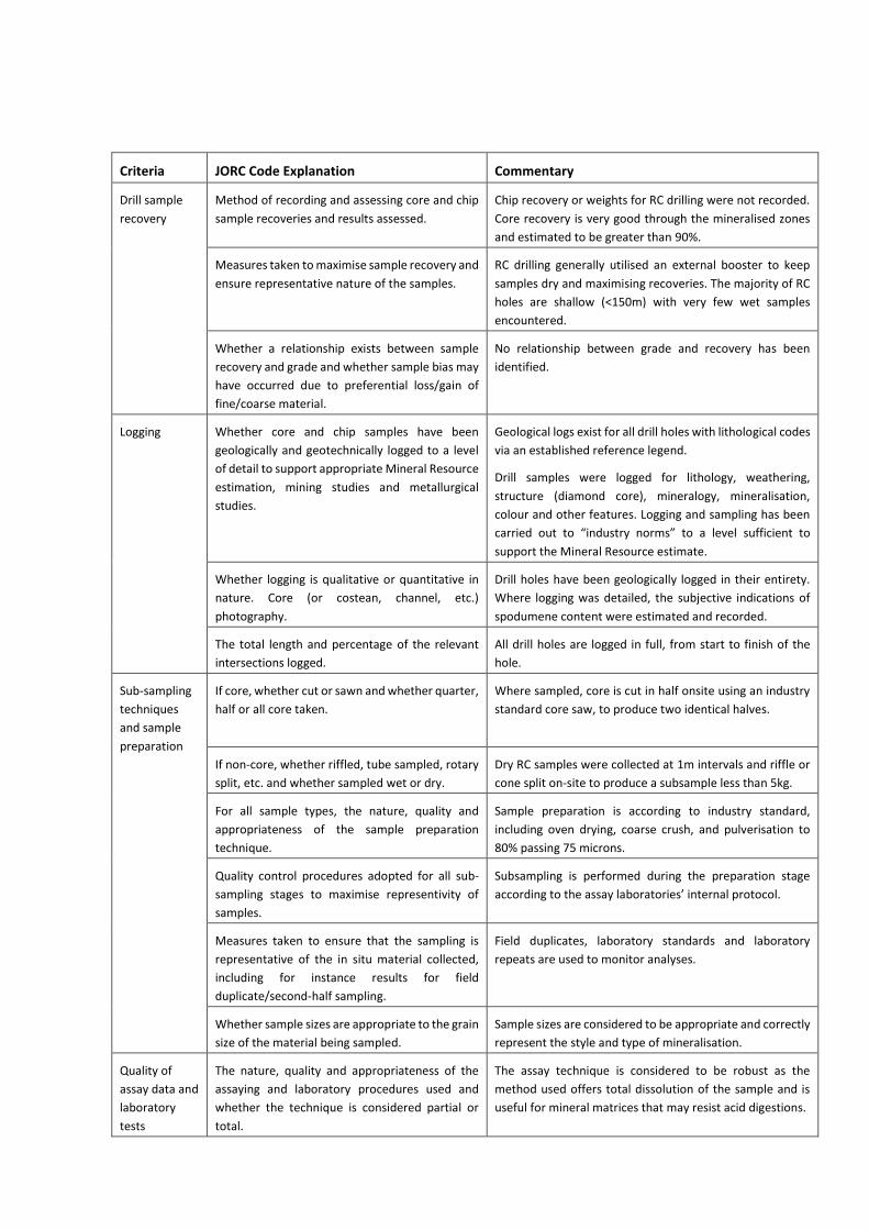
Criteria JORC Code Explanation Commentary
Sampling
techniques
Nature and quality of sampling (e.g. cut channels,
random chips, or specific specialised industry
standard measurement tools appropriate to the
minerals under investigation, such as down hole
gamma sondes, or handheld XRF instruments,
etc.). These examples should not be taken as
limiting the broad meaning of sampling.
Drilling consists of ~99% reverse circulation (RC), RC with
diamond core tails (RCD) and diamond drilling (DD) for a
total 902 holes for 92,217.49m of drilling in the Bald Hill
project database. The Bald Hill Mineral Resource is based
on assay data from 475 RC holes, 17 RCD holes and 12 DD
holes.
RC cuttings were continuously sampled at 1m intervals
through all pegmatite intercepts including 2m of waste
above and below each intercept.
DD core is typically continuously sampled at 2m intervals
through pegmatite intercepts. Where required by changes
in lithology, mineralization, or alteration, core samples may
be shorter or longer than the typical 2m.
Include reference to measures taken to ensure
sample representivity and the appropriate
calibration of any measurement tools or systems
used.
The majority of drill hole collars are accurately surveyed
using RTK DGPS equipment.
Drill samples are logged for lithology, weathering, structure
(diamond core), mineralogy, mineralisation, colour and
other features.
Half diamond core was collected and placed in marked
plastic sacks, and shipped to the assay laboratory.
RC samples were collected and placed in marked plastic
bags which were placed in sacks and then shipped to the
assay laboratory.
Aspects of the determination of mineralisation
that are Material to the Public Report. In cases
where ‘industry standard’ work has been done
this would be relatively simple (e.g. ‘reverse
circulation drilling was used to obtain 1 m samples
from which 3 kg was pulverised to produce a 30 g
charge for fire assay’). In other cases more
explanation may be required, such as where there
is coarse gold that has inherent sampling
problems. Unusual commodities or
mineralisation types (e.g. submarine nodules)
may warrant disclosure of detailed information.
Drill samples were jaw crushed and riffle split to 2-2.5kg for
pulverizing to 80% passing 75 microns. Prepared samples
are fused with sodium peroxide and digested in dilute
hydrochloric acid. The resultant solution is analysed by ICP,
by Nagrom Laboratory in Perth.
The assay technique is considered to be robust as the
method used offers total dissolution of the sample and is
useful for mineral matrices that may resist acid digestions.
Drilling
techniques
Drill type (e.g. core, reverse circulation, open-hole
hammer, rotary air blast, auger, Bangka, sonic,
etc.) and details (e.g. core diameter, triple or
standard tube, depth of diamond tails, face-
sampling bit or other type, whether core is
oriented and if so, by what method, etc.).
RC was drilled using 4.5-inch (140 mm) rods with a nominal
5.9-inch (150 mm) diameter hole. Diamond core used either
PQ, NQ2 or HQ3 diameter core. Core was oriented where
possible.
All DD holes and ~98% of RC drill holes are angled; the
remainder were drilled vertically.
Criteria JORC Code Explanation Commentary
Drill sample
recovery
Method of recording and assessing core and chip
sample recoveries and results assessed.
Chip recovery or weights for RC drilling were not recorded.
Core recovery is very good through the mineralised zones
and estimated to be greater than 90%.
Measures taken to maximise sample recovery and
ensure representative nature of the samples.
RC drilling generally utilised an external booster to keep
samples dry and maximising recoveries. The majority of RC
holes are shallow (<150m) with very few wet samples
encountered.
Whether a relationship exists between sample
recovery and grade and whether sample bias may
have occurred due to preferential loss/gain of
fine/coarse material.
No relationship between grade and recovery has been
identified.
Logging Whether core and chip samples have been
geologically and geotechnically logged to a level
of detail to support appropriate Mineral Resource
estimation, mining studies and metallurgical
studies.
Geological logs exist for all drill holes with lithological codes
via an established reference legend.
Drill samples were logged for lithology, weathering,
structure (diamond core), mineralogy, mineralisation,
colour and other features. Logging and sampling has been
carried out to “industry norms” to a level sufficient to
support the Mineral Resource estimate.
Whether logging is qualitative or quantitative in
nature. Core (or costean, channel, etc.)
photography.
Drill holes have been geologically logged in their entirety.
Where logging was detailed, the subjective indications of
spodumene content were estimated and recorded.
The total length and percentage of the relevant
intersections logged.
All drill holes are logged in full, from start to finish of the
hole.
Sub-sampling
techniques
and sample
preparation
If core, whether cut or sawn and whether quarter,
half or all core taken.
Where sampled, core is cut in half onsite using an industry
standard core saw, to produce two identical halves.
If non-core, whether riffled, tube sampled, rotary
split, etc. and whether sampled wet or dry.
Dry RC samples were collected at 1m intervals and riffle or
cone split on-site to produce a subsample less than 5kg.
For all sample types, the nature, quality and
appropriateness of the sample preparation
technique.
Sample preparation is according to industry standard,
including oven drying, coarse crush, and pulverisation to
80% passing 75 microns.
Quality control procedures adopted for all sub-
sampling stages to maximise representivity of
samples.
Subsampling is performed during the preparation stage
according to the assay laboratories’ internal protocol.
Measures taken to ensure that the sampling is
representative of the in situ material collected,
including for instance results for field
duplicate/second-half sampling.
Field duplicates, laboratory standards and laboratory
repeats are used to monitor analyses.
Whether sample sizes are appropriate to the grain
size of the material being sampled.
Sample sizes are considered to be appropriate and correctly
represent the style and type of mineralisation.
Quality of
assay data and
laboratory
tests
The nature, quality and appropriateness of the
assaying and laboratory procedures used and
whether the technique is considered partial or
total.
The assay technique is considered to be robust as the
method used offers total dissolution of the sample and is
useful for mineral matrices that may resist acid digestions.

Criteria JORC Code Explanation Commentary
For geophysical tools, spectrometers, handheld
XRF instruments, etc., the parameters used in
determining the analysis including instrument
make and model, reading times, calibrations
factors applied and their derivation, etc.
None were used.
Nature of quality control procedures adopted
(e.g. standards, blanks, duplicates, external
laboratory checks) and whether acceptable levels
of accuracy (i.e. lack of bias) and precision have
been established.
Standards and duplicates were submitted in varying
frequency throughout the exploration campaign and
internal laboratory standards, duplicates and replicates are
used for verification.
Verification of
sampling and
assaying
The verification of significant intersections by
either independent or alternative company
personnel.
Significant intersections have been verified by alternative
TAW personnel and by CSA Global Competent Persons
(Ralph Porter and Matthew Cobb).
The Ta and Li assays show a marked correlation with the
pegmatite intersections via elevated downhole grades.
The use of twinned holes. Twinning of holes undertaken to date show reasonable
continuity and representivity of the mineralised intervals.
Documentation of primary data, data entry
procedures, data verification, data storage
(physical and electronic) protocols.
Drill logs exist for all holes as electronic files and/or
hardcopy (all 2017 logging has been input directly to field
logging computers).
Digital log sheets have been created with inbuilt validations
to reduce potential for data entry errors.
All drilling data has been loaded to a database and validated
prior to use.
Discuss any adjustment to assay data. For the Mineral Resource estimate, adjustments were
made to a number of down hole surveys. These
adjustments were made where angled holes were blocked
well before the end of hole, or where down hole surveys
had not yet been undertaken but surveys had been
completed for nearby holes.
Where the drill hole was blocked, the last survey was copied
to the end of hole depth. Where no down hole survey was
completed or the hole was blocked at surface, the down
hole surveys from a nearby hole, drilled by the same rig (and
preferably same driller), was copied and applied to the hole.
Some of these holes may need to be re-entered, cleaned
and surveyed in the future. All changes were marked as
‘nominal’ in the database.
In all cases, corrections to down hole surveys were
reviewed against surrounding drill holes and pegmatite
intervals to ensure error was minimised.
Location of
data points
Accuracy and quality of surveys used to locate
drill holes (collar and down-hole surveys),
trenches, mine workings and other locations used
in Mineral Resource estimation.
Prior to drilling, collar coordinates are situated using hand
held GPS (considered accurate to within 4m). Following
drilling, accurate surveying using RTK DGPS is undertaken
by trained site personnel.
Criteria JORC Code Explanation Commentary
Hole collars are preserved until completion of down hole
surveying. A significant portion of holes are surveyed down
hole digital instruments dominated by gyro tools.
Specification of the grid system used. Grid used is MGA 94 Zone 51.
Quality and adequacy of topographic control. Topographical survey is generated from detailed airborne
survey with points generated on a 1m by 1m grid. Areas
mined have been defined by final mine surveys.
Data spacing
and
distribution
Data spacing for reporting of Exploration Results.
Drilling has been conducted on a 40m by 40m grid
extending to 80m by 80m on the peripheries of the deposit,
with a 140m by 80m area in the northern portion of the
deposit drilled out at 20m by 20m.
Whether the data spacing and distribution is
sufficient to establish the degree of geological and
grade continuity appropriate for the Mineral
Resource and Ore Reserve estimation
procedure(s) and classifications applied.
The spacing of holes is considered of sufficient density to
provide an ‘Indicated’ or ‘Inferred’ Mineral Resource
estimation and classification under JORC (2012).
Whether sample compositing has been applied. There has been no sample compositing.
Orientation of
data in
relation to
geological
structure
Whether the orientation of sampling achieves
unbiased sampling of possible structures and the
extent to which this is known, considering the
deposit type.
Drilling has been angled to achieve the most representative
intersections through mineralisation.
The majority of drilling is angled. Some vertical holes have
been drilled in areas where access is limited or the
pegmatites are interpreted to be flat lying.
If the relationship between the drilling
orientation and the orientation of key mineralised
structures is considered to have introduced a
sampling bias, this should be assessed and
reported if material.
The lithium tantalite-bearing pegmatites are generally flat
to shallowly dipping in nature. The true width of pegmatites
is generally considered 80-95% of the intercept width, with
minimal opportunity for sample bias.
Sample
security
The measures taken to ensure sample security. The drill samples are taken from the rig by experienced
personnel, stored securely and transported to the
laboratory by a registered courier and handed over by
signature.
Audits or
reviews
The results of any audits or reviews of sampling
techniques and data.
No audits have been undertaken to date.

Section 2 Reporting of Exploration Results
Criteria Explanation Commentary
Mineral
tenement and
land tenure
status
Type, reference name/number, location and
ownership including agreements or material
issues with third parties such as joint ventures,
partnerships, overriding royalties, native title
interests, historical sites, wilderness or national
park and environmental settings.
The Bald Hill Resource is situated on Mining leases
M15/400, R15/01 and E15/1212 comprising 4,339Ha. The
tenements are 100% owned by Australian incorporated,
Singapore Exchange listed Alliance Mineral Assets Limited
(AMAL).
The Mining lease are subject to an earn-in agreement
between AMAL and Tawana Resources Limited.
There are no other third-party interests or royalties.
Government royalties are 5% for Lithium or Tantalum
mineral concentrates.
The security of the tenure held at the time of
reporting along with any known impediments to
obtaining a licence to operate in the area.
The portfolio of mineral tenements, comprising mining
leases, exploration licences, prospecting licences,
miscellaneous licences, a general-purpose lease, and a
retention lease are in good standing.
Exploration
done by other
parties
Acknowledgment and appraisal of exploration by
other parties.
Alluvial tantalite has been mined periodically from the early
1970s.
Gwalia Consolidated Limited undertook exploration for
tantalite-bearing pegmatites from 1983-1998. Work
included mapping, costeaning, and several phases of drilling
using RAB, RC, and diamond methods. The work identified
mineral resources that were considered uneconomic at the
time.
Haddington Resources Limited (Haddington) entered
agreement to develop the resource and mining
commenced in 2001 and continued until 2005.
Haddington continued with exploration until
2009.
Living Waters acquired the project in 2009 and continued
with limited exploration to the north of the main pit area.
Geology Deposit type, geological setting and style of
mineralisation.
The Bald Hill area is underlain by generally north-striking,
steeply dipping Archaean metasediments (schists and
greywackes) and granitoids.
Felsic porphyries and pegmatite sheets and veins have
intruded the Archaean rocks. Generally, the pegmatites
cross cut the regional foliation, occurring as gently dipping
sheets and as steeply dipping veins.
The pegmatites vary in width and are generally comprised
quartz-albite- muscovite-spodumene in varying amounts.
Late-stage albitisation in the central part of the main
outcrop area has resulted in fine- grained, banded, sugary
pegmatites with visible fine-grained, disseminated
tantalite. A thin hornfels characterised by needle
hornblende crystals is often observed in adjacent country
rocks to the pegmatite intrusives. Tantalite generally occurs
as fine disseminated crystals commonly associated with
Criteria Explanation Commentary
fine-grained albite zones, or as coarse crystals associated
with cleavelandite.
Weathering of the pegmatites yields secondary mineralised
accumulations in alluvial/elluvial deposits.
Drill hole
Information
A summary of all information material to the
understanding of the exploration results including
a tabulation of the following information for all
Material drill holes:
• easting and northing of the drill hole
collar
• elevation or RL (Reduced Level –
elevation above sea level in metres) of
the drill hole collar
• dip and azimuth of the hole
• down hole length and interception depth
• hole length.
Not Applicable – Not reporting exploration results.
If the exclusion of this information is justified on
the basis that the information is not Material and
this exclusion does not detract from the
understanding of the report, the Competent
Person should clearly explain why this is the case.
Not Applicable – Not reporting exploration results.
Data
aggregation
methods
In reporting Exploration Results, weighting
averaging techniques, maximum and/or
minimum grade truncations (e.g. cutting of high
grades) and cut-off grades are usually Material
and should be stated.
Not Applicable – Not reporting exploration results.
Where aggregate intercepts incorporate short
lengths of high grade results and longer lengths of
low grade results, the procedure used for such
aggregation should be stated and some typical
examples of such aggregations should be shown
in detail.
Not Applicable – Not reporting exploration results.
The assumptions used for any reporting of metal
equivalent values should be clearly stated.
Not Applicable – Not reporting exploration results.
Relationship
between
mineralisation
widths and
intercept
lengths
These relationships are particularly important in
the reporting of Exploration Results.
Not Applicable – Not reporting exploration results.
If the geometry of the mineralisation with respect
to the drill hole angle is known, its nature should
be reported.
The majority of drilling is angled. Some vertical holes have
been drilled in areas where access is limited or the
pegmatites are interpreted to be flat lying.
The lithium tantalite-bearing pegmatites are generally flat
to shallowly dipping in nature. The true width of pegmatites
are generally considered 85-95% of the intercept width,
with minimal opportunity for sample bias.
If it is not known and only the down hole lengths
are reported, there should be a clear statement to
this effect (e.g. ‘down hole length, true width not
known’).
Not Applicable – Not reporting exploration results.

Criteria Explanation Commentary
Diagrams Appropriate maps and sections (with scales) and
tabulations of intercepts should be included for
any significant discovery being reported These
should include, but not be limited to a plan view
of drill hole collar locations and appropriate
sectional views.
Not Applicable – Not reporting exploration results
Balanced
reporting
Where comprehensive reporting of all
Exploration Results is not practicable,
representative reporting of both low and high
grades and/or widths should be practiced to avoid
misleading reporting of Exploration Results.
Not Applicable – Not reporting exploration results
Other
substantive
exploration
data
Other exploration data, if meaningful and
material, should be reported including (but not
limited to): geological observations; geophysical
survey results; geochemical survey results; bulk
samples – size and method of treatment;
metallurgical test results; bulk density,
groundwater, geotechnical and rock
characteristics; potential deleterious or
contaminating substances.
The metallurgical test work for spodumene referred to in
the release was undertaken by Nagrom. Nagrom has
extensive experience with tantalum and lithium extraction
testwork and has ISO9001:2008 accreditation. Results
have been reported without interpretation.
Further work The nature and scale of planned further work (e.g.
tests for lateral extensions or depth extensions or
large-scale step-out drilling).
Further RC and diamond drilling is warranted at the deposit
to explore for additional resources and improve the
understanding of the current resources prior to mining.
Diagrams clearly highlighting the areas of possible
extensions, including the main geological
interpretations and future drilling areas, provided
this information is not commercially sensitive.
Diagrams have been included in the body of this report.
Section 3 Estimation and Reporting of Mineral Resources (Criteria listed in the preceding section also apply to this section).
Criteria Explanation Commentary
Database
integrity
Measures taken to ensure that data has not
been corrupted by, for example, transcription or
keying errors, between its initial collection and
its use for Mineral Resource estimation
purposes.
Logging is completed onto templates using standard logging
codes into Toughbook laptops. Analytical results are
imported directly into the database by a database
specialist.
The central database, from which the extract used for
Mineral Resource estimation was taken, is managed by
Tawana. Upon receipt of the extract, CSA Global validated
the database for internal integrity as part of the import
process for modelling in Surpac.
Data validation procedures used. Data were validated for internal database integrity as part
of the import process for use in Surpac. This includes logical
integrity checks for data beyond the hole depth maximum,
and overlapping from-to errors within interval data. Visual
validation checks were also made for obviously spurious
collar or downhole survey values, collars which were not
assigned a proper RL value, and collars which may lack
substantial downhole survey data.
Site visits Comment on any site visits undertaken by the
Competent Person and the outcome of those
visits.
CSA Global Principal Consultants; Ralph Porter and
Matthew Cobb have visited site and reviewed the drilling,
sample collection, and logging data collection procedures,
along with conducting a review of the site geology.
The outcome of the site visits (broadly) were that data has
been collected in a manner that supports reporting a
Mineral Resource estimate in accordance with the JORC
Code, and controls to the mineralisation are well-
understood.
If no site visits have been undertaken indicate
why this is the case.
Not Applicable.
Geological
interpretation
Confidence in (or conversely, the uncertainty of
) the geological interpretation of the mineral
deposit.
The geological model developed is based on lithological
logging of pegmatites within a metasedimentary host, with
occasional hypabyssal intrusions of dioritic composition.
The deposit geology is very well understood based on
previous mining history and open pit exposures, and this is
reflected in the generally high confidence in both the
mineralisation and geological interpretations.
Nature of the data used and of any assumptions
made.
The input data used for geological modelling has been
derived from the qualitative and quantitative logging of
lithology, alteration, geochemical composition of samples
returned from RC and DD drilling.
The effect, if any, of alternative interpretations
on Mineral Resource estimation.
The geological model developed has a solid lithological
basis, and is controlled by the presence of visually distinct
pegmatite within drillholes. Pegmatite structures have
been modelled as predominantly low angle / sub-horizontal
structures on the basis of a high density of input drillhole
Criteria Explanation Commentary
data and confirmation of the interpretation on the basis of
mapping. The data do not readily lend themselves to
alternative interpretations, and it is unlikely that such
alternatives would yield a more geologically reasonable
result.
The use of geology in guiding and controlling
Mineral Resource estimation.
The model developed for mineralisation is geologically
driven; controlled by the presence or absence of pegmatite.
The factors affecting continuity both of grade
and geology.
Geological continuity is controlled by the preference for
fractionated pegmatitic fluids to follow preferential
structural pathways through the host rocks (an intercalated
pile of metasediments and metavolcanics. Grade within this
pegmatite is controlled by numerous factors such as fluid
residence time, degree of fluid fractionation and pegmatite
thickness.
Dimensions The extent and variability of the Mineral
Resource expressed as length (along strike or
otherwise), plan width, and depth below surface
to the upper and lower limits of the Mineral
Resource.
The Bald Hill Mineral Resource comprises one large, main,
sub horizontal pegmatite body, striking north-south, with a
strike length of 1,230m, and a width at its widest point of
1,080m. This main body is surrounded by several smaller
discrete pegmatite bodies, sub-parallel to the main, which
result in a total strike length for the whole resource of
2,045m, and a total width of 1,800m. The Mineral Resource
has a total vertical depth of 245m, beginning 20m below the
natural surface and plunging gently to the south along its
entire strike length.
Estimation and
modelling
techniques
The nature and appropriateness of the
estimation technique(s) applied and key
assumptions, including treatment of extreme
grade values, domaining, interpolation
parameters and maximum distance of
extrapolation from data points. If a computer
assisted estimation method was chosen include
a description of computer software and
parameters used.
The Bald Hill Mineral Resource has been estimated using
ordinary Kriging in a Surpac block model. The variables Li2O
ppm and Ta2O5ppm were estimated independently in a
univariate sense. The pegmatites on which this Mineral
Resource was defined was domained internally on the basis
of a 7,500ppm Li2O cut-off, which itself was determined
from exploratory data analysis as a point of inflection within
the Li2O grade distribution. This resulted in a high-grade
core of Li2O mineralisation surrounded by lower grade
pegmatite, and is an interpretation supported by the
petrogenetic model for the formation of Li2O bearing
pegmatites.
Samples were composited to 1m intervals based on
assessment of the raw drill hole sample intervals. Various
high-grade cuts were used for both Li2O (ranging from
10,000ppm to 60,000ppm) and Ta2O5 (ranging from
300ppm to 4,000ppm) based on statistical review of each
object. Composites for some objects remained uncut
depending on the statistical review.
High and low-grade domains were estimated
independently with hard boundaries assumed between
domains. Parameters for estimation and search ellipsoids
were determined from quantitative kriging analysis
performed within the SupervisorTM software package,
Criteria Explanation Commentary
which was also used to define semivariogram models for
each variable. The parameters defined for the largest, most
populated domains (main mineralised body and its high-
grade core) were used to inform all smaller subsidiary
domains during estimation.
A two search pass strategy was employed, with successive
searches using more relaxed parameters for selection of
input composite data, and a greater search radius. Blocks
not informed for any given variable after two passes were
assigned the Sichel Mean of the input data from that
particular domain.
All geological modelling and grade estimation was
completed using Surpac software.
The availability of check estimates, previous
estimates and/or mine production records and
whether the Mineral Resource estimate takes
appropriate account of such data.
This Mineral Resource estimate is an update of the
previously reported Mineral Resource estimate released in
Q2 2017. The current estimate represents an incremental
update based on additional drilling, and is comparable to its
predecessor in terms of average grades, with the expected
increase in tonnage from extensional drilling. Historic
estimates for the Bald Hill deposit focussed on Ta2O5 only,
and as such are not directly comparable to the current
estimate for which Li2O is the primary target variable.
The assumptions made regarding recovery of
by-products.
The only significant by-product to be considered is Ta2O5
which has been estimated within the domains defined by
Li2O.
Estimation of deleterious elements or other
non-grade variables of economic significance
(eg. sulphur for acid mine drainage
characterisation).
No deleterious elements have been identified or estimated.
In the case of block model interpolation, the
block size in relation to the average sample
spacing and the search employed.
Block model dimensions used for the Bald Hill Mineral
Resource estimate were 10 by 10 by 5m (XYZ) sub-celled to
2.5 by 2.5 by 1.25m for resolution of volumes at lithological
boundaries. This compares to an average drillhole spacing
of 20m within the more densely informed areas of the
deposit. This 20m spacing increases to up to 80m between
drillholes in less well informed portions of the deposit.
Kriging Neighbourhood Analysis (KNA) was conducted
within the SupervisorTM software package to test a variety
of block sizes in both well and poorly informed areas of the
deposit. The chosen block size represents the smallest block
size that yields a robust set of estimation statistics, which
are comparable to the results also yielded from larger
blocks sizes.
Any assumptions behind modelling of selective
mining units.
No assumptions were made regarding selective mining
units.
Criteria Explanation Commentary
Any assumptions about correlation between
variables.
The two variables under consideration; Li2O and Ta2O5 are
uncorrelated within both the pegmatite as a whole, and
within the high-grade domain (correlation coefficient of -
0.04). Consequently, no correlation between variables was
considered. Both variables were treated in a univariate
sense.
Description of how the geological interpretation
was used to control the resource estimates.
The nature of the mineralised body is such that the
definition of the pegmatite host also defines the
mineralisation. Within that, and based on a combination of
petrogenetic process and statistical appraisal, an internal
high-grade Li2O domain was defined.
Discussion of basis for using or not using grade
cutting or capping.
Domained data for both variables were assessed using
histogram and log probability plots to define potential top
cuts to data. Where the Competent Person observed likely
breaks in the continuity of the grade distributions, a top cut
was chosen and applied. This was conducted on a per-
domain basis.
The process of validation, the checking process
used, the comparison of model data to drill hole
data, and use of reconciliation data if available.
The results of estimation into the block model for the Bald
Hill Mineral resource were validated visually and
statistically. Estimated block grades were compared visually
in section against the corresponding input data values.
Additionally, trend plots of input data and block estimates
were compared for swaths generated in each of the three
principal geometric orientations (northing, easting and
elevation).
Moisture Whether the tonnages are estimated on a dry
basis or with natural moisture, and the method
of determination of the moisture content.
Tonnages are reported on a dry basis.
Cut-off
parameters
The basis of the adopted cut-off grade(s) or
quality parameters applied.
Modelling of mineralisation for the resource was based on
a combination of pegmatite lithological logging. Within this
mineralisation shape, a higher grade core was defined on
the basis of a 7,500 ppm Li2O cut-off.
The Mineral Resource is reported using both a 0.5% Li2O
cut-off, which approximates a reasonable economic cut-off
grade used for potential open pit mining as determined
from pit optimisation studies.
Mining factors
or assumptions
Assumptions made regarding possible mining
methods, minimum mining dimensions and
internal (or, if applicable, external) mining
dilution. It is always necessary as part of the
process of determining reasonable prospects for
eventual economic extraction to consider
potential mining methods, but the assumptions
made regarding mining methods and
parameters when estimating Mineral Resources
may not always be rigorous. Where this is the
case, this should be reported with an
The methods used to design and populate the Bald Hill
Mineral Resource block model were defined under the
assumption that the deposit is likely to be mined via open
pit methods.
Criteria Explanation Commentary
explanation of the basis of the mining
assumptions made.
Metallurgical
factors or
assumptions
The basis for assumptions or predictions
regarding metallurgical amenability. It is always
necessary as part of the process of determining
reasonable prospects for eventual economic
extraction to consider potential metallurgical
methods, but the assumptions regarding
metallurgical treatment processes and
parameters made when reporting Mineral
Resources may not always be rigorous. Where
this is the case, this should be reported with an
explanation of the basis of the metallurgical
assumptions made.
The material targeted for extraction predominantly
comprises the mineral spodumene, for which metallurgical
processing methods are well established. No specific detail
regarding metallurgical assumptions have been applied in
the estimation the current Mineral Resource, however at
the current level of detail available, the Competent Person
believes with sufficient confidence that metallurgical
concerns will not pose any significant impediment to
eventual economic extraction.
Environmental
factors or
assumptions
Assumptions made regarding possible waste
and process residue disposal options. It is always
necessary as part of the process of determining
reasonable prospects for eventual economic
extraction to consider the potential
environmental impacts of the mining and
processing operation. While at this stage the
determination of potential environmental
impacts, particularly for a greenfields project,
may not always be well advanced, the status of
early consideration of these potential
environmental impacts should be reported.
Where these aspects have not been considered
this should be reported with an explanation of
the environmental assumptions made.
No assumptions have been made regarding waste products,
however the Mineral Resource has previously been mined
by open pit methods with a processing facility, stacked
waste dumps and tailings storage facilities on site. It is
reasonable to assume that in the presence of this
infrastructure, the creation and storage of waste products
on site will not be of concern for future mining activities.
Bulk density Whether assumed or determined. If assumed,
the basis for the assumptions. If determined, the
method used, whether wet or dry, the
frequency of the measurements, the nature,
size and representativeness of the samples.
In situ bulk densities for the Bald Hill Mineral Resource have
been assigned on a lithological basis for both mineralisation
and waste, based on historical values derived from mining
and values taken from those used in similar deposits and
lithologies.
The Competent Person considers the values chosen to be
suitably representative.
The bulk density for bulk material must have
been measured by methods that adequately
account for void spaces (vugs, porosity, etc),
moisture and differences between rock and
alteration zones within the deposit.
Densities have been assigned on a lithological basis based
on a total of 44 metasediment and 25 pegmatite core
samples measured at the Nagrom laboratory and values
derived from surrounding deposits and rock types.
Discuss assumptions for bulk density estimates
used in the evaluation process of the different
materials.
Bulk densities have been applied on a lithological unit basis.
Values assigned were as follows:
Fresh pegmatite mineralisation 2.65 t/m3
Transitional pegmatite 2.5t/m3
Fresh diorite 2.8t/m3
Transitional diorite 2.6t/m3
Fresh metasediments 2.74t/m3
Transitional metasediments 2.6t/m3

Criteria Explanation Commentary
Oxide metasediments 2.2t/m3
Waste fill 1.8t/m3
additional bulk density testwork utilising drill core across
the mineralised zones and less common waste units is
recommended for future estimates.
Classification The basis for the classification of the Mineral
Resources into varying confidence categories.
The Mineral Resource has been classified as Indicated and
Inferred on a qualitative basis; taking into consideration
numerous factors such as drillhole spacing, estimation
quality statistics (kriging slope of regression), number of
informing samples used in the estimate, average distance
to informing samples in comparison to the semivariogram
model ranges, and overall coherence and continuity of the
modelled mineralisation wireframes.
Whether appropriate account has been taken of
all relevant factors (ie relative confidence in
tonnage/grade estimations, reliability of input
data, confidence in continuity of geology and
metal values, quality, quantity and distribution
of the data).
The classification reflects areas of lower and higher
geological confidence in mineralised lithological domain
continuity based on the intersecting drill sample data
numbers, spacing and orientation. Overall mineralisation
trends are reasonably consistent within the various
lithology types over numerous drill sections.
Whether the result appropriately reflects the
Competent Person’s view of the deposit.
The Mineral Resource estimate appropriately reflects the
Competent Person’s views of the deposit.
Audits or
reviews
The results of any audits or reviews of Mineral
Resource estimates.
Internal audits were completed by CSA Global which
verified the technical inputs, methodology, parameters and
results of the estimate.
The current model has not been audited by an independent
third party
Discussion of
relative
accuracy/
confidence
Where appropriate a statement of the relative
accuracy and confidence level in the Mineral
Resource estimate using an approach or procedure
deemed appropriate by the Competent Person.
For example, the application of statistical or
geostatistical procedures to quantify the relative
accuracy of the resource within stated confidence
limits, or, if such an approach is not deemed
appropriate, a qualitative discussion of the factors
that could affect the relative accuracy and
confidence of the estimate.
The Mineral Resource accuracy is communicated through
the classification assigned to the deposit. The Mineral
Resource estimate has been classified in accordance with
the JORC Code, 2012 Edition using a qualitative approach.
All factors that have been considered have been adequately
communicated in Section 1 and Section 3 of this Table.
The statement should specify whether it relates
to global or local estimates, and, if local, state
the relevant tonnages, which should be relevant
to technical and economic evaluation.
Documentation should include assumptions
made and the procedures used.
The Mineral Resource statement relates to a global
estimate of in-situ tonnes and grade.
These statements of relative accuracy and
confidence of the estimate should be compared
with production data, where available.
The deposit has been historically mined for tantalum
(Ta2O5), however no accounting for Li2O had been
undertaken, and therefore no production records are
available for comparison to the current estimate.