monitoring a cruise shipwreckarchive.amerisurv.com/...monitoringcruiseshipwreck... · data for...
TRANSCRIPT


>> By Jack Lucic
Technology addresses the urgent safety needs for rescue and discovering why?
Monitoring a Cruise Shipwreck
Capsized off the Italian shore, the tragedy of the cruise ship
Costa Concrdia generated global concern for the passengers.
Displayed with permission • The American Surveyor • Vol. 9 No. 4 • Copyright 2012 Cheves Media • www.Amerisurv.com

ith 14-decks, the Italian-made Costa Concordia cruise ship was a gargantuan-size vessel by any accounts. It measured 290 meters (950-feet) long, 35.5 meters (116 feet) wide, and weighed 114,500 tons. It was the biggest
of a half-dozen “dream class cruise ships” owned and operated by Costa Crociere, a subsidiary of Carnival Corporation and Carnival plc.
Unfortunately, on January 13, 2012, one of Europe’s largest cruise ships and the largest Italian cruise ship ever built, the Costa Concordia, struck a rock in the Tyrrhenian Sea just off the shore of Isola del Giglio, near the western coast of Italy. This accident tore a 49-meter- (160-foot-) long gash in its hull. With water flooding in and listing, the capsized cruise ship drifted back to Giglio Island, where it grounded, lying on its side in shallow water on an underwater ledge with much of the vessel’s structure above water, and in danger of shifting
Technology addresses the urgent safety needs for rescue and discovering why?
Displayed with permission • The American Surveyor • Vol. 9 No. 4 • Copyright 2012 Cheves Media • www.Amerisurv.com

and sinking. The damaged ship came to an uncertain rest.
The evacuation of the 4,252 people on board became imperative. Thirty people are known to have died, 64 others were injured, and two passengers and a crewmember trapped inside were rescued in the days after the incident.
Local authorities with the Italian Civil Defence, who led the rescue operations, contacted land surveyor Mauro Alessandroni almost immedi-ately after the event and charged him with the task of monitoring the possible movements of the ship. They wanted to prevent danger to the rescue teams who were searching for possible survivors still inside the wreck.
Less than two days after the catastro-phe, during the urgent search efforts, Alessandroni initiated the checking stage for movement of the wreck by using an optical-mechanical total station, installing
two prisms on the ship, one on the prow and the other on the stern. For triangula-tion, two additional prisms were placed on nearby dry land.
In the following days, he performed manual measurements every 15 minutes. Alessandroni manually recorded the data, downloading it into calculation software to determine any movement.
Recognizing the urgency of the need and knowing that there is a less labor-
intensive, reliable alternative, Geotop Ltd., based in Ancona, Italy, offered Alessandroni a Topcon QS Quick Station robotic total station.
The Topcon QS robotic system offers the one-touch Quick-Lock feature and dual laser integration, which is designed to expand remote control coverage in order to speed up prism search and lock operations. The robotic total station automated the data acquisition and
“ The monitoring is expected to continue for several months.”
The Topcon QS Quick Station robotic total station was critical to the search and recovery efforts.
Displayed with permission • The American Surveyor • Vol. 9 No. 4 • Copyright 2012 Cheves Media • www.Amerisurv.com

The Costa Concordia came to an uncertain rest on a sea shelf close to shore.
provided a link to a remote computer, which improved the reliability of data quality and the ability to more quickly monitor any movement of the ship.
On January 18th, five days after the catastrophe, Alessandroni brought the Topcon QS to Giglio Island. There was no location where a stable concrete or steel pillar could be set, therefore a tripod was used. Via the radio link, data is streamed to a sailing boat moored inside the harbor at a distance of about 800 meters away. An inflatable fireman’s boat was used to reach the monitoring station site.
Additionally, to ensure that Alessandroni was getting the most from the Topcon system, a meeting was held which included Geotop Monitoring Technical staff, led by Giuseppe Perrucci, Geotop deputy technical manager. It was decided that the:
◾ Topcon QS Total Station was performing at the required accuracy.
◾ Polifemo Monitoring Software, from Geotop’s subsidiary, Geopro
Software House. Polifemo consists of two parts: the Acquirer, which can record data with a pre-set frequency or set on continuous, and the Monitor, which receives in real time the information from the
Acquirer, and can also use the data for charts, analysis and studies. It was decided to:
◾ Install the Polifemo Acquirer software onboard the QS Total Station
Local Topcon dealer, Geotop s.r.l., provided the software to process the data for charts, analysis and studies.
Displayed with permission • The American Surveyor • Vol. 9 No. 4 • Copyright 2012 Cheves Media • www.Amerisurv.com
◾ Install the Polifemo Monitor on Alessandroni’s PC (with Windows XP OS) located on the boat moored in the harbor.
◾ The communication system selected was a Satel Satelline radio modem, connected via RS232 to the total station, powered by a 12 v, 12Ah battery, that also powers the total station and that is installed in a waterproof box that was named “IRIS.”
◾ An AC/DC connected to the power unit charges the battery of the IRIS.
◾ The total station is mounted onto a tripod with the legs not lowered and braced by ropes secured to the ground.
◾ On the boat another IRIS Kit was installed, same as the one described above, connected to the PC via a USB cable.
Alessandroni reports that the install-ing operations for the Topcon technolo-gies were carried out without difficulties and according to the business plan. Particularly important has been the Polifemo software feature that auto-matically generates graphical reports of single or grouped points, according the X, Y, Z, XY, XYZ components. These reports were required by the department of Civil Defence.
The monitoring is still being per-formed and is expected to continue for
several months, until people researching the cause of the catastrophe are no longer on the wreck.
There are still many question as to why the Costa Concordia cruise ship, which had departed from Rome and was heading toward the northern coast of Italy had changed course to pass near Giglio island. The thought was that the captain wanted to give both passengers and islanders a visual treat. The tragedy claimed 30 of the 3,229 passengers and 1,023 crew who were on the huge ship.
Based in Chicago, Jack Lucic is a freelance writer and can be reached at [email protected].
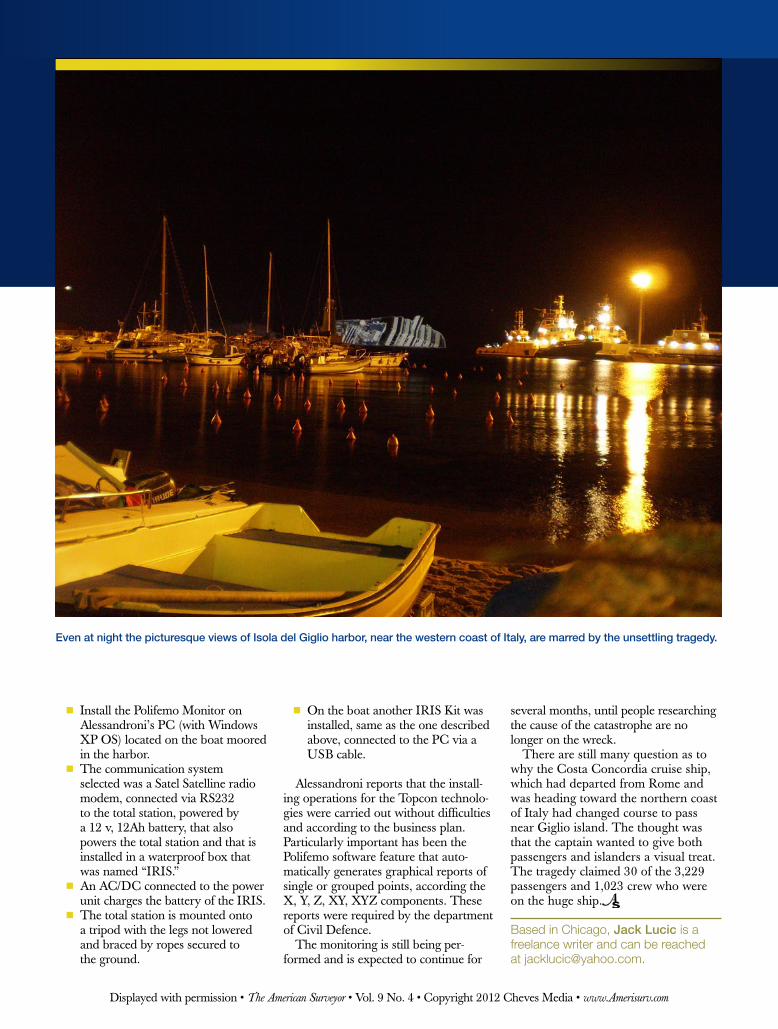
Even at night the picturesque views of Isola del Giglio harbor, near the western coast of Italy, are marred by the unsettling tragedy.
Displayed with permission • The American Surveyor • Vol. 9 No. 4 • Copyright 2012 Cheves Media • www.Amerisurv.com