morris june2015 usiei_updated
TRANSCRIPT

Lidar BreakdownConcerns, Trends & Availability
Eric Morris
ESRI Southeast User ConferenceMay 4th, 2015
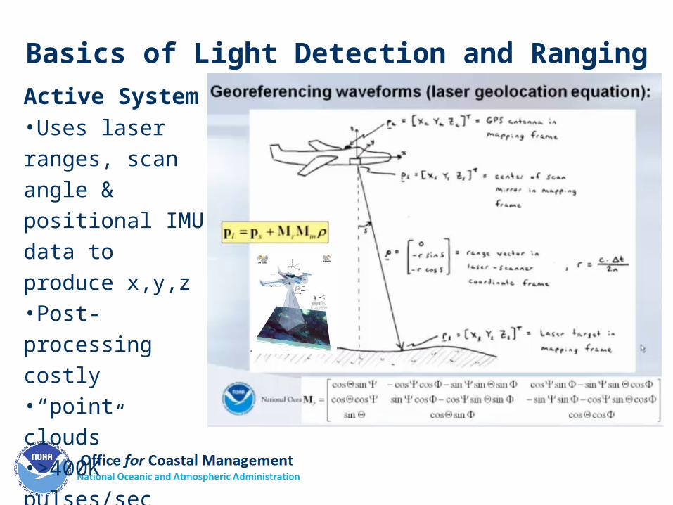
Active System•Uses laser ranges, scan angle & positional IMU data to produce x,y,z•Post-processing costly•“point clouds”•>400K pulses/sec
Basics of Light Detection and Ranging

A (Brief) History of Lidar
• 1960s – Apollo landings• 1977 – NOAA/NASA AOL• 1993 – Airborne GPS & IMU• 2003 – ASPRS LAS 1.0 format (open source)• 2010 – NEEA• 2012 – U.S. Interagency Elevation Inventory• 2014 – 3DEP • ~2020 – GEDI

ConcernsGeodesy Vertical & Horizontal Accuracy

RMSEZ & ρ

Slope StabilityOso, WA

Shoreline Delineation
Ocracoke, NC

Beach Erosion
Natural Disaster
Assessments
Fire Island, NY

Willapa, WA
Topobathymetric Lidar

Topobathy

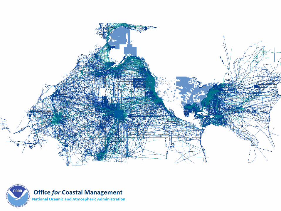
Why TopobathyNOAA NGS Atlantic Coast Mapping Project
Lockwoods Folly Inlet, NC
1 mi

Airborne Lidar Bathymetry (ALB)
• Applicable to oceans, rivers, lakes
• Tides
• Snell’s Law
• Water Clarity
• Eye safety
• Air Space
• Refraction
“Requires more everything”
Tampa Bay, FL


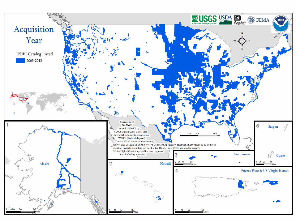
Trends


1997 - 2000


www.coast.noaa.gov/digitalcoast/


www.coast.noaa.gov/digitalcoast
Eric L. [email protected]
Questions?
Special Thanks:Kirk Waters, PhD, Applied Sciences, NOAA OCMAmar Nayegandhi, Director of Remote Sensing, DewberryChris Parrish, PhD, formerly of NOAA NGS and CCOM-JHC, now at Oregon State Univ.