mountain flying leo h. leboeuf, cfi [email protected] [email protected] 860-693-0410...
TRANSCRIPT

Mountain Flying
Leo H. LeBoeuf, [email protected]
[email protected] 860-693-0410860-977-1331
May 2008

Monument Valley AZ
Mountain FlyingLeo H. LeBoeuf CFI
860-977-1331
860-693-0410
May 2008

Mountain FlyingAgenda
• Intro
• Video
• Planning– Aircraft Performance– Navigation– Weather
• Operations
• Conclusion

Mountain Flying Planning
• Proper Planning Precludes Perilous Predicaments
• Do it on the Ground Well Before the Flight• Know Aircraft Performance (or Lack of
Performance) First• Detailed Flight Log
– Headings– Frequencies– Landmarks

Mountain FlyingAircraft Performance
• Density Altitude– Severe Reductions in Performance– Keep Aircraft at least 10% Below Gross Weight
• C172P = 240 Pounds Below Gross• Only Leaves 380# With 40 gal (240#) Fuel• Plan to Buy Fuel @ Local Airports
• Know How To Lean• Taxi – T/O – Cruise –Descent – Missed
• Field Length Requirements• Aircraft Performance Charts don’t go to 14,000’
– Humidity – if High • T/O distance > 10% Climb Performance < 10%

Mountain Flying C172
2152.15
1500
1600
1700
1800
1900
2000
2100
2200
2300
2400
2500
50 55 60 65 70 75 80 85 90 95 100 105 110 115 120
Standard
Utility
N65998 CPF601
Empty Weight = 1554 + 40 Gal Fuel – 170# + 200# Front Seat

Mountain Flying Aircraft Performance
• What is your Service Ceiling? Vx = Vy
• Vx Increases with Altitude Vy Decreases
• T/O and Landing Distances Significantly Increased
• A 3,000’ Runway can Generate High Pucker Factor• Ground speed is Increased for Increased TAS • TAS Increases ~ 2% / 1,000’ for a given IAS
– Aph. of IAS 65 Kts = 78 Kts Ground Speed FL 010
• Turn Radius Increases TAS2 for Given IAS• Know and fly the IAS for each realm of flight

Mountain PerformanceTypical Light ASEL
• Service Ceiling vs Gross weight– 2,400 = 13,200– 2,160 = 15,000
• Takeoff Distance (50’) at 8,000’ @ 20 C– 2,400 = 4480– 2,160 = 3292
• Vy– S/L = 78 Kts– 5,000 = 75 Kts– 10,000 = 72 Kts– 12,000 = Maybe– (all Altitudes Density
Altitude)• Data is For Training Purposes
use Aircraft POH for all calculations

Mountain FlyingFlight Log
• Do it on the ground– Have all Frequencies on the Log (Nav and COMM)– Know your Altitude and Heading for Each Leg
• Legs Must be Chosen to Include Topographical features – Choose the Route with Best Emergency Landing Spots– Log Target Altitude and Heading for 3 mi before a pass– Log All Altitude Changes – Log all Headings - VOR Coverage is Spotty
• Waypoints Should have 3 Identifying Features to Confirm Location
• C172 Rate of Climb appx. 150 feet per minute!

Monument Valley AZFind the Airport

Mountain Flying Navigation Considerations
• Hypoxia Diminishes Ability to Reason and Process Visual Clues
• Have Current Sectional
• Get State Aeronautical Charts– Gives Local Tribal Knowledge– Gives Pass Locations
• Review the Route
• Know Your Alternates
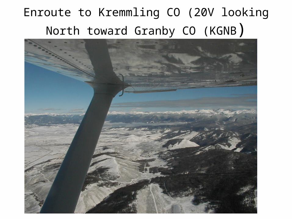
Enroute to Kremmling CO (20V looking North
toward Granby CO (KGNB)

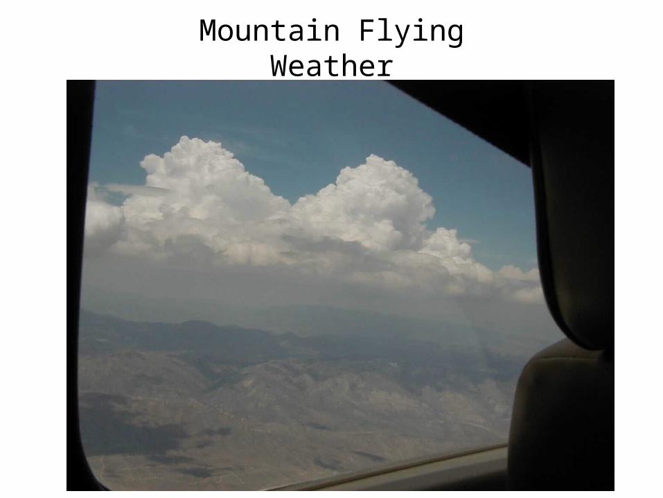
Mountain Flying Weather Planning
• Set Personal Minimums– Day VFR Only– Winds < 30 Kts at FL of Highest Terrain
• > 20 Kts tough on non-pilot passengers• >25 Kts Rough Ride (CAP Wind Limit)
• Cumulus Activity– Grow up fast– Don’t take off with < 1,600’ AGL Bases– Land with Bases < 1,000’ AGL– 1200 to 1600 hrs local is the worst time to fly
Mountain FlyingWeather

Mountain FlyingWeather Minimums
• Ceiling at least 2,000 above all Passes and Terrain Enroute– Many Reporting Stations and Airports are in Valleys
• More automated stations at higher elevations
– IF Station is in a Valley, Could Mean Cloud Bases > 6,000’ AGL @ Reporting Station
– Temperature Dew Point Spread > 40 F WIND SHEAR
• Visibility at Least 15 Miles – Need this for Positional Awareness– Can’t Out Climb the Terrain.

Aph to Mammoth Lakes CA (KMMH)

Mountain FlyingWeather
• Know and Check ASOS / AWOS Enroute– Many areas, now have some wx at high
elevations
• You Know the Wx Behind You Remember the Life Saving 180 Degree Turn
• Turbulence can be Severe (bend & break little airplanes)– Turbulence can cause > + / - 2,000 fpm

Mountain FlyingWeather
• Understand Mountain Wave– Strongest in stable air– 30 to 90 degrees to ridge line– Frequency of wave > with > wind– Noted in remarks of WX
• ACSL Alto Cumulus Standing Lenticular• CCSL Cirro Cumulus Standing Lenticular
• Rotor– Very turbulent– Below Peak– May not have rotor cloud present– If close to ground severe LLWS

Mountain Flying Weather
Know How to Read the Sky
From NOAA web site but no longer posted
Truckee CA
Mountain FlyingWeather
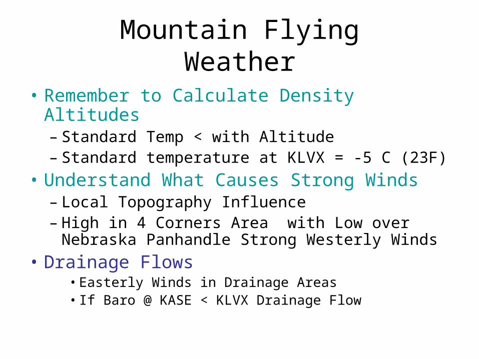
• Remember to Calculate Density Altitudes– Standard Temp < with Altitude– Standard temperature at KLVX = -5 C (23F)
• Understand What Causes Strong Winds– Local Topography Influence– High in 4 Corners Area with Low over
Nebraska Panhandle Strong Westerly Winds
• Drainage Flows• Easterly Winds in Drainage Areas• If Baro @ KASE < KLVX Drainage Flow
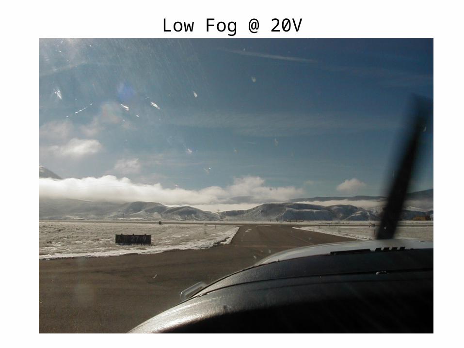
Low Fog @ 20V

Mountain FlyingWeather
• If the WX doesn’t Meet Minimums– Hertz– Budget– Alamo– Avis
• Play Tourist– Find the Hot Springs
• Go Around the Mountains

Mountain FlyingOperations
• Create Your Own Check List Using Data from POH– Include High Altitude Operations Items
• May Need to Lean Mixture to Start Engine
• Taxi– Lean Until Rough then Richen – If Not Leaned Plugs Will Foul

Mountain FlyingOperations
• Run-up– Carbureted
• Full Throttle Lean to Max RPM
– Injected• Full Throttle Lean to Max RPM or POH
Recommended Fuel Flow• May Have to Adjust Mixture During T/O Run
– Turbo• Follow POH• Don’t Over Boost!

Mountain Flying Operations
• Takeoff– Full Power Carbureted and Injected Engines
• Carbureted – Enrichen ½ Turn Before Starting T/O Roll• Injected – May Adjust Mixture During T/O Roll
– Turbo Follow POH Don’t Over Boost– Flaps
• Depends on Aircraft • CPA Recommends Flaps 0• Some Like Flaps 10 in C182
• LOOOOOOOOONG Take OFF Roll– Don’t Over Rotate – Use Proper Airspeed

Mountain Flying Operations
• Climb– Pitch for Vy (Decreases with Altitude)– Scan Gauges Watch CHT- Oil Temp - TIT– Be Patient
• C172 or PA28-181 ~ 150 fpm climb• Now you will appreciate your planning• Shuttle Climb• Circle Climb
• YOU CAN’T OUT CLIMB THE TERRAIN.

Corona Pass and Breckenridge CO

Mountain FlyingOperations
• Crossing Passes or Ridges– Shuttle Climb or Circle – Be at Pass Crossing Altitude 3 NM from Pass– Cross at 45 Degree Angle to Ridge/Pass– Monitor Rate of Climb
• VSI• Air Speed• Altimeter

Mountain FlyingOperations
• Crossing Ridges and Passes– Utilize Escape Turn if Down Drafts
Encountered– At Ridge Line Heading 90 Degrees to Line– Maintain Crossing Altitude for 3 NM after
Crossing Ridge Line or Pass
• If You Can’t See the Other Side, You will Make an Impact on the Scenery

Mountain Flying Operations
–If You Can’t See the Other Side, You will Make an Impact on the Scenery
Breckenridge CO

Mountain Flying Operations
• Crossing a Ridge Line
45o
90o
1000’ AGL minimum 2000’ more comfortable
3 nm 3 nm
Cumulo Granite
Mountain FlyingOperations
• Enroute– Turbulence
• Worst at 1200’ to 1600’ AGL on Days with CU• Valleys Smoother
– Maneuvering Speed (Va)• Normal Category = 1.95*Vs (CAS)• C172 50Kt Stall *1.95 = 97 Va @ full Gross 2400#• C172 POH = 99 IAS @ 2400 92 IAS @ 2000 82 IAS @ 1600
– Rough Air Speed = 1.7 * Vs @ Flight Weight

Mountain Flying Operations
• Valley Flying– Fly on Windward Side of Valley
Wind

Mountain Flying Operations
• Valley Flying– Keep Lights on to Improve Visibility– Watch for Traffic– Use Caution Over Airports– Stay to the Side to Allow More room for 180
Degree Turn– Escape to Low Ground

Mountain Flying Operations
• Valley Flying– Check Out Unknown Valleys– Make a Pass At Altitude First– Climb Above Terrain and Fly Down Stream
Toward Lower End – When Returning to Fly Low Level Can You
Find It?• Are You Sure This is the Valley That You Just
Scoped OUT?

Leaving Leadville CO (KLXV) Collegiate Peaks

Mountain FlyingOperations
• Communications– Coverage is Spotty Down Low– VOR Coverage is Poor Down Low– Monitor 121.5 at all times
• File a Flight Plan and Fly the Plan• Use Flight Watch
– Give Position - PIREPS on Each Side of Pass– 122.0 or RCO FSS (Check the Map)– FAA & CAP Need Your Help to Find You

Mountain Flying Operations
• Descent & Landing– Plan Arrival Pattern
• May not be Standard due to terrain• May be One Way Airport• May not See Airport During Approach
– Richen Mixture on Way Down • ¼ to ½ Turn of Mixture / 1000 feet of altitude loss• Don’t shock cool the engine
– Plan Descent Point & Use Power + Flaps on Descent
– Be prepared for Turbulence

Approach to Glenwood Springs CO (KGWS)
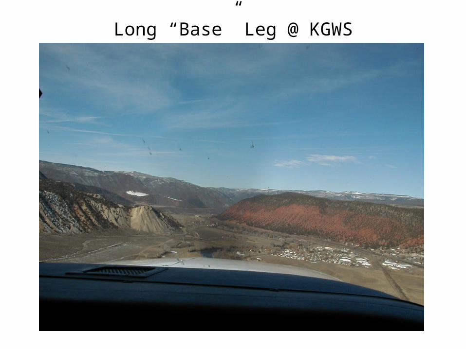
Long “Base” Leg @ KGWS

Base to Final @ KGWS

Final To KGWS

Mountain Flying Operations LLWS
• Extreme Wind Velocity Changes
• LLWS Alert • Heavy Precipitation• Blowing Dust Near Airport
Surface• Temps > 80o F• Temp/Dew Point > 40o F• TS with VIRGA in Area• PIREPS• Sudden A/S Gain or Loss
• IF < 1000’ Agl Go Around When– +/- 15 Kt Airspeed – +/- 500 fpm VVI
Deviation from Normal– +/- 5 Degree Pitch
Variation– +/- 1 Dot glide slope
change

Mountain FlyingOperations
• Landings– Use Appropriate Air Speed
• Ground speed will be higher• Sink rate may be higher
– Stabilized Approach– Touchdown 1000’ or 1/3 Down runway– Know where the Low Ground is
• It could be behind you • Head that way if you can’t get it together and regroup
– Go Around May Not be an Option!

Final to Aspen CO (KASE)

Monument Valley AZOne Way - No Go Around!

Mountain FlyingOperations
• Landings– Adjust Mixture
• Carbureted Engines enrichen ½ turn per 2000’ descent• Within 5 miles and 1,000 to 1,500 above airport elevation set
cruise power lean, then enrichen One or Two ½ turns then reduce power
• Injected Engines POH fuel flow or as above
• Rejected Landing– May not be possible– Full Power and enrichen ½ turn or per POH
Mountain FlyingConclusion
• Mountain Flying is – Dangerous– Requires Extra Care and Preparation– Spectacular– Very Weather Dependent– Requires Intimate Knowledge of your Plane
• Take a Mountain Flying Course– Get Local Instruction– Don’t be subject of an NTSB report

Mountain Flying Alletsch Glacier Swiss Alps
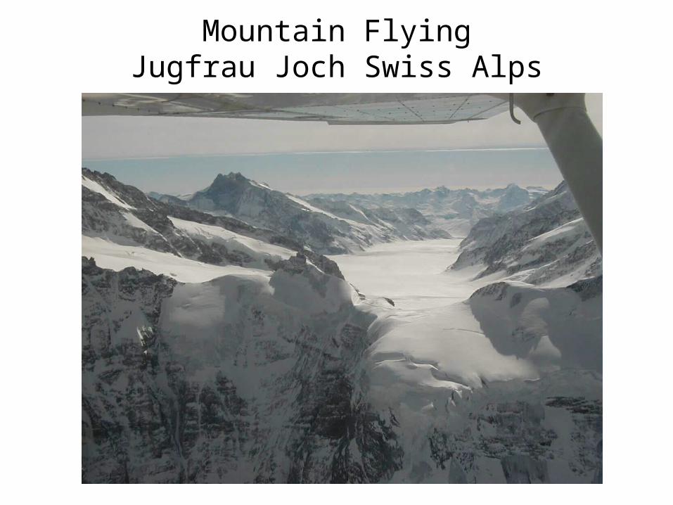
Mountain FlyingJugfrau Joch Swiss Alps

Mountain Flying El Capitan Yosemite CA

Mountain Flying7ME @ KLXV
Perfect Mountain Flying Aircraft for Day VFR

Mountain Flying References
• http://www.wisesurvival.com/ (Wilderness Survival Institute)• How to Crash an Airplane & Survive Mick Wilson
http://www.crashandsurvive.com/ • Advisory Circular 00-57 Hazardous Mountain Winds
– http://rgl.faa.gov/Regulatory_and_Guidance_Library/rgAdvisoryCircular.nsf/0/780437d88cbdafd086256a94006fd5b8!OpenDocument&Click=
• Most State Departments of Transportation have an Aeronautics or Aviation Department
– http://www.coloradopilots.org/– http://www.colorado-aeronautics.org/default.htm – http://www.dot.state.co.us/– http://www.montanapilots.org/– http://www.mdt.mt.gov/aviation/– http://itd.idaho.gov/aero/– http://www.flyidaho.org/– http://dot.state.wy.us/web/aero/index.html– http://www.wyomingpilots.org/Hangar1/Home/
• WWW.AOPA.org– http://www.aopa.org/members/files/guides/mntfly.html