move from drones to maps - recent proceedings · 2017-04-05 · move from drones to maps unmanned...
TRANSCRIPT
Move from Drones to MapsUnmanned Aerial Systems support for ArcGIS
Joseph Peters
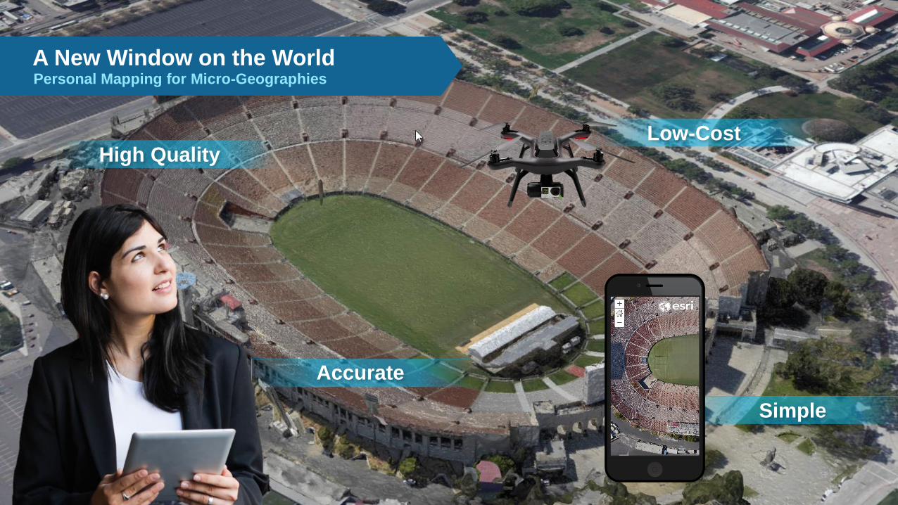
A New Window on the World
High Quality
Personal Mapping for Micro-Geographies
Simple
Low-Cost
Accurate

ResultsUAS for project management and monitoring
Measure
Model
Map

ResultsUAS for project management and monitoring

One button publishing to the web
Output to ArcGIS Online

2D Mapping
Imagery Mosaics
Inspection
Oblique Images & Video
3D Mapping
Elevation Products
Monitoring
Motion Imagery
Static Aerial Imagery VideoDrone2Map FMV Tools
Operational Patterns:Geography binds them all together

A Variety of ChoicesFixed wing versus rotary - sensors
SenseFly eBee
MicaSense RedEdge
3D Robotics – Solo
GoPro Hero4
Aeryon Labs - SkyRanger
Sony qX1
Altavian NOVA
DJI – Phantom


DJI Phantom 4 GoPro Hero 4 Black Sony R10C 16mm
Not all Cameras are EqualLens Distortion Plots
Verified by:
Engineering and Survey

Ground ControlNeeded for precise 3D accuracy

Typical Imagery Workflow
CTTasking
(Flight Planning)
PCollection Processing
E DExploitation Dissemination
Applies to Drone Operations
Esri Focus Area
Reliance on Partners

FAA RestrictionsNew Part 107 makes it easier but…
There are regulations:
1. Drones can now be flown commercially by anyone. FAA Part 107 provides for anyone passing a written
online test to be licensed for commercial operation.
2. While operators need to understand how to operate their drone as well as the regulations governing its
use, flight planning software included with the majority of drones automates the take-off, imagery
collection, and landing.
3. Esri provides a 60-day trial of Drone2Map so that users can see for themselves how easy the software
is to use.
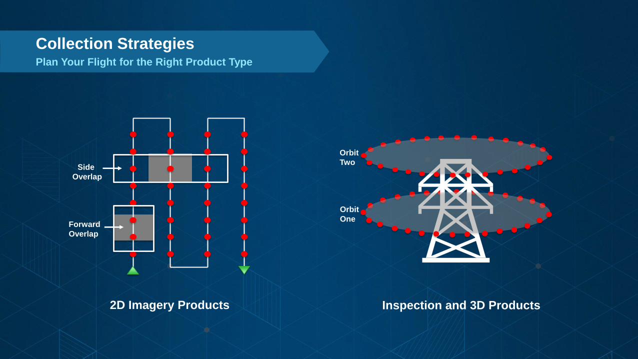
Side
Overlap
Forward
Overlap
2D Imagery Products
Orbit
One
Orbit
Two
Inspection and 3D Products
Plan Your Flight for the Right Product Type
Collection Strategies

Drone Tasking AppsLet the Robot be a Robot!!!
Mapping
Inspection

Drone2Map for ArcGISAccurate 2D & 3D Map Products
Implementation:
• Is a Windows App running on a PC or Surface Tablet
• Does not require ArcGIS for Desktop
• Includes an ArcGIS Online Individual Account
ArcGIS
Online
Fly Drone Run App Get Map
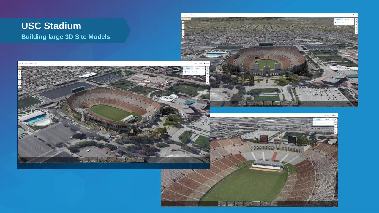
Building large 3D Site Models
USC Stadium

Wrightsville Beach, NCUAS for Surveying, Engineering & Construction
Orthos
3D

ResultsUAS for Surveying, Engineering & Construction
Total Area Processed
Sony R10C
Total 195 / 1.25GB
Collection Time < 1hr / 2flts
Ground Control Used Photos Collected Output Parameters
Oceanic Pier to
Masonboro Inlet
71.62 Acres
14 Points
Fully Surveyed
Processing Time: 4 hrs 32 mins
Products Produced: Orthos, DSM, Point Cloud, 3D Mesh
Overall Accuracy: Mean RMS 1.27 inches
Horizontal GSD – 1.21 in
3D Points / Meter - 104
Verified by:
Engineering and Survey

