multi-municipal comprehensive plan pages 1-112
DESCRIPTION
Multi-Municipal Plan for the City of Connellsville, Connellsville Township & Sout Connellsville. Chapter's 1-4TRANSCRIPT

FINAL DRAFT
MULTI-MUNICIPAL COMPREHENSIVE PLAN
for the
CITY OF CONNELLSVILLE
CONNELLSVILLE TOWNSHIP
SOUTH CONNELLSVILLE BOROUGH
November 2009

FINAL DRAFT MULTI-MUNICIPAL COMPREHENSIVE PLAN
CITY OF CONNELLSVILLE, CONNELLSVILLE TOWNSHIP, AND SOUTH CONNELLSVILLE BOROUGH
November 2009 i
Acknowledgements City of Connellsville
City Council
Judy Reed, Mayor
Terry Bodes
David McIntire
Charles Matthews
Brad Geyer
Planning Commission
Sam Spotto, Chairperson
George Strawn
David Leeder
Daniel Cocks
Nicka Dunn
Steering Committee Members
Judy Reed, Mayor
Daniel Cocks
David McIntire
South Connellsville Borough
Borough Council
Pete Casini, Mayor
Clyde Martz, Council Member
Robert Ward, Council Member
Steering Committee Members
Clyde Martz, Council Member
Robert Ward, Council Member
Connellsville Township
Board of Supervisors
Don Hann, Township Supervisor
Leah Brothers, Township Secretary/Treasurer
Steering Committee Members
Don Hann, Township Supervisor
Diane Cassidy
Connellsville Township Planning Commission
FINAL DRAFT MULTI-MUNICIPAL COMPREHENSIVE PLAN
CITY OF CONNELLSVILLE, CONNELLSVILLE TOWNSHIP, AND SOUTH CONNELLSVILLE BOROUGH
November 2009 ii
Connellsville Redevelopment Authority
J. Michael Edwards, Executive Director
Dexston Reed, Board
Fayette County Planning Department
Sara Rosiek
PA Department of Community and Economic Development
Joy Wilhelm Ruff
Jack Machek
Progress Council – Trail Town Program
Cathy McCollom
Trail Town Outreach Corps
Tim Padalino
Pennsylvania Environmental Council
Jim Segedy
Bureau of Recreation and Conservation
Tracy Stack
Fay-Penn Economic Development Council
Michael Jordan
The Studio Three
Brian Hollars
Others
Public meeting attendees
The preparation of this plan was financed in part through a Land Use Planning and Technical Assistance Grant from the Department of Community and Economic Development, as administered by the Governor’s Center for Local Government Services, Pennsylvania Department of Community and Economic Development. Additional funding was provided by each municipality.
FINAL DRAFT MULTI-MUNICIPAL COMPREHENSIVE PLAN
CITY OF CONNELLSVILLE, CONNELLSVILLE TOWNSHIP, AND SOUTH CONNELLSVILLE BOROUGH
Table of Contents
November 2009
Table of Contents
Executive Summary
Chapter 1 Overview
Chapter 2 Demographic and Socio-Economic Profile
Chapter 3 Vision for the Connellsville Region
Chapter 4 Economic Assessment and Development Strategy
Chapter 5 Housing Profile and Plan
Chapter 6 Historic & Cultural Resources Plan
Chapter 7 Natural Resources Plan
Chapter 8 Community Facilities Plan
Chapter 9 Transportation Plan
Chapter 10 Parks, Recreation and Open Space Plan
Chapter 11 Energy Conservation Plan
Chapter 12 Land Use Plan
Chapter 13 Implementation Plan
Appendix A: Planning Area Project Facilities Inventory and Analysis
Appendix B: Connellsville School District – Project Facilities Inventory and Analysis
Appendix C: Sample Maintenance Plan
Appendix D: Urban Sustainability Guidelines
Appendix E: Recommended Suitable Street Trees
Appendix F: Schematic Design for Connellsville Civic Plaza
Appendix G: Quick-Test Calculation
Appendix H: Connellsville Main Street Building and Design Guidelines

FINAL DRAFT MULTI-MUNICIPAL COMPREHENSIVE PLAN
CITY OF CONNELLSVILLE, CONNELLSVILLE TOWNSHIP, AND SOUTH CONNELLSVILLE BOROUGH
Executive Summary - 1
November 2009
Scenic view of Connellsville
Executive Summary
Overview
The Connellsville area consists of the City of Connellsville, Connellsville Township, and South Connellsville Borough. These three municipalities have many distinctive features and attributes, including a main street business district and a range of housing opportunities. The communities also have a common vision to improve the quality of life for area residents and visitors. Amenities of the Connellsville area include its history, culture, and location. In addition, the Connellsville area is rich in recreational and outdoor activities. It has become a tourist destination due to the Great Allegheny Passage (GAP) trail, the Youghiogheny River, the state game lands, and other nearby attractions such as Ohiopyle and Seven Springs. Connellsville boasts ample resources for hiking, biking, boating, fishing, and hunting and has a unique opportunity to maximize its recreational amenities to leverage additional resources for development and revitalization.
The multi-municipal comprehensive plans highlights specific goals and objectives related to housing, community facilities, land use, parks and recreation, open space, energy conservation, and natural resources. In addition, the multi-municipal plan includes an economic assessment of the Connellsville area with a focus on the core area revitalization strategy for the area’s urban center, the business district in the City of Connellsville. The following summaries highlight some main points and trends that will be further discussed and explored in the multi-municipal comprehensive plan.
Finding 1: Build upon existing assets and strengths
There are a numerous assets and strengths in the Connellsville area that municipal officials and community members can build upon to revitalize and enhance the existing communities. For example, several assets identified include the small town and rural atmosphere, the walkable business district, the GAP trail, the Youghiogheny River, parks and recreational resources, and friendly people. In addition, there are several opportunities for infill development, particularly along East and West Crawford Avenue in the City of Connellsville and along East Crawford Avenue in Connellsville Township.

FINAL DRAFT MULTI-MUNICIPAL COMPREHENSIVE PLAN
CITY OF CONNELLSVILLE, CONNELLSVILLE TOWNSHIP, AND SOUTH CONNELLSVILLE BOROUGH
Executive Summary - 2
November 2009
GAP trail along Third Street
Anchor Hocking Site
Finding 2: City of Connellsville – Link the Great Allegheny Passage to the downtown business district
The City of Connellsville provides bicyclists and other users of the GAP trail with an “urban” experience unique from other area trail towns such as Confluence and Meyersdale. Bicyclists and other tourists need places to eat, sleep, and shop. In addition, they need appropriately located bike racks to temporarily and safely store their bikes while they explore the area’s wealth of recreational resources. The urban, city experience that downtown Connellsville offers bicyclists and other tourists could be enhanced with the addition of restaurants, hotels, shops, circulation improvements, and better signage to direct trail users to area amenities, including “share the road” signage.
Finding 3: South Connellsville Borough – Revitalize the Anchor Hocking Site
The former Anchor Hocking site, once the location of a bottling plant that employed over 300 residents of the Connellsville area, is a prime site for redevelopment and reuse. The site provides many challenges, including its size at over 650,000 square feet. However, many federal, state, and local agencies, including the Fay-Penn Economic Development Council, Southwestern Regional Commission, the Appalachian Regional Commission, and the Economic Development Administration, have been working with local officials from South Connellsville Borough and the City of Connellsville with a strong commitment to exploring reuse options for this site. The plant, if redeveloped and converted into new, mixed-use space, would once again be able to positively impact the local and regional economy by providing jobs to an existing workforce rich in manufacturing and production skills. The redeveloped site could offer attractive space for green technology firms as one of many options.

FINAL DRAFT MULTI-MUNICIPAL COMPREHENSIVE PLAN
CITY OF CONNELLSVILLE, CONNELLSVILLE TOWNSHIP, AND SOUTH CONNELLSVILLE BOROUGH
Executive Summary - 3
November 2009
Housing along Pittsburgh Street
U.S. Route 119 and East Crawford Avenue
Finding 4: Connellsville Township – Create a Gateway
For many people entering Connellsville Township, the exit from U.S. Route 119 onto East Crawford Avenue/Route 711 presents an impression that does reflect the strong housing stock and community attributes. The types of uses and lack of landscaping, curbs, and defined buffers creates a sense of disorder. Updating the zoning ordinance to encourage appropriate setbacks, signage, building scale and massing, as well as land uses that are appropriate for the gateway, should be encouraged.
Finding 5: Create a broader range of housing alternatives
Due to gradual shifts in demographics, an aging population, and smaller household size, a broader range of housing alternatives are needed, particularly for elderly populations and single-parent households in the Connellsville area.
A healthy mix of housing types and styles already exists throughout the Connellsville area, which provides a great opportunity to revitalize the existing housing stock through rehabilitation programs. Within the Connellsville business district, there are ample vacant buildings available that could be converted to mixed use, including storefronts on the ground floor and apartment units on the upper floors. In addition, the Youghiogheny River presents the possibility of developing riverfront housing in locations that are not in a flood plain.

FINAL DRAFT MULTI-MUNICIPAL COMPREHENSIVE PLAN
CITY OF CONNELLSVILLE, CONNELLSVILLE TOWNSHIP, AND SOUTH CONNELLSVILLE BOROUGH
Executive Summary - 4
November 2009
Connellsville Armory
Finding 6: Preserve and enhance the rich historic and cultural resources
The Connellsville area is home to several buildings on the National Register of Historic Places, including the Armory. There is a need to develop reuse and revitalization strategies for these buildings in order to preserve and enhance their historic and architectural significance and beauty. In addition to many historic structures, the area is rich in history and culture with annual celebrations at Stewart’s Crossing, the Geranium Festival, and Art on the Yough event.
Finding 7: Protect, preserve and enhance the plethora of natural resources that adds to the quality of life
The Connellsville area is home to the Youghiogheny River and several of its tributaries and streams, biodiversity areas with specific species of plants and vegetation, and wooded lands including the state game lands used for hunting. These natural resources need to be protected, preserved, and enhanced to ensure that they continue to add to the high quality of life in the region.
Finding 8: Enhance maintenance of parks and recreation facilities
Another one of the strengths throughout Connellsville is the number of parks, playgrounds, and other recreational facilities that are available for use by residents. Many of these facilities suffer from deferred maintenance and compliance issues according to current safety standards and the Americans with Disabilities Act (ADA). Maintenance plans and schedules should be developed to adequately maintain the parks and replace old equipment with more modern playground equipment up to current safety standards.
Yough River Park

FINAL DRAFT MULTI-MUNICIPAL COMPREHENSIVE PLAN
CITY OF CONNELLSVILLE, CONNELLSVILLE TOWNSHIP, AND SOUTH CONNELLSVILLE BOROUGH
Executive Summary - 5
November 2009
Crawford Avenue and Arch Street
Finding 9: Develop a transportation network to meet current and future needs
The existing transportation network in the Connellsville area consists of several state highways, local roads, railways, waterways, and a public transportation system that runs through the City of Connellsville to connect to other areas throughout Fayette County and surrounding counties. There are congestion and safety issues on many roadways and bridges, particularly on Memorial Bridge, currently under reconstruction, and along Crawford Avenue during morning and afternoon rush hours. Needed improvements include the enhancement of pedestrian and bicycle safety to encourage greater use, and the reconstruction of the Amtrak train
station to encourage more visitor stops in Connellsville.
Since vehicular traffic is the primary present and anticipated future mode of transportation in the region, Connellsville must maintain and upgrade the local elements of its existing transportation network. In addition, alternate routes for access to the Anchor Hocking site should be explored. This would include a potential bridge from West Wine Street to U.S. Route 119 across the Youghiogheny River.
Finding 10: Maintain the context and character of existing land uses
A mix of land uses, including, residential, recreational, open space, commercial, industrial and agricultural exists in the Connellsville area. Area municipalities should encourage growth that is well integrated and compatible with existing land uses that will protect the existing environment. It is important to preserve valuable natural resource areas and focus development in areas where the necessary infrastructure is already in place.
Connellsville business district Rural housing

FINAL DRAFT MULTI-MUNICIPAL COMPREHENSIVE PLAN
CITY OF CONNELLSVILLE, CONNELLSVILLE TOWNSHIP, AND SOUTH CONNELLSVILLE BOROUGH
Executive Summary - 6
November 2009
Finding 11: Reverse continued population loss and poverty rates
The Connellsville area continues to lose population, although at a much slower rate than in the past. The City of Connellsville, the largest and most populous of the three municipalities, is losing population at a much faster rate than its neighboring counterparts. The population of the Connellsville area as a whole is projected to decline further by 2012. In addition, poverty rates are high, particularly in the City of Connellsville where 28.2% of residents were living in poverty in 2000. The poverty rate in the City was more than double the poverty rates in the Township and Borough.
Finding 12: Conserve energy
When and where appropriate, the Connellsville area should explore ways to reduce energy consumption, promote the conservation of non-renewable energy resources, and encourage the development of renewable energy sources to cut down on costs and help sustain the environment. See the Urban Sustainability Guidelines in Appendix D for additional information.
W:\CLIENT\PA\CONNELLSVILLE\COMP PLAN\Document\Executive Summary.doc

FINAL DRAFT MULTI-MUNICIPAL COMPREHENSIVE PLAN
CITY OF CONNELLSVILLE, CONNELLSVILLE TOWNSHIP, AND SOUTH CONNELLSVILLE BOROUGH
Chapter 1 Overview - 1
November 2009
Chapter 1 Overview
Introduction to the Planning Area
The multi-municipal plan for the City of Connellsville, South Connellsville Borough, and Connellsville Township (referred to in the document as the “planning area” or “Connellsville area”) was developed to create communities that provide opportunities for employment, housing, and recreation that enhance the health, safety, and welfare of all residents.
The communities in the planning area are linked by many common features, including an economic, geographic, and cultural history. Although each community has its own unique features and attributes, they all have in common the desire to improve the area’s livability for future generations. Each community has been impacted by the decline in manufacturing jobs, population loss, and the change in the base economy, but the communities have been working together to address common issues that impact the lives of all residents.
Local Planning in Pennsylvania
Pennsylvania municipalities are empowered by the Pennsylvania Municipalities Planning Code (MPC) “to plan their development” and to “govern development locally through both zoning ordinances and subdivision and land development ordinances.” A plan provides a “blueprint” for what the community wants to look like in the future and the necessary steps to realize that future. The MPC authorizes municipalities to prepare comprehensive plans for the purposes of promoting and protecting safety, health and morals; accomplishing coordinated development; providing for the general welfare; guiding uses of land and structures, type and location of streets, public grounds and other facilities, among other things.
Finally, the MPC authorizes two or more municipalities to enter into an intergovernmental cooperative agreement for the purpose of developing and adopting a comprehensive plan. By developing a multi-municipal comprehensive plan, there is the potential to plan more efficiently and effectively on a regional basis. The benefits of multi-municipal planning include several incentives that are available only to municipalities that come together and prepare a comprehensive plan. Some of these benefits include tax revenue sharing, transfer of development rights, and joint zoning. In addition, the municipalities continue to explore opportunities for joint municipal service delivery, including police services and street works.
Planning as Policy

FINAL DRAFT MULTI-MUNICIPAL COMPREHENSIVE PLAN
CITY OF CONNELLSVILLE, CONNELLSVILLE TOWNSHIP, AND SOUTH CONNELLSVILLE BOROUGH
Chapter 1 Overview - 2
November 2009
As a policy guide and blueprint for municipal officials, the comprehensive plan is meant to provide guidance in the day-to-day administrative decision-making encountered by the elected bodies. It also serves as a template of what area residents and stakeholders would like to see in the future if certain steps are taken to strengthen the economy, provide more opportunities for businesses, rehabilitate the downtown area, upgrade housing, and improve the overall conditions to foster growth.
In providing guidance to local officials, for example, a request to rezone a large parcel of land from an agricultural use to an intensive commercial use can cause significant impacts, both positive and negative, for a municipality. As part of the decision-making process, municipal officials, planning staff, and local planning commissions should be able to find justification within the approved multi-municipal comprehensive plan as to whether the rezoning request should be approved or denied.
The comprehensive plan serves as a policy guide for the City of Connellsville, South Connellsville Borough, and Connellsville Township These communities, while they share many common characteristics, also have unique land use issues, ranging from infill development in an urban environment to maintaining open space that preserves game lands and wooded areas. Plan policies and recommendations are to be implemented over time through a variety of decision-making actions including the subdivision of land, and the location and construction of public infrastructure improvements, among other things. The comprehensive plan was developed to respond to the growing interest in making land use decisions that are made in a coordinated and responsible manner to capitalize on potential economic development initiatives and to preserve and enhance the quality of life.
The Regional Planning Process
The regional planning process was initiated with an Intergovernmental Cooperation Agreement executed by and between the participating municipalities. This agreement discusses the process for developing and adopting the multi-municipal plan. The agreement includes a description of the power and scope of delegated authority, the manner and extent of financing the preparation of the plan, the organizational structure necessary to implement the agreement, and an outline of the planning process in terms of schedule and necessary components like public participation and a discussion on the commitments for participation and withdrawal. While the three municipalities jointly agreed to the terms and conditions of the agreement, executing the agreement did not alter the power or structure of the local units of government.
The regional planning process for the City of Connellsville, South Connellsville Borough, and Connellsville Township began in July 2008 with the first of several steering committee meetings. Members of the comprehensive plan steering committee were appointed by the elected bodies of each municipality to assist with the development of a community vision

FINAL DRAFT MULTI-MUNICIPAL COMPREHENSIVE PLAN
CITY OF CONNELLSVILLE, CONNELLSVILLE TOWNSHIP, AND SOUTH CONNELLSVILLE BOROUGH
Chapter 1 Overview - 3
November 2009
statement, community development goals and objectives, and a draft future land use map.
Assisting the municipalities was a staff member from the Trail Town program of the Progress Fund, the Department of Community and Economic Development (DCED), the Connellsville Redevelopment Authority, and Mullin & Lonergan Associates, a planning and community development consulting firm.
On March 19, 2008, a visioning workshop was held in the community center in the City of Connellsville. Approximately 100 residents attended and participated in a S.W.O.T. analysis designed to encourage the residents to envision the future of their municipalities on a regional basis. The idea of regionalism was easily understood and accepted by those in attendance. By the end of the workshop, most attendees realized that preserving and enhancing their quality of life would require a proactive response on their part to regional planning.
In August 2008, site visits and meetings were conducted in each community to understand current issues and concerns.
In November 2008, Mullin & Lonergan Associates presented a demographic overview and a photographic survey of existing conditions in the three municipalities to the steering committee.
From November 2008 through March 2009, sections of the comprehensive plan were drafted. In late April, a complete draft of the multi-municipal comprehensive plan was provided to each of the three municipalities.
The steering committee continued their work with a second meeting on March 26, 2009. At that meeting, a progress report was given and the draft comprehensive plan vision statements were presented for comment. The statements were accepted by those in attendance with only minor revisions.
In April 2009, the draft plan was presented to the steering committee for review and comment. An upbeat discussion took place on the specific elements of the plan. Several comments were received and accepted with only minor revisions impacting the overall document.
In May 2009, a workshop was held with the steering committee to review the future land use map for the planning area. Existing land use maps were created for each of the municipalities and a composite map was prepared for review by the committee as a whole. Committee members identified areas appropriate for new development, areas that should remain primarily rural in nature due to infrastructure restrictions and a desire to preserve agricultural areas, and priority areas for new infrastructure development. Based on these concepts, a draft future land use map for the planning area was created. This map, along with land use designations and descriptions, was incorporated into the draft comprehensive plan.

FINAL DRAFT MULTI-MUNICIPAL COMPREHENSIVE PLAN
CITY OF CONNELLSVILLE, CONNELLSVILLE TOWNSHIP, AND SOUTH CONNELLSVILLE BOROUGH
Chapter 1 Overview - 4
November 2009
Using This Plan
This multi-municipal comprehensive plan is to be used as a guide for making decisions relative to land use and development in the three municipalities. Elected officials of each municipality will continue to act as the governing body for their respective municipalities, but their decisions should be guided by the recommendations included within this document and developed in joint collaboration with each other. This document provides guidance for site plans, subdivision plans, zoning requests, community facility projects and other concerns related to future land use.
It is important to note that while the three municipalities collaborated extensively on the plan, implementation of the plan will be carried out by each of the three elected bodies in their respective municipalities.
The multi-municipal comprehensive plan is divided into thirteen chapters containing nine plan elements, most of which are required by the MPC. Following the Overview and Demographic and Socio-Economic Profile sections, the chapters include:
Vision for the Connellsville Region
Economic Assessment and Development Strategy Plan
Housing Profile and Plan
Historic & Cultural Resources Plan
Natural Resources Plan
Community Facilities Plan
Transportation Plan
Parks, Recreation & Open Space Plan
Energy Conservation Plan
Land Use Plan
Implementation Plan.
The Economic Development Plan portion of the document is an expanded version of the plan due to the desire by the communities to explore the economic development issues in each community and potential development opportunities.
The Implementation Plan contains a detailed and descriptive list of the strategies included in each of the plan components. The primary purpose of the Implementation Plan is to provide a step-by-step guide for municipal officials and residents to achieve the community goals and objectives, and ultimately the long-range community vision, established in the multi-municipal comprehensive plan. Goals are broad value-based statements that express a future condition or action that the planning area desires to achieve. Objectives are more specific statements that enumerate action steps that must be taken in order to achieve a desired goal. Lastly, strategies are specific

FINAL DRAFT MULTI-MUNICIPAL COMPREHENSIVE PLAN
CITY OF CONNELLSVILLE, CONNELLSVILLE TOWNSHIP, AND SOUTH CONNELLSVILLE BOROUGH
Chapter 1 Overview - 5
November 2009
projects or programs that enable the planning area to achieve their objectives, which in turn, assists in achieving overall goals.
Amending the Plan
A comprehensive plan is a document that should be used as a frequent resource in the daily administration of municipal business and as a policy document in the long range planning for a municipality. However, times change, economies fluctuate and circumstances can dictate the need to modify or amend the long range vision and plan of a municipality. When this occurs, the comprehensive plan can be amended to reflect the new and projected conditions so that future decisions by elected officials reflect a renewed community vision and strategy. At the very least, the MPC requires that a multi-municipal plan be reviewed every ten years.
Interrelationship with Plan Elements
One of the requirements of the MPC is that a comprehensive plan shall include an explanation of how the individual plan elements (such as land use, housing, transportation, economic development, natural resources, historic resources, etc.) are interrelated and impact one another. This may be best explained by the efforts to link the Great Allegheny Passage (GAP) with economic development, new jobs, infill development, improved land uses, housing that reinforces the local economy, improved recreational facilities, increased access to the river, and an improved transportation infrastructure. Although the communities have their own tax bases and unique features and issues, the economies of the three communities are inexorably intertwined. What happens with the former Anchor Hocking plant site in South Connellsville Borough will directly impact the economic health of the City of Connellsville and Connellsville Township, and the economic health of the central business district in the City of Connellsville will in turn impact both the Township and Borough. As a result, there exists an obvious interrelationship among various plan elements such as land use and housing, transportation, community facilities, and economic development, in the very least.
Because of this interrelationship among plan components, basic planning principles can provide guidance when making recommendations, and eventually approved policies, for future land use decisions. The comprehensive plan’s Land Use Plan allocates land uses and specifies the recommended types of land uses and densities for those uses.
Through land use planning, such as designation of rural resource areas, watersheds and wellhead protection areas for community water supplies can be established. Intensive residential development is not proposed where sewer infrastructure is not planned, available, or in close proximity, and where soils are not suitable for on-site sewage disposal.

FINAL DRAFT MULTI-MUNICIPAL COMPREHENSIVE PLAN
CITY OF CONNELLSVILLE, CONNELLSVILLE TOWNSHIP, AND SOUTH CONNELLSVILLE BOROUGH
Chapter 1 Overview - 6
November 2009
It is important that community facilities, including recreation and open space, are available to serve the residents of the area, in addition to visitors and tourists. The Parks, Recreation and Open Space Plan notes existing recreational facilities, proposed recreational facilities, and potential opportunities for recreational facilities. The Plan provides extensive discussion on opportunities to link the recreational and tourism aspects with overall economic development.
Future public facilities should be sited to be consistent with the community goals and objectives of the Land Use Plan, such as maintaining open space and recreation uses.
The Land Use Plan encourages economic vitality by providing areas for commercial and industrial development and agricultural activities. Preservation of residential communities can provide support for local businesses and a local workforce. Providing for open space and preservation of community resources supports the quality of life in the area and can encourage additional private investment.
It is necessary to maintain a transportation circulation system, which can accommodate generated traffic volumes. In turn, future development should not adversely affect the circulation system. Land use decisions are influenced by the existing circulation system, while at the same time those land use decisions affect circulation systems and their functions. Existing rural and residential areas should be protected as much as possible from the impacts of through-traffic, which can be accomplished by proposed improvements to the circulation network.
Compatibility with Other Plans
Another regulatory requirement of the MPC is that a comprehensive plan must indicate how the recommendations contained with this plan are compatible with the comprehensive plans of neighboring municipalities and Fayette County.
The municipalities of Dunbar Borough, Springfield Township, Bullskin Township and Upper Tyron are surrounded by the planning area covered by this comprehensive plan.
The Fayette County Comprehensive Plan was reviewed extensively for this multi-municipal plan. This document is primarily a public policy guide to decision-making regarding the physical development of the county as a whole. The goals and objectives contained within this multi-municipal plan are intended to be consistent and compatible with the county comprehensive plan.
In August 2009 the Fayette County Planning Commission received a draft copy of this multi-municipal comprehensive plan for review and comment.

FINAL DRAFT MULTI-MUNICIPAL COMPREHENSIVE PLAN
CITY OF CONNELLSVILLE, CONNELLSVILLE TOWNSHIP, AND SOUTH CONNELLSVILLE BOROUGH
Chapter 1 Overview - 7
November 2009
Relationship to Adjoining Municipalities
The existing and proposed development in the City of Connellsville, Connellsville Township, and South Connellsville Borough are, in many cases, compatible with the existing and proposed development plans in adjoining municipalities.
If instances of adjacent incompatible uses arise and are of concern to neighboring municipalities, buffering techniques can be included in subdivision and land use development ordinances and zoning ordinances.

FINAL DRAFT MULTI-MUNICIPAL COMPREHENSIVE PLAN
CITY OF CONNELLSVILLE, CONNELLSVILLE TOWNSHIP, AND SOUTH CONNELLSVILLE BOROUGH
Chapter 1 Overview - 8
November 2009

FINAL DRAFT MULTI-MUNICIPAL COMPREHENSIVE PLAN
CITY OF CONNELLSVILLE, CONNELLSVILLE TOWNSHIP, AND SOUTH CONNELLSVILLE BOROUGH
Chapter 2 Demographic & Socio-Economic Profile - 1
November 2009
Chapter 2 Demographic & Socio-Economic Profile
Regional Context
Three municipalities are the focus of this comprehensive plan: the City of Connellsville, Connellsville Township, and South Connellsville Borough. Located in the north central peak of Fayette County, these three communities have forged a partnership to promote a regional planning initiative.
The Connellsville area is rich in history. During the French and Indian War, a British army commanded by General Edward Braddock approached Fort Duquesne, crossing the Youghiogheny River at Stewart's Crossing, situated in the middle of modern Connellsville. Connellsville was officially founded as a township in 1793 by Zachariah Connell, a military captain during the American Revolution. Connellsville became a borough in 1806 and a city in 1909 when it unified with the nearby town of New Haven. During the later half of the nineteenth century, coal mining was the main industry in the Connellsville area. This industry brought much wealth to the region. As technology advanced and jobs were outsourced to other areas, the coke and coal industry began to decline. Beginning in the 1950s, a wave of deindustrialization hit the Connellsville area, leading to decreased population and increased poverty rates. While the Connellsville area is not a capital of industry anymore, the area provides its residents with a good quality of life in a small town setting. The Youghiogheny River and Great Allegheny Passage trail provide residents and tourists alike with endless recreational activities. The trail and river, as well as vacant industrial and historic buildings, provide a vast array of development opportunities for the three municipalities.
Population Trends
Population trends among the three municipalities varied between 1990 and 2000. The City of Connellsville and Connellsville Township experienced declines while South Connellsville Borough experienced an increase in the number of residents. Table 2-1. Population Trends in the Planning Area, 1990-2000
1990 2000 % Change 1990-2000
Connellsville City 9,229 9,146 -0.9%Connellsville Township 2,553 2,483 -2.7%
South Connellsville Borough 2,204 2,281 3.5%Planning Area Total 13,986 13,910 -0.5%Pennsylvania 11,881,643 12,281,054 3.4%Fayette County 145,351 148,644 2.3%
Source: U.S. Census Bureau, 2000 SF3 P1; 1990 STF1 P001

FINAL DRAFT MULTI-MUNICIPAL COMPREHENSIVE PLAN
CITY OF CONNELLSVILLE, CONNELLSVILLE TOWNSHIP, AND SOUTH CONNELLSVILLE BOROUGH
Chapter 2 Demographic & Socio-Economic Profile - 2
November 2009
The City of Connellsville, the most populous of the three municipalities in the planning area, experienced a 0.9% decline in population during the 1990s. Additionally, the population of the City of Connellsville is projected to continue to decrease over the next few years with an expected population of 8,265 residents by 20121, which is a decrease of 9.6% from 2000.
Similar to the City of Connellsville, Connellsville Township also lost population during the 1990s. The number of residents in Connellsville Township decreased 2.7% to 2,483 residents. The Township’s population is projected to decline slightly by 2012 to 2,387 residents, a decrease of 3.9%.
By comparison, South Connellsville Borough experienced a 3.5% increase in population during the 1990s, or a net gain of 77 residents. The slight growth in population in South Connellsville Borough was consistent with the population trends of both the State of Pennsylvania and Fayette County throughout the 1990s. Though the population increased during the 1990s, this trend is not likely to continue through 2012. In fact, the population of South Connellsville Borough is projected to decline to 2,130 residents by 2012, a decrease of 6.6%.
Figure 2-1. Population Trends in the Planning Area, 1990-2012Source: DemographicsNow, Inc; U.S. Census Bureau
0
1000
2000
3000
4000
5000
6000
7000
8000
9000
10000
1990 2000 2007 2012
Connellsville CityConnellsville TownshipSouth Connellsville
Although the population is projected to decline in the planning area between 2000 and 2012, the population decreases are fairly gradual in both Connellsville Township and South Connellsville Borough. The decreases are most significant in the City of Connellsville. As Figure 1 illustrates, the
1 Population projections provided by DemographicsNOW, Inc.

FINAL DRAFT MULTI-MUNICIPAL COMPREHENSIVE PLAN
CITY OF CONNELLSVILLE, CONNELLSVILLE TOWNSHIP, AND SOUTH CONNELLSVILLE BOROUGH
Chapter 2 Demographic & Socio-Economic Profile - 3
November 2009
population of the City of Connellsville is projected to drop at a much faster rate than the rest of the planning area.
Racial Composition
Across the planning area, the racial composition of the population is 96% white, while blacks and residents of all other races combined represent 4% of the total population. The City of Connellsville has the largest minority population with blacks representing nearly 4% of the total population and all other races equal to 1.5%.
Table 2-2 Racial Composition in the Planning Area, 2000
Total White Black
American Indian/Alaska
Native
Asian/ Pacific
IslanderOther/Two or More Races Hispanic
Connellsville City 9,146 8,647 359 12 30 98 49Connellsville Township 2,483 2,460 15 0 2 6 3
South Connellsville Borough 2,281 2,234 31 1 0 15 7
Planning Area Total 13,910 13,341 405 13 32 119 59Pennsylvania 12,281,054 10,484,203 1,224,612 18,348 223,230 330,661 394,088
Fayette County 148,644 141,657 5,223 168 341 1,255 564
Source: DemographicsNow, Inc.; U.S. Census Bureau Persons of Hispanic descent of any race also represent a very small percentage of the total population. In 2000, Hispanics accounted for less than 1% of the population in the planning area.
0%
10%
20%
30%
40%
50%
60%
70%
80%
90%
100%
Connellsville City Connellsville Township
South Connellsville
Borough
Planning Area Total
Pennsylvania Fayette County
Figure 2-2. Racial Composition in the Planning Area, 2000Source: DemographicsNow, Inc.; U.S. Census Bureau
Hispanic
Other/Two or More Races
Asian/ Pacific Islander
American Indian/Alaska Native
Black
White

FINAL DRAFT MULTI-MUNICIPAL COMPREHENSIVE PLAN
CITY OF CONNELLSVILLE, CONNELLSVILLE TOWNSHIP, AND SOUTH CONNELLSVILLE BOROUGH
Chapter 2 Demographic & Socio-Economic Profile - 4
November 2009
Age Distribution
The age profile of a planning area influences the labor supply, the demand on education facilities, the need for various types of social services and the need for different types of housing. The following figure illustrates the age distribution of the three municipalities. Several trends are evident.
0%
10%
20%
30%
40%
50%
60%
70%
80%
90%
100%
Connellsville City Connellsville Township
South Connellsville Borough
Planning Area Total
Pennsylvania Fayette County
Figure 2-3. Age Distribution Trends, 2000Source: DemographicsNOW, Inc.; U.S. Census Bureau
65 years & older
55 to 64 years
45 to 54 years
25-44 years
20-24 years
5-19 years
Under 5 years
The age distributions in the City of Connellsville, Connellsville Township and South Connellsville Borough are very similar to state and county patterns.
In Connellsville Township, the 5-19 year age group is slightly smaller and the 45-54 year age group is significantly higher (as segments of the total population) than elsewhere in the planning area.
The 65 years and older population makes up 18.7% of the total population in the planning area and is about 3% more than that of the state. This important trend represents the aging of the baby boom generation (45-54 years) and the continued prominence of the 65 and older age group. As life spans continue to increase and as the baby boom generation ages, this bracket will continue to grow significantly. Social services and housing types to fit the needs of these segments of the population will be important development factors.
Another important trend is the prominence of the 25-44 year age group. In the planning area, this age group accounts for 27.4% of the population, the largest of any age group. The significance of the 25-44 age group is that this group is most likely to get married, start families, and buy homes. This is also the primary labor force contingent. Commercial and industrial establishments locate to areas

FINAL DRAFT MULTI-MUNICIPAL COMPREHENSIVE PLAN
CITY OF CONNELLSVILLE, CONNELLSVILLE TOWNSHIP, AND SOUTH CONNELLSVILLE BOROUGH
Chapter 2 Demographic & Socio-Economic Profile - 5
November 2009
where the demographic makeup will prove profitable and/or where a skilled labor force is available to meet their needs.
The median age in the three municipalities also provides a snapshot of the residents. The City of Connellsville had the youngest median age in 2000 at 38.2 years. South Connellsville Borough was slightly higher with a median age of 39.5 years.
Connellsville Township had the oldest median age among the municipalities at 42.6 years. By comparison, the median age of Fayette County was 40.2 years while Pennsylvania’s median age was 38.
Education
Education plays a critical role in the economic viability of a community. Business and industry analyze regional demographics when searching for new locations and plant expansions. They scrutinize the level of high school and college graduates, the quality of local schools and the availability of worker-readiness programs.
Across the planning area, 46.8% of residents 25 years and older in 2000 were identified as high school graduates. This was slightly lower than the county rate and significantly higher than the state rate. The percentage of residents with associate degrees was slightly lower in the planning area than at the county and state levels. Furthermore, the percentage of residents with bachelor degrees and graduate/professional degrees was significantly lower in the planning area compared to the state.
The following table indicates the highest level of educational attainment. For example, 53.3% of persons age 25 and older in Connellsville Township were high school graduates. Of these, 4.4% went on to obtain a graduate or professional degree. Table 2-3. Highest Level of Educational Attainment in the Planning Area, 2000
High School Graduate
Associate Degree
Bachelor's Degree
Graduate/ Professional
Degree Connellsville City 43.6% 4.8% 9.6% 3.1%
Connellsville Township 53.3% 4.1% 5.3% 4.4%South Connellsville
Borough 52.0% 6.5% 5.7% 1.4%Planning Area Total 46.8% 4.9% 8.2% 3.1%
Pennsylvania 38.1% 5.9% 14.0% 8.4%Fayette County 47.8% 4.8% 7.2% 4.3%
Source: U.S. Census Bureau, 2000 SF3 P37

FINAL DRAFT MULTI-MUNICIPAL COMPREHENSIVE PLAN
CITY OF CONNELLSVILLE, CONNELLSVILLE TOWNSHIP, AND SOUTH CONNELLSVILLE BOROUGH
Chapter 2 Demographic & Socio-Economic Profile - 6
November 2009
Labor Force & Commuting Patterns
Analyzing commuter travel patterns is important for regional planning. Commuting patterns indicate where people work and how far people must drive to get to work. Commuting time is the best criterion for assessing commuter travel patterns. The average commute length is usually dependent on the distance from home to work. However, poor traffic management, inefficient highways, traffic delays, speed limits, and a host of other factors affect commuting time. Table 2-4. Labor Force and Commuting Patterns in the Planning Area, 2000
Westmoreland County 2,391 Westmoreland County 8,985Washington County 1,317 Allegheny County 5,151Greene County 780 Washington County 3,051Allegheny County 732 Monongalia County, WV 1,520Somerset County 552 Greene County 1,204Monongalia County, WV 241 Somerset County 397Preston County, WV 99 Butler County 168Garrett County, MD 87 Beaver County 136All Other Places 481 All Other Places 1,419Total In-Commuters 6,680 Total Out-Commuters 22,031
Source: U.S. Census Bureau, 2000 County to County Worker Flow Patterns
IN-COMMUTERS OUT-COMMUTERS(People who live elsewhere and commute to Fayette County for work)
(People who live in Fayette County but commute elsewhere for work)
LOCAL RESIDENT WORKERS(People who live and work in Fayette County)Fayette County 35,915
One of the most important commuting characteristics in the planning area are travel patterns that indicate who is traveling where for employment. This data is available on the county level. In 2000, there were 35,915 residents who lived and worked in Fayette County. These residents comprised 84.3% of the total number of persons employed in the County.
A total of 6,680 residents of outlying counties made the daily commute into Fayette County in 2000 to their place of employment, also referred to as in-commuters. Meanwhile, 22,031 residents of Fayette County commuted out to other counties to reach their jobs and are known as out-commuters. This cross-commutation resulted in a net worker outflow of 15,351 workers.
Fayette County residents are dependent on jobs supplied by companies in Westmoreland and Allegheny Counties. Of the 22,031 commuters who worked outside of Fayette County, 64.2% (14,136) traveled to either Westmoreland or Allegheny Counties for work. On the reverse commute, 35.8% of in-commuters (2,391) were from Westmoreland County, while 11% (732) were from Allegheny County.
Another important commuting characteristic is the length of time spent commuting. The average commute time in the planning area was 21.8 minutes, more than 3 minutes shorter than the state’s average commute time of 25 mintues. Residents of Connellsville Township had the shortest mean commute

FINAL DRAFT MULTI-MUNICIPAL COMPREHENSIVE PLAN
CITY OF CONNELLSVILLE, CONNELLSVILLE TOWNSHIP, AND SOUTH CONNELLSVILLE BOROUGH
Chapter 2 Demographic & Socio-Economic Profile - 7
November 2009
time to work of 21.4 minutes while residents of South Connellsville experienced the longest commute of the three municipalities at 24.2 minutes. The shorter commuting time for residents in the planning area has several implications.
First, it can indicate that there is a steady base supply of jobs close to where residents live to satisfy the employment needs of the population. However, because much of Fayette County is rural, workers throughout the County must commute longer distances to reach their place of work. The planning area is more urbanized than other parts of Fayette County, thus, residents of the area enjoy shorter commute times than the average commute time of 26.5 minutes in Fayette County. Conversely, longer commuting times may also be indicative of residents who choose to live further away from employment centers and in the more rural areas of the area.
Second, within Fayette County, 55.6% of the labor force resides and works in the County. Those that work outside of the County have increased average commuting times. If new commercial and industrial developments are located in appropriate locations in the planning area, more jobs will be generated in closer proximity to where residents live. Table 2-5. Travel Time to Work in the Planning Area, 2000
Mean Travel
Time to Work
Less than15 minutes
15 to 29minutes
30 to 44minutes
45 to 59minutes
60 to 89minutes
90 minutesor more
Workedat home
Connellsville City 20.8 39.3% 35.6% 12.8% 5.8% 4.5% 1.0% 1.1%Connellsville Township 20.4 42.7% 30.5% 9.7% 5.9% 5.3% 2.5% 3.5%
South Connellsville Borough 24.2 37.9% 39.1% 13.3% 4.5% 1.8% 3.3% 0.0%Planning Area Total 21.8 39.8% 35.2% 12.3% 5.6% 4.2% 1.7% 1.2%
Fayette County 26.5 32.4% 33.0% 14.4% 8.3% 6.1% 3.8% 2.0%Pennsylvania 25.2 29.5% 35.0% 17.9% 7.3% 4.8% 2.6% 3.0%
Source: U.S. Census Bureau, 2000 SF3 P31
Employment
The municipal employment trends in the planning area were similar to county and state trends with manufacturing, retail trade, and education, health, and social services as the three largest industries.
Agriculture, forestry, fishing, hunting and mining continued to be a very small segment of the area economy. However, the rates were equal to or higher than that of the state in this industry.
Manufacturing employment rates were slightly higher in the planning area, with the exception of Connellsville Township, than at the state and county levels. In South Connellsville Borough, for example, the manufacturing industry accounted for 26.2% of its residents’ jobs, which is much higher than the state and county rate.
Retail trade employment in the City of Connellsville was greater than in the county and across the state. Moreover, state and county employment rates in educational, health and social services were generally equal to or slightly higher than the rates for these industries in the state and county.

FINAL DRAFT MULTI-MUNICIPAL COMPREHENSIVE PLAN
CITY OF CONNELLSVILLE, CONNELLSVILLE TOWNSHIP, AND SOUTH CONNELLSVILLE BOROUGH
Chapter 2 Demographic & Socio-Economic Profile - 8
November 2009
Professional, scientific, management, administrative and waste management services trends in the City of Connellsville were higher than elsewhere in the area and reflected a labor force with a large number of residents who were more than likely employed outside of Fayette County.
In South Connellsville Borough, the number of those employed in the public administration industry was significantly higher than the rest of the planning area, the county, and the state.
Table 2-6. Employment by Industry in the Planning Area, 2000
Connellsville City
Connellsville Township
South Connellsville
Borough PAFayette County
Agriculture, forestry, fishing, hunting, and mining 1.3% 3.5% 5.0% 1.3% 3.2%Construction 4.5% 14.0% 7.1% 6.0% 7.7%Manufacturing 20.6% 14.3% 26.2% 16.0% 14.8%Wholesale Trade 2.2% 2.2% 1.2% 3.6% 3.2%Retail Trade 17.0% 11.5% 14.1% 12.1% 15.2%Transportation, warehousing, and utilities 7.6% 7.3% 2.5% 5.4% 7.2%Information 2.7% 3.0% 0.0% 2.6% 1.9%Finance, insurance, real estate, rental and leasing 1.3% 4.4% 3.8% 6.6% 3.2%Professional, scientific, management, administrative, and waste management services 5.5% 3.7% 1.7% 8.5% 5.5%Educational, health, and social services 22.4% 21.7% 18.0% 21.9% 20.5%Arts, entertainment, recreation, accomodation and food services 8.8% 6.6% 6.6% 7.0% 8.6%Other services 2.6% 3.7% 4.6% 4.8% 5.3%Public Administration 3.7% 4.1% 9.1% 4.2% 3.5%Source: U.S. Census Bureau, 2000 SF3 P49
The civilian labor force in each of the municipalities grew significantly between 1990 and 2000 and, as a result, unemployment rates declined significantly, falling by more than 7 full percentage points during the decade. In the City of Connellsville, the labor force increased by 328 persons while the unemployment rate decreased dramatically from 15.6% to 7.2%. Even with this drastic decline in unemployment, the City’s unemployment rate is still high compared to the rest of the planning area and the state. In Connellsville Township, the labor force increased by 198 persons and unemployment fell to 3.4% from 12.1%. In South Connellsville, the labor force increased by 153 people and unemployment dropped from 12.9% to 3.4%.

FINAL DRAFT MULTI-MUNICIPAL COMPREHENSIVE PLAN
CITY OF CONNELLSVILLE, CONNELLSVILLE TOWNSHIP, AND SOUTH CONNELLSVILLE BOROUGH
Chapter 2 Demographic & Socio-Economic Profile - 9
November 2009
Table 2-7. Civilian Labor Force and Unemployment Trends, 1990-2000
Civilian Labor Force Unemployed
Civilian Labor Force Unemployed
Connellsville City 3,488 15.6% 3,816 7.2%
Connellsville Township 1,014 12.1% 1,212 3.4%South Connellsville
Borough 887 12.9% 1,040 5.5%Planning Area Total 5,389 14.5% 6,068 6.1%
Pennsylvania 5,779,327 6.0% 5,992,886 5.7%Fayette County 56,792 13.3% 64,335 8.3%
Source: U.S. Census Bureau, 2000 SF3 P43; 1990 STF3 P070
1990 2000
Income
Households with sufficient disposable income for purchasing goods and services are vital to the economic viability of a community. The amount of local spending in a community affects both the type and the amount of products and services available.
In 2000, the median household income for residents in the planning area was $29,187, which was equivalent to 73% percent of the state median household income and 106% of the county level. This represented an increase of 11.5% from 1990 income levels, when adjusted for inflation.
Within the planning area, median household income levels in 2000 ranged from $21,070 in the City of Connellsville to $33,750 in South Connellsville Borough. The largest increase in income levels occurred in South Connellsville Boroug, where the median income increased by 33.3% during the 1990s. In the City of Connellsville, median household income decreased by almost 4%. Table 2-8. Median Household Incomes in the Planning Area, 1990-2000
2000 Income ($)
Actual
Adjusted to 2000 Dollars Actual
Connellsville City 16,635 21,917 21,070 -3.9%
Connellsville Township 23,766 31,312 32,740 4.6%South Connellsville
Borough 19,221 25,324 33,750 33.3%Planning Area Total 19,874 26,184 29,187 11.5%
Pennsylvania 29,069 38,299 40,106 4.7%Fayette County 19,195 25,290 27,451 8.5%
Source: U.S. Census Bureau, 2000 SF3 P53; 1990 STF3 P080A
1990 Income ($)% Change 1990-2000 (Adjusted)
Poverty
In 2000, 23% of the population in the planning area lived in poverty. This was slightly higher than the 1990 rate of 22.5%. In both years, the poverty rate in the

FINAL DRAFT MULTI-MUNICIPAL COMPREHENSIVE PLAN
CITY OF CONNELLSVILLE, CONNELLSVILLE TOWNSHIP, AND SOUTH CONNELLSVILLE BOROUGH
Chapter 2 Demographic & Socio-Economic Profile - 10
November 2009
planning area was generally higher than the county level and drastically higher than the state level.
On a municipal basis, however, the disparities were obvious. In 2000, the poverty rate was extremely high in the City of Connellsville with 28.2% living in poverty. The lower than average 2000 median household income of $21,070 in the City of Connellsville plays a factor in the high level of poverty as many people’s incomes were not keeping pace with rising housing costs and the rising costs of basic necessities like food, clothing, and transportation. In Connellsville Township, 14.2% of residents were living in poverty in 2000, slightly lower than the County rate but higher than the state poverty rate. Conversely, South Connellsville Borough was the only locality in the planning area to experience a decrease in the number of persons living in poverty. By 2000, 12.2% were living in poverty in South Connellsville, a decrease of 41.2% since 1990. Table 2-9. Poverty Rates in the Planning Area, 1990-2000
1990 2000% Change 1990-
2000Connellsville City 25.8% 28.2% 9.5%
Connellsville Township 12.4% 14.2% 14.1%South Connellsville
Borough 20.7% 12.2% -41.2%Planning Area Total 22.5% 23.0% 2.2%
Pennsylvania 11.1% 11.0% -1.3%Fayette County 20.9% 18.0% -14.0%
Source: U.S. Census Bureau, 2000 SF3 P87; 1990 STF3 P117 Conclusions
The demographic analysis of the Connellsville area reveals several important conclusions for planning. These implications serve as the basis for the goals and objectives developed to assist the planning area in achieving its long-term regional vision. Based on the demographic analysis, the following conclusions can be made:
Low in-migration rates (the number of persons who move into an area) and high out-migration rates (the number of persons who move away from an area) caused by a loss of job opportunities in the area hinder economic expansion and development. While the overall population growth rate is important, it is not as important as other regional characteristics, such as age distribution and educational opportunities, in creating, attracting and retaining a skilled workforce.
The changing population distributions need to be understood and anticipated in order to provide services equitably. In addition, development should be focused on the most appropriate areas in Connellsville.
In 2000, there were 35,915 residents who lived and worked in Fayette County. These residents comprised 84.3% of the total number of persons employed in the County. The remaining county workforce consisted of 6,680 in-commuters, residents of outlying counties, who made the daily

FINAL DRAFT MULTI-MUNICIPAL COMPREHENSIVE PLAN
CITY OF CONNELLSVILLE, CONNELLSVILLE TOWNSHIP, AND SOUTH CONNELLSVILLE BOROUGH
Chapter 2 Demographic & Socio-Economic Profile - 11
November 2009
commute into Fayette County for work. There were 22,031 out-commuters, residents of Fayette County who commuted out to other counties to reach their jobs. This cross-commutation resulted in a net worker outflow of 15,351 workers. While many may have no choice due to a lack of local job opportunities, there is a sizable number of residents who choose to live in the Connellsville area, where the housing stock is more affordable and the atmosphere more rural, and commute to out-of-county jobs. This situation raises the issues of transportation, increasing housing costs, air pollution, and sprawl as pressure increases to develop farmland and other open space areas.
Infill opportunities exist throughout the three municipalities and a large number of them are in the City of Connellsville. By directing new housing development to areas with existing public water and sewer service, the planning area can promote more affordable housing development and preservation of its valuable rural resource areas.
Median household income levels increased in South Connellsville Borough at a significantly higher rate than in the planning area, the county and the state. Between 1990 and 2000, the median household income increased by more than 33.3% in the Borough but only by 8.5% in the county and by 4.7% across the state. Actual incomes in the three municipalities were higher than the county but lower than the state income levels. The exception to this was the City of Connellsville, which was below both levels.
Poverty rates were higher in the planning area than in the county or state in 2000. Across the area, poverty stood at 23% compared to 18% in Fayette County and 11% in the state. The City of Connellsville had the highest poverty rate in the area at 28.2%. South Connellsville and Connellsville Township experienced lower poverty rates at 12.2% and 14.2%, respectively. These rates were lower than the county but higher than the state poverty rate.
W:\CLIENT\PA\CONNELLSVILLE\COMP PLAN\Document\Ch 2 Demographic Socio-Economic Profile.doc

FINAL DRAFT MULTI-MUNICIPAL COMPREHENSIVE PLAN
CITY OF CONNELLSVILLE, CONNELLSVILLE TOWNSHIP, AND SOUTH CONNELLSVILLE BOROUGH
Chapter 3 Vision for the Connellsville Region - 1
November 2009
Chapter 3 Vision for the Connellsville Region
The Visioning Process
To lay the groundwork for creating a municipal consensus for the future of the Connellsville planning area, a SWOT analysis was performed at a community meeting and visioning session held on March 18, 2008. The meeting and workshop was held at the auditorium of the Connellsville Community Center in the City of Connellsville. Approximately 80 persons attended and actively engaged in discussion and debate. Steering Committee members from the City of Connellsville, Connellsville Township, South Connellsville Borough, and the Connellsville Redevelopment Authority were on hand to participate in the discussion, which was guided by Mullin & Lonergan Associates, Inc.
After a brief overview of existing conditions and current issues in the planning area, a SWOT Analysis was conducted. A SWOT Analysis is a valuable exercise in the comprehensive planning process to identify the strengths, weaknesses, opportunities and threats (SWOT) facing a planning area. To conduct the SWOT Analysis, residents present at the meeting participated in a general discussion of where the region used to be, where it is now, and where it should be in 10-20 years. Participants were able to provide their comments by raising their hands and then speaking. The informal, larger discussion was very positive and many residents actively participated in the dialogue.
Strengths are conditions or issues that make a community stand out when compared with other communities. A strength can be a physical asset (recreational trails), a program (excellent schools), or an impression or feeling (a good place to raise a family). These assets are valuable and should be preserved or improved upon. The strengths of the Connellsville planning area identified by workshop participants are listed on the following page.

FINAL DRAFT MULTI-MUNICIPAL COMPREHENSIVE PLAN
CITY OF CONNELLSVILLE, CONNELLSVILLE TOWNSHIP, AND SOUTH CONNELLSVILLE BOROUGH
Chapter 3 Vision for the Connellsville Region - 2
November 2009
Weaknesses are the opposite of strengths. These are drawbacks or short-term challenges that need to be addressed so that they do not cause long-term problems to the quality of life or the regional economy of the municipalities. A discussion of weaknesses can provide valuable information to develop an implementation plan that is proactive and results oriented. Workshop participants identified the following weaknesses in the planning area.
Lack of appreciation for local history Lack of youth activities Lack of a hotel/ other lodging facilities in town Appearance of political squabbling
Aging population & declining household income Lack of amenities to support housing stock
Bridges in need of repair (poor transportation) Budget challenges to maintain parks
Dilapidated buildings Declining youthful population
Potholes Absence of landlord pride
Lack of industry Lack of a visitor information center
Absence of public transportation Lack of a plan/ guiding vision (20 year old plan)
Lack of aggressive efforts to attract businesses Lack of convenient parking
Lack of local appreciation for bike trail Lack of amenities to attract trail users into town
Declining skills of workforce Lack of bicycling orientation & activities in schools
Vacant lots Lack of youth programs
Outdated zoning regulations Lack of code enforcement
Deteriorating neighborhoods Lack of communication
Need for better signage Too many dollar stores
Weak academic program at public schools Need for a recreation center Lack of professional people investing back into community
Drug abuse (need for enforcement)
Wea
knes
ses
Rich in history Small town atmosphere
Numerous historic buildings and resources Police and fire services
Local hospital Geranium capital of the universe
Central location, close to highways Diverse ethnic population
Beautiful, scenic river Beautiful churches
GAP Trail passes through downtown Affordable place to live
Trout fishing Friendly people
Library Local newspaper Clean environment (air & river); low pollution Connellsville Airport
Mountains as backdrop Youth & families; people moving back to area
Rafting and kayaking on river Coke and coal capital of the universe
Good schools Close proximity to Falling Water & Linden Hall
Amtrak station 17 miles to Ohiopyle (easy day trip by bicycle)
Proximity to skiing Wellness programs at public schools
Local artists Sportman's paradise - 4 seasons of recreation
Parks (Yough Park and S. Connellsville Park) Wesley Building renovations
Community Center Local Theatre
Crown, Cork, & Seal Plant Walkable business district Festivals - Geranium, Timber Days, River Crossing
Strong local organizations, i.e. Chamber of Commerce and Historical Society
Stre
ngth
s

FINAL DRAFT MULTI-MUNICIPAL COMPREHENSIVE PLAN
CITY OF CONNELLSVILLE, CONNELLSVILLE TOWNSHIP, AND SOUTH CONNELLSVILLE BOROUGH
Chapter 3 Vision for the Connellsville Region - 3
November 2009
Opportunities are the long-range positive trends affecting the planning area. These are items that provide guidance on projects or activities that could be implemented to improve the area. Workshop attendees identified the following opportunities in the planning area.
Connellsville area could be a cycling hub
Creation of a cycling race or touring event
Ability to start a coffee shop or restaurant with little competition
Vacant lots for infill development
Engage younger people in activities
Use of Amtrak to promote bicycling industry
Theater can support public performances Convert vacant storefronts to thriving businesses
Tourism = job opportunities for youth
East Park band shell - outdoor concerts & activities Scenic railroad to sister city - Cumberland, MD
Connect to festivals in Washington, D.C. by bike or rail
Day packages (bike and Amtrak)
Get to know and interact with people face-to-face
Farmer's market and an abundance of local farms
Senior bus trips to local attractions
Bicycle rickshaw service
Services for seniors & blind (tours on 2-person bikes)
Potential reuse of Anchor Hocking Site & new jobs
Potential for Main Street designation and funding
Potential bike trail spur on Meadow Lane
Bedroom community to Pittsburgh and Morgantown
Potential park on Hawthorn Street in Connellsville TownshipIncrease the amount of use of swimming pool at community center (youth activity)
Opp
ortu
nitie
s

FINAL DRAFT MULTI-MUNICIPAL COMPREHENSIVE PLAN
CITY OF CONNELLSVILLE, CONNELLSVILLE TOWNSHIP, AND SOUTH CONNELLSVILLE BOROUGH
Chapter 3 Vision for the Connellsville Region - 4
November 2009
Threats include long-term weaknesses that could jeopardize the future success of the planning area if not reversed in a timely and effective manner. The following threats were identified.
From the SWOT Analysis, a balance sheet of assets and constraints was developed.
Assets Walkable business district Local festivals – Geranium Festival, Timber Days, River Crossing Good school district Renovation of the Wesley Building (already underway) to create a
boutique hotel, coffee shop, and gift shop Historic and cultural resources Friendly people Local Connellsville Airport Parks and recreation resources (i.e. Yough Park, GAP trail coming
through town, scenic river, South Connellsville Park, fishing, kayaking, etc.)
Small town, rural atmosphere Affordable place to live Central location, close proximity to area highways Railroad and Amtrak Station The local community theatre Underutilized commercial properties Potential for economic growth Infill development opportunities Healthy mix of housing types and styles Strong and reliable police and fire services Library
Potential to continue to lose young people
Window of opportunity to capitalize on the bike trail
Vacant buildings that are deteriorated
Potential reduction of public access to riverfront
Potential to lose local hospital
Lack of economic opportunity
Closure of neighborhood schools Becoming a non-commercial base
Blight
Deteriorating bridges & other public infrastructure
Loss of employment opportunities for youth
Continual decline in residential neighborhoods
Environmental degradation to river
Pervasive, negative attitude & apathy
Not achieving economic impetus from tourism
Inability to draw visitors downtown from the trail
Thre
ats
FINAL DRAFT MULTI-MUNICIPAL COMPREHENSIVE PLAN
CITY OF CONNELLSVILLE, CONNELLSVILLE TOWNSHIP, AND SOUTH CONNELLSVILLE BOROUGH
Chapter 3 Vision for the Connellsville Region - 5
November 2009
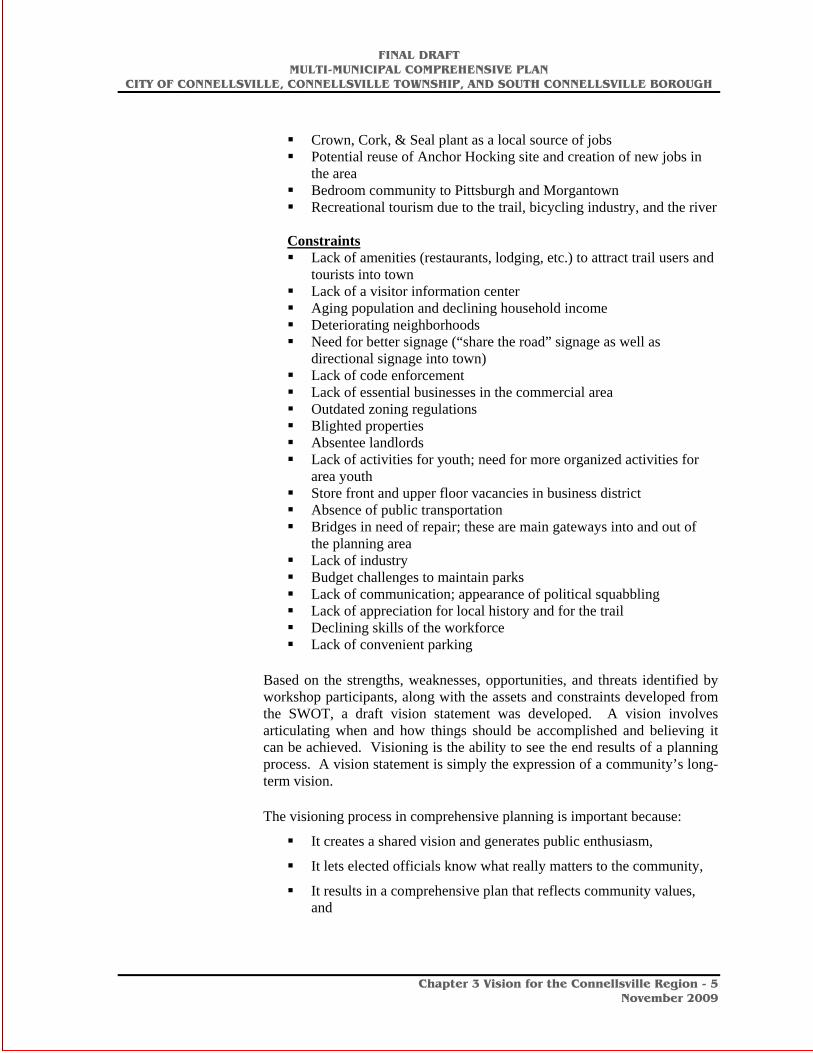
Crown, Cork, & Seal plant as a local source of jobs Potential reuse of Anchor Hocking site and creation of new jobs in
the area Bedroom community to Pittsburgh and Morgantown Recreational tourism due to the trail, bicycling industry, and the river
Constraints Lack of amenities (restaurants, lodging, etc.) to attract trail users and
tourists into town Lack of a visitor information center Aging population and declining household income Deteriorating neighborhoods Need for better signage (“share the road” signage as well as
directional signage into town) Lack of code enforcement Lack of essential businesses in the commercial area Outdated zoning regulations Blighted properties Absentee landlords Lack of activities for youth; need for more organized activities for
area youth Store front and upper floor vacancies in business district Absence of public transportation Bridges in need of repair; these are main gateways into and out of
the planning area Lack of industry Budget challenges to maintain parks Lack of communication; appearance of political squabbling Lack of appreciation for local history and for the trail Declining skills of the workforce Lack of convenient parking
Based on the strengths, weaknesses, opportunities, and threats identified by workshop participants, along with the assets and constraints developed from the SWOT, a draft vision statement was developed. A vision involves articulating when and how things should be accomplished and believing it can be achieved. Visioning is the ability to see the end results of a planning process. A vision statement is simply the expression of a community’s long-term vision.
The visioning process in comprehensive planning is important because:
It creates a shared vision and generates public enthusiasm,
It lets elected officials know what really matters to the community,
It results in a comprehensive plan that reflects community values, and

FINAL DRAFT MULTI-MUNICIPAL COMPREHENSIVE PLAN
CITY OF CONNELLSVILLE, CONNELLSVILLE TOWNSHIP, AND SOUTH CONNELLSVILLE BOROUGH
Chapter 3 Vision for the Connellsville Region - 6
November 2009
It results in a commitment towards implementation of a comprehensive plan.
Vision statements become the basis for the community goals, objectives, and implementation strategies found in a comprehensive plan. The following vision statements reflect the plan elements required by the Municipalities Planning Code. The vision statements are written from a perspective of twenty years into the future. They express what the planning area envisions for the year 2029 and reflect what has been accomplished since the multi-municipal plan was developed in 2009. The vision statements that were approved by the Steering Committee are as follows:
Economic Development Our traditional central business district in Connellsville has
experienced downtown revitalization, appropriate in-fill development and creative re-use of historic structures.
Growth areas are well-defined and serve as centers for employment and services, which contain adequate levels of infrastructure and community facilities.
Underutilized commercial and industrial sites (i.e. the Brimstone Building, the former Anchor Hocking Site, the Aaron’s Building, etc.) have been revitalized, redeveloped and adapted for use by new businesses and cleaner industries.
Amenities such as new restaurants, lodging facilities, and shops exist in the central business district to attract area tourists and travelers into Connellsville for lodging, dining, and shopping.
An art incubator links local artists with art space, resources, classes, and potential markets for their wares.
Housing The area will continue to provide a wide range of housing options for
a variety of household types and income levels. Future generations will be able to obtain affordable housing and achieve homeownership.
The neighborhoods surrounding the core downtown area will continue to provide a variety of residential housing options, with primarily higher density housing in the core area.
Outlying areas will continue to accommodate a range of housing densities and types, primarily low-density housing.
Physical Environment, Natural and Historic Resources Continued environmental and resource protection to improve and
preserve the natural environment.
The open lands, parks, playgrounds, and river and stream corridors will continue to be an essential resource, providing areas for wildlife habitat, recreational opportunities, scenic beauty and aesthetic

FINAL DRAFT MULTI-MUNICIPAL COMPREHENSIVE PLAN
CITY OF CONNELLSVILLE, CONNELLSVILLE TOWNSHIP, AND SOUTH CONNELLSVILLE BOROUGH
Chapter 3 Vision for the Connellsville Region - 7
November 2009
qualities that will continue to make the planning area a desirable place to live and visit.
Community Facilities Adequate public services will reflect the current and projected
population changes in the area.
The level of services provided to areas throughout Connellsville reflects the distinct differences in land use and development patterns.
New technologies are encouraged where they will provide logical and efficient solutions to the planning area’s utility service needs.
Residents have access to adequate parks and playgrounds.
The Connellsville school district is well-funded and provides an excellent education to local students.
Transportation Connellsville has an integrated transportation system that provides
for the efficient and safe flow of people, services and goods.
The roads and bridges are upgraded to provide for a range of uses, including non-motorized vehicles.
Centers of employment and residential development are connected by public transit, adequate roadways, and linkages to nearby metropolitan areas.
Land uses around major transportation hubs are well-planned and focus on appropriate development for a regional service area.
The Amtrak Train Station has been rebuilt and serves as a great resource to connect residents, tourists and travelers to recreational amenities in town and throughout the region.
Parks, Recreation & Open Space Yough Park has been transformed and is more integrated with the
Great Allegheny Passage Trail running through it, better connected with the river, and more user-friendly for cyclists, fishermen, joggers, and area families that utilize the playground and picnic facilities.
Park and recreation areas are well-maintained and equipped, and enjoyed by residents and visitors of all ages and abilities.
Expanses of rural open space are protected from inappropriate and encroaching development through regulatory ordinances, agricultural security areas, and designated sewage priority areas.
The Great Allegheny Passage Trail, running through Connellsville, continues as a recreational resource for Connellsville residents and a tourist attraction for visitors.

FINAL DRAFT MULTI-MUNICIPAL COMPREHENSIVE PLAN
CITY OF CONNELLSVILLE, CONNELLSVILLE TOWNSHIP, AND SOUTH CONNELLSVILLE BOROUGH
Chapter 3 Vision for the Connellsville Region - 8
November 2009
The vacant parcel on Hawthorn Street in Connellsville Township has been transformed into a park and playground facility for use by Township residents.
Energy Conservation Growth in the planning area has occurred where roads offer
opportunities for shorter vehicular trips, adequate service and carpooling.
Structures are built to current code standards to ensure maximum efficiency of energy consumption in buildings. Rehabilitated buildings are brought up to the highest energy efficiency level possible, with LEED certification as a goal.
The communities will work with a regional organization that will assist residents to apply energy saving techniques in their homes and work places.
Residents and building owners are more familiar with and more likely to use geothermal, solar and other renewable energy resources in their existing homes and businesses as well as planned developments.
Inter-Municipal Cooperation The communities will find common ground on sharing police
services, road maintenance, and economic development initiatives that benefit area companies and result in more jobs.
The potential for police regionalization has been explored and steps are underway to join efforts.
Land Use The planning area has a mix of land uses that reflects its history and
pattern of development. The City of Connellsville will continue to provide a more urban experience within a small town atmosphere; while South Connellsville Borough will continue to be predominately residential with some commercial and industrial uses in addition to large areas of open space for recreation and conservation; while Connellsville Township will continue to be primarily a low-density residential area with farms and open space with large tracts of land available for recreation and conservation.
Mixed-use development has been encouraged and fostered in the central business district of the City of Connellsville, providing for a more dynamic and lively downtown.
Future planned growth and development is directed to those areas which are supported by infrastructure, particularly sewer and water, and which minimize conflicting or incompatible land uses.
New development is of a character and density that is appropriate for the existing landscape. The landscape has been preserved and

FINAL DRAFT MULTI-MUNICIPAL COMPREHENSIVE PLAN
CITY OF CONNELLSVILLE, CONNELLSVILLE TOWNSHIP, AND SOUTH CONNELLSVILLE BOROUGH
Chapter 3 Vision for the Connellsville Region - 9
November 2009
enhanced through emphasis on roadway and scenic corridors and by discouraging dispersed, low density and inefficient uses of land that characterize sprawl.
Clustered development (i.e., development that seeks to preserve most of a site or area in its natural state) is encouraged to preserve the overall character of the planning area and to allow for more efficient use of land.
Open space and recreation areas will continue to provide opportunities for a range of outdoor activities, including hunting, fishing, and hiking as well as other activities.
Existing commercial areas along Crawford Avenue and Pittsburgh Street have been preserved, enhanced and revitalized as the centers of opportunity for businesses and services.
Future Land Use
Based on the vision statement for the planning area, work began on the development of a planning area future land use map. Using existing base maps and existing zoning maps, in addition to field work, future land use maps were developed for each of the three communities. For the City of Connellsville, a detailed future land use map was created to be used as a base to develop a new zoning ordinance. For Connellsville Township, the future land use map follows the pattern outline in the future land use map approved as part of its comprehensive plan in 1999. For South Connellsville Borough, the future land use map parallels the existing land uses.
Once the future land use map was prepared, each of the communities’ committee members then presented the future land use plan to local elected officials and planning commission members for consideration and comment in their respective communities.
To continue the comprehensive planning process, the future land use map became the basis for developing the individual plan elements. A draft of the comprehensive plan was prepared and presented to the Steering Committee for review and comment.
The Next Steps
In April 2009, copies of the draft plan were provided to each of the three municipalities for review and comment.
In May 2009 meetings were held in each of the three communities to discuss the plan and to receive feedback. Comments received at the public meeting will be considered by the Steering Committee and revisions made to the draft plan, if appropriate.
The required 45-day public review period ran from September 4, 2009 through October 17, 2009.

FINAL DRAFT MULTI-MUNICIPAL COMPREHENSIVE PLAN
CITY OF CONNELLSVILLE, CONNELLSVILLE TOWNSHIP, AND SOUTH CONNELLSVILLE BOROUGH
Chapter 4 Economic Assessment and Development Strategy Plan - 1
November 2009
Chapter 4: Economic Assessment and Development Strategy Plan
Introduction
An analysis of the current and projected economic conditions was conducted for the City of Connellsville, Connellsville Township, and South Connellsville Borough in order to understand the current economic dynamics in the area. The assessment methodology included interviews with the Connellsville Redevelopment Authority, Fay-Penn, the Progress Fund, real estate brokers, property owners, and research based on U.S. Census data and data acquired from DemographicsNow.
Economic Background
The economic viability of the core downtown area of Connellsville is a reflection of the health of commerce and industry in the planning area. Salaries in the planning area reflect the types of occupations and the education levels of the workforce. In addition to the local market, the growing tourism market that is drawing visitors and their spending power into the area can have a unique and far-reaching impact on the economy not only in Connellsville but throughout the Laurel Highlands and Ohiopyle recreation areas. Fayette County is already home to a wide range of outdoor recreation opportunities. Leveraging Connellsville’s position as one of the key gateways to the Laurel Highlands is vital to diversifying the economy.
Fayette County: Brief Overview
The City of Connellsville, Connellsville Township, and South Connellsville Borough are located in Fayette County, and the types of industries, employers, and occupations available in the planning area are closely tied to the overall economy of Fayette County and southwestern Pennsylvania. While data at the county level is more readily available, employment data by occupation and industry at the local level is rather limited.
Fayette County: Major Employers
The following table provides a list of major employers and their respective industry sectors from the first quarter of 2007, the most recent data available.

FINAL DRAFT MULTI-MUNICIPAL COMPREHENSIVE PLAN
CITY OF CONNELLSVILLE, CONNELLSVILLE TOWNSHIP, AND SOUTH CONNELLSVILLE BOROUGH
Chapter 4 Economic Assessment and Development Strategy Plan - 2
November 2009
Table 4-1. Major Employers in Fayette County, 2007 Major Employers1 Industry Sector
The Uniontown Hospital Health Care and Social AssistanceNemacolin Woodlands Inc. Accommodation and Food ServicesConnellsville Area School District Educational ServicesTeletech Services Corp Admin/Support, W aste Mgmt/Remediation SrvsNational Envelope Corporation ManufacturingWal-Mart Associates Inc. Retail TradeAlbert Gallatin Area School District Educational ServicesFayette County Public AdministrationTeleperformance USA Admin/Support, W aste Mgmt/Remediation SrvsUniontown Area School District Educational Services1 1st Quarter 2007 - FinalSource: Pennsylvania Department of Labor and Industry
Understanding the range of industries in Fayette County provides insights into how Fayette County residents earn a living. The following table provides census data on the industries in Fayette County from the 2000 U.S. Census with updates from the American Community Survey (ACS) for 2006.
Table 4-2. Fayette County Industry Comparison, 2000 and 2006
Number Employed
Percent of Total
NumberEmployed
Percent of Total
Agriculture, forestry, fishing and hunting, and mining 1,894 3.2% 1,309 2.4%Construction 4,543 7.7% 5,004 9.1%Manufacturing 8,726 14.8% 6,058 11.0%Wholesale trade 1,890 3.2% 904 1.6%Retail trade 8,946 15.2% 7,342 13.3%Transportation and warehousing, and utilities 4,262 7.2% 4,348 7.9%Information 1,149 1.9% 767 1.4%Finance, insurance, real estate, and rental and leasing 1,911 3.2% 1,767 3.2%
Professional, scientific, management, administrative,and waste management services 3,273 5.5% 4,280 7.8%Educational, health and social services 12,095 20.5% 13,295 24.2%Arts, entertainment, recreation, accommodation and food services 5,092 8.6% 5,314 9.7%Other services (except public administration) 3,143 5.3% 2,207 4.0%Public administration 2,093 3.5% 2,419 4.4%
Totals: 59,017 100% 55,014 100%Source: U. S. Census Bureau, 2000
Industry
2000 2006
From Table 4-2, it can be concluded that:
• The industry with the largest number of employed persons is educational, health, and social services (2000 U.S. Census). By 2006, it is estimated that almost 25% of those employed are in the educational, health, and social services industry.
• The retail trade industry employed over 15% in 2000; by 2006, it is estimated that the percentage declined to just over 13%.

FINAL DRAFT MULTI-MUNICIPAL COMPREHENSIVE PLAN
CITY OF CONNELLSVILLE, CONNELLSVILLE TOWNSHIP, AND SOUTH CONNELLSVILLE BOROUGH
Chapter 4 Economic Assessment and Development Strategy Plan - 3
November 2009
• Manufacturing, while third in terms of the total number of persons employed, has declined from just under 15% of persons employed to 11% by 2006.
• Arts, entertainment, recreation, accommodations, and food services is one of only three industries, in addition to construction and professional services, that has seen an increase in employment, highlighting the growing importance of this industry to Fayette County’s economy.
The following graph highlights the industries with the greatest changes in employment from 2000 to 2006.
Figure 4-1. Greatest Changes in Employment in Fayette County: 2000-2006
-3,000-2,500-2,000-1,500-1,000
-5000
500
Manufacturing Retail trade Construction Publicadministration
Arts,entertainment,
recreation,accommodation
and foodservices
Greatest Changes in Employment in Fayette County: 2000 - 2006
Source: U.S. Census Bureau, 2000; County Business Patterns, 2006
The above graph shows that, while the manufacturing and retail trade industries experienced declines in employment, other industries, including construction, public administration and arts, entertainment, recreation, accommodation, and food services experienced an increase. This is particularly notable given the overall decline in employment countywide between 2000 and 2006, from 59,017 persons employed to 55,014, or a loss of over 7%. The following table depicts the top five industries in Fayette County by number of employees. This data corresponds closely to Table 4-2 on the number of employees by industry. Table 4-3. Top Five Industries in Fayette County
General Medical and Surgical Hospitals 1,734Full-service restaurants 1,564Grocery Stores 1,382Limited-service eating places 1,360Outpatient care centers 963Source: U.S. Census Bureau, 2000
IndustryNumber
Employed

FINAL DRAFT MULTI-MUNICIPAL COMPREHENSIVE PLAN
CITY OF CONNELLSVILLE, CONNELLSVILLE TOWNSHIP, AND SOUTH CONNELLSVILLE BOROUGH
Chapter 4 Economic Assessment and Development Strategy Plan - 4
November 2009
Educational, health and social services 1,190 21.3%
Manufacturing 1,120 20.0%
Retail trade 860 15.4%
Entertainment, accommodations, food services 450 8.0%Construction 375 6.7%
% of Employees by Industry
IndustryTotal Number of Employees
The following table provides an overview on occupations in Fayette County. Table 4-4. Fayette County Occupations, 2000 and 2006
Number Employed
Percent of Total
NumberEmployed
Percent of Total
Management, professional, and related occupations 14,111 23.9% 15,911 28.9%Service occupations 9,883 16.7% 11,768 21.4%Sales and office occupations 14,879 25.2% 11,803 21.5%Farming, fishing, and forestry occupations 388 0.7% 157 0.3%Construction, extraction, and maintenance occupations 7,556 12.8% 6,903 12.5%Production, transportation, and material moving occupations 12,200 20.7% 8,472 15.4%
Totals: 59,017 100% 55,014 100%Source: U. S. Census Bureau, 2000
Occupation
2000 2006
From Table 4-4 above, it can be concluded that:
• Management, professional, and related occupations and service occupations were the only two occupation categories to experience an increase between 2000 and 2006
• The largest decline was in production, transportation, and material moving occupations.
Connellsville Area Background Data on Employment, Industries and Occupations
The Connellsville area’s dominance as the coal and coke capital of the world in the late part of the 19th century and the first half of the 20th century established the foundation for the industrial and manufacturing heritage that remains to this day. While manufacturing continues to play a prominent role in the local economy, the transition to a more service-based economy has resulted in the educational, health, and social service industries employing the largest number of persons.
The following tables provide current information on the industries, occupations, wages, and top industries in the City of Connellsville, Connellsville Township, and South Connellsville Borough. Table 4-5. Employment by Industry
Source: U. S. Census Bureau, 2000

FINAL DRAFT MULTI-MUNICIPAL COMPREHENSIVE PLAN
CITY OF CONNELLSVILLE, CONNELLSVILLE TOWNSHIP, AND SOUTH CONNELLSVILLE BOROUGH
Chapter 4 Economic Assessment and Development Strategy Plan - 5
November 2009
Table 4-5 on the previous page shows that in the planning area, the industry with the largest number of employees is the educational, health, and social services industry, with 1,190 employees, or over 20% of all employees. The manufacturing industry is the second largest sector of the economy.
The following table shows employment by occupation in the Connellsville area. Sales and office occupations were held by over 26% of employed persons in the Connellsville area, followed closely by management, professional, and related occupations. Table 4-6. Employment by Occupation
Number Employed % Employed
1,307 22.9%Service occupations 924 16.2%Sales and office occupations 1,494 26.2%Farming, fishing, and forestry occupations 58 1.0%
624 11.0%
1,289 22.6%
Occupations
Management, professional, and related occupations
Construction, extraction, and maintenance occupationsProduction, transportation, and material moving occupations
Source: U.S. Census Bureau, 2000

FINAL DRAFT MULTI-MUNICIPAL COMPREHENSIVE PLAN
CITY OF CONNELLSVILLE, CONNELLSVILLE TOWNSHIP, AND SOUTH CONNELLSVILLE BOROUGH
Chapter 4 Economic Assessment and Development Strategy Plan - 6
November 2009
Employee Earnings
The following table entitled Connellsville Area Employee Earnings by Industry provides data on the number of employees by industry and earnings level.
• In the retail trade industry, approximately 50% of the workers earned less than $10,000 annually. Only 26% of those employed in retail trade earned more than $20,000 annually.
• Those employed in other services, including machinery and equipment servicing, tended to have greater earnings. Almost 25% of these workers made over $30,000 annually.
• Those employed in the manufacturing and educational, health, and social services industries tended to have the largest number of people making over $75,000 annually.
Table 4-7. Connellsville Area Employee Earnings by Industry Place-of-Work
Agriculture, forestry, mining
4 40 15 44 15 10 10 138
Construction 30 89 110 75 60 0 10 374
Manufacturing 140 305 270 215 115 30 45 1120
Wholesale trade 10 20 14 60 4 0 0 108
Retail trade 420 185 110 70 25 15 29 854
Transportation, warehousing, utilities
50 58 29 175 50 0 14 376
Information 20 70 19 20 0 0 0 129
Finance, insurance, real estate
20 49 14 10 24 10 0 127
Professional, management, administrative services
58 94 69 20 0 0 10 251
Educational, health and social services
265 285 199 289 89 25 14 1166
Entertainment, accommodations, food services
190 184 34 10 4 4 29 455
Other services (except public)
79 45 15 4 25 0 10 178
Public administration
35 60 73 55 20 4 15 262
Armed forces 0 0 0 10 0 0 0 10Total, Industry 1,321 1,484 971 1,057 431 98 186 5,548
IndustryTotal
Employees
Employee Earnings in 1999
<$10,000 $75,000+ Else$10,000 - $19,999
$20,000 - $29,000
$30,000 - $49,999
$50,000 - $74,999
Source: University of Wisconsin-Milwaukee, U.S. Census Bureau (2000)

FINAL DRAFT MULTI-MUNICIPAL COMPREHENSIVE PLAN
CITY OF CONNELLSVILLE, CONNELLSVILLE TOWNSHIP, AND SOUTH CONNELLSVILLE BOROUGH
Chapter 4 Economic Assessment and Development Strategy Plan - 7
November 2009
Connellsville Area: Economic Role of Tourism
The entertainment, accommodations, and food services industry is an emerging sector of Fayette County’s economy and a contributor to economic development. Though this data is dated (2000 U.S. Census), it does highlight the potential for tourism to produce both jobs and revenue for the area.
An extensive study of the economic impact of the Great Allegheny Passage (GAP) was conducted by the Trail Town Program (special project of the Progress Fund), the Laurel Highlands Visitors’ Bureau (LHVB), and the Allegheny Trail Alliance (ATA). The study involved three phases of research, including economic impact research among businesses located on and around the trail, marketing research among trail users, and a follow-up research with businesses. According to the economic impact study and survey conducted, the following economic impacts were identified:
• Over $40 million in annual direct spending and another $7.5 million in wages were attributed to the Great Allegheny Passage (GAP) in 2008.1
• The trail from the Pittsburgh region to Washington, D.C. has become a national and international destination that hosts an estimated 750,000 trips annually.
• Overnight visitors spend an average of $98 a day in trail communities, including lodging.
• Almost all (97%) of the overnighters reported biking as their primary activity while on the trail.
• Compared to 2006, average gross revenues for 2007 increased by 18.8% among outdoor/trail-related businesses.
• Reported gross revenue displayed slight to significant increases from 2006 to 2007 across all business types and especially among outdoor/trail related businesses.
• Respondents to the survey estimated that an average one-quarter (24.9%) of the business they received could be attributed to the existence of the area’s biking/hiking trail.
• 64.3% of the survey respondents in Fayette County attributed some of the increase in their sales/revenue to the trail system.
• Over 25% of the businesses reported expansion or expansion plans within the year.
• Estimated receipts for 2007 totaled $12,044,071; wages totaled $2,926,2502
The data clearly shows a positive impact on the local economy from the presence of the trail system. The GAP is clearly a significant economic engine for not only the region but the entire trail. For the Connellsville planning area,
1 These figures are for the entire 132-mile Great Allegheny Passage (GAP) that connects Cumberland, MD to McKeesport, PA. 2 This includes businesses in Allegheny County, Westmoreland County, Fayette County, Somerset County, PA, and Allegany County, MD).

FINAL DRAFT MULTI-MUNICIPAL COMPREHENSIVE PLAN
CITY OF CONNELLSVILLE, CONNELLSVILLE TOWNSHIP, AND SOUTH CONNELLSVILLE BOROUGH
Chapter 4 Economic Assessment and Development Strategy Plan - 8
November 2009
positioning the local market to reap some of the benefits will continue to be a vital component in enhancing the local economy.
The full report can be viewed at the Allegheny Trail Alliance’s web site at http://www.atatrail.org/about/reports.cfm.
Connellsville’s economy continues to experience an ongoing transition from a manufacturing-based economy to a service-based economy. This is reflected by the higher level of employment in the health care industry and professional services. In addition, the data also reflects the growing role of the accommodation and food services industry in the local economy. While tourism itself can fluctuate based on the availability of disposable income, it is an important part of creating an economically viable and diverse economy. Tourism can be leveraged to enhance the quality of life for local residents through enhanced business and job opportunities.

FINAL DRAFT MULTI-MUNICIPAL COMPREHENSIVE PLAN
CITY OF CONNELLSVILLE, CONNELLSVILLE TOWNSHIP, AND SOUTH CONNELLSVILLE BOROUGH
Chapter 4 Economic Assessment and Development Strategy Plan - 9
November 2009
Linking the Great Allegheny Passage Trail (GAP) and Connellsville: Creating a Unique Experience
The Connellsville destination along the Great Allegheny Passage trail provides an opportunity for bicyclists and other recreationalists to enjoy a more “urban” experience than at any other community along the trail. Located 43 miles from the northern terminus of the trail near McKeesport, Connellsville is an ideal location for bikers and walkers to stop for food, lodging, and convenience goods. The Yough Park entrance from the northern terminus of the trail into Connellsville is a gateway into the Laurel Highlands region.
The newly constructed gateway arch provides a dramatic entrance to Connellsville from the northern portion of the trail. It provides a transition from the Pittsburgh region to the Laurel Highlands region. Note the Laurel Highland mountain range in the background.
Stewart’s Crossing is located adjacent to the trail on the left upon entering Yough River Park from the northern portion of the trail. The shallow crossing area of the Youghiogheny River was crossed by General Braddock. General George Washington sent a letter to Colonel William Crawford addressed at Stewart’s Crossing.

FINAL DRAFT MULTI-MUNICIPAL COMPREHENSIVE PLAN
CITY OF CONNELLSVILLE, CONNELLSVILLE TOWNSHIP, AND SOUTH CONNELLSVILLE BOROUGH
Chapter 4 Economic Assessment and Development Strategy Plan - 10
November 2009
The trail splits at North Third Street and North First Street, with the current trail following North Third Street. This site could be a key location to place a visitor-friendly site, such as a park/greenspace, additional parking, housing, or a riverside restaurant or rest stop that would welcome visitors to Connellsville.
The Yough River Park Master Plan has recently been completed. The Master Plan involves substantial upgrades to the park that will be implemented in several phases over the next five years.
The trail leads travelers into the City of Connellsville along Third Street. This stretch of the trail is primarily residential with some business uses, and provides a transition to the heart of Connellsville’s business district.

FINAL DRAFT MULTI-MUNICIPAL COMPREHENSIVE PLAN
CITY OF CONNELLSVILLE, CONNELLSVILLE TOWNSHIP, AND SOUTH CONNELLSVILLE BOROUGH
Chapter 4 Economic Assessment and Development Strategy Plan - 11
November 2009
Upon entering the business district at the intersection of West Crawford Avenue and Third Street, bikers and other recreationalists are welcomed to a location that offers little in the way of amenities that would compel a visitor to stay the night in the community and explore its features. For example, there are vacant storefronts vacant lots scattered along both East and West Crawford Avenue. Upon first glance it appears on the surface that there are few reasons to stop and explore Connellsville.
Visitors want to know what type of restaurants, lodging, entertainment, and services are available that would be attractive and worth exploring. Are there safe places to lock or store a bike? And, why should I spend my time and money in Connellsville? Connellsville offers a wealth of recreational and outdoor activities. The Youghiogheny River is readily available for fishing and kayaking. In addition, the downtown area is home to a number of historic, beautiful buildings. The missing component is linking these resources and amenities into a “package” that allows tourists (and others) to experience the beauty of the area.
Providing answers to the above questions was one of the factors in developing the core revitalization strategy that follows. The strategy will explore a range of issues that need to be addressed in order for Connellsville to become a tourist destination and a more welcoming stop on the GAP trail, including signage, tourism amenities, infrastructure (bridges, roadways, etc.), environment, land use, transportation, and recreation.
The City of Connellsville is the geranium capital of the U.S. Note the geraniums in the landscaped island that separates automobile traffic from the trail. Every year volunteers from the community plant the geraniums and other foliage to welcome visitors arriving by way of the GAP Trail. At this point, the trail enters into the central business district of Connellsville at West Crawford Avenue and Third Street.

FINAL DRAFT MULTI-MUNICIPAL COMPREHENSIVE PLAN
CITY OF CONNELLSVILLE, CONNELLSVILLE TOWNSHIP, AND SOUTH CONNELLSVILLE BOROUGH
Chapter 4 Economic Assessment and Development Strategy Plan - 12
November 2009
City of Connellsville: Core Revitalization Strategy
The following text provides the background information for the Core Revitalization Strategy. This includes a review of blighting influences, signage, visual characteristics, zoning and development issues, recreational amenities, and pedestrian and bicycle circulation. In addition, the Connellsville Downtown and Gateway-to-Gateway Master Plans provide a visual overview of the issues identified in the text. The background information is followed by a prioritization of each of the strategies identified in this chapter.
Strategy Area
The central business district within the City of Connellsville consists of approximately 30 city blocks that contain 163 primary buildings. The heart of the business district extends along West Crawford Avenue from its intersection with Rt. 119 to North Carnegie Avenue. The business district also extends north and south of West Crawford Street.
Map 4-1 Connellsville Proposed Main Street Project Area

FINAL DRAFT MULTI-MUNICIPAL COMPREHENSIVE PLAN
CITY OF CONNELLSVILLE, CONNELLSVILLE TOWNSHIP, AND SOUTH CONNELLSVILLE BOROUGH
Chapter 4 Economic Assessment and Development Strategy Plan - 13
November 2009
West Crawford Avenue north of 3rd Street West Crawford Avenue north of Arch Street
Connellsville’s business district offers a range of retail services, including gift shops, a bike shop, auto repair, a hardware store, restaurants, and a music store. In addition, there are several businesses that offer professional services, including a law firm, banks, an engineering firm, real estate companies, and manufacturing offices. While there are a considerable number of storefront vacancies, the existing businesses have found a market niche that has served them well. The following graph highlights the types of businesses found in Connellsville’s central business district.

FINAL DRAFT MULTI-MUNICIPAL COMPREHENSIVE PLAN
CITY OF CONNELLSVILLE, CONNELLSVILLE TOWNSHIP, AND SOUTH CONNELLSVILLE BOROUGH
Chapter 4 Economic Assessment and Development Strategy Plan - 14
November 2009
Figure 4-2. Businesses in Connellsville’s Central Business District
Health Care and Social Assistance,
11%
Retail, 22%
Other Services,25%
Manufacturing - Non-Food
Construction
Retail
Transportation andWarehousing
Information Services
Finance and Insurance
Rental and LeasingServices
Professional andScientific Services
Administrative andSupport Services
Health Care and SocialAssistance
Arts, Entertainment, andRecreation
Accomodations andFood Services
Other Services
Governmental and PublicAdministrative Offices
Connellsville Businesses: Central Business District
Source: Field Survey Conducted by M & L, 2008
The businesses most prevalent in Connellsville fall under the broad category of “Other Services”, which includes hair, nail, and skin care services (13), churches and religious organizations, business professional and labor organizations (6), automotive repair and maintenance (3), and pet services (1). Collectively, Other Services makes up 25% of the businesses in the central business district.
Retail is the next largest category, with 22% of the business within the central business district falling under this category. This includes miscellaneous store retailers (8), sporting goods, hobbies, books, and music stores (7), clothing and clothing accessories (6), health and personal care (2), gasoline stations (2), and food and beverage stores (1).
Health care and social assistance is the third largest category, with 11% of the businesses falling under this category. This includes doctors, physicians and dental offices (9), and offices of other health care practitioners (3).

FINAL DRAFT MULTI-MUNICIPAL COMPREHENSIVE PLAN
CITY OF CONNELLSVILLE, CONNELLSVILLE TOWNSHIP, AND SOUTH CONNELLSVILLE BOROUGH
Chapter 4 Economic Assessment and Development Strategy Plan - 15
November 2009
Assessment of Downtown Building Conditions
Of the 163 buildings within the business district, 120 have storefronts. Of these existing storefronts, 25% are vacant. An exterior building conditions survey conducted by M&L in September 2008 reveals that almost half of the buildings in the downtown are in either fair or poor condition. However, the number of totally vacant buildings overall is less than 4%, while the number of empty/vacant parcels is just over 4%. Additionally, over 75% of the buildings were built before 1939. See the Building Condition map on the following page.

FINAL DRAFT MULTI-MUNICIPAL COMPREHENSIVE PLAN
CITY OF CONNELLSVILLE, CONNELLSVILLE TOWNSHIP, AND SOUTH CONNELLSVILLE BOROUGH
Chapter 4 Economic Assessment and Development Strategy Plan - 16
November 2009
INSERT BUILDING CONDITION MAP

FINAL DRAFT MULTI-MUNICIPAL COMPREHENSIVE PLAN
CITY OF CONNELLSVILLE, CONNELLSVILLE TOWNSHIP, AND SOUTH CONNELLSVILLE BOROUGH
Chapter 4 Economic Assessment and Development Strategy Plan - 17
November 2009
Lion’s Club Parklet
Visual Environment
Over the years the City of Connellsville has worked to improve its business district through streetscape enhancements, including new lighting and banners that celebrate the community’s heritage. These amenities certainly add a sense of vitality to the business district. While the real estate market has been termed “dormant” by local property owners and agents, targeted redevelopment and infill development that is economically sustainable and linked to growing industries will serve Connellsville well over the long term. Portions of the business district have seen the addition of parklets that have helped to soften the appearance of the business district and provide green space that enhances the image and functionality of the district.
One of the most significant assets of the downtown is its location along the Youghiogheny River. Water amenities add interest to the downtown environment. However, Connellsville has yet to achieve its full potential as a riverfront community. Every effort should be made to preserve and expand public access and circulation along the river bank, while encouraging adjacent land uses that take advantage of water views. The Youghiogheny River can be a dynamic contributor to the City’s tax base and the overall economy.
West Crawford Avenue north of Arch Street
Enhancing the business district will require addressing a few key items, including signage, streetscape, zoning, building setbacks, etc.

FINAL DRAFT MULTI-MUNICIPAL COMPREHENSIVE PLAN
CITY OF CONNELLSVILLE, CONNELLSVILLE TOWNSHIP, AND SOUTH CONNELLSVILLE BOROUGH
Chapter 4 Economic Assessment and Development Strategy Plan - 18
November 2009
Improving the condition and appearance of private property in the core area will involve a multi-pronged strategy that will include enhanced code enforcement efforts, coordination with stakeholders in the community, and the development of a façade improvement program to provide a match to business owners who wish to enhance the facades of their buildings. The City of Connellsville has applied to be designated as a Main Street community. This designation would provide the community with resources to assist in enhancing the business district. A full-time Main Street manager could be hired who could work closely with private property owners to enhance their properties and to make the district more attractive. Although the Main Street designation has been delayed due to state funding issues, it is anticipated that this designation could occur in the next few years.
Signage
There is no shortage of commercial, professional, and traffic signs in downtown Connellsville. The cumulative effect of a variety of sign shapes, colors, sizes, locations, and functions contributes to visual clutter in the downtown. Many of the commercial signs compete for attention in a futile attempt to attract customers through size rather than quality design.
Improving the appearance of Connellsville’s downtown through the regulation of signage is a revitalization tool that can produce a dramatic impact on the physical environment. The City can use its zoning powers to combat the proliferation and visual chaos of improper signage.
Improperly placed signs
Signs that are not located at the place of business they represent (pure advertising signs) do not belong in downtown Connellsville. The signs pictured above are out of scale with the architecture and add unnecessary clutter to the downtown.
Rather than being an advertisement for a product or a store, signs in downtown Connellsville should communicate information about the business located on the premises. Well designed signs can add to the charm and attractiveness of the entire street scene. The placement and size of signs is an important factor to

FINAL DRAFT MULTI-MUNICIPAL COMPREHENSIVE PLAN
CITY OF CONNELLSVILLE, CONNELLSVILLE TOWNSHIP, AND SOUTH CONNELLSVILLE BOROUGH
Chapter 4 Economic Assessment and Development Strategy Plan - 19
November 2009
consider. On older buildings, a good clue to the appropriate sign placement is the original location of signs on the building. On many buildings, the frieze panel over the entranceway has historically been a sanctioned place for a signboard.
Properly designed signboards and display windows add interest and allure to the downtown. The passerby is drawn to the establishment because of the wealth of interesting things to see and do inside. Smaller, tasteful signs are much more effective than large garish signs in attracting customers.
The design of any sign should depend on the name, nature, and location of the business. The style of the building on which or in front of which the sign is to be placed also plays a role in determining proper signage. The shape of the sign board, its size relative to the letters and images, the colors and graphic style, and the lighting are all important elements of sign design.
In general, small signs of simple design with no more than two or three colors would be appropriate for downtown Connellsville. Lettering should be clear and legible and fill at least half of the total area of the sign board. The size of the sign board should be determined by the proportion and design of the storefront and the character of the entire façade. Sign boards should not obscure architectural detail or cover building elements that frame the storefront. If a sign is illuminated, the light source should focus on the sign without casting a glare.
The current zoning ordinance contains a Sign Ordinance that places guidelines for the size and placement of signs. The following is a summary of the current Sign Ordinance:
“Business signs shall be permitted in commercial and industrial districts. In any district, business signs of the wall sign type, associated with a nonconforming use, shall be permitted if located on the same premises as such use and if it does not exceed in the aggregate twenty (20) square feet in area or two (2) feet in height or width. All business signs shall be set back from the established right-of-way line of any street or highway at least twenty-five (25) feet and shall not be located closer than six (6) feet to any other property line.”
The downtown business district appears to have signage that exceeds the current guidelines. While many of these signs may have been placed before the sign ordinance was enacted, enforcement of the Sign Ordinance should occur as businesses change or new requests come in for signage. This will reduce the visual clutter and improve the overall appearance of key gateways into the business district. In addition, the ordinance should be reviewed as part of the revised zoning ordinance, particularly as it applies to the U.S. Route 119/West Crawford Avenue gateway into Connellsville.
Land Use and Zoning Issues
The character of downtown Connellsville is significantly impacted by the land use and zoning decisions made by land owners and the local government. The cumulative impact of past zoning decisions reveals itself in a built environment that is not in keeping with the original character of the business district. Often

FINAL DRAFT MULTI-MUNICIPAL COMPREHENSIVE PLAN
CITY OF CONNELLSVILLE, CONNELLSVILLE TOWNSHIP, AND SOUTH CONNELLSVILLE BOROUGH
Chapter 4 Economic Assessment and Development Strategy Plan - 20
November 2009
times, zoning decisions are made in reaction to a developer’s suggestion or in haste to see development occur. A clear and understandable zoning code can result in land use decisions that are in keeping with the intent of the overall development goals of the community. It also provides a clear “road map” for developers who desire a smooth development review process with a minimal number of surprises. Creating infill development and/or rehabilitation projects in an older business district can be a difficult and time consuming effort, even in the best of circumstances.
Example of building set back
The setback of the building in the previous photo is more appropriate for a suburban highway commercial district than a downtown district. In downtown Connellsville, new infill structures should be built to the sidewalk in order to maintain continuity in the building façade line.
One of the challenges in the downtown area of Connellsville involves the narrow lot sizes. Providing flexibility for development while maintaining the integrity of building height and setbacks in the business district can be accomplished through land use regulatory measures that encourage productive reuse of the older building stock and enhance the long-term viability of the business district. The benefits of infill development include:
• Promotion of economic development opportunities within communities • Expansion of the municipal tax base • Maximization of existing investments including infrastructure and
streetscape enhancement
A review of the existing zoning ordinance regulations, Ordinance No. 736, provides limited guidance for permitted land uses. While there is a basic outline of zoning districts and permitted uses, the current regulations provide little framework. The current ordinance does not exclude desirable uses, such as bed and breakfasts (B&B), other lodging, or trail amenities. Rather, the current ordinance needs to be revamped to clearly outline the types of permitted uses in the various districts and to “shape” the public realm.
Typical zoning issues identified in the DCED guidelines include the following:

FINAL DRAFT MULTI-MUNICIPAL COMPREHENSIVE PLAN
CITY OF CONNELLSVILLE, CONNELLSVILLE TOWNSHIP, AND SOUTH CONNELLSVILLE BOROUGH
Chapter 4 Economic Assessment and Development Strategy Plan - 21
November 2009
• Typically, infill, replacement, and redevelopment are not permitted “by right”.
• Strict separation of land uses hampers the feasibility of many opportunities.
• Overly large-setbacks and low building coverage standards create urban neighborhoods with a suburban character.
• Shared parking is prohibited; total requirements for mixed-use projects are commonly based on a cumulative calculation.
In addition, the City of Connellsville has its own subdivision ordinance but no land development ordinance. The current subdivision ordinance, for instance, does not have a minimum width standard, with a 40’ x 100’ width standard used in every district. Building setbacks are outlined in the subdivision ordinance, but not in the zoning ordinance. A revised Subdivision and Land Development Ordinance (SALDO) should be developed and brought up to current standards, in addition to a revised and updated zoning ordinance.
Land Assembly and Redevelopment
The vacant lot at the corner of West Crawford Avenue and North First Street, 224 West Crawford Avenue (also known as the Mongell property) and the lot at the corner of West Crawford Avenue and South Arch Street, 171 West Crawford Avenue (current site of the Medicine Shoppe) are obvious sites for land assembly and redevelopment. These sites are shown on the Downtown Master Plan and Gateway-to-Gateway Plan and photo simulations are also provided later in this chapter. In addition, there are other parcels in the business district that are prominent sites for redevelopment and infill development. Secondary infill development sites are depicted in the following photographs.
Potential development site on West Crawford Avenue
next to Meadow Lane

FINAL DRAFT MULTI-MUNICIPAL COMPREHENSIVE PLAN
CITY OF CONNELLSVILLE, CONNELLSVILLE TOWNSHIP, AND SOUTH CONNELLSVILLE BOROUGH
Chapter 4 Economic Assessment and Development Strategy Plan - 22
November 2009
Infill development opportunity on West Crawford Avenue
Pedestrian, Bicycle, and Vehicular Circulation
Pedestrian, bicycle, and vehicular circulation are important components of providing an environment to both visitors and local residents that is easy and safe to navigate. There is currently a low degree of physical and functional connectivity between either side of the Crawford Avenue bridge. For those who approach Connellsville at Third Street and West Crawford, there are few visual clues concerning amenities in other parts of the community. While a kiosk and signage does exist to provide information to visitors, there are not enough visual clues to entice visitors into the business district.
In Chapter 9 of this document, the Transportation Plan, a traffic and safety analysis was conducted utilizing data from PennDOT. The study identified West Crawford Avenue as one of the main corridors with a high level of traffic delays and accidents. Creating an environment that is conducive to having more pedestrian and bicycle circulation in the study area requires addressing some of the key transportation roadway issues in the community. In addition, infrastructure projects, including the Crawford Avenue Bridge, and addressing safety and cross-walk issues at key intersections is vital.
One of the primary methods of linking the trail along Third Street with the downtown area is via a proposed Bicycle Loop Trail. This trail would serve to link areas in Connellsville and encourage visitors to explore more of the community.
See Chapter 9 of this document, the Transportation Plan, for more detailed circulation information. The Gateway-to-Gateway plan provides a visual display of the proposed Bicycle Loop Trail loop.

FINAL DRAFT MULTI-MUNICIPAL COMPREHENSIVE PLAN
CITY OF CONNELLSVILLE, CONNELLSVILLE TOWNSHIP, AND SOUTH CONNELLSVILLE BOROUGH
Chapter 4 Economic Assessment and Development Strategy Plan - 23
November 2009
Parks and Open Space
Connellsville is fortunate to have Yough Park in the community and the GAP trail traversing through the downtown. In addition, there is a plaza near the city hall and a parklet on West Crawford Avenue near Meadow Lane. Still, creating an environment that encourages visitors to stay and enjoy the amenities in Connellsville will require developing additional green spaces that will provide amenities for recreationalists. The Gateway-to-Gateway plan provides additional information on a proposed Bike Plaza at the corner of West Crawford Avenue and North Third Street. This plaza is designed to provide bike racks and lockers in addition to a kiosk. It will also serve as a resting area and encourage visitors to stay in Connellsville to explore the community. Chapter 7, the Parks, Recreation, and Open Space Plan, also provides more detailed information on recreation areas in the City of Connellsville and in Connellsville Township and South Connellsville Borough.
Public Improvements to Encourage Biking and Trail Use
There are a number of public improvements that could be undertaken to encourage additional use of the trail. A number of strategic improvements have already been completed to make the trail more user-friendly, including new trail signs and artwork on the water towers that reflects the history and unique features of Connellsville. Additional public improvements in the downtown Connellsville area would leverage and build upon past efforts. This would include the following:
• bike racks for safe storage throughout the trail and near area attractions • signage that is clearly marked • structural improvements to the Crawford Bridge, including appearance
enhancements, improved lighting, converting strategically located sidewalks into a bike and pedestrian lane
• placing “share the road” signage along key corridors • timed signals for cyclists crossing the roadways • enhanced pavement stripping
According to a recent study on regional biking and pedestrian use in Washington State that outlined the region’s long-term growth management, economic, and transportation strategy, well-designed and strategically located bike and pedestrian facilities can result in an increase in the use of local recreational trails and resources.
Enhancing Recreational Use
As discussed earlier, Connellsville is ideally positioned to leverage its location on the Great Allegheny Passage. It offers a more urban experience than any other location along the trail in Pennsylvania. The trail is used frequently by some area residents for recreational walking and biking, but for the majority of

FINAL DRAFT MULTI-MUNICIPAL COMPREHENSIVE PLAN
CITY OF CONNELLSVILLE, CONNELLSVILLE TOWNSHIP, AND SOUTH CONNELLSVILLE BOROUGH
Chapter 4 Economic Assessment and Development Strategy Plan - 24
November 2009
people in Connellsville, it is an untapped resource. Enhanced use of the trail by local residents will improve the quality of life for people in Connellsville. A more focused effort may be required to create this integration of recreation uses. Part of developing a comprehensive plan is to look at opportunities to enhance the health of residents in the area. The trail certainly offers that opportunity. The question is how many people in the community are trail users? And, more importantly, how can more residents become active users of this valuable resource?
The following is a list of ideas for encouraging local residents to become more health-conscious and more active trail users:
• Conduct a survey of residents, possibly on-line, to determine the factors that determine trail usage. Is it the lack of a bike? Are area residents unsure about what the trail really offers them? This might help to tailor the marketing of the trail towards local residents in addition to visitors.
• Encourage more use, as a fitness and family activity, to improve overall health. This could be done by sponsoring local events on the trail, or partnering with a local health care provider to sponsor a ride.
• Conduct bike safety classes at local schools. Partner with a bike group to offer lessons on wearing a helmet properly.
• Establish an annual Connellsville ride that would be locally sponsored. A contest could be organized to create a name for the ride that promotes Connellsville. The ride could become an effective mechanism to spread the word to not only a broader group of local people but also visitors from all over the region. Local businesses would benefit from increased patronage of local shops and restaurants. Currently, two events take place locally that promote the trail. There is a Fall Foliage Ride sponsored by the Yough River Trail Council (YRTC) and a ½ marathon run in the spring.
Downtown Master Plan Description
Currently, downtown Connellsville includes several historic buildings, restaurants, shops, professional services, parking lots, and vacant buildings. A once dense and bustling City during the industrial era has since dwindled in population and, as a result, has left many pockets of vacant areas in the City center.
In order to take advantage of the tourism generated from the Great Allegheny Passage and to create a dense central core once again, this Plan calls for concentrating reinvestment activities within an area defined by Prospect Street, Fairview Avenue, Water Street, and Apple Street. In particular, major reinvestment activities are focused along Pittsburgh Street, Crawford Ave, and North Meadow Lane within this defined area.
There are four kinds of improvements shown on the Downtown Master Plan. They include:
• Commercial / Mixed Use Redevelopment – Identifies properties in which commercial infill, reinvestment, and redevelopment will contribute to the

FINAL DRAFT MULTI-MUNICIPAL COMPREHENSIVE PLAN
CITY OF CONNELLSVILLE, CONNELLSVILLE TOWNSHIP, AND SOUTH CONNELLSVILLE BOROUGH
Chapter 4 Economic Assessment and Development Strategy Plan - 25
November 2009
density and vitality of downtown. New buildings on these sites are recommended to be approximately three stories high, mixed-use with retail on ground floors, have zero setbacks from the right-of-way, and have architectural features that relate to the surrounding building character. The Downtown Master Plan identifies two of these properties as key redevelopment properties for the downtown area. They include:
o Hotel Redevelopment Site – Turning the current Medicine Shoppe (171 West Crawford Avenue) into a three story, 40 room hotel takes advantage of the Crawford Avenue and Arch Street intersection. Screening the existing parking in the rear of the property enhances the aesthetic quality of the property.
o 224 West Crawford Avenue (former Mongell Property) – Although located across the Youghiogheny River from downtown, this property provides a key opportunity to link the Great Allegheny Passage with downtown. A two story, mixed-use building with a restaurant that provides outdoor seating and deck overlooking the River would take full advantage of this site. Screened parking hidden on the opposite side of the building along with boat docks and bike racks makes this redevelopment property unique and easily accessible to those using alternative transportation.
• Historic Restoration – Identifies properties in which historic restoration will contribute to the overall character of downtown. Properties identified that are potential candidates for historic preservation include the Brimstone and Aaron buildings along with buildings in key locations within the downtown.
• Bicycle Facilities Improvements – Identifies opportunities in which improved bicycle facilities will allow bicyclists traveling along the Great Allegheny Passage to conveniently access downtown Connellsville and its amenities. They include:
o Bicycle Loop Trail defined with shared lane markings, or Sharrows, share the road signs, and directional signage. The Federal Highway Administration is currently experimenting with Sharrows and is in the process of approving the marking for regular use.
o Bike Plaza located at the corner of Crawford Avenue and North Meadow Lane. Borrowing space from the current public parking lot, this plaza includes bike lockers, bike racks, a drinking fountain, benches, information kiosk, and plantings.
• Streetscape Improvements – Identifies Pittsburgh Street, Crawford Avenue, and North Meadow Lane as streets in which public right-of-way improvements will contribute to the overall character and functionality of downtown. Streetscape improvements include street trees, new sidewalks, brick crosswalks, light posts, bump outs at key intersections, and screening parking lots with vegetation. A list of suitable street trees is located in Appendix E.

FINAL DRAFT MULTI-MUNICIPAL COMPREHENSIVE PLAN
CITY OF CONNELLSVILLE, CONNELLSVILLE TOWNSHIP, AND SOUTH CONNELLSVILLE BOROUGH
Chapter 4 Economic Assessment and Development Strategy Plan - 26
November 2009
The Connellsville Downtown Master Plan map on the following page graphically summarizes the improvements outlined above.

FINAL DRAFT MULTI-MUNICIPAL COMPREHENSIVE PLAN
CITY OF CONNELLSVILLE, CONNELLSVILLE TOWNSHIP, AND SOUTH CONNELLSVILLE BOROUGH
Chapter 4 Economic Assessment and Development Strategy Plan - 27
November 2009

DRAFT MULTI-MUNICIPAL COMPREHENSIVE PLAN
CITY OF CONNELLSVILLE, CONNELLSVILLE TOWNSHIP, AND SOUTH CONNELLSVILLE BOROUGH
Chapter 4 Economic Assessment and Development Strategy Plan - 28
November 2009
Connellsville Downtown and Gateway to Gateway Combined Master Plan Description
Currently, there are several planning and construction projects underway or recently completed within the City of Connellsville. Several of them directly relate to the Great Allegheny Passage Trail that leads through the west side of the City along the Youghiogheny River. Bicyclists from across the United States and even all over the World travel to the region to ride the Passage which connects Washington DC to Pittsburgh, bringing with them the potential to buy services and products.
The master plan for Stewart’s Crossing (by Widmer Engineering and David Reagan) creates the northern bicycle gateway into the City. Next, the Trail passes through Youghiogheny Park in which Mackin Engineering has recently completed a master plan. The Gateway to Gateway Master Plan focuses on the Trail along Third Street through a residential and commercial section of Connellsville as it crosses Crawford Avenue, the historic main street of the City. This Plan also includes the industrial section of the Trail as it exits the City at the southern gateway.
Other trail projects have been planned to better connect the City with the Great Allegheny Passage. They include a Coal and Coke Trail Connector and a bicycle loop trail passing through the City and its downtown. Two bridge redesigns, completed by PennDOT and Mackin Engineering, focus on creating better pedestrian and bicycle access on the Memorial and Crawford Avenue bridges that connect the two sides of the City.
All of these plans are shown on the Combined Master Plan in order to illustrate how they relate to each other. At the same time, the Combined Master Plan suggests opportunities for vehicular gateways entering the City, including where Route 119 crosses Pittsburgh Street and Crawford Avenue.
All of these projects will enhance the Great Allegheny Passage which will eventually revitalize a struggling City by showing off its natural resources, history, goods and services, industry, and identity.
The Connellsville Downtown Master Plan and Gateway to Gateway map on the following page graphically summarizes the improvements and projects outlined above.

DRAFT MULTI-MUNICIPAL COMPREHENSIVE PLAN
CITY OF CONNELLSVILLE, CONNELLSVILLE TOWNSHIP, AND SOUTH CONNELLSVILLE BOROUGH
Chapter 4 Economic Assessment and Development Strategy Plan - 29
November 2009

DRAFT MULTI-MUNICIPAL COMPREHENSIVE PLAN
CITY OF CONNELLSVILLE, CONNELLSVILLE TOWNSHIP, AND SOUTH CONNELLSVILLE BOROUGH
Chapter 4 Economic Assessment and Development Strategy Plan - 30
November 2009
Development Opportunities
As identified in the previously described Downtown Master Plan and Combined Master Plan, key sites have been identified in the City of Connellsville that could serve as catalysts for the business district and create economic momentum. The following is a detailed look at each of the three identified sites and the reasoning behind the selection of the sites. A photo simulation is also provided to show a “before” and “after” view of what each of the three sites could look like if development occurred.
West Crawford Avenue between Arch Street and Meadow Lane
A hotel site in the downtown area of Connellsville would maximize the impact of a transient lodging facility on the local economy. However, it may take several years before a hotel becomes economically feasible in Connellsville due to national and regional economic trends.
Research reveals that an increasing number of transients are being attracted to Connellsville due primarily to utilization of the GAP Trail.3 Many of these transients arrive in Connellsville by bicycle. The sole motel in the area is the Melody Motor Lodge located two miles south of downtown Connellsville on Route 119. After a long day of bicycling on the trail, the added distance to the Melody Lodge is unwelcome at best and dangerous at worst. Connellsville should begin to position its downtown for the eventual development of a franchise hotel or motel that captures the demand for lodging created by increased use of the trail.
As a matter of public policy, assembling a site for a hotel in the downtown is a worthwhile endeavor in light of the spin-off or “multiplier” economic impact of this investment.
Connellsville has attempted to attract a franchise hotel or motel to the downtown for several years. The Widewater outparcel on Route 119 was originally viewed by local officials as an appropriate site for a small hotel or motel. For a variety of reasons, hotel developers have not responded to this opportunity.
A transient lodging market study in Connellsville was commissioned in 2008 by the Trail Towns Program, an initiative of the Progress Fund focused on the link between regional economic development and tourism. This study concludes that:
• A positive market trend towards boutique hotels bodes well for Connellsville
• An estimated 25,680 trail users annually could be in the market for overnight accommodations in the Connellsville area.
• A potential demand exists for 12,840 room nights per year, or 35 physical hotel rooms, due to trail use.
• Hotel occupancy within the Competitive Market Area, including Connellsville, has increased each year since 2005.
3 Hospitality Market Study, The Progress Fund, August 2008

DRAFT MULTI-MUNICIPAL COMPREHENSIVE PLAN
CITY OF CONNELLSVILLE, CONNELLSVILLE TOWNSHIP, AND SOUTH CONNELLSVILLE BOROUGH
Chapter 4 Economic Assessment and Development Strategy Plan - 31
November 2009
• Tourism has induced hotel room demand significantly during the summer months
• A recognized chain operator should penetrate this market with a reasonable share of the region’s growing tourism and transient employment sectors.
The property at the southeast corner of Arch Street and West Crawford Avenue is located on a prominent gateway intersection leading into the historic business district of Connellsville. As such, this location would be an excellent choice for a hotel site. The corner parcel is currently occupied by an office building that contains a Medicine Shoppe pharmacy.
This site is critical for a number of reasons:
• It is a gateway location to the historic business district. • It links the business districts on West Crawford that are separated by the
river. • It is within easy walking distance from the Amtrak train station.
The following conceptual photo-simulation provides a visual concept of what is currently there and what could be developed at the southeastern corner of Arch Street and West Crawford Avenue.
"Before" picture: Southeastern corner of Arch Street and West Crawford Avenue

DRAFT MULTI-MUNICIPAL COMPREHENSIVE PLAN
CITY OF CONNELLSVILLE, CONNELLSVILLE TOWNSHIP, AND SOUTH CONNELLSVILLE BOROUGH
Chapter 4 Economic Assessment and Development Strategy Plan - 32
November 2009
"After" picture: Southeastern corner of Arch Street and West Crawford Avenue
This photo-simulation provides a concept for a potential project that links economic development, planning, real estate, and tourism. In order to continue to create a dynamic destination in Connellsville, a strategically focused blend of local, county, state, and federal resources will be required. The commitment, perseverance, and persistence of local officials will also be required in carrying this project through to fruition.
Properties on West Crawford Avenue Between the Crawford Avenue Bridge and Third Street
The property at 224 West Crawford Avenue (locally known as the Mongell property) is a vacant parcel located on a prominent corner at West Crawford Avenue and North First Street. This is a prime location for a gateway project that builds on access to the trail, the river, and the bridge leading to the historic business district of the City of Connellsville.
224 West Crawford Avenue (Mongell Property)

DRAFT MULTI-MUNICIPAL COMPREHENSIVE PLAN
CITY OF CONNELLSVILLE, CONNELLSVILLE TOWNSHIP, AND SOUTH CONNELLSVILLE BOROUGH
Chapter 4 Economic Assessment and Development Strategy Plan - 33
November 2009
The vacant lot is a half-acre site currently zoned for commercial use. Previously used for a gas station, it is unknown at this time whether underground storage tanks need to be removed or the extent to which any environmental remediation efforts are required to prepare the site for redevelopment. Any use of the site for residential or mixed-use would require a thorough environmental evaluation to determine the level of remediation necessary for redevelopment.
Infill development on this site is important for a number of key strategic reasons:
• It is located in a prominent gateway location. • It is adjacent to the bridge that provides access to the historic downtown
area of the City of Connellsville. • The site is located in proximity to the existing trail on Third Street and the
proposed bike trail extension located on First Street. • The site is adjacent to the Youghiogheny River (see following photo).
View of the parcel from the Youghiogheny River
There are a number of issues that should be considered for the corner lot:
• The need to create an anchor building for the block that will create a positive street wall along the primary street, West Crawford Avenue, and the secondary street, First Street.
• Little building context currently exists for the site. On one side of the lot is the river. The adjacent parcel to the north contains a one-story structure. Across First Street, on the northwest corner, is a 2 ½ story apartment building.
• The need to explore the acquisition of the adjoining parcel, currently occupied by an auto detailing shop, to create a larger parcel for development.
• A portion of the land is in a flood plain. Any proposed development would have to address this issue.

DRAFT MULTI-MUNICIPAL COMPREHENSIVE PLAN
CITY OF CONNELLSVILLE, CONNELLSVILLE TOWNSHIP, AND SOUTH CONNELLSVILLE BOROUGH
Chapter 4 Economic Assessment and Development Strategy Plan - 34
November 2009
• A clock tower or public art could be placed near the bridge as a gateway location in the interim.
• There are a number of additional benefits to consider in developing the site:
• Water views create opportunities for commercial redevelopment, particularly those that offer outdoor amenities.
• It will expand the municipal tax base by developing a vacant parcel. • It will expand the development potential of adjoining parcels. • It will enhance the character of the business district. • It will reduce public infrastructure costs and maximize existing
investments in Connellsville services.
The following photo-simulation provides a visual concept of what is currently there and what could be developed at the northeastern corner of West Crawford Avenue and North First Street (next to the bridge and the Youghiogheny River).
"Before" picture: Northeastern corner of West Crawford Avenue and North First Street
"After" picture: Northeastern corner of West Crawford Avenue and North First Street

DRAFT MULTI-MUNICIPAL COMPREHENSIVE PLAN
CITY OF CONNELLSVILLE, CONNELLSVILLE TOWNSHIP, AND SOUTH CONNELLSVILLE BOROUGH
Chapter 4 Economic Assessment and Development Strategy Plan - 35
November 2009
Visualizing the potential for certain locations to “liven up” a visitors experience can provide the first step in outlining the development steps necessary to realize the vision. The following conceptual photo-simulation provides a visual concept of a potential new building and streetscape improvements at the intersection of West Crawford Avenue and North Third Street.
"Before" picture: Intersection of West Crawford Avenue and North Third Street
"After" picture: Intersection of West Crawford Avenue and North Third Street
While the above picture is conceptual, it does provide a vision for a key portion of the business district that enhances its viability and encourages visitors to stay and explore the beauty of the Connellsville area.
Another concept that has been explored as part of the Gateway-to-Gateway Plan is a bike plaza at this location that would be tied into the trail and offer amenities that could include bike lockers and racks as well as a kiosk that would provide up-to-date information on activities in the community.
The Third Street Area Master Plan on the following page provides the “big picture” of the necessary components required to enhance the area. The components include housing, infrastructure, green space improvements to enhance the area’s economic environment. The Third Street Area Master Plan is focused on the area between Third Street and the Youghiogheny River and the northern and southern gateways into Connellsville.

DRAFT MULTI-MUNICIPAL COMPREHENSIVE PLAN
CITY OF CONNELLSVILLE, CONNELLSVILLE TOWNSHIP, AND SOUTH CONNELLSVILLE BOROUGH
Chapter 4 Economic Assessment and Development Strategy Plan - 36
November 2009

DRAFT MULTI-MUNICIPAL COMPREHENSIVE PLAN
CITY OF CONNELLSVILLE, CONNELLSVILLE TOWNSHIP, AND SOUTH CONNELLSVILLE BOROUGH
Chapter 4 Economic Assessment and Development Strategy Plan - 37
November 2009
The following Third and Crawford Redevelopment Area/Streetscape Improvements plan illustrates several key concepts linked to the revitalization of this section of Connellsville to make it attractive and inviting to trail users. The concepts for enhancing the experience of residents and trail users include streetscape improvements at the intersection of Third Street and Crawford, constructing a bicycle plaza, identifying infill development sites, and providing additional parking.
Several broad recommendations for this area include the following:
• Strengthen Crawford Avenue as a Main Street: This is accomplished by concentrating commercial/mixed-use redevelopment and façade improvements within a couple of blocks of the bike lanes on Third Street.
• Strengthen the Residential Area North of Crawford Avenue: This is accomplished with residential rehabilitation, infill development, historic restoration, and new park development.
• Improve the Streetscape: Major streetscape improvements along Crawford Avenue focus on a pedestrian and bicycle oriented environment.

DRAFT MULTI-MUNICIPAL COMPREHENSIVE PLAN
CITY OF CONNELLSVILLE, CONNELLSVILLE TOWNSHIP, AND SOUTH CONNELLSVILLE BOROUGH
Chapter 4 Economic Assessment and Development Strategy Plan - 38
November 2009
• Create Bicycle Plazas: Creating spaces for bicyclists to stop, park their bikes, rest, and get information about local businesses further facilitates trail-related tourism and economic opportunities.
• Parking Improvements: The creation of angled parking along Third Street and construction of a new parking lot on Third Street will provide additional parking options for trail users.
Bike Racks
Bike racks can serve as more of a function than just a place to lock up a bike. For example, they can have a design element that reflects the history and culture of an area. The following is a guideline of possible designs for a bike rack provided by the Association of Pedestrian and Bicycle Professionals (APBP):
There many different types of design, some more practical than others, but the examples above provide a sense of the range of options available.

DRAFT MULTI-MUNICIPAL COMPREHENSIVE PLAN
CITY OF CONNELLSVILLE, CONNELLSVILLE TOWNSHIP, AND SOUTH CONNELLSVILLE BOROUGH
Chapter 4 Economic Assessment and Development Strategy Plan - 39
November 2009
Examples of various bike racks
Within Connellsville, there are a variety of designs embedded in various buildings and ornamental fences that reflect the city’s past. The following photo shows an ornamental fence design on Apple Street. Note that it is similar to a bicycle wheel in its outline. A local contest involving the community could be organized that encourages people to design a bike rack for future installation in downtown Connellsville.
Ornamental design on Apple Street

DRAFT MULTI-MUNICIPAL COMPREHENSIVE PLAN
CITY OF CONNELLSVILLE, CONNELLSVILLE TOWNSHIP, AND SOUTH CONNELLSVILLE BOROUGH
Chapter 4 Economic Assessment and Development Strategy Plan - 40
November 2009
Melody Motor Lodge
Visitor Services
Connellsville is ideally located near several recreation amenities including the Great Allegheny Passage Trail (GAP), the Youghiogheny River, and Yough Park. It is also close to regional attractions that include Ohiopyle, Fallingwater, and Kentuck Knob. These natural and manmade landmarks provide Connellsville with the opportunity to leverage its location to enhance the local economy.
Providing adequate visitor services is a key component of drawing a higher volume of visitors to the Connellsville area. New visitors and returning visitors can be drawn back to the area through providing an array of services that are targeted toward meeting a variety of needs. The following is a list of the some of the visitor services and facilities that can enhance the marketability of Connellsville:
• Promote a one-day bike ride from Pittsburgh to Connellsville, returning to Pittsburgh the same day via Amtrak.
• Coordinate the marketing efforts of the community. Create a link to the Connellsville web site on the Great Allegheny Passage web site to get cyclists off the trail and into the City of Connellsville.
• Create a local hiking/biking downtown spur that links the GAP with the central business district of Connellsville and the businesses on Rt. 119. (See Combined Master Plan Map.)
• Highlight local historic, cultural, business, and recreational sites in the greater area via wayfinding signs for the proposed “Downtown Connellsville Spur.”
Lodging options for visitors to Connellsville are currently limited. According to a recent hospitality survey conducted by Synergy Advisors Corp. that analyzed the ability of the local market to absorb additional hotel rooms, the market could probably absorb an additional 35 hotel rooms during the peak season. Until that time comes, there are strategies that can be utilized to capture more of the existing market share that may be currently lost to other communities.
The Melody Motor Lodge, located about 1.5 miles south of Connellsville on S.R. 119, has served area visitors for over 20 years. According to the proprietor,

DRAFT MULTI-MUNICIPAL COMPREHENSIVE PLAN
CITY OF CONNELLSVILLE, CONNELLSVILLE TOWNSHIP, AND SOUTH CONNELLSVILLE BOROUGH
Chapter 4 Economic Assessment and Development Strategy Plan - 41
November 2009
the Lodge has experienced an increase in business over the years as the trail and other recreational activities have become more popular. They have also experienced a noticeable increase in visitors who are 55 and over. In addition, Ed’s Diner, located next to the motel, is a popular place for visitors who stop for breakfast before kayaking or canoeing in the area, or for those who are getting together to begin their journey on the trail.
The motel has experienced an increase in the number of lodgers and has attracted visitors from all over the world. Given the distance from the Great Allegheny Passage Trail to the Melody Motor Lodge, there are a few methods to link visitors to lodging while future lodging options are explored. These include the following:
• Consider a van shuttle service between the motel and the downtown area/trailhead.
• Pick up visitors at the Connellsville Amtrak station stop and other nearby locations, including Yough Park.
Connellsville is experiencing some growth in the “boutique” lodging market. Renovations are near completion on the Wesley Building (photo below), located on West Apple Street and Meadow Lane, one block north of West Crawford Avenue. The Wesley building is ideally situated close to the Amtrak station and the new Mexican restaurant, El Canelo. In addition, it is adjacent to North Meadow Lane, the proposed bike/walk trail loop that is anticipated to link the Great Allegheny Passage (GAP) Trail with the core of the Connellsville business district.
Wesley Building on West Apple Street
The ground floor of the building will contain two shops, including a country gift shop that will feature Fayette County products, such as Youghiogheny Glass. The other portion will contain the Youghiogheny Café, an Internet café that will serve wine and offer live music. Future plans for the café call for an outdoor dining courtyard. Plans are to offer tours from the hotel to area attractions, including Ohiopyle and possibly Seven Springs during the wintertime.

DRAFT MULTI-MUNICIPAL COMPREHENSIVE PLAN
CITY OF CONNELLSVILLE, CONNELLSVILLE TOWNSHIP, AND SOUTH CONNELLSVILLE BOROUGH
Chapter 4 Economic Assessment and Development Strategy Plan - 42
November 2009
El Canelo Restaurant
The addition of a new restaurant, El Canelo, has also provided Connellsville with a broader range of dining options that can enhance tourism in the area.
Entertainment next to the Wesley Building View from the Wesley Building towards the
Amtrak station

DRAFT MULTI-MUNICIPAL COMPREHENSIVE PLAN
CITY OF CONNELLSVILLE, CONNELLSVILLE TOWNSHIP, AND SOUTH CONNELLSVILLE BOROUGH
Chapter 4 Economic Assessment and Development Strategy Plan - 43
November 2009
The Amtrak station in Connellsville provides an opportunity to enhance tourism. It is the only train stop along the Great Allegheny Passage portion of the trail. With daily trains from both Pittsburgh (west) and Washington DC (south), the station is an opportunity that has yet to be fully realized.
Connellsville's Amtrak Station
There are a number of issues associated with the train station that must be addressed before it can be fully utilized:
• The station is poorly designed and fails to create a positive impression of the area. Discussions have been underway concerning construction of a new station that would provide more amenities and services, possibly linking with a visitor’s center that would be a “one-stop” shop for cyclists and others.
• The distance from the station to the trail and the central business district • Absence of signage
Recent developments concerning Connellsville’s Amtrak Station have led to a focused approach towards conceptualizing a better link between the train station, the business district, the Great Allegheny Passage Trail, and the region. Recent funding of $14,000 from the American Recovery and Reinvestment Act (ARRA) has been earmarked for the design of a “retro-style” station. Amtrak has indicated that $1.25 million has been allocated for the station construction and a 550-foot concrete platform at the Peach and Water Streets location. According to Amtrak statistics, in 2008, more than 4,500 passengers either boarded or disembarked in Connellsville.
The following conceptual drawing shows what the new station could potentially look like. A design team is currently (2009) exploring options for a more specific design and site plan for the station.

DRAFT MULTI-MUNICIPAL COMPREHENSIVE PLAN
CITY OF CONNELLSVILLE, CONNELLSVILLE TOWNSHIP, AND SOUTH CONNELLSVILLE BOROUGH
Chapter 4 Economic Assessment and Development Strategy Plan - 44
November 2009
Conceptual drawing of a future Amtrak Station

DRAFT MULTI-MUNICIPAL COMPREHENSIVE PLAN
CITY OF CONNELLSVILLE, CONNELLSVILLE TOWNSHIP, AND SOUTH CONNELLSVILLE BOROUGH
Chapter 4 Economic Assessment and Development Strategy Plan - 45
November 2009
Prioritization and Preliminary Cost Estimates: Implementing the Core Revitalization Strategy
Realizing the components of the Core Revitalization Strategy outlined in the above section and highlighted in the Downtown Master Plan map requires both leadership and the financial resources needed to make the goals a reality. The following table outlines the priorities and cost estimates for each item. The cost estimates were based on similar projects and developments. Property acquisition and redevelopment projects were based on the current market value of the property and current market costs for redevelopment. Final costs will vary depending on the length of time it takes to implement each project.
Cost Estimate
Priority 1 $200,000
Priority 2 $2,000,000
Priority 3 $17,000,000
Priority 4 $300,000
Priority 5 $250,000
$350,000
$50,000
Priority 2 $100,000
Priority 3 $75,000
Streetscape enhancements along East and West Crawford Avenue from Prospect Street to the intersection of 8th Street/U.S. Rt. 119. Streetscape improvements will include street trees, decorative street furniture, trash cans, a community directory/kiosk, brick crosswalks, bump outs, and parking lot screening.
INFRASTRUCTURE IMPROVEMENTS
Crawford Avenue Bridge enhancements, including widening the bridge, adding a bike/pedestrian lane, share the road signage, and timed signals near the bridge for bike/pedestrian crossing.Completion of Memorial Bridge with addition of bike/pedestrian lanes and other features.On street and off street parking improvements at the Youghiogheny Park/Great Allegheny Passage trail head.
STREETSCAPE ENHANCEMENTS
Street lighting and curb cuts on North Pittsburgh Street from West Crawford Avenue north to Apple Street.
Street lighting and curb cuts on South Pittsburgh Street from West Crawford Avenue south to Fairview Avenue.
Focus resources on West Crawford Avenue between Third Street and U.S. Route 119 at 8th Street.
Priority 1Create bicycle loop trail. Install shared lane markings, share the road signs, and directional signs on West Crawford and North Meadow Lane. Add streetscape improvements.
Focus resources on West Crawford Avenue between the Crawford Avenue Bridge and Third Street: Implement the Gateway-to-Gateway Master Plan recommendations. See the enclosed "Connellsville Gateway-to-Gateway Master Plan, Third and Crawford Redevelopment Area/Streetscapes Improvements" site plan.
Cost Estimate
Focus initial resources on West Crawford Avenue on the block between Pittsburgh Street and Arch Street and the Crawford Avenue Bridge.

DRAFT MULTI-MUNICIPAL COMPREHENSIVE PLAN
CITY OF CONNELLSVILLE, CONNELLSVILLE TOWNSHIP, AND SOUTH CONNELLSVILLE BOROUGH
Chapter 4 Economic Assessment and Development Strategy Plan - 46
November 2009
Priority 1 $300,000
Priority 2 $300,000
Priority 3 $58,000
Priority 4 $117,000
Priority 5 $30,000
Priority 1 $1,200,000
Priority 2 $500,000
Priority 3 $1,060,000
Priority 4 $2,300,000
Cost Estimate
a. Amend City zoning map to conform to future land use map of the Connellsville Comprehensive Plan
b. Amend City zoning ordinance to facilitate/permit the types of developments illustrated in the Connellsville Comprehensive Plan for downtown Connellsville.
3rd Street Residential Infill: Acquire parcels on the west side of North 3rd Street between West Crawford Avenue and the Youghiogheny Park trailhead.
Historic restoration of the vacant home at 223 North 3rd Street. Potential site for a bed and breakfast or lodging due to its proximity to Youghiogheny Park and GAP trail.
Commercial/Mixed-Use
Residential Development
ZONING
Prepare a new zoning ordinance:
Meason Street Residential Redevelopment: Acquire parcels on the south side of Meason Street between North 3rd Street and North First Street for infill housing development.
Priority 1
Acquire property at 237 N. First Street, current location of a beer and soda distributorship, to create a development opportunity for housing on the riverfront and a more contextually appropriate gateway to Youghiogheny Park and the Great Allegheny Passage Trail. This area is identified as the Riverside Redevelopment in the Gateway-to-Gateway plan.
PROPERTY ACQUISITION, SITE ASSEMBLY, AND DEVELOPMENT
Acquire 119 S. Pittsburgh Street (vacant lot) for land banking.
Acquire the vacant parcel at the corner of North First Street and West Crawford Avenue, 224 West Crawford Avenue. Explore the acquisition of the adjacent property north of 224 W. Crawford to allow for a larger site.
Cost Estimate
Acquire the following properties on the east side of West Crawford Avenue: 101, 105, 107, and 109 West Crawford Avenue. The current structures are a blighting influence and should be demolished. Assemble the parcels for an infill development project that is contextually appropriate for the main street business district. The structure should be three stories and mixed-use with retail on the ground floor. The architecture should relate to the surrounding business district.Acquire the parcel at the northeast corner of South Arch Street and West Crawford Avenue, current site of the Medicine Shoppe, for potential development of a hotel. The hotel should be designed to be contextual with the surrounding core business district, with three stories and screened parking in the rear.
Acquire property at the northeast corner of West Crawford Street and Third Street, 420 West Crawford, in addition to an adjacent parcel, 109 North Third Street, for a mixed-use infill development with retail on the first floor and office or residential on the second floor. A "Bicycle Plaza" should be developed on the corner.
$20,000

DRAFT MULTI-MUNICIPAL COMPREHENSIVE PLAN
CITY OF CONNELLSVILLE, CONNELLSVILLE TOWNSHIP, AND SOUTH CONNELLSVILLE BOROUGH
Chapter 4 Economic Assessment and Development Strategy Plan - 47
November 2009
Cost Estimate
Cost Estimate
Priority 1 $3,500,000
Priority 2 TBD
Priority 3 $1,800,000 to $2,300,000
Cost Estimate
Priority 1 $75,000
Priority 2 $50,000
Priority 3 $50,000
Cost Estimate
TBD
• North Arch Street at Apple Street continuing to South Arch Street at S th St t
• East Crawford Avenue beginning at Prospect Street continuing south to Route 119.
OVERALL CORE AREA STRATEGY
• North Pittsburgh Street, beginning at North Alley continuing south to Gallatin Avenue, on Pittsburgh Street
Create a public-private partnership to begin a downtown code enforcement task force to address properties in poor condition. The task force would be made up of the code enforcement officer, the Main Street program coordinator, the City, and the Connellsville Redevelopment Authority. One of the projects of the new task force should be to revisit the sign ordinance to discourage inappropriately scaled signage.
Priority 1
CODE ENFORCEMENT
Prepare, adopt and enforce a property maintenance code.
DEMOLITION
Demolish the buildings at 105, 107, and 109 West Crawford Avenue on the east side of West Crawford Avenue.
124 S. Pittsburgh Street
The Aaron Building, located at the northeast corner of North Pittsburgh Street and East Apple Street, is in need of major rehabilitation. A structural engineering analysis should be conducted to determine the feasibility of preserving this structure.
The Armory Building, although located on Washington Street and outside of the core area, is in close proximity to the downtown area and has served a central role in Connellsville's past. A recent feasibility study estimated a rehabilitation cost of $1.8 to $2.3 million.
122 S. Pittsburgh Street
The Brimstone Building, located at 101 North Pittsburgh Street at a primary gateway to the business district, should be rehabilitated. The structure is at a prominent location and would provide a boost for the business district as a mixed-use development with retail on the ground floor and a boutique hotel on the upper floors.
BUILDING REHABILITATION
Part of municipal expenditures
Approve the "Rebirth of a Community: Building and Design Guidelines" document. The target area includes the following:
Priority 1• North Third Street from Yough Park continuing south to St. Rita's.
• East Apple Street at Prospect Street continuing to East Apple Street at North Arch Street.

DRAFT MULTI-MUNICIPAL COMPREHENSIVE PLAN
CITY OF CONNELLSVILLE, CONNELLSVILLE TOWNSHIP, AND SOUTH CONNELLSVILLE BOROUGH
Chapter 4 Economic Assessment and Development Strategy Plan - 48
November 2009
Cost Estimate
Priority 1
Priority 2
Priority 3
TBD
PUBLIC PROGRAMS
Pursue redesignation as a multi-municipal state enterprise zone
Seek Neighborhood Revitalization Strategy Area (NRSA) designation from HUDPrepare a redevelopment plan in accordance with the PA Urban Redevelopment Law for critical areas within the downtown area.
Community Design Workshop
A community design workshop was conducted in December 2008 which was sponsored by the Pennsylvania Environmental Council (PEC), the Trail Town Program of the Progress Fund, DCNR, and the Richard King Mellon Foundation. The following graphics, prepared by Studio Three, were produced as a result of the workshop. The graphics provide an opportunity to explore façade improvement options for various buildings and the potential that exists to bring some of the buildings back to life.
The “Connellsville Main Street Design Guidelines: Rebirth of a Community” document, found in the appendices, provides more specifics for enhancing the downtown’s environment.
Brimstone Building: Corner of East Crawford Avenue and North Pittsburgh Street
Source: Studio Three and the PEC
The Brimstone building is a beautiful, historic structure located in the heart of downtown Connellsville at a prominent intersection. If rehabilitated, the Brimstone building could be a mixed-use building with retail on the ground floor and apartments or offices on the upper floors.

DRAFT MULTI-MUNICIPAL COMPREHENSIVE PLAN
CITY OF CONNELLSVILLE, CONNELLSVILLE TOWNSHIP, AND SOUTH CONNELLSVILLE BOROUGH
Chapter 4 Economic Assessment and Development Strategy Plan - 49
November 2009
Fiesta Realty Building: West Crawford Avenue between 4th and 5th Streets
Source: Studio Three and the PEC
Infill Development: North Pittsburgh Street
Source: Studio Three and the PEC
The Fiesta Realty building on West Crawford Avenue and Fourth Street is located near the trail gateway into the downtown business district. It is a unique structure that could benefit from façade improvements to enhance the business district.
This structure at the corner of North Pittsburgh Street and West Peach Street is located at a prominent intersection. The site next to the structure could be an infill development that would complement the existing corner building.

DRAFT MULTI-MUNICIPAL COMPREHENSIVE PLAN
CITY OF CONNELLSVILLE, CONNELLSVILLE TOWNSHIP, AND SOUTH CONNELLSVILLE BOROUGH
Chapter 4 Economic Assessment and Development Strategy Plan - 50
November 2009
Parklet: North Pittsburgh Street
Source: Studio Three and the PEC
Another option that was explored in the above sketch was a parklet next to the structure located at the corner of North Pittsburgh Street. The Pittsburgh Street corridor is heavily traveled corridor with few green spaces. This parklet could provide a nice greenspace for this section of the community.

DRAFT MULTI-MUNICIPAL COMPREHENSIVE PLAN
CITY OF CONNELLSVILLE, CONNELLSVILLE TOWNSHIP, AND SOUTH CONNELLSVILLE BOROUGH
Chapter 4 Economic Assessment and Development Strategy Plan - 51
November 2009
Exploring Opportunities for the Crawford Avenue Bridge
The Crawford Avenue Bridge presents a unique opportunity to create a link to all of the cultural, recreational, and historic amenities in Connellsville. The bridge should be reconfigured to better accommodate bicycle and pedestrian traffic.
Source: Studio Three and the PEC
Source: Studio Three and the PEC

DRAFT MULTI-MUNICIPAL COMPREHENSIVE PLAN
CITY OF CONNELLSVILLE, CONNELLSVILLE TOWNSHIP, AND SOUTH CONNELLSVILLE BOROUGH
Chapter 4 Economic Assessment and Development Strategy Plan - 52
November 2009
Economic Generators of Activity: South Connellsville Borough and Connellsville Township
This section of the plan provides an overview of the key sites within South Connellsville Borough and Connellsville Township identified as having a prominent place in the economic make-up of each community.
South Connellsville Borough South Connellsville Borough’s economy has been tied closely to the manufacturing sector, as indicated by the 2000 census data. Over 25% of the Borough’s workforce was employed in manufacturing, the largest percentage of all three communities, in 2000. With the closing of the Anchor Hocking plant in 2004, the manufacturing employment levels have most likely declined. Still, the Crown Cork and Seal plant, located next to the Anchor Hocking plant, provides viable employment in the community in addition to contributing to the tax base. The plant provides employment for approximately 168 persons. Many of the employees live in the greater Connellsville area.
There has been some discussion of the Crown Cork and Seal plant exploring the potential for expansion. One potential option involves acquiring one building that is currently part of the vacant Anchor Hocking site. This expansion would create additional jobs while also retaining the current jobs at the plant.
Anchor Hocking Site
The Anchor Hocking plant, which produced bottles for the former Latrobe Brewing Company, makers of Rolling Rock beer, closed in November 2004. The closing of the plant resulted in the loss of about 300 jobs, of which 283 were union employees. The plant closing signaled the end of a major employer not only in South Connellsville Borough but also the entire region. The plant’s size presents challenges for reuse options, with approximately 650,000 square feet of space and three warehouses. The site’s advantages include its proximity to the CSX railroad line which allows shipping of raw materials or finished goods in addition to a local workforce with strong skills in manufacturing and production.
A number of regional, state, and federal agencies, including Fay-Penn Economic Development Council, Southwestern Regional Commission, the Appalachian Regional Commission, and the Economic Development Administration, have been working with local officials from South Connellsville Borough and the City of Connellsville to explore reuse options.

DRAFT MULTI-MUNICIPAL COMPREHENSIVE PLAN
CITY OF CONNELLSVILLE, CONNELLSVILLE TOWNSHIP, AND SOUTH CONNELLSVILLE BOROUGH
Chapter 4 Economic Assessment and Development Strategy Plan - 53
November 2009
Anchor Hocking Plant
The cost for property acquisition and improvements has been estimated to be $8.6 million. Given the scale of the project, the first step involved the completion of a feasibility study to determine potential reuse options for the building, including the possibility of a multi-tenant facility that could house warehouses, distribution centers, or light manufacturing uses. Federal, state, and local agencies committed resources to fund the feasibility study to assist Fay-Penn in determining the best reuse for the plant. Preliminary findings from the feasibility study indicate that the scale of the project will require a phased approach. It is anticipated that portions of the plant will be demolished, while other buildings will be retrofitted for other uses.
The study recommends three phases for the rehab/reuse of the Anchor Hocking Glass site, as follows:
Phase One: Renovation and leasing of warehouse space. Develop a Master Plan for the remaining 300,000 square feet of existing space.
Phase Two: Demolition of “hot end” facility and renovation and leasing of 300,000 square feet for light industrial use.
Phase Three: Development of remaining property.
Reducing the number of structures and the square footage of leasable space is one option currently being explored. This would make to site more marketable and attractive to potential tenants. In addition, the internal roadway system needs to be reconfigured to allow greater traffic mobility within the plant. Rail access would also be reconfigured to allow greater connectivity to the plant. The plant could become a small industrial park.
The Marcellus Shale gas exploration industry is projected to have a greater impact on the area’s economy and there is a potential for light manufacturing and warehousing of firms connected to the gas exploration and transportation industry. The rail access could provide an attractive method of shipping the gas to markets throughout the midwest and east coast.

DRAFT MULTI-MUNICIPAL COMPREHENSIVE PLAN
CITY OF CONNELLSVILLE, CONNELLSVILLE TOWNSHIP, AND SOUTH CONNELLSVILLE BOROUGH
Chapter 4 Economic Assessment and Development Strategy Plan - 54
November 2009
Fay-Penn will continue to analyze the site, including the completion of an environmental investigation. The current property owner, Anchor Glass Container Corporation, has not provided any data on potential hazardous waste findings. One initial recommendation is for Fay-Penn to negotiate the property purchase as a “clean” site, requiring that a Phase 1 and Phase 2 environmental study be conducted to determine the level of existing environmental conditions.
Overall, the study recommends that if the financial, economic, and environmental conditions can be met, Fay-Penn Economic Development Council should pursue the purchase of the site.
Anchor Hocking Plant

DRAFT MULTI-MUNICIPAL COMPREHENSIVE PLAN
CITY OF CONNELLSVILLE, CONNELLSVILLE TOWNSHIP, AND SOUTH CONNELLSVILLE BOROUGH
Chapter 4 Economic Assessment and Development Strategy Plan - 55
November 2009
Connellsville Township
Connellsville Township is primarily a low-density residential area with a small commercial area. The Township has expressed an interest in diversifying its tax base so that it does not have to rely exclusively on residential tax revenues. In addition to the cluster of businesses along East Crawford Avenue and Route 119, there is a small commercial area on East Crawford Avenue close to Geibel High that could be enhanced with more development.
Although there is an abundance of undeveloped land in the Township, very little of it is developable due to topography issues and the absence of roads and public infrastructure.
The Township’s tax base is almost entirely residential and the community has expressed a need to introduce some businesses into the community to diversify the tax base. In addition, there has been discussion on implementing some type of mercantile tax on businesses to increase tax revenues. A YMCA facility has also been considered on Crawford Avenue. The YMCA was interested in developing the property with a day care center (part of the Laurel Highlands YMCA system). However, mine subsidence has occurred in this area that may limit the feasibility of development. This area is zoned for commercial use.
Combined, the manufacturing and construction industries supplied almost one-third of the employment in Connellsville Township (2000 U.S. Census). There are a number of large trucking-related firms that serve, in part, as economic generators in the township.
Upgrades to the gateway into Connellsville Township at U.S. Route 119 and East Crawford Avenue/Route 711 is a high priority. There are a number of potential development sites along East Crawford Avenue near the U.S. Route 119 and East Crawford/Route 711 intersection, particularly between West Blake Avenue and West Georgia Avenue. This area is currently zoned for commercial use, with one large parcel zoned industrial. In addition, sidewalks should be considered in the commercial areas, particularly along East Crawford Avenue. This was recommended in the 1999 Connellsville Township Comprehensive Plan and remains valid today. In addition, a combination of crossing signals, crosswalks, landscaped medians, and other infrastructure improvements could greatly improve the gateway by making it more pedestrian friendly and more attractive.
Other Key Properties of Interest
There are other properties not located in the core area of the City of Connellsville that have been discussed and identified as important to the Connellsville area. These include the Armory on Washington Street and the theater in the Community Center. The other site, the property at North Third Street and West Crawford Avenue, is discussed earlier in this chapter. In addition, the 26 acres of land in Connellsville Township on East Crawford

DRAFT MULTI-MUNICIPAL COMPREHENSIVE PLAN
CITY OF CONNELLSVILLE, CONNELLSVILLE TOWNSHIP, AND SOUTH CONNELLSVILLE BOROUGH
Chapter 4 Economic Assessment and Development Strategy Plan - 56
November 2009
Avenue and the Norton Boulevard site have been discussed in the Housing Plan section of this document.
Armory Building
The Armory building, listed on the National Register of Historic Places in 1991, has served the Connellsville community as a community meeting hall and as space the National Guard.
The Armory Building
The structure has been identified as a key restoration project for community use. A feasibility study was conducted in 2008 to explore the possible renovations of the building. The building has been vacant for a number of years and the structure needs upgrading to meet current codes, including ADA accessibility and parking. The exterior building façade needs to be repointed and cleaned, and new windows and doors need to be installed. Extensive interior work is also needed, including updating the utilities and mechanical systems. The study also recommended acquiring land adjacent to the Armory for parking.
The overall reuse concept for the Armory is to serve as a multi-use community facility. The potential use of the building as a social hall for weddings, reunions, parties, and other social events could generate income to retire the debt for the rehabilitation. The building currently has a maximum capacity of 300 persons. In addition, it could serve as a link to local history and serve as a veteran’s museum. Space could also be available for art classes and exhibits and education and job training.
Rehabilitating the building to serve as a state-of-the-art facility is estimated to cost $2.3 million. The City has set-aside $254,000 to help in planning and visioning for the Armory. The City currently owns the Armory. The City would like to install a new HVAC system for the Armory and upgrades to the bathroom facilities.
Edwin S. Porter Theater and Performing Arts Center: Community Center Building

DRAFT MULTI-MUNICIPAL COMPREHENSIVE PLAN
CITY OF CONNELLSVILLE, CONNELLSVILLE TOWNSHIP, AND SOUTH CONNELLSVILLE BOROUGH
Chapter 4 Economic Assessment and Development Strategy Plan - 57
November 2009
Constructed in 1916, the building originally served as the local high school. Since the building reopened, it has been home to the Connellsville Community Center. The second-level auditorium within the building is currently being remodeled to become a fully functioning community theater. The former auditorium will be restored to house a theater for local and regional actors. Musical performances, film festivals, and theatrical classes are planned for the building. The Cultural Trust of Connellsville has been a vital part of the auditorium’s rebirth.
Interior View of the Edwin S. Porter Theater and Performing Arts Center
Lectures, workshops and classes related to the arts, historic preservation and humanities will be offered at the Center. Specifically, courses related to the classics, languages, literature, music, philosophy, the performing arts, religion and the visual arts will be featured.
A grant from the Community Foundation of Fayette County assisted in the remodeling work. Improvements include making the bathrooms handicap accessible. Workers from PA Careerlink program have supplied labor for portions of the remodeling work. In addition, a concession stand is being built with proceeds going towards a fund to continue rehabilitation efforts. The theater’s seating capacity is 800.
Economic Development Programs: Enterprise Zone (State), Enterprise Community (Federal), Downtown Revitalization Loan Fund, and the SBA HUBZone Program
The Connellsville area has a number of economic development programs and designations that can benefit existing and prospective businesses and industrial firms. These programs include the state Enterprise Zone program, the federal Enterprise Community program, the Downtown Revitalization Loan Fund, and the SBA HUBZone Program.

DRAFT MULTI-MUNICIPAL COMPREHENSIVE PLAN
CITY OF CONNELLSVILLE, CONNELLSVILLE TOWNSHIP, AND SOUTH CONNELLSVILLE BOROUGH
Chapter 4 Economic Assessment and Development Strategy Plan - 58
November 2009
State Enterprise Zone Program
The Enterprise Zone program is targeted towards assisting companies, and in turn communities, to become more competitive in the global economy. The program covering the Connellsville area is managed by the Fay-Penn Economic Development Council. The program focus in Fayette County is primarily on the Enterprise Zone Loan Fund (EZLF). The EZLF is designed to encourage job growth in the private business sector in Fayette County’s designated Enterprise Zone. Eligible companies can request loans up to $750,000 (or 45% of the total project cost, whichever is less) to assist in supporting capital expansion projects that involve fixed assets such as new equipment and facilities.
Additional Enterprise Zone program benefits include:
• Priority consideration for other DCED grant and loan funds. • Eligibility to apply for low interest loans for Enterprise Zone firms of up
to $500,000 per project for up to seven years. Repayments of these loans help to capitalize the Enterprise Zone revolving loan fund.
• Eligibility for the lowest statewide prevailing interest rates on other DCED business development loan programs, including Pennsylvania Industrial Development Authority (PIDA), Machinery and Equipment Loan Fund (MELF), and Small Business First, with loan terms up to 10 years.
• Eligibility to apply for 20% credits against the State Corporate Net Income Tax for the value of improvements made to business properties located within Enterprise Zones for up to 10 years.
• Designation of Enterprise Zone firms as Socially and Economically Restricted Businesses to confer advantages in bidding on state government contracts for up to 13 years.
• Availability of assistance for clean-up of contaminated sites under Act II for up to 13 years.
The State Enterprise Zone program designation recently ended, but efforts are underway to re-instate the program and potentially revise the program boundary.
The current boundaries of the State Enterprise Zone encompass the primary industrial areas of South Connellsville Borough, including the Anchor Hocking Plant and the Crown Cork and Seal Plant. The zone also includes the prime industrial areas of the City of Connellsville, such as the rail area on the eastern side of the Youghiogheny River and the industrial area south of West Crawford Avenue near the Allegheny Energy transformer plant on the western side of the river.
The boundary extends into Connellsville Township between Narrows Road and U.S. Route 119 north into Bullskin Township. The Enterprise Zone also includes areas to the west of U.S. Route 119 in Connellsville Township that contain businesses that could benefit from the resources available from the program.
A review of the land uses in the Enterprise Zone indicates that the current configuration is adequate. While some areas within the Enterprise Zone in

DRAFT MULTI-MUNICIPAL COMPREHENSIVE PLAN
CITY OF CONNELLSVILLE, CONNELLSVILLE TOWNSHIP, AND SOUTH CONNELLSVILLE BOROUGH
Chapter 4 Economic Assessment and Development Strategy Plan - 59
November 2009
Connellsville Township are currently zoned residential and agricultural, there may be future opportunities to benefit from the program.
See the attached Economic Opportunity Map for the current boundaries.
Additional information is available at Fay-Penn Economic Development Council’s web site: http://www.faypenn.org/.
Enterprise Community (Federal)
The Enterprise Community program is designed around four key principles, including economic opportunity, sustainable community development, community-based partnership, and a strategic vision for change. These principles include creating job opportunities, enhancing liveable communities, developing partnerships, and creating a mechanism for community engagement. The program is particularly focused on areas of high, persistent poverty and areas with declining populations. The U.S. Department of Agriculture (USDA) designates and oversees all rural EZs and ECs under the Rural Development, Office of Community Development program, which includes the program in Fayette County.
A portion of the City of Connellsville, specifically the area within census tract 2607, was recently part of the Fayette Enterprise Community (FEC) program (see map above). In addition to census tract 2607, the FEC is made up of five additional census tracts throughout Fayette County, totaling 84.37 square miles.

DRAFT MULTI-MUNICIPAL COMPREHENSIVE PLAN
CITY OF CONNELLSVILLE, CONNELLSVILLE TOWNSHIP, AND SOUTH CONNELLSVILLE BOROUGH
Chapter 4 Economic Assessment and Development Strategy Plan - 60
November 2009
Other areas in the FEC include Redstone and Menallen Township, a portion of the City of Uniontown, and a portion of Dunbar Township. According to the most recent FEC Strategic Plan, there are 105 benchmarks to help revitalize the most distressed areas of Fayette County. A Board of Directors guides the overall FEC program.
In 2008, the FEC Board received 23 grant applications for over $180,000. The Board reviewed and approved 16 projects totaling $80,000. Each of the benchmarks falls into one of the seven categories that make up the FEC Strategic Plan. Those categories are Agriculture, Community Development, Economic Development, Education, Housing, Social Conditions, and Transportation. According to the FEC program website, 2008 was the last year of the program.
If the program is re-instituted, the boundaries for the program should be expanded to include a larger geographic area. This would include the area north of East Crawford Avenue and North Pittsburgh Street, including Census Tract 2608, Block Group 3.
For more information, visit either of the following web sites: http://www.faypenn.org/ or http://www.ezec.gov.
Downtown Revitalization Revolving Loan Fund
The Downtown Revitalization Revolving Loan Fund is administered by the Fay-Penn Economic Development Council. The loan program is designed to assist in financing retail and service business projects in downtown business districts, including the City of Connellsville’s downtown business district. Loan funds can be used to assist with business start-ups, expansions, capital improvements or to provide working capital. The maximum loan amount is $50,000, with the actual amount depending on the availability of funds. The program requires at least a 40% match of equity or private financing, in addition to a minimum 10% equity in the project. Applicants must commit to creating or retaining one full-time job for every $12,500 loaned.
For more information, visit the Fay-Penn Economic Development Council’s web site: http://www.faypenn.org/.
SBA HUBZone Program
The U.S. Small Business Administration (SBA) HUBZone program is focused on providing federal contracting assistance and increased employment opportunities in economically distressed areas, including a portion of the City of Connellsville (census tracts 2607 and 2608). For an area business to qualify, it must meet the following criteria:
• The business must be located in a “historically underutilized business zone.”
• The business must be owned and controlled by one or more U.S. citizens. • At least 35% of its employees must reside in a HUBZone.
The HUBZone Program offers a number of program benefits to existing businesses located within the designated area:
• Preference is given to small businesses for federal contracts.

DRAFT MULTI-MUNICIPAL COMPREHENSIVE PLAN
CITY OF CONNELLSVILLE, CONNELLSVILLE TOWNSHIP, AND SOUTH CONNELLSVILLE BOROUGH
Chapter 4 Economic Assessment and Development Strategy Plan - 61
November 2009
• Eligible firms can quality for higher SBA-guaranteed surety bonds on construction and service contract bids.
• There is potential for employer tax credits, tax-free facility bonds, and investment tax deductions.
For more information, visit the Small Business Administration web site at http://www.sba.gov/hubzone, or the Enterprise Zone/Enterprise Community web site at http://www.ezec.gov/Invest/HUBZones.html.
For additional information on a wide-array of business assistance programs, explore Fay-Penn Economic Development Council’s web site at http://www.faypenn.org/.
Evaluation of Local Business Development Organizations
Introduction
This section of the revitalization plan focuses on recent and current activities undertaken by local business development organizations in the Connellsville area. Specifically, this section evaluates the marketing and promotional efforts as well as other business development related activities carried out by the Connellsville Redevelopment Authority and other organizations that are focused on business development and the revitalization of the commercial district.
The Connellsville business district has several vacant storefronts and a number of underutilized upper floor spaces that could be used as offices or apartments. In addition, the business district lacks amenities to attract trail users and other tourists into town. While these issues need to be addressed by area business development organizations, some of the area’s strengths, including its unique cultural, historic, and recreational resources, can be used to spur economic growth. The Connellsville area is rich in history. The downtown offers several infill development opportunities within the main street corridor, and several historic buildings are ripe for rehabilitation and reuse. The Great Allegheny Passage Trail also travels directly through the City via Third Street and provides an opportunity for expansion of commerce.
There are several nonprofit organizations in the Connellsville area that are working to revitalize the downtown business district and better connect the downtown to area amenities such as the Great Allegheny Passage Trail. These organizations include the Connellsville Redevelopment Authority, the Connellsville Cultural Trust, the Greater Connellsville Chamber of Commerce, and the Progress Fund, specifically through the Trail Town Program. In addition, the Yough River Trail Council is also involved in maintaining the trail and working with GAP trail officials. While the main organization behind business development in Connellsville is the Connellsville Redevelopment Authority, all of the organizations previously mentioned are involved in marketing and promotional efforts of the Connellsville area.

DRAFT MULTI-MUNICIPAL COMPREHENSIVE PLAN
CITY OF CONNELLSVILLE, CONNELLSVILLE TOWNSHIP, AND SOUTH CONNELLSVILLE BOROUGH
Chapter 4 Economic Assessment and Development Strategy Plan - 62
November 2009
Connellsville Redevelopment Authority
Over the past year, the Steering Committee of the Main Street Program has been working diligently to raise matching funds to become eligible for Main Street funding from the Pennsylvania Department of Community and Economic Development (DCED). To date, fundraising efforts by the Redevelopment Authority have exceeded the necessary local match of $125,000. In addition, a formal Main Street application was submitted to the Pennsylvania Downtown Center and DCED in fall 2008. Due to the current (FY 2009 to FY 2010) budget situation the Main Street application was deferred for the following year. It is anticipated that once the program is fully funded the Main Street application will have a strong likelihood of approval and designation as a Main Street business district.
The Main Street Program informational brochure used by the Redevelopment Authority and the Cultural Trust to raise the needed local matching funds.
Main Street Program Development
As part of the Main Street planning process, both a vision statement and mission statement were created through a public visioning process. These statements were established to help guide development, other related activities, and policies in the Connellsville business district. These statements are as follows:
• Connellsville Main Street Vision Statement: Connellsville is a community of rich natural and historic resources where all embrace local history, the benefits of tourism centered on the Great Allegheny Passage, the Youghiogheny River, the beauty of the environment, as well as the advantages of local services, businesses, artists and crafters, so that both the quality of life and vitality of businesses are improved through increased visitors and active members of the community.
• Connellsville Main Street Mission Statement: With the current business community, natural and historic resources, and cultural diversity as a solid foundation, the Connellsville Main Street Program will provide opportunities for existing and future businesses to expand and flourish by encouraging economic development and revitalization through the promotion of our heritage, the arts, and tourism.

DRAFT MULTI-MUNICIPAL COMPREHENSIVE PLAN
CITY OF CONNELLSVILLE, CONNELLSVILLE TOWNSHIP, AND SOUTH CONNELLSVILLE BOROUGH
Chapter 4 Economic Assessment and Development Strategy Plan - 63
November 2009
Other Programs and Initiatives
Besides working to establish a Main Street program in Connellsville, the Redevelopment Authority was awarded $200,000 in Hometown Streets: Safe Routes to School funds from the Pennsylvania Department of Transportation. These funds will be used to complete streetscape improvements and pedestrian safety enhancements along North Pittsburgh Street.
The Redevelopment Authority also administers the City’s Community Development Block Grant (CDBG) program and Home Investment Partnerships (HOME) program. In 2008, CDBG funds were allocated to the following projects: Stewart’s Crossing, the Community Center Auditorium, Armory Restoration Feasibility Study, Senior Citizen’s Center, Acquisition of Real Property, Austin Avenue Park, Fire Equipment for City and New Haven Volunteer Fire Departments, the Leslie House, and Code Enforcement. In addition, HOME funds were used for the First Time Homebuyer Program for down payment assistance, closing cost assistance, and/or home improvements.
Provided the City of Connellsville is awarded with Main Street program funding from DCED, the Redevelopment Authority will hire a Main Street Manager to begin to implement the program in the City’s proposed Main Street district.
Another project completed by the Redevelopment Authority was the construction of an arch along the GAP trail near the Martin’s Grocery Store Plaza. This stone and glass arch is an innovative method of welcoming trail cyclists to Connellsville. The arch demonstrates the City’s charm and its history of glass making. This project was completed in partnership with the Connellsville Cultural Trust and the Progress Fund.
Images of the newly installed arch along the Great Allegheny Passage Trail entering the City of Connellsville.
Connellsville Cultural Trust
The mission of the Connellsville Cultural Trust, formed in July 2006, is to improve the quality of life in the Connellsville region by valuing and preserving the cultural and historic assets and supporting and nurturing other cultural groups and educational initiatives.

DRAFT MULTI-MUNICIPAL COMPREHENSIVE PLAN
CITY OF CONNELLSVILLE, CONNELLSVILLE TOWNSHIP, AND SOUTH CONNELLSVILLE BOROUGH
Chapter 4 Economic Assessment and Development Strategy Plan - 64
November 2009
Connellsville Heritage Trail
Over the past few years, one of the main promotional efforts of the Cultural Trust has been the creation of the Connellsville Heritage Trail. The Heritage Trail is a self-guided tour through the city. The tour visits 11 illustrated poster-sized signs, combining historic photos and storytelling. The Heritage Trail is a way to discover the history of the city while walking or biking. On the typical journey through the trail, a participant will learn about neighborhood character, area churches, businesses, and restaurants along the way. The focus of the trail is on the cultural, ethnic, and industrial make up of the city.
The goal of the Connellsville Heritage Trail is to increase awareness and appreciation of historic sites and their significance in the city. Another goal was to increase local pride and to help people identify with their historic roots.
Left: A map of the Heritage Trail located inside the brochure. Right: A marker along the Heritage Trail tour
through Connellsville’s history.
Historical markers are located at each stop of the trail. These markers help to recognize prominent figures in the history of the city. In addition, the Cultural Trust has created a pocket guide of the Heritage Trail that is available through area merchants (Youghiogheny Glass, PNC Bank) and at Crawford’s Cabin.
Other Programs and Initiatives
In addition to the Heritage Trail, the Cultural Trust has initiated a festival called Art on the Yough. This festival was held in conjunction with the Braddock Crossing Event in Yough Park on the third weekend in June 2008. The Cultural Trust will continue Art on the Yough again in 2009 as part of the larger Braddock’s Crossing event.
The Connellsville Cultural Trust has also been very active in the restoration of the former auditorium of the high school. This space is to house a theater for local and regional actors. Musical performances, film festivals, and theatrical classes will bring this venue back to life. Furthermore, lectures, workshops and classes related to the arts, historic preservation, humanities, classics, languages,

DRAFT MULTI-MUNICIPAL COMPREHENSIVE PLAN
CITY OF CONNELLSVILLE, CONNELLSVILLE TOWNSHIP, AND SOUTH CONNELLSVILLE BOROUGH
Chapter 4 Economic Assessment and Development Strategy Plan - 65
November 2009
literature, music, philosophy, the performing arts, religion, and the visual arts will be featured in this facility.
The Trail Town Program of the Progress Fund
The Trail Town Program is an economic development initiative along the Great Allegheny Passage. The Trail Town Program envisions a corridor of revitalized trailside communities along the Great Allegheny Passage that reaps the benefits of trail-based tourism and recreation as part of a larger, coordinated approach to regional economic development. The long-term economic viability of participating communities is to be achieved through concentrated business development efforts that capitalize on the trail user market. The goals of the Trail Town Program are as follows:
• Retain existing businesses • Expand and increase revenues of existing businesses • Recruit sustainable new businesses • Adopt the Trail Town vision and integrate its concept of a visitor friendly
environment in community planning
The Trail Town Program has been very active in the revitalization planning for the Connellsville area. Projects undertaken by the Progress Fund include the creation of a Connellsville Trail Town brochure and visitor’s guide. The brochure includes a map of the business district in Connellsville with a key and index identifying area attractions and businesses such as banks and ATMs, restaurants, specialty stores, and recreation and trail services available in the City. The brochure also lists the telephone numbers for each attraction listed.
Left: One page of the Connellsville Trail Town brochure. Right: One of the new informational kiosks along
the GAP trail in Yough Park with a map of Connellsville.

DRAFT MULTI-MUNICIPAL COMPREHENSIVE PLAN
CITY OF CONNELLSVILLE, CONNELLSVILLE TOWNSHIP, AND SOUTH CONNELLSVILLE BOROUGH
Chapter 4 Economic Assessment and Development Strategy Plan - 66
November 2009
In addition to the Connellsville Trail Town brochure, the Progress Fund has also replaced the signage at the two main trail heads in Connellsville, at Yough Park and behind Martin’s Grocery. The new signage includes a directory of names and phone numbers of area businesses as well as a map of the City.
The Trail Town program is also managing the “Gateway to Gateway” study which will provide recommendations and strategies to enhance the neighborhood between Yough Park, the southern portal into Connellsville, and Third Street to the Youghiogheny River.
As part of the Trail Town’s Public Art Program, three silos at the Youghiogheny Glass Factory, located at the southern gateway of the trail, were transformed to incorporate factory glass pieces. Beautiful, colorful mosaics were created on these silos. This project is a great example of how public art can connect with a community. The newly redecorated silos enhance the aesthetics of the trail and highlight the history of Connellsville by using glass.
The beautiful mosaic silos along the trail in Connellsville.
Finally, the Trail Town program has been actively marketing a property that the owner is hoping to lease for use as a bed and breakfast. The property is located directly on the trail on Third Street. The owner is willing to finance the necessary rehabilitation work. To date, there have been several inquires on the space but potential operators of a bed and breakfast do not want to lease space, preferring to purchase it instead. Unfortunately, the owner does not want to sell the property at this time.
Local Events
Timber Days, the Geranium Festival, and the celebration of General Braddock’s crossing over the Youghiogheny River are three locally organized events that are held annually in the City of Connellsville for area residents and visitors to enjoy. Timber Days, sponsored by the Greater Connellsville Chamber of Commerce, is held at the Yough River Park on the Saturday of Labor Day weekend. The Timber Days festival is highlighted by professional lumberjack

DRAFT MULTI-MUNICIPAL COMPREHENSIVE PLAN
CITY OF CONNELLSVILLE, CONNELLSVILLE TOWNSHIP, AND SOUTH CONNELLSVILLE BOROUGH
Chapter 4 Economic Assessment and Development Strategy Plan - 67
November 2009
competition, live music, a car cruise, an amateur lumberjack competition, activities for kids, arts & crafts, booths, vendors, and more.
The celebration and re-enactment of General Braddock’s crossing of the Youghiogheny River is held yearly the third weekend in June. This event is sponsored by the Connellsville Area Historical Society. Local townspeople gather in period dress, both Colonial and Indian, and walk across the river. Period campsites are set up for visitors to wander through and take a look at what life was like over 250 years ago.
Connellsville, known to many locals as the “geranium capital of the world,” hosts a Geranium Festival annually in the springtime in the City of Connellsville. The Geranium Festival is sponsored by the Connellsville Area Garden Club. During this festival, there are geraniums, hanging baskets, perennials, plants, and shrubs available for purchase. In addition, there are crafts for sale including jewelry, pottery, wood art for home and yard, nature and wildlife photographs, dolls, stained glass, frames, and local sports memorabilia. Local churches, school organizations, and the Lions Club provide an array of the area’s favorite ethnic food for patrons to enjoy.
Findings and Recommendations on Marketing and Promotional Efforts • There are several organizations, including the Cultural Trust, the
Redevelopment Authority, the Trail Town Program (Progress Fund), and the city government, that are committed to working together to revitalize Connellsville and better integrate the town with the trail.
• The Main Street Program would be an appropriate fit in the City of Connellsville. It is well supported by area residents and visitors, as is evident by the successful local match fundraising efforts of the Redevelopment Authority. The Main Street program would give the Redevelopment Authority the funds necessary to begin to invest in additional façade improvements, storefront renovations, business recruitment and retention, streetscape improvements, and other initiatives to make the business district more attractive to potential new businesses, area residents, and tourists.
• The Connellsville Trail Town brochure produced by the Trail Town Program is a valuable resource for trail users and should continue to be available along the trail. This brochure should also be made available at all businesses in the Connellsville business district for area residents and tourists. The brochure should be updated and redistributed on an annual basis.
• The Trail Town website (www.trailtowns.org) is another helpful resource in marketing Connellsville. All of the trail towns are listed on the site, with information such as a downtown profile, properties and photo lists, demographics, a town map, and a list of community partners, resources and links, and information on how to get involved. This website should be updated and maintained on a regular basis.
• The Heritage Trail is a worthwhile educational activity for cyclists while riding through Connellsville. The Heritage Trail brochure should also be

DRAFT MULTI-MUNICIPAL COMPREHENSIVE PLAN
CITY OF CONNELLSVILLE, CONNELLSVILLE TOWNSHIP, AND SOUTH CONNELLSVILLE BOROUGH
Chapter 4 Economic Assessment and Development Strategy Plan - 68
November 2009
made available along the trail as well as in area businesses. A link to the Heritage Trail brochure should be created on the Connellsville Trail Town website.
• The Great Allegheny Passage website (www.greatalleghenypassage.org) is a great place for the organizations in Connellsville to advertise yearly festivals and events, including the Geranium Festival and Timber Days. This may help to attract new cyclists and tourists to the Connellsville area that frequently check this website when planning trips.
• Area organizations should continue to host the Timber Days Festival, the Geranium Festival, and the reenactment of General Braddock’s crossing as yearly events for both residents and tourists to enjoy. These events should be marketed to the trail community.
• There are several marketing and promotional opportunities that area organizations have not tapped into that could provide valuable public relations for Connellsville.
• Advertisements can be placed in cycling magazines. • Brochures should be placed in bike shops across the Western
Pennsylvania region. These can include existing and new brochures that promote Connellsville as a tourist destination for cycling, fishing, canoeing, etc.
• The City and area organizations may also want to consider sponsoring existing local events, i.e. the MS 150 or Pedal Pittsburgh, to market to other areas of the region and effectively promote Connellsville as a trail town.
• The City and area organizations should promote Amtrak day trips to Connellsville.
Conclusion
The economic vitality of the Connellsville planning area depends on a focused approach to economic development. As discussed throught this chapter, Connellsville is ideally located near several recreation amenities including the Great Allegheny Passage Trail (GAP), the Youghiogheny River, and Yough Park. These natural and manmade landmarks provide Connellsville with the opportunity to leverage its location to enhance the local economy. The combination of tourism, industrial development, economic development, marketing, recreation improvements, and strategic infrastructure improvements can create an environment that will enhance the economy and provide new jobs and growth.

DRAFT MULTI-MUNICIPAL COMPREHENSIVE PLAN
CITY OF CONNELLSVILLE, CONNELLSVILLE TOWNSHIP, AND SOUTH CONNELLSVILLE BOROUGH
Chapter 4 Economic Assessment and Development Strategy Plan - 69
November 2009
Implementation
The following goals and objectives are proposed to enhance the economy of the Connellsville area.
Core Area of the City of Connellsville
Goal: Link the Great Allegheny Passage (GAP) with overall economic development efforts in the City of Connellsville.
Objectives:
1. Continue to work with the Trail Town Program, the Connellsville Redevelopment Authority, Fay-Penn Economic Development Council, and others to link the overall economic development efforts: physical development and redevelopment; marketing and promotion; land use and zoning; circulation enhancements; visitor services; and public and recreational improvements.
Goal: Implement a development strategy that maximizes public resources to leverage area strengths.
Objectives:
1. Develop key gateway locations, including the property on the corner of Third Street and West Crawford, and the corner of Arch Street and West Crawford.
2. Explore future opportunities to develop the Mongell property at the corner of First Street and West Crawford Avenue.
3. Explore site acquisition, assembly, and demolition for parcels on the south side of West Crawford between Pittsburgh Street and Meadow Lane.
4. Redevelop the Brimstone Building as a mixed-use building.
5. Strategically relocate businesses that are on or near the riverfront that could be better located elsewhere, including beer distributorships and auto-related businesses.
6. Implement the proposed 1.5 mile “Inter-City” hiking/biking loop through the downtown area that links the GAP trail with the central business district, the Youghiogheny River front and Yough Park, and businesses on S.R. 119.
7. Explore re-use of the Aarons Building to determine rehabilitation costs.

DRAFT MULTI-MUNICIPAL COMPREHENSIVE PLAN
CITY OF CONNELLSVILLE, CONNELLSVILLE TOWNSHIP, AND SOUTH CONNELLSVILLE BOROUGH
Chapter 4 Economic Assessment and Development Strategy Plan - 70
November 2009
Goal: Enhance the physical infrastructure.
Objectives:
1. Identify infrastructure improvements needed to support future residential, commercial, and industrial development, and request technical and financial assistance to obtain implementation funding.
2. Improve signage to allow for a more user-friendly environment.
3. Install amenities that are visitor-friendly and appropriately placed, including bike racks and facilities for bikers.
4. Implement a façade improvement program to enhance the physical environment.
5. Implement a streetscape enhancement program, including street trees, flower boxes, and other features.
Goal: Develop municipal policies that support and reinforce the positive economic developments.
Objectives:
1. Implement a Main Street Program to assist in promoting the economic development efforts currently underway.
2. Implement a zoning ordinance for the City of Connellsville that creates appropriate standards for the historic business district (setbacks, building height, and lot sizes).
3. Assist entrepreneurs who are interested in locating to the area; encourage businesses that reinforce the overall recreation and tourism economic development efforts.
4. Guide the redevelopment of the Crawford Avenue Bridge and Memorial Bridge; work closely with PennDOT, SPC, and local engineers to ensure that the bridge redevelopments are completed with appropriate design and features to allow for pedestrian and bike traffic in addition to automobile traffic.
5. Provide river access along the Youghiogheny River for recreational purposes.
6. Develop a public easement for the trail along the river.
7. Link the Amtrak station with the trail; provide amenities for visitors.
8. Collaborate with public agencies and private businesses to attract/retain/expand commercial enterprises.
9. Link local residents with fitness efforts. Partner with a local hospital or regional health care organization.

DRAFT MULTI-MUNICIPAL COMPREHENSIVE PLAN
CITY OF CONNELLSVILLE, CONNELLSVILLE TOWNSHIP, AND SOUTH CONNELLSVILLE BOROUGH
Chapter 4 Economic Assessment and Development Strategy Plan - 71
November 2009
10. Work with Fayette County to lobby state and federal legislators for the funds needed to implement economic development initiatives.
11. Continue working with Fay-Penn Economic Development Council, DCNR, the EPA, and others to redevelop brownfield sites.
12. Work with Fay-Penn Economic Development Council to re-designate the Fayette Enterprise Community (FEC) designation. Explore the opportunity to include a larger portion of the business district and community, including Census Tract 2608, Block Group 3.
13. Work with Fay-Penn Economic Development Council and DCED to extend the State Enterprise Zone program designation.
Goal: Enhance marketing and promotional efforts.
Objectives:
1. Create a link to the Connellsville website on the GAP website to encourage more visitors into Connellsville.
2. Sponsor a local promotional event, such as Pedal Pittsburgh or other similar rides, to highlight Connellsville’s recreational and cultural resources.
3. Promote Amtrak day trips to Connellsville to attract more visitors and reinforce the gateway to the Laurel Highlands.
4. Offer a shuttle service from the trail head parking area to area lodging.
Overall Economic Development Plan
Goal: Enhance the vitality of the Connellsville planning area by achieving a strong economic base.
Objectives:
1. Work with Fayette County and economic development agencies to identify, target, and support industries that will provide jobs for area residents, including jobs in growing industries such as education, healthcare, social services, professional services, arts, entertainment, recreation, food services, and related businesses.
2. Redevelop vacant or underutilized commercial and industrial land, including Anchor Hocking, to provide jobs and enhance municipal tax bases.
3. Pursue the revitalization of the City of Connellsville’s central business district, especially revitalization of its physical environment.

DRAFT MULTI-MUNICIPAL COMPREHENSIVE PLAN
CITY OF CONNELLSVILLE, CONNELLSVILLE TOWNSHIP, AND SOUTH CONNELLSVILLE BOROUGH
Chapter 4 Economic Assessment and Development Strategy Plan - 72
November 2009
4. Collaborate with public agencies, including the Fay-Penn Economic Development Council, and provide businesses to attract/retain/expand commercial enterprises.
5. Work with Fayette County to lobby state and federal legislators for the funds needed to implement economic development issues.
Goal: Implement municipal actions to encourage economic development.
Objectives:
1. Maintain an adequate supply of land zoned for commercial and industrial uses in appropriate locations.
2. Maintain an updated inventory of planning area brownfields and request Fayette County’s technical assistance with assessing the redevelopment potential of these sites.
3. Identify infrastructure improvements needed to support future residential, commercial, and industrial development, and request Fayette County technical and financial assistance to obtain implementation funding. This would include the area in Connellsville Township between Norton Avenue and Geibel High School.
4. Utilize the Pennsylvania Urban Redevelopment Law (35 P.S. 1701-1474) to eliminate blight and rehabilitate blighted sections of the communities.

