multiple uses for lidar data throughout all stages of a
TRANSCRIPT

Multiple uses for LiDAR data throughout all stages of a floodplain
restoration project
Andrew L. Nichols University of California, Davis Center for Watershed Sciences
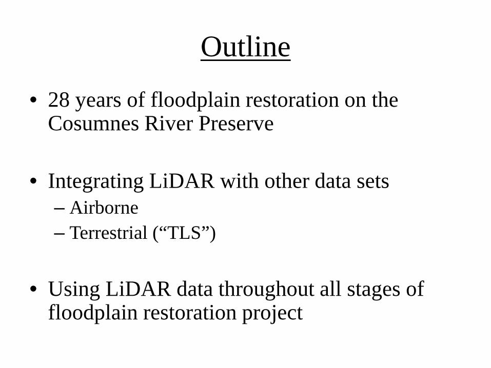
Outline
• 28 years of floodplain restoration on the Cosumnes River Preserve
• Integrating LiDAR with other data sets – Airborne – Terrestrial (“TLS”)
• Using LiDAR data throughout all stages of
floodplain restoration project

Cosumnes River Preserve
46,000 acres along Cosumnes River
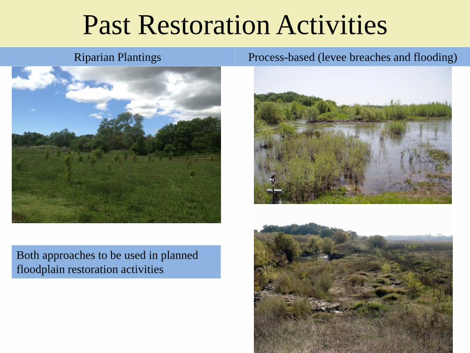
Past Restoration Activities Riparian Plantings Process-based (levee breaches and flooding)
Both approaches to be used in planned floodplain restoration activities
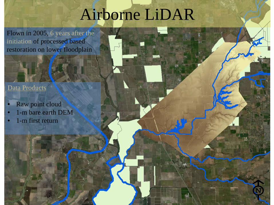
Airborne LiDAR Flown in 2005, 6 years after the initiation of processed based restoration on lower floodplain
Data Products • Raw point cloud • 1-m bare earth DEM • 1-m first return
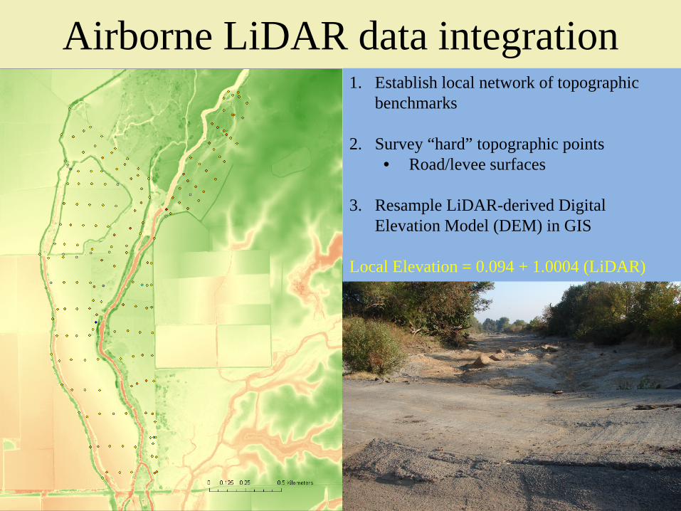
Airborne LiDAR data integration 1. Establish local network of topographic
benchmarks
2. Survey “hard” topographic points • Road/levee surfaces
3. Resample LiDAR-derived Digital
Elevation Model (DEM) in GIS
Local Elevation = 0.094 + 1.0004 (LiDAR)

Terrestrial LiDAR (TLS) Local topographic and aboveground biomass surveys in 2011 • High Resolution
~7,000,000 data points over 0.03 km2
~ 0.1m pixel DEM
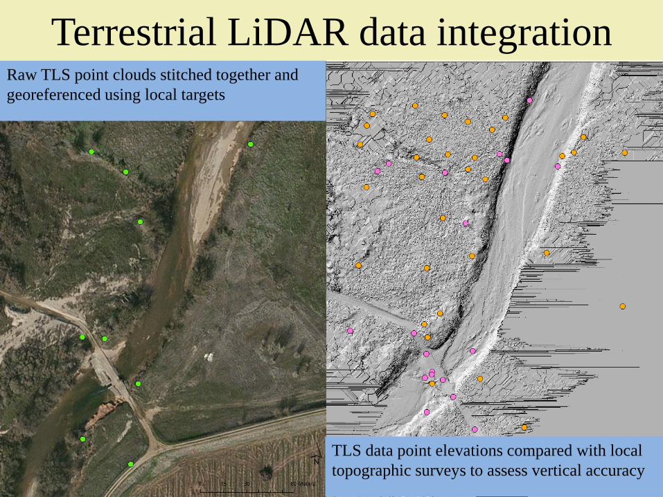
Terrestrial LiDAR data integration Raw TLS point clouds stitched together and georeferenced using local targets
TLS data point elevations compared with local topographic surveys to assess vertical accuracy
Geomorphic change
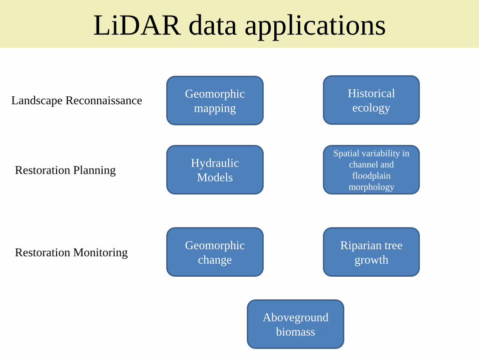
LiDAR data applications
Riparian tree growth Restoration Monitoring
Geomorphic mapping
Historical ecology Landscape Reconnaissance
Restoration Planning Hydraulic Models
Spatial variability in channel and floodplain
morphology
Aboveground biomass

Refining geomorphic maps • Flood basin
boundaries defined by bounding alluvial fans
Mapped contact between Holocene alluvium alluvial fan adjusted based on LiDAR-derived topography
Atwater and Marchand (1982)
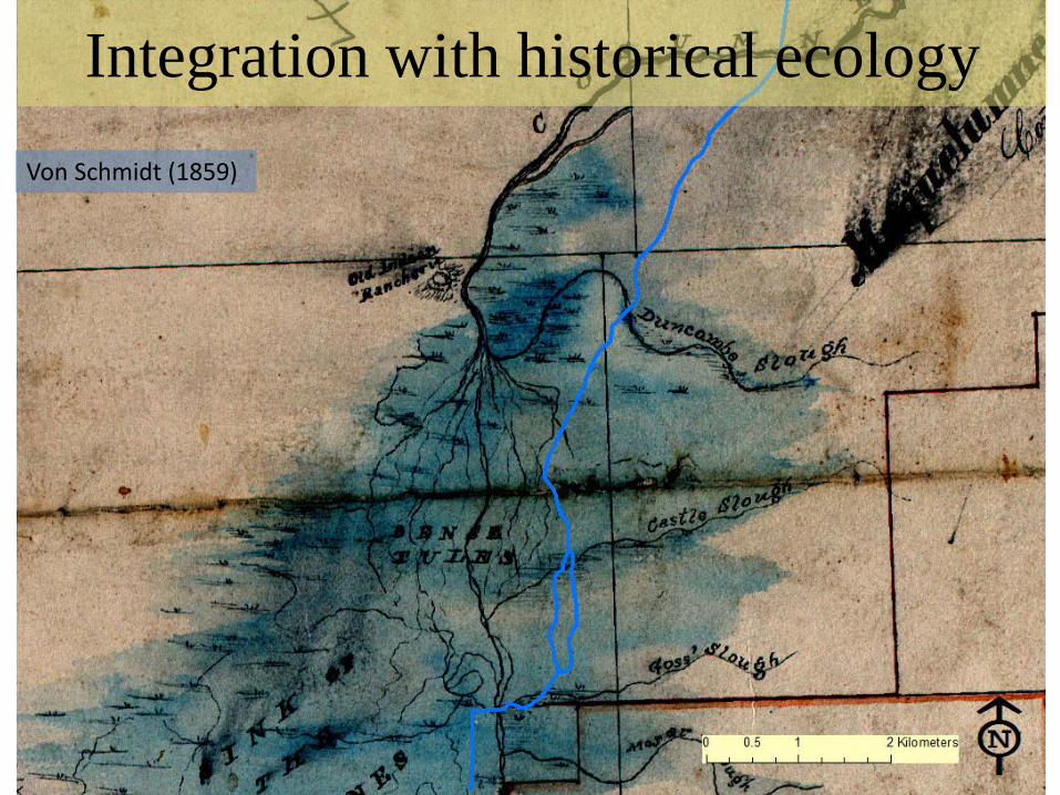
Integration with historical ecology Von Schmidt (1859)

Integration with historical ecology

Baseline for hydraulic modeling • Flow routing • Flood statistics • Restoration scenarios
CCHE2d Fong (2012)

Channel and floodplain morphology Rapid data extraction identifies spatial variation in channel morphology without labor- intensive topographic surveys
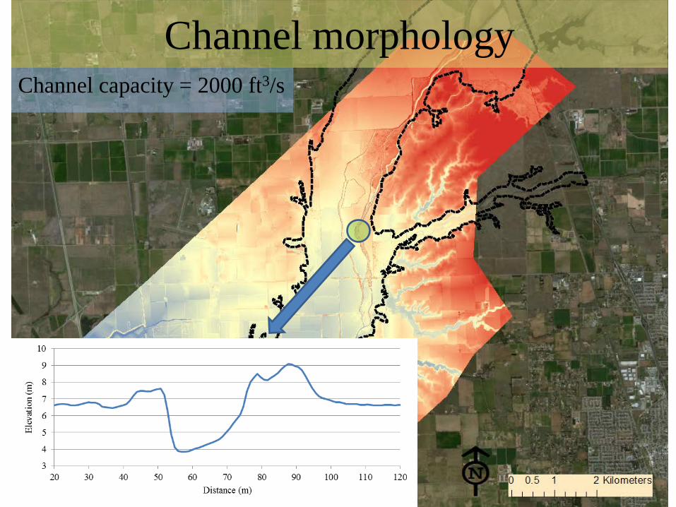
Channel morphology Channel capacity = 2000 ft3/s
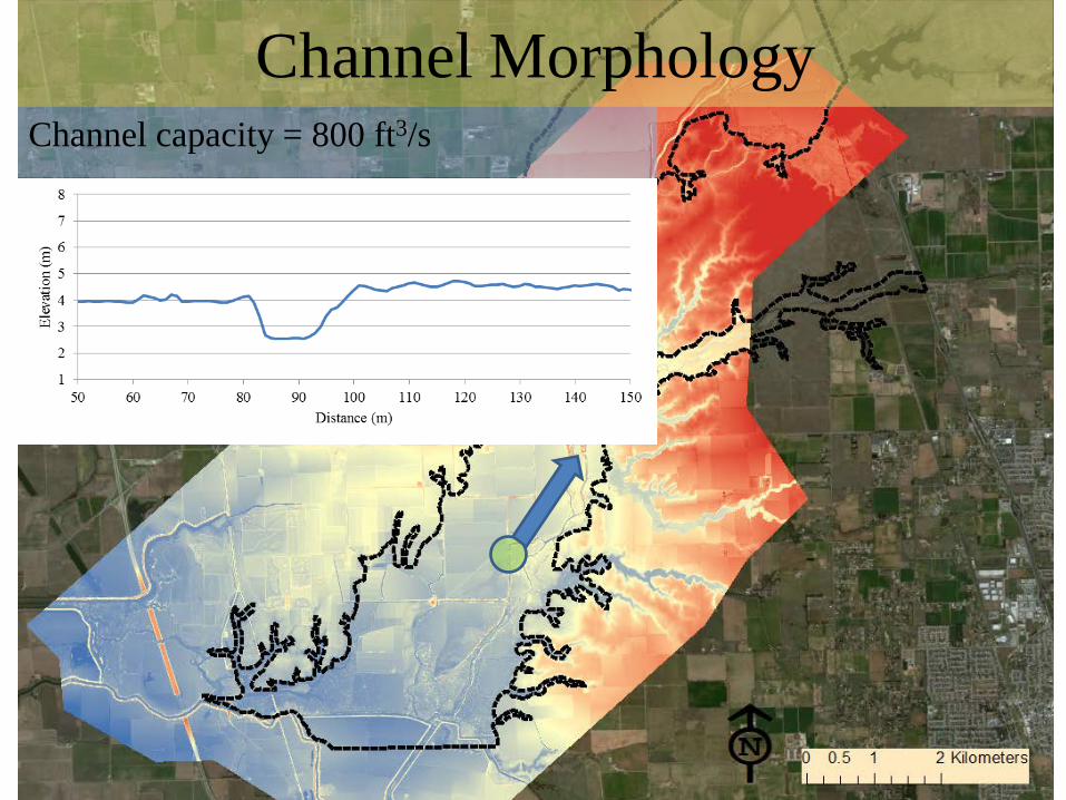
Channel Morphology Channel capacity = 800 ft3/s
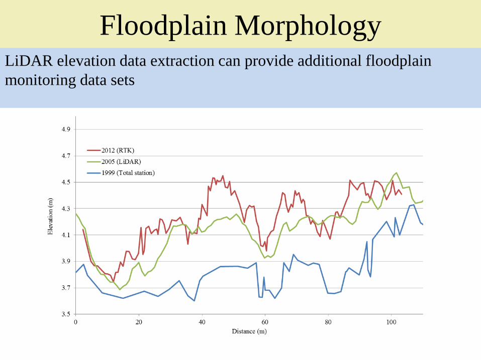
Floodplain Morphology LiDAR elevation data extraction can provide additional floodplain monitoring data sets

Quantifying geomorphic change LiDAR can be used as a baseline data set for geomorphic change detection (GCD) associated with floodplain restoration
0.25m DEM of floodplain sandsplay

Quantifying geomorphic change Monitoring floodplain sediment deposition and erosion associated with levee breaching and restored flood flows

Quantifying riparian tree growth LiDAR first returns can be quickly used to document riparian tree heights and growth rates
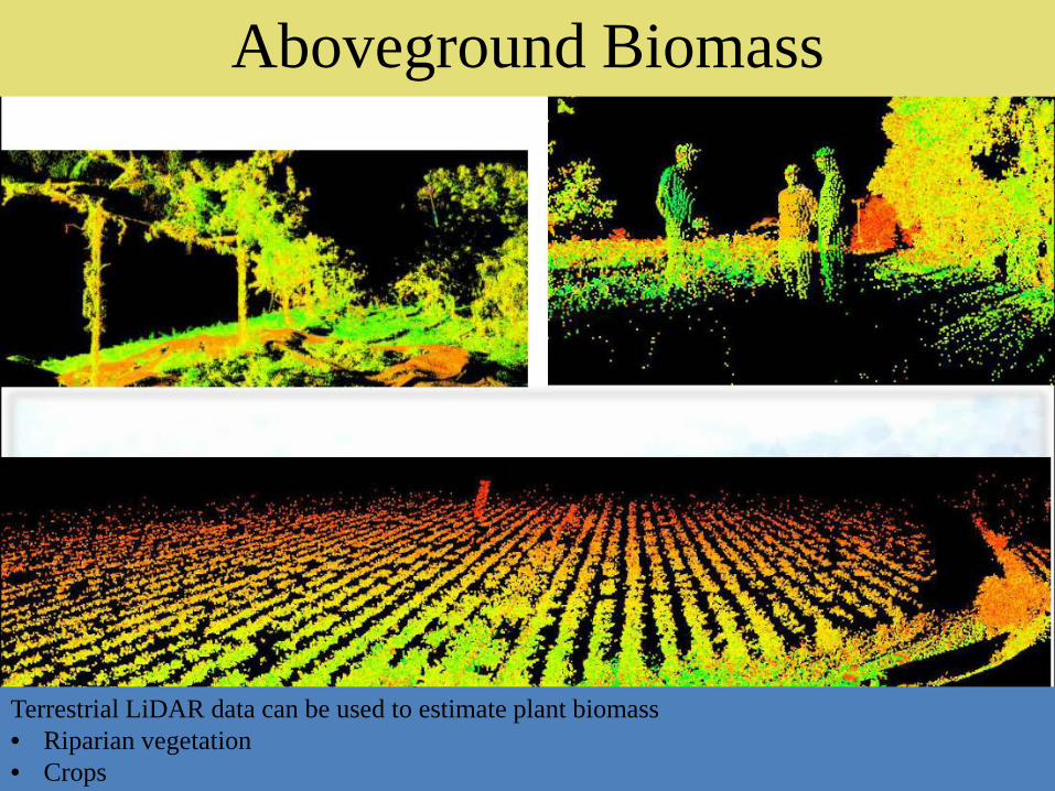
Aboveground Biomass
Terrestrial LiDAR data can be used to estimate plant biomass • Riparian vegetation • Crops
LiDAR and Floodplains • Rapidly acquired, high-resolution topographic data
• Simple integration with local survey networks
• Multiple applications that span many disciplines
• Ideal for establishing baseline conditions and calculating change
Limitations: • Expensive $100k for TLS scanner/$50k per airborne LiDAR flight Data processing is labor intensive
• Confounding effects (e.g. water, dense vegetation) • Not conducive to “event-based” monitoring

Acknowledgements
• Center for Watershed Sciences – Joshua Viers – Rachel Hutchinson – Catherine Fong – Garret Liles – Alison Whipple
• Watershed Sciences, Inc. (Airborne LiDAR) • Jan Eitel (University of Idaho)