mysql 5.7 gis
TRANSCRIPT


Copyright © 2014 Oracle and/or its affiliates. All rights reserved. |
MySQL 5.7 GIS
Matt Lord MySQL Product Manager
Copyright © 2014 Oracle and/or its affiliates. All rights reserved. |
Safe Harbor Statement
The following is intended to outline our general product direction. It is intended for information purposes only, and may not be incorporated into any contract. It is not a commitment to deliver any material, code, or functionality, and should not be relied upon in making purchasing decisions. The development, release, and timing of any features or functionality described for Oracle’s products remains at the sole discretion of Oracle.
3
Copyright © 2014 Oracle and/or its affiliates. All rights reserved. |
MySQL 5.7 GIS : Agenda
1
2
3
4
5
An introduction to GIS
Common terms and concepts
What’s new in MySQL 5.7
Some real world examples
What’s next for MySQL GIS
4
Copyright © 2014 Oracle and/or its affiliates. All rights reserved. |
An Introduction to GIS
5
Copyright © 2014 Oracle and/or its affiliates. All rights reserved. |
“Everything is related to everything else, but near things are more related than distant things.” – Waldo Tobler, “A Computer Movie Simulating Urban Growth in
the Detroit Region.” Economic Geography 46 (1970), p.236
6
Tobler's First Law of Geography
Copyright © 2014 Oracle and/or its affiliates. All rights reserved. |
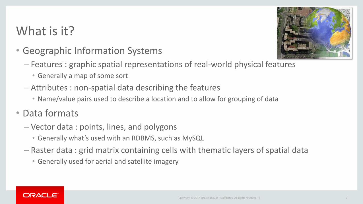
What is it?
• Geographic Information Systems
– Features : graphic spatial representations of real-world physical features • Generally a map of some sort
– Attributes : non-spatial data describing the features • Name/value pairs used to describe a location and to allow for grouping of data
• Data formats – Vector data : points, lines, and polygons
• Generally what’s used with an RDBMS, such as MySQL
– Raster data : grid matrix containing cells with thematic layers of spatial data • Generally used for aerial and satellite imagery
7
Copyright © 2014 Oracle and/or its affiliates. All rights reserved. |
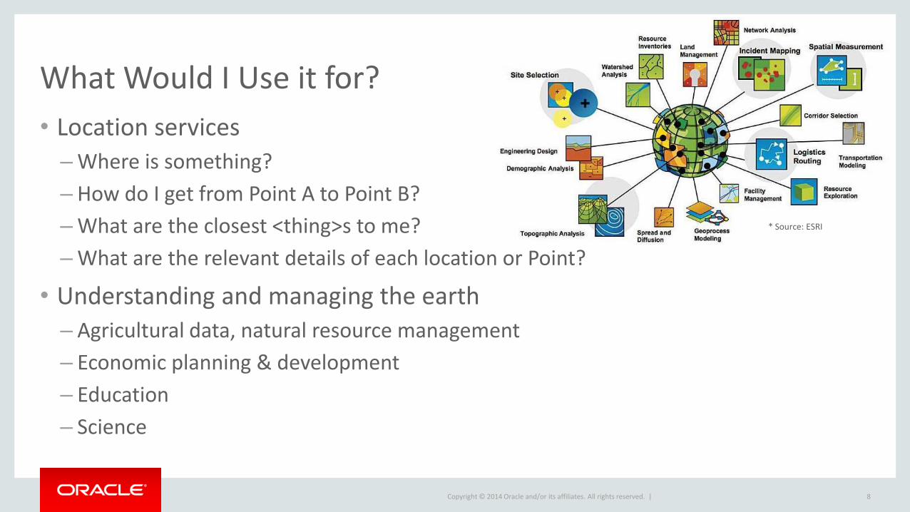
What Would I Use it for?
• Location services
– Where is something?
– How do I get from Point A to Point B?
– What are the closest <thing>s to me?
– What are the relevant details of each location or Point?
• Understanding and managing the earth
– Agricultural data, natural resource management
– Economic planning & development
– Education
– Science
8
* Source: ESRI
Copyright © 2014 Oracle and/or its affiliates. All rights reserved. |
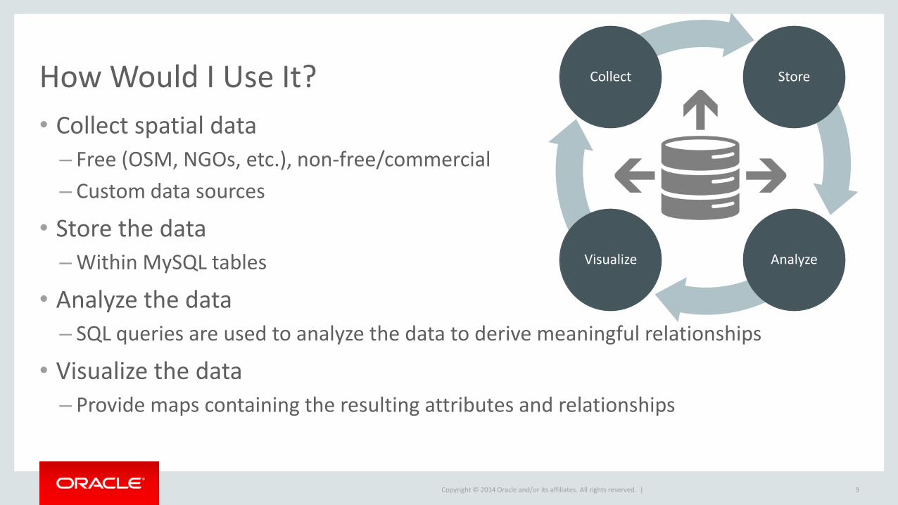
How Would I Use It?
9
Store Collect
Analyze Visualize
• Collect spatial data
– Free (OSM, NGOs, etc.), non-free/commercial
– Custom data sources
• Store the data – Within MySQL tables
• Analyze the data
– SQL queries are used to analyze the data to derive meaningful relationships
• Visualize the data
– Provide maps containing the resulting attributes and relationships

Copyright © 2014 Oracle and/or its affiliates. All rights reserved. |
Common Terms and Concepts
10
Copyright © 2014 Oracle and/or its affiliates. All rights reserved. |
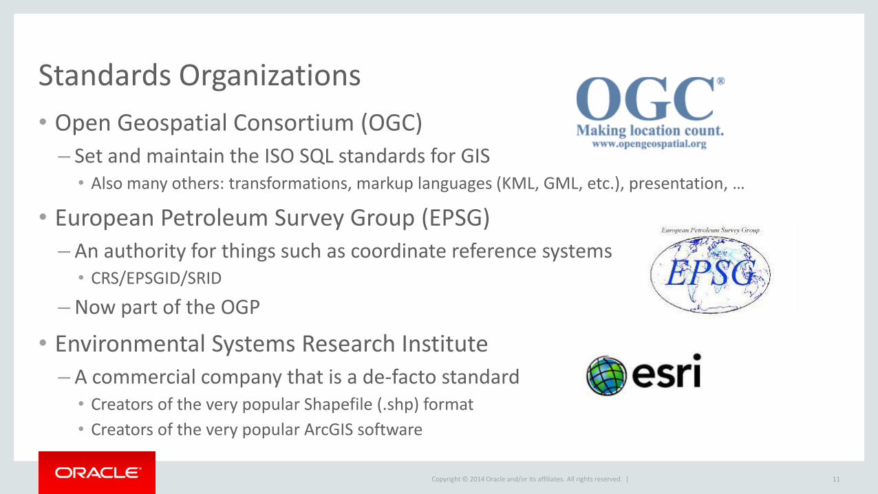
Standards Organizations
• Open Geospatial Consortium (OGC)
– Set and maintain the ISO SQL standards for GIS • Also many others: transformations, markup languages (KML, GML, etc.), presentation, …
• European Petroleum Survey Group (EPSG)
– An authority for things such as coordinate reference systems • CRS/EPSGID/SRID
– Now part of the OGP
• Environmental Systems Research Institute
– A commercial company that is a de-facto standard • Creators of the very popular Shapefile (.shp) format
• Creators of the very popular ArcGIS software
11
Copyright © 2014 Oracle and/or its affiliates. All rights reserved. |
Common Terms
• Coordinates
– x,y,z coordinates in planar space (4D is m or measure)
– MySQL currently only supports 2D (x,y) coordinates
• Projection – Allows a spheroidal surface to be represented in planar format
– Necessary for creating “flat” or 2D maps from locations on a spheroid
• Coordinate reference system (CRS/SRS/EPSGID/SRID)
– Defines where a POINT—represented by a longitude and latitude coordinate pair—is located on the physical earth and defines its relationship to other POINTs
– Also used for calculating distances
12
Copyright © 2014 Oracle and/or its affiliates. All rights reserved. |
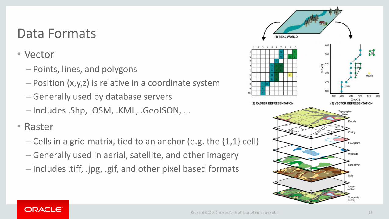
Data Formats
• Vector
– Points, lines, and polygons
– Position (x,y,z) is relative in a coordinate system
– Generally used by database servers
– Includes .Shp, .OSM, .KML, .GeoJSON, …
• Raster
– Cells in a grid matrix, tied to an anchor (e.g. the {1,1} cell)
– Generally used in aerial, satellite, and other imagery
– Includes .tiff, .jpg, .gif, and other pixel based formats
13
Copyright © 2014 Oracle and/or its affiliates. All rights reserved. |
Data Sources
• Free
– OpenStreetMap
– Governments and NGOs
– Universities (UCGIS) and other non-profits
• Commercial / Non-free
– Data Depot, Geography Network, Land Info, Macon, NEXRAIN, SPOT image, …
• Custom
– Geoencoding from various sources, such as user generated images and GPS data • Most media today is automatically geotagged: tweets, photos, Facebook posts, …
– Create custom maps using ArcGIS, QGIS, GRASS, …
14
Copyright © 2014 Oracle and/or its affiliates. All rights reserved. |
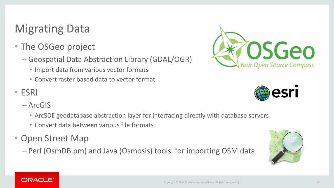
Migrating Data
• The OSGeo project
– Geospatial Data Abstraction Library (GDAL/OGR) • Import data from various vector formats
• Convert raster based data to vector format
• ESRI
– ArcGIS • ArcSDE geodatabase abstraction layer for interfacing directly with database servers
• Convert data between various file formats
• Open Street Map – Perl (OsmDB.pm) and Java (Osmosis) tools for importing OSM data
15
Copyright © 2014 Oracle and/or its affiliates. All rights reserved. |
What’s New in MySQL 5.7
16
Copyright © 2014 Oracle and/or its affiliates. All rights reserved. |
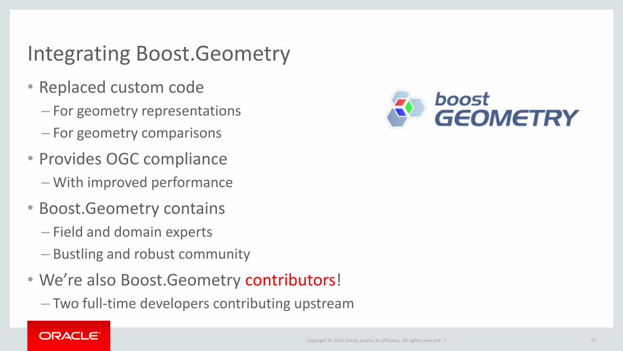
Integrating Boost.Geometry
• Replaced custom code
– For geometry representations
– For geometry comparisons
• Provides OGC compliance – With improved performance
• Boost.Geometry contains
– Field and domain experts
– Bustling and robust community
• We’re also Boost.Geometry contributors! – Two full-time developers contributing upstream
17
Copyright © 2014 Oracle and/or its affiliates. All rights reserved. |
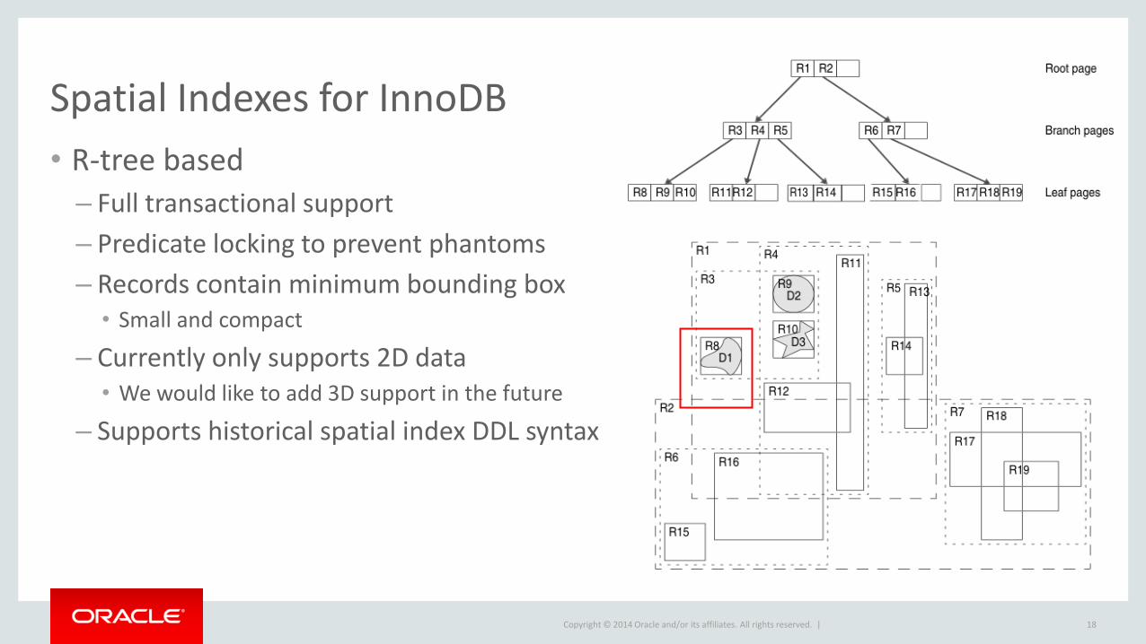
Spatial Indexes for InnoDB
• R-tree based
– Full transactional support
– Predicate locking to prevent phantoms
– Records contain minimum bounding box • Small and compact
– Currently only supports 2D data • We would like to add 3D support in the future
– Supports historical spatial index DDL syntax
18
Copyright © 2014 Oracle and/or its affiliates. All rights reserved. |
Additional Features
• GeoHash
– B-tree indexes on the generated hash values
– Quick lookups for exact matches
– Not very accurate for proximity searches
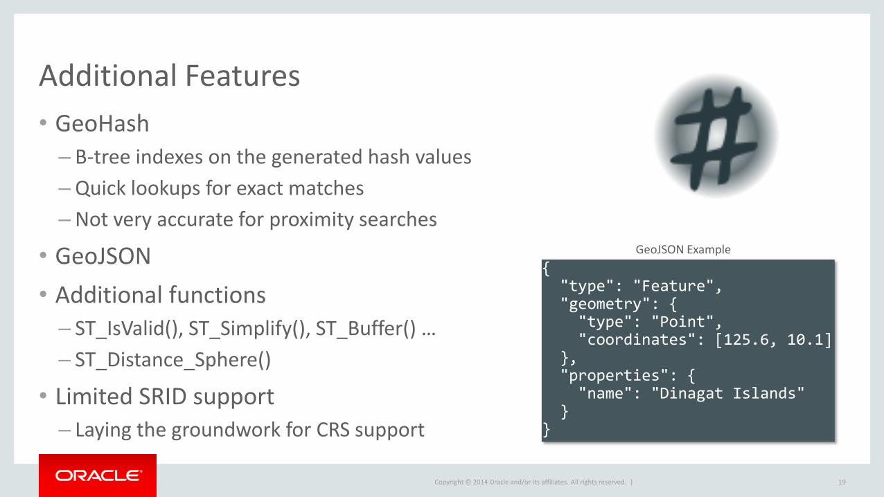
• GeoJSON
• Additional functions
– ST_IsValid(), ST_Simplify(), ST_Buffer() …
– ST_Distance_Sphere()
• Limited SRID support – Laying the groundwork for CRS support
19
{ "type": "Feature", "geometry": { "type": "Point", "coordinates": [125.6, 10.1] }, "properties": { "name": "Dinagat Islands" } }
GeoJSON Example

Copyright © 2014 Oracle and/or its affiliates. All rights reserved. |
Some Real World Examples
20
Copyright © 2014 Oracle and/or its affiliates. All rights reserved. |
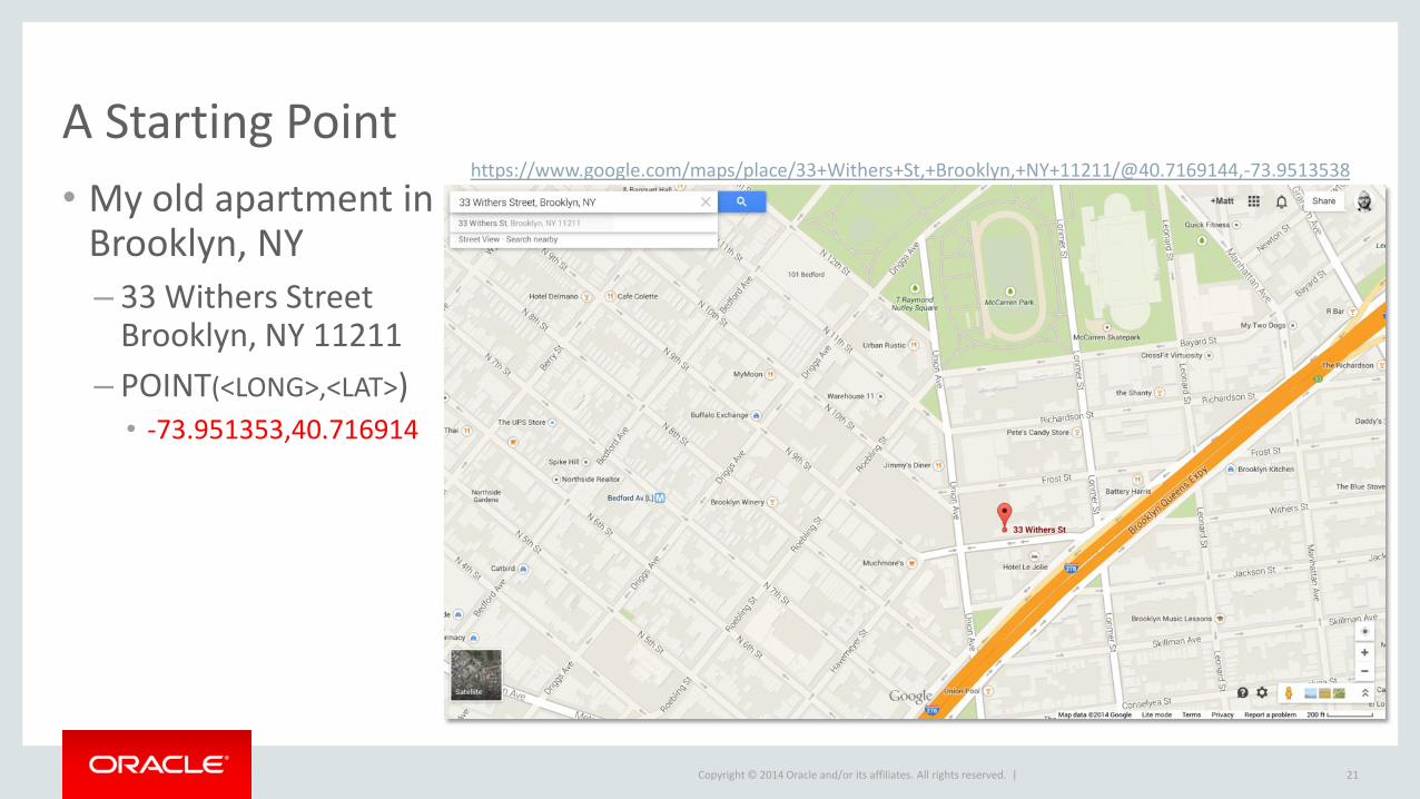
A Starting Point
• My old apartment in Brooklyn, NY
– 33 Withers Street Brooklyn, NY 11211
– POINT(<LONG>,<LAT>) • -73.951353,40.716914
21
https://www.google.com/maps/place/33+Withers+St,+Brooklyn,+NY+11211/@40.7169144,-73.9513538

Copyright © 2014 Oracle and/or its affiliates. All rights reserved. |
The Application Use Case
• I’m hungry and in the mood for Thai food
– What Thai restaurants are around me?
– What’s the closest one?
– Can I see the menu, contact info, yelp ratings, etc.?
– How would I get there?
22
Copyright © 2014 Oracle and/or its affiliates. All rights reserved. |
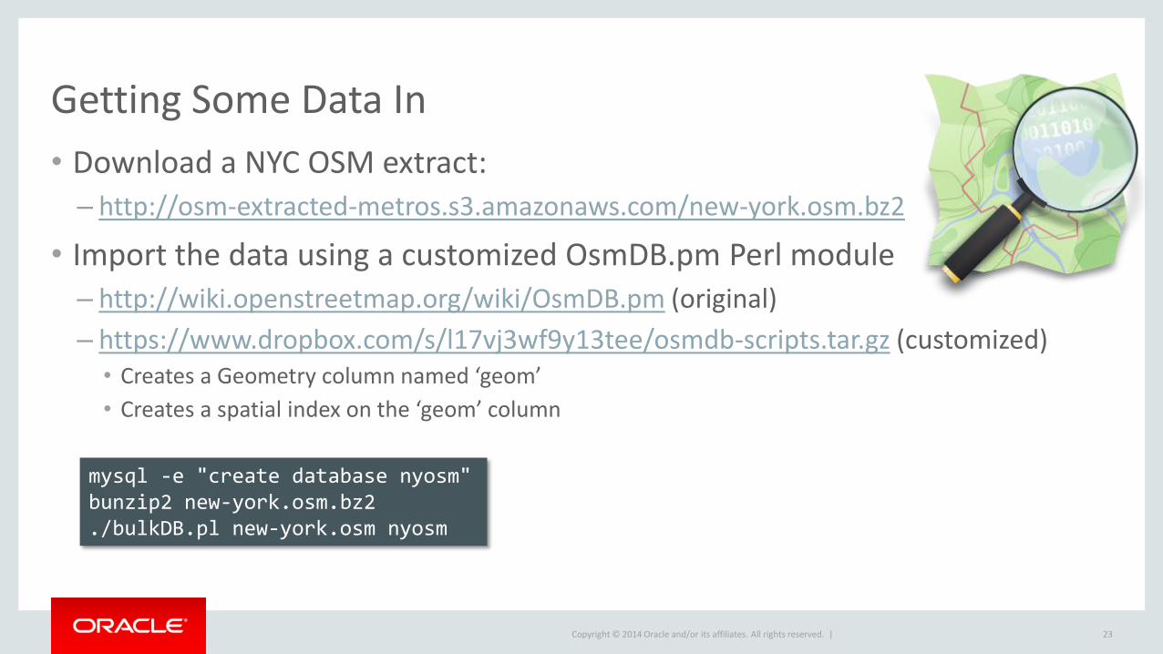
Getting Some Data In
• Download a NYC OSM extract:
– http://osm-extracted-metros.s3.amazonaws.com/new-york.osm.bz2
• Import the data using a customized OsmDB.pm Perl module
– http://wiki.openstreetmap.org/wiki/OsmDB.pm (original)
– https://www.dropbox.com/s/l17vj3wf9y13tee/osmdb-scripts.tar.gz (customized) • Creates a Geometry column named ‘geom’
• Creates a spatial index on the ‘geom’ column
23
mysql -e "create database nyosm" bunzip2 new-york.osm.bz2 ./bulkDB.pl new-york.osm nyosm
Copyright © 2014 Oracle and/or its affiliates. All rights reserved. |
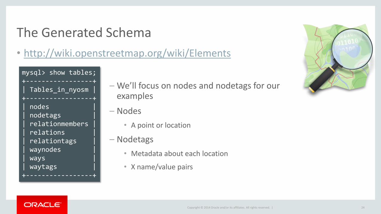
The Generated Schema
• http://wiki.openstreetmap.org/wiki/Elements
24
mysql> show tables; +-----------------+ | Tables_in_nyosm | +-----------------+ | nodes | | nodetags | | relationmembers | | relations | | relationtags | | waynodes | | ways | | waytags | +-----------------+
– We’ll focus on nodes and nodetags for our examples
– Nodes
• A point or location
– Nodetags
• Metadata about each location
• X name/value pairs
Copyright © 2014 Oracle and/or its affiliates. All rights reserved. |
De-normalizing the Tag Data
• Greatly simplify our query
• Allow for the use of a full-text index
– Also improves performance
• Mimic better schema created by osm2pgsql
– http://wiki.openstreetmap.org/wiki/Osm2pgsql/schema#planet_osm_nodes
25
mysql> alter table nodes add column tags text, add fulltext index(tags); mysql> update nodes set tags=(SELECT group_concat(concat(k, "=", v) SEPARATOR ';') from nodetags where nodetags.id=nodes.id group by nodes.id);
* Source: ESRI
Copyright © 2014 Oracle and/or its affiliates. All rights reserved. |
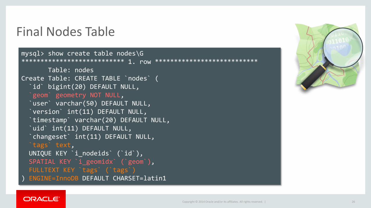
Final Nodes Table
26
mysql> show create table nodes\G *************************** 1. row *************************** Table: nodes Create Table: CREATE TABLE `nodes` ( `id` bigint(20) DEFAULT NULL, `geom` geometry NOT NULL, `user` varchar(50) DEFAULT NULL, `version` int(11) DEFAULT NULL, `timestamp` varchar(20) DEFAULT NULL, `uid` int(11) DEFAULT NULL, `changeset` int(11) DEFAULT NULL, `tags` text, UNIQUE KEY `i_nodeids` (`id`), SPATIAL KEY `i_geomidx` (`geom`), FULLTEXT KEY `tags` (`tags`) ) ENGINE=InnoDB DEFAULT CHARSET=latin1
Copyright © 2014 Oracle and/or its affiliates. All rights reserved. |
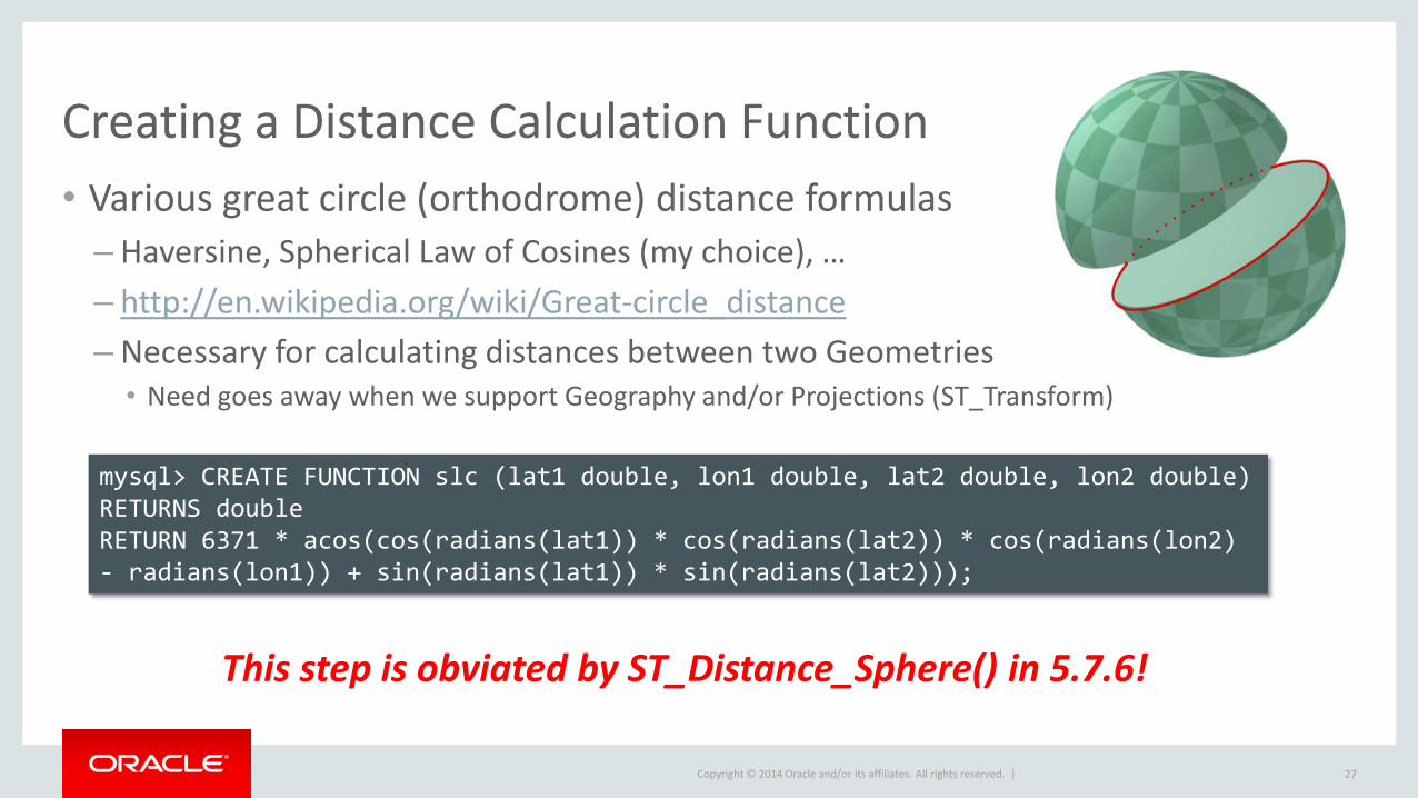
Creating a Distance Calculation Function
• Various great circle (orthodrome) distance formulas
– Haversine, Spherical Law of Cosines (my choice), …
– http://en.wikipedia.org/wiki/Great-circle_distance
– Necessary for calculating distances between two Geometries • Need goes away when we support Geography and/or Projections (ST_Transform)
27
mysql> CREATE FUNCTION slc (lat1 double, lon1 double, lat2 double, lon2 double) RETURNS double RETURN 6371 * acos(cos(radians(lat1)) * cos(radians(lat2)) * cos(radians(lon2) - radians(lon1)) + sin(radians(lat1)) * sin(radians(lat2)));
This step is obviated by ST_Distance_Sphere() in 5.7.6!
Copyright © 2014 Oracle and/or its affiliates. All rights reserved. |
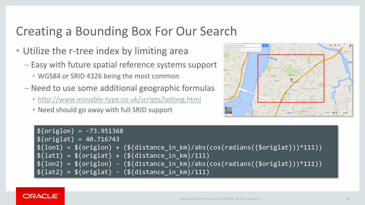
Creating a Bounding Box For Our Search
• Utilize the r-tree index by limiting area
– Easy with future spatial reference systems support • WGS84 or SRID 4326 being the most common
– Need to use some additional geographic formulas • http://www.movable-type.co.uk/scripts/latlong.html
• Need should go away with full SRID support
28
${origlon} = -73.951368 ${origlat} = 40.716743 ${lon1} = ${origlon} + (${distance_in_km}/abs(cos(radians({$origlat}))*111)) ${lat1} = ${origlat} + (${distance_in_km}/111) ${lon2} = ${origlon} - (${distance_in_km}/abs(cos(radians({$origlat}))*111)) ${lat2} = ${origlat} - (${distance_in_km}/111)
Copyright © 2014 Oracle and/or its affiliates. All rights reserved. |
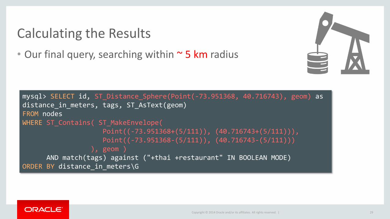
Calculating the Results
• Our final query, searching within ~ 5 km radius
29
mysql> SELECT id, ST_Distance_Sphere(Point(-73.951368, 40.716743), geom) as distance_in_meters, tags, ST_AsText(geom) FROM nodes WHERE ST_Contains( ST_MakeEnvelope( Point((-73.951368+(5/111)), (40.716743+(5/111))), Point((-73.951368-(5/111)), (40.716743-(5/111))) ), geom ) AND match(tags) against ("+thai +restaurant" IN BOOLEAN MODE) ORDER BY distance_in_meters\G
Copyright © 2014 Oracle and/or its affiliates. All rights reserved. |
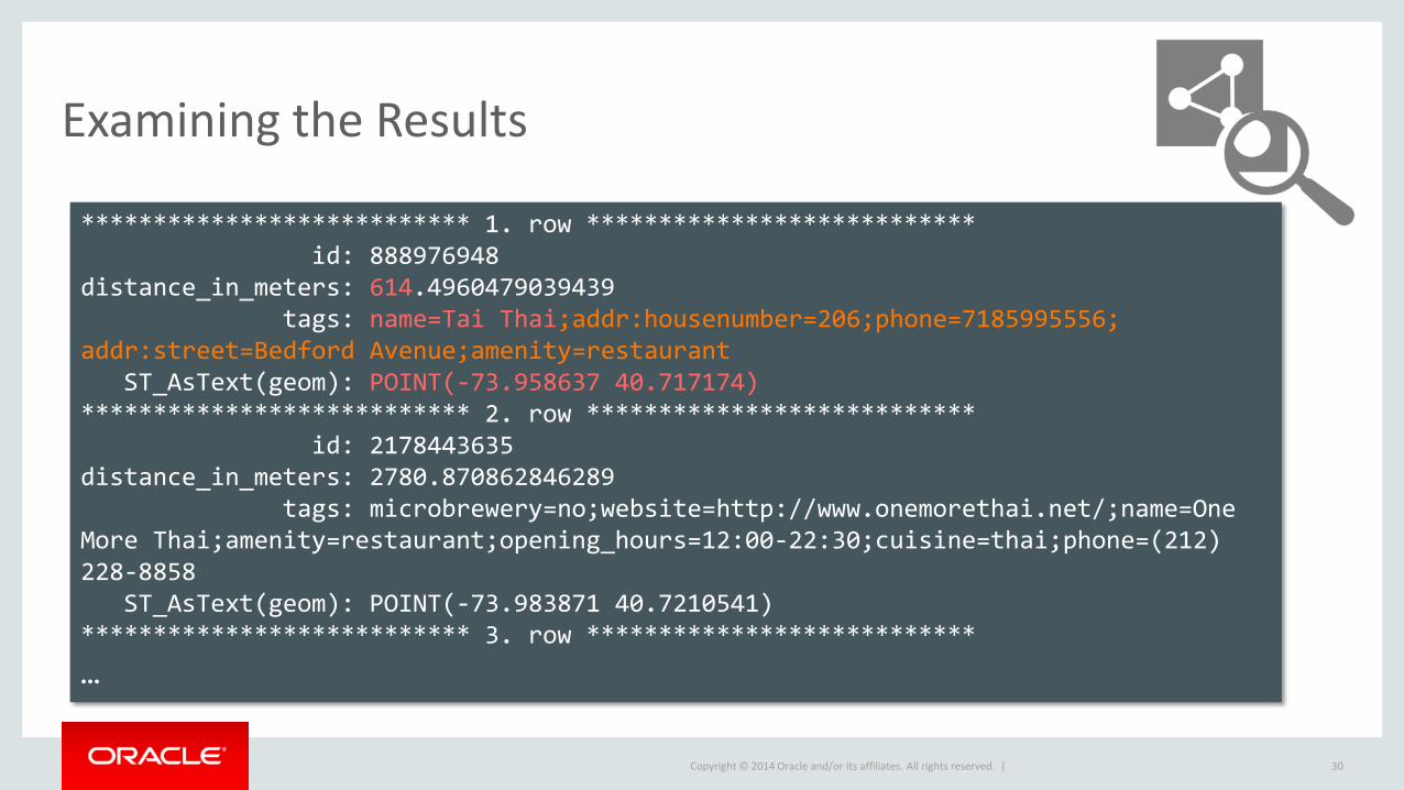
Examining the Results
30
*************************** 1. row *************************** id: 888976948 distance_in_meters: 614.4960479039439 tags: name=Tai Thai;addr:housenumber=206;phone=7185995556; addr:street=Bedford Avenue;amenity=restaurant ST_AsText(geom): POINT(-73.958637 40.717174) *************************** 2. row *************************** id: 2178443635 distance_in_meters: 2780.870862846289 tags: microbrewery=no;website=http://www.onemorethai.net/;name=One More Thai;amenity=restaurant;opening_hours=12:00-22:30;cuisine=thai;phone=(212) 228-8858 ST_AsText(geom): POINT(-73.983871 40.7210541) *************************** 3. row ***************************
…
Copyright © 2014 Oracle and/or its affiliates. All rights reserved. |
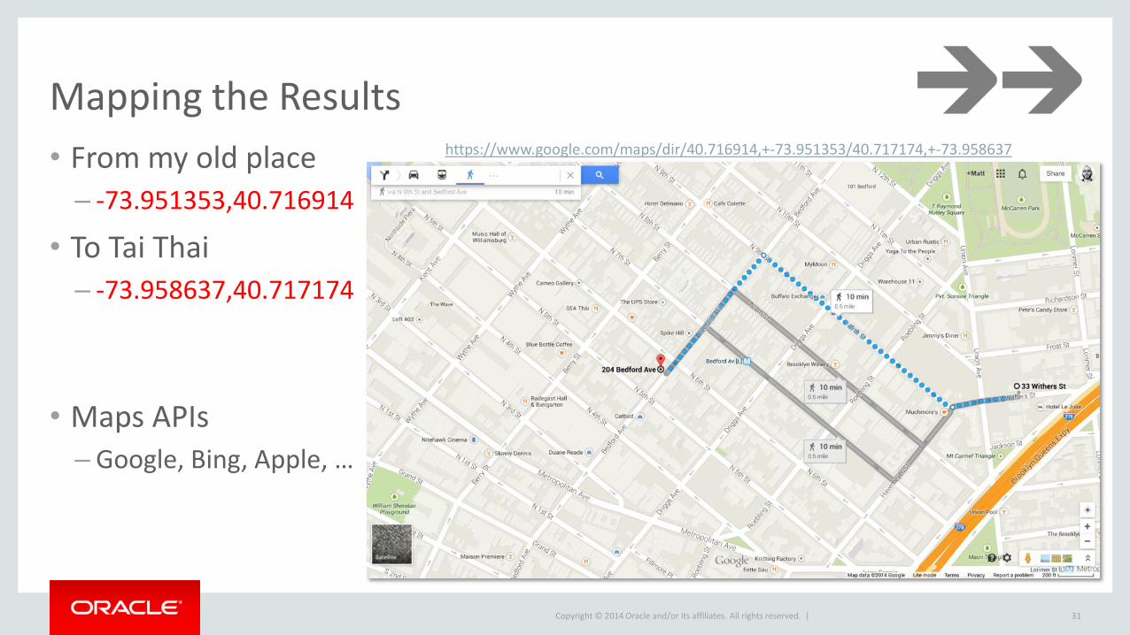
Mapping the Results
31
• From my old place
– -73.951353,40.716914
• To Tai Thai
– -73.958637,40.717174
• Maps APIs
– Google, Bing, Apple, …
https://www.google.com/maps/dir/40.716914,+-73.951353/40.717174,+-73.958637

Copyright © 2014 Oracle and/or its affiliates. All rights reserved. |
What’s Next for MySQL GIS
32
Copyright © 2014 Oracle and/or its affiliates. All rights reserved. |
Storage Enhancements
• R-tree enhancements
– 3D support
• Improved storage
– Fixed length storage when possible
– Transparent compression
– Transparent encryption
– Improved BLOB handling • Streaming API, in place updates, …
• Concurrency improvements – Scaling well on very large NUMA machines
33
Copyright © 2014 Oracle and/or its affiliates. All rights reserved. |
Geography
• Geography types
• Geography functions
• Makes distance calculations very accurate
– Simple ST_Distance() call for distance value in meters
• Makes area searches very easy
– Simple ST_Buffer() call to search a radius of N meters
34
Copyright © 2014 Oracle and/or its affiliates. All rights reserved. |
Additional Features
• Spatial reference system support
– Starting with WGS84 (SRID 4326)
• Projections
– ST_Transform()
• OGC standard Information_Schema metadata
• Additional performance optimizations
• 3D and Geodetic support
• What else would you like to see? – Let us know!
35
Copyright © 2014 Oracle and/or its affiliates. All rights reserved. |
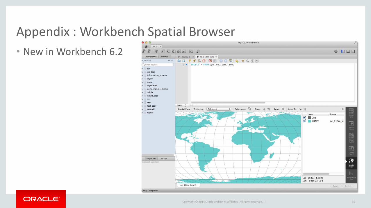
Appendix : Workbench Spatial Browser
• New in Workbench 6.2
36
Copyright © 2014 Oracle and/or its affiliates. All rights reserved. |
Appendix : Additional Resources
• Manual
– http://dev.mysql.com/doc/refman/5.7/en/spatial-extensions.html
• Community forum
– http://forums.mysql.com/list.php?23
• Boost.Geometry – http://www.boost.org/libs/geometry
• Report GIS bugs and submit feature requests
– http://bugs.mysql.com/
37

Copyright © 2014 Oracle and/or its affiliates. All rights reserved. |
Safe Harbor Statement
The preceding is intended to outline our general product direction. It is intended for information purposes only, and may not be incorporated into any contract. It is not a commitment to deliver any material, code, or functionality, and should not be relied upon in making purchasing decisions. The development, release, and timing of any features or functionality described for Oracle’s products remains at the sole discretion of Oracle.
38
