national health resource repository (nhrr)
TRANSCRIPT

National Health Resource Repository
(NHRR)
India’s first health facility registry
Enabling Evidence Based Planning and Policy Making
A Joint Project
of
Central Bureau of Health Intelligence,
Ministry of Health & Family Welfare
&
National Remote Sensing Centre,
Indian Space Research Organization

Introduction
Unique Facility Number assigned to all Healthcare Establishments
First National Registry that will cohesively work with Ayushman Bharat and Central TB Division
Ayushman Bharat
Central TB Division
NRSC / ISRO’s NHRR project goal is
“To design, develop & deploy technology platform
(Mobile/tablet app & Geo-Web portal);
To empower generation of comprehensive health
sector database / health resources census and
provide GIS based enabling environment for
visualization and analytics;
To facilitate improved health care asset
management, efficient health service delivery,
evidence based planning & decision making,
resource allocation, strengthen health information
system and finally governance for good health &
well-being in the country; and also support the
recently announced: AYUSHMAN BHARAT –
National health Protection Mission.”
National Health Resource Repository (NHRR) is a
joint project of Central Bureau of Health Intelligence
(CBHI), Directorate General of Health Services,
Ministry of Health & Family Welfare, New Delhi &
National Remote Sensing Centre, Indian Space
Research Organization (ISRO), Hyderabad and being
carried out as per the Memorandum of
understanding (MoU) signed on May 3, 2017
between the two organizations.
CBHI has defined the vision of NHRR project as
“To strengthen evidence-based decision making
and develop a platform for citizen and provider-
centric services by creating a robust, standardized
and secured IT-enabled repository of India’s
healthcare resources.”
i. To develop android based mobile (tablet) application for collection of health resources assets details.
ii. To develop an interface on Bhuvan platform to receive Mobile geo-tagged data, provide facility for
moderation and display of assets.
iii. To link the healthcare resources assets data with administrative boundaries and natural resources data.
iv. To generate tools for data analytics and updation.
v. To arrange capacity building activities for the Ministry officials for enabling data collection.
NHRR Project Stake Holders & their Roles :
Central Bureau of health intelligence (CBHI) Main Executing agency
National Remote Sensing Centre (NRSC/ISRO)
Design, Develop & Deploying technology platform for country
wide data collection through tablet application & data
collection Management, Visualization, Analytics and updation
Bill & Melinda Gates Foundation (BMGF)
Human Resource supply through Beehyv Software Solutions
Private Limited, Hyderabad and Technical facilitation for the
project
IMS Health and Quintiles (IQVIA) Agency deployed by CBHI for data collection, Quality check &
documentation.
The project has the following objectives :

NHRR Census Methodology
The census of health resources assets is carried out in paperless mode with Canvasser method in two phases,
using Tablet Application.
• Line Listing Phase – The field investigators physically visit each street of the village and ward to identify and
record the details of every Health establishment as per enumeration blocks of 2011 census.
• Enumeration Phase – Based on line listing the field investigator again physically approaches each identified
health establishment and collects data on various health resources using the structured questionnaires on
tablets.
Data collection using tablet application GPS,
Photo, Name, HE Category are captured,
Unique facility number assigned to all Health
Establishments
Field Investigator
(FI)
Based on Location captured during Line
Listing, FI will visit and capture detailed
information on basic details, physical
infrastructure, Services, Human resources,
Medical training, National Health
Programmes, Technology, Quality control &
TB services.
Bhuvan NHRR
Web portal
Reports
Spatial Analytics
Users
Govt./Pvt. agencies & Citizens
Census is being conducted
using digital Enumeration
Block (EB) maps
(census 2011)
Data Collection Framework
The data on an estimated 20 lakh+ health establishments (both government & private) of the country covered
across 23 lakh+ EBs (census 2011) are being collected under this project as per the eleven schedules (data
collection questionnaires) designed by CBHI & IMS Health and Quintiles (IQVIA), the identified data collection
agency. The summarized view of schedules indicating the quantum of data being collected is presented here.
Summary of NHRR Schedules
S. No Name of Schedule Total No. of
Questions
Mandatory
Questions
Non- Mandatory
Questions
Total No. of
Attributes
1 Line listing 24 21 3 24
2 Sub Centre 90 87 3 127
3 Primary Health Centre 105 102 3 146
4 Community Health Centre 198 193 5 309
5 Sub Divisional/ District Hospital 686 682 4 1132
6 Medical college 982 971 11 1478
7 Clinic/ Polyclinic 565 554 11 898
8 Diagnostic Lab 116 107 9 162
9 Blood Bank 60 46 14 94
10 Pharmacy 44 34 10 54
11 Doctor 10 8 2 10
Total 2880 2805 75 4434

NHRR Schedules:
Data Collection details of all health establishments are under Ten Heads
1. Physical Location & Photograph of Health Establishment Geographic coordinates (latitude/longitude)
With photograph
Geographic Location (Plain, Hilly, Plain Tribal, Hilly Tribal))
2. Basic Details of HE Government/Private
Central/State
Profit/Non-Profit
Non-Ayush (Allopathic)
Ayush (Ayurvedic, Yoga, Unani, Siddha, Homeopathic)
Registration/Certification details
Number of Beds and Occupancy Ratio
3. Physical Infrastructure of HE Building ownership
Dedicated Rooms available
No. of vehicles
Power supply
Alternative power supply
4. Services Offered/Facilities and Equipment Available at HE Medicine and Allied (19)
Surgery and Allied(11)
5. Human Resource Available at HE at Various Levels Doctors
- Medical Administrative Staff
- General Practitioner
- Specialist
Paramedical Staff
- Nursing staff
- Others supporting staff
6. Other Support Services Pharmacy Services
Blood Bank Services
Cath Lab Services
7. National Health Programmes IDSP,NACP, NVBDCP, NLEP, RNTCP, NPCB, NPPCD, NMHP, NPCDCS NIDDCP,NPPCF, NTCP, NOHP, NPHCE, PMR
8 . Quality Control Rogi kalyan Samithi Constituted
Suggestion/Complaint Box
Hospital Infection Control Committee
Quality Assurance Board
Quality Accreditation/Certification
9. Technology Internet Connectivity
Type of device(s) available at HE
HE using ICD-10 for patient records
HE uses ICF for medical record keeping
HE has HMIS or not
Tele Medicine
HE empanelled under any Healthcare Insurance Scheme
10. TB Diagnosis & Treatment Services TB Diagnostic Services
Number of Patients diagnosed and Patients Treated
Tests used for diagnosis of pulmonary & extra pulmonary TB
HE with TB Treatment Services & How long patients are treated
Which anti TB drugs are used
Support Services (3)
Advanced Medical Services (3)
Reason for referral
Type of HE
HE Status
Type and Number of Cases
Operation theatres
Water supply
Toilet facility
Waste management
Furniture Details
Diagnostic Services
Dialysis Services
- Medicine Super- Specialist
- Surgical Super-Specialist
- Dental / Dental Specialist
Technology Application Stages:
Following four application stages are there of NHRR project
Stage 1 :
Bhuvan NHRR Tablet Application
Stage 2 :
Intermediary Web Application
Stage 4:
Bhuvan NHRR Data Updation
Stage 3:
Bhuvan NHRR Web Portal
• Used by the FIs & Supervisors to collect data of Health
Establishments
• Data collection using Canvasser method in two phases
- Line Listing phase - Enumeration phase
Data collection Management Info. System & Quality Check
• MIS : Platform to facilitate and monitor the activities
associated with data collection
• QC : Used by the QC team for conducting necessary
quality checks and data cleaning.
Data Visualization & Data Analytics To visualize healthcare data, perform data analytics and
generate healthcare intelligence reports for making
informed decisions, optimum utilization and
management of health resources from the cleaned
datasets.
Data Updation & Sustenance
To maintain authenticity, accuracy and data quality, an
interface will be provided to health service providers to
update the details of their establishments through web
portal or mobile app.

Software / Technologies used for NHRR :
Internet
• ExtJS, GeoExt,
Jquery, D3 • OpenLayers, • Leaflet • OL-Cesium,
CesiumJS • Leaflet, WebGL
• ODK/ Geo-ODK
Collect Android Mobile App for Census
• Enketo Smart Paper for QC & Update
• GeoServer • MapServer • Mapnik • QGIS
(WMS/ WFS)
• Custom Services
(PHP, NodeJS, Java, Python)
• ODK Aggregate Server
• Enketo Smart Paper Server
• PostgreSQL with PostGIS (Spatial) & HStore extensions
(Audit-Trail)
• ClickHouse (Columnar DB for Analytics & Reporting)
Client Tier Web Tier Database Tier
− Mobile/ Tablet App
• Customized version of ODK/ Geo-ODK Collect (an open-source native android mobile app framework) is used
for data collection. All paper based NHRR schedules are designed/ developed and converted into digital
forms (XForms) for the mobile app using XLSForms.
• ODK Aggregate is used to aggregate & push the data collected through mobile app to the database.
− Data Collection & Management MIS Portal
• JQuery, JQueryUI (a JavaScript based framework) along with HTML, CSS, JavaScript etc. are used for MIS
module and QC web application.
− Visualization & Analytics – Geo web Portal
• ExtJS & JQuery (a JavaScript based framework) are used for the design & development of visualization &
analytics Geo web portal. GeoExt, OpenLayers, Leaflet, OL-Cesium, CesiumJS & WebGL APIs are used for 2D/
3D Web Mapping. D3.js & DC.js frameworks are used for Charting.
• QGIS is used for spatial data preparation at the desktop and GeoServer is used for spatial data publishing at
the server level.
• PHP, NodeJS, Java & Python server-side scripting languages are used for business logic and data flow
between the application & database server.
• PostgreSQL database along with PostGIS is used to store the census data as well as the spatial data.
ClickHouse (columnar DB) is used for analytics and reporting.
− Update & Sustenance - Web & Mobile/tablet Application
• Enketo Smart Paper for web is already used by the QC team to edit & update the data currently. ODK/ Geo-
ODK Collect App for android mobile/ tablet will also be used for the data update through mobile/ tablet.
Geo web portal & Mobile/tablet Application Architecture
Geo web portal
Mobile/tablet app

Major Accomplishments
Project Planning & Preparatory Activities:
• Preparatory meetings with all stakeholders were held to understand the detailed requirements, deliverables
& the delivery schedule after signing of MoU.
• Manpower recruitment process was jointly done by CBHI & BMGF for RRSC-West, NRSC/ISRO, Jodhpur and
CBHI, MoH&FW, New Delhi; and project orientation training was given in house at RRSC-W Jodhpur.
• Requisite Hardware was procured & supplied by CBHI.
• For project execution numbers of meetings were held with team to prepare work plan for all the deliverables
keeping in mind the best practices followed internationally.
• The best practices for development of Mobile App have been followed after a thorough review of latest
emerging technologies & Mobile framework for data collection. The design of the app was finalized - wireframe
design prepared using Just-in mind software.
• The app is based on android using the native approach. The native approach offers best performance as the
app is able to easily access and utilize the built-in capabilities of the user’s device.
• PHP is used for server side programming. Leaflet is used for map display and spatial visualization. ODK (Open
Data Kit) open source framework is used for data collection. ODK Aggregate Server was customized according
to functionality.
Objective 1: To develop android based mobile (tablet) application for collection of
health resources assets details.
The development of mobile/ tablet app is carried out in compliance with the requirements defined by CBHI
through FRS, SRS documents & HE type wise data collection schedules.
Expected outcomes
- Both private and public health
facilities
- Detailed information about human
resources, service availability and
equipment details
- Identifying unserved areas and
overlapping areas
- Reviewing alignment of services
with target population
- Addressing geographic
inequality
- Creating environment for
universal health coverage
- Mapping pattern of incidence,
prevalence, spread & modelling
- Identifying Hotspots, Morbidity
and Mortality
- Reveals where programs are
ineffective & lacking
- Analysing demographics, environment
& ecology, Landuse / Landcover,
transport options and seasonality
COMPREHENSIVE DATA
IMPROVED EFFICIENCY
EQUITY
DISEASES & TRENDS
VULNERABILITY & CONTEXT

• Enumeration Block (EB) Layout Map Directory
− Directory of Enumeration Block Layout Map (both rural
& urban) with States/UTs wise directory of codes of all
states, districts and villages as published by Registrar
General of India, Ministry of Home Affairs were
provided by CBHI
− Replacement of existing EB directory with new EB
directory received from CBHI / IQVIA after correcting
the discrepancies reported
− In-house module developed to store EB Maps into
database in desired structure
− Development & Customization of Virtual Machine to
store and retrieve EB Maps to visualize & use it to
understand and navigate to the EB during data
collection using Mobile App
• Pilot Study
− Pilot study was carried out using Bhuvan-
NHRR mobile app (version 1) during
September-October 2017 in 5 districts
viz., Hamirpur (Himachal Pradesh),
Ernakulam (Kerala), Bhopal (Madhya
Pradesh), Jodhpur (Rajasthan) & North
Sikkim (Sikkim).
− 5550 EB’s were completed, 4000 HE’s
were line listed & about 2000 HE’s were
enumerated.
− Based on learning's from pilot phase, fully
upgraded version of census schedules
(XLSForms), Mobile App (version 2&3) and
MIS portal are developed.
Screenshots of Bhuvan NHRR Mobile Application Interface for Data Collection
• ODK offers several advantages over the traditional paper-based tools especially for collecting structured data
questions. It creates a normalized database schema on its own, makes use of simple file format i.e. .XLS.
Multiple edits can be made to these XLS forms without having the need to do major changes in Mobile App
developed for data collection. It is able to record information in both online and offline mode, and also
facilitates real-time data synchronization between the data collection device and server.
• The forms required for data collection through mobile app need to be authored in XLS format. For this the
schedules (data collection questionnaires) provided in .doc file format by CBHI are written in XLSForm format.
After every schedule is written in XLSForm format, the file format is changed to XML which is then uploaded to
the ODK server which ultimately creates the database schema. A change in schedules requires change to be
made to XLS Forms which in turn change the XML files and ultimately leads to the changed database.
• Device Specifications & Security: The file size of NHRR tablet/mobile .apk is 7.3 MB. Required device
specifications for proper functioning of mobile app are: minimum of Android 4.4.2, display of 7’ IPS HD, GPS,
GPRS / WIFI, High Internal Memory with 1GB+ RAM and high resolution camera. To address security concerns,
a device’s IMEI number is linked to a particular user so as to ensure that only authorized user can access the
application. Also, the passwords for logging in to the app are encrypted at the database end. SMS gateway
provided for OTP, once data is collected of HE.
• Internal and external testing & evaluation of the application is carried out by NRSC Software Development
Team in two stages. The suggestions proposed by the development team are incorporated in the application.
• Documentation: User Manual, Test Cases, Privacy Policy, Terms of Service document are prepared together
with Video tutorial.

− Quality Check Module:
• QC Work Allocation sub module: QC process is initiated for all enumerated HEs by linking District
Coordinator (DC) with available ‘QC Persons’ through 'QC Work Allocation Module'.
• QC Builder sub module: Provides responsive geo-visualization of collected data on map with simple
interface to create complex queries and filters on the data. It has 13 types of representations as Line Listing
(1), Individual Schedule (9), Visualization of EBs (1), Doctor (1) & QC Status (1).
• Data Validation and Cleaning sub module: Data quality maintenance is at two Levels:
(i) Mobile/tablet : Form based basic rules, Schedule based validations & acknowledgement
(ii) Web: Different sets of pre-defined QC test cases (141) to test against each schedule through QC web
module. Individual HE details can be opened/ viewed/ edited. QC users can Check Quality, Send Back to FI,
Complete QC, and Revert Back to QC Person & Approve QC.
Custom Query Builder sub module Data Validation and Cleaning sub module
− Administrator, User Registration, Work Allocation, Team Management modules are developed for Team
Monitoring & Management for data collection, by creation of teams for data collection, work allocation,
manage field teams and monitor their work, attendance & leave management and monitoring of individual
as well as overall progress of the field work.
Objective 2: To develop an interface on Bhuvan platform to receive Mobile geo-tagged
data, provide facility for moderation and display of assets.
Following tasks / developments were taken up to fulfil the objective
Management Information System (MIS) : Intermediary Web Application
MIS for Team Monitoring & Management
MIS is developed to facilitate and monitor the activities
associated with data collection along with quality checks
and data cleaning functionalities for QC team members
(QC Persons, QC Supervisors, QC Lead, RPMU, PMU & QC
Admin). It is developed in compliance with the
requirements defined by CBHI through Web FRS. It has
eight modules namely Administrator, User Registration,
Work Allocation, Team Management, Quality Check,
Progress Reports, Issue Management and Ward /
Village / EB Status

− Progress Reports module: Reports designed as per the FRS to Monitor the field work
• Field work progress: A total of 11 reports are generated to give the status about the Progress made by the
team on the field. Facility to generate these reports 3 times a day using materialized views and cron job for
scheduling.
• FI work progress: Gives a detailed list of the work done by all the FIs, which comprises of List of completed
and incomplete EBs, List of Line Listed and Enumerated HE by each FI.
• Map story: Tells at a glance how the data collection work has progressed across the country with respect to
time. There is a time slider running that can be played or paused at any instant and accordingly the HEs that
were Line Listed till that point of time are depicted on the map.
− Issue Management module: Developed to check and resolve the issues faced by field data collectors while
using the mobile app on field
− Ward/Village/EB status module: Developed to find information about respective ward/village or EB
i. To which FI / DC is the ward/village allocated.
ii. To which FI EB has been assigned & EB status.
• QC Reports sub module: Reports designed as per the FRS to give the status about the QC process under two
main heads viz. QC Progress Reports and QC Reports at National, State, District, Sub district levels.
Types of QC progress Reports Types of QC Reports
i. QC Progress Report ii. EB Status Report iii. QC Progress Report (QC Done) iv. QC Progress Report (QC Pending) v. QC Progress Report (QC Refusal)
i. HE Type Changed ii. HE Name Changed iii. OTP Report iv. Raw & Edited Forms
v. HE LL after EB Completion vi. Duplicate Contact Number vii. FI completing <6 EB per day viii. FI with >10 EBs & >10 HEs pending
− Data Collection Summary module
• Survey status sub module: A login based report generation
module (viewed online in tabular format and downloaded in
document(PDF), excel(CSV), text(txt) file) for CBHI users to
view summary of data collection including EB & HE details at
National, State, District, Sub district levels.
• Data Download sub module: A login based module developed
to generate & download data for all HE types on the fly in
prescribe format (min 35 to max. 2560 columns) in form of
excel (xls/xlsx/ csv) files.
• EB status sub module: A login based module developed to
download detailed EB wise report on EB allotment,
completion and number of HE’s present in it .
Types of Field Work Progress Reports
i. Overall Field Progress ii. EB Completion Status iii. HE Completion Status iv. HEs in EBs
ix. HE Type-wise Line listing x. HE Completion Status (with Big HE Classification) ix. Summary of Data Collection
v. Pending Enumeration vi. FI-wise HE Completion Status vii. Completion of District viii. EB Allocated Vs Completion
Summary of Data Collection

Objective 3: Linking the healthcare resources assets data with administrative boundaries and natural resources data
Portal is conceptualized as a single window solution for visualization, data analytics and generation of
reports for making informed decisions, optimum utilization of health resources, and management of
health resources so as to enhance health service delivery.
Bhuvan-NHRR Geo-web portal
The design of the portal is arrived after extensive
review of various national and international health
portals, documents and policies on health, emerging
technologies and technical standards & specifications.
Guidelines for Indian government websites (GIGW)
with Web 3.0 technical standards and W3C consortium
specifications are considered for portal development.
The voluminous data, concurrent usage and diversified
nature of internet connectivity in the country are also
kept in mind while designing the Portal.
The NHRR web application is hosted on Bhuvan
platform. The primary hosting is at Bhuvan NRSC,
Hyderabad and secondary hosting (copy) is maintained
in Bhuvan Regional node at RRSC Jodhpur. The servers
are connected to the external network devices
through Gigabit Ethernet and connected to the
internal storage network through Gigabit Ethernet
Network as well as Fibre channel SAN switch based
network.
The default window of the Portal is map viewer that
enables the geo-visualization of satellite imagery as
natural colour composite maps that may be zoomed
up to village level. Moreover, various thematic maps
(land use/land cover, drainage & water bodies,
settlements, slope, infrastructure – rail, roads, canal
and waterways) at the scale of 1:10,000 are used
along with administrative boundaries, demographic
data and climate data.
Health establishment’s line listing & enumeration data
according to HE type is at first shown as clustered
state-wise/district-wise number, which after further
drill drown (zoom) is located individually as per geo-
coordinates collected during health census and
finalised symbols.
A wide range of tools for navigation, measurement,
selection and querying are provided along with
personalized tools to facilitate various spatial analysis
and operations.

2. Data collection & management - It includes information pertaining to data collection in field and its
management as described under objective 2.
3. Geo-visualization & Analytics - Provides visualization of data (both spatial & non-spatial) and tools for
geospatial analysis
• NHRR Explorer & Geo-Visualization- A set of questionnaire designed for GIS based querying and visualization
under the following three sections
• Health Access & Analytics - Provides GIS based tools for better healthcare service delivery
• Dashboard - Represents data statistics in a dynamic manner
• Demographic Profile - Display data about socio-economic conditions of population of a region
• Government Interventions - Provides details on various schemes and policies that the govt. has introduced in
the health sector
4. Disease Surveillance & Risk Analysis: To present information on disease prevalence in various regions of
India, the associated risk factors and prediction of outbreak of a disease through disease modelling.
5. Health Access Planning & Decision Support System: Information system to generate details about availability
of infrastructure, manpower, availability of pharmacy and diagnostic labs using geospatial analysis
6. Capacity Building: This module facilitates the training component of the project. The various training
documents are made available here in a downloadable format. Users are provided information on utilization of
the project portal for their benefit.
Geo-Visualization Sub Information System Query Based Interface
− Categorization of Health
facilities on Map on the basis of
Type , Ownership, Type of
Medicine Practice , Status etc.
− Postcard view for each Health
facility having basic information
− Maintained separately for Physical
Infrastructure, Manpower, Equipment and
Support facilities (Diagnostic/Pharmacy
/Blood Bank) & to provide details through
tables, charts and map display
− State/District level report generation
All the data variables (belonging
to 10 major heads listed earlier
in NHRR schedules section)
could be queried through this
interface. Results are furnished
in tabular view.
The web portal offers following modules:
1. About NHRR : It contains information about project under following heads :
• Overview- Introduction, Goal, Objectives, Tasks, Deliverables and Case Studies of the project.
• Data Sources- Sources of Spatial & Non-Spatial (Primary & Secondary) data.
• Metadata- provides information on Spatial & Non-Spatial Data.
• Publications - Brochure, Documents, Posters, Presentations & Infographics are available in downloadable
formats.
• Gallery - A photo album of important events of the project.
• Team NHRR stakeholders – list of all stakeholders with their roles.
• Team Technology platform - list of members of NHRR team involved in development of technology platform.

Objective 4 : Generation of tools for data analytics and updation
To fulfil this objective, following tasks / developments are being taken up:
• Literature Review of International Health Data Analytics Portals, Geo-Health Initiatives by International
Organization and Health GIS Research Methodologies to explore the emerging trends
• A comprehensive analysis of the data representation techniques for Healthcare Data based on the best
practices was carried out and a number of Business Intelligence (BI) tools both Open Source (D3, Metabase
etc.) and Proprietary (Tableau, Microsoft power BI etc.) were explored
• The D3 JavaScript library meets the requirement of data representation and generation of data analytics as
this is web based, could be fully customized, supports various methods of data visualization and could be
linked with other data analytics through R and Python.
• Creation of alternate schema suitable for analysis & QC: Query writing & Migration from row
oriented PostgreSQL RDBMS data into columnar Clickhouse DBMS format for all the 9 schedules as well as
Doctor Details and Line listing Details for faster retrieval of data for analysis developed.
− Data Visualisation/Analytics (Map) tools
• Health Facility wise PROXIMITY ANALYSIS Tool is used to understand the availability of the health care
facilities in the selected area and shortest route and Distance calculation through network analysis
• Health Facility FLOW MAP Tool (Accessibility & population load) for showing the flow of an origin point
(village centroid) to a destination point (Health Facility Centre) and vice versa by using a Bezier curve.
− Data Visualisation/Analytics (Charts) tools
• With D3 JavaScript library the charts are incorporated as Dashboard, Zoomable Sunburst, Zoomable
Treemap, Sequence sunburst, Hierarchical Bars, Zoomable Bubble, Collapsible Tree etc.
• The Dashboards are designed & developed with wireframe designs for all HE types using Tableau software.
• Dashboard to represent data statistics in a dynamic manner
• Infographics & Flip book are designed and developed for highlighting the results.
• Apart from these visualizations, it is also proposed to use Gramener data analytics toolset for advance
analytics.
Proximity Analysis Tool Flow Map Tool

Sunburst chart: Showing distribution of HE’s at National level, which can further be drill down to state > District > Sub district > Village/ward > government & private categorization > up to individual HE
- NHRR Census Data Updation & Sustenance
• Regularly updated and accurate Health Establishments (HEs) data play a very important role in evidence
based planning and decision making. The current census being conducted under NHRR project is a massive
exercise and economically not viable to carry out with regular frequency of 2-4 years. The data collected
under NHRR project is dynamic in nature and hence updation is necessary.
• NHRR programme needs a Structured & Universal Approach for updation and to sustain.
• Following are the ways, and would be finalised in due course of time as an interface through mobile
application and directly through web.
i. Self-Update: Addition/ Deletion/ Edit & Update of HE information by Owner of the HE
ii. Crowdsourcing: New Addition & Update through Crowdsourcing
iii. Secondary Sources: Integrating data from secondary sources like state/ central departments/ private
sectors to enrich NHRR database
iv. Surveys/ Campaign: Online Surveys/ Campaign through mobile application/ web
• Self-Update mechanism will be more appropriate mode of updation, as the contact details (mobile number)
of the HE owner is already collected during the census. So the HE owner can login along with OTP
authentication can add/ edit & update/ delete (show/ hide) the data. To maintain authenticity, accuracy and
quality; the data collected through NHRR census as well as from all the above methods will go through on-
screen checks, mandatory responses, constraints/ acknowledgements and have to pass number of quality
test cases.
• Interface will restrict non-editable fields disabled and provide radio buttons, check boxes, combo boxes/
selections and less number of free-form text boxes to reduce the typing mistakes of users and restrict to the
large list of options. This entire process is done by the user/ moderator/ administrator after login as well as
verified through mobile OTP/ email etc.
• Customized “Enketo Smart Paper” for web and customized “ODK/ Geo-ODK Collect” android mobile
framework will be used to design & develop the interface for updation and sustenance module. Currently
Enketo Smart Paper for web is already used by the QC team to edit & update the data by verifying it through
the respondent/ owner of the HE.
Objective 5 : Capacity building of the Ministry officials for enabling data collection.
• Training of Trainers (ToT): Trainings to facilitate data collection through NHRR Mobile application for IQVIA
Officials, in turn they have trained state wise Field Investigators on NHRR Program and Data collection
methodology.
• Extended training & capacity building for Ministry officials ,IQVIA officials & their QC team on Data
collection, visualization, report generation, moderation & QC process.

The potential of GIS to benefit the public health addressing national healthcare needs has become widespread
and is being realized in many parts of the world. Both public and private sectors are developing innovative ways
to harness the data integration and spatial visualization power of GIS.
Looking at the size of population residing in different terrains in the country and available health resources in
states, utilising GIS for health sector has great potential for efficacy and success in Indian scenario. It plays a
critical role in determining where and when to intervene for evidence based planning, increasing accessibility of
service, improving the quality of care, adoption of spatial approaches to disease surveillance, spatial
epidemiology, implementation of health policies, finding cost-effective delivery modes, and satisfying the needs
of the citizens in general and research community in particular for data accessibility through public domain
Health GIS / Geo Health portal.
The geo web portal development is on full swing by the NHRR team including visualization & analytics. Following
advanced modules are proposed to make Geo-web portal a comprehensive health portal of the nation by
strengthening using best practices in Health GIS and spatially enabling health sector to address evidence based
planning, good health and well-being in the country and support newly announced Ayushman Bharat- the
National Health Protection mission.
Health access and planning
Once the HE data are available for all the districts, it would be easy to carry out Health facility assessment, Network Analysis and catchment area of HE, distribution, capacity and functionality of HE. While comparing with population distribution, the demand side of service would be studied. Beside this, the module would also provide infrastructure, manpower and services sub information systems as supply side of service
Disease Surveillance
The incidence, prevalence and spread of diseases would be studied and a nationwide identified diseases mapping would be taken up to study the mortality and morbidity patterns in different seasons. Further disease modelling would be taken up in GIS environment to forecast future disease spread, epidemic outbreaks and factors which foster or inhibit disease transmission
Risk Analysis
Risk analysis would be attempted in respect to
water, soil and air contaminants. Landscape ecology
would be studied encompassing the data from
primary, secondary and satellite remote sensing in
“scenario building” exercises.
Community Health Profile
The health of a population would be studied to
identify the health care needs specially of child,
woman, older population, vaccination facility and
study of localized pattern of health risk using
cluster analysis.
Health & Well-being promotion & health literacy
Best practices and guidelines would be made
available for food and nutrition requirement, child,
women and senior citizen health, occupation health
and disaster management. It will also provide a
platform for popularizing the state and national
health schemes.
Training and Capacity building
eLearning modules are planned for data updation,
utilization of geo web portal for visualization, data
analytics and district level health establishments
analysis.

NHRR Project Timeline : S.No Activity Q1 Q2 Q3 Q4 Q1 Q2 Q3 Q4 Q1 Q2 Q3 Q4 Q1 Q2 Q3 Q4
1
Project Planning & Preparatory Activities (manpower
recruitment, hardware procurement, team orientation
training, interaction meetings with stakeholders for detailed
requirements & deliverables, supply of enumeration block
map directory, location code directory and NHRR schedules )
2
(a) Review of best practices in mobile app development
(b) Development of App Version 1
(c) Internal testing, evaluation & quality check
(d)Capacity building of the officials of CBHI and IQVIA for data
collection
(e) Pilot phase of data collection in five states
(f)Supply of NHRR Schedules :review of schedules, validations &
acknowledgements
(g) Rectification & updation of Enumeration Block Map directory
(h) Development of App Version 2 & 3
(i)Capacity building of CBHI & IQVIA officials for operational
phase of data collection
(j) Continuous support for operational phase of data collection
3
(a)Administrator, User Registration, Work Allocation, Team
Management modules
(b)Quality Check modules : QC work allocation, QC Builder, Data
Validation & cleaning, QC Reports, QC Progress
(c) Progress Reports module
(d) Issue Management module
(e) Ward/Village/EB status module
(f)Data Collection Summary module : Survey status, Data
Download, EB status(g) TB Variables and CHRI Matrix module
(h) Web interface for data input for enumeration of big HE
(i) Mass data correction & upload
(h) Reconciliation of health data from other sources (NIN)
4 Bhuvan - NHRR Portal Development
(a)Review of best practices of national and international health
portals, documents and policies on health
(b) Conceptualization of design
(c)Linking the healthcare resources assets data with
administrative boundaries
(d) Linking the healthcare resources assets data with natural
(e) Generation of tools for data analytics
(f) Data Visualisation/Analytics tools
(g) Capacity building of the CBHI officials for data analysis &
5 NHRR Census Data Updation & Sustenance module
(a) New HE Registration
(b) HE Updation
6 Bhuvan Health
(a) Health Access And Planning
(b) Report Generation
(c) Community Health Profile
7
Project Documentation : Brochure, User Manuals, Test Cases,
Privacy Policy, Terms of Service, Project Reports &
Presentations
Development of android based mobile (tablet) application for collection of healthcare resources assets details (pilot &
Development of an interface on Bhuvan platform for Mobile geotagged data and Quality check (pilot & operational phase)
4th Year(A pr'20-M ar'21)
1st Year(A pr'17-M ar'18)
2nd Year(A pr'18-M ar'19)
3rd Year(A pr'19-M ar'20)
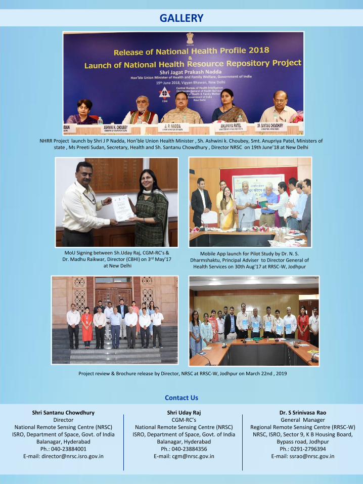
GALLERY
Contact Us
Shri Santanu Chowdhury Director
National Remote Sensing Centre (NRSC) ISRO, Department of Space, Govt. of India
Balanagar, Hyderabad Ph.: 040-23884001
E-mail: [email protected]
Shri Uday Raj CGM-RC’s
National Remote Sensing Centre (NRSC) ISRO, Department of Space, Govt. of India
Balanagar, Hyderabad Ph.: 040-23884356
E-mail: [email protected]
Dr. S Srinivasa Rao General Manager
Regional Remote Sensing Centre (RRSC-W) NRSC, ISRO, Sector 9, K B Housing Board,
Bypass road, Jodhpur Ph.: 0291-2796394
E-mail: [email protected]
MoU Signing between Sh.Uday Raj, CGM-RC’s & Dr. Madhu Raikwar, Director (CBHI) on 3rd May’17
at New Delhi
Project review & Brochure release by Director, NRSC at RRSC-W, Jodhpur on March 22nd , 2019
NHRR Project launch by Shri J P Nadda, Hon’ble Union Health Minister , Sh. Ashwini k. Choubey, Smt. Anupriya Patel, Ministers of state , Ms Preeti Sudan, Secretary, Health and Sh. Santanu Chowdhury , Director NRSC on 19th June’18 at New Delhi
Mobile App launch for Pilot Study by Dr. N. S. Dharmshaktu, Principal Adviser to Director General of
Health Services on 30th Aug’17 at RRSC-W, Jodhpur