national mineral exploration policy - … · national mineral exploration policy ... that india is...
TRANSCRIPT
NATIONAL MINERAL EXPLORATION POLICY(NON-FUEL AND NON-COAL MINERALS)
2016
www.mines.nic.in
We cannot imagine our world today without the use of mineral resources. Availability and use of minerals have been factors determining self-sufficiency of all countries. Nature has bestowed on India, through its fascinating geological setup, an immense potential for mineral resources at par with many mineral rich countries of the world. The mining sector, however, due to diverse reasons has not yet been able to adequately deliver on the promise which this endowment offers to the country. To realize this mineral potential in terms of mining activity and contribute commensurately to the growth of national economy is a challenge that we need to address.
To address this challenge, we have initiated a number of steps to ensure that the national economy receives the rightful contribution from its geological wealth. The Mines and Minerals (Development and Regulation) Amendment Act, 2015 is one major step which has invigorated the mining sector. It now mandates auction as only mode for grant of mineral concessions. However, to ensure a continuous flow of auctionable blocks, accelerating mineral exploration activity in the country is of vital necessity. The participation of private sector is equally important in exploration. National Mineral Exploration Policy (NMEP) provides a structured framework for comprehensive exploration in the country with a judicious interplay of government support and private innovation and enterprise.
The Policy displays a wide canvas wherein the government provides basic geoscience data to the public, creates a platform for collaboration of government, industry and academics, and has attractive provisions for private explorers through revenue share model to showcase their expertise, knowledge and enterprise.
Natural resources have to be explored, refined and processed for use in nation building.I would urge government agencies, academic and research institutions, mineral industry and other stake holders to rise to the occasion and contribute for full realization of country’s mineral potential. Let us all work together for doubling the share of mining sector in India’s GDP.
Narendra Singh Tomar
Narendra Singh Tomar Minister of Steel and Mines, Government of India
ujsUnz flag rksejbLikr ,oa [kku ea=h] Hkkjr ljdkj
It gives me immense pleasure to bring forth this National Mineral Exploration Policy. The Ministry of Mines has been seeking and devising methods and means to enhance and accelerate the growth of the mining sector. In this endeavor, the Mines and Minerals (Development and Regulation) Amendment Act, 2015 was promulgated. However, we realize that to harness the full potential of the Act, invigorating the mineral exploration sector is a vital necessity. Keeping this in mind the NMEP has been drafted giving due stress on the essential requirements for an effective framework and regime of comprehensive exploration of the mineral potential of the country.
For ensuring extensive and intensive exploration of the country, the NMEP has provided the basic requirements for explorers to foray with confidence into the challenging venture of mineral exploration. The explorers will have free access to basic geoscience data on geospatial platform, access to output of research programs for uncovering the concealed and deep seated deposits, and a structured regime where the risk of investment is mitigated to a reasonably large extent. The NMEP also provides for an industry driven centre for mineral targeting, which will provide a platform where crucially important diverse geoscientific issues of delineating potential zones for deep seated and concealed mineral deposits can be addressed through collaborative programs of government, academia and industry. The policy also provides a framework for utilization of the funds of National Mineral Exploration Trust for exploration as well as capacity building of the State Government exploration wings.
We are sure the NMEP will initiate an era of accelerated mineral exploration in the country. With the liberalized provisions, the policy offers, I look forward to the energy and enterprise which is inherent in our civilization to unravel the mineral wealth for development of the country.
Vishnu Deo Sai
Vishnu Deo Sai Minister of State for Steel and Mines, Government of India
fo".kq nso lk;bLikr ,oa [kku jkT; ea=h] Hkkjr ljdkj
It gives me immense satisfaction to bring forth this National Mineral Exploration Policy which offers a judicious framework for comprehensive mineral exploration in the country. It is a consensus amongst geoscientists that India is endowed with large mineral resource and has geological environment for many others. However, adequate survey and exploration have not been carried out in the country to discover the full potential. This requires a sound and comprehensive strategy to be implemented in a coordinated, systematic and consistent manner.
The MMDR Amendment Act, 2015 has brought in transparency in allocation of mineral concessions in terms of Prospecting License and Mining Lease. The present regime of grant of mineral concessions provides for Non Exclusive Reconnaissance Permit (NERP) which does not
allow seamless transitions to prospecting and mining licences. On account of this, the private sectors do not seem to be enthused to take up high risk of exploration. Keeping this in view, National Mineral Exploration Policy (NMEP) prescribes for incentivising the participation of private companies in exploration.
Under NMEP, private agencies would be engaged to carry out exploration with the right to a certain share in the revenue (by way of royalty/premium to be accruing to the state government) from the successful bidder of mineral block after e-auction, which will be discovered by that private explorer. The revenue sharing could be either in the form of a lump sum or an annuity, to be paid throughout the period of mining lease, with transferable rights.
It is common knowledge that acquisition, processing and interpretation of pre-competitive baseline geoscience information play a pivotal role in any successful exploration process. Keeping this in view, the policy assures that baseline geoscience data comprising geology, geochemistry, and geophysics will be generated as a public good and will be made available in public domain for free access. National Aero-geophysical Mapping program will be launched in the whole country. National Geoscience Data Repository (NGDR) will be set up which will collate and make available all baseline and mineral exploration information generated by various central and state government agencies.
The great challenge before us is to search for concealed and deep seated deposits. For this purpose, National Centre for Mineral Targeting (NCMT) will be set up on public private partnership which will be a unique applied research enterprise focusing on optimizing mineral exploration efforts of public and private sectors.
We are confident that with the number of initiatives outlined in the policy the country will enter into a new era of accelerated mineral exploration.
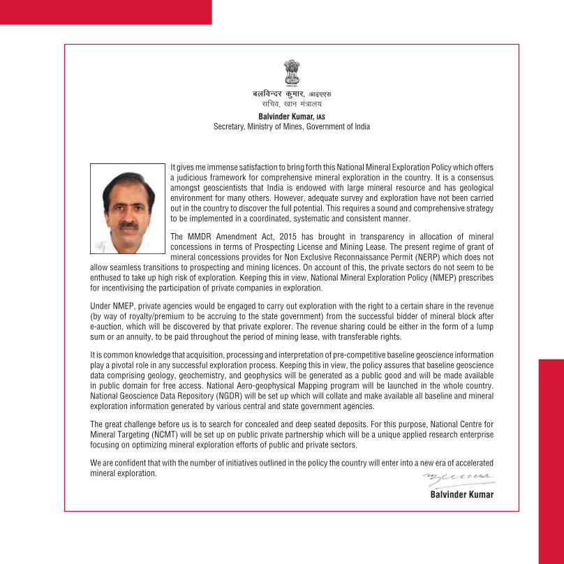
Balvinder Kumar
Balvinder Kumar, IAS Secretary, Ministry of Mines, Government of India
cyfoUnj dqekj] vkb,,llfpo] [kku ea=ky;
INDEX
1. PREAMBLE ............................................................................................................................ 1
2. SCOPE OF POLICY DOCUMENT ............................................................................................. 1
3. BACKGROUND ....................................................................................................................... 2
4. BASIC FEATURES OF THE NEW EXPLORATION STRATEGY .................................................. 5
5. PRE-COMPETITIVE BASELINE GEOSCIENCE DATA .............................................................. 6
6. REGIONAL EXPLORATION DATA ......................................................................................... 10
7. OFFSHORE MAPPING AND EXPLORATION ......................................................................... 10
8. NATIONAL GEOSCIENCE DATA REPOSITORY (NGDR) ....................................................... 11
9. OGP AREA AND ITS PERIODIC REVIEW .............................................................................. 12
10. PROBING DEEP SEATED/CONCEALED MINERAL DEPOSITS .............................................. 13
11. PRIORITIZATION OF REGIONAL AND DETAILED EXPLORATION ........................................ 13
12. PRIVATE SECTOR PARTICIAPTION IN EXPLORATION ........................................................ 14
13. ORE BENEFICIATION ........................................................................................................... 16
14. NATIONAL CENTRE FOR MINERAL TARGETING (NCMT) .................................................... 17
15. ROLE OF STATE GOVERNMENTS AND PUBLIC SECTOR UNDERTAKINGS (PSUs) ............. 19
16. PROCEDURES & CLEARANCES ........................................................................................... 20

1
NATIONAL MINERAL EXPLORATION POLICY(NON-FUEL AND NON-COAL MINERALS)
2016
1. PREAMBLE1.1 The country is endowed with vast resources of a variety of minerals and has favorable
geological settings for many others. However, vast geographical areas are still to be explored to the desired levels. Detailed exploration to understand and uncover this potential is crucial for the growth of Indian economy. This requires a sound and comprehensive mineral exploration policy/strategy to be implemented in a coordinated, systematic and consistent manner.
1.2 The country needs to formulate a suitable mineral exploration policy framework which:
(i) Establishes priorities, in terms of activities, mineral commodities, areas, mining technology etc.;
(ii) Identifies and defines roles for the groups of key players in the sector viz., government, the exploration industry, research and academic bodies, and financiers;
(iii) Recognizes that coordinated activity amongst all these players is vital to success in exploration and, therefore, creates the institutional mechanisms necessary for this purpose;
(iv) Outlines the changes in the enabling framework (legal, regulatory, financial and fiscal) required for obtaining the best results in exploration; and
(v) Estimates the resources required, in terms of funds, human capital and technology, and the means of harnessing these to the tasks ahead.
2. SCOPE OF POLICY DOCUMENT2.1 The National Mineral Exploration Policy (NMEP) document spells out the strategy and outlines
the action plan that the Government will adopt to ensure comprehensive exploration of country’s mineral resources (non-fuel and non-coal).
2
Successful exploration requires the bringing together of the best of knowledge and experience, the state-of-the-art technology, highly trained manpower, and also enormous financial resources, on an open, collaborative and inter-disciplinary platform. The major portion of the effort is clearly of the public good character.
3. BACKGROUND3.1 The framework governing exploration activity in the country can be considered essentially in
two parts:
a) The institutional and administrative framework through which precompetitive baseline data generation and exploration work is implemented; and
b) The legal and regulatory framework that governs the activities of various players in the sector, including the Government and the private sector.
3.2 Institutional and Administrative Framework
3.2.1 Geological Survey of India (GSI), since its inception in 1851, has been the most important institution that has performed the task of regional exploration of coal, lignite and non-fuel minerals. GSI is entrusted with the lead role in the task of carrying out geological mapping and acquiring other baseline geoscience data for the entire country. It generates and disseminates baseline geoscience data to other exploration agencies for accelerating the mineral exploration process. Directorates of Geology and Mines of some of the States have also made notable contributions in detailed exploration.Besides, Mineral Exploration Corporation Limited (MECL) and other Public Sector Undertakings carry out detailed exploration.
3.2.2 Since independence, GSI and the State Governments have discovered 60 important mineral deposits including 38 ‘greenfield’ discoveries. However, looking at the India’s likely mineral potential, there is an urgent need for accelerating exploration in the country through public and private participation.
3.3 Legal and regulatory framework governing exploration activities
3.3.1 Mines and Mineral (Development and Regulation) Act, 1957 is the main statute for the regulation of mines and mineral sector in the country. Under this Act, Mineral Concession Rules, 1960 and Mineral Conservation and Development Rules, 1988 were framed.
3
3.3.2 Subsequent to the economic liberalization in 1991, a comprehensive National Mineral Policy was announced in March 1993. The policy introduced for the first time the idea of encouraging private investment in exploration in mining. Consequently, amendments were made in the MMDR Act in January 1994. These amendments sought to simplify the procedure for grant of mineral concession so as to attract large investment through private sector participation, including foreign direct investment (FDI), and thereby, induct latest technology into the mining sector.
3.3.3 Despite the above initiatives, prospecting and mining activity could not be facilitated to the desired level. Later, based on recommendations made by the expert group constituted in the
4
Ministry of Mines in 1997, further amendments were made in MMDR Act in December 1999. The amended Act introduced the concept of reconnaissance operations as a distinct stage prior to prospecting, in terms of reconnaissance permit (RP). The RP holder had the preferential right for obtaining PL, and then ML subject to stipulated conditions.
3.3.4 The investment policy was liberalized progressively and in Feb 2006, 100 percent FDI through automatic route was allowed in mining sector. However, liberalization of investment regime and amendments in regulatory framework did not attract private investment as desired. Many companies put in their applications for RPs and PLs but very few of them have been finally converted into MLs. Inadequate resources with public sector agencies, such as, GSI and MECL and State governments’ agencies also remained a major challenge for the country. In this backdrop, a High Level Committee (HLC) was constituted by the Planning Commission in the year 2005 to suggest the changes needed for encouraging investment of public and private sector in exploration and extraction of minerals.
3.3.5 Based on recommendations of the HLC, revised National Mineral Policy was announced in 2008. The important features of this policy are: (a) grant of mineral concession of all types, such as RP, PL and ML, would be transparent and seamless and security of tenure be guaranteed to the concessionaries, (b) prospecting and mining is to be recognized as independent activities with transferability of concessions playing a key role in mineral sector development, (c) while government agencies would continue to perform the tasks assigned to them for exploration and survey, the private sector would be the main source of investment in reconnaissance and prospecting and government agencies would expend public fund primarily in areas where private sector investments are not forthcoming, (d) an open sky policy of non-exclusive reconnaissance work would be adopted to expedite completion of reconnaissance work for the entire country as early as possible.
3.4 Recent Policy Initiatives
3.4.1 In recent years, some major developments took place in mineral sector especially by way of judicial pronouncements, which were having far reaching ramifications. In brief, these developments led to the realization that all actions of the Government in the mines and mineral sector have to stand the test of Article 14 of the Constitution. In practical terms, this means that complete transparency and ‘equal opportunity for all’ must be ensured and the scope for arbitrariness and unfettered discretion must be eliminated in the allotment of mineral concessions.
5
3.4.2 The limited success of earlier policy measures, as well as the requirements of the new emerging imperatives, has led to the amendments made to the MMDR Act by the Amendment Act of 2015. The most important feature of this amendment is the grant of mining leases and composite licenses (prospecting licence-cum-mining lease) only through an auction process. The Mineral (Evidence and Mineral Contents) Rules 2015 specifies that for auction of mining lease, at least general exploration (G2) is required to be completed and for auction of composite licence, at least preliminary exploration (G3) to be completed. The amended Act also removed the earlier provision of RP and provided for non-exclusive reconnaissance permit (NERP). However, the holder of such NERP shall not be entitled to make any claim for grant of PL-cum-ML or ML. The amended Act also removed the restriction on lease transferability and allowed the transfer of mineral concession held by lease holders to any person eligible to hold such lease.
3.4.3 Further, the amended Act established National Mineral Exploration Trust (NMET) and the holder of a mining lease or PL-cum-ML would pay to the Trust a sum equivalent to 2 percent of the royalty paid in terms of the second schedule. The Trust is supposed to carry out regional and detailed exploration for minerals and related activities for development of exploration.
3.4.4 In the light of above amendments in MMDR Act and emergent need to provide an impetus to exploration in the country at this juncture has prompted a thorough review of exploration policy and strategy. The review revealed several areas that need added emphasis. A new Exploration Strategy has, therefore, been finalized with a view to provide new sense of purpose and direction within the amended legal framework.
4. BASIC FEATURES OF THE NEW EXPLORATION STRATEGY4.1 The exploration strategy will be centered on the following basic features:
(i) The Government will make available pre-competitive baseline geoscience data of the highest standards. This data will be continuously updated and benchmarked with those of other jurisdictions. The Government will specify the kind of data that will be provided to potential exploration agencies, and the timelines for their publication.
6
(ii) The pre-competitive baseline geoscience data will be made available for open dissemination free of charge.
(iii) Government will create baseline geoscience data as a public good and fund the generation and dissemination of such data.
(iv) Government will launch a special initiative to probe deep-seated/concealed mineral deposits.
(v) Public expenditure on regional and detailed exploration will be prioritized and subject to periodic review based on assessment of criticality and strategic interests.
(vi) Private sector participation in exploration will be encouraged within the existing legal framework. Government will work out suitable models for incentivizing private sector explorers. Government will also take steps to simplify procedural requirements for carrying out exploration by private sector.
(vii) Government will collaborate with scientific and research bodies, universities and industry for the scientific and technological development necessary for exploration.
(viii) Administrative structure for coordination amongst various agencies engaged in exploration will be reviewed and restructured.
5. PRE-COMPETITIVE BASELINE GEOSCIENCE DATA 5.1 Generation and dissemination of baseline data is of paramount importance for effective
exploration. It has been the experience from mineral rich countries that increased exploration activity, and discovery of economic resources, can be directly attributed to the release of pre-competitive baseline geoscience data. Further, high quality interpretation that can lead to the discovery of a deposit also depends upon the nature and resolution of data.
5.2 In keeping with the international best practices of providing pre-competitive baseline geoscience data to the stakeholders, Government intends to carry out the following in order to generate and disseminate data free of cost in public domain through web-based information system:
5.3 Geological Mapping
5.3.1 GSI has completed geological mapping on 1:50K scale of more than 98% of the mapable area
7
8
of the country. The remaining areas, which are inaccessible, are being covered incrementally on expedition basis. Digital geological maps will be made available in public domain.
5.4 National Geochemical Mapping (NGCM)
5.4.1 NGCM program was launched by GSI from the beginning of 10th Plan to gather information on the chemical behaviour of the material of the earth's crust. Under this program stream sediment samples at 1 km x 1 km grid are collected and composite samples of 2 km x 2 km are analyzed. In addition, soil, regolith, surface water and humus are also collected and analyzed. At present, 60 elements/ compounds like SiO2, Al2O3, Fe2O3, MgO, MnO, Na2O, K2O, gold, silver, cadmium, copper, mercury, lead, zinc etc are analyzed. Two more elements viz. platinum and palladium are analyzed in selected areas. All these elements are analysed with a precision level up to Clarke value.
5.4.2 Till March 2015, GSI has completed NGCM in an area of 0.54 million sq km in the entire country. Out of this, about 0.24 million sq km is within the OGP. GSI targets to cover the entire OGP area by the year 2018-19. Subsequently, NGCM will be carried out for the entire country in about eight years. Digital geochemical maps and data will be provided in public domain.
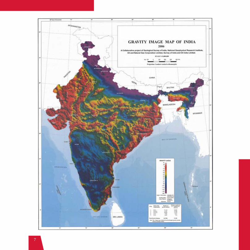
5.5 National Geophysical Mapping (NGPM)
5.5.1 NGPM Program was launched by GSI during 10th Plan period to gather information on the gravity and magnetic behaviour of the material of the earth's crust. Gravity (upto 0.1 mGal) and magnetic (5nT) data are collected at a station interval of 2.5 sq km.
5.5.2 NGPM has been completed in an area of 0.28 million sq km out of which 0.13 million sq km lies in the OGP area. GSI plans to cover the entire OGP area by 2020-21. Subsequently, NGPM will be carried out in the potential areas identified by the National Aerogeophysical Mapping project in the subsequent years. Digital geophysical maps and data will be provided in public domain.
5.6 Geo-chronological Studies
5.6.1 The modern mineral exploration practices involve generation of isotopic and geo-chronological data for understanding lithospheric architecture and metallogenic evolution through space and time. As per global best practices, high precision and high resolution geo-chronological data is an important component of baseline geoscience data. GSI would acquire a Sensitive High Resolution Ion Micro Probe (SHRIMP) for this purpose. The instrument will help understand the geological evolution of the cratons and mobile belts of India which are the conducive
9
locales for mineral formation. Further, stable isotope studies using SHRIMP will be of immense help in providing the laboratory support to critical exploration needs. With this instrument, GSI will develop a layer of Uranium-Lead (U-Pb) dates of all suitable rocks of the cratons and mobile belts of India.
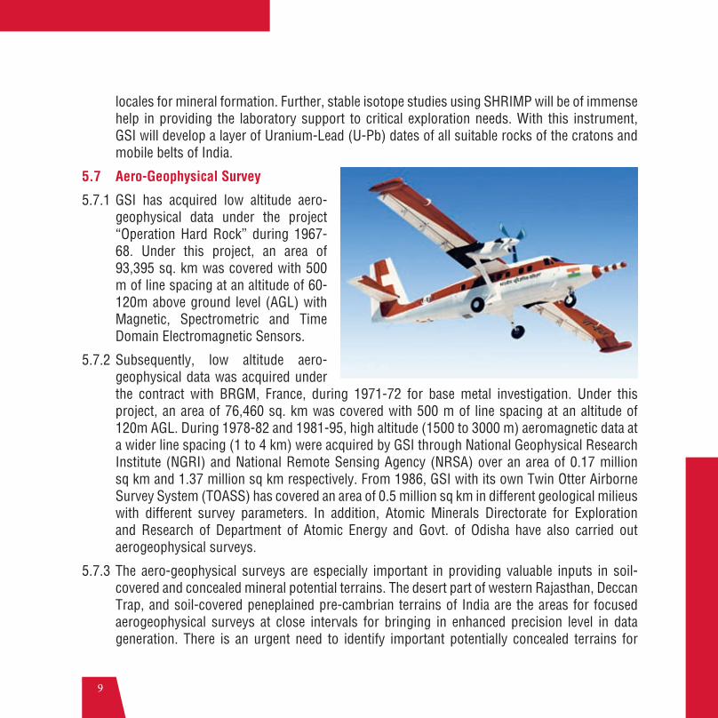
5.7 Aero-Geophysical Survey
5.7.1 GSI has acquired low altitude aero-geophysical data under the project “Operation Hard Rock” during 1967- 68. Under this project, an area of 93,395 sq. km was covered with 500 m of line spacing at an altitude of 60-120m above ground level (AGL) with Magnetic, Spectrometric and Time Domain Electromagnetic Sensors.
5.7.2 Subsequently, low altitude aero-geophysical data was acquired under the contract with BRGM, France, during 1971-72 for base metal investigation. Under this project, an area of 76,460 sq. km was covered with 500 m of line spacing at an altitude of 120m AGL. During 1978-82 and 1981-95, high altitude (1500 to 3000 m) aeromagnetic data at a wider line spacing (1 to 4 km) were acquired by GSI through National Geophysical Research Institute (NGRI) and National Remote Sensing Agency (NRSA) over an area of 0.17 million sq km and 1.37 million sq km respectively. From 1986, GSI with its own Twin Otter Airborne Survey System (TOASS) has covered an area of 0.5 million sq km in different geological milieus with different survey parameters. In addition, Atomic Minerals Directorate for Exploration and Research of Department of Atomic Energy and Govt. of Odisha have also carried out aerogeophysical surveys.
5.7.3 The aero-geophysical surveys are especially important in providing valuable inputs in soil-covered and concealed mineral potential terrains. The desert part of western Rajasthan, Deccan Trap, and soil-covered peneplained pre-cambrian terrains of India are the areas for focused aerogeophysical surveys at close intervals for bringing in enhanced precision level in data generation. There is an urgent need to identify important potentially concealed terrains for
10
undertaking aero-geophysical surveys with state of the art technology.
5.7.4 There is an urgent need for collecting aerogeophysical data on a uniform flight height and spacing. GSI has planned to take up a National Aerogeophysical Mapping Program (NAGMP) involving acquisition of aeromagnetic, electromagnetic, radiometric and gravity data. Initially, an area of about 0.8 million sq km including OGP area will be taken up on priority and completed by 2020-21. The project is proposed to be started in 2016-17. For the rest of the country (about 2.4 million sq. kms.), aerogeophysical survey will be carried out subsequently. The analog/digital aeromagnetic map and data will be provided in public domain.
6. REGIONAL EXPLORATION DATA6.1 GSI has a repository of more than 8500 geological reports (GR) of mineral investigations
carried out since 1941. These reports can be immensely useful for planning exploration strategies and focusing on targets. Metadata of all these reports are accessible on the GSI portal. More than 6100 full reports are also available on the GSI portal. In order to facilitate easy access, extraction, analysis and interpretation of these data by users, GSI has recently started carrying out digitization of all its mineral exploration reports. All data including maps and tables containing physical and chemical characteristics of samples, litho logs, etc., will be digitized and stored on a geospatial format. This data is proposed to be made available in the GSI portal by mid 2016 and will be available to all users free of charge.
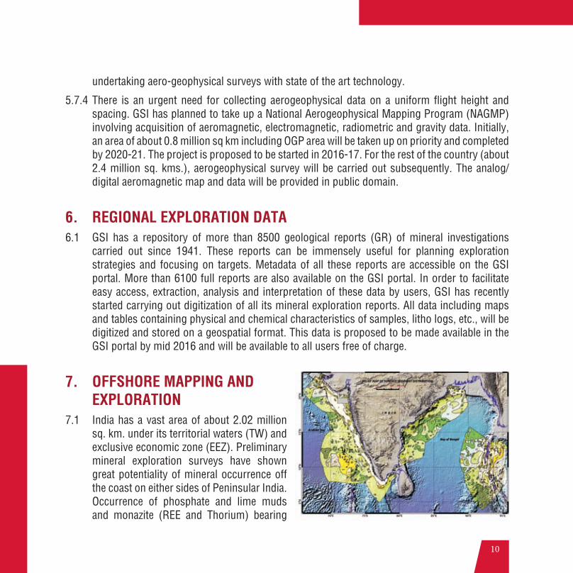
7. OFFSHORE MAPPING AND EXPLORATION
7.1 India has a vast area of about 2.02 million sq. km. under its territorial waters (TW) and exclusive economic zone (EEZ). Preliminary mineral exploration surveys have shown great potentiality of mineral occurrence off the coast on either sides of Peninsular India. Occurrence of phosphate and lime muds and monazite (REE and Thorium) bearing
11
heavy suite of minerals have been mapped and sparsely sampled for a depth of 1-2 meters only. The ninety degree east ridge in the Bay of Bengal is an extensive mega-linear submarine structure known for modern day ore forming mineral muds. Co-Ni-Mn-Fe bearing nodules on the ocean floor are recorded off the coasts of India. This provides a considerable scope for mineral targeting in offshore areas of India.
7.2 GSI has systematically mapped on reconnaissance scale an area of 1.98 million sq km in the EEZ with 40 km/20 km spaced traverses and detailing to 5 to 10 km tracks at selected sectors. Based on the seabed mapping data, preliminary mineral investigation has been carried out in an area of 0.43 million sq. km. with a sampling grid ranging from 5 km x 2 km to 1 km x 1 km.
7.3 Survey as well as assessment of mineral resources within the EEZ constitutes a key responsibility of GSI. GSI needs to plan its programmes keeping in view the Coastal Regulation Zone notification, 2012 of the MoEF&CC, which stipulates that mining of minerals, except for rare minerals not available outside the CRZ, is not permitted within the limits of the TW. GSI will identify through its regional exploration activities mineral resources for allocation of exploration license and production lease.
7.4 The work of marine survey and exploration will be carried out by GSI in coordination with Ministry of Earth Sciences and National Institute of Oceanography through the CGPB mechanism.
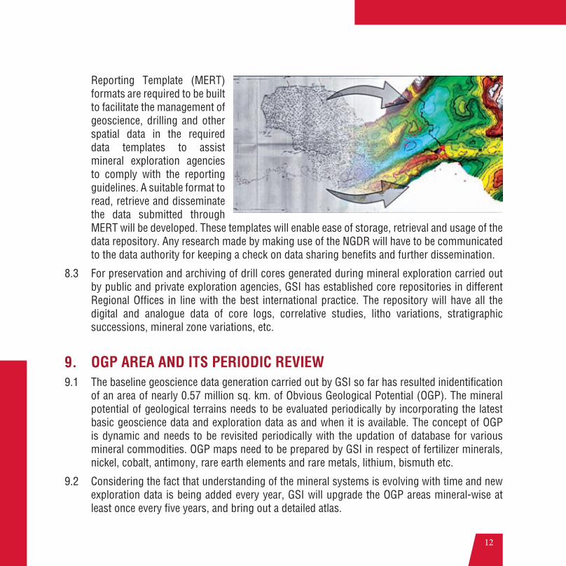
8. NATIONAL GEOSCIENCE DATA REPOSITORY (NGDR)8.1 All geological, geochemical, geophysical and mineral exploration data needs to be made
available in public domain on a digital geospatial platform. Accordingly, a National Geoscience Data Repository (NGDR) will be set up by GSI. This will collate all baseline and mineral exploration information generated by various central and state government agencies and also mineral concession holders and maintain these on a geospatial database. This database will be made available in public domain through an appropriate mechanism. GSI will build up capacity for collating, processing and interpretation of geosciences information.
8.2 National standard in regards to submission of softcopies of mineral exploration reports need to be initiated in line with those in developed countries. These standards should include guidelines in relation to the submission of mineral exploration digital data. Mineral Exploration
12
Reporting Template (MERT) formats are required to be built to facilitate the management of geoscience, drilling and other spatial data in the required data templates to assist mineral exploration agencies to comply with the reporting guidelines. A suitable format to read, retrieve and disseminate the data submitted through MERT will be developed. These templates will enable ease of storage, retrieval and usage of the data repository. Any research made by making use of the NGDR will have to be communicated to the data authority for keeping a check on data sharing benefits and further dissemination.
8.3 For preservation and archiving of drill cores generated during mineral exploration carried out by public and private exploration agencies, GSI has established core repositories in different Regional Offices in line with the best international practice. The repository will have all the digital and analogue data of core logs, correlative studies, litho variations, stratigraphic successions, mineral zone variations, etc.
9. OGP AREA AND ITS PERIODIC REVIEW9.1 The baseline geoscience data generation carried out by GSI so far has resulted inidentification
of an area of nearly 0.57 million sq. km. of Obvious Geological Potential (OGP). The mineral potential of geological terrains needs to be evaluated periodically by incorporating the latest basic geoscience data and exploration data as and when it is available. The concept of OGP is dynamic and needs to be revisited periodically with the updation of database for various mineral commodities. OGP maps need to be prepared by GSI in respect of fertilizer minerals, nickel, cobalt, antimony, rare earth elements and rare metals, lithium, bismuth etc.
9.2 Considering the fact that understanding of the mineral systems is evolving with time and new exploration data is being added every year, GSI will upgrade the OGP areas mineral-wise at least once every five years, and bring out a detailed atlas.

13
10. PROBING DEEP SEATED/CONCEALED MINERAL DEPOSITS10.1 GSI will initiate a project for probing deep seated/concealed mineral deposits. Characterizing
India’s cover, investigating India’s lithospheric architecture, resolving 4D geodynamic and metallogenic evolution, and detecting and characterizing the distal footprints of ore deposits, would be the main components of this initiative. This initiative is proposed to be taken up immediately on a pilot scale. GSI will seek collaboration with prestigious agencies in India, such as National Geophysical Research Institute (NGRI) and the proposed National Centre for Mineral Targeting (NCMT) and abroad. An approximate length of 500 km will be taken up under the pilot project.
10.2 The major work components would include:
1. Regolith characterization (transported/local, source rock)
2. Depth of basement (depth of quaternary sediments/regolith cover over basement)
3. Detect and recognize distal footprints.
11. PRIORITIZATION OF REGIONAL AND DETAILED EXPLORATION11.1 Global exploration priorities in respect of expenditure in mineral exploration are broadly defined
by the economics of the demand and supply of various minerals. Over the past several years, gold has claimed the major share of global expenditure in exploration, amounting to around half of the total budget.
11.2 In India, GSI is mainly mandated with the task of regional exploration and there is no other agency doing this work in a substantive way. Some of the State Governments have also carried out regional exploration and discovered significant deposits. MECL, a central PSU carries out detailed exploration, however, the promotional work done by MECL is negligible. GSI has prioritized its mineral exploration programmes for base metals, noble metals, diamond and Rare Earth Elements (REE) and Platinum Group Elements (PGE) minerals. The demand-supply in respect of various mineral commodities is dynamic and fast changing. Indian Bureau of Mines (IBM) will develop a mechanism for fixing national priorities based on mineral intelligence information. These priorities will be subject to periodic review. Special care will be taken to ensure that critical minerals for industry and strategic minerals vital for national security are
14
given the requisite priority.
11.3 The Central Geological Programming Board (CGPB) is the nodal agency for formulating and detailing exploration programmes in close coordination with the GSI, stakeholder ministries and associations and State geology departments. The CGPB, with its 12 thematic committees, formulates short term and long term plans, and coordinates the activities in the mandate and priorities of the National Mineral Policy.
11.4 The CGPB will, every year, on a suitable date, work out suggested priorities for public funded regional and detailed exploration, both for the immediately following Plan year, as well as on a rolling basis for the next 5 years. This scheme of priorities for the annual plan and the rolling 5 year Plan will be examined and discussed with all the stakeholders and, after approval, be communicated to all the entities working in the field so as to draw up a detailed field level action programme as well.
12. PRIVATE SECTOR PARTICIAPTION IN EXPLORATION12.1 Government’s objective is to facilitate, encourage and incentivize private sector participation
in all spheres of mineral exploration. Government intends to harness the technical expertise, technological capability and the financial resources of the private sector to discover and exploit the country’s vast mineral resources.
12.2 Participation of private sector in exploration depends on the following:
(a) Availability and free accessibility of comprehensive, pre-competitive baseline geoscience data;
(b) Incentives structures that provide an appropriate risk-return scenario; and
(c) Ease of doing business and earning attractive returns from the investment.
12.3 Generation and free dissemination of pre-competitive geoscience data has been dealt with at length in the earlier parts of this policy paper.
12.4 The legal framework currently in place has two types of mineral concessions for carrying out exploration which can be obtained by private sector participants, namely, non-exclusive reconnaissance permit (NERP) and the composite license (Prospecting License-cum-Mining
15
Lease). Composite Licence in the amended Act ensures the participation of private entrepreneur in carrying out detailed exploration with assurance of tenurial security of the mining lease.
12.5 In order to provide incentives to NERP holders, the amended MMDR Act provides the option to either retain the reconnaissance data with themselves in contrast to the earlier requirement of mandatorily sharing of information pertaining to exploration with the State Governments or to opt for submitting the information to the State Governments in case blocks are of auctionable nature. The present procedure of e-auctions also permit the holder of any NERP to participate in the auction process and in a way effectively exercise the option of first right of refusal. This procedure is also consistent with the overall policy of Government not to allot any mineral concession other than through auction process.
12.6 Full transferability of mineral concessions at any stage has also been allowed under the Amended MMDR Act, 2015. The experience abroad seems to indicate that several transfers take place between initial exploration and commercial mining of a deposit. The very requirement for effecting a transfer of mining lease or composite license of PL cum ML now built into the Act
16
will help the exploration agencies interested only in particular segments of the activity and value chain (say prospecting, exploration, feasibility study or mining) to enter and exit with ease.
12.7 Private agencies could be engaged to carry out exploration work in identified block/areas with the right to a certain share in the revenue (by way of certain percentage of royalty/premium) accruing to state government throughout the lease period, with transferable rights. This percentage/amount will be paid by successful bidder to the concerned exploring agency and to be determined when mineral blocks on the basis of successful exploration are put on e-auction.
12.8 Such revenue sharing could be either in the form of a percentage of royalty/premium for throughout the concession period (of 50 years) or a lump sum amount, to be calculated on the basis of net present value of that share of royalty/premium to be accrued during the lease period. Further, the exploration agencies will be allowed to participate in e-auctioning when mineral blocks after successful exploration are put on auction.
12.9 Government will also work out normative cost of exploration works for different kinds of minerals so that the exploration agencies could be compensated, in case they could not discover any mineable reserves in their respective areas. This will be an added incentive for exploration agencies to mitigate their risk for exploration works.
12.10 Different options can be exercised in combination or alone to attract global level exploration agencies for carrying out exploration especially forconcealed and deep seated minerals like diamond, gold, PGE, nickel etc which require specialized technical knowledge and the latest technology.
12.11 Government will develop model contracting procedures and standard agreement templates under which State Governments and their agencies can engage private sector expertise in specific exploration cases. The government will provide hand holding support to the State Governments in this process of engaging the private sector for mineral exploration. Further, the government will keep provisions to mitigate the risks of the private explorers in carrying out mineral exploration under the scheme.
13. ORE BENEFICIATION13.1 Ore beneficiation studies and related mineralogical and chemical characterization of the ore/
gangue minerals is vital in assessing economic feasibility of mineralization. In view of the
17
marginal/low grade nature of the many ores of our country, focus on beneficiation techniques is a vital necessity.
13.2 Indian Bureau of Mines (IBM) is the principal agency for undertaking ore beneficiation studies. There are five major areas that need to be focused upon by IBM:
i. Identification of lean ores or waste of important technology metals and development of beneficiation mechanisms along with other labs and institutions.
ii. Identification of crucial apparatus/equipment that are dependent on imports. IBM needs to work on cost effective capital equipment development in the country.
iii. Energy efficiency studies in mineral processing.
iv. Water conservation and water recycling circuits in mineral processing.
v. Upgradation of existing processes to make them more environmental friendly.
14. NATIONAL CENTRE FOR MINERAL TARGETING (NCMT)14.1 India has exploited most of its outcrop and near surface mineral deposits. It has become
imperative to focus on identification of deep-seated (below 300 m to 1000 m in the initial phase) and concealed mineral targets. Such an exercise requires thorough understanding of the geological and geochemical framework, knowledge of occurrence ore-forming mineral systems and the extent of thickness of non-mineralized cover rocks over the concealed mineral producing belts. Geophysical studies always play a vital role in exploration of buried ore deposits.
14.2 Deep exploration is a cost-intensive exercise with high degree of uncertainty and risk. It is, therefore, essential to adopt an integrated approach for selecting suitable geological tracts
18
before undertaking multidisciplinary geo-scientific surveys and subsequent deep drilling projects. If country is to look for sizeable new resources for sustained growth of its mineral-based industry, the country has to embark on a systematic programme of capacity building in mineral targeting.
14.3 This capacity building programme has to be a multi-disciplinary and collaborative effort that brings together the best of expertise in the GSI, academic and research institutions and the exploration and mining industry. Mineral targeting on a stand-alone basis is not an economically viable proposition for public and private mining agencies.
14.4 This activity is proposed to be housed in a not-for-profit autonomous body/company registered under Section 8 of the Companies Act, 2013, as a private-public partnership and will be called the National Centre for Mineral Targeting (NCMT). Government will contribute a part of the seed funding for this venture.
14.5 The NCMT will be a unique applied research enterprise focusing on increasing the discovery rate in mineral exploration and the quality of discoveries without relying on substantial increases in exploration expenditure. NCMT will aim
19
to add value to the mineral exploration sector through various collaborative research, training and information dissemination programs.
14.6 This approach is expected to allow maintaining the balance between fundamental and applied research outputs by ensuring that fundamental research is aligned with application in mineral sector. NCMT will fill the knowledge gap in the field of mineral exploration and act as a think tank for the overall development of the sector.
14.7 The output of the NCMT will be tailored to the requirements of the mineral sector and will have direct benefit of the public and private exploration and mining agencies.
14.8 Drilling is correlated with exploration success. The annual exploration drilling in India of about 0.5 million meters is way below global standards. Developed countries significantly invest in research on drilling technology to enhance the efficiency and quality of drilling. Many countries have dedicated centres for this purpose which has resulted in advances in drilling technology, safety and reduced environment impact. The NCMT will also address research and adoption of such fast track, environmental friendly drilling technology.
15. ROLE OF STATE GOVERNMENTS AND PUBLIC SECTOR UNDERTAKINGS (PSUs)
15.1 State Governments have a key role to play in building up a steady stream of auctionable mineral prospects. They will have to take up mineral exploration reports prepared by the GSI or other agencies and build on them to complete G3 or G2 level of exploration. States also need to build up the exploration capabilities of their staff. The Central Government will have to provide suitable incentives to expedite this process. Capacity building of States will be supported by the NMET.
15.2 In order to bring in greater number agencies for regional scale mineral exploration in the country, a significant provision has been incorporated in the MMDR Amendment Act, 2015. In pursuance of this provision the government has permitted several public sector undertakings in addition to GSI & MECL, to carry out prospecting operations without license or lease. In order to accelerate Greenfield discoveries, regional exploration by these PSUs including MECL will be encouraged. The activities of these agencies will be coordinated and monitored through the CGPB mechanism.
20
16. PROCEDURES & CLEARANCES16.1 The existing procedure for grant of mineral concession and procedural complexities for obtaining
clearances from a number of different authorities are identified as one of the deterrent in the development of exploration in mining sector. In case of RPs where clearance is required for aerial survey, the exercise involves clearances from different governmental agencies including Directorate General of Civil Aviation (DGCA) and Ministry of Defence.Efforts will be made to simplify the procedure for obtaining such permissions in time bound manner.
16.2 Clearances are also required from Ministry of Environment, Forest and Climate Change (MoEF&CC) separately from forest angle. While Reconnaissance surveys carried out in connection with mineral exploration do not attract the provisions of the Forest Conservation Act (FCA), 1980 as along as these surveys do not involve any clearing of forests or cutting of trees, prospecting under a PL granted under MMDR Act would require permission under FCA. Exploration guidelines of United Nation Framework Classification (UNFC) require a minimum number of bore holes per unit area to be drilled for various levels of exploration.The present guidelines of MoEF&CC do not provide for automatic approval of exploration to be carried out in compliance with UNFC guidelines. Though some relaxations have been permitted, further relaxations for prospecting operations especially in areas with lower canopy density are required. Ministry of Mines will endeavor to move in the direction of automatic approvals for the exploration levels mandated by UNFC.