national space-based positioning, navigation, and timing …€¦ · · 2014-04-07national...
TRANSCRIPT

NATIONAL SPACE-BASED POSITIONING, NAVIGATION,
AND TIMING (PNT) ADVISORY BOARD MEETING MINUTES
Twelfth Meeting
December 4-5, 2013
The Omni Shoreham Hotel
2500 Calvert St NW
Washington, DC 20008

National Space-Based Positioning, Navigation, and Timing Advisory Board Meeting Minutes, December 4-5, 2013
2
Twelfth Meeting Agenda
December 4-5, 2013
The Omni Shoreham Hotel 2500 Calvert St NW
Washington, DC 20008
Wednesday, December 4, 2013
9:00 – 9:05 BOARD CONVENES Mr. James J. Miller, PNT Advisory Board Call to Order Executive Director, NASA Headquarters
9:05 – 9:30 Introductions, Announcements, & Primary Agenda Items Hon. James Schlesinger, Chair Welcome of New Members & GPS Economic Assessment Dr. Bradford Parkinson, Vice-Chair
9:30 – 9:50 Update from National Coordination Office for Space-Based PNT Col. Harold “Stormy” Martin, Deputy Director, Emerging Issues from the National Space-Based PNT EXCOM Space-Based PNT National Coordination Office
9:50 – 10:20 GPS Signal (Civil Navigation) CNAV Implementation Plan Major General Marty Whelan, Director of CNAV Test Results & Road Ahead Requirements, Air Force Space Command
10:20 – 10:50 Update from U.S. Department of Transportation (DOT) Ms. Karen Van Dyke, Director for PNT, DOT NDGPS, Civil Signal Monitoring, & GPS Adj. Band Compatibility Research & Innovative Technology Administration
10:50 – 11:05 BREAK
11:05 – 11:30 NASA Options for Reduced Costs, Time, & Complexity to Deploy Dr. Yoaz Bar-Sever, Manager, Global Differential Global Differential GPS (GDGPS) as a Civil Monitoring Utility GPS System, Jet Propulsion Laboratory
11:30 – 12:00 Precise Positioning - Automated Driving & Safety Communications Mr. Russell Shields, PNT Board Member, GPS Technology Innovations & Networking Applications Founder and Chair of Ygomi LLC
12:00 – 1:00 WORKING LUNCH – Ethics Training Mr. Adam Greenstone, NASA General Counsel
1:00 – 1:30 GPS Disruptions: Efforts to Assess Risks to Critical Infrastructure Mr. Eli Albagli, Senior Analyst, Government GAO Report on Enhancing Interagency Actions Accountability Office (GAO)
1:30 – 2:00 2013 National Infrastructure Protection Plan (NIPP) Update Mr. Robert Kolasky, Director, Strategy and Department of Homeland Security (DHS) Implementation Policy, DHS Office of Infrastructure Protection
2:00 – 2:30 2014 Quadrennial Homeland Security Review (QHSR) Dr. Caryl Brzymialkiewicz, Deputy Assistant DHS Strategic Environment Assessment & Partnerships Secretary for Risk and Decision Analysis, Office of Strategy, DHS Policy 2:30 – 2:45 BREAK
2:45 – 3:15 3 Panel Presentations on GPS Benefits & Spectrum Valuation Dr. Nam D. Pham, Economist/Managing Partner, 1. Economic Impacts of GPS on Key Sectors in the U.S. Economy NDP Consulting Group
3:15 – 3:45 2. Benefits & Spectrum Valuations Derived from Emerging Mr. Bartlett Cleland, Spectrum Policy Expert, Mobile Broadband Applications former TechAmerica

National Space-Based Positioning, Navigation, and Timing Advisory Board Meeting Minutes, December 4-5, 2013
3
3:45 – 4:15 3. Challenges Ahead for GPS Markets in Evolving Spectrum Hon. John Kneuer, Spectrum Policy Expert, Sharing Environments & Some Proposed Solutions former NTIA Administrator
4:15 – 4:45 Panel Q&A Discussion with Pham, Cleland, & Kneuer All PNT Board Members
4:45 – 5:00 Preliminary Feedback - Roundtable Afternoon “Wrap-Up” All PNT Board Members
5:00 ADJOURN
Thursday, December 5, 2013 9:00 – 9:05 BOARD CONVENES Mr. James J. Miller, PNT Advisory Board Executive Call to Order Director, NASA
9:05 – 9:15 Announcements & Agenda Focus Hon. James Schlesinger, Chair Quick Thoughts and Guidance from December 4 Discussions Dr. Bradford Parkinson, Vice-Chair
9:15 – 9:40 GNSS Signal Compatibility – Multi-Constellation Management Dr. A.J. Van Dierendonck, AJ Systems & R.J. Cross-Correlation of Existing & Evolving C/A System Signals Erlandson, FAA Consultant
9:40 - 10:05 United States International Activities & Engagement Mr. Ken Hodgkins Director, Office of Space & How far to take GNSS Interoperability/Interchangeability? Advanced Technology, State Department
10:05 – 11:05 International Member “Quick 10-Minute” Regional Updates (at member’s discretion) Dr. Gerhard Beutler Switzerland Dr. Elizabeth Cannon Canada Mr. Arve Dimmen Norway Mr. Matt Higgins Australia Dr. Hiroshi Nishiguchi Japan Dr. Rafaat Rashad Egypt
11:05 – 11:15 BREAK
11:15 – 12:00 PNT Advisory Board Member 2013 – 2015 Work Plan Set-Up Intro by Governor Jim Geringer, PNT Board, Establish Expectations, Work Structure, Scope, Timeline, Environmental Systems Research Institute (ESRI) Assignments, and Deliverables for National PNT EXCOM
(1) What top level national questions need to be answered?
(2) What challenges lie ahead for providers and users?
(3) What are the options for resolution?
Proposed Focus Areas / PNT Board Working Groups (WGs) Establish WG Leads, Membership, & Drafting (1) Economic Value of GPS to U.S. Assignments -- Follow-Up from“Fact-Finding” (2) Spectrum Allocations/Reallocations Organizational Discussion on December 3 (3) PNT Unavailability
(4) Affordability Options
(5) Foreign GNSS Contributions
Recommendation Template Guidelines Feedback by All PNT Advisory Board Members (1) PNT Advisory Board Working Group Recommendations Develop any additional Recommendations, Findings, (2) Major Reasons for Proposing Recommendation & Proposed Topics for presentation to PNT EXCOM (3) Consequences of No Action on Proposed on December 10 Recommendation
12:00 – 1:00 WORKING LUNCH
1:00 ADJOURNMENT

National Space-Based Positioning, Navigation, and Timing Advisory Board Meeting Minutes, December 4-5, 2013
4
Table of Contents
Call to Order: Wednesday, December 4, 2013 5
Mr. James J. Miller
Introductions, Announcements, & Primary Agenda Items
Hon. James Schlesinger, Chair; Dr. Bradford Parkinson, Vice-Chair 5
Update from the National Coordination Office for Space-Based PNT 6
Col. Harold “Stormy” Martin
GPS Signal CNAV Implementation Plan 8
Major General Martin Whelan
Update from DOT 9
Ms. Karen Van Dyke
NASA Options for Reduced Costs, Time and Complexity to Deploy 13
Dr. Yoaz-Bar Sever
Precise Positioning – Automated Driving & Safety Considerations 14
Mr. Russell Shields
GPS Disruptions: Efforts to Assess Risks to Critical Infrastructure 15
Mr. Eli Albagli
2013 NIPP 18
Mr. Robert Kolasky
2014 QHSR 19
Ms. Hala Furst
Three-member Panel Presentation of GPS Benefits and Spectrum Valuation
1. Economic Impacts of GPS on Key Sectors in the U. S. Economy, 20
Dr. Nam D. Pham
2. Benefits & Spectrum Valuations Derived from Emerging Broadband Applications, 21
Mr. Bartlett Cleland
3. Challenges Ahead for GPS Markets in Evolving Spectrum Sharing Environments 22
& Some Proposed Solutions, Hon. John Kneuer
Call to Order: Thursday, December 5, 2013 25
Mr. James J. Miller
Announcements and Agenda Focus
Dr. James Schlesinger, Chair; Dr. Bradford Parkinson, Vice-Chair 25
GNSS Signal Capability – Multi-Constellation Management 27
Dr. A. J. Van Dierendonck
United States International Activities & Engagement 28
Mr. Ken Hodgkins
International Member Regional Updates & Perspectives (at member's discretion)
Dr. Gerhard Beutler, Germany 30
Dr. Elizabeth Cannon, Canada 31
Mr. Arve Dimmen, Norway 31
Mr. Matt Higgins, Australia 31
Dr. Hiroshi Nishiguchi, Japan 32
Dr. Rafatt Rashad, Egypt 32
PNT Advisory Board Member 2013-2015 Work Plan Set-Up 33
Appendix A: Advisory Board Members 36
Appendix B: Presentations and Reports 37
Appendix C: Attendee Sign-Up 38
Appendix D: Acronyms / Definitions 40

National Space-Based Positioning, Navigation, and Timing Advisory Board Meeting Minutes, December 4-5, 2013
5
SPACE-BASED POSITIONING, NAVIGATION, & TIMING (PNT) ADVISORY BOARD
The session of Wednesday, December 4, 2013 convened at 9 a.m.
Board Convenes: Call to Order
Mr. James J. Miller, Executive Secretary
Mr. James J. Miller, Executive Secretary, convened the twelfth session of the National Space-Based Positioning, Navigation, &
Timing (PNT) Advisory Board. He stated his appreciation to those in attendance. He reminded members that the Advisory
Board functions under the rules of the Federal Advisory Committee Act (FACA) of 1973 and, therefore, formal meeting minutes
and all presentations are posted on the National Coordination Office (NCO) website (www.gps.gov). He particularly welcomed
the six new members of the Advisory Board and thanked Gen Martin Whelan for his attendance.
Introductions, Announcements, & Primary Agenda Items
Hon. James Schlesinger, Chair
Dr. Bradford Parkinson, Vice-Chair
Dr. James Schlesinger, Chair, stressed that the renewal of the PNT Advisory Board charter offers an opportunity to address the
challenges and changes in the field. He quoted Albert Einstein: “We cannot solve our problems with the same thinking we used
when we created them.” Dr. Schlesinger observed that changing technologies in all aspects of the Global Positioning System
(GPS) world provide great opportunities to increase the system’s utility. However, such improvements can at times be inhibited
because of overreliance on outdated concepts. For example, past adherence to Selective Availability (S/A) slowed down progress
and needlessly absorbed a considerable amount of resources. The Advisory Board is empowered to call attention to those areas
of GPS operation that needed addressing and those circumstances that impede system progress. Dr. Schlesinger welcomed all
members, particularly those attending their first meeting. He also welcomed Gen Martin Whelan, representing Gen William L.
Shelton, Commander, Air Force Space Command (AFSPC). AFSPC holds stewardship for GPS. He looked forward to a report
on the new L2C and L5 navigation signals and activation of the navigation message (CNAV), which the Advisory Board has
been awaiting since 2006. Dr. Schlesinger introduced the new Advisory Board members, asking each to comment on their
associations with GPS and to identify the greatest challenge they hoped to address:
Admiral Thad Allen is past Commandant of the U.S. Coast Guard (USCG). His first interaction with electronic
navigation came in 1971 with Loran as a deck watch officer in the Coast Guard. He has followed the development of
electronic navigation since that time. He believes GPS is a critical infrastructure that makes a vital contribution to the
entire world economy.
Dr. Penina Axelrad is Chair of the Department of Aerospace Engineering Sciences at the University of Colorado at
Boulder, and has been involved with GPS since 1986. She believes that challenges to GPS include the need for
continuous innovation that takes full advantage of emerging capabilities. Much of the progress has been as an
unintended spinoff of other activities.
Dr. John Betz is a MITRE Corporation Fellow. In addition to his technical expertise he has also worked on GPS-related
negotiations with both Europe and Japan. He believes all Advisory Board members recognize the challenge of
maintaining GPS in the current budgetary environment. In the current decade, the true operational capability of other
Global Navigation Satellite Systems (GNSS) should become known. GPS needs to find ways to take advantage of the
multi-GNSS environment.
Russell Shields is co-founder and chair of Ygomi LLC. His background is in software engineering. He thought he was
finished with GPS-related activities after his organization sold Navteq to Nokia. Now his colleagues are investigating
new technologies with a particular focus on the automotive industry.
Matt Higgins is President of the International Global Navigation Satellite Systems Society, an Australia-based not-for-
profit organization, and is also manager of Geodesy and Positioning with the Department of Natural Resources and
Mines for the Queensland Government in Australia. He has also worked on various national Australian GPS matters.
He also represents the International Federation of Surveyors at the International Committee on GNSS (ICG). He
believes a major challenge is to continue emphasizing the importance of GNSS. He will bring perspectives on China
and Russia, both of whom were seeking to establish ground stations in Australia.
Dr. Elizabeth Cannon is President and Vice Chancellor of the University of Calgary, and she represents the Canadian
Aeronautics and Space Institute. She commended the Advisory Board for including six international members, and

National Space-Based Positioning, Navigation, and Timing Advisory Board Meeting Minutes, December 4-5, 2013
6
noted that she and Dr. Axelrad had previously met as students. She hopes to bring news on Canadian GPS activities
and to take back ideas for possible technical undertakings to Canada. GPS technologies are ubiquitous worldwide, and
this brings expectations from users for availability and performance. The Advisory Board should discuss how these
expectations could be met.
Dr. James Schlesinger thanked the new members for their commitments of time and energy.
* * *
Dr. Schlesinger described the “issues of interest” faced by the Advisory Board. Federal budgetary limitations are likely to
continue and cause changes to Department of Defense (DoD) programs. However, he feels assured that the current level of GPS
services will be maintained. The Air Force continues to meet its GPS performance and availability commitments to users. The
Air Force is also committed to improvements both in satellites and in the control system. While some “slippages” in the GPS III
program have occurred, he is confident that the DoD and the Air Force will maintain the level of service. The agenda for the
PNT Board session is “robust” and includes much information from key government and industry players.
Dr. Schlesinger said Dr. Jan Brecht-Clark, NCO Director, would provide an overview on current efforts. Dr. Schlesinger said the
PNT Executive Committee (PNT EXCOM) is scheduled to meet on December 10, 2013. Both he and Dr. Brad Parkinson, Vice
Chair, plan to attend. The Executive Branch has continued to have concerns on protecting the GPS frequency bands. Several
presentations will address this topic. In addition, the Advisory Board will hear status reports on efforts to have GPS declared a
critical infrastructure. Furthermore, the board will receive updated reports on the economic value of GPS services. The Advisory
Board’s economic study should be both complete and credible.
Dr. Parkinson agreed; the Advisory Board must not present any figures in which it did not believe or could not defend.
Dr. Parkinson also said the Advisory Board has organized itself into subgroups, and he hopes to have final definitions of the
subgroups and assign members by the session’s close. The tentative groupings are:
1. Economic value of GPS to the U.S. and the world
2. Spectrum allocations and reallocations: how either might affect GPS and GNSS
3. Assured PNT: what can be done to protect, toughen and augment the system?
4. Affordability options: How could the overall cost of PNT be reduced?
5. International GNSS contributions
The international GNSS contributions, Dr. Parkinson noted, is crosscutting, as it involves the previous four subjects. Dr.
Schlesinger invited additional opening comments from Advisory Board members, but none were forthcoming. Dr. Brecht-Clark
thanked Mr. Miller for creating a meeting agenda that matched well against the topics that would be discussed at the pending
EXCOM session.
* * *
Update from the National Coordination Office for Space-Based PNT
Emerging Issues from the National Space-Based PNT EXCOM
Colonel Harold “Stormy” Martin, Deputy Director
Space-Based PNT National Coordination Office
Col “Stormy” Martin reported he has worked with GPS since 1991. The Advisory Board members probably know better than he
the myriad uses where GPS has been put. It is noteworthy that the letters “GPS” have taken on a life of their own. Not only do
individuals have GPS in their automobiles and cell phones, but a number of software applications (or “apps”) are now being
advertised as “the GPS for your taxes” or “the GPS for your soul.” This is a powerful testimony of how engrained GPS has
become in the national culture. The Federal government recognized this a decade ago by creating the PNT EXCOM. The
briefing would include a report on emerging issues within the PNT EXCOM.
Col Martin restated the major points relative to GPS in the 2010 National Space Policy. The overarching mandate is that: “The
U.S. must maintain its leadership in the service, provision and use of GNSS.” Four additional aims supported this general goal:
Provide continuous worldwide access to GPS for peaceful uses, free of direct user charges
Encourage compatibility and interoperability with foreign GNSS services
Operate and maintain constellations to satisfy civil and national security needs
National Space-Based Positioning, Navigation, and Timing Advisory Board Meeting Minutes, December 4-5, 2013
7
Invest in domestic capabilities and support international activities to detect, mitigate and increase resiliency to harmful
interference
Col Martin then addressed the topic of threats to GPS, including domestic threats such as radio frequency interference, either
intentional or unintentional. Intentional interference is increasingly a concern because of the ease with which inexpensive
jammers can be purchased on the Internet. While it is illegal to import, buy or sell jamming devices, U.S. law does not ban
ownership of such devices. Many people are unaware that jamming GPS is both illegal and poses a hazard. More education is
needed.
Jamming to GPS also raises questions over system resilience. Presidential Policy Directive 21 (PPD 21), issued February 2013,
identifies sixteen sectors of critical infrastructure and which federal agency is in charge of “shepherding” each sector. These
critical infrastructures – e.g. communications, transportation – are not directly operated by the Federal government. Therefore,
the government proceeds through an outreach plan in association with the National Infrastructure Protection Plan (NIPP).
Through this program, the Department of Homeland Security (DHS) and the Department of Transportation (DOT) call attention
to each sector’s GPS dependencies. The objective is to extend critical infrastructure resilience from just a GPS perspective to a
broad all-hazards approach.
Col Martin then addressed the topic of spectrum allocation. As recently as three years ago, this was not considered a threat to
GPS. Now, the EXCOM continuously monitors it at the strategic level. The 2010 presidential memorandum targeted
identification of 500 MHz for broadband initiatives. More recently, a 2013 presidential memorandum raised the issue of sharing
spectrum. This is a significant policy change. Previously, assigned spectrum was considered “someone’s real estate.” Many
private companies are seeking new spectrum, often near the GPS band, as demonstrated by the issue of potential LightSquared
interference with the GPS receivers. In connection with this, the EXCOM has announced its intention to review spectrum
interference standards. One step to getting the EXCOM’s “arms around the problem” was the creation of the National Advanced
Spectrum and Communications Test Network (NASCTN), which has been assigned the task of coordinating testing and
evaluation of spectrum sharing possibilities. Additionally, DOT is undertaking a GPS Adjacent Band Compatibility Assessment
aimed at identifying a process for determining tolerable adjacent band power limits. GPS itself is not the only pertinent spectrum
user of these frequency bands. Various augmentation systems also need consideration. One such augmentation is the Nationwide
Differential GPS (NDGPS) system. NDGPS operates approximately 80 sites around the country and broadcasts differential GPS
corrections. The future of NDGPS is currently under review.
GPS outreach activities undertaken by the EXCOM include: the GPS.gov website, educational efforts through the National
Science Teachers Association, exhibits at the Smithsonian and elsewhere, participation in international gatherings, and
publication of a newsletter for Congress.
Topics to be addressed by the EXCOM in the future include the proliferation of civil jammers; the future role of the NASCTN;
the GPS economic impact report, and the future of CNAV broadcasting.
Finally, Col Martin briefly reported on the status of the GPS constellation. It is “very robust,” with 36 satellites in orbit, 31 in
operation. The baseline configuration is for 24 satellites, of which three are operational spares. GPS has continuously met all
commitments for positioning and performance since 1993. Modernized civil GPS capabilities include the second civil signal –
L2C – currently being broadcast by 11 satellites; the third civil signal – L5 – currently being broadcast for four satellites, and the
fourth civil signal – L1C. L1C is designed for GNSS interoperability and the first one will be launched with GPS III in 2015.
Discussion:
Dr. Schlesinger commented that educational efforts about the hazards of jamming are fine, but their value is limited if no
enforcement mechanism exists. What is being planned for enforcement?
Gen Whelan responded that the enforcement responsibility lies with the Federal Communications Commission (FCC). The FCC
would outline its enforcement activities at the next PNT EXCOM session. The FCC has levied fines against various individuals.
Dr. Schlesinger said that if enforcement is limited to seizing someone’s $30 jammer, no great penalty is involved. Does the FCC
“have the appetite” to tackle the issue?
Ms. Ciganer asked how Dr. Schlesinger thought enforcement should occur. The law against making cell phone calls while
driving has for the most part been unenforced.
Dr. Schlesinger said he was identifying a policy issue; the details are for the Advisory Board to determine.
Dr. Parkinson noted that Australia exacted penalties of up to five years in prison and $850,000 in fines. These, if enforced, are a
powerful disincentive. To enforce any law, one needs the mechanisms and techniques for determining when jamming is

National Space-Based Positioning, Navigation, and Timing Advisory Board Meeting Minutes, December 4-5, 2013
8
occurring and pinpointing the source. Otherwise, enforcement is a “toothless tiger.” DHS and the FCC should develop and
implement a plan that is a high priority.
Gov. Geringer said that while the FCC might ostensibly hold responsibility for enforcement, it may not recognize that a “slap on
the wrist” is insufficient. It is possible that some persons in “the government space” still view GPS as more of a novelty than a
necessity. Jamming and spoofing threaten property, the economy, and public health in unacceptable ways. Appropriate
enforcement was required. Many believe GPS jamming is something that can “be worked around,” rather than addressing it
seriously. The Advisory Board should dig into the matter further.
Mr. Higgins said that in his experience, obtaining the resources needed for enforcement in major cities is far easier than obtaining
the resources for enforcement in the Australian Outback.
Admiral Allen asked whether if jammers shut down an airport, can negligence or liability issues be raised? Perhaps some
temporary remedy could be employed while a statutory remedy is developed.
Mr. McGurn said the best detector of a GPS jammer is a GPS receiver. If a police vehicle suddenly loses GPS service, then an
officer may be able to determine that a nearby vehicle is carrying a jammer. This, however, requires the enactment of appropriate
state and local laws.
Ms. Ciganer seconded this approach, saying that when a police officer stops a car, he could identify such jammer if he’s been
made aware what to look for.
Dr. Parkinson said while it is a federal crime to own a jammer, it is not a federal crime to manufacture them. They can be freely
manufactured for export.
Dr. Brecht-Clark reported that in New Jersey, a fine of several thousand dollars was recently imposed for jamming airport
operations. While this was widely publicized locally, it is unlikely it would dissuade persons living elsewhere. The problem is
that while the number of jammers is proliferating, the number of people with enforcement authority and the required technology
remains low.
Mr. Faga said efforts should be made to educate the New York Times, the Washington Post and other widespread media on how
jamming places the public at risk.
Ms. Ciganer said she has done considerable work with local law enforcers. She suggested compiling a “Here’s what you need to
know” guide for local law enforcement personnel and also conduct selected trials.
Dr. Parkinson endorsed the idea, but said legal advice may be required on potential legal impediments to its implementation.
Gov. Geringer suggested “launching” the idea at national organizations of state legislatures, and offered to contact the
appropriate committee of the National Governors Association.
Dr. Parkinson suggested creating a set of recommendations and having them reviewed to determine if any legal or other
impediments existed.
Dr. Schlesinger commented that he doubted turning to lawyers for advice would prove productive.
* * *
GPS Civil Navigation (CNAV) Implementation Plan
CNAV Test Results & Road Ahead
Major General Martin Whelan
Director of Requirements, Air Force Space Command
General Martin Whelan said he would report on progress with the CNAV message implementation plan. While sequestration is
having various impacts on DoD budgets, thus far GPS quality, service and refresher plans are unaffected. The FY15 budget is
under development.
CNAV has been under discussion for a considerable time. Currently, L2C and L5 signals are being transmitted, but without a
navigation message. AFSPC is working hard to activate these messages as soon as possible. One of the reasons for the delay is
that additional time was needed to complete testing prior to activation. Testing began in late summer 2013 and, based on initial
test results, a “way ahead” has been plotted. Gen William Shelton, AFSPC commander, wished to assure the Advisory Board of
his unwavering commitment to providing full-time broadcast CNAV messaging capability on L2C and L5 as soon as possible.

National Space-Based Positioning, Navigation, and Timing Advisory Board Meeting Minutes, December 4-5, 2013
9
The CNAV capability will add diversity and robustness for dual frequency users. Gen Shelton intends to provide details plans to
the NCO and a report to the next EXCOM meeting. Current plans are to begin initial broadcasting in the spring of 2014. CNAV
uploads will occur twice weekly. The signal will meet GPS Standard Positioning System (SPS) standards, but may not achieve
current accuracy levels until full implementation in late 2014.
CNAV live sky testing occurred in June and was conducted in cooperation with civil, industry, and international partners. The
two-week test series included independent assessment and verification. The tests identified four errors that required action. The
first, which was addressed in real time, related to implementation of the test series. The second required improvement to the
tools suite, which should be totally integrated into the ground segment by December 2014. The third and fourth errors required
patches to satellite software. All four issues are now regarded as closed.
Dr. Schlesinger asked Gen Whelan to convey to Gen. Shelton the Advisory Board’s gratitude for his leadership with CNAV
activation.
Dr. Parkinson seconded this comment.
Dr. Schlesinger raised the topic of sequestration and how, based on his early career in budgeting, no budget item is sacrosanct.
GPS has enjoyed protection from Deputy Secretary of Defense Ashton Carter, but he is now stepping down and his replacement
not yet known. This could provide an opportunity for “the men with the green eyeshades” to come forward to eliminate things.
Gen Whelan said he agreed that with sequestration, everything – including GPS – is on the table. However, AFSPC continues to
strive to avoid any degradation in service. He also welcomed the continued support of the Advisory Board.
Dr. Schlesinger quoted from a 2006 document: “Our position is to continue to provide the best space-based positioning,
navigation and timing service in the world.” The Chinese are now “moving up” on GPS. How is GPS going to stay ahead?
Gen Whelan said AFSPC is aware of China’s steps in capacity and signal diversity. This, however, does not alter his confidence
that GPS remains the “Gold Standard” of world GNSS systems. AFSPC is committed to maintain GPS leadership. However,
because of sequestration and budget cuts, this position could not be the position of some people outside of the Air Force.
* * *
Update from the U.S. Department of Transportation
NDGPS; Civil Signal Monitoring, & GPS Adjacent Band Compatibility
Ms. Karen Van Dyke
Director for PNT, DOT Research & Innovative Technology Administration (RITA)
Ms. Karen Van Dyke said she had been asked to report on three particular DOT GPS-related activities: the status of the NDGPS
system; GPS civil signal monitoring, and the adjacent band compatibility assessment.
Much of the original rationale for NDGPS, created in the 1980s, no longer applies. Reason include: changes in USCG policy
that allows navigation aids to be positioned with a GPS receiver; increased used of Wide Area Augmentation Systems (WAAS);
limited availability of consumer-grade NDGPS receivers; and the end of S/A. The termination of S/A has led to a decrease in the
manufacture of NDGPS receivers. Those still being produced cost more than WAAS systems. The DOT has also “backed away”
from the potential NDGPS to implement Positive Train Control. It should be noted, however, that a complete discontinuation of
the system is also expensive.
A joint DHS/USCG and DOT/RITA notice requesting public comment on the future of NDGPS was been published in the
Federal Register on April 16, 2013. The trade press and interested parties were also notified. Additionally, an announcement
was placed on www.gps.gov. Comments are being sought on: current NDGPS use, the impact of possible NDGPS
discontinuation, and the alternatives available to users. Suggestions for alternate uses for the existing NDGPS infrastructure are
also being solicited. The response levels are considerably lower than anticipated. To date, only 35 responses have been received.
While the comment period officially ended in July 2013, responses are still welcome. Comments received came largely from
maritime associations and pilots’ associations that use NDGPS for harbor navigation.
Dr. Parkinson recalled a discussion on the potential use of NDGPS in narrow waterways, such as the St. Lawrence
River.
Ms. Van Dyke responded that maritime groups have grown accustomed to the accuracy provided by NDGPS and are
expressing concern that such service should no longer be available. Many state and local surveying activities also use
NDGPS. Regarding responses from federal agencies, the USCG, DOT and other government bodies have each stated

National Space-Based Positioning, Navigation, and Timing Advisory Board Meeting Minutes, December 4-5, 2013
10
they do not have requirements that entail the use of NDGPS. While NDGPS is still used in the St. Lawrence Seaway, a
transition from it is already planned.
Ms. Van Dyke continued explaining that the next steps in this process are to complete comment collection and to assess potential
alternatives. The costs of such alternatives will be determined on a site-by-site basis. Comments will be accepted over the next
30 days. There is a considerable range of possible outcomes ranging from NDGPS being enhanced for additional uses to full
decommissioning. In the event of decommissioning, federal, state, and local users for the NDGPS infrastructure will be sought.
Dr. Parkinson asked about the cost of NDGPS operation.
Ms. Van Dyke said the estimated annual cost is $25 million. USCG funds 80 transmitters, DOT funds 29, and the
Army Corps of Engineers funds seven. DOT’s NDGPS costs are carried in the RITA budget and constitutes its largest
item. In her view, NDGPS should be funded by an operations budget rather than a research budget.
Mr. Betz noted that when a federal agency says it has no requirement for something, typically that’s “Washington-
speak” for “We like it, but want someone else to pay for it.” He asked Ms. Van Dyke if such could be the case with
NDGPS.
Ms. Van Dyke responded that, in her view, voicing support for NDGPS does not commit an agency to funding it. Also,
the continued decline in NDGPS receiver manufacturing indicates declining interest.
Admiral Allen said a similar issue occurred with Enhanced Loran (eLoran) when DHS was created and it got moved to
a different appropriation.
Mr. Miller asked if NDGPS is a key part of DOT’s Intelligent Transportation System (ITS) program.
Ms. Van Dyke responded that DOT had considered using NDGPS to improve lane positioning accuracy from several
meters down to 10 centimeters, but it has since backed away in part due to signal reception issues in “tall building”
urban environments and due to concern with potential GPS disruptions. ITS research is now focusing on combined
sensor use.
Ms. Neilan asked about the USCG’s operation of reference stations and whether a decision on NDGPS would adversely
affect the National Geodetic Survey.
Ms. Van Dyke said that it is under discussion. The USCG operates so many stations that the loss of NDGPS should, in
principle, not have a significant impact.
Dr. Parkinson noted that the United Kingdom, in implementing eLoran, has opted for unmanned stations. These
provide enormous savings. Are NDGPS stations operated in this way?
Ms. Van Dyke said, yes, NDGPS stations are unmanned.
Dr. Parkinson asked about the annual operating cost, per station.
Ms. Van Dyke said the annual RITA budget included $5.6 million for 29 stations, and she would obtain data on USCG
costs. She noted that a decision on NDGPS is expected by summer 2014, and no implementation changes will occur
before 2016.
The next topic addressed by Ms. Van Dyke was civil signal performance monitoring. DOT is responsible for performance
monitoring of GPS civil signals. She called attention to the International Committee on GNSS’s (ICG’s) transparency principle
that “Every GNSS provider should publish documentation that describes the signal and system information, the policies of
provision, and the minimum levels of performance offered for its open service.” Currently, this is only done on GPS L1 C/A
signals. Performance standards for L2C and L5 have not yet been established. The crucial function of signal/service monitoring
is to verify that commitments to GNSS performance are being met. Additionally, monitoring improves the situational awareness
for GNSS operators, and provides assurance that any civil service failure is detected and resolved promptly. All these factors
support the GPS performance history that has made it the world’s Gold Standard.
The DOT “GPS Civil Monitoring Performance Specifications” (CMPS) document defines the measurements required to show if
performance standards for monitoring GPS’ signals/service are met. The document’s first version was developed in 2005 and
listed 193 requirements, covering performance monitoring, signal monitoring, non-broadcast data requirements, and reporting
and archiving requirements. The document was later updated to align with the 2008 GPS SPS Performance Standard. The most

National Space-Based Positioning, Navigation, and Timing Advisory Board Meeting Minutes, December 4-5, 2013
11
current CMPS was completed in April 2009 and is available at GPS.gov. Since 1999, DOT has published quarterly reports
providing analysis of SPS performance for the Federal Aviation Administration (FAA).
Dr. Parkinson asked if DOT has access to GPS monitoring data from the European Geostationary Navigation Overlay
Service (EGNOS) or Japan’s Quasi Zenith Satellite System (QZSS), and whether there could be savings by information
sharing?
Ms. Van Dyke said this has not yet happened, but it is regarded as a future possibility. She called attention to the ICG
working group in this area. It is her understanding that considerable progress occurred at the most recent ICG meeting
in Dubai, and DOT wishes to engage this working group.
Mr. Faga asked whether the ‘anomaly reports’ are formally documented.
Ms. Van Dyke said they are. Furthermore, attention was paid to events occurring below the threshold definition of
anomalies as these might point to future problems.
Mr. Faga noted that the transition from a GPS- to a GNSS-community requires reporting anomalies from all GNSS
systems. Is such reporting occurring?
Ms. Van Dyke said such reporting is in its early stages. The subject was at the ICG meeting, particularly with the
Russians, Chinese, and Europeans.
Mr. Faga asked if the meeting minutes capture these discussions.
Ms. Van Dyke said some discussion may have been offline.
Ms. Neilan noted that a group was established two years ago to discuss this issue within ICG. It is chaired by Japan,
China, and the International GNSS Service (IGS). An initial meeting was held to establish a “meeting of the minds” to
discuss which control segments require monitoring, and how data from multiple sources could be merged. The current
need is to ascertain who is doing what and how to determine priorities.
Mr. Shields asked about DOT activities for improving E911 capabilities.
Ms. Van Dyke responded that as E911 is not a DOT responsibility and, as a result, the department has not been heavily
involved. Improvements are needed for in-building use. Commonly, people believe that if they contact E911 from
inside a building, their location within that building would is also reported.
Admiral Allen asked about the effects of current budgetary constraints, and continuing resolutions, on these programs.
Ms. Van Dyke said the short answer is there has not been an adverse effect. The Fiscal Year (FY) 2012 budget was
increased due to recapitalization efforts, and because the continuing resolution carried the increase onto FY13, they
received $2 million more than the USCG request.
Ms. Van Dyke moved on to the topic of assessing the GPS adjacent band compatibility. This effort was prompted in part by the
bandwidth challenge from LightSquared. On January 13, 2012, the EXCOM co-chairs wrote to the National
Telecommunications and Information Administration (NTIA) to propose the drafting of new standards for GPS spectrum
interference. Such standards would provide potential commercial users with the information needed to avoid developing
proposals that would adversely affect existing or evolving space-based PNT services. The reasoning was that LightSquared
would not be the final entity seeking to operate near the GPS bandwidth. Therefore, a general policy was needed. It has been
fortunate to have Mr. John D. Porcari as DOT Deputy Secretary, a strong advocate of GPS and PNT, to support this effort.
Mr. Porcari has tasked the FAA and RITA with developing a framework for GPS spectrum protection criteria. The goal is to
determine the adjacent-power band limits, as a function of offset frequency, needed to ensure continued GPS operation.
Protection is needed for all GPS receivers, many of which have been operating for many years. A secondary goal is to determine
the required limits for future GPS receivers using the modernized GPS signals (L2C, L5, and L1C).
Gov. Geringer noted that when EXCOM co-chairs issued their letter, a commitment was also made to include an
Advisory Board member in this undertaking.
Dr. Parkinson sought Ms. Van Dyke’s comment on why Gov. Geringer was not contacted.
Ms. Van Dyke responded that the letter was a very high-level communication that did not specify who else might be
involved, but nevertheless she would certainly welcome such participation.

National Space-Based Positioning, Navigation, and Timing Advisory Board Meeting Minutes, December 4-5, 2013
12
Dr. Parkinson said such participation would be enormously valuable.
Gov. Geringer commented that his understanding is that the EXCOM had made a firm commitment for Advisory Board
participation.
Ms. Van Dyke continued explaining that the near-term focus is on the L1 band, as it is the most susceptible to interference from
the adjacent band. RITA is currently waiting for the outcome of the bandwidth auction.
Gov. Geringer asked if RITA is involved in the sale and allocation of the first available spectrum.
Ms. Van Dyke said RITA is not, but the DOT is.
Gov. Geringer asked when the auction occurs, who will ensure that concerns were are not limited to the upper band of
the L1 frequency band?
Ms. Van Dyke responded that the DOT relies on NTIA.
Gov. Geringer commented that FirstNet funding will not proceed until the auction occurred. It is also his view that
NTIA is more oriented to advocating for broadband than to protecting GPS. Who will advocate for GPS?
Admiral Allen suggested posing the question to the infrastructure protection personnel of National Programs and
Protection Directorate at DHS.
Ms. Van Dyke added that a significant challenge to the work on adjacent band compatibility is that outside of certified avionics,
it lacks interference masks for some GPS receivers. Therefore, testing the receivers for interference is required. A test program is
being organized to utilize the different receiver types identified in 2007 by the Technology Working Group. GPS manufacturers
will be involved. Additionally, RITA is interested in what the NASCTN may offer. As of yet, however, not enough is known to
make a determination whether this is the appropriate venue for future work. A key component of the program is where and how
the testing is done.
Dr. Parkinson asked who will receive the test organization report.
Ms. Van Dyke said reports would go to NIST, DOD, and NTIA, who are in the process of developing the
Memorandum of Agreement for this work.
Dr. Parkinson noted the tendency to give “lip service” to industry involvement. In practice, such involvement is
sought too late to provide useful input. Could “teeth” be put into the forthcoming memorandum to ensure early
involvement by industry representatives?
Ms. Van Dyke said she has not yet seen the draft agreement. She noted that legal questions exist about the extent to
which industry is allowed to participate in the process to determine the test procedures.
Ms. Van Dyke said that a first meeting with GPS receiver manufacturers was held in September 2013. The goal is to develop for
each receiver category a “family of curves” about the maximum interference levels that can be tolerated. The government cannot
rapidly test all possible architectures, so a better approach is to define maximum interference capabilities for commercial
manufacturers and others to plan around.
Mr. Kirk Lewis noted that at an EXCOM meeting, broadband advocates stated that while GPS receivers are supposedly
built to certain standards, receivers that fail to meet such standards are nevertheless still being built. In his view, this is
a misrepresentation as it applies to DoD receiver standards.
Ms. Van Dyke noted that outside of certified aviation receivers, it is not practical to set standards for all receivers as
this ignores the great number of receivers already in use.
Mr. Betz said that while initial testing focuses on L1, are there any other activities in parallel to investigate other
frequency bands?
Ms. Van Dyke said testing is focused entirely on L1.
Mr. Betz noted that some problems with LightSquared relate to overlapping waves, so will this be addressed by in the
testing?
National Space-Based Positioning, Navigation, and Timing Advisory Board Meeting Minutes, December 4-5, 2013
13
Ms. Van Dyke said that it is challenging to find an approach that can anticipate all architectures that might be created.
* * *
NASA Options for Reduced Costs, Time and Complexity to Deploy
Global Differential GPS System as a Civil Monitoring Utility
Dr. Yoaz Bar-Sever, Manager
Global Differential GPS System, NASA Net Propulsion Laboratory
Dr. Yoaz Bar-Sever explained his briefing would address potential cost savings in using the Global Differential GPS System
(GDGPS) for civil signal performance monitoring. After fourteen years of studies, no civil signal monitoring appears to be in
sight besides what may be implemented in OCX several years from now. He recalled telling the May 2013 Advisory Board
meeting that based on a cursory assessment, 80 percent of CSM requirements could be met inexpensively by using GDGPS, and
Dr. Parkinson requested a more detailed analysis. In July 2013, DOT asked NASA to develop a CSM proposal. A draft proposal
was submitted for review on September 9, feedback was received by September 17, and a final report submitted to DOT on
September 27, 2013.
GDGPS has been monitored all civil signals since the year 2000. The system is operating with 99.999 percent reliability and
provides accuracy better than 10 centimeters. The system is customer-supported, including industry, NASA, and the DoD. The
system framework is a large global tracking network that makes use of all available high-quality GPS data. Its core is a 24/7 real-
time tracking network of 75 sites worldwide, operated and maintained by NASA. Client services include GPS performance
monitoring; provision for nearly all of precision agriculture and offshore drilling activities, and support for e911. Monitoring
averages a 25-fold redundancy, which ensures very high reliability.
Dr. Parkinson noted that Ms. Van Dyke had stated there were 193 formal requirements. How many does GDGPS
meet?
Dr. Bar-Sever responded that GDGPS immediately meets 80 percent at first review, with more detailed analyses to
come. GDGPS also monitors GLONASS, BeiDou, and soon Galileo.
Dr. Bar-Sever presented an analysis of CSPM requirements. Any given requirement can be defined as easy, hard, or impossible.
“Easy” requirements can be met with existing technology or anticipated developments. “Hard” requirements can be met through
special receivers. “Impossible” requirements are those that fall outside the GDGPS’s authority as a private organization. It is
estimated that 90 percent of requirements are “Easy.” Existing infrastructure can meet these with a $2.75 million investment in
software development. The operating costs are estimated at $2.75 million for both the initial and subsequent years.
Gov. Geringer asked how the File Transfer Protocol (FTP) sites can be secured.
Dr. Bar-Sever said dedicated landlines offer a low cost solution.
Mr. Lewis asked whether this approach would continue operations once the Object Linking and Embedding (OLE)
Control Extension is in place.
Dr. Bar-Sever said it is up to customers to decide if they wish to continue. The proposed approach offers a bridge
rather than a long-term answer. Also, customers can “slice and dice” available services however they wish.
Dr. Bar-Sever estimates that the eight percent of requirements considered “Hard” could be met with an additional year for
development time and an added annual cost of $1.5 million. Four “Impossible” requirements need to be accomplished through
changes to the ground monitoring stations.
Dr. Parkinson noted the near impossibility to determine who has established a given requirement and who holds
responsibility for it.
Dr. Bar-Sever agreed. However, whatever history or utility a requirement might have, we are still obligated to adhere
to it.
Dr. Parkinson expressed frustration on the difficulty to reach whoever has originated a requirement in order to see if
that requirement still meets a current need or is justified by its expense.
Dr. Schlesinger said the nature of the federal requirements process is that some requirements come from human beings
and others “fall like the gentle rain from heaven.”

National Space-Based Positioning, Navigation, and Timing Advisory Board Meeting Minutes, December 4-5, 2013
14
Dr. Bar-Sever noted that some requirements dated to a 1999 study.
Dr. Bar-Sever then identified three benefits of CSM based on GDGPS:
1. First, the dense global network enabled localized, user-relevant situational assessment
2. Second, the sampling of a broad range of civilian user types incorporated direct user experience
3. Third, the system could be readily extended to incorporate other GNSS systems
Integrity is not compromised by transferring the CSM function to a private entity. CSM is not a safety-of-life. The proposed
approach would leverage NASA’s $1.5 million annual expenditure in maintenance and upgrade of the global GNSS tracking
network. NASA is prepared to help close the fiscal and schedule gaps in CSM. The next step would entail working with the Air
Force and DOT to evaluate a possible synergy with the modernized ground control segment (OCX) and to assess costs vs.
benefits.
Gov. Geringer asked if any foreign GNSS systems would pay for these services.
Dr. Bar-Sever explained that currently GPS is the system’s only customer. However, additional business would be
sought from the commercial sector.
Gov. Geringer asked, relative to a Russian proposal to locate monitoring stations on U.S. soil, whether the Russians
would accept a U.S. offer to undertake monitoring in exchange for a data swap.
Mr. Miller said Mr. Hodgkins would address this in his presentation on international matters.
Dr. Parkinson asked, what is the level of non-recurring costs?
Dr. Bar-Sever estimated non-recurring costs of achieving 90 percent of requirements at $2.75 million, with one year for
software development. The non-recurring cost of meeting the additional eight percent “Hard” requirements could be
$1.5 million annually for two years.
Dr. Parkinson asked if the $1.5 million is only for the NASA sites.
Dr. Bar-Sever said it is. He intended to modify only several dozen of the 75 tracking sites.
Mr. Betz asked if an independent assessment has been made of right-sized information assurance.
Dr. Bar-Sever said it would be inappropriate as each customer had unique requirements. For example, OCX
requirements are very rigorous. Those requirements should not be imposed on other customers, as each determines its
own needs.
Mr. Faga asked the status of the website.
Dr. Bar-Sever responded that no website for CSM currently existed.
In conclusion, Dr. Bar-Sever said “everything is on the table” in terms of how his organization might collaborate with NASA on
this proposal.
* * *
Precise Positioning – Automated Driving & Safety Considerations
GPS Technology Innovations & Networking Applications
Mr. Russell Shields, PNT Board Member
Founder and Chair of Ygomi LLC
Mr. Russell Shields said he would discuss on-going work with (ITS), in particular collision avoidance warning. This system is
primarily intended for on-road transportation. Vehicle-to-vehicle (V2V) communications have been in development for over a
decade. Considerable support exists in Congress as about ten percent of members of Congress have had a close relative or friend
die in an automotive accident. Future technology will allow vehicles to “see” pedestrians and other objects on the road. While
many great ideas are “floating around,” they are hard to implement because each automobile is, in itself, a moving platform. A
pilot project in Ann Arbor, Michigan, included collision warning devices installed on 3,000 automobiles. The project showed
that the system can provide warnings, but it was difficult to assign this a dollar value. The requirements for V2V systems
include: (1) each vehicle must be able to send time, position, speed, and direction information; (2) each vehicle needs to “hear”

National Space-Based Positioning, Navigation, and Timing Advisory Board Meeting Minutes, December 4-5, 2013
15
other vehicle signals to calculate if their paths might intersect; and (3) all information transmitted must be highly accurate and
reliable. All data should, therefore, be drawn from a single consistent source.
There are limitations on current systems such as, for example, two vehicles that are side-by-side could be reported as being 30
yards apart. This is not a GPS problem, but a deficiency in onboard equipment. It is not clear whether the automotive industry is
sufficiently sensitive to this problem. Discussions are underway on how to get continuous and highly reliable position reporting.
The task is complicated by the fact that 250 million vehicles of various designs are now on the roads, with new models added
continuously. The ultimate goal is not a “collision warning system” but a system that actually prevents collisions. Down the
road it is likely we’ll see automatic driving. Several states have already passed laws to permit this. The United Kingdom has
enacted legislation to allow driverless vehicles on the road. Honda has announced it will introduce driverless vehicles by 2020,
and soon thereafter Mercedes made a similar announcement at the 2013 Frankfurt Motor Show.
Driverless automobiles are likely to initially be restricted to limited access highways. While driverless vehicles would save lives,
any pedestrian fatality caused by a driverless vehicle will generate considerable negative publicity. Further, while an automobile
on surface roads can receive positioning information on pedestrians, it cannot anticipate what any given pedestrian might do next.
If the vehicle stops whenever it detects a pedestrian “no one would ever get anywhere,” but if the vehicle fails to stop it would hit
the pedestrian should it move into the traffic.
Progress is likely to come step-by-step. High-end vehicles already feature aspects of automated driving, including braking
assistance, adaptive cruise control, and lane departure warnings. The introduction of “smart phones” has greatly reduced
technology costs and, as a result, high-resolution cameras are now cheap. Automobiles that cost between $15,000 and $20,000
often have six or more on-board cameras. In driverless vehicles, cameras and radar would provide the sensing capabilities.
Authorities would need to provide real time data on highway construction and planned closures. Considerable work is also being
done on the legal aspects of the situation. A natural evolution is likely to occur. First, the range of automatic driving will be
extended to additional roads. Second, automotive positioning data will become more precise. Third, automakers will extend
these capabilities without relying on GNSS systems until reliability is “completely assured.”
Dr. Schlesinger asked what effect driverless vehicle systems might have on insurance rates.
Mr. Shields said there is no readily available way to legislate mileage-based insurance rates. Also, it would be
politically difficult to charge higher insurance rates to drivers of lower-tech vehicles.
* * *
GPS Disruptions: Efforts to Assess Risks to Critical Infrastructure
GAO Report on Enhancing Interagency Actions
Mr. Eli Albagli, Senior Analyst
Government Accountability Office
Mr. Eli Albagli explained that his briefing would describe why the report was written; present an assessment of possible GPS
national risk disruptions; and explain how evaluation was conducted by the Government Accountability Office (GAO). The
report also includes a number of recommendations. The study was requested by both Houses of Congress, specifically Senator
Thomas Coburn (Oklahoma), Senator Susan Collins (Maine), and Congressman Michael McCaul (Texas). The request was for a
study that focused on four of the sixteen critical infrastructures: energy, transportation, communications, and the financial world.
It should be noted these sectors are also interrelated with the others in various ways. The study examined whether GPS has
appropriately assessed sector risks and, also, reviewed DOT and DHS efforts to mitigate those risks along with strategies for
backup. The GAO audit spans between November 2012 and November 2013.
Dr. Schlesinger asked for clarification whether this is an implication that a backup must already be in place.
Mr. Albagli responded that, no, this is not a statement that backup strategies are actually in place.
Dr. Schlesinger noted there’s a difference between having backup strategies and having a strategy for having a backup
strategy. National Security Presidential Directive-39 (NSPD-39) discusses the need for backup strategies should a
disruption to GPS occur. Also, the 2012 National Risk Estimate (NRE) DHS was charged to undertake a risk
assessment which, in his view, was a complex analysis done in a very little time and using limited or unknown data.
The DHS risk assessment for GPS focused on three disruption scenarios: disruptions from natural events (e.g. extreme
weather or solar storms); unintentional disruptions; and intentional disruptions.
Mr. Albagli said the GAO’s assessment primarily focuses on NSPD-39 and the National Infrastructure Protection Plan (NIPP).
Presidential Policy Directive 21 (PPD-21), issued in February 2013, steered other studies into discussing physical security.
Executive Order 13636 places more emphasis on cyber security. Four key assessment criteria are: completeness; reproducibility;

National Space-Based Positioning, Navigation, and Timing Advisory Board Meeting Minutes, December 4-5, 2013
16
defensibility, and documentation. The report, however, does not address recent concerns about spectrum intrusion. There was
also no assessment of the financial sector. The NRE studies were conducted by panels of subject matter experts. DHS reported it
sometimes took 20 to 30 contacts to identify persons with sector-specific GPS expertise. These shortcomings prompted one
conclusion; namely, the GAO doubts DHS has instituted an adequate risk management approach to risks posed by interference to
GPS. The GAO made the creation of backup systems its second focus area. There has been a lot of progress on mitigation, but
much work remains.
The 2008 architecture report intended to provide more efficient GPS capabilities in the 2020-2025 timeframe and was to include
a risk management process, but this was not done due to budget constraints and competing agendas. The 2011 DHS risk
mitigation study was, unfortunately, made concurrently with the risk assessment effort instead of being done subsequently.
Current risk mitigation efforts encompass more than just space-based technologies. DOT is looking into alternatives to space-
based systems for possible implementation in 2016-2017. DOT and the FAA are considering three potential backup systems for
NextGen. While some results have been achieved, in his view poor collaboration among the agencies has hampered progress. It
remains unclear who is responsible for what and how it will be determined whether those responsibilities are being met. For
example, during the GAO study, DHS had informed GAO that NSPD-39 placed primary responsibility for DOT, whereas DOT
stated the reverse.
Mr. Faga asked where the fault may lay.
Mr. Albagli declined to assign blame. The principal question is whether NSPD-39, first issued in 2004, needs updating
since GPS capabilities have grown remarkably since 2004.
Mr. McGurn said his reading of NSPD-39 is that it fails to assign principal responsibility to anybody.
Mr. Albagli agreed, and noted this was why he emphasized the need for written agreements to establish desired
outcomes and assigning responsibility for their fulfillment.
Dr. Schlesinger said that in many ways progress has not occurred; instead, things had regressed. At one time, eLoran
was the agreed-upon backup. DHS, however, terminated eLoran for budgetary reasons. If a backup is required, it is
difficult to understand why an existing, inexpensive backup system was eliminated.
Mr. Albagli said GAO had “certainly heard” that view.
Dr. Parkinson said that every review committee – up to and including the EXCOM -- had unanimously recommended
eLoran. The Advisory Board is concerned that a system unanimously endorsed by knowledgeable parties had been cast
aside.
Mr. Albagli said he could not comment on this and suggested directing the question to DHS.
Admiral Allen said accountability rests with OMB.
Mr. Betz noted that even if eLoran existed today, it would be useful only if the 16 critical infrastructures acquired and
installed the necessary equipment. The central issue is not just eLoran, but whether any actual progress has been made
to implement any backup system.
Dr. Parkinson called this a “chicken and egg” problem. The United Kingdom, South Korea and other nations are
moving toward eLoran. However, suitable eLoran equipment is not being manufactured in the U.S. because OMB has
eliminated the home market.
Mr. Albagli noted that some positive steps are being taken towards interagency collaboration on backup. First, pertinent agencies
are finalizing a Memorandum of Understanding (MOU) covering how information will be shared among PNT operation centers
should a GPS disruptions occur. Second, in the first half of 2013, the EXCOM established a PNT task force to test the resilience
of critical infrastructure that is reliant on GPS. Unfortunately, misunderstandings still exist. The DOT believes the task force
should largely monitor sector activities while DHS believes the tasking is broader and includes elevating awareness. GAO
believes that raising awareness is an important task.
The GAO examined the four sectors individually. Sector representatives reported that their current reliance on backup systems is
low. For example, the bulk power sector lacks a sufficient installed base of Phasor Measurement Units (PMUs) that use GPS to
provide more frequent measurement, and a major effort is now being made to install PMUs as these are an important component
of Smart Grid. The rail segment is now developing Positive Train Control (PTC) that does not rely on differential GPS, and in
his view this might have prevented the recent Metro-North accident in New York City. The aviation segment reports that due to
continued use of legacy systems it is not reliant on GPS, although this may change in the future since the Next Generation Air

National Space-Based Positioning, Navigation, and Timing Advisory Board Meeting Minutes, December 4-5, 2013
17
Transportation System (NextGen) is critically reliant on GPS. In short, GPS is a victim of its own success and because
disruptions are rare, many sectors are hesitant to expend funds on mitigation. The GAO’s conclusion is that DHS has failed to
measure the effectiveness of backup efforts. Furthermore, DHS has not worked with its partners to develop a timeline for this
task. DHS officials asserted that the effects of possible GPS disruptions are prohibitively costly to measure and, is therefore
instead focusing on raising sector awareness of GPS importance. DHS believes that assessing the effectiveness of a given backup
system is not as important as measuring the overall sector resilience.
Dr. Schlesinger asked who is responsible for sustaining the bulk energy sector.
Mr. Albagli said he believes DHS should do this in collaboration with sector partners.
Adm. Allen said responsibility lies with the Department of Energy (DOE).
Gov. Geringer said no mention has been made of emergency services, which is a primary concern.
Mr. Albagli said that is a good point. He added that emergency services were examined as a subset of the
communications sector, and some serious concerns were identified.
Gov. Geringer said “resilience” measures a system’s capacity to “bounce back” from a disruption, where in his view it
is more important to prevent disruptions. Has any emphasis been placed on this?
Mr. Albagli called attention to the 2008 and 2010 reports, which discussed a layered architecture intended to create
multiple levels for protecting GPS service. He noted that the penalties for GPS jamming are also preventive measure.
Dr. Brecht-Clark called attention to a three-year DHS plan for raising awareness of the critical nature of GPS services
to all 16 infrastructure sections. This effort targeted three sectors in 2013.
Dr. Schlesinger returned to the issue of bulk power. Earlier the Advisory Board heard that jamming devices are readily
available on the Internet. If five power stations were simultaneously jammed, what would happen?
Mr. Albagli said that an alternative scatter system exists that would measure the state of the bulk power system, but this
approach may be less efficient and effective. The NIPP requires DHS to work with critical infrastructure partners to
measure the effectiveness of system protection and to develop criteria for such measurement. Measuring effectiveness
is crucial.
The GAO’s conclusion on mitigation is that: “As a result of not having measurements, or a plan to assess the impact of GPS
disruptions on critical infrastructure sectors, DHS cannot provide assurance that the critical sectors would be able to maintain
operations in the event of a GPS disruption without significant economic loss or loss of life”.
Mr. Albagli then identified the obstacles. First, sectors have low awareness of how embedded GPS is in their operations.
Second, sustainability is an issue. Sectors told GAO “things would still work” without GPS, but they did not acknowledge that
they would work at a very low level. For example, the maritime sector lacks sufficient mariners with direct experience with
legacy systems that have been unused for years. In some areas, dependency on GPS is increasing such as, for example, PMUs,
NextGen and Positive Train Control. Third, disruptions will become more common as jammers became more powerful and less
expensive.
Mr. Albagli then presented GAO’s major conclusions:
GPS is an increasingly important component in national life
The DHS NRE lacks key characteristics of risk assessments. In consequence, the NRE is of limited value in mitigation
planning, the setting of priorities, and resource allocation
Although the President has directed DOT and DHS to develop backup capabilities, only limited progress has been
made
Critical infrastructures are employing a variety of mitigation strategies. However, risks are underestimated, growing,
and interdependent
DHS has not measured the effectiveness of sector mitigation efforts
Such efforts are hindered by the absence of agreed-upon metrics for measuring mitigation efforts
Ms. Albagli said GAO has recommendations for DHS and, separately, for DHS in combination with DOT. DHS needs to raise
the quality of risk assessment by developing a plan and timeframe. Further, DHS needs to develop performance metrics to
measure the effectiveness of mitigation efforts. DHS and DOT need to address collaboration issues in order to clarify their
respective roles and responsibilities.

National Space-Based Positioning, Navigation, and Timing Advisory Board Meeting Minutes, December 4-5, 2013
18
Gov. Geringer asked what is meant by the development of performance metrics.
Mr. Albagli responded that determining appropriate metrics is a task for DHS, DOT, and the individual sectors.
Dr. Schlesinger inquired if GAO gave out “letter grades” to government agencies.
Mr. Albagli said it did not. However, as stated earlier, NSPD-39 was established in 2004 and significant gaps have
since developed.
* * *
2013 National Infrastructure Protection Plan (NIPP)
Department of Homeland Security Implementation
Mr. Robert Kolasky, Director
Strategy and Policy, DHS Office of Infrastructure Protection
Mr. Robert Kolasky said that while DHS may take exception to certain points Mr. Albagli made, it is in general agreement with
the GAO study presented. DHS is working closely with DOT and sector partners on the GAO recommendations. The briefing
will address the updating of the NIPP that as a result of PPD-21.
The NIPP is periodically updated with the intent to: (1) address the risks faced by GPS; and (2) create cross-agency government
partnerships with the private sector to address those risks. The current NIPP is not detailed and, instead, provides a framework
for addressing the issues. PPD-21 has adopted an all-risks approach, placing significant additional emphasis of cyber security.
The plan calls for integrating steps directed at physical risks with steps directed at cyber risks. The NIPP was first published in
2006 and revised in 2009. The 2013 version has completed its review process and is now following an integrated approach for its
final review. It should be issued by the end of the year. The new version focuses more on national level sectors rather than
solely those in the government. The plan addresses both security and resilience.
The NIPP Vision Statement is that: “A nation in which physical and cyber critical infrastructure remain secure and resilient; with
vulnerabilities reduced; consequences minimized; threats identified and disrupted, and responses and recovery hastened.” The
NIPP’s shared goals include the ability to: analyze critical infrastructure vulnerabilities; address multiple threats; enhance system
resilience; share information across the critical infrastructure community; and promote learning and adaptation from exercises
and incidents. The definition of critical infrastructures comes from the Patriot Act.
Dr. Parkinson asked which of the 16 critical infrastructures is not dependent on GPS.
Mr. Kolasky said all are dependent, at least to some extent. He plans to work through the sector structures to raise
awareness of GPS importance and to show how loss of GPS availability could influence sector operation. One of
DHS’s tasks is to prevent this effort from becoming a “silo” in individual sectors.
Today’s “risk landscape” includes terrorism, cyber threats, extreme weather events, pandemics, and aging infrastructure. The
NIPP recognizes this is not a hierarchical system, but a reality characterized by multiple players, with varying responsibility and
authority. The federal government should not direct the efforts of individual sectors. Rather, the federal government needs to
work with state governments, owner-operators and non-governmental-organizations to manage and address risks. The “core
tenets” guiding the NIPP effort are: (1) efforts need to be coordinated and comprehensive; (2) second, cross-sector dependencies
must be recognized; and (3) information sharing needed improvement.
Gov. Geringer noted that we’re using words as collaboration, cross sector, information sharing, etc., and yet agencies
have repeatedly told the Advisory Board they lack resources to act. Thus, the “reality” is that many existing
circumstances run counter to the core tenets Mr. Kolasky has identified. How is this to be addressed?
Mr. Kolasky said the 2013 plan was developed with the hope that it would influence future resource use.
Gov. Geringer said that a disaster or disruption could occur at any time. People cannot wait for the completion of a
plan before taking action. Also, it is difficult to understand how a government can claim it lacks the resources to face
an emergency.
Mr. Kolasky said he cannot answer for the actions of every agency. However, the NIPP reviewers believe that
investments in security are more likely if there is a document that clarifies the market advantages of such investments.

National Space-Based Positioning, Navigation, and Timing Advisory Board Meeting Minutes, December 4-5, 2013
19
Mr. Faga noted he is familiar with the 2006 and 2009 NIPP, and agrees with Mr. Kolasky that GPS affects every sector.
Still, the NIPP does not specifically protect GPS. People tend to have parochial concerns; that is, people responsible
for dams are principally interested in dams and not in GPS. How can GPS mitigation programs get the resources and
priority they needed?
Mr. Kolasky said he does not believe GPS constitutes a separate sector. GPS is crucially important but it should be
addressed in a cross-sector manner.
Dr. Parkinson said that any “call to action” should assign responsibilities and fix a deadline. Does the NIPP do this?
Mr. Kolasky said the NIPP lacks that level of specificity, but that will come in a subsequent implementation plan.
Dr. Parkinson said that most of the “core tenets” could be restated as metrics and audited by someone.
Mr. Kolasky said the purpose was to develop a national plan for a critical infrastructure partnership. Many sectors are
not answerable to the federal government. Therefore, guidance needs to be issued to each of the 16 sectors for their
development of a sector specific plan. A national plan and its associated call to action will give greater prominence to
GPS-related concerns. Mr. Kolasky explained that the “call to action” has three main points: build partnerships,
innovate in risk management, and focus on outcomes.
Mr. Hatch asked if these tasks are assigned to anyone in particular.
Mr. Kolasky said the NIPP lacks authority to assign tasks to state or local governments or to the private sector.
* * *
2014 Quadrennial Homeland Security Review
DHS Strategic Environment Assessment & Partnerships
Ms. Hala Furst, Analyst
Office of Policy, Department of Homeland Security
Ms. Hala Furst, substituting for Dr. Caryl Brzymialkiewicz, introduced herself as the lead for the Quadrennial Homeland Security
Review (QHSR) outreach effort of the DHS Office of Policy, Strategy, Planning, Analysis and Risk.
The Homeland Security Act requires DHS to conduct a QHSR as a comprehensive examination of the homeland security strategy
of the Nation. The QHSR includes recommendations regarding long-term strategy and priorities, and also the provision for
guidance on programs, assets, capabilities, budget, policies and authorities of DHS. The 2014 QHSR is the second such report.
It will be delivered to Congress along with the President’s FY15 budget. The QHSR is a comprehensive review and dives deeper
into the DHS security environment; updates the five-mission framework, and identifies potential areas for strategic shifts. The
study focuses on broader mission area challenges, governance, and securing Internet networks. These will help evolve the DHS
posture to counter terrorist threats and also advance a more coordinated approach to homeland cyber-security. The QHSR will
harmonize DHS’s approach to securing federal and civilian Internet networks, and coordinate DHS’ efforts to secure critical
infrastructure and respond to biological concerns. The analyses are nearly complete.
Partnerships are increasingly important to DHS because: (1) the nature of threats has increased; (2) the level of interdependencies
is greater; (3) the private sector was the principal provider of goods and services; and (4) DHS resources are constrained.
Government and industry share the concern for public safety, protection of information, availability of markets, reputation, and
improved business prospects. DHS will provide a checklist that frames the problem and identifies five different potential
archetypes to address it. Academics, government officials, and persons from the business world have collaborated to develop
these archetypes, which have also been validated through tabletop exercises.
Ms. Neilan asked which GPS stakeholders have participated.
Ms. Furst said most responders were government employees, some from the private sector, and several dozen persons
took part in online discussions.
Dr. Parkinson asked why he has not heard about this process.
Ms. Furst said letters were sent to 200 organizations representing private sector interests.
Dr. Parkinson said GPS has between 300 and 700 million users. For example, did any farmers participate in the study?
It appears the study did include some of the persons directly involved with GPS use.
National Space-Based Positioning, Navigation, and Timing Advisory Board Meeting Minutes, December 4-5, 2013
20
Ms. Furst said the effort engaged the intergovernmental affairs offices and their stakeholder groups and, in her view,
was one of the best outreach efforts DHS has undertaken.
Dr. Parkinson said the process appears flawed in that it has not engaged direct GPS users such as, to name a few,
farming and open pit mining. The various GPS advisory boards are better aware of users who are unlikely to step
forward unless specifically invited.
Ms. Furst welcomed the comment.
Mr. Khosla said that as the immediate past president of the International Society of Precision Agriculture he has not
received notification.
Ms. Neilan noted that on slide #11 the outcome sought for “response to disaster” is matched with the private sector
interest to “enhance brand recognition; leverage new market.” It is an odd pairing.
Ms. Furst agreed.
Ms. Furst closed her briefing by inviting additional suggestions for persons or groups that should be contacted.
* * *
Three-member Panel Presentations of GPS Benefits and Spectrum Valuation
Dr. Schlesinger introduced the panel and noted that despite on-going efforts, it may be not possible to really determine a set
economic value for GPS.
1st Panel Briefing
Economic Impacts of GPS on Key Sectors in the U. S. Economy
Dr. Nam D. Pham, Economist/Managing Partner
NDP Consulting Group
Dr. Nam D. Pham noted his May 2013 presentation focused on GNSS in three sectors: agriculture, transportation, and
engineering/construction. Today, he would focus on the benefits of GPS to the non-commercial sectors and make three
main points: global industry overview; contributions of GNSS manufacturers, and the consumer benefits of GNSS.
The overall GNSS market is 59 percent consumer use; 25 percent commercial use, and 16 percent military use. The
market is dominated by location-based applications (LBS). An estimate from a European GNSS agency is that global
shipments of GNSS devices have grown from 125 million units in 2006 to 1 billion currently, and will increase to 2.5
billion by 2022. The total number of devices in use will increase from 2 billion today to 7 billion by 2022. The
European study reported that in 2012 LBS applications constituted 85+ percent of global use. While LBS is the most
common use, road transportation is the most valuable sector. It accounts for $38.0 billion of the estimated $59.4 billion
of the entire market. The European study also reports that LBS will continue to be the strongest growing segment
through 2022, when it will reach 65 percent of the projected overall $143.9 billion market. North America is dominant
in the aviation market with a 70+ percent share, and in precision agriculture with a 58 percent share. In other segments
– LBS, surveying, rail, road and marine – North America constitutes between 10 and 30 of the global market.
Two components of GPS value exist: the value of manufacture and value to its users. Three GNSS-related
manufacturing industries carry the North American Industry Classification System (NAICS) codes: #334220 (radio,
television and wireless broadcasting; #334511 (search, detection, navigation and guidance); and#334519 (other
measuring and controlling devices). When combined they directly employ 42,000 persons and produce revenues of
$16 billion. When the costs of supplies purchased by these industries are included, the employment rises to 105,000
and the output to $32 billion.
Gov. Geringer noted that if the “added value” to GPS users were included, the result would “dwarf” the
numbers presented.
Dr. Pham agreed, and noted these figures only cover GPS equipment manufacturing.
Dr. Pham next addressed consumer benefits of GPS. There has been a rapid growth in LBS from 100 million units in
2006 to 800 million in 2012. Growth is driven by rapid innovation and new applications, e.g. tablets and cameras.

National Space-Based Positioning, Navigation, and Timing Advisory Board Meeting Minutes, December 4-5, 2013
21
LBS services provide many benefits: (1) aiding the government in disaster response and search and rescue; (2) aiding
companies in their core functions and sales/marketing; and (3) providing consumers with time and fuel savings and
improved emergency responses. The Boston Consulting Group has issued a study tying U.S. LBS services to $1.6
trillion in economic activity – equal to 18 percent of the nation’s Gross Domestic Product (GDP).
Aviation industry forecasts that the average number of daily commercial flights will increase the number of passengers
from 712 million in 2010 to 1.2 billion in 2030. The FAA attributes to GPS approximately $123 billion in savings over
these two decades. Also, a DOT study estimates a 25:1 benefit/cost for surface transportation using GPS in real-time
information systems. This is eight times the return compared to conventional systems.
The estimate of GPS benefits by market segment are:
Location-Based Services $1.6 trillion in economic activities
$1.4 trillion in cost savings
Aviation – NextGen $123 billion cumulative savings through 2030
Ground Transportation $30.2 billion cumulative savings through 2018
Precision Agriculture $19.9 – $33.2 billion savings annually
Engineering Construction/Surveying $9.2 - $23 billion savings annually
Dr. Schlesinger asked how one assigns a value to lives saved or time saved through improved transportation.
Dr. Pham said determining fuel and time savings is relatively simple, but currently no methodology measures the value
of lives saved.
Mr. Brenner said the most recent annual estimate from the National Transportation Safety Board (NTSB) estimates the
cost of automotive accidents at $250 to $300 billion. If intelligent automobile systems reduce this by only ten percent,
the cost savings are highly significant.
2nd Panel Briefing
Benefits & Spectrum Valuations Derived from Emerging Mobile Broadband Applications
Mr. Bartlett Cleland, Spectrum Policy Expert (formerly with TechAmerica)
Mr. Bartlett Cleland explained that he is not a GPS expert, which can be an advantage when approaching the subject
without preconceived ideas. A review of available literature shows that the best analysis of GPS value comes from the
economic sectors that have used it the longest. Most research is industry specific (e.g. agriculture; transportation, etc.)
and often also geographically focused (e.g. agriculture in Georgia, etc.). Many studies are five to fifteen years old and,
given the rapid pace of GPS development and applications, are outdated. Moreover, few of these studies include
serious financial analyses. More current GPS studies are needed. Even popular literature gives many examples of new
applications, e.g. “GPS-enabled” fashion and “GPS-enabled” running shoes. New users are constantly being found,
even a policeman shooting a GPS device onto a fleeing vehicle to track it. In Information Technology (IT)
development progress is akin to “Moore’s Law” – that is, the computing capability/cost parameter doubles every
eighteen months. GPS-related development occurs at a similar rate.
There are many competing needs for limited spectrum. While the number of current and reliable studies of impacts to
GPS is rather limited; studies of broadband offer “an embarrassment of riches.” This reflected the fact that broadband
is a concentrated industry with considerable funds to devote in studies to show its worth. GPS needs to “maintain its
place at the table.” GPS concerns will not cease to be relevant to users, but they could become irrelevant to policy
makers.
Mr. McGurn asked what percentage of broadband use is for games, movies, and related activities.
Mr. Cleland explained there are significant differences between two-way communication (e.g. cell phones)
and one-way communications (e.g. streaming video).
Mr. McGurn reframed his question into broad entertainment use.
Mr. Cleland said that while one rarely receives an email larger than several megabytes, a video download is
many times that size. The dramatic rise in spectrum use is for email use and texting, but video streaming and

National Space-Based Positioning, Navigation, and Timing Advisory Board Meeting Minutes, December 4-5, 2013
22
gaming. At the same time gaming platforms are increasingly interactive. Therefore, it is becoming difficult
to make a clear distinction between communications and entertainment.
Mr. McGurn asked if Mr. Cleland could provide a rough order of magnitude answer to his question.
Mr. Cleland said he could not.
3rd Panel Briefing
Challenges Ahead for GPS Markets in Evolving Spectrum Sharing Environments & Some Proposed Solutions
Hon. John Kneuer, Spectrum Policy Analyst (formerly NTIA Administrator)
Mr. John Kneuer, responding to Mr. Faga’s previous question, said Netflix accounts for 70 percent of evening Internet
traffic.
Mr. Kneuer said he has 30 years experience with GPS, and today’s briefing would focus on the overall environment of
which GPS is part. At one time people spoke of convergence. That is, a circumstance in which voice and data come
together, and local and long distance also come together, all on one platform. This convergence reflects an assumption
that a fixed platform offers speed and delivery advantages over a mobile platform. Due to technological changes this is
no longer the case. Roughly speaking, movement is in a direction away from convergence and towards “singularity.”
Singularity reflects wireless broadband; consumer product innovation, and new media business models. Consumers
now have a strong preference to obtain “everything” from a single source. The global market for singularity
approaches $1 trillion annually, which has prompted intense competition between carriers. For example, cable would
like to move beyond the consumer’s television and into the external market where consumers would buy from a vendor
that can provide a full range of products. Spectrum availability is essential to suppliers. Such demand is behind the
June 2010 Presidential Memorandum calling for 500 MHz of spectrum to be made available in the next decade. The
demand for spectrum is likely to be unending.
Dr. Parkinson asked what percentage of video use is for entertainment.
Mr. Kneuer said it is very high.
Dr. Parkinson suggested 75 percent as a figure.
Mr. Cleland said that is possible. However, broadcasters may challenge the view that they are just providing
“entertainment.” Instead, they regard themselves as “first reporters,” as their broadcasts include information
on weather, disasters, and emergencies.
Mr. Cleland continued explaining that the application layer wants to control the customer. Google Chrome Cast can
plug into a television and project content onto the screen, whereas Amazon Kindle provides live video conferencing.
Across the market vendors are attempting to become a consumer’s sole source for everything. This, in turn, puts
intense pressure on spectrum. Historically, government-controlled spectrum has been transferred to the commercial
market, but this source is running out. Within the 500-698 MHz band, some current spectrum holders are yielding
spectrum in exchange for the revenue from its auction. An “H Block” auction is scheduled for January 2014, and a
third auction is tentatively scheduled of three separate asynchronous bands.
Gov. Geringer asked whether auction proceeds would fund FirstNet.
Mr. Kneuer said the FCC has established with the DISH Network a $1.5 billion reserve bid for the January
2014 auction. This would provide initial FirstNet funds; additional funds would come from later auctions.
Gov. Geringer asked what spectrum would be allocated to FirstNet.
Mr. Kneuer said it would be in the 700 MHz range.
Dr. Parkinson asked if auctions were “open bid” or “closed bid.”
Mr. Kneuer said the secondary market is characterized by trade transactions in the marketplace.
Dr. Parkinson asked about government-auctioned spectrum.

National Space-Based Positioning, Navigation, and Timing Advisory Board Meeting Minutes, December 4-5, 2013
23
Mr. Kneuer said FCC auctions, while becoming increasingly complex, are fairly straightforward.
Mr. Shields asked if any spectrum offerings might be recast as downlink only.
Mr. Kneuer said that at one time 10 MHz of uplink went with 10 MHz of downlink. Now, however, a small
uplink request can carry very large downlink consequences. Increasingly technology allows for disparate
structures to be banded so that much more is available to meet downlink requirements.
Mr. Kneuer said that one needs to look downrange to be prepared for the future. He identified four trends:
First, singularity greatly expands spectrum demand. It is interesting that the impact GPS has, in
coordination with communications technology, remained unquantifiable. A device that tells
someone where they are represents one level of value; a device that communicates that location to
others had a second level of value
Second, transformational technologies are making a larger number of businesses spectrum
dependent
Third, increased competition and technical innovation will lead to “strange bedfellows” along
vendors
Fourth, early identification of trends and an awareness of the larger environment are crucial to
long-range spectrum planning
Panel Discussion:
Dr. Parkinson restated the task the EXCOM had assigned to the Advisory Board:
Assess the current and projected Economic Impact of GPS on the United States and the World
o Consider all civil and commercial uses, with all GPS & interoperable foreign PNT signals
o Enumerate the unclassified military uses
o Consider economic, infrastructure, and scientific impacts if high-powered, terrestrial communications
transmitters occupy the adjacent bands
Answer the following key questions:
o How complete and credible are existing studies of the economic impact of GPS?
o Do these studies adequately capture the potential impact of modifications to the adjacent Mobile Satellite
Service (MSS) band in the form of high-powered terrestrial transmitters?
o What additional studies are recommended and what other stakeholders should be involved?
Gov. Geringer thanked the panelist, and said he thought that heightened competition for spectrum prompts the question: where do
we go from here? First of all, we need an updated evaluation of GPS’ economic contribution. Would a comparative analysis be
better than a comprehensive analysis? Would decision-makers place greater value on broadband? Entertainment cannot be
regarded as unessential as it is a substantial share of the economy. Also, the largest need of GPS is that of timing. Therefore,
GPS and Broadband are complementary and a case could be advanced, on the basis of partnership.
Mr. Kneuer expressed full agreement. It is manifestly the case that other systems will not work without the timing function GPS
supplies. The issue now becomes the vulnerability of GPS within the spectrum. It is difficult to concretely demonstrate that GPS
has greater economic value than broadband. The key point is that both GPS and broadband are essential to the economy.
Economic studies may help in making of budget decisions, but it is doubtful they can be made equally valuable in making
spectrum policy. It is necessary to articulate how GPS and broadband are both required, and also looking down the road to
identify the next major player and how that player may be accommodated.
Mr. Lewis asked what is the estimated cost should the GPS timing function be lost?
Mr. Kneuer said the consequences would be enormous. The strongest argument for GPS is that any level of degradation will
have dramatic negative impacts across the economy. Compared to this, the consequences of spectrum reallocation amount to
only incremental additions to things already being done.
Ms. Ciganer noted that Amazon has announced the possible delivery of goods by drones with a 30-minute response time.

National Space-Based Positioning, Navigation, and Timing Advisory Board Meeting Minutes, December 4-5, 2013
24
Mr. Kneuer commented that Amazon’s “drone delivery” announcement may have been a publicity stunt. Amazon wants to do
30-minute delivery of everything. Whether delivery is by drones or by bicyclists is secondary to the topic. For example,
Amazon recently made an agreement with the U.S. Postal Service to provide Saturday delivery. It is likely many delivery
businesses will emerge in response to the “30-minute” delivery standard.
Mr. Cleland said the conversations still tends to be binary: GPS vs. broadband. One question is how far we can squeeze GPS or
broadband before one hears “ouch”? Metaphorically, instead of moving pieces on the “chessboard” (i.e., existing arrangements)
one must eliminate the chessboard and see how pieces relate to each other. Economic analysis is only one aspect of the debate. It
is doubtful that studies attempting to show the relative value of GPS and broadband will be useful. In fact, virtually all
commentary assumes a chessboard competition between GPS and broadband.
Ms. Ciganer said that end-users have a great deal of data. As an example, a large warehouse saved $1 million a year by
employing a GPS-enabled system accurate to within 0.5 inches. Such “real world” examples often go unreported in the literature
of the field.
Dr. Pham suggested several caveats. Are we looking for gross impact or net impact? Three problems exist in terms of measuring
the economic value of GPS: (1) it was difficult to de-compose a company, which does a variety of things, into single lines of
business to show the specific GPS impact; (2) important GPS value-addition followed from its applications; and (3) it is difficult
to assign a dollar value for accidents avoided. One can readily show that precision agriculture increases productivity by 10 to 14
percent. In aviation, however, how does one measure the value in avoiding an accident?
Mr. Higgins said that an Australian study of augmented GPS has looked at the return on a $100 million augmentation system.
The study measures not just economic value, but also environmental benefits and safety. An additional positive impact is that of
net foreign trade. To provide a sense of magnitude, the augmentation cost is $100 million whereas the prospective cost of
broadband is $43 billion. This difference may account for why more studies of broadband are undertaken.
Mr. Cleland said in his view it difficult to remove economics from the story.
Mr. Klosha asked how studies undertaken in specific locales can be translated into useful measures of economic return. For
example, how can one quantify all the changes that have been spurred by precision agriculture and assign an economic value to
each?
Dr. Pham said one can assume the individual farmer will purchase GPS products only if he believes they bring an economic
return.
Mr. Klosha cautioned against relying on “back of the envelope” calculations where one may be extrapolating from yet other
extrapolations.
Gov. Geringer said that central to the discussion is how to keep GPS secure while meeting the presidential directive that 500
MHz of spectrum should be made available. What if the current GPS spectrum were kept for government purposes with private
corporations providing GPS services within their own spectrum?
Mr. Kneuer said that so long as GPS services are free, there will be little interest or motivation for private corporations to
duplicating GPS capabilities.
Gov. Geringer asked if it may be possible to charge a fee for the current market-driven services. If so, how would that fee be
determined?
Dr. Pham said one might ask a farmer: what would you be prepared to pay for these services?
Mr. Klosha said farmers currently pay between $400 and $1200 a year for GPS-related services and applications, such as John
Deere’s differential GPS service, depending on the degree of accuracy they seek.
Dr. Schlesinger commented that GPS is an unfolding revolution that continues to unfold. He does not know how one assesses the
overall economic value of a revolution. For instance, what was the value of the invention of fire? The Advisory Board should
remain aware that it could be following a “will-o-wisp”.
The Wednesday, December 4, 2013 session of the PNT Advisory Board adjourned at 5:05 p.m.
* * *

National Space-Based Positioning, Navigation, and Timing Advisory Board Meeting Minutes, December 4-5, 2013
25
PNT Advisory Board session of Thursday, December 5, 2013 convened at 9 a.m.
Call to Order
Mr. James J. Miller, Executive Director
NASA PNT Advisory Board
Mr. James J. Miller called the meeting to order.
Brief comments were made by Mr. Dana Goward, president of the Resilient Navigation and Timing (RNT) Foundation in
Alexandria, Virginia. As a supporter GPS, he has helped organize the RNT Foundation to support PNT internationally by
working to establish appropriate legal remedies and enforcement for jamming and spoofing. The organization’s website is
www.rntfnd.org.
Announcements and Agenda Focus
Dr. James Schlesinger, Chair
Dr. Bradford Parkinson, Vice-Chair
Dr. Bradford Parkinson announced that at 11:15 a.m. the Advisory Board would review an outline of Dr. Schlesinger’s intended
comments to the next PNT EXCOM meeting. It is important that the Advisory Board reach consensus on this.
Dr. James Schlesinger noted that yesterday’s session had ended while a discussion of the economic impact was in progress, so he
invited further member comments.
Dr. Parkinson said that, at best, the studies are preliminary. It is important that no specific numbers be given to the PNT
EXCOM until the Advisory Board has reviewed them in depth. The board should not publicly endorse figures it cannot back up.
Mr. Betz asked if a standard methodology exists for quantifying the value of infrastructure. If so, the Advisory Board could use
it as a starting point.
Dr. Schlesinger said the Advisory Board has been informed of the large benefits derived from GPS equipment manufactures, i.e.
the salaries of those engaged in manufacturing and the purchase of those goods that manufacturing requires. However, this
hardly measures the value of GPS to consumers. GPS represents a revolutionary change in how things work. Estimating its
value is akin to trying to estimate the value of the invention of energy. Without energy society would cease functioning, and yet
it is also difficult to assign a specific economic value to its sector.
Dr. Parkinson agreed and suggested the best course might be to provide an exhaustive list of examples, such as precision
agriculture where it is possible to create a range for the value the farmer put on GPS.
Gov. Geringer noted the context in which the EXCOM had requested the economic analysis, which came because broadband at
the time was receiving a higher priority in terms of benefits to society. Our response should be to call attention to the economic
value created by GPS. GPS makes a range of services including automobile-based navigation systems, mining and many others
possible. Measuring the value of such services is inherently difficult. One can, for example, try to show trends of how GPS-
enabled devices increase productivity. Furthermore, we need to bear in mind that broadband is dependent on GPS for its required
timing and synchronization function. The question is what should be told to the EXCOM? We could emphasize two points: (1)
GPS-related productivity trends; and (2) the crucial role played by the GPS timing function. We should avoid presenting an
argument in terms of broadband versus GPS, since the former is dependent on the latter and, thus, no real competition exists.
Dr. Schlesinger said that GPS is crucial to the global economy. Sitting here, he could buy stock in Hong Kong, and calculate
momentary price differences between Hong Kong and United States; and he could do this because of enablers such as GPS. Such
capabilities have prompted an immense expansion in the world economy. When dealing with a technological revolution,
however, traditional means of measurement may not be pertinent.
Ms. Neilan noted that GPS has even more importance in that it has set the standard for all nations implementing their own GNSS
systems. The fact that GLONASS, Galileo and other GNSS systems are all based on GPS is an international recognition of its
importance. Further, nations that do not operate their own satellites -- e.g. Canada, South Africa, and Australia -- are developing
their own GNSS policies in confluence with GPS standards. Here, too, the dollar value of this contribution is difficult to
measure.
Mr. Faga said the EXCOM’s commissioning of the economic study is one of the few times he has seen that body coming together
with enthusiasm for a particular task. Therefore, it is unwise to respond that the task is impossible. It is appropriate to give the

National Space-Based Positioning, Navigation, and Timing Advisory Board Meeting Minutes, December 4-5, 2013
26
EXCOM numbers in “orders of magnitude,” with the caveat that finer granularity is difficult to pin down. “Ball park” estimates
are preferable to no numbers at all.
Dr. Parkinson noted that numbers are already available from economists in Europe and Australia, and he would be comfortable
citing such sources.
Mr. Faga commented that, in commissioning the study, the EXCOM is showing concern with encroachments on the spectrum
and protecting budgets. All EXCOM members would endorse the broad philosophical argument, but the EXCOM needs
arguments it can present persuasively to others.
Dr. Parkinson said he hoped a tighter financial range could be established in the next six to twelve months.
Adm. Allen said the Australian report uses a well detailed methodology. It provides figures on productivity and productivity
advances due to GPS. Emphasis should be placed on the breadth of the story: GPS is embedded across the entire economy. This
story could in part be told by anecdotes, e.g. stories from farmers on precision agriculture; from miners, and others. Social and
environmental benefits should be included. For example on precision agriculture, by improving the measurability of what a
farmer did, allows that farmer to act with greater assurance. The farmer can make decisions, from paying taxes to ordering
supplies, with greater confidence and comfort.
Dr. Parkinson commented on the “Washington mentality” in wanting to know “the bottom line.” Anecdotal evidence about the
value of GPS applications does not lend themselves to becoming part of the “elevator ride” answers others want to hear.
Capt. Burns said the aviation industry has considerable reliable data on GPS value. However, that data should be further refined
before presenting it publicly.
Gov. Geringer expressed concern that if the Advisory Board fails to place a concrete value on GPS, then OMB will assign an
arbitrary value and decisions will be made accordingly. This is what happened with eLoran.
Dr. Parkinson asked if a consensus exists.
Dr. Schlesinger said that in his view one cannot assign a firm dollar value to GPS. One can provide a minimum value, but we all
know the real value is much greater.
Mr. Higgins said one could emphasize what would be lost without GPS, which would include broadband. For instance, airlines
such as Qantas would not save tens of thousands of dollars a day by being able to fly direct rather than point-to-point.
Dr. Parkinson expressed a sense of déjà vu. When he had first promoted GPS, he explained to various DoD commands what the
system would do for them. “They’d all say: ‘That’s great, but don’t charge me for it’.” The best case for GPS rested on its
general benefits rather than its benefits to individuals.
Dr. Schlesinger said that analysts have been trying for a half-century to define the GDP, including how to figure in criminal
syndicates and gambling. Gradually, analysts worked through these questions. Without GPS, the aviation industry as it is known
would not exist because it would lack the ability to adequately space aircraft in flight. Without GPS, evolution into NextGen is
impossible. The point to be stressed is that the entire evolving society is dependent on GPS. One can measure minimum benefits
based on expenditures, but one cannot readily measure the benefits to consumers.
Mr. McGurn said that one thing that impressed him from the European report is the projected growth in GPS-enabled devices.
Dr. Cannon said she believes the economic assessment is justified in order to keep GPS operating in its current form. It is
essential to take action to protect the investments made in GPS, including its spectrum.
Dr. Parkinson noted that some people have asserted that GPS makes inefficient use of its spectrum, even though GPS shares it
with GNSS systems. Dr. Parkinson also said he has asked Mr. Betz to estimate how many users GPS had per hertz, and Dr. Betz
had estimated 100 users per hertz, a figure that is likely to double in three to four years. This is a powerful response to the
assertion that GPS is underutilizing its spectrum.
* * *

National Space-Based Positioning, Navigation, and Timing Advisory Board Meeting Minutes, December 4-5, 2013
27
GNSS Signal Capability – Multi-Constellation Management
Cross-Correlation of Existing & Evolving C/A System Signals
Dr. A. J. Van Dierendonck
AJ Systems
Dr. Van Dierendonck explained that in the late 1990s, the Interagency GPS Executive Board (IGEB - predecessor to the PNT
EXCOM) commissioned several studies on resolving disagreements over GPS Coarse Acquisition (C/A) code cross-correlation.
The concern was that the increasing number of C/A code signals, including Space-based Augmentation Systems (SBAS) and
WAAS, could cause excessive interference. Two Institute of Navigation papers on this topic were published in 1999 and 2000,
but they did not resolve the issue. In fact, the disagreement “went away” when it was recognized that WAAS signals have a
much higher data rate than GPS signals, thus no interference occurs. WAAS signals are more like long code signals than short
code C/A signals.
Subsequently, disagreements arose during bilateral discussions with Europe on the Galileo GNSS. It is not clear how this
occurred as Galileo did not propose the use of short codes. However, some felt Galileo would add “noise” that would “eat into
the GPS margin.” Also, some international entities, such as the Japanese QZSS, wanted to use C/A codes. Codes were assigned
to QZSS, and also for the Indoor Messaging System (IMES), although only for test purposes. At the bilateral discussions with
Galileo, a methodology was developed for use with long codes, which is referred to as the aggregate power methodology.
Problems occur when some applied the long code methodology to shorter codes, and it makes the C/A code look extremely bad.
Nevertheless, legacy signals such as C/A had to be defended because it was clear they were going to be around for a long time.
The International Telecommunication Union (ITU) Working Party 4C, which has established GNSS interference requirements, is
considering an alternate C/A code interference methodology. However, in his view this methodology is still incorrect, partly
because it is based on the aggregate power methodology and partly because it is too complex for pushing within that international
forum. The C/A code is used in aviation and is also the preferred signal for cell phone applications. C/A cross correlation is
often mistakenly regarded as “noise” but, actually, cross correlation is largely a code correlation peak distortion of the desired
signal. Its effect is similar to multipath and degrades the power of the signal. Normally, this phenomenon is dominated by
oscillator phase noise, which is well known and accommodated in the design of GPS receivers. The “bottom line” for RTCA and
the FAA is:
Acquisition degradation is accommodated by raising detection thresholds above distorted correlation peak power
Code tracking errors are mitigated by using multipath mitigation techniques
C/NO estimators are affected and used as a quality check, but not used for navigation
Dr. Van Dierendonck presented a slide detailing C/A code properties and also addressed spectral separation. Spectral separation
between the desired signal and the interfering code is a key consideration. The basic C/A code is a line code (it repeats every
millisecond) and because of this, and the data being carried, it produces spectral lines that are 1 KHz apart. The only time
interference occurs is in the “valleys” between signals, and it is insignificant. This is why the long-code methodology should not
be applied to short-codes. Dr. Van Dierendonck presented a slide giving an example scenario of 36 Space Vehicles (SVs) with
Doppler crossings within 50 Hz. The C/A-on-C/A interference is scenario-dependent. He then presented a series of scenarios.
Under a thermal noise of 198 dBW/Hz, and other factors, any additional C/A-on-C/A interference is not significant as it occurs
below the noise level for which receivers are designed. Since individual interference patterns happen at different times, no
aggregating effect with short codes occurs. Finally, hardware simulation testing using a U.S. Navy Space and Naval Warfare
Systems Command (SPAWAR) simulator and three different receivers shows they are all well within the RTCA Minimum
Operational Performance Standards (MOPS) requirements.
In summary, the effects of C/A-to-C/A interference are significantly overstated. Cross-correlation does but the receiver is
designed to work around it. Although an additional look at the QZSS system’s impact is needed, the long-code methodology
commonly used in bilateral discussions is not appropriate in short-code circumstances. Because of its simplicity, most
commercial applications preferred using C/A code, and its use will continue because of the large number of legacy systems.
Mr. Miller noted that the key issue is the value to users of the L1 C/A signal. L1 C/A has millions of users, and many
have expressed concerns about suggestions to migrate over to L1C and, perhaps, eventually “sun setting” L1 C/A.
Dr. Van Dierendonck said that, in his view, the C/A code should not be “sunset.” Commonly, it takes 15 to 20 years to
develop standards for a new signal. The C/A code is the only signal currently available. L1C does not yet exist and,
therefore, we’re likely to continue to be “living with” C/A code for a considerable time. Moreover, cell phone
operations are likely to always prefer C/A code. Furthermore, the U. S. military has various C/A code receivers in use
which would have to be redesigned or replaced.
Mr. Faga asked if the program office is actually considering the “sunset” of the C/A code.
Mr. Miller said that there have been no formal interagency discussions, but there has been some talk offline.

National Space-Based Positioning, Navigation, and Timing Advisory Board Meeting Minutes, December 4-5, 2013
28
Mr. Murphy asked whether Dr. Van Dierendonck could summarize the question of long-code to short-code
interference.
Dr. Van Dierendonck responded that all long codes interfere with all other long codes.
Mr. Murphy asked whether the effect of long codes is to raise the noise level on short codes.
Dr. Van Dierendonck replied that overlapping a short-code spectrum with a long-code spectrum produces another long
code.
Dr. Parkinson said that the potential “sun setting” of L1 C/A has, indeed, been suggested. There have been some
technical arguments that L1C is a superior code and migration should occur. However, hundreds of millions of
receivers currently used L1 C/A and discussion about migration is premature as L1C is not close to being an
operational system. Further, once L1C becomes operational, the aviation industry will need 15 to 20 years to complete
its adoption.
Mr. Murphy agreed that any effort to “sunset” L1 C/A requires a very long planning period.
Gov. Geringer asked whether the Advisory Board should make a recommendation that it opposes “sunset” for L1 C/A.
Mr. Betts said the ability to maintain operation of all legacy systems is a key performance criterion for any new signal.
Currently nothing in the GPS program plan contemplates shutting down the L1 C/A code.
Mr. Lewis said it is necessary to establish the transition criteria before one initiates the timeline for its execution. As an
analogy, once the decision to change from analog to digital television broadcasting was made, a set of criteria was
established that had to be met “before they started the clock” on the transition. Even once those criteria had been met,
the “clock” had to run for another ten to twenty years.
Responding to Gov. Geringer’s query, Dr. Parkinson said he doubted the threat to L1 C/A is not, as of yet, such that it
require a recommendation from the Advisory Board. However, the board does need to keep an eye on this. The
Advisory Board may want to consider the question of “when does the clock start” For discussion at its next meeting.
* * *
United States International Activities & Engagement
How Far to Take GNSS Interoperability/Interchangeability?
Mr. Ken Hodgkins
Office of Space & Advanced Technology, Department of State
Mr. Ken Hodgkins said he would discuss U.S. Space-Based PNT and recent international cooperation activities. The 2010
National Space Policy declaration established the basic guideline of “maintaining leadership in the service, provision, and use of
GNSS.” The more important elements of this guideline are to provide civil GPS services free of direct charge; to encourage
global compatibility and interoperability; to promote transparency; to enable market access to industry, and to support
international activities to detect and mitigate harmful interference. Overall, U.S. policy supports the global use of GPS
technology along these lines. Additional goals include continued service improvements and spectrum protection.
Mr. Hodgkins identified the full and regional GNSS constellations and the regional augmentation systems with which
compatibility and interoperability are being pursued. In working with these providers, the first U.S. objective is to ensure
compatibility – specifically, to ensure spectral separation between M-code and other signals. The second objective is to achieve
interoperability among the systems. Finally, the U.S. seeks to promote fair competition and a transparency level equal to that
provided by GPS.
In May 2012 the Russian Federation proposed locating a number of GLONASS civil signal monitoring stations within U.S.
territory. Both the FAA and NASA initially expressed interest in acting hosts. During subsequent meetings with the Russians,
the proposal further evolved and is now under U.S. government review.
Dr. Parkinson asked Mr. Hodgkins if he could provide a “thumbnail” description of the proposal.
Mr. Hodgkins explained that, in addition to the U.S., the Russians have also contacted some 30 other nations. The
initial proposal has evolved into considering the use of existing sites in the U.S. such as those of the IGS. The Russians

National Space-Based Positioning, Navigation, and Timing Advisory Board Meeting Minutes, December 4-5, 2013
29
have yet to provide a GLONASS civil signal performance standard. Informal discussions continue with the U.S.
stressing the need for clarity of intent.
Adm. Allen reported that Russia has also approached Australia. The Australians have also experienced difficulty
securing a written description of what the Russians required. The view in Australia is that the ICG should “thrash out”
the details of what a standard monitoring system should be. Rather than responding to “what the Russians want” and
“what the Chinese want,” in his view it may be better to have a standard reference station that everyone can use.
Mr. Hodgkins described the general approach taken to international PNT activities. The Department of State (DOS) has a
working group on international PNT issues at bilateral and/or multilateral discussions. It is important that DOS receive support,
such as access to GPS expertise, from the GPS community within the federal government. Recent bilateral engagements include:
China: Informal discussions have occurred with the China Satellite Navigation Office (CSNO) and “on the
margins” at multinational meetings. China has agreed to more formalized GNSS discussion in China in
2014.
European Union: The U.S.-EU GPS-Galileo Working Group C, which looks at future GNSS applications,
met in September 2013 and made progress on a draft report on advanced GPS and Galileo signal applications.
The EU has also signed a waiver of FCC rules requiring licensing of all Galileo capable receive-only Earth
stations.
India: A meeting was held in early 2013 to discuss ITU coordination. Further, the U.S.-India Civil Service
Joint Space Working Group (CSJWG) met in Washington, DC in March 2013 for informal discussions on
compatibility and interoperability.
Japan: The annual plenary meeting was held in Tokyo in July 2013. There are no outstanding technical
issues with Japan. The GPS-QZSS Technical Working Group has met to discuss compatibility as it related to
the anticipated expansion of QZSS.
Mr. Hodgkins then reported on multi-lateral activities, in particular the ICG whose membership includes the six current GNSS
providers and 22 other UN member states. ICG decisions are non-binding. The ICG is working to promote the use of GNSS in
developing countries and, also, it strives to encourage compatibility and interoperability among the world GNSS systems. The
ICG maintains four working groups with focus on: interoperability; enhancement of performance; information dissemination and
capacity building; and timing and reference frames. The ICG’s eighth meeting in Dubai, United Arab Emirates, on November
10-14, 2013 resulted in the following outcomes:
1. A task force was established to develop common reporting methods for GNSS interference.
2. An Interoperability Task Force was established to analyze the results of the Interoperability Workshop hosted by the
U.S. in April 2013. This workshop includes both service providers and industry representatives.
3. An International GNSS Monitoring and Assessment group was established to define what service parameters should be
monitored and how this should be achieved.
At the ICG meeting there was a consensus that a fully interoperable GNSS Space Service Volume (SSV) for space opeartions out
to GEO altitudes could provide benefits no single system could provide on its own.
These GNSS international engagement activities are posted on www.gps.gov.
Capt. Burns said he has received several letters from European Union (EU) counterparts discussing possible mandating
of Galileo-based instruments in European airspace. This could prompt the Russians to follow suit. He has great
concern about this prospect.
Mr. Hodgkins said he is aware of the letters. Obviously, the concern is justified. Fortunately, mechanisms exist to
engage with Galileo should they chose to pursue such mandate.
Capt. Burns said he believes the EU’s step is a reaction in case someone else requires their own system. Similar events
had occurred in aviation’s past.
Mr. Murphy said Russia has already mandated use of GLONASS equipment in Russian airspace beginning in 2017.
This deadline is virtually impossible to meet, if for no other reason than that the airlines do not have a technical basis
for implementing the mandate. It is likely that this Russian statement is what has prompted the EU response. Unless
“we get a handle” on this situation, the multiple GNSS requirements may become unworkable for carriers operating

National Space-Based Positioning, Navigation, and Timing Advisory Board Meeting Minutes, December 4-5, 2013
30
internationally. While technologists could build receivers that handle all signals, there are a number of international
legal issues that would still need to be addressed.
Mr. Hodgkins said he will make an inventory of who had actually said what on the subject.
Mr. Murphy said the Air Navigation Conference (ANC) originally took the position of stressing the downside of
multiple mandates. The recent trend, however, is that individual states are seeing advantages in implementing such
mandates. The argument now appears to revolve not around “whether” to have mandates but “when” these mandates
should occur.
Mr. Faga asked if Mr. Hodgkins could comment further on the EU seeking a waiver of FCC rules.
Mr. Hodgkins said his understanding is that under FCC rules, one needs a license to broadcast a signal into the U.S.
Ms. Ciganer said that in March 2011, the FCC released the requirement that one have a waiver for Radio Navigation
Satellite Service (RNSS). A “Catch-22” has occurred where industry cannot not go in and make a request because the
RNSS have not provided the information required by the manufacturer to file such request. Therefore, industry has not
been able to seek the waivers. Frequent reminders have come from the FCC, but the missing piece is the RNSS
operator information about the signals. Mr. Hodgkins’ action is a step in the right direction about getting matters
resolved. Also, in 2012 three proposals were made to introduce transmissions into the RNSS bands, and yet each
proposal contravened international agreements about frequency allocations. These concerns should be raised within the
GNSS community.
Mr. Hodgkins said greater efforts are being made to avoid forcing operators to obtain FCC approval in order to track
Galileo signals.
* * *
International Member Regional Updates & Perspectives (at member's discretion)
Dr. Gerhard Beutler, Switzerland
Dr. Gerhard Beutler explained he was representing the International Association of Geodesy (IAG) and would provide
a review of the world’s GNSS systems; a status update on IGS, and a description of the Multi-GNSS Experiment
(MGEX).
Dr. Beutler gave current figures for the GPS, GLONASS, Galileo, and Beidou constellations. All GLONASS and
Galileo satellites will carry laser retro-reflectors. The Japanese QZSS, a Regional Navigation Satellite System and GPS
augmentation will have three geosynchronous satellites in highly inclined geosynchronous orbit, and one of these
satellites is already active. The Chinese Beidou GNSS system also includes a regional component to improve
performance over Asia.
The IGS was created nearly 25 years ago and became an official IAG service in 1994. The IGS Central Bureau is
located at JPL, and Advisory Board member Ms. Neilan is its Director. Since 1992, the number of IGS worldwide
GNSS monitoring sites has increased from 20 to over 400.
The IGS-MGEX experiment is led by Dr. Oliver Montenbruck of the German Space Agency. The IGS-MGEX
network includes 90 stations tracking various GNSS systems. The experiment employs a mix of equipment. This
presents some difficulty as the biases must be determined for each equipment type. The objective of this effort is to
produce GNSS satellite orbit information and clocks. So far we have results for GPS, GLONASS, and the initial set of
Galileo satellites. Initial results show some variance over time, which is probably due to the significant dependency on
the elevation of the sun above the orbital plane. The MGEX experiment has implications far beyond the scientific
community because all the multi-GNSS ephemeris is being made available. Satellite Laser Ranging (SLR) has been
essential in obtaining deviation information on each satellite. Overall the lowest reported deviation (2 centimeters) is
for GPS, and GLONASS is showing much improved performance. Within a few years, separate solutions will exist for
all the four GNSS systems. The ICG is disappointed that GPS will not carry laser retro-reflectors for some time, but
nevertheless the announcement of its implementation starting with GPS-III SV9 is most welcome by the geodetic
community.
Ms. Neilan added that the MGEX experiment is moving in the direction of providing results in real time.
National Space-Based Positioning, Navigation, and Timing Advisory Board Meeting Minutes, December 4-5, 2013
31
Dr. Elizabeth Cannon, Canada
Dr. Elizabeth Cannon said she represented the Canadian Aeronautics and Space Institute. While the institute is not
directly related with GNSS activities, they are in contact with the head of Canada’s GNSS coordination board. In 2011,
six government departments and one agency created a GNSS coordination board. Departmental participants include,
among others, industry, foreign affairs, national resources, transport, and public safety. The three critical areas of on-
going efforts include: interference, detection and mitigation, and infrastructure. The work on interference includes a
review of existing legislation and enforcement efforts, with the intent of making recommendations for improvements.
It has become clear that greater public, and stakeholder’s, awareness is needed regarding the risks in GNSS
interference. Also, efforts are underway to develop coordinated GNSS interference testing. While these steps are in
their early stages, they represent a clear government-wide commitment to tackling these issues. Fifty GNSS jamming
events have occurred at a Montreal airport over a 13-day period. Attention is now being focused on how best to
address jamming and interference. Existing legislation is being reviewed to establish whether it is sufficient to address
intentional jamming.
Mr. Arve Dimmen, Norway
The Norway recognizes the importance of protecting the GNSS frequency bands, but in general people unfamiliar with
the issues are not aware of this importance and spectrum allocation will continue to be contentious. Norway is making
major efforts to improving the use of existing infrastructure. Norway also continues to participate in Galileo’s
operational aspects, and in the last year two transmitting stations have been activated to support Galileo’s “Search and
Rescue” function. One of these stations is in Norway, and the other in the Canary Islands, Spain.
Maritime Differential GPS (DGPS) is now used by thirty nations. Most of the associated infrastructure, however, is 15
to 20 years old and needs modernization. This provides an opportunity to implement multi-GNSS coverage with
integrity. DGPS is likely to play a critical role for at least the next decade. Norway is considering launching a small
satellite (20 cm in size) to provide surveillance over the polar region. This satellite would “listen” to the Automatic
Identification System (AIS) signals broadcast from all polar shipping traffic. A small test satellite has been in operation
for over three years, and has demonstrated the rapid technological advances being made in the field of mini-satellites.
The objective is to map shipping lanes and collect statistics on their use.
Norway’s key geographic area is its far north. Shipping traffic has increased along the sea route to Asia that runs north
of the Russian land mass. This route was taken by 4 ships in 2010 and by 71 ships in 2013. When compared with
other routes, such as the Suez Canal, this number is very low, yet it nevertheless shows a clear trend.
Ms. Neilan asked the name of the Norwegian satellite.
Mr. Dimmen said it is: AIS-1. Two more will be launched in 2014.
Mr. Matt Higgins, Australia
Mr. Matt Higgins said he would address five topics: the economic value of GPS; spectrum issues; assured PNT;
affordability options, and international GNSS contributions. A 2008 Allen Consulting report on nine Australian
economic areas had predicted that augmented GPS services would add between $7 billion and $14 billion to the
country’s GDP by 2020, where as the cost of a regional GPS augmentation would only be about $100 million.
Dr. Parkinson asked if any political resistance exists to this argument.
Mr. Higgins said he did not know; but in any case funds have not yet been appropriated.
On spectrum issues, while Australia has laws against jamming, being able to monitor interference is a challenge in a
country like Australia; for example monitoring in cites or near airports is different to monitoring across the Australian
Outback.
The Australian Communication and Media Authority (ACMA, which is equivalent to the FCC) acts only on behalf of
license-holders. The Australian Department of Defense has paid $100,000 to secure a license so GPS can be protected.
Regarding assured PNT, an Australian-designed terrestrial technology (called Locata) uses ground stations for
positioning. This is a very promising alternative should GNSS not be available. The ground stations are self-
synchronizing to the nanosecond level. The system can be used indoors, so it lends itself to support automatic

National Space-Based Positioning, Navigation, and Timing Advisory Board Meeting Minutes, December 4-5, 2013
32
warehousing operations. Its first commercial use was for open cut mining at the Newmont Boddington gold mine,
where Locata combined with GNSS could provide readings down to 250 meters below sea level. At that sub-elevation,
GPS and GLONASS are only 4% four percent effective. The system is somewhat expensive and currently only one
prototype system exists.
Concerning international GNSS issues, Australia is not far from the “hot spot” (thanks to QZSS and Beidou regional
services) over Southeast Asia that has maximum access to GNSS signals. Australia can at all times receive signals
from over 40 satellites. Also, the short messaging capability of BeiDou is extremely valuable during natural disasters.
The high number of GNSS satellite signals over Australia has posed the question of how to best utilize the combined
GNSS capabilities.
Mr. Higgins said he has been involved in writing Australia’s new GNSS plan. The plan had four major points: ensure
leadership for Australia’s GNSS community; take a whole-of-nation approach to a multi-GNSS enabled National
Positioning Infrastructure (NPI); mitigate current and future vulnerabilities and take advantage of Australia’s unique
geographic position. Australia released its new national space policy on April 9, 2013. Among other things, this policy
stresses the need for cost-effective access to space capabilities, and calls for the creation of infrastructure plans for
Earth Observation (EO) and PNT. The plan has received bipartisan support, but the position of the new Australian
government is not yet known.
Dr. Parkinson commented that he thought the strategic plan is quite impressive.
Dr. Hiroshi Nishiguchi, Japan
The main objective of non-GNSS nations to developing their own systems is, rather than for business or economic
advantages, to uphold national sovereignty. At the same time, GNSS users are seeking legal assurances from their
respective national governments that commercial utilization will be protected. This is especially true in the
transportation segment. Accordingly, it quite natural that people of GNSS-provider nations wish such services be
managed and operated by their respective national governments.
U.S.-Japan bilateral discussions conducted since 1998 have given credibility to GPS among the Japanese people. As a
logical next step, the Japanese government has undertaken implementation of the QZSS augmentation system as an
essential social infrastructure. Other GNSS systems are generally following the U.S. example in management structure
and outreach to obtain users’ acceptance of their systems. GLONASS is an example of this.
Dr. Nishiguchi quoted from the U.S. statement, “Charting the Future,” published by the National Research Council in
1995, that “GPS goals should aim to protect national security; encourage commercial growth; and foster international
acceptance and continued U.S. leadership in the field.” He also noted former President Clinton’s statement that
national objectives are achieved not only through military capabilities, but also through leadership in key technologies,
infrastructure and foreign trade. These create international advantages, and GPS has been a “central pillar” in these
areas. The international user community appreciates U.S. efforts to maintain a stable and transparent GPS policy, and
also American efforts to maintain peace in the world.
Dr. Schlesinger expressed his gratitude for this tribute.
Dr. Rafaat Rashad, Egypt
Dr. Rafaat Rashad said the views he would express are his own. As an observer at the recent ICG gathering in Dubai,
he noted that other systems are increasingly challenging American GNSS-provider dominance. While these systems
still lack the size and power of GPS, they can nevertheless influence decisions. In his view, the Dubai gathering had
been more political than technical. Within the various working groups, delegates were able to learn all they could about
other systems. However, in turn they were reluctant to provide information about their own systems. Hopefully future
efforts will be more reciprocal and produce outcomes that are responsive to overall interests.
On the issue of protecting GNSS, in his view the hazard presented by interference and jamming is far less than the
threat to the GNSS frequency bands posed by encroaching commercial interests, such as LightSquared. The
LightSquared episode has been widely discussed in journals and elsewhere. There is a risk that prospect of interference
with GPS could lead to declining reliance on GPS, as opposed to other GNSS systems. China is working very hard to
catch up with GPS. These factors could potentially result in some losses to U.S. “soft power.”

National Space-Based Positioning, Navigation, and Timing Advisory Board Meeting Minutes, December 4-5, 2013
33
The formation of a GPS Users’ Forum could play an important role in protecting the GPS system. Such a forum would
help in resisting interference such as that coming from commercial interests. Such a forum might be able to argue the
case for GPS more effectively than the Advisory Board. The Institute of Navigation (ION), and other non-
governmental organizations, could be appropriate bodies to establish such a forum.
* * *
PNT Advisory Board Member 2013-2015 Work Plan Set-Up:
Establish Expectations, Work Structure, Scope, Timeline,
Assignments, and Deliverables for National PNT EXCOM
Dr. Parkinson presented a set of slides inended to incorporate the Advisory Board’s discussions, including the economic
discussion. Dr. Parkinson noted the Advisory Board charter has been renewed. Six new members have joined, with 70 to 80
years of combined experience with GPS. Also, the Advisory Board now has six international members.
Dr. Schlesinger noted that the Advisory Board’s international contingent leans heavily to U.S. allies. Why not invite a
Russian representative?
Dr. Parkinson said that is worth pursuing.
Dr. Parkinson then presented a chart identifying the three major PNT study subjects:
1. Assured Availability of PNT
2. Affordability of PNT
3. Economic Value of PNT (which encompasses the value of GPS value to the entire user community and costs associated
with the potential denial of PNT spectrum).
Assured Availability is reflected by the term “Protect; Toughen, and Augment”: Protect includes law enforcement efforts to
prevent interference and measures taken in reaction to interference; Toughen includes adding diversity and increased jam
resistance to receivers; and Augment includes ‘densifying’ the satellite constellation, adding diversity through the use of other
interoperable GNSS system, and creating of alternate systems.
On Affordability, the “nibbles” approach presented at the May 2013 meeting could cut overall satellite costs by half. Also, on
user equipment, the suggested use of horizontal nulling antennas could reduce jamming. Finally, NASA’s civil-signal
monitoring capabilities are quite economical.
On the Economic Value of PNT, it is clear that GPS has transformed American society. Two questions needed addressing: what
economic value does GPS provide; and should the cost of GPS spectrum be compromised? The financial studies conducted in
the European Union and Australia are credible. The data presented to the Advisory Board, however, assesses the value of GPS-
related manufacturing but not the far greater value in GPS use. He estimates the aggregate global value of GPS services at the
level of “many tens of billions of dollars” annually. The question of GPS’ economic value tends to assume that GPS and
broadband are in competition, but this is not a “zero sum” game because broadband is depended on GPS for its timing function.
GPS makes very efficient use of its spectrum. At present, 150 signals share the GPS L1 band, and this number may rise to 400
by 2023. Therefore, the GPS band is hardly “underutilized” as some have claimed; in fact, GPS has approximately 40,000 users
for every KHz of its spectrum.
Dr. Parkinson presented a proposed organization for the Advisory Board work plan:
• Group 1: Assured Availability of PNT
o 1.1: Protect Clear and Truthful Reception
Spectrum Allocation Assurance
o 1.2: Toughen User Receivers
All GNSS Signal Receivers
o 1.3 Augment or substitute PNT Solutions
Non-GPS PNT
• Group 2: Affordability of PNT
• Group 3: Economic Value of PNT
o 3.1: Spectrum Denial – Economic Impact

National Space-Based Positioning, Navigation, and Timing Advisory Board Meeting Minutes, December 4-5, 2013
34
Dr. Parkinson noted that 1.2 and 1.3 constitute an International Subgroup, and 1.1 and 3.1 constitute a Spectrum Subgroup.
Dr. Cannon noted “spectrum denial” is under the third point. Why not include jamming and interference at this point?
Dr. Parkinson said the question addressed by the EXCOM to the Advisory Board is directed at spectrum denial.
Dr. Parkinson presented a chart on Possible Assignments, which tentatively identifies working group chairs and members:
• Assured PNT: Dr. Parkinson; chair. Mr. Murphy, Mr. Faga, Dr. Rashad, Mr. Shields, Gov. Geringer; members
• Spectrum Issues: Mr. Hatch; chair.
• International Cooperation: Mr. Higgins; chair. Mr. Dimmen, Mr. McGurn, Ms. Neilan, Mr. Betz, Dr. Beutler;
members
• Affordability Options: Dr. Axelrad, Adm. Allen; members
• Economic Value: Capt. Burns, Dr. Cannon, Dr. Nishiguchi, Ms. Ciganer, Mr. Khosla; members
Dr. Parkinson explained that affordability is a “nuts and bolts” issue. The details greatly interest some, but may not need to be
part of the presentation.
Adm. Allen said that affordability should not be addressed separately from governance issues. Multiple entities are engaged in
matters that affected cost.
Dr. Schlesinger urged that affordability not be lost. The Advisory Board has long stressed DoD’s tendency to “price itself out of
the market.” For example, options such as multiple-launch of satellites should not be omitted. It is a simple fact that one cannot
do something one cannot afford to do.
Mr. Marquez suggested that affordability is less a goal than a means to a goal. Viewed from this perspective, affordability is a
subset of assured PNT.
Dr. Parkinson suggested leaving affordability as a separate working group, subject to possible revision. Current budget pressures
make affordability a major concern. In his view the DoD requirements process is broken. The Advisory Board lacks the
authority to fix that process, but it can identify ways to “live within the budget.” The goal could be to sustain the 24-satellite
constellation or, alternatively, provide a cost-effective way to expand to 30 satellites.
Dr. Axelrad pointed out that an earlier chart had listed use of NASA civil-signal monitoring capability as a possible contributor to
affordability.
Mr. McGurn asked if GPS is required to use only those launchers that have been priced. Could other possibilities, such as Sea
Launch, be investigated?
Dr. Parkinson said launch options remain on the table.
Mr. Lewis said the question on how to reduce launch costs is already under review. A major cost driver is that the requirements
list has not been reviewed since 1999. Greater affordability may be achieved if these requirements are reviewed to verify their
continued validity after 14 years of technological change.
Dr. Parkinson agreed.
Ms. Neilan asked whether the Advisory Board has sufficient ‘energy’ to raise issues related to the requirements process.
Dr. Parkinson said it does not. When he had worked on GPS requirements, he was able to have some taken out, however a few
months later those requirements had returned. Taking on the requirements process is a large-scale effort.
Mr. Lewis said a fundamental question is how the Advisory Board views its role. How are its views communicated to Congress?
No short- or long-term campaign exists to keep the appropriate people on Capitol Hill informed so they can make conscious
decisions instead of decisions based on anecdotes.
Dr. Parkinson noted that no centralized authority exists to advocate the needs of GPS to the government.
Mr. Lewis said the principal purpose of the EXCOM is to collectively identify what tasks need to be undertaken. To an extent, it
has become a body that made “checkmarks” to show it has been informed of something.

National Space-Based Positioning, Navigation, and Timing Advisory Board Meeting Minutes, December 4-5, 2013
35
Dr. Parkinson asked Mr. Lewis to prepare a brief summary of his views for consideration at the next Advisory Board meeting.
Mr. Miller said he will circulate the assignments list to members. Anyone wishing to have their assignment altered should notify
him promptly.
Mr. Lewis asked if the groups could seek external advice.
Dr. Parkinson said they could.
Mr. Miller noted the Advisory Board’s charter specifically authorizes the use of special advisors. Also, he would be happy to
invite a GLONASS representative to the Advisory Board’s next session, and proposed it be held in June 2014 with a March
update on working group progress.
Ms. Neilan noted the ICG will mark its 20th anniversary at its Pasadena, California meeting the week beginning June 22.
The twelfth session of the Space-Based PNT Advisory Board adjourned at 12:20 p.m., Thursday, December 5, 2013.
* * *

National Space-Based Positioning, Navigation, and Timing Advisory Board Meeting Minutes, December 4-5, 2013
36
Appendix A: Space-Based PNT Advisory Board Members
Special Government Employees:
James R. Schlesinger (Chair), MITRE Corporation
Bradford Parkinson (Vice Chair), Stanford University
Thad Allen, Booz Allen Hamilton
Penina Axelrad, University of Colorado
John Betz, MITRE Corporation
Dean Brenner, Qualcomm
Joseph D. Burns, United Airlines
Per K. Enge, Stanford University
Martin C. Faga, MITRE Corporation
James E. Geringer, Economic and Social Research Institute
Ronald R. Hatch, NavCom Technology, John Deere Corporation
Rajiv Khosla, Colorado State University
Peter Marquez, Planetary Resources
Terence J. McGurn, consultant (retired CIA)
Timothy A. Murphy, The Boeing Company
Ruth Neilan, NASA Jet Propulsion Laboratory
T. Russell Shields, Ygomi LLC
Special Representatives:
Gerhard Beutler, International Association of Geodesy (Switzerland)
Elizabeth Cannon, Canadian Aeronautics and Space Institute (Canada)
Ann Ciganer, U.S. GPS Industry Council (USA)
Arve Dimmen, Norwegian Coastal Administration (Norway)
Matt Higgins, International GNSS Society (Australia)
Hiroshi Nishiguchi, Japan GPS Council (Japan)
Rafaat Rashad, Arab Institute of Navigation (Egypt)
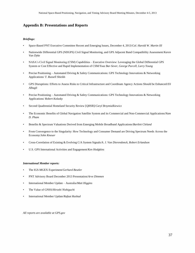
National Space-Based Positioning, Navigation, and Timing Advisory Board Meeting Minutes, December 4-5, 2013
37
Appendix B: Presentations and Reports
Briefings:
• Space-Based PNT Executive Committee Recent and Emerging Issues, December 4, 2013/Col. Harold W. Martin III
• Nationwide Differential GPS (NDGPS) Civil Signal Monitoring, and GPS Adjacent Band Compatibility Assessment/Karen
Van Dyke
• NASA’s Civil Signal Monitoring (CSM) Capabilities – Executive Overview: Leveraging the Global Differential GPS
System or Cost Effective and Rapid Implementation of CSM/Yoaz Bar‐Sever, George Purcell, Larry Young
• Precise Positioning – Automated Driving & Safety Communications: GPS Technology Innovations & Networking
Applications/ T. Russell Shields
• GPS Disruptions: Efforts to Assess Risks to Critical Infrastructure and Coordinate Agency Actions Should be Enhanced/Eli
Albagli
• Precise Positioning – Automated Driving & Safety Communications: GPS Technology Innovations & Networking
Applications/ Robert Kolasky
• Second Quadrennial Homeland Security Review [QHSR]/Caryl Brzymialkiewicz
• The Economic Benefits of Global Navigation Satellite System and its Commercial and Non-Commercial Applications/Nam
D. Pham
• Benefits & Spectrum Valuations Derived from Emerging Mobile Broadband Applications/Bartlett Cleland
• From Convergence to the Singularity: How Technology and Consumer Demand are Driving Spectrum Needs Across the
Economy/John Kneuer
• Cross-Correlation of Existing & Evolving C/A System Signals/A. J. Van Dierendonck, Robert Erlandson
• U.S. GPS International Activities and Engagement/Ken Hodgkins
International Member reports:
• The IGS-MGEX Experiment/Gerhard Beutler
• PNT Advisory Board December 2013 Presentation/Arve Dimmen
• International Member Update – Australia/Matt Higgins
• The Value of GNSS/Hiroshi Nishiguchi
• International Member Update/Rafaat Rashad
All reports are available at GPS.gov

National Space-Based Positioning, Navigation, and Timing Advisory Board Meeting Minutes, December 4-5, 2013
38
Appendix C: Attendee Sign-Up Wednesday, December 4, 2013
NASA Attendees:
Barbara Adde, NASA
Yoaz Bar-Sever, NASA Jet Propulsion Laboratory
A.J. Oria, NASA / Overlook Systems Technologies, Inc.
A.J. Van Dierendonck, NASA / A.J. Systems
Stephanie Wan, NASA / Overlook Systems Technologies, Inc.
Other Attendees:
Eli Albagli, Government Accountability Office
Kenneth Alexander, National Coordination Office
Nick Ambercrombie, Booz Allen Hamilton
Michael Bergman, Department of Homeland Security
Mark Bernstein, ASRC Management Service
Jan Brecht-Clark, National Coordination Office
Andrew Carcich, EAYSS
Bartlett Cleland, Madery Bridge Associates
Ray Clore, Department of State
Clark Cohen, PNT Holdings
Mike Conschafter, Exelis
Dee Ann Divis, Inside GNSS
Brian D. Daugherty, Joint Staff J6
John Dragseth, Department of Homeland Security
Stephen Edso, Joint Staff J6
Anita Eisenstadt, National Coordination Office
Hala Furst, Department of Homeland Security/Policy
Dana Goward, Resilient Navigation Foundation
Stephen Grupenhagen. SAF/AQSL
Brett Heimov, American Center for Democracy
John Kirkemo, United States Air Force
Jason Kim, Department of Commerce
Bob Kolasky, Department of Homeland Security
Larry Hothem, U.S. Coast Guard
Matt Jones, Boeing
Frank Loage, Federal Aviation Administration
Jules McNeff, Overlook Systems
Steve Moran, Raytheon
Mitch Narins, Federal Aviation Administration

National Space-Based Positioning, Navigation, and Timing Advisory Board Meeting Minutes, December 4-5, 2013
39
Dave Olsen, Federal Aviation Administration
Tony Park, MESI
Doug Pederson, U.S. Air Force
Frank Prautzson, Velocity Tech Partners
Joseph Sapp, self
Logan Scott, Comcast
Steve Sidorek, National Coordination Office
Trent Skidmore, National Coordination Office
Zedris Teague, Exelis
Joe Valvano, ASRC Management Services
Martin Whelan, Air Force Space Command
Thursday, December 5, 2013
NASA Attendees
Richard Rood, NASA
Stephanie Wan, NASA / Overlook Systems Technologies, Inc.
Other Attendees:
Ken Alexander, National Coordination Office
Jeff Auerbach, Department of State
Frank Bauer, Emergent Space Technology
Jan Brecht-Clark, National Coordination Office
Jim Burton, National Coordination Office
Robert Crane, National Coordination Office
Brian Dougherty, Joint Staff J6
Steven Edson, Joint Staff J6
Mike Filler, BES
Dana Goward, Resilient Navigation and Timing Foundation
Steven Grupenhagen, SAF/AQSC
Rick Hamilton, U. S. Coast Guard
Ken Hodgkins, Department of State
Harold Martin, National Coordination Office
Steve Moran, Raytheon
Doug Pederson, U.S. Air Force
Logan Scott, Comcast
Trent Skidmore, National Coordination Office
Micheline Tabache, European Space Agency
Karen Van Dyke, Department of Transportation

National Space-Based Positioning, Navigation, and Timing Advisory Board Meeting Minutes, December 4-5, 2013
40
Appendix D: Acronyms / Definitions
ACMA Australian Communication and Media Authority
AFSPC Air Force Space Command
AIS Automatic Identification System
ANC Air Navigation Conference
Beidou Chinese GNSS Constellation (sometimes referred to as COMPASS)
C/A L1 Coarse Acquisition
CMPS Civil Signal Performance Specifications
CNAV GPS Civilian Navigation Message
CSJWG U.S.-India Civil Service Joint Space Working Group
CSM Civil Signal (Performance) Monitoring
CSNO China Satellite Navigation Office
CSPM Civil Signal Performance Monitoring
DGPS (Maritime) Differential GPS
DHS Department of Homeland Security
DoD U.S. Department of Defense
DOE U.S. Department of Energy
DOS U.S. Department of State
DOT U.S. Department of Transportation
E911 Emergency 911
EGNOS European Geostationary Navigation Overlay Service
eLoran Enhanced Loran
ESRI Environmental Systems Research Institute
EO Earth Observation
EU European Union
EXCOM PNT Executive Committee
FAA Federal Aviation Administration
FACA Federal Advisory Committee Act
FCC Federal Communications Commission
FTP File Transfer Protocol
FY Fiscal Year
GALILEO European GNSS Constellation
GAO Government Accountability Office
GDGPS Global Differential GPS System
GDP Gross Domestic Product
GLONASS Russian GNSS Constellation
GNSS Global Navigation Satellite System
GPS Global Positioning System
GPS III GPS Block III
IAG International Association of Geodesy
ICG International Committee on GNSS
IGEB Interagency GPS Executive Board
IGS International GNSS Service
IMES Japan’s Indoor Messaging System
IT Information Technology
ITS Intelligent Transportation System
ITU International Telecommunication Union
JPL NASA Jet Propulsion Laboratory
KHz Kilohertz
L1 C/A GPS 1st Civilian Signal / Coarse Acquisition
L1C GPS 4th Civilian Signal (interoperable with the Galileo Open Service)
L2C GPS 2nd Civilian Signal (for science applications & surveying)
L5 GPS 3rd Civilian Signal (for safety-of-life, such as aviation)
LBS Location-based applications
MGEX Multi-GNSS Experiment
MHz Megahertz
MOPS Minimum Operational Performance Standards
MOU Memorandum of Understanding
MSS Mobile Satellite Service
NAICS North American Industry Classification System

National Space-Based Positioning, Navigation, and Timing Advisory Board Meeting Minutes, December 4-5, 2013
41
NASA National Aeronautics and Space Administration
NASCTN National Advanced Spectrum & Communications Test Network
NCO National Coordination Office
NDGPS Nationwide Differential GPS
NextGen Next Generation Air Transportation System
NIPP National Infrastructure Protection Plan
NPI Australian National Positioning Infrastructure
NRE National Risk Assessment
NSPD National Security Policy Directive
NTIA National Telecommunications and Information Administration
NTSB National Transportation Safety Board
OCX GPS Modernized Operational Control Center
OLE Object Linking and Embedding
OMB Office of Management and Budget
PMU Phasor Measurement Unit
PNT Positioning, Navigation, and Timing
PPD Presidential Policy Directive
QHSR Quadrennial Homeland Security Review
QZSS Quasi-Zenith Satellite System
RITA DOT Research & Innovative Technology Administration
RNT Resilient Navigation and Timing Foundation
RNSS Radionavigation Satellite Services (not to confuse with Regional Navigation Satellite System!)
RTCA Formerly the Radio Technical Commission for Aeronautics, now RTCA Inc.
S/A Selective Availability
SBAS Space-based Augmentation System
SGE Special Government Employees
SLR Satellite Laser Ranging
SPAWAR U.S. Navy Space and Naval Warfare Systems Command
SPS GPS Standard Positioning Service
SV GPS Space Vehicle
PNT Positioning, Navigation, and Timing
USCG U.S. Coast Guard
V2V Vehicle-to-Vehicle
WAAS Wide Area Augmentation System