noaa unmanned aircraft systems (uas) program documents/standards... · noaa unmanned aircraft...
TRANSCRIPT

Current and Future Operations and Transitions
Philip M. KenulTriVector Services
19 May 2017
Dangerous, Dirty, Dull, DeniedEfficient, Effective, Economical and Environmentally Friendly
19 May 2017
NOAA Unmanned Aircraft Systems (UAS) Program
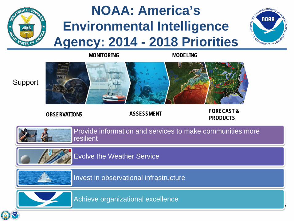
NOAA: America’s Environmental Intelligence
Agency: 2014 - 2018 Priorities
2
OBSERVATIONS
MONITORING
ASSESSMENT
MODELING
FORECAST &PRODUCTS
Provide information and services to make communities more resilient
Evolve the Weather Service
Invest in observational infrastructure
Achieve organizational excellence
Support
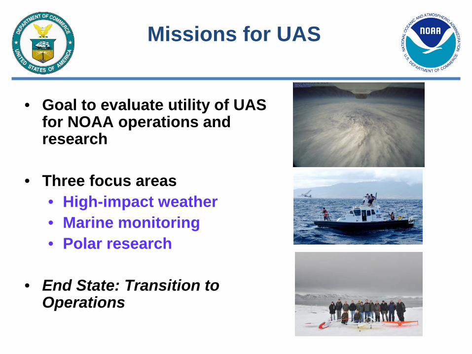
Missions for UAS
• Goal to evaluate utility of UAS for NOAA operations and research
• Three focus areas• High-impact weather• Marine monitoring• Polar research
• End State: Transition to Operations

NASA Global HawkSensing Hazards with Operational Unmanned Technology (SHOUT)
• NOAA Flight Level: ~ 55-63,000 ft• Duration: ~26 hr• Range: 11,000 nm• Payload: 1,500+ lbs• Deployment Sites:
• NASA Wallops Flight Facility(Wallops Island, VA)
• NASA Armstrong Flight ResearchCenter (Edwards AFB)
• Payloads-over 30 approved• Dropsondes – in situ vertical temperature,
moisture, winds• Remote Sensors – vertical temperature,
moisture, winds• Remote Sensors – ocean surface wind speed
and cloud structures
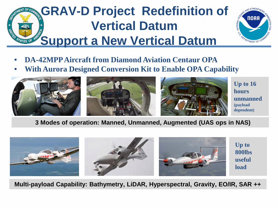
GRAV-D Project Redefinition of Vertical Datum
Support a New Vertical Datum
Multi-payload Capability: Bathymetry, LiDAR, Hyperspectral, Gravity, EO/IR, SAR ++
3 Modes of operation: Manned, Unmanned, Augmented (UAS ops in NAS)
• DA-42MPP Aircraft from Diamond Aviation Centaur OPA• With Aurora Designed Conversion Kit to Enable OPA Capability
Up to 800lbs useful load
Up to 16 hours unmanned(payload dependent)

Project Challenges
• Operational– Long, boring flights-Dull– Large area to cover with
some long distances (Aleutians, Pacific Islands)
– Aircraft stability critical for good data
• Management– Efficiently covering the
entire country in terms of cost and time
• First operation gravity survey on a UAS
6
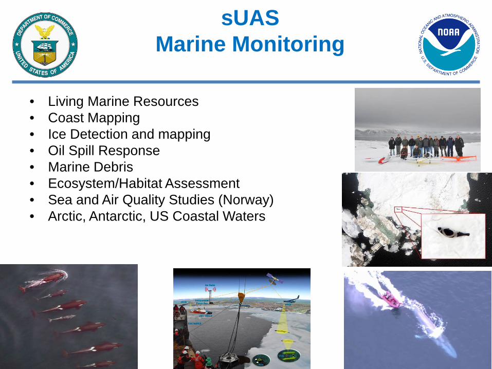
sUAS Marine Monitoring
• Living Marine Resources• Coast Mapping• Ice Detection and mapping• Oil Spill Response• Marine Debris• Ecosystem/Habitat Assessment• Sea and Air Quality Studies (Norway)• Arctic, Antarctic, US Coastal Waters

Comparative body condition
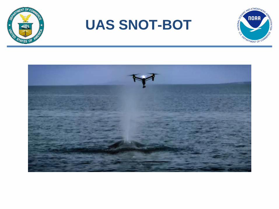
UAS SNOT-BOT

Arctic Shield ISR MissionsOil Spill & SAR
USCG/NOAA/Industry PartnershipSea ice ridge detection/monitoringMarine and marine mammal monitoringUsefulness in search and rescue scenariosDetection and monitoring of oil spilled from shipDetection and monitoring of marine debris from ship

GLOBAL ARCHER 2018Arctic Domain Awareness
Ice Mapping/Arctic Weather

Recent Focus Areas
• Emergency Response (Oil spill/Storm Damage Assessment)• Operating BVLOS• Integration with manned aviation in controlled environments• Polar Operations• Supporting development of new capabilities through partnerships and
CRADAS:– High-resolution sensor – Autonomous recovery system– Ice sensing and deicing
• Data products and dissemination • Collaborating with industry and other agencies to share knowledge and
experience• Use of Autonomy to Reduce Costs and Increase Mission Effectiveness

13
Unmanned? GHOC at WFF Fully Staffed During a Hurricane

NOAA Contact Information
NOAA UAS Web Site: http://uas.noaa.gov/
Questions should be directed to:
Robbie Hood - NOAA UAS Program DirectorNOAA Office of Oceanic and Atmospheric Research([email protected] / 301-734-1102)
Philip M. Kenul– NOAA UAS Program NOAA Office of Oceanic and Atmospheric Research([email protected] / 301- 346-5939)