north carolina register
TRANSCRIPT

This publication is printed on permanent, acid-free paper in compliance with G.S. 125-11.13
NORTH CAROLINA
REGISTER
VOLUME 29 ● ISSUE 23 ● Pages 2596 - 2761
June 1, 2015
I. PROPOSED RULES
Health and Human Services, Department of
Commission for Public Health ........................................................................ 2596 – 2598
II. APPROVED RULES........................................................................................ 2599 – 2725
Environment and Natural Resources, Department of
Environmental Management Commission
Coastal Resources Commission
Marine Fisheries Commission
Well Contractors Certification Commission
Wildlife Resources Commission
Occupational Licensing Boards and Commissions
Medical Board
Real Estate Commission
State Human Resources, Office of
State Human Resources Commission
III. RULES REVIEW COMMISSION ................................................................. 2726 – 2735
IV. CONTESTED CASE DECISIONS Index to ALJ Decisions ...................................................................................... 2736 – 2741
Text of ALJ Decisions
14 DOJ 05714 ................................................................................................. 2742 – 2746
14 DOJ 06135 ................................................................................................. 2747 – 2749
14 DOJ 07612 ................................................................................................. 2750 – 2752
14 DOJ 08383 ................................................................................................. 2753 – 2757
14 DOJ 08744 ................................................................................................. 2758 – 2761
PUBLISHED BY
The Office of Administrative Hearings
Rules Division
6714 Mail Service Center
Raleigh, NC 27699-6714
Telephone (919) 431-3000
Fax (919) 431-3104
Julian Mann III, Director
Molly Masich, Codifier of Rules
Dana Vojtko, Publications Coordinator
Lindsay Woy, Editorial Assistant
Kelly Bailey, Editorial Assistant

This publication is printed on permanent, acid-free paper in compliance with G.S. 125-11.13
Contact List for Rulemaking Questions or Concerns
For questions or concerns regarding the Administrative Procedure Act or any of its components, consult with the
agencies below. The bolded headings are typical issues which the given agency can address, but are not inclusive.
Rule Notices, Filings, Register, Deadlines, Copies of Proposed Rules, etc. Office of Administrative Hearings
Rules Division
1711 New Hope Church Road (919) 431-3000
Raleigh, North Carolina 27609 (919) 431-3104 FAX
contact: Molly Masich, Codifier of Rules [email protected] (919) 431-3071
Dana Vojtko, Publications Coordinator [email protected] (919) 431-3075
Lindsay Woy, Editorial Assistant [email protected] (919) 431-3078
Kelly Bailey, Editorial Assistant [email protected] (919) 431-3083
Rule Review and Legal Issues Rules Review Commission
1711 New Hope Church Road (919) 431-3000
Raleigh, North Carolina 27609 (919) 431-3104 FAX
contact: Abigail Hammond, Commission Counsel [email protected] (919) 431-3076
Amber Cronk May, Commission Counsel [email protected] (919) 431-3074
Amanda Reeder, Commission Counsel [email protected] (919) 431-3079
Julie Brincefield, Administrative Assistant [email protected] (919) 431-3073
Alexander Burgos, Paralegal [email protected] (919) 431-3080
Fiscal Notes & Economic Analysis and Governor's Review Office of State Budget and Management
116 West Jones Street (919) 807-4700
Raleigh, North Carolina 27603-8005 (919) 733-0640 FAX
Contact: Anca Grozav, Economic Analyst [email protected] (919) 807-4740
NC Association of County Commissioners
215 North Dawson Street (919) 715-2893
Raleigh, North Carolina 27603
contact: Amy Bason [email protected]
NC League of Municipalities (919) 715-4000
215 North Dawson Street
Raleigh, North Carolina 27603
contact: Sarah Collins [email protected]
Legislative Process Concerning Rule-making Joint Legislative Administrative Procedure Oversight Committee
545 Legislative Office Building
300 North Salisbury Street (919) 733-2578
Raleigh, North Carolina 27611 (919) 715-5460 FAX
contact: Karen Cochrane-Brown, Staff Attorney [email protected]
Jeff Hudson, Staff Attorney [email protected]

This publication is printed on permanent, acid-free paper in compliance with G.S. 125-11.13
NORTH CAROLINA REGISTER
Publication Schedule for January 2015 – December 2015
FILING DEADLINES NOTICE OF TEXT PERMANENT RULE TEMPORARY
RULES
Volume &
issue
number
Issue date Last day
for filing
Earliest date for
public hearing
End of required
comment
Period
Deadline to submit
to RRC
for review at
next meeting
Earliest Eff.
Date of
Permanent Rule
Delayed Eff. Date of
Permanent Rule
31st legislative day of the
session beginning:
270th day from publication
in the Register
29:13 01/02/15 12/08/14 01/17/15 03/03/15 03/20/15 05/01/15 05/2016 09/29/15
29:14 01/15/15 12/19/14 01/30/15 03/16/15 03/20/15 05/01/15 05/2016 10/12/15
29:15 02/02/15 01/09/15 02/17/15 04/06/15 04/20/15 06/01/15 05/2016 10/30/15
29:16 02/16/15 01/26/15 03/03/15 04/17/15 04/20/15 06/01/15 05/2016 11/13/15
29:17 03/02/15 02/09/15 03/17/15 05/01/15 05/20/15 07/01/15 05/2016 11/27/15
29:18 03/16/15 02/23/15 03/31/15 05/15/15 05/20/15 07/01/15 05/2016 12/11/15
29:19 04/01/15 03/11/15 04/16/15 06/01/15 06/22/15 08/01/15 05/2016 12/27/15
29:20 04/15/15 03/24/15 04/30/15 06/15/15 06/22/15 08/01/15 05/2016 01/10/16
29:21 05/01/15 04/10/15 05/16/15 06/30/15 07/20/15 09/01/15 05/2016 01/26/16
29:22 05/15/15 04/24/15 05/30/15 07/14/15 07/20/15 09/01/15 05/2016 02/09/16
29:23 06/01/15 05/08/15 06/16/15 07/31/15 08/20/15 10/01/15 05/2016 02/26/16
29:24 06/15/15 05/22/15 06/30/15 08/14/15 08/20/15 10/01/15 05/2016 03/11/16
30:01 07/01/15 06/10/15 07/16/15 08/31/15 09/21/15 11/01/15 05/2016 03/27/16
30:02 07/15/15 06/23/15 07/30/15 09/14/15 09/21/15 11/01/15 05/2016 04/10/16
30:03 08/03/15 07/13/15 08/18/15 10/02/15 10/20/15 12/01/15 05/2016 04/29/16
30:04 08/17/15 07/27/15 09/01/15 10/16/15 10/20/15 12/01/15 05/2016 05/13/16
30:05 09/01/15 08/11/15 09/16/15 11/02/15 11/20/15 01/01/16 05/2016 05/28/16
30:06 09/15/15 08/24/15 09/30/15 11/16/15 11/20/15 01/01/16 05/2016 06/11/16
30:07 10/01/15 09/10/15 10/16/15 11/30/15 12/21/15 02/01/16 05/2016 06/27/16
30:08 10/15/15 09/24/15 10/30/15 12/14/15 12/21/15 02/01/16 05/2016 07/11/16
30:09 11/02/15 10/12/15 11/17/15 01/02/16 01/20/16 03/01/16 05/2016 07/29/16
30:10 11/16/15 10/23/15 12/01/15 01/15/16 01/20/16 03/01/16 05/2016 08/12/16
30:11 12/01/15 11/05/15 12/16/15 02/01/16 02/22/16 04/01/16 05/2016 08/27/16
30:12 12/15/15 11/20/15 12/30/15 02/15/16 02/22/16 04/01/16 05/2016 09/10/16

This publication is printed on permanent, acid-free paper in compliance with G.S. 125-11.13
EXPLANATION OF THE PUBLICATION SCHEDULE
This Publication Schedule is prepared by the Office of Administrative Hearings as a public service and the computation of time periods are not to be deemed binding or controlling.
Time is computed according to 26 NCAC 2C .0302 and the Rules of Civil Procedure, Rule 6.
GENERAL
The North Carolina Register shall be published twice
a month and contains the following information
submitted for publication by a state agency:
(1) temporary rules;
(2) text of proposed rules;
(3) text of permanent rules approved by the Rules
Review Commission;
(4) emergency rules
(5) Executive Orders of the Governor;
(6) final decision letters from the U.S. Attorney
General concerning changes in laws affecting
voting in a jurisdiction subject of Section 5 of
the Voting Rights Act of 1965, as required by
G.S. 120-30.9H; and
(7) other information the Codifier of Rules
determines to be helpful to the public.
COMPUTING TIME: In computing time in the schedule,
the day of publication of the North Carolina Register
is not included. The last day of the period so computed
is included, unless it is a Saturday, Sunday, or State
holiday, in which event the period runs until the
preceding day which is not a Saturday, Sunday, or
State holiday.
FILING DEADLINES
ISSUE DATE: The Register is published on the first and
fifteen of each month if the first or fifteenth of the
month is not a Saturday, Sunday, or State holiday for
employees mandated by the State Personnel
Commission. If the first or fifteenth of any month is a
Saturday, Sunday, or a holiday for State employees,
the North Carolina Register issue for that day will be
published on the day of that month after the first or
fifteenth that is not a Saturday, Sunday, or holiday for
State employees.
LAST DAY FOR FILING: The last day for filing for any
issue is 15 days before the issue date excluding
Saturdays, Sundays, and holidays for State employees.
NOTICE OF TEXT
EARLIEST DATE FOR PUBLIC HEARING: The hearing
date shall be at least 15 days after the date a notice of
the hearing is published.
END OF REQUIRED COMMENT PERIOD
An agency shall accept comments on the text of a
proposed rule for at least 60 days after the text is
published or until the date of any public hearings held
on the proposed rule, whichever is longer.
DEADLINE TO SUBMIT TO THE RULES REVIEW
COMMISSION: The Commission shall review a rule
submitted to it on or before the twentieth of a month
by the last day of the next month.
FIRST LEGISLATIVE DAY OF THE NEXT REGULAR
SESSION OF THE GENERAL ASSEMBLY: This date is the
first legislative day of the next regular session of the
General Assembly following approval of the rule by
the Rules Review Commission. See G.S. 150B-21.3,
Effective date of rules.

PROPOSED RULES
29:23 NORTH CAROLINA REGISTER JUNE 1, 2015
2596
Note from the Codifier: The notices published in this Section of the NC Register include the text of proposed rules. The agency
must accept comments on the proposed rule(s) for at least 60 days from the publication date, or until the public hearing, or a later
date if specified in the notice by the agency. If the agency adopts a rule that differs substantially from a prior published notice,
the agency must publish the text of the proposed different rule and accept comment on the proposed different rule for 60 days.
Statutory reference: G.S. 150B-21.2.
TITLE 10A – DEPARTMENT OF HEALTH AND HUMAN
SERVICES
Notice is hereby given in accordance with G.S. 150B-21.2 that the
Commission for Public Health intends to amend the rule cited as
10A NCAC 41A .0101.
Link to agency website pursuant to G.S. 150B-19.1(c):
http://chp.publichealth.nc.gov/
Proposed Effective Date: October 1, 2015
Public Hearing:
Date: June 22, 2015
Time: 10:00 a.m.
Location: Cardinal Room, 5605 Six Forks Rd., Raleigh, NC
Reason for Proposed Action: Middle East respiratory syndrome
(MERS) is an emerging infectious disease first identified in
September 2012. It is usually associated with respiratory tract
infections and is fatal in approximately 1/3 of cases. This disease
can spread rapidly if appropriate control measures are not
followed. Chikungunya virus infection was first characterized in
Africa in 1952. In December 2013 sustained transmission was
identified in the Caribbean Islands and travel associated cases
were identified in continental US shortly thereafter. In July 2014
local transmission was identified in Florida. Rapid application of
control measures may help limit spread if cases are reported once
identified.
It is imperative that public health authorities be rapidly notified
when these infections are suspected or confirmed so that
appropriate control measures can be implemented to prevent
further spread. For this reason, the State Health Director issued
a temporary order pursuant to G.S. 130A-141.1 requiring
immediate reporting of either condition effective June 23, 2014.
An emergency rule was implemented effective on September 2,
2014, followed by a temporary rule that was effective on
December 2, 2014. This proposed amendment replaces the
temporary rule to require ongoing reporting of MERS and
Chikungunya.
Comments may be submitted to: Chris Hoke, 1931 Mail
Service Center, Raleigh, NC 27699-1931, phone (919) 707-5006,
fax (919) 870-4829, or email [email protected]
Comment period ends: July 31, 2015
Procedure for Subjecting a Proposed Rule to Legislative
Review: If an objection is not resolved prior to the adoption of the
rule, a person may also submit written objections to the Rules
Review Commission after the adoption of the Rule. If the Rules
Review Commission receives written and signed objections after
the adoption of the Rule in accordance with G.S. 150B-21.3(b2)
from 10 or more persons clearly requesting review by the
legislature and the Rules Review Commission approves the rule,
the rule will become effective as provided in G.S. 150B-21.3(b1).
The Commission will receive written objections until 5:00 p.m.
on the day following the day the Commission approves the rule.
The Commission will receive those objections by mail, delivery
service, hand delivery, or facsimile transmission. If you have any
further questions concerning the submission of objections to the
Commission, please call a Commission staff attorney at 919-431-
3000.
Fiscal impact (check all that apply).
State funds affected
Environmental permitting of DOT affected
Analysis submitted to Board of Transportation
Local funds affected
Substantial economic impact (≥$1,000,000)
Approved by OSBM
No fiscal note required by G.S. 150B-21.4
CHAPTER 41 – HEALTH: EPIDEMIOLOGY
SUBCHAPTER 41A – COMMUNICABLE DISEASE
CONTROL
SECTION .0100 – REPORTING OF COMMUNICABLE
DISEASES
10A NCAC 41A .0101 REPORTABLE DISEASES AND
CONDITIONS
(a) The following named diseases and conditions are declared to
be dangerous to the public health and are hereby made reportable
within the time period specified after the disease or condition is
reasonably suspected to exist:
(1) acquired immune deficiency syndrome
(AIDS) - 24 hours;
(2) anthrax - immediately;
(3) botulism - immediately;
(4) brucellosis - 7 days;
(5) campylobacter infection - 24 hours;
(6) chancroid - 24 hours;
(7) chikungunya virus infection - 24 hours;
(7)(8) chlamydial infection (laboratory confirmed) - 7
days;
(8)(9) cholera - 24 hours;
(9)(10) Creutzfeldt-Jakob disease – 7 days;
(10)(11) cryptosporidiosis – 24 hours;
(11)(12) cyclosporiasis – 24 hours;
(12)(13) dengue - 7 days;

PROPOSED RULES
29:23 NORTH CAROLINA REGISTER JUNE 1, 2015
2597
(13)(14) diphtheria - 24 hours;
(14)(15) Escherichia coli, shiga toxin-producing - 24
hours;
(15)(16) ehrlichiosis – 7 days;
(16)(17) encephalitis, arboviral - 7 days;
(17)(18) foodborne disease, including Clostridium
perfringens, staphylococcal, Bacillus cereus,
and other and unknown causes - 24 hours;
(18)(19) gonorrhea - 24 hours;
(19)(20) granuloma inguinale - 24 hours;
(20)(21) Haemophilus influenzae, invasive disease - 24
hours;
(21)(22) Hantavirus infection – 7 days;
(22)(23) Hemolytic-uremic syndrome – 24 hours;
(23)(24) Hemorrhagic fever virus infection –
immediately;
(24)(25) hepatitis A - 24 hours;
(25)(26) hepatitis B - 24 hours;
(26)(27) hepatitis B carriage - 7 days;
(27)(28) hepatitis C, acute – 7 days;
(28)(29) human immunodeficiency virus (HIV)
infection confirmed - 24 hours;
(29)(30) influenza virus infection causing death – 24
hours;
(30)(31) legionellosis - 7 days;
(31)(32) leprosy – 7 days;
(32)(33) leptospirosis - 7 days;
(33)(34) listeriosis – 24 hours;
(34)(35) Lyme disease - 7 days;
(35)(36) lymphogranuloma venereum - 7 days;
(36)(37) malaria - 7 days;
(37)(38) measles (rubeola) - 24 hours;
(38)(39) meningitis, pneumococcal - 7 days;
(39)(40) meningococcal disease - 24 hours;
(41) Middle East respiratory syndrome (MERS) - 24
hours;
(40)(42) monkeypox – 24 hours;
(41)(43) mumps - 7 days;
(42)(44) nongonococcal urethritis - 7 days;
(43)(45) novel influenza virus infection – immediately;
(44)(46) plague - immediately;
(45)(47) paralytic poliomyelitis - 24 hours;
(46)(48) pelvic inflammatory disease – 7 days;
(47)(49) psittacosis - 7 days;
(48)(50) Q fever - 7 days;
(49)(51) rabies, human - 24 hours;
(50)(52) Rocky Mountain spotted fever - 7 days;
(51)(53) rubella - 24 hours;
(52)(54) rubella congenital syndrome - 7 days;
(53)(55) salmonellosis - 24 hours;
(54)(56) severe acute respiratory syndrome (SARS) – 24
hours;
(55)(57) shigellosis - 24 hours;
(56)(58) smallpox - immediately;
(57)(59) Staphylococcus aureus with reduced
susceptibility to vancomycin – 24 hours;
(58)(60) streptococcal infection, Group A, invasive
disease - 7 days;
(59)(61) syphilis - 24 hours;
(60)(62) tetanus - 7 days;
(61)(63) toxic shock syndrome - 7 days;
(62)(64) trichinosis - 7 days;
(63)(65) tuberculosis - 24 hours;
(64)(66) tularemia – immediately;
(65)(66) typhoid - 24 hours;
(66)(67) typhoid carriage (Salmonella typhi) - 7 days;
(67)(68) typhus, epidemic (louse-borne) - 7 days;
(68)(69) vaccinia – 24 hours;
(69)(70) vibrio infection (other than cholera) – 24 hours;
(70)(71) whooping cough – 24 hours; and
(71)(72) yellow fever - 7 days.
(b) For purposes of reporting, "confirmed human
immunodeficiency virus (HIV) infection" is defined as a positive
virus culture, repeatedly reactive EIA antibody test confirmed by
western blot or indirect immunofluorescent antibody test, positive
nucleic acid detection (NAT) test, or other confirmed testing
method approved by the Director of the State Public Health
Laboratory conducted on or after February 1, 1990. In selecting
additional tests for approval, the Director of the State Public
Health Laboratory shall consider whether such tests have been
approved by the federal Food and Drug Administration,
recommended by the federal Centers for Disease Control and
Prevention, and endorsed by the Association of Public Health
Laboratories.
(c) In addition to the laboratory reports for Mycobacterium
tuberculosis, Neisseria gonorrhoeae, and syphilis specified in G.S.
130A-139, laboratories shall report:
(1) Isolation or other specific identification of the
following organisms or their products from
human clinical specimens:
(A) Any hantavirus or hemorrhagic fever
virus.
(B) Arthropod-borne virus (any type).
(C) Bacillus anthracis, the cause of
anthrax.
(D) Bordetella pertussis, the cause of
whooping cough (pertussis).
(E) Borrelia burgdorferi, the cause of
Lyme disease (confirmed tests).
(F) Brucella spp., the causes of
brucellosis.
(G) Campylobacter spp., the causes of
campylobacteriosis.
(H) Chlamydia trachomatis, the cause of
genital chlamydial infection,
conjunctivitis (adult and newborn) and
pneumonia of newborns.
(I) Clostridium botulinum, a cause of
botulism.
(J) Clostridium tetani, the cause of
tetanus.
(K) Corynebacterium diphtheriae, the
cause of diphtheria.
(L) Coxiella burnetii, the cause of Q fever.
(M) Cryptosporidium parvum, the cause of
human cryptosporidiosis.
(N) Cyclospora cayetanesis, the cause of
cyclosporiasis.
PROPOSED RULES
29:23 NORTH CAROLINA REGISTER JUNE 1, 2015
2598
(O) Ehrlichia spp., the causes of
ehrlichiosis.
(P) Shiga toxin-producing Escherichia
coli, a cause of hemorrhagic colitis,
hemolytic uremic syndrome, and
thrombotic thrombocytopenic
purpura.
(Q) Francisella tularensis, the cause of
tularemia.
(R) Hepatitis B virus or any component
thereof, such as hepatitis B surface
antigen.
(S) Human Immunodeficiency Virus, the
cause of AIDS.
(T) Legionella spp., the causes of
legionellosis.
(U) Leptospira spp., the causes of
leptospirosis.
(V) Listeria monocytogenes, the cause of
listeriosis.
(W) Middle East respiratory syndrome
virus.
(W)(X) Monkeypox.
(X)(Y) Mycobacterium leprae, the cause of
leprosy.
(Y)(Z) Plasmodium falciparum, P. malariae,
P. ovale, and P. vivax, the causes of
malaria in humans.
(Z)(AA) Poliovirus (any), the cause of
poliomyelitis.
(AA)(BB) Rabies virus.
(BB)(CC) Rickettsia rickettsii, the cause of
Rocky Mountain spotted fever.
(CC)(DD) Rubella virus.
(DD)(EE) Salmonella spp., the causes of
salmonellosis.
(EE)(FF) Shigella spp., the causes of
shigellosis.
(FF)(GG) Smallpox virus, the cause of
smallpox.
(GG)(HH) Staphylococcus aureus with reduced
susceptibility to vanomycin.
(HH)(II) Trichinella spiralis, the cause of
trichinosis.
(II)(JJ) Vaccinia virus.
(JJ)(KK) Vibrio spp., the causes of cholera and
other vibrioses.
(KK)(LL) Yellow fever virus.
(LL)(MM) Yersinia pestis, the cause of plague.
(2) Isolation or other specific identification of the
following organisms from normally sterile
human body sites:
(A) Group A Streptococcus pyogenes
(group A streptococci).
(B) Haemophilus influenzae, serotype b.
(C) Neisseria meningitidis, the cause of
meningococcal disease.
(3) Positive serologic test results, as specified, for
the following infections:
(A) Fourfold or greater changes or
equivalent changes in serum antibody
titers to:
(i) Any arthropod-borne viruses
associated with meningitis or
encephalitis in a human.
(ii) Any hantavirus or
hemorrhagic fever virus.
(iii) Chlamydia psittaci, the cause
of psittacosis.
(iv) Coxiella burnetii, the cause
of Q fever.
(v) Dengue virus.
(vi) Ehrlichia spp., the causes of
ehrlichiosis.
(vii) Measles (rubeola) virus.
(viii) Mumps virus.
(ix) Rickettsia rickettsii, the
cause of Rocky Mountain
spotted fever.
(x) Rubella virus.
(xi) Yellow fever virus.
(B) The presence of IgM serum antibodies
to:
(i) Chlamydia psittaci.
(ii) Hepatitis A virus.
(iii) Hepatitis B virus core
antigen.
(iv) Rubella virus.
(v) Rubeola (measles) virus.
(vi) Yellow fever virus.
(4) Laboratory results from tests to determine the
absolute and relative counts for the T-helper
(CD4) subset of lymphocytes and all results
from tests to determine HIV viral load.
Authority G.S. 130A-134; 130A-135; 130A-139; 130A-141.

APPROVED RULES
29:23 NORTH CAROLINA REGISTER JUNE 1, 2015
2599
This Section includes a listing of rules approved by the Rules Review Commission followed by the full text of those rules. The
rules that have been approved by the RRC in a form different from that originally noticed in the Register or when no notice was
required to be published in the Register are identified by an * in the listing of approved rules. Statutory Reference: G.S. 150B-
21.17.
Rules approved by the Rules Review Commission at its meeting on April 16, 2015.
REGISTER CITATION TO THE NOTICE OF TEXT
ENVIRONMENTAL MANAGEMENT COMMISSION
Riparian Buffer Mitigation Fees to the NC Ecosystem Enhan...
15A NCAC 02B .0269* G.S. 150B-21.5(a)(3)
Emission Rates Requiring a Permit 15A NCAC 02Q .0711* 29:08 NCR
MARINE FISHERIES COMMISSION
Definitions 15A NCAC 03I .0101* 29:07 NCR
User Conflict Resolution 15A NCAC 03I .0122* 29:07 NCR
Duke Energy Progress Brunswick Nuclear Plant Intake 15A NCAC 03J .0207 29:07 NCR
New River 15A NCAC 03J .0208 29:07 NCR
Albemarle Sound/Chowan River River Herring Management Areas
15A NCAC 03J .0209 29:07 NCR
Pots 15A NCAC 03J .0301* 29:07 NCR
Permits to Use Mechanical Methods for Shellfish on 15A NCAC 03K .0111* 29:07 NCR
Permits to Use Mechanical Methods for Oysters and 15A NCAC 03K .0206 29:07 NCR
Permits to Use Mechanical Methods for Oysters and 15A NCAC 03K .0303 29:07 NCR
Bay Scallop Harvest Management 15A NCAC 03K .0501* 29:07 NCR
Taking Bay Scallops at Night and on Weekends 15A NCAC 03K .0502 29:07 NCR
Marketing Scallops Taken from Shellfish Leases or Franchises
15A NCAC 03K .0507* 29:07 NCR
Scallop Season and Harvest Limit Exemptions 15A NCAC 03K .0508* 29:07 NCR
Shrimp Harvest Restrictions 15A NCAC 03L .0101 29:07 NCR
Prohibited Nets, Mesh Lengths and Areas 15A NCAC 03L .0103* 29:07 NCR
Recreational Shrimp Limits 15A NCAC 03L .0105* 29:07 NCR
Mutilated Finfish 15A NCAC 03M .0101 29:07 NCR
American Eel 15A NCAC 03M .0510 29:07 NCR
Procedures and Requirements to Obtain Licenses, Endorseme...
15A NCAC 03O .0101* 29:07 NCR
Display of Licenses and Registrations 15A NCAC 03O .0106* 29:07 NCR
Ocean Fishing Pier Reporting Requirements 15A NCAC 03O .0113* 29:07 NCR
Procedures and Requirements to Obtain Permits 15A NCAC 03O .0501* 29:07 NCR
Permit Conditions; Specific 15A NCAC 03O .0503* 29:07 NCR
Descriptive Boundaries for Coastal-Joint-Inland Waters 15A NCAC 03Q .0202* 29:07 NCR
Shrimp Trawl Prohibited Areas 15A NCAC 03R .0114* 29:07 NCR
Anadromous Fish Spawning Areas 15A NCAC 03R .0115* 29:07 NCR
River Herring Management Areas 15A NCAC 03R .0202 29:07 NCR
COASTAL RESOURCES COMMISSION
Single Family Residences Exempted 15A NCAC 07K .0208* 29:11 NCR

APPROVED RULES
29:23 NORTH CAROLINA REGISTER JUNE 1, 2015
2600
WILDLIFE RESOURCES COMMISSION
Migratory Game Birds 15A NCAC 10B .0105* 29:11 NCR
Dog Training and Field Trials 15A NCAC 10B .0114 29:11 NCR
Bear 15A NCAC 10B .0202* 29:11 NCR
Deer (White Tailed) 15A NCAC 10B .0203* 29:11 NCR
Feral Swine 15A NCAC 10B .0223* 29:11 NCR
Trappers and Hunters 15A NCAC 10B .0404* 29:11 NCR
Public Mountain Trout Waters 15A NCAC 10C .0205* 29:11 NCR
Trotlines and Set-Hooks 15A NCAC 10C .0206* 29:11 NCR
Crappie 15A NCAC 10C .0306 29:11 NCR
Striped Bass 15A NCAC 10C .0314* 29:11 NCR
Trout 15A NCAC 10C .0316 29:11 NCR
Manner of Taking Nongame Fishes: Purchase and Sale 15A NCAC 10C .0401* 29:11 NCR
Taking Nongame Fishes for Bait or Personal Consumption 15A NCAC 10C .0402* 29:11 NCR
Permitted Special Devices and Open Seasons 15A NCAC 10C .0407 29:11 NCR
General Regulations Regarding Use 15A NCAC 10D .0102* 29:11 NCR
Hunting On Game Lands 15A NCAC 10D .0103* 29:11 NCR
Fishing on Game Lands 15A NCAC 10D .0104* 29:11 NCR
Currituck County 15A NCAC 10F .0340 29:11 NCR
WELL CONTRACTORS CERTIFICATION COMMISSION
Requirements 15A NCAC 27 .0801* 29:12 NCR
Approval of Continuing Education Courses 15A NCAC 27 .0810* 29:12 NCR
Determination of Credit 15A NCAC 27 .0820* 29:12 NCR
Special Provisions for Continuing Education 15A NCAC 27 .0840 29:12 NCR
MEDICAL BOARD
Definitions 21 NCAC 32S .0201* 29:14 NCR
Qualifications and Requirements for License 21 NCAC 32S .0202* 29:14 NCR
Agency 21 NCAC 32S .0211 29:14 NCR
Prescriptive Authority 21 NCAC 32S .0212* 29:14 NCR
Supervision of Physician Assistants 21 NCAC 32S .0213* 29:14 NCR
Supervising Physician 21 NCAC 32S .0214 29:14 NCR
Responsibilities of Primary Supervising Physicians in 21 NCAC 32S .0215 29:14 NCR
Continuing Medical Education 21 NCAC 32S .0216* 29:14 NCR
Violations 21 NCAC 32S .0217* 29:14 NCR
Scope of Rules 21 NCAC 32S .0224* 29:14 NCR
Reporting Criteria 21 NCAC 32Y .0101* 29:14 NCR
REAL ESTATE COMMISSION
Agency Agreements and Disclosure 21 NCAC 58A .0104* 29:12 NCR
Advertising 21 NCAC 58A .0105* 29:12 NCR
Handling of Trust Money 21 NCAC 58A .0116* 29:12 NCR
Mineral and Oil and Gas Rights Mandatory Disclosure 21 NCAC 58A .0119* 29:12 NCR
Examination Subject Matter, Format, and Passing Scores 21 NCAC 58A .0402* 29:12 NCR
APPROVED RULES
29:23 NORTH CAROLINA REGISTER JUNE 1, 2015
2601
Business Entities 21 NCAC 58A .0502* 29:12 NCR
Continuing Education Required of Nonresident Licensees 21 NCAC 58A .1711* 29:12 NCR
Request for Examinations and Video Recordings 21 NCAC 58C .0605* 29:12 NCR
Application and Criteria for Original Approval 21 NCAC 58E .0203* 29:12 NCR
Active and Inactive Status: Renewal of Approval 21 NCAC 58E .0204* 29:12 NCR
Application for Original Approval 21 NCAC 58E .0303* 29:12 NCR
Request for a Video Recording 21 NCAC 58E .0308* 29:12 NCR
Change in Sponsor Ownership 21 NCAC 58E .0408* 29:12 NCR
Changes During Approval Period 21 NCAC 58E .0409* 29:12 NCR
Denial or Withdrawal of Approval 21 NCAC 58E .0412* 29:12 NCR
Advertising, Providing Course Information 21 NCAC 58E .0505* 29:12 NCR
STATE HUMAN RESOURCES COMMISSION
Employee Objection to Material in File 25 NCAC 01C .0311* 29:11 NCR
Covered Employees and Leave Credits 25 NCAC 01E .1603* 29:11 NCR
Denial of Veterans' Preference 25 NCAC 01H .1103* 29:11 NCR
Settlements/Consent Agreements in Grievances, 25 NCAC 01J .1304* 29:11 NCR
These Rules are subject to the Legislative Session that began in January 2015.
MARINE FISHERIES COMMISSION
River Herring 15A NCAC 03M .0513 29:07 NCR
WILDLIFE RESOURCES COMMISSION
Wildlife Taken for Depredations 15A NCAC 10B .0106* 29:14 NCR
Coyote 15A NCAC 10B .0219* 29:14 NCR
Protection of Endangered/Threatened/Special Concern 15A NCAC 10I .0102* 29:14 NCR
Threatened Species 15A NCAC 10I .0104* 29:14 NCR
TITLE 15A – DEPARTMENT OF ENVIROMENT AND
NATURAL RESOURCES
15A NCAC 02B .0269 RIPARIAN BUFFER
MITIGATION FEES TO THE NC ECOSYSTEM
ENHANCEMENT PROGRAM
The following is the process for payment of fees to the Riparian
Buffer Restoration Fund administered by the North Carolina
Ecosystem Enhancement Program as one option to mitigate
riparian buffer impacts allowed under rules in 15A NCAC 02B.
Persons who wish to use this option shall first meet the criteria
established for doing so in the buffer rules in 15A NCAC 02B that
reference this Rule. Such buffer rules include, but may not be
limited to 15A NCAC 02B .0295. Persons who choose to satisfy
their mitigation determination by paying a compensatory
mitigation fee to the Riparian Buffer Restoration Fund as allowed
here shall use the following procedure:
(1) SCHEDULE OF FEES: The amount of
payment into the Fund shall be based on the
costs of riparian buffer restoration. The
payment amount shall be determined by
multiplying the acres or square feet of
mitigation required under other rules in 15A
NCAC 02B by an initial value of ninety-six
cents per square foot or forty-one thousand
eight hundred and eighteen dollars per acre
($41,818/acre). This initial per-acre rate shall
be adjusted in January of each year by staff of
the NC Ecosystem Enhancement Program
based upon the construction cost index factor
published every December in the Engineering
News Record. The Engineering News Record is
hereby incorporated by reference including
subsequent amendments and editions, and is
located at
http://enr.construction.com/economics/ at an
annual subscription cost of forty-nine dollars
and ninety-nine cents ($49.99).
(2) The required fee shall be submitted to the N.C.
Ecosystem Enhancement Program (NC EEP),
1652 Mail Service Center, Raleigh, NC 27699-
1652 prior to any activity that results in the
removal or degradation of the protected riparian
buffer for which a "no practical alternatives"

APPROVED RULES
29:23 NORTH CAROLINA REGISTER JUNE 1, 2015
2602
determination has been made pursuant to
requirements of other rules in 15A NCAC 02B.
(3) The payment of a compensatory mitigation fee
may be fully or partially satisfied by donation
of real property interests pursuant to
requirements of other rules in this Subchapter.
History Note: Authority G.S. 143-214.1; 143-214.5; 143-
214.5(i); 143-214.7; 143-214.12; 143-214.21; 143-215.3(a)(1);
143-215.6A; 143-215.6B; 143-215.6C; 143-215.8B; 143B-
282(c); 143B-282(d); S.L. 2005-190; S.L. 2006-259;
Eff. August 11, 2009;
Amended Eff. May 1, 2015.
15A NCAC 02Q .0711 EMISSION RATES REQUIRING A PERMIT
(a) A permit to emit toxic air pollutants shall be required for any facility where one or more emission release points are obstructed or
non-vertically oriented whose actual rate of emissions from all sources are greater than any one of the following toxic air pollutant
permitting emissions rates:
Pollutant (CAS Number)
Carcinogens
lb/yr
Chronic
Toxicants
lb/day
Acute
Systemic
Toxicants
lb/hr
Acute Irritants
lb/hr
acetaldehyde (75-07-0) 6.8
acetic acid (64-19-7) 0.96
acrolein (107-02-8) 0.02
acrylonitrile (107-13-1) 0.4 0.22
ammonia (7664-41-7) 0.68
aniline (62-53-3) 0.25
arsenic and inorganic arsenic compounds 0.053
asbestos (1332-21-4) 5.7 X 10⁻³
aziridine (151-56-4) 0.13
benzene (71-43-2) 8.1
benzidine and salts (92-87-5) 0.0010
benzo(a)pyrene (50-32-8) 2.2
benzyl chloride (100-44-7) 0.13
beryllium (7440-41-7) 0.28
beryllium chloride (7787-47-5) 0.28
beryllium fluoride (7787-49-7) 0.28
beryllium nitrate (13597-99-4) 0.28
bioavailable chromate pigments,
as chromium (VI) equivalent
0.0056
bis-chloromethyl ether (542-88-1) 0.025
bromine (7726-95-6) 0.052
1,3-butadiene (106-99-0) 11
cadmium (7440-43-9) 0.37
cadmium acetate (543-90-8) 0.37
cadmium bromide (7789-42-6) 0.37
carbon disulfide (75-15-0) 3.9
carbon tetrachloride (56-23-5) 460
chlorine (7782-50-5) 0.79 0.23
chlorobenzene (108-90-7) 46
chloroform (67-66-3) 290
chloroprene (126-99-8) 9.2 0.89
cresol (1319-77-3) 0.56
p-dichlorobenzene (106-46-7) 16.8
dichlorodifluoromethane (75-71-8) 5200
dichlorofluoromethane (75-43-4) 10
di(2-ethylhexyl)phthalate (117-81-7) 0.63
dimethyl sulfate (77-78-1) 0.063
1,4-dioxane (123-91-1) 12
epichlorohydrin (106-89-8) 5600
ethyl acetate (141-78-6) 36

APPROVED RULES
29:23 NORTH CAROLINA REGISTER JUNE 1, 2015
2603
ethylenediamine (107-15-3) 6.3 0.64
ethylene dibromide (106-93-4) 27
ethylene dichloride (107-06-2) 260
ethylene glycol monoethyl ether (110-80-5) 2.5 0.48
ethylene oxide (75-21-8) 1.8
ethyl mercaptan (75-08-1) 0.025
fluorides 0.34 0.064
formaldehyde (50-00-0) 0.04
hexachlorocyclopentadiene (77-47-4) 0.013 0.0025
hexachlorodibenzo-p-dioxin (57653- 85-7) 0.0051
n-hexane (110-54-3) 23
hexane isomers except n-hexane 92
hydrazine (302-01-2) 0.013
hydrogen chloride (7647-01-0) 0.18
hydrogen cyanide (74-90-8) 2.9 0.28
hydrogen fluoride (7664-39-3) 0.63 0.064
hydrogen sulfide (7783-06-4) 1.7
maleic anhydride (108-31-6) 0.25 0.025
manganese and compounds 0.63
manganese cyclopentadienyl tricarbonyl
(12079-65-1)
0.013
manganese tetroxide (1317-35-7) 0.13
mercury, alkyl 0.0013
mercury, aryl and inorganic compounds 0.013
mercury, vapor (7439-97-6) 0.013
methyl chloroform (71-55-6) 250 64
methylene chloride (75-09-2) 1600 0.39
methyl ethyl ketone (78-93-3) 78 22.4
methyl isobutyl ketone (108-10-1) 52 7.6
methyl mercaptan (74-93-1) 0.013
nickel carbonyl (13463-39-3) 0.013
nickel metal (7440-02-0) 0.13
nickel, soluble compounds, as nickel 0.013
nickel subsulfide (12035-72-2) 0.14
nitric acid (7697-37-2) 0.256
nitrobenzene (98-95-3) 1.3 0.13
n-nitrosodimethylamine (62-75-9) 3.4
non-specific chromium (VI) compounds, as
chromium (VI) equivalent
0.0056
pentachlorophenol (87-86-5) 0.063 0.0064
perchloroethylene (127-18-4) 13000
phenol (108-95-2) 0.24
phosgene (75-44-5) 0.052
phosphine (7803-51-2) 0.032
polychlorinated biphenyls (1336-36- 3) 5.6
soluble chromate compounds, as chromium
(VI) equivalent
0.013
styrene (100-42-5) 2.7
sulfuric acid (7664-93-9) 0.25 0.025
tetrachlorodibenzo-p-dioxin (1746- 01-6) 0.00020
1,1,1,2-tetrachloro-2,2,-difluoroethane
(76-11-9)
1100
1,1,2,2-tetrachloro-1,2-difluoroethane
(76-12-0)
1100
1,1,2,2-tetrachloroethane (79-34-5) 430

APPROVED RULES
29:23 NORTH CAROLINA REGISTER JUNE 1, 2015
2604
toluene (108-88-3) 98 14.4
toluene diisocyanate,2,4-(584-84-9) and 2,6-
(91-08-7) isomers
0.003
trichloroethylene (79-01-6) 4000
trichlorofluoromethane (75-69-4) 140
1,1,2-trichloro-1,2,2-trifluoroethane
(76-13-1)
240
vinyl chloride (75-01-4) 26
vinylidene chloride (75-35-4) 2.5
xylene (1330-20-7) 57 16.4
(b) A permit to emit toxic air pollutants shall be required for any facility where all emission release points are unobstructed and
vertically oriented whose actual rate of emissions from all sources are greater than any one of the following toxic air pollutant permitting
emissions rates:
Pollutant (CAS Number) Carcinogens
lb/yr
Chronic
Toxicants
lb/day
Acute
Systemic
Toxicants
lb/hr
Acute Irritants
lb/hr
acetaldehyde (75-07-0) 28.43
acetic acid (64-19-7) 3.90
acrolein (107-02-8) 0.08
acrylonitrile (107-13-1) 1.3 1.05
ammonia (7664-41-7) 2.84
aniline (62-53-3) 1.05
arsenic and inorganic arsenic compounds 0.194
asbestos (1332-21-4) 7.748 x 10⁻³
aziridine (151-56-4) 0.3
benzene (71-43-2) 11.069
benzidine and salts (92-87-5) 1.384 x 10⁻³
benzo(a)pyrene (50-32-8) 3.044
benzyl chloride (100-44-7) 0.53
beryllium (7440-41-7) 0.378
beryllium chloride (7787-47-5) 0.378
beryllium fluoride (7787-49-7) 0.378
beryllium nitrate (13597-99-4) 0.378
bioavailable chromate pigments,
as chromium (VI) equivalent
0.008
bis-chloromethyl ether (542-88-1) 0.034
bromine (7726-95-6) 0.21
1,3-butadiene (106-99-0) 40.585
cadmium (7440-43-9) 0.507
cadmium acetate (543-90-8) 0.507
cadmium bromide (7789-42-6) 0.507
carbon disulfide (75-15-0) 7.8
carbon tetrachloride (56-23-5) 618.006
chlorine (7782-50-5) 1.6 0.95
chlorobenzene (108-90-7) 92.7
chloroform (67-66-3) 396.631
chloroprene (126-99-8) 18.5 3.69
cresol (1319-77-3) 2.32
p-dichlorobenzene (106-46-7) 69.50
dichlorodifluoromethane (75-71-8) 10445.4
dichlorofluoromethane (75-43-4) 21.1
di(2-ethylhexyl)phthalate (117-81-7) 1.3
dimethyl sulfate (77-78-1) 0.1
1,4-dioxane (123-91-1) 23.6

APPROVED RULES
29:23 NORTH CAROLINA REGISTER JUNE 1, 2015
2605
epichlorohydrin (106-89-8) 7655.891
ethyl acetate (141-78-6) 147.41
ethylenediamine (107-15-3) 12.6 2.63
ethylene dibromide (106-93-4) 36.896
ethylene dichloride (107-06-2) 350.511
ethylene glycol monoethyl ether (110-80-5) 5.1 2.00
ethylene oxide (75-21-8) 2.490
ethyl mercaptan (75-08-1) 0.11
fluorides 0.7 0.26
formaldehyde (50-00-0) 0.16
hexachlorocyclopentadiene (77-47-4) 2.5 x 10⁻² 0.01
hexachlorodibenzo-p-dioxin (57653- 85-7) 0.007
n-hexane (110-54-3) 46.3
hexane isomers except n-hexane 379.07
hydrazine (302-01-2) 2.5 x 10⁻²
hydrogen chloride (7647-01-0) 0.74
hydrogen cyanide (74-90-8) 5.9 1.16
hydrogen fluoride (7664-39-3) 1.3 0.26
hydrogen sulfide (7783-06-4) 5.1
maleic anhydride (108-31-6) 0.5 0.11
manganese and compounds 1.3
manganese cyclopentadienyl tricarbonyl
(12079-65-1)
2.5 x 10⁻²
manganese tetroxide (1317-35-7) 0.3
mercury, alkyl 2.5 x 10⁻³
mercury, aryl and inorganic compounds 2.5 x 10⁻²
mercury, vapor (7439-97-6) 2.5 x 10⁻²
methyl chloroform (71-55-6) 505.4 257.98
methylene chloride (75-09-2) 2213.752 1.79
methyl ethyl ketone (78-93-3) 155.8 93.19
methyl isobutyl ketone (108-10-1) 107.8 31.59
methyl mercaptan (74-93-1) 0.05
nickel carbonyl (13463-39-3) 2.5 x 10⁻²
nickel metal (7440-02-0) 0.3
nickel, soluble compounds, as nickel 2.5 x 10⁻²
nickel subsulfide (12035-72-2) 0.194
nitric acid (7697-37-2) 1.05
nitrobenzene (98-95-3) 2.5 0.53
n-nitrosodimethylamine (62-75-9) 4.612
non-specific chromium (VI) compounds, as
chromium (VI) equivalent
0.008
pentachlorophenol (87-86-5) 0.1 0.03
perchloroethylene (127-18-4) 17525.534
phenol (108-95-2) 1.00
phosgene (75-44-5) 0.1
phosphine (7803-51-2) 0.14
polychlorinated biphenyls (1336-36- 3) 7.656
soluble chromate compounds, as chromium
(VI) equivalent
2.6 x 10⁻²
styrene (100-42-5) 11.16
sulfuric acid (7664-93-9) 0.5 0.11
tetrachlorodibenzo-p-dioxin (1746- 01-6) 2.767 x 10⁻⁴
1,1,1,2-tetrachloro-2,2,-difluoroethane
(76-11-9)
2190.2

APPROVED RULES
29:23 NORTH CAROLINA REGISTER JUNE 1, 2015
2606
1,1,2,2-tetrachloro-1,2-difluoroethane
(76-12-0)
2190.2
1,1,2,2-tetrachloroethane (79-34-5) 581.110
toluene (108-88-3) 197.96 58.97
toluene diisocyanate,2,4-(584-84-9) and 2,6-
(91-08-7) isomers
8.4 x 10⁻³
trichloroethylene (79-01-6) 5442.140
trichlorofluoromethane (75-69-4) 589.66
1,1,2-trichloro-1,2,2-trifluoroethane
(76-13-1)
1000.32
vinyl chloride (75-01-4) 35.051
vinylidene chloride (75-35-4) 5.1
xylene (1330-20-7) 113.7 68.44
(c) For the following pollutants, the highest emissions occurring
for any 15-minute period shall be multiplied by four and the
product shall be compared to the value in Paragraph (a) or (b) as
applicable. These pollutants are:
(1) acetaldehyde (75-07-0);
(2) acetic acid (64-19-7);
(3) acrolein (107-02-8);
(4) ammonia (7664-41-7);
(5) bromine (7726-95-6);
(6) chlorine (7782-50-5);
(7) formaldehyde (50-00-0);
(8) hydrogen chloride (7647-01-0);
(9) hydrogen fluoride (7664-39-3); and
(10) nitric acid (7697-37-2).
History Note: Authority G.S. 143-215.3(a)(1); 143-215-107;
143-215.108; 143B-282;
Rule originally codified as part of 15A NCAC 02H .0610;
Eff. July 1, 1998;
Amended Eff. May 1, 2015; May 1, 2014; January 1, 2010; June
1, 2008; April 1, 2005; February 1, 2005; April 1, 2001.
* * * * * * * * * * * * * * * * * * * *
15A NCAC 03I .0101 DEFINITIONS
All definitions set out in G.S. 113, Subchapter IV and the
following additional terms apply to this Chapter:
(1) Enforcement and management terms:
(a) Commercial Quota. Total quantity of
fish allocated for harvest by
commercial fishing operations.
(b) Educational Institution. A college,
university, or community college
accredited by an accrediting agency
recognized by the U.S. Department of
Education; an Environmental
Education Center certified by the N.C.
Department of Environment and
Natural Resources Office of
Environmental Education and Public
Affairs; or a zoo or aquarium certified
by the Association of Zoos and
Aquariums.
(c) Internal Coastal Waters or Internal
Waters. All Coastal Fishing Waters
except the Atlantic Ocean.
(d) Length of finfish.
(i) Curved fork length. A length
determined by measuring
along a line tracing the
contour of the body from the
tip of the upper jaw to the
middle of the fork in the
caudal (tail) fin.
(ii) Fork length. A length
determined by measuring
along a straight line the
distance from the tip of the
snout with the mouth closed
to the middle of the fork in
the caudal (tail) fin, except
that fork length for billfish is
measured from the tip of the
lower jaw to the middle of the
fork of the caudal (tail) fin.
(iii) Pectoral fin curved fork
length. A length of a
beheaded fish from the dorsal
insertion of the pectoral fin to
the fork of the tail measured
along the contour of the body
in a line that runs along the
top of the pectoral fin and the
top of the caudal keel.
(iv) Total length. A length
determined by measuring
along a straight line the
distance from the tip of the
snout with the mouth closed
to the tip of the compressed
caudal (tail) fin.
(e) Recreational Possession Limit.
Restrictions on size, quantity, season,

APPROVED RULES
29:23 NORTH CAROLINA REGISTER JUNE 1, 2015
2607
time period, area, means, and methods
where take or possession is for a
recreational purpose.
(f) Recreational Quota. Total quantity of
fish allocated for harvest for a
recreational purpose.
(g) Regular Closed Oyster Season. March
31 through October 15, unless
amended by the Fisheries Director
through proclamation authority.
(h) Scientific Institution. One of the
following entities:
(i) An educational institution as
defined in this Item;
(ii) A state or federal agency
charged with the
management of marine or
estuarine resources; or
(iii) A professional organization
or secondary school working
under the direction of, or in
compliance with mandates
from, the entities listed in
Subitems (h)(i) and (ii) of
this Item.
(i) Seed Oyster Management Area. An
open harvest area that, by reason of
poor growth characteristics, predation
rates, overcrowding or other factors,
experiences poor utilization of oyster
populations for direct harvest and sale
to licensed dealers and is designated
by the Marine Fisheries Commission
as a source of seed for public and
private oyster culture.
(2) Fishing Activities:
(a) Aquaculture operation. An operation
that produces artificially propagated
stocks of marine or estuarine resources
or obtains such stocks from permitted
sources for the purpose of rearing in a
controlled environment. A controlled
environment provides and maintains
throughout the rearing process one or
more of the following:
(i) food;
(ii) predator protection;
(iii) salinity;
(iv) temperature controls; or
(v) water circulation,
utilizing technology not found in the
natural environment.
(b) Attended. Being in a vessel, in the
water or on the shore, and immediately
available to work the gear and be
within 100 yards of any gear in use by
that person at all times. Attended does
not include being in a building or
structure.
(c) Blue Crab Shedding. The process
whereby a blue crab emerges soft from
its former hard exoskeleton. A
shedding operation is any operation
that holds peeler crabs in a controlled
environment. A controlled
environment provides and maintains
throughout the shedding process one
or more of the following:
(i) food;
(ii) predator protection;
(iii) salinity;
(iv) temperature controls; or
(v) water circulation, utilizing
technology not found in the
natural environment. A
shedding operation does not
include transporting pink or
red-line peeler crabs to a
permitted shedding
operation.
(d) Depuration. Purification or the
removal of adulteration from live
oysters, clams, or mussels by any
natural or artificially controlled
means.
(e) Long Haul Operations. Fishing a
seine towed between two vessels.
(f) Peeler Crab. A blue crab that has a
soft shell developing under a hard
shell and having a white, pink, or red-
line or rim on the outer edge of the
back fin or flipper.
(g) Possess. Any actual or constructive
holding whether under claim of
ownership or not.
(h) Recreational Purpose. A fishing
activity that is not a commercial
fishing operation as defined in G.S.
113-168.
(i) Shellfish marketing from leases and
franchises. The harvest of oysters,
clams, scallops, or mussels from
privately held shellfish bottoms and
lawful sale of those shellfish to the
public at large or to a licensed shellfish
dealer.
(j) Shellfish planting effort on leases and
franchises. The process of obtaining
authorized cultch materials, seed
shellfish, and polluted shellfish stocks
and the placement of those materials
on privately held shellfish bottoms for
increased shellfish production.
(k) Shellfish production on leases and
franchises:

APPROVED RULES
29:23 NORTH CAROLINA REGISTER JUNE 1, 2015
2608
(i) The culture of oysters, clams,
scallops, or mussels on
shellfish leases and
franchises from a sublegal
harvest size to a marketable
size.
(ii) The transplanting (relay) of
oysters, clams, scallops, or
mussels from areas closed
due to pollution to shellfish
leases and franchises in open
waters and the natural
cleansing of those shellfish.
(l) Swipe Net Operations. Fishing a seine
towed by one vessel.
(m) Transport. Ship, carry, or cause to be
carried or moved by public or private
carrier by land, sea, or air.
(n) Use. Employ, set, operate, or permit
to be operated or employed.
(3) Gear:
(a) Bunt Net. The last encircling net of a
long haul or swipe net operation
constructed of small mesh webbing.
The bunt net is used to form a pen or
pound from which the catch is dipped
or bailed.
(b) Channel Net. A net used to take
shrimp that is anchored or attached to
the bottom at both ends or with one
end anchored or attached to the bottom
and the other end attached to a vessel.
(c) Commercial Fishing Equipment or
Gear. All fishing equipment used in
Coastal Fishing Waters except:
(i) Cast nets;
(ii) Collapsible crab traps, a trap
used for taking crabs with the
largest open dimension no
larger than 18 inches and that
by design is collapsed at all
times when in the water,
except when it is being
retrieved from or lowered to
the bottom;
(iii) Dip nets or scoops having a
handle not more than eight
feet in length and a hoop or
frame to which the net is
attached not exceeding 60
inches along the perimeter;
(iv) Gigs or other pointed
implements that are
propelled by hand, whether
or not the implement remains
in the hand;
(v) Hand operated rakes no more
than 12 inches wide and
weighing no more than six
pounds and hand operated
tongs;
(vi) Hook-and-line and bait-and-
line equipment other than
multiple-hook or multiple-
bait trotline;
(vii) Landing nets used to assist in
taking fish when the initial
and primary method of taking
is by the use of hook and line;
(viii) Minnow traps when no more
than two are in use;
(ix) Seines less than 30 feet in
length;
(x) Spears, Hawaiian slings, or
similar devices that propel
pointed implements by
mechanical means, including
elastic tubing or bands,
pressurized gas, or similar
means.
(d) Corkline. The support structure a net
is attached to that is nearest to the
water surface when in use. Corkline
length is measured from the outer most
mesh knot at one end of the corkline
following along the line to the outer
most mesh knot at the opposite end of
the corkline.
(e) Dredge. A device towed by engine
power consisting of a frame, tooth bar
or smooth bar, and catchbag used in
the harvest of oysters, clams, crabs,
scallops, or conchs.
(f) Fixed or stationary net. A net
anchored or staked to the bottom, or
some structure attached to the bottom,
at both ends of the net.
(g) Fyke Net. An entrapment net
supported by a series of internal or
external hoops or frames, with one or
more lead or leaders that guide fish to
the net mouth. The net has one or
more internal funnel-shaped openings
with tapered ends directed inward
from the mouth, through which fish
enter the enclosure. The portion of the
net designed to hold or trap fish is
completely enclosed in mesh or
webbing, except for the openings for
fish passage into or out of the net
(funnel area).
(h) Gill Net. A net set vertically in the
water to capture fish by entanglement
of the gills in its mesh as a result of net
design, construction, mesh length,
webbing diameter, or method in which
it is used.
APPROVED RULES
29:23 NORTH CAROLINA REGISTER JUNE 1, 2015
2609
(i) Headrope. The support structure for
the mesh or webbing of a trawl that is
nearest to the water surface when in
use. Headrope length is measured
from the outer most mesh knot at one
end of the headrope following along
the line to the outer most mesh knot at
the opposite end of the headrope.
(j) Hoop Net. An entrapment net
supported by a series of internal or
external hoops or frames. The net has
one or more internal funnel-shaped
openings with tapered ends directed
inward from the mouth, through which
fish enter the enclosure. The portion
of the net designed to hold or trap the
fish is completely enclosed in mesh or
webbing, except for the openings for
fish passage into or out of the net
(funnel area).
(k) Lead. A mesh or webbing structure
consisting of nylon, monofilament,
plastic, wire, or similar material set
vertically in the water and held in
place by stakes or anchors to guide
fish into an enclosure. Lead length is
measured from the outer most end of
the lead along the top or bottom line,
whichever is longer, to the opposite
end of the lead.
(l) Mechanical methods for clamming.
Dredges, hydraulic clam dredges,
stick rakes, and other rakes when
towed by engine power, patent tongs,
kicking with propellers or deflector
plates with or without trawls, and any
other method that utilizes mechanical
means to harvest clams.
(m) Mechanical methods for oystering.
Dredges, patent tongs, stick rakes, and
other rakes when towed by engine
power, and any other method that
utilizes mechanical means to harvest
oysters.
(n) Mesh Length. The distance from the
inside of one knot to the outside of the
opposite knot, when the net is
stretched hand-tight in a manner that
closes the mesh opening.
(o) Pound Net Set. A fish trap consisting
of a holding pen, one or more
enclosures, lead or leaders, and stakes
or anchors used to support the trap.
The holding pen, enclosures, and
lead(s) are not conical, nor are they
supported by hoops or frames.
(p) Purse Gill Nets. Any gill net used to
encircle fish when the net is closed by
the use of a purse line through rings
located along the top or bottom line or
elsewhere on such net.
(q) Seine. A net set vertically in the water
and pulled by hand or power to capture
fish by encirclement and confining
fish within itself or against another
net, the shore or bank as a result of net
design, construction, mesh length,
webbing diameter, or method in which
it is used.
(4) Fish habitat areas. The estuarine and marine
areas that support juvenile and adult
populations of fish species, as well as forage
species utilized in the food chain. Fish habitats
as used in this definition, are vital for portions
of the entire life cycle, including the early
growth and development of fish species. Fish
habitats in all Coastal Fishing Waters, as
determined through marine and estuarine
survey sampling, include:
(a) Anadromous fish nursery areas.
Those areas in the riverine and
estuarine systems utilized by post-
larval and later juvenile anadromous
fish.
(b) Anadromous fish spawning areas.
Those areas where evidence of
spawning of anadromous fish has been
documented in Division sampling
records through direct observation of
spawning, capture of running ripe
females, or capture of eggs or early
larvae.
(c) Coral:
(i) Fire corals and hydrocorals
(Class Hydrozoa);
(ii) Stony corals and black corals
(Class Anthozoa, Subclass
Scleractinia); or
(iii) Octocorals; Gorgonian corals
(Class Anthozoa, Subclass
Octocorallia), which include
sea fans (Gorgonia sp.), sea
whips (Leptogorgia sp. and
Lophogorgia sp.), and sea
pansies (Renilla sp.).
(d) Intertidal Oyster Bed. A formation,
regardless of size or shape, formed of
shell and live oysters of varying
density.
(e) Live rock. Living marine organisms
or an assemblage thereof attached to a
hard substrate, excluding mollusk
shells, but including dead coral or
rock. Living marine organisms
associated with hard bottoms, banks,
reefs, and live rock include:
(i) Coralline algae (Division
Rhodophyta);

APPROVED RULES
29:23 NORTH CAROLINA REGISTER JUNE 1, 2015
2610
(ii) Acetabularia sp., mermaid's
fan and cups (Udotea sp.),
watercress (Halimeda sp.),
green feather, green grape
algae (Caulerpa sp.)
(Division Chlorophyta);
(iii) Sargassum sp., Dictyopteris
sp., Zonaria sp. (Division
Phaeophyta);
(iv) Sponges (Phylum Porifera);
(v) Hard and soft corals, sea
anemones (Phylum
Cnidaria), including fire
corals (Class Hydrozoa), and
Gorgonians, whip corals, sea
pansies, anemones,
Solengastrea (Class
Anthozoa);
(vi) Bryozoans (Phylum
Bryozoa);
(vii) Tube worms (Phylum
Annelida), fan worms
(Sabellidae), feather duster
and Christmas treeworms
(Serpulidae), and sand castle
worms (Sabellaridae);
(viii) Mussel banks (Phylum
Mollusca: Gastropoda); and
(ix) Acorn barnacles
(Arthropoda: Crustacea:
Semibalanus sp.).
(f) Nursery areas. Areas that for reasons
such as food, cover, bottom type,
salinity, temperature, and other
factors, young finfish and crustaceans
spend the major portion of their initial
growing season. Primary nursery
areas are those areas in the estuarine
system where initial post-larval
development takes place. These are
areas where populations are uniformly
early juveniles. Secondary nursery
areas are those areas in the estuarine
system where later juvenile
development takes place. Populations
are composed of developing sub-
adults of similar size that have
migrated from an upstream primary
nursery area to the secondary nursery
area located in the middle portion of
the estuarine system.
(g) Shellfish producing habitats. Historic
or existing areas that shellfish, such as
clams, oysters, scallops, mussels, and
whelks use to reproduce and survive
because of such favorable conditions
as bottom type, salinity, currents,
cover, and cultch. Included are those
shellfish producing areas closed to
shellfish harvest due to pollution.
(h) Strategic Habitat Areas. Locations of
individual fish habitats or systems of
habitats that provide exceptional
habitat functions or that are
particularly at risk due to imminent
threats, vulnerability, or rarity.
(i) Submerged aquatic vegetation (SAV)
habitat. Submerged lands that:
(i) are vegetated with one or
more species of submerged
aquatic vegetation including
bushy pondweed or southern
naiad (Najas guadalupensis),
coontail (Ceratophyllum
demersum), eelgrass (Zostera
marina), horned pondweed
(Zannichellia palustris),
naiads (Najas spp.), redhead
grass (Potamogeton
perfoliatus), sago pondweed
(Stuckenia pectinata,
formerly Potamogeton
pectinatus), shoalgrass
(Halodule wrightii), slender
pondweed (Potamogeton
pusillus), water stargrass
(Heteranthera dubia), water
starwort (Callitriche
heterophylla), waterweeds
(Elodea spp.), widgeongrass
(Ruppia maritima), and wild
celery (Vallisneria
americana). These areas may
be identified by the presence
of above-ground leaves,
below-ground rhizomes, or
reproductive structures
associated with one or more
SAV species and include the
sediment within these areas;
or
(ii) have been vegetated by one
or more of the species
identified in Sub-item
(4)(i)(i) of this Rule within
the past 10 annual growing
seasons and that meet the
average physical
requirements of water depth
(six feet or less), average
light availability (secchi
depth of one foot or more),
and limited wave exposure
that characterize the
environment suitable for
growth of SAV. The past
presence of SAV may be

APPROVED RULES
29:23 NORTH CAROLINA REGISTER JUNE 1, 2015
2611
demonstrated by aerial
photography, SAV survey,
map, or other documentation.
An extension of the past 10
annual growing seasons
criteria may be considered
when average environmental
conditions are altered by
drought, rainfall, or storm
force winds.
This habitat occurs in both subtidal
and intertidal zones and may occur in
isolated patches or cover extensive
areas. In defining SAV habitat, the
Marine Fisheries Commission
recognizes the Aquatic Weed Control
Act of 1991 (G.S. 113A-220 et. seq.)
and does not intend the submerged
aquatic vegetation definition, or this
Rule or Rules 03K .0304 and .0404, to
apply to or conflict with the non-
development control activities
authorized by that Act.
(5) Licenses, permits, leases and franchises, and
record keeping:
(a) Assignment. Temporary transferal to
another person of privileges under a
license for which assignment is
permitted. The person assigning the
license delegates the privileges
permitted under the license to be
exercised by the assignee, but retains
the power to revoke the assignment at
any time, and is still the responsible
party for the license.
(b) Designee. Any person who is under
the direct control of the permittee or
who is employed by or under contract
to the permittee for the purposes
authorized by the permit.
(c) For Hire Vessel. As defined by G.S.
113-174, when the vessel is fishing in
state waters or when the vessel
originates from or returns to a North
Carolina port.
(d) Holder. A person who has been
lawfully issued in his or her name a
license, permit, franchise, lease, or
assignment.
(e) Land:
(i) For commercial fishing
operations, when fish reach
the shore or a structure
connected to the shore.
(ii) For purposes of trip tickets,
when fish reach a licensed
seafood dealer, or where the
fisherman is the dealer, when
fish reach the shore or a
structure connected to the
shore.
(iii) For recreational fishing
operations, when fish are
retained in possession by the
fisherman.
(f) Licensee. Any person holding a valid
license from the Department to take or
deal in marine fisheries resources.
(g) Logbook. Paper forms provided by
the Division and electronic data files
generated from software provided by
the Division for the reporting of
fisheries statistics by persons engaged
in commercial or recreational fishing
or for-hire operators.
(h) Master. Captain of a vessel or one
who commands and has control,
authority, or power over a vessel.
(i) New fish dealer. Any fish dealer
making application for a fish dealer
license who did not possess a valid
dealer license for the previous license
year in that name. For purposes of
license issuance, adding new
categories to an existing fish dealers
license does not constitute a new
dealer.
(j) Office of the Division. Physical
locations of the Division conducting
license and permit transactions in
Wilmington, Washington, Morehead
City, Roanoke Island, and Elizabeth
City, North Carolina. Other
businesses or entities designated by
the Secretary to issue Recreational
Commercial Gear Licenses or Coastal
Recreational Fishing Licenses are not
considered Offices of the Division.
(k) Responsible party. Person who
coordinates, supervises, or otherwise
directs operations of a business entity,
such as a corporate officer or
executive level supervisor of business
operations, and the person responsible
for use of the issued license in
compliance with applicable statutes
and rules.
(l) Tournament Organizer. The person
who coordinates, supervises, or
otherwise directs a recreational fishing
tournament and is the holder of the
Recreational Fishing Tournament
License.
(m) Transaction. Act of doing business
such that fish are sold, offered for sale,
exchanged, bartered, distributed, or
landed.

APPROVED RULES
29:23 NORTH CAROLINA REGISTER JUNE 1, 2015
2612
(n) Transfer. Permanent transferal to
another person of privileges under a
license for which transfer is permitted.
The person transferring the license
retains no rights or interest under the
license transferred.
(o) Trip Ticket. Paper forms provided by
the Division and electronic data files
generated from software provided by
the Division for the reporting of
fisheries statistics by licensed fish
dealers.
History Note: Authority G.S. 113-134; 113-174;
143B-289.52;
Eff. January 1, 1991;
Amended Eff. March 1, 1995; March 1, 1994; October 1, 1993;
July 1, 1993;
Recodified from 15A NCAC 03I .0001 Eff. December 17, 1996;
Amended Eff. April 1, 1999; August 1, 1998; April 1, 1997;
Temporary Amendment Eff. May 1, 2000; August 1, 1999; July 1,
1999;
Amended Eff. August 1, 2000;
Temporary Amendment Eff. August 1, 2000;
Amended Eff. May 1, 2015; April 1, 2014; April 1, 2011; April 1,
2009; October 1, 2008; December 1, 2007; December 1, 2006;
September 1, 2005; April 1, 2003; April 1, 2001.
15A NCAC 03I .0122 USER CONFLICT RESOLUTION
(a) In order to address user conflicts, the Fisheries Director may,
by proclamation, impose any or all of the following restrictions:
(1) specify time;
(2) specify area;
(3) specify means and methods;
(4) specify seasons; and
(5) specify quantity.
This authority may be used based on the Fisheries Director's own
findings or on the basis of a valid request in accordance with
Paragraph (b) of this Rule. The Fisheries Director shall hold a
public meeting in the area of the user conflict prior to issuance of
a proclamation based on his or her own findings.
(b) Request for user conflict resolution:
(1) Any person(s) desiring user conflict resolution
may make such request in writing addressed to
the Director of the Division of Marine
Fisheries, P.O. Box 769, 3441 Arendell St.,
Morehead City, NC 28557-0769. A request
shall contain the following information:
(A) a map of the affected area including an
inset vicinity map showing the
location of the area with detail
sufficient to permit on-site
identification and location;
(B) identification of the user conflict
causing a need for user conflict
resolution;
(C) recommended solution for resolving
user conflict; and
(D) name and address of the person(s)
requesting user conflict resolution.
(2) Within 90 days of the receipt of the information
required in Subparagraph (b)(1) of this Rule,
the Fisheries Director shall review the
information and determine if user conflict
resolution is necessary. If user conflict
resolution is not necessary, the Fisheries
Director shall deny the request. If user conflict
resolution is necessary, the Fisheries Director
or designee shall hold a public meeting in the
area of the user conflict. The requestor shall
present his or her request at the public meeting.
(3) Following the public meeting as described in
Subparagraph (b)(2) of this Rule, the Fisheries
Director shall refer the users in the conflict for
mediation or deny the request. If the user
conflict cannot be resolved through mediation,
the Fisheries Director shall submit for approval
a proclamation to the Marine Fisheries
Commission that addresses the conflict.
(4) Proclamations issued under this Rule shall
suspend appropriate rules or portions of rules
under the authority of the Marine Fisheries
Commission as specified in the proclamation.
The provisions of Rule .0102 of this Section
terminating suspension of a rule pending the
next Marine Fisheries Commission meeting and
requiring review by the Marine Fisheries
Commission at the next meeting shall not apply
to proclamations issued under this Rule.
History Note: Authority G.S. 113-134; 113-181; 113-182;
113-221.1; 143B-289.52;
Eff. May 1, 2015.
15A NCAC 03J .0207 DUKE ENERGY PROGRESS
BRUNSWICK NUCLEAR PLANT INTAKE CANAL
It is unlawful to use any commercial fishing equipment in the
Duke Energy Progress Brunswick Nuclear Plant Intake Canal
between the fish diversion screen and the Duke Energy Progress
Brunswick Nuclear Plant.
History Note: Authority G.S. 113-134; 113-182;
143B-289.52;
Eff. January 1, 1991;
Amended Eff. May 1, 2015.
15A NCAC 03J .0208 NEW RIVER
(a) It is unlawful to use trawl nets except skimmer trawls
upstream of the Highway 172 Bridge over New River.
(b) It is unlawful to use skimmer trawls upstream of the Highway
172 Bridge over New River from 9:00 P.M. through 5:00 A.M.
from August 16 through November 30.
History Note: Authority G.S. 113-134; 113-182; 143B-
289.52;
Eff. August 1, 1998;
Amended Eff. May 1, 2015; August 1, 2004.
APPROVED RULES
29:23 NORTH CAROLINA REGISTER JUNE 1, 2015
2613
15A NCAC 03J .0209 ALBEMARLE SOUND/CHOWAN
RIVER RIVER HERRING MANAGEMENT AREAS
It is unlawful to use drift gill nets with a mesh length less than
three inches from January 1 through May 15 in the Albemarle
Sound and Chowan River river herring management areas defined
in 15A NCAC 03R .0202.
History Note: Authority G.S. 113-134; 113-182; 143B
289.52;
Temporary Adoption Eff. May 1, 2000;
Eff. April 1, 2001;
Amended Eff. May 1, 2015; June 1, 2013; December 1, 2007.
15A NCAC 03J .0301 POTS
(a) It is unlawful to use pots except during time periods and in
areas specified herein:
(1) In Coastal Fishing Waters from December 1
through May 31, except that all pots shall be
removed from Internal Waters from January 15
through February 7. Fish pots upstream of U.S.
17 Bridge across Chowan River and upstream
of a line across the mouth of Roanoke, Cashie,
Middle, and Eastmost Rivers to the Highway
258 Bridge are exempt from the January 15
through February 7 removal requirement. The
Fisheries Director may, by proclamation,
reopen various waters to the use of pots after
January 19 if it is determined that such waters
are free of pots.
(2) From June 1 through November 30, north and
east of the Highway 58 Bridge at Emerald Isle:
(A) In areas described in 15A NCAC 03R
.0107(a);
(B) To allow for the variable spatial
distribution of crustacea and finfish,
the Fisheries Director may, by
proclamation, specify time periods for
or designate the areas described in
15A NCAC 03R .0107(b); or any part
thereof, for the use of pots.
(3) From May 1 through November 30 in the
Atlantic Ocean and west and south of the
Highway 58 Bridge at Emerald Isle in areas and
during time periods designated by the Fisheries
Director by proclamation.
The Fisheries Director may, by proclamation authority
established in 15A NCAC 03L .0201, further restrict the use of
pots to take blue crabs.
(b) It is unlawful to use pots:
(1) in any navigation channel marked by State or
Federal agencies; or
(2) in any turning basin maintained and marked by
the North Carolina Ferry Division.
(c) It is unlawful to use pots in a commercial fishing operation,
unless each pot is marked by attaching a floating buoy that shall
be of solid foam or other solid buoyant material and no less than
five inches in diameter and no less than five inches in length.
Buoys may be of any color except yellow or hot pink or any
combination of colors that include yellow or hot pink. The owner
shall always be identified on the attached buoy by using engraved
buoys or by engraved metal or plastic tags attached to the buoy.
The identification shall include one of the following:
(1) gear owner's current motorboat registration
number;
(2) gear owner's U.S. vessel documentation name;
or
(3) gear owner's last name and initials.
(d) Pots attached to shore or a pier shall be exempt from
Subparagraphs (a)(2) and (a)(3) of this Rule.
(e) It is unlawful to use shrimp pots with mesh lengths smaller
than one and one-fourth inches stretch or five-eighths-inch bar.
(f) It is unlawful to use pots to take eels with mesh lengths smaller
than one-half inch by one-half inch, except until January 1, 2017
eel pots of any mesh length with an escape panel that is at least
four inches square with a mesh length of one inch by one-half inch
located in the outside panel of the upper chamber of rectangular
pots and in the rear portion of cylindrical pots shall be allowed.
(g) It is unlawful to use crab pots in Coastal Fishing Waters
unless each pot contains no less than two unobstructed escape
rings that are at least two and five-sixteenths inches inside
diameter and located in the opposite outside panels of the upper
chamber of the pot, except the following are exempt from the
escape ring requirements:
(1) unbaited pots;
(2) pots baited with a male crab; and
(3) pots set in areas and during time periods
described in 15A NCAC 03R .0118.
(h) The Fisheries Director may, by proclamation, exempt the
escape ring requirements described in Paragraph (g) of this Rule
in order to allow the harvest of mature female crabs and may
impose any or all of the following restrictions:
(1) specify time;
(2) specify area;
(3) specify means and methods;
(4) specify seasons; and
(5) specify quantity.
(i) It is unlawful to use more than 150 crab pots per vessel in
Newport River.
(j) It is unlawful to remove crab pots from the water or remove
crabs from crab pots between one hour after sunset and one hour
before sunrise.
(k) It is unlawful to use pots to take crabs unless the line
connecting the pot to the buoy is non-floating.
(l) It is unlawful to use pots with leads or leaders to take shrimp.
For the purpose of this Rule, "leads" or "leaders" are defined as
any fixed or stationary net or device used to direct fish into any
gear used to capture fish. Any device with leads or leaders used
to capture fish shall not be a pot.
History Note: Authority G.S. 113-134; 113-173; 113-182;
113-221.1; 143B-289.52;
Eff. January 1, 1991;
Amended Eff. August 1, 1998; May 1, 1997; March 1, 1996;
March 1, 1994; October 1, 1992; September 1, 1991;
Temporary Amendment Eff. July 1, 1999;
Amended Eff. August 1, 2000;
Temporary Amendment Eff. September 1, 2000;

APPROVED RULES
29:23 NORTH CAROLINA REGISTER JUNE 1, 2015
2614
Amended Eff. May 1, 2015; April 1, 2014; September 1, 2005;
August 1, 2004; August 1, 2002.
15A NCAC 03K .0111 PERMITS TO USE
MECHANICAL METHODS FOR SHELLFISH ON
SHELLFISH LEASES OR FRANCHISES
(a) Permits to Use Mechanical Methods for Shellfish on Shellfish
Leases or Franchises shall be issued in compliance with the
general rules governing all permits in 15A NCAC 03O .0500. The
procedures and requirements for obtaining permits are found in
15A NCAC 03O .0501.
(b) It is unlawful to harvest shellfish by the use of mechanical
methods from shellfish leases or franchises without first obtaining
a Permit to Use Mechanical Methods for Shellfish on Shellfish
Leases or Franchises.
History Note: Authority G.S. 113-134; 113-169.1; 113-182;
143B-289.52;
Eff. May 1, 2015.
15A NCAC 03K .0206 PERMITS TO USE
MECHANICAL METHODS FOR OYSTERS OR CLAMS
ON SHELLFISH LEASES OR FRANCHISES
History Note: Authority G.S. 113-134; 113-182; 143B-
289.52;
Eff. October 1, 1992;
Temporary Amendment Eff. September 1, 2000;
Amended Eff. August 1, 2002;
Repealed Eff. May 1, 2015.
15A NCAC 03K .0303 PERMITS TO USE
MECHANICAL METHODS FOR OYSTERS OR CLAMS
ON SHELLFISH LEASES OR FRANCHISES
REQUIREMENT
History Note: Authority G.S. 113-134; 113-182; 143B-
289.52;
Eff. January 1, 1991;
Amended Eff. September 1, 1991;
Temporary Amendment Eff. September 1, 2000;
Amended Eff. August 1, 2002;
Repealed Eff. May 1, 2015.
15A NCAC 03K .0501 BAY SCALLOP HARVEST
MANAGEMENT
The Fisheries Director may, by proclamation, impose any of the
following restrictions for commercial or recreational bay scallop
harvest from public bottom:
(1) specify time;
(2) specify area;
(3) specify means and methods;
(4) specify open seasons for the taking of bay
scallops during the period beginning the last
Monday in January and ending the last Friday
in May;
(5) specify size; and
(6) specify quantity, but shall not exceed
possession of more than 15 standard U.S.
bushels per person per day or a total of 30
standard U.S. bushels in any combined
commercial fishing operation per day.
History Note: Authority G.S. 113-134; 113-182; 113-201;
113-221.1; 143B-289.52;
Eff. January 1, 1991;
Amended Eff. May 1, 2015; February 1, 2008.
15A NCAC 03K .0502 TAKING BAY SCALLOPS AT
NIGHT AND ON WEEKENDS
(a) It is unlawful to take bay scallops between sunset and sunrise,
or on Saturdays or Sundays, except as provided in 15A NCAC
03K .0105.
(b) Bay scallops taken on Saturdays or Sundays from shellfish
leases or franchises in accordance with G.S. 113-208 are exempt
from this Rule.
History Note: Authority G.S. 113-134; 113-182; 143B-
289.52;
Eff. January 1, 1991;
Temporary Amendment Eff. July 1, 1999;
Amended Eff. May 1, 2015; August 1, 2000.
15A NCAC 03K .0507 MARKETING SCALLOPS
TAKEN FROM SHELLFISH LEASES OR FRANCHISES
(a) It is unlawful to sell, purchase, or possess scallops during the
closed season without the lease or franchise holder delivering to
the purchaser or other recipient a certification, on a form provided
by the Division, that the scallops were taken from a valid shellfish
lease or franchise. Certification forms shall be furnished by the
Division to lease and franchise holders upon request.
(b) It is unlawful for lease or franchise holders or their designees
to take or possess scallops from public bottom while possessing
aboard a vessel scallops taken from shellfish leases or franchises.
History Note: Authority G.S. 113-134; 113-182; 113-201;
143B-289.52;
Eff. May 1, 2015.
15A NCAC 03K .0508 SCALLOP SEASON AND
HARVEST LIMIT EXEMPTIONS
The following exemptions and restrictions shall apply to the
possession, sale, purchase, or transport of scallops produced in an
aquaculture operation:
(1) Possession and sale of scallops by a scallop
aquaculture operation shall be exempt from
restrictions set forth in 15A NCAC 03K .0501,
.0504, and .0505.
(2) Purchase and possession of scallops from a
scallop aquaculture operation shall be exempt
from restrictions set forth in 15A NCAC 03K
.0501, .0504, and .0505.
(3) It is unlawful for a person to possess, sell,
purchase, or transport scallops described in
Sub-Items (1) and (2) of this Rule unless in
compliance with all conditions of the
Aquaculture Operation Permit, as set forth in
15A NCAC 03O .0501 and .0503.

APPROVED RULES
29:23 NORTH CAROLINA REGISTER JUNE 1, 2015
2615
History Note: Authority G.S. 113-134; 113-182; 143B-
289.52;
Eff. May 1, 2015.
15A NCAC 03L .0101 SHRIMP HARVEST
RESTRICTIONS
(a) It is unlawful to take shrimp until the Fisheries Director, by
proclamation, opens the season.
(b) The Fisheries Director may, by proclamation, impose any or
all of the following restrictions on the taking of shrimp:
(1) specify time;
(2) specify area;
(3) specify means and methods;
(4) specify season;
(5) specify size; and
(6) specify quantity.
History Note: Authority G.S. 113-134; 113-182; 113-221.1;
143B-289.52;
Eff. January 1, 1991;
Amended Eff. May 1, 2015.
15A NCAC 03L .0103 PROHIBITED NETS, MESH
LENGTHS AND AREAS
(a) It is unlawful to take shrimp with nets with mesh lengths less
than the following:
(1) Trawl net - one and one-half inches;
(2) Fixed nets, channel nets, float nets, butterfly
nets, and hand seines - one and one-fourth
inches; and
(3) Cast net - no restriction.
(b) It is unlawful to take shrimp with a net constructed in such a
manner as to contain an inner or outer liner of any mesh length.
Net material used as chafing gear shall be no less than four inches
mesh length, except that chafing gear with smaller mesh may be
used only on the bottom one-half of the tailbag. Such chafing gear
shall not be tied in a manner that forms an additional tailbag.
(c) It is unlawful to take shrimp with trawls that have a combined
headrope of greater than 90 feet in Internal Coastal Waters in the
following areas:
(1) North of the 35° 46.3000' N latitude line;
(2) Core Sound south of a line beginning at a point
34° 59.7942' N - 76° 14.6514' W on Camp
Point; running easterly to a point 34° 58.7853'
N - 76° 09.8922' W on Core Banks; to the South
Carolina State Line;
(3) Pamlico River upstream of a line from a point
35° 18.5882' N - 76° 28.9625' W at Pamlico
Point; running northerly to a point 35° 22.3741'
N - 76° 28.6905' W at Willow Point; and
(4) Neuse River southwest of a line from a point
34° 58.2000' N - 76° 40.5167' W at Winthrop
Point on the eastern shore of the entrance to
Adams Creek; running northerly to a point 35°
01.0744' N - 76° 42.1550' W at Windmill Point
at the entrance of Greens Creek at Oriental.
(d) Effective January 1, 2017 it is unlawful to take shrimp with
trawls that have a combined headrope of greater than 220 feet in
Internal Coastal Waters in the following areas:
(1) Pamlico Sound south of the 35° 46.3000' N
latitude line and north of a line beginning at a
point 34° 59.7942' N - 76° 14.6514' W on Camp
Point; running easterly to a point 34° 58.7853'
N - 76° 09.8922' W on Core Banks;
(2) Pamlico River downstream of a line from a
point 35° 18.5882' N - 76° 28.9625' W at
Pamlico Point; running northerly to a point 35°
22.3741' N - 76° 28.6905' W at Willow Point;
and
(3) Neuse River northeast of a line from a point 34°
58.2000' N - 76° 40.5167' W at Winthrop Point
on the eastern shore of the entrance to Adams
Creek; running northerly to a point 35° 01.0744'
N - 76° 42.1550' W at Windmill Point at the
entrance of Greens Creek at Oriental.
(e) It is unlawful to use a shrimp trawl in the areas described in
15A NCAC 03R .0114.
(f) It is unlawful to use channel nets except as provided in 15A
NCAC 03J .0106.
(g) It is unlawful to use shrimp pots except as provided in 15A
NCAC 03J .0301.
(h) It is unlawful to use a shrimp trawl that does not conform with
the federal rule requirements for Turtle Excluder Devices (TED)
as specified in 50 CFR Part 222.102 Definitions, 50 CFR Part
223.205 (a) and Part 223.206 (d) Gear Requirements for Trawlers,
and 50 CFR Part 223.207 Approved TEDs. These federal rules
are incorporated by reference including subsequent amendments
and editions. Copies of these rules are available via the Code of
Federal Regulations posted on the Internet at
http://www.gpoaccess.gov/cfr/index.html and at the Division of
Marine Fisheries, P.O. Box 769, Morehead City, North Carolina
28557 at no cost.
History Note: Authority G.S. 113-134; 113-182;
143B-289.52;
Eff. January 1, 1991;
Amended Eff. May 1, 2015; April 1, 2009; July 1, 2006.
15A NCAC 03L .0105 RECREATIONAL SHRIMP
LIMITS
It is unlawful to:
(1) Possess from areas open to the harvest of
shrimp more than 48 quarts, heads on or 30
quarts, heads off, of shrimp per person per day
or if a vessel is used, per vessel per day for
recreational purposes except as provided in 15A
NCAC 03O .0303(e) and (f).
(2) Take or possess more than four quarts, heads on
or two and one-half quarts, heads off, of shrimp
per person per day with a cast net from areas
closed to the taking of shrimp.
History Note: Authority G.S. 113-134; 113-182; 143B-
289.52;
Eff. April 1, 2009;

APPROVED RULES
29:23 NORTH CAROLINA REGISTER JUNE 1, 2015
2616
Amended Eff. May 1, 2015; June 1, 2013.
15A NCAC 03M .0101 MUTILATED FINFISH
It is unlawful to possess aboard a vessel or while engaged in
fishing any species of finfish that is subject to a size or harvest
restriction without having head and tail attached, except:
(1) mullet when used for bait;
(2) hickory shad when used for bait provided that
not more than two hickory shad per vessel or
fishing operation may be cut for bait at any one
time; and
(3) tuna possessed in a commercial fishing
operation as provided in 15A NCAC 03M
.0520.
History Note: Authority G.S. 113-134; 113-182; 143B-
289.52;
Eff. January 1, 1991;
Amended Eff. January 1, 1991;
Temporary Amendment Eff. May 1, 2001;
Amended Eff. May 1, 2015; April 1, 2011; July 1, 2006; August 1,
2002.
15A NCAC 03M .0510 AMERICAN EEL
It is unlawful to:
(1) Possess, sell or take American eels less than
nine inches in length;
(2) Possess more than 25 American eels per person
per day for recreational purposes, except the
master and each mate of for-hire vessels that
hold a valid for-hire license may possess 50 eels
each per day; and
(3) Possess American eels from September 1
through December 31 except when taken by
baited pots.
History Note: Authority G.S. 113-134; 113-182; 143B-
289.52;
Eff. July 1, 1993;
Temporary Amendment Eff. August 1, 2000;
Amended Eff. May 1, 2015; April 1, 2001.
15A NCAC 03M .0513 RIVER HERRING
It is unlawful to take or possess river herring from North Carolina
Coastal Fishing Waters. Possession of river herring from sources
other than North Carolina Coastal Fishing Waters shall be limited
to fish less than or equal to six inches total length aboard a vessel
or while engaged in fishing.
History Note: Authority G.S. 113-134; 113-182; 113-221;
143B-289.52;
Eff. March 1, 1995;
Amended Eff. August 1, 1998;
Temporary Amendment Eff. May 1, 2000; August 1, 1999; July 1,
1999; March 1, 1999;
Amended Eff. October 1, 2008; December 1, 2007; April 1, 2001;
Amended Eff. Pending Legislative Review.
15A NCAC 03O .0101 PROCEDURES AND
REQUIREMENTS TO OBTAIN LICENSES,
ENDORSEMENTS AND COMMERCIAL FISHING
VESSEL REGISTRATIONS
(a) To obtain any Marine Fisheries licenses, endorsements,
commercial fishing vessel registrations, except Recreational
Fishing Tournament Licenses to Sell Fish and Land or Sell
Licenses, the following information is required for the application
by the licensee, a responsible party, or person holding a power of
attorney:
(1) Full name, physical address, mailing address,
date of birth, and signature of the licensee on
the application. If the licensee is not appearing
before a license agent or a representative of the
Division, the licensee's signature on the
application shall be notarized;
(2) Current picture identification of licensee or
responsible party. Acceptable forms of picture
identification are driver's license, state
identification card, military identification card,
resident alien card (green card), or passport; or
if purchased by mail, a copy thereof;
(3) Certification that the applicant does not have
four or more marine or estuarine resource
violations during the previous three years;
(4) Valid documentation papers or current motor
boat registration, or copy thereof when
purchasing a commercial fishing vessel
registration. If an application for transfer of
documentation is pending, a copy of the
pending application and a notarized bill of sale
may be submitted;
(5) Current articles of incorporation and a current
list of corporate officers when purchasing a
license or commercial fishing vessel
registration in a corporate name. In the case of
incorporation of an individual fishing vessel,
the name of the master of that vessel shall also
be specified. The responsible party shall notify
the Morehead City Office of the Division of
Marine Fisheries within five days of change of
the master specified for that vessel;
(6) An affirmation of liability insurance and that
the operator is knowledgeable of United States
Coast Guard (USCG) safety requirements for
the vessel(s) used in the operation in
accordance with G.S. 113-168.6 when
purchasing a commercial fishing vessel
registration with a for-hire endorsement.
(7) If a partnership is established by a written
partnership agreement, a current copy of such
agreement shall be provided when purchasing a
license, endorsement, or commercial fishing
vessel registration in a partnership name;
(8) For nonresidents, certification of the state of
residency;
(9) In addition to the information required in G.S.
113-169.4, linear length of pier when
purchasing an Ocean Fishing Pier License;

APPROVED RULES
29:23 NORTH CAROLINA REGISTER JUNE 1, 2015
2617
(10) In addition to the information required in G.S.
113-171.1, current aircraft registration and list
of operator(s) when purchasing a Spotter Plane
License;
(11) In addition, for fish dealers licenses, the
physical address of the established location
where business is conducted and, if different,
the address where records are kept;
(12) When purchasing a Fish Dealer License with
clam or oyster categories or a consolidated
license, the applicant shall provide valid
certification as a North Carolina certified
shellfish dealer;
(13) In addition, for the Blanket For-Hire Captain's
Coastal Recreational Fishing License (CRFL),
the applicant shall provide a valid certification
from the USCG that allows carrying six or
fewer passengers or a certification from the
USCG that allows carrying more than six
passengers; and
(14) In addition, for the Blanket For-Hire Vessel
CRFL or the Non-Blanket For-Hire Vessel
License, valid documentation papers or current
motor boat registration or copies thereof for the
vessel engaged as for-hire. If an application for
transfer of documentation is pending, a copy of
the pending application and a notarized bill of
sale may be submitted.
(b) License to Land Flounder from the Atlantic Ocean.
(1) To qualify for a License to Land Flounder from
the Atlantic Ocean, the applicant shall:
(A) have landed in North Carolina at least
1,000 pounds of flounder from a single
vessel each year from the Atlantic
Ocean during any two of the 1992-93,
1993-94, 1994-95 license years for
which the person had a vessel that was
licensed to land in North Carolina; and
(B) have been licensed under G.S. 113-
152 or 113-153 during any two of the
1992-93, 1993-94, or 1994-95 license
years; and
(C) hold a valid Standard or Retired
Standard Commercial Fishing License
or valid Land or Sell License.
(2) It is lawful for a person to hold Licenses to Land
Flounder from the Atlantic Ocean equal to the
number of vessels that he owns that
individually met the eligibility requirements of
Parts (b)(1)(A) and (b)(1)(B) of this Rule.
(3) The License to Land Flounder from the Atlantic
Ocean is only valid when used on the vessel
specified at the time of license issuance.
(4) At the time of issuance, the applicant for the
License to Land Flounder from the Atlantic
Ocean shall specify the name of the master of
the vessel for each License to Land Flounder
from the Atlantic Ocean issued.
(5) The holder of the License to Land Flounder
from the Atlantic Ocean shall notify the
Morehead Office of the Division of Marine
Fisheries within five days of change as to the
master identified on the license.
(6) Licenses to Land Flounder from the Atlantic
Ocean are issued for the current license year
and expire on June 30.
(c) To obtain a Recreational Fishing Tournament License to Sell
Fish, the tournament organizer shall apply with the Division of
Marine Fisheries at least 30 days prior to the starting date of the
tournament with the following required information:
(1) Full name, physical address, mailing address,
date of birth, signature of the tournament
organizer, name of tournament, and dates of
tournament on the license application. If the
licensee is not appearing before a representative
of the Division, the licensee's signature shall be
notarized on the application.
(2) Current picture identification of tournament
organizer. Acceptable forms of picture
identification are driver's license, state
identification card, military identification card,
resident alien card (green card), or passport; or
if purchased by mail, a copy thereof.
(d) To obtain a Land or Sell License, the following information
is required for a proper application:
(1) Full name, physical address, mailing address,
date of birth, and signature of the responsible
party or master for the vessel on the license
application. If the licensee is not appearing
before a representative of the Division, the
licensee's signature on the application shall be
notarized on the application;
(2) Current picture identification of responsible
party or master. Acceptable forms of picture
identification are driver's license, state
identification card, military identification card,
resident alien card (green card), or passport; or
if applying by mail, a copy thereof;
(3) Valid documentation papers or current motor
boat registration or copy thereof when
purchasing a commercial fishing vessel
registration. If an application for transfer of
documentation is pending, a copy of the
pending application and a notarized bill of sale
may be submitted.
Fees shall be based on the vessel's homeport as it appears on the
U.S. Coast Guard documentation papers or the State in which the
vessel is registered, in accordance with G.S. 113-169.5.
(e) Proof of residency in North Carolina for:
(1) Standard Commercial Fishing License or
Retired Standard Commercial Fishing License
shall require a notarized certification from the
applicant that the applicant is a resident of the
State of North Carolina as defined by G.S. 113-
130(4); and
(A) a notarized certification from the
applicant that a North Carolina State

APPROVED RULES
29:23 NORTH CAROLINA REGISTER JUNE 1, 2015
2618
Income Tax Return was filed for the
previous calendar or tax year as a
North Carolina resident;
(B) a notarized certification that the
applicant was not required to file a
North Carolina State Income Tax
Return for the previous calendar or tax
year; or
(C) military identification, military
dependent identification and
permanent change of station orders or
assignment orders substantiating
individual's active duty assignment at
a military facility in North Carolina.
(2) All other types of licenses:
(A) North Carolina voter registration card;
or
(B) Current North Carolina Driver's
License; or
(C) Current North Carolina Certificate of
Domicile; or
(D) Current North Carolina Identification
Card issued by the North Carolina
Division of Motor Vehicles; or
(E) Military identification, military
dependent identification and
permanent change of station orders or
assignment orders substantiating
individual's active duty assignment at
a military facility in North Carolina.
(f) Applications submitted without complete and required
information shall not be processed until all required information
has been submitted. Incomplete applications shall be returned to
the applicant with deficiency in the application so noted.
(g) It is unlawful for a license or registration holder to fail to
notify the Division of Marine Fisheries within 30 days of a change
of name or address, in accordance with G.S. 113-169.2.
(h) Licenses are available at Offices of the Division or by mail
from the Morehead City Office, unless otherwise specified. In
addition, Recreational Commercial Gear Licenses are available at
Wildlife Service Agents who have been designated as agents of
the Department.
(i) To renew any Marine Fisheries licenses, endorsements, and
commercial fishing vessel registration, except Recreational
Commercial Gear Licenses, the following is required for the
renewal application by the licensee, a responsible party, or person
holding a power of attorney;
(1) The information required in Subparagraphs
(a)(4), (a)(5), and (a)(6) of this Rule are only
required if a change has occurred since the last
issuance of license, endorsement, or
commercial fishing vessel registration.
(2) Certification that articles of incorporation and
list of corporate officers, if incorporated,
written partnership agreement, if written
partnership, or documentation papers or motor
boat registration previously provided for initial
license purchase are still valid and current for
renewal.
(3) Current and valid state driver's license or state
identification picture identification numbers
and expiration dates shall be verified on mail
license renewal applications or any other
electronic license renewal process, otherwise
the licensee shall provide a photocopy for
renewal by mail or visit a Division License
Office and present a current and valid picture
identification pursuant to Subparagraph (a)(2)
of this Rule.
(4) The licensee's or responsible party's signature
on the application shall certify all information
as true and accurate. Notarization of signature
on renewal applications shall not be required.
(5) The Division of Marine Fisheries may require
current copies of documentation for licenses,
endorsements, or commercial fishing vessel
registration on renewal when necessary to
verify inconsistent information or the
information cannot be verified by independent
sources.
(6) If the linear length of the pier has not changed
for the Ocean Fishing Pier License renewal, the
responsible party shall certify that the length is
accurate; otherwise, a Marine Patrol Officer's
signature is required to certify the linear length
before the license can be renewed.
(7) Certification that shellfish dealer certification
by North Carolina previously provided for
issuance of Fish Dealer License with clam or
oyster categories or consolidated license is still
valid and current for renewal.
History Note: Authority G.S. 113-134; 113-168; 113-168.1-6;
113-169; 113-169.2-5; 113-171.1; 113-174.3; 143B-289.52;
Eff. January 1, 1991;
Amended Eff. July 1, 1997; March 1, 1994;
Temporary Amendment Eff. July 1, 1999;
Amended Eff. August 1, 2000;
Temporary Amendment Eff. April 1, 2001;
Amended Eff. May 1, 2015; July 1, 2008; December 1, 2006;
August 1, 2004; August 1, 2002.
15A NCAC 03O .0106 DISPLAY OF LICENSES AND
REGISTRATIONS
(a) It is unlawful:
(1) For any person to use a vessel required to be
registered under the provisions of G.S. 113-
168.6 in a commercial fishing operation
without a current commercial fishing vessel
registration decal mounted on an exterior
surface so as to be plainly visible when viewed
from the port side; and
(2) To display any commercial fishing vessel
registration decal not issued for the vessel
displaying it.
(b) It is unlawful to fail to display any fish dealer's licenses
required by G.S. 113-169.3, or ocean fishing pier license required

APPROVED RULES
29:23 NORTH CAROLINA REGISTER JUNE 1, 2015
2619
by G.S. 113-169.4 in prominent public view in each location
subject to licensing.
(c) It is unlawful to fail to display a current For-Hire License
decal on the exterior surface of the vessel so as to be visible when
viewed from the port side while engaged in for-hire recreational
fishing.
History Note: Authority G.S. 113-168.6; 113-169.3; 113-
169.4; 143B-289.52;
Eff. January 1, 1991;
Temporary Amendment Eff. July 1, 1999;
Amended Eff. May 1, 2015; December 1, 2006; August 1, 2000.
15A NCAC 03O .0113 OCEAN FISHING PIER
REPORTING REQUIREMENTS
It is unlawful for the responsible party of the Ocean Fishing Pier
License to fail to provide to the Division by the 10th of each
month a daily count of anglers fishing from the licensed pier from
the previous month, including a daily count of zero for days when
anglers did not fish. The information shall be submitted on a
paper form provided by the Division or via electronic mail to the
electronic mail address provided at the time of license application.
History Note: Authority G.S. 113-134; 113-169.4; 113-174.1;
143B-289.52;
Eff. April 1, 2011;
Amended Eff. May 1, 2015.
15A NCAC 03O .0501 PROCEDURES AND
REQUIREMENTS TO OBTAIN PERMITS
(a) To obtain any Marine Fisheries permit, the following
information is required for proper application from the applicant,
a responsible party, or person holding a power of attorney:
(1) Full name, physical address, mailing address,
date of birth, and signature of the applicant on
the application. If the applicant is not appearing
before a license agent or the designated
Division contact, the applicant's signature on
the application shall be notarized;
(2) Current picture identification of applicant,
responsible party, or person holding a power of
attorney. Acceptable forms of picture
identification are driver's license, North
Carolina Identification card issued by the North
Carolina Division of Motor Vehicles, military
identification card, resident alien card (green
card), or passport; or if applying by mail, a copy
thereof;
(3) Full names and dates of birth of designees of the
applicant who will be acting under the
requested permit where that type permit
requires listing of designees;
(4) Certification that the applicant and his
designees do not have four or more marine or
estuarine resource convictions during the
previous three years;
(5) For permit applications from business entities:
(A) Business Name;
(B) Type of Business Entity: Corporation,
partnership, or sole proprietorship;
(C) Name, address, and phone number of
responsible party and other identifying
information required by this
Subchapter or rules related to a
specific permit;
(D) For a corporation, current articles of
incorporation and a current list of
corporate officers when applying for a
permit in a corporate name;
(E) For a partnership, if the partnership is
established by a written partnership
agreement, a current copy of such
agreement shall be provided when
applying for a permit; and
(F) For business entities, other than
corporations, copies of current
assumed name statements if filed and
copies of current business privilege
tax certificates, if applicable; and
(6) Additional information as required for specific
permits.
(b) A permittee shall hold a valid Standard or Retired Standard
Commercial Fishing License in order to hold a:
(1) Pound Net Permit;
(2) Permit to Waive the Requirement to Use Turtle
Excluder Devices in the Atlantic Ocean; or
(3) Atlantic Ocean Striped Bass Commercial Gear
Permit.
(c) A permittee and his designees shall hold a valid Standard or
Retired Standard Commercial Fishing License with a Shellfish
Endorsement or a Shellfish License in order to hold a:
(1) Permit to Transplant Prohibited (Polluted)
Shellfish;
(2) Permit to Transplant Oysters from Seed Oyster
Management Areas;
(3) Permit to Use Mechanical Methods for
Shellfish on Shellfish Leases or Franchises;
(4) Permit to Harvest Rangia Clams from
Prohibited (Polluted) Areas; or
(5) Depuration Permit.
(d) A permittee shall hold a valid:
(1) Fish Dealer License in the proper category in
order to hold Dealer Permits for Monitoring
Fisheries Under a Quota/Allocation for that
category; and
(2) Standard Commercial Fishing License with a
Shellfish Endorsement, Retired Standard
Commercial Fishing License with a Shellfish
Endorsement or a Shellfish License in order to
harvest clams or oysters for depuration.
(e) Aquaculture Operations/Collection Permits:
(1) A permittee shall hold a valid Aquaculture
Operation Permit issued by the Fisheries
Director to hold an Aquaculture Collection
Permit.
(2) The permittee or designees shall hold
appropriate licenses from the Division of

APPROVED RULES
29:23 NORTH CAROLINA REGISTER JUNE 1, 2015
2620
Marine Fisheries for the species harvested and
the gear used under the Aquaculture Collection
Permit.
(f) Atlantic Ocean Striped Bass Commercial Gear Permit:
(1) Upon application for an Atlantic Ocean Striped
Bass Commercial Gear Permit, a person shall
declare one of the following gears for an initial
permit and at intervals of three consecutive
license years thereafter:
(A) gill net;
(B) trawl; or
(C) beach seine.
For the purpose of this Rule, a "beach seine" is
defined as a swipe net constructed of multi-
filament or multi-fiber webbing fished from the
ocean beach that is deployed from a vessel
launched from the ocean beach where the
fishing operation takes place.
Gear declarations shall be binding on the
permittee for three consecutive license years
without regard to subsequent annual permit
issuance.
(2) A person is not eligible for more than one
Atlantic Ocean Striped Bass Commercial Gear
Permit regardless of the number of Standard
Commercial Fishing Licenses, Retired
Standard Commercial Fishing Licenses or
assignments held by the person.
(g) Applications submitted without complete and required
information shall not be processed until all required information
has been submitted. Incomplete applications shall be returned to
the applicant with deficiency in the application so noted.
(h) A permit shall be issued only after the application has been
deemed complete by the Division of Marine Fisheries and the
applicant certifies to abide by the permit general and specific
conditions established under 15A NCAC 03J .0501, .0505, 03K
.0103, .0104, .0107, .0111, .0401, 03O .0502, and .0503 as
applicable to the requested permit.
(i) The Fisheries Director, or his agent may evaluate the following
in determining whether to issue, modify, or renew a permit:
(1) Potential threats to public health or marine and
estuarine resources regulated by the Marine
Fisheries Commission;
(2) Applicant's demonstration of a valid
justification for the permit and a showing of
responsibility as determined by the Fisheries
Director; and
(3) Applicant's history of habitual fisheries
violations evidenced by eight or more
violations in 10 years.
(j) The Division of Marine Fisheries shall notify the applicant in
writing of the denial or modification of any permit request and the
reasons therefor. The applicant may submit further information,
or reasons why the permit should not be denied or modified.
(k) Permits are valid from the date of issuance through the
expiration date printed on the permit. Unless otherwise
established by rule, the Fisheries Director may establish the
issuance timeframe for specific types and categories of permits
based on season, calendar year, or other period based upon the
nature of the activity permitted, the duration of the activity,
compliance with federal or state fishery management plans or
implementing rules, conflicts with other fisheries or gear usage,
or seasons for the species involved. The expiration date shall be
specified on the permit.
(l) For permit renewals, the permittee's signature on the
application shall certify all information as true and accurate.
Notarization of signature on renewal applications shall not be
required.
(m) For initial or renewal permits, processing time for permits
may be up to 30 days unless otherwise specified in this Chapter.
(n) It is unlawful for a permit holder to fail to notify the Division
of Marine Fisheries within 30 days of a change of name or
address, in accordance with G.S. 113-169.2.
(o) It is unlawful for a permit holder to fail to notify the Division
of Marine Fisheries of a change of designee prior to use of the
permit by that designee.
(p) Permit applications are available at all Division Offices.
History Note: Authority G.S. 113-134; 113-169.1; 113-169.3;
113-182; 113-210; 143B-289.52;
Temporary Adoption Eff. September 1, 2000; May 1, 2000;
Eff. April 1, 2001;
Temporary Amendment Eff. October 1, 2001;
Amended Eff. May 1, 2015; April 1, 2011; April 1, 2009; July 1,
2008; December 1, 2007; September 1, 2005; April 1, 2003;
August 1, 2002.
15A NCAC 03O .0503 PERMIT CONDITIONS;
SPECIFIC
(a) Horseshoe Crab Biomedical Use Permit:
(1) It is unlawful to use horseshoe crabs for
biomedical purposes without first obtaining a
permit.
(2) It is unlawful for persons who have been issued
a Horseshoe Crab Biomedical Use Permit to fail
to submit a report on the use of horseshoe crabs
to the Division of Marine Fisheries due on
February 1 of each year. Such reports shall be
filed on forms provided by the Division and
shall include a monthly account of the number
of crabs harvested, statement of percent
mortality up to the point of release, and a
certification that harvested horseshoe crabs are
solely used by the biomedical facility and not
for other purposes.
(3) It is unlawful for persons who have been issued
a Horseshoe Crab Biomedical Use Permit to fail
to comply with the Atlantic States Marine
Fisheries Commission Interstate Fishery
Management Plan for Horseshoe Crab. The
Atlantic States Marine Fisheries Commission
Interstate Fishery Management Plan for
Horseshoe Crab is incorporated by reference
including subsequent amendments and editions.
Copies of this plan are available via the Internet
from the Atlantic States Marine Fisheries
Commission at
http://www.asmfc.org/fisheries-

APPROVED RULES
29:23 NORTH CAROLINA REGISTER JUNE 1, 2015
2621
management/program-overview and at the
Division of Marine Fisheries, P.O. Box 769,
3441 Arendell St., Morehead City, North
Carolina 28557 at no cost.
(b) Dealers Permits for Monitoring Fisheries under a
Quota/Allocation:
(1) During the commercial season opened by
proclamation or rule for the fishery for which a
Dealers Permit for Monitoring Fisheries under
a Quota/Allocation permit is issued, it is
unlawful for the fish dealers issued such permit
to fail to:
(A) fax or send via electronic mail by noon
daily, on forms provided by the
Division, the previous day's landings
for the permitted fishery to the dealer
contact designated on the permit.
Landings for Fridays or Saturdays
shall be submitted on the following
Monday. If the dealer is unable to fax
or electronic mail the required
information, the permittee shall call in
the previous day's landings to the
dealer contact designated on the
permit, but shall maintain a log
furnished by the Division;
(B) submit the required log to the Division
upon request or no later than five days
after the close of the season for the
fishery permitted;
(C) maintain faxes and other related
documentation in accordance with
15A NCAC 03I .0114;
(D) contact the dealer contact designated
on the permit daily regardless of
whether or not a transaction for the
fishery for which a dealer is permitted
occurred; and
(E) record the permanent dealer
identification number on the bill of
lading or receipt for each transaction
or shipment from the permitted
fishery.
(2) Striped Bass Dealer Permit:
(A) It is unlawful for a fish dealer to
possess, buy, sell, or offer for sale
striped bass taken from the following
areas without first obtaining a Striped
Bass Dealer Permit validated for the
applicable harvest area:
(i) Atlantic Ocean;
(ii) Albemarle Sound
Management Area as
designated in 15A NCAC
03R .0201; and
(iii) the Joint and Coastal Fishing
Waters of the
Central/Southern
Management Area as
designated in 15A NCAC
03R .0201.
(B) No permittee shall possess, buy, sell,
or offer for sale striped bass taken
from the harvest areas opened by
proclamation without having a North
Carolina Division of Marine Fisheries
issued valid tag for the applicable area
affixed through the mouth and gill
cover, or, in the case of striped bass
imported from other states, a similar
tag that is issued for striped bass in the
state of origin. North Carolina
Division of Marine Fisheries striped
bass tags shall not be bought, sold,
offered for sale, or transferred. Tags
shall be obtained at the North Carolina
Division of Marine Fisheries Offices.
The Division of Marine Fisheries shall
specify the quantity of tags to be
issued based on historical striped bass
landings. It is unlawful for the
permittee to fail to surrender unused
tags to the Division upon request.
(3) Albemarle Sound Management Area for River
Herring Dealer Permit: It is unlawful to
possess, buy, sell, or offer for sale river herring
taken from the following area without first
obtaining an Albemarle Sound Management
Area for River Herring Dealer Permit:
Albemarle Sound Management Area for River
Herring as defined in 15A NCAC 03R .0202.
(4) Atlantic Ocean Flounder Dealer Permit:
(A) It is unlawful for a fish dealer to allow
vessels holding a valid License to
Land Flounder from the Atlantic
Ocean to land more than 100 pounds
of flounder from a single transaction at
their licensed location during the open
season without first obtaining an
Atlantic Ocean Flounder Dealer
Permit. The licensed location shall be
specified on the Atlantic Ocean
Flounder Dealer Permit and only one
location per permit shall be allowed.
(B) It is unlawful for a fish dealer to
possess, buy, sell, or offer for sale
more than 100 pounds of flounder
from a single transaction from the
Atlantic Ocean without first obtaining
an Atlantic Ocean Flounder Dealer
Permit.
(5) Black Sea Bass North of Cape Hatteras Dealer
Permit. It is unlawful for a fish dealer to
purchase or possess more than 100 pounds of
black sea bass taken from the Atlantic Ocean
north of Cape Hatteras (35° 15.0321’ N) per
day per commercial fishing operation during

APPROVED RULES
29:23 NORTH CAROLINA REGISTER JUNE 1, 2015
2622
the open season unless the dealer has a Black
Sea Bass North of Cape Hatteras Dealer Permit.
(c) Blue Crab Shedding Permit: It is unlawful to possess more
than 50 blue crabs in a shedding operation without first obtaining
a Blue Crab Shedding Permit from the Division of Marine
Fisheries.
(d) Permit to Waive the Requirement to Use Turtle Excluder
Devices in the Atlantic Ocean:
(1) It is unlawful to trawl for shrimp in the Atlantic
Ocean without Turtle Excluder Devices
installed in trawls within one nautical mile of
the shore from Browns Inlet (34° 35.7000' N
latitude) to Rich's Inlet (34° 17.6000' N
latitude) without a valid Permit to Waive the
Requirement to Use Turtle Excluder Devices in
the Atlantic Ocean when allowed by
proclamation from April 1 through November
30.
(2) It is unlawful to tow for more than 55 minutes
from April 1 through October 31 and 75
minutes from November 1 through November
30 in the area described in Subparagraph (d)(1)
of this Rule when working under this permit.
Tow time begins when the doors enter the water
and ends when the doors exit the water.
(3) It is unlawful to fail to empty the contents of
each net at the end of each tow.
(4) It is unlawful to refuse to take observers upon
request by the Division of Marine Fisheries or
the National Marine Fisheries Service.
(5) It is unlawful to fail to report any sea turtle
captured. Reports shall be made within 24
hours of the capture to the Marine Patrol
Communications Center by phone. All turtles
taken incidental to trawling shall be handled
and resuscitated in accordance with
requirements specified in 50 CFR 223.206.
This federal rule is incorporated by reference
including subsequent amendments and editions.
Copies of this rule are available via the Code of
Federal Regulations posted on the Internet at
http://www.gpoaccess.gov/cfr/index.html and
at the Division of Marine Fisheries, P.O. Box
769, Morehead City, North Carolina 28557 at
no cost.
(e) Pound Net Set Permits. Rule 15A NCAC 03J .0505 sets forth
the specific conditions for pound net set permits.
(f) Aquaculture Operations/Collection Permits:
(1) It is unlawful to conduct aquaculture operations
utilizing marine and estuarine resources
without first securing an Aquaculture Operation
Permit from the Fisheries Director.
(2) It is unlawful:
(A) to take marine and estuarine resources
from Coastal Fishing Waters for
aquaculture purposes without first
obtaining an Aquaculture Collection
Permit from the Fisheries Director.
(B) to sell, or use for any purpose not
related to North Carolina aquaculture,
marine and estuarine resources taken
under an Aquaculture Collection
Permit.
(C) to fail to submit to the Fisheries
Director an annual report due on
December 1 of each year on the form
provided by the Division the amount
and disposition of marine and
estuarine resources collected under
authority of this permit.
(3) Lawfully permitted shellfish relaying activities
authorized by 15A NCAC 03K .0103 and .0104
are exempt from requirements to have an
Aquaculture Operation or Collection Permit
issued by the Fisheries Director.
(4) Aquaculture Operations/Collection Permits
shall be issued or renewed on a calendar year
basis.
(5) It is unlawful to fail to provide the Division of
Marine Fisheries with a listing of all designees
acting under an Aquaculture Collection Permit
at the time of application.
(g) Scientific or Educational Activity Permit:
(1) It is unlawful for institutions or agencies
seeking exemptions from license, rule,
proclamation, or statutory requirements to
collect, hold, culture, or exhibit for scientific or
educational purposes any marine or estuarine
species without first obtaining a Scientific or
Educational Activity Permit.
(2) The Scientific or Educational Activity Permit
shall only be issued for scientific or educational
purposes and for collection methods and
possession allowances approved by the
Division of Marine Fisheries.
(3) The Scientific or Educational Activity Permit
shall only be issued for approved activities
conducted by or under the direction of
Scientific or Educational institutions as defined
in Rule 15A NCAC 03I .0101.
(4) It is unlawful for the responsible party issued a
Scientific or Educational Activity Permit to fail
to submit a report on collections and, if
authorized, sales to the Division of Marine
Fisheries due on December 1 of each year
unless otherwise specified on the permit. The
reports shall be filed on forms provided by the
Division. Scientific or Educational Activity
permits shall be issued on a calendar year basis.
(5) It is unlawful to sell marine or estuarine species
taken under a Scientific or Educational Activity
Permit without:
(A) the required license(s) for such sale;
(B) authorization stated on the permit for
such sale; and

APPROVED RULES
29:23 NORTH CAROLINA REGISTER JUNE 1, 2015
2623
(C) providing the information required in
Rule 15A NCAC 03I .0114 if the sale
is to a licensed fish dealer.
(6) It is unlawful to fail to provide the Division of
Marine Fisheries a listing of all designees
acting under a Scientific or Educational
Activity Permit at the time of application.
(7) The permittee or designees utilizing the permit
shall call the Division of Marine Fisheries
Communications Center at 800-682-2632 or
252-726-7021 not later than 24 hours prior to
use of the permit, specifying activities and
location.
(h) Under Dock Oyster Culture Permit:
(1) It is unlawful to cultivate oysters in containers
under docks for personal consumption without
first obtaining an Under Dock Oyster Culture
Permit.
(2) An Under Dock Oyster Culture Permit shall be
issued only in accordance with provisions set
forth in G.S. 113-210(c).
(3) The applicant shall complete and submit an
examination, with a minimum of 70 percent
correct answers, based on an educational
package provided by the Division of Marine
Fisheries pursuant to G.S. 113-210(j). The
examination demonstrates the applicant's
knowledge of:
(A) the application process;
(B) permit criteria;
(C) basic oyster biology and culture
techniques;
(D) shellfish harvest area closures due to
pollution;
(E) safe handling practices;
(F) permit conditions; and
(G) permit revocation criteria.
(4) Action by an Under Dock Oyster Culture
Permit holder to encroach on or usurp the legal
rights of the public to access public trust
resources in Coastal Fishing Waters shall result
in permit revocation.
(i) Atlantic Ocean Striped Bass Commercial Gear Permit:
(1) It is unlawful to take striped bass from the
Atlantic Ocean in a commercial fishing
operation without first obtaining an Atlantic
Ocean Striped Bass Commercial Gear Permit.
(2) It is unlawful to use a single Standard
Commercial Fishing License, including
assignments, to obtain more than one Atlantic
Ocean Striped Bass Commercial Gear Permit
during a license year.
(j) Coastal Recreational Fishing License Exemption Permit:
(1) It is unlawful for the responsible party seeking
exemption from recreational fishing license
requirements for eligible individuals to conduct
an organized fishing event held in Joint or
Coastal Fishing Waters without first obtaining
a Coastal Recreational Fishing License
Exemption Permit.
(2) The Coastal Recreational Fishing License
Exemption Permit shall only be issued for
recreational fishing activity conducted solely
for the participation and benefit of one of the
following groups of eligible individuals:
(A) individuals with physical or mental
limitations;
(B) members of the United States Armed
Forces and their dependents, upon
presentation of a valid military
identification card, for military
appreciation;
(C) individuals receiving instruction on
recreational fishing techniques and
conservation practices from
employees of state or federal marine or
estuarine resource management
agencies, or instructors affiliated with
educational institutions; and
(D) disadvantaged youths.
For purposes of this Paragraph,
educational institutions include high
schools and other secondary
educational institutions.
(3) The Coastal Recreational Fishing License
Exemption Permit is valid for the date(s), time,
and physical location of the organized fishing
event for which the exemption is granted and
the time period shall not exceed one year from
the date of issuance.
(4) The Coastal Recreational Fishing License
Exemption Permit shall only be issued when all
of the following, in addition to the information
required in 15A NCAC 03O .0501, is submitted
to the Fisheries Director in writing a minimum
of 30 days prior to the event:
(A) the name, date(s), time, and physical
location of the event;
(B) documentation that substantiates
local, state, or federal involvement in
the organized fishing event, if
applicable;
(C) the cost or requirements, if any, for an
individual to participate in the event;
and
(D) an estimate of the number of
participants.
History Note: Authority G.S. 113-134; 113-169.1; 113-169.3;
113-182; 113-210; 143B-289.52;
Temporary Adoption Eff. September 1, 2000; August 1, 2000;
May 1, 2000;
Eff. April 1, 2001;
Amended Eff. May 1, 2015; April 1, 2014; April 1, 2009; July 1,
2008; January 1, 2008; September 1, 2005; October 1, 2004;
August 1, 2004; August 1, 2002.
APPROVED RULES
29:23 NORTH CAROLINA REGISTER JUNE 1, 2015
2624
15A NCAC 03Q .0202 DESCRIPTIVE BOUNDARIES
FOR COASTAL-JOINT-INLAND WATERS
Descriptive boundaries for Coastal-Joint-Inland Waters
referenced in 15A NCAC 03Q .0201 are as follows:
(1) Beaufort County:
(a) Pamlico - Tar River - Inland Waters
west and Coastal Waters east of a line
beginning at a point on the north shore
35° 32.2167' N - 77° 02.8701' W;
running southwesterly along the east
side of the railroad bridge to a point on
the south shore 35° 32.0267' N - 77°
03.5179' W.
(i) All Manmade Tributaries -
All manmade tributaries
within this waterbody are
designated as Joint.
(b) Pungo River - Inland Waters north and
Joint Waters south of a line beginning
at a point on the west shore 35°
34.2702' N - 76° 30.1354' W; running
northeasterly to a point on the east
shore 35° 34.3192' N - 76° 30.0238'
W. Joint Waters east and Coastal
Waters west of a line beginning at a
point on the north shore 35° 32.0974'
N - 76° 29.6067' W; running southerly
to a point on the south shore 35°
30.2620' N - 76° 29.3843' W.
(i) Flax Pond Bay - All waters
within this waterbody are
designated as Coastal.
(ii) Upper Dowry Creek - Inland
Waters north and Coastal
Waters south of a line
beginning at a point on the
west shore 35° 31.8946' N -
76° 32.1231' W; running
northeasterly to a point on the
east shore 35° 31.9656' N -
76° 32.0114' W.
(iii) Lower Dowry Creek - Inland
Waters north and Coastal
Waters south of a line
beginning at a point on the
west shore 35° 32.4188' N -
76° 35.3924' W; running
northeast to a point on the
east shore 35° 32.4691' N -
76° 35.2748' W.
(iv) George Best Creek - All
waters within this waterbody
are designated as Coastal.
(v) Toms Creek - All waters
within this waterbody are
designated as Coastal.
(vi) Pantego Creek - Inland
Waters north and Coastal
Waters south of a line
beginning at a point on the
north shore 35° 31.9908' N -
76° 36.6105' W; running
southerly along the
Breakwater to a point 35°
31.6628' N - 76° 36.9840' W;
running southwesterly to a
point on the south shore 35°
31.5653' N - 76° 37.3832' W.
(vii) Pungo Creek - Inland Waters
west and Coastal Waters east
of a line beginning at a point
on the north shore 35°
29.9986' N - 76° 40.3564' W;
running southerly to a point
on the south shore 35°
29.8887' N - 76° 40.3262' W.
(A) Vale Creek - Inland
Waters north and
Coastal Waters
south of a line
beginning at a point
on the west shore
35° 31.0370' N - 76°
38.9044' W;
running
northeasterly to a
point on the east
shore 35° 31.0528'
N - 76° 38.8536' W.
(B) Scotts Creek -
Inland Waters north
and Coastal Waters
south of a line
beginning at a point
on the west shore
35° 30.4264' N - 76°
40.1156' W;
running easterly to a
point on the east
shore 35° 30.4264'
N - 76° 39.9430' W.
(C) Smith Creek -
Inland Waters west
and Coastal Waters
east of a line
beginning at a point
on the north shore
35° 30.2844' N - 76°
40.2941' W;
running southerly to
a point on the south
shore 35° 30.1982'
N - 76° 40.2621' W.
(viii) Woodstock (Little) Creek -
Inland Waters south and
Coastal Waters north of a line
beginning at a point on the
west shore 35° 30.5291' N -

APPROVED RULES
29:23 NORTH CAROLINA REGISTER JUNE 1, 2015
2625
76° 38.1600' W; running
easterly to a point on the east
shore 35° 30.4852' N - 76°
38.0278' W.
(ix) Jordan Creek - Inland Waters
west and Coastal Waters east
of a line beginning at a point
on the north shore 35°
27.7256' N - 76° 36.2159' W;
running southerly to a point
35° 27.5587' N - 76° 36.2704'
W; following the eastern
shore to a point 35° 27.4651'
N - 76° 36.3294' W; running
southerly to a point on the
south shore 35° 27.3429' N -
76° 36.4498' W.
(x) Satterthwaite Creek - Inland
Waters northwest and
Coastal Waters southeast of a
line beginning at a point on
the north shore 35° 25.2994'
N - 76° 35.4281' W; running
southerly to a point on the
south shore 35° 25.1284' N -
76° 35.4949' W.
(xi) Wright Creek - Inland Waters
southwest and Coastal
Waters northeast of a line
beginning at a point on the
west shore 35° 24.8664' N -
76° 35.4240' W; running
southeasterly to a point on
the east shore 35° 24.7995' N
- 76° 35.3086' W.
(c) North Creek - Joint Waters north and
Coastal Waters south of a line
beginning at a point on the west shore
35° 25.1667' N - 76° 40.1042' W;
running easterly to a point on the east
shore 35° 25.0971' N - 76° 39.6340'
W.
(d) St. Clair Creek - Inland Waters north
and Coastal Waters south of a line
beginning at a point on the west shore
35° 25.7691' N - 76° 42.6406' W;
running easterly to a point on the east
shore 35° 25.7695' N - 76° 42.5967'
W.
(e) Mixon Creek - Inland Waters north
and Coastal Waters south of a line
beginning at a point on the west shore
35° 25.7601' N - 76° 46.5971' W;
running easterly to a point 35°
25.7304' N - 76° 46.2547' W;
following the southern shoreline to a
point 35° 25.6878' N - 76° 46.2034'
W; running southeasterly to a point
35° 25.6606' N - 76° 46.1892' W;
following the southern shoreline to a
point 35° 25.6267' N - 76° 46.1494'
W; running southeasterly to a point on
the east shore 35° 25.6166' N - 76°
46.1361' W.
(f) Bath Creek - Inland Waters north and
Coastal Waters south of a line
beginning at a point on the west shore
35° 27.1685' N - 76° 49.4087' W;
running northeasterly to a point on the
east shore 35° 27.2371' N - 76°
49.0969' W.
(g) Duck Creek - Inland Waters northeast
and Coastal Waters southwest of a line
beginning at a point on the west shore
35° 27.5395' N - 76° 52.0074' W;
running southerly to a point on the east
shore 35° 27.4401' N - 76° 51.9827'
W.
(h) Mallard Creek - Inland Waters north
and Coastal Waters south of a line
beginning at a point on the west shore
35° 27.6461' N - 76° 53.6398' W;
running easterly to a point on the east
shore 35° 27.6425' N - 76° 53.5816'
W.
(i) Upper Goose Creek - Inland Waters
northeast and Coastal Waters
southwest of a line beginning at a
point on the west shore 35° 28.5346' N
- 76° 56.0229' W; running
southeasterly to a point on the east
shore 35° 28.4014' N - 76° 55.8714'
W.
(j) Broad Creek - Inland Waters north and
Coastal Waters south of a line
beginning at a point on the west shore
35° 29.1023' N - 76° 57.3738' W;
running easterly to a point on the east
shore 35° 29.1059' N - 76° 57.1188'
W.
(k) Herring Run (Runyan Creek) - Inland
Waters north and Coastal Waters
south of a line beginning at a point on
the west shore 35° 32.1615' N - 77°
02.3606' W; running southeasterly to a
point on the east shore 35° 32.1340' N
- 77° 02.3438' W.
(l) Chocowinity Bay - Inland Waters
northwest and Coastal Waters
southeast of a line beginning at a point
on the west shore 35° 29.4751' N - 77°
01.8507' W; running northeasterly to a
point on the east shore 35° 29.8780' N
- 77° 01.3169' W.
(m) Calf Tree Creek - Inland Waters south
and Coastal Waters north of a line
beginning at a point on the north shore
35° 29.2268' N - 77° 01.2973' W;

APPROVED RULES
29:23 NORTH CAROLINA REGISTER JUNE 1, 2015
2626
running southeasterly to a point on the
south shore 35° 29.2115' N - 77°
01.2831' W.
(n) Hills Creek - Inland Waters south and
Coastal waters north of a line
beginning at a point on the west shore
35° 28.5227' N - 77° 00.2664' W;
running easterly to a point on the east
shore 35° 28.5193' N - 77° 00.2270'
W.
(o) Blounts Creek - Inland Waters west
and Coastal Waters east of a line
beginning at a point on the north shore
35° 26.2010' N - 76° 58.1716' W;
running southerly to a point on the
south shore 35° 26.1369' N - 76°
58.1671' W.
(p) Nevil Creek - Inland Waters south and
Coastal Waters north of a line
beginning at a point on the west shore
35° 26.1117' N - 76° 54.5233' W;
running southeasterly to a point on the
east shore 35° 26.0966' N - 76°
54.5045' W.
(q) Barris Creek - Inland Waters south and
Coastal Waters north of a line
beginning at a point on the west shore
35° 24.8423' N - 76° 49.9928' W;
running easterly to a point on the east
shore 35° 24.8451' N - 76° 49.9745'
W.
(r) Durham Creek - Inland Waters south
and Coastal Waters north of a line
beginning at a point on the west shore
35° 23.7824' N - 76° 49.3016' W;
running easterly to a point on the east
shore 35° 23.7821' N - 76° 48.8703'
W.
(s) Huddles Cut - Inland Waters south and
Coastal Waters north of a line
beginning at a point on the west shore
35° 22.5817' N - 76° 44.8727' W;
running easterly to a point on the east
shore 35° 22.5782' N - 76° 44.8594'
W.
(t) Huddy Gut - All waters within this
waterbody are designated as Coastal.
(u) South Creek - Inland Waters south and
Coastal Waters north of a line
beginning at a point on the west shore
35° 18.9589' N - 76° 47.4298' W;
running easterly to a point on the east
shore 35° 18.9994' N - 76° 47.3007'
W.
(i) Tooleys Creek - Inland
Waters north and Coastal
Waters south of a line
beginning at a point on the
west shore 35° 20.7080' N -
76° 44.8937' W; running
northeasterly to a point on the
east shore 35° 20.7440' N -
76° 44.8324' W.
(ii) Drinkwater Creek - Inland
Waters north and Coastal
Waters south of a line
beginning at a point on the
west shore 35° 20.1441' N -
76° 45.8262' W; running
easterly to a point on the east
shore 35° 20.1333' N - 76°
45.7530' W.
(iii) Jacobs Creek - Inland Waters
northwest and Coastal
Waters southeast of a line
beginning at a point on the
north shore 35° 20.1420' N -
76° 45.8395' W; running
southwesterly to a point on
the south shore 35° 20.0692'
N - 76° 45.8912' W.
(iv) Jacks Creek - Inland Waters
north and Coastal Waters
south of a line beginning at a
point on the north shore 35°
19.5455' N - 76° 47.0155' W;
running southwesterly to a
point on the south shore 35°
19.4986' N - 76° 47.0741' W.
(v) Whitehurst Creek - Inland
Waters west and Coastal
Waters east of a line
beginning at a point on the
north shore 35° 19.2878' N -
76° 47.4778' W; running
southerly to a point on the
south shore 35° 19.2295' N -
76° 47.4430' W.
(vi) Little Creek - Inland Waters
south and Coastal waters
north of a line beginning at a
point on the west shore 35°
18.9873' N - 76° 45.9292' W;
running easterly to a point on
the east shore 35° 19.0209' N
- 76° 45.8258' W.
(vii) Short Creek - Inland Waters
southeast and Coastal Waters
northwest of a line beginning
at a point on the north shore
35° 20.1228' N - 76° 44.6031'
W; running southwesterly to
a point on the south shore 35°
20.0527' N - 76° 44.6667' W.
(viii) Long Creek - Inland Waters
south and Coastal Waters
north of a line beginning at a
point on the west shore 35°

APPROVED RULES
29:23 NORTH CAROLINA REGISTER JUNE 1, 2015
2627
20.3050' N - 76° 44.3444' W;
running northeasterly to a
point on the east shore 35°
20.4185' N - 76° 43.8949' W.
(ix) Bond Creek - Inland Waters
south and Coastal Waters
north of a line beginning at a
point on the west shore 35°
20.4231' N - 76° 42.0469' W;
running southeasterly to a
point on the east shore 35°
20.2539' N - 76 ° 41.8254' W.
(x) Muddy Creek - Inland
Waters south and Coastal
Waters north of a line
beginning at a point on the
west shore 35° 20.1523' N -
76° 41.2074' W; running
northeasterly to a point on the
east shore 35° 20.2413' N -
76° 41.0572' W.
(v) Davis Creek - Inland Waters south and
Coastal Waters north of a line
beginning at a point on the west shore
35° 20.7032' N - 76° 40.3404' W;
running easterly to a point on the east
shore 35° 20.7112' N - 76° 40.1637'
W.
(w) Strawhorn Creek - Inland Waters
south and Coastal Waters north of a
line beginning at a point on the west
shore 35° 20.4091' N - 76° 39.0998'
W; running northeasterly to a point on
the east shore 35° 20.4750' N - 76°
38.8874' W.
(x) Lower Goose Creek - All waters
within this waterbody are designated
as Coastal.
(i) Lower Spring Creek - Inland
Waters west and Coastal
Waters east of a line
beginning at a point on the
north shore 35° 19.7932' N -
76° 37.5347' W; running
southerly to a point on the
south shore 35° 19.4670' N -
76° 37.4134' W.
(ii) Peterson Creek - Inland
Waters west and Coastal
Waters east of a line
beginning at a point on the
west shore 35° 18.7722' N -
76° 37.5059' W; running
northeasterly to a point on the
east shore 35° 18.8406' N -
76° 37.4111' W.
(iii) Snode Creek - Inland Waters
west and Coastal Waters east
of a line beginning at a point
on the north shore 35°
18.2787' N - 76° 37.4679' W;
running southwesterly to a
point on the south shore 35°
18.0821' N - 76° 37.5544' W.
(iv) Campbell Creek - Inland
Waters west and Coastal
Waters east of a line
beginning at a point on the
north shore 35° 17.1203' N -
76° 37.9248' W; running
southerly to a point on the
south shore 35° 16.8807' N -
76° 37.9101' W.
(A) Smith Creek - All
waters within this
waterbody are
designated as
Inland.
(v) Hunting Creek - Inland
Waters south and Coastal
Waters north of a line
beginning at a point on the
west shore 35° 16.7523' N -
76° 36.8138' W; running
easterly to a point on the east
shore 35° 16.6779' N - 76°
36.5885' W.
(2) Bertie County:
(a) Albemarle Sound - All waters within
this waterbody are designated as
Coastal.
(i) All Manmade Tributaries -
All manmade tributaries
within this waterbody are
designated as Joint.
(ii) Roanoke River - Joint Waters
south and Coastal Waters
north of a line beginning at a
point on the west shore of the
Roanoke River 35° 56.5068'
N - 76° 41.8858' W; running
easterly to a point on the east
shore 35° 56.5324' N - 76°
41.5896' W.
(A) Sandy Run
(Norfleet Gut) -
Inland Waters north
and Joint Waters
south of a line
beginning at a point
on the west shore
36º 10.1119' N - 77º
17.5396' W;
running
northeasterly to a
point on the east
shore 36º 10.1172'
N - 77º 17.5316' W.

APPROVED RULES
29:23 NORTH CAROLINA REGISTER JUNE 1, 2015
2628
(B) Quinine - Inland
Waters north and
Joint Waters south
of a line beginning
at a point on the
west shore 36°
09.6041' N - 77°
15.9091' W;
running easterly to a
point on the east
shore 36° 09.6068'
N - 77° 15.8912' W.
(C) Wire Gut - Inland
Waters north and
Joint Waters south
of a line beginning
at a point on the
west shore 36°
00.9580' N - 77°
13.0755' W;
running easterly to a
point on the east
shore 36° 00.9542'
N - 77° 13.0320' W.
(D) Apple Tree Creek -
Inland Waters east
and Joint Waters
west of a line
beginning at a point
on the north shore
36° 00.4174' N - 77°
12.3252' W;
running
southeasterly to a
point on the south
shore 36° 00.3987'
N - 77° 12.3088' W.
(E) Indian Creek -
Inland Waters east
and Joint Waters
west of a line
beginning at a point
on the north shore
35° 59.0794' N - 77°
11.4926' W;
running southerly to
a point on the south
shore 35° 59.0597'
N - 77° 11.4967' W.
(F) Coniott Creek -
Inland Waters west
and Joint Waters
east of a line
beginning at a point
on the north shore
35° 56.6562' N - 77°
04.2860' W;
running
southwesterly to a
point on the south
shore 35° 56.6397'
N - 77° 04.3066' W.
(G) Conine Creek - All
waters within this
waterbody are
designated as Joint.
(H) Old Mill Creek -
Inland Waters north
and Joint Waters
south of a line
beginning at a point
on the west shore
35° 53.9483' N - 76°
55.3921' W;
running
southeasterly to a
point on the east
shore 35° 53.9378'
N - 76° 55.3710' W.
(I) Cut Cypress Creek -
Inland Waters
northeast and Joint
Waters southwest of
a line beginning at a
point on the north
shore 35° 51.9465'
N - 76° 53.5762' W;
running
southeasterly to a
point on the south
shore 35° 51.9229'
N - 76° 53.5556' W.
(J) Broad Creek -
Inland Waters west
and Joint Waters
east of a line
beginning at a point
on the north shore
35° 52.5191' N - 76°
50.4235' W;
running southerly to
a point on the south
shore 35° 52.4262'
N - 76° 50.3791' W.
(K) Thoroughfare - All
waters within this
waterbody are
designated as Joint.
(iii) Cashie River - Inland Waters
west and Joint Waters east of
a line beginning at a point on
the north shore 35° 54.7865'
N - 76° 49.0521' W; running
southerly to a point on the
south shore 35° 54.6691' N -
76° 49.0553' W. Joint Waters
south and west and Coastal
Waters north and east of a

APPROVED RULES
29:23 NORTH CAROLINA REGISTER JUNE 1, 2015
2629
line beginning at a point on
the west shore 35° 56.2934'
N - 76° 44.1769' W; running
easterly to a point on the
north shore of an island in the
mouth of the river 35°
56.2250' N - 76° 43.9265' W.
Joint Waters west and
Coastal Waters east of a line
beginning at a point on the
south shore of an island in the
mouth of the river 35°
56.1254' N - 76° 43.9846' W;
running southerly to a point
on the south shore 35°
56.0650' N - 76° 43.9599' W.
(A) Cashoke Creek -
Inland Waters west
and Joint Waters
east of a line
beginning at a point
on the north shore
35° 56.2934' N - 76°
44.1769' W;
running
southwesterly to a
point on the south
shore 35° 56.2623'
N - 76° 44.1993' W.
(B) Broad Creek -
Inland Waters south
and Joint Waters
north of a line
beginning at a point
on the west shore
35° 55.0568' N - 76°
45.2632' W;
running easterly to a
point on the east
shore 35° 55.0543'
N - 76° 45.1309' W.
(C) Grinnel Creek -
Inland Waters east
and Joint Waters
west of a line
beginning at a point
on the north shore
35° 55.3147' N - 76°
44.5010' W;
running southerly to
a point on the south
shore 35° 55.2262'
N - 76° 44.5495' W.
(iv) Middle River - All waters
within this waterbody are
designated as Joint.
(v) Eastmost River - Joint
Waters south and Coastal
Waters north of a line
beginning at a point on the
west shore 35° 56.5024' N -
76° 42.4877' W; running
westerly to a point on the east
shore 35° 56.4070' N -76°
42.7647' W.
(vi) Mud Gut - Inland Waters
west and Joint Waters east of
a line beginning at a point on
the north shore 35° 53.2880'
N - 76° 45.4463' W; running
southwesterly to a point on
the south shore 35° 53.2527'
N - 76° 45.4678' W.
(b) Black Walnut Swamp - Inland Waters
west and Coastal Waters east of a line
beginning at a point on the north shore
35° 59.4680' N - 76° 40.9556' W;
running southerly to a point on the
south shore 35° 59.3946' N - 76°
40.9629' W.
(c) Salmon Creek - Inland Waters
southwest and Coastal Waters
northeast of a line beginning at a point
on the north shore 36° 00.4648' N - 76°
42.3513' W; running southeasterly to a
point on the south shore 36° 00.3373'
N - 76° 42.1499' W.
(d) Chowan River - Joint Waters
northwest and Coastal Waters
southeast of a line beginning at a point
on the west shore 36° 02.3162' N - 76°
42.4896' W; running northeasterly to a
point on the east shore 36° 03.1013' N
- 76° 40.8732' W.
(i) Barkers Creek - Inland
Waters west and Joint Waters
east of a line beginning at a
point on the north shore 36°
14.0709' N - 76° 44.2451' W;
running southerly to a point
on the south shore 36°
14.0492' N - 76° 44.2456' W.
(ii) Willow Branch - Inland
Waters southwest and Joint
Waters northeast of a line
beginning at a point on the
north shore 36° 04.7206' N -
76° 43.7667' W; running
southeasterly to a point on
the south shore 36° 04.7138'
N - 76° 43.7580' W.
(iii) Keel (Currituck) Creek -
Inland Waters north and Joint
Waters south of a line
beginning at a point on the
west shore 36° 14.1245' N -
76° 44.1961' W; running
easterly to a point on the east

APPROVED RULES
29:23 NORTH CAROLINA REGISTER JUNE 1, 2015
2630
shore 36° 14.0899' N - 76°
43.8533' W.
(3) Bladen County:
(a) Cape Fear River - Inland Waters north
and Joint Waters south of a line
beginning at a point on the west shore
34° 24.2628' N - 78° 17.6390' W;
running northeasterly along the Lock
and Dam # 1 to a point on the east
shore 34° 24.2958' N - 78° 17.5634'
W.
(i) Natmore Creek - Inland
Waters north and Joint
Waters south of a line
beginning at a point on the
west shore 34° 24.2841' N -
78° 16.4405' W; running
easterly to a point on the east
shore 34° 24.2852' N - 78°
16.4039' W.
(4) Brunswick County:
(a) Calabash River And Tributaries - All
waters within this waterbody are
designated as Coastal.
(b) Saucepan Creek - All waters within
this waterbody are designated as
Coastal.
(c) Shallotte River - Inland Waters
northwest and Coastal Waters
southeast of a line beginning at a point
on the south shore 33° 58.3412' N -
78° 23.1948' W; running northeasterly
to a point on the north shore 33°
58.3518' N - 78° 23.1816' W.
(i) Mill Dam Branch - All
waters within this waterbody
are designated as Coastal.
(ii) Squash Creek - All waters
within this waterbody are
designated as Coastal.
(iii) Mill Pond - All waters within
this waterbody are
designated as Coastal.
(iv) Charles Branch - Inland
Waters north and Coastal
Waters south of a line
beginning at a point on the
west shore 33° 58.6276' N -
78° 21.2919' W; running
easterly to a point on the east
shore 33° 58.6257' N - 78°
21.2841' W.
(v) Grisset Swamp - All waters
within this waterbody are
designated as Coastal.
(vi) Little Shallotte River And
Tributaries - All waters
within this waterbody are
designated as Coastal.
(d) Lockwood Folly River - Inland Waters
northeast and Coastal Waters
southwest of a line beginning at a
point on the north shore 34° 00.6550'
N - 78° 15.8134' W; running
southeasterly along the south side of
NC Hwy 211 bridge to a point on the
south shore 34° 00.6285' N - 78°
15.7928' W.
(i) Stanberry Creek - All waters
within this waterbody are
designated as Coastal.
(ii) Pompeys Creek - All waters
within this waterbody are
designated as Coastal.
(iii) Maple Creek - All waters
within this waterbody are
designated as Coastal.
(iv) Rubys Creek - All waters
within this waterbody are
designated as Coastal.
(v) Big Doe Creek - All waters
within this waterbody are
designated as Coastal.
(vi) Lennons Creek - All waters
within this waterbody are
designated as Coastal.
(vii) Mercers Mill Pond Creek -
Inland Waters north and
Coastal Waters south of a
line beginning at a point on
the west shore 33° 57.7498'
N - 78° 12.3532' W; running
southeasterly to a point on
the east shore 33° 57.7439' N
- 78° 12.3440' W.
(e) Elizabeth River - All waters within
this waterbody are designated as
Coastal.
(i) Ash Creek - All waters
within this waterbody are
designated as Coastal.
(f) Beaverdam Creek - All waters within
this waterbody are designated as
Coastal.
(g) Dutchman Creek - All waters within
this waterbody are designated as
Coastal.
(i) Calf Gully Creek - All waters
within this waterbody are
designated as Coastal.
(ii) Jumpin Run - All waters
within this waterbody are
designated as Coastal.
(iii) Fiddlers Creek - All waters
within this waterbody are
designated as Coastal.
(h) Cape Fear River - Joint Waters north
and Coastal Waters south of a line

APPROVED RULES
29:23 NORTH CAROLINA REGISTER JUNE 1, 2015
2631
beginning at a point on the western
side 34° 13.6953' N - 77° 57.2396' W;
running southeasterly along the
southern side of US 17-74-76 bridge to
a point on the eastern side 34°
13.6214' N - 77° 57.0341' W.
(i) Duke Energy Progress
Brunswick Nuclear Plant
Intake Canal - All waters
within this waterbody are
designated as Coastal.
(ii) Walden Creek - All waters
within this waterbody are
designated as Coastal.
(iii) Orton Creek - Inland Waters
west and Coastal Waters east
of a line beginning at a point
on the north shore 34°
02.8436' N - 77° 56.7498' W;
running southerly to a point
on the south shore 34°
02.8221' N - 77° 56.7439' W.
(iv) Lilliput Creek - Inland
Waters west and Coastal
Waters east of a line
beginning at a point on the
north shore 34° 04.1924' N -
77° 56.5361' W; running
southerly to a point on the
south shore 34° 04.1487' N -
77° 56.5447' W.
(v) Sandhill Creek - Inland
Waters southwest and
Coastal Waters northeast of a
line beginning at a point on
the north shore 34° 06.9584'
N - 77° 57.0085' W; running
southeasterly to a point on
the south shore 34° 06.9371'
N - 77° 56.9943' W.
(vi) Town Creek - Inland Waters
west and Coastal Waters east
of a line beginning at a point
on the north shore 34°
07.7492' N - 77° 57.3445' W;
running southerly to a point
on the south shore 34°
07.7034' N - 77° 57.3431' W.
(vii) Mallory Creek - Inland
Waters west and Coastal
Waters east of a line
beginning at a point on the
north shore 34° 09.9868' N -
77° 58.2023' W; running
southerly to a point on the
south shore 34° 09.9618' N -
77° 58.2133' W.
(viii) Brunswick River - Joint
Waters northwest and
Coastal Waters southeast of a
line beginning at a point on
the south shore 34° 10.7281'
N - 77° 57.7793' W; running
northeasterly to a point on the
north shore 34° 10.9581' N -
77° 57.6452' W.
(A) Alligator Creek:
(I) Southernmost
entrance: Inland
Waters east and
Joint Waters
west of a line
beginning at a
point on the
south shore 34°
13.5040' N - 77°
58.6331' W;
running
northwesterly to
a point on the
north shore 34°
13.5472' N - 77°
58.6628' W; and
(II) Northernmost
entrance: Inland
Waters east and
Joint Waters
west of a line
beginning at a
point on the
south shore 34°
14.4300' N - 77°
59.2346' W;
running
northerly to a
point on the
north shore 34°
14.4618' N - 77°
59.2300' W.
(B) Jackeys Creek -
Inland Waters west
and Joint Waters
east of a line
beginning at a point
on the south shore
34° 11.9400' N - 77°
58.5859' W;
running northerly to
a point on the north
shore 34° 11.9565'
N - 77° 58.5859' W.
(C) Sturgeon Creek -
Inland Waters west
and Joint Waters
east of a line
beginning at a point
on the north shore
34° 14.6761' N - 77°

APPROVED RULES
29:23 NORTH CAROLINA REGISTER JUNE 1, 2015
2632
59.4145' W;
running southerly to
a point on the south
shore 34° 14.6404'
N - 77° 59.4058' W.
(ix) Cartwheel Creek - Inland
Waters west and Joint Waters
east of a line beginning at a
point on the north shore 34°
15.7781' N - 77° 59.3852' W;
running southerly to a point
on the south shore 34°
15.7564' N - 77° 59.3898' W.
(x) Indian Creek - Inland Waters
west and Joint Waters east of
a line beginning at a point on
the north shore 34° 17.0441'
N - 78° 00.3662' W; running
southwesterly to a point on
the south shore 34° 17.0006'
N - 78° 00.3977' W.
(xi) Hood Creek - Inland Waters
west and Joint Waters east of
a line beginning at a point on
the north shore 34° 20.3713'
N - 78° 04.7492' W; running
southwesterly to a point on
the south shore 34° 20.3393'
N - 78° 04.7373' W.
(xii) Northwest Creek - All waters
within this waterbody are
designated as Inland.
(5) Camden County:
(a) Albemarle Sound - All waters within
this waterbody are designated as
Coastal.
(i) All Manmade Tributaries -
All manmade tributaries
within this waterbody are
designated as Joint.
(ii) Pasquotank River - Inland
Waters north and Joint
Waters south of a line
beginning at a point on the
west shore 36° 18.0768' N -
76° 13.0979' W; running
easterly along the south side
of the Highway 158 Bridge to
a point on the east shore 36°
18.0594' N - 76° 12.9620' W.
Joint Waters west and
Coastal Waters east of a line
beginning at a point on the
north shore 36° 11.4282' N -
76° 01.2876' W; running
southwesterly to a point on
the south shore 36° 08.7563'
N - 76° 03.6991' W.
(A) Raymond Creek -
Inland Waters north
and Joint Waters
south of a line
beginning at a point
on the west shore
36° 14.0746' N - 76°
03.3952' W;
running easterly to a
point on the east
shore 36° 14.0711'
N - 76° 03.3668' W.
(B) Portohonk Creek -
Inland Waters
northeast and Joint
Waters southwest of
a line beginning at a
point on the west
shore 36° 15.0519'
N - 76° 05.2793' W;
running
southeasterly to a
point on the east
shore 36° 15.0391'
N - 76° 05.2532' W.
(C) Areneuse Creek -
Inland Waters north
and Joint Waters
south of a line
beginning at a point
on the west shore
36° 17.3133' N - 76°
08.1655' W;
running
southeasterly to a
point on the east
shore 36° 17.1328'
N - 76° 07.6269' W.
(iii) North River - Inland Waters
west and Joint Waters east of
a line beginning at a point on
the north shore 36° 18.7703'
N - 75° 58.7384' W; running
southerly to a point on the
south shore 36° 18.4130' N-
75° 58.7228' W. Joint
Waters north and Coastal
Waters south of a line
beginning at a point on the
west shore 36° 09.8986' N -
75° 54.6771' W; running
easterly to a point on the east
shore 36° 10.0108' N - 75°
52.0431' W.
(A) Wading Gut -
Inland Waters south
and Joint Waters
north of a line
beginning at a point
APPROVED RULES
29:23 NORTH CAROLINA REGISTER JUNE 1, 2015
2633
on the west shore
36° 10.6054' N - 75°
55.9529' W;
running
southeasterly to a
point on the east
shore 36° 10.5777'
N - 75° 55.8654' W.
(B) Little Broad Creek -
Inland Waters south
and Joint Waters
north of a line
beginning at a point
on the west shore
36° 11.6530' N - 75°
57.2035' W;
running
southeasterly to a
point on the east
shore 36° 11.5587'
N - 75° 56.9160' W.
(C) Broad Creek -
Inland Waters west
and Joint Waters
east of a line
beginning at a point
on the north shore
36° 12.2197' N - 75°
57.2685' W;
running southerly to
a point on the south
shore 36° 11.6766'
N - 75° 57.2254' W.
(D) Hunting Creek -
Inland Waters
southwest and Joint
Waters northeast of
a line beginning at a
point on the north
shore 36° 15.0480'
N - 75° 57.5820' W;
running
southeasterly to a
point on the south
shore 36° 14.9308'
N - 75° 57.4635' W.
(E) Abel Creek - Inland
Waters west and
Joint Waters east of
a line beginning at a
point on the north
shore 36° 15.9530'
N - 75° 58.0348' W;
running southerly to
a point on the south
shore 36° 15.8553'
N - 75° 58.0842' W.
(F) Back Landing
Creek - Inland
Waters northwest
and Joint Waters
southeast of a line
beginning at a point
on the north shore
36° 16.4746' N - 76°
07.6377' W;
running
southwesterly to a
point on the south
shore 36° 16.2030'
N - 76° 57.8897' W.
(G) Public Creek -
Inland Waters west
and Joint Waters
east of a line
beginning at a point
on the north shore
36° 17.2462' N - 75°
58.2774' W;
running southerly to
a point on the south
shore 36° 17.2121'
N - 75° 58.2788' W.
(H) Cow Creek - Inland
Waters west and
Joint Waters east of
a line beginning at a
point on the north
shore 36° 17.8667'
N - 75° 58.3483' W;
running southerly to
a point on the marsh
island 36° 17.7600'
N - 75° 58.3300' W;
running southerly
following the
eastern shoreline of
the island to a point
36° 17.7122' N - 75°
58.3273' W;
running
southwesterly to a
point on the south
shore 36° 17.6522'
N - 75° 58.3543' W.
(I) Great Creek:
(I) Mouth: Inland
Waters west
and Joint
Waters east of a
line beginning
at a point on the
north shore 36°
18.1045' N -
75° 58.4289'
W; running
southerly to a
point on the
APPROVED RULES
29:23 NORTH CAROLINA REGISTER JUNE 1, 2015
2634
south shore 36°
17 9882' N -
75° 58.4458'
W; and
(II) On north shore
of Great Creek
within the
fourth
tributary:
Inland Waters
south and Joint
Waters north of
a line
beginning at a
point on the
west shore 36°
18.1729' N -
75° 58.9137'
W; running
southeasterly to
a point on the
south shore 36°
18.1640' N -
75° 58.9022'
W.
(J) Indiantown Creek -
All waters within
this waterbody are
designated as
Inland.
(6) Carteret County:
(a) Neuse River - All waters within this
waterbody are designated as Coastal.
(i) Adams Creek - All waters
within this waterbody are
designated as Coastal.
(A) Back (Black) Creek
- All waters within
this waterbody are
designated as
Coastal.
(B) Cedar Creek - All
waters within this
waterbody are
designated as
Coastal.
(ii) Garbacon Creek - All waters
within this waterbody are
designated as Coastal.
(iii) South River - Inland Waters
south and Coastal Waters
north of a line beginning at a
point on the west shore 34°
53.5068' N - 76° 31.1233' W;
running northeasterly to a
point on the east shore 34°
53.4494' N - 76° 31.3032' W.
(A) Big Creek - All
waters within this
waterbody are
designated as
Coastal.
(B) Southwest Creek -
All waters within
this waterbody are
designated as
Coastal.
(C) West Fork - All
waters within this
waterbody are
designated as
Inland.
(D) East Creek - All
waters within this
waterbody are
designated as
Inland.
(E) Eastman Creek - All
waters within this
waterbody are
designated as
Coastal.
(iv) Browns Creek - All waters
within this waterbody are
designated as Coastal.
(b) North River - All waters within this
waterbody are designated as Coastal.
(i) Panter Cat Creek - All waters
within this waterbody are
designated as Coastal.
(ii) Cypress Creek - All waters
within this waterbody are
designated as Coastal.
(c) Newport River - Inland Waters west
and Coastal Waters east of a line
beginning at a point on the north shore
34° 45.2478' N - 76° 46.4479' W;
running southerly to a point on the
south shore 34° 45.1840' N - 76°
46.4488' W.
(i) Core Creek - All waters
within this waterbody are
designated as Coastal.
(ii) Harlowe Creek - All waters
within this waterbody are
designated as Coastal.
(iii) Bogue Sound And
Tributaries - All waters
within these waterbodies are
designated as Coastal.
(d) White Oak River - Inland Waters north
and Coastal Waters south of a line
beginning at a point on the west shore
34° 48.1466' N -77° 11.4711' W;
running easterly to a point on the east
shore 34° 48.1620' N -77° 11.4244' W.
(i) Pettiford Creek - Inland
Waters east and Coastal

APPROVED RULES
29:23 NORTH CAROLINA REGISTER JUNE 1, 2015
2635
Waters west of a line
beginning at a point on the
north shore 34° 42.6935' N -
77° 04.0745' W; running
along the west side of the
Highway 58 bridge to a point
on the south shore 34°
42.6569' N - 77° 04.0786' W.
(ii) Little Hadnotts Creek -
Inland Waters north and
Coastal Waters south of a
line beginning at a point on
the west shore 34° 45.0839'
N - 77° 06.5931' W; running
northerly to an easterly point
on the east shore 34°
45.0867' N - 77° 06.5780' W.
(iii) Hadnotts Creek - Inland
Waters east and Coastal
Waters west of a line
beginning at a point on the
north shore 34° 45.9908' N -
77° 05.7847' W; running
along the west side of the
Highway 58 bridge to a point
on the south shore 34°
45.9738' N - 77° 05.7810' W.
(iv) Neds Creek - All waters
within this waterbody are
designated as Coastal.
(v) Hunters Creek - Inland
Waters north and Coastal
Waters south of a line
beginning at a point on the
northwest shore 34° 47.1205'
N - 77° 09.9462' W; running
southeasterly to a point on
the southeast shore 34°
47.0947' N -77° 09.9160' W.
(7) Chowan County:
(a) Albemarle Sound - All waters within
this waterbody are designated as
Coastal.
(i) All Manmade Tributaries -
All manmade tributaries
within this waterbody are
designated as Joint.
(ii) Yeopim River - Inland
Waters west and Joint Waters
east of a line beginning at a
point on the north shore 36°
05.4526' N - 76° 27.7651' W;
running southerly to a point
on the south shore at Norcum
Point 36° 05.1029' N - 76°
27.7120' W. Joint Waters
west and Coastal Waters east
of a line beginning at a point
on the north shore 36°
04.7426' N - 76° 24.2536' W;
running southwesterly to a
point on the south shore 36°
04.1136' N - 76° 24.5365' W.
(iii) Queen Anne Creek - Inland
Waters east and Coastal
Waters west of a line
beginning at a point on the
north shore 36° 03.3757' N -
76° 36.3629' W; running
southerly to a point on the
south shore 36° 03.3551' N -
76° 36.3574' W.
(iv) Pembroke Creek (Pollock
Swamp) - Inland Waters west
and Coastal Waters east of a
line beginning at a point on
the west shore 36° 03.2819'
N - 76° 37.0138' W; running
northeasterly to a point on the
east shore 36° 03.4185' N -
76° 36.6783' W.
(v) Chowan River - Joint Waters
northwest and Coastal
Waters southeast of a line
beginning at a point on the
west shore 36° 02.3162' N -
76° 42.4896' W; running
northeasterly to a point on the
east shore 36° 03.1013' N -
76° 40.8732' W.
(A) Rocky Hock Creek -
Inland Waters east
and Joint Waters
west of a line
beginning on the
west shore at a point
36° 06.5662' N - 76°
41.3108' W;
running
southeasterly to a
point on the east
shore at 36°
06.6406' N - 76°
41.4512' W.
(B) Dillard (Indian)
Creek - Inland
Waters east and
Joint Waters west of
a line beginning at a
point on the north
shore 36° 14.2234'
N - 76° 41.5901' W;
running southerly to
a point on the south
shore 36° 14.2023'
N - 76° 41.5855' W.
(C) Stumpy Creek -
Inland Waters east

APPROVED RULES
29:23 NORTH CAROLINA REGISTER JUNE 1, 2015
2636
and Joint Waters
west of a line
beginning at a point
on the north shore
36° 16.6440' N - 76°
40.4251' W;
running southerly to
a point on the south
shore 36° 16.6255'
N - 76° 40.4196' W.
(D) Catherine
(Warwick) Creek -
Inland Waters
northeast and Joint
Waters southwest of
a line beginning at a
point on the west
shore 36° 18.1011'
N - 76° 41.1286' W;
running
southeasterly to a
point on the east
shore 36° 17.9413'
N - 76° 40.8627' W.
(8) Columbus County:
(a) Cape Fear River - All waters within
this waterbody are designated as Joint.
(i) Livingston Creek - Inland
Waters south and Joint
Waters north of a line
beginning at a point on the
west shore 34° 21.1518' N -
78° 12.0358' W; running
easterly to a point on the east
shore 34° 21.1420' N - 78°
12.0018' W.
(ii) Waymans Creek - Inland
Waters southwest and Joint
Waters northeast of a line
beginning at a point on the
west shore 34° 22.9861' N -
78° 14.5266' W; running
southeasterly to a point on
the east shore 34° 22.9838' N
- 78° 14.5236' W.
(9) Craven County:
(a) Neuse River - Inland Waters west and
Joint Waters east of a line at Pitch
Kettle Creek beginning at a point on
the north shore 35° 16.9793' N - 77°
15.5529' W; running south to a point
on the south shore 35° 16.9237' N -
77° 15.5461' W. Joint Waters
northwest and Coastal Waters
southeast of a line beginning at a point
on the east shore 35° 07.7096' N - 77°
01.6749' W; running southwesterly
along the southern side of the Southern
Railroad bridge to a point on the west
shore 35° 07.1530' N - 77° 02.5570'
W.
(i) Adams Creek - All waters
within this waterbody are
designated as Coastal.
(A) Back Creek - All
waters within this
waterbody are
designated as
Coastal.
(ii) Courts Creek - Inland Waters
east and Joint Waters west of
a line beginning at a point on
the north shore 34° 56.6958'
N - 76° 42.7175' W; running
southwesterly to a point on
the south shore 34° 56.6606'
N - 76° 42.7450' W.
(iii) Long Branch - Inland Waters
south and Coastal Waters
north of a line beginning on
the west shore 34° 55.6189'
N - 76° 43.8180' W; running
easterly to a point on the east
shore 34° 55.6175' N - 76°
43.7846' W.
(iv) Clubfoot Creek - All waters
within this waterbody are
designated as Coastal.
(A) Gulden Creek - All
waters within this
waterbody are
designated as
Coastal.
(B) Mitchell Creek - All
waters within this
waterbody are
designated as
Coastal.
(C) Morton Mill Pond -
Inland Waters west
and Coastal Waters
east of a line
beginning at a point
on the north shore
34° 51.9245' N - 76°
45.7754' W;
running southerly to
a point on the south
shore 34° 51.7799'
N - 76° 45.8184' W.
(v) Hancock Creek - Coastal
Waters east and Inland
Waters west of a line
beginning on the north shore
at 34° 56.3420' N - 76°
51.2809' W; running
southerly to a point on the
APPROVED RULES
29:23 NORTH CAROLINA REGISTER JUNE 1, 2015
2637
south shore at 34° 56.2731' N
- 76° 51.3034' W.
(vi) Slocum Creek - Inland
Waters west and Coastal
Waters east of a line
beginning at a point on the
north shore at 34° 57.1875' N
- 76° 53.7648' W; running
southwesterly to a point on
the south shore 34° 57.1334'
N - 76° 53.8069' W.
(vii) Scott Creek - Inland Waters
west and Coastal Waters east
of a line from a point on the
north shore 35° 05.5723' N -
77° 02.0677' W; running
southerly to a point on the
south shore 35° 05.5316' N -
77° 02.0745' W.
(viii) Trent River - Inland Waters
west and Joint Waters east of
a line at Wilson Creek
beginning at a point on the
north shore 35° 04.05490' N -
77° 06.0987' W; running
southerly to a point on the
south shore 35° 04.3837' N -
77° 06.1230' W. Joint
Waters west and Coastal
Waters east of a line on the
western side of the Highway
70 Trent River Bridge
beginning at a point on the
north shore 35° 06.2136' N -
77° 02.1968' W; running
southerly to a point on the
south shore 35° 05.9351' N -
77° 02.2645' W.
(A) Brice Creek - Inland
Waters south and
Joint Waters north
of a line beginning
at a point on the
west shore 35°
04.5114' N - 77°
03.6433' W;
running easterly to a
point on the east
shore 35° 04.5634'
N - 77° 03.4469' W.
(ix) Jack Smith Creek - Inland
Waters southwest and Joint
Waters northeast of a line
beginning on the west shore
35° 07.5482' N - 77° 03.1613'
W; running southeasterly to a
point on the east shore 35°
07.5320' N - 77° 03.1338' W.
(x) Bachelor Creek - Inland
Waters west and Joint Waters
east of a line beginning at a
point on the north shore 35°
09.0099' N - 77° 04.5858' W;
running southerly to a point
on the south shore 35°
08.9085' N - 77° 04.7172' W.
(xi) Dollys Gut - Inland Waters
west and Joint Waters east of
a line beginning at a point on
the north shore 35° 13.6303'
N - 77° 09.9847' W; running
southerly to a point on the
south shore 35° 13.5937' N -
77° 09.9778' W.
(xii) Greens Thorofare:
(A) Easternmost
entrance: Inland
Waters northwest
and Joint Waters
southeast of a line
beginning at a point
on the north shore
35° 13.7807' N - 77°
09.9224' W;
running
southwesterly to a
point on the south
shore 35° 13.7587'
N - 77° 09.9728' W;
and
(B) Westernmost
entrance: Inland
Waters south and
Joint Waters north
of a line beginning
on the west shore
35° 14.1398' N - 77°
11.5530' W;
running easterly to a
point on the east
shore 35° 14.1481'
N - 77° 11.5036' W.
(xiii) Greens Creek - Inland Waters
west and Joint Waters east of
a line beginning on the north
shore 35° 14.1883' N - 77°
11.8862' W; running
southeasterly to a point on
the south shore 35° 14.1389'
N - 77° 11.7535' W.
(xiv) Turkey Quarter Creek -
Inland Waters south and Joint
Waters north of a line
beginning at a point on the
west shore 35° 15.6738' N -
77° 14.6823' W; running
southeasterly to a point on
APPROVED RULES
29:23 NORTH CAROLINA REGISTER JUNE 1, 2015
2638
the east shore 35° 15.6534' N
- 77° 14.6470' W.
(xv) Pitch Kettle Creek - All
waters within this waterbody
are designated as Inland.
(xvi) Taylors Creek - Inland
Waters west and Joint Waters
east of a line beginning at a
point on the north shore 35°
14.3719' N - 77° 10.8050' W;
running southwesterly to a
point on the south shore 35°
14.3300' N - 77° 10.8352' W.
(xvii) Pine Tree Creek - Inland
Waters west and Joint Waters
east of a line beginning at a
point on the north shore 35°
12.6663' N - 77° 07.4285' W;
running southwesterly to a
point on the south shore 35°
12.7033' N - 77° 07.3594' W.
Inland Waters north and Joint
Waters south of a line
beginning at a point on the
west shore 35° 12.8553' N -
77° 07.8300' W; running
easterly to a point on the east
shore 35° 12.8372' N - 77°
07.7934' W. Inland Waters
north and Joint Waters south
of a line beginning at a point
on the west shore 35°
13.2012' N - 77° 08.7753' W;
running southeasterly to a
point on the east shore 35°
13.1714' N - 77° 08.7071' W.
(xviii) Stumpy Creek:
(A) Southernmost
entrance: Inland
Waters northwest
and Joint Waters
southeast of a line
beginning at a point
on the north shore
35° 11.5752' N - 77°
06.1866' W;
running
southwesterly to a
point on the south
shore 35° 11.5550'
N - 77° 06.2411' W;
and
(B) Northernmost
entrance: Inland
Waters north and
Joint Waters south
of a line beginning
at a point on the
west shore 35°
11.9377' N - 77°
06.7263' W;
running
southeasterly to a
point on the south
shore 35° 11.9169'
N - 77° 06.7044' W.
(xix) Swift Creek - Inland Waters
north and Joint Waters south
of a line beginning at a point
on the west shore 35°
11.5972' N - 77° 06.0562' W;
running easterly to a point on
the east shore 35° 11.5816' N
- 77° 05.9861' W.
(xx) Mill Creek - Inland Waters
east and Joint Waters west of
a line beginning at a point on
the north shore 35° 08.5041'
N - 77° 02.3400' W; running
south easterly to a point on
the south shore 35° 08.4711'
N - 77° 02.3176' W.
(xxi) Duck Creek - Inland Waters
north and Coastal Waters
south of a line beginning at a
point on the north shore 35°
05.7648' N - 77° 00.5191' W;
running south easterly to a
point on the south shore at
35° 05.6803' N - 77° 00.4179'
W.
(xxii) Northwest Creek - Inland
Waters north and Coastal
Waters south of a line
beginning at a point on the
west shore 35° 03.5096' N -
76° 58.2604' W; running
northeasterly to a point on the
east shore at 35° 03.5948' N -
76° 58.0297' W.
(xxiii) Upper Broad Creek - Inland
Waters north and Coastal
Waters south of a line
beginning at a point on the
west shore 35° 04.5050' N -
76° 56.5269' W; running
easterly along the Tidelands
EMC power lines to a point
on the east shore at 35°
04.4705' N - 76° 56.2115' W.
(10) Currituck County:
(a) Albemarle Sound - All waters within
this waterbody are designated as
Coastal.
(i) All Manmade Tributaries -
All manmade tributaries
within this waterbody are
designated as Joint.
APPROVED RULES
29:23 NORTH CAROLINA REGISTER JUNE 1, 2015
2639
(ii) North River - Inland Waters
west and Joint Waters east of
a line beginning at a point on
the north shore 36° 18.7703'
N - 75° 58.7384' W; running
southerly to a point on the
south shore 36° 18.4130' N -
75° 58.7228' W. Joint
Waters north and Coastal
Waters south of a line
beginning on the west shore
36° 09.8986' N - 75° 54.6771'
W; running easterly to a point
on the east shore 36°
10.0108' N - 75° 52.0431' W.
(A) Duck Creek - Inland
Waters northeast
and Joint Waters
southwest of a line
beginning at a point
on the west shore
36° 12.4056' N - 75°
54.2967' W;
running
southeasterly to a
point on the east
shore 36° 12.1865'
N - 75° 54.0298' W.
(B) Barnett Creek -
Inland Waters
northeast and Joint
Waters southwest of
line beginning at a
point on the north
shore 36° 14.2405'
N - 75° 55.0112' W;
running
southeasterly to a
point on the south
shore 36° 14.0956'
N - 75° 54.9774' W.
(C) Lutz Creek - Inland
Waters northeast
and Joint Waters
southwest of a line
beginning at a point
on the north shore
36° 14.7397' N - 75°
55.4914' W;
running
southeasterly to a
point on the east
shore 36° 14.4948'
N - 75° 55.1989' W.
(D) Goose Creek:
(I) Southernmost
entrance:
Inland Waters
north and Joint
Waters south of
a line
beginning at a
point on the
west shore 36°
15.5152' N -
75° 57.0936'
W; running
easterly to a
point on the
east shore 36°
15.4016' N -
75° 56.7842'
W; and
(II) Northernmost
entrance:
Inland Waters
south and Joint
Waters north of
a line
beginning at a
point on the
west shore 36°
16.0334' N -
75° 57.1018'
W; running
easterly to a
point on the
east shore 36°
16.0301' N -
75° 57.0629'
W.
(E) Deep Creek - Inland
Waters east and
Joint Waters west of
a line beginning at a
point on the north
shore 36° 17.1576'
N - 75° 56.7594' W;
running southerly to
a point on the south
shore 36° 16.9846'
N - 75° 56.6802' W.
(F) Narrow Ridges
Creek - Inland
Waters east and
Joint Waters west of
a line beginning at a
point on the north
shore 36° 18.3249'
N - 75° 57.8910' W;
running southerly to
a point on the south
shore 36° 18.1388'
N - 75° 57.9029' W.
(G) Bump Landing
Creek - Inland
Waters east and
Joint Waters west of

APPROVED RULES
29:23 NORTH CAROLINA REGISTER JUNE 1, 2015
2640
a line beginning at a
point on the north
shore 36° 19.3757'
N - 75° 57.9057' W;
running southerly to
a point on the south
shore 36° 19.2496'
N - 75° 57.9107' W.
(H) Taylor Bay - All
waters within this
waterbody are
designated as Joint.
(I) Intracoastal
Waterway From
Taylor Bay To
Coinjock Bay - All
waters within this
part of the
Intracoastal
Waterway are
designated as Joint.
(J) Indiantown Creek -
All waters within
this waterbody are
designated as
Inland.
(b) Currituck Sound - Joint Waters north
and Coastal Waters south of a line
beginning at a point on the west shore
of Currituck Sound 36° 04.8195' N -
75° 47.4101' W; running easterly to a
point on the east shore 36° 05.5739' N
- 75° 44.5729' W.
(i) All Manmade Tributaries -
All manmade tributaries
within this waterbody are
designated as Joint.
(ii) Coinjock Bay - All waters
within this waterbody are
designated as Joint.
(iii) Nelson (Nells) Creek:
(A) Northernmost
entrance: Inland
Waters south and
Joint Waters north
of a line beginning
at a point on the
west shore 36°
16.5806' N - 75°
52.1168' W;
running
northeasterly to a
point on the east
shore 36° 16.6410'
N - 75° 51.9580' W;
and
(B) Southernmost
entrance: Inland
Waters west and
Joint Waters east of
a line beginning at a
point on the north
shore 36° 15.9816'
N - 75° 51.7245' W;
running southerly to
a point on the south
shore 36° 15.8640'
N - 75° 51.6897' W.
(iv) Hog Quarter Creek:
(A) Northernmost
entrance: Inland
Waters west and
Joint Waters east of
a line beginning at a
point on the north
shore 36° 07.7400'
N - 75° 48.6254' W;
running southerly to
a point on the south
shore 36° 07.7210'
N - 75° 48.6135' W;
and
(B) Southernmost
entrance: Inland
Waters west and
Joint Waters east of
a line beginning at a
point on the north
shore 36° 07.4118'
N - 75° 48.4986' W;
running southerly to
a point on the south
shore 36° 07.3532'
N - 75° 48.5110' W.
(v) Parkers Creek - Inland
Waters northwest and Joint
Waters southeast of a line
beginning on the west shore
36° 22.1079' N - 75° 55.5459'
W; running northeasterly to a
point on the east shore 36°
22.1607' N - 75° 55.4512' W.
Inland Waters south and Joint
Waters north of a line
beginning at a point on the
west shore 36° 22.3928' N -
75° 55.6970' W; running
northeasterly to a point on the
east shore 36° 22.4011' N -
75° 55.6782' W.
(vi) North Landing River - All
waters within this waterbody
are designated as Joint.
(A) Northwest River -
Inland Waters west
and Joint Waters
east of a line
beginning at a point
APPROVED RULES
29:23 NORTH CAROLINA REGISTER JUNE 1, 2015
2641
on the north shore of
36° 30.8374' N - 76°
04.8770' W;
running southerly to
a point on the south
shore 36° 30.7061'
N - 76° 04.8916' W.
(I) Gibbs Canal -
Inland Waters
west and Joint
Waters east of a
line beginning
at a point on the
north shore 36°
32.2322' N -
76° 01.8923'
W; running
southerly to a
point on the
south shore 36°
32.1997' N -
76° 01.8937'
W.
(II) Tull Creek -
Inland Waters
southwest and
Joint Waters
northeast of a
line beginning
at a point on the
north shore 36°
30.0991' N -
76° 04.8587'
W; running
southeasterly to
a point on the
south shore 36°
29.9599' N -
76° 04.7126'
W.
(B) West Landing -
Inland Waters north
and Joint Waters
south of a line
beginning at a point
on the west shore
36° 30.9867' N - 76°
02.5868' W;
running easterly to a
point on the east
shore 36° 31.0045'
N - 76° 02.3780' W.
(11) Dare County:
(a) Alligator River - Coastal Waters north
and Joint Waters south of a line
beginning at a point on the west shore
35° 54.2903' N - 76° 01.6818' W;
running along the south side of the US
64 bridge to a point on the east shore
35° 53.6835' N - 75° 58.8578' W.
(i) Whipping Creek - Inland
Waters east and Joint Waters
west of a line beginning at a
point on the north shore 35°
41.3930' N - 76° 00.2481' W;
running southerly to a point
on the south shore 35°
41.3717' N - 76° 00.2554' W.
(ii) Swan Creek and Lake -
Inland Waters east and Joint
Waters west of a line
beginning at a point on the
north shore 35° 40.2674' N -
76° 00.7360' W; running
southerly to a point on the
south shore 35° 40.2420' N -
76° 00.7548' W.
(iii) Milltail Creek - Inland
Waters east and Joint Waters
west of a line beginning at a
point on the north shore 35°
50.5192' N - 75° 58.6134' W;
running southerly to a point
on the south shore 35°
50.4956' N - 75° 58.6158' W.
(iv) Laurel Bay Lake (Creek) -
Inland Waters east and Joint
Waters west of a line
beginning at a point on the
north shore 35° 52.4036' N -
75° 58.8560' W; running
southerly to a point on the
south shore 35° 52.3960' N -
75° 58.8528' W.
(v) East Lake - Coastal Waters
west and Inland Waters east
of a line beginning at a point
on the north shore 35°
56.1676' N - 75° 55.2603' W;
running southerly to a point
on the south shore 35°
55.4727' N - 75° 55.5043' W.
Joint Waters north and Inland
Waters south of a line
beginning at a point on the
west shore 35° 58.6402' N -
75° 52.1855' W; running
easterly to a point on the east
shore 35° 58.5887' N - 75°
51.7080' W.
(b) Albemarle Sound - All waters within
this waterbody are designated as
Coastal.
(i) All Manmade Tributaries -
All manmade tributaries
within this waterbody are
designated as Joint.
APPROVED RULES
29:23 NORTH CAROLINA REGISTER JUNE 1, 2015
2642
(ii) Kitty Hawk Bay - Joint
Waters north and Coastal
Waters south of a line
beginning at a point on the
west shore 36° 03.1967' N -
75° 44.3087' W; running
easterly to a point on the east
shore 36° 03.1871' N - 75°
44.2716' W. Joint Waters
east and Coastal Waters west
of a line beginning at a point
on the north shore 36°
03.1338' N - 75° 44.2423' W;
running southerly to a point
on the south shore 36°
03.0919' N - 75° 44.2533' W.
Joint Waters east and Coastal
Waters west of a line
beginning at a point on the
north shore 36° 02.9960' N -
75° 44.2840' W; running
southerly to a point on the
south shore 36° 02.9592' N -
75° 44.2291' W. Joint
Waters east and Coastal
Waters west of a line
beginning at a point on the
north shore 36° 02.4964' N -
75° 44.2089' W; running
southerly to a point on the
south shore 36° 01.3270' N -
75° 43.6422' W.
(iii) Peter Mashoes Creek - Inland
Waters west and Coastal
Waters east of a line
beginning at a point on the
north shore 35° 57.2344' N -
75° 48.3087' W; running
southerly to a point on the
south shore 35° 56.7805' N -
75° 48.3563' W.
(iv) Tom Mann Creek - Inland
Waters south and Coastal
Waters north of a line
beginning at a point on the
west shore 35° 58.5296' N -
75° 52.8982' W; running
easterly to a point on the east
shore 35° 58.5175' N - 75°
53.6851' W.
(v) Collington Harbor - Joint
Waters east and Coastal
Waters west of a line
beginning at a point on the
north shore 36° 01.0828' N -
75° 43.6070' W; running
southerly to a point on the
south shore 36° 01.0510' N -
75° 43.6015' W.
(c) Croatan Sound - All waters within this
waterbody are designated as Coastal.
(i) All Manmade Tributaries -
All manmade tributaries
within this waterbody are
designated as Joint.
(ii) Spencer Creek - Inland
Waters west and Coastal
Waters east of a line
beginning at a point on the
north shore 35° 51.4205' N -
75° 45.0645' W; running
southerly to a point on the
south shore 35° 51.3876' N -
75° 45.0640' W. Inland
Waters west and Coastal
Waters east of a line
beginning at a point on the
north shore 35° 51.5597' N -
75° 45.0141' W; running
southerly to a point on the
south shore 35° 51.4624' N -
75° 45.0498' W. Inland
Waters west and Coastal
Waters east of a line
beginning at a point on the
north shore 35° 51.6783' N -
75° 44.9125' W; running
southerly to a point on the
south shore 35° 51.5693' N -
75° 45.0109' W.
(iii) Calahan Creek (Callaghan
Creek) - Inland Waters west
and Coastal Waters east of a
line beginning at a point on
the north shore 35° 51.1312'
N - 75° 45.1327' W; running
southwesterly to a point on
the south shore 35° 51.0953'
N - 75° 45.1629' W.
(d) Roanoke Sound - All waters within
this waterbody are designated as
Coastal.
(i) Buzzard Bay - Joint Waters
north and Coastal Waters
south of a line beginning at a
point on the west shore 35°
59.6662' N - 75° 41.8400' W;
running easterly to a point on
the east shore 35° 59.4376' N
- 75° 40.5770' W.
(e) Pamlico Sound - All waters within this
waterbody are designated as Coastal.
(i) Stumpy Point Bay - All
waters within this waterbody
are designated as Coastal.
(A) All Manmade
Tributaries - All
manmade

APPROVED RULES
29:23 NORTH CAROLINA REGISTER JUNE 1, 2015
2643
tributaries within
this waterbody are
designated as Joint.
(ii) Long Shoal River - Inland
Waters north and Coastal
Waters south of a line
beginning at a point on the
west shore 35° 38.7661' N -
75° 53.4429' W; running
easterly to a point on the east
shore 35° 38.7641' N - 75°
53.4159' W.
(A) All Manmade
Tributaries - All
manmade
tributaries within
this waterbody are
designated as Joint.
(B) Pains Bay - All
waters within this
waterbody are
designated as
Coastal.
(I) Pains Creek -
Inland Waters
north and
Coastal Waters
south of a line
beginning at a
point on the west
shore 35°
36.4464' N - 75°
49.0420' W;
running easterly
to a point on the
east shore 35°
36.4439' N - 75°
49.0324' W.
(C) Deep Creek - Inland
Waters north and
Coastal Waters
south of a line
beginning at a point
on the west shore
35° 37.8971' N - 75°
51.3125' W;
running easterly to a
point on the east
shore 35° 37.8840'
N - 75° 51.2928' W.
(f) Currituck Sound - Joint Waters north
and Coastal Waters south of a line
beginning at a point on the west shore
36° 04.8195' N - 75° 47.4101' W;
running easterly to a point on the east
shore 36° 05.5739' N - 75° 44.5729'
W.
(i) All Manmade Tributaries -
All manmade tributaries
within this waterbody are
designated as Joint.
(ii) Martin Point Creek (Jean
Guite Creek) - Inland Waters
south and Joint Waters north
of a line beginning at a point
on the west shore 36°
07.6716' N - 75° 44.9656' W;
running easterly to a point on
the east shore 36° 07.7568' N
- 75° 44.6823' W.
(12) Gates County:
(a) Chowan River - All waters within this
waterbody are designated as Joint.
(i) Catherine (Warwick) Creek -
Inland Waters northeast and
Joint Waters southwest of a
line beginning at a point on
the west shore 36° 18.1011'
N - 76° 41.1286' W; running
southeasterly to a point on
the east shore 36° 17.9413' N
- 76° 40.8627' W.
(ii) Bennetts Creek - Inland
Waters north and Joint
Waters south of a line
beginning at a point on the
west shore 36° 18.3499' N -
76° 42.0286' W; running
northeasterly to a point on the
east shore 36° 18.4057' N -
76° 41.6986' W.
(iii) Beef Creek - Inland Waters
north and Joint Waters south
of a line beginning at a point
on the west shore 36°
20.3235' N - 76° 44.6401' W;
running easterly to a point on
the east shore 36° 20.3070' N
- 76° 44.5797' W.
(iv) Sarem Creek - Inland Waters
east and Joint Waters west of
a line beginning at a point on
the north shore 36° 21.7259'
N - 76° 46.4085' W; running
southerly to a point on the
south shore 36° 21.6748' N -
76° 46.4392' W.
(v) Shingle (Island) Creek:
(A) Westernmost
entrance: Inland
Waters north and
Joint Waters south
of a line beginning
at a point on the
north shore 36°
21.8449' N - 76°
48.0940' W;
running
APPROVED RULES
29:23 NORTH CAROLINA REGISTER JUNE 1, 2015
2644
southeasterly to a
point on the south
shore 36° 21.7831'
N - 76° 48.0427' W;
and
(B) Easternmost
entrance: Inland
Waters north and
Joint Waters south
of a line beginning
at a point on the
west shore 36°
21.8469' N - 76°
47.2668' W;
running
northeasterly to a
point on the east
shore 36° 21.9062'
N - 76° 47.1862' W.
(vi) Barnes Creek - Inland Waters
north and Joint Waters south
of a line beginning at a point
on the western shore 36°
21.8820' N - 76° 48.6419' W;
running easterly to a point on
the east shore 36° 21.8978' N
- 76° 48.5902' W.
(vii) Spikes Creek - Inland Waters
northwest and Joint Waters
southeast of a line beginning
at a point on the west shore
36° 22.6515' N - 76° 50.8882'
W; running northeasterly to a
point on the east shore 36°
22.6684' N - 76° 50.8493' W.
(viii) Buckhorn Creek (Run Off
Swamp) - Inland Waters
north and Joint Waters south
of a line beginning at a point
on the west shore 36°
22.9682' N - 76° 51.9172' W;
running easterly to a point on
the east shore 36° 22.9614' N
- 76° 51.8870' W.
(ix) Mud Creek - Inland Waters
north and Joint Waters south
of a line beginning at a point
on the west shore 36°
23.5134' N - 76° 53.9131' W;
running easterly to a point on
the east shore 36° 23.5132' N
- 76° 53.8815' W.
(x) Somerton Creek - Inland
Waters north and Joint
Waters south of a line
beginning at a point on the
west shore 36° 31.7177' N -
76° 54.8327' W; running
easterly to a point on the east
shore 36° 31.7143' N - 76°
54.7810' W.
(13) Halifax County:
(a) Roanoke River - Inland Waters
northwest and Joint Waters southeast
of a line beginning at a point on the
west shore 36° 12.5264' N - 77°
23.0223' W; running northeasterly
along the south side of the Highway
258 Bridge to a point on the east shore
36° 12.5674' N - 77° 22.9724' W.
(i) Kehukee Swamp - Inland
Waters west and Joint Waters
east of a line beginning at a
point on the north shore 36°
05.1942' N - 77° 18.9596' W;
running southwesterly to a
point on the south shore 36°
05.1670' N - 77° 18.9761' W.
(ii) Clarks Canal - Inland Waters
north and Joint Waters south
of a line of a line beginning at
a point on the west shore 36°
04.6165' N - 77° 19.5817' W;
running easterly to a point on
the east shore 36° 04.6215' N
- 77° 19.5643' W.
(14) Hertford County:
(a) Chowan River - All waters within this
waterbody are designated as Joint.
(i) Keel (Currituck) Creek -
Inland Waters north and Joint
Waters south of a line
beginning at a point on the
west shore 36° 14.1245' N -
76° 44.1961' W; running
easterly to a point on the east
shore 36° 14.0899' N - 76°
43.8533' W.
(ii) Swain Mill (Taylor Pond)
Creek - Inland Waters west
and Joint Waters east of a line
beginning at a point on the
north shore 36° 18.5808' N -
76° 43.4729' W; running
southerly to a point on the
south shore 36° 18.5616' N -
76° 43.4706' W.
(iii) Goose Creek - Inland Waters
west and Joint Waters east of
a line beginning at a point on
the north shore 36° 19.5838'
N - 76° 44.5971' W; running
southerly to a point on the
south shore 36° 19.5375' N -
76° 44.5925' W.
(iv) Wiccacon River - Inland
Waters west and Joint Waters
east of a line beginning at a
APPROVED RULES
29:23 NORTH CAROLINA REGISTER JUNE 1, 2015
2645
point on the north shore 36°
20.5439' N - 76° 45.4550' W;
running southeasterly to a
point on the south shore 36°
20.4684' N - 76° 45.3392' W.
(v) Hodges Creek - Inland
Waters west and Joint Waters
east of a line beginning at a
point on the north shore 36°
21.2459' N - 76° 46.3421' W;
running southerly to a point
on the south shore 36°
21.1823' N - 76° 46.3243' W.
(vi) Catherine Creek - Inland
Waters south and Joint
Waters north of a line
beginning at a point on the
west shore 36° 22.9579' N -
76° 53.1994' W; running
southeasterly to a point on
the east shore 36° 22.9456' N
- 76° 53.1742' W.
(vii) Harris (Hares) Mill Creek -
All waters within this
waterbody are designated as
Inland.
(viii) Meherrin River - All waters
within this waterbody are
designated as Joint.
(A) Potecasi Creek -
Inland Waters
southwest and Joint
Waters northeast of
a line beginning at a
point on the west
shore 36° 26.1234'
N - 76° 57.5262' W;
running
southeasterly to a
point on the east
shore 36° 26.1005'
N - 76° 57.4960' W.
(B) Liverman Creek -
Inland Waters north
and Joint Waters
south of a line
beginning at a point
on the west shore
36° 26.7244' N - 76°
58.2797' W;
running easterly to a
point on the east
shore 36° 26.7086'
N - 76° 58.2499' W.
(C) Vaughan's Creek -
Inland Waters west
and Joint Waters
east of a line
beginning at a point
on the north shore
36° 28.3541' N - 77°
05.6259' W;
running southerly to
a point on the south
shore 36° 28.3307'
N - 77° 05.6369' W.
(D) Banks Creek - All
waters within this
waterbody are
designated as
Inland.
(ix) Buckhorn Creek - Inland
Waters north and Joint
Waters south of a line
beginning at a point on the
west shore 36° 31.9519' N -
76° 55.2580' W; running
easterly to a point on the east
shore 36° 31.9628' N - 76°
55.2429' W.
(15) Hyde County:
(a) Pamlico Sound - All waters within this
waterbody are designated as Coastal.
(i) Pungo River - Inland Waters
north and Joint Waters south
of a line beginning at a point
on the west shore 35°
34.2702' N - 76° 30.1354' W;
running northeasterly to a
point on the east shore 35°
34.3192' N - 76° 30.0238' W.
Joint Waters east and Coastal
Waters west of a line
beginning at a point on the
north shore 35° 32.0974' N -
76° 29.6067' W; running
southerly to a point on the
south shore 35° 30.2620' N -
76° 29.3843' W.
(A) Rutman Creek -
Inland Waters north
and Joint Waters
south of a line
beginning at a point
on the west shore
35° 33.1874' N - 76°
27.4090' W;
running easterly to a
point 35° 33.1759'
N - 76° 27.2525' W;
running
northeasterly to a
point on the east
shore 35° 33.2455'
N - 76° 26.9119' W.
(B) Wilkerson Creek -
Inland Waters south
and Joint Waters
APPROVED RULES
29:23 NORTH CAROLINA REGISTER JUNE 1, 2015
2646
north of a line
beginning at a point
on the west shore
35° 33.1251' N - 76°
27.2328' W;
running northerly to
a point 35° 33.1553'
N - 76° 27.2447' W;
running easterly to a
point on the east
shore 35° 33.3286'
N - 76° 26.2019' W.
(C) Intracoastal
Waterway From
Wilkerson Creek To
Alligator River At
Winn Bay - All
waters within this
part of the
Intracoastal
Waterway are
designated as Joint.
(D) Horse Island Creek
- Inland Waters east
and Joint Waters
west of a line
beginning at a point
on the north shore
35° 32.1965' N - 76°
28.0462' W;
running southerly to
a point on the south
shore 35° 32.1480'
N - 76° 28.0705' W.
(E) Tarklin Creek -
Inland Waters east
and Joint Waters
west of a line
beginning at a point
on the north shore
35° 31.1553' N - 76°
28.1478' W;
running
southeasterly to a
point on the south
shore 35° 31.0974'
N - 76° 28.0984' W.
(F) Scranton Creek -
Inland Waters east
and Joint Waters
west of line
beginning at a point
on the north shore
35° 30.0080' N - 76°
26.7759' W;
running southerly to
a point on the south
shore 35° 29.9574'
N - 76° 26.7750' W.
(G) Smith Creek -
Inland Waters south
and Coastal Waters
north of a line
beginning at a point
on the west shore
35° 30.2812' N - 76°
29.7546' W;
running
southeasterly to a
point on the east
shore 35° 30.1904'
N - 76° 29.4657' W.
(H) Fishing Creek -
Inland Waters east
and Coastal Waters
west of a line
beginning at a point
on the west shore
35° 30.2400' N - 76°
35.0143' W;
running
southeasterly to a
point on the east
shore 35° 30.0645'
N - 76° 34.8211' W.
(I) Slades Creek - All
waters within this
waterbody are
designated as
Coastal.
(J) Fortescue Creek -
All waters within
this waterbody are
designated as
Coastal.
(ii) Rose Bay - All waters within
this waterbody are
designated as Coastal.
(A) Rose Bay Creek -
All waters within
this waterbody are
designated as
Coastal.
(B) Rose Bay Canal -
Inland Waters east
and Joint Waters
west of a line
beginning at a point
on the north shore
35° 28.5607' N - 76°
19.6545' W;
running southerly to
a point on the south
shore 35° 28.5509'
N - 76° 19.6572' W.
Joint Waters north
and Coastal Waters
south of a line

APPROVED RULES
29:23 NORTH CAROLINA REGISTER JUNE 1, 2015
2647
beginning at a point
on the west shore
35° 27.8491' W -
76° 24.2198' W;
running easterly to a
point on the east
shore 35° 27.8404'
N - 76° 24.2065' W.
(iii) Swan Quarter Bay - All
waters within this waterbody
are designated as Coastal.
(A) Oyster Creek - All
waters within this
waterbody are
designated as
Coastal.
(iv) Juniper Bay - All waters
within this waterbody are
designated as Coastal.
(A) Juniper Bay Creek -
Joint Waters east
and Coastal Waters
west of a line
beginning at a point
on the north shore
35° 23.2472' N - 76°
14.8754' W;
running
southwesterly to a
point on the south
shore 35° 23.1738'
N - 76° 14.9794' W.
(B) Juniper Bay Creek
Canal - Inland
Waters north and
Joint Waters south
of a line beginning
at a point on the
west shore 35°
23.8618' N - 76°
13.1044' W;
running easterly to a
point on the east
shore 35° 23.8677'
N - 76° 13.0888' W.
(v) Lake Mattamuskeet - All
waters within this waterbody
are designated as Inland.
(A) Outfall Canal -
Inland Waters north
and Joint Waters
south of a line
beginning at a point
on the west shore
35° 26.6017' N - 76°
10.1715' W;
running easterly to a
point on the east
shore 35° 26.6093'
N - 76° 10.1513' W.
Joint Waters north
and Coastal waters
south of a line
beginning at a point
on the west shore
35° 21.4945' N - 76°
06.5336' W;
running
northeasterly to a
point on the east
shore 35° 21.5480'
N - 76° 06.4819' W.
(B) Lake Landing Canal
- Inland Waters
north and Joint
Waters south of a
line beginning at a
point on the west
shore 35° 28.7878'
N - 76° 04.5867' W;
running easterly to a
point on the east
shore 35° 28.7910'
N - 76° 04.5726' W.
Joint Waters north
and Coastal Waters
south of a line
beginning at a point
on the west 35°
25.9529' N - 76°
03.6785' W;
running easterly to a
point on the east
shore 35° 25.9568'
N - 76° 03.6566' W.
Joint Waters north
and Coastal Waters
south of a line
beginning at a point
on the west shore
35° 25.9666' N - 76°
03.5856' W;
running easterly to a
point on the east
shore 35° 25.9819'
N - 76° 03.5600' W.
(C) Waupopin Canal -
Inland Waters west
and Joint Waters
east of a line
beginning at a point
on the north shore
35° 31.8413' N - 76°
01.7779' W;
running southerly to
a point on the south
shore 35° 31.8283'
N - 76° 01.7637' W.
APPROVED RULES
29:23 NORTH CAROLINA REGISTER JUNE 1, 2015
2648
Joint Waters west
and Coastal Waters
east of a line
beginning at a point
on the west shore
35° 31.5557' N - 75°
58.8725' W;
running easterly to a
point on the east
shore 35° 31.5648'
N - 75° 58.8555' W.
(D) Rattlesnake Canal -
Joint Waters north
and Coastal Waters
south of a line
beginning at a point
on the west shore
35° 26.6965' N - 76°
00.8079' W;
running easterly to a
point on the east
shore 35° 26.7116'
N - 76° 00.7749' W.
(E) All Other Manmade
Tributaries To Lake
Mattamuskeet - All
other manmade
tributaries within
this waterbody are
designated as
Inland.
(vi) Middletown Creek - All
waters within this waterbody
are designated as Coastal.
(vii) Long Shoal River - Inland
Waters north and Coastal
Waters south of a line
beginning at a point on the
west shore 35° 38.7661' N -
75° 53.4429' W; running
easterly to a point on the east
shore 35° 38.7641' N - 75°
53.4159' W.
(A) All Manmade
Tributaries - All
manmade
tributaries within
this waterbody are
designated as Joint.
(B) Broad Creek - All
waters within this
waterbody are
designated as
Coastal.
(C) Flag Creek - Inland
Waters west and
Coastal Waters east
of a line beginning
at a point on the
west shore 35°
37.3782' N - 75°
53.0699' W;
running easterly to a
point on the east
shore 35° 37.3894'
N - 75° 53.0593' W.
(D) Cumberland Creek -
Inland Waters west
and Coastal Waters
east of a line
beginning at a point
on the north shore
35° 38.3026' N - 75°
53.3010' W;
running southerly to
a point on the south
shore 35° 38.2692'
N - 75° 53.3038' W.
(b) Alligator River - Inland Waters west
and Joint Waters east of a line
beginning at a point on the north shore
at Cherry Ridge Landing 35° 42.2172'
N - 76° 08.4686' W; running southerly
to a point on the south shore 35°
42.1327' N - 76° 08.5002' W.
(i) Swan Creek and Lake - All
waters within this waterbody
are designated as Inland.
(16) Jones County:
(a) White Oak River - Inland Waters north
and Coastal Waters south of a line
beginning at a point on the west shore
34° 48.1466' N - 77° 11.4711' W;
running easterly to a point on the east
shore 34° 48.1620' N - 77° 11.4244'
W.
(i) Grants Creek - All waters within this
waterbody are designated as Inland.
(ii) Hunters Creek - Inland
Waters north and Coastal
Waters south of a line
beginning at a point on the
northwest shore 34° 47.1205'
N - 77° 09.9462' W; running
southeasterly to a point on
the southeast shore 34°
47.0947' N - 77° 09.9160' W.
(17) Martin County:
(a) Roanoke River - All waters within this
waterbody are designated as Joint.
(i) Prices Gut - Inland Waters
west and Joint Waters east of
a line beginning at a point on
the north shore 35° 57.3701'
N - 77° 11.9815' W; running
southerly to a point on the
south shore 35° 57.3552' N -
77° 11.9796' W.
APPROVED RULES
29:23 NORTH CAROLINA REGISTER JUNE 1, 2015
2649
(ii) Rainbow Gut - Inland Waters
south and Joint Waters north
of a line beginning at a point
on the west shore 35°
55.9334' N - 77° 11.3246' W;
running easterly to a point on
the east shore 35° 55.9275' N
- 77° 11.3136' W.
(iii) Conoho Creek - Inland
Waters north and Joint
Waters south of a line
beginning at a point on the
west shore 35° 52.5439' N -
77° 02.6673' W; running
easterly to a point on the east
shore 35° 52.5407' N - 77°
02.6280' W.
(iv) Sweetwater Creek - Inland
Waters east and Joint Waters
west of a line beginning at a
point on the west shore 35°
51.6464' N - 77° 00.5090' W;
running southeasterly to a
point on the east shore 35°
51.6252' N - 77° 00.4879' W.
(A) Peter Swamp - All
waters within this
waterbody are
designated as
Inland.
(v) Devils Gut - All waters
within this waterbody are
designated as Joint.
(A) Upper Deadwater
Creek - All waters
within this
waterbody are
designated as Joint.
(B) Lower Deadwater
Creek - All waters
within this
waterbody are
designated as Joint.
(C) Gardner Creek -
Inland Waters south
and Joint Waters
north of a line
beginning at a point
on the west shore
35° 50.1599' N - 76°
56.0211' W;
running easterly to a
point on the east
shore 35° 50.1633'
N - 76° 55.9899' W.
(vi) Roses Creek - Inland Waters
southeast and Joint Waters
northwest of a line beginning
at a point on the north shore
35° 50.1683' N - 76° 50.9664'
W; running southwesterly to
a point on the south shore 35°
50.1363' N - 76° 56.9907' W.
(vii) Welch Creek - Inland Waters
south and Joint Waters north
of a line beginning at a point
on the western shore 35°
51.8458' N - 76° 45.8381' W;
running easterly along the
shoreline and across the
mouths of the three creek
entrances to a point on the
east shore 35° 51.8840' N -
76° 45.6207' W.
(18) New Hanover County:
(a) Cape Fear River - Joint Waters north
and Coastal Waters south of a line
beginning at a point on the western
side 34° 13.6953' N - 77° 57.2396' W;
running southeasterly along the
southern side of US 17-74-76 bridge to
a point on the eastern side 34°
13.6214' N - 77° 57.0341' W.
(i) Lords Creek - Inland Waters
east and Coastal Waters west
of a line beginning at a point
on the north shore 34°
05.1562' N - 77° 55.3816' W;
running southerly to a point
on the south shore 34°
05.1303' N - 77° 55.4008' W.
(ii) Todds Creek - Inland Waters
east and Coastal Waters west
of a line beginning at a point
on the north shore 34°
07.4791' N - 77° 55.5175' W;
running southeasterly to a
point on the south shore 34°
07.4578' N - 77° 55.5116' W.
(iii) Barnards Creek - Inland
Waters east and Coastal
Waters west of a line
beginning at a point on the
north shore 34° 09.4347' N -
77° 56.5969' W; running
southerly to a point on the
south shore 34° 09.3887' N -
77° 56.5791' W.
(iv) Greenfield Lake Outlet -
Inland Waters east and
Coastal Waters west of a line
beginning at a point on the
north shore 34° 12.7210' N -
77° 57.2058' W; running
southerly to a point on the
south shore 34° 12.7075' N -
77° 57.2085' W.
(v) Tommer Creek:

APPROVED RULES
29:23 NORTH CAROLINA REGISTER JUNE 1, 2015
2650
(A) Southernmost
entrance: Inland
Waters northwest
and Joint Waters
southwest of a line
beginning at a point
on the west shore
34° 15.6397' N - 77°
58.9608' W;
running
northeasterly to a
point on the east
shore 34° 15.6589'
N - 77° 58.9338' W;
and
(B) Northernmost
entrance: Inland
Waters south and
Joint Waters north
of a line beginning
at a point on the
west shore 34°
16.6630' N - 77°
59.4699' W;
running
northeasterly to a
point on the east
shore 34° 16.6767'
N - 77° 59.4506' W.
(vi) Catfish Creek - Inland
Waters east and Joint Waters
west of a line beginning at a
point on the north shore 34°
16.7546' N - 77° 59.3751' W
; running southeasterly to a
point on the south shore 34°
16.7118' N - 77° 59.3870' W.
(vii) Northeast Cape Fear River -
Inland Waters north and Joint
Waters south of a line
beginning at a point on the
west side 34° 26.5658' N -
77° 50.0871' W; running
northeasterly along the
southern side of NC 210
bridge to a point on the east
side 34° 26.6065' N - 77°
49.9955' W.
(A) Smiths Creek -
Inland Waters east
and Joint Waters
west of a line
beginning at a point
on the north shore
34° 16.0366"N - 77°
56.8405' W;
running
southeasterly to a
point on the south
shore 34° 15.9919'
N - 77° 56.7961' W.
(B) Ness Creek - Inland
Waters east and
Joint Waters west of
a line beginning at a
point on the north
shore 34° 17.1741'
N - 77° 57.2460' W;
running
southeasterly to a
point on the south
shore 34° 17.1494'
N - 77° 57.2044' W.
(C) Dock Creek - Inland
Waters east and
Joint Waters west of
a line beginning at a
point on the north
shore 34° 18.1274'
N - 77° 57.3847' W;
running
southwesterly to a
point on the south
shore 34° 18.1173'
N - 77° 57.3678' W.
(D) Fishing Creek -
Inland Waters east
and Joint Waters
west of a line
beginning at a point
on the north shore
34° 19.1613' N - 77°
57.2460' W;
running
southwesterly to a
point on the south
shore 34° 19.1331'
N - 77° 57.2245' W.
(E) Prince George
Creek - Inland
Waters south and
Joint Waters north
of a line beginning
at a point on the
west shore 34°
21.8481' N - 77°
57.0066' W;
running
northeasterly to a
point on the east
shore 34° 21.8778'
N - 77° 57.9755' W.
(F) Sturgeon Creek -
Inland Waters south
and Joint Waters
north of a line
beginning at a point
on the west shore

APPROVED RULES
29:23 NORTH CAROLINA REGISTER JUNE 1, 2015
2651
34° 22.6796' N - 77°
51.6018' W;
running
northeasterly to a
point on the east
shore 34° 22.6931'
N - 77° 51.5776' W.
(G) Island Creek -
Inland Waters east
and Joint Waters
west of a line
beginning at a point
on the south shore
34° 23.2509' N - 77°
47.3377' W ;
running
northeasterly to a
point on the north
shore 34° 23.3322'
N - 77° 49.3208' W.
(19) Northampton County:
(a) Roanoke River - Inland Waters
northwest and Joint Waters southeast
of a line beginning at a point on the
west shore 36° 12.5264' N - 77°
23.0223' W; running northeasterly
along the south side of the Highway
258 Bridge to a point on the east shore
36° 12.5674' N - 77° 22.9724' W.
(i) Sandy Run (Norfleet Gut) -
Inland Waters north and Joint
Waters south of a line
beginning at a point on the
west shore 36° 10.1119' N -
77° 17.5396' W; running
northeasterly to a point on the
east shore 36° 10.1172' N -
77° 17.5316' W.
(b) Meherrin River - All waters within this
waterbody up to the Virginia state line
are designated as Joint.
(i) Vaughan's Creek - Inland
Waters west and Joint Waters
east of a line beginning at a
point on the north shore 36º
28.3541' N - 77º 05.6259' W;
running southerly to a point
on the south shore 36 º
28.3307' N - 77º 05.6369' W.
(20) Onslow County:
(a) Beasleys Creek (Barlow Creek) - All
waters within this waterbody are
designated as Coastal.
(b) Kings Creek - All waters within this
waterbody are designated as Coastal.
(c) Turkey Creek - All waters within this
waterbody are designated as Coastal.
(d) Mill Creek - All waters within this
waterbody are designated as Coastal.
(e) New River - Inland Waters north and
Coastal Waters south of a line
beginning at a point on the west shore
34° 45.1654' N - 77° 26.1222' W;
running easterly along the southern
side of the US Hwy 17 bridge to a
point on the east shore 34° 45.2007' N
- 77° 25.9790' W.
(i) Wheeler Creek - All waters
within this waterbody are
designated as Coastal.
(ii) Everett Creek - All waters
within this waterbody are
designated as Coastal.
(iii) Stones Creek - All waters
within this waterbody are
designated as Coastal.
(iv) Muddy Creek - All waters
within this waterbody are
designated as Coastal.
(v) Mill Creek - All waters
within this waterbody are
designated as Coastal.
(vi) Lewis Creek - All waters
within this waterbody are
designated as Coastal.
(vii) Southwest Creek - Inland
Waters north and Coastal
Waters south of a line
beginning at a point on the
west shore 34° 40.8723' N -
77° 26.2399' W; running
northeasterly to a point on the
east shore 34° 40.9112' N -
77° 26.1758' W.
(viii) Brinson Creek - Inland
Waters west and Coastal
Waters east of a line
beginning at a point on the
north shore 34° 44.0945' N -
77° 26.4335' W; running
southerly to a point on the
south shore 34° 44.0654' N -
77° 26.4239' W.
(ix) Northeast Creek - Inland
Waters northeast and Coastal
Waters southwest of a line
beginning at a point on the
west shore 34° 44.0778' N -
77° 21.2640' W; running
southeasterly along the
southern side of the railroad
bridge to a point on the east
shore 34° 44.0446' N - 77°
21.2126' W.
(x) Wallace Creek - Inland
Waters east and Coastal
Waters west of a line
beginning at a point on the
APPROVED RULES
29:23 NORTH CAROLINA REGISTER JUNE 1, 2015
2652
north shore 34° 40.9604' N -
77° 21.5698' W; running
southwesterly along the
western side of the first
bridge upstream from the
mouth, to a point on the south
shore 34° 40.8576' N - 77°
21.4787' W.
(xi) Codels Creek - Inland Waters
east and Coastal Waters west
of a line beginning at a point
on the north shore 34°
38.8845' N - 77° 20.4533' W;
running southerly to a point
on the south shore 34°
38.8691' N - 77° 20.4515' W.
(xii) French Creek - Inland Waters
east and Coastal Waters west
of a line beginning at a point
on the north shore 34°
38.4059' N - 77° 20.2619' W;
running southerly to a point
on the south shore 34°
38.2566' N - 77° 20.3233' W.
(xiii) Duck Creek - Inland Waters
southwest and Coastal
Waters northeast of a line
beginning at a point on the
north shore 34° 38.0179' N -
77° 20.5169' W; running
southwesterly to a point on
the south shore 34° 37.9172'
N - 77° 20.6520' W.
(f) Freeman (Browns) Creek - All waters
within this waterbody are designated
as Coastal.
(g) Bear Creek - All waters within this
waterbody are designated as Coastal.
(h) Queens Creek - Inland Waters west
and Coastal Waters east of a line
beginning at a point on the north shore
34° 42.5696' N - 77° 11.8550' W;
running southerly to a point on the
south shore 34° 42.4238' N - 77°
11.8550' W.
(i) Parrotts Swamp - All waters
within this waterbody are
designated as Coastal.
(i) White Oak River - Inland Waters north
and Coastal Waters south of a line
beginning at a point on the west shore
34° 48.1466' N - 77° 11.4711' W;
running northeasterly to a point on the
east shore 34° 48.1620' N - 77°
11.4244' W.
(i) Stevens Creek - All waters
within this waterbody are
designated as Coastal.
(ii) Holland Mill (Mill Pond)
Creek - All waters within this
waterbody are designated as
Coastal.
(iii) Webbs Creek - Inland Waters
northwest and Coastal
Waters southeast of a line
beginning at a point on the
north shore 34° 45.7559' N -
77° 10.1321' W; running
southwesterly to a point on
the south shore 34° 45.7404'
N - 77° 10.1486' W.
(iv) Freemans Creek - Inland
Waters west and Coastal
Waters east of a line
beginning at a point on the
north shore 34° 46.9791' N -
77° 10.3935' W; running
southerly to a point on the
south shore 34° 46.9663' N -
77° 10.3999' W.
(v) Calebs Creek - Inland Waters
west and Coastal Waters east
of a line beginning at a point
on the north shore 34°
48.1354' N - 77° 11.4688' W;
running southeasterly to a
point on the south shore 34°
48.1192' N - 77° 11.4546' W.
(vi) Grants Creek - All waters
within this waterbody are
designated as Inland.
(21) Pamlico County:
(a) Pamlico River - All waters within this
waterbody are designated as Coastal.
(i) Lower Goose Creek - All
waters within this waterbody
are designated as Coastal.
(A) Dixons Creek - All
waters within this
waterbody are
designated as
Coastal.
(B) Patons Creek - All
waters within this
waterbody are
designated as
Coastal.
(C) Wilson Creek - All
waters within this
waterbody are
designated as
Coastal.
(D) Eastham Creek -
Inland Waters east
and Coastal Waters
west of a line
beginning at a point

APPROVED RULES
29:23 NORTH CAROLINA REGISTER JUNE 1, 2015
2653
on the north shore
35° 17.8205' N - 76°
35.1828' W;
running southerly to
a point on the south
shore 35° 17.6797'
N - 76° 35.1840' W.
(E) Upper Spring Creek
- All waters within
this waterbody are
designated as
Coastal.
(F) Intracoastal
Waterway from
Upper Spring Creek
To Gale Creek - All
waters within this
waterbody are
designated as
Coastal.
(G) Hunting Creek -
Inland Waters south
and Coastal Waters
north of a line
beginning at a point
on the west shore
35º 16.7523' N - 76º
36.8138' W;
running easterly to a
point on the east
shore 35º 16.6779'
N - 76º 36.5885' W.
(ii) Oyster Creek - All waters
within this waterbody are
designated as Coastal.
(iii) Clark Creek - All waters
within this waterbody are
designated as Coastal.
(A) Middle Prong - All
waters within this
waterbody are
designated as
Coastal.
(B) James Creek - All
waters within this
waterbody are
designated as
Coastal.
(b) Pamlico Sound - All waters within this
waterbody are designated as Coastal.
(i) Porpoise Creek - All waters
within this waterbody are
designated as Coastal.
(ii) Drum Creek - All waters
within this waterbody are
designated as Coastal.
(iii) Bay River - Inland Waters
south and Coastal Waters
north of a line beginning at a
point on the north shore 35°
08.4601' N - 76° 45.9173' W;
running southeasterly to a
point on the south shore 35°
08.4436' N - 76° 45.8885' W.
(A) Gale Creek - Inland
Waters west and
Coastal Waters east
of a line beginning
at a point on the
north shore 35°
13.3142' N - 76°
36.7089' W;
running
southwesterly to a
point on the south
shore 35° 13.2964'
N - 76° 36.7222' W.
(B) Chadwick Creek -
All waters within
this waterbody are
designated as
Coastal.
(C) Bear Creek - All
waters within this
waterbody are
designated as
Coastal.
(D) Vandemere Creek -
Inland Waters north
and Coastal Waters
south of a line
beginning at a point
on the west shore
35° 12.0330' N - 76°
40.7460' W;
running
northeasterly to a
point on the east
shore 35° 12.0433'
N - 76° 40.7235' W.
(I) Long Creek - All
waters within
this waterbody
are designated as
Coastal.
(E) Smith Creek - All
waters within this
waterbody are
designated as
Coastal.
(F) Chapel Creek -
Inland Waters north
and Coastal Waters
south of a line
beginning at a point
on the west shore
35° 10.0076' N - 76°
42.4909' W;

APPROVED RULES
29:23 NORTH CAROLINA REGISTER JUNE 1, 2015
2654
running easterly to a
point on the east
shore 35° 10.0096'
N - 76° 42.4722' W.
(G) Raccoon Creek - All
waters within this
waterbody are
designated as
Coastal.
(H) Trent Creek - Inland
Waters south and
Coastal Waters
north of a line
beginning at a point
on the west shore
35° 06.2738' N - 76°
43.1071' W;
running
southeasterly to a
point on the east
shore 35° 06.2603'
N - 76° 43.0741' W.
(I) Thomas Creek -
Inland Waters east
and Coastal Waters
west of a line
beginning at a point
on the north shore
35° 07.2024 ' N -
76° 43.0929' W;
running southerly to
a point on the south
shore 35° 07.1610'
N - 76° 43.0947' W.
(iv) Masons Creek - All waters
within this waterbody are
designated as Coastal.
(v) Moore Creek - All waters
within this waterbody are
designated as Coastal.
(vi) Rices Creek - All waters
within this waterbody are
designated as Coastal.
(vii) Ball Creek - All waters
within this waterbody are
designated as Coastal.
(viii) Cabin Creek - All waters
within this waterbody are
designated as Coastal.
(ix) Riggs Creek - All waters
within this waterbody are
designated as Coastal.
(x) Spring Creek - All waters
within this waterbody are
designated as Coastal.
(xi) Long Creek - All waters
within this waterbody are
designated as Coastal.
(c) Neuse River - All waters within this
waterbody are designated as Coastal.
(i) Swan Creek - All waters
within this waterbody are
designated as Coastal.
(ii) Lower Broad Creek - All
waters within this waterbody
are designated as Coastal.
(A) Greens Creek - All
waters within this
waterbody are
designated as
Coastal.
(B) Pittman Creek - All
waters within this
waterbody are
designated as
Coastal.
(C) Burton Creek - All
waters within this
waterbody are
designated as
Coastal.
(D) Brown Creek - All
waters within this
waterbody are
designated as
Coastal.
(I) Spice Creek -
All waters
within this
waterbody are
designated as
Coastal.
(E) Gideon Creek - All
waters within this
waterbody are
designated as
Coastal.
(F) Tar Creek - All
waters within this
waterbody are
designated as
Coastal.
(G) Parris Creek - All
waters within this
waterbody are
designated as
Coastal.
(iii) Orchard Creek - All waters
within this waterbody are
designated as Coastal.
(iv) Pierce Creek - All waters
within this waterbody are
designated as Coastal.

APPROVED RULES
29:23 NORTH CAROLINA REGISTER JUNE 1, 2015
2655
(v) Whitaker Creek - All waters
within this waterbody are
designated as Coastal.
(vi) Smith Creek - Joint Waters
northwest and Coastal
Waters southeast of a line
beginning at a point on the
north shore at the Oriental
Bridge 35° 01.5149' N - 76°
41.9549' W; running
southwesterly to a point on
the south shore 35° 01.3391'
N - 76° 42.1774' W.
(vii) Greens Creek - All waters
within this waterbody are
designated as Joint.
(A) Kershaw Creek -
All waters within
this waterbody are
designated as Joint.
(viii) Dawson Creek - Inland
Waters west and Coastal
Waters east of a line
beginning at a point on the
north shore 35° 00.3371' N -
76° 45.6513' W; running
southerly to a point on the
south shore 35° 00.1492' N -
76° 45.6202' W.
(A) Tarkiln Creek -
Inland Waters north
and Coastal Waters
south of a line
beginning at a point
on the west shore
35° 00.4124' N - 76°
45.5392' W;
running easterly to a
point on the east
shore 35° 00.4289'
N - 76° 45.4472' W.
(ix) Gatlin Creek - Inland Waters
north and Coastal Waters
south of a line beginning at a
point on the west shore 34°
58.4165' N - 76° 47.4645' W;
running easterly to a point on
the east shore 34° 58.4154' N
- 76° 47.4371' W.
(x) Little Creek - Inland Waters
north and Coastal Waters
south of a line beginning at a
point on the west shore 34°
58.5175' N - 76° 49.5822' W;
running southeasterly to a
point on the east shore 34°
58.5086' N - 76° 49.5680' W.
(xi) Mill Creek - Inland Waters
north and Coastal Waters
south of a line beginning at a
point on the west shore 34°
59.6024' N - 76° 51.1276' W;
running easterly to a point on
the east shore 34° 59.5955' N
- 76° 51.0864' W.
(xii) Beard Creek - Inland Waters
north and Coastal Waters
south of a line beginning at a
point on the west shore 35°
00.3293' N - 76° 52.1855' W;
running easterly to a point on
the east shore 35° 00.3055' N
- 76° 51.9012' W.
(xiii) Lower Duck Creek - Inland
Waters north and Coastal
Waters south of a line
beginning at a point on the
west shore 35° 01.5781' N -
76° 54.1580' W; running
easterly to a point on the east
shore 35° 01.5566' N - 76°
54.0248' W.
(xiv) Goose Creek - Inland Waters
north and Coastal Waters
south of a line beginning at a
point on the west shore 35°
03.4414' N - 76° 55.1170' W;
running easterly to a point on
the east shore 35° 03.3567' N
- 76° 54.9728' W.
(xv) Upper Broad Creek - Inland
Waters north and Coastal
Waters south of a line
beginning at a point on the
west shore 35° 04.5050' N -
76° 56.5269' W; running
easterly to a point on the east
shore 35° 04.4705' N - 76°
56.2115' W.
(22) Pasquotank County:
(a) Albemarle Sound - All waters within
this waterbody are designated as
Coastal.
(i) All Manmade Tributaries -
All manmade tributaries
within this waterbody are
designated as Joint.
(ii) Little River - Inland Waters
northwest and Joint Waters
southeast of a line beginning
at a point on the west shore
36° 12.2950' N - 76° 17.1405'
W; running northeasterly to a
point on the east shore 36°
12.5237' N - 76° 16.9418' W.
Joint Waters west and
Coastal Waters east of a line
beginning at a point on the

APPROVED RULES
29:23 NORTH CAROLINA REGISTER JUNE 1, 2015
2656
north shore 36° 07.5322' N -
76° 10.6901' W; running
southwesterly to a point on
the south shore 36° 06.4199'
N - 76° 11.6047' W.
(A) Symonds Creek -
Inland Waters
northeast and Joint
Waters southwest of
a line beginning at a
point on the north
shore 36° 10.2898'
N - 76° 14.1801' W;
running
southeasterly to a
point on the south
shore 36° 10.2042'
N - 76° 14.0368' W.
(iii) Big Flatty Creek - Inland
Waters west and Joint Waters
east of a line beginning at a
point on the north shore 36°
09.3267' N - 76° 08.2562' W;
running southerly to a point
on the south shore 36°
08.9730' N - 76° 08.3175' W.
Joint waters north and
Coastal Waters south of a
line beginning at a point on
the west shore 36° 07.9621'
N - 76° 07.1818' W; running
easterly to a point on the east
shore 36° 08.2706' N - 76°
06.2525' W.
(iv) Pasquotank River - Inland
Waters north and Joint
Waters south of a line
beginning at a point on the
west shore 36° 18.0768' N -
76° 13.0979' W; running
easterly along the south side
of the Highway 158 Bridge to
a point on the east shore 36°
18.0594' N - 76° 12.9620' W.
Joint Waters west and
Coastal Waters east of a line
beginning on the north shore
36° 11.4282' N - 76° 01.2876'
W; running southwesterly to
a point on the south shore 36°
08.7563' N - 76° 03.6991' W.
(A) Little Flatty Creek -
Inland Waters west
and Joint Waters
east of a line
beginning at a point
on the north shore
36° 11.5209' N - 76°
04.6517' W;
running southerly to
a point on the south
shore 36° 10.9973'
N - 76° 04.5149' W.
(B) New Begun Creek -
Inland Waters west
and Joint Waters
east of a line
beginning at a point
on the north shore
36° 13.3298' N - 76°
08.2878' W;
running southerly to
a point on the south
shore 36° 13.0286'
N - 76° 08.1820' W.
(I) Paling Creek -
All waters
within this
waterbody are
designated as
Inland.
(II) James Creek
- All waters
within this
waterbody
are
designated as
Inland.
(C) Charles Creek -
Inland Waters south
and Joint Waters
north of a line
beginning at a point
on the west shore
36° 17.8090' N - 76°
13.0732' W;
running easterly to a
point on the east
shore 36° 17.8024'
N - 76° 13.0407' W.
(23) Pender County:
(a) Cape Fear River - All waters within
this waterbody are designated as Joint.
(i) Lyon Thoroughfare (Lyon
Thorofare):
(A) Easternmost
entrance: Inland
Waters northwest
and Joint Waters
southeast of a line
beginning at a point
on the west shore
34° 22.0493' N - 78°
04.4435' W;
running
northeasterly to a
point on the east
shore 34° 22.0783'

APPROVED RULES
29:23 NORTH CAROLINA REGISTER JUNE 1, 2015
2657
N - 78° 04.4123' W;
and
(B) Westernmost
entrance: Inland
Waters east and
Joint Waters west of
a line beginning at a
point on the north
shore 34° 21.9197'
N - 78° 07.0527' W;
running
southeasterly to a
point on the south
shore 34° 21.8618'
N - 78° 06.9992' W.
(ii) Black River - Inland Waters
northeast and Joint Waters
southwest of a line beginning
at a point on the north shore
34° 22.0783' N - 78° 04.4123'
W; running southeasterly to a
point on the south shore 34°
21.9950' N - 78° 04.2864' W.
(iii) Northeast Cape Fear River -
Inland Waters north and Joint
Waters south of a line
beginning at a point on the
west side 34° 26.5658' N -
77° 50.0871' W; running
northeasterly along the
southern side of NC 210
bridge to a point on the east
side 34° 26.6065' N - 77°
49.9955' W.
(A) Cowpen Creek -
Inland Waters west
and Joint Waters
east of a line
beginning at a point
on the north shore
34° 22.1417' N - 77°
59.3357' W;
running southerly to
a point on the south
shore 34° 22.1298'
N - 77° 59.3426' W.
(B) Long Creek - Inland
Waters west and
Joint Waters east of
a line beginning at a
point on the west
shore 34° 22.7149'
N - 77° 58.2797' W;
running
northeasterly to a
point on the east
shore 34° 22.7428'
N - 77° 58.2348' W.
(C) Turkey Creek -
Inland Waters east
and Joint Waters
west of a line
beginning at a point
on the north shore
34° 22.8465' N - 77°
57.4827' W;
running southerly to
a point on the south
shore 34° 22.7895'
N - 77° 57.4452' W.
(D) Old Creek - Inland
Waters north and
Joint Waters south
of a line beginning
at a point on the
west shore 34°
22.5249' N - 77°
52.1493' W;
running
northeasterly to a
point on the east
shore 34° 22.5327'
N - 77° 52.1278' W.
(E) Honey Creek -
Inland Waters north
and Joint Waters
south of a line
beginning at a point
on the west shore
34° 22.8627' N - 77°
51.0887' W;
running easterly to a
point on the east
shore 34° 22.8609'
N - 77° 51.0507' W.
(F) Harrisons Creek -
Inland Waters east
and Joint Waters
west of a line
beginning at a point
on the north shore
34° 24.1859' N - 77°
48.6570' W;
running
southwesterly to a
point on the south
shore 34° 24.1387'
N - 77° 48.6982' W.
(G) Island Creek -
Inland Waters east
and Joint Waters
west of a line
beginning at a point
on the south shore
34° 23.2509' N - 77°
47.3377' W;
running
APPROVED RULES
29:23 NORTH CAROLINA REGISTER JUNE 1, 2015
2658
northeasterly to a
point on the north
shore 34° 23.3322'
N - 77° 49.3208' W.
(b) Topsail Sound And Tributaries - All
waters within these waterbodies are
designated as Coastal.
(c) Beasleys (Barlow) Creek - All waters
within this waterbody are designated
as Coastal.
(24) Perquimans County:
(a) Albemarle Sound - All waters within
this waterbody are designated as
Coastal.
(i) All Manmade Tributaries -
All manmade tributaries
within this waterbody are
designated as Joint.
(ii) Yeopim River - Inland
Waters west and Joint Waters
east of a line beginning at a
point on the north shore 36°
05.4526' N - 76° 27.7651' W;
running southerly to a point
on the south shore at Norcum
Point 36° 05.1029' N - 76°
27.7120' W. Joint Waters
west and Coastal Waters east
of a line beginning at a point
on the north shore 36°
04.7426' N - 76° 24.2536' W;
running southwesterly to a
point on the south shore 36°
04.1136' N - 76° 24.5365' W.
(A) Yeopim Creek -
Inland Waters north
and Joint Waters
south of a line
beginning at a point
on the west shore of
36° 04.7206' N - 76°
24.8396' W;
running easterly to a
point on the east
shore 36° 04.7426'
N - 76° 24.2536' W.
(iii) Perquimans River - Joint
Waters west and Coastal
Waters east of a line
beginning at a point on the
west shore 36° 05.9669' N -
76° 18.1791' W; running
northeasterly to a point on the
east shore 36° 06.7655' N -
76° 16.5953' W. Inland
Waters southwest and Joint
Waters northeast of a line
beginning at a point on the
west shore 36° 11.6569' N -
76° 28.0055' W; running
southeasterly to a point on
the east shore 36° 11.6123' N
- 76° 27.9382' W.
(A) Walter's Creek -
Inland Waters
southwest and Joint
Waters northeast of
a line beginning at a
point on the north
shore 36° 11.1305'
N - 76° 27.9185' W;
running
southeasterly to a
point on the south
shore 36° 11.0224'
N - 76° 27.6626' W.
(B) Mill Pond Creek -
Inland Waters north
and Joint Waters
south of a line
beginning at a point
on the west shore
36° 11.9757' N - 76°
27.5752' W;
running easterly to a
point on the east
shore 36° 11.9766'
N - 76° 27.2511' W.
(C) Suttons Creek -
Inland Waters north
and Joint Waters
south of a line
beginning at a point
on the west shore
36° 10.0394' N - 76°
23.7945' W;
running
southeasterly to a
point on the east
shore 36° 09.9325'
N - 76° 23.5263' W.
(D) Jackson (Cove)
Creek - Inland
Waters northeast
and Joint Waters
southwest of a line
beginning at a point
on the north shore
36° 08.4642' N - 76°
20.3324' W;
running
southeasterly to a
point on the east
shore 36° 08.4159'
N - 76° 20.2890' W.
(E) Muddy Creek -
Inland Waters
northwest and Joint
APPROVED RULES
29:23 NORTH CAROLINA REGISTER JUNE 1, 2015
2659
Waters southwest of
a line beginning at a
point on the north
shore 36° 07.0381'
N - 76° 17.1350' W;
running
southeasterly to a
point on the east
shore 36° 07.0218'
N - 76° 17.1226' W.
(iv) Little River - Inland Waters
northwest and Joint Waters
southeast of a line beginning
at a point on the west shore
36° 12.2950' N - 76° 17.1405'
W; running northeasterly to a
point on the east shore 36°
12.5237' N - 76° 16.9418' W.
Joint Waters west and
Coastal Waters east of a line
beginning at a point on the
north shore 36° 07.5322' N -
76° 10.6901' W; running
southwesterly to a point on
the south shore 36° 06.4199'
N - 76° 11.6047' W.
(A) Deep Creek - Inland
Waters southwest
and Joint Waters
northeast of a line
beginning at a point
on the north shore
36° 11.0945' N - 76°
16.6717' W;
running
southeasterly to a
point on the south
shore 36° 10.7510'
N - 76° 16.2258' W.
(B) Davis Creek -
Inland Waters west
and Joint Waters
east of a line
beginning at a point
on the north shore
36° 12.2950' N - 76°
17.1405' W;
running southerly to
a point on the south
shore 36° 12.2222'
N - 76° 17.1153' W.
(25) Tyrrell County:
(a) Albemarle Sound - All waters within
this waterbody are designated as
Coastal.
(i) All Manmade Tributaries -
All manmade tributaries
within this waterbody are
designated as Joint.
(ii) Banton (Maybell) Creek -
Inland Waters south and
Coastal Waters north of a line
beginning at a point on the
west shore 35º 56.0552' N -
76º 22.0664' W; running
northeasterly to a point on the
east shore 35º 56.1151' N -
76º 21.8760' W.
(iii) Scuppernong River - Coastal
Waters northwest and Joint
Waters southeast of a line
beginning at a point on the
northeast shore 35° 56.7196'
N - 76° 18.8964' W; running
southwesterly to a point on
the southwest shore at 35°
56.3351' N - 76° 19.6609' W.
Inland Waters south and Joint
Waters north of a line
beginning at a point on the
west shore 35° 54.0158' N -
76° 15.4605' W; running
easterly to a point on the east
shore 35° 54.0406' N - 76°
15.3007' W.
(A) First Creek (Rider's
Creek) - Inland
Waters south and
Joint Waters north
of a line beginning
at a point on the
west shore 35°
54.0495' N - 76°
15.2842' W;
running
northeasterly to a
point on the east
shore 35° 54.0641'
N - 76° 15.2554' W.
(B) Furlough Creek -
Inland Waters west
and Joint Waters
east of a line
beginning at a point
on the north shore
35° 55.6391' N - 76°
18.9797' W;
running
southwesterly to a
point on the south
shore 35° 55.6322'
N - 76° 18.9907' W.
(iv) Alligator River - Inland
Waters west and Joint Waters
east of a line beginning at a
point on the north shore at
Cherry Ridge Landing 35°
42.2172' N - 76° 08.4686' W;

APPROVED RULES
29:23 NORTH CAROLINA REGISTER JUNE 1, 2015
2660
running southerly to a point
on the south shore 35°
42.1327' N - 76° 08.5002' W.
Coastal Waters north and
Joint Waters south of a line
running along the north side
of the Highway 64 Bridge
beginning at a point on the
west shore 35° 54.2903' N -
76° 01.6818' W; running
easterly to a point on the east
shore 35° 53.6835' N - 75°
58.8578' W.
(A) Little Alligator
River - Inland
Waters west and
Coastal Waters east
of a line beginning
at a point on the
north shore 35°
56.7640' N - 76°
01.0299' W;
running southerly to
a point on the south
shore 35° 55.9362'
N - 76° 01.2492' W.
(B) Second Creek -
Inland Waters west
and Joint Waters
east of a line
beginning at a point
on the north shore
35° 51.7616' N - 76°
03.5105' W;
running southerly to
a point on the south
shore 35° 51.1317'
N - 76° 03.8003' W.
(C) Goose Creek -
Inland Waters west
and Joint Waters
east of a line
beginning at a point
on the north shore
35° 50.2658' N - 76°
03.9115' W;
running southerly to
a point on the south
shore 35° 50.2123'
N - 76° 03.9120' W.
(D) The Frying Pan - All
waters within this
waterbody are
designated as Joint.
(E) Gum Neck Landing
Ditch - Inland
Waters northeast
and Joint Waters
southwest of a line
beginning at a point
on the west shore
35° 41.6054' N - 76°
06.8215' W;
running
southeasterly to a
point on the east
shore 35° 41.5841'
N - 76° 06.7991' W.
(26) Washington County:
(a) Albemarle Sound - All waters within
this waterbody are designated as
Coastal.
(i) All Manmade Tributaries -
All manmade tributaries
within this waterbody are
designated as Joint.
(ii) Mackeys (Kendrick) Creek -
Inland Waters southeast and
Coastal Waters northwest of
a line beginning at a point on
the north shore 35° 56.3806'
N - 76° 36.4356' W; running
southwesterly to a point on
the south shore 35° 56.3122'
N - 76° 36.4613' W.
(iii) Pleasant Grove Creek
(Cherry Swamp) - Inland
Waters south and Coastal
Waters north of a line
beginning at a point on the
west shore 35° 56.4791' N -
76° 34.1624' W; running
easterly to a point on the east
shore 35° 56.5042' N - 76°
34.0319' W.
(iv) Chapel Swamp Creek -
Inland Waters south and
Coastal Waters north of a line
beginning at a point on the
west shore 35° 56.4150' N -
76° 33.3494' W; running
easterly to a point on the east
shore 35° 56.4122' N - 76°
33.3091' W.
(v) Bull Creek - Inland Waters
west and Coastal Waters east
of a line beginning at a point
on the north shore 35°
56.9954' N - 76° 23.0291' W;
running southerly to a point
on the south shore 35°
56.9602' N - 76° 23.0282' W.
(vi) Deep Creek - Inland Waters
west and Coastal Waters east
of a line beginning at a point
on the north shore 35°
56.1291' N - 76° 23.1179' W;
running southerly to a point
APPROVED RULES
29:23 NORTH CAROLINA REGISTER JUNE 1, 2015
2661
on the south shore 35°
56.0744' N - 76° 23.1230' W.
(vii) Banton (Maybell) Creek -
Inland Waters south and
Coastal Waters north of a line
beginning at a point on the
west shore 35° 56.0552' N -
76° 22.0664' W; running
northeasterly to a point on the
east shore 35° 56.1151' N -
76° 21.8760' W.
(b) Roanoke River - Joint Waters south
and Coastal Waters north of a line
beginning at a point on the west shore
of the Roanoke River 35° 56.5068' N -
76° 41.8858' W; running easterly to a
point on the east shore 35° 56.5324' N
- 76° 41.5896' W.
(i) Conaby Creek - Inland
Waters south and Joint
Waters north of a line
beginning at a point on the
west shore 35° 55.3779' N -
76° 42.4401' W; running
easterly to a point on the east
shore 35° 55.3752' N - 76°
42.3408' W.
(ii) Welch Creek - Inland Waters
south and Joint Waters north
of a line beginning at a point
on the western shore 35º
51.8458' N - 76º 45.8381' W;
running easterly along the
shoreline and across the
mouths of the three creek
entrances to a point on the
east shore 35º 51.8840' N -
76º 45.6207' W.
(c) Scuppernong River - All waters within
this waterbody are designated as
Inland.
History Note: Authority G.S. 113-132; 113-134;
143B-289.52;
Eff. February 1, 1991;
Amended Eff. May 1, 2015; June 1, 2013; April 1, 2009; August
1, 2004; July 1, 1993; September 1, 1991.
15A NCAC 03R .0114 SHRIMP TRAWL PROHIBITED
AREAS
The shrimp trawl prohibited areas referenced in 15A NCAC 03L
.0103(e) are delineated in the following Internal Coastal Waters:
(1) Pungo River - all waters upstream of a line from
a point 35° 23.3166' N - 76° 34.4833' W at
Wades Point; running easterly to a point 35°
23.6463' N - 76° 31.0003' W on the north shore
of the entrance to Abels Bay.
(2) Pamlico River - all waters upstream of a line
from a point 35° 20.5108' N - 76° 37.7218' W
on the western shore of the entrance to Goose
Creek; running northeasterly to a point 35°
23.3166' N - 76° 34.4833' W at Wades Point.
(3) Neuse River - all waters upstream of a line from
a point 34° 56.3658' N - 76° 48.7110' W at
Cherry Point; running northerly to a point 34°
57.9116' N - 76° 48.2240' W at Wilkinson
Point.
(4) Shallotte River - all waters upstream of a line
beginning at a point 33° 54.8285' N - 78°
22.3657' W on the west side of Shallotte River;
running southeasterly to a point 33° 54.6276' N
- 78° 21.7882' W on the east side of the river.
(5) Eastern Channel - all waters of Eastern Channel
east and north of a line beginning at a point 33°
52.6734' N - 78° 28.7339' W at Jinks Creek;
running southerly to a point 33° 52.5942' N -
78° 28.6759' W at Tubbs Inlet; and south and
west of a line beginning at a point 33° 53.6266'
N - 78° 26.6262' W; running easterly to a point
33° 53.6501' N - 78° 26.5635' W.
(6) Sunset Beach - all waters of the Intracoastal
Waterway west of a line beginning at a point
33° 52.9247' N - 78° 30.7041' W on the north
end of the Highway 1172 Bridge; running
southerly to a point 33° 52.8417' N - 78°
30.6490' W at the south end of the bridge.
(7) Calabash River - all waters west of a line
beginning at a point 33° 53.4368' N - 78°
32.9720' W on the north end of the Highway
1164 Bridge; running southerly to a point 33°
53.3534' N - 78° 32.9720' W at the south end
of the bridge.
History Note: Authority G.S. 113-134; 113-182; 143B-
289.52;
Eff. July1, 2006;
Amended Eff. May 1, 2015.
15A NCAC 03R .0115 ANADROMOUS FISH
SPAWNING AREAS
The anadromous fish spawning areas as defined in 15A NCAC
03I .0101 and referenced in 15A NCAC 03N .0106 are delineated
in the following Internal Coastal Waters:
(1) Currituck Sound Area:
(a) Northwest River - all waters of the
Northwest River and its tributaries
east of a line beginning on the north
shore at a point 36º 30.8374' N - 76º
04.8770' W; running southerly to the
south shore to a point 36º 30.7061' N -
76º 04.8916' W.
(b) Tull Bay/Tull Creek - all waters of
Tull Bay and its tributaries northeast
of a line beginning on the north shore
at a point 36º 30.0991' N - 76º 04.8587'
W; running southeasterly to the south
shore to a point 36º 29.9599' N - 76º
04.7126' W; and south of a line

APPROVED RULES
29:23 NORTH CAROLINA REGISTER JUNE 1, 2015
2662
beginning on the west shore at a point
36º 30.9867' N - 76º 02.5868' W;
running easterly to the east shore to a
point 36º 31.0045' N - 76º 02.3780' W;
and west of a line beginning on the
north shore at a point 36º 30.8291' N -
76º 02.1329' W; running
southwesterly to the south shore to a
point 36º 30.1512' N - 76º 02.4982' W.
(2) Albemarle Sound Area:
(a) Big Flatty Creek - all waters of Big
Flatty Creek and its tributaries east of
a line beginning on the north shore at
a point 36º 09.3267' N - 76º 08.2562'
W; running southerly to the south
shore to a point 36º 08.9730' N - 76º
08.3175' W; and north of a line
beginning on the west shore at a point
36º 07.9621' N - 76º 07.1818' W;
running easterly to the east shore to a
point 36º 08.2706' N - 76º 06.2525' W.
(b) Batchelor Bay - west of a line
beginning on the north shore at a point
35º 58.2070' N - 76º 42.7267' W;
running southeasterly to the south
shore to a point 35º 56.5622' N - 76º
41.5506' W.
(c) Bull Bay - southwest of a line
beginning on the northwest shore at a
point 35º 58.9002' N - 76º 23.9965' W;
running southeasterly to the southeast
shore at a point 35º 56.7198' N - 76º
18.8964' W.
(3) North River - all waters of the North River and
its tributaries east of a line beginning on the
north shore at a point 36º 18.7703' N - 75º
58.7384' W; running southerly to the south
shore to a point 36º 18.4130' N - 75º 58.7228'
W; and north of a line beginning on the west
shore at a point 36º 16.9952' N - 75º 57.0758'
W; running easterly to the east shore to a point
36º 16.9801' N - 75º 56.6820' W.
(4) Pasquotank River - all waters of the Pasquotank
River and its tributaries south of a line
beginning on the west shore at a point 36º
18.0768' N - 76º 13.0979' W; running easterly
to the east shore along the south side of the
Highway 158 Bridge to a point 36º 18.0594' N
- 76º 12.9620' W; and northwest of a line
beginning on the northeast shore at a point 36º
14.3294' N - 76º 04.7866' W; running
southwesterly to the southwest shore to a point
36º 12.8147' N - 76º 07.0465' W.
(5) Pasquotank River Area:
(a) Charles Creek - north of a line
beginning on the west shore at a point
36º 17.8090' N - 76º 13.0732' W;
running easterly to the east shore to a
point 36º 17.8024' N - 76º 13.0407' W.
(b) New Begun Creek - east of a line
beginning on the north shore at a point
36º 13.3298' N - 76º 08.2878' W;
running southerly to the south shore to
a point 36º 13.0286' N - 76º 08.1820'
W.
(6) Little River - all waters of the Little River and
its tributaries southeast of a line beginning on
the west shore at a point 36º 12.5237' N - 76º
16.9418' W; running southeasterly to the east
shore to a point 36º 12.2950' N - 76º 17.1405'
W; and north of a line beginning on the west
shore at a point 36º 09.6537' N - 76º 15.0689'
W; running northeast to the east shore to a point
36º 10.2112' N - 76º 14.0287' W.
(7) Perquimans River - all waters of the
Perquimans River and its tributaries northeast
of a line beginning on the west shore at a point
36º 11.6569' N - 76º 28.0055' W; running
southeasterly to the east shore to a point 36º
11.6123' N - 76º 27.9382' W; and northwest of
a line beginning on the southwest shore at a
point 36º 11.1512' N - 76º 27.4424' W; running
northeasterly to the northeast shore to a point
36º 11.5124' N - 76º 26.7298' W.
(8) Perquimans River Area:
(a) Walter's Creek - northeast of a line
beginning on the north shore at a point
36º 11.1305' N - 76º 27.9185' W;
running southeasterly to the south
shore to a point 36º 11.0224' N - 76º
27.6626' W.
(b) Mill Creek - south of a line beginning
on the west shore at a point 36º
11.9766' N - 76º 27.2511' W; running
easterly to the east shore to a point 36º
11.9757' N - 76º 27.5752' W.
(9) Yeopim River - all waters of the Yeopim River
and its tributaries east of a line beginning on the
north shore at a point 36º 05.4526' N - 76º
27.7651' W; running southerly to the south
shore to a point on Norcum Point 36º 05.1029'
N - 76º 27.7120' W; and west of a line
beginning on the north shore at a point 36º
04.7426' N - 76º 24.2537' W; running
southwesterly to the south shore to a point 36º
04.1137' N - 76º 24.5366' W.
(10) Yeopim River Area, Yeopim Creek - south of a
line beginning on the west shore at a point 36º
04.7206' N - 76º 24.8396' W; running easterly
to the east shore to a point 36º 04.7426' N - 76º
24.2536' W.
(11) Edenton Bay - all waters of Edenton Bay and its
tributaries west of a line beginning on the north
shore at a point 36º 03.3757' N - 76º 36.3629'
W; running southerly to the south shore to a
point 36º 03.3551' N - 76º 36.3574' W; and
north of a line beginning on the west shore at a
point 36º 02.1767' N - 76º 38.4058' W; running

APPROVED RULES
29:23 NORTH CAROLINA REGISTER JUNE 1, 2015
2663
easterly to the east shore to a point 36º 02.0299'
N - 76º 36.0445' W; and east of a line beginning
on the west shore at a point 36º 03.2819' N - 76º
37.0138' W; running northeasterly to the east
shore to a point 36º 03.4185' N - 76º 36.6783'
W.
(12) Chowan River - all waters of the Chowan River
and tributaries northwest of a line beginning on
the west shore at a point 36º 02.3162' N - 76º
42.4896' W; running northeasterly to the east
shore to a point 36º 03.1013' N - 76º 40.8732'
W; and south of a line beginning on the west
shore at a point 36º 32.6293' N - 76º 55.3564'
W; and running to the east shore to a point 36º
32.6284' N - 76º 55.1757' W.
(13) Chowan River Area, Meherrin River - all
waters of the Meherrin River and tributaries
west of a line beginning on the north shore at a
point 36º 25.9937' N - 76º 56.8884' W; running
southerly to the south shore to a point 36º
25.7926' N - 76º 56.8966' W; and south of a line
beginning on the west shore at a point 36º
32.7867' N - 77º 09.8885' W; running easterly
to the east shore to a point 36º 32.7807' N - 77º
09.8565' W.
(14) Cashie River - all waters of the Cashie River
and tributaries east of a line beginning on the
north shore at a point 35º 54.7865' N - 76º
49.0521' W; running southerly to the south
shore at a point 35º 54.6691' N - 76º 49.0553'
W; west of a line beginning on the west shore
at a point 35º 56.2934' N - 76º 44.1769' W;
running easterly to the north shore to a point on
the north shore of an island in the mouth of the
river 35º 56.2250' N - 76º 43.9265' W; west of
a line beginning on the south shore at a point of
an island in the mouth of the river 35º 56.1254'
N - 76º 43.9846' W; running southerly to the
south shore to a point 35º 56.0650' N - 76º
43.9599' W.
(15) Middle River - all waters of the Middle River
southwest of a line beginning on the west shore
at a point 35º 55.4000' N - 76º 43.8259' W;
running southeasterly to the east shore to a point
35º 55.3977' N - 76º 43.6797' W.
(16) Eastmost River - all waters of the Eastmost
River and its tributaries south of a line
beginning on the west shore at a point 35º
56.5024' N - 76º 42.4877' W; running westerly
to the east shore to a point 35º 56.4070' N - 76º
42.7647' W.
(17) Roanoke River - all waters of the Roanoke
River and tributaries south of a line beginning
on the west shore at a point 35º 56.5068' N - 76º
41.8858' W; running easterly to the east shore
to a point 35º 56.5324' N - 76º 41.5896' W; and
southeast of a line beginning on the west shore
at a point 36º 12.5264' N - 77º 23.0223' W;
running northeasterly to the east shore along the
south side of the Highway 258 Bridge to a point
36º 12.5674' N - 77º 22.9724' W.
(18) Roanoke River Area:
(a) Warren Neck Creek - all waters of
Warren Neck Creek and its tributaries
west of a line beginning on the
northwest shore at a point 35º 52.1820'
N - 76º 47.4855' W; running southerly
to the southeast shore to a point 35º
52.1448' N - 76º 47.4237' W.
(b) Thoroughfare - all waters of the
Thoroughfare south of a line
beginning on the west shore at a point
35º 54.0510' N - 76º 48.1206' W;
running easterly to the east shore to a
point 35º 54.0684' N - 76º 48.0613' W;
and north of a line beginning on the
west shore at a point 35º 53.2842' N -
76º 48.8650' W; running easterly to
the east shore to a point 35º 55.2800'
N - 76º 48.8077' W.
(c) Devils Gut - all waters of Devils Gut
and its tributaries northwest of a line
beginning on the west shore at a point
35º 49.5300' N - 76º 54.2209' W;
running easterly to the east shore to a
point 35º 49.5486' N - 76º 54.1703' W.
(d) Conine Creek - all waters of Conine
Creek and its tributaries west of a line
beginning on the north shore at a point
35º 52.9752' N - 76º 58.0474' W;
running southwesterly to the south
shore to a point 35º 52.9776' N - 76º
57.9958' W.
(19) Scuppernong River - all waters of the
Scuppernong River and tributaries southeast of
a line beginning on the northeast shore at a
point 35º 56.7196' N - 76º 18.8964' W; running
southwesterly to the southwest shore to a point
35º 56.3351' N - 76º 19.6609' W; and north of a
line beginning on the west shore at a point 35º
54.0158' N - 76º 15.4605' W; running easterly
to the east shore to a point 35º 54.0406' N - 76º
15.3007' W.
(20) Alligator River - all waters of the Alligator
River and tributaries east of a line beginning on
the north shore at Cherry Ridge Landing at a
point 35º 42.2172' N - 76º 08.4686' W; running
southerly to the south shore to a point 35º
42.1327' N - 76º 08.5002' W; and south of a line
beginning on the west shore at a point 35º
57.4252' N - 76º 00.8704' W; running easterly
to the east shore to a point 35º 57.5494' N - 75º
56.8268' W.
(21) Alligator River Area, the Frying Pan - all waters
of the Frying Pan and its tributaries west of a
line beginning on the north shore at a point 35º
46.0777' N - 76º 03.3439' W; running southerly

APPROVED RULES
29:23 NORTH CAROLINA REGISTER JUNE 1, 2015
2664
to the south shore to a point 35º 45.6011' N -
76º 03.3692' W.
(22) Neuse River - all waters of the Neuse River and
its tributaries northwest of a line beginning on
the west shore at a point 35 08.8723' N - 77
04.6700' W; running northeasterly to the east
shore to a point 35 09.1032' N - 77 04.3355'
W; and southeast of a line at Pitch Kettle Creek
beginning on the north shore at a point 35
16.9793' N - 77 15.5529' W; running south to
the south shore to a point 35 16.9237' N - 77
15.5461' W.
(23) Neuse River Area:
(a) Smith Creek - north of a line
beginning on the west shore at a point
35 02.2439' N - 76 42.3035' W;
running easterly to the east shore to a
point 35 02.2392' N - 76 42.1910' W.
(b) Kershaw Creek - north of a line
beginning on the west shore at a point
35 02.4197' N - 76 43.7886' W;
running easterly to the east shore to a
point 35 02.4218' N - 76 43.7367' W.
(24) White Oak River - all waters north of a line
beginning at a point on the west shore 34°
46.0728' N - 77° 08.9657' W; running easterly
to a point on the east shore 34° 46.1431' N - 77°
08.8907' W; running north to the Coastal -
Inland Fishing Waters boundary line beginning
at a point on the west shore 34° 48.1466' N - 77°
11.4711' W; running northeasterly to a point on
the east shore 34° 48.1620' N - 77° 11.4244' W.
(25) Cape Fear River - all waters north of a line
beginning at a point on the west shore 34°
07.7034' N - 77° 57.3431' W; running easterly
to a point on the east shore 34° 08.0518' N - 77°
55.7626' W; running north to the Joint - Inland
Fishing Waters boundary on the following
rivers:
(a) Cape Fear River - at a line beginning
at a point on the west shore 34°
24.2628' N - 78° 17.6390' W; running
northeasterly along the Lock and Dam
No. 1 to a point on the east shore 34°
24.2958' N - 78° 17.5634' W.
(b) Black River - at a line beginning at a
point on the north shore 34° 22.0783'
N - 78° 04.4123' W; running
southeasterly to a point on the south
shore 34° 21.9950' N - 78° 04.2864'
W.
(c) Northeast Cape Fear River - at a line
beginning at a point on the west side
34° 26.5658' N - 77° 50.0871' W;
running northeasterly along the
southern side of the Highway 210
Bridge to a point on the east side 34°
26.6065' N - 77° 49.9955' W.
History Note: Authority G.S. 113-134; 113-182; 113-221;
143B-289.52;
Eff. December 1, 2007;
Amended Eff. May 1, 2015.
15A NCAC 03R .0202 RIVER HERRING
MANAGEMENT AREAS
(a) The Albemarle Sound River Herring Management Area
referenced in 15A NCAC 03J .0209 is defined as the Coastal and
Joint Fishing Waters of Albemarle, Currituck, Roanoke, Croatan
and Pamlico sounds and all their joint water tributaries north of a
line beginning on the west shore at a point 35° 48.5015' N - 75°
44.1228' W on Roanoke Marshes Point; running southeasterly to
the east shore to a point 35° 44.1710' N - 75° 31.0520' W on the
north point of Eagles Nest Bay.
(b) The Chowan River River Herring Management Area
referenced in 15A NCAC 03J .0209 is defined as the area
northwest of a line beginning on the west shore at a point 35°
59.9267' N - 76° 41.0313' W on Black Walnut Point; running
northeasterly to the east shore to a point 36° 02.2140' N - 76°
39.3240' W on Reedy Point, to the North Carolina/Virginia state
line; including the Meherrin River.
History Note: Authority G.S. 113-134; 113-182; 143B-
289.52;
Eff. May 1, 2015.
* * * * * * * * * * * * * * * * * * * *
15A NCAC 07K .0208 SINGLE FAMILY RESIDENCES
EXEMPTED
(a) All single family residences constructed within the Coastal
Shoreline Area of Environmental Concern that are more than 40
feet landward of normal high water or normal water level, and
involve no land disturbing activity within the 40 feet buffer area
are exempted from the CAMA permit requirement as long as this
exemption is consistent with all other applicable CAMA permit
standards and local land use plans and rules in effect at the time
the exemption is granted.
(b) This exemption allows for the construction of a generally
shore perpendicular access to the water, provided that the access
shall be no wider than six feet. The access may be constructed
out of materials such as wood, composite material, gravel, paver
stones, concrete, brick, or similar materials. Any access
constructed over wetlands shall be elevated at least three feet
above any wetland substrate as measured from the bottom of the
decking.
(c) Within the AEC for estuarine shorelines contiguous to waters
classified as Outstanding Resource Waters (ORW), no CAMA
permit shall be required if the proposed development is a
single-family residence that has a built upon area of 25 percent or
less and:
(1) has no stormwater collection system; and
(2) is at least 40 feet from waters classified as
ORW.
(d) Before beginning any work under this exemption, the
Department of Environment and Natural Resources representative
shall be notified of the proposed activity to allow on-site review.

APPROVED RULES
29:23 NORTH CAROLINA REGISTER JUNE 1, 2015
2665
Notification may be by telephone at (252) 808-2808, in person, or
in writing to the North Carolina Division of Coastal Management,
400 Commerce Ave., Morehead City, NC 28557. Notification
shall include:
(1) the name, address, and telephone number of the
landowner and the location of the work,
including the county, nearest community, and
water body; and
(2) the dimensions of the proposed project,
including proposed landscaping and the
location of normal high water or normal water
level.
(e) In eroding areas, this exemption shall apply only when the
local permit officer has determined that the house has been located
the maximum feasible distance back on the lot but not less than
forty feet.
(f) Construction of the structure authorized by this exemption
shall be completed by December 31 of the third year of the
issuance date of this exemption.
History Note: Authority G.S. 113A-103(5)c;
Eff. November 1, 1984;
Amended Eff. May 1, 2015; December 1, 2006; December 1,
1991; May 1, 1990; October 1, 1989.
* * * * * * * * * * * * * * * * * * * *
15A NCAC 10B .0105 MIGRATORY GAME BIRDS
(a) Cooperative State Rules:
(1) The taking of sea ducks (scoter, eider and old
squaw) during any federally-announced season
for only these species shall be limited to the
waters of the Atlantic Ocean, and to those
coastal waters south of US 64 that are separated
by a distance of at least 800 yards of open water
from any shore, island or marsh.
(2) Tundra swans may be taken during the open
season by permit only subject to annual
limitations imposed by the U.S. Fish and
Wildlife Service. Based upon the annual
limitations imposed by the U.S. Fish and
Wildlife Service, the Wildlife Resources
Commission shall issue nontransferable swan
permits to applicants who will be selected at
random by computer. Only one swan may be
taken under each permit which shall be
cancelled at the time of the kill by cutting out
the month and day of the kill. Accompanying
the permit is a tag which must be affixed to the
swan at the time and place of the kill. The tag
must be affixed in accordance with instructions
provided with the permit. In addition, a
preaddressed post-paid card is supplied to each
permittee on which to report the number of days
hunted and the details of the kill if made. It is
unlawful to hunt swans without having the
permit and the tag in possession or to possess a
swan without the cancelled permit in possession
and the tag affixed in accordance with
instructions provided with the permit to the
swan. It is unlawful to possess a swan permit or
tag while hunting that was assigned to another
person or to alter the permit or tag in any way
other than cutting out the proper month and day
of kill.
(b) Notwithstanding the provisions of G.S. 113-291.1(a) and (b),
the following restrictions apply to the taking of migratory game
birds:
(1) No migratory game bird may be taken:
(A) With a rifle;
(B) With a shotgun of any description
capable of holding more than three
shells, unless it is plugged with a one-
piece filler, incapable of removal
without disassembling the gun, so as
to limit its total capacity to not more
than three shells.
(2) No migratory game bird may be taken:
(A) From or by the use of a sinkbox or any
other type of low floating device
affording the hunter a means of
concealment beneath the surface of the
water;
(B) With the aid of bait, or on, over, or
within 300 yards of any place where
any grain, salt or other feed is exposed
so as to constitute an attraction to
migratory game birds or has been so
exposed during any of the 10
consecutive days preceding the taking,
except that this Part shall not apply to
standing crops, flooded croplands,
grain crops shocked on the field where
grown, or grains found scattered solely
as the result of normal agricultural
planting or harvesting;
(C) With the aid of live decoys, or on, over
or within 300 yards of any place where
tame or captive migratory game birds
are present, unless such birds are and
have been for a period of 10
consecutive days prior to such taking
confined within an enclosure which
eliminates the audibility of their calls
and totally conceals them from the
sight of wild migratory game birds.
(3) Crippled waterfowl may be taken from a
motorboat under power in those areas
described, delineated, and designated as special
sea duck hunting areas in Subparagraph (a)(1)
of this Rule.
(4) Waterfowl hunting and harassment and other
unauthorized activities is prohibited on posted
waterfowl management areas established by the
Wildlife Resources Commission for Canada
Geese and ducks restoration. Information on
impoundments can be found at ncwildlife.org.

APPROVED RULES
29:23 NORTH CAROLINA REGISTER JUNE 1, 2015
2666
(5) In that area of Roanoke Sound adjacent to and
immediately Northeast of Roanoke Island as
marked by buoys designating the waterfowl rest
area, it is unlawful to harass or take any
waterfowl.
(6) The area east of US 17 is designated as an
experimental September teal season zone as
referenced by the Federal frameworks calling
for state rules designating experimental areas.
(c) Reporting Requirements: For tundra swan and Canada goose
seasons where a permit is required to hunt by Memorandum of
Agreement with the U.S. Fish & Wildlife Service, hunter
questionnaires supplied on preaddressed, postage-paid cards shall
be returned to the Commission and postmarked no later than April
1 following the end of the applicable season. Failure to return the
questionnaire and animal parts, if required, by this date shall make
the individual ineligible to receive a permit for the following
applicable season. In lieu of returning a hard copy, individuals
may fill out a questionnaire on-line through the Wildlife
Commission web site at ncwildlife.org when this option is
available by April 1 following the end of the applicable season.
History Note: Authority G.S. 113-134; 113-274; 113-291.1;
113-291.2; 50 C.F.R. 20.21; 50 C.F.R. 20.105;
Eff. February 1, 1976;
Amended Eff. July 1, 1995; April 1, 1992; February 1, 1990;
September 1, 1989;
Temporary Amendment Eff. September 10, 1998;
Amended Eff. August 1, 2015; May 1, 2007; June 1, 2005; May 1,
2004; July 1, 2000.
15A NCAC 10B .0106 WILDLIFE TAKEN FOR
DEPREDATIONS
(a) Depredation permits allow the taking of undesirable or excess
wildlife resources as described in Subparagraphs (1) and (2) of
this Paragraph. Only employees of the Wildlife Resources
Commission and Wildlife Damage Control Agents may issue
depredation permits. Each permit shall be written on a form
supplied by the Commission. No permit is needed for the owner
or lessee of a property to take wildlife while committing
depredations on the property; however the manner of taking,
disposition of dead wildlife, and reporting requirements as
described in this Rule still apply.
No permit shall be issued to take any endangered or threatened
species of wildlife listed under 15A NCAC 10I, except alligators,
by reason of depredations to property. Only the Executive
Director may issue depredation permits for Special Concern
species listed in 15A NCAC 10I .0105 and for alligators. An
individual may take an endangered or threatened species in
immediate defense of his own life or of the lives of others without
a permit. Any endangered or threatened species that may
constitute a demonstrable but non-immediate threat to human
safety shall be reported to a federal or state wildlife enforcement
officer, who, upon verification of the report, may take or remove
the specimen as provided by 15A NCAC 10I .0102. Depredation
permits for other species shall be issued under the following
conditions:
(1) for taking wildlife that is or has been damaging
or destroying property provided there is
evidence of property damage. No permit may
be issued for the taking of any migratory birds
and other federally-protected animals unless a
corresponding valid U.S. Fish and Wildlife
Service depredation permit, if required, has
been issued. The permit shall name the species
allowed to be taken and may contain limitations
as to age, sex, or any other condition within the
species so named. The permit shall be issued to
a landholder or an authorized representative of
a unit of local government for depredations on
public property; and the permit shall be used
only by individuals named on the permit.
(2) for taking of wildlife resources in
circumstances of overabundance or when the
wildlife resources present a danger to human
safety. Cities as defined in G.S. 160A-1(2)
seeking such a depredation permit must apply
to the Executive Director using a form supplied
by the Commission requesting the following
information:
(A) the name and location of the city;
(B) the acreage of the affected property;
(C) a map of the affected property;
(D) the signature of an authorized city
representative;
(E) the nature of the overabundance or the
threat to public safety; and
(F) a description of previous actions taken
by the city to ameliorate the problem.
(b) Wildlife Damage Control Agents: Upon completion of a
training course designed for the purpose of reviewing and
updating information on wildlife laws and safe, humane wildlife
handling techniques, and demonstration of a knowledge of
wildlife laws and safe, humane wildlife handling techniques, an
individual with no record of wildlife law violations may apply to
the Wildlife Resources Commission (Commission) to become a
Wildlife Damage Control Agent (WDCA). Those persons who
demonstrate knowledge of wildlife laws and safe, humane
wildlife handling techniques by a passing score of at least 85
percent on a written examination provided by a representative of
the Wildlife Resources Commission, in cooperation with the
training course provider, shall be approved. Those persons failing
to obtain a passing score shall be given one chance for re-testing
without re-taking the course. Those persons approved as agents
by the Commission may then issue depredation permits for
depredation as defined in Subparagraph (a)(1) of this Rule to
landholders and be listed as a second party to provide the control
service. WDCAs may not issue depredation permits for coyotes
in the counties of Beaufort, Dare, Hyde, Tyrrell, Washington; big
game animals; bats; or species listed as endangered, threatened,
or special concern under 15A NCAC 10I .0103, .0104 and .0105
of this Chapter. WDCAs shall report to the Wildlife Resources
Commission the number and disposition of animals taken, by
county, annually. Records shall be available for inspection by a
Wildlife Enforcement officer at any time during normal business
hours. These business hours are the posted business hours of the
Commisson at ncwildlife.org. Wildlife Damage Control Agent
status shall be revoked at any time by the Executive Director when

APPROVED RULES
29:23 NORTH CAROLINA REGISTER JUNE 1, 2015
2667
there is evidence of violations of wildlife laws, failure to report,
or inhumane treatment of animals by the WDCA. A WDCA may
not charge for the permit, but may charge for his or her
investigations and control services. In order to maintain a
knowledge of current laws, rules, and techniques, each WDCA
shall renew his or her agent status every three years by showing
proof of having attended at least one training course provided for
the purpose of reviewing and updating information on wildlife
laws, and safe, humane wildlife handling techniques within the
previous 12 months.
(c) Each depredation permit shall have an expiration date or time
after which the depredation permit is no longer valid. The
depredation permit authorizes possession of any wildlife
resources taken under the permit and shall be retained as long as
the wildlife resource is in the permittee's possession. All
individuals taking wildlife resources under the authority of a
depredation permit are obligated to the conditions written on the
permit and the requirements specified in this Rule.
(d) Manner of Taking:
(1) Taking Without a Permit. Wildlife taken
without a permit while committing
depredations to property may, during the open
season on the species, be taken by the
landholder by any lawful method. During the
closed season, such depredating wildlife may
be taken without a permit only by the use of
firearms or archery equipment as defined in
15A NCAC 10B .0116.
(2) Taking With a Permit. Wildlife taken under a
depredation permit may be taken only by the
method or methods authorized by the permit.
When trapping is authorized, in order to limit
the taking to the intended purpose, the permit
may specify a reasonable distance from the
property sought to be protected, according to
the particular circumstances, within which the
traps shall be set. The Executive Director or
agent may also state in a permit authorizing
trapping whether or not bait may be used and
the type of bait, if any, that is authorized. In
addition to any trapping restrictions that may be
contained in the permit, the method of trapping
shall be in accordance with the requirements
and restrictions imposed by G.S. 113-291.6 and
other local laws passed by the General
Assembly. No depredation permit shall
authorize the use of poisons or pesticides in
taking wildlife except in accordance with the
provisions of the North Carolina Pesticide Law
of 1971, the Structural Pest Control Act of
1955, and G.S. 113, Article 22A. No
depredation permit shall authorize the taking of
wildlife by any method by any landholder upon
the lands of another except when the individual
is listed as a second party on a depredation
permit.
(3) Intentional Wounding. It is unlawful for any
landholder, with or without a depredation
permit, intentionally to wound a wild animal in
a manner so as not to cause its immediate death
as suddenly and humanely as the circumstances
permit.
(e) Disposition of Wildlife Taken:
(1) Generally. Except as provided by the
succeeding Subparagraphs of this Paragraph,
any wildlife killed without a permit while
committing depredations shall be buried or
otherwise disposed of in a safe and sanitary
manner on the property. Wildlife killed under a
depredation permit may be transported to an
alternate disposal site if desired. Anyone in
possession of carcasses of animals being
transported under a depredation permit shall
have the depredation permit in his or her
possession. Except as provided by
Subparagraphs (d)(2) through (5) of this Rule,
all wildlife killed under a depredation permit
shall be buried or otherwise disposed of as
stated on the permit.
(2) Deer and feral swine. The edible portions of
feral swine and deer may be retained by the
landholder for consumption but shall not be
transported from the property where the
depredations took place without a valid
depredation permit. The landholder may give a
second party the edible portions of the feral
swine and deer taken under the depredation
permit. The receiver of the edible portions shall
hold a copy of the depredation permit. The
nonedible portions of any deer carcass,
including head, hide, feet, and antlers, shall be
disposed of as specified in Subparagraph (1) of
this Paragraph or turned over to a wildlife
enforcement officer for disposition.
(3) Fox. Any fox killed under a depredation permit
may be disposed of as described in
Subparagraph (1) of this Paragraph or, upon
compliance with the fur tagging requirements
of 15A NCAC 10B .0400, the carcass or pelt
thereof may be sold to a licensed fur dealer.
(4) Furbearing Animals. The carcass or pelt of any
furbearing animal killed during the open season
for taking such furbearing animal for control of
depredations to property, whether with or
without a permit, may be sold to a licensed fur
dealer provided that the person offering such
carcass or pelt for sale has a valid hunting or
trapping license; provided further that, bobcats
and otters may only be sold upon compliance
with any required fur tagging requirement set
forth in 15A NCAC 10B .0400.
(5) Animals Taken Alive. Wild animals in the
order Carnivora, armadillos, groundhogs,
nutria, and beaver shall be humanely
euthanized either at the site of capture or at a
facility designed to humanely handle the
euthanasia or released on the property where
captured. Feral swine shall be euthanized while

APPROVED RULES
29:23 NORTH CAROLINA REGISTER JUNE 1, 2015
2668
still in the trap in accordance with G.S. 113-
291.12. For all other animals taken alive, the
animal shall be euthanized or released on
property with permission of the landowner.
When the relocation site is public property,
written permission must be obtained from an
appropriate local, state, or federal official
before any animal may be released. Animals
transported or held for euthanasia must be
euthanized within 12 hours of capture. Anyone
in possession of live animals being transported
for relocation or euthanasia under a depredation
permit shall have the depredation permit in his
or her possession.
(f) Reporting Requirements. Any landholder who kills an
alligator, deer, Canada goose, bear, or wild turkey under a valid
depredation permit shall report such kill on the form provided
with the permit and mail the form upon the expiration date to the
Wildlife Resources Commission. Any landowner who kills a
coyote in the counties of Beaufort, Dare, Hyde, Tyrrell, and
Washington shall report such kill as directed on the form provided
with the depredation permit. The killing and method of
disposition of every alligator and bear, or coyote in the counties
of Beaufort, Dare, Hyde, Tyrrell, and Washington taken without
a permit shall be reported to the Wildlife Resources Commission
within 24 hours following the time of such killing.
History Note: Authority G.S. 113-134; 113-273; 113-274;
113-291.4; 113-291.6; 113-300.1; 113-300.2; 113-307; 113-331;
113-333; 113-334(a); 113-337;
Eff. February 1, 1976;
Amended Eff. August 1, 2013; January 1, 2012; August 1 2010;
July 1, 2010; May 1, 2008; August 1, 2002; July 1, 1997; July 1,
1995; January 1, 1995; January 1, 1992; August 1, 1990;
Temporary Amendment Eff. August 1, 2014 and shall remain in
effect until amendments expire as specified in G.S. 150B-21.1(d)
or the United States District Court for the Eastern District of
North Carolina's court order number 2:13-CV-60-BOs signed on
May 13, 2014 is rescinded, whichever date is earlier. The court
order is available at www.ncwildlife.org;
Temporary Amendment Eff. February 27, 2015;
Amended Eff. Pending Legislative Review.
15A NCAC 10B .0114 DOG TRAINING AND FIELD
TRIALS
(a) For purposes of 15A NCAC 10B and 10D, the following
definitions apply:
(1) "Commission-sanctioned field trial" means a
field trial that, pursuant to a written request
from the sponsoring organization, has been
authorized in writing and scheduled for
occurrence by an authorized representative of
the Wildlife Resources Commission.
(2) "Active participant" means a person
participating in a field trial who handles dogs or
uses a firearm.
(b) Each person using wildlife to train or run dogs shall possess
a North Carolina hunting license.
(c) A person serving as judge of a commission-sanctioned field
trial is exempted from any license requirements. Judges of non-
sanctioned field trials using wildlife shall possess a North
Carolina hunting license.
(d) Except as exempted in Paragraph (e) of this Rule, the
following applies to active participants in field trials:
(1) North Carolina residents participating in any
field trial that uses wildlife shall have a N.C.
hunting license;
(2) non-residents participating in a commission-
sanctioned field trial that uses wildlife shall
possess a N.C. hunting license or a hunting
license from his or her state of residence; and
(3) non-residents participating in other types of
field trials that use wildlife shall possess a N.C.
hunting license
(e) Persons without a license may participate in commission-
sanctioned field trials for beagles conducted without firearms on
private field trial areas that are fenced in accordance with G.S.
113-276(k).
(f) Except as allowed by rules pertaining to authorized field trials,
it is unlawful to carry axes, saws or climbing irons while training
or running dogs during closed season on game animals.
(g) On a commission-sanctioned field trial for retrievers or bird
dogs, shotguns containing live ammunition or firearms using only
blank ammunition may be used only when the application for and
the authorization of the field trial so provide. No wild waterfowl,
quail or pheasant shall be used in field trials when shotguns with
live ammunition are permitted. All waterfowl, quail and
pheasants so used shall be obtained from a licensed game bird
propagator. Each specimen of waterfowl so obtained shall be
marked by one of the methods provided by 50 C.F.R. 21.13. Each
pheasant or quail so obtained shall be banded by the propagator
prior to delivery with a leg band that is imprinted with the number
of his or her propagation license. The purchaser of the birds shall
obtain a copy of the receipt from the propagator showing the date
and the number and species of birds purchased. The copy of the
receipt shall be available for inspection by any authorized agent
of the Wildlife Resources Commission during the time and at the
place where the trial is being held.
(h) Applications for authorization of a field trial shall be
submitted in writing to a Wildlife Enforcement Officer at least 30
days prior to the scheduled event.
(i) Pursuant to G.S. 113-291.1(d), hunters may train dogs using
shotguns with shot of number 4 size or smaller during the closed
season using domestically raised waterfowl and domestically
raised game birds. Only nontoxic shot shall be used when training
dogs using domestically raised waterfowl. All domestically
raised waterfowl shall be individually tagged on one leg with a
seamless band stamped with the number of the propagation
license for the facility from which the domestically raised
waterfowl originated. All other domestically raised game birds
shall be individually tagged on one leg with a band indicating the
propagation license number for the facility from which the birds
originated.
History Note: Authority G.S. 113-134; 113-273; 113-276;
113-291.1; 113-291.5; 50 C.F.R. 21.13;
Eff. February 1, 1976;
APPROVED RULES
29:23 NORTH CAROLINA REGISTER JUNE 1, 2015
2669
Amended Eff. May 1, 2015; January 1, 2013; January 1, 2012;
May 1, 2006; July 1, 1995; July 1, 1994; July 1, 1991; May 1,
1990.
15A NCAC 10B .0202 BEAR
(a) Open Seasons for hunting bear shall be from the:
(1) Monday on or nearest October 15 to the
Saturday before Thanksgiving and the third
Monday after Thanksgiving to January 1 in and
west of Surry, Wilkes, Caldwell, Burke, and
Cleveland counties.
(2) Second Monday in November to January 1 in
all of Bladen, Carteret, Cumberland, Duplin,
New Hanover, Onslow, Pamlico, Pender, and
Sampson counties.
(3) First Monday in December to the third Saturday
thereafter in Brunswick, Columbus, and
Robeson counties.
(4) Second Monday in November to the following
Saturday and the third Monday after
Thanksgiving to the fifth Saturday after
Thanksgiving in all of Beaufort, Camden,
Chowan, Craven, Dare, Edgecombe, Greene,
Halifax, Hyde, Jones, Lenoir, Martin, Nash,
Northampton, Pasquotank, Pitt, Tyrrell,
Washington, Wayne, and Wilson counties.
(5) Saturday preceding the second Monday in
November to the following Saturday and the
third Monday after Thanksgiving to the fifth
Saturday after Thanksgiving in Bertie,
Currituck, Gates, Hertford, and Perquimans
counties.
(6) Concurrent with the open season for all lawful
weapons for hunting deer as specified in 15A
NCAC 10B .0203(a)(1) in Alamance,
Alexander, Anson, Cabarrus, Caswell,
Catawba, Chatham, Davie, Davidson, Durham,
Franklin, Forsyth, Gaston, Granville, Guilford,
Harnett, Hoke, Iredell, Johnston, Lee, Lincoln,
Mecklenburg, Montgomery, Moore, Orange,
Person, Randolph, Richmond, Rockingham,
Rowan, Scotland, Stanly, Stokes, Union,
Vance, Warren, Wake, and Yadkin counties.
(b) Restrictions
(1) For purposes of this Paragraph, "bait" means
any natural, unprocessed food product that is a
grain, fruit, nut, vegetable, or other material
harvested from a plant crop that is not modified
from its raw components.
(2) Bears shall not be taken with the use or aid of:
(A) any processed food product as defined
in G.S. 113-294(r), any animal, animal
part or product, salt, salt lick, honey,
sugar, sugar-based material, syrups,
candy, pastry, gum, candy block, oils,
spices, peanut butter, or grease;
(B) any extracts of substances identified in
Part (A) of this Subparagraph;
(C) any substances modified by
substances identified in Part (A) of this
Subparagraph, including any extracts
of those substances; or
(D) any bear bait attractant, including
sprays, aerosols, scent balls, and scent
powders.
(3) Bears may be taken with the aid of bait from the
first open Monday through the following
Saturday only in the counties in Subparagraphs
(a)(1) through (a)(5) of this Rule. In counties
with a season split into two or more segments,
this Subparagraph applies only to the first
segment.
(4) Bears shall not be taken while in the act of
consuming bait.
(5) Bears may be taken with the aid of bait during
the entire open season in the counties identified
in Subparagraph (a)(6) of this Rule.
(6) Hunters shall not take bears using dogs in the
following counties: Alamance south of
Interstate 85, Anson west of N.C. Hwy 742,
Cabarrus, Chatham, Davie, Davidson, Franklin,
Forsyth, Gaston, Guilford, Lee, Lincoln,
Mecklenburg, Montgomery, Orange south of
Interstate 85, Randolph, Rockingham, Rowan,
Stanly, Union, and Wake south of N.C. Hwy
98. In all other counties and parts of counties,
hunters may take bears using dogs and may
release dogs in the vicinity of bait.
(c) No Open Season. There is no open season in those parts of
counties included in the following posted bear sanctuaries:
Avery, Burke, and Caldwell counties--Daniel Boone
bear sanctuary except by permit only
Beaufort, Bertie, and Washington counties--Bachelor
Bay bear sanctuary
Beaufort and Pamlico counties--Gum Swamp bear
sanctuary
Bladen County--Suggs Mill Pond bear sanctuary
Brunswick County--Green Swamp bear sanctuary
Buncombe, Haywood, Henderson, and Transylvania
counties--Pisgah bear sanctuary
Carteret, Craven, and Jones counties--Croatan bear
sanctuary
Clay County--Fires Creek bear sanctuary
Columbus County--Columbus County bear sanctuary
Currituck County--North River bear sanctuary
Dare County--Bombing Range bear sanctuary except by
permit only
Haywood County--Harmon Den bear sanctuary
Haywood County--Sherwood bear sanctuary
Hyde County--Gull Rock bear sanctuary
Hyde County--Pungo River bear sanctuary
Jackson County--Panthertown-Bonas Defeat bear
sanctuary
Macon County--Standing Indian bear sanctuary
Macon County--Wayah bear sanctuary
Madison County--Rich Mountain bear sanctuary

APPROVED RULES
29:23 NORTH CAROLINA REGISTER JUNE 1, 2015
2670
McDowell and Yancey counties--Mt. Mitchell bear
sanctuary except by permit only
Mitchell and Yancey counties--Flat Top bear sanctuary
Wilkes County--Thurmond Chatham bear sanctuary
(d) The daily bag limit is one, the possession limit is one, and the
season limit is one.
(e) Kill Reports. The carcass of each bear shall be reported as
provided by 15A NCAC 10B .0113.
History Note: Authority G.S. 113-134; 113-291.1; 113-291.2;
113-291.7; 113-305;
Eff. February 1, 1976;
Amended Eff. July 1, 1998; September 1, 1995; July 1, 1995; July
1, 1994; April 14, 1992;
Temporary Amendment Eff. July 1, 1999;
Amended Eff. July 1, 2000;
Temporary Amendment Eff. July 1, 2002;
Amendment Eff. August 1, 2002;
Temporary Amendment Eff. September 1, 2003;
Temporary Amendment Expired Eff. December 27, 2003;
Amended Eff. August 1, 2015; August 1, 2014; August 1, 2012;
August 1, 2010; May 1, 2009; May 1, 2008; May 1, 2007; May 1,
2006; June 1, 2005.
15A NCAC 10B .0203 DEER (WHITE-TAILED)
(a) Open Seasons (All Lawful Weapons) for hunting deer:
(1) Deer With Visible Antlers. Deer with antlers or
spikes protruding through the skin, as
distinguished from knobs or buttons covered by
skin or velvet, may be taken during the
following seasons:
(A) Saturday on or nearest October 15
through January 1 in all of Beaufort,
Bertie, Bladen, Brunswick, Camden,
Carteret, Chowan, Columbus*,
Cumberland, Craven, Currituck, Dare,
Duplin, Edgecombe, Franklin, Gates,
Greene, Halifax, Harnett, Hertford,
Hoke, Hyde, Johnston, Jones, Lenoir,
Martin, Moore, Nash, New Hanover,
Northampton, Onslow, Pamlico,
Pasquotank, Pender, Perquimans, Pitt,
Richmond**, Robeson, Sampson,
Scotland**, Tyrrell, Vance, Wake,
Warren, Washington, Wayne, and
Wilson counties.
*Unlawful to hunt or kill deer in Lake
Waccamaw or within 50 yards of its
shoreline.
**Refer to 15A NCAC 10D .0103(h)
for seasons on Nicholson Creek,
Rockfish Creek, and Sandhills Game
Lands.
(B) Saturday before Thanksgiving through
January 1 in all of Alexander,
Alleghany, Ashe, Catawba, Davie,
Forsyth, Gaston, Iredell, Lincoln,
Stokes, Surry, Watauga, Wilkes*, and
Yadkin counties.
*Refer to 15A NCAC 10D .0103(h)
for seasons on Buffalo Cove game
land.
(C) Monday of Thanksgiving week
through the third Saturday after
Thanksgiving Day in all of Avery,
Buncombe, Burke, Caldwell,
Cherokee, Clay, Graham, Haywood,
Henderson, Jackson, Macon,
Madison, McDowell, Mitchell, Swain,
Transylvania, and Yancey counties.
(D) Two Saturdays before Thanksgiving
through January 1 in all of Alamance,
Anson, Cabarrus, Caswell, Chatham,
Davidson, Durham, Granville,
Guilford, Lee, Mecklenburg,
Montgomery, Orange, Person,
Randolph, Rockingham, Rowan,
Stanly, and Union counties.
(E) Saturday on or nearest September 10
through January 1 in those parts of
Camden, Gates, and Pasquotank
counties known as the Dismal Swamp
National Wildlife Refuge; in those
parts of Hyde, Tyrrell, and
Washington counties known as the
Pocosin Lakes National Wildlife
Refuge; in those parts of Anson and
Richmond counties known as the Pee
Dee National Wildlife Refuge; and in
that part of Currituck County known
as the Mackay Island National
Wildlife Refuge.
(F) Monday of Thanksgiving week
through January 1 in all of Cleveland,
Polk, and Rutherford counties, except
for South Mountain Game Land.
(2) Deer of Either Sex. Except on Game Lands,
deer of either sex may be taken during the open
seasons and in the counties and portions of
counties listed in Parts (A), (B), (C), (D), (E),
(F), and (G) of this Subparagraph: (Refer to
15A NCAC 10D .0103 for either-sex deer
seasons on Game Lands). Deer of either sex
may be taken during the open season identified
in Part (H) of this Subparagraph.
(A) The open either-sex deer hunting dates
established by the U.S. Fish and
Wildlife Service during the period
from the Saturday on or nearest
September 10 through January 1 in
those parts of Camden, Gates, and
Pasquotank counties known as the
Dismal Swamp National Wildlife
Refuge; in those parts of Hyde, Tyrrell
and Washington counties known as
the Pocosin Lakes National Wildlife
Refuge; in those parts of Anson and
Richmond counties known as the Pee

APPROVED RULES
29:23 NORTH CAROLINA REGISTER JUNE 1, 2015
2671
Dee National Wildlife Refuge; and in
those parts of Currituck County
known as the Currituck National
Wildlife Refuge and the Mackay
Island National Wildlife Refuge.
(B) The open either-sex deer hunting dates
established by the appropriate military
commands during the period from
Saturday on or nearest October 15
through January 1 in that part of
Brunswick County known as the
Sunny Point Military Ocean Terminal,
in that part of Craven County known
and marked as Cherry Point Marine
Base, in that part of Onslow County
known and marked as the Camp
Lejeune Marine Base, on Fort Bragg
Military Reservation, and on Camp
Mackall Military Reservation.
(C) Youth either-sex deer hunts. First
Saturday in October for youth either-
sex deer hunting by permit only on a
portion of Belews Creek Steam
Station in Stokes County designated
by agents of the Commission; the third
Saturday in October for youth either-
sex deer hunting by permit only on
Mountain Island State Forest in
Lincoln and Gaston counties; and the
second Saturday in November for
youth either-sex deer hunting by
permit only on apportion of Warrior
Creek located on W. Kerr Scott
Reservoir, Wilkes County designated
by agents of the Commission. A youth
is defined as a person under 16 years
of age.
(D) The last open day of the Deer with
Visible Antlers season described in
Subparagraph (a)(1) of this Rule in all
of Buncombe*, Haywood, Henderson,
Madison, and Transylvania
counties.**
*Except for that part east of NC 191,
south of the French Broad and
Swannanoa Rivers, west of US 25, and
north of NC 280
**Refer to 15A NCAC 10D .0103 for
either-sex deer seasons on game lands
that differ from the days identified in
this Subparagraph
(E) The last six open days of the Deer
With Visible Antlers season described
in Subparagraph (a)(1) of this Rule in
all of Avery, Burke, Caldwell,
McDowell, Mitchell, and Yancey
counties.
(F) The first six open days and the last
seven open days of the Deer with
Visible Antlers season described in
Subparagraph (a)(1) of this Rule in all
of Cleveland, Polk, and Rutherford
counties.
(G) All the open days of the Deer With
Visible Antlers season described in
Subparagraph (a)(1) of this Rule in
and east of Ashe, Watauga, Wilkes,
Alexander, Catawba, Lincoln, and
Gaston counties and in the following
parts of counties:
Buncombe: That part east of NC 191,
south of the French Broad and
Swannanoa Rivers, west of US 25, and
north of NC 280; and
Henderson. That part east of NC 191
and north and west of NC 280.
(H) The fourth Saturday in September,
subject to the following restriction:
only persons under the age of 16 years
may hunt.
(b) Open Seasons (Bow and Arrow) for hunting deer:
(1) Authorization. Subject to the restrictions set
out in Subparagraph (2) of this Paragraph and
the bag limits set out in Paragraph (e) of this
Rule, deer of either sex may be taken with bow
and arrow during the following seasons:
(A) Saturday on or nearest September 10
to the third Friday thereafter in the
counties and parts of counties having
the open season for Deer With Visible
Antlers specified by Part (A) of
Subparagraph (a)(1) of this Rule,
except on Nicholson Creek, Rockfish
Creek, and Sandhills Game Lands.
(B) Saturday on or nearest September 10
to the third Friday before
Thanksgiving in the counties and parts
of counties having the open seasons
for Deer with Visible Antlers specified
by Part (B) of Subparagraph (b)(1) of
this Rule except for that portion of
Buffalo Cove Game Land in Wilkes
County.
(C) Saturday on or nearest September 10
to the Sunday prior to the opening of
the blackpowder firearms and bow and
arrow season identified in Part
(c)(1)(C) of this Rule; and the Sunday
immediately following the closing of
blackpowder firearms and bow and
arrow season identified in Part
(c)(1)(C) of this Rule to the Sunday
before Thanksgiving in the counties
and parts of counties having the open
seasons for Deer With Visible Antlers
specified by Part (C) of Subparagraph
(a)(1) of this Rule and in Cleveland,
Polk, and Rutherford counties.

APPROVED RULES
29:23 NORTH CAROLINA REGISTER JUNE 1, 2015
2672
(D) Saturday on or nearest September 10
to the fourth Friday before
Thanksgiving in the counties and parts
of counties having the open season for
Deer With Visible Antlers specified
by Part (D) of Subparagraph (b)(1) of
this Rule, and on Nicholson Creek,
Rockfish Creek, and Sandhills Game
Lands.
(2) Restrictions
(A) Dogs may not be used for hunting deer
during the bow and arrow season,
except a single dog on a leash may be
used to retrieve a wounded deer in
accordance with G.S. 113-291.1(k).
(B) Only archery equipment of the types
authorized in 15A NCAC 10B .0116
for taking deer may be used during the
bow and arrow deer hunting season.
(c) Open Seasons (Blackpowder Firearms and Bow and Arrow)
for hunting deer:
(1) Authorization. Subject to the restrictions set
out in Subparagraph (2) of this Paragraph, deer
may be taken only with blackpowder firearms
and bow and arrow during the following
seasons:
(A) The Saturday on or nearest October 1
to the Friday of the second week
thereafter in the counties and parts of
counties having the open seasons for
Deer With Visible Antlers specified
by Part (A) of Subparagraph (a)(1) of
this Rule, except on Nicholson Creek,
Rockfish Creek, and Sandhills Game
Lands.
(B) The third Saturday preceding
Thanksgiving until the Friday of the
second week thereafter in the
counties* and parts of counties having
the open seasons for Deer With
Visible Antlers specified by Part (B)
of Subparagraph (a)(1) of this Rule.
*Refer to 15A NCAC 10D .0103(h)
for seasons on Buffalo Cove game
land.
(C) Monday on or nearest October 1 to the
Saturday of the second week thereafter
in Cleveland, Polk, and Rutherford
counties and in the counties and parts
of counties having the open seasons
for Deer With Visible Antlers
specified by Part C of Subparagraph
(a)(1) of this Rule.
(D) The fourth Saturday preceding
Thanksgiving until the Friday of the
second week thereafter in the counties
and parts of counties having the open
season for Deer With Visible Antlers
specified by Part (D) of Subparagraph
(a)(1) of this Rule, and on Nicholson
Creek, Rockfish Creek, and Sandhills
Game Lands.
(2) Restrictions
(A) Deer of either sex may be taken during
blackpowder firearms and bow and
arrow season in and east of the
following counties: Polk, Rutherford,
McDowell, Burke, Caldwell,
Watauga, and Ashe. Deer of either sex
may be taken on the last day of this
season only in all other counties.
(B) Dogs shall not be used for hunting
deer during the blackpowder firearms
and bow and arrow seasons, except a
single dog on a leash may be used to
retrieve a wounded deer in accordance
with G.S. 113-291.1(k).
(3) As used in this Paragraph, blackpowder
firearms means "Any firearm - including any
firearm with a matchlock, flintlock, percussion
cap, or similar type of ignition system -
manufactured in or before 1898; any replica of
this type of firearm if such replica is not
designed or redesigned for using rimfire or
conventional centerfire fixed ammunition; and
any muzzle-loading rifle, muzzle-loading
shotgun, or muzzle-loading handgun that is
designed to use blackpowder, blackpowder
substitute, or any other propellant loaded
through the muzzle and that cannot use fixed
ammunition."
(d) Open Season (Urban Season) for hunting deer:
(1) Authorization. Subject to the restrictions set
out in Subparagraph (3) of this Paragraph and
the bag limits set out in Paragraph (e) of this
Rule, deer of either sex may be taken with bow
and arrow in participating cities in the State, as
defined in G.S. 160A-1(2), from the second
Saturday following January 1 to the fifth
Saturday thereafter. Deer shall not be taken on
any game land or part thereof that occurs within
a city boundary.
(2) Participation. Cities that intend to participate in
the urban season must send a letter to that effect
no later than April 1 of the year prior to the start
of the urban season to the Executive Director or
his designee at 1722 Mail Service Center,
Raleigh, N.C. 27699-1722. Cities must also
submit a map of the city's boundaries within
which the urban season shall apply.
(3) Restrictions:
(A) Dogs shall not be used for hunting
deer during the urban season, except a
single dog on a leash may be used to
retrieve a wounded deer in accordance
with G.S. 113-291.1(k).
(B) Only archery equipment of the types
authorized in 15A NCAC 10B .0116

APPROVED RULES
29:23 NORTH CAROLINA REGISTER JUNE 1, 2015
2673
for taking deer shall be used during the
urban season.
(e) Bag limits. In and east of Vance, Franklin, Wake, Harnett,
Moore, and Richmond counties, the possession limit is six deer,
up to four of which may be deer with visible antlers. In all other
counties of the state the possession limit is six deer, up to two of
which may be deer with visible antlers. The season limit in all
counties of the State, is six deer. In addition to the bag limits
described above, a hunter may obtain multiple bonus antlerless
deer harvest report cards from the Wildlife Resources
Commission or any Wildlife Service Agent to allow the harvest
of two additional antlerless deer per card on lands others than
lands enrolled in the Commission's game land program during any
open deer season in all counties and parts of counties of the State
identified in Part (G) of Subparagraph (a)(2) of this Rule.
Antlerless deer harvested and reported on the bonus antlerless
harvest report card shall not count as part of the possession and
season limit. Hunters may also use the bonus antlerless harvest
report cards for deer harvested during the season described in
Paragraph (d) of this Rule within the boundaries of participating
municipalities, except on State-owned game lands. Antlerless
deer include males with knobs or buttons covered by skin or
velvet as distinguished from spikes protruding through the skin.
The bag limits described above do not apply to deer harvested in
areas covered in the Deer Management Assistance Program
(DMAP) as described in G.S. 113-291.2(e) for those individuals
using Commission-issued DMAP tags and reporting harvest as
described on the DMAP license. Season bag limits shall be set by
the number of DMAP tags issued and in the hunters' possession.
All deer harvested under this program, regardless of the date of
harvest, shall be tagged with these DMAP tags and reported as
instructed on the DMAP license. The hunter does not have to
validate the Big Game Harvest Report Card provided with the
hunting license for deer tagged with the DMAP tags. Any deer
harvested on lands enrolled in the DMAP and not tagged with
DMAP tags may only be harvested during the regularly
established deer seasons subject to all the restrictions of those
seasons, including bag limits, and reported using the big game
harvest report card or the bonus antlerless harvest report card.
History Note: Authority G.S. 113-134; 113-270.3; 113-276.1;
113-291.1; 113-291.2;
Eff. February 1, 1976;
Amended Eff. July 1, 1998; July 1, 1997; July 1, 1996, July 1,
1995; December 1, 1994; July 1, 1994; July 1, 1993;
Temporary Amendment Eff. July 1, 1999;
Amended Eff. July 1, 2000;
Temporary Amendment Eff. July 1, 2002; July 1, 2001;
Amended Eff. August 1, 2002 (Approved by RRC on 06/21/01 and
04/18/02);
Temporary Amendment Eff. June 1, 2003;
Amended Eff. June 1, 2004 (this amendment replaces the
amendment approved by RRC on July 17, 2003);
Amended Eff. August 1, 2015; August 1, 2014; August 1, 2013;
August 1, 2012; August 1, 2011; July 10, 2010; June 1, 2008; May
1, 2007; May 1, 2006; June 1, 2005.
15A NCAC 10B .0219 COYOTE
(a) This Rule applies to hunting coyotes. In all counties of the
State, except those counties specified in Paragraph (b), the
following apply:
(1) There is no closed season for taking coyotes.
(2) Coyotes may be taken on private lands anytime
during the day or night.
(3) Coyotes may be taken on public lands without
a permit from the hours of one-half hour before
sunrise until one-half hour after sunset, and
from one-half hour after sunset to one-half hour
before sunrise by permit only.
(b) In the counties of Beaufort, Dare, Hyde, Tyrell, and
Washington, the following apply:
(1) Coyote hunting on public lands is prohibited,
except that coyotes may be taken on State-
owned game lands by the holder of a permit for
a specific special hunt opportunity for coyotes
authorized by G.S 113-264(d). Any special
hunt for coyotes pursuant to G.S. 113-264(d)
shall only allow hunting from the hours of one-
half hour before sunrise until one-half hour
after sunset. Contests or competition coyote
hunts on public lands are prohibited. If, within
a calendar year, two or more red wolves are shot
by one or more hunters with a valid special hunt
permit for coyotes on State game lands within
the five counties identified in this Paragraph, all
special hunts for coyotes on State game lands
within those five counties shall be suspended
for one calendar year.
(2) There is no closed season for taking coyotes on
private lands. Coyotes may be taken on private
lands from hours of one-half hour before
sunrise until one-half hour after sunset only.
(3) Coyotes may be taken on private lands by
permit only, and any take shall be reported
within 24 hours to the Commission.
(4) Coyote hunting permits are in addition to
hunting licenses. Individuals exempted form
license requirements under the provisions
specified in G.S. 113-276 shall acquire the
coyote hunting permits to hunt coyotes in the
counties specified in this Paragraph. Coyote
hunting permits are valid for one calendar year
and are subject to annual renewal. These
permits are non-transferable. Permit holders
shall submit their harvest reports in order to be
eligible for permit renewal.
(c) There are no bag limit restrictions on coyotes.
(d) Manner of Take. Hunters may use electronic calls and
artificial lights.
History Note: Authority G.S. 113-134; 113-264; 113-291.1;
113-291.2;
Eff. July 1, 1993;
Temporary Amendment Eff. October 1, 2011;
Amended Eff. January 1, 2012;

APPROVED RULES
29:23 NORTH CAROLINA REGISTER JUNE 1, 2015
2674
Temporary Amendment Eff. August 1, 2014 and shall remain in
effect until amendments expire as specified in G.S. 150B-21.1(d)
or the United States District Court for the Eastern District of
North Carolina's court order number 2:13-CV-60-BOs signed on
May 13, 2014 is rescinded, whichever date is earlier. The court
order is available at www.ncwildlife.org;
Amended Eff. July 26, 2013;
Temporary Amendment Eff. February 27, 2015;
Amended Eff. Pending Legislative Review.
15A NCAC 10B .0223 FERAL SWINE
(a) This Rule applies to hunting feral swine. There is no closed
season for taking feral swine. Feral swine may be taken on private
lands anytime during the day or night. Feral swine may be taken
on public lands without a permit from the hours of one-half hour
before sunrise until one-half hour after sunset, and from one-half
hour after sunset to one-half hour before sunrise by permit only.
(b) There are no bag limit restrictions on feral swine.
(c) Hunters may use artificial lights and electronic calls.
History Note: Authority G.S. 113-129; 113-134; 113-264;
113-291; 113-291.1; 113-291.2;
Temporary Adoption Eff. October 1, 2011;
Eff. February 1, 2012;
Temporary Amendment Eff. August 1, 2012;
Amended Eff. August 1, 2015; March 21, 2013.
15A NCAC 10B .0404 TRAPPERS AND HUNTERS
(a) Every fox taken in an area of open season as provided by G.S.
113-291.4 shall be tagged at the scene of taking.
(b) Every person taking any bobcat or otter in this State, or any
foxes under a depredation permit, general statute, rule, or local
law that permits taking, shall obtain and affix the appropriate tag
to each carcass or pelt before selling or transferring the same to
any person or transporting the same for any purpose, except that:
(1) A person may transport the same from the place
of taking to his North Carolina residence and
from his North Carolina residence to a fur tag
agent or taxidermist's place of business.
(2) A person may transport the same from the place
of taking to the nearest place in this State where
the appropriate tag may be obtained.
(3) The carcass, pelt or mounted specimen is
exempt from tagging requirements while in the
taxidermist's place of business or after the
mount is completed.
(4) A licensed trapper may take live foxes during
any legal trapping season, except foxes taken
under G.S. 113-291.4, without tagging them
and sell them to a licensed controlled hunting
preserve for fox in accordance with G.S. 113-
273(g).
No carcass or pelt of any bobcat, otter or fox taken within this
State may be removed from the state without an appropriate fur
tag having been affixed thereto, except a licensed taxidermist
may ship the same to a tannery for processing. Any carcass or
pelt remaining in a person's possession after the end of the
season, except those in a licensed taxidermist's place of business
or his or her taxidermy preservation facility, shall be properly
tagged by him or her within 30 days following the close of such
season, provided that no tags shall be shipped from the
Commission to a person 23 consecutive days from the close of
the season. When the U.S. Fish and Wildlife Service repeals its
tagging requirements for otter and bobcat this Paragraph shall
apply only to tagging foxes.
(c) In any case where the taking of foxes with weapons or traps
and the sale thereof is authorized by local legislation, except live
foxes taken by licensed trappers who live-trap foxes for sale
during any open season, the hunter or trapper taking any such fox
shall, in the absence of a specific provision to the contrary, obtain
and affix the carcass or pelt with an appropriate tag before selling
or transferring the same to any other person, or transporting the
same for any purpose than as authorized by Paragraph (a) of this
Rule.
History Note: Authority G.S. 113-134; 113-276.1; 113-291.4;
S.L. 1985, chs. 108, 179, 180, 664 and 722;
Eff. November 14, 1978;
Amended Eff. August 1, 2015; August 1, 2010; July 10, 2010; May
1, 2008; July 1, 1994; January 1, 1992; December 1, 1985;
October 1, 1980.
15A NCAC 10C .0205 PUBLIC MOUNTAIN TROUT
WATERS
(a) For purposes of this Rule, the following definitions apply:
(1) "Natural bait" means any living or dead
organism (plant or animal), or parts thereof, or
prepared substances designed to attract fish by
the sense of taste or smell.
(2) "Artificial lure" means a fishing lure that
neither contains nor has been treated by any
substance that attracts fish by the sense of taste
or smell.
(3) "Youth anglers" are individuals under 16 years
of age.
(b) For purposes of this Rule, 15A NCAC 10C .0316, and 15A
NCAC 10D .0104, the following classifications apply:
(1) "Public Mountain Trout Waters" are all waters
included in this Rule and so designated in 15A
NCAC 10D .0104.
(2) "Catch and Release/Artificial Flies Only Trout
Waters" are Public Mountain Trout Waters
where only artificial flies having one single
hook may be used. No trout may be possessed
or harvested while fishing these streams.
Waters designated as such include tributaries
unless otherwise noted.
(3) "Catch and Release/Artificial Lures Only Trout
Waters" are Public Mountain Trout Waters
where only artificial lures having one single
hook may be used. No trout may be possessed
or harvested while fishing these streams.
Waters designated as such include tributaries
unless otherwise noted.
(4) "Delayed Harvest Trout Waters" are Public
Mountain Trout Waters where between October
1 and one-half hour after sunset on the Friday
before the first Saturday of the following June

APPROVED RULES
29:23 NORTH CAROLINA REGISTER JUNE 1, 2015
2675
it is unlawful to possess natural bait, use more
than a single hook on an artificial lure, or
harvest or possess trout while fishing. From
6:00 a.m. on the first Saturday in June until
noon that same day only youth anglers may fish
and these waters have no bait or lure
restrictions. From noon on the first Saturday in
June until October 1 anglers of all ages may fish
and these waters have no bait or lure
restrictions. Waters designated as such do not
include tributaries unless otherwise noted.
(5) "Hatchery Supported Trout Waters" are Public
Mountain Trout Waters that have no bait or lure
restrictions. Waters designated as such do not
include tributaries unless otherwise noted.
(6) "Special Regulation Trout Waters" are Public
Mountain Trout Waters where watercourse-
specific regulations apply. Waters designated
as such do not include tributaries unless
otherwise noted.
(7) "Wild Trout Waters" are Public Mountain Trout
Waters which are identified as such in this Rule
or 15A NCAC 10D .0104. Only artificial lures
having only one single hook may be used. No
person shall possess natural bait while fishing
these waters. Waters designated as such do not
include tributaries unless otherwise noted.
(8) "Wild Trout Waters/Natural Bait" are Public
Mountain Trout Waters where all artificial lures
and natural baits, except live fish, may be used
provided they are fished using only one single
hook. Waters designated as such include
tributaries unless otherwise noted.
(9) "Undesignated Waters" are all other waters in
the state. These waters have no bait or lure
restrictions. Trout may not be possessed while
fishing these waters from March 1 until 7:00
a.m. on the first Saturday in April.
(c) Seasons, creel and size limits. Seasons, creel and size limits
for trout in all waters are listed in Rule .0316 of this Subchapter.
(d) Classifications. This Paragraph designates waters in each
county that have a specific classification. Waters on game lands
are so designated in 15A NCAC 10D .0104, unless otherwise
indicated in this Paragraph. All other waters are classified as
Undesignated Waters.
(1) Alleghany
(A) Delayed Harvest Trout Waters are as
follows:
Little River (S.R. 1133 bridge to 275
yards downstream of the intersection
of S.R. 1128 and S.R. 1129 [marked
by a sign on each bank])
(B) Hatchery Supported Trout Waters are
as follows:
Big Pine Creek
Bledsoe Creek
Brush Creek (N.C. 21 bridge to
confluence with Little River, except
where posted against trespassing)
Cranberry Creek
(Big) Glade Creek
Little River (275 yards downstream
from the intersection of S.R. 1128 and
S.R. 1129 [marked by a sign on each
bank] to McCann Dam)
Meadow Fork
Pine Swamp Creek
Piney Fork
Prathers Creek
(C) Wild Trout Waters are as follows:
Big Sandy Creek (portion on Stone
Mountain State Park)
Stone Mountain Creek (portion on
Stone Mountain State Park)
(2) Ashe County
(A) Catch and Release/Artificial Lures
Only Trout Waters are as follows:
Big Horse Creek (Virginia state line to
Mud Creek at S.R. 1363, excluding
tributaries)
(B) Delayed Harvest Trout Waters are as
follows:
Big Horse Creek (S.R. 1324 bridge to
North Fork New River)
Helton Creek (Virginia state line to
New River)
South Fork New River (upstream end
of Todd Island to the SR 1351 bridge)
Trout Lake
(C) Hatchery Supported Trout Waters are
as follows:
Beaver Creek (N.C. 221 to South Fork
New River)
Big Horse Creek (Mud Creek at S.R.
1363 to S.R. 1324 bridge)
Big Laurel Creek (S.R. 1315 bridge to
confluence with North Fork New
River)
Buffalo Creek (S.R. 1133 bridge to
N.C. 194-88 bridge)
Cranberry Creek (Alleghany Co. line
to South Fork New River)
Nathans Creek
North Fork New River (Watauga Co.
line to Sharp Dam)
Old Fields Creek (N.C. 221 to South
Fork New River)
Peak Creek (headwaters to Trout
Lake, except Blue Ridge Parkway
waters)
Roan Creek
Three Top Creek (except game land
portion)
(3) Avery County
(A) Catch and Release/Artificial Flies
Only Trout Waters are as follows:

APPROVED RULES
29:23 NORTH CAROLINA REGISTER JUNE 1, 2015
2676
Elk River (portion on Lees-McRae
College property, excluding the
millpond)
Lost Cove Creek (game land portion,
excluding Gragg Prong and
Rockhouse Creek)
(B) Catch and Release/Artificial Lures
Only Trout Waters are as follows:
Wilson Creek (game land portion)
(C) Hatchery Supported Trout Waters are
as follows:
Boyde Coffey Lake
Elk River (S.R. 1305 crossing
immediately upstream of Big Falls to
the Tennessee state line)
Linville River (Land Harbor line
[below dam] to the Blue Ridge
Parkway boundary line, except where
posted against trespassing)
Milltimber Creek
North Toe River — upper (Watauga
St. to Roby Shoemaker Wetlands and
Family Recreational Park, except
where posted against trespassing)
North Toe River — lower (S.R. 1164
to Mitchell Co. line, except where
posted against trespassing)
Squirrel Creek
Wildcat Lake
(D) Wild Trout Waters are as follows:
Birchfield Creek
Cow Camp Creek
Cranberry Creek (headwaters to U.S.
19E/N.C. 194 bridge)
Gragg Prong
Horse Creek
Kentucky Creek
North Harper Creek
Plumtree Creek
Roaring Creek
Rockhouse Creek
Shawneehaw Creek (portion adjacent
to Banner Elk Greenway)
South Harper Creek
Webb Prong
(4) Buncombe County
(A) Catch and Release/Artificial Lures
Only Trout Waters are as follows:
Carter Creek (game land portion)
(B) Hatchery Supported Trout Waters are
as follows:
Bent Creek (headwaters to N.C.
Arboretum boundary line)
Cane Creek (headwaters to S.R. 3138
bridge)
Corner Rock Creek (Little Andy
Creek to confluence with Walker
Branch)
Dillingham Creek (Corner Rock
Creek to Ivy Creek)
Ivy Creek (Ivy River) (Dillingham
Creek to U.S. 19-23 bridge)
Lake Powhatan
Reems Creek (Sugar Camp Fork to
U.S. 19-23 bridge, except where
posted against trespassing)
Rich Branch (downstream from the
confluence with Rocky Branch)
Stony Creek
Swannanoa (S.R. 2702 bridge near
Ridgecrest to Wood Avenue bridge
[intersection of N.C. 81 and U.S. 74A
in Asheville], except where posted
against trespassing)
(5) Burke County
(A) Catch and Release/Artificial Lures
Only Trout Waters are as follows:
Henry Fork (portion on South
Mountains State Park)
(B) Delayed Harvest Trout Waters are as
follows:
Jacob Fork (Shinny Creek to lower
South Mountains State Park
boundary)
(C) Hatchery Supported Trout Waters are
as follows:
Carroll Creek (game land portion
above S.R. 1405)
Henry Fork (lower South Mountain
State Park line downstream to S.R.
1919 at Ivy Creek)
Linville River portion within Linville
Gorge Wilderness area and portion
below Lake James powerhouse from
upstream bridge on S.R. 1223 to
Muddy Creek)
(D) Special Regulation Trout Waters are
as follows:
Catawba River (Muddy Creek to City
of Morganton water intake dam)
(E) Wild Trout Waters are as follows:
All waters located on South
Mountains State Park, except those
waters identified in parts A and B of
this Subparagraph
(6) Caldwell County
(A) Delayed Harvest Trout Waters are as
follows:
Wilson Creek (game land portion
below Lost Cove Creek to Philips
Branch)
(B) Hatchery Supported Trout Waters are
as follows:
Boone Fork Pond
Buffalo Creek (mouth of Joes Creek to
McCloud Branch)

APPROVED RULES
29:23 NORTH CAROLINA REGISTER JUNE 1, 2015
2677
Joes Creek (first falls upstream of S.R.
1574 to confluence with Buffalo
Creek)
Wilson Creek (Phillips Branch to
Brown Mountain Beach Dam, except
where posted against trespassing)
Yadkin River (Happy Valley Ruritan
Community Park to S.R. 1515)
(C) Wild Trout Waters are as follows:
Buffalo Creek (Watauga Co. line to
Long Ridge Branch including game
land tributaries)
Joes Creek (Watauga Co. line to first
falls upstream of the end of S.R. 1574)
Rockhouse Creek
(7) Cherokee County
(A) Hatchery Supported Trout Waters are
as follows:
Davis Creek (confluence of Bald and
Dockery creeks to Hanging Dog
Creek)
Hyatt Creek (Big Dam Branch to
Valley River)
Junaluska Creek (Ashturn Creek to
Valley River)
Shuler Creek (Joe Brown Hwy [S.R.
1325] bridge to Tennessee state line)
Valley River (S.R. 1359 to U.S. 19
business bridge in Murphy)
(B) Wild Trout Waters/Natural Bait are as
follows:
Bald Creek (game land portion)
Dockery Creek (game land portion)
North Shoal Creek (game land
portion)
(8) Clay County
(A) Delayed Harvest Trout Waters are as
follows:
Fires Creek (USFS Rd. 340A to the
foot bridge in the USFS Fires Creek
Picnic Area)
(B) Hatchery Supported Trout Waters are
as follows:
Buck Creek (game land portion
downstream of U.S. 64 bridge)
Fires Creek (foot bridge in the USFS
Fires Creek Picnic Area to S.R. 1300)
Tusquitee Creek (Compass Creek to
lower S.R. 1300 bridge)
(9) Graham County
(A) Delayed Harvest Trout Waters are as
follows:
(Big) Snowbird Creek (USFS
footbridge at the old railroad junction
to USFS Rd. 2579)
(B) Hatchery Supported Trout Waters are
as follows:
Calderwood Reservoir (Cheoah Dam
to Tennessee state line)
Cheoah Reservoir
Panther Creek (confluence of Stand
Creek and Rock Creek to Lake
Fontana)
Santeelah Creek (Johns Branch to
Lake Santeelah)
(Big) Snowbird Creek (USFS Road
2579 to S.R. 1127 bridge)
Stecoah Creek (upper game land
boundary to Lake Fontana)
Tulula Creek (S.R. 1201 to lower
bridge on S.R. 1275)
West Buffalo Creek
Yellow Creek (Lake Santeelah
hydropower pipeline to Cheoah River)
(C) Wild Trout Waters are as follows:
Little Buffalo Creek
South Fork Squally Creek
Squally Creek
(D) Wild Trout Waters/Natural Bait are as
follows:
Deep Creek
Franks Creek
Long Creek (game land portion)
(10) Haywood County
(A) Delayed Harvest Trout Waters are as
follows:
West Fork Pigeon River (Queen Creek
to the first game land boundary
upstream of Lake Logan)
(B) Hatchery Supported Trout Waters are
as follows:
Cold Springs Creek (Fall Branch to
Pigeon River)
Jonathan Creek (upstream S.R. 1302
bridge to Pigeon River, except where
posted against trespassing)
Pigeon River (Stamey Cove Branch to
upstream U.S. 19-23 bridge)
Richland Creek (Russ Avenue [U.S.
276] bridge to U.S. 19 bridge)
West Fork Pigeon River (Tom Creek
to Queen Creek, including portions on
game lands, except Middle Prong)
(C) Wild Trout Waters/Natural Bait are as
follows:
Hemphill Creek
Hurricane Creek
(11) Henderson County
(A) Delayed Harvest Trout Waters are as
follows:
North Fork Mills River (game land
portion below the Hendersonville
watershed dam)
(B) Hatchery Supported Trout Waters are
as follows:
(Rocky) Broad River (end of S.R.
1611 to Rutherford Co. line)

APPROVED RULES
29:23 NORTH CAROLINA REGISTER JUNE 1, 2015
2678
Cane Creek (railroad bridge upstream
of S.R. 1551 bridge to U.S. 25 bridge)
Clear Creek (Laurel Fork to S.R.
1582)
Green River (Lake Summit
powerhouse to game land boundary)
(Big) Hungry River
(12) Jackson County
(A) Catch and Release/Artificial Lures
Only Trout Waters are as follows:
Flat Creek
Tuckasegee River (upstream from the
Clark property)
(B) Delayed Harvest Trout Waters are as
follows:
Tuckasegee River (downstream N.C.
107 bridge to the falls located 275
yards upstream of the U.S. 23-441
bridge [marked by a sign on each
bank])
(C) Hatchery Supported Trout Waters are
as follows:
Balsam Lake
Bear Creek Lake
Cedar Cliff Lake
Cullowhee Creek (Tilley Creek to
Tuckasegee River)
Dark Ridge Creek (Jones Creek to
Scott Creek)
Greens Creek (Greens Creek Baptist
Church on S.R. 1730 to Savannah
Creek)
Savannah Creek (downstream of S.R.
1300 bridge to Cagle Branch)
Scott Creek (Dark Ridge Creek to
Tuckasegee River, except where
posted against trespassing)
Tanasee Creek Lake
Tuckasegee River — upper (John
Brown Branch to the downstream
N.C. 107 bridge)
Tuckasegee River — lower (falls
located 275 yards upstream of U.S. 23-
441 bridge [marked by a sign on each
bank] to S.R. 1534 bridge at Wilmot)
Wolf Creek Lake
(D) Wild Trout Waters are as follows:
Gage Creek
North Fork Scott Creek
Tanasee Creek
Whitewater River (downstream from
Silver Run Creek to South Carolina
state line)
Wolf Creek (except Balsam Lake and
Wolf Creek Lake)
(E) Wild Trout Waters/Natural Bait are as
follows:
Buff Creek
Chattooga River (S.R. 1100 bridge to
the South Carolina state line)
Lower Fowler Creek (game land
portion)
Scotsman Creek (game land portion)
(13) Macon County
(A) Delayed Harvest Trout Waters are as
follows:
Nantahala River (Whiteoak Creek to
Nantahala hydropower discharge
canal)
(B) Hatchery Supported Trout Waters are
as follows:
Burningtown Creek (Left Prong to
Little Tennessee River)
Cartoogechaye Creek (downstream
U.S. 64 bridge to Little Tennessee
River)
Cliffside Lake
Cullasaja River (Sequoyah Dam to
U.S. 64 bridge near junction of S.R.
1672)
Nantahala River — upper (Dicks
Creek to Whiteoak Creek)
Nantahala River — lower (Nantahala
hydropower discharge canal to Swain
Co. line)
Queens Creek Lake
(C) Wild Trout Waters/Natural Bait are as
follows:
Chattooga River (S.R. 1100 bridge to
South Carolina state line)
Jarrett Creek (game land portion)
Kimsey Creek
Overflow Creek (game land portion)
Park Creek
Tellico Creek (game land portion)
Turtle Pond Creek (game land portion)
(14) Madison County
(A) Delayed Harvest Trout Waters are as
follows:
Big Laurel Creek (N.C. 208 bridge to
the U.S. 25-70 bridge)
Shelton Laurel Creek (N.C. 208 bridge
at Belva to the confluence with Big
Laurel Creek)
Spring Creek (N.C. 209 bridge at Hot
Springs city limits to iron bridge at end
of Andrews Ave.)
(B) Hatchery Supported Trout Waters are
as follows:
Big Laurel Creek (Mars Hill
watershed boundary to the S.R. 1318
[Big Laurel Rd.] bridge downstream
of Bearpen Branch)
Big Pine Creek (S.R. 1151 bridge to
French Broad River)
Little Ivy Creek (confluence of Middle
Fork and Paint Fork at Beech Glen to

APPROVED RULES
29:23 NORTH CAROLINA REGISTER JUNE 1, 2015
2679
confluence with Ivy Creek at Forks of
Ivy)
Max Patch Pond
Meadow Fork Creek (S.R. 1165 to
Spring Creek)
Puncheon Fork (Hampton Creek to
Big Laurel Creek)
Roaring Fork (Fall Branch to Meadow
Fork)
Shelton Laurel Creek (confluence of
Big Creek and Mill Creek to N.C. 208
bridge at Belva)
Shut-in Creek
Spillcorn Creek
Spring Creek (junction of N.C. 209
and N.C. 63 to USFS Rd. 223)
West Fork Shut-in Creek (lower game
land boundary to confluence with East
Fork Shut-in Creek)
(C) Wild Trout Waters/Natural Bait are as
follows:
Big Creek (headwaters to the lower
game land boundary)
(15) McDowell County
(A) Catch and Release/Artificial Lures
Only Trout Waters are as follows:
Newberry Creek (game land portion)
(B) Delayed Harvest Trout Waters are as
follows:
Catawba River (portion adjacent to
Marion Greenway)
Curtis Creek (game land portion
downstream of the USFS boundary at
Deep Branch)
Mill Creek (U.S. 70 bridge to I-40
bridge)
(C) Hatchery Supported Trout Waters are
as follows:
Armstrong Creek (Cato Holler line
downstream to upper Greenlee line)
Catawba River (Catawba Falls
Campground to Old Fort Recreation
Park)
Little Buck Creek (game land portion)
Mill Creek (upper railroad bridge to
U.S. 70 bridge, except where posted
against trespassing)
North Fork Catawba River
(headwaters to North Cove School at
S.R. 1569 bridge)
(16) Mitchell County
(A) Delayed Harvest Trout Waters are as
follows:
Cane Creek (N.C. 226 bridge to S.R.
1189 bridge)
North Toe River (U.S. 19E bridge to
N.C. 226 bridge)
(B) Hatchery Supported Trout Waters are
as follows:
Big Rock Creek (headwaters to N.C.
226 bridge at S.R. 1307 intersection)
Cane Creek (S.R. 1219 to N.C. 226
bridge)
East Fork Grassy Creek
Grassy Creek (East Fork Grassy Creek
to mouth)
Little Rock Creek (Green Creek
bridge to Big Rock Creek, except
where posted against trespassing)
North Toe River (Avery Co. line to
S.R. 1121 bridge)
(C) Wild Trout Waters are as follows:
Green Creek (headwaters to Green
Creek bridge, except where posted
against trespassing)
Little Rock Creek (above Green Creek
bridge, including all tributaries, except
where posted against trespassing)
Wiles Creek (game land boundary to
mouth)
(17) Polk County
(A) Delayed Harvest Trout Waters are as
follows:
Green River (Fishtop Falls Access
Area to the confluence with Cove
Creek)
(B) Hatchery Supported Trout Waters are
as follows:
Green River (Mouth of Cove Creek to
the natural gas pipeline crossing)
North Pacolet River (Joels Creek to
N.C. 108 bridge)
(18) Rutherford County
(A) Hatchery Supported Trout Waters are
as follows:
(Rocky) Broad River (Henderson Co.
line to U.S. 64/74 bridge, except
where posted against trespassing)
(19) Stokes County
(A) Hatchery Supported Trout Waters are
as follows:
Dan River (Virginia state line
downstream to a point 200 yards
below the end of S.R. 1421)
(20) Surry County
(A) Delayed Harvest Trout Waters are as
follows:
Ararat River (N.C. 103 bridge to U.S.
52 bridge)
Mitchell River (.6 mile upstream of
the end of S.R. 1333 to the S.R. 1330
bridge below Karps Mill Dam)
(B) Hatchery Supported Trout Waters are
as follows:
Ararat River (S.R. 1727 bridge
downstream to the N.C. 103 bridge)
Big Elkin Creek (dam 440 yards
upstream of N.C. 268 bridge to a point
APPROVED RULES
29:23 NORTH CAROLINA REGISTER JUNE 1, 2015
2680
265 yards downstream of N.C. 268
[marked by a sign on each bank])
Fisher River (Cooper Creek) (Virginia
state line to I-77 bridge)
Little Fisher River (Virginia state line
to N.C. 89 bridge)
Lovills Creek (U.S. 52 Business
bridge to Ararat River)
Pauls Creek (Virginia state line to .3
miles below S.R. 1625 bridge)
(21) Swain County
(A) Hatchery Supported Trout Waters are
as follows:
Alarka Creek (game land boundary to
Fontana Reservoir)
Calderwood Reservoir (Cheoah Dam
to Tennessee state line)
Cheoah Reservoir
Connelly Creek (Camp Branch to
Tuckasegee River)
Deep Creek (Great Smoky Mountains
National Park Boundary line to
Tuckasegee River)
Nantahala River (Macon Co. line to
existing Fontana Lake water level)
(B) Delayed Harvest Waters Trout Waters
are as follows:
Tuckasegee River (U.S. 19 bridge to
Slope Street bridge)
(22) Transylvania County
(A) Catch and Release/Artificial Flies
Only Trout Waters are as follows:
Davidson River (headwaters to Avery
Creek, excluding Avery Creek,
Looking Glass Creek and Grogan
Creek)
(B) Delayed Harvest Waters Trout Waters
are as follows:
East Fork French Broad River (Glady
Fork to French Broad River)
Little River (confluence of Lake
Dense to 100 yards downstream of
Hooker Falls)
(C) Hatchery Supported Trout Waters are
as follows:
Davidson River (Avery Creek to lower
USFS boundary)
French Broad River (confluence of
North Fork French Broad River and
West Fork) French Broad River to the
Island Ford Rd. [S.R. 1110] Access
Area
Middle Fork French Broad River
(upstream U.S. 178 bridge to French
Broad River)
West Fork French Broad River (Camp
Cove Branch to confluence with North
Fork French Broad River)
(D) Wild Trout Waters are as follows:
All waters located on Gorges State
Park
Whitewater River (downstream from
Silver Run Creek to South Carolina
state line)
(E) Wild Trout Waters/Natural Bait are as
follows:
North Fork French Broad River (game
land portion downstream of S.R.
1326)
Thompson River (S.R. 1152 to South
Carolina state line, except where
posted against trespassing)
(23) Watauga County
(A) Catch and Release/Artificial Lures
Only Trout Waters are as follows:
Dugger Creek (portions on Blue Ridge
Mountain Club)
Laurel Creek (portions on Blue Ridge
mountain Club and Powder Horn
Mountain Development)
Pond Creek (headwaters to Locust
Ridge Rd. bridge, excluding the pond
adjacent to Coffee Lake)
(B) Delayed Harvest Trout Waters are as
follows:
Coffee Lake
Watauga River (adjacent to
intersection of S.R. 1557 and S.R.
1558 to N.C. 105 bridge and S.R. 1114
bridge to N.C. 194 bridge at Valle
Crucis)
(C) Hatchery Supported Trout Waters are
as follows:
Beaverdam Creek (confluence of
Beaverdam Creek and Little
Beaverdam Creek to an unnamed
tributary adjacent to the intersection of
S.R. 1201 and S.R. 1203)
Beech Creek
Buckeye Creek (Buckeye Creek
Reservoir dam to Grassy Gap Creek)
Buckeye Creek Reservoir
Cove Creek (S.R. 1233 bridge at
Zionville to S.R. 1233 bridge at
Amantha)
Dutch Creek (second bridge on S.R.
1134 to mouth)
Elk Creek (S.R. 1510 bridge at Triplett
to Wilkes Co. line, except where
posted against trespassing)
Laurel Creek (S.R. 1123 bridge at S.R.
1157 intersection to Watauga River)
Meat Camp Creek (S.R. 1340 bridge at
S.R. 1384 intersection to N.C. 194)
Middle Fork New River (Lake Chetola
dam to South Fork New River)
Norris Fork Creek

APPROVED RULES
29:23 NORTH CAROLINA REGISTER JUNE 1, 2015
2681
South Fork New River (canoe launch
70 yards upstream of U.S. 421 bridge
to lower boundary of Brookshire Park)
Stony Fork (S.R. 1500 bridge at S.R.
1505 intersection to Wilkes Co.line)
(D) Wild Trout Waters are as follows:
Dutch Creek (headwaters to second
bridge on S.R. 1134)
Howard Creek
Maine Branch (headwaters to North
Fork New River)
North Fork New River (from
confluence with Maine and Mine
branches to Ashe Co. line)
Watauga River (Avery Co. line to S.R.
1580 bridge)
Winkler Creek (lower bridge on S.R.
1549 to confluence with South Fork
New River)
(24) Wilkes County
(A) Catch and Release/Artificial Lures
Only Trout Waters are as follows:
Dugger Creek (portions on Blue Ridge
Mountain club)
Harris Creek (portion on Stone
Mountain State Park)
(B) Delayed Harvest Trout Waters are as
follows:
East Prong Roaring River (Bullhead
Creek downstream to Stone Mountain
State Park lower boundary)
Elk Creek — upper (Watauga Co. line
to lower boundary of the Blue Ridge
Mountain Club)
Elk Creek — lower (portion on
Leatherwood Mountains
development)
Reddies River (Town of North
Wilkesboro water intake dam to
confluence with the Yadkin River)
Stone Mountain Creek (from falls at
Allegheny Co. line to confluence with
East Prong Roaring River and
Bullhead Creek)
(C) Hatchery Supported Trout Waters are
as follows:
Bell Branch Pond
Cub Creek (.5 mile upstream of S.R.
2460 bridge to S.R. 1001 bridge)
Darnell Creek (North Prong Reddies
River) (downstream ford on S.R. 1569
to confluence with North Fork
Reddies River)
Fall Creek (S.R. 1300 bridge to
confluence with South Prong Lewis
Fork, except where posted against
trespassing)
Middle Fork Reddies River (Clear
Prong) (headwaters to bridge on S.R.
1580)
Middle Prong Roaring River
(headwaters to bridge on S.R. 1736)
North Fork Reddies River (Vannoy
Creek) (headwaters to Union School
bridge on S.R. 1559)
Pike Creek
Pike Creek Pond
South Fork Reddies River (S.R. 1355
bridge to confluence with Middle Fork
Reddies River)
South Prong Lewis Fork (Fall Creek to
S.R. 1155 bridge)
(D) Wild Trout Waters are as follows:
Big Sandy Creek (portion on Stone
Mountain State Park)
Garden Creek (portion on Stone
Mountain State Park)
Widow Creek (portion on Stone
Mountain State Park)
(25) Yancey County
(A) Catch and Release/Artificial Flies
Only Trout Waters are as follows:
South Toe River (headwaters to Upper
Creek)
Upper Creek
(B) Delayed Harvest Trout Waters are as
follows:
Cane River (Blackberry Ridge Rd. to
downstream boundary of Cane River
County Park)
(C) Hatchery Supported Trout Waters are
as follows:
Bald Mountain Creek (except where
posted against trespassing)
Cane River (Bee Branch [S.R. 1110]
to Bowlens Creek)
Price Creek (junction of S.R. 1120 and
S.R. 1121 to Indian Creek)
South Toe River (Clear Creek to lower
boundary line of Yancey Co.
recreation park, except where posted
against trespassing)
(D) Wild Trout Waters are as follows:
Cattail Creek (bridge at Mountain
Farm Community Rd. to N.C. 187
bridge)
Lickskillet Creek
Middle Creek (game land boundary to
mouth)
History Note: Authority G.S. 113-272; 113-292;
Eff. February 1, 1976;
Amended Eff. July 1, 1998; July 1, 1997; July 1, 1996; July 1,
1995; July 1, 1994; July 1, 1993; October 1, 1992;
Temporary Amendment Eff. July 1, 1999;
Amended Eff. July 1, 2000;

APPROVED RULES
29:23 NORTH CAROLINA REGISTER JUNE 1, 2015
2682
Temporary Amendment Eff. July 1, 2001;
Temporary Amendment Eff. July 1, 2002;
Amended Eff. August 1, 2002 (approved by RRC on 6/21/01 and
04/18/02);
Temporary Amendment Eff. June 1, 2003;
Amended Eff. June 1, 2004 (this amendment replaces the
amendment approved by RRC on July 17, 2003);
Amended Eff. August 1, 2015: August 1, 2014; August 1, 2013;
August 1, 2012; August 1, 2011; August 1, 2010; May 1, 2009;
May 1, 2008; May 1, 2007; May 1, 2006; June 1, 2005.
15A NCAC 10C .0206 TROTLINES, JUG HOOKS AND
SET HOOKS
(a) For purposes of this Rule, the following definitions apply:
(1) "set hook" means a fishing device consisting of
a single line having no more than three hooks
that is attached at one end only to a stationary
object.
(2) "jug hook" means a fishing device consisting of
a single line having no more than three hooks
that is attached to a float.
(3) "trotline" means a fishing device consisting of
a horizontal common line having multiple
hooks attached.
(b) Except as otherwise prohibited in this Rule, trotlines, jug
hooks, and set hooks may be set in the inland waters of North
Carolina, provided no live bait is used. Trotlines, jug hooks, and
set hooks may not be set in any of the impounded waters on the
Sandhills Game Land. Trotlines, jug hooks, and set hooks may
not be set in any designated public mountain trout waters except
impounded waters of power reservoirs and municipally-owned
water supply reservoirs open to the public for fishing. In Lake
Waccamaw, trotlines, jug hooks, or set hooks may be set only
from October 1 through April 30.
(c) Each trotline, set hook, and jug hook shall bear legible and
indelible identification of the user's name and address or the user's
Wildlife Resources Commission customer number. Each trotline
shall be conspicuously marked at each end and each set hook
conspicuously marked at one end with a flag, float, or other
prominent object so that its location is readily discernible by boat
operators and swimmers. Trotlines shall be set parallel to the
nearest shore in all inland fishing waters unless otherwise
prohibited. The number of jug hooks that may be fished is limited
to 70 per boat. All trotlines, set hooks, and jug hooks shall be
fished at least once daily and all fish removed at that time.
Trotlines, set hooks, and jug hooks without bait or not labled as
described in this Paragraph may be removed from the water by
wildlife enforcement officers. It is unlawful to use metal cans or
glass jugs as floats.
History Note: Authority G.S. 113-134; 113-272; 113-292;
Eff. February 1, 1976;
Amended Eff. July 1, 1993; May 1, 1992; July 1, 1989; January
1, 1982;
Temporary Amendment Eff. July 1, 2002;
Amended Eff. August 1, 2015; August 1, 2014; August 1, 2013;
May 1, 2008; June 1, 2005; August 1, 2002.
15A NCAC 10C .0306 CRAPPIE
(a) There is no daily creel limit for Crappie, except for waters
identified in Paragraphs (b), (c), and (d) of this Rule. There is no
minimum size limit for these fish, except for waters identified in
Paragraphs (c) and (d). There is no closed season.
(b) In Buckhorn Reservoir in Wilson and Nash counties the daily
creel limit is 20 fish.
(c) In the following waters, the daily creel limit is 20 fish and the
minimum size limit is 10 inches:
(1) B. Everett Jordan Reservoir,
(2) Roanoke River and its tributaries downstream
of Roanoke Rapids dam,
(3) Cashie River and its tributaries,
(4) Middle River and its tributaries, and
(5) Eastmost River and its tributaries.
(d) In the following waters, the daily creel limit is 20 fish and the
minimum size limit is eight inches:
(1) Pee Dee River from Blewett Falls Dam to the
South Carolina state line;
(2) Badin Lake;
(3) Falls Lake (Stanly and Montgomery counties);
(4) Lake Tillery;
(5) Blewett Falls Lake;
(6) Lake Norman;
(7) Lake Hyco;
(8) Lake Ramseur;
(9) Cane Creek Lake;
(10) Tar River downstream of Tar River Reservoir
Dam;
(11) Neuse River downstream of Falls Lake Dam;
(12) Haw River downstream of Jordan Lake Dam;
(13) Deep River downstream of Lockville Dam;
(14) Cape Fear River;
(15) Waccamaw River downstream of Lake
Waccamaw Dam;
(16) Lumber River including Drowning Creek;
(17) all other public fishing waters east of Interstate
95, except Tar River Reservoir in Nash County,
Sutton Lake in New Hanover County, and
waters listed in Paragraph (c) of this Rule; and
(18) all public waters west of Interstate 77.
For waters in Subparagraphs (10) through (18), the restrictions
apply to all tributaries.
History Note: Authority G.S. 113-134; 113-292;
Eff. November 1, 2013;
Amended Eff. August 1, 2015.
15A NCAC 10C .0314 STRIPED BASS
(a) The daily creel limit for Striped Bass and its hybrids is four
fish in the aggregate, except in waters identified in Paragraphs (b),
(e), (f), (g), (h), and (i) of this Rule. The minimum size limit for
these fish is 20 inches, except in waters identified in Paragraphs
(b), (c), (d), (e), (f), (g), (h), and (i) of this Rule. There is no closed
season, except for waters identified in Paragraphs (f), (g), (h), (i),
and (j) of this Rule.
(b) In the Dan River upstream from its confluence with Bannister
River to the dam at Union Street in Danville, VA and in John H.
Kerr Reservoir, the daily creel limit on Striped Bass and its

APPROVED RULES
29:23 NORTH CAROLINA REGISTER JUNE 1, 2015
2683
hybrids is two in the aggregate and the minimum size limit is 24
inches from October 1 through May 31. From June 1 through
September 30, the daily creel limit on Striped Bass and its hybrids
is four in the aggregate with no minimum size limit.
(c) In Lake Gaston and Roanoke Rapids Reservoir, the minimum
size limit for Striped Bass and its hybrids is 20 inches from
October 1 through May 31. There is no minimum size limit for
these fish from June 1 through September 30.
(d) In Lake Norman, Arrowhead Lake (Anson Co.), High Rock
Pond (Caswell Co.), Moss Lake, Mountain Island Reservoir, Oak
Hollow Lake, Lake Thom-A-Lex, Lake Townsend, and Salem
Lake the minimum size limit for Striped Bass and its hybrids is
16 inches.
(e) In Lake Matamuskeet, and in the Pee Dee River and its
tributaries downstream from the Blewett Falls Dam to the South
Carolina state line, the daily creel limit is three fish in the
aggregate, and the minimum size limit is 18 inches.
(f) In the inland fishing waters of Neuse, Pungo, and Tar Pamlico
rivers and their tributaries extending upstream to the first
impoundment of the main course on the river or its tributaries, and
in all other inland fishing waters east of Interstate 95 not specified
in Paragraphs (e), (g), (h), and (i) of this Rule, the daily creel limit
for Striped Bass and its hybrids is two fish in the aggregate. The
minimum size limit is 18 inches but no Striped Bass or hybrids
between the lengths of 22 inches and 27 inches shall be possessed.
In these waters, the season for taking and possessing Striped Bass
is closed from May 1 through September 30.
(g) In the inland fishing waters of the Cape Fear River and its
tributaries downstream of Buckhorn Dam, the season for taking
and possessing Striped Bass is closed year-round.
(h) In the inland and joint fishing waters [as identified in 15A
NCAC 10C .0107(1)(e)] of the Roanoke River Striped Bass
Management Area, which includes the Roanoke, Cashie, Middle,
and Eastmost rivers and their tributaries, the open season for
taking and possessing Striped Bass and its hybrids is March 1
through April 30 from the joint-coastal fishing waters boundary
at Albemarle Sound upstream to Roanoke Rapids Lake dam.
During the open season, the daily creel limit for Striped Bass and
its hybrids is two fish in the aggregate and the minimum size limit
is 18 inches. No fish between 22 inches and 27 inches in length
shall be possessed in the daily creel limit. Only one fish larger
than 27 inches may be possessed in the daily creel limit.
(i) In designated inland fishing waters of Roanoke Sound,
Croatan Sound, Albemarle Sound, Chowan River, Currituck
Sound, Alligator River, Scuppernong River, and their tributaries
(excluding the Roanoke River and Cashie River and their
tributaries), Striped Bass fishing season, size limits and creel
limits are the same as those established by rules or proclamations
of the Marine Fisheries Commission in adjacent joint or coastal
fishing waters.
(j) The Executive Director may, by proclamation, suspend, or
extend the hook-and-line season for Striped Bass in the inland and
joint waters of coastal rivers and their tributaries. It is unlawful
to violate the provisions of any proclamation issued under this
authority.
History Note: Authority G.S. 113-134; 113-292; 113-304;
113-305;
Eff. November 1, 2013;
Amended Eff. August 1, 2015; August 1, 2014.
15A NCAC 10C .0316 TROUT
(a) The daily creel limit for trout in Hatchery-Supported Trout
Waters is seven fish. There is no minimum size limit for these
fish. The open season is from 7 a.m. on the first Saturday in April
until March 1, except for waters designated in Paragraphs (d) and
(g) of this Rule.
(b) The daily creel limit for trout in Wild Trout Waters and Wild
Trout/Natural Bait Trout Waters is four fish. The minimum size
limit for these fish is seven inches. There is no closed season.
(c) No trout may be harvested from Catch and Release/Artificial
Lures Only Trout Waters or Catch and Release/Artificial Flies
Only Trout Waters. Trout may not be possessed while fishing
these waters.
(d) The daily creel limit for trout in Delayed Harvest Trout
Waters is seven fish. There is no minimum size limit for these
fish. The Youth-only Delayed Harvest Trout Water Season is
from 6 a.m. on the first Saturday in June until 12 p.m. that same
day. During this season only individuals under the age of 16 may
fish. From 12 p.m. on the first Saturday in June until September
30, the Delayed Harvest Trout Waters Season is open for all
anglers. From October 1 to one-half hour after sunset on the
Friday before the first Saturday in June, trout may not be
harvested or possessed while fishing these waters. Delayed
Harvest Trout Waters are closed to all fishing from one-half hour
after sunset on the Friday before the first Saturday in June to 6
a.m. on the first Saturday in June.
(e) The daily creel limits, size limits, and seasons for trout in
Special Regulation Trout Waters are as follows: in the Catawba
River (Burke County) from Muddy Creek to the City of
Morganton water intake dam the daily creel limit is seven fish.
There is no minimum size limit for these fish, but only one may
be greater than 14 inches. There is no closed season.
(f) The daily creel limit for trout in undesignated trout waters is
seven fish. There is no minimum size limit for these fish.
(g) There is no closed season on taking trout from Linville River
within Linville Gorge Wilderness Area and the impounded waters
of power reservoirs and municipally-owned water supply
reservoirs open to the public for fishing.
(h) In designated Public Mountain Trout Waters the season for
taking all species of fish is the same as the trout fishing season.
(i) All trout water designations and manners of take are set forth
in 15A NCAC 10C .0205.
History Note: Authority G.S. 113-134; 113-292;
Eff. November 1, 2013;
Amended Eff. August 1, 2015.
15A NCAC 10C .0401 MANNER OF TAKING
NONGAME FISHES: PURCHASE AND SALE
(a) Except as permitted by the rules in this Section, it is unlawful
to take nongame fishes from the inland fishing waters of North
Carolina in any manner other than with hook and line or
grabbling. Nongame fishes may be taken by hook and line or
grabbling at any time without restriction as to size limits or creel
limits, with the following exceptions:
(1) Blue crabs shall have a minimum carapace
width of five inches (point to point) and it is

APPROVED RULES
29:23 NORTH CAROLINA REGISTER JUNE 1, 2015
2684
unlawful to possess more than 50 crabs per
person per day or to exceed 100 crabs per vessel
per day.
(2) While boating on or fishing in the following
inland fishing waters, no person shall take river
herring (alewife and blueback) that are greater
than six inches in length or possess such herring
regardless of origin in:
(A) Roanoke River downstream of
Roanoke Rapids Dam;
(B) Tar River downstream of Rocky
Mount Mill Dam;
(C) Neuse River downstream of Milburnie
Dam;
(D) Cape Fear River downstream of
Buckhorn Dam;
(E) Pee Dee River downstream of Blewett
Falls Dam;
(F) Lumber River including Drowning
Creek;
(G) all the tributaries to the rivers listed
above; and
(H) all other inland fishing waters east of
I-95.
(3) Grass carp shall not be taken or possessed on
Lake James, Lookout Shoals Lake, Lake
Norman, Mountain Island Reservoir, Lake
Wylie, and John H. Kerr Reservoir, except that
one fish per day may be taken with archery
equipment.
(4) No trotlines or set-hooks shall be used in the
impounded waters located on the Sandhills
Game Land or in designated public mountain
trout waters.
(5) In Lake Waccamaw, trotlines or set-hooks may
be used only from October 1 through April 30.
(6) In inland fishing waters, gray trout (weakfish)
recreational seasons, size limits and creel limits
are the same as those established by Marine
Fisheries Commission rule or proclamations
issued by the Fisheries Director in adjacent
joint or coastal fishing waters.
(b) The season for taking nongame fishes by other hook and line
methods in designated public mountain trout waters is the same
as the trout fishing season. Trout seasons are designated in 15A
NCAC 10C .0316.
(c) Nongame fishes taken by hook and line, grabbling, or by
licensed special devices may be sold, with the following
exceptions:
(1) alewife and blueback herring, excluding those
less than six inches in length collected from
Kerr Reservoir (Granville, Vance, and Warren
counties);
(2) blue crab; and
(3) bowfin.
(d) Freshwater mussels, including the Asiatic clam (Corbicula
fluminea), may be taken only from impounded waters, except
mussels shall not be taken in Lake Waccamaw and in University
Lake in Orange County. The daily possession limit for freshwater
mussels is 200 in the aggregate, except there is no daily possession
limit for the Asiatic clam (Corbicula fluminea).
(e) In waters that are stocked and managed for catfish and located
on game lands, on Commission-owned property, or on the
property of a cooperator, including waters within the Community
Fishing Program, it is unlawful to take channel, white, or blue
catfish (forked tail catfish) by means other than hook and line; the
daily creel limit for forked tail catfish is six fish in aggregate.
Waters where this creel limit applies shall be posted on-site with
signs indicating the creel limit.
(f) In Lake Norman and Badin Lake, the daily creel limit for blue
catfish greater than 32 inches is one fish.
(g) The daily creel limit for American eels taken from or
possessed, regardless or origin, while boating on or fishing in
inland fishing waters is 25, and the minimum size limit is 9 inches.
History Note: Authority G.S. 113-134; 113-272; 113-292;
Eff. February 1, 1976;
Amended Eff. July 1, 1994; July 1, 1993; May 1, 1992;
Temporary Amendment Eff. December 1, 1994;
Amended Eff. July 1, 1998; July 1, 1996; July 1, 1995;
Temporary Amendment Eff. July 1, 1999;
Amended Eff. July 1, 2000;
Temporary Amendment Eff. July 1, 2002; July 1, 2001;
Amended Eff. August 1, 2002 (approved by RRC on 06/21/01 and
04/18/02);
Temporary Amendment Eff. June 1, 2003;
Amended Eff. May 1, 2004 (this amendment replaces the
amendment approved by RRC on July 17, 2003);
Amended Eff. August 1, 2015 August 1, 2014; August 1, 2013;
August 1, 2012; August 1, 2011; August 1, 2010; May 1, 2009;
May 1, 2008; May 1, 2007; May 1, 2006; June 1, 2005.
15A NCAC 10C .0402 TAKING NONGAME FISHES
FOR BAIT OR PERSONAL CONSUMPTION
(a) It is unlawful to take nongame fish for bait or personal
consumption in the inland waters of North Carolina using
equipment other than:
(1) a net of dip net design not greater than six feet
across;
(2) a seine of not greater than 12 feet in length
(except in Lake Waccamaw where there is no
length limitation) and with a bar mesh measure
of not more than one-fourth inch;
(3) a cast net;
(4) a bow net for the seasons and waters in which
the use of bow nets is authorized in 15A NCAC
10C .0407;
(5) a gig (except in Public Mountain Trout Waters);
(6) up to three traps for the seasons and waters in
which the use of traps is authorized in 15A
NCAC 10C .0407;
(7) up to two eel pots;
(8) a spear gun for the seasons and waters in which
the use of a spear gun is authorized in 15A
NCAC 10C .0407;
(9) minnow traps not exceeding 12 inches in
diameter and 24 inches in length, with funnel
openings not exceeding one inch in diameter,

APPROVED RULES
29:23 NORTH CAROLINA REGISTER JUNE 1, 2015
2685
and that are under the immediate control and
attendance of the individual operating them;
(10) a hand-held line with a single bait attached;
(11) a single, multiple-bait line for taking crabs not
to exceed 100 feet in length, marked on each
end with a solid float no less than five inches in
diameter, bearing legible and indelible
identification of the user's name and address,
and under the immediate control and attendance
of the person using the device, with a limit of
one line per person and no more than one line
per vessel; or
(12) a collapsible crab trap with the largest open
dimension not greater than 18 inches and that
by design is collapsed at all times when in the
water, except when it is being retrieved or
lowered to the bottom, with a limit of one trap
per person.
(b) It is unlawful to sell nongame fishes or aquatic animals taken
under this Rule.
(c) Game fishes taken while netting for bait shall be returned
unharmed to the water, except white perch may be taken when
captured in a cast net being used to collect nongame fishes for bait
or personal consumption in all impounded waters west of I-95 and
in the Tar River Reservoir (Nash County).
(d) No person shall take or possess during one day more than 200
nongame fish in aggregate for bait or personal consumption
subject to the following restrictions:
(1) No more than 25 eels, none of which may be
less than 9 inches in length, shall be taken from
or possessed, regardless of origin, while boating
on or fishing in inland fishing waters;
(2) While boating on or fishing in the following
inland fishing waters, no river herring (alewife
and blueback) that are greater than six inches in
total length shall be taken and no such river
herring shall be possessed regardless of origin:
(A) Roanoke River downstream of
Roanoke Rapids Dam;
(B) Tar River downstream of Rocky
Mount Mill Dam;
(C) Neuse River downstream of Milburnie
Dam;
(D) Cape Fear River downstream of
Buckhorn Dam;
(E) Pee Dee River downstream of Blewett
Falls Dam;
(F) Lumber River including Drowning
Creek;
(G) the tributaries to the rivers listed
above; and
(H) all other inland fishing waters east of
Interstate 95.
(3) No more than 50 crabs per person per day or
100 per vessel per day with a minimum
carapace width of five inches (point to point)
shall be taken.
(e) Any fishes taken for bait purposes are included within the
daily possession limit for that species.
(f) It is unlawful to take nongame fish for bait or any other fish
bait from designated public mountain trout waters and from the
bodies of water specified for the following counties:
(1) Chatham County:
Deep River
Rocky River
Bear Creek
(2) Lee County:
Deep River
(3) Moore County:
Deep River
(4) Randolph County:
Deep River below the Coleridge Dam
Fork Creek
(g) In the waters of the Little Tennessee River, including all the
tributaries and impoundments thereof, and on adjacent shorelines,
docks, access ramps, and bridge crossings, it is unlawful to
transport, possess, or release live alewife or live blueback herring.
History Note: Authority G.S. 113-134; 113-135; 113-135.1;
113-272; 113-272.3; 113-292;
Eff. February 1, 1976;
Amended Eff. July 1, 2000; July 1, 1998; July 1, 1993; July 1,
1992; May 1, 1992; July 1, 1989;
Temporary Amendment Eff. July 1, 2001;
Amended Eff. July 18, 2002;
Temporary Amendment Eff. June 1, 2003;
Amended Eff. June 1, 2004 (this amendment replaces the
amendment approved by RRC on July 17, 2003);
Amended Eff. August 1, 2015; August 1, 2014; August 1, 2013;
August 1, 2010; May 1, 2008; May 1, 2007; May 1, 2006.
15A NCAC 10C .0407 PERMITTED SPECIAL
DEVICES AND OPEN SEASONS
Except in designated public mountain trout waters, and in
impounded waters located on the Sandhills Game Land, there is a
year-round open season for the licensed taking of nongame fishes
by bow and arrow. The use of special fishing devices, including
crab pots in impoundments located entirely on game lands is
prohibited. Seasons and waters in which the use of other special
devices is authorized are indicated by counties below:
(1) Alamance:
(a) July 1 to August 31 with seines in
Alamance Creek below NC 49 bridge
and Haw River;
(b) July 1 to June 30 with gigs in all public
waters;
(2) Alexander: July 1 to June 30 with traps and
gigs in all public waters; and with spear guns in
Lake Hickory and Lookout Shoals Reservoir;
(3) Alleghany: July 1 to June 30 with gigs in New
River, except designated public mountain trout
waters;
(4) Anson:
(a) July 1 to June 30 with traps and gigs in
all public waters;
(b) March 1 to April 30 with bow nets in
Pee Dee River below Blewett Falls
Dam;

APPROVED RULES
29:23 NORTH CAROLINA REGISTER JUNE 1, 2015
2686
(c) July 1 to August 31 with seines in all
running public waters, except Pee Dee
River from Blewett Falls downstream
to the Seaboard Coast Line Railroad
trestle;
(5) Ashe: July 1 to June 30 with gigs in New River
(both forks), except designated public mountain
trout waters;
(6) Beaufort:
(a) July 1 to June 30 with traps in the
Pungo River, and in the Tar and
Pamlico Rivers above Norfolk and
Southern Railroad bridge; and with
gigs in all inland public waters;
(b) March 1 to April 30 with bow nets in
all inland public waters;
(7) Bertie:
(a) July 1 to June 30 with traps in the
Broad Creek (tributary of Roanoke);
(b) March 1 to April 30 with bow nets in
all inland public waters, excluding
public lakes, ponds, and other
impounded waters;
(8) Bladen:
(a) March 1 to April 30 with bow nets in
Black River;
(b) July 1 to March 1 with hand-crank
electrofishers (local law) in Cape Fear
River between Lock and Dam 1 and 3
and in Black River, except that hand-
crank electrofishing is prohibited
within 400 yards of Lock and Dam 1,
2, and 3 on Cape Fear River;
(9) Brunswick: March 1 to April 30 with bow nets
in Alligator Creek, Hoods Creek, Indian Creek,
Orton Creek below Orton Pond, Rices Creek,
Sturgeon Creek and Town Creek;
(10) Buncombe: July 1 to June 30 with gigs in all
public waters, except designated public
mountain trout waters;
(11) Burke:
(a) July 1 to August 31 with seines in all
running public waters, except Johns
River and designated public mountain
trout waters;
(b) July 1 to June 30 with traps, gigs, and
spear guns in all public waters, except
designated public mountain trout
waters and Lake James;
(12) Cabarrus:
(a) July 1 to August 31 with seines in all
running public waters,
(b) July 1 to June 30 with traps and gigs in
all public waters;
(13) Caldwell: July 1 to June 30 with traps, gigs, and
spear guns in all public waters, except
designated public mountain trout waters;
(14) Camden:
(a) July 1 to June 30 with traps in all
inland public waters;
(b) March 1 to April 30 with bow nets in
all inland public waters, excluding
public lakes, ponds, and other
impounded waters;
(15) Carteret: March 1 to April 30 with bow nets in
all inland public waters except South River and
the tributaries of the White Oak River;
(16) Caswell:
(a) July 1 to June 30 with gigs in all public
waters;
(b) July 1 to August 31 with seines in all
running public waters, except Moons
Creek;
(c) July 1 to June 30 with traps in Hyco
Reservoir;
(17) Catawba:
(a) July 1 to August 31 with seines in all
running public waters, except
Catawba River below Lookout Dam;
(b) July 1 to June 30 with traps, spear
guns, and gigs in all public waters;
(18) Chatham:
(a) December 1 to April 15 with dip and
gill nets in the Cape Fear River, Deep
River, Haw River and Rocky River
(local law);
(b) July 1 to August 31 with seines in the
Cape Fear River, and Haw River;
(c) July 1 to June 30 with traps in Deep
River; and with gigs in all public
waters;
(19) Cherokee: July 1 to June 30 with gigs in all
public waters, except designated public
mountain trout waters;
(20) Chowan:
(a) March 1 to April 30 with bow nets in
all inland public waters, excluding
public lakes, ponds, and other
impounded waters;
(b) July 1 to June 30 with traps in all
inland public waters, excluding public
lakes, ponds, and other impounded
waters;
(21) Clay: July 1 to June 30 with gigs in all public
waters, except designated public mountain trout
waters;
(22) Cleveland:
(a) July 1 to August 31 with seines in all
running public waters;
(b) July 1 to June 30 with gigs, traps and
spear guns in all public waters;
(23) Columbus:
(a) December 1 to March 1 with gigs in all
inland public waters, except Lake
Waccamaw and its tributaries;
(b) March 1 to April 30 with bow nets in
Livingston Creek;

APPROVED RULES
29:23 NORTH CAROLINA REGISTER JUNE 1, 2015
2687
(c) July 1 to March 1 with hand-crank
electrofishers (local law) in
Waccamaw and Lumber rivers;
(24) Craven:
(a) July 1 to June 30 with traps in the main
run of the Trent and Neuse Rivers;
(b) March 1 to April 30 with bow nets in
all inland public waters, except Pitch
Kettle, Grindle, Slocum (downstream
of the US 70 bridge), Spring and
Hancock Creeks and their tributaries;
and with seines in the Neuse River;
(25) Currituck:
(a) July 1 to June 30 with traps in Tulls
Creek and Northwest River;
(b) March 1 to April 30 with bow nets in
all inland public waters, excluding
public lakes, ponds, and other
impounded waters;
(26) Dare:
(a) July 1 to June 30 with traps in
Mashoes Creek, Milltail Creek, East
Lake and South Lake;
(b) March 1 to April 30 with bow nets in
all inland public waters, excluding
public lakes, ponds, and other
impounded waters;
(27) Davidson:
(a) July 1 to August 31 with seines in all
running public waters;
(b) July 1 to June 30 with gigs in all public
waters, and with traps in all public
waters except Leonard's Creek,
Abbott's Creek below Lake
Thom-A-Lex dam, and the Abbott's
Creek arm of High Rock Lake
upstream from the NC 8 bridge;
(28) Davie:
(a) July 1 to June 30 with traps and gigs in
all public waters;
(b) July 1 to August 31 for taking only
carp and suckers with seines in
Dutchmans Creek from US 601 to
Yadkin River and in Hunting Creek
from SR 1338 to South Yadkin River;
(29) Duplin:
(a) December 1 to June 5 with seines in
the main run of the Northeast Cape
Fear River downstream from a point
one mile above Serecta Bridge;
(b) March 1 to April 30 with bow nets in
the main run of the Northeast Cape
Fear River downstream from a point
one mile above Serecta Bridge;
(30) Durham:
(a) July 1 to August 31 with seines in
Neuse River;
(b) July 1 to June 30 with gigs in all public
waters;
(31) Edgecombe: March 1 to April 30 with bow nets
in all public waters;
(32) Forsyth: July 1 to June 30 with traps and gigs
in all public waters, except traps may not be
used in Belews Creek Reservoir;
(33) Franklin:
(a) July 1 to August 31 with seines in Tar
River;
(b) July 1 to June 30 with gigs in all public
waters, except Parrish, Laurel Mill,
Jackson, Clifton, Moore's and Perry's
Ponds, and in the Franklinton City
ponds;
(34) Gaston:
(a) July 1 to August 31 with seines in all
running public waters;
(b) July 1 to June 30 with gigs, traps and
spear guns in all public waters;
(35) Gates: March 1 to April 30 with bow nets in all
inland public waters, excluding public lakes,
ponds, and other impounded waters;
(36) Graham: July 1 to June 30 with gigs in all
public waters, except designated public
mountain trout waters;
(37) Granville:
(a) July 1 to June 30 with gigs in all public
waters, except Kerr Reservoir;
(b) July 1 to August 31 with seines in the
Tar River below US 158 bridge;
(c) July 1 to June 30 with dip and cast nets
in Kerr Reservoir;
(38) Greene: March 1 to April 30 with bow nets and
reels in Contentnea Creek;
(39) Guilford:
(a) July 1 to August 31 with seines in Haw
River, Deep River below Jamestown
Dam, and Reedy Fork Creek below
US 29 bridge;
(b) July 1 to June 30 with gigs in all public
waters;
(40) Halifax: March 1 to April 30 with bow nets in
Beech Swamp, Clarks Canal, Conoconnara
Swamp, Fishing Creek below the Fishing Creek
Mill Dam, Kehukee Swamp, Looking Glass
Gut, Quankey Creek, and White's Mill Pond
Run;
(41) Harnett:
(a) January 1 to May 31 with gigs in Cape
Fear River and tributaries;
(b) March 1 to April 30 with bow nets in
Cape Fear River;
(42) Haywood: July 1 to June 30 with gigs in all
public waters, except Lake Junaluska and
designated public mountain trout waters;
(43) Henderson: July 1 to June 30 with gigs in all
public waters, except designated public
mountain trout waters;
(44) Hertford:
APPROVED RULES
29:23 NORTH CAROLINA REGISTER JUNE 1, 2015
2688
(a) July 1 to June 30 with traps in
Wiccacon Creek;
(b) March 1 to April 30 with bow nets in
all inland public waters, excluding
public lakes, ponds, and other
impounded waters;
(45) Hyde:
(a) July 1 to June 30 with traps in all
inland waters;
(b) March 1 to April 30 with bow nets in
all inland public waters, excluding
public lakes, ponds, and other
impounded waters;
(46) Iredell: July 1 to June 30 with traps and gigs in
all public waters; and with spear guns in
Lookout Shoals Reservoir and Lake Norman;
(47) Jackson: July 1 to June 30 with gigs in all
public waters, except designated public
mountain trout waters;
(48) Johnston: March 1 to April 30 with bow nets in
Black Creek, Little River, Middle Creek, Mill
Creek, Neuse River and Swift Creek;
(49) Jones:
(a) July 1 to June 30 with traps in the
Trent River below US 17 bridge and
White Oak River below US 17 bridge;
(b) March 1 to April 30 with bow nets in
all inland public waters, except the
tributaries to the White Oak River;
(50) Lee:
(a) December 1 to April 15 with dip and
gill nets (local law) in Cape Fear River
and Deep River;
(b) July 1 to August 31 with seines in
Cape Fear River;
(c) July 1 to June 30 with traps in Deep
River, and with gigs in all public
waters;
(51) Lenoir:
(a) July 1 to June 30 with traps in Neuse
River below US 70 bridge at Kinston;
(b) March 1 to April 30with bow nets in
Neuse River and Contentnea Creek
upstream from NC 118 bridge at
Grifton; and with seines in Neuse
River;
(52) Lincoln:
(a) July 1 to August 31 with seines in all
running public waters;
(b) July 1 to June 30 with traps, gigs and
spear guns in all public waters;
(53) McDowell:
(a) July 1 to August 31 with seines in all
running public waters, except
designated public mountain trout
waters;
(b) July 1 to June 30 with traps, gigs, and
spear guns in all public waters, except
designated public mountain trout
waters and Lake James;
(54) Macon: July 1 to June 30 with gigs in all public
waters, except designated public mountain trout
waters;
(55) Madison: July 1 to June 30 with gigs in all
public waters, except designated public
mountain trout waters;
(56) Martin: March 1 to April 30 with bow nets in
all inland public waters, excluding public lakes,
ponds, and other impounded waters;
(57) Mecklenburg:
(a) July 1 to August 31 with seines in all
running public waters;
(b) July 1 to June 30 with traps, gigs and
spear guns in all public waters except
Freedom Park Pond and Hornet's Nest
Ponds;
(58) Montgomery:
(a) July 1 to August 31 with seines in all
running public waters, except that part
of the Pee Dee River between the Lake
Tillery dam at Hydro and the mouth of
Rocky River;
(b) July 1 to June 30 with traps and gigs in
all public waters;
(59) Moore:
(a) July 1 to August 31 with seines in all
running public waters except in Deep
River;
(b) July 1 to June 30 with gigs in all public
waters, except lakes located on the
Sandhills Game Land; and with traps
in Deep River and its tributaries;
(60) Nash:
(a) July 1 to June 30 with gigs in all public
waters, except Tar River;
(b) March 1 to April 30 with bow nets in
the Tar River below Harris' Landing
and Fishing Creek below the Fishing
Creek Mill Dam;
(61) New Hanover: March 1 to April 30with bow
nets in all inland public waters, except Sutton
(Catfish) Lake;
(62) Northampton:
(a) July 1 to June 30 with gigs in all public
waters, except Gaston and Roanoke
Rapids Reservoirs and the Roanoke
River above the US 301 bridge;
(b) March 1 to April 30with bow nets in
Occoneechee Creek, Old River
Landing Gut and Vaughans Creek
below Watsons Mill;
(63) Onslow:
(a) July 1 to June 30 with traps in White
Oak River below US 17 bridge;
(b) August 1 to March 31 with eel pots in
the main run of New River between

APPROVED RULES
29:23 NORTH CAROLINA REGISTER JUNE 1, 2015
2689
US 17 bridge and the mouth of
Hawkins Creek;
(c) March 1 to April 30 with bow nets in
the main run of New River and in the
main run of the White Oak River;
(d) March 1 to April 30 with bow nets in
Grant's Creek;
(64) Orange:
(a) July 1 to August 31 with seines in Haw
River,
(b) July 1 to June 30 with gigs in all public
waters;
(65) Pamlico: March 1 to April 30 with bow nets in
all inland public waters, except Dawson Creek;
(66) Pasquotank:
(a) July 1 to June 30 with traps in all
inland waters;
(b) March 1 to April 30 with bow nets in
all inland public waters, excluding
public lakes, ponds, and other
impounded waters;
(67) Pender:
(a) December 1 to June 5 with seines in
the main run of Northeast Cape Fear
River;
(b) March 1 to April 30 with bow nets in
the Northeast Cape Fear River, Long
Creek, Moore's Creek approximately
one mile upstream to New Moon
Fishing Camp, and Black River;
(c) July 1 to March 1 with hand-crank
electrofishers (local law) in Black
River;
(68) Perquimans:
(a) July 1 to June 30 with traps in all
inland waters;
(b) March 1 to April 30 with bow nets in
all inland public waters, excluding
public lakes, ponds, and other
impounded waters;
(69) Person:
(a) July 1 to August 31 with seines in
Hyco Creek and Mayo Creek;
(b) July 1 to June 30 with gigs in all public
waters.
(70) Pitt:
(a) July 1 to June 30 with traps in Neuse
River and in Tar River below the
mouth of Hardee Creek east of
Greenville;
(b) March 1 to April 30 with bow nets in
all inland public waters, except
Grindle Creek, and Contentnea Creek
between NC 118 bridge at Grifton and
the Neuse River;
(c) December 1 to June 5 with seines in
Tar River;
(71) Polk: July 1 to June 30 with gigs in all public
waters, except designated public mountain trout
waters;
(72) Randolph:
(a) July 1 to August 31 with seines in
Deep River above the Coleridge Dam
and Uwharrie River;
(b) July 1 to June 30 with gigs in all public
waters;
(73) Richmond:
(a) July 1 to August 31 with seines in all
running public waters, except Pee Dee
River from Blewett Falls downstream
to the Seaboard Coast Line Railroad
trestle;
(b) July 1 to June 30 with traps and gigs in
all public waters, except lakes located
on the Sandhills Game Land;
(c) March 1 to April 30 with bow nets in
Pee Dee River below Blewett Falls
Dam;
(74) Robeson: December 1 to March 1 with gigs in
all inland public waters.
(75) Rockingham:
(a) July 1 to August 31 with seines in Dan
River and Haw River;
(b) July 1 to June 30 with traps in Dan
River; and with gigs in all public
waters;
(76) Rowan:
(a) July 1 to August 31 with seines in all
running public waters,
(b) July 1 to June 30 with traps and gigs in
all public waters;
(77) Rutherford:
(a) July 1 to August 31 with seines in all
running public waters, except
designated public mountain trout
waters;
(b) July 1 to June 30 with traps, gigs, and
spear guns in all public waters, except
designated public mountain trout
waters;
(78) Sampson:
(a) March 1 to April 30 with bow nets in
Big Coharie Creek, Black River and
Six Runs Creek;
(b) July 1 to March 1 with hand-crank
electrofishers (local law) in Black
River downstream of NC 1105 bridge;
(79) Stanly:
(a) July 1 to August 31 with seines in all
running public waters, except that part
of the Pee Dee River between the Lake
Tillery dam at Hydro and the mouth of
Rocky River;
(b) July 1 to June 30 with traps and gigs in
all public waters;

APPROVED RULES
29:23 NORTH CAROLINA REGISTER JUNE 1, 2015
2690
(80) Stokes: July 1 to June 30 with traps and gigs in
all public waters, except designated public
mountain trout waters, and traps may not be
used in Belews Creek Reservoir;
(81) Surry: July 1 to June 30 with gigs in all public
waters, except designated public mountain trout
waters; and with traps in the main stem of
Yadkin River;
(82) Swain: July 1 to June 30 with gigs in all public
waters, except designated public mountain trout
waters;
(83) Transylvania: July 1 to June 30 with gigs in all
public waters, except designated public
mountain trout waters;
(84) Tyrrell:
(a) July 1 to June 30 with traps in
Scuppernong River and Alligator
Creek;
(b) March 1 to April 30 with bow nets in
all inland public waters, excluding
Lake Phelps, the drainage canals that
connect Lake Phelps and Scuppernong
River, public lakes, ponds and other
impounded waters;
(85) Union:
(a) July 1 to August 31 with seines in all
running public waters,
(b) July 1 to June 30 with traps and gigs in
all public waters;
(86) Vance:
(a) July 1 to August 31 with seines in the
Tar River;
(b) July 1 to June 30 with gigs in all public
waters, except Rolands, Faulkners,
Southerlands, and Weldon Ponds, City
Lake, and Kerr Reservoir;
(c) July 1 to June 30 with dip and cast nets
in Kerr Reservoir;
(87) Wake:
(a) July 1 to June 30 with gigs in all public
waters, except Sunset, Benson,
Wheeler, Raleigh, and Johnson Lakes;
(b) March 1 to April 30 with bow nets in
the Neuse River below Milburnie
Dam, and Swift Creek below Lake
Benson Dam;
(88) Warren:
(a) July 1 to August 31 with seines in
Fishing Creek, Shocco Creek, and
Walker Creek; excluding Duck and
Hammes Mill Ponds;
(b) July 1 to June 30 with gigs in all public
waters, except Duck and Hammes Mill
Ponds, Kerr Reservoir, and Gaston
Reservoir;
(c) July 1 to June 30 with dip and cast nets
in Kerr Reservoir;
(89) Washington: March 1 to April 30 with bow
nets in all inland public waters, excluding Lake
Phelps, the drainage canals that connect Lake
Phelps and Scuppernong River, public lakes,
ponds and other impoundments.
(90) Wayne: March 1 to April 30 with bow nets in
Little River, Mill Creek and Neuse River.
(91) Wilkes: July 1 to June 30 with traps in Yadkin
River below W. Kerr Scott Reservoir; and with
gigs and spear guns in all public waters, except
designated public mountain trout waters;
(92) Wilson:
(a) July 1 to June 30 with gigs in
Contentnea Creek (except Buckhorn
Reservoir), including unnamed
tributaries between Flowers Mill and
SR 1163 (Deans) bridge;
(b) March 1 to April 30 with bow nets in
Contentnea Creek below US 301
bridge and in Toisnot Swamp
downstream from the Lake Toisnot
Dam;
(93) Yadkin: July 1 to June 30 with gigs in all public
waters, and with traps in the main stem of
Yadkin River.
History Note: Authority G.S. 113-134; 113-276; 113-292;
Eff. February 1, 1976;
Temporary Amendment Eff. December 29, 1988;
Temporary Amendment Eff. December 1, 1993;
Amended Eff. July 1, 2000; July 1, 1998; July 1, 1996; December
1, 1995; July 1, 1995; July 1, 1994; June 1, 1994;
Temporary Amendment Eff. July 1, 2002; July 1, 2001;
Amended Eff. August 1, 2002 (approved by RRC on 06/21/01 and
04/18/02);
Temporary Amendment Eff. June 1, 2003;
Amended Eff. August 1, 2015; May 1, 2007; June 1, 2005; August
1, 2004.
15A NCAC 10D .0102 GENERAL REGULATIONS
REGARDING USE
(a) For purposes of this Subchapter, the following definitions
apply:
(1) "Permanent Hunting Blind" means any
structure that is used for hunter concealment,
constructed from manmade or natural
materials, and that is not disassembled and
removed at the end of each day's hunt.
(2) "Target shooting" means the discharge of a
firearm for purposes other than hunting,
trapping, or self-defense.
(3) "Youth" are individuals under 16 years of age.
(b) Trespass. Entry on game lands for purposes other than
hunting, trapping, or fishing shall be as authorized by the
landowner. The Wildlife Resources Commission has identified
the following areas on game lands that have additional restrictions
on entry or usage:
(1) Archery Zone. On portions of game lands
posted as "Archery Zones" hunting is limited to
bow and arrow hunting and falconry only. On

APPROVED RULES
29:23 NORTH CAROLINA REGISTER JUNE 1, 2015
2691
these areas, deer of either sex may be taken on
all open days of any applicable deer season.
(2) Safety Zone. On portions of game lands posted
as "Safety Zones" hunting is prohibited. No
person shall hunt or discharge a firearm or bow
and arrow within, into, or across a posted safety
zone on any game land. Falconry is exempt
from this provision.
(3) Restricted Firearms Zone. On portions of game
lands posted as "Restricted Firearms Zones" the
use of centerfire rifles is prohibited.
(4) Restricted Zone. Portions of game lands posted
as "Restricted Zones" are closed to all use by
the general public, and entry upon such an area
for any purpose is prohibited without first
having obtained written approval of such entry
or use from an authorized agent of the Wildlife
Resources Commission. Entry shall be
authorized only when such entry will not
compromise the primary purpose for
establishing the Restricted Zone and the person
or persons requesting entry can demonstrate a
valid need or such person is a contractor or
agent of the Commission conducting official
business. "Valid need" includes issues of
access to private property, scientific
investigations, surveys, or other access to
conduct activities in the public interest.
(5) Temporary Restricted Zone. Portions of game
lands posted as "Temporary Restricted Zones"
are closed to all use by the general public, and
entry upon such an area for any purpose is
prohibited without first having obtained written
approval of such entry or use from an
authorized agent of the Wildlife Resources
Commission. An area of a game land shall be
declared a Temporary Restricted Zone when
there is a danger to the health or welfare of the
public due to topographical features or
activities occurring on the area.
(6) Scouting-only Zone. On portions of the game
lands posted as "Scouting-only Zones" the
discharge of firearms or bow and arrow is
prohibited.
(7) Restricted Deer Hunting Zone. On portions of
game lands posted as "Restricted Deer Hunting
Zones" the use of dogs for taking deer is
prohibited, except as allowed by permit as
provided in G.S. 113-264(d).
The Commission shall conduct a public input meeting in the area
where the game land is located before establishing an archery, a
restricted firearms, a restricted zone, or a restricted deer hunting
zone. After the input meeting, the public comments shall be
presented at an official Commission meeting for final
determination.
(c) Littering. No person shall deposit any litter, trash, garbage,
or other refuse at any place on any game land except in receptacles
provided for disposal of such refuse at designated camping and
target-shooting areas. No garbage dumps or sanitary landfills
shall be established on any game land by any person, firm,
corporation, county or municipality, except as permitted by the
landowner.
(d) Use of weapons. No person shall discharge:
(1) any weapon within 150 yards of any game land
building or designated game land camping area,
except where posted otherwise;
(2) any weapon within 150 yards of any residence
located on or adjacent to game lands, except on
Butner-Falls of Neuse and Jordan game lands;
and
(3) any firearm within 150 yards of any residence
located on or adjacent to Butner-Falls of Neuse
and Jordan Game Lands.
No person shall hunt with or have in possession any shotgun shell
containing lead or toxic shot while hunting on any posted
waterfowl impoundment on any game land, except shotgun shells
containing lead buckshot may be used while deer hunting. Every
individual carrying a concealed handgun must adhere to the
requirements set forth in G.S. 14-415.11, even if the state issuing
the concealed handgun permit is not North Carolina. On
Buckhorn, Butner-Falls of Neuse, Chatham, Harris, Hyco, Jordan,
Kerr Scott, Lee, Mayo, Sutton Lake, and Vance game lands and
Pee Dee River Game Land north of U.S. 74, and that portion of
R. Wayne Bailey- Caswell Game Land that is located north of
U.S. 158 and east of N.C. 119, no person shall possess a firearm
during closed hunting seasons or closed hunting days for game
birds or game animals, except under the following conditions:
(1) the firearm is a .22 caliber pistol with a barrel
not greater than seven and one-half inches in
length and shooting only short, long, or long
rifle ammunition carried as a side arm;
(2) the firearm is cased or not immediately
available for use;
(3) the firearm is used by persons participating in
field trials on field trial areas; or
(4) the firearm is possessed in designated camping
areas for defense of persons and property.
(e) Game Lands License: Hunting and Trapping
(1) Requirement. Except as provided in
Subparagraph (4) of this Paragraph, any person
entering upon any game land for the purpose of
hunting, trapping, running dogs or training dogs
using wildlife shall have in his or her
possession a game lands license in addition to
the appropriate hunting or trapping license, or a
license that conveys the game land use privilege
(2) For commission-sanctioned field trials, active
participants (as defined in 15A NCAC 10B
.0114) in a field trial using wildlife shall
possess a game lands license in addition to the
appropriate North Carolina hunting license, or
a license that conveys the game land use
privilege, except non-residents may substitute
hunting licenses from their state(s) of residence.
(3) For any other field trial using wildlife occurring
on game lands, judges and active participants
shall possess a game lands license in addition to
the appropriate North Carolina hunting license,

APPROVED RULES
29:23 NORTH CAROLINA REGISTER JUNE 1, 2015
2692
or a license that conveys the game land use
privilege
(4) Exceptions:
(A) a person under 16 years of age may
hunt on game lands on the license of
his parent or legal guardian;
(B) on the game lands described in Rule
.0103(e)(1) of this Section, the game
lands license is required only for
hunting doves; all other activities are
subject to the control of the
landowners.
(f) Field Trials and Training Dogs. Any individual or
organization sponsoring a field trial on the Sandhills Field Trial
area or the Laurinburg Fox Trial facility shall file with the
Commission an application to use the area and facility
accompanied by the facility use fee computed at the rate of two
hundred dollars ($200.00) for each scheduled day of the trial. The
total facility use fee shall cover the period from 12:00 noon of the
day preceding the first scheduled day of the trial to 10:00 a.m. of
the day following the last scheduled day of the trial. The facility
use fee shall be paid for all intermediate days on which for any
reason trials are not run but the building or facilities are used or
occupied. A fee of seventy-five dollars ($75.00) per day shall be
charged to sporting, educational, or scouting groups for scheduled
events utilizing the club house only. No person or group of
persons or any other entity shall enter or use in any manner any of
the physical facilities located on the Sandhills Field Trial area or
the Laurinburg Fox Trial facility without first having obtained
written approval of such entry or use from an authorized agent of
the Wildlife Resources Commission, and no such entry or use of
any such facility shall exceed the scope of or continue beyond the
approved use. The Sandhills Field Trial facilities shall be used
only for field trials scheduled with the approval of the Wildlife
Resources Commission. No more than 16 days of field trials may
be scheduled for occurrence on the Sandhills facilities during any
calendar month, and no more than four days may be scheduled
during any calendar week; provided, that a field trial requiring
more than four days may be scheduled during one week upon
reduction of the maximum number of days allowable during some
other week so that the monthly maximum of 16 days is not
exceeded. Before October 1 of each year, the North Carolina Field
Trial Association or other organization desiring use of the
Sandhills facilities between October 22 and November 18 and
between December 3 and March 31 shall submit its proposed
schedule of such use to the Wildlife Resources Commission for
its consideration and approval. The use of the Sandhills Field
Trial facilities at any time by individuals for training dogs is
prohibited; elsewhere on the Sandhills Game Lands dogs may be
trained only on Mondays, Wednesdays, and Saturdays from
October 1 through April 1. Dogs may not be trained or permitted
to run unleashed from April 1 through August 15 on any game
land located west of I-95 except when participating in field trials
sanctioned by the Wildlife Resources Commission. Dogs may not
be trained or permitted to run unleashed from March 15 through
June 15 on any game land located east of I-95 except when
participating in field trials sanctioned by the Wildlife Resources
Commission. Additionally, on game lands located west of I-95
where special hunts are scheduled for sportsmen participating in
the Disabled Sportsman Program, dogs may not be trained or
allowed to run unleashed during legal big game hunting hours on
the dates of the special hunts. A field trial shall be authorized
when such field trial does not conflict with other planned activities
on the Game Land or field trial facilities and the applying
organization can demonstrate their experience and expertise in
conducting genuine field trial activities. Entry to physical
facilities, other than by field trial organizations under permit, shall
be granted when they do not conflict with other planned activities
previously approved by the Commission and they do not conflict
with the mission of the agency.
(g) Trapping. Subject to the restrictions contained in 15A NCAC
10B .0110, .0302 and .0303, trapping of furbearing animals is
permitted on game lands during the applicable open seasons,
except that trapping is prohibited:
(1) on the field trial course of the Sandhills Game
Land;
(2) in posted "safety zones" located on any game
land;
(3) by the use of bait on the National Forest Lands
bounded by the Blue Ridge Parkway on the
south, US 276 on the north and east, and NC
215 on the west;
(4) on the John's River Waterfowl Refuge in Burke
County; and
(5) on the Dupont State Forest Game Lands.
On those areas of state-owned land known collectively as the
Roanoke River Wetlands controlled trapping is allowed under a
permit system.
(h) Vehicular Traffic. No person shall drive a motorized vehicle
on any game land except on those roads constructed, maintained,
and opened for vehicular travel and those trails posted for
vehicular travel, unless such person:
(1) is driving in the vehicle gallery of a scheduled
bird dog field trial held on the Sandhills Game
Land; or
(2) is a disabled sportsman as defined in Paragraph
(j) of this Rule or holds a Disabled Access
Program Permit as described in Paragraph (m)
of this Rule and is abiding by the rules
described in Paragraph (m).
(i) Camping. No person shall camp on any game land except on
an area designated by the landowner for camping.
(j) Swimming. Swimming is prohibited in the lakes located on
the Sandhills Game Land.
(k) Disabled Sportsman Program. In order to qualify for permit
hunts for disabled sportsmen offered by the Commission and use
of designated blinds during those hunts, an individual shall
possess a Disabled Veteran Sportsman license, a Totally Disabled
Sportsman license or a disabled sportsman hunt certification
issued by the Commission. In order to qualify for the certification,
the applicant shall provide medical certification of one or more of
the following disabilities:
(1) missing 50 percent or more of one or more
limbs, whether by amputation or natural causes;
(2) paralysis of one or more limbs;
(3) dysfunction of one or more limbs rendering the
person unable to perform the task of grasping
and lifting with the hands and arms or unable to
APPROVED RULES
29:23 NORTH CAROLINA REGISTER JUNE 1, 2015
2693
walk without mechanical assistance, other than
a cane;
(4) disease or injury or defect confining the person
to a wheelchair, walker, or crutches; or
(5) deafness.
On game lands where the privileges described in Paragraph (m)
of this Rule apply, participants in the program may operate
electric wheel chairs, all terrain vehicles or other passenger
vehicles:
(1) on ungated or open-gated roads normally closed
to vehicular traffic; and
(2) on any Commission-maintained road open for
vehicular travel and those trails posted for
vehicular travel.
Each program participant may be accompanied by one companion
provided such companion has in his possession the companion
card issued by the Commission. Hunters who qualify under the
Disabled Sportsman Program and their companions may access
special hunting blinds for people with disabilities during regularly
scheduled, non-permit hunting days on a first come basis, except
for those blinds located on the Restricted Area of Caswell Game
Land.
(l) Release of Animals and Fish. It is unlawful to release pen-
raised animals or birds, wild animals or birds, domesticated
animals, except hunting dogs and raptors where otherwise
permitted for hunting or training purposes, or feral animals, or
hatchery-raised fish on game lands without prior written
authorization. It is unlawful to move wild fish from one stream
to another on game lands without prior written authorization.
Written authorization shall be given when release of such animals
is determined by a Wildlife Resources Commission biologist not
to be harmful to native wildlife in the area and such releases are
in the public interest or advance the programs and goals of the
Wildlife Resources Commission.
(m) Non-Highway Licensed Vehicles. It is unlawful to operate
motorized land vehicles not licensed for highway use on Game
Lands except for designated areas on National Forests. Disabled
persons as defined in Paragraph (j) of this Rule and people who
have obtained a Disabled Access Program permit are exempt from
the previous sentence but must comply with the terms of their
permit. Furthermore, disabled persons, as defined under the
federal Americans with Disabilities Act, may use wheelchairs or
other mobility devices designed for indoor pedestrian use on any
area where foot travel is allowed.
(n) Disabled Access Program. Permits issued under this program
shall be based upon medical evidence submitted by the person
verifying that a handicap exists that limits physical mobility to the
extent that normal utilization of the game lands is not possible
without vehicular assistance. Persons meeting this requirement
may operate electric wheel chairs, all terrain vehicles, and other
passenger vehicles on any Commission-maintained road open for
vehicular travel and those trails posted for vehicular travel and
ungated or open-gated roads otherwise closed to vehicular traffic
on game lands owned by the Wildlife Resources Commission and
on game lands whose owners have agreed to such use. Those
game lands, or parts thereof, where this Paragraph applies are
designated in the game land rules and map book. This Paragraph
does not permit vehicular access on fields, openings, roads, paths,
or trails planted to wildlife food or cover. One companion, who
is identified by a companion card issued to each qualified disabled
person, may accompany a disabled person to provide assistance,
provided the companion is at all times in visual or verbal contact
with the disabled person. The companion may participate in all
lawful activities while assisting a disabled person, provided
license requirements are met. Any vehicle used by a qualified
disabled person for access to game lands under this provision shall
display the vehicular access permit issued by the Wildlife
Resources Commission in the passenger area of the vehicle where
it can easily be seen by Commission staff outside the vehicle. It is
unlawful for anyone other than disabled persons as defined in
Paragraph (j) of this Rule and those holding a Disabled Access
Permit to hunt, during waterfowl season, within 100 yards of a
waterfowl blind designated by the Wildlife Resources
Commission as a Disabled Sportsman's hunting blind.
(o) Public nudity. Public nudity, including nude sunbathing, is
prohibited on any Game Land, including land or water. For the
purposes of this Section, "public nudity" means a person's
intentional failure to cover with a fully opaque covering the
person's genitals, pubic area, anal area, or female breasts below a
point from the top of the areola while in a public place.
(p) Shooting Ranges. On public shooting ranges managed by the
Commission, no person shall use designated shooting ranges for
any purpose other than for firearm or bow and arrow
marksmanship, development of shooting skills or for other safe
uses of firearms and archery equipment. All other uses, including
camping, building fires, operating concessions or other activities
not directly involved with recreational or competitive shooting are
prohibited, except that activities that have been approved by the
Commission and for which a permit has been issued may be
conducted, provided that the permit authorizing such activity is
available for inspection by wildlife enforcement officers at the
time the activity is taking place. No person, when using any
shooting range, shall deposit any debris or refuse on the grounds
of the range. This includes any items used as targets, except that
clay targets broken on the range, by the shooter, may be left on
the grounds where they fall. No person shall shoot any items
made of glass on the grounds of the range. No person may leave
any vehicle or other obstruction in such a location or position that
it will prevent, impede or inconvenience the use by other persons
of any shooting range. No person shall leave parked any vehicle
or other object at any place on the shooting range other than such
a place or zone as is designated as an authorized parking zone and
posted or marked as such. No person shall handle any firearms or
bow and arrow on a shooting range in a careless or reckless
manner. No person shall intentionally shoot into any target holder,
post, or other permanent fixture or structure while using a
shooting range. No person shall shoot a firearm in a manner that
would cause any rifled or smoothbore projectiles to travel off of
the range, except that shotgun shot, size No. 4 or smaller may be
allowed to travel from the range if it presents no risk of harm or
injury to any person(s). Persons using a shooting range must obey
posted range safety rules and those persons who violate range
safety rules or create a public safety hazard must leave the
shooting range if directed to by law enforcement officers or
Commission employees. No person shall handle any firearms on
a shooting range while under the influence of an impairing
substance. The consumption of alcohol or alcoholic beverages on
a shooting range is prohibited. Open days and hours of operation
APPROVED RULES
29:23 NORTH CAROLINA REGISTER JUNE 1, 2015
2694
shall be designated on signs and at least one of such signs will be
posted at the entrance to each shooting range. No person, when
using any shooting range, shall do any act which is prohibited or
neglect to do any act which is required by signs or markings
placed on such area under authority of this Rule for the purpose
of regulating the use of the area.
(q) Limited-access Roads. During the months of June, July and
August, roads posted as "Limited-access Roads" are open to
motorized vehicles from 5:00 a.m. to 10:00 p.m. only. These
roads shall be posted with the opening and closing times.
History Note: Authority G.S. 113-129; 113-134; 113-264;
113-270.3; 113-291.2; 113-291.5; 113-305; 113-306; 143-
318.10;
Eff. February 1, 1976;
Amended Eff. July 1, 1993; April 1, 1992;
Temporary Amendment Eff. October 11, 1993; Amended Eff. July
1, 1998; July 1, 1996; July 1, 1995; July 1, 1994;
Temporary Amendment Eff. July 1, 1999;
Amended Eff. July 1, 2000;
Temporary Amendment Eff. August 31, 2001;
Amended Eff. August 1, 2002;
Amended Eff. June 1, 2004; (this amendment replaces the
amendment approved by RRC on July 17, 2003);
Amended Eff. January 1, 2013; January 1, 2012; June 1, 2011;
August 1, 2010; May 1, 2009; May 1, 2008; May 1, 2007; May 1,
2006; November 1, 2005;
Temporary Amendment Eff. July 1, 2014;
Amended Eff. May 1, 2015; August 1, 2014.
15A NCAC 10D .0103 HUNTING ON GAME LANDS
(a) Safety Requirements. No person while hunting on any
designated game land shall be under the influence of alcohol or
any narcotic drug, or fail to comply with restrictions enacted by
the National Park Service regarding the use of the Blue Ridge
Parkway where it adjoins game lands listed in this Rule.
(b) Traffic Requirements. No person shall park a vehicle on game
lands in such a manner as to block traffic or gates, or otherwise
prevent vehicles from using any roadway.
(c) Tree Stands. It is unlawful to erect or to occupy, for the
purpose of hunting, any tree stand or platform attached by nails,
screws, bolts, or wire to a tree on any game land designated
herein. This prohibition does not apply to lag-screw steps or
portable stands that are removed after use with no metal remaining
in or attached to the tree.
(d) Time and Manner of Taking. Hunting is allowed on game
lands only during the open season for game animals and game
birds, unless hunting is allowed by permit. Individual game lands
or parts thereof may be closed to hunting or limited to specific
dates by this Chapter. Persons shall hunt only with weapons
lawful for the open game animal or game bird seasons. On
managed waterfowl impoundments, persons shall:
(1) not enter the posted impoundment areas earlier
than 4:00 a.m. on the permitted hunting dates;
(2) not hunt after 1:00 p.m. on such hunting dates;
(3) not set decoys out prior to 4:00 a.m.;
(4) remove decoys by 3:00 p.m. each day; and
(5) not operate any vessel or vehicle powered by an
internal combustion engine.
On waterfowl impoundments that have a posted "Scouting-only
Zone," trapping during the trapping season and waterfowl hunting
on designated waterfowl hunting days are the only activities
allowed on the portion of the impoundment outside of the posted
"Scouting-only Zone." No person shall attempt to obscure the sex
or age of any bird or animal taken by severing the head or any
other part thereof, or possess any bird or animal that has been so
mutilated. No person shall place, or cause to be placed on any
game land, salt, grain, fruit, or other foods without prior written
authorization of the Commission or its agent. A decision to grant
or deny authorization shall be made based on the best
management practices for the wildlife species in question. No
person shall take or attempt to take any game birds or game
animals attracted to such foods.
(e) Definitions:
(1) For purposes of this Section, "Dove Only Area"
refers to a Game Land on which doves may be
taken and dove hunting is limited to Mondays,
Wednesdays, Saturdays, Thanksgiving Day,
Christmas Day, and New Year's Days within
the federally-announced season.
(2) For purposes of this Section, "Three Days per
Week Area" refers to a Game Land on which
any game may be taken during the open seasons
and hunting is limited to Mondays,
Wednesdays, Saturdays, Thanksgiving Day,
Christmas Day, and New Year's Days, except
for game lands in this Rule that specifically
allow hunting on Tuesdays, Thursday, and
Fridays. Falconry may also be practiced on
Sundays. These "open days" also apply to
either-sex deer hunting seasons listed under
each game land. Raccoon and opossum hunting
may continue until 7:00 a.m. on Tuesdays, until
7:00 a.m. on Thursdays, and until midnight on
Saturdays.
(3) For purposes of this Section, "Six Days per
Week Area" refers to a Game Land on which
any game may be taken during the open
seasons.
(f) Hunting with Dogs on Game Lands. Deer shall not be taken
with the use of dogs on game lands in counties or parts of counties
where taking deer with dogs is prohibited as described in 15A
NCAC 10B .0109.
(g) Bear Sanctuaries. On Three Days per Week Areas and Six
Days per Week Areas, bears shall not be taken on lands designated
and posted as bear sanctuaries except when authorized by permit
only elsewhere in this Chapter. Feral Swine shall not be taken
with the use of dogs on bear sanctuaries. Dogs shall not be trained
or allowed to run unleashed between March 1 and the Monday on
or nearest October 15 on bear sanctuaries in and west of the
counties and parts of counties described in 15A NCAC 10B .0109.
(h) The listed seasons and restrictions apply in the following
game lands:
(1) Alcoa Game Land in Davidson, Davie,
Montgomery, Rowan, and Stanly counties
(A) Six Days per Week Area
(B) Deer of either sex may be taken the
first six open days and the last six open

APPROVED RULES
29:23 NORTH CAROLINA REGISTER JUNE 1, 2015
2695
days of the applicable Deer With
Visible Antlers Season in that portion
in Montgomery county and deer of
either sex may be taken all the open
days of the applicable Deer With
Visible Antlers Season in those
portions in Davie, Davidson, Rowan
and Stanly counties.
(C) On the Lick Creek Tract, deer and bear
hunting is archery only.
(2) Alligator River Game Land in Tyrrell County
(A) Six Day per Week Area
(B) Deer of either sex may be taken all the
open days of the applicable Deer With
Visible Antlers Season.
(C) Bear may only be taken the first three
hunting days during the November
Bear Season and the first three hunting
days during the second week of the
December Bear Season.
(3) Angola Bay Game Land in Duplin and Pender
counties
(A) Six Days per Week Area
(B) Deer of either sex may be taken all the
open days of the applicable Deer With
Visible Antlers Season.
(C) Target shooting is prohibited.
(4) Bachelor Bay Game Land in Bertie, Martin, and
Washington counties
(A) Six Days per Week Area
(B) Deer of either sex may be taken all the
open days of the applicable Deer With
Visible Antlers Season.
(5) Bertie County Game Land in Bertie County
(A) Six Days per Week Area
(B) Deer of either sex may be taken all the
open days of the applicable Deer With
Visible Antlers Season.
(6) Bladen Lakes State Forest Game Land in
Bladen County
(A) Three Days per Week Area
(B) Deer of either sex may be taken all the
open days of the applicable Deer With
Visible Antlers Season.
(C) Except for muzzle-loaders, rifles
larger than .22 caliber rimfire shall not
be used.
(D) On the Singletary Lake Tract the use
of dogs for hunting deer and bear is
prohibited.
(E) Wild turkey hunting on the Singletary
Lake Tract is by permit only.
(F) Camping is restricted to September 1
through the last day of February and
March 31through May 14 in areas both
designated and posted as camping
areas.
(7) Brinkleyville Game Land in Halifax County
(A) Six Days per Week Area
(B) Deer of either sex may be taken the
first six open days and the last six open
days of the applicable Deer With
Visible Antlers Season.
(C) Horseback riding is prohibited.
(8) Brunswick County Game Land in Brunswick
County
(A) Hunting is by permit only.
(B) The use of dogs for hunting deer is
prohibited.
(9) Buckhorn Game Land in Orange County
(A) Hunting is by permit only.
(B) Horseback riding is prohibited.
(10) Buckridge Game Land in Tyrrell County.
(A) Three Days per Week Area
(B) Deer of either sex may be taken all the
open days of the applicable Deer With
Visible Antlers Season.
(C) Bear may only be taken the first three
hunting days during the November
Bear Season and the first three hunting
days of the second week of the
December Bear Season. If any of these
days falls on a Tuesday, Friday or
Saturday, bear hunting is allowed on
those days.
(D) Target shooting is prohibited.
(11) Buffalo Cove Game Land in Caldwell and
Wilkes Counties
(A) Six Days per Week Area
(B) The Deer With Visible Antlers season
for deer consists of the open hunting
days from the Monday before
Thanksgiving through the third
Saturday after Thanksgiving. Deer
may be taken with bow and arrow on
open days beginning the Saturday on
or nearest September 10 to the third
Saturday thereafter, and Monday on or
nearest October 15 to the Saturday
before Thanksgiving and during the
Deer With Visible Antlers Season.
Deer may be taken with muzzle-
loading firearms on open days
beginning the Monday on or nearest
October 1 through the Saturday of the
second week thereafter, and during the
Deer With Visible Antlers season.
(C) Deer of either sex may be taken the
last open day of the applicable Deer
With Visible Antlers Season.
(D) Horseback riding is prohibited except
on designated trails May 16 through
August 31 and all horseback riding is
prohibited from September 1 through
May 15.
(12) Bullard and Branch Hunting Preserve Game
Lands in Robeson County
(A) Three Days per Week Area

APPROVED RULES
29:23 NORTH CAROLINA REGISTER JUNE 1, 2015
2696
(B) Deer of either sex may be taken the
first six open days and the last six open
days of the applicable Deer With
Visible Antlers Season.
(13) Butner - Falls of Neuse Game Land in Durham,
Granville and Wake counties
(A) Six Days per Week Area
(B) Deer of either sex may be taken the
first six open days and the last six open
days of the applicable Deer With
Visible Antlers Season.
(C) Waterfowl shall be taken only on:
(i) the opening and closing days
of the applicable waterfowl
seasons;
(ii) Thanksgiving, Christmas,
New Year's and Martin
Luther King, Jr. Days; and
(iii) Tuesdays, Thursdays, and
Saturdays of the applicable
waterfowl seasons.
On the posted waterfowl
impoundments a special permit is
required for all waterfowl hunting
after November 1.
(D) Horseback riding is prohibited.
(E) Target shooting is prohibited.
(F) Wild turkey hunting is by permit only,
except on those areas posted as an
archery zone.
(G) The use of dogs for hunting deer is
prohibited on that portion west of NC
50 and south of Falls Lake.
(H) The use of bicycles is restricted to
designated areas, except that this
restriction does not apply to hunters
engaged in the act of hunting during
the open days of the applicable
seasons for game birds and game
animals.
(I) Camping and the presence of campers
and tents in designated Hunter
Camping Areas are limited to
September 1 through the last day of
February and March 31 through May
14.
(J) Camping is allowed at any time in the
designated Mountains-to-Sea Trail
Camping Area and shall not exceed a
maximum stay of two consecutive
nights. Campfires are prohibited in
this camping area.
(14) Buxton Woods Game Land in Dare County:
(A) Six Days per Week Area
(B) Deer of either sex may be taken all the
open days of the applicable Deer With
Visible Antlers Season.
(C) Target shooting is prohibited.
(15) Cape Fear River Wetlands Game Land in
Pender County
(A) Six Days per Week Area
(B) Deer of either sex may be taken all the
open days of the applicable Deer With
Visible Antlers Season.
(C) Turkey Hunting is by permit only on
that portion known as the Roan Island
Tract.
(D) The use of dogs for hunting deer is
prohibited on the portion of the game
land that is west of the Black River,
north of Roan Island, east of Lyon
Swamp Canal to Canetuck Road, and
south of NC 210 to the Black River.
(E) Target shooting is prohibited.
(16) Carteret County Game Land in Carteret County
(A) Six Days per Week Area
(B) Deer of either sex may be taken the
first six open days and the last six open
days of the applicable Deer With
Visible Antlers Season.
(C) The use of dogs for hunting deer is
prohibited.
(17) R. Wayne Bailey-Caswell Game Land in
Caswell County
(A) Three Days per Week Area
(B) Deer of either sex may be taken the
last six open days of the applicable
Deer With Visible Antlers Season.
(C) Horseback riding is allowed only
during June, July, and August, and on
Sundays during the remainder of the
year except during open turkey and
deer seasons. Horseback riding is
allowed only on roads opened to
vehicular traffic. People age 16 or
older horseback riding on this game
land must possess a Game Lands
license.
(D) The area encompassed by the
following roads is permit-only for all
quail and woodcock hunting and all
bird dog training: From Yanceyville
south on NC 62 to the intersection of
SR 1746, west on SR 1746 to the
intersection of SR 1156, south on SR
1156 to the intersection of SR 1783,
east on SR 1783 to the intersection of
NC 62, north on NC 62 to the
intersection of SR 1736, east on SR
1736 to the intersection of SR 1730,
east on SR 1730 to NC 86, north on
NC 86 to NC 62.
(E) On the posted waterfowl
impoundment, waterfowl hunting is
by permit only after November 1.
(F) Camping and the presence of campers
and tents in designated Hunter

APPROVED RULES
29:23 NORTH CAROLINA REGISTER JUNE 1, 2015
2697
Camping Areas are limited to
September 1 through the last day of
February and March 31 through May
14.
(G) Target shooting is prohibited, except
at the R. Wayne Bailey-Caswell
Shooting Range.
(18) Catawba Game Land in Catawba County
(A) Three Days per Week Area
(B) Deer of either sex may be taken the
last open day of the applicable Deer
With Visible Antlers Season.
(C) Deer may be taken with bow and
arrow only from the tract known as
Molly's Backbone.
(19) Chatham Game Land in Chatham County
(A) Six Days per Week Area
(B) Deer of either sex may be taken the
first six open days and the last six open
days of the applicable Deer With
Visible Antlers Season.
(C) Wild turkey hunting is by permit only.
(D) Horseback riding is allowed only
during June, July, and August; and on
Sundays during the remainder of the
year except during open turkey and
deer seasons.
(E) Target shooting is prohibited.
(20) Cherokee Game Land in Ashe County
(A) Six Days per Week Area
(B) Deer of either sex may be taken the
last six open days of the applicable
Deer With Visible Antlers Season.
(21) Chowan Game Land in Chowan County
(A) Six Days per Week Area
(B) Deer of either sex may be taken all the
days of the applicable Deer With
Visible Antlers Season.
(22) Chowan Swamp Game Land in Bertie, Gates
and Hertford counties.
(A) Six Days per Week Area
(B) Deer of either sex may be taken all the
open days of the applicable Deer With
Visible Antlers Season.
(C) Bear hunting is restricted to the first
three hunting days during the
November bear season and the first
three hunting days during the second
week of the December bear season
except that portion of Chowan Swamp
Game Land in Gates County that is
east of Highway 158/13, south of
Highway 158, west of Highway 32,
and north of Catherine Creek and the
Chowan River where the bear season
is the same as the season dates for the
Gates County bear season.
(D) Camping is restricted to September 1
through the last day of February and
March 31 through May 14 in areas
both designated and posted as
camping areas.
(23) Cold Mountain Game Land in Haywood
County
(A) Six Days per Week Area
(B) Horseback riding is prohibited except
on designated trails May 16 through
August 31 and all horseback riding is
prohibited from September 1 through
May 15.
(C) Deer of either sex may be taken the
last open day of the applicable Deer
With Visible Antlers Season.
(24) Columbus County Game Land in Columbus
County.
(A) Three Days per Week Area
(B) Deer of either sex may be taken all the
open days of the applicable Deer With
Visible Antlers Season.
(25) Croatan Game Land in Carteret, Craven and
Jones counties
(A) Six Days per Week Area
(B) Deer of either sex may be taken all the
open days of the applicable Deer With
Visible Antlers Season.
(C) Waterfowl shall be taken only on the
following days:
(i) the opening and closing days
of the applicable waterfowl
seasons;
(ii) Thanksgiving, Christmas,
New Year's, and Martin
Luther King, Jr. Days; and
(iii) Tuesdays and Saturdays of
the applicable waterfowl
seasons.
(D) Beginning on the first open waterfowl
day in October through the end of the
waterfowl season, waterfowl hunting
from designated Disabled Sportsmen
blinds on the Catfish Lake Waterfowl
Impoundment is by permit only.
(E) Dove hunting is by permit only for the
first two open days of dove season on
posted areas. During the rest of dove
season, no permit is required to hunt
doves.
(26) Currituck Banks Game Land in Currituck
County
(A) Six Days per Week Area
(B) Permanent waterfowl blinds in
Currituck Sound on these game lands
shall be hunted by permit only from
November 1 through the end of the
waterfowl season.
(C) Licensed hunting guides may
accompany the permitted individual or

APPROVED RULES
29:23 NORTH CAROLINA REGISTER JUNE 1, 2015
2698
party provided the guides do not use a
firearm.
(D) The boundary of the game land shall
extend 5 yards from the edge of the
marsh or shoreline.
(E) Dogs are allowed only for waterfowl
hunting by permitted waterfowl
hunters on the day of their hunt.
(F) No screws, nails, or other objects
penetrating the bark shall be used to
attach a tree stand or blind to a tree.
(G) Deer of either sex may be taken all the
days of the applicable Deer With
Visible Antlers season.
(27) Dare Game Land in Dare County
(A) Six Days per Week Area
(B) Deer of either sex may be taken the
last six open days of the applicable
Deer With Visible Antlers Season.
(C) No hunting is allowed on posted parts
of bombing range.
(D) The use and training of dogs is
prohibited from March 1 through June
30.
(28) Dover Bay Game Land in Craven County
(A) Six Days per Week Area
(B) Deer of either sex may be taken all the
days of the applicable Deer With
Visible Antlers season.
(29) Dupont State Forest Game Lands in Henderson
and Transylvania counties
(A) Hunting is by Permit only.
(B) The training and use of dogs for
hunting is prohibited except by special
hunt permit holders during scheduled
permit hunts.
(30) Elk Knob Game Land in Watauga County
(A) Six Days per Week Area
(B) Deer of either sex may be taken the
last six open days of the applicable
Deer With Visible Antlers Season.
(31) Embro Game Land in Halifax and Warren
counties
(A) Six Days per Week Area
(B) Deer of either sex may be taken the
first six open days and the last six open
days of the applicable Deer With
Visible Antlers Season.
(C) Horseback riding is prohibited.
(32) Goose Creek Game Land in Beaufort and
Pamlico counties
(A) Six Days per Week Area
(B) Deer of either sex may be taken all the
open days of the applicable Deer With
Visible Antlers Season.
(C) Except as provided in Part (D) of this
Subparagraph, waterfowl in posted
waterfowl impoundments shall be
taken only on the following days:
(i) the opening and closing days
of the applicable waterfowl
seasons;
(ii) Thanksgiving, Christmas,
New Year's, and Martin
Luther King, Jr. Days; and
(iii) Tuesdays and Saturdays of
the applicable waterfowl
seasons.
(D) Beginning on the first open waterfowl
season day in October and through the
end of the waterfowl season,
waterfowl hunting is by permit only on
the following waterfowl
impoundments: Pamlico Point,
Campbell Creek, Hunting Creek,
Spring Creek, Smith Creek, and
Hobucken.
(E) On Pamlico Point and Campbell Creek
Waterfowl Impoundments all
activities, except waterfowl hunting
on designated waterfowl hunting days
and trapping during the trapping
season, are restricted to the posted
Scouting-only Zone during the period
November 1 through March 15.
(F) Camping is restricted to September 1
through the last day of February and
March 31 through May 14 in areas
both designated and posted as
camping areas.
(G) Hunting and vehicular access on the
Parker Farm Tract is restricted from
September 1 through January 1 and
April 1 through May 15 to individuals
that possess a valid hunting
opportunity permit.
(33) Green River Game Land in Henderson, and
Polk counties
(A) Six Days per Week Area
(B) Deer of either sex may be taken the
last open day of the applicable Deer
With Visible Antlers Season.
(C) Horseback riding is prohibited.
(34) Green Swamp Game Land in Brunswick
County
(A) Six Days per Week Area
(B) Deer of either sex may be taken all the
open days of the applicable Deer With
Visible Antlers Season.
(35) Gull Rock Game Land in Hyde County
(A) Six Days per Week Area
(B) Deer of either sex may be taken all the
open days of the applicable Deer With
Visible Antlers Season.
(C) Waterfowl on posted waterfowl
impoundments shall be taken only on
the following days:
APPROVED RULES
29:23 NORTH CAROLINA REGISTER JUNE 1, 2015
2699
(i) the opening and closing days
of the applicable waterfowl
seasons; and
(ii) Thanksgiving, Christmas,
New Year's, and Martin
Luther King, Jr. Days; and
(iii) Tuesdays and Saturdays of
the applicable waterfowl
season.
(D) Camping is restricted to September 1
through the last day of February and
March 31 through May 14 in areas
both designated and posted as
camping areas.
(E) Bear may only be taken the first three
hunting days during the November
Bear Season and the first three hunting
days during the second week of the
December Bear Season, except for that
portion designated as bear sanctuary.
(36) Harris Game Land in Chatham, Harnett, and
Wake counties
(A) Six Days per Week Area
(B) Deer of either sex may be taken the
first six open days and the last six open
days of the applicable Deer With
Visible Antlers Season.
(C) Waterfowl shall be taken only on:
(i) Tuesdays, Fridays, and
Saturdays of the applicable
waterfowl seasons;
(ii) Thanksgiving, Christmas,
and New Year's Days; and
(iii) the opening and closing days
of the applicable waterfowl
seasons.
(D) The use or construction of permanent
hunting blinds shall be prohibited.
(E) Wild turkey hunting is by permit only.
(F) Target shooting is prohibited.
(G) Horseback riding is prohibited.
(37) Holly Shelter Game Land in Pender County
(A) Three Days per Week Area
(B) Deer of either sex may be taken all the
open days of the applicable Deer With
Visible Antlers Season.
(C) Waterfowl may be taken only on the
following days:
(i) the opening and closing days
of the applicable waterfowl
seasons;
(ii) Thanksgiving, Christmas,
New Year's, and Martin
Luther King, Jr. Days; and
(iii) Tuesdays and Saturdays of
the applicable waterfowl
seasons.
(D) Camping is restricted to September 1
through the last day of February and
March 31through May 14 in areas both
designated and posted as camping
areas.
(E) On that portion north of the Bear
Garden Road, west of Shaw Road to
Baby Branch, east of the Northeast
Cape Fear River, south of NC 53 and
west of NC 50, deer hunting and bear
hunting are permit only.
(F) The use of dogs for hunting deer and
bear is prohibited on that portion of the
game land that is south of Baby
Branch extending west to Stag Park
Road, west of Shaw Road, north of
Meeks Road extending west to Stag
Park Road and east of Stag Park Road.
(G) Hunting and vehicular access on the
Pender 4 Tract is restricted from
September 1 to the last day of
February and April 1 to May 15 to
individuals that possess valid hunting
opportunity permits, unless otherwise
authorized by the Wildlife Resources
Commission.
(H) Hunters who possess a Disabled
Access Permit may operate an All
Terrain Vehicle on and within 100
yards of trails designated for Disabled
Sportsman Access.
(I) Target shooting is prohibited, except
on the Holly Shelter Shooting Range.
(38) Hyco Game land in Person County
(A) Six Days per Week Area
(B) Deer of either sex may be taken the
first six open days and the last six open
days of the applicable Deer With
Visible Antlers Season.
(C) Target shooting is prohibited.
(39) J. Morgan Futch Game Land in Tyrrell County,
Permit Only Area.
(40) Johns River Game Land in Burke County
(A) Hunting is by permit only.
(B) During permitted deer hunts, deer of
either sex may be taken by permit
holders.
(C) Entry on posted waterfowl
impoundments is prohibited October 1
through March 31, except by lawful
waterfowl hunting permit holders and
only on those days written on the
permits.
(D) The use or construction of permanent
hunting blinds is prohibited.
(41) Jordan Game Land in Chatham, Durham,
Orange, and Wake counties
(A) Six Days per Week Area
(B) Deer of either sex may be taken all the
open days of the applicable Deer With
Visible Antlers Season.
APPROVED RULES
29:23 NORTH CAROLINA REGISTER JUNE 1, 2015
2700
(C) Waterfowl may be taken only on:
(i) Mondays, Wednesdays, and
Saturdays of the applicable
waterfowl seasons;
(ii) Thanksgiving, Christmas,
and New Year's Days; and
(iii) the opening and closing days
of the applicable waterfowl
seasons.
(D) Horseback riding is prohibited except
on those areas posted as American
Tobacco Trail and other areas posted
for equestrian use. Unless otherwise
posted, horseback riding is permitted
on posted portions of the American
Tobacco Trail anytime the trail is open
for use. On all other trails posted for
equestrian use, horseback riding is
allowed only during June, July, and
August, and on Sundays the remainder
of the year except during open turkey
and deer seasons. People age 16 or
older who ride horseback on trails
occurring entirely within the game
land boundaries must possess a Game
Lands license.
(E) Target shooting is prohibited.
(F) Wild turkey hunting is by permit only,
except on those areas posted as an
Archery Zone.
(G) The use of bicycles is restricted to
designated areas, except that this
restriction does not apply to hunters
engaged in the act of hunting during
the open days of the applicable
seasons for game birds and game
animals.
(42) Juniper Creek Game Land in Brunswick and
Columbus counties
(A) Six Days per Week Area
(B) Deer of either sex may be taken all the
open days of the Deer With Visible
Antlers Season.
(C) Camping is restricted to September 1
through the last day of February and
March 31 through May 14 in areas
both designated and posted as
camping areas.
(43) Kerr Scott Game Land in Wilkes County
(A) Six Days per Week Area
(B) Use of centerfire rifles is prohibited.
(C) Use of muzzleloaders, shotguns, or
rifles for hunting deer during the
applicable Deer With Visible Antlers
Season is prohibited.
(D) Tree stands shall not be left overnight;
and no screws, nails, or other objects
penetrating the bark shall be used to
attach a tree stand or blind to a tree.
(E) Deer of either sex may be taken on all
open days of the applicable Deer With
Visible Antlers season.
(F) Hunting on posted waterfowl
impoundments is by permit only.
(G) The use of firearms for hunting wild
turkey is prohibited.
(44) Lantern Acres Game Land in Tyrrell and
Washington counties
(A) Six Days per Week Area
(B) Deer of either sex may be taken all the
open days of the applicable Deer With
Visible Antlers Season.
(C) Wild turkey hunting is by permit only.
(D) The use of dogs for hunting deer on the
Godley Tract is prohibited.
(E) Waterfowl hunting on posted
waterfowl impoundments is by permit
only.
(45) Lee Game Land in Lee County
(A) Six Days per Week Area
(B) Deer of either sex may be taken the
first six open days and the last six open
days of the applicable Deer With
Visible Antlers Season.
(C) Target shooting is prohibited.
(46) Light Ground Pocosin Game Land in Pamlico
County
(A) Six Days per Week Area
(B) Deer of either sex may be taken all the
open days of the applicable Deer with
Visible Antlers Season.
(47) Linwood Game Land in Davidson County
(A) Six Days per Week Area
(B) Deer of either sex may be taken on all
of the open days of the applicable Deer
With Visible Antlers Season.
(48) Lower Fishing Creek Game Land in
Edgecombe and Halifax counties
(A) Six Days per Week Area
(B) Deer of either sex may be taken the
first six open days and the last six open
days of the applicable Deer With
Visible Antlers Season.
(C) Horseback riding is prohibited.
(D) The use of dogs for hunting deer is
prohibited.
(49) Mayo Game Land in Person County
(A) Six Days per Week Area
(B) Deer of either sex may be taken the
first six open days and the last six open
days of the applicable Deer With
Visible Antlers Season.
(C) Waterfowl shall be taken only on:
(i) Tuesdays, Thursdays, and
Saturdays applicable
waterfowl seasons;
APPROVED RULES
29:23 NORTH CAROLINA REGISTER JUNE 1, 2015
2701
(ii) Christmas and New Year's
Days; and
(iii) the opening and closing days
of the applicable waterfowl
seasons.
(D) Target shooting is prohibited.
(50) Mitchell River Game Land in Surry County
(A) Three Days per Week Area
(B) Deer of either sex may be taken the
last six days of the applicable Deer
with Visible Antlers Season.
(C) Horseback riding is prohibited except
on designated trails May 16 through
August 31, and all horseback riding is
prohibited from September 1 through
May 15.
(51) Nantahala Game Land in Cherokee, Clay,
Graham, Jackson, Macon, Swain, and
Transylvania counties
(A) Six Days per Week Area
(B) Deer of either sex may be taken the
last open day of the applicable Deer
With Visible Antlers Season in that
portion located in Transylvania
County.
(52) Needmore Game Land in Macon and Swain
counties.
(A) Six Days per Week Area
(B) Horseback riding is prohibited except
on designated trails May 16 through
August 31, and all horseback riding is
prohibited from September 1 through
May 15.
(C) On posted dove fields, dove hunting
on the opening day of dove season is
by permit only.
(53) Neuse River Game Land in Craven County
(A) Six Days per Week Area
(B) Deer of either sex may be taken all the
open days of the applicable Deer With
Visible Antlers Season.
(54) New Lake Game Land in Hyde and Tyrrell
counties
(A) Six Days per Week Area
(B) Deer of either sex may be taken all the
open days of the applicable Deer With
Visible Antlers Season.
(55) Nicholson Creek Game Land in Hoke County
(A) Three Days per Week Area
(B) Deer of either sex may be taken with
bow and arrow on open hunting days
from the Saturday on or nearest
September 10 to the fourth Friday
before Thanksgiving.
(C) Deer of either sex may be taken with
muzzle-loading firearms on open
hunting days beginning the fourth
Saturday before Thanksgiving through
the Wednesday of the second week
thereafter.
(D) The Deer With Visible Antlers season
consists of the open hunting days from
the second Saturday before
Thanksgiving through the third
Saturday after Thanksgiving.
(E) Deer of either sex may be taken the
last open day of the applicable Deer
With Visible Antlers Season.
(F) The use of dogs for hunting deer is
prohibited.
(G) Wild turkey hunting is by permit only.
(H) On Lake Upchurch, the following
activities are prohibited:
(i) Operating any vessel or
vehicle powered by an
internal combustion engine;
and
(ii) Swimming.
(I) Target shooting is prohibited.
(56) North River Game Land in Camden and
Currituck counties
(A) Six Days per Week Area
(B) Deer of either sex may be taken all the
open days of the applicable Deer With
Visible Antlers Season.
(C) The boundary of the Game Land shall
extend five yards from the edge of the
marsh or shoreline.
(D) Hunting on the posted waterfowl
impoundment is by permit only.
(57) Northwest River Marsh Game Land in
Currituck County
(A) Six Days per Week Area
(B) Deer of either sex may be taken all the
open days of the applicable Deer With
Visible Antlers Season.
(C) The boundary of the Game Land shall
extend five yards from the edge of the
marsh or shoreline.
(58) Pee Dee River Game Land in Anson,
Montgomery, Richmond, and Stanly counties
(A) Six Days per Week Area
(B) Deer of either sex may be taken the
first six open days and the last six open
days of the applicable Deer With
Visible Antlers Season.
(C) Use of centerfire rifles is prohibited in
that portion in Anson and Richmond
counties North of US-74.
(D) Target shooting is prohibited.
(E) Horseback riding is allowed only on
roads opened to vehicular traffic and
only during the following times:
(i) during June, July, and
August; and
(ii) on Sundays during the other
months or parts of months

APPROVED RULES
29:23 NORTH CAROLINA REGISTER JUNE 1, 2015
2702
when deer and turkey seasons
are closed.
(59) Perkins Game Land in Davie County
(A) Three Days per Week Area
(B) Deer of either sex may be taken the
last open day of the applicable Deer
With Visible Antlers Season.
(C) Horseback riding is prohibited from
November 1 through January 1.
(60) Pisgah Game Land in Avery, Buncombe,
Burke, Caldwell, Haywood, Henderson,
Madison, McDowell, Mitchell, Transylvania,
Watauga, and Yancey counties
(A) Six Days per Week Area
(B) Deer of either sex may be taken the
last open day of the applicable Deer
With Visible Antlers Season.
(C) Horseback riding is prohibited on the
Black Bear (McDowell County),
Linville River (Burke County), and
Little Tablerock Tracts (Avery,
McDowell, and Mitchell counties).
(61) Pond Mountain Game Land in Ashe County
(A) Six Days per Week Area
(B) Deer of either sex may be taken the
last six open days of the applicable
Deer with Visible Antlers Season.
(C) Horseback riding is prohibited except
on designated trails from May 16
through August 31 and Sundays from
September 1 through October 31. All
horseback riding is prohibited from
November 1 through May 15.
(D) Deer and bear hunting is by permit
only.
(62) Pungo River Game Land in Hyde County
(A) Six Days per Week Area
(B) Deer of either sex may be taken all the
open days of the applicable Deer With
Visible Antlers Season.
(63) Rhodes Pond Game Land in Cumberland and
Harnett counties
(A) Hunting is by permit only.
(B) Swimming is prohibited on the area.
(64) Roanoke River Wetlands in Bertie, Halifax,
Martin, and Northampton counties
(A) Hunting is by Permit only.
(B) Vehicles are prohibited on roads or
trails except those operated on
Commission business or by permit
holders.
(C) Camping is restricted to September 1
through the last day of February and
March 31through May 14 in areas both
designated and posted as camping
areas, provided, however, that
camping is allowed at any time within
100 yards of the Roanoke River on the
state-owned portion of the game land.
(65) Roanoke Island Marshes Game Land in Dare
County-Hunting is by permit only.
(66) Robeson Game Land in Robeson County
(A) Three Days per Week Area
(B) Deer of either sex may be taken the
first six open days and the last six open
days of the applicable Deer With
Visible Antlers Season.
(67) Rockfish Creek Game Land in Hoke County
(A) Three Days per Week Area
(B) Deer of either sex may be taken with
bow and arrow on open hunting days
from the Saturday on or nearest
September 10 to the fourth Friday
before Thanksgiving.
(C) Deer of either sex may be taken with
muzzle-loading firearms on open
hunting days beginning the fourth
Saturday before Thanksgiving through
the Wednesday of the second week
thereafter.
(D) The Deer With Visible Antlers season
consists of the open hunting days from
the second Saturday before
Thanksgiving through the third
Saturday after Thanksgiving.
(E) Deer of either sex may be taken the
last open day of the applicable Deer
With Visible Antlers Season.
(F) The use of dogs for hunting deer is
prohibited.
(G) Wild turkey hunting is by permit only.
(H) Taking fox squirrels is prohibited.
(I) Target shooting is prohibited.
(68) Rocky Run Game Land in Onslow County:
Hunting is by permit only.
(69) Sampson Game Land in Sampson County
(A) Three Days per Week Area
(B) Deer of either sex may be taken all the
open days of the applicable Deer With
Visible Antlers Season.
(C) Target shooting is prohibited.
(70) Sandhills Game Land in Hoke, Moore,
Richmond and Scotland counties
(A) Three Days per Week Area
(B) Hunting is prohibited on the J. Robert
Gordon Field Trial Grounds from
October 22 through March 31 except
as follows:
(i) deer may be taken with
archery equipment on all the
open days of the bow-and-
arrow season through the
fourth Friday before
Thanksgiving; with legal
muzzleloading firearms and
archery equipment all the
open days of the muzzeloader
season through the second
APPROVED RULES
29:23 NORTH CAROLINA REGISTER JUNE 1, 2015
2703
Saturday before
Thanksgiving; and with all
legal weapons from the
second Monday before
Thanksgiving through the
Saturday following
Thanksgiving;
(ii) dove may be taken all open
days from the opening day of
the dove season through the
third Saturday thereafter;
(iii) opossum, raccoon, and
squirrel (gray and fox) may
be taken all the open days
from second Monday before
Thanksgiving through the
Saturday following
Thanksgiving;
(iv) rabbit may be taken all open
days from the second
Saturday preceding
Thanksgiving through the
Saturday following
Thanksgiving;
(v) waterfowl may be taken on
open days during any
waterfowl season; and
(vi) wild animals and wild birds
may be taken as part of a
Disabled Sportsmen Program
Permit Hunt.
(C) The Deer With Visible Antlers season
is the open hunting days from the
second Saturday before Thanksgiving
through the third Saturday after
Thanksgiving except on the J. Robert
Gordon Field Trial Grounds.
(D) The bow-and-arrow season is all open
days from the Saturday on or nearest
to Sept. 10 to the fourth Friday before
Thanksgiving and, except on the J.
Robert Gordon Field Trial Grounds,
the third Monday after Thanksgiving
through January 1. Deer may be taken
with archery equipment on all open
hunting days during the bow and
arrow season, the Deer with Visible
antlers season, and the muzzleloader
season as stated in this Subparagraph.
(E) Muzzleloader season is all the open
days from the fourth Saturday
preceeding Thanksgiving through the
Wednesday of the second week
thereafter and, except on the J. Robert
Gordon Field Trial Grounds, the third
Monday after Thanksgiving through
January 1. Deer may be taken with
muzzle-loading firearms on all open
hunting days during the muzzleloader
season and the Deer With Visible
Antlers season.
(F) Either-sex deer hunting during the
Deer With Visible Antlers Season is
by permit only.
(G) In addition to the regular hunting days,
waterfowl may be taken on the
opening and closing days of the
applicable waterfowl seasons.
(H) Wild turkey hunting is by permit only.
(I) The following areas are permit-only
for all quail and woodcock hunting
and dog training on birds:
(i) In Richmond County: that
part east of US 1;
(ii) In Scotland County: that part
west of SR 1328 and north of
Gardner Farm Lane and that
part east of SR 1328 and
north of Scotland Lake Lane.
(J) Horseback riding on field trial grounds
from October 22 through March 31 is
prohibited unless riding in authorized
field trials.
(K) Camping and the presence of campers
and tents in designated Hunter
Camping Areas are limited to
September 1 through the last day of
February and March 31 through May
14.
(L) Target shooting is prohibited, except
at the John F. Lentz Hunter Education
Complex.
(71) Sandy Creek Game Land in Nash and Franklin
Counties
(A) Six Days per Week Area
(B) Deer of either sex may be taken the
first six open days and the last six open
days of the applicable Deer With
Visible Antlers Season.
(C) Horseback riding is prohibited.
(D) The use of dogs for hunting deer is
prohibited.
(72) Sandy Mush Game Land in Buncombe and
Madison counties.
(A) Three Days per Week Area
(B) Deer of either sex may be taken the
last open day of the applicable Deer
with Visible Antlers season.
(C) Horseback riding is prohibited except
on designated trails May 16 through
August 31 and all horseback riding is
prohibited from September 1 through
May 15.
(D) Dogs shall only be trained on
Mondays, Wednesdays, and Saturdays
and only as allowed in 15A NCAC
10D .0102(e).

APPROVED RULES
29:23 NORTH CAROLINA REGISTER JUNE 1, 2015
2704
(E) Dove hunting is by permit only from
the opening day through the second
Saturday of dove season.
(73) Second Creek Game Land in Rowan County-
hunting is by permit only.
(74) Shocco Creek Game Land in Franklin, Halifax,
Nash and Warren counties
(A) Six Days per Week Area
(B) Deer of either sex may be taken the
first six open days and the last six open
days of the applicable Deer With
Visible Antlers Season.
(C) Horseback riding is prohibited.
(75) South Mountains Game Land in Burke,
Cleveland, McDowell and Rutherford counties
(A) Six Days per Week Area
(B) The Deer With Visible Antlers season
consists of the open hunting days from
the Monday before Thanksgiving
through the third Saturday after
Thanksgiving. Deer may be taken with
bow and arrow on open days
beginning the Saturday on or nearest
September 10 to the third Saturday
thereafter, and Monday on or nearest
October 15 to the Saturday before
Thanksgiving and during the Deer
With Visible Antlers season. Deer
may be taken with muzzle-loading
firearms on open days beginning the
Monday on or nearest October 1
through the Saturday of the second
week thereafter, and during the Deer
With Visible Antlers season.
(C) Deer of either sex may be taken the
last open day of the applicable Deer
With Visible Antlers Season.
(D) Horseback riding is prohibited except
on designated trails May 16 through
August 31 and all horseback riding is
prohibited from September 1 through
May 15.
(E) That part of South Mountains Game
Land in Cleveland, McDowell, and
Rutherford counties is closed to all
grouse, quail and woodcock hunting
and all bird dog training.
(76) Stones Creek Game Land in Onslow County
(A) Six-Day per Week Area
(B) Deer of either sex may be taken all the
open days of the applicable Deer With
Visible Antlers Season.
(C) The use of dogs for hunting deer is
prohibited on Mondays, Wednesdays,
and Fridays.
(D) Swimming in all lakes is prohibited.
(E) Waterfowl on posted waterfowl
impoundments may be taken only on
the following days:
(i) the opening and closing days
of the applicable waterfowl
seasons;
(ii) Thanksgiving, Christmas,
New Year's, and Martin
Luther King, Jr. Days; and
(iii) Tuesdays and Saturdays of
the applicable waterfowl
seasons.
(F) Target shooting is prohibited.
(77) Suggs Mill Pond Game Land in Bladen and
Cumberland counties
(A) Hunting and trapping is by Permit
only.
(B) Camping is restricted to September 1
through the last day of February and
March 31 through May 14 in areas
both designated and posted as
camping areas.
(C) Entry is prohibited on scheduled hunt
or trapping days except for:
(i) hunters or trappers holding
special hunt or trapping
permits; and
(ii) persons using Campground
Road to access Suggs Mill
Pond Lake at the dam.
(78) Sutton Lake Game Land in New Hanover and
Brunswick counties
(A) Six Days per Week Area
(B) Deer of either sex may be taken the
last six open days of the applicable
Deer With Visible Antlers Season.
(C) Target shooting is prohibited.
(79) Tar River Game Land in Edgecombe County –
hunting is by permit only.
(80) Three Top Mountain Game Land in Ashe
County
(A) Six Days per Week Area
(B) Deer of either sex may be taken the
last six open days of the applicable
Deer With Visible Antlers Season.
(C) Horseback riding is prohibited.
(81) Thurmond Chatham Game Land in Alleghany
and Wilkes counties
(A) Six Days per Week Area
(B) Deer of either sex may be taken the
first six open days and the last six open
days of the applicable Deer With
Visible Antlers Season.
(C) Horseback riding is prohibited except
on designated trails May 16 through
August 31, and all horseback riding is
prohibited from September 1 through
May 15. People age 16 or older
horseback riding on this game land
must possess a Game Lands license.
(D) The maximum period of consecutive
overnight camping at any designated

APPROVED RULES
29:23 NORTH CAROLINA REGISTER JUNE 1, 2015
2705
campground is 14 days within any 30
day period from May 1 through
August 31. After 14 consecutive days
of camping all personal belongings
must be removed from the game land.
(82) Tillery game Land in Halifax County
(A) Six Days per Week Area
(B) Deer of either sex may be taken the
first six open days and the last six open
days of the applicable Deer With
Visible Antlers Season.
(C) Horseback riding is prohibited.
(D) The use of dogs for hunting deer is
prohibited.
(E) Wild turkey hunting is by permit only.
(83) Toxaway Game Land in Jackson and
Transylvania counties
(A) Six Days per Week Area
(B) Deer of either sex may be taken the
last open day of the applicable Deer
With Visible Antlers Season.
(C) Horseback riding is prohibited except
on designated trails May 16 through
August 31 and all horseback riding is
prohibited from September 1 through
May 15.
(84) Uwharrie Game Land in Davidson,
Montgomery, and Randolph counties
(A) Six Days per Week Area
(B) Deer of either sex may be taken the
first six open days and the last open six
days of the applicable Deer With
Visible Antlers Season.
(C) On the posted waterfowl
impoundment, waterfowl may be
taken only on the following days:
(i) the opening and closing days
of the applicable waterfowl
seasons;
(ii) Thanksgiving, Christmas,
New Year's, and Martin
Luther King, Jr. Days; and
(iii) Mondays, Wednesdays and
Saturdays of the applicable
waterfowl seasons.
(85) Vance Game Land in Vance County
(A) Six Days per Week Area
(B) Deer of either sex may be taken all the
open days of the applicable Deer With
Visible Antlers Season.
(C) The use of dogs, centerfire rifles and
handguns for hunting deer is
prohibited on the Nutbush Peninsula
tract.
(86) Van Swamp Game Land in Beaufort and
Washington counties
(A) Six Days per Week Area
(B) Deer of either sex may be taken all the
open days of the applicable Deer With
Visible Antlers Season.
(C) Bear may only be taken the first three
hunting days during the November
Bear Season and the first three hunting
days during the second week of the
December Bear Season.
(87) White Oak River Game Land in Onslow
County
(A) Three Days per Week Area
(B) Deer of either sex may be taken all the
open days of the applicable Deer With
Visible Antlers Season.
(C) Except as provided in Part (D) of this
Subparagraph, waterfowl in posted
waterfowl impoundments shall be
taken only on the following days:
(i) the opening and closing days
of the applicable waterfowl
seasons;
(ii) Thanksgiving, Christmas,
New Year's, and Martin
Luther King, Jr. Days; and
(iii) Tuesdays and Saturdays of
the applicable waterfowl
seasons.
(D) Beginning on the first open waterfowl
season day in October and through the
end of the waterfowl season, a permit
is required for hunting posted
waterfowl impoundments.
(E) The Huggins Tract and Morton Tracts
have the following restrictions:
(i) access on Hargett Avenue
and Sloan Farm Road
requires a valid Hunting
Opportunity Permit;
(ii) hunting is by permit only;
and
(iii) the use of dogs for hunting
deer is prohibited.
(F) Wild turkey hunting is by permit only.
(88) Whitehall Plantation Game Land in Bladen
County
(A) Hunting and trapping is by permit
only.
(B) Camping is restricted to September 1
through the last day of February and
March 31 through May 14 in areas
both designated and posted as
camping areas.
(i) On permitted type hunts, deer of either sex may be taken on
the hunt dates indicated on the permit. Completed applications
must be received by the Commission not later than the first day of
September next preceding the dates of hunt. Permits shall be
issued by random computer selection, shall be mailed to the
permittees prior to the hunt, and are nontransferable. A hunter

APPROVED RULES
29:23 NORTH CAROLINA REGISTER JUNE 1, 2015
2706
making a kill must validate the kill and report the kill to a wildlife
cooperator agent or by phone.
(j) The following game lands and refuges are closed to all hunting
except to those individuals who have obtained a valid and current
permit from the Wildlife Resources Commission:
(1) Bertie, Halifax and Martin counties—Roanoke
River Wetlands;
(2) Bertie County—Roanoke River National
Wildlife Refuge;
(3) Bladen County—Suggs Mill Pond Game
Lands;
(4) Burke County—John's River Waterfowl
Refuge;
(5) Dare County—Dare Game Lands (Those parts
of bombing range posted against hunting);
(6) Dare County—Roanoke Sound Marshes Game
Lands; and
(7) Henderson and Transylvania counties—Dupont
State Forest Game Lands.
(k) Access to Hunting Creek Swamp Waterfowl Refuge in Davie
County requires written permission from the Commission.
Written permission will be granted only when entry onto the
Waterfowl Refuge will not compromise the primary purpose for
establishing the Waterfowl Refuge and the person requesting
entry can demonstrate a valid need or the person is a contractor or
agent of the Commission conducting official business. "Valid
need" includes issues of access to private property, scientific
investigations, surveys, or other access to conduct activities in the
public interest.
(l) Feral swine may be taken by licensed hunters during the open
season for any game animal using any legal manner of take
allowed during those seasons. Dogs may not be used to hunt feral
swine except on game lands that allow the use of dogs for hunting
deer or bear and during the applicable deer or bear season.
(m) Youth Waterfowl Day. On the day declared by the
Commission to be Youth Waterfowl Day, youths may hunt on any
game land and on any impoundment without a special hunt
permit, including permit-only areas, except where prohibited in
Paragraph (h) of this Rule.
(n) Permit Hunt Opportunities for Disabled Sportsmen. The
Commission may designate special hunts for participants of the
disabled sportsman program by permit. The Commission may
schedule these permit hunts during the closed season. Hunt dates
and species to be taken shall be identified on each permit. If the
hunt has a limited weapon choice, the allowed weapons shall be
stated on each permit.
(o) As used in this Rule, horseback riding includes all equine
species.
(p) When waterfowl hunting is specifically permitted in this Rule
on Christmas and New Years' Day and those days fall on Sundays,
the open waterfowl hunting day shall be the following day.
History Note: Authority G.S. 113-134; 113-264; 113-291.2;
113-291.5; 113-296; 113-305;
Eff. February 1, 1976;
Temporary Amendment Eff. October 3, 1991;
Amended Eff. July 1, 1998; July 1, 1997; July 1, 1996; September
1, 1995; July 1, 1995; September 1, 1994; July 1, 1994;
Temporary Amendment Eff. October 1, 1999; July 1, 1999;
Amended Eff. July 1, 2000;
Temporary Amendment Eff. July 1, 2002; July 1, 2001;
Amended Eff. August 1, 2002 (approved by RRC on 06/21/01 and
04/18/02);
Temporary Amendment Eff. June 1, 2003;
Amended Eff. June 1, 2004 (this replaces the amendment
approved by RRC on July 17, 2003);
Amended Eff. May 1, 2015; August 1, 2014; January 1, 2013;
August 1, 2012; August 1, 2011; August 1, 2010; May 1, 2009;
May 1, 2008; May 1, 2007; October 1, 2006; August 1, 2006; May
1, 2006; February 1, 2006; June 1, 2005; October 1, 2004.
15A NCAC 10D .0104 FISHING ON GAME LANDS
(a) Generally. Except as otherwise indicated herein, fishing on
game lands which are open to fishing shall be in accordance with
the statewide rules. All game lands are open to public fishing
except restocked ponds when posted against fishing, Hunting
Creek Swamp Waterfowl Refuge, Grogan Creek in Transylvania
County, and in the case of private ponds where fishing may be
prohibited by the owners thereof. No trotline or set-hook or any
net, trap, gig, bow and arrow, or other special fishing device of a
type mentioned in 15A NCAC 10C .0404(b),(c),(d), and (f) may
be used in any impounded waters located entirely on game lands.
Bow and arrow may be used to take nongame fishes in impounded
waters located entirely on game lands with the exception of those
waters mentioned in 15A NCAC 10C .0404(a). Blue crabs taken
by hook and line (other than set-hooks) in designated waterfowl
impoundments located on game lands must have a minimum
carapace width of five inches (point to point) and the daily
possession limit is 50 per person and 100 per vessel.
(b) Designated Public Mountain Trout Waters
(1) Fishing Hours. It is unlawful to fish in
designated public mountain trout waters on any
game land and in all waters on the Dupont State
Forest Game Land from one-half hour after
sunset to one-half hour before sunrise, except in
Hatchery Supported Trout waters as stated in
15A NCAC 10C .0305(a), Delayed Harvest
waters as stated in 15A NCAC 10C .0205(a)(5),
game lands sections of the Nantahala River
located downstream from the Swain County
line, and in the sections of Green River in Polk
County located on Green River Game Lands
from Cove Creek downstream to the natural gas
pipeline crossing.
(2) Location. All waters located on the game lands
listed in this Subparagraph are designated
public mountain trout waters except Cherokee
Lake, Grogan Creek, Big Laurel Creek
downstream from the US 25-70 bridge to the
French Broad River, Pigeon River downstream
of Waterville Reservoir to the Tennessee state
line, Nolichucky River, Mill Ridge Pond,
Cheoah River downstream of Santeetlah
Reservoir, Little River from 100 yards
downstream of Hooker Falls downstream to the
Dupont State Forest boundary, Lake Imaging,
Lake Dense, Lake Alfred, Lake Julia, Fawn
Lake, North Fork Catawba River downstream
APPROVED RULES
29:23 NORTH CAROLINA REGISTER JUNE 1, 2015
2707
of the mouth of Armstrong Creek, Green River
downstream of the natural gas pipeline
crossing, and Spring Creek below US Forest
Service road 223.
Dupont State Forest Game Lands in
Henderson and Transylvania counties.
Three Top Mountain Game Land in
Ashe County.
Nantahala National Forest Game
Lands in Cherokee, Clay, Graham,
Jackson, Macon, Swain, and
Transylvania counties.
Pisgah National Forest Game Lands in
Avery, Buncombe, Burke, Caldwell,
Haywood, Henderson, Madison,
McDowell, Mitchell, Transylvania,
and Yancey counties.
Thurmond Chatham Game Land in
Wilkes County.
Toxaway Game Land in Transylvania
County.
South Mountains Game Land in
Cleveland and Rutherford counties.
Cold Mountain Game Land in
Haywood County.
Green River Game Land in Henderson
and Polk counties.
Pond Mountain Game Land in Ashe
County.
(3) All designated public mountain trout waters
located on the game lands listed in
Subparagraph (b)(1) of this Rule are wild trout
waters unless classified otherwise. [See 15A
NCAC 10C .0205(d)]
(c) Ponds. In all game lands ponds, it is unlawful to take channel,
white or blue catfish (forked tail catfish) by means other than hook
and line and the daily creel limit for forked tail catfish is six fish
in aggregate.
History Note: Authority G.S. 113-134; 113-264; 113-272;
113-292; 113-305;
Eff. February 1, 1976;
Amended Eff. July 1, 2000; July 1, 1998; July 1, 1996; July 1,
1995; July 1, 1994; July 1, 1993; July 1, 1992;
Temporary Amendment Eff. July 1, 2002; July 1, 2001;
Amended Eff. August 1, 2002 (approved by RRC on 06/21/01 and
04/18/02);
Temporary Amendment Eff. June 1, 2003;
Amended Eff. August 1, 2015; August 1, 2014; August 1, 2010;
May 1, 2009; August 1, 2004.
15A NCAC 10F .0340 CURRITUCK COUNTY
(a) Regulated Areas. This Rule applies to the waters and portion
of waters described as follows:
(1) Bell's Island. The waters contained in all the
canals on Bell's Island.
(2) Walnut Island Subdivision. The waters in all
the canals in the Walnut Island subdivision in
the Village of Grandy.
(3) Waterview Shores Subdivision. The waters in
all the canals in the Waterview Shores
subdivision in the Village of Grandy. The
regulated area begins at the entrances to the
subdivision from Dowdy Bay (Poplar Branch
Bay) at 36.25148N, 75.87061W; 36.24981N,
75.87042W; and 36.24872N, 75.87055W.
(4) Neal's Creek Landing. Those waters of
Currituck Sound within 50 yards of Neal's
Creek Landing as delineated by appropriate
markers.
(5) Tull's Bay.
(A) Those waters of Tull's Creek within 50
yards upstream and 50 yards
downstream of and within the canal
leading to Tull's Bay Marina as
delineated by appropriate markers.
(B) Those waters which constitute the
canals of the Tull's Bay Colony
subdivision and 50 yards north along
the Mississippi Canal from its
intersection with Elizabeth Canal.
(b) Speed Limit. No person shall operate any motorboat or vessel
at greater than no-wake speed within any of the regulated areas
described in Paragraph (a) of this Rule.
(c) Placement and Maintenance of Markers. The Board of
Commissioners of Currituck County is designated a suitable
agency for placement and maintenance of the markers
implementing this Rule, subject to the approval of the United
States Coast Guard and the United States Army Corps of
Engineers.
History Note: Authority G.S. 75A-3; 75A-15;
Eff. May 1, 1982;
Amended Eff. May 1, 2015; July 1, 1993; January 1, 1991;
December 1, 1990; January 1, 1989.
15A NCAC 10I .0102 PROTECTION OF
ENDANGERED/THREATENED/SPECIAL CONCERN
(a) No Open Season. There is no open season for taking any of
the species listed as endangered in Rule .0103, or threatened in
Rule .0104 of this Section, except for the American alligator
(Alligator mississipiensis) as set forth in the rules of this Chapter.
Unless otherwise provided in North Carolina General Statutes or
the rules of this Chapter, there is no open season for taking any of
the species listed as special concern in Rule .0105 of this Section.
Except as provided in Paragraphs (b), (c) and (e) of this Rule, it is
unlawful to take or possess any animal listed in Rules .0103,
.0104, or .0105 of this Section at any time.
(b) Permits. The executive director may issue permits to take or
possess an endangered, threatened, or special concern species:
(1) to an individual or institution with experience
and training in handling, and caring for the
wildlife and in conducting a scientific study, for
the purpose of scientific investigation relevant
to perpetuation or restoration of said species or
as a part of a scientifically valid study or
restoration effort;
APPROVED RULES
29:23 NORTH CAROLINA REGISTER JUNE 1, 2015
2708
(2) to a public or private educator or exhibitor who
demonstrates that he or she has lawfully
obtained the specimen or specimens in his or
her possession, possesses the requisite
equipment and expertise to care for such
specimen or specimens, and abides by the
caging requirements for the species set forth in
15A NCAC 10H .0302;
(3) to a person who lawfully possessed any such
species for more than 90 days immediately
prior to the date that such species was listed and
who abides by the caging requirements for the
species set forth in 15A NCAC 10H .0302,
provided however, that no permit shall be
issued more than 90 days after the effective date
of the initial listing for that species; or
(4) to a person with demonstrable depredation from
a Special Concern Species, or the American
alligator (Alligator mississipiensis).
(c) Taking Without a Permit:
(1) An individual may take an endangered,
threatened, or special concern species in
defense of his own life or the lives of others.
(2) A state or federal conservation officer or
employee who is designated by his agency to do
so may, when acting in the course of his official
duties, take, possess, and transport endangered,
threatened, or special concern species if the
action is necessary to:
(A) aid a sick, injured, diseased, or
orphaned specimen;
(B) dispose of a dead specimen;
(C) salvage a dead specimen that may be
useful for scientific study; or
(D) remove specimens that constitute a
demonstrable but nonimmediate threat
to human safety, provided the taking is
done in a humane and noninjurious
manner. The taking may involve
injuring or killing endangered,
threatened, or special concern species
only if it is not possible to eliminate
the threat by live-capturing and
releasing the specimen unharmed, in a
habitat that is suitable for the survival
of that species.
(d) Reporting. Any taking or possession of an endangered,
threatened, or special concern species under Paragraphs (b) and
(c) of this Rule is subject to applicable reporting requirements of
federal law and regulations, and the reporting requirements of the
permit issued by the Executive Director or of 15A NCAC 10B
.0106(e).
(e) Exceptions.
(1) Notwithstanding any other provisions of this
Rule, processed meat and other parts of
American alligators that have been lawfully
taken in a state in which there is an open season
for harvesting alligators may be possessed,
bought, and sold when such products are
marketed in packages or containers that are
labeled to indicate the state in which they were
taken and the identity, address, and lawful
authority of the processor or distributor.
(2) Raptors listed as special concern species in
Rule .0105 of this Section may be taken from
the wild for falconry purposes and for falconry
propagation, provided that a valid North
Carolina endangered species permit has been
obtained as required in Paragraph (b) of this
Rule.
(3) Captive-bred raptors listed as special concern
species may be bought, sold, bartered, or traded
as provided in 50 C.F.R. 21.30 when marked as
required under those regulations. 50 C.F.R.
21.30 is hereby incorporated by reference, shall
include any later amendments and editions of
the incorporated material, and may be accessed
free of cost at http://www.ecfr.gov/cgi-bin/text-
idx?SID=1bc046c08a9f0f17cb904604d98ab74
8&node=se50.9.21_130&rgn=div8.
(4) Red Wolves (Canis rufus) listed as threatened
in Rule .0104 in this Section may be taken or
harassed pursuant to the conditions provided in
50 C.F.R. 17.84(c). 50 C.F.R. 17.84(c) is
hereby incorporated by reference, shall include
any later amendments and editions of the
incorporated material, and may be accessed free
of cost at http://www.ecfr.gov/cgi-bin/text-
idx?rgn=div8&node=50:2.0.1.1.1.8.1.5.
(5) Importation, possession, sales, transportation,
and exportation of species listed as special
concern species in Rule .0105 of this Section
shall be allowed under permit by retail and
wholesale establishments whose primary
function is providing scientific supplies for
research, provided that:
(A) the specimens were lawfully obtained
from captive or wild populations
outside of North Carolina;
(B) they are possessed in indoor facilities;
(C) all transportation of specimens
provides safeguards adequate to
prevent accidental escape; and
(D) importation, possession, and sale or
transfer is permitted only as listed in
Parts (e)(4)(A) and (B) of this Rule.
(f) A written application to the Commission shall be required for
a permit to authorize importation, and possession for the purpose
of retail or wholesale sale. The application shall identify the
source of the specimens and provide documentation of lawful
acquisition. Applications for permits shall include plans for
holding, transportation, advertisement, and sale in such detail as
to allow a determination of the safeguards provided against
accidental escape and sales to unauthorized individuals.
(g) Purchase, importation, and possession of special concern
species within North Carolina is allowed under permit to state and
federal governmental agencies, corporate research entities, and
research institutions, provided that:

APPROVED RULES
29:23 NORTH CAROLINA REGISTER JUNE 1, 2015
2709
(1) sales are permitted to out of state consumers;
(2) the specimens will be possessed in indoor
facilities and safeguards adequate to prevent
accidental escape are provided during all
transportation of the specimens;
(3) the agency's or institution's Animal Use and
Care Committee has approved the research
protocol for this species; and
(4) no specimens may be stocked or released in the
public or private waters or lands of North
Carolina and specimens may not be transferred
to any private individual.
History Note: Authority G.S. 113-134; 113-291.2; 113-291.3;
113-292; 113-333;
Eff. June 11, 1977;
Amended Eff. January 1, 2013; January 1, 2012; May 1, 2009;
April 1, 2003; April 1, 2001; April 1, 1997; February 1, 1994;
September 1, 1989; March 1, 1981; March 17, 1978.
Temporary Amendment Eff. February 27, 2015;
Amended Eff. Pending Legislative Review.
15A NCAC 10I .0104 THREATENED SPECIES
LISTED
(a) The following species of resident wildlife are designated as
federally-listed threatened species:
(1) Amphibians: None Listed At This Time.
(2) Birds: Piping plover (Charadrius melodus
melodus).
(3) Crustacea: None Listed At This Time.
(4) Fish:
(A) Spotfin chub (Cyprinella monacha);
and
(B) Waccamaw silverside (Menidia
extensa).
(5) Mammals: None Listed At This Time.
(6) Mollusks: Noonday globe (Patera clarki
nantahala).
(7) Reptiles:
(A) Bog turtle (Glyptemys muhlenbergii);
(B) American alligator (Alligator
mississipiensis);
(C) Green seaturtle (Chelonia mydas); and
(D) Loggerhead seaturtle (Caretta caretta).
(b) The following species of resident wildlife are designated as
state-listed threatened species:
(1) Amphibians:
(A) Carolina gopher frog (Rana capito
capito);
(B) Eastern tiger salamander (Ambystoma
tigrinum tigrinum);
(C) Junaluska salamander (Eurycea
junaluska); and
(D) Wehrle's salamander (Plethodon
wehrlei).
(2) Birds:
(A) Bald eagle (Haliaeetus
leucocephalus);
(B) Gull-billed tern (Sterna nilotica
aranea); and
(C) Northern saw-whet owl (Aegolius
acadicus).
(3) Crustacea: None Listed At This Time.
(4) Fish:
(A) American brook lamprey (Lampetra
appendix);
(B) Banded sculpin (Cottus carolinae);
(C) Bigeye jumprock (Scartomyzon
ariommus);
(D) Blackbanded darter (Percina
nigrofasciata);
(E) Carolina madtom (Noturus furiosus);
(F) Carolina pygmy sunfish (Elassoma
boehlkei);
(G) Carolina redhorse (Moxostoma sp.)
(Pee Dee River and its tributaries and
Cape Fear River and its tributaries);
(H) Least brook lamprey (Lampetra
aepyptera);
(I) Logperch (Percina caprodes);
(J) Rosyface chub (Hybopsis rubrifrons);
(K) Sharphead darter (Etheostoma
acuticeps);
(L) Sicklefin redhorse (Moxostoma sp.)
(Hiwassee River and its tributaries and
Little Tennessee River and its
tributaries);
(M) Turquoise darter (Etheostoma
inscriptum); and
(N) Waccamaw darter (Etheostoma
perlongum).
(5) Mammals:
(A) Eastern woodrat (Neotoma floridana
floridana);
(B) Rafinesque's big-eared bat
(Corynorhinus rafinesquii
rafinesquii); and
(C) Red wolf (Canis rufus).
(6) Mollusks:
(A) Alewife floater (Anodonta implicata);
(B) Big-tooth covert (Fumonelix
jonesiana);
(C) Cape Fear threetooth (Triodopsis
soelneri);
(D) Carolina fatmucket (Lampsilis radiata
conspicua);
(E) Clingman covert (Fumonelix
wheatleyi clingmanicus);
(F) Eastern lampmussel (Lampsilis
radiata radiata);
(G) Eastern pondmussel (Ligumia nasuta);
(H) Engraved covert (Fumonelix orestes);
(I) Mountain creekshell (Villosa
vanuxemensis);
(J) Roan supercoil (Paravitrea varidens);
(K) Roanoke slabshell (Elliptio
roanokensis);
APPROVED RULES
29:23 NORTH CAROLINA REGISTER JUNE 1, 2015
2710
(L) Sculpted supercoil (Paravitrea
ternaria);
(M) Seep mudalia (Leptoxis dilatata);
(N) Smoky Mountain covert (Inflectarius
ferrissi);
(O) Squawfoot (Strophitus undulatus);
(P) Tidewater mucket (Leptodea
ochracea);
(Q) Triangle floater (Alasmidonta
undulata);
(R) Waccamaw ambersnail (Catinella
waccamawensis);
(S) Waccamaw fatmucket (Lampsilis
fullerkati);
(T) Waccamaw spike (Elliptio
waccamawensis).
(7) Reptiles: None Listed At This Time.
History Note: Authority G.S. 113-134; 113-291.2; 113-292;
113-333;
Eff. March 17, 1978;
Amended Eff. June 1, 2008; April 1, 2001; November 1, 1991;
April 1, 1991; June 1, 1990; September 1, 1989;
Temporary Amendment Eff. February 27, 2015;
Amended Eff. Pending Legislative Review.
* * * * * * * * * * * * * * * * * * * *
15A NCAC 27 .0801 REQUIREMENTS
(a) Every certified well contractor shall obtain two Continuing
Education Units (CEU) each year for the first three years of the
contractor's certification. CEUs shall be earned during the renewal
period. The renewal period is July 1 through June 30.
(b) If subject to disciplinary action, the certified well contractor
shall complete continuing education as required by the
Commission per G.S. 87-98.12.
(c) Selection of courses and activities that meet the requirements
of Rule .0820 of this Chapter is the responsibility of the certified
well contractor.
(d) CEUs may be earned as follows:
(1) completion of college courses or community
college courses;
(2) completion of continuing education courses,
including correspondence, televised,
videotaped, audiotapes, webinars, and other
courses/tutorials that provide a completion
certificate;
(3) teaching or instructing a course described in
Subparagraph (1) or (2) of this Paragraph;
(4) attending or making presentations at
professional or technical events, including
seminars, in-house courses, workshops,
meetings, conventions, or conferences; or
(5) authoring published papers, articles, or books.
History Note: Authority G.S. 87-98.12; 143B-301.11;
Temporary Adoption Eff. December 15, 1998;
Eff. August 1, 2000;
Amended Eff. July 1, 2015; May 1, 2011.
15A NCAC 27 .0810 APPROVAL OF CONTINUING
EDUCATION COURSES
(a) Courses shall be preapproved by a representative(s) of the
Commission no less than 30 days prior to the course date.
(b) Course approvals shall expire June 30 of each certification
period for which they have been approved.
(c) Representatives of the Commission shall be allowed to attend
any approved course for the purpose of auditing without fee or
advance notice.
(d) The Commission shall approve courses that instruct on well
contractor activities and the use of well contractor equipment,
products, and materials. To be approved, courses and activities
shall result in the maintenance, improvement, or expansion of
skills and knowledge related to the practice of well contractor
activities. Additionally, requests for approval of courses or
activities shall include the following information:
(1) course or activity content;
(2) timed agenda for the course;
(3) all course or activity dates and locations;
(4) qualifications of instructors (including both
education and experience); and
(5) a sample of completion certificate or other
forms provided by or to be preapproved by the
Commission for use in documenting
attendance.
(e) CEU credit shall not be awarded for courses involving sales
of products to course attendees.
History Note: Authority G.S. 87-98.12; 143B-301.11;
Temporary Adoption Eff. December 15, 1998;
Eff. August 1, 2000;
Amended Eff. July 1, 2015; May 1, 2011.
15A NCAC 27 .0820 DETERMINATION OF CREDIT
(a) Courses or activities shall maintain, improve, or expand the
skills and knowledge related to the practice of well contractor
activities in order for a well contractor to receive credit. The
Commission shall award the stated hours of credit (CEU) for any
approved and completed course or activity in each of the
following categories:
(1) credit for college or community college courses
shall be 45 CEUs for receipt of a passing grade
in the course, regardless of the number of
credits awarded by the college or community
college;
(2) credit for continuing education courses,
including televised, videotaped, audiotapes,
webinars, and other courses/tutorials that
provide a completion certificate shall be one
CEU for each hour of attendance;
(3) credit for published papers, articles, and books
is 10 CEUs; or
(4) credit for teaching or presenting in
Subparagraphs (1) and (2) of this Rule are
double the stated credits. Credit for teaching or
presenting is available only for the first time
that a well contractor teaches such a course or
makes such a presentation.

APPROVED RULES
29:23 NORTH CAROLINA REGISTER JUNE 1, 2015
2711
(b) CEU credit shall not be awarded to an individual certified well
contractor for scheduled portions of a program where the
individual did not attend, was not awake, or in which the
individual certified well contractor did not personally participate.
History Note: Authority G.S. 87-98.12; 143B-301.11;
Temporary Adoption Eff. December 15, 1998;
Eff. August 1, 2000;
Amended Eff. July 1, 2015; May 1, 2011.
15A NCAC 27 .0840 SPECIAL PROVISIONS FOR
CONTINUING EDUCATION
History Note: Authority G.S. 87-98.12; 143B-301.11;
Temporary Adoption Eff. December 15, 1998;
Eff. August 1, 2000;
Amended Eff. May 1, 2011;
Repealed Eff. July 1, 2015.
TITLE 21 – OCCUPATIONAL LICENSING BOARDS AND
COMMISSIONS
CHAPTER 32 – MEDICAL BOARD
21 NCAC 32S .0201 DEFINITIONS
The following definitions apply to this Subchapter:
(1) "Board" means the North Carolina Medical
Board.
(2) "Examination" means the Physician Assistant
National Certifying Examination.
(3) "Family member" means a spouse, parent,
grandparent, child, grandchild, sibling, aunt,
uncle or first cousin, or persons to the same
degree by marriage.
(4) "Physician Assistant" means a person licensed
by the Board under the provisions of G.S. 90-
9.3.
(5) "Physician Assistant License" means approval
for the physician assistant to perform medical
acts, tasks, or functions under North Carolina
law.
(6) "Physician Assistant Educational Program" is
the educational program set out in G.S. 90-
9.3(a)(1).
(7) "License Renewal" means paying the annual
fee and providing the information requested by
the Board as outlined in this Subchapter.
(8) "Supervise" or "Supervision" means the
physician's function of overseeing the medical
acts performed by a physician assistant.
(9) "Supervisory Arrangement" is the written
statement that describes the medical acts, tasks,
and functions delegated to the physician
assistant by the primary supervising physician
appropriate to the physician assistant's
education, qualification, training, skills, and
competence.
(10) "Supervising Physician" means the licensed
physician who shall provide on-going
supervision, consultation, and evaluation of the
medical acts performed by the physician
assistant as defined in the in the Supervisory
Arrangement. The physician may serve as a
primary supervising physician or as a back-up
supervising physician.
(a) "Primary Supervising Physician" is
the physician who is accountable to
the Board for the physician assistant's
medical activities and professional
conduct at all times, whether the
physician personally is providing
supervision or the supervision is being
provided by a Back-up Supervising
Physician. The Primary Supervising
Physician shall assure the Board that
the physician assistant is qualified by
education, training, and competence to
perform all medical acts required of
the physician assistant in the particular
field or fields that the physician
assistant is expected to perform
medical acts. The Primary
Supervising Physician shall also be
accountable to the Board for his or her
physician assistant’s compliance with
the rules of this Subchapter.
(b) "Back-up Supervising Physician"
means the physician who is
accountable to the Board for
supervision of the physician assistant's
activities in the absence of the Primary
Supervising Physician and while
actively supervising the physician
assistant.
(11) "Volunteer practice" means performance of
medical acts, tasks, or functions without
expectation of any form of payment or
compensation.
History Note: Authority G.S. 90-9.3; 90-18(c)(13); 90-18.1;
Eff. September 1, 2009;
Amended Eff. May 1, 2015.
21 NCAC 32S .0202 QUALIFICATIONS AND
REQUIREMENTS FOR LICENSE
(a) Except as otherwise provided in this Subchapter, an individual
shall obtain a license from the Board before practicing as a
physician assistant. An applicant for a physician assistant license
shall:
(1) submit a completed application, available at
www.ncmedboard.org, to the Board;
(2) meet the requirements set forth in G.S. 90-9.3
and has not committed any of the acts listed in
G.S. 90-14;
(3) supply a certified copy of applicant's birth
certificate if the applicant was born in the
APPROVED RULES
29:23 NORTH CAROLINA REGISTER JUNE 1, 2015
2712
United States or a certified copy of a valid and
unexpired U.S. passport. If the applicant does
not possess proof of U.S. citizenship, the
applicant shall provide information about the
applicant's immigration and work status that the
Board shall use to verify applicant's ability to
work lawfully in the United States;
(4) submit to the Board proof that the applicant
completed a Physician Assistant Educational
Program. He or she shall also show successful
completion of the Physician Assistant National
Certifying Examination;
(5) pay to the Board a non-refundable fee of two
hundred dollars ($200.00) plus the cost of a
criminal background check. There is no fee to
apply for a physician assistant limited volunteer
license;
(6) submit National Practitioner Data Bank
(NPDB) and Healthcare Integrity and
Protection Data Bank (HIPDB) reports. These
reports shall be requested by the applicant and
submitted to the Board within 60 days of the
request;
(7) submit a Board Action Data Bank Inquiry from
the Federation of State Medical Boards
(FSMB). This report shall be requested by the
applicant and submitted to the Board within 60
days of the request;
(8) submit to the Board two complete original
fingerprint record cards, on fingerprint record
cards supplied by the Board upon request;
(9) submit to the Board a signed consent form
allowing a search of local, state, and national
files to disclose any criminal record;
(10) disclose whether he or she has ever been
suspended from, placed on academic probation,
expelled, or required to resign from any school,
including a PA educational program;
(11) attest that he or she has no license, certificate,
or registration as a physician assistant currently
under discipline, revocation, suspension, or
probation or any other adverse action resulting
from a health care licensing board;
(12) certify that he or she is mentally and physically
able to safely practice as a physician assistant
and is of good moral character;
(13) provide the Board with three original
recommendation forms dated within six months
of the application. These recommendations
shall come from persons under whom the
applicant has worked or trained who are
familiar with the applicant's academic
competence, clinical skills, and character. At
least one reference form shall be from a
physician and two reference forms must be
from peers under whom the applicant has
worked or trained. References shall not be from
any family member or in the case of applicants
who have not been licensed anywhere,
references shall not be from fellow students of
the applicant's Educational Program;
(14) if two years or more have passed since
graduation from a Physician Assistant
Educational Program, document that he or she
has completed at least 100 hours of continuing
medical education (CME) during the preceding
two years, at least 50 hours of which must be
recognized by the National Commission on
Certification of Physician Assistants as
Category I CME; and
(15) supply any other information the Board deems
necessary to evaluate the applicant's
qualifications, including explanation or
documentation of the information required in
this Rule.
(b) An applicant may be required to appear in person for an
interview with the Board, if the Board determines in its discretion
that more information is needed to evaluate the application.
History Note: Authority G.S. 90-9.3; 90-11; 90-18(c)(13); 90-
18.1;
Eff. September 1, 2009;
Amended Eff. May 1, 2015; March 1, 2011.
21 NCAC 32S .0211 AGENCY
History Note: Authority G.S. 90-9.3; 90-18(c)(13); 90-18.1;
Eff. September 1, 2009;
Repealed Eff. May 1, 2015.
21 NCAC 32S .0212 PRESCRIPTIVE AUTHORITY
A physician assistant may prescribe, order, procure, dispense, and
administer drugs and medical devices subject to the following
conditions:
(1) The physician assistant complies with all state
and federal laws regarding prescribing,
including G.S. 90-18.1(b);
(2) Each supervising physician and physician
assistant incorporates within his or her written
supervisory arrangements, as defined in Rule
.0201(9) of this Subchapter, instructions for
prescribing, ordering, and administering drugs
and medical devices and a policy for periodic
review by the physician of these instructions
and policy;
(3) In order to compound and dispense drugs, the
physician assistant complies with G.S. 90-
18.1(c);
(4) In order to prescribe controlled substances,
(a) the physician assistant must have a
valid Drug Enforcement
Administration (DEA) registration
and prescribe in accordance with DEA
rules;
(b) all prescriptions for substances falling
within schedules II, IIN, III, and IIIN,
as defined in the federal Controlled
Substances Act, 21 U.S.C. 812, which

APPROVED RULES
29:23 NORTH CAROLINA REGISTER JUNE 1, 2015
2713
is hereby incorporated by reference,
including all subsequent amendments
or editions, shall not exceed a
legitimate 30 day supply. 21 U.S.C.
812 may be accessed at
http://www.deadiversion.usdoj.gov/2
1cfr/21usc/812.htm free of charge;
and
(c) the supervising physician shall
possess at least the same schedule(s)
of controlled substances as the
physician assistant's DEA registration;
(5) Each prescription issued by the physician
assistant contains, in addition to other
information required by law, the following:
(a) the physician assistant's name,
practice address, and telephone
number;
(b) the physician assistant's license
number and, if applicable, the
physician assistant's DEA number for
controlled substances prescriptions;
and
(c) the authorizing supervising
physician's, either primary or back-up,
name and telephone number;
(6) The physician assistant documents
prescriptions in writing on the patient's record,
including the medication name and dosage,
amount prescribed, directions for use, and
number of refills;
(7) A physician assistant who requests, receives,
and dispenses medication samples to patients
complies with all applicable state and federal
regulations; and
(8) A physician assistant shall not prescribe
controlled substances, as defined by the state
and federal controlled substances acts, for:
(a) the physician assistant's own use;
(b) the use of the physician assistant's
supervising physician;
(c) the use of the physician assistant's
immediate family;
(d) the use of any person living in the
same residence as the physician
assistant; or
(e) the use of any anyone with whom the
physician assistant is having a sexual
relationship.
As used in this Item, "immediate family" means a
spouse, parent, child, sibling, parent-in-law, son-in-law
or daughter-in-law, brother-in-law or sister-in-law, step-
parent, step-child, or step-sibling.
History Note: Authority G.S. 90-18(c)(13); 90-18.1; 90-
18.2A;
Eff. September 1, 2009;
Amended Eff. May 1, 2015; August 1, 2012.
21 NCAC 32S .0213 PHYSICIAN SUPERVISION OF
PHYSICIAN ASSISTANTS
(a) A physician wishing to serve as a primary supervising
physician shall exercise supervision of the physician assistant in
accordance with rules adopted by the Board.
(b) A physician assistant may perform medical acts, tasks, or
functions only under the supervision of a physician. Supervision
shall be continuous but, except as otherwise provided in the rules
of this Subchapter, shall not be construed as requiring the physical
presence of the supervising physician at the time and place that
the services are rendered.
(c) Each team of physician(s) and physician assistant(s) shall
ensure:
(1) the physician assistant's scope of practice is
identified;
(2) delegation of medical tasks is appropriate to the
skills of the supervising physician(s) as well as
the physician assistant's level of competence;
(3) the relationship of, and access to, each
supervising physician is defined; and
(4) a process for evaluation of the physician
assistant's performance is established.
(d) Each supervising physician and physician assistant shall sign
a statement, as defined in Rule .0201(9) of this Subchapter, that
describes the supervisory arrangements in all settings. The
physician assistant shall maintain written prescribing instructions
at each site. This statement shall be kept on file at all practice
sites, and shall be available upon request by the Board.
(e) A primary supervising physician and a physician assistant in
a new practice arrangement shall meet monthly for the first six
months to discuss practice relevant clinical issues and quality
improvement measures. Thereafter, the primary supervising
physician and the physician assistant shall meet at least once every
six months. A written record of these meetings shall be signed
and dated by both the supervising physician and the physician
assistant, and shall be available upon request by the Board. The
written record shall include a description of the relevant clinical
issues discussed and the quality improvement measures taken.
History Note: Authority G.S. 90-9.3; 90-18(c)(13); 90-18.1;
Eff. September 1, 2009;
Amended Eff. May 1, 2015.
21 NCAC 32S .0214 SUPERVISING PHYSICIAN
History note: Authority G.S. 90-9.3; 90-18(c)(13); 90-18.1;
Eff. September 1, 2009;
Repealed Eff. May 1, 2015.
21 NCAC 32S .0215 RESPONSIBILITIES OF
PRIMARY SUPERVISING PHYSICIANS IN REGARD TO
BACK-UP SUPERVISING PHYSICIANS
(a) The primary supervising physician shall ensure that a
supervising physician, either primary or back-up, is accessible for
the physician assistant to consult whenever the physician assistant
is performing medical acts, tasks, or functions.
(b) A back-up supervising physician shall be licensed to practice
medicine by the Board, not prohibited by the Board from
supervising a physician assistant, and approved by the primary

APPROVED RULES
29:23 NORTH CAROLINA REGISTER JUNE 1, 2015
2714
supervising physician as a person willing and qualified to oversee
the medical acts performed by the physician assistant in the
absence of the primary supervising physician. A current list of all
approved back-up supervising physicians, signed and dated by
each back-up supervising physician, the primary supervising
physician, and the physician assistant, shall be retained as part of
the Supervisory Arrangement.
History Note: Authority G.S. 90-18(c)(13); 90-18.1;
Eff. September 1, 2009;
Amended Eff. May 1, 2015.
21 NCAC 32S .0216 CONTINUING MEDICAL
EDUCATION
(a) A physician assistant shall complete at least 100 hours of
continuing medical education (CME) every two years, at least 50
hours of which must be recognized by the National Commission
on Certification of Physician Assistants (NCCPA) as Category I
CME. A physician assistant shall provide CME documentation
for inspection by the board or its agent upon request. The two
year period shall run from the physician assistant's birthday,
beginning in the year 1999, or the first birthday following initial
licensure, whichever occurs later.
(b) A physician assistant who possesses a current certification
with the NCCPA shall be deemed in compliance with the
requirement of Paragraph (a) of this Rule. The physician assistant
must attest on his or her annual renewal that he or she is currently
certified by the NCCPA.
History Note: Authority G.S. 90-5.1(a)(3); 90-5.1(a)(10); 90-
9.3; 90-18(c)(13); 90-18.1;
Eff. September 1, 2009;
Amended Eff. May 1, 2015; November 1, 2010.
21 NCAC 32S .0217 VIOLATIONS
It is unprofessional conduct for a physician assistant to violate the
rules of this Subchapter, or to represent himself or herself as a
physician. The Board may take disciplinary action against a
supervising physician or a physician assistant pursuant to G.S. 90-
14(a)(6) and (7) for violations of the rules of this Subchapter.
History Note: Authority G.S. 90-9.3; 90-14; 90-14.2;
Eff. September 1, 2009;
Amended Eff. May 1, 2015.
21 NCAC 32S .0224 SCOPE OF RULES
The rules in this Subchapter are intended for the purpose of
fulfilling the Board's statutory directive with regard to the
regulation, supervision, and disciplining of physician assistants
and their supervising physicians, and for no other purpose.
History Note: Authority G.S. 90-5.1(a)(2); 90-5.1(a)(3); 90-
18.1;
Eff. May 1, 2015.
21 NCAC 32Y .0101 REPORTING CRITERIA
(a) The Department of Health and Human Services
("Department") may report to the North Carolina Medical Board
("Board") information regarding the prescribing practices of those
physicians and physician assistants ("prescribers") whose
prescribing:
(1) falls within the top one percent of those
prescribing 100 milligrams of morphine
equivalents ("MME") per patient per day; or
(2) falls within the top one percent of those
prescribing 100 MME's per patient per day in
combination with any benzodiazepine and who
are within the top one percent of all controlled
substance prescribers by volume.
(b) In addition, the Department may report to the Board
information regarding prescribers who have had two or more
patient deaths in the preceding twelve months due to opioid
poisoning.
(c) The Department may submit these reports to the Board upon
request and may include the information described in G.S. 90-
113.73(b).
(d) The reports and communications between the Department and
the Board shall remain confidential pursuant to G.S. 90-16 and
G.S. 90-113.74.
History Note: Authority G.S. 90-113.74;
Eff. May 1, 2015.
* * * * * * * * * * * * * * * * * * * *
CHAPTER 58 – REAL ESTATE COMMISSION
21 NCAC 58A .0104 AGENCY AGREEMENTS AND
DISCLOSURE
(a) Every agreement for brokerage services in a real estate
transaction and every agreement for services connected with the
management of a property owners association shall be in writing
and signed by the parties thereto. Every agreement for brokerage
services between a broker and an owner of the property to be the
subject of a transaction shall be in writing and signed by the
parties at the time of its formation. Every agreement for
brokerage services between a broker and a buyer or tenant shall
be express and shall be in writing and signed by the parties thereto
not later than the time one of the parties makes an offer to
purchase, sell, rent, lease, or exchange real estate to another.
However, every agreement between a broker and a buyer or tenant
that seeks to bind the buyer or tenant for a period of time or to
restrict the buyer's or tenant's right to work with other agents or
without an agent shall be in writing and signed by the parties
thereto from its formation. A broker shall not continue to
represent a buyer or tenant without a written, signed agreement
when such agreement is required by this Rule. Every written
agreement for brokerage services of any kind in a real estate
transaction shall be for a definite period of time, shall include the
broker's license number, and shall provide for its termination
without prior notice at the expiration of that period, except that an
agency agreement between a landlord and broker to procure
tenants or receive rents for the landlord's property may allow for
automatic renewal so long as the landlord may terminate with
notice at the end of any contract period and any subsequent
renewals. Every written agreement for brokerage services that
includes a penalty for early termination shall set forth such a
provision in a clear and conspicuous manner that shall distinguish

APPROVED RULES
29:23 NORTH CAROLINA REGISTER JUNE 1, 2015
2715
it from other provisions of the agreement. For the purposes of this
Rule, an agreement between brokers to cooperate or share
compensation shall not be considered an agreement for brokerage
services and, except as required by Rule .1807 of this Subchapter,
need not be memorialized in writing.
(b) Every listing agreement, written buyer agency agreement, or
other written agreement for brokerage services in a real estate
transaction shall contain the following provision: "The broker
shall conduct all brokerage activities in regard to this agreement
without respect to the race, color, religion, sex, national origin,
handicap, or familial status of any party or prospective party."
The provision shall be set forth in a clear and conspicuous manner
that shall distinguish it from other provisions of the agreement.
For the purposes of this Rule, the term, "familial status" shall be
defined as it is in G.S. 41A-3(1b).
(c) In every real estate sales transaction, a broker shall, at first
substantial contact with a prospective buyer or seller, provide the
prospective buyer or seller with a copy of the publication
"Working with Real Estate Agents," set forth the broker's name
and license number thereon, review the publication with the buyer
or seller, and determine whether the agent will act as the agent of
the buyer or seller in the transaction. If the first substantial contact
with a prospective buyer or seller occurs by telephone or other
electronic means of communication where it is not practical to
provide the "Working with Real Estate Agents" publication, the
broker shall at the earliest opportunity thereafter, but in no event
later than three days from the date of first substantial contact, mail
or otherwise transmit a copy of the publication to the prospective
buyer or seller and review it with him or her at the earliest
practicable opportunity thereafter. For the purposes of this Rule,
"first substantial contact" shall include contacts between a broker
and a consumer where the consumer or broker begins to act as
though an agency relationship exists and the consumer begins to
disclose to the broker personal or confidential information. The
"Working with Real Estate Agents" publication may be obtained
on the Commission's website at www.ncrec.gov or upon request
to the Commission.
(d) A real estate broker representing one party in a transaction
shall not undertake to represent another party in the transaction
without the written authority of each party. The written authority
shall be obtained upon the formation of the relationship except
when a buyer or tenant is represented by a broker without a written
agreement in conformity with the requirements of Paragraph (a)
of this Rule. Under such circumstances, the written authority for
dual agency shall be reduced to writing not later than the time that
one of the parties represented by the broker makes an offer to
purchase, sell, rent, lease, or exchange real estate to another party.
(e) In every real estate sales transaction, a broker working directly
with a prospective buyer as a seller's agent or subagent shall
disclose in writing to the prospective buyer at the first substantial
contact with the prospective buyer that the broker represents the
interests of the seller. The written disclosure shall include the
broker's license number. If the first substantial contact occurs by
telephone or by means of other electronic communication where
it is not practical to provide written disclosure, the broker shall
immediately disclose by similar means whom he or she represents
and shall immediately mail or otherwise transmit a copy of the
written disclosure to the buyer. In no event shall the broker mail
or transmit a copy of the written disclosure to the buyer later than
three days from the date of first substantial contact with the buyer.
(f) In every real estate sales transaction, a broker representing a
buyer shall, at the initial contact with the seller or seller's agent,
disclose to the seller or seller's agent that the broker represents the
buyer's interests. In addition, in every real estate sales transaction
other than auctions, the broker shall, no later than the time of
delivery of an offer to the seller or seller's agent, provide the seller
or seller's agent with a written confirmation disclosing that he or
she represents the interests of the buyer. The written confirmation
may be made in the buyer's offer to purchase and shall include the
broker's license number.
(g) The provisions of Paragraphs (c), (d) and (e) of this Rule do
not apply to real estate brokers representing sellers in auction sales
transactions.
(h) A broker representing a buyer in an auction sale transaction
shall, no later than the time of execution of a written agreement
memorializing the buyer's contract to purchase, provide the seller
or seller's agent with a written confirmation disclosing that he or
she represents the interests of the buyer. The written confirmation
may be made in the written agreement.
(i) A firm that represents more than one party in the same real
estate transaction is a dual agent and, through the brokers
associated with the firm, shall disclose its dual agency to the
parties.
(j) When a firm represents both the buyer and seller in the same
real estate transaction, the firm may, with the prior express
approval of its buyer and seller clients, designate one or more
individual brokers associated with the firm to represent only the
interests of the seller and one or more other individual brokers
associated with the firm to represent only the interests of the buyer
in the transaction. The authority for designated agency shall be
reduced to writing not later than the time that the parties are
required to reduce their dual agency agreement to writing in
accordance with Paragraph (d) of this Rule. An individual broker
shall not be so designated and shall not undertake to represent
only the interests of one party if the broker has actually received
confidential information concerning the other party in connection
with the transaction. A broker-in-charge shall not act as a
designated broker for a party in a real estate sales transaction
when a provisional broker under his or her supervision will act as
a designated broker for another party with a competing interest.
(k) When a firm acting as a dual agent designates an individual
broker to represent the seller, the broker so designated shall
represent only the interest of the seller and shall not, without the
seller's permission, disclose to the buyer or a broker designated to
represent the buyer:
(1) that the seller may agree to a price, terms, or any
conditions of sale other than those established
by the seller;
(2) the seller's motivation for engaging in the
transaction unless disclosure is otherwise
required by statute or rule; and
(3) any information about the seller that the seller
has identified as confidential unless disclosure
of the information is otherwise required by
statute or rule.
(l) When a firm acting as a dual agent designates an individual
broker to represent the buyer, the broker so designated shall

APPROVED RULES
29:23 NORTH CAROLINA REGISTER JUNE 1, 2015
2716
represent only the interest of the buyer and shall not, without the
buyer's permission, disclose to the seller or a broker designated to
represent the seller:
(1) that the buyer may agree to a price, terms, or
any conditions of sale other than those
established by the seller;
(2) the buyer's motivation for engaging in the
transaction unless disclosure is otherwise
required by statute or rule; and
(3) any information about the buyer that the buyer
has identified as confidential unless disclosure
of the information is otherwise required by
statute or rule.
(m) A broker designated to represent a buyer or seller in
accordance with Paragraph (j) of this Rule shall disclose the
identity of all of the brokers so designated to both the buyer and
the seller. The disclosure shall take place no later than the
presentation of the first offer to purchase or sell.
(n) When an individual broker represents both the buyer and
seller in the same real estate sales transaction pursuant to a written
agreement authorizing dual agency, the parties may provide in the
written agreement that the broker shall not disclose the following
information about one party to the other without permission from
the party about whom the information pertains:
(1) that a party may agree to a price, terms, or any
conditions of sale other than those offered;
(2) the motivation of a party for engaging in the
transaction, unless disclosure is otherwise
required by statute or rule; and
(3) any information about a party that the party has
identified as confidential, unless disclosure is
otherwise required by statute or rule.
(o) A broker who is selling property in which the broker has an
ownership interest shall not undertake to represent a buyer of that
property except that a broker who is selling commercial real estate
as defined in Rule .1802 of this Subchapter in which the broker
has less than 25 percent ownership interest may represent a buyer
of that property if the buyer consents to the representation after
full written disclosure of the broker's ownership interest. A firm
listing a property owned by a broker affiliated with the firm may
represent a buyer of that property so long as any individual broker
representing the buyer on behalf of the firm does not have an
ownership interest in the property and the buyer consents to the
representation after full written disclosure of the broker's
ownership interest.
(p) A broker or firm with an existing listing agreement for a
property shall not enter into a contract to purchase that property
unless, prior to entering into the contract, the listing broker or firm
first discloses in writing to their seller-client that the listing broker
or firm may have a conflict of interest in the transaction and that
the seller-client may want to seek independent counsel of an
attorney or another licensed broker. Prior to the listing broker
entering into a contract to purchase the listed property, the listing
broker and firm shall either terminate the listing agreement or
transfer the listing to another broker affiliated with the firm. Prior
to the listing firm entering into a contract to purchase the listed
property, the listing broker and firm shall disclose to the seller-
client in writing that the seller-client has the right to terminate the
listing and the listing broker and firm shall terminate the listing
upon the request of the seller-client.
History Note: Authority G.S. 41A-3(1b); 41A-4(a); 93A-3(c);
93A-6(a);
Eff. February 1, 1976;
Readopted Eff. September 30, 1977;
Amended Eff. July 1, 2015; July 1, 2014; July 1, 2009; July 1,
2008; April 1, 2006; July 1, 2005; July 1, 2004; April 1, 2004;
September 1, 2002; July 1, 2001; October 1, 2000; August 1,
1998; July 1, 1997; August 1, 1996; July 1, 1995.
21 NCAC 58A .0105 ADVERTISING
(a) Authority to Advertise.
(1) A broker shall not advertise any brokerage
service or the sale, purchase, exchange, rent, or
lease of real estate for another or others without
the consent of his or her broker-in-charge and
without including in the advertisement the
name of the broker or firm with whom the
broker is associated.
(2) A broker shall not advertise or display a "for
sale" or "for rent" sign on any real estate
without the written consent of the owner or the
owner's authorized agent.
(b) Blind Ads. A broker shall not advertise the sale, purchase,
exchange, rent, or lease of real estate for others in a manner
indicating the offer to sell, purchase, exchange, rent, or lease is
being made by the broker's principal only. Every such
advertisement shall conspicuously indicate that it is the
advertisement of a broker or brokerage firm and shall not be
confined to publication of only a post office box number,
telephone number, street address, internet web address, or e-mail
address.
(c) A person licensed as a limited nonresident commercial broker
shall comply with the provisions of Rule .1809 of this Subchapter
in connection with all advertising concerning or relating to his or
her status as a North Carolina broker.
History Note: Authority G.S. 93A-2(a1); 93A-3(c); 93A-9;
Eff. February 1, 1976;
Readopted Eff. September 30, 1977;
Amended Eff. July 1, 2015; April 1, 2013; July 1, 2009; January
1, 2008; April 1, 2006; July 1, 2004; October 1, 2000; August 1,
1998; April 1, 1997; July 1, 1989; February 1, 1989.
21 NCAC 58A .0116 HANDLING OF TRUST MONEY
(a) Except as provided in Paragraph (b) of this Rule, all monies
received by a broker acting in his or her fiduciary capacity
(hereinafter "trust money") shall be deposited in a trust or escrow
account as defined in Rule .0117(b) of this Section no later than
three banking days following the broker's receipt of such monies.
(b) Exceptions to the requirements of Paragraph (a):
(1) All monies received by a provisional broker
shall be delivered upon receipt to the broker
with whom he or she is affiliated.
(2) All monies received by a non-resident
commercial broker shall be delivered as
required by Rule .1808 of this Subchapter.

APPROVED RULES
29:23 NORTH CAROLINA REGISTER JUNE 1, 2015
2717
(3) Earnest money or tenant security deposits paid
by means other than currency and received by a
broker in connection with a pending offer to
purchase or lease shall be deposited in a trust or
escrow account no later than three days
following acceptance of the offer to purchase or
lease; the date of acceptance of the offer or lease
shall be set forth in the purchase or lease
agreement.
(4) A broker may accept custody of a check or
other negotiable instrument made payable to the
seller of real property as payment for an option
or due diligence fee, or to the designated escrow
agent in a sales transaction, but only for the
purpose of delivering the instrument to the
seller or designated escrow agent. While the
instrument is in the custody of the broker, the
broker shall, according to the instructions of the
buyer, either deliver it to the named payee or
return it to the buyer. The broker shall
safeguard the instrument and be responsible to
the parties on the instrument for its safe delivery
as required by this Rule. A broker shall not
retain an instrument for more than three
business days after the acceptance of the option
or other sales contract.
(c) Prior to depositing trust money into a trust or escrow account
that bears interest, the broker having custody over the money shall
first secure written authorization from all parties having an
interest in the money. Such authorization shall specify and set
forth in a conspicuous manner how and to whom the interest shall
be disbursed.
(d) In the event of a dispute between buyer and seller or landlord
and tenant over the return or forfeiture of any deposit other than a
residential tenant security deposit held by the broker, the broker
shall retain the deposit in a trust or escrow account until the broker
has obtained a written release from the parties consenting to its
disposition or until disbursement is ordered by a court of
competent jurisdiction. Alternatively, the broker may deposit the
disputed monies with the appropriate Clerk of Superior Court in
accordance with the provisions of G.S. 93A-12. If it appears that
one of the parties has abandoned his or her claim to the funds, the
broker may disburse the money to the other claimant according to
the written agreement. Before doing so, however, the broker must
first make a reasonable effort to notify the absent party and
provide that party with an opportunity to renew his or her claim
to the funds. Tenant security deposits shall be disposed of in
accordance with G.S. 42-50 through 56 and G.S. 42A-18.
(e) A broker may transfer an earnest money deposit from his or
her trust or escrow account to the closing attorney or other
settlement agent no more than 10 days prior to the anticipated
settlement date. A broker shall not disburse prior to settlement
any earnest money in his or her possession for any other purpose
without the written consent of the parties.
(f) A broker shall not disburse trust money to or on behalf of a
client in an amount exceeding the balance of trust money
belonging to the client and held in the trust account.
(g) Every broker shall safeguard any money or property of others
that comes into the broker's possession in a manner consistent
with the Real Estate License Law and Commission rules. A broker
shall not convert the money or property of others to his or her own
use, apply such money or property to a purpose other than that it
was intended for, or permit or assist any other person in the
conversion or misapplication of such money or property.
History Note: Authority G.S. 93A-3(c); 93A-6;
Eff. April 1, 2013;
Amended Eff. July 1, 2015.
21 NCAC 58A .0119 MINERAL AND OIL AND GAS
RIGHTS MANDATORY DISCLOSURE STATEMENT
(a) Every owner of real property subject to a transfer of the type
governed by G.S. 47E-1 and 47E-2(b) shall complete a disclosure
statement form prescribed by the Commission and designated
"Mineral and Oil and Gas Rights Mandatory Disclosure
Statement," and shall furnish a copy of the completed form to a
purchaser as required by G.S. 47E-4.1. The form shall bear the
seal of the North Carolina Real Estate Commission and shall
include the following:
(1) instructions to property owners regarding
transactions when the disclosure statement is
required;
(2) the text and format of the disclosure statement
form as required by G.S. 47E-4.1(a);
(3) a note to purchasers regarding their rights under
G.S. 47E-5 in the event they are not provided
with a disclosure statement as required by G.S.
47E-4.1;
(4) the identification of the subject property and the
parties to the transaction;
(5) an acknowledgment by the owner(s) that the
disclosure statement is true and correct as of the
date signed; and
(6) an acknowledgment by the buyer(s) of the
receipt of a copy of the disclosure statement.
(b) The disclosure statement form described in Paragraph (a) of
this Rule shall be available on the Commission's website at
www.ncrec.gov or upon request to the Commission.
(c) The disclosure statement form described in Paragraph (a) of
this Rule may be reproduced, but the text of the form shall not be
altered or amended in any way.
(d) Every broker representing a party in a real estate transaction
governed by G.S. 47E-1 and 47E-2(b) shall inform each client of
the client's rights and obligations under G.S. Chapter 47E.
(e) The disclosure statement form described in Paragraph (a) of
this Rule applies to all contracts executed on or after January 1,
2015.
History Note: Authority G.S. 47E-4.1; 47E-4.1(b); 47E-5;
47E-8; 93A-3(c); 93A-6;
Temporary Adoption Eff. January 1, 2015;
Eff. July 1, 2015.
21 NCAC 58A .0402 EXAMINATION SUBJECT
MATTER, FORMAT, AND PASSING SCORES
(a) The real estate licensing examination shall test applicants on
the following general subject areas:
(1) real estate law;

APPROVED RULES
29:23 NORTH CAROLINA REGISTER JUNE 1, 2015
2718
(2) real estate brokerage law and practices;
(3) the Real Estate License Law, rules of the
Commission, and the Commission's trust
account guidelines;
(4) real estate finance;
(5) real estate valuation (appraisal);
(6) real estate mathematics; and
(7) related subject areas.
(b) The real estate licensing examination shall consist of two
sections, a "national" section on general real estate law, principles,
and practices and a "state" section on North Carolina real estate
law, principles, and practices. Unless the "national" section is
waived by the Commission for an applicant based on its authority
under G.S. 93A-9, an applicant shall pass both sections of the
examination in order to pass the examination.
(c) In order to pass the real estate licensing examination, an
applicant shall attain a score for each required section of the
examination that is at least equal to the passing score established
by the Commission for each section of the examination in
compliance with psychometric standards for establishing passing
scores for occupational licensing examinations as set forth in the
"Standards for Educational and Psychological Testing" jointly
promulgated by the American Educational Research Association,
the American Psychological Association, and the National
Council on Measurement in Education. The "Standards for
Educational and Psychological Testing" are incorporated by
referencing, including subsequent amendments and editions. A
copy of the "Standards for Educational and Psychological
Testing" is available for inspection at the North Carolina Real
Estate Commission's office, whose address is posted on its
website at www.ncrec.gov. Copies of the "Standards for
Educational and Psychological Testing" may be ordered from the
American Education Research Association through its website at
www.aera.net at a charge of sixty-nine dollars and ninety-five
cents ($69.95) per copy plus shipping.
(d) An applicant who passes one or both sections of the
examination will receive only a score of "pass" for the section(s)
passed; however, an applicant who fails one or both sections of
the examination shall be informed of their actual score for the
section(s) failed. An applicant who is required to pass both
sections of the examination shall do so within his or her 180-day
examination eligibility period, and if the applicant passes only one
section during his or her 180-day examination eligibility period,
then that passing score shall not be recognized if the applicant
subsequently re-applies to the Commission for a license.
(e) A passing examination score obtained by a license applicant
for both sections of the examination, or for the "state" section if
that is the only section an applicant is required to pass, shall be
recognized as valid for a period of one year from the date the
examination was passed. During this time, the applicant shall
satisfy any remaining requirements for licensure that were
pending at the time of examination. The running of the one-year
period shall be tolled upon mailing the applicant the letter set forth
in 21 NCAC 58A .0616(c) informing the applicant that his or her
moral character is in question, and shall resume running when the
applicant's application is either approved for license issuance,
denied, or withdrawn. The application of an applicant with a
passing examination score who fails to satisfy all remaining
requirements for licensure within one year shall be canceled and
the applicant shall be required to reapply and satisfy all
requirements for licensure, including retaking and passing the
license examination, in order to be eligible for licensure.
History Note: Authority G.S. 93A-3(c); 93A-4(b); 93A-4(d);
Eff. February 1, 1976;
Readopted Eff. September 30, 1977;
Amended Eff. July 1, 2015; January 1, 2012; April 1, 2006; July
1, 2000; July 1, 1996; July 1, 1989; December 1, 1985; May 1,
1982; April 11, 1980.
21 NCAC 58A .0502 BUSINESS ENTITIES
(a) Every business entity other than a sole proprietorship shall
apply for and obtain from the Commission a firm license prior to
engaging in business as a real estate broker. An entity that
changes its business form other than by conversion shall submit a
new license application upon making the change and obtain a new
firm license. An entity that converts to a different business entity
in conformity with and pursuant to applicable North Carolina
General Statutes is not required to apply for a new license.
However, such converted entity shall provide the information
required by this Paragraph in writing to the Commission within
10 days of the conversion and shall include the duplicate license
fee prescribed in Rule .0509 of this Section to have the firm
license reissued in the legal name of the converted entity.
Incomplete applications shall not be acted upon by the
Commission. Application forms for partnerships, corporations,
limited liability companies, associations, and other business
entities required to be licensed as brokers shall be available on the
Commission's website at www.ncrec.gov or upon request to the
Commission and shall require the applicant to set forth:
(1) the name of the entity;
(2) the name under which the entity will do
business;
(3) the type of business entity;
(4) the address of its principal office;
(5) the entity's NC Secretary of State Identification
Number if it is required to be registered with the
Office of the NC Secretary of State;
(6) the name, real estate license number, and
signature of the proposed qualifying broker for
the proposed firm;
(7) the address of and name of the proposed broker-
in-charge for each office as defined in Rule
.0110(a) of this Subchapter, along with a
completed broker-in-charge declaration form
for each proposed broker-in-charge;
(8) any past criminal conviction of and any pending
criminal charge against any principal in the
company or any proposed broker-in-charge;
(9) any past revocation, suspension, or denial of a
business or professional license of any principal
in the company or any proposed broker-in-
charge;
(10) if a general partnership, a description of the
applicant entity, including a copy of its written
partnership agreement or if no written
agreement exists, a written description of the
rights and duties of the partners, and the name

APPROVED RULES
29:23 NORTH CAROLINA REGISTER JUNE 1, 2015
2719
of each partner. If a partner is an entity rather
than a natural person, the name of each officer,
partner, or manager of that entity, or any entity
therein;
(11) if a limited liability company (LLC), a
description of the applicant entity, including a
copy of its written operating agreement or if no
written agreement exists, a written description
of the rights and duties of the managers, and the
name of each manager. If a manager is an entity
rather than a natural person, the name of each
officer, partner, or manager of that entity, or
any entity therein;
(12) if a business entity other than a corporation,
limited liability company, or partnership, a
description of the organization of the applicant
entity, including a copy of its organizational
documents evidencing its authority to engage in
real estate brokerage;
(13) if a foreign business entity, a Certificate of
Authority to transact business in North Carolina
issued by the NC Secretary of State and an
executed consent to service of process and
pleadings; and
(14) any other information required by this Rule.
When the authority of a business entity to engage in the real estate
business is unclear in the application or in law, the Commission
shall require the applicant to declare in the license application that
the applicant's organizational documents authorize the firm to
engage in the real estate business and to submit organizational
documents, addresses of affiliated persons, and similar
information. For purposes of this Rule, the term "principal," when
it refers to a person or entity, means any person or entity owning
10 percent or more of the business entity, or who is an officer,
director, manager, member, partner, or who holds any other
comparable position.
(b) After filing a written application with the Commission and
upon a showing to the Commission that one principal of the
business entity holds a broker license on active status and is in
good standing who will serve as qualifying broker of the entity,
the entity shall be licensed provided it appears to the Commission
that the applicant entity employs and is directed by personnel
possessed of the requisite character and fitness required of
applicants for a broker license by G.S. 93A-4(b). The qualifying
broker of a partnership of any kind shall be a general partner of
the partnership; the qualifying broker of a limited liability
company shall be a manager of the company; and the qualifying
broker of a corporation shall be an officer of the corporation. A
licensed business entity may serve as the qualifying broker of
another licensed business entity if the qualifying broker-entity has
as its qualifying broker a natural person who is licensed as a
broker. The natural person who is qualifying broker shall assure
to the Commission the performance of the qualifying broker's
duties with regard to both entities. A provisional broker may not
serve as a qualifying broker.
(c) The licensing of a business entity shall not be construed to
extend to the licensing of its partners, managers, members,
directors, officers, employees or other persons acting for the entity
in their individual capacities regardless of whether they are
engaged in furthering the business of the licensed entity.
(d) The qualifying broker of a business entity shall assume
responsibility for:
(1) designating and assuring that there is at all
times a broker-in-charge for each office and
branch office of the entity as "office" and
"branch office" are defined in Rule .0110(a) of
this Subchapter;
(2) renewing the real estate broker license of the
entity;
(3) retaining the firm's renewal pocket card at the
firm and producing it as proof of firm licensure
upon request and maintaining a photocopy of
the firm license certificate and pocket card at
each branch office thereof;
(4) notifying the Commission of any change of
business address or trade name of the entity and
the registration of any assumed business name
adopted by the entity for its use;
(5) notifying the Commission in writing of any
change of his or her status as qualifying broker
within 10 days following the change;
(6) securing and preserving the transaction and
trust account records of the firm whenever there
is a change of broker-in-charge at the firm or
any office thereof and notifying the
Commission if the trust account records are out
of balance or have not been reconciled as
required by Rule .0117 of this Subchapter;
(7) retaining and preserving the transaction and
trust account records of the firm upon
termination of his or her status as qualifying
broker until a new qualifying broker has been
designated with the Commission or, if no new
qualifying broker is designated, for the period
of time records are required to be retained by
Rule .0108 of this Subchapter;
(8) notifying the Commission if, upon the
termination of his or her status as qualifying
broker, the firm's transaction and trust account
records cannot be retained or preserved or if the
trust account records are out of balance or have
not been reconciled as required by Rule .0117
of this Subchapter; and
(9) notifying the Commission regarding any
revenue suspension, revocation of Certificate of
Authority, or administrative dissolution of the
entity by the NC Secretary of State within 10
days of the suspension, revocation, or
dissolution.
(e) Every licensed business entity and every entity applying for
licensure shall conform to all the requirements imposed upon it
by the North Carolina General Statutes for its continued existence
and authority to do business in North Carolina. Failure to conform
to such requirements shall be grounds for disciplinary action or
denial of the entity's application for licensure. Upon receipt of
notice from an entity or agency of this State that a licensed entity
has ceased to exist or that its authority to engage in business in
APPROVED RULES
29:23 NORTH CAROLINA REGISTER JUNE 1, 2015
2720
this State has been terminated by operation of law, the
Commission shall cancel the license of the entity.
History Note: Authority G.S. 55-11A-04; 93A-3(c); 93A-4(a);
93A-4(b); 93A-4(d);
Eff. February 1, 1976;
Readopted Eff. September 30, 1977;
Amended Eff. July 1, 2015; July 1, 2014; July 1, 2009; January 1,
2008; April 1, 2006; July 1, 2005; April 1, 2004; July 1, 2003;
October 1, 2000; August 1, 1998; January 1, 1997; July 1, 1994;
May 1, 1990.
21 NCAC 58A .1711 CONTINUING EDUCATION
REQUIRED OF NONRESIDENT BROKERS
(a) To be considered a nonresident for continuing education
purposes, a real estate broker licensed in North Carolina shall not
have a North Carolina business address, mailing address, or
residence address at the time he or she applies for license renewal
if he or she seeks to renew his or her license on active status. A
nonresident North Carolina broker who wishes to renew his or her
license on active status may fully satisfy the continuing education
requirement by any one of the following means:
(1) A nonresident broker may, at the time of license
renewal, hold a real estate license on active
status in another state and certify on a form
prescribed by the Commission that the broker
holds such license. If at any time after renewal
there is a change in the status of the out-of-state
license, the nonresident broker shall notify the
Commission within 10 days and request that his
or her North Carolina license be placed on
inactive status, or provide evidence to the
Commission that he or she has satisfied either
Subparagraph (a)(2) or (a)(3) of this Rule or the
requirements of Rule .1702 of this Section.
(2) A nonresident broker may, within one year
preceding license expiration, complete the
Commission-prescribed Update course plus
one Commission-approved continuing
education elective course, or complete two
Commission-approved continuing education
elective courses.
(3) A nonresident broker may, within one year
preceding license expiration, complete eight
classroom hours in courses approved for
continuing education credit by the real estate
licensing agency in the broker's state of
residence or in the state where the course was
taken. To obtain credit for a continuing
education course completed in another state and
not approved by the Commission, the broker
must submit a written request for continuing
education credit accompanied by a
nonrefundable processing fee of twenty dollars
($20.00) per request and evidence satisfactory
to the Commission that the course was
completed and that the course was approved for
continuing education credit by the real estate
licensing agency in the broker's state of
residence or in the state where the course was
taken.
(4) A nonresident broker may obtain eight hours
equivalent credit for a course or courses not
approved by the Commission or for related
educational activities as provided in Rule .1708
of this Section. The maximum amount of
continuing education credit the Commission
will award a nonresident broker for an
unapproved course or educational activity is
eight hours.
(b) When requesting to change an inactive license to active status,
or when applying for reinstatement of a license expired for not
more than six months, a nonresident broker may fully satisfy the
continuing education requirements described in Rules .0505 and
.1703 of this Subchapter by complying with any of the options
described in Paragraph (a) of this Rule, except that the
requirements in Subparagraphs (a)(2) and (a)(3) of this Rule
restricting the taking of courses to one year preceding license
expiration shall not be applicable.
(c) No carry-over credit to a subsequent license period shall be
awarded for a course taken in another state that has not been
approved by the North Carolina Real Estate Commission as an
elective course.
(d) A nonresident broker who has renewed his or her license on
active status pursuant to Paragraph (a) of this Rule shall notify the
Commission within 10 days if he or she subsequently affiliates
with an office with a North Carolina business or mailing address,
or becomes a resident of this State, and within 30 days provide
evidence to the Commission that he or she has satisfied the
requirements of either Subparagraphs (a)(2) or (a)(3) of this Rule
or the requirements of Rule .1702 of this Section.
History Note: Authority G.S. 93A-3(c); 93A-4.1;
Eff. July 1, 1994;
Amended Eff. July 1, 2015; January 1, 2008; April 1, 2006;
October 1, 2000; March 1, 1996; July 1, 1995.
21 NCAC 58C .0605 REQUEST FOR
EXAMINATIONS AND VIDEO RECORDINGS
(a) Upon request of the Commission, an instructor shall submit
to the Commission copies of final course examinations, with
answer keys, used in prelicensing courses taught by the instructor.
(b) Upon request of the Commission, an instructor shall submit
to the Commission a digital video recording that depicts the
instructor teaching portions of a prelicensing or postlicensing
course specified in the request by the Commission, and
demonstrates that the instructor possesses the basic teaching skills
described in Rule .0604 of this Section.
(c) Any video recording submitted to the Commission in
connection with an instructor application shall be approximately
one hour in length and depict the instructor teaching one
continuous block of instruction on a single topic. Any video
recording submitted in connection with an instructor application
or in response to a request from the Commission shall:
(1) have been made within 12 months of the date of
submission;
(2) be recorded either on a digital video disc
(DVD), USB drive, or similar medium;

APPROVED RULES
29:23 NORTH CAROLINA REGISTER JUNE 1, 2015
2721
(3) be unedited;
(4) include a label identifying the instructor and
dates of the video instruction; and
(5) have visual and sound quality sufficient to
allow reviewers to clearly see and hear the
instructor.
History Note: Authority G.S. 93A-4(a); 93A-4(d); 93A-33;
Eff. October 1, 2000;
Amended Eff. July 1, 2015; April 1, 2006; April 1, 2004;
September 1, 2002.
21 NCAC 58E .0203 APPLICATION AND CRITERIA
FOR ORIGINAL APPROVAL
(a) A person seeking initial approval as an update course
instructor shall submit an application for original approval on a
form provided by the Commission. The application form shall be
available on the Commission's website at www.ncrec.gov or upon
request to the Commission and shall require the applicant to set
forth:
(1) the applicant's legal name, occupation, address,
and telephone number;
(2) the applicant's professional and occupational
licensing history and status;
(3) the applicant's criminal history and history of
professional license disciplinary actions;
(4) the applicant's educational background,
including special real estate education;
(5) the applicant's experience in the real estate
business;
(6) the applicant's real estate teaching experience;
and
(7) the applicant's signature.
An applicant who is not a resident of North Carolina shall also file
with the application a consent to service of process and pleadings.
No application fee is required. All required information regarding
the applicant's qualifications shall be submitted.
(b) The applicant shall be truthful, honest, and of high integrity.
(c) The applicant shall be qualified under one of the following
standards:
(1) possession of a current North Carolina real
estate broker license that is not on provisional
status, a current continuing education record,
and three years full-time experience on active
status in general real estate brokerage,
including substantial experience in real estate
sales and at least one year of general brokerage
experience in North Carolina, within the
previous seven years. For purposes of this
Rule, "substantial experience" is experience
that is material, valuable, and worthwhile and
not nominal, occasional, or intermittent; or
(2) possession of qualifications found by the
Commission to be equivalent to the standard
stated in Subparagraph (c)(1) of this Rule.
(d) The applicant shall possess good teaching skills as
demonstrated on a video recording portraying the instructor
teaching a live audience. The applicant shall submit the video
recording for Commission review on a digital video disc (DVD),
USB drive, or similar medium. The video recording shall be 45-
60 minutes in length and depict a continuous block of instruction
on a single real estate or directly related topic. The video
recording shall be unedited, show a portion of the audience, and
have visual and sound quality sufficient to enable reviewers to see
and hear the instructor. The video recording shall have been
recorded within 12 months of the date of submission and include
a label identifying the instructor and date of the video instruction.
The video recording shall demonstrate that the instructor
possesses the teaching skills described in Rule .0509 of this
Subchapter.
(e) The applicant shall take the Commission's Update Instructor
Seminar for the real estate license year in which the applicant's
approval would be effective prior to approval being issued. If this
seminar is not taken within six months after filing the application
for approval, the application shall be deemed cancelled. The
Update Instructor Seminar shall be a seven hour course offered by
the Commission multiple times each year to demonstrate the
General Update Course and Broker-in-Charge Update Course
materials described in Rule .0102(b) of this Subchapter to
approved instructors to prepare them to teach those courses.
Registration and available dates for the Update Instructor Seminar
are available online at the Commission's website, www.ncrec.gov.
(f) An applicant shall be exempt from qualifying under
Paragraphs (c) and (d) of this Rule if he or she is a Commission-
approved real estate prelicensing instructor who has satisfied all
requirements for an unconditional approval or possesses a current
North Carolina real estate broker license, a current continuing
education record, and a current designation as a Distinguished
Real Estate Instructor (DREI) granted by the Real Estate
Educators Association.
History Note: Authority G.S. 93A-3(c); 93A-4.1;
Eff. July 1, 1994;
Amended Eff. July 1, 2015; July 1, 2014; January 1, 2008; April
1, 2004; July 1, 2003; September 1, 2002; July 1, 1996; July 1,
1995.
21 NCAC 58E .0204 ACTIVE AND INACTIVE
STATUS; RENEWAL OF APPROVAL
(a) An instructor's initial approval shall be issued on active status
and shall remain on active status during the approval period so
long as the instructor takes the Commission's annual Update
Instructor Seminar, described in Rule .0203(e) of this Section,
before September 1 of each year. An instructor may teach the
General Update Course or Broker-In-Charge Update Course
while his or her license is on active status. When an instructor fails
to complete the Update Instructor Seminar by September 1, the
instructor's approval shall be placed on inactive status and shall
remain on inactive status until the seminar is taken or until the
expiration of the instructor's approval, whichever occurs first. An
instructor shall not teach any version of the update course while
his or her approval is on inactive status.
(b) If an instructor whose approval is on active status is unable to
take the Update Instructor Seminar on any of the scheduled
seminar dates as shown on the Commission's website at
www.ncrec.gov before September 1 of any year due to a personal
hardship such as a personal or family illness or a business conflict,
the instructor may request and obtain from the Commission an

APPROVED RULES
29:23 NORTH CAROLINA REGISTER JUNE 1, 2015
2722
extension of time to take the seminar on a seminar date following
the September 1 deadline. The instructor shall not complete the
course later than December 1 of that year. If an extension of time
is granted, the instructor's approval shall remain on active status
during the extension period.
(c) Commission approval of update course instructors expires on
the third December 31 following issuance of approval. Approved
instructors shall file applications for renewal of approval on a
form provided by the Commission on or before the December 1
immediately preceding expiration of approval. The renewal
application form shall be available on the Commission's website
at www.ncrec.gov or upon request to the Commission and shall
require the applicant to set forth:
(1) the applicant's legal name, occupation, address,
and telephone number;
(2) the applicant's Update Course Instructor
Number;
(3) the applicant's professional and occupational
licensing history and status;
(4) the applicant's criminal history and history of
professional license disciplinary actions;
(5) information regarding the applicant's
experience as a real estate instructor;
(6) information regarding real estate education and
instructor training received by the applicant;
(7) the applicant's real estate related employment;
and
(8) the applicant's signature.
In order to renew their approval, applicants shall satisfy the
criteria for original approval, with the exception of the
requirement in Rule .0203(d) of this Section, and their approval
shall be on active status as described in Paragraph (a) of this Rule.
Applicants for renewal of approval whose approval is on inactive
status shall also take the Commission's annual Update Instructor
Seminar for the real estate license year in which the applicant's
renewal of approval would be effective.
(d) In order to reinstate an expired instructor approval, the former
instructor shall file an application for original approval on a form
provided by the Commission and described in Rule .0203(a) of
this Section, satisfy the criteria for original approval set forth in
Rule .0203(b) and (c) of this Section, and demonstrate that he or
she has attended at least three separate real estate instructor
educational programs of at least six hours each during the
previous three years. If the applicant's prior instructor approval
was on inactive status at the time the approval expired, the
applicant shall additionally take the Commission's annual Update
Instructor Seminar for the real estate license year in which the
applicant's reinstated approval would be effective. If the
applicant's prior instructor approval has been expired for more
than one year, the applicant shall also satisfy the criteria for
original approval set forth in Rule .0203(d) of this Section.
History Note: Authority G.S. 93A-3(c); 93A-4.1;
Eff. July 1, 1994;
Amended Eff. July 1, 2015; July 1, 2014; January 1, 2012; July 1,
2000; July 1, 1996; July 1, 1995.
21 NCAC 58E .0303 APPLICATION FOR ORIGINAL
APPROVAL
(a) A person or entity seeking original approval of a proposed
elective course shall complete an application on a form prescribed
by the Commission. The form shall be available on the
Commission's website at www.ncrec.gov or upon request to the
Commission and shall require the applicant to set forth:
(1) the title of the proposed elective course;
(2) the applicant's legal name, address, and
telephone number;
(3) the identification of the continuing education
coordinator;
(4) the applicant's sponsor code, if previously
approved;
(5) the amount of the application fee enclosed;
(6) the credit/classroom hours awarded for
completing the course;
(7) the subject matter of the course;
(8) the identification of the course owner;
(9) the information regarding the instructor guide
and student manual;
(10) the identification of prospective instructors; and
(11) the applicant's signature.
(b) The applicant shall submit a nonrefundable fee of one hundred
dollars ($100.00) per course payable to the North Carolina Real
Estate Commission; provided, however, that no fee is required if
the applicant is a community college, junior college, college or
university located in this State and accredited by the Southern
Association of Colleges and Schools, or is an agency of federal,
state, or local government.
(c) The application shall be accompanied by a copy of the course
objectives, timed outline, instructor's guide, and materials that
will be provided to students.
(d) An applicant who is not a resident of North Carolina shall also
file with the application a consent to service of process and
pleadings.
History Note: Authority G.S. 93A-3(c); 93A-4.1;
Eff. July 1, 1994;
Amended Eff. July 1, 2015; March 1, 1996; July 1, 1995.
21 NCAC 58E .0308 REQUEST FOR A VIDEO
RECORDING
Upon the written request of the Commission, the sponsor of an
approved elective course shall submit to the Commission a digital
video recording depicting the course being taught by a particular
instructor designated by the Commission. The digital video
recording of the instructor's course presentation shall conform to
technical specifications set forth in Rule .0203(d) of this
Subchapter.
History Note: Authority G.S. 93A-3(c); 93A-4.1;
Eff. July 1, 1994;
Amended Eff. July 1, 2015; April 1, 2004.
21 NCAC 58E .0408 CHANGE IN SPONSOR
OWNERSHIP
If, at any time after the original approval of a course sponsor, an
aggregate of fifty percent or more of the ownership interest is

APPROVED RULES
29:23 NORTH CAROLINA REGISTER JUNE 1, 2015
2723
transferred to natural persons or entities other than those having
an ownership interest at the time of the original application, the
course sponsor approval shall terminate. Termination shall be
effective on the date of the transaction resulting in the aggregate
transfer of fifty percent or more of the original ownership. The
course sponsor, the transferring owners, and the new owners shall
not conduct any course after the termination of sponsor approval.
The natural persons or entities holding an ownership interest after
the transfer shall obtain an original course sponsor approval as
required by G.S. 93A-4.1 and Rules .0104, .0303 and .0402 of
this Subchapter prior to advertising courses, registering students,
accepting tuition, conducting courses, or otherwise engaging in
any sponsor activity.
History Note: Authority G.S. 93A-3(c); 93A-4.1;
Eff. July 1, 1994;
Amended Eff. July 1, 2015; July 1, 2014.
21 NCAC 58E .0409 CHANGES DURING APPROVAL
PERIOD
(a) Course sponsors shall notify the Commission in writing prior
to any change in business name, ownership interest, continuing
education coordinator, address, or business telephone number.
(b) Course sponsors shall obtain advance approval from the
Commission for any changes to be made in the content or number
of hours for elective courses. However, changes in course content
that are solely for the purpose of assuring that information
provided in a course is current and accurate do not require
approval during the approval period, but shall be reported at the
time the sponsor requests renewal of course approval. Requests
for approval of changes shall be in writing.
History Note: Authority G.S. 93A-3(c); 93A-4.1;
Eff. July 1, 1994;
Amended Eff. July 1, 2015.
21 NCAC 58E .0412 DENIAL OR WITHDRAWAL OF
APPROVAL
(a) The Commission may deny or withdraw approval of any
course or course sponsor upon finding that:
(1) the course sponsor made any false statements or
presented any false, incomplete, or incorrect
information in connection with an application
for course or sponsor approval or renewal of
such approval;
(2) the course sponsor or any official or instructor
in the employ of the course sponsor refused or
failed to comply with any of the provisions of
this Subchapter;
(3) the course sponsor or any official or instructor
in the employ of the course sponsor provided
false, incomplete, or incorrect information in
connection with any reports the course sponsor
is required to submit to the Commission;
(4) the course sponsor engaged in a pattern of
canceling scheduled courses;
(5) the course sponsor provided to the Commission
in payment for required fees a check that was
dishonored by a bank;
(6) an instructor in the employ of the course
sponsor fails to conduct approved courses in a
manner that demonstrates possession of the
teaching skills described in Rule .0509 of this
Subchapter;
(7) the course sponsor or any official or instructor
in the employ of the course sponsor has been
found by a court of competent jurisdiction to
have violated, in connection with the offering
of continuing education courses, any applicable
federal or state law or regulation:
(A) prohibiting discrimination on the basis
of disability;
(B) requiring places of public
accommodation to be in compliance
with prescribed accessibility
standards; or
(C) requiring that courses related to
licensing or certification for
professional or trade purposes be
offered in a place and manner
accessible to persons with disabilities;
(8) the course sponsor or any official or instructor
in the employ of the course sponsor has been
disciplined by the Commission or any other
occupational licensing agency in North
Carolina or another jurisdiction;
(9) the course sponsor or any official or instructor
in the employ of the course sponsor collected
money from brokers for a continuing education
course, but refuses or fails to provide the
promised instruction;
(10) the course sponsor or any person associated
with the sponsor provided to a broker any false,
incomplete, or misleading information relating
to real estate licensing or education matters or
the broker's education needs or license status;
(11) the course sponsor fails to submit to the
Commission class rosters as required by Rule
.0406 of this Section; or
(12) the course sponsor fails to submit the per-
student-fee as required by G.S. 93A-4.1(d) and
Rule .0406 of this Section.
(b) If a broker who is an approved course sponsor or an instructor
in the employ of an approved course sponsor engages in any
dishonest, fraudulent, or improper conduct in connection with the
broker's activities as a course sponsor or instructor, the broker
shall be subject to disciplinary action pursuant to G.S. 93A-6.
History Note: Authority G.S. 93A-3(c); 93A-4.1; 93A-
6(a)(15);
Eff. July 1, 1994;
Amended Eff. July 1, 2015; July 1, 2010; April 1, 2004; July 1,
2000.

APPROVED RULES
29:23 NORTH CAROLINA REGISTER JUNE 1, 2015
2724
21 NCAC 58E .0505 ADVERTISING; PROVIDING
COURSE INFORMATION
(a) Course sponsors shall not utilize advertising of any type that
is false or misleading. If the number of continuing education
credit hours awarded by the Commission for an approved elective
course is less than the number of scheduled hours for the course,
any course advertisement or promotional materials that indicate
that the course is approved for real estate continuing education
credit in North Carolina shall specify the number of continuing
education credit hours awarded by the Commission for the course.
(b) Any flyers, brochures, or similar materials utilized to promote
a continuing education course shall describe the fee to be charged
and the sponsor's cancellation and fee refund policies. Course
sponsors shall provide prospective students with a full description
of the sponsor's cancellation and fee refund policies prior to
accepting payment for any course(s).
(c) Course sponsors of any elective course shall, upon request,
provide any prospective student a description of the course
content sufficient to give the prospective student a general
understanding of the instruction to be provided in the course.
(d) Course sponsors shall not use endorsements or
recommendations of any person or organization, in advertising or
otherwise, unless the person or organization has consented in
writing to the use of the endorsement or recommendation and is
not compensated for such use.
History Note: Authority G.S. 93A-3(c); 93A-4.1;
Eff. July 1, 1994;
Amended Eff. July 1, 2015; July 1, 2001.
TITLE 25 – OFFICE OF STATE HUMAN RESOURCES
25 NCAC 01C .0311 EMPLOYEE OBJECTION TO
MATERIAL IN FILE
History Note: Authority G.S. 126-25;
Temporary Amendment Eff. May 23, 2014;
Repealed Eff. May 1, 2015.
25 NCAC 01E .1603 COVERED EMPLOYEES AND
LEAVE CREDITS
(a) A full-time employee with a permanent, probationary, trainee
or time-limited appointment may be granted 24 hours of
community service leave each calendar year, or in lieu of the 24
hours award, with the approval of the supervisor, an employee
may be eligible to choose one of the following leave options:
(1) Tutoring and Mentoring - up to one hour per
week, not to exceed 36 hours in a calendar year;
or
(2) Literacy Program – up to five hours per month.
(b) The 24 hours of paid leave shall be credited to employees on
January 1 of each year, unless they choose the tutoring/mentoring
option. New employees shall be credited with leave immediately
upon their employment, prorated at two hours per month for the
remainder of the calendar year. Separated employees who are
reemployed within the same calendar year shall be credited leave
the same as a newly hired employee; however, the combination of
reemployment credit and total hours used prior to separation in
the same calendar year shall not exceed the annual 24 hour
maximum leave benefit.
(c) Part-time (half time or more) employees with a permanent,
probationary, trainee or time-limited appointment may be granted
leave prorated proportionately to the percentage awarded to full-
time employees.
(d) If an employee chooses to change leave options from regular
Community Service Leave to the special leave provisions for
volunteering for the tutoring or mentoring program or the literacy
program or vice versa, during the calendar year, the maximum
hours allowed under the new option shall be reduced by the
amount already used in the prior leave option.
History Note: Authority G.S. 126-4;
Eff. April 1, 2001;
Amended Eff. May 1, 2015.
25 NCAC 01H .1103 DENIAL OF VETERANS'
PREFERENCE
History Note: Authority G.S. 126-4(10); 126-4(11); 128-15;
150B, Article 3; S.L. 2013-382, s. 6.1;
Eff. September 1, 1987;
Recodified from 25 NCAC 01H .0613 Eff. October 5, 2004;
Amended Eff. June 1, 2008; February 1, 2007; February 17,
2014;
Temporary Amendment Eff. February 28, 2014;
Repealed Eff. May 1, 2015.
25 NCAC 01J .1304 SETTLEMENTS/CONSENT
AGREEMENTS IN GRIEVANCES, CONTESTED CASES
(a) Any mediation agreement, settlement agreement, or consent
agreement in a grievance or contested case that requires the
entering of data into human resources and payroll information
system used by agencies with employees subject to G.S. 126, shall
be approved by the Office of State Human Resources for
compliance with all rules contained in Subchapters 1C (Personnel
Administration), 1D (Compensation), 1E (Employee Benefits),
1H (Recruitment and Selection), and 1J (Employee Relations) in
Title 25 of the North Carolina Administrative Code before the
agency enters the data.
(b) Data shall be entered into the human resources and payroll
information system by an agency when it determines that an
action shall be taken that affects classification, salary, leave,
demotion, reassignment, transfer, or for any other human
resources action, except where the only personnel action taken as
a result of the settlement is the substitution of a resignation for a
dismissal.
(c) Approval by the Office of State Human Resources shall be
indicated by the signature of the State Human Resources Director
or his or her designee in an appropriate place on the settlement or
consent agreement to the Office of State Human Resources
Director. This provision shall not be construed to require Office
of State Human Resources' approval of a settlement in which the
only portion requiring approval is the awarding of attorney's fees
to the employee's attorney by the Office of Administrative
Hearings.
(d) This provision shall also not be construed to require approval
of any settlement the terms of which allow an employee to

APPROVED RULES
29:23 NORTH CAROLINA REGISTER JUNE 1, 2015
2725
substitute a resignation for a dismissal and to withdraw a
grievance or a contested case action.
(e) The provisions of 25 NCAC 01A .0104 (EXCEPTIONS AND
VARIANCES) shall be complied with when any provision of a
settlement or consent agreement in a grievance or contested case
requires an exception to or variance from the rules in this Chapter
contained in Subchapters 1C (Personnel Administration), 1D
(Compensation), 1E (Employee Benefits), 1H (Recruitment and
Selection), and 1J (Employee Relations). This compliance shall
be in addition to the requirements of this Rule. Any settlement or
consent agreement that contains a provision that requires an
exception to or variance from existing human resources policy
shall be reviewed and approved by the Office of State Human
Resources Director prior to the processing of any human
resources action forms by the Office of State Human Resources
or the university human resources and payroll system.
(f) Requests to enter data into the State's human resources and
payroll system that are required by the provisions of any
settlement or consent agreement that has not been approved by the
Office of State Human Resources as required by this Rule shall
not be processed by the human resources and payroll information
system used by agencies with employees subject to G.S. 126, and
shall be returned to the agency without action.
(g) No agency shall agree to any mediation agreement, settlement
agreement, or consent agreement entered under G.S. 126 that does
not comply with the rules in this Subchapter. However, no rules
in this Subchapter shall constrain the authority of any agency to
request an exception from these rules; nor shall any provision of
these rules restrict the discretion and authority of any decision
maker applying these Rules to apply the rules consistent with the
decision maker's discretion and authority.
History Note: Authority. 126-4; 126-34.01;
Temporary Adoption Eff. May 23, 2014;
Eff. May 1, 2015.

RULES REVIEW COMMISSION
29:23 NORTH CAROLINA REGISTER JUNE 1, 2015
2726
This Section contains information for the meeting of the Rules Review Commission June 16, 2015 at 1711 New Hope Church
Road, RRC Commission Room, Raleigh, NC. Anyone wishing to submit written comment on any rule before the Commission
should submit those comments to the RRC staff, the agency, and the individual Commissioners. Specific instructions and
addresses may be obtained from the Rules Review Commission at 919-431-3000. Anyone wishing to address the Commission
should notify the RRC staff and the agency no later than 5:00 p.m. of the 2nd business day before the meeting. Please refer to
RRC rules codified in 26 NCAC 05.
RULES REVIEW COMMISSION MEMBERS
Appointed by Senate Appointed by House
Jeff Hyde (1st Vice Chair) Garth Dunklin (Chair) Margaret Currin Stephanie Simpson (2nd Vice Chair)
Jay Hemphill Anna Baird Choi Faylene Whitaker Jeanette Doran
Ralph A. Walker COMMISSION COUNSEL
Abigail Hammond (919)431-3076 Amber Cronk May (919)431-3074 Amanda Reeder (919)431-3079
RULES REVIEW COMMISSION MEETING DATES
June 16, 2015 July 16, 2015 August 20, 2015 September 17, 2015
AGENDA RULES REVIEW COMMISSION
TUESDAY, JUNE 16, 2015 10:00 A.M. 1711 New Hope Church Rd., Raleigh, NC 27609
I. Ethics reminder by the chair as set out in G.S. 138A-15(e)
II. Approval of the minutes from the last meeting
III. Follow-up matters A. Social Services Commission – 10A NCAC 73A .0107, .0108 (Hammond) B. Board of Dental Examiners – 21 NCAC 16R .0101, .0102, .0103, .0104, .0105, .0106, .0107, .0108, .0109,
.0110, .0201, .0202, .0203, .0204, .0205, .0206; 16S .0101, .0102, .0202, .0203; 16T .0101, .0102; 16U
.0101, .0102, .0103, .0201, .0203, .0204; 16V .0101, .0102; 16W .0101, .0102; 16Y .0101, .0102, .0103,
.0104; 16Z .0101 (May) C. Irrigation Contractors Licensing Board - 21 NCAC 23 .0105 (Reeder) D. Building Code Council – 2012 NC Residential Code, Sections R101.2, R202, and R324, 2012 NC Building
Code, Chapter 36; 2012 NC Fire Code, 4504.1 (Reeder)
IV. Review of Log of Filings (Permanent Rules) for rules filed between April 21, 2015 and May 20, 2015
Pesticide Board (Reeder)
Board of Agriculture (May)
Department of Commerce - Division of Employment Security (Hammond)
Commission for Public Health (May)
Coastal Resources Commission (May)
Board of Certified Public Accountant Examiners (May)
Board of Chiropractic Examiners (May)
Board of Pharmacy (May) V. Existing Rules Review
Review of Reports 1. 04 NCAC 02R – Alcoholic Beverage Control Commission 2. 10A NCAC 21 – Division of Medical Assistance 3. 10A NCAC 22 – Division of Medical Assistance
RULES REVIEW COMMISSION
29:23 NORTH CAROLINA REGISTER JUNE 1, 2015
2727
4. 15A NCAC 07B – Coastal Resources Commission 5. 21 NCAC 50 – Board of Examiners of Plumbing, Heating and Fire Sprinkler Contractors 6. 21 NCAC 61 – Respiratory Care Board
VI. Commission Business
Legislative Update
Next meeting: Tuesday, July 16, 2015
Commission Review Log of Permanent Rule Filings
April 21, 2015 through May 20, 2015
PESTICIDE BOARD
The rules in Chapter 9 are from the Food and Drug Protection Division of the Department of Agriculture and Consumer Services. The rules in Subchapter 9L are from the N.C. Pesticide Board and include organizational rules (.0100); registration (.0300); samples and submissions (.0400); pesticide licenses (.0500); pesticide and pesticide container disposal (.0600); declaration of pests and restrictions on their control (.0700); bulk distribution of pesticides (.0800); aerial application of pesticides (.1000); private pesticide applicator certification (.1100); arsenic trioxide (.1200); availability of restricted use pesticides (.1300); ground application of pesticides (.1400); worker protection standards for agricultural pesticides (.1800); pesticide storage (.1900); chemigation (any process whereby pesticides are applied to land, crops, or plants using an irrigation system) (.2000); hearing rules of the North Carolina pesticide board (.2100); and interim protection measures for the Carolina heelsplitter mussel (.2200).
Definitions Amend/*
02 NCAC 09L .0504
Classifications Amend/*
02 NCAC 09L .0505
Categories of Consultants Amend/*
02 NCAC 09L .0507
Recertification Options Amend/*
02 NCAC 09L .0522
Soil and Growing Media Fumigation Examination Waver Adopt/*
02 NCAC 09L .0529
Definitions Amend/*
02 NCAC 09L .1102
Certification Examination Amend/*
02 NCAC 09L .1103
Single Purchase Emergency Certification Permit Amend/*
02 NCAC 09L .1104
Term of Certification; Recertification Amend/*
02 NCAC 09L .1108
Certification of Private Applicators Adopt/*
02 NCAC 09L .1109
AGRICULTURE, BOARD OF
The rules in Chapter 9 are from the Food and Drug Protection Division. The rules in Subchapter 9M concern Drugs.
Manufacturer Registration Amend/*
02 NCAC 09M .0101

RULES REVIEW COMMISSION
29:23 NORTH CAROLINA REGISTER JUNE 1, 2015
2728
COMMERCE - EMPLOYMENT SECURITY, DIVISION OF
The rules in Chapter 24 concern the Division of Employment Security. The rules in Subchapter 24A concern general information (.0100); requests for documents and public records unrelated to contested claim (.0200); and petitions for rulemaking (.0300).
Office Location Adopt/*
04 NCAC 24A .0101
Address Changes Adopt/*
04 NCAC 24A .0102
Addresses for Notice Adopt/*
04 NCAC 24A .0103
Addresses for Filing Claims, Appeals, Exceptions, Request... Adopt/*
04 NCAC 24A .0104
Definitions Adopt/*
04 NCAC 24A .0105
Filing/Mailing Dates and Use of Forms Adopt/*
04 NCAC 24A .0106
Digital Signatures Adopt/*
04 NCAC 24A .0107
Signatures on Reports and Forms Adopt/*
04 NCAC 24A .0108
Power of Attorney Adopt/*
04 NCAC 24A .0109
Written Request Required Adopt/*
04 NCAC 24A .0201
Clear Description of Records Required Adopt/*
04 NCAC 24A .0202
Determination as to Disclosure Adopt/*
04 NCAC 24A .0203
Release of Information to Third Party Adopt/*
04 NCAC 24A .0204
Fees for Copies and Services Adopt/*
04 NCAC 24A .0205
Method of Payment Adopt/*
04 NCAC 24A .0206
Payment Required Before Information Release Adopt/*
04 NCAC 24A .0207
Right to Petition Adopt/*
04 NCAC 24A .0301
Disposition of Petition Adopt/*
04 NCAC 24A .0302
The rules in Subchapter 24B concern benefits including claims for unemployment insurance benefits (.0100); interstate claims (.0200); work search requirements (.0300); adjudication (.0400); labor disputes (.0500); unemployment insurance benefit overpayments (.0600); request for waiver of overpayment (.0700); interstate overpayment recovery (.0800); setoff debt collection act (.0900); and treasury offset program (.1000).
Filing a Claim Adopt/*
04 NCAC 24B .0101

RULES REVIEW COMMISSION
29:23 NORTH CAROLINA REGISTER JUNE 1, 2015
2729
Alternative Filing Methods Adopt/*
04 NCAC 24B .0102
Weekly Certifications Adopt/*
04 NCAC 24B .0103
Information to be Provided to New Claimants Filing a Claim Adopt/*
04 NCAC 24B .0104
Antedating Adopt/*
04 NCAC 24B .0105
Suspension of Benefits for Probation Violators Who Avoid ... Adopt/*
04 NCAC 24B .0106
Registration for Work Adopt/*
04 NCAC 24B .0201
Benefits Rights of Interstate Claimants Adopt/*
04 NCAC 24B .0202
Claims for Benefits Adopt/*
04 NCAC 24B .0203
Determination of Claims Adopt/*
04 NCAC 24B .0204
Appellate Procedure Adopt/*
04 NCAC 24B .0205
Canadian Claims Adopt/*
04 NCAC 24B .0206
Notification of Interstate Claim Adopt/*
04 NCAC 24B .0207
Requirements for Claimants Adopt/*
04 NCAC 24B .0301
Record of Work and Wages of Claimants Adopt/*
04 NCAC 24B .0302
Determinations Adopt/*
04 NCAC 24B .0401
Request for Separation Information from Employer Adopt/*
04 NCAC 24B .0402
Notice to Employer of Labor Dispute Claim Adopt/*
04 NCAC 24B .0501
Employer Response Requirement Adopt/*
04 NCAC 24B .0502
Determination of Labor Dispute and Referral for Hearing Adopt/*
04 NCAC 24B .0503
Issues Adopt/*
04 NCAC 24B .0504
Notice Requirement for Overpayment Adopt/*
04 NCAC 24B .0601
Bill for Repayment of Overpayment Adopt/*
04 NCAC 24B .0602
Wage Audit Notice for Employers Adopt/*
04 NCAC 24B .0603
Waiver of Repayments of Nonfraudulent Overpayment Adopt/*
04 NCAC 24B .0701
Waiver of Repayments of Fraudulent Overpayment Adopt/*
04 NCAC 24B .0702
Decision and Consideration of Waiver Petitions Adopt/*
04 NCAC 24B .0703

RULES REVIEW COMMISSION
29:23 NORTH CAROLINA REGISTER JUNE 1, 2015
2730
Factors in Determining Equity and Good Conscience Adopt/*
04 NCAC 24B .0704
Factors in Determining Fault Adopt/*
04 NCAC 24B .0705
Duties of the Requesting State Adopt/*
04 NCAC 24B .0801
Duties of Recovering State Adopt/*
04 NCAC 24B .0802
Duties of Paying State Adopt/*
04 NCAC 24B .0803
Withdrawals of Combined Wage Claims Adopt/*
04 NCAC 24B .0804
Setoff Debt Collection Act Hearings Adopt/*
04 NCAC 24B .0901
Notice of Referral Adopt/*
04 NCAC 24B .1001
Reevaluation of Debt Adopt/*
04 NCAC 24B .1002
The rules in Subchapter 24C concern initial appeals from determination and higher authority review including general initial appeals information (.0100); initial appeals hearing (.0200); legal representation for initial appeals (.0300); subpoenas for initial appeals (.0400); higher authority review of appeals decision (.0500); and post-decision relief (.0600).
Appeal Date Established by Testimony Adopt/*
04 NCAC 24C .0101
Exception to Timeliness Requirement Adopt/*
04 NCAC 24C .0102
Base Period Employer Denied Noncharging Adopt/*
04 NCAC 24C .0103
Employer Party to Determination Adopt/*
04 NCAC 24C .0104
Appearance by Party Adopt/*
04 NCAC 24C .0201
Presenting and Scheduling Appeals Claims Adopt/*
04 NCAC 24C .0202
Contents of Appeal to Appeals Section Adopt/*
04 NCAC 24C .0203
Appeals Hearing Notice Adopt/*
04 NCAC 24C .0204
Telephone Hearings Adopt/*
04 NCAC 24C .0205
In-person Hearings Adopt/*
04 NCAC 24C .0206
Rescheduling a Hearing Adopt/*
04 NCAC 24C .0207
Disqualification of Appeals Referee Adopt/*
04 NCAC 24C .0208
Conduct of Hearings Adopt/*
04 NCAC 24C .0209
Hearsay Adopt/*
04 NCAC 24C .0210

RULES REVIEW COMMISSION
29:23 NORTH CAROLINA REGISTER JUNE 1, 2015
2731
Controlled Substance Results Adopt/*
04 NCAC 24C .0211
Contents of Appeals Decision Adopt/*
04 NCAC 24C .0212
Administration Proceedings Adopt/*
04 NCAC 24C .0301
Notices of Service to Party Adopt/*
04 NCAC 24C .0302
Issuance of Subpoenas Adopt/*
04 NCAC 24C .0401
Objection to Subpoena Adopt/*
04 NCAC 24C .0402
Requirements for Appeal Statement to Board of Review Adopt/*
04 NCAC 24C .0501
Acknowledgement of Appeal Adopt/*
04 NCAC 24C .0502
Oral Arguments Adopt/*
04 NCAC 24C .0503
Legal Representation Adopt/*
04 NCAC 24C .0504
Introduction of Evidence in Higher Authority Hearings Adopt/*
04 NCAC 24C .0505
Content of Higher Authority Decision Adopt/*
04 NCAC 24C .0506
Post-Decision Relief Adopt/*
04 NCAC 24C .0601
The rules in Subchapter 24D concern tax administration including account charge protests (.0100); request for noncharging of benefits payments (.0200); adequacy (.0300); voluntary election and payments (.0400); records (.0500); reports (.0600); transfer of experience rating to related entity successor account (.0700); agreements to compromise (.0800); special tax investigations (.0900); requests and hearings to review and redetermine tax rate (.1000); tax liability hearings (.1100); seasonal pursuits (.1200); collection methods of employer debt (.1300); and records (.1400).
Notice of Claim to Employer Adopt/*
04 NCAC 24D .0101
Notice to Employer of Potential Charges Adopt/*
04 NCAC 24D .0102
Requirements for Filing Protests Adopt/*
04 NCAC 24D .0103
Time for Filing Protests Adopt/*
04 NCAC 24D .0104
Grounds for Protest Adopt/*
04 NCAC 24D .0105
DES's Responsibilities Upon Receipt of Protest Adopt/*
04 NCAC 24D .0106
Determination on Grounds Contained in Protest Adopt/*
04 NCAC 24D .0107
Making the Request for Noncharging Adopt/*
04 NCAC 24D .0201
Determination on Requests for Noncharging Adopt/*
04 NCAC 24D .0202

RULES REVIEW COMMISSION
29:23 NORTH CAROLINA REGISTER JUNE 1, 2015
2732
Appealing Denial of Request for Noncharging Adopt/*
04 NCAC 24D .0203
Adequacy Threshold Adopt/*
04 NCAC 24D .0301
Adequacy Threshold Determination Adopt/*
04 NCAC 24D .0302
Adequacy Penalty Determination Adopt/*
04 NCAC 24D .0303
Appealing Adequacy Penalty Adopt/*
04 NCAC 24D .0304
Voluntary Election by Employer Adopt/*
04 NCAC 24D .0401
Election to Reimburse in Lieu of Contributions Adopt/*
04 NCAC 24D .0402
Payment of Employer Taxes Adopt/*
04 NCAC 24D .0403
Records of Employers Adopt/*
04 NCAC 24D .0501
Wage Records Adopt/*
04 NCAC 24D .0502
Allowances and Reimbursement Advances Adopt/*
04 NCAC 24D .0503
Manner of Recordkeeping Adopt/*
04 NCAC 24D .0504
General Format of Reports and Forms and Methods of Submis... Adopt/*
04 NCAC 24D .0601
Status Reports Adopt/*
04 NCAC 24D .0602
Quarterly Reports from Taxed Employers Adopt/*
04 NCAC 24D .0603
Annual Reports from Domestic Employers Adopt/*
04 NCAC 24D .0604
Transfer of Experience Adopt/*
04 NCAC 24D .0701
Requirements for Transfer of Experience Adopt/*
04 NCAC 24D .0702
Application Adopt/*
04 NCAC 24D .0801
Special Tax Investigations Adopt/*
04 NCAC 24D .0901
Request for Redetermination of Tax Rate Adopt/*
04 NCAC 24D .1001
Division's Obligations Adopt/*
04 NCAC 24D .1002
Continued Payments Required Adopt/*
04 NCAC 24D .1003
Appealing a Tax Matter Adopt/*
04 NCAC 24D .1101
Scheduling Tax Hearings Adopt/*
04 NCAC 24D .1102
Telephone Hearings Adopt/*
04 NCAC 24D .1103
RULES REVIEW COMMISSION
29:23 NORTH CAROLINA REGISTER JUNE 1, 2015
2733
In-person Hearings Adopt/*
04 NCAC 24D .1104
Rescheduling a Tax Hearing Adopt/*
04 NCAC 24D .1105
Subpoenas Adopt/*
04 NCAC 24D .1106
The Tax Opinion Adopt/*
04 NCAC 24D .1107
Request for Seasonal Determination Adopt/*
04 NCAC 24D .1201
Written Determination Adopt/*
04 NCAC 24D .1202
Display Required Adopt/*
04 NCAC 24D .1203
Wage Records and Reports Requirements Adopt/*
04 NCAC 24D .1204
Notice to Employer Adopt/*
04 NCAC 24D .1301
Notice to Garnishee Adopt/*
04 NCAC 24D .1302
Official Forms Adopt/*
04 NCAC 24D .1401
The rules in Subchapter 24E concern unemployment insurance documents and records.
Confidentiality of Unemployment Insurance Information Repeal/*
04 NCAC 24E .0101
Request for Documents and Records Repeal/*
04 NCAC 24E .0102
Fees for Copies and Services Repeal/*
04 NCAC 24E .0103
Payment of Fees Repeal/*
04 NCAC 24E .0104
PUBLIC HEALTH, COMMISSION FOR
The rules in Chapter 46 concern local standards including general provisions (.0100); standards for local health departments (.0200) and local health department staff (.0300); and sanitation inspections (.0400).
Mandated Services Amend/*
10A NCAC 46 .0201
Grade A Milk Sanitation Repeal/*
10A NCAC 46 .0212
COASTAL RESOURCES COMMISSION
The rules in Subchapter 7H are the state guidelines for areas of environmental concern (AECs) including introduction and general comments (.0100); the estuarine system (.0200); ocean hazard areas (.0300); public water supplies (.0400); natural and cultural resource areas (.0500); development standards (.0600); general permits for construction or maintenance of bulkheads and the placement of riprap for shoreline protection in estuarine and public trust waters (.1100); piers, docks and boat houses in estuarine and public trust waters (.1200); general permit to construct boat ramps along estuarine and public trust shorelines and into estuarine and public trust waters (.1300); groins in estuarine
RULES REVIEW COMMISSION
29:23 NORTH CAROLINA REGISTER JUNE 1, 2015
2734
and public trust waters (.1400); excavation within or connecting to existing canals, channels, basins, or ditches in estuarine waters, public trust waters, and estuarine shoreline AECs (.1500); aerial and subaqueous utility lines with attendant structures in coastal wetlands, estuarine waters, public trust waters and estuarine shorelines (.1600); emergency work requiring a CAMA or a dredge and fill permit (.1700); beach bulldozing landward of the mean high-water mark in the ocean hazard AEC (.1800); temporary structures within the estuarine and ocean hazard AECs (.1900); authorizing minor modifications and repair to existing pier/mooring facilities in estuarine and public trust waters and ocean hazard areas (.2000); construction of sheetpile sill for shoreline protection in estuarine and public trust waters (.2100); construction of freestanding moorings in established waters and public trust areas (.2200); replacement of existing bridges and culverts in estuarine waters, estuarine shorelines, public trust areas and coastal wetlands (.2300); placement of riprap for wetland protection in estuarine and public trust waters (.2400); replacement of structures; the reconstruction of primary or frontal dune systems; and the maintenance excavation of existing canals, basins, channels, or ditches, damaged, destroyed, or filled in by hurricanes or tropical storms (.2500); construction of wetland, stream and buffer mitigation sites by the North Carolina Ecosystem Enhancement Program or the North Carolina Wetlands Restoration Program (.2600); and the construction of riprap sills for wetland enhancement in estuarine and public trust waters (.2700).
General Permit for Excavation Within or Connecting to Exi... Amend/*
15A NCAC 07H .1501
Approval Procedures Amend/*
15A NCAC 07H .1502
General Conditions Amend/*
15A NCAC 07H .1504
Specific Conditions Amend/*
15A NCAC 07H .1505
PUBLIC HEALTH, COMMISSION FOR
The rules in Subchapter 18C are water supply rules including their protection and location (.0100-.0200), submission of plans, etc. (.0300), design criteria (.0400-.0500), raw surface water facilities (.0600), surface water treatment facilities (.0700), hydropneumatic storage tanks (.0800), distribution systems (.0900), disinfection (.1000), protection of unfiltered and filtered supplies (.1100-.1200), variances (.1300), fluoridation (.1400), water quality standards and variances (.1500-.1600), systems grants (.1700), local plan approval (.1800), administrative penalties (.1900), filtration and disinfection (.2000); operating permits (.2100); and ground water systems (.2200).q
Revised Total Coliform Rule Adopt/*
15A NCAC 18C .1539
CERTIFIED PUBLIC ACCOUNTANT EXAMINERS, BOARD OF
The rules in Subchapter 8G are the continuing professional education requirements including general provisions (.0100); responsibilities to clients and colleagues (.0200); and other responsibilities and requirements (.0300 and .0400).
Computation of CPE Credits Amend/*
21 NCAC 08G .0409
CHIROPRACTIC EXAMINERS, BOARD OF
The rules in Chapter 10 include organization of the Board (.0100); the practice of chiropractic (.0200); rules of unethical conduct (.0300); rule-making procedures (.0400); investigation of complaints (.0500); contested cases and hearings in contested cases (.0600-.0700); and miscellaneous provisions (.0800).
Peer Reviews Amend/*
21 NCAC 10 .0305
RULES REVIEW COMMISSION
29:23 NORTH CAROLINA REGISTER JUNE 1, 2015
2735
PHARMACY, BOARD OF
The rules in Chapter 46 cover organization of the board (.1200); general definitions (.1300); hospitals and other health facilities (.1400); admission requirements and examinations (.1500); licenses and permits (.1600); drugs dispensed by nurse and physician assistants (.1700); prescriptions (.1800); forms (.1900); administrative provisions (.2000); elections (.2100); continuing education (.2200); prescription information and records (.2300); dispensing in health departments (.2400); miscellaneous provisions (.2500); devices (.2600); nuclear pharmacy (.2700); compounding (.2800); product selection (.2900); disposal of unwanted drugs (.3000); clinical pharmacist practitioner (.3100); impaired pharmacist peer review program (.3200); and registry of pharmacist technicians (.3300).
Registration Amend/*
21 NCAC 46 .3301

CONTESTED CASE DECISIONS
29:23 NORTH CAROLINA REGISTER JUNE 1, 2015
2736
This Section contains the full text of some of the more significant Administrative Law Judge decisions along with an index to all
recent contested cases decisions which are filed under North Carolina's Administrative Procedure Act. Copies of the decisions
listed in the index and not published are available upon request for a minimal charge by contacting the Office of Administrative
Hearings, (919) 431-3000. Also, the Contested Case Decisions are available on the Internet at http://www.ncoah.com/hearings.
OFFICE OF ADMINISTRATIVE HEARINGS
Chief Administrative Law Judge
JULIAN MANN, III
Senior Administrative Law Judge
FRED G. MORRISON JR.
ADMINISTRATIVE LAW JUDGES
Melissa Owens Lassiter A. B. Elkins II
Don Overby Selina Brooks
J. Randall May Phil Berger, Jr.
J. Randolph Ward
AGENCY CASE
NUMBER DATE
PUBLISHED
DECISION
REGISTER
CITATION
ALCOHOLIC BEVERAGE CONTROL COMMISSION
ABC Commission v. Noble 6 Enterprises LLC, T/A Peppermint Rabbit 13 ABC 20226 08/13/14
ABC Commission v. Demetrius Earl Smith, T/A Smith's Convenient Store 14 ABC 01354 08/18/14
ABC Commission v. 40 and Holding, LLC T/A London Bridge Pub 14 ABC 01953 12/16/14
Melody Locklear McNair v. ABC Commission 14 ABC 02323 06/25/14
Marcus L. Bellamy T/A Bellas Grill v. ABC Commission 14 ABC 03485 07/24/14
Kelvin M. Williams, dba Da Wave v. ABC Commission 14 ABC 04723 09/12/14
ABC Commission v. Prescott Elliot Urban Environments LLC T/A Marquis Market 14 ABC 04798 10/02/14
ABC Commission v. Noa Noa LLC T/A Noa Noa 14 ABC 05891 11/20/14
M & K Investments Inc. v. ABC Commission 14 ABC 06199 11/24/14
DEPARTMENT OF CRIME CONTROL AND PUBLIC SAFETY
Travis Earl Atkinson v. NC Victims Compensation Commission 13 CPS 16304 09/02/14
Shamika Mack v. NC Department of Public Safety Victim Services 14 CPS 00557 01/30/15 29:21 NCR 2518
Carl John Perkinson v. Department of Public Safety 14 CPS 02245 06/24/14
Karen Tate v. Victims Compensation Commission 14 CPS 02397 09/03/14
Waheeda Ammeri v. Department of Public Safety 14 CPS 03254 07/21/14
Mitchell Kent Wilson v. NC Crime Victims Compensation Commission 14 CPS 05569 11/06/14
Jacorey Thomas v. NC DPS Victim Services 14 CPS 05922 10/20/14
Rodger L. Ackerson v. Janice W. Carmichael, NC Crime Victims Compensation
Commission
14 CPS 06627 10/14/14
DEPARTMENT OF HEALTH AND HUMAN SERVICES
M. Yaghi, DDS, P.A. v. DHHS 11 DHR 11579 09/15/14
M. Yaghi, DDS, P.A. v. DHHS 11 DHR 11580 09/15/14
Timothy John Murray v. DHHS, Division of Health Service Regulation 11 DHR 12594 12/19/14 29:16 NCR 1971
Senior Home Care Services, Inc. v. DHHS 12 DHR 09750 08/13/14
Parker Home Care LLC v. DHHS, Division of Medical Assistance 12 DHR 10864 10/06/14
Johnson Allied Health Services, Inc. v. DHHS 12 DHR 11536 09/02/14
Helen Graves v. Alamance County Department of Social Services and NC Department of
Health and Human Services, Division of Health Service Regulation
12 DHR 12411 09/02/14
AHB Psychological Services v. DHHS and Alliance Behavioral Healthcare 13 DHR 00115 01/06/14 29:02 NCR 202
Albert Barron, Sr. v. Eastpointe Human Services Local Management Entity 13 DHR 00784 04/22/14 29:04 NCR 444
At Home Personal Care Services, Inc. v. DHHS, Division of Medical Assistance 13 DHR 01922 03/20/14 29:07 NCR 834

CONTESTED CASE DECISIONS
29:23 NORTH CAROLINA REGISTER JUNE 1, 2015
2737
AHB Psychological Services v. DHHS and Alliance Behavioral Healthcare 13 DHR 08874 01/06/14 29:02 NCR 202
Sheryl A. Lyons v. DHHS 13 DHR 10228 05/12/14 29:05 NCR 559
Cleveland Otis Dunston v. North Carolina Nurse Aide Registry 13 DHR 10364 10/06/14
Kenneth Terrell Ford v. DHHS, Division of Facility Services 13 DHR 10745 02/12/14 29:03 NCR 356
Pamela Byrd v. DHHS 13 DHR 12691 11/05/13 29:06 NCR 685
Mary Lynne Nance v. DHHS, Division of Health Service 13 DHR 13351 05/13/14 29:08 NCR 959
Tricare Counseling and Consulting, Inc. v. DHHS, Division of Medical Assistance 13 DHR 14221 12/31/13 29:04 NCR 460
Neogenesis, LLC v. DHHS, Division of Medical Assistance and its agent Eastpointe Human
Services Local Management Entity
13 DHR 14222 06/09/14 29:09 NCR 1113
J. Mark Oliver DDS, PLLC v. DHHS, Division of Medical Assistance 13 DHR 14369 02/19/14 29:02 NCR 206
Jabez Home Infusion Company Services v. DHHS 13 DHR 15135 09/02/14 29:12 NCR 1531
Carolina Behavioral Care, PA v. DHHS, Division of Medical Assistance 13 DHR 16643 08/11/14 29:21 NCR 2497
Genesis Project 1 Inc. v. DHHS, Division of Medical Assistance and its agent, Mecklink
Behavioral Healthcare
13 DHR 17094 12/16/13 29:01 NCR 70
Ervin Smith v. DHHS, Division of Health Service Regulation, Health Care Personnel
Registry
13 DHR 17560 07/30/14
Ashley Renee Davis v. Department of Human Services 13 DHR 17606 09/02/14
Estate of Earlene W. Alston, Lewis E. Alston v. DHHS, DMA 13 DHR 17909 04/08/14 29:02 NCR 211
Total Renal Care of North Carolina, LLC v. DHHS, Division of Health Service Regulation,
Certificate of Need Section and Bio-Medical Applications of North Carolina
13 DHR 18127 06/23/14 29:07 NCR 842
Total Renal Care of North Carolina, LLC v. DHHS, Division of Health Service Regulation,
Certificate of Need Section and Bio-Medical Applications of North Carolina
13 DHR 18223 06/23/14 29:07 NCR 842
Lawanda Suggs v. DHHS, Division of Health Service Regulation, Health Care Personnel
Registry
13 DHR 18454 08/15/14
David LeGrand v. DHHS, Division of Health Service Regulation, Health Care Personnel
Registry
13 DHR 18668 08/01/14 29:10 NCR 1229
Absolute Home Care Agency, Inc. v. DHHS, Division of Medical Assistance 13 DHR 18689 09/02/14 29:11 NCR 1445
Victor Horn v. DHHS, Division of Health Service Regulation 13 DHR 19156 03/25/15 29:20 NCR 2366
John A. Page v. DHHS 13 DHR 19546 09/24/14
United Home Care, Inc. d/b/a Untied Home Health, Inc. d/b/a United Home Health v.
DHHS, Division of Health Service Regulation, Certificate of Need Section, and
Maxim Healthcare Services, Inc.
13 DHR 19690 06/05/14 29:09 NCR 1122
Heartfelt Alternatives Inc. v. Alliance Behavioral Healthcare, DHHS 13 DHR 19958 12/09/14 29:16 NCR 2010
Susan Arrowood, OLPC v. DHHS, Division of Medical Assistance and its agent Partners
Behavioral Health Management
13 DHR 19981 01/08/14 29:03 NCR 366
Rosemary Nwankwo v. DHHS 13 DHR 20013 08/13/14
Akinsola Ade Okunsokan v. DHHS, Division of Health Service Regulation, Health Care
Personnel Registry
13 DHR 20066 09/26/14
Marilyn Sherrill v. DHHS 13 DHR 20086 08/13/14
Angelo Cornilus Graham v. Office of Administrative Hearings 13 DHR 20090 10/01/14
HSB Enterprise Corporation, Hettion S. Booker v. DHHS, Division of Medical Assistance,
Program Integrity Section
13 DHR 20235 09/02/14
Leisa Lenora Dockery v. DHHS, Division of Health Service Regulation, Health Care
Personnel Registry
13 DHR 20318 09/15/14
Gregory P. Lathan, President and Registered Agent, The EI Group Inc. v. DHHS 13 DHR 20332 08/20/14
Jacqueline Marie Jackson v. DHHS, Division of Health Service Regulation, Health Care
Personnel Registry
14 DHR 00460 07/10/14
Parker Home Care LLC v. DHHS 14 DHR 00752 10/06/14
Rhamia Machae Robinson v. DHHS, Division of Health Service Regulation 14 DHR 01051 12/23/14 29:18 NCR 2177
Nadiah Porter v. Durham County Department of Social Services (DSS) (Formerly Durham's
Alliance for Child Care Access, DACCA)
14 DHR 01309 06/30/14
Wittner Wright and Lisa Wright v. DHHS 14 DHR 01510 07/21/14
Darrick Pratt v. DHHS, Division of Health Service Regulation 14 DHR 01598 08/26/14
Victoria McLaughlin v. DHHS, Division of Health Service Regulation 14 DHR 01741 10/01/14
Elite Care Inc. Demetrice Wilson v. DHHS and East Carolina Behavioral Health 14 DHR 01926 09/02/14
Dana Eric Weaver v. DHHS, Division of Health Service Regulation 14 DHR 01958 12/30/14 29:20 NCR 2408
Elizabeth Mitchell v. Durham DSS 14 DHR 01982 06/23/14
Wayne Mitchell v. Durham DSS 14 DHR 02044 06/23/14
Sylvia B. Thompson v. DHHS, Vital Records 14 DHR 02280 10/17/14
Robert Stanley Hendricks v. Walter B. Jones 14 DHR 02367 10/21/14
Prince Onwuka, Roda V. Onwuka v. Division of Child Development and Early Education 14 DHR 02636 07/24/14
Cumberland County Hospital System, Inc. d/b/a Cape Fear Valley Health System and Hoke
Healthcare, LLC v. DHHS, Division of Health Service Regulation, Certificate of
14 DHR 02853 08/21/14 29:12 NCR 1588

CONTESTED CASE DECISIONS
29:23 NORTH CAROLINA REGISTER JUNE 1, 2015
2738
Need Section and FirstHealth of the Carolinas, Inc. d/b/a FirstHealth Moore
Regional Hospital
Andrea Cook v. DHHS, Division of Health Service Regulation 14 DHR 02947 07/29/14
Dianne Lucas v. DHHS, Division of Health Service Regulation 14 DHR 03088 08/05/14
Faisal Saed Ismail v. New Hanover County DSS 14 DHR 03089 08/01/14
Evangela Wayne v. DHHS, Division of Health Service Regulation 14 DHR 03296 09/09/14
Peter K. Kagwanja, owner Lighthouse Foodmart v. DHHS, Division of Public Health 14 DHR 03335 07/03/14
Independent Living Group Home Shanita Lovelace v. DHHS 14 DHR 03482 09/05/14
Jennifer Lyn McKinney v. DHHS, Division of Health Service Regulation 14 DHR 03521 08/07/14
Alamance Regional Medical Center v. NCDHHS, Division of Medical Assistance 14 DHR 03558 02/25/15 29:21 NCR 2524
Juan Wilbornx v. DHHS 14 DHR 03585 08/18/14
Harold Eku John Coker v. Office of Administrative Hearings 14 DHR 03644 08/01/14
Estella White v. DHHS, Division of Health Service Regulation 14 DHR 03645 01/08/15 29:22 NCR 2560
Nancy A. Wood v. DHHS, Division of Social Services, Child Welfare Services 14 DHR 03938 11/04/14
Mount Zion Daycare and Kimberly Brandon v. DHHS 14 DHR 04338 11/02/14 29:22 NCR 2566
TT & T Services, Inc. v. DHHS, Division of Medical Assistance and Eastpointe Human
Services
14 DHR 04461 09/19/14
TT & T Services Inc., Euniceteen Diggs v. Eastpoint MCO 14 DHR 04560 11/04/14
Lori Brady, Administrator, Randolph Fellowship Home Inc., Alpha House v. DHHS,
Division of Health Service Regulation
14 DHR 04606 10/08/14
Wilbert Nichols III, Community Alternative Housing Inc. v. Eastpointe MCO, Tichina
Hamer
14 DHR 04640 09/16/14
Derrik J. Brown v. DHHS 14 DHR 05065 10/08/14
Jacqueline McAdoo v. DHHS 14 DHR 05287 09/12/14
Eva Lewis Washington, Successful Transitions LLC 14 DHR 05447 10/06/14
Mary Jones v. DHHS, Division of Health Service Regulation 14 DHR 05763 12/19/14 29:18 NCR 2186
Nicole Emanuel v. DHHS, Division of Health Service Regulation 14 DHR 05881 11/14/14
ASA Food Mart #1 d/b/a Mohammad Shafi Khen 14 DHR 05927 11/03/14
Lashawn Tillery v. DHHS, Division of Health Service Regulation 14 DHR 06059 11/25/14
Duke Raleigh Hospital, Designated Rep: Mary Planisek v. DHHS, Division of Medical
Assistance, Program Integrity Program
14 DHR 06107 10/29/14
Forever Young Group Care LLC v. DHHS, Division of Health Service Regulation 14 DHR 06130 11/04/14
Randolph Dugar v. Brunswick County DSS 14 DHR 06133 11/12/14
De'Ericka Crowder v. DHHS, Division of Health Service Regulation 14 DHR 06489 11/18/14
Muna Elmi v. DHHS 14 DHR 06563 10/13/14
Yolanda M Lewis v. Health Personnel Care Registry Investigations Branch 14 DHR 06774 12/30/14
Olivia Napier Wilson v. DHHS, Division of Health Service Regulation 14 DHR 07025 11/24/14
Kathleen T. Clark, Bradley W. Burris v. Cumberland County Department of Social Services
& Individual Social Workers Deborah Harrington, Sherita Hamilton, Veronica
Hudson, Glenda Simmons
14 DHR 07354 12/19/14
Beulah Forbes v. DHHS 14 DHR 07968 12/17/14
DEPARTMENT OF JUSTICE
Derrick Wayne Knox v. NC Criminal Justice Education and Training Standards Commission 11 DOJ 04831 11/19/14 29:16 NCR 1979
Derrick Wayne Knox v. NC Criminal Justice Education and Training Standards Commission 11 DOJ 09478 11/19/14 29:16 NCR 1979
Riki Paul Matsufugi Johnson v. NC Alarm Systems Licensing Board 12 DOJ 09070 09/18/14
Brian Louis Scott v. NC Private Protective Services Board 12 DOJ 10093 09/23/14
Stephen James Riley v. NC Sheriffs' Education and Training Standards Commission 13 DOJ 09572 10/30/13 29:04 NCR 465
William Dale Aaronson v. NC Sheriffs' Education and Training Standards Commission 13 DOJ 11693 01/07/14 29:03 NCR 373
Benjamin Lee Torain v. NC Private Protective Services Board 13 DOJ 14220 12/11/13 29:06 NCR 692
Jose Monserrate Acosta v. NC Private Protective Services 13 DOJ 15271 12/11/13 29:02 NCR 213
Kent Patrick Locklear v. NC Sheriffs' Education and Training Standards Commission 13 DOJ 15368 01/03/14 29:01 NCR 74
Michael Keith Fox v. NC Criminal Justice Education and Training Standards Commission 13 DOJ 15453 05/27/14 29:05 NCR 572
Michael Tyler Nixon v. NC Alarm Systems Licensing Board 13 DOJ 16246 11/25/13 29:01 NCR 79
Vincent Dale Donaldson v. NC Sheriffs' Education and Training Standards Commission 13 DOJ 16255 04/14/14 29:07 NCR 877
Jason Thomas Hunt v. NC Criminal Justice Education and Training Standards Commission 13 DOJ 16261 09/18/14 29:12 NCR 1546
Garrett Dwayne Gwin v. NC Criminal Justice Education and Training Standards
Commission
13 DOJ 17240 06/10/14
Donald Shane Dublin v. NC Criminal Justice Education and Training Standards
Commission
13 DOJ 18990 09/12/14 29:11 NCR 1453
James Brian Gilmore v. NC Criminal Justice Education and Training Standards Commission 13 DOJ 19034 12/10/14 29:16 NCR 2026
Howard Ron Simons v. NC Sheriffs' Education and Training Standards Commission 13 DOJ 19148 06/20/14
William Richard Herring v. NC Sheriffs' Education and Training Standards Commission 13 DOJ 19149 09/18/14

CONTESTED CASE DECISIONS
29:23 NORTH CAROLINA REGISTER JUNE 1, 2015
2739
Keith Lavon Mallory, Jr. v. NC Sheriff's Education and Training Standards Commission 13 DOJ 19152 08/20/14
Janet Staricha v. University of NC at Chapel Hill 13 DOJ 19693 06/06/14
David Nollie Eure v. Criminal Justice Education and Training Standards Commission 14 DOJ 00561 11/07/14 29:15 NCR 1896
Scott Eric Smithers v. NC Private Protective Services Board 14 DOJ 00728 07/31/14
Lisa Paulette Childress v. NC Sheriffs' Education and Training Standards Commission 14 DOJ 00869 07/07/14
Derek Andre Howell v. NC Sheriffs' Education and Training Standards Commission 14 DOJ 00871 08/22/14
Angela Renee Joyner v. NC Sheriffs' Education and Training Standards Commission 14 DOJ 00873 06/23/14
Dennis Kevin Creed v. NC Sheriffs' Education and Training Standards Commission 14 DOJ 00878 05/23/14 29:08 NCR 992
Jeremy Samuel Jordan v. NC Sheriffs' Education and Training Standards Commission 14 DOJ 01203 06/12/14
Orlando Rosario v. NC Criminal Justice Education and Training Standards Commission 14 DOJ 01519 09/15/14
Robert James Roy v. NC Criminal Justice Education and Training Standards Commission 14 DOJ 02039 10/13/14
Kerry Graves v. NC Private Protective Services Board 14 DOJ 02248 09/22/14 29:11 NCR 1467
Timothy Wayne Spivey, Sr v. Criminal Justice Training Standards Commission 14 DOJ 02719 12/16/14
Susan Potts Casper v. Criminal Justice Education and Training Standards Commission 14 DOJ 02720 12/09/14
Antwain Renae Smith v. NC Criminal Justice Education and Training Standards
Commission
14 DOJ 02721 10/31/14 29:11 NCR 1474
Areleous Carlos Tilghman v. NC Criminal Justice Education and Training Standards
Commission
14 DOJ 02723 11/10/14
Gene Arthur Pulley III v. NC Criminal Justice Education and Training Standards Commission 14 DOJ 02724 12/04/14 29:18 NCR 2193
Willie Urell Johnson v. NC Sherrifs' Education and Training Standards Commission 14 DOJ 03028 11/21/14 29:20 NCR 2422
Joe Louis Mason v. Sheriffs' Education and Training Standards Commission 14 DOJ 03029 11/06/14 29:15 NCR 1901
Shawn Quincy Bromell v. NC Sherrifs' Education and Training Standards Commission 14 DOJ 03030 01/12/15 29:20 NCR 2427
Dierdre Aston Rhinehart v. NC Criminal Justice Education and Training Standards
Commission
14 DOJ 03523 09/16/14
Kenneth Lamont McCoy v. NC Alarm Systems Licensing Board 14 DOJ 03904 07/17/14
Brenda Louise Lassiter v. NC Criminal Justice Education and Training Standards
Commission
14 DOJ 04104 09/17/14
Richard Frank Dambakly v. Criminal Justice Education and Training Standards Commission 14 DOJ 04106 01/20/15 29:22 NCR 2574
Joseph O'Donnell v. Criminal Justice Education and Training Standards Commission 14 DOJ 04108 12/15/14 29:22 NCR 2583
Donald Edward Cottle II v. NC Alarm Systems Licensing Board 14 DOJ 04127 08/27/14
Ossie James Adkins v. NC Alarm Systems Licensing Board 14 DOJ 04129 08/29/14
David R. Beatson v. NC Private Protective Services Board 14 DOJ 04313 09/04/14 29:09 NCR 1183
Charles Cornelius Gunning v. Criminal Justice Education and Training Standards Commission 14 DOJ 05066 01/20/15 29:22 NCR 2590
Lawrence Jason Roberts v. NC Sheriffs' Education and Training Standards Commission 14 DOJ 05565 12/14/14 29:19 NCR 2293
Jermaine Chareem Norfleet v. Private Protective Services Board 14 DOJ 05702 10/24/14
Michael Ryan Davis v. Alarm Systems Licensing Board 14 DOJ 05704 10/24/14
Jeffery Scott Adams v. NC Sheriffs' Education and Training Standards Commission 14 DOJ 05714 01/21/15 29:23 NCR 2742
James Cornelius Tatum, Jr. v. NC Sheriffs' Education and Training Standards Commission 14 DOJ 05715 10/07/14
Andrew George Anderson v. NC Sheriffs' Education and Training Standards Commission 14 DOJ 05716 12/19/14 29:18 NCR 2200
Jeremy Clark v. NC Private Protection Services Board 14 DOJ 05882 11/07/14
Malinda McCray McCullum v. Alarm Systems Licensing Board 14 DOJ 06134 11/21/14 29:15 NCR 1907
Daniel Lewis Sager v. NC Alarm Systems Licensing Board 14 DOJ 06135 01/27/15 29:23 NCR 2747
Rory Dean Fountain v. NC Alarm Systems Licensing Board 14 DOJ 07612 11/21/14 29:23 NCR 2750
Allen Leslie Jackson v. Private Protective Services Board 14 DOJ 08154 12/30/14 29:18 NCR 2215
John Lee Powell Sr. v. Private Protective Services Board 14 DOJ 08383 02/04/15 29:23 NCR 2753
Gordon Fareed Shaw v. Private Protective Services Board 14 DOJ 08581 12/16/14
Markus Schopfer Von Stolz v. Private Protective Services Board 14 DOJ 08698 12/17/14
Jimmy Darrell Hollar v. Private Protective Services Board 14 DOJ 08744 02/04/15 29:23 NCR 2758
DEPARTMENT OF LABOR
Jacquelyn Thomas v. NCDOL 14 DOL 05878 09/26/14
DIVISION OF EMPLOYMENT SECURITY
Heather Clawson v. University of Pembroke 14 DSC 07243 12/09/14
DEPARTMENT OF STATE TREASURER
Reza M. Salami v. NC A&T State University, Retirement Systems Division 13 DST 09273 06/26/14
Ozie L. Hall v. Department of State Treasurer, Retirement Systems Division, Teachers' and
State Employees Retirement System
14 DST 02877 07/07/14
Lucy Hayes v. Department of State Treasurer, Retirement Systems Division 14 DST 03138 08/29/14
DG Gassaway v. NC Teachers and State Employees Retirement Systems 14 DST 06260 10/06/14
STATE BOARD OF EDUCATION
CONTESTED CASE DECISIONS
29:23 NORTH CAROLINA REGISTER JUNE 1, 2015
2740
Isaac F. Pitts, Jr. v. Department of Public Instruction 13 EDC 11604 07/23/14 29:10 NCR 1237
Tara Jane Dumas v. Department of Public Instruction 13 EDC 18876 05/02/14 29:08 NCR 966
Catherine Helgesen v. Department of Public Instruction, Licensure Section 13 EDC 20059 07/22/14 29:10 NCR 1244
Crystal Arnae Kelly v. Department of Public Instruction 14 EDC 03803 09/05/14
Barbara Cheskin v. Department of Public Instruction 14 EDC 04962 10/06/14
DEPARTMENT OF ENVIRONMENT AND NATURAL RESOURCES
Castle Bay Property Owners Association Inc. A NC Non-Profit Corp v. NCDENR Division
of Energy, Mineral & Land Resources and White Horse Farm, Richard & Ann
Donaldson v. DENR, Division of Water Quality
14 EHR 01136 11/14/14 29:15 NCR 1911
Certain Teed Corporation v. Department of Environment and Natural Resources, Division of
Water Resources
13 EHR 13548 06/30/14
Castle Bay Property Owners Association Inc. A NC Non-Profit Corp v. NCDENR Division
of Energy, Mineral & Land Resources and White Horse Farm, Richard & Ann
Donaldson v. DENR, Division of Water Quality
14 EHR 01410 11/14/14 29:15 NCR 1911
Certain Teed Corporation v. Department of Environment and Natural Resources, Division of
Water Resources
13 EHR 14024 06/30/14
NC Coastal Federation, Cape Fear River Watch, Penderwatch and Conservancy, Sierra Club
v. Department of Environment and Natural Resources, Division of Air Quality and
Carolinas Cement Company LLC
13 EHR 17906 07/01/14
WASCO LLC and DYNA-DIGGR LLC v. NCDENR, Division of Waste Management 13 EHR 18253 01/12/15 29:21 NCR 2503
HUMAN RELATIONS COMMISSION
Shannon S. Smith v. Housing Authority of the Town of Mt. Airy 14 HRC 03220 08/20/14
DEPARTMENT OF INSURANCE
Sandy T. Moore v. Blue Cross/Blue Shield NC, State Health Plan 14 INS 00275 08/07/14
Beryl Joan Waters v. NC State Health Plan 14 INS 01413 09/18/14
BOARD OF LICENSED PROFESSIONAL COUNSELORS
Beth Ford v. NC LPC Board 14 LPC 03805 08/25/14
MISCELLANEOUS
Timothy Odell Hicks v. Minimal Housing Standard Commission 14 CTY 05449 11/24/14
William L. Harris v. NC Administrative Office of the Courts 14 MIS 00113 08/25/14
Beth Ford v. Wake County Special Proceeding Court 14 MIS 01123 08/26/14
Dammion C. Wright v. North Carolina Central University 14 MIS 05200 09/16/14
Lorriane Blackwell Lewis v. Guilford County District Court, Guilford County Superior Court,
Appellant Division Clerk of Court, Office of the Governor
14 MIS 09122 12/30/14
OFFICE OF STATE HUMAN RESOURCES (formerly OFFICE OF STATE
PERSONNEL)
Ricky Lynn Mason v. NC Correctional Institution for Women 10 OSP 07753 10/09/14
Peter Duane Deaver v. NC Department State Bureau of Investigation and NC Department of
Justice
11 OSP 05950 08/26/14 29:09 NCR 1091
Azlea Hubbard v. Department of Commerce, Division of Workforce Solutions 12 OSP 08613 05/19/14
Mark Smagner v. Department of Revenue 13 OSP 05246 12/05/13 29:04 NCR 471
Antonio Asion v. Department of Public Safety, et. Al. 13 OSP 10036 05/09/14 29:05 NCR 593
Thomas Carl Bland v. NC Agricultural & Technical State University 13 OSP 11087 10/30/13 29:06 NCR 697
Antonio Asion v. Department of Public Safety, et. Al. 13 OSP 11386 05/09/14 29:05 NCR 593
Ricky Ward v. Department of Public Safety 13 OSP 11968 05/14/14 29:05 NCR 615
Chauncey John Ledford v. Department of Public Safety 13 OSP 12223 12/31/13 29:03 NCR 381
Mary Chapman Knight v. Department of Commerce, Division of Employment Security 13 OSP 12677 07/30/14 29:12 NCR 1562
Larry Joel Williams v. Person County Department of Social Services 13 OSP 12712 01/30/15 29:21 NCR 2510
Mary S. Hardin v. Department of Public Safety 13 OSP 13014 07/10/14 29:10 NCR 1255
Harold Leonard McKeithan v. Fayetteville State University 13 OSP 13380 12/03/13 29:05 NCR 637
Vicki Belinda Johnson v. DHHS 13 OSP 13603 08/08/14
Lenton Credelle Brown v. Department of Public Safety, W. Ellis Boyle General Counsel 13 OSP 13729 05/16/14
Cleveland Dunston v. DHHS 13 OSP 14365 06/23/14 29:06 NCR 705
Kenneth Shields v. Department of Public Safety 13 OSP 15762 02/26/14 29:01 NCR 84
Tammy Cagle v. Swain County Consolidated Human Services Board 13 OSP 15763 12/19/13 29:04 NCR 480

CONTESTED CASE DECISIONS
29:23 NORTH CAROLINA REGISTER JUNE 1, 2015
2741
Rena Pearl Bridges v. Department of Commerce 13 OSP 15896 02/19/14 29:01 NCR 95
Barbara Hinton v. Surry County Health and Nutrition Center 13 OSP 16230 02/12/14 29:03 NCR 388
Elaine Rouse v. Winston-Salem State University 13 OSP 17182 08/26/14
Elaine Rouse v. Winston-Salem State University 13 OSP 17182 08/29/14
Meg DeMay v. Richmond County Department of Social Services 13 OSP 18084 07/02/14 29:06 NCR 719
Chris Edward Fidler v. Department of Revenue 13 OSP 18255 08/25/14 29:11 NCR 1459
Patrick E. Holmes v. Fayetteville State University 13 OSP 188480 07/15/14 29:12 NCR 1576
Renecia Morgan v. Washington County Department of Social Services 13 OSP 18590 04/21/14 29:08 NCR 983
Gregg Sipler v. University of NC at Greensboro 13 OSP 18692 04/21/14 29:07 NCR 885
Josephine Keke v. DHHS 13 OSP 19639 04/17/14 29:08 NCR 973
Carolyn Collins v. Department of Public Safety 13 OSP 19827 07/11/14 29:10 NCR 1273
Wanda Renfrow v. Department of Revenue 13 OSP 20268 01/06/15 29:20 NCR 2388
Joseph Vincoli v. Department of Public Safety 14 OSP 00389 04/10/14 29:02 NCR 218
Anna Hamburg v. DHHS 14 OSP 00867 11/20/14 29:19 NCR 2297
Karis Fitch v. NC Department of Public Safety 14 OSP 04286 12/12/14 29:19 NCR 2323
Rose Marie Johnson v. Durham County Department of Social Services 14 OSP 01317 07/21/14
Pamela M. Walsh v. Deborah McSwain, (NC DPS), Department of Public Safety 14 OSP 01345 09/25/14
Ralph Douglas Moody v. NC State Treasurer's Office, Deputy Treasurer Brenda Williams 14 OSP 01733 09/24/14
Craig Williams v. Billy Deaver NCCU Superintendent, NC Central University of Building
Trades
14 OSP 02111 06/06/14
Shaneda L. Gilliam v. Department of Public Safety, Division of Adult Correction 14 OSP 02493 10/21/14
Crystal McLean v. Alicia Lopez, NC SCO/DOA, NC State Construction Office/Department
of Administration
14 OSP 02944 07/01/14
Sion A. Moss III v. NC School for the Deaf 14 OSP 02993 09/17/14
Teresa Wheeler v. County of Currituck-Currituck County Fire/EMS Department 14 OSP 03688 08/12/14
Wesley Monroe Enzor, Jr v. Department of Public Safety 14 OSP 04842 12/29/14
Martin J. Rios v. DHHS, Cherry Hospital 14 OSP 05062 11/03/14
Vickey A. Ingram v. CLT Transit Management of CLT Inc. 14 OSP 05202 09/19/14
Sallie Newton v. NC State University 14 OSP 06467 11/12/14
Denise Malloy Hubbard v. North Carolina State University 14 OSP 06909 11/06/14
Maretta L Brewington v. Sampson County Department of Social Services 14 OSP 07608 12/19/14
Gina-Marie Kross, RN v. DHHS, Division of Health Service Regulation 14 OSP 08199 12/19/14
DEPARTMENT OF REVENUE
C-Co Mini Mart Inc. v. Department of Revenue 13 REV 10490 09/10/14
Feeling Great Inc. v. Department of Revenue 13 REV 18080 07/23/14 29:07 NCR 891
Sleep Medical Center Inc. v. Department of Revenue 13 REV 18081 07/23/14 29:07 NCR 891
Curtis Leyshon v. Department of Revenue 13 REV 20016 08/29/14
Lisa Webb Leyshon v. Department of Revenue 13 REV 20017 08/29/14
Cyril Broderick, Jr. v. Department of Revenue 14 REV 01773 06/24/14
Kacey Suo v. Department of Revenue 14 REV 02878 10/14/14
P&P of Holden Beach Inc. or Rockfish Ventures 1 Inc. 14 REV 03901 08/05/14
C-Co Mini Mart Inc. v. Department of Revenue 14 REV 10490 08/01/14
OFFICE OF THE SECRETARY OF STATE
Cheryl A. Tatum v. Department of Secretary of State 13 SOS 18521 06/09/14 29:09 NCR 1176
Tonya Denise Pettaway v. Department of the Secretary of State 14 SOS 02369 08/05/14
Anthony Garrard v. Secretary of State's Office 14 SOS 03403 08/22/14
UNC HOSPITALS
Sarah W. Robbins v. UNC Hospitals 13 UNC 13904 10/03/14
WILDLIFE RESOURCES COMMISSION
People for the Ethical Treatment of Animals, Inc., Jacob Matthew Norris, and Julie
Coveleski v. North Carolina Wildlife Resources Commission and Gordon Myers,
as Executive Director, North Carolina Wildlife Resources Commission
14 WRC 01045 08/01/14
People for the Ethical Treatment of Animals, Inc., Jacob Matthew Norris, and Julie
Coveleski v. North Carolina Wildlife Resources Commission and Gordon Myers,
as Executive Director, North Carolina Wildlife Resources Commission
14 WRC 01348 08/01/14
People for the Ethical Treatment of Animals, Inc., v. Wildlife Resources Commission and
Gordon Myers, As Executive Director
14 WRC 10041 12/29/14

CONTESTED CASE DECISIONS
29:23 NORTH CAROLINA REGISTER JUNE 1, 2015
2742

CONTESTED CASE DECISIONS
29:23 NORTH CAROLINA REGISTER JUNE 1, 2015
2743

CONTESTED CASE DECISIONS
29:23 NORTH CAROLINA REGISTER JUNE 1, 2015
2744

CONTESTED CASE DECISIONS
29:23 NORTH CAROLINA REGISTER JUNE 1, 2015
2745

CONTESTED CASE DECISIONS
29:23 NORTH CAROLINA REGISTER JUNE 1, 2015
2746

CONTESTED CASE DECISIONS
29:23 NORTH CAROLINA REGISTER JUNE 1, 2015
2747

CONTESTED CASE DECISIONS
29:23 NORTH CAROLINA REGISTER JUNE 1, 2015
2748

CONTESTED CASE DECISIONS
29:23 NORTH CAROLINA REGISTER JUNE 1, 2015
2749
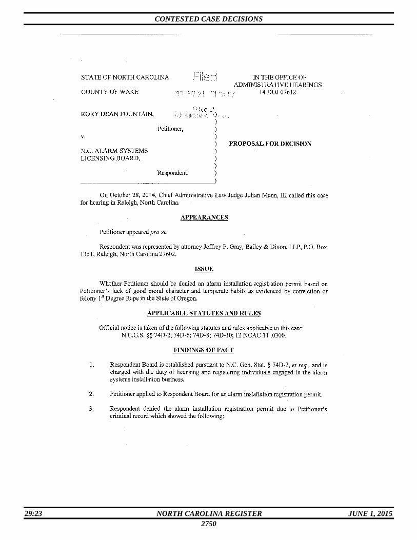
CONTESTED CASE DECISIONS
29:23 NORTH CAROLINA REGISTER JUNE 1, 2015
2750

CONTESTED CASE DECISIONS
29:23 NORTH CAROLINA REGISTER JUNE 1, 2015
2751

CONTESTED CASE DECISIONS
29:23 NORTH CAROLINA REGISTER JUNE 1, 2015
2752

CONTESTED CASE DECISIONS
29:23 NORTH CAROLINA REGISTER JUNE 1, 2015
2753

CONTESTED CASE DECISIONS
29:23 NORTH CAROLINA REGISTER JUNE 1, 2015
2754

CONTESTED CASE DECISIONS
29:23 NORTH CAROLINA REGISTER JUNE 1, 2015
2755

CONTESTED CASE DECISIONS
29:23 NORTH CAROLINA REGISTER JUNE 1, 2015
2756
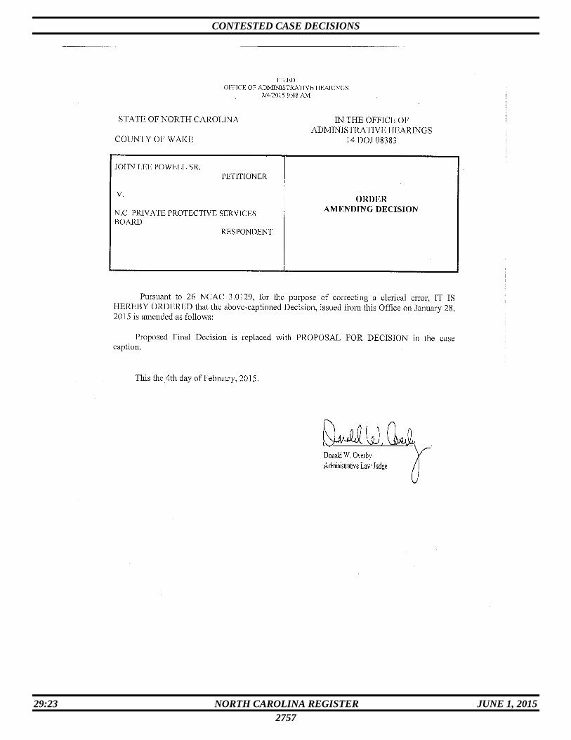
CONTESTED CASE DECISIONS
29:23 NORTH CAROLINA REGISTER JUNE 1, 2015
2757

CONTESTED CASE DECISIONS
29:23 NORTH CAROLINA REGISTER JUNE 1, 2015
2758
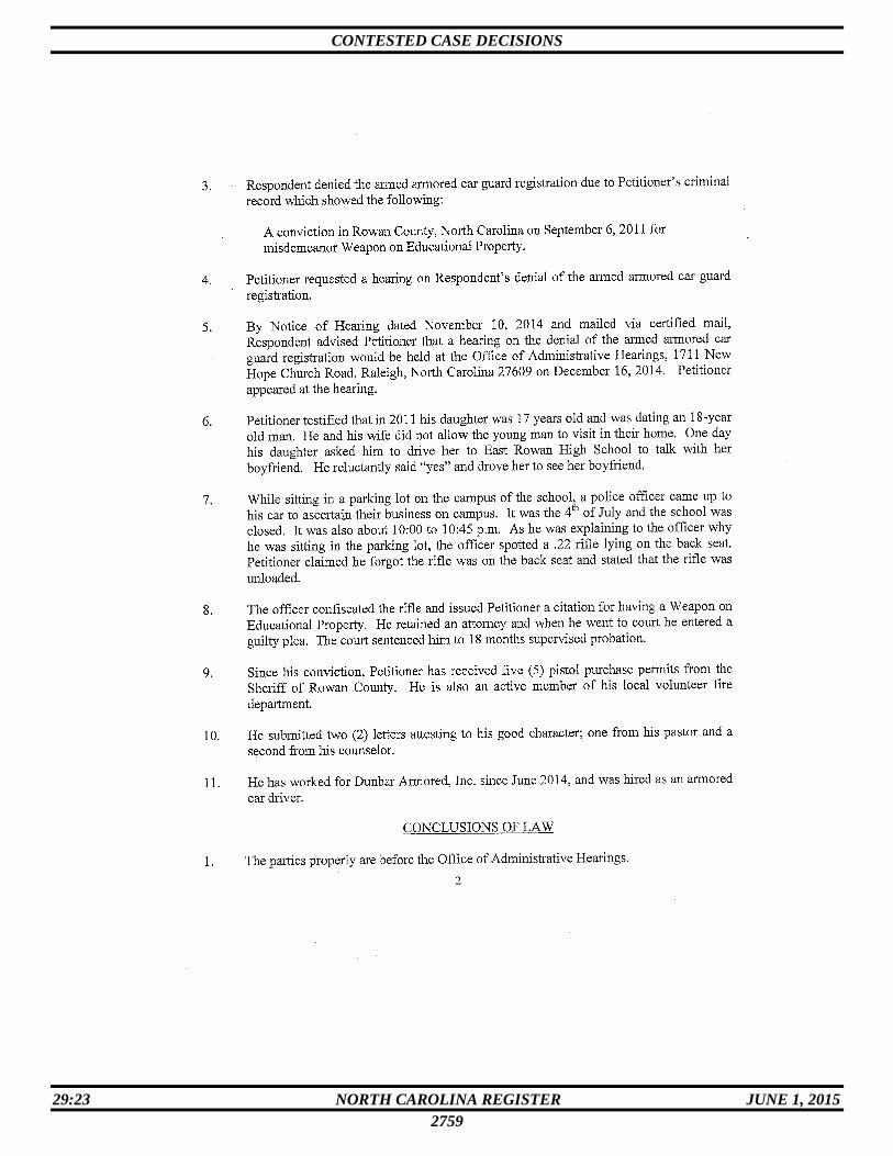
CONTESTED CASE DECISIONS
29:23 NORTH CAROLINA REGISTER JUNE 1, 2015
2759
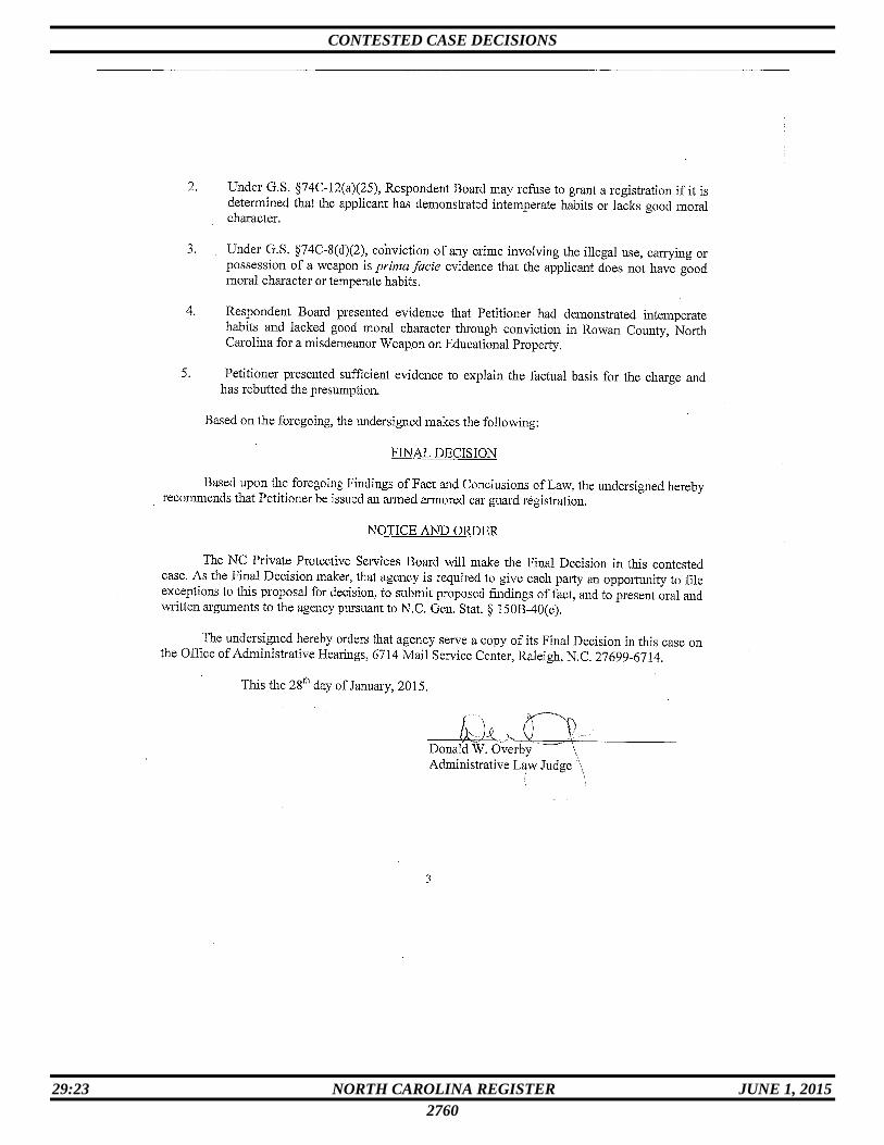
CONTESTED CASE DECISIONS
29:23 NORTH CAROLINA REGISTER JUNE 1, 2015
2760
CONTESTED CASE DECISIONS
29:23 NORTH CAROLINA REGISTER JUNE 1, 2015
2761