norwegian water information system: vann-nett an important tool in the water framework directive...
TRANSCRIPT

Norwegian Water Information System: Vann-Nett
An important tool in the Water Framework Directive (WFD) implementation
A more Streamlined Water Management with GIS
Lars Stalsberg, Norwegian Water Resources and Energy DirectorateLine Fjellvær, Directorate for nature management


GIS in the Water Framework Directive
• Implementation of The Water Framework Directive (WFD) (2000/60/EC) initiated the development of a Norwegian GIS based Water Information System (Vann-Nett) to able to:
• implement the directive• delineate water bodies (WB)• add attributes to the WB• present the data for the public• Report the data to ESA/EU
• Handle a large number of geographical data (today 16400 WBs)• Easy access to the WB which needs updating• Easy access for all users to retrieve data on an object• Easy to create statistics and maps for reports and the public

What is Vann-Nett?
•Vann-Nett consists of three different applications
• Vann-Nett Saksbehandler for executives who maintain WFD data (can be viewed by all stakeholders)
• Vann-Nett Innsyn which is created for all stakeholders who need easy access to WFD data
• Map• Statistics • Photos of WBs
• Vann-Nett Rapport which is a temporary application for fetching reports on all administrative levels
• Users ask for new reports which will be created in Crystal Reports as templates
•Vann-Nett both a Norwegian and an English version

Why ArcGIS Server in the WFD work?
•Our reasons for using an ArcGIS Server (AGS) and a multi-user ArcSDE database for Vann-Nett are that;
• All users work via the Internet in the same interface
• All users add data to the same central database (Oracle)
• All users can see all data in real time
• All users have got access to the same thematic datasets
• All users have access to templates for reports/statistics/maps
• Easy to centrally administer users, data and application
• Easy to add new data and templates to the users via the application
• Possible to hook up with other AGS, such as SFTs Vannmiljøsystem to fetch data in real time!
• In the future hook up to other AGS

The WFD data input Vann-Nett
•The users create new WB and update existing ones via the map interface or by using search engine

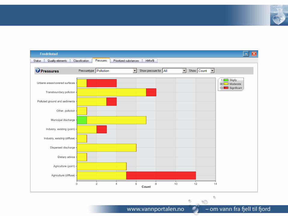
The WFD data output Vann-Nett
•Vann-Nett Public is used for data output on all administrative levels (Municipalities, counties, RBDA, Country) and for WBs
• Statistics on status and risk evaluation• Statistics on different pressure, quality elements etc• Detailed data on each WB

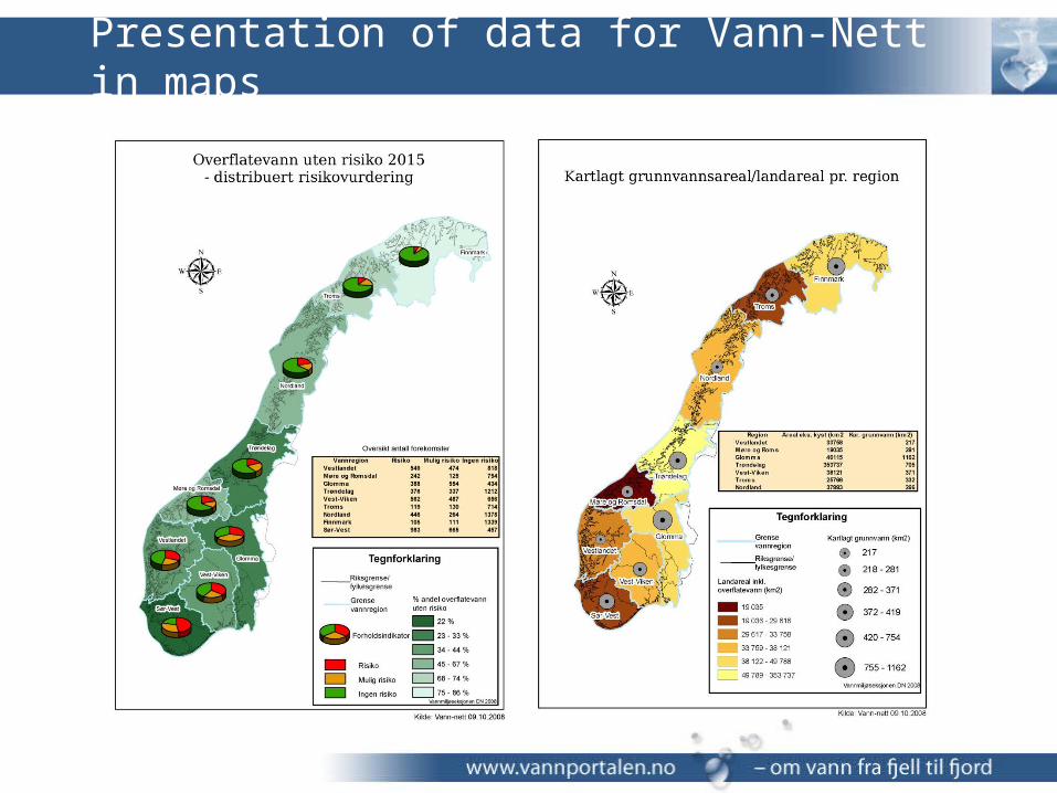
Presentation of data for Vann-Nett in maps

Heavily Modified Water Bodies


Thematic data
•No WMS for thematic data yet, because;• Thematic data via WMS has a long
response time in AGS• When a server is down, response time
even longer• Not always a good legend for the data
in the TOC• This might be improved in AGS 9.3,
but still a little early to see how this works in practice
• But, Vann-Nett has a service where users can add WMS locally!
•So, in Vann-Nett we use locally stored data (still)
• Gives good response time, but no updates from owners (of course, manual updates are no good solution)
• Geocache for vector and orthophoto works very fast and parks WMS totally
• Users are very concerned about response time
• As time and money allows we will look into new ways of displaying thematic data in Vann-Nett

Who is using Vann-Nett?
•Users of the Vann-Nett applications are (and will be):
• Executive personnel administering the WBs and the data
• Ministries and directorates• Municipalities• Press• The public• Eurostat, EEA, ESA and
the EU• NGOs and other
organizations

The future development of Norwegian Water Information System (2009)
• Streamlining of database to be fully compatible with SEIS - WISE and reporting
• Access to all documents and plans relevant for the WFD work fetched via Web-service
• Connecting Vann-Nett and Vannmiljøsystemet (Water Environmental System) will be connected
• And more……
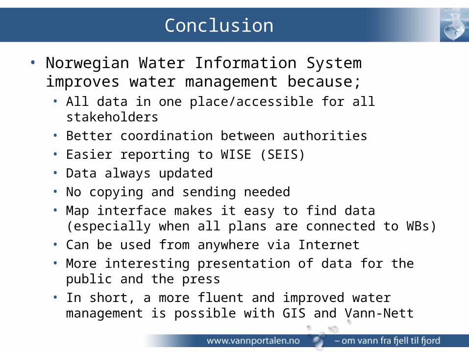
Conclusion
• Norwegian Water Information System improves water management because;• All data in one place/accessible for all stakeholders• Better coordination between authorities• Easier reporting to WISE (SEIS)• Data always updated• No copying and sending needed• Map interface makes it easy to find data (especially when all
plans are connected to WBs)• Can be used from anywhere via Internet• More interesting presentation of data for the public and the press• In short, a more fluent and improved water management is
possible with GIS and Vann-Nett

• Feel free to test these links• Executive version:
http://vann-nett.nve.no/vann-nett• Public version:
http://vann-nett.nve.no• Reports in Norwegian:
http://vann-nett.nve.no/rapport
• Thank you for your attention