nyack - geophysical characterization problem - determine subsurface parameters, relevant to fluid...
Post on 21-Dec-2015
217 views
TRANSCRIPT

Nyack - Geophysical Characterization
Problem - determine subsurface parameters, relevant to fluid flow and basin evolution, from non-invasive observations made on the surface.
Expectations - simple visual observation indicates a bed load dominated, glacial fluvial system. Thus one expects a fairly thin valley fill dominated by non-continuous, coarse grained fluvial components.

Two Geophysical Methods
• Gravity for bedrock configuration. Gravity is the measure of the mutual attraction of masses. The valley fill is significantly less dense than the surrounding bedrock.
• Radar for characterization of very shallow stratigraphy. Different mixes of valley fill have slightly different dielectric properties which affect the propagation of radar waves according to Maxwell’s equations.
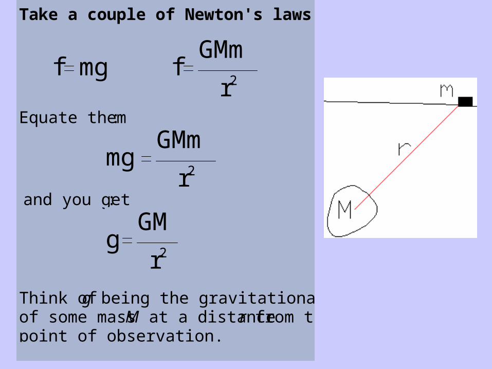
Take a couple of Newton's laws:
f mg fGMm
r2
Equate them:
mgGMm
r2
and you get:
gGM
r2
Think of g being the gravitational effect of some mass M at a distance r from the point of observation.

We measure gz, the vertical component of gravity:
Integrate over all mass in a distant volume to get theanomalous gravity at a point, P:
g P( ) zyxGr 2
dM d d d


Gravity anomaly from equal bodies, different depths. Area under the curves is equal.

Here’s where we currently have gravity observations

Gravity Observations - collect and process
•Collect observations, GPS gives +/- 30 cm elevation control
•Correct observations for:
• instrumental and tidal drift (+/- 0.002 mgal)
• latitude (+/- 0.001 mgal)
• elevation above mean sea level (+/- 0.1 mgal)
• local/regional deviations in topography
Thus total error is ~ +/- 0.11 milligal
d/d(horizontal) +/- 0.05 mgal/km for terrain correction

Color is terrain correction; contours are topography
Terrain corrections are largest source of error but not random error

Complete Bouguer Anomaly on Topography

• Processing ends and interpretation begins
• A subjective step
• Probably the most important step in gravity methods
Observed Gravity - Regional Gravity = Residual Gravity
Knowns for the Nyack Valley:
• We are looking for the anomaly caused by the lower density valley fill. Thus at the bedrock contacts at the valley’s edge, the residual gravity must be near zero
• Bedrock density is around 2800 kg/m^3 (experience)
• Glaciation post dates faulting - valley is roughly U-shaped
• Model results must fit gradients and volume of anomaly values

Gravity from Beyond ~ Planar

Regional Gravity as Best Fit Plane

Residual at Small Scale
Residual, from shallow sources, centers on zero milligals.

Residual - After Adjusting for Known Zeroes
Magenta = zero residual contour; green = known zeroes; cyan = data

Color is Residual; Contours on Topography

Compare Complete Bouguer Anomaly and Residual
Removed planar regional
Residual’s zero (faint magenta line) approximates bedrock contact


Poor fit - density contrast too low
High gradients and short-radius curvature require high density contrast and help bound density contrast. This was delta-rho = -250 kg/m^3; higher delta rho means shallower basin

Profile A-A’; with delta rho = -700 kg/m^3
Maximum depth ~ 109 meters

Profile B-B’; with delta rho = -700 kg/m^3
Maximum depth ~ 150 meters; close to gravity minimum

Gravity - that’s where we are


Maxwell’s Equations
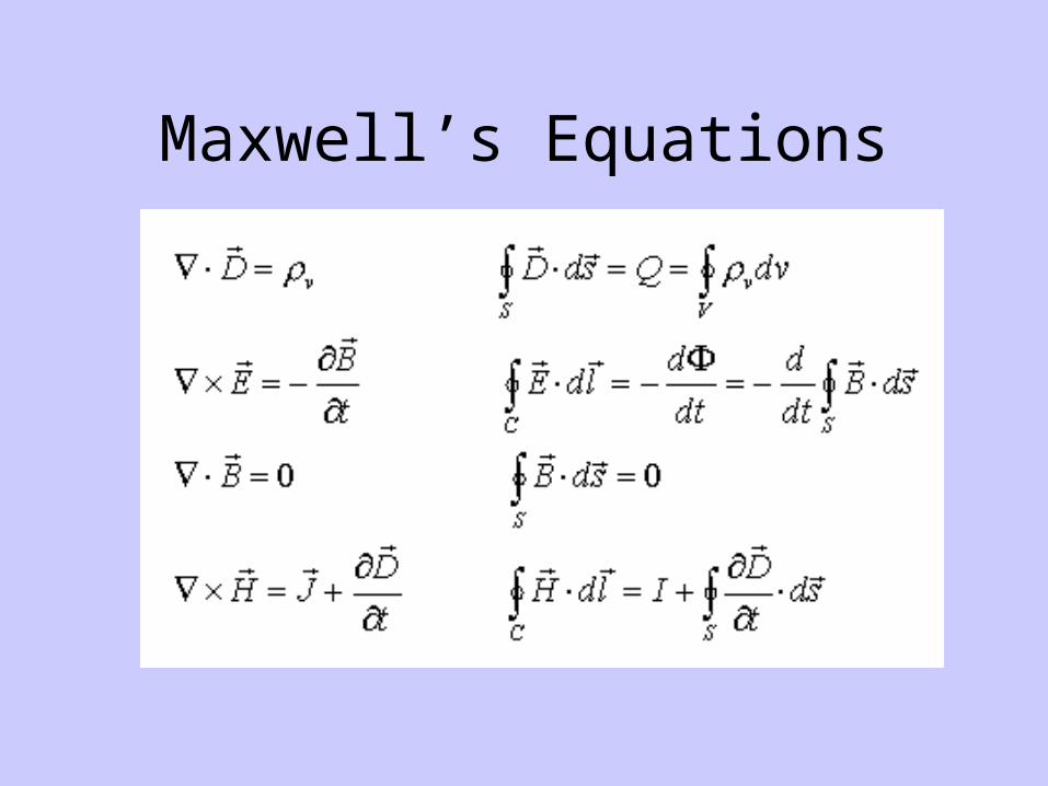
Maxwell’s Equations