oeqc publication form the environmental notice
TRANSCRIPT


OEQC Publication Form The Environmental Notice
Name of Project: HI-SEAS/PISCES Mars Habitat Project
Applicable Law:
Chapter 343, HRS
Type of Document: Final EA
Island: Hawai`i
District: North Hilo
TMK: (3rd
.) 3-8-001:001 (por.)
Permits Required: State of Hawai‘i; Conservation District Use Permit; Forest Reserve Special Use Permit; State Historic Preservation Division Determination of No Effect
Name of Applicant or Proposing Agency: Address City, State, Zip Contact and Phone
University of Hawai‘i 2440 Campus Road, Box 368 Honolulu, Hawai‘i 96822 Dr. Kim Binsted, 808-398-1300, [email protected]
Approving Agency: Address City, State, Zip Contact and Phone
University of Hawai‘i 2440 Campus Road, Box 36 Honolulu, Hawai‘i 96822 Dr. Kim Binsted, 808-398-1300, [email protected]
Consultant Address City, State, Zip Contact and Phone
Geometrician Associates PO Box 396 Hilo HI 96721 Ron Terry, 969-7090
Project Summary. The Department of Information and Computer Sciences at the University of Hawai‘i at Manoa UHM), in collaboration with Cornell University and the Pacific International Space Center for Exploration Systems (PISCES), seeks to prepare and manage a temporary experimental site at the 8,000-foot elevation on Mauna Loa, on Hawai‘i Island. The site is on a cinder cone ridge surrounded by lava flows and closely resembles the surface of Mars. Experiments conducted over five years would utilize a small, portable “habitat” similar to one that might be constructed for Mars to focus on issues astronauts will experience as they explore the solar system. The central experiment will focus on food needs during long-term planetary exploration missions. The project will also partner with schools for student participation through internships, classes and outreach with K-12 students. The project would install the habitat within an area of about 0.5 acres of State land on a disturbed part of the former quarry in the Mauna Loa Forest Reserve. All wastewater and biological waste will be contained for regular servicing and removal. Power will be supplied by an ultra-quiet and efficient generator. The site contains little vegetation, no rare, threatened or endangered species, and no archaeological sites or cultural practices. In order to keep the site isolated, the quarry access road would be gated and locked at a point about 2,300 feet west of Mauna Loa Road during the five years of the experiment. After five years, the project would terminate, the habitat would be removed, and the site would be cleared of any debris or traces of the experiment.

HI-SEAS/PISCES Mars Habitat Project Final EA Distribution List Theresa Donham, Archaeology Branch Chief State Historic Preservation Division 40 Po‘okela Street Hilo HI 96720 Deputy Director Environmental Health Administration Hawai‘i State Department of Health P.O. Box 3378 Honolulu HI 96801 Russell Tsuji, Administrator Hawai‘i State Land Division P.O. Box 621 Honolulu HI 96809 Bobby Jean Leithead-Todd, Director Hawai‘i County Planning Dept. 101 Aupuni Street, Suite 3 Hilo HI 96720 PISCES Cultural Advisory Committee NOAA - Mauna Loa Observatory John Barnes 1437 Kilauea Ave. #102 Hilo, Hawaii, 96720 Librarian Hilo Public Library 300 Waianuenue Avenue Hilo HI 96720

Dear Participant: Attached for your records is a Final Environmental Assessment (FEA) and Finding of No Significant Impact (FONSI) prepared pursuant to the EIS law (Hawaii Revised Statutes, Chapter 343) and the EIS rules (Administrative Rules, Title 11, Chapter 200).
Project Name: HI-SEAS/PISCES Mars Habitat Project Location: Island: Hawai‘i District: North Hilo Tax Map Key Number: (3rd.) 3-8-001:001 (por.) Proposing/Approving Agency: University of Hawai‘i Address: 2440 Campus Road, Box 368
Honolulu, Hawai‘i 96822 Contact: Dr. Kim Binsted Phone: 808-398-1300 Email: [email protected]
If you no longer need the Draft EA or Final EA, please recycle it. Thank you for your participation in the Environmental Assessment process.

Dear Participant: This notice is to inform you that that a Final Environmental Assessment (FEA) and Finding of No Significant Impact (FONSI) prepared pursuant to the EIS law (Hawai‘i Revised Statutes, Chapter 343) and the EIS rules (Administrative Rules, Title 11, Chapter 200) is available for your review and records. As of February 23, 2013, the EA is available for download at: http://hawaii.gov/health/environmental/oeqc/index.html
Project Name: HI-SEAS/PISCES Mars Habitat Project Location: Island: Hawai‘i District: North Hilo Tax Map Key Number: (3rd.) 3-8-001:001 (por.) Proposing/Approving Agency: University of Hawai‘i Address: 2440 Campus Road, Box 368
Honolulu, Hawai‘i 96822 Contact: Dr. Kim Binsted Phone: 808-398-1300 Email: [email protected]
Thank you for your participation in the Environmental Assessment process.

HI-SEAS/PISCES Mars Habitat Project
Final Environmental Assessment
University of Hawai‘i
February 2013
Submitted Pursuant to Chapter 343, Hawai‘i Revised Statutes (HRS)


HI-SEAS/PISCES Mars Habitat Project
Final Environmental Assessment
Humu‘ula, North Hilo District, Island of Hawai‘i
Tax Map Key Number: (3rd) 3-8-001:001 (por.) PROPOSING/APPROVING AGENCY: University of Hawai‘i 2440 Campus Road, Box 368 Honolulu, HI 96822 CONSULTANT:
Geometrician Associates P.O. Box 396 Hilo, Hawai‘i 96721
CLASS OF ACTION:
Use of State Funds and Land Use of Land in Conservation District
This document is prepared pursuant to: Hawai‘i Environmental Policy Act,
Chapter 343, Hawai‘i Revised Statutes (HRS), and Title 11, Chapter 200, Hawai‘i Department of Health Administrative Rules (HAR)

[this page intentionally left blank]

i HI-SEAS/PISCES Mars Habitat Project Environmental Assessment
TABLE OF CONTENTS SUMMARY ................................................................................................................................. ii PART 1 PURPOSE AND NEED FOR THE PROPOSED ACTION................................ 1 PART 2 PROPOSED ACTION AND ALTERNATIVES ................................................ 1 PART 3 AFFECTED ENVIRONMENT/ENVIRONMENTAL CONSEQUENCES ........ 7 3.1 Geology ................................................................................................................ 7 3.2 Water Resources ................................................................................................. 9 3.3 Biological Resources ......................................................................................... 10 3.4 Cultural Resources .............................................................................................. 13 3.5 Air Quality ........................................................................................................... 21 3.6 Noise and Visual Resources ................................................................................. 22 3.7 Socioeconomics and Land Use ............................................................................ 23 3.8 Safety and Environmental Health ........................................................................ 26 3.9 Utilities ................................................................................................................ 28 3.10 Traffic and Transportation ................................................................................... 28 3.11 Cumulative Impacts ............................................................................................. 29 PART 4 STATE OF HAWAI‘I FINDINGS ...................................................................... 30 PART 5 REFERENCES .................................................................................................... 32 PART 6 PERSONS AND AGENCIES CONTACTED .................................................... 33 PART 7 LIST OF PREPARERS........................................................................................ 33 LIST OF FIGURES FIGURE 1 Location Map ..................................................................................................... 3 FIGURE 2 Aerial Image ........................................................................................................ 3 FIGURE 3 Project Site Photos .............................................................................................. 4 FIGURE 4 Conceptual Habitat Design ................................................................................ 5 FIGURE 5 Typical Generator Appearance ............................................................................. 6 APPENDIX 1a Comments in Response to Pre-Consultation APPENDIX 1b Comments to Draft EA and Responses APPENDIX 2 Arthropod Survey APPENDIX 3 Archaeological Survey

ii HI-SEAS/PISCES Mars Habitat Project Environmental Assessment
SUMMARY OF THE PROPOSED ACTION, ENVIRONMENTAL IMPACTS AND MITIGATION MEASURES
The Department of Information and Computer Sciences at the University of Hawai‘i at Manoa (UHM), in collaboration with Cornell University and the Pacific International Space Center for Exploration Systems (PISCES), seeks to prepare and manage a temporary experimental site at the 8,000-foot elevation on Mauna Loa, on Hawai‘i Island. The site is on a cinder cone surrounded by lava flows and closely resembles the surface of Mars. Experiments conducted over five years would utilize a small, portable “habitat” similar to one that might be constructed for Mars to focus on the operational and psychological issues astronauts will experience as they explore the solar system. The central experiment will focus on food needs during long-term planetary exploration missions, which must consider packaging waste, energy efficiency, scheduling, menu fatigue and social cohesion in the crew. The UHM study, entitled HI-SEAS (Hawai‘i Space Exploration Analog and Simulation), will examine the tradeoffs (energy, effort, satisfaction, waste) between pre-prepared meals and meals that require some preparation. The project would install a “habitat” within an area of about 0.5 acres on a previously disturbed portion of the quarried cinder cone ridge. The State of Hawai‘i land is within the Conservation District and is part of the Mauna Loa Forest Reserve. It is almost devoid of vegetation and contains no rare, threatened or endangered species. Consultation has revealed no cultural resources or practices. The habitat will be a self-contained unit with sleeping quarters, a kitchen, a computer and lab workspace, and a bathroom, along with an accessory water tank and wastewater tank. All wastewater and biological waste will be contained for regular servicing and removal. Power will be supplied by an ultra-quiet and efficient generator. The habitat structure would have about 900 square feet of floor space and be 20 feet in height or less, and will be barely visible from any public vantage point. Access is via a 1.3-mile long 4WD road off of Mauna Loa Road. In order to keep the site isolated, this access road would be gated and locked at a point about 2,300 feet west of Mauna Loa Road during the five years of the experiment. The habitat would be inhabited by a crew of six for missions up to a year starting in early 2013 and lasting as long as five years. The crews will live and work under strict analog conditions, only venturing outside in simulated space suits, communicating with ‘Earth’ via channels disrupted by latencies and drop-outs, etc. These long-term analog missions also offer opportunity for other researchers, who will be invited to propose research studies to test their ideas in this environment. Possible topics include remote medicine, crew dynamics, communication technologies, psychological support strategies, and so on. The project will also partner with schools for student participation through internships, classes and outreach with K-12 students. After five years, the project would terminate, the habitat would be removed, and the site would be cleared of any debris or traces of the experiment. If at any time during or after the experiment PISCES determines the site suitable for additional uses, it would reapply for such uses.

1 HI-SEAS/PISCES Mars Habitat Project Environmental Assessment
PART 1 PURPOSE AND NEED FOR THE PROPOSED ACTION A number of serious risks are associated with long-term human space exploration, including radiation, microgravity, confinement in small spaces, and nutritional deficits, that can affect crew behavior, health and mission success (http://humanresearchroadmap.nasa.gov/Evidence/ ) To successfully return to the Moon, or venture onwards to Mars, asteroids or other deep-space destinations, scientists will need to assess these risks and develop reliable countermeasures. Some of these risks that require study are also common to isolated, confined and/or extreme environments here on Earth. These are called analog environments, because they share a significant subset of the conditions astronauts will face in long-term space exploration. Hawai‘i has some very strong analog environments, which have the geological, operational and psychological characteristics of the environments astronauts will experience as they explore the solar system. The Department of Information and Computer Sciences at the University of Hawai‘i at Manoa (UHM), in collaboration with Cornell University, seeks to utilize such an analog environment to gain critical information on the food that astronauts will eat during long-term planetary exploration missions. The current NASA food system, which uses individual pre-prepared meals, was designed for the Space Shuttle and International Space Station. However, longer-term missions must consider packaging waste, energy efficiency, scheduling, menu fatigue and social cohesion in the crew. The UHM study, entitled HI-SEAS (Hawai‘i Space Exploration Analog and Simulation), will look at the tradeoffs (energy, effort, satisfaction, waste) between pre-prepared meals and meals that require some preparation, over the long term. To be valid, this study must take place in a realistic operational analog, with the kind of workload, communications issues, and psychological stresses that an astronaut crew would face. PART 2 PROPOSED ACTION AND ALTERNATIVES Proposed Action, Location and Property Ownership UHM has teamed with the Pacific International Space Center for Exploration Systems (PISCES) to identify and obtain land use permits and prepare and manage an appropriate experimental site on the Island of Hawai‘i, where large extents of high altitude lava landscapes are present. PISCES, an agency of the Department of Business, Economic Development and Tourism (DBEDT) based out of the University of Hawai‘i at Hilo (UHH), is an international research and education center dedicated to the development, verification and validation of new technologies needed for operations on the Moon, Mars and beyond. PISCES is built on partnerships between industry, private entrepreneurs, academia and the governmental agencies of space-faring nations of the world. PISCES is currently planning a simulated lunar outpost (robotic and human) on the Island of Hawai’i, where research will be conducted and new technologies will be developed. Here the public will be invited to experience first-hand what it will be like to live and work on the Moon and, eventually, on Mars. Because of its local origin and management, PISCES has been successful in accomplishing this program in a way that protects the unique natural and cultural resources of Hawai‘i. A central theme of PISCES activities are opportunities for student

2 HI-SEAS/PISCES Mars Habitat Project Environmental Assessment
participation through internships, classes and outreach with K-12 students. For these reasons, PISCES is an appropriate partner and host for the HI-SEAS experiment. The HI-SEAS/PISCES project would transport and install a “habitat” within an area of approximately half an acre on a previously quarried cinder cone ridge in the Conservation District within the Mauna Loa Forest Reserve, which is owned by the State of Hawai‘i and administered by the Department of Land and Natural Resources, Division of Forestry and Wildlife (DOFAW) (Figures 1-2). The cinder cone ridge is located at about 8,060 feet in elevation on the slopes of Mauna Loa and is dated from between 1,500 and 3,000 years before the present. Access to the site is via a 1.3-mile long 4WD road off of Mauna Loa Road, at UTM 239180 E 2169440 N. A portion of the cinder cone has previously been quarried and reworked by heavy equipment, providing an already disturbed surface (Figure 3). Disturbance will involve filling and leveling various patches on the existing road , utilizing operators who regularly maintain DLNR roads and equipment that has been cleaned of soil and seeds to avoid introduction of invasive species, as well as very slight dressing and leveling the already loose cinder on several hundred square feet of the habitat site with a small backhoe. Experience in this environment indicates that rearranging this cinder will not lead to any potential for erosion and sedimentation, and no special erosion prevention measures will be required. The habitat, which is currently under design, will be a small, self-contained unit with sleeping quarters, a kitchen, a computer and lab workspace, and a bathroom, along with an accessory water tank and wastewater tank placed near the habitat (Figure 4). All wastewater and biological waste will be contained for regular servicing and removal. Power will be supplied with a Planetary Power Hy-Gen variable speed diesel generator, which is quieter, less polluting and uses up to 60% less fuel than other gensets. It can utilize locally available biodiesel and can operate silently at night by powering the habitat off of its on-board battery packs. No cement pad will be required, as the 4 x 5 x 3.5-foot generator will sit on a rubber-tired, single-axle mini-trailer, similar to one used for a small cement mixer (Figure 5). Fuel will be delivered during the weekly truck visits. The habitat structure would have approximately 900 square feet of floor space (including a small loft) and be 23 feet in height or less; accessory structures would be substantially shorter. The habitat would be inhabited by a crew of six for missions up to 12 months. The series of missions will start in early 2013 and last as long as five years. The crews will live and work under strict analog conditions, only venturing outside in simulated space suits, communicating with ‘Earth’ via channels disrupted by latencies and drop-outs, etc. These long-term analog missions are also an excellent opportunity for other human factors researchers, who will be invited to propose and implement opportunistic research studies to test their ideas in this environment. Possible topics include remote medicine, crew dynamics, communication technologies, psychological support strategies, and so on. Because there are a large number of identified risks that can only be studied under long-term controlled analog conditions, it is hoped

3 HI-SEAS/PISCES Mars Habitat Project Environmental Assessment
Figure 1 Location Map
Figure 2 Aerial Image

4 HI-SEAS/PISCES Mars Habitat Project Environmental Assessment
Figure 3 Project Site Photos
Landscape surrounding proposed habitat site ▲ ▼ Proposed location of habitat
KEY: (Locations conceptual) Circle and rectangle mark habitat site and storage
A: water tank; B: septic tank; C: power system; D: storage container

5 HI-SEAS/PISCES Mars Habitat Project Environmental Assessment
Figure 4. Conceptual Habitat Design
Plan View of Habitat ▲ ▼ Second Floor

6 HI-SEAS/PISCES Mars Habitat Project Environmental Assessment
Figure 5. Typical Generator Appearance
to repeat this simulated mission scenario regularly, so that all the necessary countermeasures can be explored, developed and thoroughly tested. In order to keep the site isolated from casual vehicular access, which would degrade the quality of the experiment, the access road to the quarry would be gated during the five years of the experiment and locked at a point about 2,300 feet west of Mauna Loa Road, at approximately at UTM 240452 E 2169127 N (see Figure 2 for location). A “Knox Box” type of lock is planned for the gate. PISCES will apply through the Hawai‘i County Fire Department to register and obtain the necessary lock, and emergency services including DLNR, the Police Department, the Fire Department and Civil Defense will then have a universal key that will open all Knox Boxes. After the project is over, the site will be restored. It is important to recall that the project would occur in an already disturbed pile of cinder left behind from quarrying. Site restoration will consist of removing all equipment and material; ensuring that no small pieces of trash remain behind; raking areas of loose cinder on which blocks have been placed to get a more natural appearing surface; and monitoring the site after three months, six months and a year to determine if any invasive plants or animals have taken hold and deal with them appropriately in cooperation with DOFAW.

7 HI-SEAS/PISCES Mars Habitat Project Environmental Assessment
The Department of Land and Natural Resources would have a key to a separate lock, and any legitimate access request could be applied for and obtained after consultation with PISCES. After five years, the project would terminate, the habitat would be removed, and the site would be cleared of any debris or traces of the experiment. If at any time during or after the experiment PISCES determines that the site is suitable for additional experimental uses, it would begin a new Conservation District Use Application and comply with all applicable Hawai‘i environmental laws and regulations. Alternatives As discussed above, the project needs a realistic planetary-surface habitat under strong operational conditions to understand and address the risks of long-term human space exploration. The following criteria were considered highly desirable for potential sites:
• Physically isolated from used roads and trails, so that passersby are unlikely • Visually isolated, so that minimal human activity can be seen from the site • Low visibility from any roads or nearby public vantages, to discourage sightseers • Accessible by 4WD vehicle and service trucks, but with a securable access so that a gate
can be emplaced to discourage visitors • Very little vegetation • Very little macroscopic animal life such as mammals or birds • Mars-like physical geology • Pre-graded to minimize disturbance of existing sites but maximize usability of site • Moderate temperature, so that sorties in mock-up suits are tolerable • No significant environmental or cultural impact
In general, Mauna Kea is considered more sensitive in terms cultural, biological and hunting resources, and therefore attention was focused on Mauna Loa. The requirement for feasible access limited the search to sites that connected to Mauna Loa Access Road. There are potentially other sites on that have some of these characteristics, but none have been identified except the subject site that met all criteria. PART 3 AFFECTED ENVIRONMENT AND ENVIRONMENTAL CONSEQUENCES 3.1 Geology
3.1.1 Definition of Resource For the purposes of this analysis, geology includes surface geology, topography, geological hazards, and soils.
3.1.2 Region of Influence
8 HI-SEAS/PISCES Mars Habitat Project Environmental Assessment
The region of influence (ROI) for geology includes the approximately half-acre area directly affected by physical activities from the proposed project.
3.1.3 Surface Geology The project site is on the side of an elongated ridge of cinder/spatter cones from a Mauna Loa eruption dated from between 1,500 and 3,000 years before the present (see maps, aerial images and photographs in Figures 1-3). Just west of the ridge of cinder cone is a pahoehoe lava flow associated with the eruption (Wolfe and Morris 1996).
3.1.4 Topography As illustrated in Figure 3, the surface of the site has been modified by heavy equipment excavating and/or compacting the edge of an elongated cinder cone with multiple vents. The topography is irregular and slopes slightly upwards towards the axis of the cones.
3.1.5 Soils The lava landscape is too young to have developed soils and is not classified as a soil by the U.S. Natural Resources Conservation Services (U.S. Soil Conservation Service 1973). As a consequence, plants are present in only very restricted locations.
3.1.6 Seismicity/Lava Flow Hazards The project site is rated Lava Flow Hazard Zone 2 on a scale of ascending risk from 9 to 1. The hazard risk here is based on the fact Mauna Loa is an active volcano. Volcanic Hazard Zone 2 consists of areas on both sides of the northeast and southwest rift zones, which are downslope of potential eruption sites. About 20 percent of this area has been covered by lava in historical time, 5 percent since 1950. In terms of seismic risk, the entire Island of Hawai‘i is rated Zone 4 Seismic Hazard (Uniform Building Code, Appendix Chapter 25, Section 2518). Zone 4 areas are at risk from major earthquake damage, especially to structures that are poorly designed or built.
3.1.7 Impacts and Mitigation Measures Preparation of the project site will involve only very minor leveling with hand tools or a small loader/excavator, as the habitat can be set on leveled blocks and no other structures will be used. The substrate is adequate for the modest weight of the habitat. UHM and PISCES will monitor volcanic activity in the area and will suspend the activity if eruption activity warrants it.

9 HI-SEAS/PISCES Mars Habitat Project Environmental Assessment
3.2 Water Resources
3.2.1 Definition of Resource Water resources are defined here to encompass the nation’s lakes, streams, groundwater, wetlands, and coastal areas that are intended to be protected by the federal Clean Water Act (33 USC 26 parts 1251 et seq., 2000). Groundwater refers to subsurface hydrologic resources such as aquifers that are used for domestic, agricultural, and industrial purposes. Wetlands are defined by the U.S. Army Corps of Engineers (USACE) as areas that are characterized by a prevalence of vegetation adapted to saturated soil conditions, and are identified based on specific soil, hydrology, and vegetation criteria defined by USACE. For the purposes of this analysis, floodplains are also included in water resources, and they are defined as any low-lying area designated by the Federal Emergency Management Agency (FEMA) subject to inundation by a 100-year flood (i.e., a flood that has a one percent chance of being equaled or exceeded in any given year).
3.2.2 Region of Influence The region of influence (ROI) for water resources includes the approximately half-acre area directly affected by physical activities from the proposed project, as well as areas immediately downslope, which could be affected by any runoff from the habitat roof. Because the project would not take water or affect water in underlying aquifers, which lie thousands of feet below the project surface, no aquifers are included in the ROI.
3.2.3 Water Supply There is no existing water supply at the site.
3.2.4 Water Quality There are no streams, lakes, springs, wetlands or other water bodies in the project area, which contains lava flows too geologically young to have developed surface water features. Basal, perched and perhaps confined artesian aquifers associated with high elevation precipitation input from Mauna Loa and Mauna Kea are presumed to lie several thousand feet below the surface of the Mauna Loa-Mauna Kea Saddle area. The nature of these aquifers is currently being investigated in a research exploratory well project about 10 miles north at Pohakuloa Training Area (UH Hawai‘i Institute of Geophysics and Planetology 2012).
3.2.5 Floodplains and Drainage The project site is not within an area mapped on Flood Insurance Rate Maps prepared by the Federal Emergency Management Agency (FEMA). The project site is thus classified within Zone X, outside a designated floodplain. There are no known areas of local, unmapped flood hazard, due to the highly permeable surface and low rainfall.

10 HI-SEAS/PISCES Mars Habitat Project Environmental Assessment
3.2.6 Impacts and Mitigation Measures
The proposed project would have no impact on water supply, water resources or floodplains. The habitat will include a water supply of 500 1,000 gallons that will require filling at least every 18 days via truck; current plans are to top off the tank weekly. As discussed in Section 3.9, below, both grey water and wastewater will be stored and transported offsite. Due to the very restricted nature of new impermeable surface associated with the project – essentially the 1,200 square feet of the footprint of the habitat and accessory structures – there will be no measurable runoff. In addition, the surrounding substrate of volcanic cinder and pahoehoe lava flows is extremely permeable and absorbs all precipitation or other water input immediately, with no runoff. 3.3. Biological Resources
3.3.1 Definition of Resource Biological resources are plant and animal species and the habitats in which they occur. This analysis divides these resources into flora and vegetation; fauna; and special status species, including threatened, endangered, and sensitive species and their defined critical habitat.
3.3.2 Region of Influence
The region of influence (ROI) for biological resources is concentrated on the approximately half-acre area directly affected by physical activities from the proposed project. Although the project should be able to avoid introduction of any invasive species, the ROI also includes high elevation areas of Mauna Loa and Mauna Kea that could be affected by invasive species that might gain a foothold in alpine areas because of activities associated with any the project in this biologically sensitive area.
3.3.3 Flora and Vegetation As evident in Figures 2 and 3, the actual project site has very few individual plants because of its location on a previously graded substrate of volcanic ash. Undisturbed areas nearby on the ash and lava substrates contain the typical very sparse vegetation commonly found in similar substrates throughout Mauna Kea and Mauna Loa. Near the project site are a few small clusters of the native shrubs kupaoa (Dubautia scabra), pukiawe (Leptecophylla tameiameiae) and ōhelo (Vaccinium reticulatum). Cracks and undersides of rocks have a few mosses, ferns (Pellaea ternifolia) and lichens of various forms.
3.3.4 Fauna There are no native mammals in Hawai‘i except for Hawaiian hoary bats (Lasiurus cinereus semotus), which would not find the area suitable habitat because of the lack of vegetation that

11 HI-SEAS/PISCES Mars Habitat Project Environmental Assessment
provides roosting and foraging habitat. Similarly, the near absence of vegetation means that very few birds, whether native or alien, would be present. The presence of feral, non-native goats and/or sheep was indicated by scat. These animals are deleterious to native flora but are valuable as hunting resources. The habitat is extremely marginal for goats or sheep and they are likely present only very occasionally. Because there are rare native arthropods present in certain high elevation areas, and there is relatively little known about arthropod distribution in high elevation areas of Hawai‘i, the project included a survey for arthropods, the results of which are provided in Appendix 2. Six species of endemic but not rare arthropods were observed, as well as evidence of two moth larvae. The arthropods found during this survey are generally broadly distributed throughout the ‘a‘a and pahoehoe lava habitat types wherever their preferred microhabitat is present. There were no introduced invasive species except for some evidence of aphids on Vaccinium reticulatum, which are very commonly observed in this widespread plant. Importantly, no ants were observed.
3.3.5 Special Status Species No rare, threatened or endangered species were observed on the site or would find the site suitable habitat. However, the wide-ranging endangered Hawaiian Petrel (Pterodroma sandwichensis), and the threatened Newell’s Shearwater (Puffinus auricularis newelli), nest on the high mountains. The site does not appear suitable for nesting, but these birds may fly over the project site as they do many areas of the Hawaiian Islands. Fledglings of these birds at certain seasons may become disoriented by unshielded outdoor lighting and are vulnerable to injury or death.
3.3.6 Impacts and Mitigation Measures No impact to vegetation or flora would occur, as there are no plants on the actual site and only common alpine species nearby. As for fauna, there is a little or no use by native birds and no expected use by native Hawaiian hoary bats. The only other mammals very occasionally present are feral goats or sheep, which are not of conservation concern in Hawai‘i. The project would not cause impacts to native arthropods. Free-ranging predators and scavengers found in the substrates are also not likely to have their populations affected by disturbance in the small physical footprint of a half-acre or less. To avoid the potential downing of Hawaiian Petrels and Newell’s Shearwaters by their interaction with outdoor lighting, no unshielded lighting will be permitted after dark during either construction or operation of the project. All lighting will be shielded in conformance with the Hawai‘i County Outdoor Lighting Ordinance (Hawai‘i County Code Chapter 9, Article 14), which requires shielding of exterior lights so as to lower the ambient glare caused by unshielded lighting.

12 HI-SEAS/PISCES Mars Habitat Project Environmental Assessment
Projects in relatively undisturbed alpine areas of Hawai‘i should endeavor to avoid introduction of invasive species. It should be noted that all of Mauna Loa Road as well as the specific project site are and have been open to the public and there are no measures in place by DLNR or any other entity to prevent alien species introductions. Furthermore, emplacement of the habitat will involve only very minor leveling with hand tools or a small loader/excavator, and no fresh foods or plant materials are involved in the experiment. Nevertheless, the project will proactively incorporate a number of measures to ensure that invasive plants and animals are not accidentally introduced to the environment. These measures are modified from invasive species protocol in the extremely sensitive summit ecosystem of Mauna Kea and will be incorporated in the project’s operating procedures:
• All vehicles, equipment and supplies destined for the project site will be inspected for invasive plants, insects or other animals prior to travel to the habitat project site, if there is any potential for invasive species. If any plants, insects, or other animals are observed in any vehicle, equipment, or delivery, the items will be cleaned and the species removed. If these are unfamiliar or known highly invasive species, the Hawai‘i Department of Agriculture (HDOA) will be contacted.
• If invasive species are found during an inspection process, one of three options will be undertaken, depending on the circumstances: 1. Unpack and clean the delivery prior and repeat the inspection prior to leaving pier or
other facility where found. 2. Fumigate, using a State licensed and certified contractor appropriate to the threat
identified, the container or delivery. 3. Reject the delivery.
• If any off-Island motor vehicles and equipment (new or used) are involved, they will be pressure washed before first use at the project site.
• Contractors, subcontractors, and suppliers will be informed of these guidelines. • Immediate coordination with the Office of Mauna Kea Management (OMKM) will occur
if invasive species, particularly ants, are found on the site. Experts associated with OMKM can recommend a course of action, including authorities to contact.
3.4. Cultural Resources
3.4.1 Definition of Resource
Cultural resources are defined as those sites, structures, landscapes, districts, objects, records, and lifeway skills that are of importance to a culture or community for historic, scientific, traditional, or religious reasons. Cultural resources are tied to places, persons, events, or practices of social custom and traditional skills and are recognized for their heritage, social, educational, and scientific value through the passage of state and federal laws for their protection. Archeological resources are locations and objects from past human activities. Architectural resources are standing structures that are usually over 50 years of age and of significant historic or aesthetic value. Traditional cultural properties (TCPs) hold importance to Native Hawaiians or other ethnic groups for the continuing practice of traditional culture. Any of these properties may

13 HI-SEAS/PISCES Mars Habitat Project Environmental Assessment
meet the criteria for inclusion in the State Register of Historic Places. A determination of eligibility (Chapter 6e, Hawai‘i Revised Statutes) is a requirement of the Hawai‘i State environmental assessment process before State-funded initiation of ground disturbance or alteration of a landscape or structure.
3.4.2 Region of Influence The region of influence (ROI) for historic properties is concentrated on the approximately half-acre area directly affected by physical activities from the proposed project. Historic properties resources in areas outside this are not likely to experience any adverse effects from the proposed HI-SEAS/PISCES uses. The ROI for cultural resources is more difficult to define, because any impact to cultural practices related to the project may have impact to communities outside the immediate area, but for the present discussion it will be defined as the Hawaiian Islands.
3.4.3 Historic Properties As discussed previously, the project site is the end of a rough, unpaved road in a spot where vehicles have somewhat compacted the area, making it more suitable for the proposed use. There is no evidence of any archaeological features at or near the project site or on the access road. What appears to be a modern cairn is located at the top of the ridge, well away from the area occupied by the project. Because of the extensive physical disturbance of the surface and the lack of manmade structures, it would appear that there is no potential to affect historic properties. On November 15, 2012, the Hilo and Honolulu offices of the State Historic Preservation Division (SHPD) was requested by letter to concur that given the evident absence of historic properties, the project would not affect historic properties, or, if the agency was are unable to make that determination based on the information provided, to recommend additional information or reports needed to assess the effect on historic properties. As of December 6, 2012, no response had been received. SHPD was also provided a copy of the Draft EA for comment, and in a comment letter of January 11, SHPD requested an archaeological survey (see Appendix 1b). This survey, which was prepared by a professional archaeological consulting firm and determined that no historic properties were present or would be affected (see Appendix 3), has been submitted to SHPD and is expected to be approved within 30 days. In the unlikely event that historic properties are inadvertently discovered during any of the activities associated with either the development or maintenance of the project, activity in the area of the discovery will be halted and DLNR-SHPD contacted immediately.
3.4.4 Cultural Impact Assessment
The Constitution of the State of Hawai‘i clearly states the duty of the State and its agencies is to preserve, protect, and prevent interference with the traditional and customary rights of native Hawaiians. Article XII, Section 7 requires the State to “protect all rights, customarily and traditionally exercised for subsistence, cultural and religious purposes and possessed by ahupua‘a tenants who are descendants of native Hawaiians who inhabited the Hawaiian Islands

14 HI-SEAS/PISCES Mars Habitat Project Environmental Assessment
prior to 1778” (2000). In spite of the establishment of the foreign concept of private ownership and western-style government, Kamehameha III (Kauikeaouli) preserved the people’s traditional right to subsistence. As a result in 1850, the Hawaiian Government confirmed the traditional access rights to native Hawaiian ahupua‘a tenants to gather specific natural resources for customary uses from undeveloped private property and waterways under the Hawai‘i Revised Statutes (HRS) 7-1. In 1992, the State of Hawai‘i Supreme Court reaffirmed HRS 7-1 and expanded it to include,
“native Hawaiian rights…may extend beyond the ahupua‘a in which a native Hawaiian resides where such rights have been customarily and traditionally exercised in this manner” (Pele Defense Fund v. Paty, 73 Haw.578, 1992).
Act 50, enacted by the Legislature of the State of Hawai‘i in 2000, relating to Environmental Impact Statements, stated that:
“…there is a need to clarify that the preparation of environmental assessments or environmental impact statements should identify and address effects on Hawaii’s culture, and traditional and customary rights… “[H.B. NO. 2895].
Material prepared for the Saddle Road Improvements Environmental Impact Statement (EIS) (FHWA-CFLHD 1999, Vols. IV and V) include a Cultural Impact Assessment (CIA) by Pualani Kanahele Kanaka‘ole and Edward Kanahele of the Edith Kanakaole Foundation, along with a study of Traditional Cultural Properties (TCPs) by Dr. Charles Langlas. These studies provide a thorough assessment of the cultural background and values in the Saddle between Mauna Kea and Mauna Loa. The studies included extensive archival research, interpretation of chants and mele, and interviews with Hawaiian Home Lands (HHL) homesteaders and others. Most of the cultural background information in this EA is derived directly from this study and the summary of it prepared for the Saddle Road EIS (Ibid., vol. 1), which is paraphrased or quoted directly below. Native Hawaiian culture began at least 1,000 years ago when people from other Polynesian lands arrived to the Hawaiian Islands, Hawai‘i nei. Hawaiian culture developed independently from the rest of Polynesia, although there was intermittent input by later Polynesian visitors until at least the 1200s, when transoceanic voyages appears to have ceased. Stages of development of Hawaiian culture include the settlement era and the era of high culture.
• Settlement Era. The beginning date of the settlement era is not known with certainty, but it is likely to have occurred over a thousand years ago. The era encompasses settlement, development of stable water and food sources, and acclimatization of these settlers and their culture to the new environment. These settlers adapted beliefs and practices of their southern islands culture to the Hawaiian Islands. Their religious establishment, food culture, societal structure, and clan system were all altered to form a new Hawaiian culture.

15 HI-SEAS/PISCES Mars Habitat Project Environmental Assessment
• Era of High Culture. The era of high culture includes the refinement of the Hawaiian society in all aspects from 1200 to the time period of around 1800. This era of high culture saw the coalescing of political power through powerful military chiefdoms that at times took over an entire island or multiple islands. The state religion was an integral part of the political structure. This system was the kapu system, which became the backbone of the Hawaiian ruling caste and legal system. The kapu system regulated behavior and dealt out punishment for infractions. Another parallel system, as powerful as the kapu, was the ‘aumakua worship, a worship system that serviced clans and extended families. This family worship utilized deified ancestors as their gods and guardians who were seen as empathetic yet powerful clan and family spiritual agents. These ‘aumakua provided security and support of the family system’s cultural beliefs and practices.
In 1819, the kapu system was abolished by the ruling caste and the Hawaiian Kingdom evolved into a westernized constitutional monarchy. In 1893, the legal government of Queen Lili‘uokalani was overthrown from power. A two generation decline in Hawaiian socioeconomic status took place during the 1900s and was not arrested until the “Hawaiian Renaissance” began in 1970. The proposed project site is within the island of Hawai‘i, the ‘apana (political land section or district) of Hilo and the ahupua‘a of Humu‘ula. The high elevation areas of the island are considered to have religious importance to Native Hawaiians. Place names reflect the relationship of this area of concern with the indigenous people, their philosophy of life, and their gods. According to work by the Edith Kanaka‘ole Foundation, Lono-nui-akea was the original name for the Island of Hawai‘i. It is the sacred name of Lono, the god of stormy weather, dark clouds, and rain. Throughout Polynesia, two islands were honored as Ka inoa akua (the god name, or namesake), and the Island of Hawai‘i was one of these. The popular interpretation of Mauna Kea is “white mountain.” Mauna Kea is known around the world, and is regarded by many as the highest island mountain, the highest mountain in the world from below sea level, and the best mountain from which to make astronomical observations. To the Native Hawaiian, Mauna Kea is a Kupuna, a grandparent or ancestor, and an One hanau, birthplace or home, and its name may more properly relate to Wakea, the Sky Father. Another significant landmark within the project vicinity, located about 15 miles to the northwest, is Ka Pu‘u-a-Pele. The top of this cinder cone marks the joining of the ‘apana of Kona, Kohala, and Hamakua. In the words of Pualani Kanaka‘ole Kanahele and Edward Kanahele:
“Wakea and Papa are the original parents of native Hawaiians. Mythologically they are the marriage of sky and earth: Wakea, Sky Father and Papa, Earth Mother. Between the two all things were born. Mauna Kea is the piko (center of a beginning or ending) of the

16 HI-SEAS/PISCES Mars Habitat Project Environmental Assessment
island. This piko is the initial provider of the land mass of Hawai‘i mokupuni. Hawai‘i was also the hiapo, or first island child, of Papa and Wakea. The responsibilities and resources of Hawai‘i and Wakea are needed for the growth and well-being of the island and all living forms of this mokupuni. The kalo (taro, a staple food) was Wakea and Papa’s first food child and regarded as an elder brother who fed all indigenous natives, or kanaka maoli from the beginning of time today. During the time of ali‘i (chiefs, elite of the society) it was important for them to trace genealogy to the kalo and eventually to Wakea and Papa. When the genealogy could prove the connection they received the status of the senior line or hiapo line. Mauna Kea falls in the senior line genealogy. The Wakea and Papa beliefs and practices, including the tribute and respect for hiapo and kupuna, extend to contemporary times. Ancestral memory reminds the native Hawaiian that the mountain, like their parents, is the well-spring and provider of physical and spiritual nourishment. Strands of information from the past are found today in songs and people’s actions. Besides land, water is a vital element of life and living. The high mountains attract clouds, then the clouds shed their water and the water soaks into the earth. The Pohakuloa area has Lilinoe as the female deity of misty rain and heavy fog, while Poliahu is the snow deity which adorns the top of Mauna Kea during the winter. These male and female water forms both belong to the Mauna Kea area. The ancestors of Native Hawaiians were island people and used the ocean to travel from island to island. Due to the vastness of the ocean and the limited land base, the measurement for survival was the ability to acquire food. Resources for the acquisition of food included the reef, fresh water, and fertile soil. The Hawaiian moon calendar was devised to assist Hawaiians in gathering and planting on fortuitous days. Using the moon calendar, the forefathers calculated the established cycles of all life forms. It was based on many generations of observation and practice, and it proved successful. Other forms of traditional literature condone the fact that the ancestors made an effort to understand the intricacy of relationships of diverse life forms. One of the reasons for this was to protect and help sustain the food sources. They recognized a hierarchical order as well as a system of harmony and interaction of all existing life forms known to them. They observed and made critical analyses of their sky, land, and ocean spaces. Rain, ocean, clouds, wind movement, coral species of the ocean, and seeded plants of the uplands are referred to within a common bond for generating regrowth or as a food source. Kane was responsible for regeneration, and the ocean currents, rain, wind, and clouds move together to make this possible. For food systems to regenerate themselves, the sky, land, and ocean spaces unite in a harmonic and natural rhythm to maintain the

17 HI-SEAS/PISCES Mars Habitat Project Environmental Assessment
currents of water particles and clean air. This movement is known as lokahi. Lokahi is a system of working in unity and harmony. This knowledge was passed on through protocol, cultural practices, songs, and stories. Lokahi is the antithesis of hierarchy. Lokahi is the system which bypasses the hiapo system and does not give precedence to first born or senior line. It is the system which states that everything is equal because everything, no matter how small or large, has a function which is necessary to maintain the overall well being of the whole entity. Native Hawaiian ancestors lived within these two systems and measured everything by this frame of reference. One example is the division of ocean, sky, and land. These spaces were divided horizontally and vertically. The land division would be of primary concern for the proposed project. The most familiar is the vertical divisions, or moku and ahupua‘a sections common to maps of today. The boundary lines run from mountains to the ocean. The vertical boundaries followed mountains, rivers, streams, and cinder cones. The natural vegetation growth was the measuring device for the horizontal pattern of the second land division. For this division, vegetation growth dictated land division name changes. The forest, like the coral bed, is the food source and therefore a vital system for the continuum of life and life cycles. The trees house food for birds, insects, animals, and man, and produce seeds for regeneration. The forest provides vegetation used for medicinal purposes, spiritual adornment, housing construction, and many other items. The following information identifies the horizontal space and the kinds of flora typical to each of these horizontal land areas.
Kuahiwi. Kuahiwi means the mountain top, the backbone of the island, which is too high in elevation for heavy vegetation to grow. It is a very important area because of its height. Kualono. Kualono is the region near the mountain top. Little vegetation grows in this area. The mamane and naio are the only hardy trees to grow at this height. Both of these are hardwood trees. The flower of the mamane was a specialty for the ali‘i because of its shape and yellow color. When he wanted a special lei he would send his runners to fetch mamane flowers. ‘A‘ali‘i can also be found at this height. The PISCES project site is within the Kualono. Waoma‘ukele. Waoma‘ukele is the region named for the wet, soggy ground. This area was located in the rain belt of the island, especially on the ko‘olau side of each island. The typical trees of this area are the very large koa, ‘ohi‘a, varieties of lobelia, and mamane. Waoakua. Waoakua is the forested region below the waoma‘ukele. This area is said to be occupied by spirits of the forest. Man seldom ventured into this area

18 HI-SEAS/PISCES Mars Habitat Project Environmental Assessment
during ancestral times except when a particular kind of tree was needed and could not be found elsewhere. The large trees acquired from the waoakua and the waoma‘ukele deserved substantial offerings. This is the region where the forest had a greater variety of trees. Some of the trees found are kolea, ho’awa, kopiko, maile, maua, alani, koa, and ‘ohi‘a. Waokanaka. Waokanaka is the forested region makai (toward the sea) of the waoakua. This area was frequented by native Hawaiians. They found wood and other materials for weapons, house construction, tools, surfboards, and canoe accessories. They harvested dye, collected medicine, collected bird feathers, gathered vegetation for leis, gathered vegetation for the kuahu, gathered material for making rope, and many other useful things for everyday living. The trees in the waoakua are also found in this area, but the trees of this area may be smaller. Other flora found in this area include pilo, hapu‘u, holei, papala, hau kuahiwi, palapalai ‘olapa, and mamaki. Kula. Kula referred to the upland grassy plains. The plants of the kula included ’ilima, ma‘o, ‘ama‘u, ‘a‘ali‘i, ‘uluhe, and pili. Kahakai. Kahakai referred to the edge of the ocean. At the kahakai was found the niu, hala, kaunaoa, kamani, hau, milo, naupaka, lama, and alahe‘e. All plants were recognized as useful to the Hawaiian (FHWA-CFLHD 1998, Vols. IV and V).”
In evaluating the effects of the Saddle Road Improvements project, which occupied many of the zones listed above, the Edith Kanakaole Foundation identified these resources and concepts as of sufficient importance to potentially affect the quality of life for native Hawaiians and their relationship to the environment and land.
• Importance of vegetation and the identity of the land sections. • High cultural value of older or larger trees and kipuka which normally housed older trees. • Priority to promote new growth through the non-disturbance of seed producing forest
areas within the waoma‘ukele and waoakua. Hawaiians did not penetrate these areas if the trees they needed were available elsewhere.
• Importance of food source and regenerative energy of the forest. • Philosophy of “a life for a life.” When it was necessary to cut a large tree from the high
forest, an offering of a human sacrifice was made. • Importance of Waoma‘ukele as a good source of water, and for maintaining the richness
of the rainforest. Again, quoting Pualani Kanaka‘ole Kanahele and Edward Kanahele:
“Native Hawaiians are people whose daily lives and culture are rooted in and integrated with the surrounding natural and biological world. They recognized and practiced respect for hierarchy or hiapo for man and land alike. The mountain is the sacred child of Wakea,

19 HI-SEAS/PISCES Mars Habitat Project Environmental Assessment
and it is the source for the land. The mountains and land were genealogically connected to native Hawaiians through the original ancestor, Wakea and Papa. The mountains or land, water, and sky were a necessary part of the life cycle. The taro was regarded as an older brother of the land and provided sustenance. The coral was also an older brother (of the sea) and was the means through which other food could be acquired. The hierarchical system assigns rank to man, god, and the elements of the environment. Within the hierarchical food system another set of rules apply. The older or larger trees are primary and most important. The other animals that use these trees as their residence or food source are secondary. The lokahi system complements and maintains the well being of the whole entity. Everything is important because each has a function. Water was and is necessary for all life forms. Laws for water and the use of water were formulated so all had exposure to water. Water that did not touch ground was highly prized. Such as the water in the lake on Mauna Kea and the water in the piko of the taro leaf. Water that moved underground or over land from the mountain to the sea was sometimes funneled into irrigation channels and fed the older brother kalo and was also treasured. The mountain and the waoma‘ukele attracted the atmospheric water” (FHWA-CFLHD 1998, Vols. IV and V).
The resources of high importance in the Saddle area that were determined to be important as part of the above analysis were the mamane forest, kipuka, prehistoric trails, and historic trails. The cultural value of mamane/naio forest and kipuka is associated with the age and size of the trees. Although it would not be asserted that the setting of the PISCES project site renders it without cultural value, as all places and all elements of the landscape are bound together into a whole, each part of which has a function, it is important to note that no māmane trees, kipuka or trails are present on or near the project site. An interview with Henry Auwae conducted by Dr. Charles Langlas as part of the Saddle Road project’s Traditional Cultural Properties report is relevant to any study of traditional resources and practices in the Saddle region. Mr. Auwae’s knowledge of these sites may have been unique. He was the only one of informants recommended through contact and coordination with native Hawaiian organizations, which included former cowboys from Parker Ranch and Pu‘u O‘o Ranch, who professed knowledge of cultural sites in the area. Mr. Auwae attained his knowledge about ritual sites and burials from his great grandparents, who adopted him, and imparted their knowledge to him. When he was a boy, his great grandparents journeyed with him several times through the Saddle. His great grandmother was an expert healer (kahuna la‘au lapa‘au) who traveled to see people who were sick and to collect medicinal plants, and his great grandfather the last of a line of prophets (kula). His great grandparents had specialist knowledge of ritual sites that they shared with Mr. Auwae when they traveled together. Although elderly at the time, he was gracious enough to be interviewed on five occasions as part of the Saddle Road project, and two helicopter trips were made to attempt to locate sites that he recalled from childhood visits or from other knowledge.

20 HI-SEAS/PISCES Mars Habitat Project Environmental Assessment
Mr. Auwae knew of two areas where people used to live and where there were Hawaiian burials, one on the west side and one in the Saddle. Mr. Auwae said there were Hawaiian graves in the Keamuku area, near Waiki‘i Ranch, on the far western side of the Saddle. Mr. Auwae also knew of “villages” north of the present Saddle Road on the lower slopes of Mauna Kea, at an elevation where several springs existed, and he knew of graves in that area. He said there were formerly Hawaiian burials in the area of Bradshaw Army Airfield in the PTA, and to the southeast of Mauna Kea State Park in the PTA. Both areas were heavily bulldozed by the Army after World War II and he thought that nothing remained of the graves. With Mr. Auwae’s assistance, followed up by on the ground survey of each of the many original alternative corridors considered in the Saddle Road EIS, the Saddle Road Improvements project avoided impacting or approaching any burials. None of the five ritual sites that Mr. Auwae knew of could be definitely located because no stone remains of the sites were found. Mr. Auwae designated approximate locations for the sites, which were all far away from the proposed PISCES location. Inspection of the half-acre PISCES site with the project team, which includes Native Hawaiians familiar with both the site and the type of resources and settings that are important in Hawaiian cultural practices, did not reveal the type of resources on the site that would be important. Although all of the landscapes in the Hawaiian Islands can be said to be linked together and thus have cultural significance, no gathering resources such as plant material or wood are present on this small site, and there are no pu‘u, springs, or other physical features that might have a role in cultural practice any association with legendary or divine beings. Consultation Specifically for PISCES Project Site As part of early consultation, a letter describing for the project and requesting input on site conditions and potential impacts was provided to the Office of Hawaiian Affairs and the State Historic Preservation Division, as well as all members of the PISCES Cultural Advisory Committee, which was set up by PISCES to ensure that their actions minimized impacts to cultural resources. Members include:
• Robert Lindsey • Ahia Dye • Lehua Veincent • Frank Trusdell • Kamaka Gunderson • Koa Omphroy • Kimo Pihana • Nate Chang • Ka‘iu Kimura • Kalepa Baybayan
To date, there has been no response from OHA and SHPD. Although the cultural committee members have not yet provided any specific information relative to cultural sites or practices

21 HI-SEAS/PISCES Mars Habitat Project Environmental Assessment
potentially present or impacted, and several voiced support for the project and its potential to improve educational opportunities, general concerns expressed include the following:
• Cumulative impacts related to other projects planned within the next five years • Relation to other projects on Mauna Kea • Assurances regarding cleanup after the project is completed
No party reviewing the Draft EA supplied any information relating to adverse cultural impacts expected to result from the project.
3.3.5 Impacts and Mitigation Measures The project should not have adverse impacts on any cultural resources or practices. The area does not appear to have a special cultural significance, and no gathering practices or resources are known from the site or nearby area. The project site will be blessed in a traditional Hawaiian ceremony to honor the land and ask permission for its use, and the site will be respectfully restored to its original condition at the end of the experiment. As discussed in Section 3.11, there are no other projects nearby with which cultural impacts would tend to accumulate. 3.5. Air Quality
3.5.1 Definition of Resource
Although the Clean Air Act (42 USC 85 parts 7401 et seq., 1999) is a federal law, States are generally responsible for implementing the Act. Each State is required by the EPA to develop a State Implementation Plan that contains strategies to achieve and maintain the National Ambient Air Quality Standards (NAAQS). NAAQS establish limits for six criteria pollutants including ozone, nitrogen dioxide, carbon monoxide, sulfur dioxide, lead, and breathable particulates (PM10, or particulate matter less than 10 microns in diameter). EPA has set national ambient air quality standards (NAAQS) for six of the following criteria pollutants; ozone (O3), particulate matter (PM 2.5 and 10), nitrogen dioxide (NO 2), carbon monoxide (CO), sulfur dioxide (SO2), and lead (Pb). The entire state of Hawai‘i is classified as in attainment, meaning criteria air pollutants do not exceed the NAAQS. Areas that violate air quality standards are designated as nonattainment areas for the relevant pollutants. Areas that comply with air quality standards are designated as attainment areas for relevant pollutants.
3.5.2 Region of Influence The region of influence (ROI) for air quality is defined as the Saddle region, because prevailing winds could carry pollutants that might be generated from any project at this particular site throughout the entire Saddle region. A semi-persistent inversion layer at about 7,000-8,000 feet in altitude tends to limit effects to areas below this elevation. A sensitive receptor as far as air quality is concerned is present about seven miles to the southwest at the Mauna Loa Observatory (MLO), which is a premier atmospheric research facility that has been continuously monitoring

22 HI-SEAS/PISCES Mars Habitat Project Environmental Assessment
and collecting data related to atmospheric change since the 1950s. The undisturbed air, remote location, and minimal influences of vegetation and human activity at MLO are ideal for monitoring constituents in the atmosphere that can cause climate change. The observatory is part of the National Oceanic and Atmospheric Administration (NOAA) - Earth System Research Laboratory - Global Monitoring Division.
3.5.3 Existing Conditions The entire state of Hawai‘i is classified as in attainment, meaning criteria air pollutants do not exceed the NAAQS. Local air quality is excellent and uninfluenced by human activities. Air pollution is mainly derived from volcanic emissions of sulfur dioxide, which convert into particulate sulfate and produce a volcanic haze (vog) that persistently blankets the Ka‘ū and Kona areas of the islands at lower elevations. The trade wind inversion generally keeps this area free of vog.
3.5.4 Impacts and Mitigation Measures Preparation of the project site will involve only very minor leveling with hand tools or a small loader/excavator, and therefore dust generation will be negligible. The generator and visiting service vehicles will produce very small quantities of engine pollutants, but these are negligible compared to the thousands of vehicles and other equipment with engines operating in the Saddle region. No mitigation measures are necessary, other than keeping all equipment in good working order. 3.6 Noise and Visual Resources
3.6.1 Definition of Resource
The acoustic environment is defined as sound levels related to wildlife habitat and human health and enjoyment, which can be affected by noise, defined as unwanted sound. The visual environment includes scenic areas, vistas and viewplanes, whether at the project site or with which the project can potentially interact.
3.6.2 Region of Influence
Sound from the type of activities proposed for the site would carry no more than a few hundred meters, and would generally be blocked from traveling east because of the ridge of cinder cones and prevailing easterly winds. The region of influence (ROI) for noise is defined as the area within 400 meters of the site. The region of influence (ROI) for visual resources is defined as all parts of the Saddle region from which the project site is visible.

23 HI-SEAS/PISCES Mars Habitat Project Environmental Assessment
3.6.3 Existing Conditions No sensitive human or wildlife noise receptors are present within the noise ROI, which is completely occupied by lava with little or no vegetation. There are currently no manmade structures at the project site, which has views of/is visible from the south slope of Mauna Kea, portions of the north slope of Mauna Loa, Mauna Loa Observatory, portions of Pohakuloa Training Area and Pu‘u Huluhulu, a commonly visited cinder cone on Saddle Road that offers sweeping view of the Saddle. Because of the project site’s position on the west side of the cinder cone ride, it is not visible from points east, including the closest section of Mauna Loa Road. No scenic resources, including important viewplanes or scenic sites recognized in the Natural Beauty chapter of the Hawai‘i County General Plan, are present at or near the project site.
3.6.4 Impacts and Mitigation Measures The project may involve occasional light generator noise, but because of the lack of sensitive receptors, but there will be no noise impacts to any sensitive receptors. The proposed habitat and accessory structures will introduce a temporary manmade element into the landscape that will be easily visible to anyone directly on the former quarry site. From public viewpoints from Mauna Kea, Mauna Loa, and Mauna Loa Observatory and Pu‘u Huluhulu, the structures will be extremely difficult to see. From the closest vantage, two miles away on Mauna Loa Road, a 20-foot tall structure will have the prominence of the width of a typical pencil lead – about 1/20th of an inch – held at arm’s length. From Mauna Kea, 15 miles away, the object would appear just taller than the width of a human hair, which would likely be indiscernible against its background without binoculars. With coloring designed to blend into the cinder, the habitat will not likely be noticed from any public vantage point, and will have no scenic impacts. After the end of the experiment, the habitat and accessory structures will be removed and the site will be restored, permanently erasing any visual impact. 3.7 Socioeconomics and Land Use
3.7.1 Definition of Resource Socioeconomic analyses can encompass investigations of population, income, employment, and housing conditions of a specific area. Because of the very minor nature of the project and the lack of nearby affected communities, the socioeconomic issues considered in this analysis are conformance with land use designations, education and recreation.
3.7.2 Region of Influence

24 HI-SEAS/PISCES Mars Habitat Project Environmental Assessment
The region of influence (ROI) for socioeconomics and land use is defined as the Island of Hawai‘i, that will most directly experience the project’s presence and benefits.
3.7.3 Existing Conditions Population on the Big Island doubled from about 92,000 in 1980 to over 185,000 in 2010 (Hawai‘i DBEDT 2010). Although East Hawai‘i still has most of the island’s residents, much growth over the last 15 years has been concentrated in West Hawai‘i, where most tourist resorts and hotels are located. On any given day, visitors account for over 5 percent of the de facto population – and most are in West Hawai‘i. The Saddle between Mauna Loa and Mauna Kea is nearly unoccupied, although there is a scattering of residences on Department of Hawaiian Home Lands pastoral lots in Humu‘ula, about 7 miles north of the project site (see Figure 1). The general area is used for recreation, primarily hunting in vegetated portions of the Mauna Loa and Upper Waiakea Forest Reserves. There is also limited hiking in this area of Hawai‘i Volcanoes National Park, a section of which is located about five miles south of the project site (see Figure 1). Military uses predominate in the area northwest, which is part of the U.S. Army’s Pohakuloa Training Area (see Figure 1).
3.7.4 Land Use Designations and Permits Forest Reserve Designation and Special Use Permit The project site itself is within the Mauna Loa Forest Reserve. This portion of the Forest Reserve is in DLNR Hunting Unit E, where wild pig, sheep and goats may be taken by archery only, with no dogs permitted. It is open year-round on weekends and holidays, and bag limits apply. Bird hunting in season according to regulations is also allowed. Research activities such as the one proposed are allowed with a Special Use Permit from the Hawai‘i State Board of Land and Natural Resources (BLNR) pursuant to the State of Hawai‘i’s Forestry Rules at §13-104-18, Hawai‘i Administrative Rules. Special uses include activities such as meetings, weddings, concerts, shows, and other community events or activities and scientific collection of plants and animals. Permits are granted for activities considered compatible with the functions and purposes of a unit within a forest reserve. An application for a Special Use Permit is considered on its own merits, including its effect on the premises, facilities, and the public’s use and enjoyment of the forest reserve. As the project would not adversely affect the forest reserve, it would appear to meet the standards for granting of a Special Use Permit. Conservation District Use Permit All land in the State of Hawai‘i is classified into one of four land use categories – Urban, Rural, Agricultural, or Conservation – by the State Land Use Commission, pursuant to Chapter 205, HRS. The project site is classified within the State Land Use Conservation District, Resource Subzone. Any proposed use must undergo an examination for its consistency with the goals and rules of this district and subzone. The applicant will prepare a Conservation District Use

25 HI-SEAS/PISCES Mars Habitat Project Environmental Assessment
Application (CDUA), to which this EA will be an appendix. The project consists of a temporary research project conducted by the University of Hawai‘i to collect data on human adaptation to a space analog environment. The action is therefore a Data Collection Use as defined in Section 13-5-22 (P-1, D-1), which is defined as “Data collection, research, education, and resource evaluation that involves permanent facilities or structures larger than 500 square feet or a land use causing significant ground disturbance or impact to a natural resource.” The CDUA will be the formal application for a permit and evaluation of the consistency of the project with the criteria of the Conservation District permit process. Briefly, the following individual consistency criteria should be noted.
1. The proposed land use is consistent with the purpose of the Conservation District; The purpose of the Conservation District is to conserve, protect and preserve the important natural resources of the State through appropriate management and use to promote their long-term sustainability and the public health, safety and welfare. The action is consistent with this purpose, in that it will contribute to public welfare through education and research, without jeopardizing any natural resource. 2. The proposed land use is consistent with the objectives of the subzone of the land on which the use will occur; The proposed action is consistent with the objectives of the Resource Subzone, which is to ensure, with proper management, the sustainable use of the natural resources of these areas. The action involves a properly managed use that ensures sustained use of the natural resources of the area by being located away from important natural resources and taking measures to avoid any impacts. 3. The proposed land use complies with provisions and guidelines contained in Chapter 205A, Hawaii Revised Statutes (HRS), entitled "Coastal Zone Management," where applicable; The property is not within Special Management Area (SMA) and is not otherwise subject to the provision of the CZM regulatory process. The project is not inconsistent with the goals or objectives of the CZM program. 4. The proposed land use will not cause substantial adverse impact to existing natural resources within the surrounding area, community or region; Disturbance will involve very slight dressing and leveling of a few patches on the existing road and the already loose cinder on various hundred square feet of the habitat site with a small backhoe. Experience in this environment indicates that rearranging this cinder will not lead to any potential for erosion and sedimentation, and no special erosion prevention measures will be required. The proposed project will have no adverse impacts

26 HI-SEAS/PISCES Mars Habitat Project Environmental Assessment
to historic sites or to the scenic character of the area. No substantial adverse impact will occur to existing natural resources. 5. The proposed land use, including buildings, structures and facilities, shall be compatible with the locality and surrounding areas, appropriate to the physical conditions and capabilities of the specific parcel or parcels; The proposed action is compatible with the former use as a cinder quarry and due to its very minor character is not incompatible with adjacent open space uses. 6. The existing physical and environmental aspects of the land, such as natural beauty and open space characteristics, will be preserved or improved upon, whichever is applicable; The current site has already been modified for cinder quarrying, and the temporary project will not adversely alter any existing physical, environmental or open space characteristics. 7. Subdivision of land will not be utilized to increase the intensity of land uses in the Conservation District; The proposed action does not involve or depend upon subdivision. 8. The proposed land use will not be materially detrimental to the public health, safety and welfare. The proposed action will enhance the quality of higher education in Hawai‘i and will have a beneficial effect upon public welfare.
County Land Use Designations and Policies The County designates the site Conservation in the General Plan Land Use Pattern Allocation Guide Map (LUPAG), and the use is considered consistent with the LUPAG (see letter from Planning Department in Appendix 1a). It is not within the Special Management Area, which is meant to protect coastal resources. According to the Planning Department (see letter in Appendix 1a), the project is consistent with County land use designations, and fulfills policies in the General Plan related to the economy:
2.3 (b) Encourage the expansion of the research and development industry by working with and supporting the University of Hawaii at Hilo and West Hawaii, the Natural Energy Laboratory at Hawaii Authority and other agencies’ programs that support sustainable economic development in the County of Hawaii.

27 HI-SEAS/PISCES Mars Habitat Project Environmental Assessment
2.3 (f) Support all levels of educational, employment and training opportunities and institutions. 2.3 (i) Continue to encourage the research, development and implementation of advanced technologies and processes.
3.7.5 Impacts and Mitigation Measures The project would have no adverse effect on socioeconomics or land use. No displacement or effects to existing populations or land uses would occur. The project would benefit society by providing unique educational opportunities in the STEM (Science, Technology, Engineering and Mathematics) fields. Gating the cinder road approximately 2,300 feet west of Mauna Loa Road will temporarily remove vehicular access to the site except for the project managers and those might absolutely require such access and who receive permission from the Division of Forestry and Wildlife, as discussed in Part 1. Because there are no known cultural or recreational uses of the cinder area, including hunting, this should not seriously inconvenience any parties, including hunters, who could access the surrounding area on foot, although game resource are extremely scarce in this unvegetated area. Once the experiment is complete, the gate will be removed and the access to this former cinder quarry could be restored. The project appears to be is consistent with all land use designations, a finding which will be conclusively determined as part of the application for a DLNR-DOFAW Special Use Permit and a Conservation District Use Permit. Consultation with the County Department of Public Works and Planning Department after final design plans are complete will determine whether grading permits and building permits will be required. 3.8 Safety and Environmental Health
3.8.1 Definition of Resource
For the purposes of this EA, safety and environmental health refer to existing recognized environmental conditions (RECs) such as hazardous materials, toxic substances or hazardous conditions that have the potential to affect public health or safety.
3.8.2 Region of Influence
The region of influence (ROI) for safety and environmental health is the approximately half-acre area directly affected by physical activities from the proposed project. The issue of water quality is discussed in Section 3.2, above.

28 HI-SEAS/PISCES Mars Habitat Project Environmental Assessment
3.8.3. Existing Conditions No Phase I Environmental Site Assessment was performed for the project site, but visual inspection of the site, which contains only compacted volcanic ash, indicates no obvious evidence of contamination or hazardous conditions. The quarrying activity that occurred previously involved simple excavation and is unlikely to have left any significant contamination issues.
3.8.4 Impacts and Mitigation Measures The project will not involve the use of hazardous materials or toxic substances, with the potential exception of small quantities of fuel and oil for a generator. The fueling area for the generator will be designed so that a small spill can be confined and cleaned up, and all refueling will be undertaken by trained professionals in conformance with all regulations and best practices. 3.9 Utilities
No electricity, telephone, water supply or wastewater utilities are present in the area or needed for the project. There will be no impact on utilities. Power will be supplied with a Planetary Power Hy-Gen variable speed diesel generator, which is quieter, less polluting and uses up to 60% less fuel than other gensets. On-site wastewater will be stored in a 320 500-gallon “transport tank” from Chemtainer Hawaii, which are low enough to fit under the habitat but which may also be located slightly downslope. Two tanks will be utilized, in order to always have one hooked up to the habitat while the other is transported to the wastewater plant for disposal and treatment. The project will generate wastewater at 300 to 350 gallons per week. Tanks will be pumped out by Kona Lua as needed, probably every 10 days or so. The wastewater tank will be placed on a heavy duty 12’ x 12’ waterproof tarp laid over a square frame of 1''x 6'' x 8' boards; the tarp and boards will form a shallow basin around the tank sufficient to contain any small spills. 3.10 Traffic and Transportation
The site is accessed from Hilo and PISCES headquarters by the Saddle Road (State Route 200) a formerly substandard road that has been improved by the Federal Highway Administration (FHWA) and for most of its length represents the most modern highway on the island, and then Mauna Loa Road, a one-lane road used primarily by workers and suppliers at Mauna Loa Observatory (see Figure 1). Servicing the inhabitants of the habitat will require 1 to 2 trips per week, including supplying food and water and removing wastewater. This level of extra vehicular activity will have no effect on traffic on Saddle Road, with its approximately 2,000 vehicles per day (vpd) in 2012 (pers. comm. R. Terry with FHWA). Traffic on Mauna Loa Road is not metered but probably amounts to a few hundred vpd, at most. Vehicles traveling downhill on Mauna Loa Road are usually obliged to pull over when an uphill-traveling vehicle approaches. Every additional trip adds to the potential for such an encounter, but given the low

29 HI-SEAS/PISCES Mars Habitat Project Environmental Assessment
number of trips, this will not significantly impact traffic on this road. In its review of the Draft EA, the DLNR Office of Conservation and Coastal Lands (OCCL) questioned whether maintenance of the project’s inhabitants would have adverse impacts on DLNR-DOFAW’s cinder road (see Appendix 1b for letter). The project team has coordinated with DOFAW Administrator Roger Imoto concerning the road. As discussed in Section 1, in order to allow transport of the habitat and accessory facilities, the road will be resurfaced in several low spots in cooperation with DLNR-DOFAW. The expected one to two supply trips per week is probably matched currently by curious drivers exploring side roads off Mauna Loa Road. Mr. Imoto does not envision any impacts to the road from servicing the project. PISCES will maintain and leave the road in at least as good a condition as it currently is. 3.11 Cumulative Impacts
3.11.1 Planned and Reasonably Foreseeable Projects
No construction or other projects involving an active land use are known to be occurring within a two-mile radius. Three to ten miles distant within Pohakuloa Training Area (PTA) there is a planned expansion of training facilities. In 2011, the U.S. Army published a Notice of Intent in the Federal Register that it plans to prepare a programmatic environmental impact statement (PEIS) to evaluate the impact of modernize training ranges, infrastructure, and support facilities at PTA. The project includes constructing and operating an Infantry Platoon Battle Area that would include an Infantry Platoon Battle Course, Live-fire Shoothouse, and a Military Operations on Urban Terrain facility. None of these activities would interact in any way with the proposed HI-SEAS/PISCES project. Ten miles north, also within PTA, a research exploratory well project is about to begin drilling (UH Hawai‘i Institute of Geophysics and Planetology 2012). This project will evaluate deep aquifers and assess the potential to develop this water resource for use by PTA, Hawaiian Home Lands and the Mauna Kea Observatories. This activity would not interact in any way with the proposed HI-SEAS/PISCES project. A consortium of governments and institutions is planning the Thirty Meter Telescope (TMT), a large segmented mirror reflecting telescope to be built on the North Plateau of Mauna Kea (UHH 2010). This billion dollar project is expected to be built starting in the last half of the current decade and will involve traffic and construction impacts, both on Mauna Kea and at support facilities in Hilo. None of the TMT activities would interact in any way with the proposed HI-SEAS/PISCES project. As discussed above, PISCES is an international research and education center dedicated to the development, verification and validation of new technologies needed for operations on the Moon, Mars and beyond. PISCES projects are centered on limited and carefully monitored sites mostly on the lower slopes of Mauna Kea. Although PISCES is ideally suited to manage the HI-SEAS experiment, and there is great synergy in the relationship with the HI-SEAS project, there

30 HI-SEAS/PISCES Mars Habitat Project Environmental Assessment
does not appear to be any potential for interaction of adverse impacts that could occur at the HI-SEAS project site and other PISCES locations, which are about 10 miles away.
3.11.2 Cumulative Impacts and Mitigation Measures
Cumulative impacts result when implementation of several projects that individually have limited impacts combine to produce more severe impacts or conflicts in mitigation measures. The adverse effects of the project – minor and temporary disturbance to air quality, noise or visual quality– are very limited in severity, nature and geographic scale. As discussed above, the projects known to be occurring nearby will not generate impacts with which the very minor and temporary effects from the HI-SEAS/PISCES project would accumulate, and no cumulative impacts are foreseen. PART 4: STATE OF HAWAI‘I FINDINGS Chapter 11-200-12, Hawai‘i Administrative Rules, outlines those factors agencies must consider when determining whether an Action has significant effects:
1. The proposed project will not involve an irrevocable commitment or loss or destruction of any natural or cultural resources. No valuable natural or cultural resources would be committed or lost. The site is unvegetated, with no water bodies, and there are no cultural resources present.
2. The proposed project will not curtail the range of beneficial uses of the environment. The proposed temporary project in no way curtails beneficial uses of the environment in this area, which will be restored to its original condition after use is complete.
3. The proposed project will not conflict with the State's long-term environmental policies. The State’s long-term environmental policies are set forth in Chapter 344, HRS. The broad goals of this policy are to conserve natural resources and enhance the quality of life. The proposed action does not adversely affect the environment and is highly beneficial for education. It is thus consistent with all elements of the State’s long-term environmental policies.
4. The proposed project will not substantially affect the economic or social welfare of the community or State. No adverse effects to the economic or social welfare will occur.
5. The proposed project does not substantially affect public health in any detrimental way. No effects to public health are anticipated.
6. The proposed project will not involve substantial secondary impacts, such as population changes or effects on public facilities. No adverse secondary effects are expected to result from the project, which is not significant enough to directly or indirectly tax public infrastructure or facilities.
7. The proposed project will not involve a substantial degradation of environmental quality. The proposed action is minor and is being regulated by permits to avoid environmental degradation, and thus would not contribute to environmental degradation.
8. The proposed project will not substantially affect any rare, threatened or endangered species of flora or fauna or habitat. The project site has no vegetation. Impacts to rare,

31 HI-SEAS/PISCES Mars Habitat Project Environmental Assessment
threatened or endangered species of flora or fauna will be prevented by mitigation measures to avoid impacts to fledgling seabirds and prevent introduction of invasive species.
9. The proposed project is not one which is individually limited but cumulatively may have considerable effect upon the environment or involves a commitment for larger actions. The project does not interact with other activities in the region in such a way as to produce adverse cumulative effects or involve a commitment for larger actions.
10. The proposed project will not detrimentally affect air or water quality or ambient noise levels. Due to the character and density of the proposed action, no adverse effects on these resources would occur.
11. The project does not affect nor would it likely to be damaged as a result of being located in environmentally sensitive area such as a flood plain, tsunami zone, erosion-prone area, geologically hazardous land, estuary, fresh water, or coastal area. The project site, like much of the Big Island, is subject to lava inundation, but due to the temporary nature of the project and the mobility of the structures being emplaced, there is little risk.
12. The project will not substantially affect scenic vistas and viewplanes identified in county or state plans or studies. No aspect of the proposed action would adversely impact scenic resources or viewplanes.
13. The project will not require substantial energy consumption. Although construction and operation of the habitat will require the use of energy, no major adverse effects to energy consumption would be expected, and there is no feasible way to undertake the project without energy consumption.
Based on the findings below, and upon consideration of comments to the Draft EA, the University of Hawai‘i at Manoa had determined that the Proposed Action will not significantly alter the environment, as impacts will be minimal, and has therefore issued a Finding of No Significant Impact (FONSI).

32 HI-SEAS/PISCES Mars Habitat Project Environmental Assessment
PART 5 REFERENCES Federal Highway Administration, Central Federal Lands Highway Division (FHWA-CFLHD). 1999. Final Environmental Impact Statement, Saddle Road (State Route 200) Mamalahoa Highway (State Route 190) to Milepost 42. Gagne, W., and L. Cuddihy. 1990. “Vegetation,” pp. 45-114 in W.L. Wagner, D.R. Herbst, and S.H. Sohmer, eds., Manual of the Flowering Plants of Hawai‘i. 2 vols. Honolulu: University of Hawai‘i Press. Giambelluca TW, Chen Q, Frazier AG, Price JP, Chen Y-L, Chu P-S, Eischeid J., and Delparte, D. 2011. The Rainfall Atlas of Hawai‘i. http://rainfall.geography.hawaii.edu Handy, E.S.C., and E. Handy (with M.K. Pukui). 1972. Native Planters in Old Hawai‘i. B.P. Bishop Museum Bulletin 233. Honolulu: Bishop Museum Press. Hawai‘i County Planning Department. 2005. The General Plan, County of Hawai‘i. Hilo. http://www.hawaii-county.com/la/gp/toc.html Hawai‘i State Department of Business, Economic Development and Tourism (DBEDT). 2010. Hawai‘i State Data Book, 2010. http://hawaii.gov/dbedt/info/economic/databook/2010-individual/01/010110.pdf. Accessed November 2012. Heliker, C. 1990. Volcanic and Seismic Hazards on the Island of Hawaii. Washington: U.S. GPO. University of Hawai‘i at Hilo, Dept. of Geography. 1998. Atlas of Hawai‘i. 3rd ed. Honolulu: University of Hawai‘i Press. U.S. Fish and Wildlife Service (USFWS). USFWS Threatened and Endangered Species System (TESS). Washington: GPO. http://ecos.fws.gov/tess_public/StartTESS.do. (accessed October 2012) U.S. Soil Conservation Service. 1973. Soil Survey of Island of Hawai‘i, State of Hawai‘i. Washington: U.S.D.A. Soil Conservation Service. University of Hawai‘i at Hilo (UHH). 2010. Final Environmental Impact Statement, Thirty Meter Telescope. Hilo. University of Hawai‘i at Hilo, Dept. of Geography. 1998. Atlas of Hawai‘i. 3rd ed. Honolulu: University of Hawai‘i Press University of Hawai‘i, Hawai‘i Institute of Geophysics and Planetology. 2012. Final Environmental Assessment, Humu‘ula Saddle Region of Hawai‘i Island: A Detailed Hydrologic Evaluation and Exploratory Drilling Program. Honolulu. Wolfe, E.W., and J. Morris. 1996. Geologic Map of the Island of Hawai‘i. USGS Misc. Investigations Series Map i-2524-A. Washington, D.C.: U.S. Geological Survey.

33 HI-SEAS/PISCES Mars Habitat Project Environmental Assessment
PART 6 PERSONS AND AGENCIES CONTACTED
• Kamana‘opono Crabbe, CEO, Office of Hawaiian Affairs • EPO Manager, Hawai‘i State Department of Health • Russell Tsuji, Administrator, Hawai‘i State Land Division • Pua Aiu, Administrator, State Historic Preservation Division • Warren Lee, Director, Hawai‘i County Dept. Public Works • Harry Kubojiri, Chief, Hawai‘i County Police Department • Bobby Jean Leithead-Todd, Director, Hawai‘i County Planning Dept. • Hawai‘i County Council • Benedict Fuata, Director, Hawai‘i County Civil Defense Agency • Darren Rosario, Chief, Hawai‘i County Fire Department • Sierra Club, Moku Loa Group • PISCES Cultural Advisory Committee:
• Robert Lindsey • Ahia Dye • Lehua Veincent • Frank Trusdell • Kamaka Gunderson • Koa Omphroy • Kimo Pihana • Nate Chang • Ka‘iu Kimura • Kalepa Baybayan
Copies of communications received during early consultation are contained in Appendix 1a. Appendix1b contains written comments on the Draft EA and the responses to these comments. Various places in the EA have been modified to reflect input received in the comment letters; additional or modified non-procedural text is denoted by double underlines, as in this paragraph PART 7 LIST OF PREPARERS Ron Terry, Ph.D., Geography 20 years preparing EAs and EISs Geometrician Associates LLC

34 HI-SEAS/PISCES Mars Habitat Project Environmental Assessment
[ this page intentionally left blank]
HI-SEAS/PISCES Mars Habitat Project
Environmental Assessment
APPENDIX 1a Comments in Response to Pre-Consultation

[This page intentionally left blank]


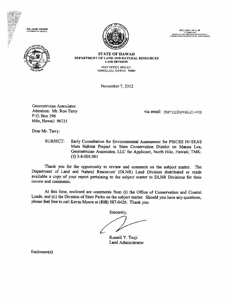


[This page intentionally left blank]

HI-SEAS/PISCES Mars Habitat Project
Environmental Assessment
APPENDIX 1b Comments to Draft EA and Responses

[This page intentionally left blank]


geometrician
A S S O C I A T E S , L L C integrating geographic science and planning
phone: (808) 969-7090 PO Box 396 Hilo Hawai’i 96721 [email protected]
February 11, 2013
Laura Leialoha Phillips McIntyre, AICP Environment Planning Office Manager Hawaii DOH Environmental Health Administration 919 Ala Moana Blvd, Suite 312 P.O. Box 3378 Honolulu HI 96814 Dear Ms. McIntyre:
Subject: Comment to Draft Environmental Assessment for HI-SEAS/PISCES Mars Habitat Project TMK 3rd. 3-8-001:001, North Hilo District, Island of Hawai‘i.
Thank you for the comment letter dated December 31, 2012, requesting the project team to review DOH’s Standard Comments, which include some specifically applicable to individual projects. We have reviewed these comments and cited appropriate requirements in various portions of the EA. In response to your request, we will provide an email response at [email protected]. As with all comment letters, your letter and our response to it will be included in the Final EA, and your office will receive an email with a link to this document when it is published. We very much appreciate your review of the document. If you have any questions about the EA, please contact me at (808) 969-7090.
Sincerely,
Ron Terry, Principal Geometrician Associates


geometrician
A S S O C I A T E S , L L C integrating geographic science and planning
phone: (808) 969-7090 PO Box 396 Hilo Hawai’i 96721 [email protected]
February 11, 2013
Bobby Jean Leithead-Todd, Director Hawai‘i County Planning Dept. 101 Pauahi Street, Suite 3 Hilo HI 96720 Dear Ms. Leithead-Todd:
Subject: Comment to Draft Environmental Assessment for HI-SEAS/PISCES Mars Habitat Project TMK 3rd. 3-8-001:001, North Hilo District, Island of Hawai‘i.
Thank you for the comment letter dated January 10, 2013, confirming the land use designation and General Plan consistency contained in the Draft EA. We will provide your office with a copy of the Final EA. We very much appreciate your review of the document. If you have any questions about the EA, please contact me at (808) 969-7090.
Sincerely,
Ron Terry, Principal Geometrician Associates


geometrician
A S S O C I A T E S , L L C integrating geographic science and planning
phone: (808) 969-7090 PO Box 396 Hilo Hawai’i 96721 [email protected]
February 11, 2013
Theresa K. Donham Acting Archaeology Branch Chief State Historic Preservation Division 601 Kamokila Blvd., Rm. 555 Kapolei HI 96707 Dear Ms. Donham:
Subject: Comment to Draft Environmental Assessment for HI-SEAS/PISCES Mars Habitat Project TMK 3rd. 3-8-001:001, North Hilo District, Island of Hawai‘i.
Thank you for the comment letter dated January 11, 2013, on the Draft EA. In answer to your specific comments: 1. Design of components. Although the components are still in design, the location has been set. The cairn is located at least 50 meters away, on the crest of a hill, and would not be affected by the project. It is important to note that the site is currently fully open to the public and is occasionally used to fire guns. 2. Input from PISCES Cultural Advisory Committee and other NHOs. Notice of the project was circulated widely to OHA, SHPD (incidentally, we do not see an acknowledgment in your letter of our 11/15/12 written request of your Honolulu and Hilo offices for comments on the project), the PISCES Cultural Committee (on two occasions), and to the general public, via a front page Hawaii Tribune Herald story in December 2012. To date, we have received informal in-person, phone and email comments of support. We have has not received any input from the committee or other NHOs indicating that there would be cultural impacts. 3. Archaeological Survey. At your request, the project contracted for an archaeological survey of the project, which determined that no historic properties were present in the area of potential effect, which included the areas you note in your letter. The survey has been submitted to your office and we look forward to your review. 4. Visual impact. The EA contains a discussion of visual impacts in Section 3.6, which offers the following conclusion: “The proposed habitat and accessory structures will introduce a temporary manmade element into the landscape that will be easily visible to anyone directly on the former quarry site. From public viewpoints from Mauna Kea, Mauna Loa, and Mauna Loa Observatory and Pu‘u Huluhulu, the structures will be extremely difficult to see. From the closest vantage, two miles away

on Mauna Loa Road, a 20-foot tall structure will have the prominence of the width of a typical pencil lead – about 1/20th of an inch – held at arm’s length. From Mauna Kea, 15 miles away, the object would appear just taller than the width of a human hair, which would likely be indiscernible against its background without binoculars. With camouflage coloring designed to blend into the cinder, the habitat will not likely be noticed from any public vantage point, and will have no scenic impacts. After the end of the experiment, the habitat and accessory structures will be removed and the site will be restored, permanently erasing any visual impact.” In the Final EA, we have also added a photograph of the generator in order to illustrate its appearance. We very much appreciate your review of the document. If you have any questions about the EA, please contact me at (808) 969-7090.
Sincerely,
Ron Terry, Principal Geometrician Associates


geometrician
A S S O C I A T E S , L L C integrating geographic science and planning
phone: (808) 969-7090 PO Box 396 Hilo Hawai’i 96721 [email protected]
February 11, 2013
Cynthia Orlando, Superintendent Hawai`i Volcanoes National Park P.O. Box 52 Hawaii National Park, HI 96718-0052 Dear Superintendent Orlando:
Subject: Comment to Draft Environmental Assessment for HI-SEAS/PISCES Mars Habitat Project TMK 3rd. 3-8-001:001, North Hilo District, Island of Hawai‘i.
Thank you for the comment letter dated January 17, 2013, on the Draft EA. In answer to your specific comments: 1. Impact to Listed seabirds. We regret that the design illustrations, which were made transparent to help show scale, could be interpreted to illustrate that the structures would be made of glass. In actuality, the dome is covered with polyester fabric, which is slightly translucent, but the interior lighting will not be strong, and the camouflage cover will block light too. With the windows covered (as they will be required to be at night), there should be no light emission that could disorient birds. 2. Invasive species. We appreciate your acknowledgment of the project’s commitment to preventing the introduction of invasive species, and we hope that if necessary, the project can contact your agency for any additional suggestions regarding the specific ecosystem that is also a prominent part of the Park’s holdings. We very much appreciate your review of the document. If you have any questions about the EA, please contact me at (808) 969-7090.
Sincerely,
Ron Terry, Principal Geometrician Associates

NIII, AHIRCROMIlIE 4’..r\$ZS WIllIAM J. AII,A JR.(IDVIAINOII 01’ HAWAII / (1 IAII1I’IIISI Al
if I tWI: IA AlA) A. lAND AND NA 111)/Il IIIAlI)IlIIlISI MMI’,’,I N N WAIl) III III) I MANA II MI I I
A. \ID fTIJ/‘A1j’;,1
AIICI
DEPARTMENT OF LAND AND NATURAL RESOURCES- LAM) 1)IVISt0
S I 1tJ•=621
January 23, 2013
Geometrician AssociatesAttention: Mr. Ron Terry via email: rterry,hawaii.rr.comP.O. Box 396Hilo, Hawaii 96721
Dear Mr. Terry:
SUBJECT: Draft Environmental Assessment for HI-SEAS/PISCES Mars HabitatProject, Geometrician Associates, LLC for Applicant, North Hilo, Hawaii;TMK: (3) 3-8-001:001
Thank you for the opportunity to review and comment on the subject matter. TheDepartment of Land and Natural Resources’ (DLNR) Land Division distributed or madeavailable a copy of your report pertaining to the subject matter to DLNR Divisions for theirreview and comments.
At this time, enclosed are comments from (i) the Engineering Division, (ii) the HawaiiDistrict Land Office, and (iii) the Office of Conservation and Coastal Lands on the subjectmatter. Should you have any questions, please feel free to call Kevin Moore at (808) 587-0426.Thank you.
Sincerely,
Russell Y. TsujiLand Administrator
Enclosure(s)

P11 2 27 EHGINEERIN{ WIllIAM J. AIIA,(A (V! (NOT! ((F I AWAIT (‘I(AII(T!WI IN
((lATIN (IT ANTI ANTI NAI lIlA! (TAIl! IIT!FS(T!NIMTSXI(IN ((TI (FAIl N I((So0I(II AANI(I,IIMIIN!
S’I’ATE OF hAWAiIDEPARTMENT OF LANI) ANt) NATURAl, RKSOUR(’ES
LAND DIVISION
POST OFFICE BOX 621I IONOI lilA I IAWAII 96iO)
1)ecember 20, 2012V)D --
MEMORANDUM >
TO: DLNR Agencies:X Div. of Aquatic Resources
Div. of Boating & Ocean RecreationXEngrneermg DivisionXDiv. of Forestry & Wildlife a-i
XDiv. of State Parks_Cornrnission on Water Resource ManagementXOffice of Conservation & Coastal LandsXLand Division — Hawaii DistrictXHistoric Preservation
FROM: ,,Z.i8Sii Y. Tsuji, Land AdministratorSUBJECT: Draft Enviromnental Assessment for HI-SEAS/PISCES Mars Habitat ProjectLOCATION: North Hilo, Hawaii; TMK: (3) 3-8-001:001APPLICANT: Geometrician Associates, LLC
Transmitted for your review and comment is information on the above referenced project.A complete copy of the draft enviromnental assessment for the project is available at the LandDivision office in Honolulu, and can also be viewed on-line at:http ://oeqc.doh.hawaii. gov/Shared°/o20Documents/EnvironmentalNotice/current_issue.pdf. Wewould appreciate your comments on this document. Please submit any comments by January 18,2013.
If no response is received by this date, we will assume your agency has no comments. Ifyou have any questions about this request, please contact Kevin Moore at 587-0426. Thank you.
Attachments
( ) We have no objections.
( ) We have no comments.( J) Comments are attached.-
//7Signed: /
Print naie: lrty S. (hang, Chief EngineerDate:
________________
cc: Central Files

DEPAR’J’MEN’I OF’ LAN)) ANI) NAl’LiRAL RESOURCESINGJN ElIUNC I)IVISION
LD/KcvinMooreREF.: DEAMarsllabitatProject
llawaii.595
COMM ENTS
X) We confirm that the project site, according to the Flood Insurance Rate Map (FIRJVI),is located in Zone X. [he National Flood Insurance Program does not have any regulationsfor developmeiits within Zone X.Please take note that the project Site, according to the Flood Insurance Rate Map (FIRM), islocated iii ZonePlease note that the correct Flood Zone Designation for the project Site according to the Flood
Insurance Rate Map (FIRM) isPlease note that the project must comply with the rules and regulations of the National FloodInsurance Program (NFIP) presented in Title 44 of the Code of Federal Regulations (44CFR),whenever development within a Special Flood 1-lazard Area is undertaken. II’there are anyquestions, please contact the State NFIP Coordinator, Ms. Carol Tyau-Bearn, of the Department ofLand and Natural Resources, Engineering Division at (808) 587-0267.
Please be advised that 44CFR indicates the minimum standards set forth by the NFIP. YourComiminity’s local flood ordinance may prove to be more restrictive and thus take precedenceover the minimum NFIP standards. If there are questions regarding the local flood ordinances,please contact the applicable County NFIP Coordinators below:
Mr. Mario Siu Li at (808) 768-8098 or Ms. Ardis Shaw-Kim at (808) 768-8296 oI’theCity and County of honolulu, Department of Planning and Permitting..Mr. Frank DeMarco at (808) 961-8042 of the County ofiiawaii, Department of PublicWorks.
() Mr. Francis Cerizo at (808) 270-7771 of the County of Maui, Department of Planning.Ms. Wynne Ushigome at (808) 241-4890 of the County of Kauai, Department of PublicWorks.
The applicant should include water demands and infrastructure required to meet project needs.Please note that projects within State lands requiring water service from the 1-Tonolulu Board ofWater Supply system will be required to pay a resource development charge, in addition to Water
Facilities Charges for transmission and daily storage.he applicant should provide the water demands and calculations to the Engineering Division so it
can be included in the State Water Projects Plan Update
() Additional Comments:
________________________________________________
Other: --
______________________
Should you have any questions, please call Ms. Suzie S. Agraan of the Planning Branch at 587-0258.
Signed:_CA.1-. CH G, CHIEF ENGINEER
Date:
_______

NEIL ABERCROMBIEGOVERNOR OF HAWAII
STATE OF HAWAIIDEPARTMENT OF LAND AND NATURAL RESOURCES
LAND DIVISION
POST OFFICE BOX 621HONOLULU, HAWAII 96809
WILLIAM 3. AILA, JR.CIIAIIUIWSON
IIOAIIES 01 lANG ANI) NA I IIRAI. RIAOIIRCESCOMMISSION (IN WA ICR IIEII(IIIRIL MANAGEMEN F
1IHJEC2bp 12:01
ECEIVE0LAND DIVSI0K
-11L0,.HAWAII
December 20, 2012
MEMORANDUM
Transmitted for your review and comment is information on the above referenced project.A complete copy of the draft enviromnental assessment for the project is available at the LandDivision office in Honolulu, and can also be viewed on-line at:http://oeqc.doh.hawaii. gov/Shared°/o20Documents/Environmental_Notice/currentjssue.pdf. Wewould appreciate your comments on this document. Please submit any comments by January 18,2013.
If no response is received by this date, we will assume your agency has no comments. Ifyou have any questions about this request, please contact Kevin Moore at 587-0426. Thank you.
Attachments
( ) We have no objections.( LA We have no comments.( ) Comments are attached.
SignedE
Print name: C.Date: /,///
TO: DLNR Agencies:XDiv. of Aquatic Resources
t-3Div. of Boating & Ocean Recreation —
XEngineering Division m c..XDiv. of Forestry & Wildlife —-4
XDiv. of State Parks I
Commission on Water Resource Management rXOffice of Conservation & Coastal Lands —>c-XLand Division — Hawaii District —>_J
(•).oXHistoric Preservation Efl —
Ui
>-
cDrT,
FROM: ,,vii8il Y. Tsuji, Land AdministratorSUBJECT: Draft Environmental Assessment for HI-SEAS/PISCES Mars Habitat ProjectLOCATION: North Hilo, Hawaii; TMK: (3) 3-8-001:001APPLICANT: Geometrician Associates, LLC
cc: Central Files /

rEII AIIEIICR)%IIIJEGOVIlFSOR OF I-F\\VAIl
December 20, 2012
—F.
U)
“rcD
,r1r’
-rr(I)
—r’
Transmitted for your review and comment is information on the above referenced project.A complete copy of the draft enviromnental assessment for the project is available at the LandDivision office in Honolulu, and can also be viewed on-line at:http ://oeg c.doh.hawaii . gov/Shared%2oDocuments/Environmental Notice/current issue.pdf. Wewould appreciate your comments on this document. Please submit any comments by January 18,2013.
If no response is received by this date, we will assume your agency has no comments. Ifyou have any questions about this request, please contact Kevin Moore at 587-0426. Thank you.
AttachmentsWe have no objections.( )
( ) We have no comments,
(*artEh.Sign d:
____________________
Print name: .Ar L&- X.Date: (i I v
WI 111AM i. AILA, JR.I!AIHIIHS(N
1 i_AND AND 4A1IIFiAI. iDilitiS(i)SISIISSII)N iii \V,ii ii iiIiSOiiii(I MANA(,IAILNI
Et 21 P 3 38S’I’ATE OF hAWAII
I)FPAR’I’MEN1 OF LAN1) ANI) NAI’UItLjLJEsLAND DIVISION
POST OFFICE BOX 621I IONOI ULU, HAWAI I
MEMORANDUM
DLNR Agencies:s_Div. of Aquatic Resources
Div. of Boating & Ocean RecreationXEngineering DivisionXDiv. of Forestry & WildlifeXDiv. of State Parks
Commission on Water Resource ManagementXOffice of Conservation & Coastal LandsXLand Division — Hawaii DistrictXHistoric Preservation
rM
rv:SUBJECT:LOCATION:APPLICANT:
C—
0
C-n
Y. Tsuji, Land AdministratorDraft Environmental Assessment for HI-SEAS/PISCES Mars Habitat ProjectNorth Hilo, Hawaii; TMK: (3) 3-8-001:001Geometrician Associates, LLC
cc: Central Files

wILLIArI .1. All.’,, JR.1IAIIIIINANRII. AI’,ECROMBIIS
lv NIh II I ANI I 151 NA I HAl HI SI ‘N S(IhVhihINh)lh 01’ IIAIVAII WAIl N III SIlIJIlIN MANAIINlI NI
lSll Ilk KIAAINA111151 11111 I S
‘,VlII,lAr,l M. lAMIllIlIllIlIhI III’bI.IVAIIII
,S.II.SIIl IIPSI II 1111-S
II IA I IN ANI IlvIAN III lIII\ IllS1111 Ill-A I I III II IN VI VA NIl S
IIISISII.SS II INIUSlI N IN Sll;IIIIiI,\NAII-lII NIINSIIIV,SII’IN ANIIIIIASISI I ANIlS
II INSlIIVAIII,N .5511 Ill Illilli SVNIIINII Mi iiI NI 151 111151
II ‘Ill-NI Ill NAIl lvii IIIIhISI 11111 hIIIAIAIVA III IN
KAI lINhI AIVI 1511151 IIhiSIIIVII II IMMISSII IN
IA NINI A I I hAIIKS
RE: Review of the Draft Environmental Assessment (DEA) for the HI-SEAS/PISCES Mars Habitat ProjectHumu’ula, North Hilo District, Island of HawaiiTMK: (3) 3-8-001:001
Dear Mr. Tsuji,
The Office of Conservation and Coastal Lands (OCCL) is in receipt of your memo datedDecember 27, 2012 requesting comments on the Draft Environmental Assessment (DEA) for thePISCES/HI-SEAS Mars Habitat Project located in the Conservation District Resource Subzone.
At this time the applicant is proposing to install a Mars Habitat Analog (MHA) in an area of lessthan 0.5 acres which will contain sleeping quarters, a kitchen, a computer lab and workspace anda bathroom to be used by a “crew” of six (6) persons. Waste disposal will be managed byutilizing on-site containment and periodic removal, and power will be supplied either by a fullyself-contained power provider or an on-site gas powered generator. The MHA will be inhabitedfor twelve (12) month periods, starting when all approvals have been granted and continuing fora five (5) year period, or as necessary. The purpose of the proposed project is to examine thetrade-offs between pre-prepared meals and meals that require some preparation as it relates tolong-term space exploration. The project will also allow other scientists to utilize the MHA forresearch into a variety of topics, including remote medicine and psychological support strategiesfor space exploration.
According to Hawaii Administrative Rules (HAR) § 13-5-22, P-i, DATA COLLECTION (D-i)Data collection, research, education, and resource evaluation that involves permanent facilitiesor structures larger than 500 square feet or a land use causing signficant ground disturbance orimpact to a natural resource. The proposed action will require the applicant to complete aConservation District Use Application (CDUA) and submit it to the OCCL for review. Please beaware that this finding does not constitute approval of the proposal.
STATE OF HAWAIIDEPARTMENT OF LAND AND NATURAL RESOURCES
OFFIC OF (‘ONSORVATION ANI) COASTAL LANDSPOST OFFICF BOX 62
I IONOLULU. I IAWAII 96809
REF:OCCL:AJR
MEMORAND1JM:/
TO: Russell Y. Tsuji, Administrator l
Land Division
FROM: Sam Lemmo, Administrator . .
Ice ofConservation and Coastal Lands
COR:H-13-76E
2
= LI)>>CDr x-s.
>-
CD

REF: AJR: OCCL (‘OR: IIA-l3-76
OCCI. Comments on the DEA:
The specific type of power source (power generation) should he determined prior tocompleting the EA. If the project will utilize the Winco PSS2I LPU-fueled generatorplease he advised that, according to the Winco PSS21 Installation and QpcrationsManual, iYiese units must be mounted on a so/id concrete pad to prevent air from exitingunder the unit. Therefore if the Winco Generator is to he used lbr this project, plans forthe construction and placement of a concrete pad shall also he included;
• The l)lA outlines a number of required vehicular trips to and from the project site tosupport the proposed project (i.e., transport food, water, waste removal). Please describein detail the potential effects of increased vehicular use (i.e., from trucks, large vehicles)on the access road;
• A letter from the State Historic Preservation Division (SHPD) which outlines theirspecific recommendations or consult shall be included in the FEA;
• The DEA states “The proposed action will include mitigation measures to prevent soilerosion”; please provide specific details regarding these mitigation measures; and
• Please describe the condition the site will be returned to post-project completion,including the removal of the structure and mitigation of the site after five (5) years of use.
If you have any questions regarding this correspondence please contact Alex. J. Roy of ourOCCL staff at 808-587-0316 or via email at [email protected]
Thank you.
CC: ChaiipersonHDLOHawaii County Planning Department

geometrician
A S S O C I A T E S , L L C integrating geographic science and planning
phone: (808) 969-7090 PO Box 396 Hilo Hawai’i 96721 [email protected]
February 11, 2013
Russell Y. Tsuji, Administrator Hawai‘i State DLNR Land Division P.O. Box 621 Honolulu HI 96809 Dear Mr. Tsuji:
Subject: Comment to Draft Environmental Assessment for HI-SEAS/PISCES Mars Habitat Project TMK 3rd. 3-8-001:001, North Hilo District, Island of Hawai‘i.
Thank you for your comment letters dated January 23, 2013, on the Draft EA. We first wish to acknowledge the no-comment memo by the Land Division, Hawaii District. In regard to the memo from the Engineering Division, we appreciate the statement that the comments in response to early consultation, which consisted of confirmation of the Flood Zone X designation, still applied. In answer to the specific comments from the Office of Conservation and Coastal Lands: 1. Generator. As design has advanced, the project team has selected the Hy-Gen from Planetary Power instead of the Winco PSS21. This variable speed diesel generator uses up to 60% less fuel than other gensets, can utilize locally available biodiesel, and is less polluting and quieter. At night it can operate silently by powering the habitat off of its on-board battery packs. No cement pad will be required, as the generator will sit on a rubber-tired, single-axle mini-trailer, similar to one used for a small cement mixer. The generator is approximately 4 x 5 x 3.5 feet in dimension, and is now illustrated in Figure 5 of the Final EA. 2. Effects of vehicular trip on access road. The project team has coordinated with DOFAW Administrator Roger Imoto concerning the road. In order to allow transport of the habitat and accessory facilities, the road will be resurfaced in several low spots in cooperation with DLNR-DOFAW, utilizing equipment that has been cleaned of soil and seeds to avoid introduction of invasive species and operators who regularly maintain DLNR roads. As discussed in the Draft EA, servicing the inhabitants of the habitat will require one to two trips per week, including supplying food and water and removing wastewater. The road probably experiences at least that much traffic currently from curious drivers exploring side roads off Mauna Loa Road. Mr. Imoto does not envision any impacts to the road from servicing the project. PISCES will maintain and leave the road in at least as good a condition as it currently is.

3. SHPD letter. Pursuant to the request from SHPD, the project has prepared an archaeological survey, which has been submitted to SHPD and included in the Final EA. No historic properties were found, and none would be affected. Please note that several contacts were made with SHPD during preparation of the EA to determine if a survey would be required. 4. Measures to prevent soil erosion. At the time of preparation of the Draft EA, the progress of site design had not yet determined whether the proposed action would include activities that would lead to the potential for erosion. The statement regarding measures to prevent soil erosion was provided in case such disturbance would occur. It now appears that the only disturbance will involve very slight dressing and leveling of a few patches on the existing road and the already loose cinder on various hundred square feet of the habitat site with a small backhoe. Experience in this environment indicates that rearranging this cinder will not lead to any potential for erosion and sedimentation, and no measures will be required. 5. Post-project completion site restoration. It is important to recall that the project would occur in an already disturbed pile of cinder left behind from quarrying. Site restoration will consist of removing all equipment and material; ensuring that no small pieces of trash remain behind; raking areas of loose cinder on which blocks have been placed to get a more natural appearing surface; and monitoring the site after three months, six months and a year to determine if any invasive plants or animals have taken hold and deal with them appropriately in cooperation with DOFAW. This information has been added to the Final EA. We very much appreciate your review of the document, including circulation to various DLNR agencies. If you have any questions about the EA, please contact me at (808) 969-7090.
Sincerely,
Ron Terry, Principal Geometrician Associates

HI-SEAS/PISCES Mars Habitat Project
Environmental Assessment
APPENDIX 2 Arthropod Survey

[This page intentionally left blank]

SUMMARY OF ARTHROPOD SURVEY WITHIN A PROPOSED OUTER PLANET
HUMAN HABITAT SIMULATION (PISCES) ON MAUNA LOA, HAWAII,
OCTOBER 15, 2012
Technical Report Prepared for Ron Terry in Association with a PISCES Human Habitat
Simulation EA for University of Hawaii, Hilo
Prepared by Jesse Eiben
University of Hawaii at Manoa Entomology Program
October 29, 2012

SUMMARY OF FINDINGS
I conducted a short duration arthropod assessment at the proposed site of an
experimental human habitat space dwelling simulation being developed by the PISCES
program at UH Hilo. Ron Terry is preparing an environmental assessment of the site,
and he accompanied me during the arthropod survey. I have extensive experience in
studying the alpine environments of Hawaii, informed by my studies detailing the life
history and habitat characteristics of the wekiu bug, Nysius wekiuicola, and developing
arthropod diversity monitoring protocols on Mauna Kea, HI.
The site of the proposed PISCES human dwelling is comprised of mostly fine
rock tephra and scoria apparently ejected from the adjacent cinder cone during relatively
recent volcanic activity. We surveyed a small area (at most 0.5 acre) of vehicle impacted
cinder and the surrounding intact pahoehoe lava flow for arthropods. Our methods were
general, and included placing 10 vials (7 dram open plastic vials) baited with attractants
for ants and other scavengers (baits were peanut butter, jelly, and sliced turkey deli meat),
visual surface scanning for arthropod movement and subsequent capture or identification,
focused visual searches for arthropods in different substrates (under rocks, in small lava-
caves, in cinder tephra), and inspection of any observed plants for associated arthropods.
We observed six species of arthropods during the two hour morning survey, and
evidence of two moth larvae. None of the insects or arthropods observed appeared to be
introduced invasive species (except for some evidence of aphids on Vaccinium
reticulatum). No ants were observed. There was very little vegetation within the
proposed physical footprint of any buildings. The vegetation observed were generally
species commonly found in similar substrates throughout Mauna Kea and Mauna Loa and
included some mosses, ferns (Pellaea ternifolia), lichens of various forms under and on
the sides of rocks, Dubautia scabra, Leptecophylla tameiamiae and V. reticulatum.
Therefore, impacts to arthropods strictly associated with a plant type will not be a major
concern if the proposed construction project occurs. Free ranging predators and
scavengers found in the substrates are also not likely to have their populations affected by
disturbance in a small physical footprint (0.25-0.5 acre). The arthropods found during
this survey are generally broadly distributed throughout the aa and pahoehoe lava habitat
types wherever their preferred microhabitat is present.

CONCLUSION AND RECOMMENDATIONS
The substrate type and plant community found at the PISCES study site are not
unique to the site, and are broadly distributed at the same elevation band throughout
Mauna Loa. The small amount of plant and arthropod diversity found at the site appears
to be unimpacted by introduced species. Because the site is quite small, and human
induced impacts will remain contained in a relatively small area, the direct impacts will
be insubstantial. However, great care should be taken to limit the introduction of new
species into this relatively pristine and intact high elevation ecosystem. The lack of the
presence of ants (all of which are introduced in the Hawaiian Islands) at this elevation is a
condition that should be preserved by limiting introduction potential, and eliminating any
ant colonies found. The impacts of ants, if introduced by construction or human use, will
have vast effects on the ecosystem not limited to the proposed PISCES study site.
Additionally, any introduction of new invasive weeds will hasten the alteration of the
arthropod community by potentially allowing new insects that may compete or predate
upon the naturally occurring fauna. Finally, because the area of the proposed site is very
small, environmentally harsh (little soil, extreme daily temperature and moisture
fluctuations) and currently hosts limited biodiversity, identification and control of newly
introduced species by human means can be efficient and inexpensive. The relative ease
of keeping the surrounding ecosystem free of newly introduced species and thus intact as
it presently exists should be a priority that can be met with basic preventive and control
methods for introduced species.

Table 1. Arthropod Species List
Habitat Type Arthropod Order Family Species Lepidoptera Cosmopteridgidae Hyposmocoma sp.
(‘burrito type’)
Pahoeohoe rocks
(Photo 1) Species notes:
• Endemic
• Distribution unknown, likely common in substrate type
Araneae Lycosidae
(Wolf spiders)
Lycosa nr. hawaiiensis Pahoehoe rocks
(Photo 2) Species notes:
• Endemic
• Distribution unknown, likely common in substrate type
Lepidoptera Likely Noctuidae ???
Likely Agrotis or
Peridroma sp.
Pahoehoe rocks in
small lava tunnel
(Photo 3) Species notes:
• Unknown origin, likely endemic
• Evidence (frass) found in rock depression indicative of caterpillar
feeding
Psocoptera Psocidae
(Bark lice)
Ptycta sp. Vaccinium reticulatum
Ohelo plant
Species notes:
• Endemic
• Diverse genus (50+species) is found widely in many habits
associated with variety of plants
Hemiptera Lygaeidae
(Seed bugs)
Nysius lichenicola Vaccinium reticulatum
Ohelo plant, and in ant
survey vials Species notes:
• Endemic
• Found commonly at high elevations on Ohelo and other host plants
Lepidoptera UNKNOWN Vaccinium reticulatum
Ohelo plant Species notes:
• Unknown
• Found evidence (frass and webbing) of caterpillar feeding on fallen
Ohelo leaves
Hymenoptera Bethylidae Sierola sp. Vaccinium reticulatum
Ohelo plant Species notes:
• Endemic
• Very speciose genus (likely many hundreds of species, ~180
described), arthropod parasitoids
Hymenoptera Vespidae Nesodynerus sp. Dubautia scabra
Species notes:
• Endemic
• Ground nesting mud-wasps that feed on microlepidoptera.

Photo 1. Hyposmocoma sp. web/dirt case
Photo 2. Lycosa sp. spider skin-molt

Photo 3. Lepidoptera frass. Likely Noctuid caterpillar feeding on lichens

HI-SEAS/PISCES Mars Habitat Project
Environmental Assessment
APPENDIX 3 Archaeological Survey

[This page intentionally left blank]

RC-0817
Archaeological Assessment Survey HI-SEAS/PISCES Mars Habitat Project (TMK: 3-3-8-01:001 por.) Humu‘ula Ahupua‘a North Hilo District Island of Hawai‘i
DRAFT VERSION PREPARED BY:
Robert B. Rechtman, Ph.D.
PREPARED FOR:
Kim Binsted Department of Information and Computer Sciences
University of Hawai‘i at Mānoa 1680 East-West Rd. Honolulu, HI 96822
January 2013

RC-0817
Archaeological Assessment Survey HI-SEAS/PISCES Mars Habitat Project
(TMK:3-3-8-01:001 por.)
Humu‘ula Ahupua‘a North Hilo District Island of Hawai‘i

RC-0817
ii
CONTENTS INTRODUCTION .........................................................................................................1
PROJECT AREA DESCRIPTION................................................................................5
PRIOR ARCHAEOLOGICAL STUDIES, SETTLEMENT PATTERNS, AND STUDY AREA EXPECTATIONS...........................................................................8
CURRENT FIELD INVESTIGATION.........................................................................8
REFERENCES CITED................................................................................................12
FIGURES 1. Study area location.....................................................................................................2
2. Tax Map Key: 3-3-8-01 showing location of study within Parcel 001. ....................3
3. Google Earth image of study area..............................................................................4
4. Proposed locations of “habitat” and support facilities; circle and rectangle are habitat structure and storage unit, A is water tank, B is septic tank, C is power system, D is storage unit............................................................................................5
5. Ridge of cinder cones that have been quarried. .........................................................6
6. Red cinder quarry area. ..............................................................................................6
7. Typical view of existing graded and cindered access road........................................7
8. Portion of Geological Map of the Island of Hawai‘i (Wolfe and Morris 1996)........7
9. Location of Gate Alternative 1. .................................................................................9
10. Location of Gate Alternative 2. ...............................................................................9
11. Modern fire ring on mauka side of access road near quarry..................................10
12. Modern hunting blind area on mauka side of access road. ....................................10
13. Modern square rock stacking on mauka side of access road. ................................11
14. Modern rock cairn using red cinder in along quarry ridge in greater habitat area.11
15. Entrance to small non-cultural lava tube in greater habitat area............................12

RC-0817
1
INTRODUCTION At the request of Kim Binsted, Ph.D. with the Department of Information and Computer Sciences at the University of Hawai‘i at Mānoa, Rechtman Consulting, LLC conducted an archaeological survey of the area encompassing and surrounding a proposed temporary experimental site within an existing cinder quarry located at about 8,000 feet on the northeastern slope of Mauna Loa in Humu‘ula Ahupua‘a, North Hilo District, Island of Hawai‘i (Figure 1). The project site (about 0.5 acres) is located within a larger state-owned parcel (TMK:3-3-8-01:001) (Figure 2).
The University of Hawai‘i at Mānoa, in collaboration with Cornell University, and the Pacific International Space Center for Exploration Systems (PISCES), has proposed to construct and operate a temporary experimental research station on a volcanic landscape that closely resembles the surface of Mars. The research station will be a small, portable “habitat” structure similar to one that might be constructed for inhabiting Mars. The habitat facility will be a self-contained unit with sleeping quarters, a kitchen, a computer and lab workspace, and a bathroom, along with an accessory water tank and wastewater tank. All wastewater and biological waste will be contained for regular servicing and removal. Power will be supplied either by a solar power provider or an ultra-quiet and efficient LPG generator. The habitat structure would have about 900 square feet of floor space and be 20 feet in height or less and will be barely visible from any public vantage point, and not within the range of visual impact of any known historic property. Access to the location of the proposed research facility will be along a 1.3-mile existing graded and cindered road extending wet from Mauna Loa Road (Figure 3). In order to maintain the integrity of the experiments, the site will need to be isolated from access by the general public. To accomplish this, the existing access road would be gated and locked during the proposed five years of experimentation.
During the proposed five years of operation “astronauts” will conduct a variety of experiments focused on the operational and psychological issues space travelers might experience as they explore the solar system. The central experiment will focus on food needs during long-term planetary exploration missions. The University of Hawai‘i at Mānoa study, entitled Hawai‘i Space Exploration Analog and Simulation (HI-SEAS), will examine the tradeoffs (energy, effort, satisfaction, waste) between using pre-prepared meals versus meals that require some preparation. The habitat would be inhabited by a crew of six that will live and work under strict analog conditions, only venturing outside in simulated space suits and communicating with “Earth” via channels disrupted by latencies and drop-outs, etc. These long-term analog missions will also offer an opportunity for other researchers, who will be invited to propose research studies to test their ideas in this environment. Upon termination of the project the habitat facilities will be removed and the site will be cleared of any and all debris leaving no trace of its former presence.
As this project proposes to use State-owned Conservation District land, an Environmental Assessment (EA) was prepared in compliance with Hawai‘i Revised Statutes Chapter 343. The Department of Land and Natural Resources–State Historic Preservation Division (DLNR-SHPD) provided review comments (DOC NO: 13 10SN01) on the draft EA and among other things, recommended that “an archaeological inventory survey be conducted of the undisturbed lands surrounding the proposed habitat,” and that this “survey should include the location of the proposed gate and any corridors along the existing road that could be affected by road improvements in connection with the construction and use of the facility.”
The current study was conducted pursuant to the DLNR-SHPD recommendation and was undertaken in accordance with Hawai‘i Administrative Rules 13§13–275; and performed in compliance with the Rules Governing Minimal Standards for Archaeological Inventory Surveys and Reports as contained in Hawai‘i Administrative Rules 13§13–276. According to 13§13-275-5(b)(5)(A) when no archaeological resources are discovered during an archaeological survey the production of an Archaeological Assessment report is appropriate. Compliance with the above standards is sufficient for meeting the historic preservation review process requirements of both the DLNR–SHPD and the County of Hawai‘i Planning Department.
In the pages that follow, this report provides a project area description; a brief discussion of prior archaeological studies, derived settlement patterns, and project area expectations; and the results of the field investigation of the current project area.

Figure 1. Study area location.
2
RC-0817
Access road
Habitat area

Figure 2. Tax Map Key: 3-3-8-01 showing location of study within Parcel 001.
3
RC-0817
Study area

Figure 3. Google Earth image of study area.
4
RC-0817
Proposed habitat location Access road
Gate alternative 1
Gate alternative 2

RC-0817
5
PROJECT AREA DESCRIPTION The area proposed for the experimental habitat facility occupies less than 0.5 acres on an already leveled and mechanically disturbed volcanic cinder substrate (Figure 4) on the side of an elongated ridge of cinder/spatter cones (Figure 5) that were created during a Mauna Loa eruption dated from between 1,500 and 3,000 years before the present (Wolfe and Morris 1996). This area has been developed as a quarry for red cinder (Figure 6), and is accessed using a graded and cindered road (Figure 7) that in some areas is over 30 feet wide. There are several more recent lava flows dating between the 1840s and the 1930s that make-up the surrounding landscape that extends along the access road between the quarry and Mauna Loa Road (Figure 8). Vegetation within this area is considered spare at best with a few small clusters of the native shrubs kupaoa (Dubautia scabra), pukiawe (Leptecophylla tameiameiae) and ōhelo (Vaccinium reticulatum).
For the purposes of the current study, the area of investigation included a corridor encompassing the existing access road and mechanically altered roadway shoulders (the HI-SEAS/PISCES Mars Habitat Project does not anticipate having to make improvements to the access road beyond the current limits of the existing mechanically disturbed areas, including the placement of a security gate); the roughly 0.5 acre footprint of the proposed location of the temporary habitat and support facilities; and an area extending 100 meters in all directions surrounding the proposed location of the temporary habitat and support facilities.
Figure 4. Proposed locations of “habitat” and support facilities; circle and rectangle are habitat structure and storage unit, A is water tank, B is septic tank, C is power system, D is storage unit.

RC-0817
6
Figure 5. Ridge of cinder cones that have been quarried.
Figure 6. Red cinder quarry area.

RC-0817
7
Figure 7. Typical view of existing graded and cindered access road.
Figure 8. Portion of Geological Map of the Island of Hawai‘i (Wolfe and Morris 1996).
Habitat location
Access road

RC-0817
8
PRIOR ARCHAEOLOGICAL STUDIES, SETTLEMENT PATTERNS, AND STUDY AREA EXPECTATIONS In 2005, Rechtman Consulting, LLC completed an archaeological study (Rechtman 2005) in compliance with Section 106 of the National Historic Preservation Act for the then proposed improvement to Mauna Loa Road. That study area was a 125 feet (38 meters) wide corridor centered on the existing roadway extending from 6,500 feet to 11,200 feet elevation. Several lava tubes were encountered and explored; and four modern features, two cairns and two memorial markers, were identified. There were no archaeological features observed in the study corridor and none of the lava tubes contained cultural features or deposits.
In his regional synthesis of the Hāmākua District, Cordy (1994) summarizes and discusses Precontact and Historic land use patterns and the results of prior archaeological studies in what he terms the Interior Plateau Subregion; this summary and discussion is also applicable to the current study area in the upper portion of Humu‘ula Ahupua‘a in the North Hilo District. Citing legendary and historical sources, Cordy identifies two primary uses for this region, as a cross-island transportation corridor and as a resources area for obtaining birds. Major trail routes were ethnohistorically recorded and or made during the Historic Period that connected Ka‘ū, Kona, Waimea, and Hilo. While the locations of most of these are known outside of the current study area, it is possible that undocumented branches off of these trail/roads could be present in the current study area. Such trails were also used to access nesting areas of the ‘u‘au (Petrel) and nēnē (Hawaiian Goose). Sources indicate that both of these bird species were seasonally plentiful in the upland region, and that exclusive rights to hunt/collect them from this area belong to certain ahupua‘a within each major island district (Athens and Kaschko 1988; Hommon and Ahlo 1983). Potential archaeological evidence of bird hunting/collecting on the slopes of Mauna Loa was documented during investigations at the United States Army Pōhakuloa Training Area to the northwest of the current study area (Athens and Kaschko 1988). Possible sites associated with this activity are pāhoehoe excavations and lava tube habitations, however, in the prior studies there were no such sites documented above the 6,500 elevation.
CURRENT FIELD INVESTIGATION On January 29, 2013, Robert B. Rechtman, Ph.D. and Erik Hanson, B.A. conducted a surface survey of the entire area of investigation. The length of the existing roadway corridor from the proposed habitat location to Mauna Loa Road was walked and two alternative locations within the roadway corridor for the proposed security gate (see Figure 3, Figures 9 and 10) were examined. There were no archaeological resources observed anywhere within the existing roadway corridor. There were a few modern rock features observed adjacent to the roadway on its mauka side; these included: a fire ring (Figure 11), rock piles marking a road cut, a modified blister/hunting blind (Figure 12), and a square rock stacking (Figure 13). The area of the proposed habitat (see Figure 4) is within the quarry proper and has been completely mechanically leveled, thus no archaeological resources are present; and the 100 meter area surrounding the proposed habitat facility was likewise void of archaeological features. A single rock cairn (Figure 14) was observed in this latter area that was clearly modern, using quarried red cinder in its construction; and a small narrow lava tube (Figure 15), exposed by quarrying activity was also observed, explored, and found to be culturally sterile.
Given the negative findings of the current study, it is concluded that no historic properties will be affected by the HI-SEAS/PISCES Mars Habitat Project. If however, in the unlikely event that historic properties are inadvertently discovered during any of the activities associated with either the development or maintenance of the HI-SEAS/PISCES Mars Habitat Project, activity in the area of the discovery will be halted and DLNR-SHPD contacted immediately.

RC-0817
9
Figure 9. Location of Gate Alternative 1.
Figure 10. Location of Gate Alternative 2.

RC-0817
10
Figure 11. Modern fire ring on mauka side of access road near quarry.
Figure 12. Modern hunting blind area on mauka side of access road.

RC-0817
11
Figure 13. Modern square rock stacking on mauka side of access road.
Figure 14. Modern rock cairn using red cinder in along quarry ridge in greater habitat area.

RC-0817
12
Figure 15. Entrance to small non-cultural lava tube in greater habitat area.
REFERENCES CITED Athens, S., and M. Kaschko
1988 Prehistoric Upland Bird Hunters: Archaeological Inventory Survey and Testing for the MPRC Project Area and the Bobcat Trail Road, Pohakuloa Training Area, Island of Hawaii. Draft IARII manuscript on file with the Department of Land and Natural Resources-State Historic Preservation Division, Kapolei, HI.
Cordy, R. 1994 A Regional Synthesis of Hāmākua District, Island of Hawai‘i. Historic Preservation
Division, Department of Land and Natural Resources, State of Hawai‘i.
Hommon, R., and H. Ahlo, Jr. l983 A Research Design for Archaeological Studies at the Pohakuloa Training Area, Island
of Hawaii. Science Management, Inc. (Honolulu). Prepared for United States Army Corps of Engineers.
Rechtman. R. 2005 Request fro SHPO Concurrence with a Determination of No Historic Properties
Affected Pursuant to the National Environmental Policy Act and in Compliance with Section 106 of the National Historic Preservation Act—Mauna Loa Road Improvement Project. Ka‘ohe and Humu‘ula ahupua‘a, Hāmākua and North Hilo Districts, Island of Hawai‘i. Rechtman Consulting Report RC-0268. Prepared for the United States Department of Commerce – National Oceanic and Atmospheric Administration, Mountain Administrative Support Center, Boulder, CO.
Wolfe, E.W., and J. Morris 1996 Geological Map of the Island of Hawaii. U.S. Department of the Interior, U.S.
Geological Survey.